Mapping Humanitarian Aid with UAVs Shelter Meeting SM14 Rob Fielding 10 October 2014.
13
Click icon to add picture Mapping Humanitarian Aid with UAVs Shelter Meeting SM14 Rob Fielding 10 October 2014
-
Upload
matthew-lewis -
Category
Documents
-
view
215 -
download
2
Transcript of Mapping Humanitarian Aid with UAVs Shelter Meeting SM14 Rob Fielding 10 October 2014.

Click icon to add picture
Mapping Humanitarian Aid with UAVs
Shelter Meeting SM14Rob Fielding10 October 2014

Not for profit
Partners
Client Agency - Medair
Parent Company

Pre Mission Objectives
Deploy the eBee to photograph and map high
resolution imagery of
disaster affected communities
within Medair’s area of
operations in the Philippines:
• Improve awareness in the general public of positive uses for drone technologies through a demonstration of its use in the humanitarian context.
• Provide information for informed decision-making in shelter programming and support.
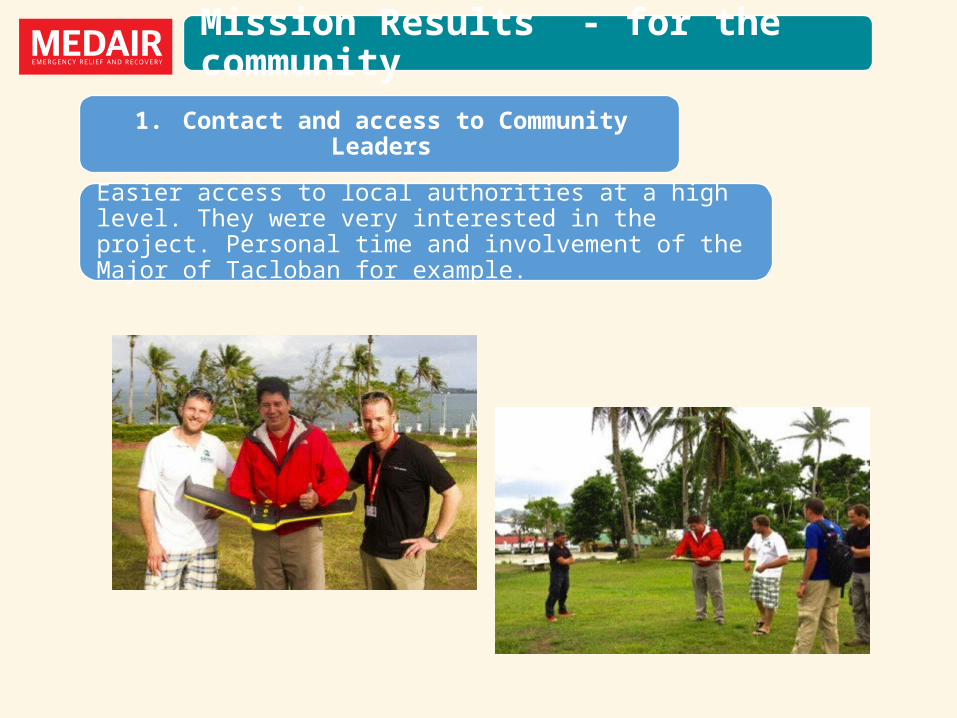
Mission Results - for the community
1. Contact and access to Community Leaders
Easier access to local authorities at a high level. They were very interested in the project. Personal time and involvement of the Major of Tacloban for example.

Mission Results - for the community
2. Maps for the communities
Produce a high resolution photograph for key settlement areas in selected Barangays.

3. Identifying locations of beneficiaries
Plotting the location of shelters built by Medair.
Mission Results - for the community


Mission Results - for the community
4. Help resolve Housing Land and Property boundary issues.
5. Provide base maps and plans for accurate cadastral maps.
6. Enables a community to plan areas of development.
7. Identifies areas of risks and hazards.
8.Repeat mapping will show rate of change of the post disaster recovery.

Mission Results - for Medair
1. Increased brand visibility and recognition in beneficiary communities.
2. Maps are likely to be on the walls of the LGU offices for many years.
3. Provides more evidence based and visual information for our institutional donors.
4. Attracts interest from people following technology and innovation.
7. Early adopter advantage of using this technology in the Humanitarian World.
5. Invitations to participate and share experiences with a wide network.
6. Enables responses to be more effective.

Outputs
Philippines - Phase I - Progressive Core Shelters – Dulag
Philippines - High Level Resolution Aerial Photograph Maps of Dulag

https://store.dji.com/product/phantom-2-vision-plus
Future Responses Planned
Repeat visit to the Philippines – 12 months on.
Roll out to other countries – Madagascar, DR Congo
Use other types of UAVs – technically easier, flexible and cheaper.
Rapid emergency deployment capacity

Challenges for Humanitarian work
Negative perception of Drones.
Humanitarians often work in conflict zones
Establishing protocols and SOPs
OCHA (Office for the Coordination of Humanitarian Aid) Unmanned Aerial Vehicles in Humanitarian Aid
Humanitarian community of practice – uavitar.com

Visit Medair.org
Thank you for listening. Any Questions?