Mapchats - Pushing Boundaries; NCES Boundaries (Doug Geverdt)
22
Pushing Boundaries: Cartography and Shaping Maps #mapchats policymap.com/mapchats- webinars Pushing Boundaries: Cartography and Shaping Maps #mapchats policymap.com/mapchats- webinars Doug Geverdt Educational Demographic and Geographic Estimates Program NCES Geographic Boundaries: School Districts, Locales, and Beyond
Transcript of Mapchats - Pushing Boundaries; NCES Boundaries (Doug Geverdt)
Pushing
Boundaries:
Cartography
and Shaping
Maps
#mapchatspolicymap.com/mapchats-
webinars
Pushing
Boundaries:
Cartography
and Shaping
Maps
#mapchatspolicymap.com/mapchats-
webinars
Doug GeverdtEducational Demographic and
Geographic Estimates Program
NCES Geographic Boundaries:
School Districts, Locales, and Beyond
Pushing
Boundaries:
Cartography
and Shaping
Maps
#mapchatspolicymap.com/mapchats-
webinars
Pushing
Boundaries:
Cartography
and Shaping
Maps
#mapchatspolicymap.com/mapchats-
webinars
#mapchats
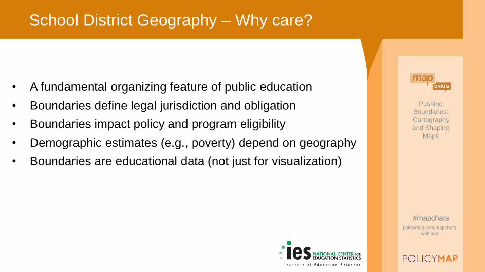
School District Geography – Why care?
• A fundamental organizing feature of public education
• Boundaries define legal jurisdiction and obligation
• Boundaries impact policy and program eligibility
• Demographic estimates (e.g., poverty) depend on geography
• Boundaries are educational data (not just for visualization)
Pushing
Boundaries:
Cartography
and Shaping
Maps
#mapchatspolicymap.com/mapchats-
webinars
Pushing
Boundaries:
Cartography
and Shaping
Maps
#mapchatspolicymap.com/mapchats-
webinars
#mapchats
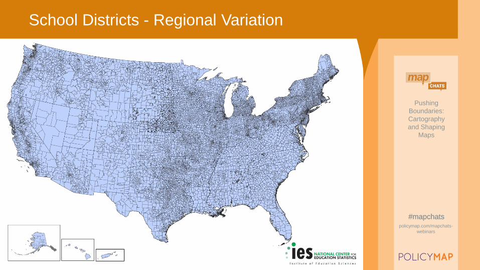
School Districts - Regional Variation
Pushing
Boundaries:
Cartography
and Shaping
Maps
#mapchatspolicymap.com/mapchats-
webinars
Pushing
Boundaries:
Cartography
and Shaping
Maps
#mapchatspolicymap.com/mapchats-
webinars
#mapchats
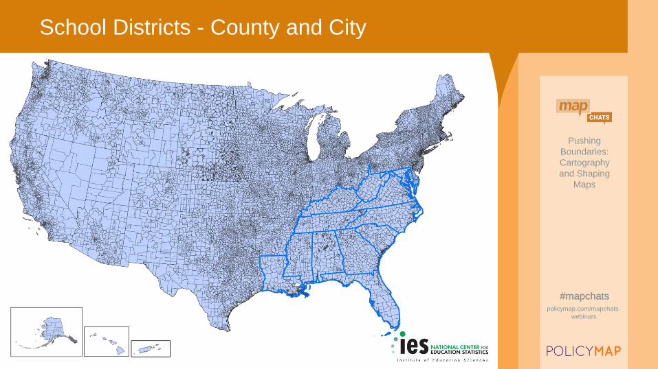
School Districts - County and City
Pushing
Boundaries:
Cartography
and Shaping
Maps
#mapchatspolicymap.com/mapchats-
webinars
Pushing
Boundaries:
Cartography
and Shaping
Maps
#mapchatspolicymap.com/mapchats-
webinars
#mapchats
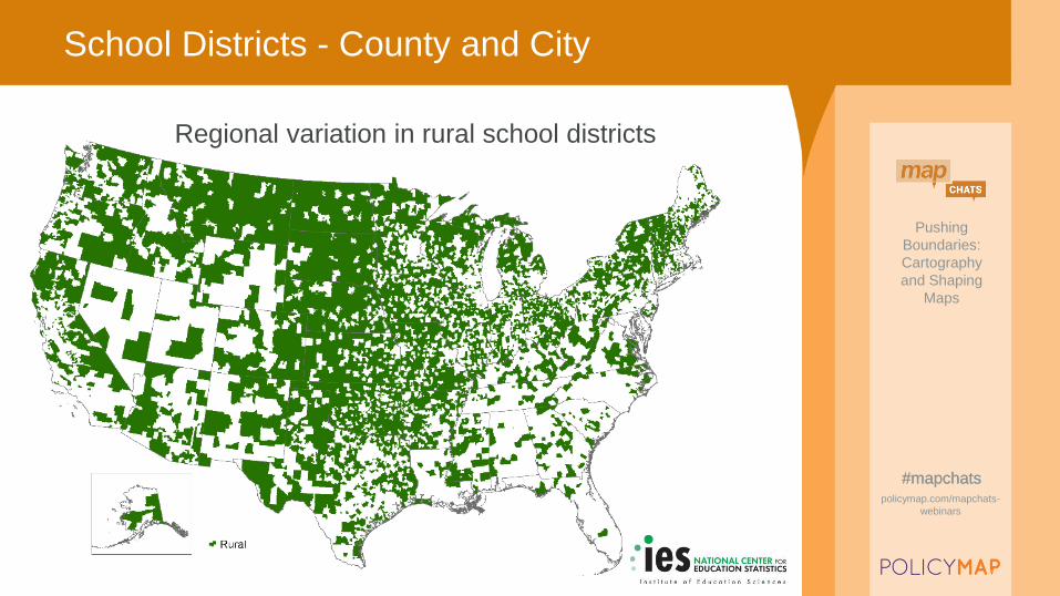
School Districts - County and City
Regional variation in rural school districts

Pushing
Boundaries:
Cartography
and Shaping
Maps
#mapchatspolicymap.com/mapchats-
webinars
Pushing
Boundaries:
Cartography
and Shaping
Maps
#mapchatspolicymap.com/mapchats-
webinars
#mapchats
School Districts – Township/Town
Pushing
Boundaries:
Cartography
and Shaping
Maps
#mapchatspolicymap.com/mapchats-
webinars
Pushing
Boundaries:
Cartography
and Shaping
Maps
#mapchatspolicymap.com/mapchats-
webinars
#mapchats
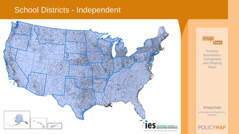
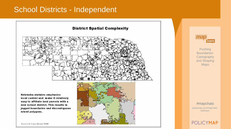
School Districts - Independent
Pushing
Boundaries:
Cartography
and Shaping
Maps
#mapchatspolicymap.com/mapchats-
webinars
Pushing
Boundaries:
Cartography
and Shaping
Maps
#mapchatspolicymap.com/mapchats-
webinars
#mapchats
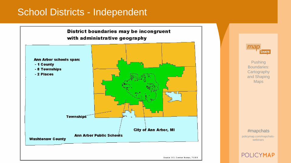
School Districts - Independent
Pushing
Boundaries:
Cartography
and Shaping
Maps
#mapchatspolicymap.com/mapchats-
webinars
Pushing
Boundaries:
Cartography
and Shaping
Maps
#mapchatspolicymap.com/mapchats-
webinars
#mapchats
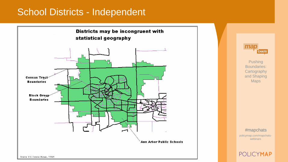
School Districts - Independent
Pushing
Boundaries:
Cartography
and Shaping
Maps
#mapchatspolicymap.com/mapchats-
webinars
Pushing
Boundaries:
Cartography
and Shaping
Maps
#mapchatspolicymap.com/mapchats-
webinars
#mapchats
School Districts - Independent
Pushing
Boundaries:
Cartography
and Shaping
Maps
#mapchatspolicymap.com/mapchats-
webinars
Pushing
Boundaries:
Cartography
and Shaping
Maps
#mapchatspolicymap.com/mapchats-
webinars
#mapchats
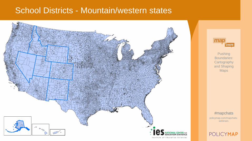
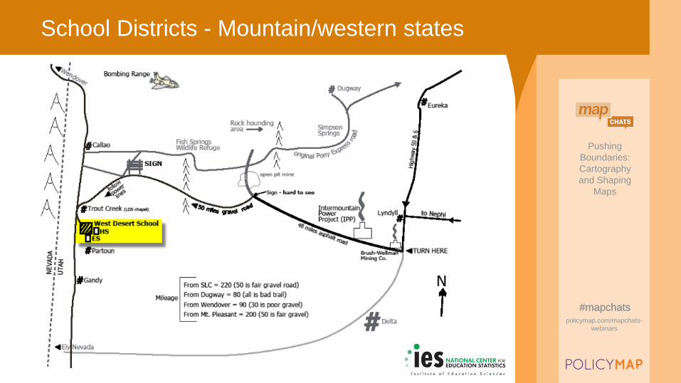
School Districts - Mountain/western states
Pushing
Boundaries:
Cartography
and Shaping
Maps
#mapchatspolicymap.com/mapchats-
webinars
Pushing
Boundaries:
Cartography
and Shaping
Maps
#mapchatspolicymap.com/mapchats-
webinars
#mapchats
School Districts - Mountain/western states

Pushing
Boundaries:
Cartography
and Shaping
Maps
#mapchatspolicymap.com/mapchats-
webinars
Pushing
Boundaries:
Cartography
and Shaping
Maps
#mapchatspolicymap.com/mapchats-
webinars
#mapchats
School Districts – Types based on grade span
Pushing
Boundaries:
Cartography
and Shaping
Maps
#mapchatspolicymap.com/mapchats-
webinars
Pushing
Boundaries:
Cartography
and Shaping
Maps
#mapchatspolicymap.com/mapchats-
webinars
#mapchats
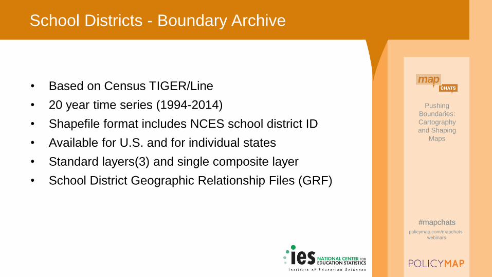
School Districts - Boundary Archive
• Based on Census TIGER/Line
• 20 year time series (1994-2014)
• Shapefile format includes NCES school district ID
• Available for U.S. and for individual states
• Standard layers(3) and single composite layer
• School District Geographic Relationship Files (GRF)
Pushing
Boundaries:
Cartography
and Shaping
Maps
#mapchatspolicymap.com/mapchats-
webinars
Pushing
Boundaries:
Cartography
and Shaping
Maps
#mapchatspolicymap.com/mapchats-
webinars
#mapchats
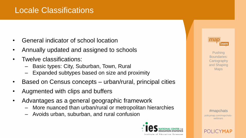
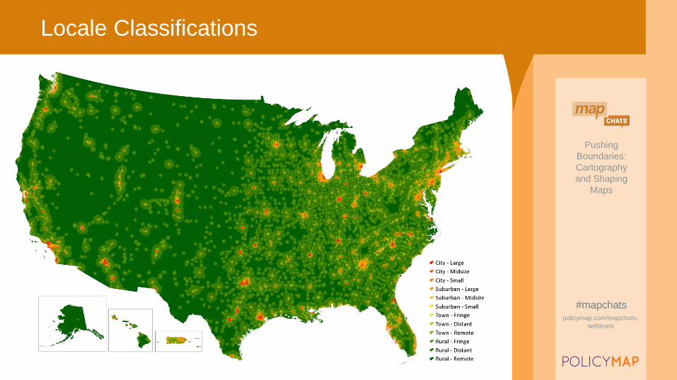
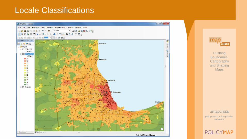
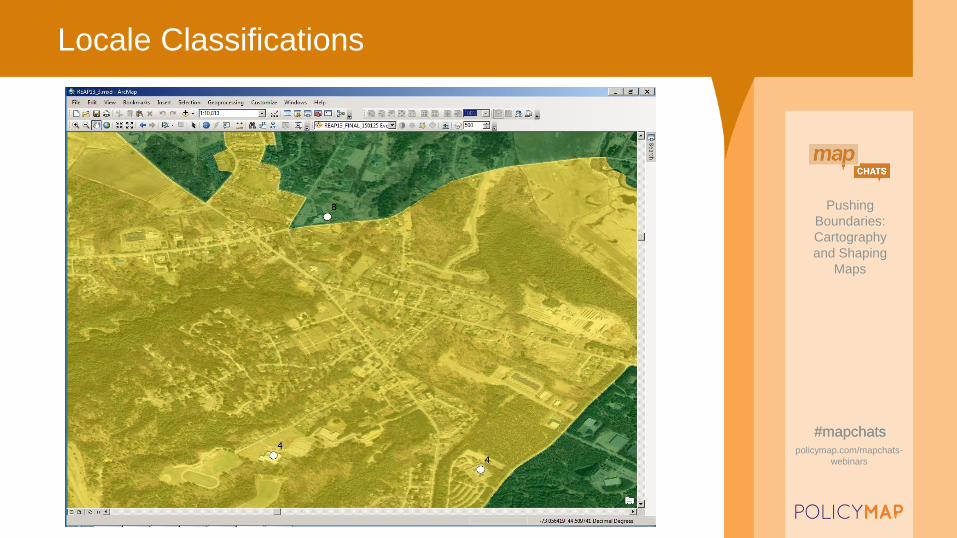
Locale Classifications
• General indicator of school location
• Annually updated and assigned to schools
• Twelve classifications:– Basic types: City, Suburban, Town, Rural
– Expanded subtypes based on size and proximity
• Based on Census concepts – urban/rural, principal cities
• Augmented with clips and buffers
• Advantages as a general geographic framework– More nuanced than urban/rural or metropolitan hierarchies
– Avoids urban, suburban, and rural confusion
Pushing
Boundaries:
Cartography
and Shaping
Maps
#mapchatspolicymap.com/mapchats-
webinars
Pushing
Boundaries:
Cartography
and Shaping
Maps
#mapchatspolicymap.com/mapchats-
webinars
#mapchats
Locale Classifications
Pushing
Boundaries:
Cartography
and Shaping
Maps
#mapchatspolicymap.com/mapchats-
webinars
Pushing
Boundaries:
Cartography
and Shaping
Maps
#mapchatspolicymap.com/mapchats-
webinars
#mapchats
Locale Classifications
Pushing
Boundaries:
Cartography
and Shaping
Maps
#mapchatspolicymap.com/mapchats-
webinars
Pushing
Boundaries:
Cartography
and Shaping
Maps
#mapchatspolicymap.com/mapchats-
webinars
#mapchats
Locale Classifications
Pushing
Boundaries:
Cartography
and Shaping
Maps
#mapchatspolicymap.com/mapchats-
webinars
Pushing
Boundaries:
Cartography
and Shaping
Maps
#mapchatspolicymap.com/mapchats-
webinars
#mapchats
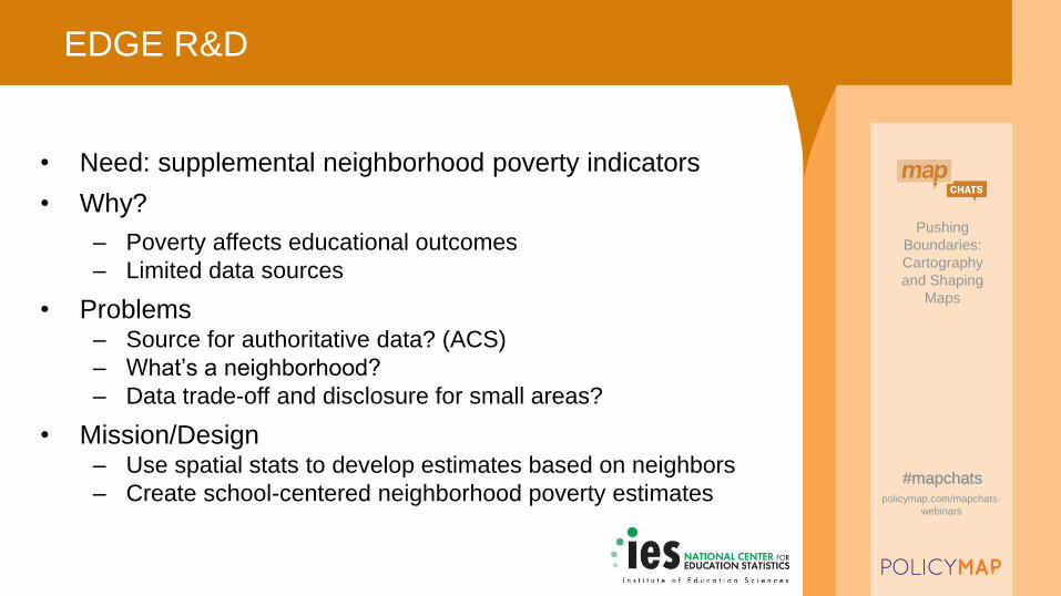
EDGE R&D
• Need: supplemental neighborhood poverty indicators
• Why?
– Poverty affects educational outcomes
– Limited data sources
• Problems– Source for authoritative data? (ACS)
– What’s a neighborhood?
– Data trade-off and disclosure for small areas?
• Mission/Design– Use spatial stats to develop estimates based on neighbors
– Create school-centered neighborhood poverty estimates
Pushing
Boundaries:
Cartography
and Shaping
Maps
#mapchatspolicymap.com/mapchats-
webinars
Pushing
Boundaries:
Cartography
and Shaping
Maps
#mapchatspolicymap.com/mapchats-
webinars
#mapchats
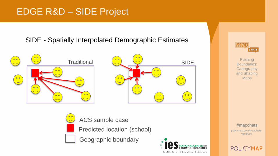
EDGE R&D – SIDE Project
ACS sample case
Predicted location (school)
Geographic boundary
Traditional SIDE
SIDE - Spatially Interpolated Demographic Estimates
Pushing
Boundaries:
Cartography
and Shaping
Maps
#mapchatspolicymap.com/mapchats-
webinars
Pushing
Boundaries:
Cartography
and Shaping
Maps
#mapchatspolicymap.com/mapchats-
webinars
#mapchats
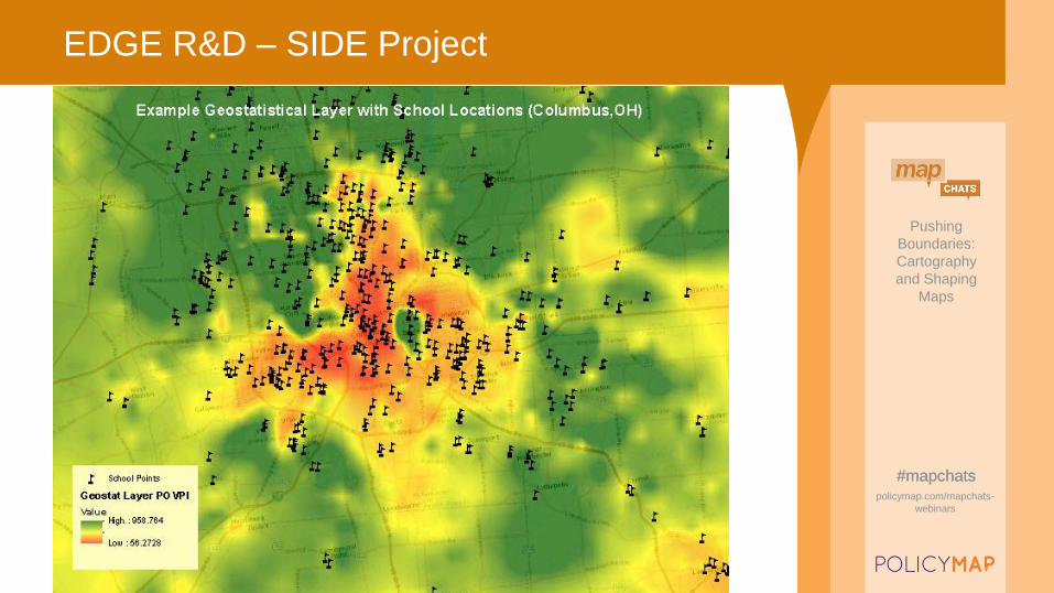
EDGE R&D – SIDE Project
Pushing
Boundaries:
Cartography
and Shaping
Maps
#mapchatspolicymap.com/mapchats-
webinars
Pushing
Boundaries:
Cartography
and Shaping
Maps
#mapchatspolicymap.com/mapchats-
webinars
#mapchats
EDGE R&D - SIDE
Questions?
Doug GeverdtNational Center for Education Statistics
Education Demographic and Geographic Estimates
https://nces.ed.gov/programs/edge/