Map Basics: Datums and Coordinate...
26
ESRM 304: Environmental and Resource Assessment © Phil Hurvitz, 2009 ESRM 304 Autumn 2015 Contributors: Phil Hurvitz, Peter Schiess, Eric Turnblom Map Basics: Datums and Coordinate Systems 1 of 39
Transcript of Map Basics: Datums and Coordinate...

ESRM 304: Environmental and Resource Assessment
© Phil Hurvitz, 2009
KEEP THIS TEXT BOX this slide includes some ESRI fonts.
when you save this presentation, use File > Save As > Tools (upper right) > Save Options
> Embed TrueType Fonts (all characters) this will allow vector maps created with
common ESRI symbols to show on computers that do not have ESRI software loaded
a a a a a a a a a a a a
ESRM 304 Autumn 2015
Contributors: Phil Hurvitz, Peter Schiess, Eric Turnblom
Map Basics: Datums and Coordinate Systems
1 of 39

ESRM 304: Environmental and Resource Assessment
© Phil Hurvitz, 2009
Datums (from Wikipedia) A geodetic datum (plural datums, not data) is a
reference from which measurements are made. In surveying and geodesy, a datum is a set of
reference points on the earth's surface against which position measurements are made, and
(often) an associated model of the shape of the earth (reference ellipsoid) to define a geographic coordinate system.
15 of 39
Datums, land division systems, & coordinate systems
ESRM 304: Environmental and Resource Assessment
© Phil Hurvitz, 2009
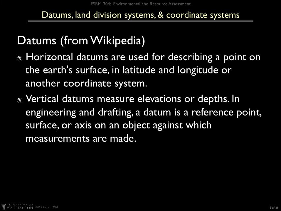
Datums (from Wikipedia) Horizontal datums are used for describing a point on
the earth's surface, in latitude and longitude or another coordinate system.
Vertical datums measure elevations or depths. In engineering and drafting, a datum is a reference point, surface, or axis on an object against which measurements are made.
16 of 39
Datums, land division systems, & coordinate systems

ESRM 304: Environmental and Resource Assessment
© Phil Hurvitz, 2009
Datums Is the earth a sphere? No, it is a spheroid/ellipsoid The earth is irregularly shaped Deformations in the crust (e.g., from gravitational
pressure of ice) Gravitational forces different where crust thickness
varies
17 of 39
Datums, land division systems, & coordinate systems

ESRM 304: Environmental and Resource Assessment
© Phil Hurvitz, 2009
Datums are mathematical models of the shape of the earth created to provide control over the survey measurement framework
Provide a frame of reference for measuring locations on the earth’s surface
Earth-centered datums (e.g., WGS84) provide locational control for the entire planet but do not fit specific locations particularly well
Local datums exist for better local control (e.g., NAD27 or NAD83 for North America)
18 of 39
Datums, land division systems, & coordinate systems

ESRM 304: Environmental and Resource Assessment
© Phil Hurvitz, 2009 19 of 39
Datums, land division systems, & coordinate systems
These points represent the same location in two different datums

ESRM 304: Environmental and Resource Assessment
© Phil Hurvitz, 2009
Datums, land division systems, & coordinate systems
Coordinate systems and land divisions extend the concept of the datum
Establish a (Cartesian) measurement framework Allow referencing of all features on, above, or
below the surface of the earth to each other
20 of 39

ESRM 304: Environmental and Resource Assessment
© Phil Hurvitz, 2009
Datums, land division systems, & coordinate systems
Examples of different referencing systems Metes and bounds US Public Land Survey System (PLSS) State Plane Universal Transverse Mercator (UTM)
21 of 39

ESRM 304: Environmental and Resource Assessment
© Phil Hurvitz, 2009
Metes and bounds
Based on physical features of local geography, directions, and distances
E.g., "beginning with a corner at the intersection of two stone walls near an apple tree on the north side of Muddy Creek road one mile above the junction of Muddy and Indian Creeks, north for 150 rods to the end of the stone wall bordering the road, then northwest along a line to a large standing rock on the corner of John Smith's place, thence west 150 rods to the corner of a barn near a large oak tree, thence south to Muddy Creek road, thence down the side of the creek road to the starting point."
22 of 39

ESRM 304: Environmental and Resource Assessment
© Phil Hurvitz, 2009
Metes and bounds
What problems could there be with metes and bounds?
[Discussion] Irregular shapes for properties lead to complex
descriptions The only thing constant is change: trees die, streams
move by erosion, properties are sold Not useful for large, newly surveyed tracts of land
being opened in the west, which were being sold sight unseen to investors
23 of 39

ESRM 304: Environmental and Resource Assessment
© Phil Hurvitz, 2009
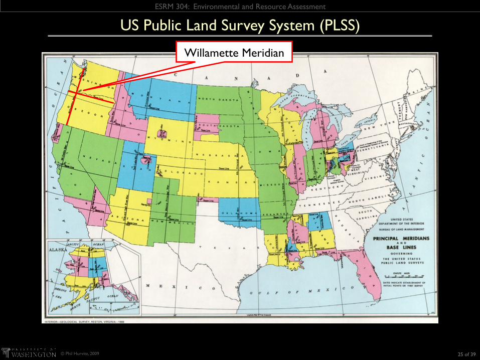
US Public Land Survey System (PLSS)
Established in 1785 (Land Ordinance Survey) Origin point in E. Ohio
24 of 39
ESRM 304: Environmental and Resource Assessment
© Phil Hurvitz, 2009
US Public Land Survey System (PLSS)
Willamette Meridian
25 of 39
ESRM 304: Environmental and Resource Assessment
© Phil Hurvitz, 2009
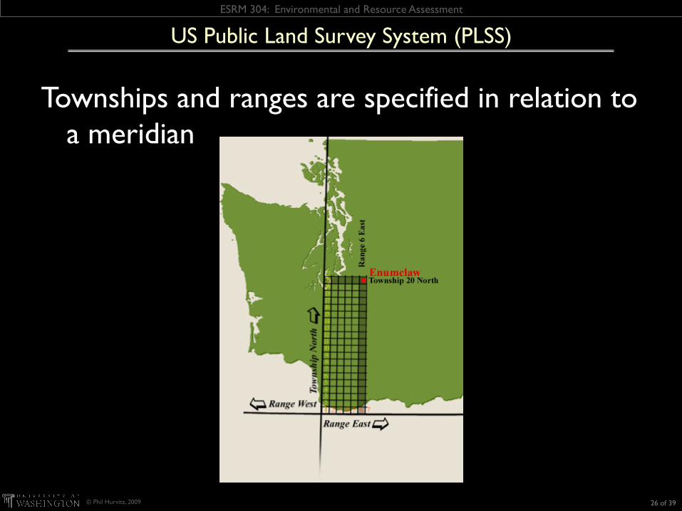
US Public Land Survey System (PLSS)
Townships and ranges are specified in relation to a meridian
26 of 39
ESRM 304: Environmental and Resource Assessment
© Phil Hurvitz, 2009
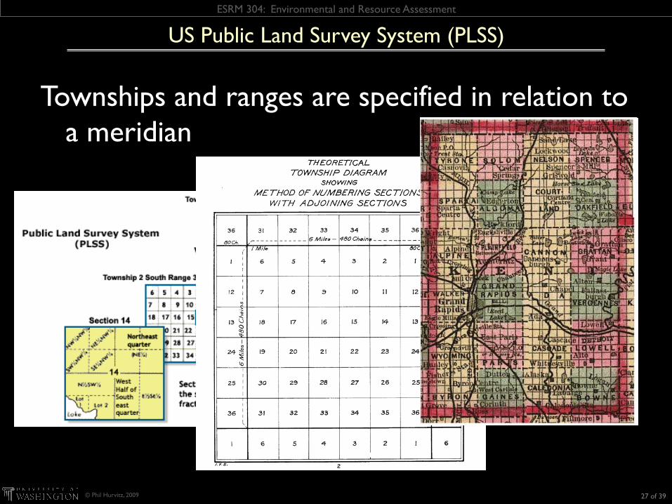
US Public Land Survey System (PLSS)
Townships and ranges are specified in relation to a meridian
27 of 39
ESRM 304: Environmental and Resource Assessment
© Phil Hurvitz, 2009
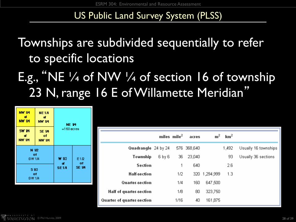
US Public Land Survey System (PLSS)
Townships are subdivided sequentially to refer to specific locations
E.g., “NE ¼ of NW ¼ of section 16 of township 23 N, range 16 E of Willamette Meridian”
28 of 39

ESRM 304: Environmental and Resource Assessment
© Phil Hurvitz, 2009
US Public Land Survey System (PLSS)
The legacy persists: Each 16th section was originally set aside for support
of public schools (in WA, managed by DNR); you should be grateful!
Land division artifacts
29 of 39

ESRM 304: Environmental and Resource Assessment
© Phil Hurvitz, 2009
Problems with PLSS Because the earth is an ellipsoid, rectangular divisions
will ultimately lead to discrepancies (can you cut an orange peel into squares?)
Imposition of new system conflicted in some locations with previously existing land divisions
US Public Land Survey System (PLSS)
30 of 39

ESRM 304: Environmental and Resource Assessment
© Phil Hurvitz, 2009
Codified in the 1930s Based on a Cartesian coordinate system Breaks the US up into a number of zones (124 in
US) Most states’ zones are based on Lambert
Conformal Conic or Transverse Mercator projection
Originally based on NAD27 datum, recently updated to NAD83 with GPS augmentation (HPGN = “High Precision GPS Network)
Highly accurate (error < 1:10,000 within a zone)
State Plane Coordinate System (SPCS)
31 of 39

ESRM 304: Environmental and Resource Assessment
© Phil Hurvitz, 2009
Each state or division of state has its own numeric code
Washington State has 2 zones, based on Lambert Conformal Conic projection
North zone: 5601 South zone: 5626
State Plane Coordinate System (SPCS)
32 of 39

ESRM 304: Environmental and Resource Assessment
© Phil Hurvitz, 2009
Problems with SPCS Each state or state subdivision uses a different zone
Makes use of the SPCS in large areas cumbersome
Accuracy declines outside of a zone Makes use of the SPCS problematic when mapping &
analyzing large areas
State Plane Coordinate System (SPCS)
33 of 39

ESRM 304: Environmental and Resource Assessment
© Phil Hurvitz, 2009
Developed by US Army Corps of Engineers in 1940s A global system (between 80°S latitude and 84°N
latitude) Unambiguous location for every place on earth Based on the Transverse Mercator projection 60 zones, each 6° wide
Universal Transverse Mercator (UTM)
34 of 39

ESRM 304: Environmental and Resource Assessment
© Phil Hurvitz, 2009
Global UTM grid
Universal Transverse Mercator (UTM)
35 of 39

ESRM 304: Environmental and Resource Assessment
© Phil Hurvitz, 2009
UTM zones in the continental US
Universal Transverse Mercator (UTM)
36 of 39

ESRM 304: Environmental and Resource Assessment
© Phil Hurvitz, 2009
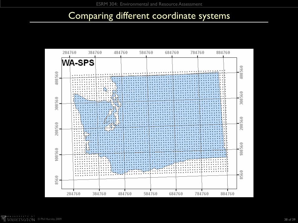
Comparing different coordinate systems
37 of 39
ESRM 304: Environmental and Resource Assessment
© Phil Hurvitz, 2009
Comparing different coordinate systems
38 of 39
ESRM 304: Environmental and Resource Assessment
© Phil Hurvitz, 2009
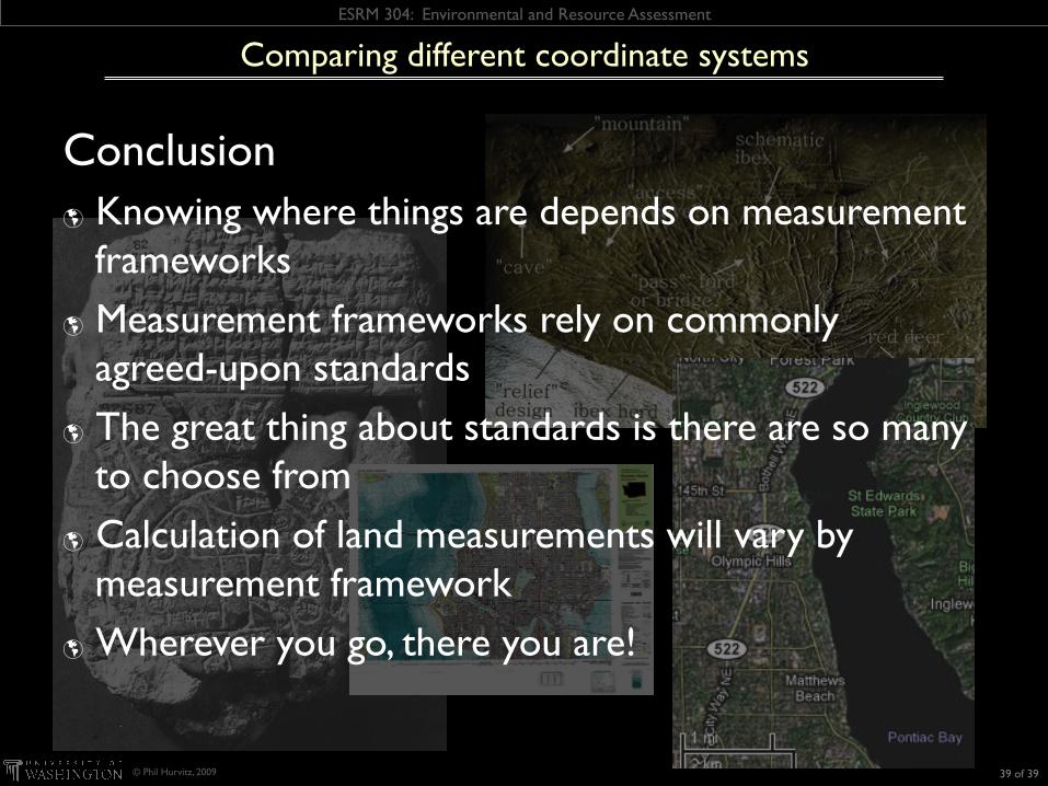
Conclusion Knowing where things are depends on measurement
frameworks Measurement frameworks rely on commonly
agreed-upon standards The great thing about standards is there are so many
to choose from Calculation of land measurements will vary by
measurement framework Wherever you go, there you are!
Comparing different coordinate systems
39 of 39