Mangroves of East Africa
26
of East Africa Michelle Taylor, Corinna Ravilious, Edmund P. Green Mangroves
-
Upload
mwagavumbi -
Category
Documents
-
view
66 -
download
0
description
Describes the mangroves of East Africa
Transcript of Mangroves of East Africa

of East AfricaMichelle Taylor, Corinna Ravilious, Edmund P. Green
Mangroves
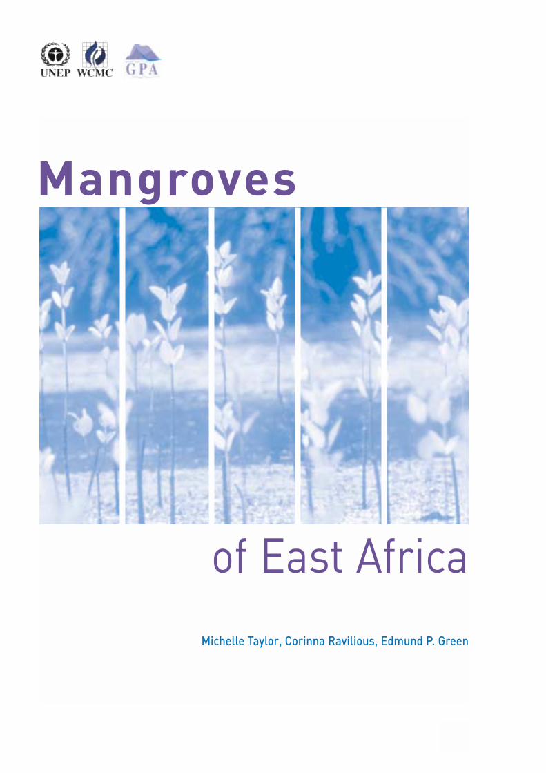
of East AfricaMichelle Taylor, Corinna Ravilious, Edmund P. Green
Mangroves
2
The contents of this report do not necessarily reflect the views or policies of UNEP or contributory organizations. The designations employed and the presentations do not imply the expressions of any opinion whatsoever on the part of UNEP or contributory organizations concerning the legal status of any country, territory, city or area or its authority, or concerning the delimitation of its frontiers or boundaries.
UNEP World Conservation Monitoring Centre219 Huntingdon RoadCambridge CB3 0DLUnited KingdomTel: +44 (0) 1223 277314Fax: +44 (0) 1223 277136E-mail: [email protected]: www.unep-wcmc.org
Director: Mark Collins
SponsorUNEP gratefully acknowledges the financial contributionof the Government of Ireland (Project Number IAL3010-02-16) for the production of this publication.
THE UNEP WORLD CONSERVATION MONITORING CENTRE is thebiodiversity assessment and policy implementation armof the United Nations Environment Programme (UNEP),the world’s foremost intergovernmental environmentalorganization. UNEP-WCMC aims to help decision-makers recognize the value of biodiversity to peopleeverywhere, and to apply this knowledge to all that theydo. The Centre’s challenge is to transform complex datainto policy-relevant information, to build tools andsystems for analysis and integration, and to support theneeds of nations and the international community as theyengage in joint programmes of action.
THE GLOBAL PROGRAMME OF ACTION FOR THE
PROTECTION OF THE MARINE ENVIRONMENT FROM LAND-BASED
ACTIVITIES aims to facilitate the realization of the duty ofStates to preserve and protect the marine environment.GPA assists States in taking actions individually or jointlywithin their respective policies, priorities and resources,which will lead to the prevention, reduction, controland/or elimination of the degradation of the marineenvironment, as well as its recovery from the impacts ofland-based activities.
© UNEP-WCMC 2003 A Banson productionThis publication may be reproduced in whole or in part and in any form for educational or non-profit purposes without specialpermission from the copyright holder, provided acknowledgement of the source is made. UNEP GPA and UNEP-WCMC will appreciatereceiving a copy of any publication that uses this publication as a source.
AcknowledgementsThe following people have been key in the completion of this publication. Their help, papers, data and communications have beenessential and we would like to send our heartiest thanks and best wishes to all: Janine Adams, Jared Bakuza, Salomao Bandeira, RichBeilfuss and Dorn Moore (International Crane Foundation), François Blasco, Ian Bryceson, Neil Burgess, Stefano Cannicci, CaterinaContini, Mary Cordiner, Farid Dahdouh-Guebas (Mangrove Management Group), Arthur Dahl, Jennifer D'Amico, Will Darwell, StephanieDuvail, Paul Erftemeijer, Kairo Gitundu, Olivier Hemerlynck (Rufiji Environment Management Project), Jacques Iltis, Claire Kremen,Ghislaine Llewellyn, Vedast Makota, Justin Moat (Royal Botanic Gardens), Nyawira Muthiga (Kenya Wildlife Service), Amani Ngusaru,Judy Oglethorpe, Harrison Onganda (Kenya Marine and Fisheries Research Institute), Rolph Payet, Jean Pascal Quod, Sware Semesi,Jude P. Shunulla, Mark Spalding, Jerker Tamelander, Kristian Teleki, Mike Traber, Caroline Turnbull, Rudy van der Elst, Mike vanKeulen, Colette Wabnitz, Y.Q. Wang, WIOMSA staff and Tris Wooldridge.

REGIONAL OVERVIEW
East African mangroves 4
Threats 7
Fauna 9
Legislation 9
Future 9
COUNTRY PROFILES
South Africa 10
Mozambique 12
Madagascar 14
United Republic of Tanzania 16
Seychelles 19
Kenya 21
Somalia 23
References and further reading 24
3
Mangroves of East Africa
Contents
Land area (km2) FAOSTAT, 2000 Coastline (km) Earthtrends, 2001 Population Population Division of the
(2000) Department of Economicand Social Affairs of theUnited Nations Secretariat,2002
Population density As above(per km2)
Annual population As abovegrowth rate (%) 2000-2005
Mangrove area on map From GIS data stored and (km2) compiled at UNEP-WCMC
and stated sourcesMangrove area (alternative Relevant country-specific
estimate) (km2) referenceNumber of nationally World Database of
protected areas Protected Areas, UNEP-containing mangroves WCMC
Sources of figures provided in country tables (unless otherwise stated)

LLiving in two worlds at once, mangroves protectcoastlines from wave energy and protect offshoreecosystems from terrestrial sediments flowing
downstream. Throughout the tropics mangroves exist inintertidal areas and are utilized as a habitat by thousands ofanimal species and as fuel, medicine, food and timber byhuman coastal populations.
As East African human populations have grown overrecent decades, increasing pressure has been placed onmangrove resources. Simultaneously, mangrove researchhas boomed, unveiling the importance of the ecological,economic and protective role that mangroves fulfil.Governments, non-governmental organizations and localcommunities have made concerted efforts to protect andregenerate remaining stands. However, overwhelmingpressures continue to take their toll.
EAST AFRICAN MANGROVESMangrove areas have a high level of productivity as theyreceive nutrients from both sea and land. Detritus is the pri-mary energy source in tropical estuaries and mangroves areoften the producer of this organic litter. Sixty per cent of leafmaterial in tropical estuaries originates from mangroves.Gross primary production in East African mangroves is
seasonally variable but generally comparable to seagrassesand more than coral reefs (see Table 1). Unfortunately littlework has centred on energy transfer in mangroveecosystems and consequently we do not have a completeunderstanding of trophic relationships and food webs.
In East Africa Sonneratia alba is very common,typically occurring in muddy soils where salinity is close tosea water. It is a hardy primary colonizer and resistant tophysical disturbance so is often found along outer margins.Rhizophora mucronata dominates on muddy soil and iscommonly found in large homogeneous stands on upperriver banks. Bruguiera gymnorrhiza occurs betweenRhizophora mucronata and Ceriops tagal zones, orinterspersed throughout them. Ceriops tagal has a weakerroot system and is less capable of withstanding strongwaves and currents; it grows in upper intertidal areas where
4
Mangroves of East Africa
Regional overview
Table 1: Mean gross primary production of biotopes in Gazi Bay, Kenya
Wet season Dry seasonmgC/m3/day mgC/m3/day
Mangroves 540.41±222.63 377.67±159.70Seagrass 552.22±291.36 230.84±84.75Coral reefs 388.88±247.12 240.27±115.29
Phot
os: S
ECA/
CML
(left
and
cent
re);
Stef
ano
Cann
icci (
right
)

sediments are thicker. Heritiera littoralis is found on riverbanks and in estuary mouths where salinity is low and ininland areas usually flooded only by spring high tides.Xylocarpus granatum grows scattered on higher ground inAvicennia marina stands where sea water flooding occursonly a few days each month and where freshwater has moreinfluence. Avicennia marina is euryhaline and tolerates avariety of flooding regimes and substrates but is mostcommonly found on firm sandy soils. It is a widelydistributed species and often a primary colonizer of exposedseaward areas. Lumnitzera racemosa is associated with B.gymnorrhiza and Xylocarpus moluccensis along riverbanks. Patterns of zonation can be altered by disturbancebecause heavily used species may not regenerate first andnewly disturbed areas may be colonized by pioneer species.
From 1950 to 2000 265 papers were publishedfocusing on mangrove research in East Africa, 92 per centof which centred on Kenya. Few were experimental orcomparative with 80 per cent descriptive in approach. Themangrove ecosystems of eastern Africa are well studied,but even the baseline information needed for environmentalimpact assessments and management plans is still notavailable. A major problem is that available information isoften not disseminated. Numerous different nationallanguages further hinder dissemination as findings areoften confined to their countries of origin.
The physical three-dimensional complexity ofmangrove forests creates a wide diversity of niches suitablefor breeding, spawning and hatching of sedentary andmigratory species. Mangroves are an important nurseryhabitat, particularly for fish and crustaceans.
Both terrestrial and aquatic biodiversity withinmangroves are high. However, if areas are deforesteddensities of epifaunal species such as Littorina scabra, Ucaspp., Sesarma spp. and Cerithidea decollata are greatlyreduced. Populations of infaunal species, nematodes,bivalves, copepods and many molluscs are still recorded insimilar densities in deforested and natural mangrove areas.
Aquaculture is an expanding industry in the EastAfrican region. The consequences of aquaculture projectsfor mangroves are well documented from Ecuador,Thailand, Indonesia, Malaysia, Vietnam, Bangladesh andIndia. If this industry develops vigorously in East Africa thereis the potential for similar degradation of mangroves. Thiscan be avoided through careful regulation of mangrovefelling. Many small-scale, locally managed farms, of lowintensity, would be economically and environmentallypreferable to a few massive ventures such as the proposedRufiji prawn project in Tanzania.
Mangrove timber is used locally in construction andfor fuel. Mangroves have a range of branch sizes and thevarying sizes have different uses and individual names inSwahili:
Fito (2.5-3.5cm): the smallest poles, used to fillwalls (usually young R. mucronata and C. tagal).Pau (4.0-7.5cm): small poles, used as roof frames(usually young R. mucronata and C. tagal).Mazio (7.5-11.5cm): a bit larger, and used to buildthe main frame of house walls (usually young R. mucronata and C. tagal), which is then packedwith mud.Boriti (11.5-13.5cm): larger poles, used to buildfences, mainly for tourist developments (usually R.mucronata).Nguso (14.0-20.0cm): used at the corner of housesto support the roof (usually mature R. mucronataand B. gymnorrhiza).Vigingi (20.5-35.0cm): the largest poles, used tosupport the main roof of larger tourist hotels(usually B. gymnorrhiza).
Local mangrove markets are common as wood isused in so many aspects of everyday life. Fish traps made ofmangrove are more robust in salt water than other types ofwood. Seaweed farmers use mangrove stakes for the samereason. Boats, such as one-man canoes carved from heavyAvicennia marina logs, furniture, drums and serving dishes
5
Regional overview
Table 2: Mangrove species distribution throughout East Africa
Species South Africa Mozambique Madagascar Tanzania Seychelles Kenya SomaliaRhizophora mucronata ✓ ✓ ✓ ✓ ✓ ✓ ✓
Ceriops tagal ✓ ✓ ✓ ✓ ✓ ✓ ✓
Bruguiera gymnorrhiza ✓ ✓ ✓ ✓ ✓ ✓ ✓
Avicennia marina ✓ ✓ ✓ ✓ ✓ ✓ ✓
Sonneratia alba ✓ ✓ ✓ ✓ ✓ ✓
Heritiera littoralis ✓ ✓ ✓ ✓
Xylocarpus granatum ✓ ✓ ✓ ✓ ✓ ✓
Lumnitzera racemosa ✓ ✓ ✓ ✓ ✓ ✓ ✓
Avicennia officinalis ✓
Total number of species 6 8 9 8 7 8 6

6
Mangroves of East Africa
East African mangrove distribution
500

are all made from mangroves. Most villages aroundmangrove forests construct the majority of buildings fromfelled mangroves as they are an easily accessible resource.
Mangrove wood is often used as fuel. Rhizophoraspecies are especially utilized as they are rich in tannin andburn almost smokelessly, imparting a pleasant taste tocooked food. Green Avicennia marina logs, however, are verysmoky and slow burning so are often used by honey collec-tors and fishermen to keep away biting insects at night.
Many villagers produce salt by boiling brackishwater in clay bowls over fire. Mangroves are heavilyexploited as a fuel source using this technique. With seventonnes of wood needed to produce one tonne of salt somecoastal forests are now bare. On a larger scale salt isharvested from evaporation ponds, shallow brine-filled pits,usually built in cleared mangrove areas.
THREATS Once common in sheltered bays and estuaries, mangroveforests in some areas of East Africa are now degraded.One of the major factors changing the characteristics ofmangroves within the region is inland topsoil erosion,typically from agriculture and grazing land. Natural levelsof erosion bring nutrients to coastal areas and buildmangrove forests by replacing mud and sand lost by waveaction. However, the extreme levels of soil being washeddownstream in recent years is burying roots, asphyxiatingmangroves.
If mangroves are felled, offshore coastal areas, suchas coral reefs, receive even more sedimentation. Alreadythe effects of excessive nutrient loads and sedimentdischarge can be seen as breaks forming in fringing reefsopposite river mouths. The central Mozambique coast(800km long) is devoid of coral due to discharge from theLompopo and Zambezi Rivers.
Oil is a major pollution threat in the region as thereare tanker routes along the East African coast linking theGulf to the Atlantic Ocean. Many countries lack even basicfacilities for handling bilge in their ports and small oil spillsare common. If mangrove lenticels and pneumatophoresbecome covered in oil the tree suffocates. The toxicity ofsubstances within the oil, the age and species compositionof mangroves, and sediment type all affect mangrovesurvival after spills. The effects of oiling can last for manyyears. For example, reduced mangrove area and epifaunalcover is still recorded in Makupa Creek, Kenya, ten yearsafter spills occurred.
Industry may be developing more slowly in EastAfrica than elsewhere but rivers, streams and mangrovesare used as dumping sites for the textile, chemical, paper,sugar and oil industries within the region. In Kenya,Tanzania and Mozambique agricultural and silvicultural
effluents enter mangrove areas. In Somalia andMadagascar the concentration is more on livestockindustries. However, industrial pollution is not a severeproblem in the region as it is still small scale.
Eastern Africa is also undergoing an extraordinaryrate of urbanization. The pressure on mangroves fromhuman populations varies immensely across the region. InMadagascar over 90 per cent of households depend onfuelwood and charcoal (including mangroves). By contrast,only 8 per cent of people in the Seychelles depend onfuelwood, even as a supplementary source of energy.
The effects of climate change will be felt across theregion as patterns of rainfall, coastal weather, atmosphericpressure and evaporation adjust. Anticipated effects ofclimate change are increased temperatures, changes inhydrology regimes, a rise in sea level, increased magnitudeand frequency of storms and increased carbon dioxideconcentration. There will be positive and negative affects onmangroves and it is highly uncertain exactly what the netoutcome will be as local variability will be very high andeffects site specific.
As temperatures rise mangroves may start tocolonize higher latitudinal areas. A warmer climate mayresult in an increase in frequency and strength of tropicalstorms and previously sheltered areas, suitable formangrove growth, may become exposed. Conversely, anyreduction in temperature could shrink mangrove range. Anychanges in temperature, salinity, storm frequency orprecipitation will have effects on flora and fauna com-position within mangrove forests.
It is difficult to predict the exact consequences ofsea-level rise as many scenarios are dependent onsedimentation fluxes from river catchments and coastaltopography or land composition. Generally opinion seems toagree that rising sea levels will lead to mangroves shiftinglandward, as long as the rate of rise does not exceedmangrove growth and there are no obstructions to inlandexpansion.
Regenerated mangrove areas, even those thatextend beyond original mangrove locations, may not be of
7
Regional overview
Mangrove area converted into coastal salt mining, Mikindani,Mtwara.
Phot
o: G
ISE
Unit/
NEM
C an
d TC
MP/
CRC

8
Mangroves of East Africa
Table 3: Uses of mangroves
Latin species names Kiswahili/Swahili Usesof mangroves and spoken through eastern Africa mangrove associates and/or Giriama, Kenya
Avicennia marina Mchu Main: no substantial utilization(Forskål) Vierhand Secondary: high quality charcoal, boat
paddles, oars, handcraft handles, axehandles, pounding poles, beehives andtraditional drums; the roots provideremedies
Avicennia officinalis Inferior firewood (only reported from Linnaeus Madagascar)Bruguiera gymnorrhiza Mshinzi, Muia, Mkoko wimbi Main: building material, roof supports, (L.) Lamarck high quality firewood
Secondary: high quality charcoal, boatpaddles, oars, handcraft handles, axehandles, pounding poles, beehives andtraditional drums; the roots provideremedies
Ceriops tagal Mkandaa mwekundu, Mkoko Building material, paddles, oars, (Perr.) C.B. Robinson mtune, Mkoko mwekundu medium quality firewood, charcoal, dyes
(incl. tanning compounds), fishing trapsHeritiera littoralis Msikundazi, Mkungu Main: charcoalDryand Secondary: firewood, building wood,
dhow mastsLumnitzera racemosa Kilalamba duma, Kikandaa, Main: no substantial utilizationWilld. Mkaa pwani Subsidiary: building wood, medium
quality firewood and charcoalPemphis acidula Kilalamba kike Main: firewood, charcoalForst. Subsidiary: building woodRhizophora mucronata Magoni, Mkoko, Mkoko mwenye Main: building wood, high qualityLamarck mwenye charcoal
Secondary: high quality firewood, dyes(incl. tanning compounds), medicines,ointments, bow-nets (using roots),fishing traps, weapons
Sonneratia alba Mlilana, Mpira Main: canoes, boat ribs, paddles, masts, Smith pneumatophores used for floating fishing
gears, window and door framesSecondary: medium quality firewood andcharcoal
Xylocarpus granatum Mkomafi Main: canoes, charcoalKoenig Secondary: firewood
Subsidiary: the fruits provide remediesfor stomach ache
Xylocarpus moluccensis Mkomafi dume Main: high quality timber: bed (Lamk.) Roem. construction, window and door frames,
medium quality charcoalSecondary: medium quality firewood

the same quality as virgin stands because speciescomposition, soil type, stocking rates and numbers ofanimals will have changed. Selective harvesting removeshigh quality mangroves leaving lower quality species torepopulate the now depleted area. Some human com-munities, such as those around Chwaka Bay on Zanzibar, doleave “mother” trees to produce seedlings but this is rareand sometimes the mother trees are merely large, mature,lower quality trees. Furthermore, lower quality mangrovewood, smaller trees, or species less used in construction,provide less income. In Chwaka Bay for instance, poles usedin construction are of a relatively poor quality and are soldfor TSh4 000 to 5 000 (currently US$55 to 75) whereas woodimported from mainland Tanzania can be sold for TSh9 000to 10 000 (US$125 to 140) as it is of a higher quality.
FAUNA Crabs are the most conspicuous invertebrates inhabitingmangroves. Upper zones are inhabited by marsh crabs,Sesarma spp., and closer to shore fiddler crabs, Uca spp.,are dominant. Giant mud crabs, Scylla serrata, hermitcrabs, prawns and shrimp are all mangrove residents.Fiddler crabs in particular play an important role in thecycling of nutrients in mangrove ecosystems as they feed ondetritus or micro-organisms living on detritus. Giant mudcrabs predate on molluscs and smaller crab species andare harvested for food. Filter feeders such as rock oysters,Saccostrea cucullata, and barnacles, Balanus amphitrite,secure themselves to lower stems or pneumatophores inlower intertidal areas, enabling them to filter plankton andnutrients from surrounding waters. Mud creepers,Terebralia palustris, mud whelk, Cerithidea decollata, andStrombus spp. are all mangrove molluscs. Some 117species of molluscs and 163 species of crustaceans havebeen recorded from mangroves in the East African region.
The most commonly found fish species inmangroves is likely to be mullet. Mullet, for example Lizamacrolepis, consume large quantities of plant materialmaking them important in nutrient cycling. Other commonfish species include Kelee shad, Hilsa kelee, milkfish,Chanos chanos, anchovy, Thryssa spp., striped catfish,Plotosus lineatus, gobies, common silver biddy, Gerresoyena, and the two-finned round herring, Spratellomorphabianalis. In all, 114 species of fish have been recorded fromEast African mangroves.
Mangroves are used by migratory bird species suchas crab plover, Dromas ardeola, African spoonbill, Plataleaalba, and great white egret, Egretta alba.
Larger creatures found in mangrove forests andsurrounding waterways include Nile crocodiles, Crocodylusniloticus, hippopotamuses, monkeys and dugong, Dugongdugon (listed as vulnerable on the IUCN Red List). Zebras,
bush pigs, blue duikers, water mongoose and otters are allperiodically found in mangrove areas.
LEGISLATIONIt is relatively rare for mangroves to be the specific focus ofa protected area in the way some marine protected areasfocus on habitats such as coral reefs. However, a wholeecosystem approach is needed to ensure the conservationof coastal areas. Many species found within mangrovesspend part of their life cycles in seagrass and coral areas soa zone of protection isolating just a reef will not preserve allspecies at all stages of their life cycles. Current levels ofprotection need to be improved throughout the region. In thepast five years two new nationally designated marineprotected areas containing mangroves have been estab-lished, both in Tanzania. On an international level, oneUNESCO Biosphere Reserve and one World Heritage Sitewith mangroves have been created since 1996.
FUTUREA rational use of mangrove forests has to be embarked uponto ensure the long-term survival of the forests and allcreatures, human and animal alike, that rely on them. Thiswill mean changes to present approaches in mangrovemanagement. Past problems facing mangrove forests havebeen the lack of community input into managementapproaches, high levels of poverty within indigenous coastalcommunities and a general lack of awareness of the truevalue of mangroves. These issues and the regeneration ofmangrove forests should be included in future mangrovemanagement plans.
Management changes are not the all-encompassingsolution as current knowledge of many aspects of mangroveecosystems needs to be improved. Techniques for naturaland artificial regeneration need to be investigated further asdo mangrove faunal interactions, mangrove fisheries,hydrology, and growth and development. We would thenbetter understand how felling and other human activitiesare affecting mangrove ecosystems. Only then will efficientand sustainable management regimes be attainable.
9
Regional overview
Migratory crab plover, Dromas ardeola, often found in EastAfrican mangroves.
Phot
o: S
ECA/
CML

MMangroves along South Africa’s east coast are moreextensive in the north, becoming less frequent insouthern estuaries. The largest mangrove areas
can be found in the Mhlathuze and St. Lucia estuaries. TheMhlathuze’s estuaries and bays actually represent 80 percent of South Africa’s mangroves while the exposed, rockywestern coast is devoid of mangroves.
Nahoon River is the southernmost occurrence ofmangroves on the East African coast and thus has a slightlydifferent species composition than is typical. The southernextents of tropical species such as Lumnitzera racemosa,Ceriops tagal and Xylocarpus granatum are found in KosiBay, northern South Africa. Avicennia marina, Bruguieragymnorrhiza and Rhizophora mucronata are commonly
found in mangrove areas throughout South Africa, with thelast not occurring south of the Bulungula River.
USESMangroves in South Africa are, for the most part, valued fortheir wood resources rather than for associated fisheries aswood poles are widely used in construction. However,mangrove areas are rich fishing grounds for bothrecreational and subsistence fisheries. Mangroves are alsoexploited in order to fish as their wood is used to constructfish traps, in particular traps called kraals. Kraals aretemporary structures, made largely from mangrovebranches, that are used to catch prawns.
THREATS AND LOSSES In 1988 mangroves occurred in 17 of the 76 estuaries withinthe Transkei. Now only 14 estuaries boast mangrovehabitat. A loss of 6.5 per cent of mangroves per year over 11years has been recorded. This reduction is indicative oflosses occurring in unprotected areas along the entireSouth African coast. No new mangrove stands have beenrecorded in the Transkei but mangrove areas in eightoriginal stands have increased (mostly in protected areas).This combination of loss and gain has made net area changeover recent decades negligible.
10
Mangroves of East Africa
South Africa
SOUTH AFRICA
Land area (km2) 1 221 040Coastline (km) 3 751Population (‘000) 2000 43 309Population density (per km2) 2000 35Annual population growth rate (%) 2000-2005 0.77Mangrove area on map (km2) 334Mangrove area (km2) Adams et al., submitted 16.88Protected areas with mangroves 7
Three estuaries and rivers have suffered completeloss of mangroves, mainly due to an altered hydrologicalregime. The Mzimvubu River has lost its mangroves toexcessive bank scouring linked to flooding events. A droughtin the Bulungula estuary closed off the estuary mouthcausing freshwater to build up and inundate the mangroveswhich were then harvested.
The biggest threats currently facing mangroves areharvesting, development around mangrove areas, andreductions of freshwater into estuaries causing rivermouths to close and mangroves to flood. In addition,inappropriate agricultural activities, such as cultivation ofsteep areas, contour furrows and veld management, haveled to catchment degradation that ultimately results inincreased sedimentation entering mangrove ecosystems.
Being at the southern limits of their extent,mangroves grow at a slower rate than forests further north,which benefit from tropical conditions. Thus, felling SouthAfrican mangroves is an activity with repercussions over alonger time period than in other countries.
FAUNASesarmid crabs, fiddler crabs, Uca spp., giant mud crabs,Scylla serrata, mudskippers, Periophthalmus kalolo, andmany gastropods are all fauna commonly found inmangrove swamps in South Africa. Mangroves provideanchorage for filter-feeding organisms such as Natal rockoysters, Crassostrea cucullata, barnacles, such as Balanusamphitrite, and numerous mussel species. The nationallyendangered mangrove kingfishers, Halcyon senegaloides,have their southernmost breeding sites in the Kobonqaba,Ngqusi and Nxaxo rivers. Blue duiker, Philantombamonticola, bushbucks, Tragelaphus scriptus, and bushpigs, Potamochoerus porcus, can regularly be found in themangroves of South Africa and there is evidence that Capeclawless otters, Aonyx capensis, water mongoose, Atilaxpaludinosus, grey duikers, Sylvicapra grimmia, andBurchell’s zebras, Equus burchelli, are also intermittentvisitors.
LEGISLATIONSouth African mangroves tend to be small and found inisolated estuary mouths, making management and policingdifficult. And, as elsewhere in East Africa, responsibilitiesfor mangrove management lie with many differentgovernment agencies and this has led to fragmented anduncoordinated administration at all three governmentalauthority levels (central, provincial and local).
In the Transkei only 6 per cent of mangroves areprotected yet this area is regarded as having a high level ofprotection owing to regulations being upheld and efficientpolicing. Unprotected areas of mangroves in Mdumbi,
Mzamba, Koboqaba and Mtamvuma have suffered 50 percent loss in trees to harvest, whereas protected areas haveseen no change in cover, and occasionally an increase.
In the absence of legally protected areas there aremangrove stands that are protected by local communities.Xora and Nxaxo mangroves are protected in this mannerand both areas have seen increased mangrove cover in thepast decade. The same could not be said for many, if any,accessible unprotected mangrove areas.
Map source: Small annotations onto base map based on locationsfrom Hughes and Hughes,1992. Indicative of locations and notregarded as providing accurate areal coverage.
11
South Africa
Mngazana estuary in southern Transkei, South Africa.
Phot
o: T
ris W
oold
ridge
Oysters on stilt roots of Rhizophora spp.
Phot
o: S
ECA/
CML
Coastal villages often use mangrove wood in construction.
Phot
o: S
ECA/
CML

MMangroves are continuous along the north andcentral coastlines of Mozambique, becoming lesscommon in southern areas. The most extensive
mangrove forests are found in the Zambezi River Delta,where almost 180km of coastline is covered in continuousmangrove forest. This area contains 50 per cent ofMozambique’s mangrove area and is also one of the largestmangrove forests in Africa.
There are well-developed areas between the Beiraand the Save Rivers in central Mozambique, where man-groves extend 50km inland with canopy heights of up to30m. And creeks in the north at Lumbo, Mecúfi, Ibo Islandand north of Pemba have mangrove areas.
USESMangroves are used for construction, firewood, charcoalproduction, tannins, fruit, fencing, fish traps and medicine inMozambique. Rhizophora mucronata bark is used to dyefishing nets. Dugout canoes and beehives are made fromAvicennia marina wood. Molluscs and crustaceans, such asmangrove crabs, Scylla serrata, mud creepers, Terebraliapalustris, and shore crabs, Matuta lunaris, collected frommangroves represent an important source of protein forhuman populations in Mozambique, especially on InhacaIsland.
THREATS AND LOSSES The overall rate of mangrove deforestation in Mozambiqueis estimated at 18.2km2/year. However, mangrove forestsare still relatively unaffected as there has been a smalloverall rate, 2.6 per cent, of mangrove cover lost from 1972to 1990. Some areas, such as Maputo and Beira, doexperience heavy utilization and mangroves here are moreat risk of severe depletion. Mangrove poles in BengueleneIsland are being harvested at a rate of 9 234 tonnes a year.
Mozambique’s coastal population was estimated at6.6 million people (42 per cent of the total) in 1997 and thisnumber is growing. The consequent pressure on coastalresources affects mangroves. Urban areas, such as Maputoand Beira, have experienced much mangrove deforestationfor firewood, charcoal, agriculture and salt production.Mossuril has had half of its mangrove forests transformedinto salt production areas. During the civil war from 1975 to1994 Inhaca Island experienced serious overpopulationproblems as people sought refuge from the mainland. Thishad negative impacts on the island’s natural resources,including mangroves. As families have returned to theirpre-war homes the pressure has eased, and currentlyInhaca Island mangroves are managed sustainably.Mangroves and mangrove products still contributeapproximately 20 per cent to the average family income onInhaca Island.
A high volume of crude oil is transported throughthe Mozambique Channel, around 450 million tonnesannually. There have been 14 minor and two major crude oilspills in Maputo harbour that have affected mangroves. Aheavy fuel oil spill in 1992 affected part of the Macanetapeninsula, including mangrove areas. The Cahora-Bassadam on the Zambezi River has reduced the flow of water,altering water conditions in the mangroves and ultimatelycausing a shrinking of mangrove area.
Industrial pollution is currently not a significantproblem in Mozambique but with the expanding ironsmelting and gas/oil drilling activities along the centre ofthe coast it could be a potential threat to mangroves infuture years.
12
Mangroves of East Africa
Mozambique

Threats to mangroves could be particularlydamaging to Mozambique’s economy as the shrimpfisheries of the Sofala Bank are valued as high as US$50to 60 million per year, 40 per cent of the country’s net foreign exchange earnings. Penaeid shrimps, at allstages of development, use mangrove as a preferrednursery habitat.
FAUNA Barnacles, Balanus amphitrite, and rock oysters,Saccostrea cucullata, grow on the trunks of mangrovetrees. Mud creepers, Terebralia palustris, burrowing crabs,Cardisoma carnifex, and sand-bubbler crab, Dotillafenestrata, are all common sights within mangrove forestsin Mozambique.
LEGISLATIONConservation and management of mangrove forests fallunder the jurisdiction of the National Directorate forWildlife and Forestry that is also responsible for allterrestrial forests. New land legislation in 1998 providespartial protection to all mangroves as it protects all livingresources from the coastline to 100m inland. Projects thatcould threaten mangrove extent are now subject toenvironmental impact assessments and mangroveexploitation for commercial purposes can only commencewith a licence. A national mangrove management plan is in the early stages of development so that the demands of conservation and sustainable use of mangroves can be met.
Map source: As in Spalding et al., 1997 and Beifuss, R.D., Moore,D., Dutton, P. and Bento, C., 2001, Patterns of vegetation changein the Zambezi Delta, Mozambique. Program for the SustainableManagement of Cahora Bassa Dam and the Lower ZambeziValley. Working Paper #3. International Crane Foundation,Baraboo, Wisconsin, USA.Eastern African Coastal Database and Atlas Project: Tanzania,2001. Government of Belgium to the Eastern African Trust Fund,UNEP, and the Tanzanian Government. Landsat TM data from2000, image interpretation by LTRS. Guerreiro et al., 1996.
13
Mozambique
MOZAMBIQUE
Land area (km2) 801 590Coastline (km) 6 942Population (‘000) 2000 18 292Population density (per km2) 2000 23Annual population growth rate (%) 2000-2005 1.76Mangrove area on map (km2) 5 211Mangrove area (km2) Saket and Matusse, 1994 3 960Protected areas with mangroves 5
Extensive mangrove cutting in the Mebase estuary, northernMozambique.
Phot
o: T
ris W
oold
ridge
Prawn ponds are commonly found in mangrove areas.
Phot
o: S
ECA/
CML
Mangrove wood felled for sale.
Phot
o: S
ECA/
CML

MMadagascar is the fourth largest island in the worldand has the longest coastline in the region at9 935km. Nearly all, 98 per cent, of mangroves
within Madagascar are found at 29 sites on the west coast,with the remaining 2 per cent located on the east coast.Most west coast stands exceed 500ha in size with Mangoky,Tsiribihina, Ranobe (Besalampy), Betsiboka, Mahajambaand Mahavavy (Baie d’Ambaro) having stands of more than20 000ha. East coast stands are smaller but more dense.
USESSeventy per cent of the human population work inagriculture yet the highest revenue earner is the fisheries
industry, employing just 14 per cent of workers. Some 60species of fish were recorded from a mangrove stand in theTulear Lagoon, 44 of which were commercial species.Mangroves are important nursery areas that support thefisheries industry and local subsistence fisheries. Acommonly used trap is a “valakira”, a v-shaped dike-likestructure made from mangrove wood, usually used to catchprawns. However, the chief use of mangroves occurs whenthe catch is brought ashore as mangrove wood is used asfuel to boil prawns and to smoke fish. This could prove to bea major threat to mangroves, especially those aroundvillages and towns. In Andavaoanemboka the use is alreadyin excess of sustainable yield.
Globally, Madagascar is a minor tourist destination;however its beautiful coastline ecosystems could be thefocus of a thriving ecotourism industry in future years as thegovernment intends to make coastal tourism a key sectorfor growth. Environmental assessments and careful coastalplanning are needed to guarantee coastal ecosystems arenot degraded further as hotels and complexes are built.
THREATS AND LOSSESCoastal sedimentation is a serious problem in Madagascar.Mahajanga port, found at the mouth of the Betsiboka,received 100 million m3 of sediment from upstream sourcesrendering it entirely useless. Sedimentation at this scaleultimately suffocates and kills mangrove stands.
Madagascan mangroves are being used pro-portionately more as time passes, especially aroundpopulation centres along the coast. This systematicdestruction is causing changes in the composition ofmangrove forests. Dense mature mangroves are beingfelled and more tannes (barren saltine areas) are formingas freshwater is channelled away from mangrove areas andinto irrigation systems upstream. The reduced flow of waterleads to increased siltation of smaller rivers, causingmangrove stands in these river mouths to die.
West coast mangroves could potentially produce58 000 tonnes of crustaceans a year through aquacultureventures. However, aquaculture has always been a small-scale industry in Madagascar. The 1990s did see asubstantial rise in the number of larger aquaculture farmsbut the scale is still minor when compared to the extensiveoperations in many East Asian countries. A medium-sizedshrimp farm established in Mahajamba Bay in the early1990s occupies several square kilometres of salt marsh,tannes and some mangrove areas. From 1972 to 1995,75km2 of mangroves were lost from Mahajamba Bay andaquaculture facilities contributed to part of thisdegradation. With a plentiful workforce, the clay-like tanneswhich provide ideal conditions for shrimp ponds, and anincreased foreign currency flow into the local economy, the
14
Mangroves of East Africa
Madagascar

aquaculture venture in Mahajamba Bay is a great businesssuccess despite the environmental consequences. Twomore aquaculture facilities have since been established onthe west coast, and there are plans for an additional three.The aquaculture industry is growing despite the conversionof sensitive silted areas to tannes, decrease in water qualitydue to pollution, and other associated environmentaldegradation.
FAUNA Among the nine threatened and endemic Madagascanwaterbird species, five are recorded from mangrove areas:Ardea humbloti, Anas bernieri, Threskiornis bernieri,Haliaeetus vociferoides and Charadrius thoracicus. Theendangered Madagascar teal, Anas bernieri, even nests inholes in mangrove trees.
The Madagascar bat, Pteropus rufus, roosts onmangrove trees, and economically important invertebratessuch as Scylla serrata and two shrimp species, Penaeusindicus and P. monodon, also occur in mangrove areas.
LEGISLATIONThere is no legislation specifically relating to mangroves butmangroves, coral reefs and islands are all classified as"sensitive zones" under environmental impact assessment(EIA) legislation. Consequently EIAs are necessary forprojects that could potentially impact these ecosystems.
Legislation pertaining to aquaculture has a fishing
focus and does not take into account any environmentaldegradation factors. Madagascar therefore needs moreeffective legislation and means of enforcement if sensitiveareas, such as mangroves, are to be protected.
Madagascar has just one official nationallydesignated protected area that covers some mangroveforest, the Mananara Marine National Park on the north-east coast. The Mananara-Nord UNESCO BiosphereReserve also covers the same area and the Sahamalaza-Iles Radama UNESCO Biosphere Reserve on the northernwest coast is another internationally designated protectedarea with mangrove habitat.
Map source: Farmalala Miadana Hariosa, 1996. Carte desFormations Végétales de Madagascar. 1:1 000 000. 3 sheets. I.C.I.V.,Toulouse, France.With minor corrections from CI/DEF/CNRE/FTM, n.d. FormationsVégétales et Momaine Forestier Nationale de Madagascar.1:1 000 000. Conservation Internationale/Direction des Eaux etForêts/Centre National de Recherches sur l'Environnement/Foiben-Taosarintanin/ Madagasikara.Both taken from 1972-1979 Landsat imagery.
15
Madagascar
MADAGASCAR
Land area (km2) 587 040Coastline (km) 9 935Population (‘000) 2000 15 970Population density (per km2) 2000 27Annual population growth rate (%) 2000-2005 2.83Mangrove area on map (km2) 3 404Mangrove area (km2) Ranaivoson, 1998 3 300Protected areas with mangroves 1
Drier conditions on the east coast of Madagascar donot naturally predispose the area to mangrovedevelopment. Mangroves here may not match theextensive forests that dominate areas of the westcoast but they provide key services to local humanpopulations. These mangroves are a nursery forpenaeid prawns and other species that make asignificant protein contribution to the diets of manycommunities. Their bark is used to make floor polishand branches are used for construction and charcoalproduction.
Nearly every patch of mangrove in theMasoala Peninsula is being slowly harvested.Mangroves at Maroantsetra have been almost entirelyremoved. This is exacerbated by the total clearance ofthe once dense climax forest that was formerly abackdrop for coastal mangroves, and the high level ofrainfall at 4m per year. Increased runoff and sedimentloads are inevitable, more so if mangrove and forestlosses continue. This will have dire repercussions forwildlife in rivers, mangroves and on coral reefsoffshore as water becomes sedimented, turbid andnutrient enriched.
As a rare ecosystem on the eastern coast ofMadagascar, these mangroves should receive highconservation priority.
MASOALA PENINSULA
Mangrove-wood “valakira” prawn traps across a river.
Phot
o: S
ECA/
CML

MMangroves are the dominant coastal ecosystem inTanzania where approximately 150 000 peopleearn their livings from mangrove resources. One
Rufiji Delta resident is quoted as saying, “About 75 per cent
of our life depends on mangrove. The remaining 25 per centis divided between fishing and farming.”
Mangroves provide ecological services such asnursery areas for fish and prawns, roosting areas for birdsand coastal protection. In recognition of their nationalimportance all mangrove areas in Tanzania have beendesignated as forest reserves since 1928-1932.
The largest mangrove forest in the East Africanregion is the Rufiji Delta and, despite heavy utilization, themajority of mangrove forests there are still intact. With fewhuman communities Kilwa, south of the Rufiji Delta, hasalso maintained its mangrove areas. Mtwara has extensivemangrove areas, as does Mnazi Bay, and both have sufferedminimal felling. In addition, replantation, combined withnatural regeneration, has occurred in these areas. Anincrease in awareness of the value of mangroves andmangrove protection efforts, achievements of the NationalMangrove Management Plan, have resulted in little changein mangrove cover in Pangani, Tanga and Muheza districtssince the plan was implemented in 1994.
USESMangroves are a traded commodity. Mangrove poles areexported and used locally as a building material and tomake fish traps. Boat-making is a common use, inparticular for the construction of dhow (traditional woodenboat) ribs and rails, and to a lesser extent keels. Rhizophoramucronata roots are used to make v-shaped stake traps(“wando”) that strand fish as the tide recedes. Mangrovewood is used for fuel to commercially produce salt and limeand process fish. Charcoal-making is widely practisedthrough the Ruvu and Wami Deltas. Mangrove stakes areused by the rapidly growing seaweed farming business onZanzibar and in the beekeeping industry, as mangrovesflower all year round.
THREATS AND LOSSOverall the actual area of mangroves seems secure inTanzania as the Mangrove Management Plan has beenresponsible for replanting initiatives, increased mangrove
16
Mangroves of East Africa
United Republic of TanzaniaTANZANIA
Land area (km2) 945 090Coastline (km) 3 641Population (‘000) 2000 35 119Population density (per km2) 37Annual population growth rate (%) 2000-2005 2.32Mangrove area on map (km2) 1 272Mangrove area (km2) Francis and Bryceson, 2001 1 335Protected areas with mangroves 7

protection that has reduced illegal harvesting andincreasing people’s awareness of mangrove ecosystems.However, threats still exist and many mangrove areas inTanzania have been heavily exploited in the past.
There is fear that in the future more mangrove areaswill be lost to prawn aquaculture (see Rufiji Delta inset).Another reason for mangrove clearance is to constructsolar evaporation pans for salt production – there are 30 saltworks in Bagamoyo alone. New activities, such as tourism,could lead to destruction as mangrove areas are cleared forhotels and complexes, as has occurred along the beaches ofBagamoyo.
A general problem for coastal ecosystems is theincreasing water pollution from upland sources. High levelsof zinc, iron and other heavy metals have been recorded inMsimbazi mangroves, located just opposite Dar es Salaamand the opening of the Msimbazi River where manypollutants exit the river system. Mangroves are remarkablytolerant of high metal concentrations. Mangrove wildlife,however, is not as resilient. Heavy metals have been re-corded as accumulating in soft body parts and shells of fishand gastropod species and this extra metabolic pressuremay affect growth rates and survival. Zinc is particularlytoxic to invertebrate and fish larvae.
The clearing of mangrove areas for timber has beenrife around the capital city of Dar es Salaam. As urban zoneshave expanded mangrove areas have been reclaimed fortowns, ports, hotels and agriculture. Dar es Salaam isgrowing at a rate of 6.75 per cent per year so this situationis likely to continue.
The expanding human population has taken its tollon mangrove forests in Zanzibar as well. The Michamvi areahad 800ha of mangroves in 1949 and just 43ha in 1989.Maruhubi had 1 040ha and just 76.5ha in 1989. The volumeof wood required for house building alone rose tenfold from1990 to 1992 and is likely to have risen again in line withhuman populations.
FAUNA Mangroves are an important site for migratory wetlandbirds. Curlew sandpipers, Calidris ferruginea, little stint,Calidris minuta, crab plover, Dromas ardeola, roseate tern,Sterna dougallii, and Caspian tern, Hydroprogne caspia, canall be found in Tanzania’s mangrove forests. Sykes’monkeys, Cercopithecus albogularis, hunt for fish and crabon low mangrove branches and hippopotamuses andcrocodiles can be found in the murky river waters.
LEGISLATIONTanzania has a long history of mangrove use and export.Mangrove forests have been legally protected since 1928-1930. Management of mangrove forests initially focused on
just wood products and involved a complete ban on felling.As there are many non-commercial uses of mangrove woodlocal communities were very dissatisfied. At the same timelicences were issued to commercial operators who thenlegally cleared massive areas whilst the villagers could notfell even a modest number of trees.
Management of mangrove forests in the past hasbeen governed by the 1957 Forest Ordinance which wasreplaced in 1991 by the National Mangrove ManagementPlan. This plan was implemented in 1994 and takes intoaccount local, small-scale users and incorporates theirharvest needs into a sustainable management plan,allowing use and preservation to exist simultaneously. Theplan has been successful as mangrove stands in Tanzaniahave expanded since its initiation. However, there are still
17
United Republic of Tanzania
Mangrove poles to be used for building purposes, Zanzibar.
Satellite (Landsat ETM, Imagery of 2000) image of the RufijiDelta. Mangroves appear red.
Phot
o: Y.
Q. W
ang
Phot
o: L
ands
at im
ages
pro
cess
ed b
y the
LTR
S at
Uni
vers
ity o
f Rho
de Is
land

Nine major tributaries form the Rufiji River basin. Thiscovers 177 000km2, roughly 20 per cent of Tanzania. Thesingle largest mangrove forest along the East Africancoast, covering 530km2, 41 per cent of the East Africantotal, is in the Rufiji Delta.
Some mangrove forests in the Rufiji areintensively used although large portions of the forestsare still intact. Considering the long history ofmangrove felling for trade and the area’s relativelyslow human population growth it is unlikely thatpopulation pressure is currently the major cause ofmangrove loss. However, poor management andunsustainable, illegal harvest has led to the depletionof mangroves in certain areas.
Some mangrove areas have been converted toaquaculture. In particular, a permit to allow a largeprawn farm in the area has caused major social unrestand even resulted in several villagers deciding toapproach the High Court to sue the government forauthorizing the permit. The prawn farm initiative wouldhave meant clearing a huge portion of mangrove forest.It would have increased migration into the area as peoplesearched for employment at the farm and this wouldhave certainly led to mangrove loss as mangroves areneeded in many aspects of everyday life. Recently plansfor this prawn farm have halted.
Rice cultivation in northern areas of the RufijiDelta has led to losses of around 1 700ha of mangroves.Seventy per cent of the population consider farming theirfirst priority and rice is important for the survival ofpeople in the area. Communities are constantly trying toexpand their lands to grow more rice but in the RufijiDelta this is illegal as it would involve further mangrove
clearance. The government has advised farmers to growmangroves in their paddy fields with the assurance thatrice cultivation could proceed until mangroves develop,at which point the farmers must abandon their fields toallow mangrove growth. This advice was offered in aneffort to reduce the amount of land left to waste after ricefarmers abandon paddy fields as the water acidifies(typically a few years after initial mangrove clearance).The advice would be ideal if rice fields were used for thetypical two or three years, but some paddy fields areused for five to seven years and mangrove growth thenmeans farmers are forced to leave paddy fieldsunnecessarily early.
Another environmental problem related to ricecultivation has been the use of DDT. Crabs still occur inrice substrates and eat developing rice shoots; DDT isused to kill them. There is a lack of understandingwithin local communities about the long-term harmfuleffects of persistent pesticides in the environment andsome misunderstanding that the government wants toban DDT to protect crabs. Open discussion about the rice cultivation situation within the delta isdesperately needed.
Poor transport to markets outside the Rufiji areameans only modest trade in mangroves and mangroveproducts is possible. The average income from fishing inthe Rufiji Delta is US$160 per year while it is US$300 inBagamoyo where transport is easier. In Rufiji, more than70 per cent of villagers complain of low market prices fortheir wares with high transportation costs, poor trans-portation and inadequate markets being the maincauses. However it is this poor transportation that isprotecting Rufiji mangroves from felling and trade.
apparent problems at national level as no authority exists toreconcile conflicting interests amongst governmentinstitutions.
A good example of a specific conflict is the prawnfarming project in Rufiji (see inset). Despite technical adviceto the contrary and social protests, the farm was given apermit to operate. This approval violated land policy thatstipulates that no large tracts of land are to be used by asingle investor. Conflicts such as these undermine the faithpeople have in the government and could lead to furtherloss of mangroves if illegal felling activities escalate.
The new forest policy of 1998 considers biodiversityand environmental protection. It seeks ecosystem stability
through the conservation of forest biodiversity, watercatchments and soil fertility. Local community involvementis encouraged and should be strengthened through jointmanagement ventures with other stakeholders.
Map source: Eastern African Coastal Database and Atlas Project:Tanzania, 2001. Government of Belgium to the Eastern AfricanTrust Fund, UNEP, and the Tanzanian Government. Landsat TMdata from 2000, image interpretation by LTRS.Zanzibar, Mafia, Pemba Island data from the Institute of MarineSciences and Eastern African Coastal Database and AtlasProject: Tanzania. Government of Belgium to the Eastern AfricanTrust Fund, UNEP, and the Tanzanian Government.
RUFIJI DELTA
18
Mangroves of East Africa
19
Seychelles
TThe Seychelles is a nation of small islands, andmangroves do not exist in the huge forests foundelsewhere in East Africa. There are stands on
Curieuse at the end of Bay Laraie, in the lagoon of Aldabraand at 12 sites around Mahé. The largest stand on Mahé,around 20ha, is close to Port Glaud/Port Launay in an areacalled La Plaine Marsh. Other large areas include those atAnse Intendance, 13ha, and Anse à la Mouche, 10ha. Thereare mangroves at Baie Ste Anne, Anse Volbet, AnsePossession and Grand Anse on Praslin and in Anse Severeon la Digue. However, the largest overall mangrove areasare found on Aldabra, Cosmoledo and Astove.
Of the seven mangrove species found on the 115islands that make up the Seychelles Avicennia marina isfound most widely.
USESMangroves seem to have no direct uses in the Seychellessuch as for fuel, building material, etc.
THREATS AND LOSSESHistorically mangroves have been cleared for roads andhousing developments with more recent felling for hotelsand proposed golf courses. Wetlands have frequently beenconsidered wastelands in the Seychelles and dumping
refuse is a common practice in mangroves there. The mainisland of Mahé has very steep relief so flat land is at apremium and there is therefore great pressure to clearmangroves. Some mangroves have been drained andreclaimed for aquaculture, agriculture and coastaldevelopment.
For all these reasons mangroves in the Seychelleshave been progressively destroyed. Some areas haverecolonized: for instance backwater areas around the landreclaimed between Victoria and the international airport onMahé. Unfortunately this is a rare example.
Water pollution is increasing in the Seychelles. Only19 per cent of domestic sewage was treated in 1995. Othermain sources of pollution, according to FAO’s 1999 report –Strategic Action Plan for Land-Based Sources and ActivitiesAffecting the Marine, Coastal and Associated FreshwaterEnvironment in the Eastern African Region – include industrialwater pollution from the Seychelles Marketing Board agro-industry (producing dairy products), the SeychellesMarketing Board food-processing plant (processing poultryand other meat products), Seychelles Brewery (producingbeer and soft drinks), Indian Ocean Tuna Limited (tunacanning), Penlac Factory (producing paint), Sodepak(manufacturing soap), and cattle and poultry abattoirs.Tourism is another major source of pollution as hotels
Seychelles

utilize many times more water than residential homes,leaving less to filter through mangrove swamps and to thecoast. And hotel effluents are often deposited directly intothe local marine environment; only eight hotels in theSeychelles had sewage treatment plants in 1997.
Climate change is of particular significance in theSeychelles as a one metre rise in sea level could lead to thesubmergence of many islands resulting in a 70 per cent lossof land, and as a coastal ecosystem mangroves would beunder threat.
FAUNAIn Seychelloise mangroves prawns, crabs, bivalves andsnails are all common invertebrates, as are mosquitoes andbutterfly beetles. Many terrestrial bird species and monkeysare mangrove residents. Aldabra atoll, one of the largestmangrove areas in the Seychelles, is the only breedinglocation for the great frigatebird, Fregata minor, and lesserfrigatebird, Fregata ariel.
LEGISLATIONThe Division of Environment in the Ministry of ForeignAffairs, Planning and Environment is responsible for policyand programme matters on environmental protection,conservation and forestry. The three main implementationarms of the Division are the National Parks andConservation section, the Forestry section and the Environ-mental Assessment and Pollution Control section. In 1994 asingle piece of legislation, the Environment Protection Act,was enacted that covers the integrated management of thecoastal zone and protection of the atmosphere. There is nospecific legislation relating to mangroves.
There are five marine protected areas in theSeychelles that contain mangrove areas. Aldabra atoll,which actually makes up a third of the land area of theSeychelles, is a Special Nature Reserve at national level butalso acclaimed internationally as a World Heritage site.
Map source: D.O.S. six-map series, compiled from airphotography from 1960. Aldabra maps annotated by R.N. Jenkin.D.O.S., 1978. Aldabra Island East. 1:25,000 Series Y852Department of Overseas Surveys 304P Ed.3.D.O.S., 1978. Aldabra Island West. 1:25,000 Series Y852Department of Overseas Surveys 304P Ed.3.D.O.S., 1978. Farquhar Group. 1:25,000 Series 304P Ed.1 -Department of Overseas Surveys.D.O.S., 1979. Cosmoledo Group. 1:25,000 Series 304P Ed.1 -Department of Overseas Surveys.D.O.S., 1993. Providence Group (North). 1:25,000 Series 304PEd.3 - Department of Overseas Surveys.D.O.S., 1993. Providence Group (South). 1:25,000 Series 304PEd.3 - Department of Overseas Surveys.
20
Mangroves of East Africa
SEYCHELLES
Land area (km2) 450Coastline (km) 746Population (‘000) 2002 100Population density (per km2) 2002 189Annual population growth rate 2002 estimate (%) 0.47Mangrove area on map (km2) 29Protected areas with mangroves 5
Mangroves are a natural filter protecting coral reefs.
Phot
o: S
ECA/
CML
Crabs are conspicuous mangrove inhabitants.
Phot
o: S
ECA/
CML

TThe protective influence of barrier islands off the coastof Lamu and the large estuary has resulted in anabundance of mangroves in the area. In fact, the
largest area of mangroves in Kenya is found in the Lamudistrict where lush forests cover more than 300km2. TheKwale, Kilifi, Tana River and Mombasa districts all havemangrove areas. The lack of protection along the remainingcoast, with the exception of some stands in the far south,leaves few extensive mangroves elsewhere.
Eight species of mangroves are found in Kenya andthey follow typical East Africa zonation patterns. Heritieralittoralis is a rarer species and its largest concentration inEast Africa is found in the Tana River Delta.
USESMangroves have traditionally been exploited by Kenyanhuman populations. Mangrove wood is used primarily astimber, and poles are used to make fences, boats, huts andfish traps. Mangroves are also good sources of fuel, eitherfirewood or charcoal, and some even have medicinalproperties, ranging from contraceptive to aphrodisiac.
Tannins and dyes are often extracted from mangroves andgreen Avicennia marina logs are burnt and used asinsecticide as the smoky fumes repel mosquitoes and otherbiting bugs. Avicennia marina leaves are also often used asfodder for livestock.
THREATS AND LOSSESMany mangrove areas are being lost to salt production. Justsix saltworks between Ngomeni and Karawa have produced71 400 tonnes of salt. This vast quantity of salt causesunderground seepage of saline water from salt pans whichkills neighbouring mangroves.
The condition of mangrove forests has declined tothe extent that export-quality poles are no longer found inmany areas of Kenya. From 1941 to 1956 there was amassive rise of 47 per cent in mangrove exports, with 35 451scores (20 poles per score) leaving Kenyan forests. Sincethen deforestation has continued relatively unabateddespite an official ban on mangrove exports (seeLegislation). In 1992 the Forest Department licensed theremoval of 72 100 scores of poles from Lamu for domesticuse. These extraction recommendations are based more onnational demand than resource availability. Good qualitywood is rapidly disappearing and some areas risk mangrovespecies becoming locally extinct, such as Xylocarpusgranatum and Heritiera littoralis in the Kwale and TanaRiver districts.
Oil pollution has also plagued Kenya in recentdecades. Between 1983 and 1993 Mombasa port andsurrounding waters experienced 391 680 tonnes of oilpollution from spills. Mangroves in Makupa Creek havebeen badly affected as a reservoir of oil has sunk intosediments causing frequent re-oiling.
New threats facing mangroves in Kenya includeincreasing industrial pollution and prawn farming. There isno history of aquaculture in Kenya so burgeoning projectslack the skills and experience necessary to succeed. In theearly 1990s there were proposals to establish prawnaquaculture and rice farming in the Tana River Delta;however, as in the Rufiji Delta in Tanzania, the projects wereshelved as a result of public protests.
The number of hotels in Mombasa tripled from eight
21
Kenya
Kenya
KENYA
Land area (km2) 580 370Coastline (km) 1 586Population (‘000) 2000 30 669Population density (per km2) 37Annual population growth rate (%) 2000-2005 1.91Mangrove area on map (km2) 610Mangrove area (km2) Ruwa, 1993 530Protected areas with mangroves 8

in 1971 to 25 in 1993. This growing tourism industry could bea potential environmental threat.
Future activities in Kenya which could affect areasof mangroves include damming activities upstream of theTana River that could reduce downstream water flow and
alter the current sediment balance, thus affecting coastalaquaculture and farming activities. Titanium has recentlybeen discovered in the Kilifi District and excavations willresult in physical alteration of the area, atmosphericdischarges and increased sediment loads. And a newpower-generating plant is being built at Kipevu inMombasa which will likely increase oil waste entering thelocal marine environment.
FAUNAMangrove forests harbour a wealth of animal life, bothterrestrial and aquatic. As well as an abundance of bird lifethere are also numerous reptiles, mammals and insects. Atthe Tana River Delta and the Ramisi River in particular,numerous animal species can be found includingcrocodiles, hippopotamuses, buffalo and smaller animalssuch as baboons, duikers, rodents and fruit bats. The MidaCreek also has a plethora of bird life roosting and feeding inits mangrove forests.
Aquatic species include many prawn and shrimp,crab, mollusc, and oyster species. Common fish speciesinclude striped catfish, Plotosus lineatus, gobies, commonsilver biddy, Gerres oyena, and the two-finned roundherring, Spratellomorpha bianalis.
LEGISLATIONA ban on exporting mangroves was implemented in 1978.This ban was lifted in 1981 and reinstated in 1982. In 1996,as Kenyan policies regarding environmental resources werebeing developed, a proposal to lift the ban arose but as yetthe ban remains. Authorization for clearing and any othermangrove exploitation has to be obtained from the KenyaForestry Department at the Ministry of Environment andNatural Resources. Furthermore, all vehicles carryingmangrove poles must have a transit permit and timberstatement. These regulations have made subsistence use ofmangroves gradually more difficult. And to furthercomplicate the situation, conflicting issues of indigenousrights and property ownership make felling by local humanpopulations even more problematic.
By-laws used to manage terrestrial forests are notsuitable for mangrove areas nor are by-laws relating to water quality and health standards sufficient for themulti-sectoral management needed for mangrove forests.Specific environmental laws are needed to ensure man-grove resources are preserved and utilized sustainably.
Map source: Kenya Wildlife Service field work July to August,1992.Harrison Onganda, Kenya Marine and Fisheries ResearchInstitute and its programme, the Kenya National OceanographicData Center.
22
Mangroves of East Africa
A movable fishing trap, main frame made of mangrove poles,Mida Creek, Kenya.
Phot
o: R
iccar
do In
noce
nti
Clearcut mangrove area in Ngomeni, Kenya.
Phot
o: J
ames
G..
Kairo

SSomalia’s coastline stretches along 3 025km, thelongest national coastline on the East Africanmainland. Somalia’s recent past is blighted with
war and unrest and, unfortunately, it is this instability thathas defined Somalia since central government wasoverthrown in 1991. After years of warlord control,Somalia’s situation now looks closer to resolution sinceclan elders and other senior figures appointed a newpresident, Abdulkassim Salat Hassan, in August 2000.
These years of war have left Somalia with theseventh youngest population in the world (as at 2000) andthe fourth largest rate of predicted population growthfrom 2000 to 2005, at 4.21 per cent per year. This is thehighest annual growth rate of all countries considered inthis publication.
With such a volatile political situation prioritieshave rightly focused on humanitarian and aid work ratherthan conservation. For this reason little information aboutmangrove status is available.
What is known is that mangroves are found inthree tidal estuaries between Saada Din Island and SabaWanak in the extreme south of the country. The CaanooleEstuary and the Bushbush Estuary, which are tidal forapproximately 30km inland, have narrow, 20m, mangrovefringes. The Bushbush Estuary runs through the
Bushbush Game Reserve, Somalia’s only marineprotected area with mangroves. Northern areas ofSomalia are subtropical and thickets of low, scatteredmangroves, usually Avicennia marina, exist. However, anupwelling of cold water inhibits abundant mangrovedevelopment. Mangroves have also formed in the lowwave energy, intertidal zones of channels along theKisimayo coast. The current status of all these mangroveareas is unknown.
USESMany mangrove stands have, in the past, been pillaged forfirewood and construction purposes. Some areas havebeen destroyed and clearances have been so extreme thatno large vegetation survived leaving barren land. Theseareas have subsequently been claimed by salt marshes,not by pioneer mangroves species.
THREATSThe overall level of urbanization and industrialization islow in Somalia so industrialized pollution of waterwaysand mass clearing of mangroves are not current issuesfaced in this country. Remaining mangrove areas tend tohave very low human population levels, two to sixinhabitants per km2, and thus experience a low rate offelling for subsistence purposes.
LEGISLATIONSomalia lacks an organized system of protected areas butin 1990 its coastal habitats were judged to be the mostextensive and well preserved in Africa so preservation ofthese systems may still be possible. The Bushbush GameReserve was officially designated in 1969 but is probablyno longer functional due to the continued politicalinstability. The area from Kisimayo to Ras Chiambone issaid to be of a high conservation priority as it includesimportant coral reef and marine turtle areas and man-grove resources.
Map source: Base map from R.H. Hughes (based on Hughes andHughes,1992). Further small areas added by F. Blasco.
23
Somalia
Somalia
SOMALIA
Land area (km2) 637 660Coastline (km) 3 025Population (‘000) 2000 8 778Population density (per km2) 14Annual population growth rate (%) 2000-2005 4.21Mangrove area on map (km2) 906Mangrove area (km2) Choudhury, 1997 200Protected areas with mangroves 1
Adams, J.B., Collotoy, B.M. and Bate,G.C., submitted. The distribution andstate of mangroves along the coast ofTranskei, Eastern Cape Province,South Africa. Wetland Ecology andManagement.
Barbosa, F.M.A., Cuambe, C.C. andBandeira, S.O., 2001. Status anddistribution of mangroves inMozambique. South African Journal ofBotany 67: 393-398.
Bosire, J.O., Dahdouh-Guebas, J., Kairo,G. and Koedam, N., submitted.Macrofaunal recruitment in a restoredmangrove system in Kenya.Restoration Ecology.
Choudhury, J.K., 1997. Sustainablemanagement of coastal mangroveforest development and social needs.Proceedings of the XI World ForestryCongress, Vol. 6, topic 38.6.http://www.fao.org/montes/foda/wforcong/PUBLI/V6/T386E/DEFAULT.HTM(accessed Dec. 2002).
Contini, C., 2002a. East AfricanMangroves: Uses.http://www.specola.unifi.it/mangroves(accessed Dec. 2002).
Contini, C., 2002b. Final Report.Macrobenthos of Eastern AfricanMangroves: Life Cycles andReproductive Biology of ExploitedSpecies (MEAM). Contract number: IC18-CT96-0127, Inhaca Island. INCO-DC project.
Dahdouh-Guebas, F., Mathenge, C.,Kairo, G. and Koedam, N., 2000.Utilization of mangrove wood productsaround Mida Creek (Kenya) amongstsubsistence and commercial users.Economic Botany 54(4): 513-527.
Diop, E.S., 1993. Conservation andSustainable Utilization of MangroveForests in Latin America and AfricaRegions. Part II – Africa. MangroveEcosystems Technical Reports.International Society for MangroveEcosystems, Okinawa, Japan.
Earthtrends, 2001. World ResourcesInstitute. http://earthtrends.wri.org/country_profiles/ (accessed2002).
Erftemeijer, P.L.A., Semesi, A.K. andOchieng, C.A., 2001. Challenges formarine botanical research in EastAfrica: Results of a bibliometricsurvey. South African Journal ofBotany 67: 411-419.
FAOSTAT, 2000. FAO.Fondo, E.N. and Martens, E.E., 1998.
Effects of mangrove deforestation onmacrofaunal densities, Gazi Bay,Kenya. Mangroves and Salt Marshes2: 75-83.
Francis, J. and Bryceson, I., 2001.Tanzanian coastal and marineresources: Some examplesillustrating questions of sustainableuse. In: Ahmed, J., Bergstrøm, C.,Bryceson, I., Child, B., Francis, J.,Khan, P., Gaoh Ousmane, B., LouisPrice, T., Senaratna, S., Tareen, N. andvan Dam, C. (eds.) Lessons Learned:Case studies in Sustainable Use.Chapter 4. IUCN, Gland, Switzerland.
Guerreiro, J., Freitas, S., Pereira, P.,Paula, J. and Macia, A., 1996.Sediment macrobenthos of mangroveflats in Inhaca Island, Mozambique.Cahiers de Biologie marine 37: 309-327.
Hughes, R.H. and Hughes, J.S., 1992. ADirectory of African Wetlands. IUCN,Gland, Switzerland and Cambridge,UK/UNEP, Nairobi, Kenya/WCMC,Cambridge, UK. 820pp.
Kairo, J.G., Dahdouh-Guebas, F., Bosire,J. and Koedam, N., 2001. Restorationand management of mangrovesystems – a lesson for and from theEast African region. South AfricanJournal of Botany 67: 383-389.
Kjerfvede, B. Lacerda, L.D. and Diop,E.S., 1997. Mangrove EcosystemStudies in Latin America and Africa.UNESCO, Paris.
Mwaguni, S. and Munga, D., 1999.Strategic Action Plan for Land-BasedSources and Activities Affecting theMarine, Coastal and Associated FreshWater Environment in the EasternAfrican Region. UNEP/FAO/IMS.http://www.unep.org/eaf/Docs/SAPEaf5/kenya.htm (accessed Dec. 2002).
Ohowa, B.O., Mwashote, B.M. andShimbira, W.S., 1997. Dissolvedinorganic nutrient fluxes from twoseasonal rivers into Gazi Bay, Kenya.Estuarine Coastal and Shelf Science45(2): 189-195.
Pernetta, J.C., 1993. Mangrove Forests,Climate Change and Sea Level Rise:Hydrological Influences on CommunityStructure and Survival, with Examplesfrom Indo-West Pacific. IUCN, Gland,Switzerland. 46pp.
Population Division of the Departmentof Economic and Social Affairs of theUnited Nations Secretariat, 2002.World Population Prospects: The 2000Revision and World UrbanizationProspects: The 2001 Revision.http://esa.un.org/unpp (accessed Dec.2002).
Ranaivoson, E., 1998. Biodiversitécôtière et marine. In: MonographieNationale sur la Biodiversité. UNEP,ONE, ANGAP, Ministère de
l’Environnement, Ministère des Eauxet Forêts. pp.117-137.
Rasolofo, M.V., 1997. Use of mangroveby traditional fishermen inMadagascar. Mangroves and SaltMarshes 1: 234-253.
Rasolofoharinoro, M., Blasco, F. andDenis, J., 1997. Aquaculture inMadagascar’s Mahajamba Bay.Intercoast Network Special Edition 1.http://www.crc.uri.edu/comm/download/IC_Mangrove.pdf (accessedDec. 2002).
Ruwa, R.K., 1993. Mangrove of Kenya.In: Diop, E.S., Field, C.D. andVannucci, M. (eds.) Proceedings of aworkshop on Conservation andSustainable Utilization of MangroveForests in Latin America and AfricaRegions. ISME Mangrove EcosystemsProceedings No. 2, InternationalSociety for Mangrove Ecosystems. pp. 23-24.
Saenger, P., Hegarl, E.J. and Davie,J.D.S., 1983. Global Status ofMangrove Ecosystems. Commissionon Ecology Papers IUCN No. 3. 88pp.
Saket, M. and Matusse, R., 1994. Estudoda determinação da taxa dedeflorestamento da vegetação mangalen Moçambique. MAP, DNFFB.Maputo, Mozambique.
Semesi, A.K., 1998. Mangrovemanagement and utilization ineastern Africa. Ambio 27: 620-626.
Semesi, A.K. and Howell, K., n.d. Themangroves of the Eastern Africanregion. UNEP, Nairobi. 45pp.
Spalding, M., Blasco, F. and Field, C.,1997. World Mangrove Atlas. TheInternational Society for MangroveEcosystems, Okinawa, Japan. 178pp.
Steinke, T.D., 1999. Mangroves in SouthAfrican estuaries. In: Allanson, B.R.and Baird, D. (eds.) Estuaries of SouthAfrica. Cambridge University Press,UK. pp. 119-140.
Wang, Y., Ngusaru, A., Tobey, J.,Makota, J., Bonynge, G., Nugranad,J., Traber, M., Hale, L. and Bowen, R.,2003 (in press). Remote sensing ofmangrove change along the Tanzaniacoast. Marine Geodesy 26(1-2).
Wood, A., Stedman-Edwards, P. andMang, J., 2000. Tanzania: Rufiji, Ruvuand Wami. In: Wood, A., Stedman-Edwards, P. and Mang, J. (eds.) TheRoot Causes of Biodiversity Loss.WWF, Earthscan. pp. 309-336.
Wooldridge, T., Webb, P. andAndriamparany, H., 1993. PreliminaryReport on the Mangals of the MasoalaPeninsular, Madagascar. Report forCARE International. 5pp.
24
Mangroves of East Africa
References & further reading
Mangroves of East Africa
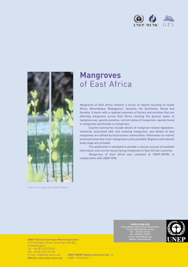
Mangroves of East Africa contains a series of reports focusing on SouthAfrica, Mozambique, Madagascar, Tanzania, the Seychelles, Kenya andSomalia. It starts with a regional summary of factors and activities that areaffecting mangroves across East Africa covering the general topics ofmangrove use, species zonation, current status of mangroves, species foundin mangroves and threats to mangroves.
Country summaries include details of mangrove-related legislation,industries associated with and involving mangroves, and details of howmangroves are utilized by local human communities. Information on marineprotected areas that cover mangroves is also provided. Regional and nationalscale maps are included.
This publication is designed to provide a concise account of availableinformation and current issues facing mangroves in East African countries.
Mangroves of East Africa was compiled at UNEP-WCMC incollaboration with UNEP-GPA.
UNEP World Conservation Monitoring Centre219 Huntingdon Road, Cambridge CB3 0DL United KingdomTel: +44 (0) 1223 277314Fax: +44 (0) 1223 277136 E-mail: [email protected] UNEP-WCMC Biodiversity Series No. 13Website: www.unep-wcmc.org ISBN: 1 899628 21 1
Cover and title page photo: UNEP/Topham
www.unep.orgUnited Nations Environment Programme
P.O. Box 30552 Nairobi, KenyaTel: + 254 (0) 2 621234Fax: +254 (0) 2 623927
E-mail: [email protected]: www.unep.org