Los Angeles Groundwater Replenishment...
66
Initial Study Los Angeles Groundwater Replenishment Project Los Angeles Department of Water and Power Environmental Affairs 111 North Hope Street, Room 1044 Los Angeles, California 90012 September 2013
Transcript of Los Angeles Groundwater Replenishment...
Initial Study
Los Angeles Groundwater Replenishment Project
Los Angeles Department of Water and Power Environmental Affairs
111 North Hope Street, Room 1044 Los Angeles, California 90012
September 2013

CEQA Initial Study
Los Angeles Groundwater Replenishment Project
September 2013
General Manager Ronald O. Nichols
Senior Assistant General Manager
Water System James B. McDaniel
Director of Environmental Affairs
Mark J. Sedlacek
Manager of Environmental Affairs Charles C. Holloway
Prepared by: Los Angeles Department of Water and Power
111 North Hope Street Los Angeles, CA 90012
Technical Assistance Provided by: AECOM
515 S. Flower Street, 9th Floor Los Angeles, CA 90071

Los Angeles Groundwater Replenishment Project
September 2013 Page i
Table of Contents
Section 1 Project Description ............................................................................ 1-1 1.1 Overview of the Project ........................................................... 1-1 1.2 California Environmental Quality Act ...................................... 1-1 1.3 Project Location ..................................................................... 1-2 1.4 Physical Setting ...................................................................... 1-5 1.5 Project Objectives and Background ........................................ 1-8 1.6 Description of the Proposed Project ....................................... 1-9 1.7 Project Construction ............................................................. 1-15 1.8 Required Permits and Approvals .......................................... 1-16 Section 2 Initial Study Checklist ......................................................................... 2-1 Section 3 Environmental Impact Assessment ................................................... 3-1 I. Aesthetics ............................................................................... 3-1 II. Agriculture and Forestry Resources ....................................... 3-2 III. Air Quality ............................................................................... 3-4 IV. Biological Resources .............................................................. 3-6 V. Cultural Resources ................................................................. 3-8 VI. Geology and Soils ................................................................... 3-9 VII. Greenhouse Gas Emissions ................................................. 3-11 VIII. Hazards and Hazardous Materials ....................................... 3-12 IX. Hydrology and Water Quality ................................................ 3-14 X. Land Use and Planning ........................................................ 3-18 XI. Mineral Resources ................................................................ 3-18 XII. Noise ..................................................................................... 3-19 XIII. Population and Housing ........................................................ 3-21 XIV. Public Services ..................................................................... 3-22 XV. Recreation ............................................................................ 3-23 XVI. Transportation/Traffic ............................................................ 3-24 XVII. Utilities and Service Systems ............................................... 3-26 XVIII. Mandatory Findings of Significance ...................................... 3-27 Section 4 List of Preparers ................................................................................ 4-1
List of Figures
Figure 1 Regional Location Map ...................................................................... 1-3 Figure 2 Location of Project Facilities .............................................................. 1-4 Figure 3 Existing DCTWRP Site Plan .............................................................. 1-6 Figure 4 Proposed DCTWRP Site Plan ......................................................... 1-11 Figure 5 Existing and Proposed Conveyance Pipelines and Replenishment Locations ................................................................ 1-14

Table of Contents
Page ii Initial Study
Acronyms and Abbreviations
AFY Acre-feet per year AOP advanced oxidation processes AQMP Air Quality Management Plan AVORS Additional Valley Outfall Relief Sewer AWPF advanced water purification facility bgs below ground surface BMPs Best Management Practices BOE City of Los Angeles Bureau of Engineering BOS City of Los Angeles Bureau of Sanitation CA 170 California Route 170 CARB California Air Resources Board CDFW California Department of Fish and Wildlife CDPH California Department of Public Health CEQA California Environmental Quality Act CFS cubic feet per second CH4 methane CNPS California Native Plant Society CO carbon monoxide CO2 carbon dioxide CO2e carbon dioxide equivalent DCTWRP Donald C. Tillman Water Reclamation Plant EIR Environmental Impact Report FAT Full Advanced Treatment GHG Greenhouse gas emissions GPM gallons per minute hp horsepower HSG Hansen Spreading Grounds I-5 Interstate 5 I-405 Interstate 405 LACDPW Los Angeles County Department of Public Works LADOT City of Los Angeles Department of Transportation LADWP Los Angeles Department of Water and Power LAFD City of Los Angeles Fire Department LAPD City of Los Angeles Police Department MF micro-filtration MG million gallons mgd million gallons per day MOU Memorandum of Understanding MWD Metropolitan Water District of Southern California N2O nitrous oxide NOP Notice of Preparation NOx nitrogen oxide NPDES National Pollution Discharge Elimination System O3 ozone O3/H2O2 ozone/hydrogen peroxide Pb lead PM2.5 Particulate matter 2.5 microns in diameter

Los Angeles Groundwater Replenishment Project
September 2013 Page iii
PM10 Particulate matter 10 microns in diameter or smaller POTW Publicly owned treatment works PSG Pacoima Spreading Grounds RO reverse osmosis RWMP Recycled Water Master Planning SCAG Southern California Association of Governments SCAQMD South Coast Air Quality Management District SFB San Fernando Groundwater Basin SOx sulfur oxide SWPPP Storm Water Pollution Prevention Plan TAC toxic air contaminants US 101 United States Route 101 USACE U.S. Army Corps of Engineers USFWS U.S. Fish and Wildlife Service UV ultraviolet UV/AOP ultraviolet irradiation/advanced oxidation processes UV/H2O2 ultraviolet irradiation/hydrogen peroxide VGS Valley Generating Station

Table of Contents
Page iv Initial Study
Page intentionally left blank

Los Angeles Groundwater Replenishment Project
September 2013 Page 1-1
SECTION 1 PROJECT DESCRIPTION
1.1 Overview of the Project
To maintain the reliability of the City’s water supply and reduce dependence on imported sources of water, the Los Angeles Department of Water and Power (LADWP) proposes to use up to 30,000 acre-feet per year (AFY) of purified recycled water from the Donald C. Tillman Water Reclamation Plant (DCTWRP) for replenishment of the San Fernando Groundwater Basin (SFB). The Los Angeles Groundwater Replenishment Project (proposed project) consists of: 1) treatment – the construction of new advanced water purification facilities (AWPF) that would perform additional treatment of tertiary effluent (Title 22 treated recycled water) from the existing DCTWRP; 2) conveyance – the use of existing and newly constructed pipelines to transport the purified recycled water from the AWPF to spreading grounds and injection wells; and 3) replenishment – spreading of the purified recycled water at the Hansen Spreading Grounds (HSG) and the Pacoima Spreading Grounds (PSG) for percolation and would include installation of up to 13 new injection wells for direct injection into the SFB to increase groundwater supply by supplementing local potable water supplies.
1.2 California Environmental Quality Act
The California Environmental Quality Act (CEQA) applies to proposed projects initiated by, funded by, or requiring discretionary approvals from state or local government agencies. The proposed groundwater replenishment project constitutes a project as defined by CEQA (California Public Resources Code Section 21000 et seq.). The CEQA Guidelines Section 15367 states that a “Lead Agency” is “the public agency which has the principal responsibility for carrying out or approving a project.” Therefore, LADWP is the lead agency responsible for compliance with CEQA for the proposed project. As lead agency for the proposed project, LADWP must complete an environmental review to determine if implementation of the proposed project would result in significant adverse environmental impacts. To fulfill the purpose of CEQA, an Initial Study has been prepared to assist in making that determination. Based on the nature and scope of the proposed project, the evaluation contained in the Initial Study environmental checklist (contained herein), and the comments received from agencies and members of the public during review of the Notice of Preparation (NOP) of an Environmental Impact Report (EIR), factors that have potential to involve significant adverse environmental impacts will be determined. Such factors will become the focus of more detailed analysis in an EIR to determine the nature and extent of any potential environmental impacts and establish appropriate mitigations for those impacts determined to be significant. The EIR will also include an evaluation of alternatives to the proposed project that would reduce or avoid significant impacts, including a No Project Alternative and alternative sites for the AWPF and other facilities. Based on the Initial Study analysis and the NOP review, factors for which no significant adverse environmental impacts are expected to occur will be eliminated from further evaluation in the EIR. A preliminary evaluation of the potentially affected factors is included in the Initial Study checklist in Section 2.

Section 1: Project Description
Page 1-2 Initial Study
1.3 Project Location
The proposed project is located in the eastern San Fernando Valley portion of the City of Los Angeles. It would consist of the SFB, DCTWRP, HSG and PSG, Valley Generating Station (VGS), and associated facilities. The 145,000-acre SFB includes the water-bearing sediments beneath the San Fernando Valley, Tujunga Valley, Browns Canyon, and the alluvial areas surrounding the Verdugo Mountains near La Crescenta and Eagle Rock in Los Angeles County, California. The SFB is bounded on the north and northwest by the Santa Susana Mountains, on the north and northeast by the San Gabriel Mountains, on the east by the San Rafael Hills, on the south by the Santa Monica Mountains and Chalk Hills, and on the west by the Simi Hills. Figure 1 shows the boundaries of the SFB. The DCTWRP is located at 6100 Woodley Avenue, in the Van Nuys community of the City of Los Angeles and is bordered by Densmore Avenue to the north, Woodley Avenue Park to the south, Woodley Avenue to the west, and the I-405 to the east. The property is owned by the U.S. Army Corps of Engineers (USACE) and the facilities are operated by the City of Los Angeles Bureau of Sanitation (BOS). Groundwater recharge into the SFB is primarily achieved through existing spreading grounds in the San Fernando Valley operated by the County of Los Angeles Department of Public Works. The HSG is located in the Sun Valley community of the City of Los Angeles and is bordered by Branford Street to the northwest, Sheldon Street to the southeast, San Fernando Road to the southwest, and Glenoaks Street to the northeast. The PSG is located in the Pacoima community of the City of Los Angeles and is bordered by Arleta Avenue to the northwest, Filmore Street to the southeast, Woodman Avenue to the southwest, and San Jose Street to the northwest. Title 22 recycled water is stored at VGS, in the Hansen Tank, which is also located in the Sun Valley community of the City of Los Angeles. It is bordered by Glenoaks Street to the northeast, San Fernando Road to the southwest, the HSG to the northwest, and Sheldon Street to the southeast. Figure 2 shows the locations of the existing facilities to be used for the proposed project, including DCTWRP, the spreading grounds, and VGS.

§̈¦5
§̈¦5
§̈¦605
§̈¦5
§̈¦405
§̈¦210
§̈¦10
§̈¦105
§̈¦110
§̈¦10
§̈¦210§̈¦405
§̈¦710
£¤101
£¤101
UV14
UV134
UV2
UV110
UV118
UV60UV1
UV170
UV90
UV126
UV710
UV2
UV2
UV134
UV14
Los A
ngele
s Rive
r
Regional Location Map0 105 Miles
Source: ESRI 2013
Figure 1I
LegendSan FernandoGroundwater Basin
P a c i f i cO c e a n
PacoimaSpreadingGrounds
HansenSpreadingGrounds
DCTWRP
_̂Valley
GeneratingStation
DCTWRP
Sepulveda DamRecreation
Area
Wood
ley Av
e
Victory Blvd
Burbank Blvd
Balbo
a Blvd
Vanowen St
Ventura Blvd
§̈¦405
£¤101

Pacoima Spreading Grounds HansenSpreadingGrounds
Hansen Tank
DCTWRP
§̈¦5
§̈¦210Valley
GeneratingStation
§̈¦405
§̈¦5
§̈¦210
£¤101
UV170
UV118
UV134
Location of Project Facilities0 1.50.75 Miles
Source: ESRI 2013Figure 2
I
LegendExisting 54" Pipeline

Los Angeles Groundwater Replenishment Project
September 2013 Page 1-5
1.4 Physical Setting
1.4.1 Donald C. Tillman Water Reclamation Plant
The 90-acre DCTWRP plant began operating in 1985 and was named after Mr. Donald C. Tillman, City Engineer from 1972 to 1980. The DCTWRP is configured as a biological nutrient (nitrogen) removal activated sludge treatment facility with 80 million gallons per day (mgd) dry weather flow capacity. The facility provides primary treatment, biological nutrient (nitrogen) removal, filtration and disinfection (chlorination). The existing tertiary treatment system consists of two phases, with 40 mgd average flow capacity each. For cost saving purposes, DCTWRP is presently in single phase operation. Incoming flow has been limited to 38 mgd (42,700 AFY), which is sufficient to meet current recycled water demands and maintain flows to the flow-through lakes and the Los Angeles River. A 6.5-acre portion of the DCTWRP is comprised of the Japanese Garden, which was designed by Dr. Koichi Kawara and dedicated in 1984. Recycled water from DCTWRP irrigates the garden and fills the 2.75 acre lake. DCTWRP tertiary effluent is currently delivered to Lake Balboa, the Wildlife Lake, and Japanese Garden Lake and flow is managed to prevent fish kills, odor problems, and algal blooms. Outflow from these flow-through lakes is discharged as part of the flow to the Los Angeles River, which supports native habitat. Monitored over the most recent five-year period, flows from DCT to the lakes and the Los Angeles River vary daily and seasonally, and have ranged on a annual average between 27 mgd (30,300 AFY) and 32 mgd (25,900 AFY). Additionally, approximately 3 mgd (3,360 AFY) annual average flow of tertiary effluent is currently distributed for non-potable reuse customers in the San Fernando Valley and approximately 2 mgd (2,250 AFY) of effluent is used within the plant for maintenance activities. The balance of the treated flow is currently discharged to the Los Angeles River over the DCTWRP overflow weir. The Balboa Pump Station is located on-site at DCTWRP and has three 18 cubic feet per second (cfs) pumps with 1,000 horsepower (hp) motors each. An existing 10-mile-long, 54-inch-diameter pipeline currently connects the DCTWRP to the Hansen storage tank, which is located southeast of the HSG at VGS. This pump station and pipeline are currently used to convey DCTWRP recycled water to irrigation and industrial cooling customers in the San Fernando Valley. The DCTWRP is located within the Sepulveda Dam Recreation Area. It is generally bounded by the Orange Line Busway and Victory Boulevard on the north, the recreation area and Interstate 405 (I-405) on the east, the recreation area and Burbank Boulevard on the south, and Woodley Avenue Park and Woodley Avenue on the west. The surrounding land uses are recreation and commercial. The Los Angeles River flows south of DCTWRP. The DCTWRP is designated as Public Facilities and Open Space in the City of Los Angeles General Plan. It is located within the Encino-Tarzana Community Plan area. The zoning designation for the DCTWRP is [Q]PF-1XL (Public Facilities) and OS-1XL (Open Space). Figure 3 shows the existing DCTWRP site plan.
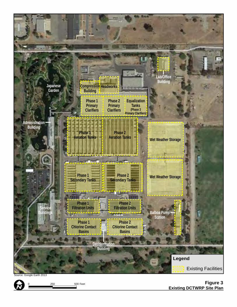
Existing DCTWRP Site Plan 0050 250 Feet
Source: Google Earth 2013
Figure 3 I
Legend
Existing Facilities
Lab/OfficeBuilding
Balboa PumpStation
HeadworksCompressionBuilding
Phase 1Primary
Clarifiers
Phase 1Aeration Tanks
Phase 1Secondary Tanks
Phase 1Filtration Units
Phase 1Chlorine Contact
Basins
Phase 2Chlorine Contact
Basins
Phase 2Filtration Units
Phase 2Secondary Tanks
Phase 2Aeration Tanks Wet Weather Storage
Wet Weather Storage
Phase 2Primary
Clarifiers
EqualizationTanks
(Phase 3Primary Clarifiers)
ServiceBuildings
DechlorinationBuilding
AdministrationBuilding
JapaneseGarden

Los Angeles Groundwater Replenishment Project
September 2013 Page 1-7
1.4.2 Existing Groundwater Replenishment Facilities
The City of Los Angeles has three major sources of groundwater located within the Upper Los Angeles River Area: the SFB, the Sylmar Basin, and the Eagle Rock Basin. The proposed project would replenish groundwater in the SFB. Groundwater recharge into the SFB is currently achieved primarily through existing spreading grounds in the San Fernando Valley. LACDPW owns and operates the HSG and the PSG. They are used, along with the Tujunga, Branford, and Lopez Spreading Grounds, to percolate stormwater into the SFB. The HSG is located along the northwest side of the Tujunga Wash Channel immediately northeast of San Fernando Road. The HSG has 6 shallow spreading basins on 105 wetted acres with an estimated maximum storage volume of 1,420 acre-feet. The facility can receive a total maximum flow of 400 cfs. The average percolation rate is 150 cfs. The sources of water to the HSG are controlled flows from Hansen Dam and Big Tujunga Dam. The HSG is designated as Public Facilities in the City of Los Angeles General Plan. It is located within the Sun Valley-La Tuna Canyon Community Plan area. The zoning designation for the HSG is [Q]PF-1XL (Public Facilities). The Hansen Dam and Hansen Recreation Area are located to the northeast. The HSG is surrounded by open space and light manufacturing uses. The PSG is located on both sides of old Pacoima Wash Channel from Arleta Avenue southwesterly to Woodman Avenue. The PSG has a gross area of 169 acres, of which the spreading basins wetted area occupies 107 acres. It is comprised of 12 shallow basins with a total intake capacity of 600 cfs and a storage volume of 440 acre-feet. The percolation rate is 65 cfs. The PSG receives controlled flows from Pacoima Dam, partially controlled flow from Lopez Flood Control Basin, and uncontrolled flow (storm flow) from East Canyon and Pacoima Wash. The PSG also receives imported water for groundwater replenishment. The PSG is designated as Open Space in the City of Los Angeles General Plan. It is located within the Arleta-Pacoima Community Plan area. The zoning designation for the HSG is OS-1XL-O (Open Space). It abuts Devonwood and Devonshire Arleta Parks and is surrounded by residential uses. Groundwater levels in the area of the SFB vary seasonally and by locality, with the levels along the western sections of the Basin at approximately 50 feet below ground surface (bgs) to between 200 and 500 feet bgs in the eastern portions of the SFB. Groundwater contamination exists throughout the SFB due to improper handling and disposal primarily of solvents widely used since the 1940s. Under a separate initiative, LADWP is studying alternatives for the remediation, containment, removal and cleanup of the contaminants from easterly portions of the SFB where the City’s major well fields are located.
1.4.3 Existing Water Storage
The VGS is located at 11801 Sheldon Street. It consists of a 150-acre electric power generating facility designed to supply power to the LADWP distribution grid. An existing 7 million gallon (MG) recycled water storage tank, Hansen Tank, is located at VGS. It is currently used to store Title 22 recycled water produced at DCTWRP for distribution to recycled water customers. VGS is designated as Public Facilities in the City of Los Angeles General Plan. It is located within the Sun Valley-La Tuna Canyon Community Plan area. The zoning designation for VGS is [Q]PF-1XL (Public Facilities). The Union Pacific Railroad

Section 1: Project Description
Page 1-8 Initial Study
parallels San Fernando Road to the southwest of VGS. The Tujunga Wash, a flood control channel, is located to the northwest. Land uses surrounding VGS are primarily commercial and industrial.
1.5 Project Objectives and Background
The purpose of the proposed project is to enhance the reliability of the City’s drinking water supply by reducing dependence on imported water supplies and increasing local potable water supplies. With increasing development and installation of non-pervious land uses in the San Fernando Valley, surface runoff is increasing and natural recharge to the groundwater basin is decreasing. Therefore, opportunities to replenish the aquifer with additional sources of water, including purified recycled water, are considered beneficial to the SFB. The primary project objective related to this purpose is to beneficially reuse advanced purified recycled water to increase recharge in the SFB. Subsequent extraction of this groundwater from the SFB will offset the purchase of imported water supplies with local groundwater. In normal years, the City relies on four sources to meet its water needs: (1) snow-melt runoff from the Eastern Sierra conveyed by the Los Angeles Aqueduct (36 percent); (2) local groundwater (11 percent); (3) purchases from the Metropolitan Water District of Southern California (MWD) conveyed from the Colorado River through the Colorado River Aqueduct and the State Water Project via the California Aqueduct (52 percent); (4) recycled water for non-potable uses and indirect potable reuse (1 percent). Population growth in the area has added to the City’s water needs. Although these water resources have served the City well for decades, several factors have converged that threaten the long-term reliability of these supplies. Climate conditions, such as consecutive years of below-normal snowfall, and environmental commitments have severely impacted historical water supply sources.
Eastern Sierra Watershed: The City’s right to export water from the Eastern Sierra is based on approximately 185 water right licenses from various rivers, lakes and creeks in the Mono Basin and Owens Valley. The City’s water rights are on file with the California State Water Resources Control Board. The City also owns the majority of land (approximately 315,000 acres) and associated riparian water rights in the Owens Valley. The Los Angeles Aqueduct deliveries from the Eastern Sierra vary with rainfall and snowpack conditions. In addition, over the last two decades, the City’s water deliveries from the Los Angeles Aqueduct have dropped significantly due to reallocation of water for environmental mitigation and enhancement activities. Among these environmental commitments are the State Water Resources Control Board’s Mono Lake Decision, which reduced LADWP’s ability to export water from the Mono Basin from 90,000 AFY to 16,000 AFY; implementation of the Owens Lake Dust Mitigation Program, to which the LADWP is currently delivering up to 95,000 AFY; implementation of the 1997 MOU between LADWP and the MOU Ad Hoc Group, which commits LADWP to supply 1,600 AFY for mitigation identified in the 1991 Water from the Owens Valley to Supply the Second Los Angeles Aqueduct Environmental Impact Report and rewatering of the Lower Owens River where losses are approximately 17,000 AFY.

Los Angeles Groundwater Replenishment Project
September 2013 Page 1-9
Purchased Water: MWD’s sources of water – the Colorado River, State Water Project, local surface and groundwater storage, and stored/transferred water with Central Valley and Colorado River agencies – are subject to great uncertainty due to climate variability and environmental issues. The current environmental crisis in the Sacramento-San Joaquin Bay-Delta led to a Federal Court decision that resulted in MWD receiving up to 30 percent less of its anticipated State Water Project deliveries. Between April 2009 and April 2011, MWD implemented an allocation plan that limited supplies to member agencies and imposed penalties for exceeding water usage targets.
In response to the challenges facing the City’s water supply, LADWP has embarked upon an aggressive effort to create reliable and sustainable sources of water for the future of Los Angeles. LADWP’s 2010 Urban Water Management Plan set a goal of 59,000 AFY of potable water demands to be met with recycled water by 2035 as a sustainable source of local water and to maximize reuse. To meet this goal, LADWP partnered with BOS and the City of Los Angeles Department of Public Works, Bureau of Engineering (BOE) to develop a Recycled Water Master Planning (RWMP) document. During development of the Recycled Water Master Planning process, the City recognized that in order to meet the water recycling goals in the Urban Water Management Plan, beneficial reuse of up to 30,000 AFY of purified recycled water from the DCTWRP for groundwater replenishment into the SFB would be required. Therefore, the Los Angeles Groundwater Replenishment Project (proposed project) is a major element of the RWMP. LADWP, BOS and BOE completed the Groundwater Replenishment Master Planning Report in 2012 as one component of the RWMP documents. The Groundwater Replenishment Master Planning Report summarizes the process of evaluating facilities that are needed to purify recycled water from the DCTWRP and replenish the SFB. The outcome of the Groundwater Replenishment Master Planning Report is a recommendation to construct and operate an AWPF located in the southwest corner of the DCTWRP and replenish the SFB through spreading at the HSG and PSG, and injection wells on Canterbury Avenue (the proposed project). The Groundwater Replenishment Master Planning process considered alternative locations for the AWPF within DCTWRP and at VGS, some of which are feasible and may be considered as part of the EIR. Purified recycled water is wastewater that has undergone multiple treatment steps, beyond standard wastewater treatment. Highly treated wastewater (known as tertiary water, and currently used for irrigation and industrial purposes, and to supply the Japanese Garden Lake and the Los Angeles River) is further treated through advanced water treatment processes, including multiple barrier filtration (microfiltration and reverse osmosis) and advanced oxidation. Purified recycled water is near-distilled water quality and meets the requirements of the California Department of Public Health and the Regional Water Quality Control Board to replenish the City’s groundwater supplies.
1.6 Description of the Proposed Project
The proposed project consists of three components: treatment, conveyance, and replenishment.

Section 1: Project Description
Page 1-10 Initial Study
1.6.1 Treatment
Proposed Facilities
Under the proposed project, an AWPF would be constructed to treat secondary or tertiary effluent produced by the DCTWRP using advanced treatment technology. The AWPF would be located in the southwest corner of the DCTWRP property where the DCTWRP maintenance and warehouse buildings are currently located. The AWPF would be bordered by a future multipurpose and office building to the north, the property line to the west, and access roads to the south and east. The space available for the AWPF at this location is approximately 106,000 square feet, or approximately 2.4 acres. The overall AWPF building footprint would be approximately 130 feet by 225 feet. A preliminary AWPF site plan is shown in Figure 4. The proposed AWPF would require the construction of a new maintenance and warehouse buildings located in the northeast corner of the DCTWRP property and along the northern property boundary to accommodate the additional staff and equipment required to operate the AWPF.. The proposed AWPF would also displace some surface parking spaces. The existing parking lot will be modified to include additional parking spaces to replace parking spaces lost to AWPF construction. All parking lot modifications will occur within the DCTWRP. Additional facilities to support the AWPF would be constructed along the northern DCTWRP property boundary, including a warehouse and expansion of the primary flow equalization tanks (Phase IV primary tanks). Due to increased electric power demand to operate the AWPF, the proposed project includes construction of a new substation. The substation would be constructed on a flat pad measuring approximately 30 feet by 90 feet and enclosed in a structure located adjacent to the proposed AWPF in the southwest corner of the DCTWRP property. An additional 16 full-time staff would be required to operate and maintain the AWPF and associated facilities. Treatment Process The AWPF treatment process would include micro-filtration (MF), reverse osmosis (RO), and advanced oxidation processes (AOP) using either ultraviolet irradiation/hydrogen peroxide (UV/H2O2) or ozone/hydrogen peroxide (O3/H2O2) and post-treatment including pH control. MF, RO, and ultraviolet irradiation/advanced oxidation process (UV/AOP) are Full Advanced Treatment (FAT) process recognized by the California Department of Public Health (CDPH) for groundwater replenishment reuse projects as currently outlined in the Groundwater Replenishment Reuse Draft Regulations.1 MF is a low-pressure membrane process used as RO pretreatment to provide particulate removal. While tertiary filtration at the DCTWRP would remove the majority of suspended solids, the micro-filtration membrane process would remove smaller suspended solids to ensure more efficient operation of the RO process. The MF process also provides an additional barrier to bacteria, protozoan cysts and viruses.
1 California Department of Public Health. Groundwater Replenishment Reuse DRAFT Regulation. March 18,
2013. Available at: http://www.cdph.ca.gov/certlic/drinkingwater/Documents/Recharge/DraftRechargeReg2013-03-28.pdf.

Proposed DCTWRP Site Plan50 00250 Feet
Source: ESRI 2013
4 erugiFI
Legend
Existing Facilities
Not Part of Project
Proposed Facilities
Lab/OfficeBuilding
Balboa PumpStation
HeadworksCompressionBuilding
Phase 1Primary
Clarifiers
Phase 1Aeration Tanks
Phase 1Secondary Tanks
Phase 1Filtration Units
Phase 1Chlorine Contact
Basins
Phase 2Chlorine Contact
Basins
Phase 2Filtration Units
Phase 2Secondary Tanks
Phase 2Aeration Tanks
Wet Weather Storage
Wet Weather Storage
Phase 2Primary
Clarifiers
EqualizationTanks
(Phase 3Primary Clarifiers)
DechlorinationBuilding
AdministrationBuilding
JapaneseGarden
Warehouse EmergencyGenerators
MaintenanceBuilding
Primary Flow EQ
Parking
Parking
Multi-Purpose &Office Building
AWPF
AWTF - MF Feed Pump Station
Title 22 PumpStaion
Section 1: Project Description
Page 1-12 Initial Study
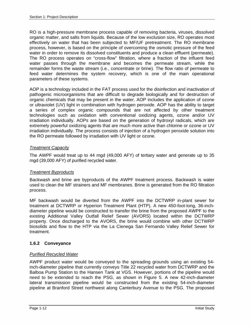
RO is a high-pressure membrane process capable of removing bacteria, viruses, dissolved organic matter, and salts from liquids. Because of the low exclusion size, RO operates most effectively on water that has been subjected to MF/UF pretreatment. The RO membrane process, however, is based on the principle of overcoming the osmotic pressure of the feed water in order to remove its dissolved constituents and produce a clean effluent (permeate). The RO process operates on “cross-flow” filtration, where a fraction of the influent feed water passes through the membrane and becomes the permeate stream, while the remainder forms the waste stream (i.e., concentrate or brine). The flow ratio of permeate to feed water determines the system recovery, which is one of the main operational parameters of these systems. AOP is a technology included in the FAT process used for the disinfection and inactivation of pathogenic microorganisms that are difficult to degrade biologically and for destruction of organic chemicals that may be present in the water. AOP includes the application of ozone or ultraviolet (UV) light in combination with hydrogen peroxide. AOP has the ability to target a series of complex organic compounds that are not affected by other treatment technologies such as oxidation with conventional oxidizing agents, ozone and/or UV irradiation individually. AOPs are based on the generation of hydroxyl radicals, which are extremely powerful oxidizing agents that are much more active than chlorine or ozone or UV irradiation individually. The process consists of injection of a hydrogen peroxide solution into the RO permeate followed by irradiation with UV light or ozone.
Treatment Capacity
The AWPF would treat up to 44 mgd (49,000 AFY) of tertiary water and generate up to 35 mgd (39,000 AFY) of purified recycled water.
Treatment Byproducts
Backwash and brine are byproducts of the AWPF treatment process. Backwash is water used to clean the MF strainers and MF membranes. Brine is generated from the RO filtration process. MF backwash would be diverted from the AWPF into the DCTWRP in-plant sewer for treatment at DCTWRP or Hyperion Treatment Plant (HTP). A new 450-foot-long, 36-inch-diameter pipeline would be constructed to transfer the brine from the proposed AWPF to the existing Additional Valley Outfall Relief Sewer (AVORS) located within the DCTWRP property. Once discharged to the AVORS, the brine would combine with other DCTWRP biosolids and flow to the HTP via the La Cienega San Fernando Valley Relief Sewer for treatment.
1.6.2 Conveyance
Purified Recycled Water
AWPF product water would be conveyed to the spreading grounds using an existing 54-inch-diameter pipeline that currently conveys Title 22 recycled water from DCTWRP and the Balboa Pump Station to the Hansen Tank at VGS. However, portions of the pipeline would need to be extended to reach the PSG, as shown in Figure 5. A new 42-inch-diameter lateral transmission pipeline would be constructed from the existing 54-inch-diameter pipeline at Branford Street northwest along Canterbury Avenue to the PSG. The proposed
Los Angeles Groundwater Replenishment Project
September 2013 Page 1-13
new 42-inch-diameter lateral transmission pipeline would be approximately 10,000 linear feet. The existing 7 MG recycled water storage tank at VGS would be connected to the purified recycled water distribution system. Existing non-potable Title 22 recycled water customers northeast of the DCTWRP outside of the Sepulveda Basin Area currently served by the existing 54-inch-diameter recycled water pipeline that would be used to convey purified water to the HSG and the PSG would also receive purified recycled water. The existing Balboa Pump Station at DCTWRP would also be expanded by adding one 800 hp pump to a previously constructed connection for additional pumps.
Title 22 Recycled Water
Sepulveda Basin customers, including golf courses and other irrigation users who are nearby and southwest of the DCTWRP would continue to be served by an existing 30-inch-diameter pipeline, as shown in Figure 5. Further, a new Title 22 recycled water pump station would need to be constructed in the southeast corner of the DCTWRP facility on a site 30 feet by 40 feet and would include three pumps, two duty and 1 backup, each with a 2,100 gallons per minute (gpm) flow rate (total of 265 hp).
1.6.3 Replenishment
Hansen Spreading Grounds
LADWP would recharge up to 35,000 AFY of highly purified recycled water at the HSG based on the availability of supply and the annual capacity of the spreading grounds. Based on available capacity, LADWP estimates an average of 15,000 AFY of purified recycled water would be recharged at HSG. Purified recycled water would be conveyed to the HSG through the existing 54-inch-diameter pipeline from DCTWRP and the Balboa Pump Station to the HSG. An outlet structure currently exists at the north end of the 54-inch pipeline near Glenoaks Boulevard. To provide maximum flexibility in delivering purified recycled water to the HSG, several ancillary facilities would be constructed at the HSG, similar to the existing outlet structure, to allow the delivery of purified recycled water to each spreading basin individually or in combination. LADWP would also construct two new lateral pipelines within the HSG.

Existing and Proposed ConveyancePipelines and Replenishment Locations
0 1.50.75 Miles
Source: ESRI 2013 Figure 5
I
LegendProposed Injection WellsProposed 42" PipelineExisting 54" PipelineExisting 30" Pipeline

Los Angeles Groundwater Replenishment Project
September 2013 Page 1-15
Pacoima Spreading Grounds Up to 23,000 AFY of purified recycled water would be recharged at the PSG based on the availability of supply and the annual capacity of the spreading grounds. Based on available capacity, LADWP estimates an average of 15,000 AFY of purified recycled water would be recharged at PSG. As discussed above, purified recycled water would be conveyed to the PSG through a new 42-inch-diameter pipeline extending from Branford Street northwest along Canterbury Avenue. To provide maximum flexibility in providing purified recycled water to the PSG, several ancillary facilities would be constructed at the PSG to allow the delivery of purified recycled water to each spreading basin individually or in combination. LADWP would construct a new turn-out structure at the north end of the 42-inch-diameter transmission pipeline near Canterbury Avenue and Filmore Street. In addition, LADWP would construct two new lateral pipelines within the PSG.
Injection Wells
For maximum operational flexibility, LADWP would construct and operate up to 13 new injection wells for use when the HSG and PSG are being used exclusively for stormwater spreading. Each well is anticipated to have an operational capacity of 2.7 mgd, or 4.2 cfs, to allow for direct injection of up to approximately 4,000 AFY of purified recycled water in to the SFB. Each well would be approximately 16 to 20 inches in diameter and would be drilled to approximately 500 to 600 feet below ground surface. A typical above ground injection well configuration would be located in a fenced area, while the below ground configuration would be in a vault. In general, a single above ground wellhead site would occupy an area of about 15 feet by 30 feet and would be less than one story tall. Where two or three wells would be clustered together, the wells would be spaced a minimum of 15 to 20 feet apart to minimize drilling interferences and allow enough room for well head facilities. A clustered injection well facility would also have a catch basin and connection to an existing storm drain for disposal of well development and test water. Figure 5 shows the proposed locations for the injection wells in an approximately 7,000 foot corridor along Canterbury Avenue.
1.7 Project Construction
Construction of the proposed project would commence in summer 2016 and is expected to last up to 66 months, ending in late 2021. Operation of the AWPF would commence in early 2022. Construction activities would typically occur from 7:00 am to 3:00 pm, but construction on major city streets would occur between the hours of 9:00 am to 3:30 pm, in accordance with the City of Los Angeles Mayor’s Executive Directive No. 2 that prohibits construction on major roads from 6:00 am to 9:00 am and 3:30 pm to 7:00 pm (rush hours). Construction at the DCTWRP would commence with construction of the new DCT service buildings in summer 2016. Construction of the service buildings is expected to take approximately 24 months to complete (ending summer 2018). Once the new service buildings have been constructed, the old service buildings would be demolished and the area graded to make room for the AWPF treatment facilities. Demolition and grading would commence in early 2019 and take approximately 6 months to complete. Construction of the

Section 1: Project Description
Page 1-16 Initial Study
AWPF would then occur for approximately 30 months, beginning in summer 2019 with completion anticipated in late 2021. Conveyance pipeline construction is expected to commence in spring 2018 and take approximately 18 months to complete, ending in fall 2019. Extension of the purified recycled water pipeline to PSG would occur within public roads and use a linear trenching technique. Once the pipeline has been installed within a segment, the trench would be backfilled and returned to its original condition. Pipeline construction would necessitate restrictions of on-street parking and closure of up to two lanes of the roadway depending on the location of construction. Materials and equipment staging and construction worker parking would use City facilities and public parking lots located along or near the proposed alignments. 1.8 Required Permits and Approvals
LADWP is the project lead agency pursuant to CEQA Guidelines Section 15367. Numerous approvals and/or permits would be required to implement the Los Angeles Groundwater Replenishment Project. The environmental documentation for the proposed project would be used to facilitate compliance with federal and state laws and the granting of permits by various state and local agencies having jurisdiction over one or more aspects of the proposed project. These approvals and permits may include the following:
City of Los Angeles Department of Water and Power
Certification by the Board of Water and Power Commissioners that the EIR was prepared in accordance with CEQA and other applicable codes and guidelines
Approval of the proposed project or an alternative to the proposed project, including a No Project alternative
United States Army Corps of Engineers
Approval to construct on federal land
Clean Water Act Section 404 Permit for regulated water features
State of California Water Resources Control Board
Approval of California Water Code Section 1211 process
Stormwater discharge permit
State of California Los Angeles Regional Water Quality Control Board
Permit for groundwater recharge (waste discharge requirements)
Clean Water Act Section 401 Water Quality Certification for water quality impacts of construction
National Pollution Discharge Elimination System (NPDES) permit for construction dewatering
NPDES permit for hydrostatic test water discharge
Los Angeles Groundwater Replenishment Project
September 2013 Page 1-17
State of California Department of Water Resources
Injection well permits
State of California Department of Transportation
Permit for heavy equipment on state highways
Los Angeles County Department of Public Works
Memorandum of Understanding and coordination for use of the HSG and PSG
City of Los Angeles Department of Public Works, Bureau of Engineering
Excavation Permits
City of Los Angeles Department of Building and Safety
Grading Permit
Haul Route Permits
City of Los Angeles Department of Transportation
Encroachment permits for pipeline construction in city streets
City of Los Angeles Board of Cultural Affairs Commissioners
Design review and approval for buildings and structures
City of Los Angeles Department of City Planning
Design review and approval for buildings and structures
Approvals of variances (height of building or structure)

Section 1: Project Description
Page 1-18 Initial Study
Page intentionally left blank

Los Angeles Groundwater Replenishment Project
September 2013 Page 2-1
SECTION 2 INITIAL STUDY CHECKLIST
The following discussion of potential environmental effects was completed in accordance with Section 15063(d)(3) of the CEQA Guidelines (2013) to determine if the proposed project may have a significant effect on the environment. A brief explanation is provided for all determinations in Section 3, Environmental Impact Assessment, of this document. A “No Impact” or “Less than Significant Impact” determination is made when the proposed project would not have any impact or would not have a significant effect on the existing environment for that issue area based on a project-specific analysis. Project Title: Los Angeles Groundwater Replenishment Project Lead Agency Name and Address: Los Angeles Department of Water and Power Environmental Planning and Assessment 111 North Hope Street, Room 1044 Los Angeles, CA 90012 Contact Person and Phone Number: Michael Mercado Environmental Affairs Los Angeles Department of Water and Power (213) 367-0395 Project Sponsor's Name and Address: Susan Rowghani Los Angeles Department of Water and Power Water Engineering & Technical Services Division 111 North Hope Street, Room 1336 Los Angeles, CA 90012 Ali Poosti City of Los Angeles Department of Public Works, Bureau of Sanitation Wastewater Engineering Services Division 2714 Media Center Drive Los Angeles, CA 90065 Project Location: The project area is located in the San Fernando Valley area of Los Angeles. City Council District: District 6

Section 2: Initial Study Checklist
Page 2-2 Initial Study
Neighborhood Council District: Encino Neighborhood Council, Lake Balboa Neighborhood Council, Mission Hills Neighborhood Council, Arleta Neighborhood Council, and Sun Valley Neighborhood Council. General Plan Designation: The DCTWRP is designated as Public Facilities and Open Space in the City of Los Angeles General Plan. The HSG and VGS are designated as Public Facilities. The PSG is designated as Open Space. The conveyance pipelines would be located entirely within the existing road right-of-way. The properties adjacent to the proposed alignment include the following designations: Low Residential, Low Medium 1 Residential, Medium Residential, Public Facilities, and Neighborhood Office. Zoning: The zoning designation for the DCTWRP is [Q]PF-1XL (Public Facilities) and OS-1XL (Open Space). The zoning designation for the HSG and VGS are [Q]PF-1XL (Public Facilities). The zoning designation for the PSG is OS-1XL-O (Open Space). The properties along the proposed new conveyance pipeline alignment are zoned R1 (One Family Residential), RA (Suburban), PF (Public Facilities), RD3-1 (Restricted Density Multiple Dwelling), P-1 (Parking Zone), and C-2 (Commercial). Description of Project: Under the proposed project, an AWPF would be constructed within the DCTWRP to treat secondary or tertiary effluent produced by the DCTWRP using advanced treatment technology. On average, the AWPF would treat up to 44 mgd (49,000 AFY) and generate 35 mgd (39,000 AFY) of purified recycled water. AWPF purified recycled water would be conveyed to the spreading grounds using an existing 54-inch-diameter pipeline that currently conveys Title 22 recycled water from DCTWRP and the Balboa Pump Station to the Hansen Tank at VGS. However, portions of the pipeline would need to be extended to reach the PSG. A new 42-inch-diameter lateral transmission pipeline would be constructed from the existing 54-inch-diameter pipeline at Branford Street northwest along Canterbury Avenue to the PSG. The proposed new 42-inch-diameter lateral transmission pipeline would be approximately 10,000 linear feet. The existing 7 million gallon (MG) recycled water storage tank at VGS would be connected to the purified recycled water distribution system. LADWP would recharge up to 35,000 AFY of purified recycled water at the HSG based on the availability of supply and the annual capacity of the spreading grounds. LADWP estimates an average of 15,000 AFY of purified recycled water would recharged at HSG. LADWP would recharge up to 23,000 AFY of purified recycled water at the PSG based on the availability of supply and the annual capacity of the spreading grounds. LADWP estimates an average of 15,000 AFY of purified recycled water would be recharged at the PSG. To provide maximum operational flexibility, LADWP would also construct up to 13 injection wells along Canterbury Avenue to allow for direct injection of purified recycled water into the SFB for use when the Hansen and Pacoima spreading grounds are being used exclusively for stormwater spreading.

Los Angeles Groundwater Replenishment Project
September 2013 Page 2-3
Surrounding Land Uses and Setting: The proposed project would be located in the eastern San Fernando Valley. The DCTWRP is located at 6100 Woodley Avenue, in the Van Nuys community of the City of Los Angeles. The property is owned by USACE and operated by BOS. The DCTWRP is located within the Sepulveda Dam Recreation Area, through which the Los Angeles River runs. It is generally bordered by the Orange Line Busway and Victory Boulevard on the north, the recreation area and I-405 on the east, the recreation area and Burbank Boulevard on the south, and Woodley Avenue Park and Woodley Avenue on the west. The surrounding land uses are recreation and commercial. The HSG are located in the Sun Valley community of the City of Los Angeles along the northwest side of the Tujunga Wash Channel immediately northeast of San Fernando Road. The Hansen Dam and Hansen Recreation Area are located to the northwest. The HSG is surrounded by open space and light manufacturing uses. The PSG are located in the Pacoima community of the City of Los Angeles on both sides of old Pacoima Wash Channel from Arleta Avenue southwesterly to Woodman Avenue. It abuts Devonwood and Devonshire Arleta Parks and is surrounded by residential uses. The VGS is located at 11801 Sheldon Street in the Sun Valley community of the City of Los Angeles and is located southeast of the HSG. The Union Pacific Railroad parallels San Fernando Road to the southwest of VGS. The Tujunga Wash, a flood control channel, is located to the northwest. Land use surrounding VGS are primarily commercial and industrial. Responsible/Trustee Agencies: United States Army Corps of Engineers
State of California Water Resources Control Board
State of California Los Angeles Regional Water Quality Control Board
State of California Department of Public Health
State of California Department of Fish and Wildlife
State of California Department of Water Resources
State of California Department of Transportation
Los Angeles County Department of Public Works, Flood Control District
Reviewing Agencies: City of Los Angeles Department of Transportation


Los Angeles Groundwater Replenishment Project
September 2013 Page 2-5
Po
ten
tial
ly S
ign
ific
ant
Imp
act
Les
s T
han
Sig
nif
ican
t Im
pac
t A
fter
Mit
igat
ion
In
corp
ora
ted
Les
s T
han
Sig
nif
ican
t Im
pac
t
No
Imp
act
I. AESTHETICS. Would the project:
a. Have a substantial adverse effect on a scenic vista? X b. Substantially damage scenic resources, including, but not limited
to, trees, rock outcroppings, and historic buildings within a state scenic highway?
X
c. Substantially degrade the existing visual character or quality of the site and its surroundings? X
d. Create a new source of substantial light or glare that would adversely affect day or nighttime views in the area? X
II. AGRICULTURE AND FORESTRY RESOURCES. In determining whether impacts to agricultural resources are significant environmental effects, lead agencies may refer to the California Agricultural Land Evaluation and Site Assessment Model (1997) prepared by the California Department of Conservation as an optional model to use in assessing impacts on agriculture and farmland. In determining whether impacts to forest resources, including timberland, are significant environmental effects, lead agencies may refer to information compiled by the California Department of Forestry and Fire Protection regarding the state’s inventory of forest land, including the Forest and Range Assessment Project and the Forest Legacy Assessment project; and forest carbon measurement methodology provided in Forest Protocols adopted by the California Air Resources Board. Would the project:
a. Convert Prime Farmland, Unique Farmland, or Farmland of Statewide Importance (Farmland), as shown on the maps prepared pursuant to the Farmland Mapping and Monitoring Program of the California Resources Agency, to non-agricultural use?
X
b. Conflict with existing zoning for agricultural use, or a Williamson act contract? X
c. Conflict with existing zoning for, or cause rezoning of, forest land (as defined in Public Resources Code section 12220(g)), timberland (as defined by Public Resources Code section 4526), or timberland zoned Timberland Production (as defined by Government Code section 51104(g))?
X
d. Result in the loss of forest land or conversion of forest land to non-forest use? X
e. Involve other changes in the existing environment that, due to their location or nature, could result in conversion of Farmland, to non-agricultural use or conversion of forest land to non-forest use?
X

Section 2: Initial Study Checklist
Page 2-6 Initial Study
Po
ten
tial
ly S
ign
ific
ant
Imp
act
Les
s T
han
Sig
nif
ican
t Im
pac
t A
fter
Mit
igat
ion
In
corp
ora
ted
Les
s T
han
Sig
nif
ican
t Im
pac
t
No
Imp
act
III. AIR QUALITY. Where available, the significance criteria established by the applicable air quality management or air pollution control district may be relied upon to make the following determinations. Would the project:
a. Conflict with or obstruct implementation of the applicable air quality plan? X
b. Violate any air quality standard or contribute substantially to an existing or projected air quality violation? X
c. Result in a cumulatively considerable net increase of any criteria pollutant for which the project region is non-attainment under an applicable federal or state ambient air quality standard (including releasing emissions which exceed quantitative thresholds for ozone precursors)?
X
d. Expose sensitive receptors to substantial pollutant concentrations? X
e. Create objectionable odors affecting a substantial number of people? X
IV. BIOLOGICAL RESOURCES. Would the project:a. Have a substantial adverse effect, either directly or through
habitat modifications, on any species identified as a candidate, sensitive, or special status species in local or regional plans, policies, or regulations, or by the California Department of Fish and Wildlife or U.S. Fish and Wildlife Service?
X
b. Have a substantial adverse effect on any riparian habitat or other sensitive natural community identified in local or regional plans, policies, regulations, or by the California Department of Fish and Wildlife or U.S. Fish and Wildlife Service?
X
c. Have a substantial adverse effect on federally protected wetlands as defined by Section 404 of the Clean Water Act (including, but not limited to, marsh, vernal pool, coastal, etc.) through direct removal, filling, hydrological interruption, or other means?
X
d. Interfere substantially with the movement of any native resident or migratory fish or wildlife species or with established native resident or migratory wildlife corridors, or impede the use of native wildlife nursery sites?
X
e. Conflict with any local policies or ordinances protecting biological resources, such as a tree preservation policy or ordinance? X
f. Conflict with the provisions of an adopted Habitat Conservation Plan, Natural Community Conservation Plan, or other approved local, regional, or state habitat conservation plan?
X

Los Angeles Groundwater Replenishment Project
September 2013 Page 2-7
Po
ten
tial
ly S
ign
ific
ant
Imp
act
Les
s T
han
Sig
nif
ican
t Im
pac
t A
fter
Mit
igat
ion
In
corp
ora
ted
Les
s T
han
Sig
nif
ican
t Im
pac
t
No
Imp
act
V. CULTURAL RESOURCES. Would the project:
a. Cause a substantial adverse change in the significance of a historical resource as defined in CEQA Guidelines Section 15064.5?
X
b. Cause a substantial adverse change in the significance of an archaeological resource pursuant to CEQA Guidelines Section 15064.5?
X
c. Directly or indirectly destroy a unique paleontological resource or site or unique geologic feature? X
d. Disturb any human remains, including those interred outside of formal cemeteries? X
VI. GEOLOGY AND SOILS. Would the project:
a. Expose people or structures to potential substantial adverse effects, including the risk of loss, injury, or death involving:
i) Rupture of a known earthquake fault, as delineated on the most recent Alquist-Priolo Earthquake Fault Zoning Map issued by the State Geologist for the area or based on other substantial evidence of a known fault? Refer to Division of Mines and Geology Special Publication 42.
X
ii) Strong seismic ground shaking? X iii) Seismic-related ground failure, including liquefaction? X iv) Landslides? X
b. Result in substantial soil erosion, loss of topsoil, or changes in topography or unstable soil conditions from excavation, grading, or fill?
X
c. Be located on a geologic unit or soil that is unstable, or that would become unstable as a result of the project, and potentially result in on-or off-site landslide, lateral spreading, subsidence, liquefaction or collapse?
X
d. Be located on expansive soil, as defined in Table 18-1-B of the Uniform Building Code (1994), creating substantial risks to life or property?
X
e. Have soils incapable of adequately supporting the use of septic tanks or alternative wastewater disposal systems where sewers are not available for the disposal of wastewater?
X
VII. GREENHOUSE GAS EMISSIONS: Would the project: a. Generate greenhouse gas emissions, either directly or indirectly,
that may have a significant impacts on the environment? X
b. Conflict with an applicable plan, policy or regulation adopted for the purpose of reducing the emissions of greenhouse gases? X

Section 2: Initial Study Checklist
Page 2-8 Initial Study
Po
ten
tial
ly S
ign
ific
ant
Imp
act
Les
s T
han
Sig
nif
ican
t Im
pac
t A
fter
Mit
igat
ion
In
corp
ora
ted
Les
s T
han
Sig
nif
ican
t Im
pac
t
No
Imp
act
VIII. HAZARDS AND HAZARDOUS MATERIALS: Would the project:
a. Create a significant hazard to the public or the environment through the routine transport, use, or disposal of hazardous materials?
X
b. Create a significant hazard to the public or the environment through reasonably foreseeable upset and accident conditions involving the release of hazardous materials into the environment?
X
c. Emit hazardous emissions or handle hazardous or acutely hazardous materials, substances, or waste within one-quarter mile of an existing or proposed school?
X
d. Be located on a site that is included on a list of hazardous materials sites compiled pursuant to Government Code Section 65962.5 and, as a result, would it create a significant hazard to the public or the environment?
X
e. For a project located within an airport land use plan or, where such a plan has not been adopted, within two miles of a public airport or public use airport, would the project result in a safety hazard for people residing or working in the project area?
X
f. For a project within the vicinity of a private airstrip, would the project result in a safety hazard for people residing or working in the project area?
X
g. Impair implementation of or physically interfere with an adopted emergency response plan or emergency evacuation plan? X
h. Expose people or structures to a significant risk of loss, injury or death involving wildland fires, including where wildlands are adjacent to urbanized areas or where residences are intermixed with wildlands?
X
IX. HYDROLOGY AND WATER QUALITY. Would the project:
a. Violate any water quality standards or waste discharge requirements? X
b. Substantially deplete groundwater supplies or interfere substantially with groundwater recharge such that there would be a net deficit in aquifer volume or a lowering of the local groundwater table level (e.g., the production rate of pre-existing nearby wells would drop to a level which would not support existing land uses or planned uses for which permits have been granted)?
X
c. Substantially alter the existing drainage pattern of the site or area, including through the alteration of the course of stream or river, in a manner that would result in substantial erosion or siltation on- or off-site?
X

Los Angeles Groundwater Replenishment Project
September 2013 Page 2-9
Po
ten
tial
ly S
ign
ific
ant
Imp
act
Les
s T
han
Sig
nif
ican
t Im
pac
t A
fter
Mit
igat
ion
In
corp
ora
ted
Les
s T
han
Sig
nif
ican
t Im
pac
t
No
Imp
act
d. Substantially alter the existing drainage pattern of the site or area, including through the alteration of the course of a stream or river, or substantially increase the rate or amount of surface runoff in a manner that would result in flooding on- or off-site?
X
e. Create or contribute runoff water which would exceed the capacity of existing or planned stormwater drainage systems or provide substantial additional sources of polluted runoff?
X
f. Otherwise substantially degrade water quality? X g. Place housing within a 100-year flood hazard area as mapped on
a federal Flood Hazard Boundary or Flood Insurance Rate Map or other flood hazard delineation map?
X
h. Place within a 100-year flood hazard area structures that would impede or redirect flood flows? X
i. Expose people or structures to a significant risk of loss, injury or death involving flooding, including flooding as a result of the failure of a levee or dam?
X
j. Inundation by seiche, tsunami, or mudflow? X X. LAND USE AND PLANNING. Would the project:
a. Physically divide an established community? X b. Conflict with any applicable land use plan, policy, or regulation of
an agency with jurisdiction over the project (including, but not limited to the general plan, specific plan, local coastal program, or zoning ordinance) adopted for the purpose of avoiding or mitigating an environmental effect?
X
c. Conflict with any applicable habitat conservation plan or natural community conservation plan? X
XI. MINERAL RESOURCES. Would the project:
a. Result in the loss of availability of a known mineral resource that would be of value to the region and the residents of the state? X
b. Result in the loss of availability of a locally important mineral resource recovery site delineated on a local general plan, specific plan or other land use plan?
X
XII. NOISE. Would the project result in:
a. Exposure of persons to or generation of noise levels in excess of standards established in the local general plan or noise ordinance, or applicable standards of other agencies?
X
b. Exposure of persons to or generation of excessive groundborne vibration or groundborne noise levels? X
c. A substantial permanent increase in ambient noise levels in the project vicinity above levels existing without the project? X

Section 2: Initial Study Checklist
Page 2-10 Initial Study
Po
ten
tial
ly S
ign
ific
ant
Imp
act
Les
s T
han
Sig
nif
ican
t Im
pac
t A
fter
Mit
igat
ion
In
corp
ora
ted
Les
s T
han
Sig
nif
ican
t Im
pac
t
No
Imp
act
d. A substantial temporary or periodic increase in ambient noise levels in the project vicinity above levels existing without the project?
X
e. For a project located within an airport land use plan or, where such a plan has not been adopted, within two miles of a public airport or public use airport, would the project expose people residing or working in the project area to excessive noise levels?
X
f. For a project within the vicinity of a private airstrip, would the project expose people residing or working in the project area to excessive noise levels?
X
XIII. POPULATION AND HOUSING. Would the project:
a. Induce substantial population growth in an area, either directly (for example, by proposing new homes and businesses) or indirectly (for example, through extension of roads or other infrastructure)?
X
b. Displace substantial numbers of existing housing, necessitating the construction of replacement housing elsewhere? X
c. Displace substantial numbers of people, necessitating the construction of replacement housing elsewhere? X
XIV. PUBLIC SERVICES.
a. Would the project result in substantial adverse physical impacts associated with the provision of new or physically altered governmental facilities, need for new or physically altered governmental facilities, the construction of which could cause significant environmental impacts, in order to maintain acceptable service ratios, response times or other performance objectives for any of the public services:
i) Fire protection? X ii) Police protection? X iii) Schools? X iv) Parks? X v) Other public facilities? X
XV. RECREATION.
a. Would the project increase the use of existing neighborhood and regional parks or other recreational facilities such that substantial physical deterioration of the facility would occur or be accelerated?
X
b. Does the project include recreational facilities or require the construction or expansion of recreational facilities that might have an adverse physical effect on the environment?
X

Los Angeles Groundwater Replenishment Project
September 2013 Page 2-11
Po
ten
tial
ly S
ign
ific
ant
Imp
act
Les
s T
han
Sig
nif
ican
t Im
pac
t A
fter
Mit
igat
ion
In
corp
ora
ted
Les
s T
han
Sig
nif
ican
t Im
pac
t
No
Imp
act
XVI. TRANSPORTATION/TRAFFIC. Would the project:
a. Conflict with an applicable plan, ordinance or policy establishing measures of effectiveness for the performance of the circulation system, taking into account all modes of transportation including mass transit and non-motorized travel and relevant components of the circulation system, including but not limited to intersections, streets, highways and freeways, pedestrian and bicycle paths, and mass transit?
X
b. Conflict with an applicable congestion management program, including, but not limited to level of service standards and travel demand measures, or other standards established by the county congestion management agency for designated roads or highways?
X
c. Result in a change in air traffic patterns, including either an increase in traffic levels or a change in location that results in substantial safety risks?
X
d. Substantially increase hazards due to a design feature (e.g., sharp curves or dangerous intersections) or incompatible uses (e.g., farm equipment)?
X
e. Result in inadequate emergency access? X f. Conflict with adopted policies, plans, or programs regarding
public transit, bicycle, or pedestrian facilities, or otherwise decrease the performance or safety of such facilities?
X
XVII. UTILITIES AND SERVICE SYSTEMS. Would the project:
a. Exceed wastewater treatment requirements of the applicable Regional Water Quality Control Board? X
b. Require or result in the construction of new water or wastewater treatment facilities or expansion of existing facilities, the construction of which could cause significant environmental effects?
X
c. Require or result in the construction of new stormwater drainage facilities or expansion of existing facilities, the construction of which could cause significant environmental effects?
X
d. Have sufficient water supplies available to serve the project from existing entitlements and resources, or are new or expanded entitlements needed?
X
e. Result in a determination by the wastewater treatment provider that serves or may serve the project that it has adequate capacity to serve the project’s projected demand in addition to the provider’s existing commitments?
X
f. Be served by a landfill with sufficient permitted capacity to accommodate the project’s solid waste disposal needs? X

Section 2: Initial Study Checklist
Page 2-12 Initial Study
Po
ten
tial
ly S
ign
ific
ant
Imp
act
Les
s T
han
Sig
nif
ican
t Im
pac
t A
fter
Mit
igat
ion
In
corp
ora
ted
Les
s T
han
Sig
nif
ican
t Im
pac
t
No
Imp
act
g. Comply with federal, state, and local statutes and regulations related to solid waste? X
XVIII. MANDATORY FINDINGS OF SIGNIFICANCE.
a. Does the project have the potential to degrade the quality of the environment, substantially reduce the habitat of a fish or wildlife species, cause a fish or wildlife population to drop below self-sustaining levels, threaten to eliminate a plant or animal community, reduce the number or restrict the range of a rare or endangered plant or animal or eliminate important examples of the major periods of California history or prehistory?
X
b. Does the project have impacts that are individually limited, but cumulatively considerable? “Cumulatively considerable” means that the incremental effects of a project are considerable when viewed in connection with the effects of past projects, the effects of other current projects, and the effects of probable future projects.
X
c. Does the project have environmental effects that will cause substantial adverse effects on human beings, either directly or indirectly?
X

Los Angeles Groundwater Replenishment Project
September 2013 Page 3-1
SECTION 3 ENVIRONMENTAL IMPACT ASSESSMENT
INTRODUCTION
The following discussion addresses impacts to various environmental resources per the Initial Study checklist questions contained in Appendix G of the CEQA Guidelines.
I. AESTHETICS
Would the project: a) Have a substantial adverse effect on a scenic vista?
No Impact. The proposed project would not have an adverse effect on a scenic vista. Scenic views or vistas are panoramic public views of various natural features, including the ocean, striking or unusual natural terrain, or unique urban or historic features. Public access to these views may be from park lands, private and publicly owned sites, and public right-of-way.2 Construction of the AWPF would occur within the DCTWRP property amongst other water treatment facilities. Construction of the proposed AWPF, conveyance pipelines, and turnout structures associated with replenishment at the HSG and PSG would result in short-term impacts to aesthetics due to the presence of construction equipment and materials in the visual landscape. However, none of these project components are located within a scenic vista. Therefore, no impacts would occur to scenic vistas due to construction of these project components. The completed AWPF would be designed to appear similar in height, building architecture, massing, and finishes as the existing DCTWRP facilities. Additionally, these facilities would not be located within or block a scenic vista. Once constructed, the conveyance pipelines and turn-out structures would be located entirely below-ground and would have no impacts to scenic vistas. No impact to a scenic vista would occur, and no further analysis is required.
b) Substantially damage scenic resources, including, but not limited to, trees, rock outcroppings, and historic buildings within a state scenic highway?
No Impact. Implementation of the proposed project would not damage scenic resources within a state scenic highway. No sections of I-405, I-5, California Route 170 (CA 170) or United States Route 101 (US 101) within the project vicinity are designated as eligible California Scenic Highways.3 Additionally, the proposed facilities would not be visible from these roadways. Further, none of the conveyance pipeline segments are Designated Scenic Highways in the Transportation Element of the City of Los Angeles General Plan.4 Therefore, no scenic roadways would be altered as a result of the implementation of the proposed project. No impact would occur, and no further analysis is required.
2 City of Los Angeles Department of City Planning, City of Los Angeles General Plan, Conservation Element,
adopted September 26, 2001. 3 State of California Department of Transportation. State Scenic Highway Program. Website:
http://www.dot.ca.gov/hq/LandArch/scenic_highways/scenic_hwy.htm, accessed April 16, 2013. 4 City of Los Angeles Department of City Planning, City of Los Angeles General Plan, Transportation Element,
adopted September 8, 1999.

Section 3: Environmental Impact Assessment
Page 3-2 Initial Study
c) Substantially degrade the existing visual character or quality of the site and its surroundings?
Less Than Significant Impact. The proposed project is not expected to substantially degrade the existing visual character or quality of the project site and its surroundings. The conveyance pipelines and turnout structures would be constructed underground and would not be visible once completed. The AWPF and associated facilities would be visible above ground; however, construction of the AWPF would occur within the DCTWRP property amongst other water treatment facilities. Further, the completed AWPF would be designed to appear similar in height, building architecture, massing, and finishes as the existing DCTWRP facilities. Therefore, these facilities would not substantially contrast with the surrounding character of the DCTWRP. The impact would be less than significant, and no further analysis is required.
d) Create a new source of substantial light or glare that would adversely affect day or nighttime views in the area?
Less Than Significant Impact. Implementation of the proposed project would not create a new source of light or glare that would adversely affect day or nighttime views. The proposed project would be constructed primarily during daylight within existing City and County facilities, including within the DCTWRP and the HSG and PSG, as well as pipeline construction within public roadway rights-of-way. The conveyance pipelines and turnout structures would be constructed underground and would not be visible once completed. No permanent night lighting or reflective surfaces would be installed with the conveyance or replenishment components of the proposed project. Security lighting may be required for the AWPF. However, the AWPF would be constructed within the DCTWRP where there is existing building security and nighttime parking lot lighting. Additionally, the AWPF and associated facilities would be constructed of non-reflective building materials. Therefore, the visual impacts associated with nighttime security lighting and glare would be less than significant. No further analysis of this issue is required.
II. AGRICULTURE AND FORESTRY RESOURCES
Would the project: a) Convert Prime Farmland, Unique Farmland or Farmland of Statewide
Importance (Farmland), as shown on the maps prepared pursuant to the Farmland Mapping and Monitoring Program of the California Resources Agency, to non-agricultural use?
No Impact. The project site is located in fully urbanized portions of the San Fernando Valley. The project areas are designated as Urban and Built-Up Land on the “Important Farmland in California” map prepared by the California Resources Agency pursuant to the Farmland Mapping and Monitoring Program. Thus, component of the proposed would be located on or near Prime Farmland, Unique Farmland, or Farmland of Statewide Importance.5 Therefore, the proposed project
5 State of California Department of Conservation, Division of Land Resource Protection, Farmland Mapping &
Monitoring Program, Important Farmland in California, 2008 map. Website: ftp://ftp.consrv.ca.gov/pub/dlrp/FMMP/pdf/statewide/2008/fmmp2008_08_11.pdf, accessed April 16, 2013.

Los Angeles Groundwater Replenishment Project
September 2013 Page 3-3
would not convert farmland to a non-agricultural use, and no impact to farmland would occur, and no further analysis is required.
b) Conflict with existing zoning for agricultural use, or a Williamson Act contract?
No Impact. The proposed project would be located entirely within public roadway rights-of-way and existing City and County public facilities. Furthermore, the County of Los Angeles does not offer Williamson Act contracts.6 Therefore, the proposed project would not conflict with existing zoning or a Williamson Act contract. No impact would occur, and no further analysis is required.
c) Conflict with existing zoning for, or cause rezoning of, forest land (as defined in Public Resources Code section 12220(g)), timberland (as defined by Public Resources Code section 4526), or timberland zoned Timberland Production (as defined by Government Code section 51104(g))?
No Impact. The proposed project would be located entirely within existing public facilities and public roadway rights-of-way in a fully urbanized portion of the San Fernando Valley. No portion of the project site is zoned for or developed as forest land or timberland as defined in Public Resources Code Section 12220(g) and Government Code Section 4526, respectively.7 Therefore, the proposed project would not conflict with existing zoning for or cause a rezoning of forest or timberland. No impact would occur, and no further analysis is required.
d) Result in the loss of forest land or conversion of forest land to non-forest use?
No Impact. The proposed project would be located entirely within existing public facilities or public roadway rights-of-way in a fully urbanized portion of the San Fernando Valley. No portion of the project site is zoned or developed for a forest land use or located within or adjacent to forest lands.8 Therefore, the proposed project would not result in the loss of forest land or conversion of forest land to non-forest use. No impact would occur, and no further analysis is required.
e) Involve other changes in the existing environment which, due to their location or nature, could result in conversion of Farmland, to non-agricultural use or conversion of forest land to non-forest use?
No Impact. The project areas and adjacent properties are designated as “Urban and Built-Up Land;” no portion of the project site or surrounding area is identified as Prime Farmland, Unique Farmland, or Farmland of Statewide Importance.9 Additionally, no forest lands exist on or adjacent to the project areas. Therefore, the proposed project would not change the existing environment in a way that
6 State of California Department of Conservation, Division of Land Resource Protection, Williamson Act
Program – Basic Contract Provisions. Website: http://www.conservation.ca.gov/dlrp/lca/basic_contract_provisions, accessed April 16, 2013.
7 City of Los Angeles Zoning Information and Map Access System (ZIMAS). Website: http://zimas.lacity.org/, accessed April 16, 2013.
8 Ibid. 9 State of California Department of Conservation, Division of Land Resource Protection, Farmland Mapping &
Monitoring Program. Important Farmland in California. 2008. Website: ftp://ftp.consrv.ca.gov/pub/dlrp/FMMP/pdf/statewide/2008/fmmp2008_08_11.pdf, accessed April 16, 2013.

Section 3: Environmental Impact Assessment
Page 3-4 Initial Study
would result in the conversion of Farmland to non-agricultural use or forest land to non-forest use. No impact would occur, and no further analysis is required.
III. AIR QUALITY
Would the project: a) Conflict with or obstruct implementation of the applicable air quality plan
(e.g., the SCAQMD Plan or Congestion Management Plan)?
Potentially Significant Impact. The South Coast Air Quality Management District (SCAQMD) and the Southern California Association of Governments (SCAG) are responsible for preparing an Air Quality Management Plan (AQMP), which implements federal Clean Air Act and California Clean Air Act requirements, and details goals, policies, and programs for improving air quality in the South Coast Air Basin. The 2007 AQMP was adopted by the SCAQMD Governing Board on June 1, 2007, and the California Air Resources Board (CARB) on September 27, 2007. The purpose of the 2007 Air Quality Management Plan for the South Coast Air Basin is to set forth a comprehensive program that will lead the region into compliance with federal air quality standards for 8-hour ozone (O3) and particulate matter less than 2.5 microns in diameter (PM2.5). According to the SCAQMD, there are two key indicators of consistency with the AQMP: (1) whether the project will not result in an increase in the frequency or severity of existing air quality violations or cause or contribute to new violations, or delay timely attainment of air quality standards or the interim emission reductions specified in the AQMP; and (2) whether the project will not exceed the assumptions in the AQMP based on the year of project buildout.10 Equipment usage and activities during construction of the proposed project would result in emissions of PM2.5 and ozone precursors, which could result in significant impacts to air quality in the area. The sources of emissions would include trucks, and on-road motor vehicles for equipment and material deliveries and workers commuting to and from the project site. This impact is potentially significant. Further analysis of air quality impacts is warranted to determine whether the project would conflict with or obstruct implementation of the applicable plans for attainment and, if so, to determine the reasonable and feasible mitigation measures that could be imposed. This issue will be further evaluated in the EIR.
b) Violate any air quality standard or contribute substantially to an existing or projected air quality violation?
Potentially Significant Impact. The proposed project has the potential to violate an air quality standard or contribute substantially to an existing or projected air quality violation. The project site is located within the Los Angeles County portion of the South Coast Air Basin, which is designated as a non-attainment area for O3, particulate matter smaller than or equal to 10 microns in diameter (PM10), and PM2.5. Construction of the proposed project would contribute air quality emissions through the use of heavy-duty construction equipment, truck delivery and haul trips, and
10 SCAQMD, The CEQA Air Quality Handbook, 1993.

Los Angeles Groundwater Replenishment Project
September 2013 Page 3-5
vehicle trips generated by construction workers traveling to and from the project site. Fugitive dust emissions would primarily result from trenching activities and site preparation or excavation activities at the DCTWRP. Nitrogen oxide (NOX) emissions would primarily result from the use of construction equipment. Operation of the proposed project would contribute air quality emissions through additional DCTWRP workers traveling to and from the project site and energy consumption associated with the AWPF. These issues will be further evaluated in the EIR.
c) Result in a cumulatively considerable net increase of any criteria pollutant for which the project region is non-attainment under an applicable federal or state ambient air quality standard (including releasing emissions which exceed quantitative thresholds for ozone precursors)?
Potentially Significant Impact. The proposed project has the potential to result in a cumulatively considerable net increase of a criteria pollutant for which the project region is non-attainment under an applicable federal or state ambient air quality standard. The proposed project and the whole of the Los Angeles metropolitan area are located within the South Coast Air Basin, which is characterized by relatively poor air quality. The South Coast Air Basin is currently classified as a federal and state non-attainment area for O3, PM10, and PM2.5 and a federal attainment/maintenance area for carbon monoxide (CO). It is classified as a state attainment area for CO, and it currently meets the federal and state standards for nitrogen dioxide, sulfur oxide (SOx), and lead (Pb).
As discussed in Section III(b) above, construction activities associated with implementation of the proposed project and long-term operation of the proposed facilities have the potential to result in increases in air pollutant emissions, which, individually or cumulatively, would exceed established thresholds. This issue will be further evaluated in the EIR.
d) Expose sensitive receptors to substantial pollutant concentrations?
Potentially Significant Impact. Some land uses are considered more sensitive to changes in air quality than others, depending on the population groups and the activities involved. CARB has identified the following groups who are most likely to be affected by air pollution: children less than 14 years of age, the elderly over 65 years of age, athletes, and people with cardiovascular and chronic respiratory diseases. According to the SCAQMD, sensitive receptors include residences, schools, playgrounds, child care centers, athletic facilities, long-term health care facilities, rehabilitation centers, convalescent centers, and retirement homes. Sensitive receptors are located within the vicinity of the DCTWRP, along the conveyance pipeline alignments and injection well locations, and in the vicinity of the HSG and the PSG. Construction activity is expected to generate on-site pollutant emissions associated with equipment exhaust, toxic air contaminant (TAC) emissions, and fugitive dust, potentially exposing nearby sensitive receptors to substantial pollutant concentrations. This issue will be further evaluated in the EIR.

Section 3: Environmental Impact Assessment
Page 3-6 Initial Study
e) Create objectionable odors affecting a substantial number of people?
Potentially Significant Impact. Potential sources that may emit odors during construction activities include equipment exhaust. Odors from these sources would be localized and generally confined to the immediate area surrounding the construction site. The proposed project would utilize typical construction techniques, and the odors would be typical of most construction sites and temporary in nature. Therefore, the odor impact during construction would be less than significant. Types of land uses that typically pose potential odor problems include agriculture, wastewater treatment plants, food processing and rendering facilities, chemical plants, composting facilities, landfills, waste transfer stations, and dairies. In addition, the occurrence and severity of odor impacts depend on numerous factors, including the nature, frequency, and intensity of the source; wind speed and direction; and the presence of sensitive receptors. Although offensive odors rarely cause any physical harm, they can still be very unpleasant, leading to considerable distress and often generating citizen complaints to local governments and regulatory agencies. Because the proposed project involves the operation of a water treatment plant, this issue will be further evaluated in the EIR.
IV. BIOLOGICAL RESOURCES
Would the project: a) Have a substantial adverse effect, either directly or through habitat
modifications, on any species identified as a candidate, sensitive, or special status species in local or regional plans, policies, or regulations, or by the California Department of Fish and Wildlife or U.S. Fish and Wildlife Service?
Less Than Significant Impact. Sensitive plants include those listed as threatened or endangered, proposed for listing, or candidate for listing by the U.S. Fish and Wildlife Service (USFWS) and/or California Department of Fish and Wildlife (CDFW) or those listed by the California Native Plant Society (CNPS). Sensitive wildlife species are those species listed as threatened or endangered, proposed for listing, or candidate for listing by USFWS and/or CDFW, or considered special status by CDFW. Sensitive habitats are those that are regulated by USFWS, USACE, and/or those considered sensitive by the CDFW. Because the proposed project would involve construction within existing City and County facilities and within public road rights-of-way in a fully urbanized portion of the San Fernando Valley, there would be no direct impacts to sensitive plants, wildlife, or vegetation communities. All construction staging would occur within the roadway or previously disturbed areas, such that no vegetation removal would be required. Therefore, there would be no indirect impacts to native vegetation, sensitive plants, sensitive wildlife species, or sensitive vegetation communities during construction. During project operations, direct and indirect impacts to nearby habitats and sensitive vegetation communities, such as the Japanese Gardens, are not expected to be significant. Additionally, post-construction flows from DCTWRP would not be modified in a way that is expected to have a substantial adverse affect on any sensitive species or vegetation communities. Nonetheless, a more
Los Angeles Groundwater Replenishment Project
September 2013 Page 3-7
detailed evaluation of direct and indirect impacts to sensitive species will be included in the EIR.
b) Have a substantial adverse effect on any riparian habitat or other sensitive natural community identified in local or regional plans, policies, and regulations or by the California Department of Fish and Wildlife or U.S. Fish and Wildlife Service?
Less Than Significant Impact. As discussed in Section IV(a) above, construction activities would occur entirely within existing City and County facilities and public roadway rights-of-way in a fully urbanized portion of the San Fernando Valley. No removal of riparian vegetation is anticipated during construction. Therefore, no direct or indirect impacts to riparian habitat or other sensitive natural community are expected to occur during construction. During project operations, direct and indirect impacts to nearby riparian habitats and sensitive vegetation communities, are not expected to be significant. Additionally, post-construction flows from DCTWRP would not be modified in a way that is expected to have a substantial adverse affect on any riparian habitat or sensitive natural community. Nonetheless, a more detailed evaluation of direct and indirect impacts to riparian habitat or other sensitive natural community will be included in the EIR.
c) Have a substantial adverse effect on federally protected wetlands as defined by Section 404 of the Clean Water Act (including, but not limited to, marsh, vernal pool, coastal, etc.) through direct removal, filling, hydrological interruption, or other means?
Less Than Significant Impact. As discussed in Section IV(a) above, construction activities would occur entirely within existing City and County facilities and public roadway rights-of-way in a fully urbanized portion of the San Fernando Valley. Nonetheless, a more detailed evaluation of impacts to federally protected wetlands will be included in the EIR.
d) Interfere substantially with the movement of any native resident or migratory fish or wildlife species or with established native resident or migratory wildlife corridors, or impede the use of native wildlife nursery/breeding sites?
Less Than Significant Impact. In an urban context, a wildlife migration corridor can be defined as a linear landscape feature of sufficient width and buffer to allow animal movement between two comparatively undisturbed habitat fragments, or between a habitat fragment and some vital resources, thereby encouraging population growth and diversity. A viable wildlife migration corridor consists of more than a path between fragmented habitats. A wildlife migration corridor must also include adequate vegetative cover and food sources for transient species, as well as resident populations of less mobile animals to survive. They must be extensive enough to allow for large animals to pass relatively undetected, be free of obstacles, and lack any other distraction that may hinder wildlife passage such as lights or noise. As discussed in Section IV(a) above, construction activities would occur entirely within existing City and County facilities and public roadway rights-of-way in a fully urbanized portion of the San Fernando Valley. Therefore, the project areas do not

Section 3: Environmental Impact Assessment
Page 3-8 Initial Study
constitute wildlife corridors. Nonetheless, a more detailed evaluation of impacts to wildlife migration will be included in the EIR.
e) Conflict with any local policies or ordinances protecting biological resources, such as a tree preservation policy or ordinance (e.g., oak trees or California walnut woodlands)?
Less Than Significant Impact. The proposed project would not conflict with local policies or ordinances protecting biological resources, such as a tree preservation policy or ordinance. Construction of the proposed project would not require removal of vegetation, including trees under the protection of the City of Los Angeles Tree Protection Ordinance.11 Nonetheless, a more detailed evaluation of local policies and ordinances protecting biological resources will be included in the EIR.
f) Conflict with the provisions of an adopted Habitat Conservation Plan, Natural Community Conservation Plan, or other approved local, regional, or state habitat conservation plan?
No Impact. The proposed project would not conflict with the provisions of an adopted Habitat Conservation Plan, Natural Community Conservation Plan, or other approved local, regional, or state habitat conservation plan. The proposed project is not located within any Significant Ecological Areas or designated Critical Habitat. No regional habitat conservation plans or Natural Community Conservation Plans have been adopted within the project area.12 No impact would occur, and no further analysis is required.
V. CULTURAL RESOURCES
Would the project: a) Cause a substantial adverse change in the significance of a historical
resource as defined in California Code of Regulations Section 15064.5?
Potentially Significant Impact. A Cultural Resources report will be prepared and will include a discussion and analysis of project impacts on historical resources, if any. The results of the report will be summarized in the EIR.
b) Cause a substantial adverse change in the significance of an archaeological resource pursuant to California Code of Regulations Section 15064.5?
Potentially Significant Impact. Project construction would involve ground disturbing activities that have the potential to uncover unknown archaeological resources. A Cultural Resources report will be prepared and will include a discussion and analysis of project impacts on archaeological resources, if any. The results of the report will be summarized in the EIR.
11 City of Los Angeles Municipal Code, Section 17.02. 12 County of Los Angeles, Draft General Plan, Conservation & Open Space, Proposed Significant Ecological
Areas Map, 2007.

Los Angeles Groundwater Replenishment Project
September 2013 Page 3-9
c) Directly or indirectly destroy a unique paleontological resource or site or unique geologic feature?
Potentially Significant Impact. Project construction would involve ground disturbing activities that have the potential to uncover unknown paleontological resources. A Cultural Resources report will be prepared and will include a discussion and analysis of project impacts on unique paleontological resources or unique geologic features, if any. The results of the report will be summarized in the EIR.
d) Disturb any human remains, including those interred outside of formal cemeteries?
Potentially Significant Impact. The EIR will discuss the potential for uncovering unidentified human remains during project construction.
VI. GEOLOGY AND SOILS
Would the project: a) Expose people or structures to potential substantial adverse effects,
including the risk of loss, injury, or death involving:
i) Rupture of a known earthquake fault, as delineated on the most recent Alquist-Priolo Earthquake Fault Zoning Map issued by the State Geologist for the area or based on other substantial evidence of a known fault? Refer to Division of Mines and Geology Special Publication 42.
Less Than Significant Impact. The proposed project would not expose people or structures to new adverse effects associated with rupture of a known earthquake fault. There are numerous known earthquake faults in the vicinity of the project site and a portion of the project site is located within a City-designated fault rupture zone.13 Therefore, the proposed project components would be designed and constructed in accordance with the latest version of the City of Los Angeles Building Code and other applicable federal, state, and local codes relative to seismic criteria. Compliance with existing regulations would ensure a less than significant impact related to fault rupture.
ii) Strong seismic ground shaking?
Less Than Significant Impact. The project site is located within the seismically active southern California region, and like all locations within the area, is subject to strong seismic ground shaking. However, as discussed in Section VI(a)(i) above, the proposed project components would be designed and constructed in accordance with the latest version of the City of Los Angeles Building Code and other applicable federal, state, and local codes relative to seismic criteria. Compliance with existing regulations would ensure a less than significant impact related to strong seismic ground shaking. No further analysis is required.
13 City of Los Angeles Department of City Planning, Environmental and Public Facilities Maps, Alquist-Priolo
Special Study Zones & Fault Rupture Study Areas Map, September 1996.

Section 3: Environmental Impact Assessment
Page 3-10 Initial Study
iii) Seismic-related ground failure, including liquefaction?
Less Than Significant Impact. Portions of the project site are located within a City-designated liquefiable area.14 However, the proposed project would be designed and constructed in compliance with the latest version of the City of Los Angeles Building Code and other applicable federal, state, and local codes relative to liquefaction criteria. Compliance with existing regulations would ensure a less than significant impact related to seismic-related ground failure, including liquefaction. No further analysis is required.
iv) Landslides?
No Impact. The project site is not located within or adjacent to a City-designated hillside area.15 Therefore, construction and excavation activities would not be expected to increase the risk of landslides in the hillside areas. No impact related to landslides would occur, and no further analysis is required.
b) Result in substantial soil erosion or the loss of topsoil?
Potentially Significant Impact. Construction activities would expose soils for a limited time, allowing for possible erosion. However, excavation would comply with all applicable provisions of Chapter IX, Division 70 of the Los Angeles Municipal Code, which addresses grading, excavation, and fill. During construction, transport of sediments from the project site by storm water runoff and winds would be prevented through the use of appropriate Best Management Practices (BMPs). Rule 403 dust control measures would be implemented as required by the SCAQMD. Additionally, LADWP would develop and implement an erosion control plan and a Storm Water Pollution Prevention Plan (SWPPP) for construction activities, in compliance with the latest National Pollutant Discharge Elimination System (NPDES) permit requirements for storm water discharges. Nonetheless, this issue will be further evaluated in the EIR.
c) Be located on a geologic unit or soil that is unstable, or that would become unstable as a result of the project, and potentially result in on- or off-site landslide, lateral spreading, subsidence, liquefaction or collapse?
Less Than Significant Impact. One of the major types of liquefaction induced ground failure is lateral spreading of mildly sloping ground. Lateral spreading involves primarily side-to-side movement of earth materials due to ground shaking, and is evidenced by near-vertical cracks to predominantly horizontal movement of the soil mass involved. As discussed in Sections VI(a)(iii) and VI(a)(iv) above, the project site is located in an area identified as being at risk for liquefaction, but is not located within or adjacent to a designated hillside area. All construction work would adhere to the latest version of the City of Los Angeles Building Code, and other applicable federal, state, and local codes relative to liquefaction criteria. Subsidence is the lowering of surface elevation due to changes occurring underground, such as the extraction of large amounts of groundwater, oil, or gas.
14 City of Los Angeles Department of City Planning, Environmental and Public Facilities Maps, Areas
Susceptible to Liquefaction Map, September 1996. 15 City of Los Angeles Department of City Planning, Environmental and Public Facilities Maps, Landslide
Inventory & Hillside Areas Map, September 1996.

Los Angeles Groundwater Replenishment Project
September 2013 Page 3-11
When groundwater is extracted from aquifers at a rate that exceeds the rate of replenishment, overdraft occurs, which can lead to subsidence. However, the proposed project does not anticipate the extraction of any groundwater, oil, or gas from the project site. Therefore, subsidence would not occur. Collapsible soils consist of loose dry materials that collapse and compact under the addition of water or excessive loading. Collapsible soils are prevalent throughout the southwestern United States, specifically in areas of young alluvial fans. Soil collapse occurs when the land surface is saturated at depths greater than those reached by typical rain events. However, the proposed project would be constructed in accordance with the latest version of the City of Los Angeles Building Code and other applicable federal, state, and local codes relative to seismic criteria. These building codes are designed to ensure safe construction. Compliance with existing regulations would ensure a less than significant impact, and no further analysis is required.
d) Be located on expansive soil, as defined in Table 18-1-B of the Uniform
Building Code (1994), creating substantial risks to life or property?
Potentially Significant Impact. Expansive soils are clay-based soils that tend to expand (increase in volume) as they absorb water and shrink (lessen in volume) as water is drawn away. If soils consist of expansive clays, foundation movement and/or damage can occur if wetting and drying of the clay does not occur uniformly across the entire area. The onsite geologic materials in the project area are yet to be determined and further analysis will be included as part of the EIR.
e) Have soils incapable of adequately supporting use of septic tanks or alternative wastewater disposal systems where sewers are not available for the disposal of wastewater?
No Impact. Construction activities would occur entirely within existing City and County facilities and public roadway rights-of-way in a fully urbanized portion of the San Fernando Valley that is currently served by sewers for the disposal of wastewater. No septic tanks or alternative wastewater disposal systems are proposed. Therefore, no impact associated with the use of such systems would occur, and no further analysis is required.
VII. GREENHOUSE GAS EMISSIONS
Would the project: a) Generate greenhouse gas emissions, either directly or indirectly, that may
have a significant impact on the environment?
Potentially Significant Impact. Greenhouse gas (GHG) emissions refer to a group of emissions that are generally believed to affect global climate conditions. The greenhouse effect compares the Earth and the atmosphere surrounding it to a greenhouse with glass panes. The glass panes in a greenhouse let heat from sunlight in and reduce the amount of heat that escapes. GHGs, such as carbon dioxide (CO2), methane (CH4), and nitrous oxide (N2O), keep the average surface temperature of the Earth close to 60 degrees Fahrenheit. Of all the GHGs, CO2 is the most abundant gas that contributes to climate change through fossil fuel

Section 3: Environmental Impact Assessment
Page 3-12 Initial Study
combustion. The other GHGs are less abundant, but have higher global warming potential than CO2. To account for this higher potential, emissions of other GHGs are frequently expressed in the equivalent mass of CO2, denoted as CO2e. GHG emissions would be generated by equipment exhaust, truck trips, and worker commute trips during construction and energy consumption and worker commute trips during operation. This issue will be further evaluated in the EIR.
b) Conflict with an applicable plan, policy or regulation adopted for the purpose of reducing the emissions of greenhouse gases?
Potentially Significant Impact. As discussed in Section VII(a) above, the proposed project has the potential to generate substantial sources of construction and operational emissions, which may conflict with a state or local climate change policy or regulation adopted for the purpose of reducing emissions of GHGs. This issue will be further evaluated in the EIR.
VIII. HAZARDS AND HAZARDOUS MATERIALS
Would the project: a) Create a significant hazard to the public or the environment through the
routine transport, use, or disposal of hazardous materials?
Potentially Significant Impact. Construction activities would be temporary in nature and would involve the limited transport, storage, use, and disposal of hazardous materials. Such hazardous materials could include on-site fueling/servicing of construction equipment, and the transport of fuels, lubricating fluids, and solvents. These types of materials are not acutely hazardous, and all storage, handling, and disposal of these materials are regulated by the California Department of Toxic Substances Control, the U.S. Environmental Protection Agency, the Occupational Safety & Health Administration, the Los Angeles County Fire Department, and the Los Angeles County Health Department. The transport, use, and disposal of construction-related hazardous materials would occur in conformance with applicable federal, state, and local regulations governing such activities. Therefore, the short-term construction impact would be less than significant. Long-term operation of the proposed project would result in increased chemical deliveries to the DCTWRP, which has the potential to create a significant hazard to the public or the environment through the routine transport, use, or disposal of hazardous materials. This issue will be further evaluated in the EIR.
b) Create a significant hazard to the public or the environment through reasonably foreseeable upset and accident conditions involving the release of hazardous materials into the environment?
Potentially Significant Impact. As discussed in Section VIII(a) above, construction activities may involve limited transport, storage, use, or disposal of some hazardous materials, such as on-site fueling/servicing of construction equipment, and the transport of fuels, lubricating fluids, and solvents. These types of materials are not acutely hazardous, and compliance with existing federal, state,

Los Angeles Groundwater Replenishment Project
September 2013 Page 3-13
and local regulations would ensure that construction impacts related to reasonably foreseeable upset and accident conditions involving the release of hazardous materials would be less than significant. Long-term operation of the proposed project would result in increased chemical deliveries to the DCTWRP, which has the potential to pose a significant hazard to the public or the environment through reasonably foreseeable upset or accident conditions. This issue will be further evaluated in the EIR.
c) Emit hazardous emissions or handle hazardous or acutely hazardous materials, substances or waste within one-quarter mile of an existing or proposed school?
Less Than Significant Impact. As discussed in Section VIII(a) above, construction activities would involve limited transport, storage, use, and disposal of hazardous materials. However, as discussed, these materials are not acutely hazardous and the transport, use, and disposal of construction-related hazardous materials would occur in conformance with all applicable federal, state, and local regulations governing such activities. Therefore, impacts related to hazardous materials within 0.25-mile of an existing or proposed school would be less than significant. Long-term operation of the proposed project would involve the transport, storage, use, or disposal of hazardous materials associated with the AWPF. However, there are no schools located within 0.25-mile of the DCTWRP. Therefore, operational impacts related to hazardous materials within 0.25-mile of an existing or proposed school would be less than significant, and no further analysis is required.
d) Be located on a site which is included on a list of hazardous materials sites compiled pursuant to Government Code Section 65962.5 and, as a result, would it create a significant hazard to the public or the environment?
Potentially Significant Impact. Some hazardous materials sites have been identified on or near the proposed project. This issue will be evaluated further in the EIR.
e) For a project located within an airport land use plan or, where such a plan has not been adopted, within two miles of a public airport or public use airport, would the project result in a safety hazard for people residing or working in the project area?
Less Than Significant Impact. The closest airport to the project site is Whiteman Airport, located less than a mile northwest of HSG and approximately 1.5-miles east of PSG. Additionally, San Fernando Airport is located less than a mile northeast of PSG and Van Nuys Airport is located less than one mile west north of the DCTWRP.16 The only above ground structures would be permanently located at DCTWRP; however, the tallest structure would be similar to the existing facilities and would not pose a hazard to aircraft operations. Therefore, implementation of the proposed project would not result in a safety hazard for people residing or
16 Airnav.com, Airports search. Website: http://www.airnav.com/airports/, accessed April 24, 2013.

Section 3: Environmental Impact Assessment
Page 3-14 Initial Study
working in the project area. The impact would be less than significant, and no further analysis is required.
f) For a project within the vicinity of a private airstrip, would the project result in a safety hazard for people residing or working in the project area?
Less Than Significant Impact. As discussed in Section VIII(e) above, the project site is located within the vicinity of private airstrips.17 However, based on the location, height, and nature of the project components, the proposed project would not result in a safety hazard for people residing or working in the project area. The impact would be less than significant, and no further analysis is required.
g) Impair implementation of or physically interfere with an adopted emergency response plan or emergency evacuation plan?
Less Than Significant Impact. The proposed project involves extension of conveyance pipelines within public roadway rights-of-way. Construction of the conveyance pipelines would involve temporary lane closures, which could have an effect on designated disaster routes. However, full roadway closures are not anticipated and any open trenches would be covered with steel plates during non-work hours. Additionally, a Traffic Management Plan would be prepared in coordination with the City of Los Angeles Department of Transportation (LADOT) for the proposed project and would detail construction traffic control and detour methods. Implementation of the Traffic Management Plan during construction would ensure that impacts related to emergency response plans would be less than significant. Following installation of the conveyance pipelines, all roadways would be returned to their existing conditions. Therefore, no long-term impacts would result from operation of the proposed project. No further analysis is required.
h) Expose people or structures to a significant risk of loss, injury or death involving wildland fires, including where wildlands are adjacent to urbanized areas or where residences are intermixed with wildlands?
No Impact. The project site is not located within a City-designated Wildfire Hazard Area or Fire Buffer Zone.18 Therefore, the proposed project would not expose people or structures to a significant risk of loss, injury, or death involving wildland fires. No impact would occur, and no further analysis is required.
IX. HYDROLOGY AND WATER QUALITY
Would the project: a) Violate any water quality standards or waste discharge requirements?
Potentially Significant Impact. Construction activities, such as excavation, would result in the disturbance of soil and temporarily increase the potential for soil erosion. Additionally, construction activities and equipment would require the on-site use and storage of fuels, lubricants, and other hydrocarbon fluids. Storm events occurring during the construction phase would have the potential to carry
17 Ibid. 18 City of Los Angeles Department of City Planning, Environmental and Public Facilities Maps, Selected Wildfire
Hazard Areas Map, September 1996.

Los Angeles Groundwater Replenishment Project
September 2013 Page 3-15
disturbed sediments and spilled substances from construction activities off-site to nearby receiving waters. LADWP would be required to obtain a General Construction Activity Storm Water Permit, issued by the State Water Resources Control Board. One of the conditions of the General Permit is the development and the implementation of a SWPPP, which would identify structural and nonstructural BMPs to be implemented during the construction phase. LADWP would also develop and implement an erosion control plan for the proposed project. This issue will be evaluated further in the EIR. Upon completion of the proposed project, storm flows would be directed to the existing storm drain system, similar to existing conditions. There would be no exposed soil remaining at completion of construction activities; therefore, there would be no potential for soil erosion or contamination. However, the EIR will include an analysis of water quality associated with replenishment of purified recycled water into the SFB.
b) Substantially deplete groundwater supplies or interfere substantially with groundwater recharge such that there would be a net deficit in aquifer volume or a lowering of the local groundwater table level (e.g., the production rate of pre-existing nearby wells would drop to a level which would not support existing land uses or planned uses for which permits have been granted)?
Less Than Signfiicant Impact. The purpose of the proposed project is to increase groundwater replenishment in order to increase groundwater supplies within the SFB and reduce reliance on imported water. By its very nature, the proposed project would not substantially deplete groundwater supplies or interfere with groundwater recharge. However, the EIR will include analysis of the capacity of the spreading grounds and the SFB to accommodate additional supplies of replenished water.
c) Substantially alter the existing drainage pattern of the site or area, including through the alteration of the course of a stream or river, in a manner, which would result in substantial erosion or siltation on- or off-site?
Less Than Significant Impact. The proposed project components would be located within previously developed areas and existing roadways, which have been previously disturbed. All drainage flows would be routed through existing storm water infrastructure. Construction activities would temporarily increase the potential for erosion due to excavation. However, compliance with the SWPPP and the erosion control plan developed for the proposed project would minimize impacts. Therefore, impacts related to erosion resulting from altered drainage patterns would be less than significant, and no further analysis is required.
d) Substantially alter the existing drainage pattern of the site or area, including
through the alteration of the course of a stream or river, or substantially increase the rate or amount of surface runoff in a manner, which would result in flooding on- or off-site?
Less Than Significant Impact. The proposed project involves previously developed areas. All drainage flows would be routed through existing storm water infrastructure serving the project site and surrounding areas. Additionally, following

Section 3: Environmental Impact Assessment
Page 3-16 Initial Study
construction of the proposed project, all roadways would be returned to their original condition. As such, after construction, storm water flows would be similar to the current condition, and the proposed project does not have the potential to substantially increase the rate of surface runoff. As discussed in Section IX(a) above, BMPs would be implemented to control runoff from the project site during construction. Therefore, no flooding is expected to occur on- or off-site as a result of the proposed project construction. The impact would be less than significant, and no further analysis is required. During project operation, long-term BMPs would be implemented to control runoff at the project site pursuant to the Standard Urban Storm Water Management Plan. Operating agreements would also be developed and implemented with LACDPW for groundwater replenishment at the HSG and the PSG, such that the capacity of the HSG and the PSG would not be exceeded and flooding would not be expected to occur on- or off-site. Further analysis of these issues will be included in the EIR. Additionally, the EIR will include analysis of the potential impact of project operation with regard to changes in flow levels within the Los Angeles River over those that are currently discharged through DCTWRP.
e) Create or contribute runoff water which would exceed the capacity of existing or planned stormwater drainage systems or provide substantial additional sources of polluted runoff?
Less Than Significant Impact. As discussed above, implementation of the proposed project would result in a similar amount of permeable surfaces as under existing conditions. Thus, no substantial increase in the amount of runoff from the project site is anticipated. Construction would require water, as necessary, to control fugitive dust. Fugitive dust emissions at the construction site would be controlled by water trucks equipped with spray nozzles. Construction water needs would generate minimal quantities of discharge water, which would drain into existing storm drains located within or adjacent to the project site. BMPs would be identified in the SWPPP developed for the proposed project pursuant to the NPDES permit requirements to control runoff from the project sites during construction. Thus, the proposed project would not create or contribute runoff which would exceed drainage system capacity, nor would it provide substantial additional sources of polluted runoff. The impact would be less than significant, and no further analysis is required.
f) Otherwise substantially degrade water quality?
Potentially Significant Impact. As discussed in Section IX(a) above, the EIR will include an analysis of water quality issues during construction activities and long-term groundwater impacts associated with replenishment of purified recycled water during project operation.
g) Place housing within a 100-year flood hazard area as mapped on a federal Flood Hazard Boundary or Flood Insurance Rate Map or other flood hazard delineation map?
No Impact. A 100-year flood is a flood defined as having a 1.0 percent chance of occurring in any given year. Portions of the project site are located within areas designated as Special Flood Areas and Zone X on the Federal Emergency

Los Angeles Groundwater Replenishment Project
September 2013 Page 3-17
Management Agency flood insurance rate maps. The Special Flood Areas designation indicates areas determined to have a less than 0.1 percent annual chance floodplain. The Zone X designation indicates areas determined to be outside the 0.2 percent annual chance floodplain.19 Therefore, portions of the project site are known to experience flooding and are anticipated to flood in the future. However, the proposed project does not include a residential component; therefore, it would not place housing within a 100-year flood hazard area. No impact would occur, and no further analysis is required.
h) Place within a 100-year flood area structures to impede or redirect flood flows?
Potentially Significant Impact. As discussed above, portions of the project area are designated as Special Flood Areas, which means that portions of the project site are known to flood.20 Therefore, the EIR will include an analysis of the project components on flood flows.
i) Expose people or structures to a significant risk of loss, injury or death involving flooding, including flooding as a result of the failure of a levee or dam?
Potentially Significant Impact. Portions of the project site would be located within City-designated inundation areas.21 Therefore, implementation of the proposed project has the potential to expose people or structures to a significant risk of loss, injury or death involving flooding as a result of the failure of a levee or dam. This issue will be evaluated further in the EIR.
j) Inundation by seiche, tsunami, or mudflow?
Less Than Significant Impact. Seiches are oscillations generated in enclosed bodies of water usually as a result of earthquake-related ground shaking. A seiche wave has the potential to overflow the sides of a containing basin to inundate adjacent or downstream areas. Seiches primarily cause damage to properties that are located adjacent to a body of water. Due to the distance between the project site and nearby bodies of water, there would be a low risk of a seiche resulting in damage to the proposed project. Tsunamis are large ocean waves caused by the sudden water displacement that results from an underwater earthquake, landslide, or volcanic eruption. Tsunamis affect low-lying areas along the coastline. The Santa Monica Mountains separate the project site from the Pacific Ocean. The project site is not located within a designated Tsunami Hazard Area.22 As discussed in Section VI(a)(iv) above, no portion of the project site is located within a City-designated hillside area. The project site would not be subject to a landslide.
19 Federal Emergency Management Agency, Flood Insurance Rate Maps, Search by Street Address. Website:
http://msc.fema.gov/webapp/wcs/stores/servlet/FemaWelcomeView?storeId=10001&catalogId=10001&langId=-1, accessed April 24, 2013.
20 Ibid. 21 City of Los Angeles Department of City Planning, Environmental and Public Facilities Maps, Inundation and
Tsunami Hazard Areas Map, September 1, 1996. 22 Ibid.

Section 3: Environmental Impact Assessment
Page 3-18 Initial Study
Therefore, construction and operation of the proposed project would not expose people or structures to a significant risk of loss, injury, or death involving inundation by seiche, tsunami, or mudflow. The impact would be less than significant, and no further analysis is required.
X. LAND USE AND PLANNING
Would the project: a) Physically divide an established community?
No Impact. The proposed project would not physically divide an established community. The proposed project would be constructed within the DCTWRP, the HSG and the PSG, and within existing roadways. No streets or sidewalks would be permanently closed as a result of the proposed project, and no separation of uses or disruption of access between land use types would occur. As such, the proposed project would not physically divide an established community, and no impact would occur. No further analysis is required.
b) Conflict with any applicable land use plan, policy, or regulation of an agency with jurisdiction over the project (including, but not limited to the general plan, specific plan, local coastal program, or zoning ordinance) adopted for the purpose of avoiding or mitigating an environmental effect?
Potentially Significant Impact. The proposed AWPF would be constructed within the DCTWRP, which is owned by the USACE and is part of the Sepulveda Basin Recreation Area. Additionally, the proposed project is subject to the goals and policies of the general plans and other planning documents developed by the City of Los Angeles. The EIR will summarize and analyze the project’s consistency with regional plans and policies.
c) Conflict with any applicable habitat conservation plan or natural community conservation plan?
No Impact. The proposed project would be located entirely within an urbanized area of the San Fernando Valley. There are no adopted habitat conservation plans that apply to the project area, and the proposed project is not located in or near any natural community conservation plan areas (refer to Section IV[f] above). Therefore, the proposed project would not conflict with any such plan. No impact would occur, and no further analysis is required.
XI. MINERAL RESOURCES
Would the project: a) Result in the loss of availability of a known mineral resource that would be of
value to the region and the residents of the state?
No Impact. The proposed project does not involve City-designated Mineral Resource Zone Areas, which are areas where adequate information indicates that significant mineral deposits are present or where it is judged that a high likelihood
Los Angeles Groundwater Replenishment Project
September 2013 Page 3-19
for their presence exists.23 Further, the proposed project involves previously developed areas. However, according to the State of California Department of Conservation, Division of Oil, Gas, and Geothermal Resources, several wells are known to exist in the vicinity of the project site.24 Should any future mineral resource be discovered on or near the project site, implementation of the proposed project would not preclude the mineral’s extraction. Therefore, the proposed project would not result in the loss of availability of a known mineral resource that would be of value to the region and the residents of the state. No impact would occur, and no further analysis is required.
b) Result in the loss of availability of a locally important mineral resource recovery site delineated on a local general plan, specific plan or other land use plan?
No Impact. The project site is not delineated as a locally-important mineral resource recovery site on any City plans.25 Further, as discussed in Section XI(a) above, no active oil wells exist on the project site. Therefore, implementation of the proposed project would not result in the loss of availability of a locally-important mineral resource recovery site, and no impact would occur. No further analysis is required.
XII. NOISE
Would the project result in: a) Exposure of persons to or generation of noise levels in excess of applicable
standards established in the local general plan or noise ordinance, or applicable standards of other agencies?
Potentially Significant Impact. A significant impact would occur if the proposed project would expose persons to or generate noise levels in excess of standards established in the local general plan, noise ordinance, or other applicable standards. Construction activity has the potential to generate noise levels in excess of City standards and in close proximity to sensitive noise receptors, such as residential uses. Operation of the proposed project would result in additional permanent water treatment facilities at the DCTWRP, located adjacent to the Sepulveda Basin Recreation Area. Therefore, the EIR will identify relevant noise standards and evaluate noise levels associated with project construction and operation.
b) Exposure of persons to or generation of excessive groundborne vibration or groundborne noise levels?
Potentially Significant Impact. A significant impact would occur if the proposed project would cause excessive vibration levels. Vibration levels rarely affect human health. Instead, most people consider vibration to be an annoyance that may affect
23 City of Los Angeles Department of City Planning, Environmental and Public Facilities Maps, Areas
Containing Significant Mineral Deposits Map, September 1996. 24 State of California Department of Conservation, Division of Oil, Gas, and Geothermal Resources, DOGGR
Online Mapping System. Website: http://maps.conservation.ca.gov/doms/doms-app.html, accessed April 24, 2013.
25 City of Los Angeles Department of City Planning, Environmental and Public Facilities Maps, Oil Field & Oil Drilling Areas Map, September 1, 1996.

Section 3: Environmental Impact Assessment
Page 3-20 Initial Study
concentration or disturb sleep. In addition, high levels of vibration may damage fragile buildings. Heavy trucks can generate ground-borne vibrations that vary depending on vehicle type, weight, and pavement conditions. In addition, certain construction equipment and construction methods can also result in varying degrees of vibration. Therefore, the EIR will identify relevant vibration standards and evaluate vibration levels associated with project construction. Following construction of the proposed facilities, the proposed project would not be expected to generate vibration. The proposed project facilities would be designed in accordance with applicable regulations and would not exceed vibration standards.
c) A substantial permanent increase in ambient noise levels in the project vicinity above levels existing without the project?
Potentially Significant Impact. A significant impact would occur if the proposed project would cause a substantial permanent increase in noise levels above existing ambient levels. As discussed in Section XII(a) above, operation of the proposed project could create new permanent sources of noise. This issue will be evaluated further in the EIR.
d) A substantial temporary or periodic increase in ambient noise levels in the project vicinity above levels existing without the project?
Potentially Significant Impact. A significant impact would occur if the proposed project would result in a substantial temporary or periodic increase in ambient noise levels. As discussed in Section XII(a) above, construction activities could result in temporary increases in noise levels at the project site. This issue will be evaluated further in the EIR.
e) For a project located within an airport land use plan or, where such a plan has not been adopted, within two miles of a public airport or public use airport, would the project expose people residing or working in the project area to excessive noise levels?
Less Than Significant Impact. A significant impact would occur if the proposed project would expose people residing or working in the project area to excessive noise levels from a public airport or public use airport. The closest airport to the project site is Whiteman Airport, located less than a mile northwest of HSG and approximately 1.5-miles east of PSG. Additionally, San Fernando Airport is located less than a mile northeast of PSG and Van Nuys Airport is located less than one mile west north of the DCTWRP.26 However, the proposed project would involve construction and operation within existing City and County facilities and public roadway rights-of-way. Therefore, no new exposure would occur, and the impact would be less than significant. No further analysis is required.
f) For a project within the vicinity of a private airstrip, would the project expose people residing or working in the project area to excessive noise levels?
Less Than Significant Impact. A significant impact would occur if the proposed project would expose people residing or working in the project area to excessive
26 Airnav.com, Airports search. Website: http://www.airnav.com/airports/, accessed April 24, 2013.

Los Angeles Groundwater Replenishment Project
September 2013 Page 3-21
noise levels from a private airstrip. As discussed above, the proposed project would involve construction and operation within the vicinity of private airstrips. However, the proposed project would involve construction and operation within existing City and County facilities and public roadway rights-of-way. Therefore, no new exposure would occur, and the impact would be less than significant. No further analysis is required.
XIII. POPULATION AND HOUSING
Would the project:
a) Induce substantial population growth in an area, either directly (for example, by proposing new homes and businesses) or indirectly (for example, through extension of roads or other infrastructure)?
No Impact. The proposed project does not include construction or operation of any residential or commercial land uses, and therefore, would not result in a direct population increase from construction of new homes or businesses. The proposed project would increase groundwater replenishment and groundwater supplies in the SFB. However, the proposed project is intended to serve existing customers and would reduce reliance on imported water sources. Therefore, the proposed project would not result in indirect population growth. No impact to population growth would occur, and no further analysis is required.
b) Displace substantial numbers of existing housing, necessitating the construction of replacement housing elsewhere?
No Impact. All construction activity would occur in the existing road rights-of-way and the roadways would be restored to their original condition following installation of the pipeline. Therefore, the proposed project would not require the removal of existing housing. Implementation of the proposed project would not impact the number or availability of existing housing in the area, and would not necessitate the construction of replacement housing elsewhere. No impact to housing would occur.
c) Displace substantial numbers of people, necessitating the construction of replacement housing elsewhere?
No Impact. As discussed in Section XIII(b) above, construction would occur within existing roadways. Thus, there are currently no residential uses on the project site and no persons would be displaced as a result of implementation of the proposed project. Construction of replacement housing would not be necessary, and no impact would occur.
Section 3: Environmental Impact Assessment
Page 3-22 Initial Study
XIV. PUBLIC SERVICES
a) Result in substantial adverse physical impacts associated with the provision of new or physically altered governmental facilities, need for new or physically altered governmental facilities, the construction of which could cause significant environmental impacts, in order to maintain acceptable service ratios, response times or other performance objectives for any of the public services:
i) Fire protection?
Less Than Significant Impact. Fire protection services in the City are provided by the City of Los Angeles Fire Department (LAFD). There are several LAFD fire stations serving the project area. As the proposed project would serve existing customers, it would not generate population growth. Furthermore, no new habitable structures would be built as part of the proposed project. Therefore, construction and operation of the proposed project would not require the construction of additional fire protection services or facilities or expansion of existing facilities. As discussed in Section VIII(h) above, the proposed project is not located within any lands designated as Wildfire Hazard Areas or a Fire Buffer Zone. Therefore, construction activities would not occur within an area designated with a substantial fire risk. The majority of construction activities would occur within existing City and County facilities. Installation of the proposed conveyance pipeline would require temporary lane closures during the construction period, which could affect response times and emergency access. However, it is not anticipated that full roadway closures would be necessary and the operation of existing roadways would be preserved throughout construction. Vehicular access to intersecting streets would be limited during portions of the construction period. However, construction would occur in segments and no portion of the roadway would remain closed during the entire construction period. Additionally, it is anticipated that lane closures would be affected and access would be restricted during working hours only and would reopen at the end of each work day. Recessed steel plates would be used to cover any open trenches during non-work hours. Furthermore, LADWP would consult with LAFD regarding construction schedules and worksite traffic control and detour plans. Development of such plans and consultation with LAFD would ensure that impacts related to emergency response and access during construction would be less than significant. No further analysis is required.
ii) Police protection?
Less Than Significant Impact. The City of Los Angeles Police Department (LAPD) is the local law enforcement agency responsible for providing police protection services in the City. Several LAPD Community Police Stations serve the project areas. As previously stated, the proposed project would not generate population growth. Therefore, construction and operation of the proposed project would not require the construction of additional police protection services or facilities or expansion of existing police facilities.

Los Angeles Groundwater Replenishment Project
September 2013 Page 3-23
As discussed in Section XIV(a)(i) above, the majority of construction activity would take place within existing City and County facilities. Installation of the proposed conveyance pipeline would require temporary lane closures during the construction period, which could have an impact on response times and emergency access. However, full roadway closures are not anticipated and any open trenches would be covered with steel plates during non-work hours. Furthermore, LADWP would consult with LAPD regarding construction schedules and worksite traffic control and detour plans. Development of such plans and consultation with LAPD would ensure that impacts related to emergency response and access during construction would be less than significant. No further analysis is required.
iii) Schools?
No Impact. As the proposed project does not include development of any residential uses, no increase in residential population would occur. Additionally, as the proposed project would serve existing customers and is intended to reduce reliance on imported water supplies. Therefore, no indirect population growth would occur. No new students would be generated, and no increase in demand for local schools would result. No impact to schools would occur, and no further analysis is required.
iv) Parks?
No Impact. Residential developments typically have the greatest potential to result in impacts to parks since these types of developments generate a permanent increase in residential population. As previously stated, the proposed project does not include development of any residential uses and would not generate any new permanent residences that would increase the demand for local and regional park facilities. Therefore, no impact to parks would occur, and no further analysis is required.
v) Other public facilities?
No Impact. The proposed project does not include development of residential or commercial uses and would not increase the demand for other public facilities. The proposed project would not result in indirect population growth, which could increase demand for other public facilities. No impact to other public facilities would occur, and no further analysis is required.
XV. RECREATION
Would the project: a) Increase the use of existing neighborhood and regional parks or other
recreational facilities such that substantial physical deterioration of the facility would occur or be accelerated?
No Impact. The proposed project would be constructed within existing City and County facilities and within public roadway rights-of-way. It involves increased groundwater replenishment in the SFB to reduce reliance on imported water supplies. Neither construction nor operation of the proposed project would generate new permanent residents that would increase the use of existing parks

Section 3: Environmental Impact Assessment
Page 3-24 Initial Study
and recreational facilities. Therefore, substantial physical deterioration of these facilities would not occur or be accelerated with implementation of the proposed project. No impact would occur, and no further analysis is required.
b) Include recreational facilities or require construction or expansion of recreational facilities which might have an adverse physical effect on the environment?
No Impact. The proposed project does not include development of any residential uses and, thus, would not generate new permanent residents that would increase the demand for recreational facilities. Further, the proposed project would serve existing customers and would not promote or indirectly induce new development that would require the construction or expansion of recreational facilities. Therefore, no impact would occur, and no further analysis is required.
XVI. TRANSPORTATION/TRAFFIC
Would the project: a) Conflict with an applicable plan, ordinance or policy establishing measures
of effectiveness for the performance of the circulation system, taking into account all modes of transportation including mass transit and non-motorized travel and relevant components of the circulation system, including but not limited to intersections, streets, highways and freeways, pedestrian and bicycle paths, and mass transit?
Potentially Significant Impact. Construction of the proposed project is expected to temporarily increase vehicle trips within the vicinity of the project site related to construction worker travel to and from the sites, deliveries of equipment and materials, and removal of demolition debris and other materials. Additionally, construction of the proposed conveyance pipeline would occur within public roadways and involve temporary road closures. During project operations, some additional personnel may be required to operate the AWPF at the DCTWRP. The EIR will assess the potential for project-related traffic to affect local roadways and area freeways. The EIR will also discuss any conflict with applicable plans, ordinances, or policies regarding traffic performance in the local and regional circulation system.
b) Conflict with an applicable congestion management program, including, but not limited to level of service standards and travel demand measures, or other standards established by the county congestion management agency for designated roads or highways?
Potentially Significant Impact. Project-related traffic impacts could occur during construction and operation. Therefore, the EIR will include an analysis of the proposed project’s effects on the County of Los Angeles Congestion Management Program.
c) Result in a change in air traffic patterns, including either an increase in traffic levels or a change in location that results in substantial safety risks?
No Impact. The proposed project would not result in a change in air traffic patterns. Construction and operation of the proposed project would not generate

Los Angeles Groundwater Replenishment Project
September 2013 Page 3-25
air traffic. Further, the proposed project would not include any high-rise structures that could act as a hazard to aircraft navigation. No impact would occur, and no further analysis is required.
d) Substantially increase hazards due to a design feature (e.g., sharp curves or dangerous intersections) or incompatible uses (e.g., farm equipment)?
No Impact. The proposed project would be constructed within existing City and County facilities and public roadways. No design changes to the existing roadways or use of roadways would occur. Therefore, no impact related to an increase in hazards due to a design feature or incompatible uses would occur. No further analysis is required.
e) Result in inadequate emergency access?
Less Than Significant Impact. The majority of construction activities would occur within existing City and County facilities. Installation of the proposed conveyance pipeline would require temporary lane closures during the construction period, which could have an effect on emergency access. Additionally, emergency services may be needed at a location where access is temporarily blocked by the construction zone. However, it is not anticipated that full roadway closures would be necessary and the operation of existing roadways would be preserved throughout construction. Construction would occur in short segments such that no portion of the roadway would remain closed during the entire construction period. Additionally, it is anticipated that lane closures would be effective and access would be restricted during working hours only and would reopen at the end of each work day. Recessed steel plates would be used to cover any open trenches during non-work hours. Furthermore, LADWP would consult with emergency service providers (e.g., LAPD, LAFD, etc.) regarding construction schedules and worksite traffic control and detour plans. Development of such plans and consultation with emergency service providers would ensure that impacts related to emergency response and access during construction would be less than significant. No further analysis is required.
f) Conflict with adopted policies, plans, or programs regarding public transit, bicycle, or pedestrian facilities, or otherwise decrease the performance or safety of such facilities?
Potentially Significant Impact. The majority of construction activity would occur within existing City and County facilities. However, construction of the proposed conveyance pipeline would require the closure of traffic lanes and may result in temporary traffic restrictions. These construction activities are also anticipated to temporarily affect public transit, bicycle, or pedestrian facilities. Further analysis of potential construction impacts will be included in the EIR. No long-term impacts to public transit, bicycle, or pedestrian facilities would occur during project operation.

Section 3: Environmental Impact Assessment
Page 3-26 Initial Study
XVII. UTILITIES AND SERVICE SYSTEMS
Would the project:
a) Exceed wastewater treatment requirements of the applicable Regional Water Quality Control Board?
Potentially Significant Impact. The proposed project involves increased groundwater replenishment within the SFB to reduce dependence on imported water supplies. As discussed above, a SWPPP and erosion control plan would be prepared for the proposed project that would specify appropriate BMPs to control runoff from the project site during construction. Additionally, any wastewater discharged by the proposed project must comply with National Pollutant Discharge Elimination System requirements. During project operation, purified recycled water would be conveyed to injection wells and spreading grounds for replenishment into the SFB. Waste discharge would be generated at the AWPF. Therefore, the EIR will include an analysis of the proposed project’s impacts on the wastewater treatment requirements of the Los Angeles Regional Water Quality Control Board.
b) Require or result in the construction of new water or wastewater treatment facilities or expansion of existing facilities, the construction of which could cause significant environmental effects?
Potentially Significant Impact. The proposed project involves the construction of a new wastewater treatment facility, which has the potential to result in significant environmental impacts. Further analysis will be included in applicable sections of the EIR. The EIR will also evaluate the potential impacts to the City of Los Angeles’ Hyperion Treatment Plant and the Publicly Owned Treatment Works (POTW) due to an increase in process byproducts from the AWPF.
c) Require or result in the construction of new stormwater drainage facilities or expansion of existing facilities, the construction of which could cause significant environmental effects?
Less Than Significant Impact. The proposed project would use existing City and County facilities and public roadway rights-of-way. As discussed in Section IX(e) above, all drainage flows would be routed through existing storm water infrastructure serving the project site and surrounding areas. Following construction, storm water flows would be similar to the current condition. Therefore, the proposed project would not require or result in the construction or expansion of storm water drainage facilities. The impact would be less than significant, and no further analysis is required.
d) Have sufficient water supplies available to serve the project from existing entitlements and resources, or are new or expanded entitlements needed?
No Impact. High water demand is typically associated with residences, hotels, and large offices.27 The proposed project would increase groundwater replenishment in the SFB to reduce dependence on imported water supplies. Therefore, additional water supplies would not be needed. No impact would occur, and no further analysis is required.
27 City of Los Angeles Bureau of Sanitation, Sewer Generation Rates Table, March 2002.

Los Angeles Groundwater Replenishment Project
September 2013 Page 3-27
e) Result in a determination by the wastewater treatment provider which serves or may serve the project that it has adequate capacity to serve the project’s projected demand in addition to the provider’s existing commitments?
Potentially Significant Impact. The proposed project involves construction and operation of an AWPF using secondary and tertiary wastewater that is currently and will be generated at the DCTWRP. The proposed project’s demand for wastewater in relation to the BOS’s existing commitments will be further evaluated in the EIR.
f) Be served by a landfill with sufficient permitted capacity to accommodate the project’s solid waste disposal needs?
Less Than Significant Impact. Construction activities would generate construction waste, such as demolition debris. Proposed project construction would incorporate source reduction techniques and recycling measures and maintain a recycling program to divert waste in accordance with the Citywide Construction and Demolition Debris Recycling Ordinance. These measures would minimize the amount of construction debris generated by the proposed project that would need to be disposed of in an area landfill. Any non-recyclable construction waste generated would be disposed of at a landfill approved to accept such materials. Limited quantities of solid waste would be generated during project operation and would comply with state and local policies and ordinances to reduce solid waste. Compliance with existing regulations would ensure a less than significant impact.
g) Comply with federal, state, and local statutes and regulations related to solid waste?
Less Than Significant Impact. The proposed project would comply with federal, state, and local statutes and regulations related to solid waste. As discussed in Section XVII(f) above, construction debris would be recycled or disposed of according to local and regional standards. All materials would be handled and disposed of in accordance with existing local, state, and federal regulations. Compliance with existing regulations would ensure a less than significant impact, and no further analysis is required.
XVIII. MANDATORY FINDINGS OF SIGNIFICANCE
a) Does the project have the potential to substantially degrade the quality of the environment, substantially reduce the habitat of a fish or wildlife species, cause a fish or wildlife population to drop below self-sustaining levels, threaten to eliminate a plant or animal community, substantially reduce the number or restrict the range of a rare or endangered plant or animal, or eliminate important examples of the major periods of California history or prehistory?
Potentially Significant Impact. The project site is previously developed and located within urbanized areas of the San Fernando Valley. Nonetheless, a records search for State and/or federally listed species in the vicinity will be conducted as part of the EIR. Although the project area is extensively developed, there is a potential for special status species to occur in the project vicinity during both the construction and operational phases of the proposed project, including direct impacts due to vegetation removal and indirect impacts to nearby habitats and river

Section 3: Environmental Impact Assessment
Page 3-28 Initial Study
flows. In addition, construction and operation of the proposed project has the potential to directly and indirectly impact riparian habitat and migratory fish and wildlife species. Impacts to biological resources will be further analyzed in the EIR. The proposed project also has the potential to impact important examples of the major periods of California history or prehistory during the construction and operational phases of the proposed project. The project facilities will be assessed, and impacts to cultural resources will be analyzed further in the EIR.
b) Does the project have environmental effects that are individually limited, but cumulatively considerable? ("Cumulatively considerable" means that the incremental effects of a project are significant when viewed in connection with the effects of past projects, the effects of other current projects, and the effects of probable future projects.)
Potentially Significant Impact. As discussed in Section III(c) above, the proposed project is located within the Los Angeles County portion of the South Coast Air Basin, which is designated a non-attainment area for O3, PM10, and PM2.5. Construction and operational activities have the potential to generate pollutant emissions in excess of the SCAQMD thresholds and contribute to a cumulatively considerable impact. Further analysis will be included in the EIR. As discussed in Section VII(a) above, GHG emissions contribute to the global condition known as the greenhouse effect. Because this issue is cumulative by its very nature, CARB established a threshold of significance and climate reduction strategies. The proposed project would generate short-term emissions of GHGs during construction and long-term emissions during operations that may exceed CARB’s thresholds of significance. Further analysis will be included in the EIR. As discussed in Sections XII(c) and XII(d) above, the proposed project could result in permanent or temporary increases in ambient noise levels, and contribute to a a cumulatively considerable noise impact. Further analysis will be included in the EIR. As discussed in Section XVI(a) above, the traffic analysis in the EIR will include cumulative traffic impact. Construction and operational activities have the potential to result in significant impacts on area roadways. Further analysis will be included in the EIR.
c) Does the project have environmental effects, which will cause substantial adverse effects on human beings, either directly or indirectly?
Potentially Significant Impact. The proposed project could have potentially significant impacts to human beings, for example, due to hazardous materials release or air quality. The EIR will include a discussion of direct and indirect project impacts on human beings.
Los Angeles Groundwater Replenishment Project
September 2013 Page 4-1
SECTION 4.0 LIST OF PREPARERS
LEAD AGENCY
Los Angeles Department of Water & Power 111 N. Hope Street, Room 1044 Los Angeles, CA 90012
PREPARED BY
Los Angeles Department of Water & Power Environmental Affairs 111 North Hope Street, Room 1044 Los Angeles, CA 90012 Charles C. Holloway, Manager of Environmental Planning and Assessment Michael Mercado, Environmental Project Manager
TECHNICAL ASSISTANCE PROVIDED BY
AECOM Technical Services, Inc. 515 South Flower Street, 9th Floor Los Angeles, CA 90071 Melissa Hatcher, Project Director Fareeha Kibriya, Project Manager Tim Harris, GIS/Graphic Specialist

Section 4: List of Preparers
Page 4-2 Initial Study
Page intentionally left blank