


Location How do you describe where you are?. Relative Location Explaining where something is in...
25
Location How do you describe where you are?
-
Upload
geraldine-young -
Category
Documents
-
view
235 -
download
0
Transcript of Location How do you describe where you are?. Relative Location Explaining where something is in...
LocationHow do you describe where you are?

Relative LocationExplaining where something is in relation to something else

Use compass directions to describe location relative to something else
http://en.wikipedia.org

Relative Location
The US is south of Canada
Ohio is west of Pennsylvania
Nebraska is northeast of Colorado
http://www.freeworldmaps.net
Absolute LocationExplaining where something is using a coordinate system
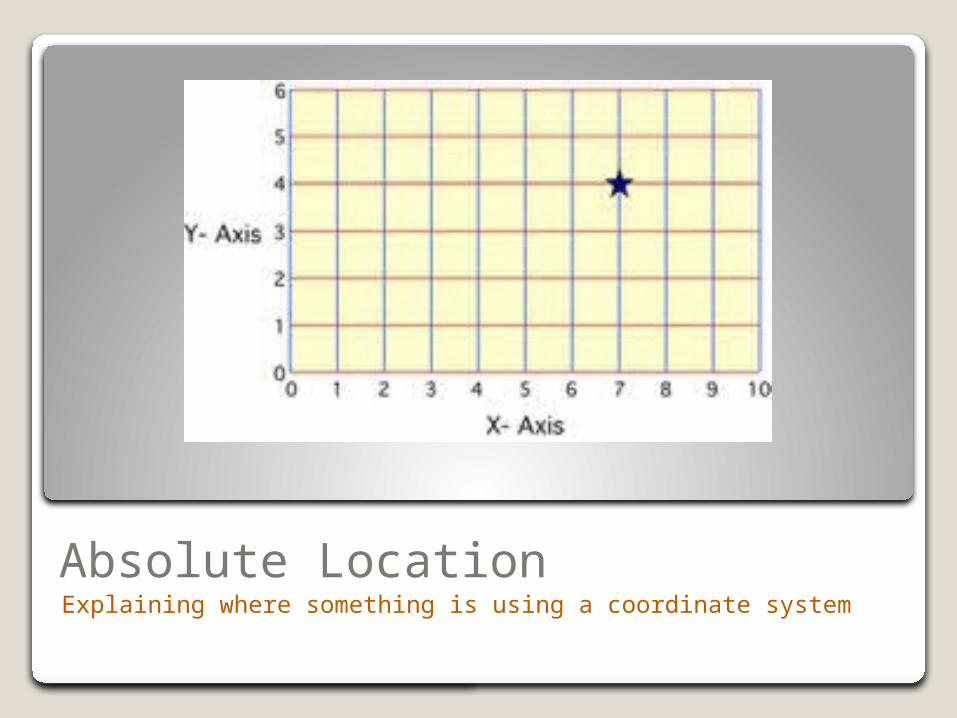
Absolute LocationExplaining where something is using a coordinate system
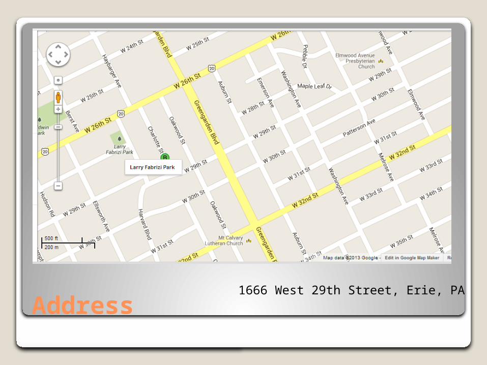
Address 1666 West 29th Street, Erie, PA

Latitude Longitude Systemgeographyalltheway.com
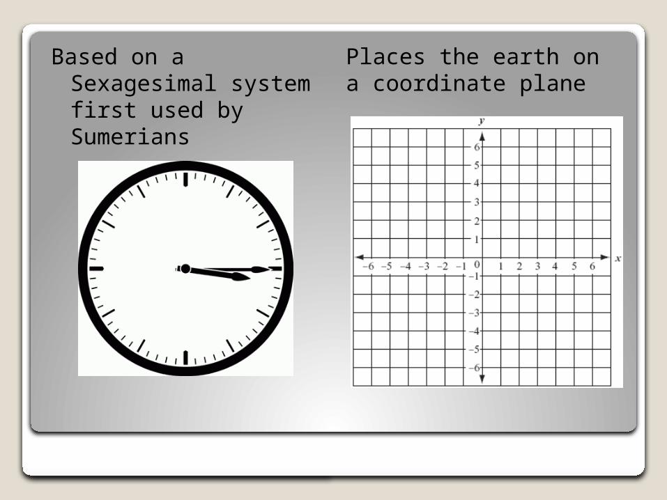
Based on a Sexagesimal system first used by Sumerians
Places the earth on a coordinate plane

geographyalltheway.com
Latitude and Longitude lines are a grid map system. But instead of being straight lines on a flat surface, Latitude and Longitude lines encircle the Earth, either as horizontal circles or vertical half circles
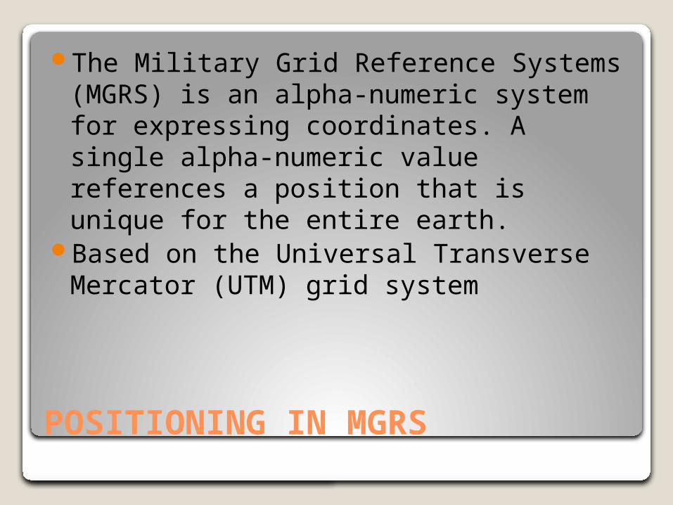
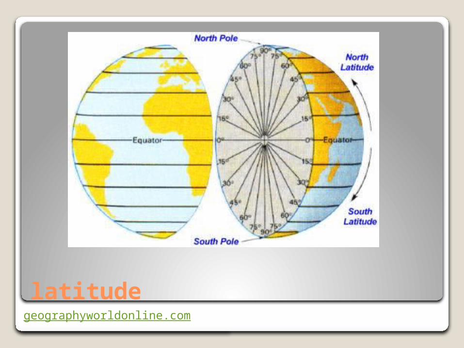
POSITIONING IN MGRS
The Military Grid Reference Systems (MGRS) is an alpha-numeric system for expressing coordinates. A single alpha-numeric value references a position that is unique for the entire earth.
Based on the Universal Transverse Mercator (UTM) grid system

Places the earth in the positive quadrant of a coordinate plane
Based on a decimal system

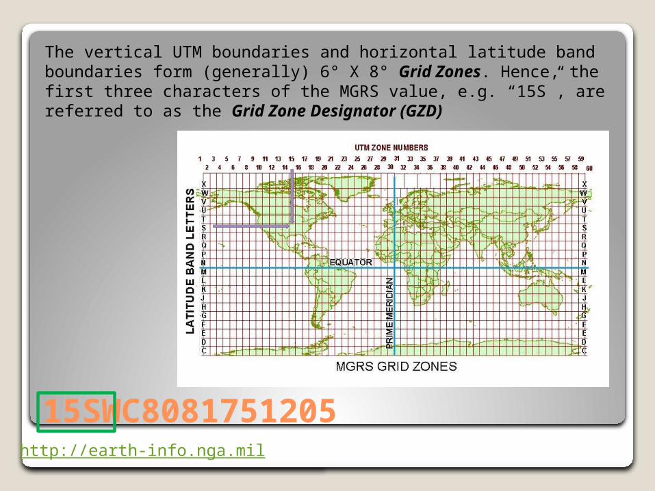
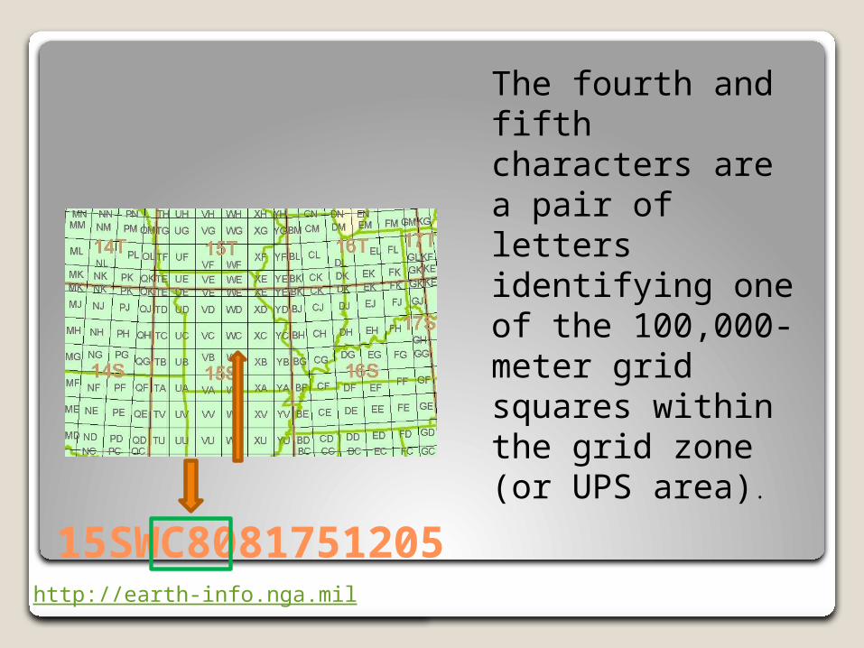
15SWC8081751205
The first two characters represent the 6° wide UTM zone.
◦Leading zeros are included so that Zone 9 is “09”.
◦For polar areas outside the UTM area, these characters are omitted
http://earth-info.nga.mil

15SWC8081751205
The third character is a letter designating a band of latitude.
◦ Beginning at 80°S and preceding northward, the 20 bands are lettered C through X, (omitting I and O)
◦ The bands are all 8° high except band X, which is 12° high.
◦ Outside the UTM are, A and B are used near the South Pole, Y and Z near the North Pole
http://earth-info.nga.mil
15SWC8081751205http://earth-info.nga.mil
The vertical UTM boundaries and horizontal latitude band boundaries form (generally) 6° X 8° Grid Zones. Hence, the first three characters of the MGRS value, e.g. “15S”, are referred to as the Grid Zone Designator (GZD)
15SWC8081751205http://earth-info.nga.mil
The fourth and fifth characters are a pair of letters identifying one of the 100,000-meter grid squares within the grid zone (or UPS area).
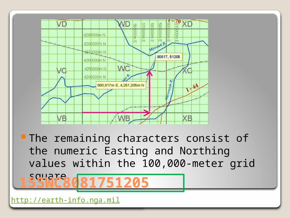
The remaining characters consist of the numeric Easting and Northing values within the 100,000-meter grid square
http://earth-info.nga.mil
15SWC8081751205

The first half refer to the EastingThe second half refers to the Northing
http://earth-info.nga.mil
15SWC8081751205

MGRS coordinates may be rounded to reflect lesser refinement. For example:
◦15SWC8081751205 is at 1-meter refinement.◦15SWC80825121 is at 10-meter refinement.◦15SWC808512 is at 100-meter refinement.◦15SWC8151 is at 1000-meter refinement.◦15SWC85 is at 10,000-meter refinement.