
Living Rivers
20
Living Rivers of the Sacramento Valley Exploring Aquatic Ecosystems Painting courtesy of Vicki Asp An educational supplement from The Sacramento Bee’s Media in Education program Clean Water for the 21st Century ECO GUIDE
Transcript of Living Rivers

Living Riversof the Sacramento Valley
Exploring Aquatic Ecosystems
Painting courtesy of Vicki Asp
An educational supplement from The Sacramento Bee’s Media in Education program
Clean Water for the 21st Century
ECO GUIDE

The source, or beginning, of a river usually flows quickly as the natural force of gravity pulls the water from higher areas down toward lower elevations. As a river follows its course out of the mountains towards valleys, it becomes wider and the flow slows. As the land continues to flatten, a river meanders, cutting curved paths across the landscape. At the end of its path – called its mouth – a river empties through a delta into a larger river, lake, or the ocean.
Rivers change the structure and shape of the land through which they travel. The moving force of water wears down rocks, moves soil and plants, and cuts through the ground, forming features like gorges, valleys, canyons, and waterfalls.
Material is carried away by rivers, only to be deposited again. In this way the Great Central Valley of California has filled with sand, silt, and gravels from both the Coast
Range and, especially, the Sierra Nevada. These sediments are as much as half a mile thick in the Sacramento area.
So when you walk on the flat plain of the Sacramento Valley, you are also walking on some of the Sierra Nevada, that was brought down by rivers!
2
Where Does a River Start?
Answer:
Rivers in the NewsFind an article in the newspaper, or online, related to a local river. Then
research that river on the Internet and discover exactly how the river is used in your area. Create an advertisement for your local river to attract customers, merchants, tourists, environmentalists, outdoor adventurers, photographers,
artists, or whoever might enjoy what your river has to offer.
“I have never seen a river that I could not love. Moving water…has a fascinating vitality. It has power and grace and associations. It has a thousand colors and a thousand shapes…”
- Roderick Haig-Brown, author
The flowing bodies of fresh water that we call rivers often begin in hills or mountains from rain falling, snow melting, or natural spring water bubbling up from the ground.
These small amounts of water collect to form rivulets and streams. As these streams merge, a river is formed, which is then joined by more creeks and rivers as the water cascades downhill. All these feeder streams are called tributaries of the river.

Rivers provide habitat for many species of plants, reptiles, amphibians, birds, insects, and mammals. Through their periodic floods, rivers are a critical source of fertility for rich valley soils. People depend on rivers as a source of food, drinking water, transportation, hydroelectric power, and irrigation of agricultural fields. In addition, people use rivers for fun and recreational activities such as fishing and whitewater rafting. Through the millennia, rivers have also provided inspiration.
To use rivers for drinking water and farm irrigation, people often change them. Dams, canals, and aqueducts are built to change or divert the flow of rivers and to reclaim dry lands by bringing water to them. In addition, some dams are built to control flooding downstream. Others are built to generate hydroelectric power, a cleaner form of energy. Like our local Folsom Dam, some of the 1400 dams in California are multipurpose, covering all of these functions water supply, flood control, and power generation – as well as providing lake recreation. Dams provide important benefits for people, but slowing and/or stopping a river’s flow generally causes dramatic changes in the river’s entire ecosystem, both upstream and downstream.
In addition to these dams, California has three major canal/aqueduct systems which move water to California farms and cities: One aqueduct diverts most of the lower Colorado River; another carries water 200 miles from the Owens Valley on the East side of the Sierra; the third main aqueduct sends half the water from the Sacramento River south. These diversions are necessary because 70% of California’s water falls in the north part of the state, but 70% of our people live in the central and southern parts. California has been transformed by all this water management into one of the most important agricultural regions on earth.
The Important Role of Rivers
Because of our aqueducts, canals, andwater use:• California is one of the richest agricultural areas in the world• Cities in our arid south have been able to boomBut:• Colorado River water no longer reaches the ocean• 60 miles of the San Joaquin River is often dry• San Joaquin’s Tulare Lake, once the largest lake in the
Western United States, is completely dry• Owens Lake, covering 150 square miles in 1913,
is now mostly dry
Did you know?
Rivers in the NewsImagine that a large dam has been proposed for construction on a river in the Sacra-mento Valley. The dam will be multipurpose, providing flood protection, hydroelectric power, water supply and lake recreation. Wildlife advocates, however are concerned that we cannot afford to lose any more riparian or salmon spawning habitat. They are also concerned about cottonwood regeneration and a small fish that only lives in that
river and needs cold flowing water to reproduce. Conduct a classroom debate using the background information from this ecoguide.
Find out how electricity in your home is generated by collecting several power
mix inserts mailed to your parents with their electricity bills (PG&E or SMUD). Research the advantages and disad-vantages of each source of energy. Which of these energy sources are the least damaging to the environment? Discuss and then write an essay (or de-sign a poster) with the following theme: How is it that when I conserve water, I also affect power generation, which in turn affects the footprint I make on the natural world I live in?
Rivers in the Classroom
3

What is a Watershed?
Rainwater and snowmelt flow from high areas and travel into low areas through what is called a watershed – all the land that “sheds” runoff into a particular body of water. If you live on planet Earth, you live in a watershed.
The water in watersheds eventually either evaporates, drains into rivers, lakes, and/or the ocean, is used by plants and animals, or seeps into the earth as groundwater. Groundwater moves more slowly than water on the surface but is still part of the watershed. It seeps into rivers and lakes further downhill.
Key Parts of Watersheds
Rivers in the Classroom
What WatershedDo You Live In?
Look at the map on the back page and see if you can tell which river that rain hit-ting your roof could end up in. What route would a raindrop from your house take if it made it all the way to the ocean with-out first evaporating or being used by an animal or plant?
Name: Taylor
School: Bella Vista High
Rain on my roof: might flow to my driveway, into a gutter, to a storm drain on my street in Orangevale, to Arcade Creek, to the Sacramento River, through the Delta to San Francisco Bay.
What’s Your Water Address?
Rivers are like the freeways of the watershed, bringing water from one area to the next. In addition to bringing water, the river carries other things it picks up along its travels such as sediment, dirt, plant life, and even trash and pollutants.
4
Throughout history, rivers all over the world have played a significant part in the settling of communities. Large cities such as Sac-ramento are located along the banks of rivers. Ask yourself, “Why would people choose to settle near a river?” In the newspaper, find a photo of a community located on a river or find a photo of such a community online. Study the photo carefully. Brainstorm and list reasons why this particular community settled on the river. Do some research on the Internet and discover if your ideas were correct. In both the Sacramento area and surrounding foothill cities, farmers, and wildlife advocates deliberate over the limited supply of water as they struggle to get their needs met. Prepare a classroom bulletin board display using some of the water issues you find in the newspa-per and/or on the internet.
If water runs through a mountain forest, it will pick up leaves, pine needles, dirt or other debris. If it runs through a pasture where cows graze, it will pick up bacteria or pollution from the wastes cows produce.
If water runs through a city or a neighborhood with a lot of people, it will pick up things people discard such as food wrappers, plastic water bottles or lawn fertilizers and pesticides. If it runs through factory or farm areas, it will pick up chemicals, pesticides, oil, fertilizers or other pollutants.
The pollution, trash, and other materials collected by rain runoff make their way through a
watershed. All this contamination can end up in rivers, lakes, wetlands, estuaries, and the ocean. The resulting pollution can harm fish, other wildlife, plants, and ultimately, us.
Think about it! Watersheds, rivers, and oceans aren’t bound by town, state, or even country lines. By looking at a map you can see that the United States shares watersheds with Canada and Mexico. Once the water reaches the ocean, currents drive it to other parts of the world, so water truly does connect us all.
Water Connects Us
All things within a watershedaffect the quality of the water in the watershed.
Rivers in the ClassroomImagine that a large dam has been proposed for construction on a river in the Sacramento Val-ley. The dam will be multipurpose, providing flood protection, hydroelectric power, water supply and lake recreation. Wildlife advocates, however are concerned that we cannot afford to lose any more riparian or salmon spawning habitat. They are also concerned about cottonwood regeneration and a small fish that only lives in that river and needs cold flowing water to reproduce. Conduct a class-room debate using the background information from this Eco Guide.
5
Rivers in the NewsSelect the Sacramento/San Joaquin Delta, or a local river. Divide the class into different interest groups,
such as farmers, ranchers, business owners, city/town dwellers, firefighters, fishermen, rafters, wildlife advocates, nature lovers. Have each group develop a plan for using the water, and be able to defend its plan. Discuss which water uses are the most important.

A river can be divided into three sections: upper, middle, and lower. In each segment the speed of the water, the amount of water, and the way a river moves through the land is different.
UPPER RIVER Trickles of runoff are pulled downward here by gravity, trickles which combine with other streamlets and grow, wearing away the land as they tumble along. The upper river develops from these merging waters.
In mountainous areas, a fun and challeng-ing activity is white-water rafting, recently introduced as an Olympic sport. The South Fork of the Upper American River is one of the most popular rafting areas in the country, with over 50 major rapids. For this sport, rapids are rated on a scale from one to six. Class one rapids are described as easy with fast-flowing water and small waves, while Class six rapids are not navi-gable except by knowledgeable experts. Rucka-Chucky rapid on the Middle Fork of the Upper American River is an example of a class six rapid.
MIDDLE RIVER As a river emerges from the mountains and begins to meet flatter land, the water slows down, sediment picked up earlier begins to drop and fill the riverbed, and the river spreads out and widens. This is the river section you see flowing through Sacra-mento.
LOWER RIVER – DELTAS and ESTUARIES Most rivers eventually flow to the ocean or another large body of water. This area is called the mouth of the river. When a river meets the ocean, it slows down still
further as it hits oncoming waves, becoming calm. As the river slows, it drops still more of the material it has been carrying, creating a new triangular land form. These deltas get their name from the Greek letter ∆.
Deltas are often associated with estuaries, rich habitats where freshwater of rivers and streams meet the salt water of the ocean.
Sections of a River
6

CASE STUDY: Sacramento-San Joaquin Delta – a crisis for all Californians
This 700 mile maze of sloughs and wa-terways just west of Sacramento is formed by the meeting, or confluence, of our state’s two largest rivers – the Sacramento and the San Joaquin. These rivers combine and flow through Suisun Marsh to San Francisco Bay, forming the largest estuary in all of Western North America.
The Delta and the tangled riparian vegeta-tion along its shores are a rich and productive habitat, providing homes for many mammals and other animals. It also acts as a nursery for young fish, amphibians, and insects, and is an important resting place for birds migrat-ing along the Pacific Flyway.
But people have changed the Delta dra-matically. Over the last 150 years, levees have been built, marsh habitat has been drained, and half the water that used to flow to the ocean has been diverted through ca-nals to far away cities and farms. In fact, water for some 23 million Californians now comes from the delta region, which has been transformed into a vast network of productive island farms. Of the original 345,000 acres of tidal marsh, only 8,000 acres have not been turned into dry land. These and other changes have triggered a host of problems, including saltwater intrusion, crashes in the population of some fishes, and high flood risk to farms and homes (as peat soils dry out and islands sink below sea level.)
At the eye of the storm is the Delta SmeltThis small fish lives in the Sacramento-San Joaquin Delta and nowhere else on earth. It is a mere 2-3 inches long, and is too small for us to bother fishing. Yet this little fish, listed as threatened in 1993, is sending California water supply into crisis. Why?
The population of this fish, once one of the most common in the Delta, has crashed in
the past few decades. It may well go extinct in the next few years.
Why do we care? For one thing, the delta smelt is an important part of a complex, in-terdependent food web. If the delta smelt disappears, so could animals that eat it, such as salmon and migrating birds, and the ani-mals that eat them. And every time we lose a species, that unique genetic information is lost forever. In fact, the Delta smelt is seen by biologists as the “canary in the coal mine”* an indicator species for the overall ecologi-cal health of the whole Delta system, and the quality of drinking water for most Californians. For reasons such as these, the Endangered
Species Act requires us to try to prevent extinctions. Researchers, environmental groups, and government officials are scram-bling to save this tiny fish.
A judge ruled that water pumped south out of the Delta must decrease by 30% in order to protect the Delta smelt. Jaws dropped to think that Southern California farms and cities must cope with such a drastic cut.
*Canaries were taken underground by early coal miners to indicate, with their dying, that air was dangerously toxic, thereby warning people to escape contaminated mines.
7
Rivers in the ClassroomSelect the Sacramento/San Joaquin Delta, or a local river. Divide the class into
different interest groups, such as farmers, ranchers, business owners, city/town dwellers, firefighters, fishermen, rafters, wildlife advocates, nature lovers. Have each group develop a plan for using the water, and be able to defend its plan. Discuss which water uses are the most important.
Photo: James D
uncan Davidson

As we have read, humans can have a tre-mendous impact on rivers. We increase their flood potential by paving large areas of their watershed, and try and decrease the flood potential with levees and dams.
Here are three other impacts you may not be aware of: one that is a serious current is-sue, and two that are left over from people of past centuries.
Suffering today from last century’s pollu-tion: the mercury legacy
So much mercury has been left behind by the gold miners of the 1800s, that many fish today in the American River (Folsom Lake and Lake Natoma areas) pose a health haz-ard. Why? Because mercury was used in the washing of gold-rich soils upstream, and be-cause fish tend to accumulate the mercury in their tissues. This accumulation has intensi-fied as soils are held back by reservoirs, and as one fish eats another, concentrating the mercury again.
Health advisories exist for Folsom Lake and Lake Natoma. Children 1–17 or women 18–45 who are pregnant should should not eat from largemouth bass, smallmouth bass, spotted bass, king salmon, and large trout. Others should limit consumption of those
same species to once per week, and no one of any age or gender should eat catfish from Lake Natoma. More detailed restrictions and weekly limits can be found on the State Of-fice of Environmental Heath Hazard Assess-ment’s website, http://www.oehha.ca.gov/fish.html
Health advisories also exist for the Delta. Isn’t it amazing that we are suffering today from pollution generated in the time of our great great great grandparents? And how about the effect of all that mercury on the fish themselves?
What legacy will you leave YOUR great great great grandchildren? Remember, there is no “away” when it comes to trash and pol-lution.
A good legacy from our predecessors-People have also done good things along the river. The American River Parkway, one of
the most beautiful river parks in the nation, stretches 30 miles from Sacramento to Fol-som, covering both sides of the river. Perhaps you have walked its paths, biked its trails, or fished its waters, resting like others from the bustle of urban Sacramento. We enjoy this amazing natural area because of the vision of city planners almost 100 years ago, and the hard work of many people since to keep the park free of development and trash. The Parkway also provides essential riparian habitat and wildlife corridors for fish, other animals, and plants.
Human Impacts on Rivers:Alien invaders, deadly fish, and parkways of vision
8
Did You Know...The Sacramento River drains most of Northern California with a watershed of 27,000
square miles.
Don’t move a mussel!One of the most important ecological is-
sues of our time is that of nonnative invasive species. Both plants and animals brought from other areas of the world have created havoc with the ecology of our local water-sheds. About half the fish species found in the American and Sacramento Rivers are nonnative, with some brought intentionally and some accidentally, mostly with ships. These fish have changed the whole food web and threaten native species. Many invasive plants are also here clogging our waterways and displacing natives. Small mollusks such as zebra and quagga mus-sels grow rampantly, overwhelm structures like fish screens and water pipes, and destroy the environmental health of creeks, lakes, and rivers.
What can you do to stop these invasions? Never empty aquarium fish, plants, or water into rivers, streams, stormdrains, or any wild area. Be careful not to mix plants or animals from one body of water with those of an-other - make sure your rafts, shoes, etc. are dry for a week or more before allowing them to enter another creek or river. Empty fish bait buckets on land, never into the water. Join a community group that is removing non-native invasive plants and restoring na-tive habitat.
Learn more about non-native species so that you can report sightings to a special toll-free line: (877) STOP-ANS. It was a teenager who spotted the nearest zebra mussel occurrence, about 100 miles south of here. Officials now are scrambling to keep the mussel from migrating further north to Sacramento.

Delta – Hot Bed of Controversy
9
All these human effects on Sacramento waterways come to a head in the Delta. That this Rhode Island-sized estuary is in serious trouble is not debated. But what do we do about it? Is there any way to balance all inter-ests?
Watch your newspaper for ar-guments like these:
Wildlife biologist:“We need to do something im-
mediately. The Delta smelt fish population continues to decline sharply and will disappear alto-gether if we don’t act fast. The winter-run Chinook salmon is in trouble as well, and the green sturgeon, central valley spring-run Chinook salmon and Central Valley steelhead are also listed as threatened. Losing these species would affect the entire ecosys-tem, a once-rich vibrant estua-rine system critical for migrating birds, fish, and other wildlife. We need to stop pumping so much water south because the pumps themselves are killing the fish.”
San Joaquin Valley farmer:“We help feed not only Cali-
fornians but the whole world. Our farm economy has helped California become one of the most important economies in the world. That means jobs and tax revenue for things like schools and other services. Well, we can’t farm without water. We agree with the Southern Califor-nia farmer who said: “We feel
we should get the water instead of the fish.” No one even knows if its really the pumps that are causing the problem. Why not end ocean fishing, or look for other causes like pesticides and urban contaminants?
Northern California environ-mentalist:
“It’s in everyone’s best inter-est to save the Delta from fur-ther degradation. We are part of the environment, not separate from it. The long term health of California is more important than short term profits for a few large corporations. We should stop sending so much of our water south just to facilitate develop-ment booms in arid Southern California, and stop subsidiz-ing the farming of such thirsty, but profitable, crops as cotton and rice. All of these practices are simply not sustainable with California’s water situation. Leave the water in the Delta, where it belongs, and grow crops like fruit and nut trees which use less water and are better suited for California.”
Southern California urban-ite:
“What do you expect people down here to do, just stop us-ing water? Abandon homes and businesses? The fact is, we are doing a much better job than you northerners of conserving water. We care about the environment too and are trying to do the right
thing. Did you know that in 2007, the average Angeleno used only 138 gallons of water each day, whereas Sacramentans may have used twice as much – a whopping 278 gallons of water
per person per day? Some of us are removing lawns, planting drought-tolerant vegetation, and buying water efficient appliances to reduce our water use. What are you doing?”

Local Watersheds:
The American andSacramento Rivers
Beginning high in the snow-covered peaks of the Sierra Nevada Mountains, the water cascades from over 10,000 feet in elevation down to just 23 feet above sea level.
The land that drains into the American River is large and varied. Overall the American River watershed drains about 1,900 square miles.
The American River is just one of many rivers that empty into the Sacra-
mento River, a river system that drains most of northern California and part of southern Oregon. All of this water flows through the city of Sacramento. Are you surprised that Sacramento sometimes floods?
Just 150 years ago, there were still vast riparian* forests with plants like cotton-wood and grapevines stretching several miles wide along both rivers. Meadows were thick with wildflowers, and large herds of elk and pronghorn antelope
grazed the nearby grasslands.
10
“Each one of us can help the watershed we live in with our actions”
Alice Cantelow, Environmental Educator

Local Watersheds:
The American andSacramento Rivers
Grizzlies and black bear drank from the rivers. The Sacramento River periodi-cally turned the valley into a huge inland sea with its seasonal flooding.
Today, grizzlies, elk, and antelope are gone from the region. Black bears have retreated to the hills and mountains, and the wildflower meadows have been pushed out by annual grasses from Eu-rope. Ninety-five percent of the wetlands and 90% of riparian woodlands have
been filled in or otherwise destroyed. But not all the news is bad. There are still over 200 species of birds that are shel-tered by the watersheds, over 50 species of mammals, and many different reptiles, amphibians, fish and insects. People are working hard to protect the remaining ri-parian habitat and even bring back some of what we have lost.
*The word “riparian” refers to something situ-ated along a riverbank.
11
“Each one of us can help the watershed we live in with our actions”
Alice Cantelow, Environmental Educator

Flood woes - todaySacramento is built in a floodplain
that used to frequently become an inland sea. It is now protected by three main dams upstream – Shas-ta and Oroville Dams in the Upper Sacramento River Watershed, and Folsom Dam on its American River tributary. People are concerned that these dams do not provide enough protection.
Why was such a large city built in such a flood prone area? And what do we do now to better protect all the people living here?
Sacramento was developed during the Gold Rush near where the American River empties into the Sacramento River. The rivers were a source of water and the new city could easily be reached by boat from the San Francisco Bay. Things happened fast and no one really paid attention to warnings about flooding. The very first year, a bad flood occurred making the residents seriously consider mov-ing, but they chose to cope instead, eventually raising the street level to the height of a building’s second story to try to avoid the frequent floods. Waters were so high in cer-tain months that boats were used to get from building to building.
Levees were later constructed to try and keep the rivers in narrow channels. The last two miles of the American River were straightened out to try and get the sediments left by hydraulic mining to wash away. Today you can still see how some
of the older homes in down-town Sacramento were built as “high water bungalows”. The lower stories had dirt floors used mostly for storage, while the home itself began on the second story. (this practi-cal type of construction for homes in a floodplain is being used again for some newer homes, especially up along the Sacramento River portion of the city).
The state and federal govern-ments stepped in and built Shasta, Oroville and Folsom Dams during the 1940-1960s, the “Big Dam Era”. Flood control was an important part of these multipurpose dams. Unfor-tunately, huge storms which began to occur were much bigger than the historic levels used when designing the dams. Meanwhile, population boomed, as more and more people moved to the floodplain.
To make matters worse, channel-ing the river between levees with little riparian vegetation to absorb water meant that when floods did occur, they tended to be bigger and more damaging.
What now? Should the dams be made bigger? Who should pay? Should people not be allowed to move into the floodplain anymore? Should those already there be required to buy flood insurance? Engineers and politicians alike are struggling with these issues.
The Sacramento River: Another Taste of Controversy
Farmers Versus The Miners –19th Century
During the Gold Rush, water was used to blast away the sides of Sierra hills and mountains to get at gold, sending tons of sediment down tributaries to the Sacramento River. Those sediments settled out when the waters slowed, burying farmlands, fill-ing in river beds, and causing flood waters to pour over the riverbanks more frequently. This destruc-tion lead to one of the nation’s first lawsuits over environmental problems. In 1884, valley farmers sued the foothill miners to get them to stop using hydraulic mining.
Who do you think should have won? The miners built flumes and canals needed to channel water for hydraulic hoses. The former cleared their land, planted seeds, and developed their farms.
The judge sided with the farmers. Hydraulic min-ing essentially ended.
12

Great Blue Heron – Andea herodiasMeet an expert fisherman! This top
predator uses its long yellow bill as a spear, catching fish and frogs in shallow waters, and rodents like mice and gophers in nearby fields.
Great blue herons stand four feet tall, with wings that stretch 6 feet. They build platforms of sticks high in trees for their nests, often in colonies.
Where to see them: This common bird can be seen standing still with crooked neck or slowly stalking prey at the edges of local ponds, creeks, and rivers. Usually alone, herons can also be found out in dry fields.
Beaver – Castor canadensis
This large rodent can weigh as much as 100 pounds, though 30-40 pounds is more normal. They have small eyes and ears, very large front teeth, long brown fur, and large wide tails.
In the deep water of rivers, beavers build burrows in the banks, with an underwa-ter entrance. In creeks and other shallow water, they often build dams of stick and mud.
Beavers are vegetarian, eating bark, twigs, roots, grasses, and other plants.
Where to see them: Beavers are found throughout the larger creeks and rivers of the Sacramento Valley and in the Sierra Nevada Mountains. The best time to look for these quiet animals is in the evening along the river edge, where you can see them pulling branches through the water. You can often hear the loud slap of their tail as they warn other beavers of your presence, just before they disappear un-derwater. Another sign you might see is a chewed stump. This is a successful rein-troduction story they had vanished from the valley because of earlier overhunting.
Rivers are Alive!Local plants and animals you might see: Plan a model community. Sketch an area that
includes a mountain range, a valley, and a river. Show the best locations for houses, croplands, community businesses and recreation areas. Where will the water for the community come from, and how will floods and droughts be dealt with? How will riparian wildlife and plants that lived here originally be protected to prevent extinction? What will happen as the community grows?
Visit your school library to find information about changes in local irrigation practices prior to the Gold Rush. Report on dry wheat farming of the 1800s, the later changes in crops grown, and reclamation of dry lands by building dams and moving water around the state. Perhaps a simple skit would be fun.
Discuss the main farm crops in your county and the Central Valley. Do these crops or live-stock need large or small amounts of water? Invite a county extension agent or a farm bu-reau representative to your class to discuss crop yields and the different kinds of crops in your area. Ask whether farmers/ranchers have all the water they need at an affordable price. Ask about water recycling and whether other things are being done by farmers/ranchers in your area to conserve water.
Rivers in the Classroom
13
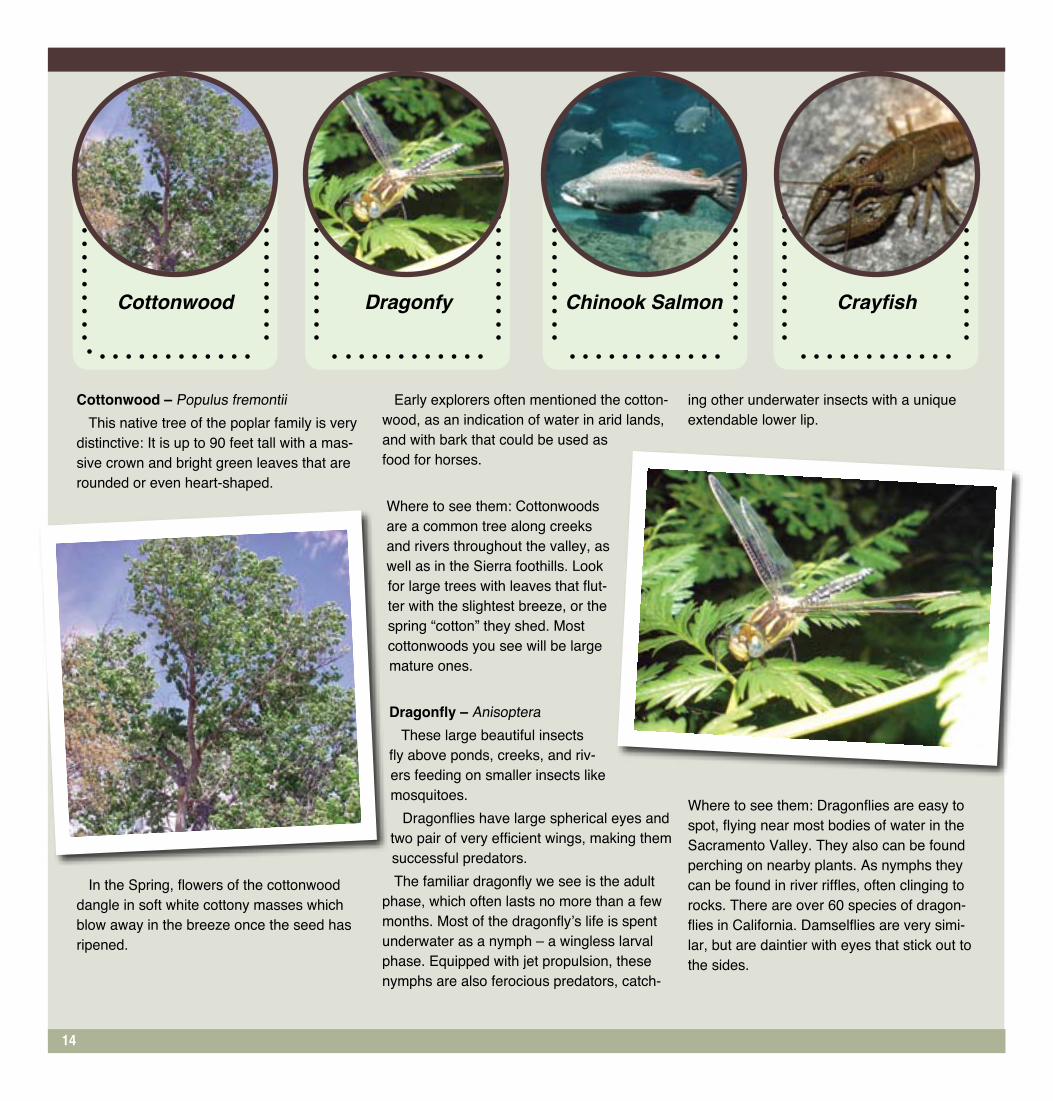
Cottonwood – Populus fremontiiThis native tree of the poplar family is very
distinctive: It is up to 90 feet tall with a mas-sive crown and bright green leaves that are rounded or even heart-shaped.
In the Spring, flowers of the cottonwood dangle in soft white cottony masses which blow away in the breeze once the seed has ripened.
Early explorers often mentioned the cotton-wood, as an indication of water in arid lands, and with bark that could be used as food for horses.
Where to see them: Cottonwoods are a common tree along creeks and rivers throughout the valley, as well as in the Sierra foothills. Look for large trees with leaves that flut-ter with the slightest breeze, or the spring “cotton” they shed. Most cottonwoods you see will be large mature ones.
Dragonfly – AnisopteraThese large beautiful insects
fly above ponds, creeks, and riv-ers feeding on smaller insects like mosquitoes.
Dragonflies have large spherical eyes and two pair of very efficient wings, making them successful predators.The familiar dragonfly we see is the adult
phase, which often lasts no more than a few months. Most of the dragonfly’s life is spent underwater as a nymph – a wingless larval phase. Equipped with jet propulsion, these nymphs are also ferocious predators, catch-
ing other underwater insects with a unique extendable lower lip.
Where to see them: Dragonflies are easy to spot, flying near most bodies of water in the Sacramento Valley. They also can be found perching on nearby plants. As nymphs they can be found in river riffles, often clinging to rocks. There are over 60 species of dragon-flies in California. Damselflies are very simi-lar, but are daintier with eyes that stick out to the sides.
Cottonwood Chinook Salmon CrayfishDragonfy
14

Chinook Salmon –Oncorhynchus tshawytscha
Often called “king” salmon in the Sacramento region, Chinook is the name preferred, and used throughout the United States and Canada. These are the same salmon that are caught in the ocean and rivers by fisher-men in Alaska and the Pacific Northwest.
Salmon are one of several na-tive fish that are anadromous. They are born in a freshwater creek or river, then swim down stream to live in the salty wa-ters of the ocean. They live in the ocean for two to five years, then return to the freshwater to spawn – to mate and lay eggs.
They miraculously return to the same river or creek where they were born. After spawning
they die, and the cycle is re-peated.
Adult salmon scoop out a nest in river gravels to lay their eggs. These nests, or redds, can be disturbed by people, or animals accidentally as they step on the eggs and young fish.
Where to see them: Although their numbers are greatly re-duced because of pollution, diversion pumps, and loss of spawning habitat to dams, you can still see salmon returning to spawn in both the American and Sacramento Rivers.
One good place to look for them is in the American River’s riffles between Watt Avenue and Hazel, between the months of October and December. Dur-ing those same months, both sides of the river are often lined
with people fishing for them just below Nimbus Dam. You can also see them at the Nimbus fish hatchery, where about a fifth of the salmon in the American River now spawn.
Crayfish (Crawdad) –Orconectes
This reddish brown crustacean looks like a small lobster, with jointed legs, two pairs of anten-nae, and front claws. It makes burrows in the stream banks or under rocks, concealing itself, facing out, to watch for food.
Small fish, snails, and insects like dragonfly larva are food for the crayfish. It is able to walk or swim in any direction – front-wards, backwards, or sideways.
Crayfish grow by molting – casting off the hard outside cov-
ering and growing a larger one. The back part of their body is flexible, which helps with swim-ming.
Where you can see them: Crayfish can be found hiding or walking along the bottom of many creeks, streams and rivers in the Sacramento area. Small bits of reddish shell in animal scat near rivers tell you crayfish live there.
15

Everyone can make a difference when it comes to protecting riv-ers. Here are some things you or your class can do to help. Can you think of others?
1. Conserve Water. Contact your local water provider to find ways to conserve water indoors and outdoors.
2. Get Involved. Contact a group in your area that is working on river conservation and ask how you might help. Write to your state legislator or U.S. representative and express your concern for the health of rivers in your area.
3. Go Natural. Use natural fertil-izers on your lawn and garden instead of chemicals. Grass clip-pings left on the lawn will fertil-ize it and it doesn’t cost a thing! Compost is great for your garden. Contact your local cooperative extension for a free composting workshop.
4. Don’t Litter. Do not throw garbage into your local waterways or into the street. Also encourage your friends to throw garbage in appropriate receptacles. In addi-tion, pick up trash when you see it on the ground. When it rains, the trash gets washed through the storm drains right into the water.
5. Use Less Electricity. Turn off lights when you aren’t in the room and encourage your parents to buy special light bulbs and appli-ances that use less energy. Less demand for electricity can mean fewer dams needed for electrical power.
5 Ways You Can Help
Chad Pregracke: Cleaning up rivers one piece at a time
Tires, barrels, even refrigera-tors. These are just a few of the many items people dump near rivers. Thousands of pounds of
trash every year are left behind. Now, thanks to Chad Pregracke, that trash is disappearing. Pregacke grew up along the banks of the Mississippi River. He swam and fished in its waters, and enjoyed the water rushing by his back yard. He never noticed the garbage ac-cumulating around him until he became a commercial diver during high school and college. He could no longer ignore all the trash.
Chad went on to obtain spon-sorships from corporations, a barge to collect the trash, and thousands of volunteers to help. It has become a full time job and his passion. At first he believed that his youth was an obstacle to reaching his goals.
He has come to realize that it is actually an asset. Now in his twenties, he has founded a non-profit organization called “Living Lands and Waters” which has a million dollar budget and has
gone on to clean up trash at several other rivers around the country. “People want to see young people succeed,“ he says.
To that end he encourages kids to get involved in environmen-tal projects, and he also urges young people not to be shy ask-ing for the help of adults to find ways to make a difference.
In his river work, Chad has seen first hand how individuals can make things better. “The great thing is that the garbage is not coming back”, he says. “People are becoming aware of the problem and they are not dump-ing as much.”
The key to real change is mak-ing a start, however small, being an inspiration to others, and from there, running with it.
www.livinglandsandwaters.org
What is your Idea?
16
“I didn’t like what I was seeing and I just started to pick
stuff up.”

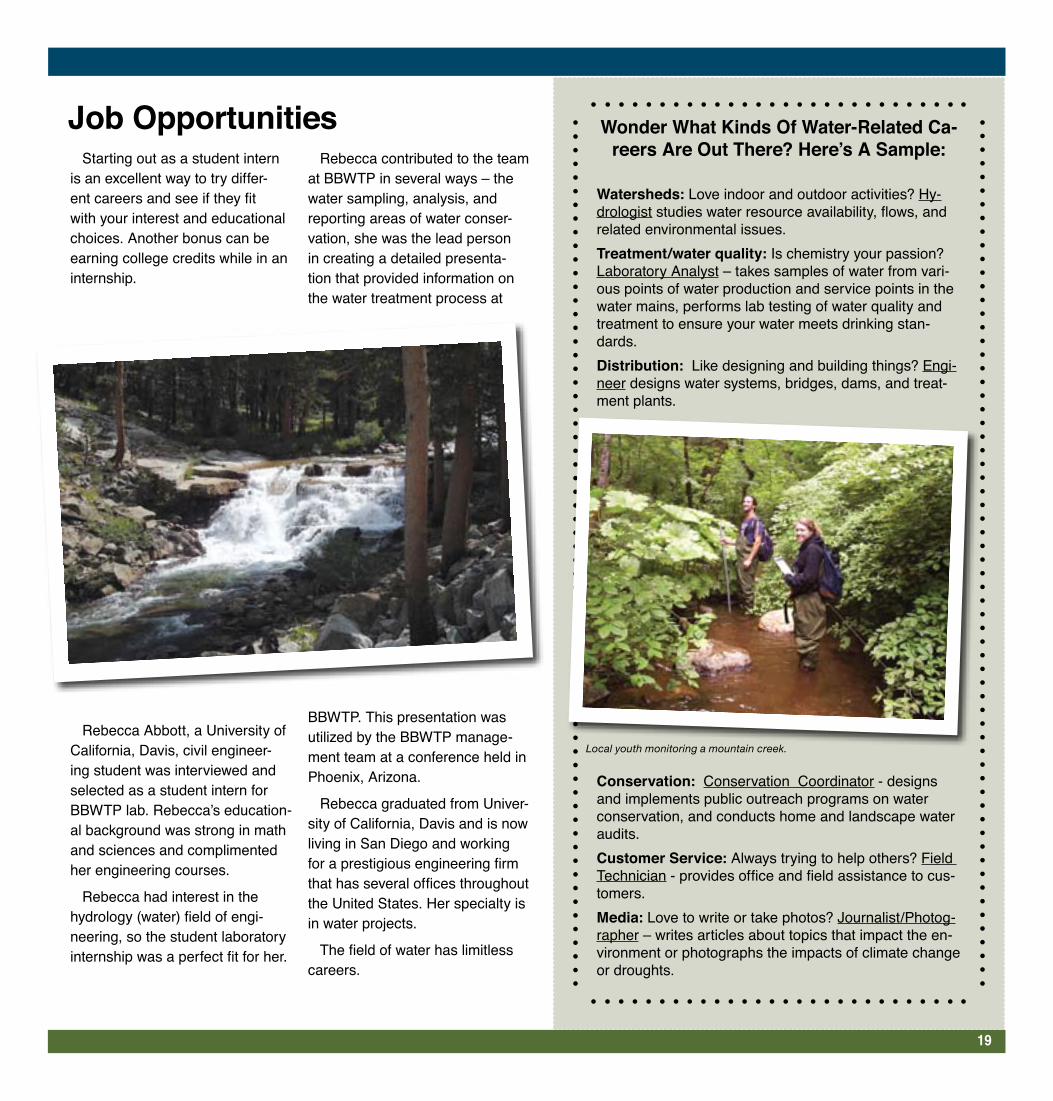
In the upper reaches of the Ameri-can River Watershed, about 40 kids from four different El Dorado County high schools gather every Fall for W.E.S. – Watershed Education Sum-mit. Working in teams side by side with professionals, they collect aquatic macroinvertebrates (bugs in the water), measure various water quality factors, conduct “pebble counts,” record loca-tions of large woody debris (important for critter habitat), survey the banks of the streams, record the extent of cano-py (shading from plants), and in gen-eral monitor the health of the streams. The intensive three-day weekend in the mountains is a combination of hard work and fun. “I love getting to be out-side working on something that really makes a difference,” Eliza Lubetkin, Union Mine High School.
All the data is actually used by peo-ple making decisions about the river at the National Forest Service.
In 2004, eleven of the W.E.S. stu-dents had the incredible opportunity to travel to Mongolia and Siberia. They brought water quality testing equip-ment, along with the expertise in using it, to high school students in a small town on the banks of Lake Baikal, a mile-deep, 400 mile long lake with a polluting pulp mill on its shores. During the three and a half weeks there, they met with various government officials, stayed in the homes of Siberian fami-lies, visited a yurt on the steppes of Mongolia, and experienced the Trans-Siberian Railway.
“I love getting to be outside work-ing on something that really makes
a difference.”
- Eliza Lubetkin, Union Mine High School
Local Kids: Helping Watersheds, Here and Abroad
17
Local and Russian teens working together in Siberia.

There are many opportunities where local teens can volunteer to help their watershed(s). Here are a few to consider:
American River Wildlife Count Join other volunteers on the first
Saturday in December to cover the American River Parkway by foot or canoe listing all the species of birds and other animals sighted that day. Researchers use these valuable data collected over many years as an indicator of changes occurring in wild life populations. Even beginners can help. Visit American River Natural History Association at www.arnha.org/annualevents.html to learn more.
Great American River Clean UpParticipation is a real contribution
to the health of the Parkway and river. Removing trash and debris prevents pollutants from entering the watershed, harming the wildlife, or creating hazards for recreational users. Additionally, keeping the Parkway clean protects ocean life by preventing trash from being washed downstream during the winter rains. Volunteers collect 20 tons of trash from the parkway and river bottom every year! http://www.arpf.org/garcu.htm
Planting native vegetation/water-shed restoration
The American River Conservancy in Coloma can always use help with their watershed restoration projects in El Dorado County. You can help
plant acorns or other na-tive vegetation, remove invasive weeds, or pick up trash from rivers and streams. Tabling at vari-ous community events is another possibility. To volunteer visit www.arconservancy.org
Creek WeekBe part of an area-wide
volunteer effort to im-prove and enhance our urban waterways. www.creekweek.net.
More Volunteer OpportunitiesHere are just a few locations
where students can help and make a difference. Check out your neighborhood for other volunteer opportunities: • American River Water Education Center (ARWEC) - www.usbr.gov/mp/arwec • Effie Yeaw Nature Center - www.sacnaturecenter.net • Placer Nature Center - www.placernaturecenter.org • Roseville Utility Exploration Center - www.roseville.ca.us/explore
What Can YOU Do?
18
Rivers in the NewsOne way groups spread the word about environ-
mental issues is to create posters that illustrate a particular problem. Find an article in the newspaper that discusses a local environmental problem involv-ing a river, drinking water or fresh water ecosystem. Use photos and text from the newspaper to create a poster aimed at heightening awareness of the problem. Hang it in your school or in a public place in your community.
Starting out as a student intern is an excellent way to try differ-ent careers and see if they fit with your interest and educational choices. Another bonus can be earning college credits while in an internship.
Rebecca Abbott, a University of California, Davis, civil engineer-ing student was interviewed and selected as a student intern for BBWTP lab. Rebecca’s education-al background was strong in math and sciences and complimented her engineering courses.
Rebecca had interest in the hydrology (water) field of engi-neering, so the student laboratory internship was a perfect fit for her.
Rebecca contributed to the team at BBWTP in several ways – the water sampling, analysis, and reporting areas of water conser-vation, she was the lead person in creating a detailed presenta-tion that provided information on the water treatment process at
BBWTP. This presentation was utilized by the BBWTP manage-ment team at a conference held in Phoenix, Arizona.
Rebecca graduated from Univer-sity of California, Davis and is now living in San Diego and working for a prestigious engineering firm that has several offices throughout the United States. Her specialty is in water projects.
The field of water has limitless careers.
Wonder What Kinds Of Water-Related Ca-reers Are Out There? Here’s A Sample:
Watersheds: Love indoor and outdoor activities? Hy-drologist studies water resource availability, flows, and related environmental issues.Treatment/water quality: Is chemistry your passion? Laboratory Analyst – takes samples of water from vari-ous points of water production and service points in the water mains, performs lab testing of water quality and treatment to ensure your water meets drinking stan-dards.Distribution: Like designing and building things? Engi-neer designs water systems, bridges, dams, and treat-ment plants.
Conservation: Conservation Coordinator - designs and implements public outreach programs on water conservation, and conducts home and landscape water audits.Customer Service: Always trying to help others? Field Technician - provides office and field assistance to cus-tomers. Media: Love to write or take photos? Journalist/Photog-rapher – writes articles about topics that impact the en-vironment or photographs the impacts of climate change or droughts.
Job Opportunities
19
Local youth monitoring a mountain creek.

Modoc County
Lassen County
SiskiyouCounty
Shasta County
Tehama County
Glenn County
Colusa County
Lake County
Plumas County
Sierra County
Solano County
Sutter County
Pit River
ClearLake
LakeOroville
OREGON
CALIFORNIA
CALIFORNIA
NEVADA
Yuba County
Nevada
County
Pacific Ocean
Feather River Middle Fork
Feat
her R
iver N
orth
Fork
Feat
her R
iver
Wes
t Bra
nch
Feather River South Fork
Yuba River North Fork
Yuba River South Fork
American River South Fork
Yuba River Middle Fork
Cache Creek
Redding
Feather River
Bear River
ButteCounty
ShastaLake
El DoradoCounty
Yolo County
Vacaville
SacramentoCounty
Placer County
McC
loud
Rive
r
American River
Woodland
Sacramento
American River North Fork
American River Middle Fork
FolsomLake
Belinda Arthurs, City of West Sacramento
Ron Brand, Sacramento Bee
Ellen Carlson, Elk Grove Water District
Becky Cassidy, California American Water
Sandy Doyle, Fair Oaks Water District
Pauline Calvillo, Bureau of Reclamation
Sharon Fraser, El Dorado Irrigation District
Monica Garcia, Regional Water Authority
Ryan Geach, City of Sacramento
Barbara Leatham, San Juan Water District
Angela Anderson, Brown and Caldwell
Linda Yager, Regional Water Authority
Written and edited by:
Alice Cantelow, American River Water Education
Center and American River Conservancy
CreditsThis educational supplement was
created by a partnership between the Regional Water Authority and the
US Bureau of Reclamation.
Design by Sacramento Bee MIE programDeveloped by the Regional Water Efficiency Program School Education Subcommittee:
The Sacramento River water-shed covers approximately 27,000 square miles.
Streams that begin in the Sierra Nevada, the Coast Ranges, the Cascade Range, and the Modoc Plateau all flow into the Sacra-mento River. The American and Feather Rivers are just two of the many streams that feed the Sac-ramento River.
20


