LIDAR Measurements of the Vertical Distribution of Aerosol ...

Lidar measurements of the cryosphere
Reykholt, Iceland, June 20–21, 2013
Lidar measurements
of the cryosphere
Reykholt, Iceland, June 20–21, 2013
Abstract volume
Lidar map of the ice-covered stratovolcano Öræfajökull in S-Vatnajökull, S-Iceland,
surveyed by TopScan GmbH in August 2011
Lidar measurements of the cryosphere
Reykholt, Iceland, June 20–21, 2013
1
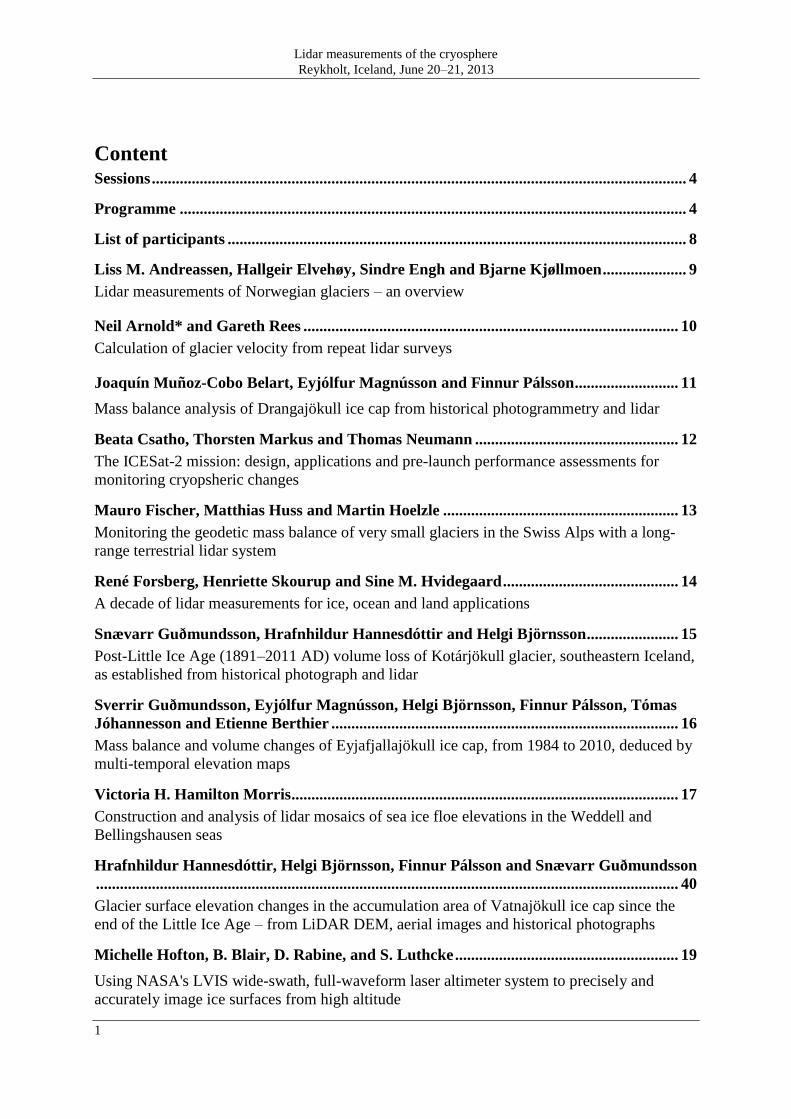
Content Sessions ...................................................................................................................................... 4
Programme ............................................................................................................................... 4
List of participants ................................................................................................................... 8
Liss M. Andreassen, Hallgeir Elvehøy, Sindre Engh and Bjarne Kjøllmoen ..................... 9
Lidar measurements of Norwegian glaciers – an overview
Neil Arnold* and Gareth Rees .............................................................................................. 10
Calculation of glacier velocity from repeat lidar surveys
Joaquín Muñoz-Cobo Belart, Eyjólfur Magnússon and Finnur Pálsson .......................... 11
Mass balance analysis of Drangajökull ice cap from historical photogrammetry and lidar
Beata Csatho, Thorsten Markus and Thomas Neumann ................................................... 12
The ICESat-2 mission: design, applications and pre-launch performance assessments for
monitoring cryopsheric changes
Mauro Fischer, Matthias Huss and Martin Hoelzle ........................................................... 13
Monitoring the geodetic mass balance of very small glaciers in the Swiss Alps with a long-
range terrestrial lidar system
René Forsberg, Henriette Skourup and Sine M. Hvidegaard ............................................ 14
A decade of lidar measurements for ice, ocean and land applications
Snævarr Guðmundsson, Hrafnhildur Hannesdóttir and Helgi Björnsson ....................... 15
Post-Little Ice Age (1891–2011 AD) volume loss of Kotárjökull glacier, southeastern Iceland,
as established from historical photograph and lidar
Sverrir Guðmundsson, Eyjólfur Magnússon, Helgi Björnsson, Finnur Pálsson, Tómas
Jóhannesson and Etienne Berthier ....................................................................................... 16
Mass balance and volume changes of Eyjafjallajökull ice cap, from 1984 to 2010, deduced by
multi-temporal elevation maps
Victoria H. Hamilton Morris ................................................................................................. 17
Construction and analysis of lidar mosaics of sea ice floe elevations in the Weddell and
Bellingshausen seas
Hrafnhildur Hannesdóttir, Helgi Björnsson, Finnur Pálsson and Snævarr Guðmundsson
.................................................................................................................................................. 40
Glacier surface elevation changes in the accumulation area of Vatnajökull ice cap since the
end of the Little Ice Age – from LiDAR DEM, aerial images and historical photographs
Michelle Hofton, B. Blair, D. Rabine, and S. Luthcke ........................................................ 19
Using NASA's LVIS wide-swath, full-waveform laser altimeter system to precisely and
accurately image ice surfaces from high altitude

Lidar measurements of the cryosphere
Reykholt, Iceland, June 20–21, 2013
2
Tómas Jóhannesson................................................................................................................ 20
Flow paths of subglacial water detected by lidar measurements of changes in the ice surface
elevation of glaciers
Tómas Jóhannesson, Helgi Björnsson, Sverrir Guðmundsson, Eyjólfur Magnússon,
Finnur Pálsson, Oddur Sigurðsson, Árni Snorrason and Þorsteinn Þorsteinsson........... 21
Measurements of the ice surface elevation of glaciers in Iceland with lidar
Jack Landy and David Barber .............................................................................................. 23
Using terrestrial lidar to understand the mechanisms driving melt pond evolution on sea ice in
the Canadian Arctic
Anne Le Brocq, Neil Ross and Martin Siegert .................................................................... 24
SURFMAP? – integrating lidar measurements into an Antarctic surface DEM
Gary M. Llewellyn .................................................................................................................. 25
An overview of past and future surveys of Iceland conducted by the NERC ARSF
Eric Lutz, Bob Hawley, Michelle Hofton, John Sonntag, Kelly Brunt and Roseanne
Dominguez ............................................................................................................................... 26
Validation of NASA laser altimeters at Summit, Greenland
Hans-Gerd Maas and Ellen Schwalbe .................................................................................. 27
3D velocity fields at Jacobshavn Isbrae glacier from multi-temporal terrestrial laser scanner data
Kjetil Melvold and Thomas Skaugen ................................................................................... 28
Spatial variability of snow depth determined from airborne laser scanning: implication for
snow course design example from Hardangervidda southern Norway
Finnur Pálsson, Eyjólfur Magnússon, Sverrir Guðmundsson, Helgi Björnsson , Hannes
H. Haraldsson and Tómas Jóhannesson .............................................................................. 29
The mass balance of Brúarjökull, outlet of N-Vatnajökull Ice cap Iceland, in the 20th
and 21st
century
Chris Polashenski ................................................................................................................... 30
Applications of terrestrial lidar in sea-ice and snow sesearch
Allen Pope, Ian C. Willis, Finnur Pálsson, Neil S. Arnold1, W. Gareth Rees and Lauren
Grey ......................................................................................................................................... 31
Elevation change, mass balance, dynamics and surging of Langjökull, Iceland from 1997 to
2007
Peter Rieger ............................................................................................................................ 32
An airborne laser scanner utilizing novel multiple-time-around processing for efficient wide-
area and high point density mapping of mixed-terrain, ice-sheets and glaciers
Robert Ricker, Stefan Hendricks, Veit Helm, Sandra Schwegmann, Henriette Skourup
and Rüdiger Gerdes ............................................................................................................... 33
Lidar measurements of the cryosphere
Reykholt, Iceland, June 20–21, 2013
3
CryoSat-2 Arctic sea-ice freeboard and thickness data product and its validation
Ciaran Robb, Ian Willis and Neil Arnold ............................................................................ 34
Using airborne remote sensing to investigate glacier geomorphic processes
Rudolf Sailer, Erik Bollmann, Veronika Ebe, Anna Girstmair, Christoph Klug, Lorenzo
Rieg, Maximilian Spross and Johann Stötter ...................................................................... 40
Potentials of ALS in the analysis of geomorphodynamic processes in high alpine regions
Toni Schenk and Beata Csatho ............................................................................................. 36
Experimental results from photon-counting laser altimetry system MABEL
Henriette Skourup, René Forsberg, Sine M. Hvidegaard, Indriði Einarsson, Arne V.
Olesen, Stine K. Rose, Louise S. Sørensen, Veit Helm, Stefan Hendricks, Robert Ricker,
Malcolm Davidson and Tânia Casal ..................................................................................... 37
Airborne lidar measurements to support CryoSat-2 validation
Johann Stötter, Rudolf Sailer and Erik Bollmann .............................................................. 40
“–20% in 10 years” – Ten years of experience with laser scan applications on Austrian
glaciers
Michael Studinger .................................................................................................................. 40
NASA's Operation IceBridge: using instrumented aircraft to bridge the observational gap
between ICESat and ICESat-2 laser altimeter measurements
Christian Wever ..................................................................................................................... 40
Airborne laser scanning in Iceland

Lidar measurements of the cryosphere
Reykholt, Iceland, June 20–21, 2013
4
Sessions
Thursday, June 20 09:00‒09:10 ‒ Welcome
09:10‒10:30 ‒ Lidar measurements for glacier inventories and mass balance monitoring
11:00‒12:30 ‒ Process studies - I
13:30‒15:00 ‒ Process studies - II
15:30‒17:30 ‒ Lidar measurements from space, incl. video discussion with input from
NASA/USA
18:30‒20:00 ‒ Workshop dinner
20:00‒21:00 ‒ Evening session
Friday, June 21
09:00‒10:30 ‒ Lidar instruments and surveying
11:00‒12:30 ‒ Poster session
14:00‒18:00 ‒ Excursion on Langjökull
Programme
Thursday, June 20, 09:10‒10:30 ‒ Lidar measurements for glacier inventories and mass
balance monitoring
Liss Marie Andreassen, Hallgeir Elvehøy, Sindre Engh and Bjarne Kjøllmoen
Norwegian Water Resources and Energy Directorate (NVE), Norway,
Lidar measurements of Norwegian glaciers ‒ an overview
René Forsberg, Henriette Skourup and Sine M. Hvidegaard
DTU Space, Technical University of Denmark
A decade of lidar measurements for ice, ocean and land applications
Allen Pope, Ian C. Willis*, Finnur Pálsson Neil S. Arnold, W. Gareth Rees and Lauren Grey
Scott Polar Research Institute (SPRI), University of Cambridge, UK
Elevation change, mass balance, dynamics and surging of Langjökull, Iceland from
1997 to 2007
Johann Stötter, Rudolf Sailer and Erik Bollmann
Institute of Geography, University of Innsbruck, Austria
“–20% in 10 years” – Ten years of experience with laser scan applications on Austrian
glaciers
Coffey 10:30‒11:00
Thursday, 11:00‒12:30 ‒ Process studies ‒ I
Neil Arnold and Gareth Rees
Scott Polar Research Institute (SPRI), University of Cambridge, UK
Calculation of glacier velocity from repeat lidar survey

Lidar measurements of the cryosphere
Reykholt, Iceland, June 20–21, 2013
5
Tómas Jóhannesson
Icelandic Meteorological Office, Iceland
Flow paths of subglacial water detected by lidar measurements of changes in the ice
surface elevation of glaciers
Jack Landy and David Barber
University of Manitoba, Canada
Using terrestrial lidar to understand the mechanisms driving melt pond evolution on
sea ice in the Canadian Arctic
Hans-Gerd Maas and Ellen Schwalbe
TU Dresden, Institute of Photogrammetry and Remote Sensing, Germany
3D velocity fields at Jacobshavn Isbrae glacier from multi-temporal terrestrial laser
scanner data
Lunch 12:30‒13:30
Thursday, 13:30‒15:00 ‒ Process studies ‒ II
Kjetil Melvold and Thomas Skaugen
Norwegian Water Resources and Energy Directorate (NVE), Norway
Spatial variability of snow depth determined from airborne laser scanning: implication
for snow course design example from Hardangervidda southern Norway
Victoria H. Hamilton-Morris,
British Antarctic Survey (BAS), UK
Construction and analysis of lidar mosaics of sea ice floe elevations in the Weddell
and Bellingshausen seas
Robert Ricker, Stefan Hendricks, Veit Helm, Sandra Schwegmann, Henriette Skourup and
Rüdiger Gerdes
Alfred Wegener Institute for Polar and Marine Research, Germany
CryoSat-2 Arctic Sea-Ice Freeboard and Thickness Data Product and its Validation
Ciaran Robb, Ian Willis and Neil Arnold
Scott Polar Research Institute (SPRI), University of Cambridge, UK
Using airborne remote sensing to investigate glacier geomorphic processes
Rudolf Sailer, Erik Bollmann, Veronika Ebe, Anna Girstmair, Christoph Klug, Lorenzo Rieg,
Maximilian Spross and Johann Stötter
Institute of Geography, University of Innsbruck, Austria
Potentials of ALS in the analysis of geomorphodynamic processes in high alpine
regions
Coffey 15:00‒15:30
Thursday 15:30‒17:30 ‒ Lidar measurements from space
Beata Csatho, Thorsten Markus and Thomas Neumann
University of Buffalo, USA
The ICESat-2 mission: design, applications and pre-launch performance assessments
for monitoring cryopsheric changes

Lidar measurements of the cryosphere
Reykholt, Iceland, June 20–21, 2013
6
Toni Schenk and Beata Csatho
University of Buffalo, USA
Experimental Results from photon-counting laser altimetry system MABEL
Skype session
Michelle Hofton, B. Blair, D. Rabine and S. Luthcke
Dept of Geographical Sciences, University of Maryland, USA
Using NASA's LVIS wide-swath, full-waveform laser altimeter system to precisely
and accurately image ice surfaces from high altitude
Michael Studinger
NASA Goddard Space Flight Center, USA
NASA's Operation IceBridge: using instrumented aircraft to bridge the observational
gap between ICESat and ICESat-2 laser altimeter measurements
Another NASA persentation
Video discussion with input from NASA/USA
Thursday 18:30‒20:00 ‒ Workshop dinner
Thursday 20:00‒21:00 ‒ Evening session
Oddur Sigurðsson ‒ Photographs of Icelandic glaciers
Finnur Pálsson ‒ Langjökull ice cap
Friday, June 20, 09:00‒10:30 ‒ Lidar instruments and surveying
Peter Rieger
RIEGL Laser Measurement Systems GmbH, Austria
An airborne laser scanner utilizing novel multiple-time-around processing for efficient
wide-area and high point density mapping of mixed-terrain, ice-sheets, and glaciers
Henriette Skourup, René Forsberg, Sine M. Hvidegaard, Indriði Einarsson, Arne V. Olesen,
Stine K. Rose, Louise S. Sørensen, Veit Helm, Stefan Hendricks, Robert Ricker, Malcolm
Davidson and Tânia Casal
DTU Space, Technical University of Denmark
Airborne Lidar measurements to support CryoSat-2 validation
Christian Wever
TopScan GmbH, Germany
Airborne laser scanning in Iceland
Coffey 10:30‒11:00
Friday 11:00‒12:30 ‒ Poster session
Mauro Fischer, Matthias Huss and Martin Hoelzle
Department of Geosciences, University of Fribourg, Switzerland
Monitoring the geodetic mass balance of very small glaciers in the Swiss Alps with a
long-range terrestrial lidar system
Lidar measurements of the cryosphere
Reykholt, Iceland, June 20–21, 2013
7
Snævarr Guðmundsson, Hrafnhildur Hannesdóttir and Helgi Björnsson
Institute of Earth Sciences, University of Iceland
Post-Little Ice Age (1891‒2011 AD) volume loss of Kotárjökull glacier, southeastern
Iceland, as established from historical photography and lidar
Sverrir Guðmundsson, Eyjólfur Magnússon, Helgi Björnsson, Finnur Pálsson, Tómas
Jóhannesson and Etienne Berthier
Institute of Earth Sciences, University of Iceland
Mass balance and volume changes of Eyjafjallajökull ice cap, from 1984 to 2010,
deduced by multi-temporal elevation maps
Tómas Jóhannesson, Helgi Björnsson, Sverrir Guðmundsson, Eyjólfur Magnússon, Finnur
Pálsson, Oddur Sigurðsson, Árni Snorrason and Þorsteinn Þorsteinsson
Icelandic Meteorological Office, Iceland
Measurements of the ice surface elevation of glaciers in Iceland with lidar
Hrafnhildur Hannesdóttir, Helgi Björnsson, Finnur Pálsson and Snævarr Guðmundsson
Institute of Earth Sciences, University of Iceland
Glacier surface elevation changes in the accumulation area of Vatnajökull ice cap
since the end of the Little Ice Age ‒ from lidar DEMs, aerial images and historical
photographs
Anne Le-Brocq, Neil Ross and Martin Siegert
College of Life and Environmental Sciences, University of Exeter, UK
SURFMAP? – integrating lidar measurements into an Antarctic surface DEM
Joaquín Muñoz-Cobo Belart, Eyjólfur Magnússon and Finnur Pálsson
University of Iceland, Iceland
Mass balance analysis of Drangajökull ice cap from historical photogrammetry and
lidar
Gary M. Llewellyn
Airborne Research and Survey Facility, Natural Environment Research Council
(NERC), UK
An overview of past and future surveys of Iceland conducted by the NERC ARSF
Eric Lutz, Bob Hawley, Michelle Hofton, John Sonntag, Kelly Brunt and Roseanne
Dominguez
Department of Earth Sciences, Dartmouth College, USA
Validation of NASA laser altimeters at Summit, Greenland
Finnur Pálsson, Eyjólfur Magnússon, Sverrir Guðmundsson, Helgi Björnsson, Hannes H.
Haraldsson, and Tómas Jóhannesson
Institute of Earth Sciences, University of Iceland
The mass balance of Brúarjökull, outlet of N-Vatnajökull Ice cap Iceland, in the 20th
and 21st century
Chris Polashenski
USACE Cold Regions Research and Engineering Laboratory (USACE-CRREL)
Applications of terrestrial lidar in sea-ice and snow research
Lunch 12:30‒13:30
Friday 14:00‒18:00 ‒ Excursion on Langjökull

Lidar measurements of the cryosphere
Reykholt, Iceland, June 20–21, 2013
8
List of participants
Name Institute
1 Liss Marie Andreassen Norwegian Water Resources and Energy Directorate (NVE)
2 Neil Arnold Scott Polar Res. Inst. (SPRI), Univ. of Cambridge, UK
3 Joaquín Muñoz-Cobo Belart University of Iceland
4 Beata Csatho University of Buffalo, USA
5 Mauro Fischer Department of Geosciences, University of Fribourg, Switzerland
6 René Forsberg DTU-Space, Technical University of Denmark
7 Snævarr Guðmundsson Institute of Earth Sciences (IES), University of Iceland
8 Sverrir Guðmundsson Institute of Earth Sciences (IES), University of Iceland
9 Brian C. Gunter Delft University of Technology, The Netherlands
10 Victoria H. Hamilton-Morris British Antarctic Survey (BAS), UK
11 Hrafnhildur Hannesdóttir Institute of Earth Sciences (IES), University of Iceland
12 Jóhann Helgason National Land Survey of Iceland
13 Michelle Hofton* Dept. of Geographical Sciences, University of Maryland
14 Sine Munk Hvidegaard DTU Space, Technical University of Denmark
15 Tómas Jóhannesson Icelandic Meteorological Office (IMO)
16 Jack Landy University of Manitoba, Canada
17 Anne Le-Brocq College of Life and Environm. Sci., University of Exeter, UK
18 Gary M. Llewellyn Natural Environment Research Council (NERC), UK
19 Eric Lutz Department of Earth Sciences, Dartmouth College, USA
20 Hans-Gerd Maas Inst. of Photogrammetry and Remote Sens., TU Dresden, Germany
21 Eyjólfur Magnússon Institute of Earth Sciences (IES), University of Iceland
22 Ingvar Matthíasson National Land Survey of Iceland
23 Kjetil Melvold Norwegian Water Resources and Energy Directorate (NVE)
24 Finnur Pálsson Institute of Earth Sciences (IES), University of Iceland
25
Gro Birkefeldt Møller
Pedersen Nordic Volcanological Center, IES, University of Iceland
26 Chris Polashenski USACE Cold Regions Res. and Eng. Lab. (USACE-CRREL)
27 Robert Ricker Alfred Wegener Institute for Polar and Marine Research, Germany
28 Peter Rieger RIEGL Laser Measurement Systems GmbH, Austria
29 Ciaran Robb Scott Polar Res. Inst. (SPRI), Univ. of Cambridge, UK
30 Rudolf Sailer Institute for Geography, University of Innsbruck, Austria
31 Toni Schenk University of Buffalo, USA
32 Ellen Schwalbe Inst. of Photogrammetry and Remote Sens., TU Dresden, Germany
33 Oddur Sigurðsson Icelandic Meteorological Office (IMO)
34 Henriette Skourup DTU-Space, Technical University of Denmark
35 Johann Stötter, Institute for Geography, University of Innsbruck, Austria
36 Michael Studinger* NASA Goddard Space Flight Center, USA
37 Guðmundur Valsson National Land Survey of Iceland
38 Christian Wever TopScan GmbH, Germany
39 Ian Willis Scott Polar Res. Inst. (SPRI), Univ. of Cambridge, UK
* Video conference

Lidar measurements of the cryosphere
Reykholt, Iceland, June 20–21, 2013
Andreassen and others 9
Lidar measurements of Norwegian glaciers – an overview
Liss M. Andreassen*, Hallgeir Elvehøy, Sindre Engh and Bjarne Kjøllmoen
Section for glaciers, snow and ice, Norwegian Water Resources and Energy Directorate (NVE)
* Corresponding author, e-mail: lma (at) nve.no
ABSTRACT
The current glacier monitoring programme in mainland Norway includes direct mass balance
investigations on 14 glaciers. Accurate maps are essential for the surveys. Previously, glaciers
maps were typically constructed from aerial photographs. Poor optical contrast of snow-
covered parts of the glacier surfaces cause larger uncertainties in derived elevations. Data
derived from laser scanning (lidar) is very accurate, particularly on snow covered surfaces
with low roughness. The first laser scanning campaigns of Norwegian glaciers were
conducted in 2001–2003 when Engabreen were mapped repeatedly. Over the period 2007–
2011 new lidar campaigns have been conducted on numerous glaciers in Norway. In most of
the campaigns simultaneous air photos have been taken. The objectives of the surveys are to
produce high quality digital elevation models (DEMs) and orthophotos to document the
present state of the glaciers and assess mass changes of the glaciers since the previous
mappings. Furthermore, the DEMs and orthophotos provide an accurate baseline for future
repeated mapping and glacier change detection.
The surveys cover ~800 km2, more than 30 % of the glacier area in Norway. All current mass
balance glaciers are now mapped with lidar. The surveys and raw data processing were done
by commercial companies, whereas NVE has carried out the further processing. The collected
data are used to calculate geodetic mass balance and are compared with mass balance
measured by the direct method where available. The new laser data combined with old
surveys are thus important for an independent validation of the direct field method. Here we
present the methods used for assessing the geodetic mass balance and its uncertainty.
Lidar measurements of the cryosphere
Reykholt, Iceland, June 20–21, 2013
10 Arnold and Rees
Calculation of glacier velocity from repeat lidar surveys
Neil Arnold* and Gareth Rees
Scott Polar Research Institute, University of Cambridge, England
* Corresponding author, e-mail: nsa12 (at) cam.ac.uk
ABSTRACT
Remotely-sensed imagery is being increasingly used as a method to calculate glacier and ice
sheet velocity. The two most common techniques revolve around radar interferometry, and
feature tracking using radar or visible imagery. Velocity calculations from spaceborne plat-
forms, particularly for slower and/or smaller ice masses, are limited by the spatial resolution
and repeat interval of such imagery, however. In this paper, we evaluate the potential of high
resolution airborne lidar imagery as a method to derive glacier velocity for slower moving,
smaller ice masses, using surveys of Midre Lovenbreen, NW Svalbard, from 2003 and 2005.
These data were used by Rees and Arnold (2007) to calculate preliminary estimates of the
glacier velocity. We use three methods; manual delineation of visible features (e.g. supra-
glacial streams, crevasse fields); automated feature tracking (using the VISICORR software
(Dowdeswell and Benham, 2003)); and a semi-automated Fourier-transform based cross-
correlation technique. In this paper, we extend this analysis to investigate the impact of
various pre-processing steps (such as slope shading of the surface derived from the point
cloud); the impact of the window size used to calculate the Fourier transforms; and also the
use of lidar return intensity measurements as well as the elevation data itself.

Lidar measurements of the cryosphere
Reykholt, Iceland, June 20–21, 2013
Belart and others 11
Mass balance analysis of Drangajökull ice cap from historical
photogrammetry and lidar
Joaquín Muñoz-Cobo Belart*1,2
, Eyjólfur Magnússon3 and Finnur Pálsson
3
1University of Iceland, Reykjavík
2University of Jaén, Spain
3Institute of Earth Sciences, University of Iceland
* Corresponding author, e-mail: jmm11 (at) hi.is
ABSTRACT
We present work in progress, applying lidar observation and photogrammetric processing of
aerial photographs with the aim of deducing volume changes of Drangajökull ice cap in
Northwest Iceland. Drangajökull was surveyed with an airborne lidar in the summer 2011.
The density of observations allows creation of a Digital Elevation Model (DEM) with 2x2m
cell size and accuracy <0.5 m in both elevation and horizontal positioning (Jóhannesson et al.,
2011). Aerial photographs allowing photogrammetric processing cover large parts of Dranga-
jökull in 1946, 1975, 1985 and 1994. We view the lidar DEM as hillshade image and compare
it with the aerial photographs to extract locations of Ground Control Points (GCP) for the
orientation of aerial photographs. The elevation of the GCPs is extracted directly from the
lidar DEM. For orientation of the 1994 photographs we reach a RMS error in planimetry
below the meter-level for 40 GCPs obtained from the lidar. The vertical component shows
even better results, with a RMS error below 0.5 meters. The difference between the lidar
DEM and the 1994 photogrammetric DEM in 10x10m resolution indicates a bias of 0.34 m
for the 1994 DEM. The standard deviation of the difference between the DEMs is 1.26 m for
stable areas outside the glacier. The above parameters of accuracy in orientation and DEM
extraction indicate that by using lidar data as a single support it is possible to get highly
accurate results in photogrammetric processing of historical photographs.
REFERENCE
Jóhannesson, T., H. Björnsson, F. Pálsson, O. Sigurðsson and Þ. Þorsteinsson. 2011. Lidar
mapping of the Snæfellsjökull ice cap, western Iceland, Jökull, 61,19–32.

Lidar measurements of the cryosphere
Reykholt, Iceland, June 20–21, 2013
12 Csatho and others
The ICESat-2 mission: design, applications and pre-launch
performance assessments for monitoring cryopsheric changes
Beata Csatho*1, Thorsten Markus
2 and Thomas Neumann
2
1Department of Geological Sciences, University at Buffalo, Buffalo, NY, USA
2Cryospheric Sciences Laboratory, NASA Goddard Space Flight Ctr, Greenbelt, MD, USA
* Corresponding author, e-mail: bcsatho (at) buffalo.edu
ABSTRACT
NASA’s Ice, Cloud, and land Elevation Satellite-2 (ICESat-2) is a 2nd-generation orbiting
laser altimeter, a follow-on to the ICESat mission, which operated between 2003 and 2009. Its
primary aim is to monitor sea-ice thickness and ice sheet elevation change at scales from
outlet glaciers to the entire ice sheet as established by ICESat. ICESat-2 is now in phase-C
(Design and Development). It is scheduled to launch in July 2016 on a Delta II rocket from
Vandenberg Air Force Base in California.
ICESat-2 will carry the Advanced Topographic Laser Altimeter System (ATLAS) and collect
data to a latitudinal limit of 88 degrees. In contrast to Geoscience Laser Altimeter System
(GLAS) on ICESat, ATLAS employs a 6-beam micro-pulse laser photon-counting approach.
It uses a high repetition rate (10 kHz; 70 cm on the ground along the direction of travel) low-
power laser in conjunction with single-photon sensitive detectors to measure ranges using
~532 nm (green) light. In the polar regions, the 91-day repeat orbit pattern with a roughly
monthly sub-cycle is designed to monitor seasonal and interannual variations of Greenland
and Antarctic ice sheet elevations and monthly sea ice thickness changes. Dense ground-
tracks over the rest of the globe (appr. 2 km ground-track spacing at the equator after two
years) will enable measurements of land topography and vegetation canopy heights, allowing
estimates of biomass and carbon in above ground vegetation. While the ICESat-2 mission was
optimized for cryospheric science, vast amount of accurate elevation measurements will be
taken over land and oceans as well as of the atmosphere. These observations will provide a
wealth of opportunities, ranging from the retrieval of cloud properties, to river stages, to snow
cover, to land use changes and ocean surface topography and more.
This talk will provide an overview of the ICESat-2 mission and elaborates on its expected
performance for ice sheet monitoring and change detection.

Lidar measurements of the cryosphere
Reykholt, Iceland, June 20–21, 2013
Fischer and others 13
Monitoring the geodetic mass balance of very small glaciers in the
Swiss Alps with a long-range terrestrial lidar system
Mauro Fischer*, Matthias Huss and Martin Hoelzle
Department of Geosciences, University of Fribourg, Switzerland
* Corresponding author, e-mail: mauro.fischer (at) unifr.ch
ABSTRACT
More than 80% of all Swiss glaciers are smaller than 0.5 km2
and hence belong to the size
class of very small glaciers, occuring mostly in cirques, niches and below headwalls where
topoclimatical factors and snow accumulation patterns are favourable for the persistence of
snow and ice. However, very small glaciers have hardly been studied and empirical field
measurements are sparse. Thus, the response of very small glaciers in the Swiss Alps to
climate change is being investigated based on an integrated approach including field evidence,
modeling and remote sensing.
Measuring glacier mass balance is important as it directly reflects the climatic forcing on the
glacier. Since 2012, both seasonal and annual mass balance of seven very small glaciers in
Switzerland is measured using the glaciological method (snow soundings and density
measurements at the end of the accumulation season, measuring melt at ablation stakes at the
end of the ablation period). Mass balance can also be reconstructed by means of the geodetic
method, which is based on the comparison of two different Digital Elevation Models (DEMs).
So far, the accuracy of such DEMs mostly derived from airborne or terrestrial laserscanning,
photogrammetry or topographic maps limited the time resolution of reliable mass balance
measurements resulting from the geodetic method to a decadal scale. Most recently, a new
generation of long-range terrestrial laserscanners especially designed for surveying snowy and
icy terrain entered the market of laserscanning devices. This is highly promising for future
accurate determination of annual and even seasonal mass balance of Alpine glaciers. It may
have the potential to circumvent laborious and time consuming glaciological mass balance
measurements. Furthermore and because ice flow is reduced for very small glaciers, it may
help to improve our understanding of the spatial and temporal component of accumulation
and melt processes on Alpine glaciers.
Here we present first expericences and experiments from working with the new Riegl VZ-
6000 long-range terrestrial laserscanner (TLS). Furthermore, we set up a strategy for an
efficient and high-quality future monitoring of the geodetic mass balance of very small
glaciers in the Swiss Alps.

Lidar measurements of the cryosphere
Reykholt, Iceland, June 20–21, 2013
14 Forsberg and others
A decade of lidar measurements for ice, ocean and land
applications
René Forsberg*, Henriette Skourup and Sine M. Hvidegaard
DTU-Space, Technical University of Denmark
* Corresponding author, e-mail: rf (at) space.dtu.dk
ABSTRACT
Starting from laser altimeter experiments for ocean dynamic topography experiments in the
North Sea, DTU-Space has over the years developed various affordable airborne lidar system
setups, mainly for land and sea ice applications. Riegl scanning laser units have been the core
instruments of this in-house development, which has also included development of software
for IMU altitude determination and calibration. In the talk, the background on the software
and methodology development is outlined, and examples shown for results of various camp-
aigns over the Greenland ice sheet, the Arctic and Atlantic Oceans and elsewhere, including a
test in paragliders by an upstart company. Generally, accuracies of the system are at the 5–
10 cm level, and mainly limited by GPS accuracies. The most recent 2012 airborne campaign
included overflights over Iceland and East Greenland glaciers for change detection, with our
typically used Norlandair DHC-6 Twin-Otter as survey aircraft.
Lidar measurements of the cryosphere
Reykholt, Iceland, June 20–21, 2013
Guðmundsson and others 15
Post-Little Ice Age (1891–2011 AD) volume loss of Kotárjökull
glacier, southeastern Iceland, as established from historical
photography and lidar
Snævarr Guðmundsson*, Hrafnhildur Hannesdóttir and Helgi Björnsson
Institute of Earth Sciences, University of Iceland
* Corresponding author, e-mail: sng4 (at) hi.is
ABSTRACT
Kotárjökull is one of several outlet glaciers draining the ice-covered central volcano
Öræfajökull in SE-Iceland. We estimate the average annual specific mass loss of the glacier,
to be 0.22 m (water equivalent) per year over the post Little Ice Age period 1891–2011. The
glacial recession corresponds to an areal decrease of 2.7 km2 (20%) and a volume loss of
0.4 km³ (30%). A surface lowering of 180 m is observed near the snout decreasing to
negligible amounts above 1700 m elevation. This minimal surface lowering at high altitudes
is supported by a comparison of the elevation of trigonometrical points on the plateau of
Öræfajökull from the Danish General Staff map of 1904 and a recent lidar-based digital
elevation model. Our estimates are derived from a) three pairs of photographs from 1891 and
2011, b) geomorphological field evidence delineating the maximum glacier extent at the end
of the Little Ice Age, and c) the high-resolution digital elevation model from 2010–2011. The
historical photographs of Frederick W.W. Howell from 1891 were taken at the end of the
Little Ice Age in Iceland, thus providing a reference of the maximum glacier extent.
Lidar measurements of the cryosphere
Reykholt, Iceland, June 20–21, 2013
16 Guðmundsson and others
Mass balance and volume changes of Eyjafjallajökull ice cap,
from 1984 to 2010, deduced by multi-temporal elevation maps
Sverrir Guðmundsson*1, Eyjólfur Magnússon
1, Helgi Björnsson
1, Finnur Pálsson
1, Tómas
Jóhannesson2 and Etienne Berthier
3
1Institute of Earth Sciences, University of Iceland
2The Icelandic Meteorological Office
3Centre National de la Recherche Scientifique, Laboratoire d’Etudes en Géophysique et Océanographie
Spatiale, Université de Toulouse, France
* Corresponding author, e-mail: sg (at) hi.is
ABSTRACT
We assess the mass balance changes of the ~81 km2 Eyjafjallajökull ice cap in South Iceland,
over three distinct periods, 1984 to 1998, 1998 to 2004, and 2004 to 2010 (influenced by the
2010 Eyjafjallajökull eruption), by comparing digital elevation models (DEMs) covering the
entire glacier. The DEMs were compiled by using i) aerial photographs taken in August 1984
by the U.S. Defense Map Agency (DMA) and the National Land Survey of Iceland, ii)
airborne EMISAR radar images obtained in August 1998 by the Electromagnetic system
(EMI) of the Technical University of Denmark, iii) two image pairs from the SPOT 5 high
resolution stereoscopic (HRS) instrument from August 2004 and iv) airborne lidar from
August 2010 (after the Eyjafjallajökull eruption from 14 April to 22 May 2010). The average
specific mass balance was estimated as the mean elevation difference between glaciated areas
of the DEMs. The glacier mass balance declined significantly between the first two periods:
from +0.2 m yr–1
w. eq. during first period 1984–1998 to –1.5 m yr–1
w. eq. for the period
1998 to 2004. This declining mass balance takes place at the same time as the average
regional temperatures increased by ~1 °C from the first to the second period (1980–1998 to
1998 to 2004). The mass balance during the third period (2004–2010) was –0.9 m yr–1
w. eq.
This increase in the mass balance from the second to the third period (–1.5 to –0.9 yr–1
w.
eq.) is explained by the deposition of a thick insulating tephra layer spread over the ice cap,
that did prevent melting during the summer 2010. Assuming a mass balance of –1.5 m yr-1
w.
eq. from 2004 to 2009 (the same as that for 1998 to 2004, at similar average temperature),
yields a mass balance of around +2 m for the glaciological year 2009 to 2010, or a gain of
~0.18 km3 (mixture of ice and tephra).
Lidar measurements of the cryosphere
Reykholt, Iceland, June 20–21, 2013
Hamilton-Morris, V. H. 17
Construction and analysis of lidar mosaics of sea ice floe
elevations in the Weddell and Bellingshausen seas
Victoria H. Hamilton-Morris
British Antarctic Survey, Cambridge, UK
e-mail: Victon (at) bas.ac.uk
ABSTRACT
Satellite altimeters, such as CryoSat-2 and ICESat, have the potential to monitor trends in
Antarctic ice thickness and extent. The Ice Characterisation Experiment in the Bellingshausen
and Weddell seas (ICEBell) aims to provide improved algorithms for extracting Antarctic sea
ice thickness from altimeter measurements. As part of a simultaneous underwater, on-ice and
airborne campaign, airborne lidar measurements were obtained over sea ice floes in a grid
pattern. This lidar data were then combined into large scale mosaics by minimising the
elevation differences in the gridline overlaps. These sea ice elevation mosaics are being used
in conjunction with snow thickness and ice draft measurements to develop freeboard to ice
thickness algorithms, as well as furthering our understanding of elevation and morphology
statistics over larger regions of sea ice. These data will provide excellent satellite altimeter
validation datasets. I will present the most recent results from the analysis of these mosaics,
including comparison of the elevation distributions from single gridlines versus the full
mosaics, validation of construction from independent data and the benefit of generating large
scale floe mosaics to help validate and put into context local and remote sensing observations.
Lidar measurements of the cryosphere
Reykholt, Iceland, June 20–21, 2013
18 Hannesdóttir and others
Glacier surface elevation changes in the accumulation area of
Vatnajökull ice cap since the end of the Little Ice Age – from lidar
DEMs, aerial images and historical photographs
Hrafnhildur Hannesdóttir*, Helgi Björnsson, Finnur Pálsson and Snævarr Guðmundsson
Institute of Earth Sciences, University of Iceland
* Corresponding author, e-mail: hrafnha (at) hi.is
ABSTRACT
The southeastern outlet glaciers of Vatnajökull ice cap have lost 15–40% of their volume
since the end of the Little Ice Age around 1890. The average annual specific mass loss of the
glaciers during the last 120 years is between 0.23–0.57 mw.eq. The mass loss is concentrated
in the ablation areas, where lateral moraines, trimlines, and glacier erratics clearly outline the
glaciers´ maximum extent. Surface lowering on the order of 150–250 m is observed close to
the glacier snouts in the narrow alpine-like valleys of S-Vatnajökull. Geomorphological field
evidence is more limited in the accumulation area. However, from aerial images of Loft-
myndir ehf., it is possible to determine whether the slopes and nunataks have been covered by
ice. The high-resolution lidar DEMs (2x2 m cell size, accuracy <0.5 m in horizontal and
vertical positioning, Jóhannesson et al., 2011, 2013) provide an accurate baseline for
estimating surface elevation changes in the accumulation area by comparing the size of
numerous nunataks at different times during the 20th
century, from the lidar DEMs, aerial
images and historical photographs. In the post Little Ice Age period, a surface lowering of 10–
15 m is estimated on Breiðabunga dome, and negligible changes are observed above 1700 m
on Öræfajökull ice cap (Guðmundsson et al., 2012). The minimal surface lowering close to
the ice divides on Breiðabunga is supported by DGPS measurements of the last 20 years. The
detailed lidar DEMs also provide basic topographical data for the peripheral areas of the
glaciers, aiding in the reconstruction of the 1890 glacier.
REFERENCES
Guðmundsson, S., Hannesdóttir, H., Björnsson, H. 2012. Post-Little Ice Age volume loss of
Kotárjökull glacier, SE-Iceland, derived from historical photography, Jökull, 62, 97–110.
Jóhannesson, T., H. Björnsson, F. Pálsson, O. Sigurðsson and Þ. Þorsteinsson. 2011. Lidar
mapping of the Snæfellsjökull ice cap, western Iceland, Jökull, 61, 19–32.
Jóhannesson T., Björnsson H., Magnússon E., Guðmundsson S., Pálsson F., Sigurðsson O.,
Thorsteinsson T., and Berthier E. 2013. Ice-volume changes, bias estimation of mass-
balance measurements and changes in subglacial lakes derived by lidar mapping of the
surface of Icelandic glaciers, Annals of Glaciology, 54, 63–74, 10.3189/2013AoG63-
A422.

Lidar measurements of the cryosphere
Reykholt, Iceland, June 20–21, 2013
Hofton and others 19
Using NASA's LVIS wide-swath, full-waveform laser altimeter
system to precisely and accurately image ice surfaces from high
altitude
Michelle Hofton*1, B. Blair
2, D. Rabine
2 and S. Luthcke
3
1Dept of Geographical Sciences, University of Maryland, College Park, MD 20742, USA.
2Code 694, NASA Goddard Space Flight Center, MD 20771, USA
3Code 698, NASA Goddard Space Flight Center, MD 20771, USA
* Corresponding author, e-mail: mhofton (at) umd.edu
ABSTRACT
NASA's Land, Vegetation, and Ice Sensor (LVIS) is a high-altitude, imaging lidar system that
measures surface elevation and surface structure across a 2km-wide swath from a nominal
altitude of 10 km. Since, 2009 it has been used to image large areas of the Greenland and
Antarctica ice sheets as part of NASA's Operation Icebridge. Most recently LVIS has
operated from dedicated, high-altitude aircraft to enable more efficient and extensive mapping
of the ice surfaces than are possible from low altitude, typically mapping areas 10X larger
than what is possible from lower altitudes. We present latest results using the sensor,
including an assessment of ICESat-1's inter-campaign elevation biases, determined using data
from LVIS flights at latitude 86S (the southernmost extent of the ICESat-1 orbit) in 2009 and
2010. A new version of the LVIS sensor is currently being readied for deployment on the
NASA's UAV Global Hawk aircraft. This version of the sensor utilizes a 4km-wide swath
comprised of 10 m wide footprints from a flight altitude of 65,000'. Details of the instrument
and initial results from the sensor tests will be presented. Testing of the LVIS-GH instrument
demonstrated sub-centimeter range precision and the high dynamic range needed to support
precise elevation data collections over the wide range of surface reflectances experienced over
sea ice and ice sheets.

Lidar measurements of the cryosphere
Reykholt, Iceland, June 20–21, 2013
20 Jóhannesson, T.
Flow paths of subglacial water detected by lidar measurements of
changes in the ice surface elevation of glaciers
Tómas Jóhannesson
Icelandic Meteorological Office
e-mail: tj (at) vedur.is
ABSTRACT
Interest in the dynamics of subglacial water flow has increased greatly in recent years with the
realisation that large variations in ice flow velocity in space and time on the ice sheets of
Greenland and Antarctica appear to be driven by changes in basal sliding that are most likely
caused by variations in the amount and pressure of basal water. As a part of lidar mapping of
the surface of glaciers and ice caps in Iceland 2008–2012, some source areas for jökulhlaups
(glacier outburst floods) have been surveyed more than once. These include the Skaftá
cauldrons in western Vatnajökull and several cauldrons in the Katla caldera in the Mýrdals-
jökull ice cap where the lidar measurements have been used to estimate floodwater volumes
and the hypsometry of the subglacial water bodies. The outflow locations from the cauldrons
are visible as several km long elongated depressions in the ice surface along the inferred
subglacial flood paths that are ~10 m deeper shortly after than shortly before jökulhlaups. For
the Skaftá cauldrons, these depressions are thought to be formed by subglacial melting driven
by the initial heat of the flood water in repeated jökulhlaups and the difference in the depth of
the depressions before and after jökulhlaups is interpreted as the consequence of melting that
takes place in a single flood. For cauldrons in Mýrdalsjökull, similar depressions surveyed in
2011 were formed in a single flood and may be partly created by erosion of loose bed material
by the flood. The length of the depression is related to the efficiency of heat transfer in the
subglacial water flow to the surrounding ice walls. The inferred efficiency of the heat transfer
is many times greater than assumed in traditional theories of jökulhlaups. This is consistent
with measurements of flood water temperature at the glacier margin during jökulhlaups that
show the water to be within a few thousandths of a degree from the freezing point.

Lidar measurements of the cryosphere
Reykholt, Iceland, June 20–21, 2013
Jóhannesson and others 21
Measurements of the ice surface elevation of glaciers in Iceland
with lidar
Tómas Jóhannesson*1, Helgi Björnsson
2, Sverrir Guðmundsson
2, Eyjólfur Magnússon
2,
Finnur Pálsson2, Oddur Sigurðsson
1, Árni Snorrason
1 and Þorsteinn Þorsteinsson
1
1Icelandic Meteorological Office
2Institute of Earth Sciences, University of Iceland
* Corresponding author, e-mail: tj (at) vedur.is
ABSTRACT
Detailed mapping of the surface of glaciers and ice caps in Iceland was initiated during the
International Polar Year 2007–2009 and essentially completed in the summer of 2012. An
airborne laser scanning method (lidar) has been employed, covering the entire surface of each
glacier/ice cap surveyed and thus yielding accurate maps of crevassed areas and other regions
that are hard to access in ground-based surveys. The vertical accuracy of the surveys is better
than 0.5 m and Digital Elevation Models (DEMs) with a resolution of 5x5m are produced. All
glaciers in Iceland >10 km² in area have now been mapped with lidar, in total ~11000 km² of
ice-covered areas. The total surveyed area is >15000 km², including proglacial areas and
repeated mapping of some areas with rapid changes due to subglacial eruptions and emptying
of subglacial water bodies. These new surface maps/DEMs will serve as a benchmark for
future evaluation of changes in the areal extent and volume of all major glaciers and ice caps
in Iceland.
The glaciers and ice caps surveyed are of different sizes and types: Vatnajökull is the largest
ice mass by volume in Europe, with sea-level equivalent of 0.85 cm, or 85% of the total
volume of glacier ice in Iceland. The Langjökull and Hofsjökull ice caps have both lost ~10%
of their total volume since 1995 and the lidar maps have enabled accurate estimates of drastic
elevation changes on these ice caps near their periphery when compared to other surface
DTMs. Drangajökull is a 150 km2 ice cap in NW-Iceland that survives below 900 m elevation
under cool conditions close to the Arctic Circle; the lidar results are now yielding the first
accurate estimates of its mass balance since ~1990. Airborne lidar scanning of the surface of
the glacier-capped volcano Eyjafjallajökull revealed the morphology of channels formed in
the ice surface, when meltwater floods and lahars (volcanic debris flows) descended down-
slope during the eruption in 2010. In addition, measurements of the surface of the Mýrdals-
jökull ice cap, carried out in the summer of 2010 and repeated over the subglacial Katla
caldera in 2011, allowed estimation of the volume of floodwater released from a subglacial
lake in July 2011, which swept away a bridge on the main road around Iceland. This cauldron
is one of several located within the caldera where a large eruption could occur in the near
future.
The project is an Icelandic contribution to ongoing research on the effects of global warming
on Arctic/Sub-Arctic ice caps and mountain glaciers worldwide. The maps will be useful for
research on glacier surges and on isostatic uplift due to decreasing lithospheric load. They can
also be useful for comparison with satellite-based measurements of glacial surfaces. Mapping
of glaciers in the vicinity of subglacial lakes (like Grímsvötn and Skaftárkatlar in Vatnajökull)
and marginal lakes (f.ex. Grænalón) is of importance for the study of jökulhlaups (glacier
outburst floods) and for investigations of changes in the courses of glacier rivers. The project
Lidar measurements of the cryosphere
Reykholt, Iceland, June 20–21, 2013
22 Measurements of the ice surface elevation of glaciers in Iceland with lidar
has already produced results on the volume decrease of some ice caps in Iceland over the past
few decades, by comparison with older maps and satellite data. The lidar maps will be in the
public domain, open for use in map production and scientific research.
REFERENCE
Jóhannesson T., Björnsson H., Magnússon E., Guðmundsson S., Pálsson F., Sigurðsson O.,
Thorsteinsson T., and Berthier E. 2013. Ice-volume changes, bias estimation of mass-
balance measurements and changes in subglacial lakes derived by lidar mapping of the
surface of Icelandic glaciers, Annals of Glaciology, 54, 63–74, 10.3189/2013AoG63-
A422.

Lidar measurements of the cryosphere
Reykholt, Iceland, June 20–21, 2013
Landy and Barber 23
Using terrestrial lidar to understand the mechanisms driving melt
pond evolution on sea ice in the Canadian Arctic
Jack Landy* and David Barber
Centre for Earth Observation Science, University of Manitoba, Winnipeg, Manitoba, Canada
* Corresponding author, e-mail: umlandy (at) cc.umanitoba.ca
ABSTRACT
In situ data were collected over landfast first-year sea ice (FYI) in Resolute Passage, Nunavut
(Canada) between May and July in 2011 and 2012, as part of the Arctic-ICE field program, to
examine the mechanisms driving melt pond formation and evolution at the ice surface.
Changes in the surface morphology of snow- then melt pond-covered ice were measured
quantitatively with a terrestrial laser scanner (lidar) and, in combination with physical
measurements taken along a geostatistical transect adjacent to the laser scanning site, were
used to calculate mass and meltwater balance at the ice surface. We present our methods for
collecting terrestrial lidar measurements on sea ice and the many challenges associated with
using such technology in an extreme Arctic environment. Low temperatures, high winds and
regular precipitation affected the operational capabilities of the instrument and the quality of
the data collected. Continuous ice movement in three dimensions also proved problematic for
registering lidar scans and georeferencing to a fixed geographic datum. We discuss the steps
taken to overcome these difficulties and produce an accurate, high-quality time-series of
digital surface models (DSMs) of the ice throughout the melt season. And we briefly review
the results of our field studies, which demonstrate that melt pond coverage varied
substantially between the two years, owing to spatio-temporal variations in the dynamic and
thermodynamic processes controlling meltwater production and drainage at the ice surface.

Lidar measurements of the cryosphere
Reykholt, Iceland, June 20–21, 2013
24 Le Brocq and others
SURFMAP? – integrating lidar measurements into an Antarctic
surface DEM
Anne Le Brocq*1, Neil Ross
2 and Martin Siegert
3
1Geography, College of Life and Environmental Sciences, University of Exeter.
2School of Geography, Politics and Sociology, Newcastle University
3Bristol Glaciology Centre, School of Geographical Sciences, University of Bristol
* Corresponding author, e-mail: A.LeBrocq (at) exeter.ac.uk
ABSTRACT
Recent major geophysical campaigns in Antarctica have acquired airborne surface elevation
measurements alongside ice thickness measurements from radar. BEDMAP2 has brought
together the radar ice thickness measurements to create Antarctic-wide grids of ice thick-
nesses and bed topography. In contrast, however, the airborne surface elevation measurements
have been little used in the production of Antarctic-wide digital elevation models of the ice
sheet surface, with the exception of for error assessment purposes (e.g. Bamber et al., 2009).
An accurate ice surface elevation product is essential for the accurate prediction of regional
subglacial hydrological systems, however, because the ice surface slope is eleven times more
important than the slope of the bed for determining the direction in which subglacial water
flows. A recent investigation of the subglacial hydrological regime in the Institute/Möller Ice
Stream region demonstrates the issues associated with the use of existing products, showing
that the source of elevation (Bamber vs airborne measurements) can lead to differing
predicted subglacial water flow routes. This poster proposes a synthesis surface elevation
dataset that will incorporate airborne surface elevation measurements into a general Antarctic
surface DEM which will be made freely available to the community and will allow significant
improvements in the characterisation and prediction of subglacial hydrological routing.
REFERENCES
Bamber, J. L., J. L. Gomez-Dans, and J. A. Griggs. 2009. A new 1 km digital elevation model
of the Antarctic derived from combined satellite radar and laser data – Part 1: Data and
methods, The Cryosphere, 3, 101–111.

Lidar measurements of the cryosphere
Reykholt, Iceland, June 20–21, 2013
Llewellyn, G. M. 25
An overview of past and future surveys of Iceland conducted by
the NERC ARSF
Gary M. Llewellyn
Airborne Research and Survey Facility, Natural Environment Research Council, England
e-mail: gaew (at) nerc.ac.uk
ABSTRACT
In 2007, the UK's Natural Environment Research Council (NERC) Airborne Research and
Survey Facility (ARSF) supported a range of scientific research projects in Iceland as part of
the International Polar Year. Since then it has returned to Iceland on an almost yearly basis
with additional scientific surveys conducted in Svalbard, Greenland and Northern Sweden, as
well as Chile, Ethiopia and most of central and Southern Europe.
The facility operates a survey-modified Dornier 228 and a Leica Geosystems ALS50-II (with
a full waveform digitiser). Additioionally, we can simultaniously operate imaging spectro-
meters (VNIR and SWIR and historically in the TIR) and collect photography via an Leica
Geosystems RCD105 (but historically a Wild RC-10). Our operation is funded in support of
UK science but previous EU Framework 7 schemes have also funded science from European
research teams. Past surveys have benefited from execent support by Icelandic Meteorological
Office for which we are very grateful. Data collected by the ARSF are available via our data
archive (http://www.neodc.rl.ac.uk/).
Our previous surveys in Iceland have supported science investigating ice dynamics, calving
and recession (e.g. at Breiðamerkurjökull), quantative modelling of a volcanically-influenced
proglacial systems (e.g. around Kverkfjöll), the relationship between faulting and magmatism
in the Krafla rift segment, the surface morphology of lava when interacting with water
(Thingvallavatn), debris flows in the Westfjords Region and deformation of the surface of
Eyjafjallajökull in 2010 (following the eruption).
This year (2013) we will return to Iceland in July and August to survey Langjökull, for mass
balance modelling and comparisons with data collected in 2007, parts of Vatnajökull
(Breiðamerkurjökull and Virkisjökull) to measure rapid ice-cap surface change and flow
dynamics and once again to the Westfjords to monitor debris flows in that region. Details of
the facilities past, current and future operation can be viewed at http://arsf.nerc.ac.uk/.

Lidar measurements of the cryosphere
Reykholt, Iceland, June 20–21, 2013
26 Lutz and others
Validation of NASA laser altimeters at Summit, Greenland
Eric Lutz*1, Bob Hawley
1, Michelle Hofton
2, John Sonntag
3, Kelly Brunt
4 and Roseanne
Dominguez5
1Dartmouth College, Department of Earth Sciences, USA
2University of Maryland, Department of Geographical Sciences, USA
3URS Corporation/NASA Goddard Space Flight Center/Wallops Flight Facility, USA
4Cryospheric Sciences Laboratory, NASA Goddard Space Flight Center, USA
5University of California - Santa Cruz, University Affiliated Research Center, NASA Ames Research Center, USA
* Corresponding author, e-mail: Eric.R.Lutz (at) dartmouth.edu
ABSTRACT
Operation IceBridge is a 6-year NASA mission to collect extensive high-resolution remote
sensing data, including elevation, of sea ice, ice sheets and glaciers during the interim period
between NASA's ICESat (Ice, Cloud, and land Elevation Satellite) and ICESat-2 missions.
Field validation is essential to accurately derive elevation changes from multiple sensors and
platforms. In a field validation along ICESat Track 412 near Summit, Greenland, we assess
the accuracy of surface elevation products from three of NASA's laser altimeters, including
the Airborne Topographic Mapper (ATM), the Land, Vegetation, and Ice Sensor (LVIS), and
the Multiple Altimeter Beam Experiment Lidar (MABEL), an airborne simulator for ICESat-
2. ATM and LVIS datasets were collected during IceBridge campaigns and the MABEL
dataset as part of ICESat-2 mission. We compare these data with contemporaneous along- and
cross-track surface-based differential global positioning system (DGPS) measurements to
identify errors and in some instances correct for them. We also evaluate how DGPS and ATM
products characterize surface features evident in high-resolution imagery acquired by
IceBridge's Digital Mapping System (DMS).

Lidar measurements of the cryosphere
Reykholt, Iceland, June 20–21, 2013
Maas and Schwalbe 27
3D velocity fields at Jacobshavn Isbrae glacier from multi-
temporal terrestrial laser scanner data
Hans-Gerd Maas* and Ellen Schwalbe
Technische Universität Dresden, Germany
* Corresponding author, e-mail: hans-gerd.maas (at) tu-dresden.de
ABSTRACT
Photogrammetric techniques have been used intensively to measure flow velocities and
spatio-temporal motion patterns at glaciers. Given a suitable camera station, terrestrial photo-
grammetric techniques offer the advantage of an almost arbitrarily high temporal resolution at
very reasonable instrumental effort. The determination of 3D motion parameters, however,
requires a stereo system and thus some extra effort for stereo image data acquisition and pro-
cessing. Even monoscopic image sequence processing (delivering 2D velocity information)
requires some extra effort (for instance a photogrammetric network) for determining a scale
factor for the transformation from image into object space.
These problems can be avoided when using a terrestrial laser scanner rather than a camera. A
laser scanner can be used to represent a glacier surface by a dense 3D point cloud. Provided a
sufficient surface structure of a glacier (e.g. by crevasse patterns), multi-temporal 3D point
clouds form a basis for the determination of 3D glacier movement velocity fields. For this
purpose, point cloud matching techniques such as ICP or LSM can be applied.
We will show the results of a pilot study on using a long range terrestrial laser scanner for
determining 3D velocity fields at Jacobshavn Isbrae glacier in West Greenland, discussing
data acquisition modes, processing techniques and results.

Lidar measurements of the cryosphere
Reykholt, Iceland, June 20–21, 2013
28 Melvold and Skaugen
Spatial variability of snow depth determined from airborne laser
scanning: implication for snow course design example from
Hardangervidda southern Norway
Kjetil Melvold* and Thomas Skaugen
The Norwegian Water Resources and Energy Directorate (NVE), Norway
* Corresponding author, e-mail: kjme (at) nve.no
ABSTRACT
Snow depth variability over small distances can affect the representativeness of depth samples
taken at the local scale and it will therefore affect the number of measurements needed to
obtain representative values. It is further difficult to obtain measurements of snow depth
distribution over a large area at a resolution that approximates the scale of its “true”
variability. Such measurements are needed in order to validate spatially distributed snow
simulations at fine- to middle-scale or observations from satellites. Manual data collection
using snow stakes or probes is labor intensive, expensive, and potentially dangerous in steep
mountain environments. These issues call for new technology such as airborne laser scanning
(ALS), which is a powerful tool for surveying large area within a short period. To assess snow
conditions on Hardangervidda (one of Europe’s largest mountain plateaus), the Norwegian
Water Resources and Energy Directorate (NVE) has conducted snow measurement campaigns
across Hardangervidda in 2008, 2009 by airborne laser scanning (ALS). The spatial extent of
the survey area is more than 240 square kilometers. Based on the ALS snow depth data with a
grid resolution of two meter were interpolated. Large variability is found for snow depth at
local scale (2 m2) and similar spatial patterns in accumulation between the two years. Based
on the ALS data it possible to investigate the performance of traditional snow course survey
(typically 100–2000 m long) for determining snow distribution and mean areal values com-
pared to results obtained from a virtual snow course with ALS derived snow depth. The
virtual snow courses are created by randomly selected snow data (of different length and
orientation) from the ALS snow field. Results show that longer snow courses are needed in
areas with large spatial variability in snow depth (typical in the western part of
Hardangervidda) compared to areas with less variability.

Lidar measurements of the cryosphere
Reykholt, Iceland, June 20–21, 2013
Pálsson and others 29
The mass balance of Brúarjökull, outlet of N-Vatnajökull Ice cap
Iceland, in the 20th
and 21st century
Finnur Pálsson*1, Eyjólfur Magnússon
1, Sverrir Guðmundsson
1, Helgi Björnsson
1 , Hannes
H. Haraldsson2 and Tómas Jóhannesson
3
1Institute of Earth Sciences, University of Iceland
2 National Power Company of Iceland
3Iceland Meteorological Office
* Corresponding author, e-mail:fp (at) hi.is
ABSTRACT
We describe the mass balance of Brúarjökull outlet on N-Vatnajökull, Iceland (~1600 km2)
during several time intervals of different climate conditions that span the 20th
century until the
present. The elevation range of Brúarjökull is 600–1750 m a.s.l. with an equilibrium line
altitude (ELA) of 1200 m and (accumulation area ratio) AAR of 60%. The mass balance of
Brúarjökull has been surveyed in-situ every year since 1992–1993 at ~15 carefully chosen
sites. The average mass balance over different periods of the 20th
and 21st centuries has been
assessed from estimation of glacier volume changes by comparing series of digital surface
elevation maps (DEMs) from: 1946 (revised version of published maps based on aerial
photogrammetry), 1963, 1964, 1972 (from various data), 1988 (from surface profiles), 2003,
2010 (from SPOT5 satellite images and GPS surface profiles) and 2011 (airborne lidar
survey). In addition, the glacier margin of the Little Ice Age maximum (LIA; ~1890) has been
estimated from the location of end moraines.

Lidar measurements of the cryosphere
Reykholt, Iceland, June 20–21, 2013
30 Polashenski, C.
Applications of terrestrial lidar in sea-ice and snow research
Chris Polashenski
USACE Cold Regions Research and Engineering Laboratory (USACE-CRREL)
e-mail: chris.polashenski (at) gmail.com
ABSTRACT
Repeat lidar scans have been used to advance topics of sea ice and snow research in both
Arctic and alpine environments. We will present results of studies conducted from 2008–2012
in Barrow, AK, evaluating melt pond formation on sea ice and preliminary results demon-
strating capability to differentiate snow grain size in alpine snow using terrestrial lidar
scanners. Techniques for cold weather operation of Riegl units, and working with a moving
sea ice environment will also be shared.

Lidar measurements of the cryosphere
Reykholt, Iceland, June 20–21, 2013
Pope and others 31
Elevation change, mass balance, dynamics and surging of
Langjökull, Iceland, from 1997 to 2007
Allen Pope1, Ian C. Willis*
1, Finnur Pálsson
2, Neil S. Arnold
1, W. Gareth Rees
1 and Lauren
Grey1
1 Scott Polar Research Institute, University of Cambridge, UK
2Institute of Earth Sciences, University of Iceland
* Corresponding author, e-mail: iw102 (at) cam.ac.uk
ABSTRACT
Langjökull is Iceland’s second largest ice cap (~925 km2). Digital elevation models (DEMs)
from 1997 (dGPS snowmobile transects interpolated by kriging), 2004 (SPOT stereo-imag-
ing), and 2007 (airborne lidar interpolated by photoclinometry) are generated and used to
investigate surface elevation changes and the geodetic mass balance across Langjökull and its
major outlet glaciers. In addition, the surface mass balance of the ice cap is determined inde-
pendently between 1997 and 2007 using a degree-day mass balance model, driven by daily
1 km gridded temperature and precipitation fields based on a network of weather stations
across Iceland. The data are downscaled to the 30 m grid of the mass balance model using
bilinear interpolation and a fixed lapse rate. The mass balance model successfully reproduces
patterns of winter, summer and net mass balance measured at stakes across the ice cap over
the same period. For the major outlet glaciers, and for the ice cap as a whole, the geodetic
balances are compared with the modelled balances for the epochs 1997–2004 and 2004–2007.
Finally, the difference between surface elevation changes and the calculated surface mass
balance are used to derive patterns of the vertical component of ice velocity. Patterns are
generally as expected with submergence in the accumulation area and emergence in the
ablation area but there are major deviations from these patterns in the south associated with
the surge-type glacier Hagafellsjökull Eystri which shows net vertical compression in the
reservoir region and net vertical extension in the receiving region over the 1997–2004 epoch
associated with the 1998 surge, and the reverse over the 2004–2007 epoch associated with
quiescence.

Lidar measurements of the cryosphere
Reykholt, Iceland, June 20–21, 2013
32 Rieger, P.
An airborne laser scanner utilizing novel multiple-time-around
processing for efficient wide-area and high point density mapping
of mixed-terrain, ice-sheets and glaciers
Peter Rieger
RIEGL Laser Measurement Systems GmbH
e-mail: Prieger (at) riegl.com
ABSTRACT
Efficiency in data acquisition is of particular importance when conducting airborne laser
scanning surveys over remote terrain. In these areas, surveys are typically constrained to short
time frames due to difficult weather situations or other logistics factors. Therefore, the
selection of an optimal instrument is critical for successfully completing such difficult
missions.
The primary specifications of interest of an airborne laser scanner are typically its pulse
repetition rate and scan speed. While these parameters are helpful, they do not provide a
complete picture of the instrument’s capabilities. The fundamental metric for productivity is
rather the total surface area which can be mapped in a finite period of time, while maintaining
regular point spacing at the same time. For reference, we provide background information on
state-of-the-art airborne laser scanners currently available and the effect of their specifications
on achievable point density and point distribution [1].
We will present a recently introduced airborne laser scanner, the RIEGL LMS-Q780, which
easily outperforms competitive instruments with respect to productivity [2]. The instrument is
capable of acquiring data at high measurement rates and from high operating altitudes at the
same time which is enabled by a novel technique which resolves range ambiguities appearing
in such situations [3]. We demonstrate the strength of our approach on a data set acquired
over difficult terrain – a scan of a mountainous region and a glacier located in the Austrian
Alps, the “Dachsteinmassiv”. This novel technique enables fast and efficient scanning of any
terrain while maintaining high point-density and a regular point pattern over the entire swath.
For the first time, a single instrument is able to map the most challenging regions with highly
variable elevations in a single pass at safe flying altitudes above mountain peaks.
REFERENCES
[1] RIEGL White Paper: How to read your LIDAR spec – a comparison of single-laser-
output and multi-laser-output LIDAR instruments. 2013. Ullrich A, Pfennigbauer M, Rieger
P; RIEGL Laser Measurement Systems GmbH, http://www.riegl.com/uploads/tx_pxpriegl-
downloads/Airborne_Laser_Scanning-what_to_expect_from_your_sensor_2013-03-
08_02.pdf.
[2] Data sheet RIEGL LMS-Q780, http://www.riegl.com/uploads/tx_pxpriegldownloads/-
10_DataSheet_LMS-Q780_22-03-2013_PRELIMINARY.pdf
[3] Resolving range ambiguities in high repetition rate airborne light detection and ranging
applications. 2012. Rieger P, Ullrich A; J. Appl. Remote Sens. 6(1), 063552.
Lidar measurements of the cryosphere
Reykholt, Iceland, June 20–21, 2013
Ricker and others 33
CryoSat-2 Arctic sea-ice freeboard and thickness data product
and its validation
Robert Ricker*1, Stefan Hendricks
1, Veit Helm
1, Sandra Schwegmann
1, Henriette Skourup
2
and Rüdiger Gerdes1
1Alfred Wegener Institute for Polar and Marine Research, Germany
2DTU Space, Technical University of Denmark
* Corresponding author, e-mail: Robert.Ricker (at) awi.de
ABSTRACT
Accurate CryoSat-2 range measurements over open water and the ice surface are necessary to
achieve the required accuracy of the freeboard to thickness conversion. The local sea-surface
height can be determined by careful detection of leads in the ice cover by the characteristics
of the radar signal. The range retrievals of ice floes are influenced by variable penetration of
the Ku-Band signal into the snow cover and the surface roughness within the CryoSat-2
footprint.
To constrain these error sources of the CryoSat-2 sea-ice thickness product, we compare the
satellite range retrievals with validation measurements in the Arctic.
The CryoSat Validation Experiment (CryoVEx) combines field and airborne measurements in
the Arctic in order to validate CryoSat-2 data. Here we report the results from the first
combined aircraft and satellite data acquisition over sea ice in the Arctic Ocean in spring
2011. During the CryoVEx 2011 campaign in the Lincoln Sea several Cryosat-2 underpasses
were accomplished with two aircraft. One aircraft was equipped with ASIRAS, an airborne
simulator of SIRAL, and an airborne laser scanner; the second aircraft carried an electro-
magnetic induction device for direct sea-ice thickness retrieval and an airborne laser scanner
as well. Both aircraft flew in close formation at the same time of a CryoSat-2 overpass.
We present our findings of the accuracy of sea-ice freeboard and thickness from CryoSat-2
data. From the combined radar and airborne laser altimetry we can estimate the nature of
CryoSat-2 range retrievals over deformed sea ice and with the additional direct EM ice-
thickness measurements we assess the errors of the freeboard to thickness conversion. Furth-
ermore, we will present the corresponding error estimates of the thickness retrieval, which are
essential for the estimations of trends in sea ice and the use of CryoSat-2 data, for example in
sea-ice modelling studies.
Lidar measurements of the cryosphere
Reykholt, Iceland, June 20–21, 2013
34 Robb and others
Using airborne remote sensing to investigate glacier geomorphic
processes
Ciaran Robb*, Ian Willis and Neil Arnold
Scott Polar Research Institute, University of Cambridge, UK
* Corresponding author, e-mail: cr485 (at) cam.ac.uk
ABSTRACT
Geomorphological mapping forms a key aspect of paleo-glaciology. Over the last 10–20 yrs,
remotely sensed data in all its forms has played an increasingly prominent role in glacial
geomorphology, but despite this technological advance in data acquisition, labour intensive,
traditional mapping remains the most accurate method. An automated method of landform
interpretation may serve to streamline the process of geomorphic mapping and subsequent
reconstruction of former glacier extent and dynamics, opening up larger and less accessible
areas to future research into glacial environments. Additionally, recent re‐focusing on a land
system approach to ice marginal and glacial bed forms would benefit from methodologies that
sample across larger areas (Evans, 2005).
Given the potential of remotely sensed data and the room for methodological improvements in
geomorphic mapping, this project aims to develop an automated methodology for mapping
the geomorphology of Icelandic glacier forelands, using statistical information derived from
lidar datasets. Such methods aim to improve consistency in geomorphological mapping using
objective, consistent and accurate computer based object and pattern recognition techniques.
Preliminary results are presented from algorithm development on a lidar dataset of the pro-
glacial margins of Breiðamerkurjökull, Iceland. Algorithm calibration is based on existing
geomorphic mapping, amongst the most detailed and accurate available (see Evans & Twigg.,
2002) with additional fieldwork planned for late June 2013.
Lidar measurements of the cryosphere
Reykholt, Iceland, June 20–21, 2013
Sailer and others 35
Potentials of ALS in the analysis of geomorphodynamic processes
in high alpine regions
Rudolf Sailer*1,2
, Erik Bollmann1, Veronika Ebe
1, Anna Girstmair
1, Christoph Klug
1,
Lorenzo Rieg1, Maximilian Spross
1 and Johann Stötter
1,2
1Institute of Geography, University of Innsbruck, Austria
2alps – Centre for Climate Change Adaptation Technologies, Innsbruck, Austria
* Corresponding author, e-mail: rudolf.sailer (at) uibk.ac.at
ABSTRACT
Airborne lidar offers a wide range of applications in mountain geomorphology. While non-
recurring lidar surveys provide base information on topography and surface characteristics,
repeat airborne lidar datasets allow analysing processes and quantifying respective changes.
At the Institute of Geography, University of Innsbruck, Austria, unique datasets with varying
repeat cycles and spatial captures are available. Due to the high spatial resolution and
accuracy, these datasets facilitate not only the detection but also the quantification of
geomorphic processes over large and often inaccessible mountainous regions. Hence, the
focus of this study lies on the ability of airborne lidar data for the quantification of rock falls,
debris flows and landslides as well as on permafrost related surface phenomena.
Annual lidar surveys of the Rofental area (Ötztal, Tyrol; 32 km2) started in 2001, aiming at
the generation of geodetic mass balances of Hintereisferner and Kesselwandferner, two of the
best investigated glaciers worldwide. Due to its high vertical accuracy (0.05 m on slopes
<40°), these data allow inter-annual analyses of dead ice melting and permafrost degradation
as well as rock falls and fluvial processes in the non-glaciated area. Even processes with very
small changing rates of less than 0.10 m per year can be quantified on the basis of these multi-
temporal airborne lidar datasets.
In a larger area of the Tyrolean Central Alps (750 km2), a bi-temporal lidar survey (2006 and
2010) allowed the detection and analysis of 189 gravitational events (rock falls, debris flows,
landslides), affecting an area larger than 100 m2. It has to be emphasized that the majority of
these processes occurred in areas where permafrost conditions are likely. Regarding their
permafrost content and thus their activity, the more than 400 rock glaciers in this area can be
attributed with an activity index derived from this airborne lidar dataset, using both
volumetric changes and surface velocities of each rock glacier.
A comprehensive overview on the ability of repeat airborne lidar surveys in high mountain
terrain is given, showing the capacities of airborne lidar data for both the (volumetric) process
quantification and the process analysis. Against the background of climate change impacts,
such investigations are highly relevant as shown by the introduction of a rock glacier activity
index or the analysis of gravitational processes.
Lidar measurements of the cryosphere
Reykholt, Iceland, June 20–21, 2013
36 Schenk and Csatho
Experimental results from photon-counting laser altimetry system
MABEL
Toni Schenk* and Beata Csatho
Department of Geology, University at Buffalo, USA
* Corresponding author, e-mail: afschenk (at) buffalo.edu
ABSTRACT
NASA’s upcoming second-generation ICESat-2 (Ice, Cloud, and Land Elevation Satellite)
will employ a photon-counting laser altimetry system with low pulse energy laser and single-
photon-sensitive detectors. To verify this novel system, to simulate ICESat-2 data over cryo-
spheric targets, and to generate data for algorithm development, NASA developed the air-
borne system MABEL (Multiple Altimeter Beam Experimental Lidar) in 2009, with the first
flights available in late 2010. To mimic the ICESat-2 satellite observations as closely as
possible, MABEL is mounted on NASA’s aircraft ER-2 and operates at 20 km altitude. At the
heart of the system is the transmitter fiber select box with 107 fibers for the 2 wavelengths of
532 nm and 1064 nm, respectively. At any given time, 16 of the 532 nm and 8 of the 1064 nm
fibers can be coupled to the transmitter fibers, thus defining the flexible viewing geometry.
The transmitter telescope with a diameter of 12.7 cm has a 100 µrad field of view with a laser
footprint of 2 m at 20 km altitude. The maximum view angle is about ±1.05 km cross track.
The receiver fiber array in the receiver telescope is aligned to the transmitter array. The six-
teen 532 nm receiver fibers are routed to a 16-channel photomultiplier tube detector and the
eight 1064 nm receiver fibers are routed to eight individual single-photon-counting detectors.
In this paper, we report about the first results of MABEL over cryospheric targets, including
the detection of ice surfaces with various degrees of roughness and the detection of surface
elevation changes from repeat flights. Finally, we compare the results with other laser alti-
metry systems, such as NASA’s ATM (Airborne Topographic Mapper) and LVIS.
Lidar measurements of the cryosphere
Reykholt, Iceland, June 20–21, 2013
Skourup and others 37
Airborne lidar measurements to support CryoSat-2 validation
Henriette Skourup*1, René Forsberg
1, Sine M. Hvidegaard
1, Indriði Einarsson
1, Arne V.
Olesen1, Stine K. Rose
1, Louise S. Sørensen
1, Veit Helm
2, Stefan Hendricks
2, Robert Ricker
2,
Malcolm Davidson3 and Tânia Casal
3
1DTU Space, Technical University of Denmark
2Alfred Wegener Institute for Polar and Marine Research, Germany
3ESA ESTEC
* Corresponding author, e-mail: hsk (at) space.dtu.dk
ABSTRACT
After the successful launch of CryoSat-2 in April 2010, the first direct validation campaign of
the satellite was carried out in the spring 2011 and partly repeated in 2012. DTU Space has
been involved in ESA’s CryoSat Validation Experiment (CryoVEx) with airborne activities
since 2003. To validate the performance of the CryoSat-2 radar altimeter (SIRAL), the aircraft
is equipped with an airborne version of the SIRAL altimeter (ASIRAS) together with a high
resolution laser scanner (lidar). Of particular interest is to study the penetration depth of
SIRAL into both land- and sea ice. This can be done by comparing the radar and laser
measurements, as the laser reflects on the air-snow surface, and thus can be used as a
reference surface for the radar signal. Additionally, the lidar is used to identify detailed ice
structures and different ice classifications.
The two campaigns focused on five main validation sites: Devon ice cap (Canada), Austfonna
ice cap (Svalbard), the EGIG line crossing the Greenland Ice Sheet, as well as the sea ice
north of Alert and sea ice around Svalbard in the Fram Strait. At each validation site, scient-
ists took in situ measurements, to link satellite and airborne data with ground data. Selected
tracks were planned to match CryoSat-2 passes and sea ice flights out of Alert were coordin-
ated with the Alfred Wegener Institute (AWI) Polar-5 carrying an EM-bird and NASA’s
Operation IceBridge carrying a variety of instruments for sea ice and snow retrievals. The
paper presents an overview and first results of the 2011–2012 airborne campaigns with special
focus on the lidar measurements to demonstrate their use for CryoSat-2 validation.

Lidar measurements of the cryosphere
Reykholt, Iceland, June 20–21, 2013
38 Stötter and others
“–20% in 10 years” – Ten years of experience with laser scan
applications on Austrian glaciers
Johann Stötter*1, Rudolf Sailer
1,2 and Erik Bollmann
1
1Institute of Geography, University of Innsbruck, Austria
2alps – Centre for Climate Change Adaptation Technologies, Innsbruck, Austria
* Corresponding author, e-mail: hans.stoetter (at) uibk.ac.at
ABSTRACT
Glaciological research on Hintereisferner, one of the largest valley glaciers in the Ötztal Alps
(Austria), has a long tradition going back to first investigations in the late 19th
century. Since
the glaciological year 1952/53, annual mass balance measurements have be carried out. In
addition to this 60 years long mass balance dataset, on basis of the direct glaciological
method, in 2001, within the EU research project OMEGA, the first airborne laser scanning
(ALS) data were acquired. Until 2012, 22 ALS campaigns have been conducted in this area,
thus providing a world-wide unique multi-temporal ALS dataset for a glaciated alpine
catchment.
The annual data of the end of the glaciological year provide high quality topographic inform-
ation which allows for calculating the glacier mass balance by applying a geodetic approach.
In a first approximation, the net mass balance is determined by converting the thickness
change of the glacier to mass change assuming ice melting on the entire glacier and thus
applying ice density of 0.9 g/cm3. Under global warming conditions resulting in general trend
of negative annual mass balances from year to year, and when considering a cumulative
longer period of five or more years, this simple method may need only very small correction
as most of the volume loss can be addressed to ice melt. Nevertheless, on an annual basis
some correction have to made when comparing the ALS based results to those from the direct
glaciological method. The factor describing the deviations between the two methods ranges
from 1.60 (2004/05) to 0.55 (2002/03). These two years represent the least and most negative
extremes within the monitored decade.
ALS data can provide further valuable information to improve these annual mass balance
results, e.g. by deriving information on the quality of surface material from the intensity
information of the received laser pulse. This application allows distinguishing between ice,
firn and snow. Furthermore, feature tracking in multi-temporal data can be used to calculate
surface velocities over the entire glacier area.

Lidar measurements of the cryosphere
Reykholt, Iceland, June 20–21, 2013
Studinger, M. 39
NASA's Operation IceBridge: using instrumented aircraft to
bridge the observational gap between ICESat and ICESat-2 laser
altimeter measurements
Michael Studinger
NASA Goddard Space Flight Center, Cryospheric Sciences Laboratory, Greenbelt, USA
e-mail: michael.studinger (at) nasa.gov
ABSTRACT
NASA's Operation IceBridge images Earth's polar ice in unprecedented detail to better
understand processes that connect the polar regions with the global climate system. Operation
IceBridge utilizes a highly specialized fleet of research aircraft and the most sophisticated
suite of innovative science instruments ever assembled to characterize annual changes in
thickness of sea ice, glaciers, and ice sheets. In addition, Operation IceBridge collects critical
data used to predict the response of Earth's polar ice to climate change and resulting sea-level
rise. IceBridge also helps bridge the gap in polar observations between NASA's ICESat
satellite missions.
Combined with previous aircraft observations, as well as ICESat, CryoSat-2 and the
forthcoming ICESat-2 observations, Operation IceBridge will produce a cross-calibrated 17-
year time series of ice sheet and sea-ice elevation data over Antarctica, as well as a 27-year
time series over Greenland. These time series will be a critical resource for predictive models
of sea ice and ice sheet behavior. In addition to laser altimetry, Operation IceBridge is using a
comprehensive suite of instruments to produce a three-dimensional view of the Arctic and
Antarctic ice sheets, ice shelves and the sea ice. The suite includes two NASA laser
altimeters, the Airborne Topographic Mapper (ATM) and the Land, Vegetation and Ice
Sensor (LVIS); four radar systems from the University of Kansas' Center for Remote Sensing
of Ice Sheets (CReSIS), a Ku-band radar altimeter, accumulation radar, snow radar and the
Multichannel Coherent Radar Depth Sounder (MCoRDS); a Sander Geophysics airborne
gravimeter (AIRGrav), a magnetometer and a high-resolution stereographic camera (DMS).
Since its start in 2009, Operation IceBridge has deployed 7 geophysical survey aircraft, 18
science instruments. All IceBridge data is freely available from NSIDC (http://nsidc.org/data/-
icebridge) 6 months after completion of a campaign.

Lidar measurements of the cryosphere
Reykholt, Iceland, June 20–21, 2013
40 Wever, C.
Airborne laser scanning in Iceland
Christian Wever
TopScan GmbH, Rheine, Germany
e-mail: wever (at) topscan.de
ABSTRACT
Since 2008, TopScan has been annually in Iceland for airborne laser scanner measurements,
and has since then captured about 12.000 km². The captured areas include among others the
Vatnajökull as one of the biggest glaciers in Europe and the Eyjafjallajökull after its eruption
in 2010.
The paper reports on the experiences from these survey flights, in particular the questions:
Complicates the situation between the Arctic Circle and the Gulf Stream and the related
climate conditions the data acquisition? Are airborne laser scanner measurements in Iceland
different from measurements in other areas?
Introductorily, the measurement principle and the state of the technics of ALS will be shortly
explained and some of the various applications will be presented.
Finally, an outlook on the ongoing developments will be discussed. Promising developments
such as bathymetric systems, being able to recognize the topography under water or a combin-
ation of ALS with hyperspectral sensors. Research and commercial applications can expect
improved classification results, for example in hydrograpghical projects for a more efficient
detection of the water-land-boundary.


![Validation of Measurements from a ZephIR Lidar · ZephIR Lidar [1]. The measurements were collected using a ZephIR 300 wind lidar (which collects finance grade measurements up to](https://static.fdocuments.net/doc/165x107/5f5261a4dc395358a915c491/validation-of-measurements-from-a-zephir-zephir-lidar-1-the-measurements-were.jpg)