LASER SCANNING AS A TOOL FOR ARCHEOLOGICAL …
7
HAL Id: halshs-00269885 https://halshs.archives-ouvertes.fr/halshs-00269885 Submitted on 3 Apr 2008 HAL is a multi-disciplinary open access archive for the deposit and dissemination of sci- entific research documents, whether they are pub- lished or not. The documents may come from teaching and research institutions in France or abroad, or from public or private research centers. L’archive ouverte pluridisciplinaire HAL, est destinée au dépôt et à la diffusion de documents scientifiques de niveau recherche, publiés ou non, émanant des établissements d’enseignement et de recherche français ou étrangers, des laboratoires publics ou privés. LASER SCANNING AS A TOOL FOR ARCHEOLOGICAL RECONSTITUTION:A GALLO-ROMAN TEMPLE IN NAIX-AUX-FORGES, FRANCE Didier Bur, Jean-Pierre Perrin, Alain Fuchs, Vincent Guermonprez To cite this version: Didier Bur, Jean-Pierre Perrin, Alain Fuchs, Vincent Guermonprez. LASER SCANNING AS A TOOL FOR ARCHEOLOGICAL RECONSTITUTION:A GALLO-ROMAN TEMPLE IN NAIX- AUX-FORGES, FRANCE. CIPA 2003, Sep 2003, Turkey. pp.1-6. halshs-00269885
Transcript of LASER SCANNING AS A TOOL FOR ARCHEOLOGICAL …

HAL Id: halshs-00269885https://halshs.archives-ouvertes.fr/halshs-00269885
Submitted on 3 Apr 2008
HAL is a multi-disciplinary open accessarchive for the deposit and dissemination of sci-entific research documents, whether they are pub-lished or not. The documents may come fromteaching and research institutions in France orabroad, or from public or private research centers.
L’archive ouverte pluridisciplinaire HAL, estdestinée au dépôt et à la diffusion de documentsscientifiques de niveau recherche, publiés ou non,émanant des établissements d’enseignement et derecherche français ou étrangers, des laboratoirespublics ou privés.
LASER SCANNING AS A TOOL FORARCHEOLOGICAL RECONSTITUTION:A
GALLO-ROMAN TEMPLE IN NAIX-AUX-FORGES,FRANCE
Didier Bur, Jean-Pierre Perrin, Alain Fuchs, Vincent Guermonprez
To cite this version:Didier Bur, Jean-Pierre Perrin, Alain Fuchs, Vincent Guermonprez. LASER SCANNING AS ATOOL FOR ARCHEOLOGICAL RECONSTITUTION:A GALLO-ROMAN TEMPLE IN NAIX-AUX-FORGES, FRANCE. CIPA 2003, Sep 2003, Turkey. pp.1-6. �halshs-00269885�
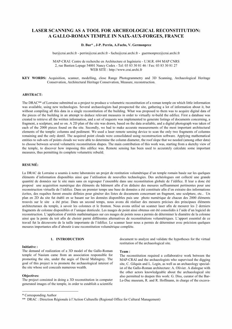
LASER SCANNING AS A TOOL FOR ARCHEOLOGICAL RECONSTITUTION: A GALLO-ROMAN TEMPLE IN NAIX-AUX-FORGES, FRANCE
D. Bur* , J-P. Perrin, A.Fuchs, V. Germonprez
[email protected] - [email protected] - [email protected] - [email protected]
MAP-CRAI: Centre de recherche en Architecture et Ingénierie - U.M.R. 694 MAP CNRS
2, rue Bastien Lepage 54001 Nancy Cedex - Tel: 03 83 30 81 46 / Fax: 03 83 30 81 27 WEB SITE : http://www.crai.archi.fr
KEY WORDS: Acquisition, scanner, modelling, close Range Photogrammetry and 3D Scanning, Archaeological Heritage
Conservation, Architectural Heritage Conservation, Measure, reconstruction. ABSTRACT: The DRAC** of Lorraine submitted us a project to produce a volumetric reconstitution of a roman temple on which little information was available, using new technologies. Several archaeologists had prospected the site, gathering a lot of information about it, but without compiling all this data in a single reconstitution of the building. What was proposed to them was to acquire digital data of the pieces of the building in an attempt to deduce relevant measures in order to virtually re-build the edifice. First a database was created to retrieve all the written information, and a set of requests was implemented to generate listings of documents concerning, a fragment, a sculpture, and so on. A 2D plan of the site was drawn, based on the data available, and a digital photograph was taken of each of the 2000 pieces found on the site. Secondly, we had to make accurate measurements of the most important architectural elements of the temple: columns and pediment. We used a laser remote sensing device to scan the only two fragments of columns remaining and the only dentil. The acquired point clouds were consolidated using reconstruction software. Applying mathematical entities to sub-sets of points clouds we were able to determine the column diameter, the roof slope that we needed (among other data) to choose between several volumetric reconstitution shapes. The main contribution of this work was, starting from a sketchy view of the temple, to discover how imposing this edifice was. Remote sensing has been used to accurately calculate some important measures, thus permitting its complete volumetric rebuild. RESUMÉ: La DRAC de Lorraine a soumis à notre laboratoire un projet de restitution volumétrique d’un temple romain basée sur les quelques éléments d’information disponibles ainsi que l’utilisation de nouvelles technologies. Des archéologues ont collecté une grande quantité de données sur le site mais sans en regrouper l’ensemble dans une reconstitution globale de l’édifice. Il leur a donc été proposé une acquisition numérique des éléments du bâtiment afin d’en déduire des mesures suffisamment pertinentes pour une reconstruction virtuelle de l’édifice. Dans un premier temps une base de données a été constituée afin d’en extraire des informations écrites, des requêtes furent ensuite définies pour générer des listes de documents concernant un fragment, une sculpture, etc.. Un plan en 2D du site fut établi en se basant sur les données disponibles puis une photo numérique de chacun des 2000 éléments trouvés sur le site a été prise. Dans un second temps, nous avons dû réaliser des mesures précises des principaux éléments architecturaux du temple, à savoir les colonnes et le fronton. Nous avons utilisé un scanner laser afin de mesurer les 2 derniers fragments de colonne disponibles et l’unique denticule. Les nuages de point ainsi obtenus ont été consolidés à l’aide d’un logiciel de reconstruction. L’application d’entités mathématiques sur ces nuages de points nous a permis de déterminer le diamètre de la colonne ainsi que la pente du toit afin de choisir parmi différentes alternatives de reconstitutions volumétriques. L’apport essentiel de ce travail fut la découverte de la taille importante de l’édifice. Le scanner laser nous a permis de déterminer avec précision quelques mesures importantes afin d’aboutir à une reconstitution volumétrique complète.
* Corresponding Author ** DRAC : Direction Régionale à l’Action Culturelle (Regional Office for Cultural Management)
1. INTRODUCTION
Initiative : The demand of realization of a 3D model of the Gallo-Roman temple of Nasium came from an association responsible for promoting the site, under the aegis of David Malingrey. The goal of this project is to promote the archaeological interest of the site whose soil conceals numerous wealth. Objectives: The project consisted in doing a 3D reconstitution in computer generated images of the temple, in order to establish a scientific
document to analyze and validate the hypotheses for the virtual restitution of the archaeological site. Team : The reconstitution required a collaborative work between the MAP-CRAI and the archaeologists who supervised the digging site, C. Gilquin and L. Legin, as well as an archaeology special-ist of the Gallo-Roman architecture: A. Olivier. A dialogue with the other actors knowledgeable about the archaeological site also permitted to deepen this work: G. Diss, curator of the Bar-Le-Duc museum, R. and R. Hoffmann, in charge of the excava-
The International Archives of the Photogrammetry, Remote Sensing and Spatial Information Sciences, Vol. 34, Part XXX
tions. A logistical support from the tows St.-Amand-sur-Ornain and Naix-aux-Forges helped these meetings. The multidisciplinary character of this research put the archae-ologists in a situation where they could benefit from contribu-tions of the data processing in their work of reconstitution and allowed the researchers to ask themselves about the content and the purpose of the computer generated images of the monument that they could offer.
2. THE 3D LASER SCANNER, A MEASURING TOOL APPLIED TO ARCHEOLOGY AND VANISHED
ARCHITECTURE,
The MAP-CRAI is equipped since 1997 with a laser scanner SOISIC designed by the company MENSI . The acquisition chain of the laser goes from the sensor to the a posteriori software processing of the collected data (3D IPSOS software). From the beginning, the main feature of this device was to verify measures in industrial environment. Later, other applications have been considered: huge shape control measurements, large scene capture, plane airframes, ship hulls, archaeological and patrimonial cultural heritage, virtual reality, models, moulds, etc. The MAP-CRAI was more specifically interested in architecture and archaeology. This results in multiple adaptations, either at data acquisition time, or at data processing time. 2.1 Laser working principle
2.1.1 Remote sensing The "Soisic" scanner is based on the principle of laser plane triangulation. It is made of a sensor (SOISIC), and a consolidation and modelling software (3DIPSOS). The sensor uses a 2,5 mW power laser beam driven by a mobile mirror. The image of the laser spot on the measured object is captured by a CCD camera. Driven by a PC, this sensor can collect the 3D coordinates of the laser spot, at the rate of about 100 points per second. The operator defines the data capture area and selects the mesh density according to the scale and the measured object nature. During the laser measure, a camcorder records views of the stage, used then to be mapped on the 3D model. This acquisition system presents many advantages among which its weight (14 kg), which makes it very handy and its capacity to scan surfaces of very diverse aspects (black rubber, stainless steel, etc.). In its principle, the measurement by scanner increases greatly the precision that one could get with more traditional techniques. The points clouds (sets of 3D points) are progressively stored in files, every point of view on an object being made of the sub-points of view corresponding to the reference spheres and the different shootings made on this object. The position of the scanner in relation to the object, the precision of the points’ capture, and the complementarity of the points of view are therefore the factors that contribute to a better ulterior exploitation of the date file. Files results are then transferred to the workstation in order to process the data. 2.1.2 The data processing - funding and modelling: The data processing takes place with the help of the 3D Ipsos software that allows toimport of the raw Soisic format files. The first stage consists in "strengthening" the various clouds of points, ie to make all the sub-points of view fit into the same
general Cartesian mark. Reference sphere placed judiciously around the measured object during the phase of acquirement al-low a partial automation of this stage, allowing to save a great amount of time. These spheres form a mark for every sub-point of view. Given that every sub-point of view contains a mini-mum of 3 reference spheres in common with the other sub-points of view, the software allows a global reorganization of the points clouds. The modelling itself constitutes the second stage: based on the points clouds data consolidated in the same system of reference, the objective is to rebuild a 3D model, with the help of simple geometric primitive or of elementary surfaces that match the clouds as close as possible. The choice of a global reconstruction of the object or a semiautomatic meshing depends obviously on the nature of the object to be modelled: the statuary is in general well handled by a mesh while some architectural or industrial elements should rather be rebuilt based on geometric primitives. This conversion of primitive shapes and elementary surfaces in DXF standard files format allows a further exploitation of the rebuilt model in all other software accepting this format. 2.2 The realizations and their specific problematic
We performed laser scans and recreated the 3D models in order to produce computer generated images, simulate illuminations, digitally archive data and to allow the archaeological investiga-tions : � At the time of the Marmaria site reconstitution in Del-
phes, several objectives were pursued: test the hypotheses concerning the roofing shapes of the buildings according to the tiles shapes and valley gutter, determinate the way the temples’ doors open according to the door casing morphology, virtually analyze some blocks and acroter statuary. [CG25] [DD38] [LAR92] [ROU52]. � The scan of the Pont Marie bridge in Paris served as ba-
sis for its three-dimensional map-less modelling and as support of an illumination simulation. � The capture of the Pont Neuf bridge and the Vert Galant
park also allowed the representation of an illumination project including the statuary and the vegetation of the park. � The Capitol of Dougga (Tunisia) reconstruction as it had
been achieved in 166 b.c. gave place to the setting up of a knowledge and information integration method in the re-construction/modelling/representation chain by leaning on photo-modelling techniques. � At the Notre Dame Cathedral in Strasbourg, different
measured drawings of the statuary and complex architec-tonic elements (capitals, moulding proportions and profile, blocks...) allowed to continue and to complete the restora-tion chain computerization (computer aided stone cutting based on the measure of original blocks) within the work-shop in charge of this building maintenance.
2.3 Research developments and problematic
The functionalities of the 3D IPSOS software not being all adapted to the reconstruction / modelling of architectural objects, we developed a set of routines permitting to quickly generate solids by profile extrusion or by revolution. Some researches are in progress concerning the automated recognition of architectural objects in point clouds.

The International Archives of the Photogrammetry, Remote Sensing and Spatial Information Sciences, Vol. 34, Part XXX
3. THE TEMPLE OF NASIUM RECONSTITUTION
PROJECT
3.1 Context
The project concerns the vestiges of a temple belonging to a former Roman city, Nasium, located in the east of France in the Meuse department (55) on the present territory of the Naix-aux-Forges and St.Amand-sur-Ornain towns. This city was founded presumably at the time where the Roman Empire marked its authority in the east of Gaul on one point of confluence of rivers and trade roads crossings. Archaeological excavations campaigns lasted several decades and permitted the collection of a great number of artifacts and various architectural element fragments. Therefore an important archaeological documentation has been provided to the MAP-CRAI. It seemed appropriate to do a preliminary study, centered on the exploitation of this information. Therefore the first part of this work was the establishment of a database, while the second part consisted in the archaeological data analysis which led to the virtual 3D restitution of the Nasium temple. 3.2 Realization of a database exploiting the archaeological sources
3.2.1 Archaeological documents exploitations: The archaeological documents have been taken into account and analyzed with a data model constitution in mind. The target of this work corresponds to an operating system modelling of the information contained in these documents.
Figure 1 : Analysis of the information models concepts.
Figure 2 : Analysis of the data models concepts.
The objectives assigned to this database were multiple: - To recover some data within the stored archaeological docu-ments, - To inventory, to decompose and to structure their information, to allow for later exploitation, - To allow relational query of information according to selection criteria. The system we choose for the development was a RDBMS (Relational Database Management System, software 4D). The exploitation of the knowledge extracted from the archaeological documents as well as the exploitation of the information useful for the architectural 3D reconstitution of the site have generated great scientific development of the existing archaeological work. 3.2.2 Database realization: The strategy of data capture is made of two steps: documents models, and then data models, connected to the information models. The data relational structure construction took naturally place at the time of the data capture : entry forms allowed to capture directly, one by one, every data, then links between them (called relations keys). The formulation of relatively complex information search engines required a programming step with the software 4D. The formulated queries look like this: - "In what documents does the fragment n°X appear? » - "Find all fragments of the frieze" Scientific rigor asked for the introduction of a hypothesis factor : the notion of belonging of an element to a set of elements. 3.3 Archaeological data analysis
3.3.1 Sculpted fragments photographic analysis: Photographic views of the various fragments discovered on the site, done at the “Maison des fouilles” of St.-Amand-sur-Ornain and at the Bar-Le-Duc Museum, allowed us to acquire knowledge about the architectural elements constituting the temple et to suggest a classification. 3.3.2 The laser scanning: A complete laser scanning of the column drums fragments by 3D point clouds helped us to determine the exact diameter of a temple column. The output showed a diameter of 0,613 m for its reeded part, and 0,58 m for its fluted part which turned out to be the exact value of a roman foot in this area of the Gaul. A dentil was also measured in order to verify major hypotheses about the building’s general shape.

The International Archives of the Photogrammetry, Remote Sensing and Spatial Information Sciences, Vol. 34, Part XXX
Figure 3 : Fluted column drum fragment measured with the 3D
laser scanner "SOISIC” and the resulting point cloud.
Figure 4 : Column reconstitution under "3D Ipsos" and exact diameter measure from Autocad.
3.3.3 Archaeological interviews: Interviews with the archaeologists resulted in the definition of a working base relative to of a first restoration elaboration of the Gallo-Roman temple. They facilitated a better knowledge of the architectural edifice and the determination of the following working hypotheses, previous to the virtual reconstitution of the temple. General points : The podium measurements (width : 21,93 m , length 23,79 m) gave out a first hypothesis : the temple had 8 columns along its width and 10 columns along its length : an“octostyle periptere” temple. The almost exact alignment of the columns with the walls of the cella seemed to corroborate this hypothesis. Considering the fragments of columns and capital, it seemed that we were in presence of a composite ordered temple with Corinthian predominant. Therefore, it would be acceptable to deduct a column height of more or less 10 column diameters, which is to be measured on a reeded column drum. We thus obtained approximately a height of 6 meters (cf. 3.3.2). A second hypothesis (cf. figure 8) showed a number of columns of 10 x 11.
The podium : The podium was constituted of a big bond quarry stone facework hiding a small bond masonry. The height of this podium is superior to the discovered substructions (1,50 m) and is estimated presumably to a height understood between 2,00 and 2,50 m. We made an assumption that facework mouldings were present at various levels of the podium height. However we would be mandatory to discover new fragments for complete interpretation. The Cella : In the inner part of the Cella walls, there was a replenishment structure, in the same fashion that we find on the site of Jublains (Mayenne). The Column : The temple was supported by 2 types of interspersed columns, of composite and Corinthian style. They were composed of a basis including a torus, on which was erected a first part of reeded drums, a transition of fluted drums, ending with various capital elements. We can estimate the capital to about 1 time the column diameter. The Cornice : The columns supported the architrave, its height representing about ¼ of the column diameter, on which we found a caisson cornice whose height is to deduct therefore from the fragments, . Finally, the whole supported a cimatum including the lyre motives. The Pediment: A dentil in a parallelogram shape permitted to certify the pediment presence at the East. Its unusual shape (orientation according to the vertical) allowed the tympanum shape determination and by deduction the pediment slope. Therefore the fanum temple hypothesis could be privileged to the classic shape temple one. The Roof covering : The roof covering was made of sawed stones (stone slate) of an average weight of 110 kg/m², in the lozenge shape, with a lap of 8 to 10 cm. The stones measurements were known; nevertheless it will be necessary to discover some of them for confirmation. The temple entrance : The temple entrance was probably located in the East, because of a greater court area on this side, and of substructions vestiges. However, the absence of staircase foundations around the podium is surprising. This fact was very important, not only to determine the access to the temple, but also and especially to know the temple’s function (it could finally be only a mausoleum). In the meantime, we can emit the hypothesis of a 2 meters wide centred staircase, at the East of the podium. The Courtyard : Around the temple, a gallery enclosed a courtyard. Rests of its pavement have been partially discovered at its eastern part, but it was too early to deduct that the whole courtyard was tiled. The paving at the East can speak for an East access to the temple. The Cella Facework : Pieces of white marble plates showing mouldings were found, probably belonging to the Cella interior decorations. The Peribole :

The International Archives of the Photogrammetry, Remote Sensing and Spatial Information Sciences, Vol. 34, Part XXX
The “peribole”, asked a lot of questions, because of the presence of numerous sculptures discovered in a pit, but also of the few number of column elements discovered and of their measures. The problem was that the architectural fragments of the site have been robbed to serve as building materials. A very uncertain hypothesis would be to suppose the presence of little pedestal columns; it would be necessary in this case to examine the discovered torus and capitals. For the cornice of this colonnade, it would be acceptable to imagine a flat cornice. The implantation of the eaves will inform us on the roof slope. 3.4 The temple of Nasium virtual 3D reconstitution
3.4.1 Restitution of the site plan: The plan and excavations reports synthesis were used to redraw an accurate 2D plan : the basis of the virtual 3D reconstitution.
Figure 5 : Plan showing the temple archaeological site.
3.4.2 The temple elevation restitution: Based on the photos, a cornice profile reconstitution has been proposed, as well as various architectural elements : podium, cella, column, and architrave. These elevations determine di-rectly the architectural composition.
Figure 6 : Reconstitution of various architectural elements
based on fragmentary state data.
3.4.3 The temple composition 3D restitution: Different types of temple composition have been studied, in or-der to extract the most acceptable one, according to its aes-thetic, functional and constructive qualities (in relation with various references).
Figure 7 : The temple intermediate volumetric reconstitution.
3.4.4 Validation of the hypotheses: In order to validate the given out hypotheses, the 3D restituions propositions were systematically submitted to the archaeologists opinions : they had the best archaeological reconstitution skills.
Figure 8 : Computer generated image - Global View of temple
4. CONCLUSION
The reconstitution work of the temple of Nasium constituted an interesting experience in several points of view. First the im-plementation of a general system of relational database allowed a rational and synthetic organization of the data collected dur-ing the various campaigns of excavations on the site as well as during their anastylosis. Secondly, the use of the laser scanner brought a really precious help to us. Thanks to the laser scanner, the data collection has been really eased on these construction elements, but also their immediate use in the modelling software. The 3D scanner proved to be therefore quite applicable for the survey of these elements in fragmentary state and showing irregular shape,

The International Archives of the Photogrammetry, Remote Sensing and Spatial Information Sciences, Vol. 34, Part XXX
which would have been especially delicate in a more traditional way. Finally the reconstitution of the building’s general shape, in permanent dialogue with the archaeologists, facilitated the re-construction hypotheses verification. Thanks to all these works, we were able to produce a representation of a vanished architec-ture thus making it accessible to the public through computer generated images.
Figure 9 : Computer generated image - Detail of the temple
5. REFERENCES
References of works linked to the laser scanner 3D: [GHE99] Guermonprez V., 1999, Reconstitution archéologique : entre restitution de réel et simulation virtuelle, mémoire de DEA, Ecole d’Architecture de Nancy. [LTM97] Laroche D., Thibault G., Martinez P., Bernard JF., Bur D. et Courtois B., Delphes, Février 1997, Restitution tridi-mensionnelle du sanctuaire d'Athena, Proceedings of imagina '97, Monaco, p. 286-295. [BLT97] Bommelaer JF., Laroche D., Thibault G., Martinez P., Bernard JF., Bur D. et Courtois B., Marmaria, 1997, Le sanc-tuaire d'Athena à Delphes, Editions De Boccard. [ROU52] Roux G., 1952, Le toit de la Tholos de Marmaria, BCH 76, p. 442-483. [CG25] Charbonneaux J. et Gottlob K., 1925, Le sanctuaire d'Athena Pronaia : la tholos, Paris. [DD38] Demangel R, et Ducoux H., 1938, L'anastylose de la Tholos de Marmaria, BCH 62, p. 370-385. [LAR92] Laroche D., 1992, La Tholos de Delphes : forme et destination. Actes du Colloque Perdrizet, Strasbourg, p. 207-223. [SA91] St Aubin J.P., 1991, Les images de synthèse pour l’étude et la conservation du patrimoine, Ministère de la culture et de la Communication, Direction du Patrimoine. References to archaeology and to the Roman architecture: [BA60] Balty J. Ch., 1960, Etudes sur la maison carré de Nî-mes, éditions Latomus Berchem. [BI65] Billoret R., 1965, Fouilles de la société d'archéologie lorraine à Grand, éditions Le Pays Lorrain.
[BO89] Bögli H., 1989, Aventicum. La ville romaine et le mu-sée, Guide archéologique de la Suisse n° 19, Association Pro-Aventico, Avenches. [FA93] Fauduet Isabelle, 1993, Les temples de tradition celti-que en Gaule romaine, Editions errance. [GR96] Gros P., 1996, L'architecture romaine, I, Les monu-ments publics, Paris, Picard. [KA74] Kapps R., 1974, Escolive Ste Camille gallo-romain, Revue archéologique de l'Est et du Centre-Est, 1° sup. [NA98] Naveau J., 1998, Le chasseur, l’apiculteur et l’artisan, Guide du musée archéologique départemental de Jublains, édi-tions Conseil Général de la Mayenne. [OA97] Olivier A., Adam J.P. , 1997, Dossiers d'Archéologia n° 25, pages 53-57 et 100-103, nov. 1997. [TOU46] Toussaint Maurice, 1946, Répertoire archéologique de la Meuse. [VI] Vitruve, Les 10 livres d’architecture et Opus Cité.
6. ACKNOWLEDGEMENTS
D. Malingrey, in charge of the association of promotion of the Nasium site. A. Olivier, archaeologist and engineer of research in the CNRS, C. Gilquin and L. Legin, R. and R. Hoffmann, archaeologists in charge of the digging site and G. Diss, curator of the Bar-Le-Duc museum, for their availability and their advice.