Landslide Hazard Assessment Models at Regional Scale...
13
Landslide Hazard Assessment Models at Regional Scale – Dobrogea region Ovidius University of Constanta (P4) -Romania
Transcript of Landslide Hazard Assessment Models at Regional Scale...
Landslide Hazard Assessment Models at Regional Scale – Dobrogea region
Ovidius University of Constanta (P4) -Romania
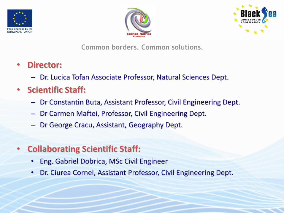
• Director: – Dr. Lucica Tofan Associate Professor, Natural Sciences Dept.
• Scientific Staff: – Dr Constantin Buta, Assistant Professor, Civil Engineering Dept.
– Dr Carmen Maftei, Professor, Civil Engineering Dept.
– Dr George Cracu, Assistant, Geography Dept.
• Collaborating Scientific Staff: • Eng. Gabriel Dobrica, MSc Civil Engineer
• Dr. Ciurea Cornel, Assistant Professor, Civil Engineering Dept.
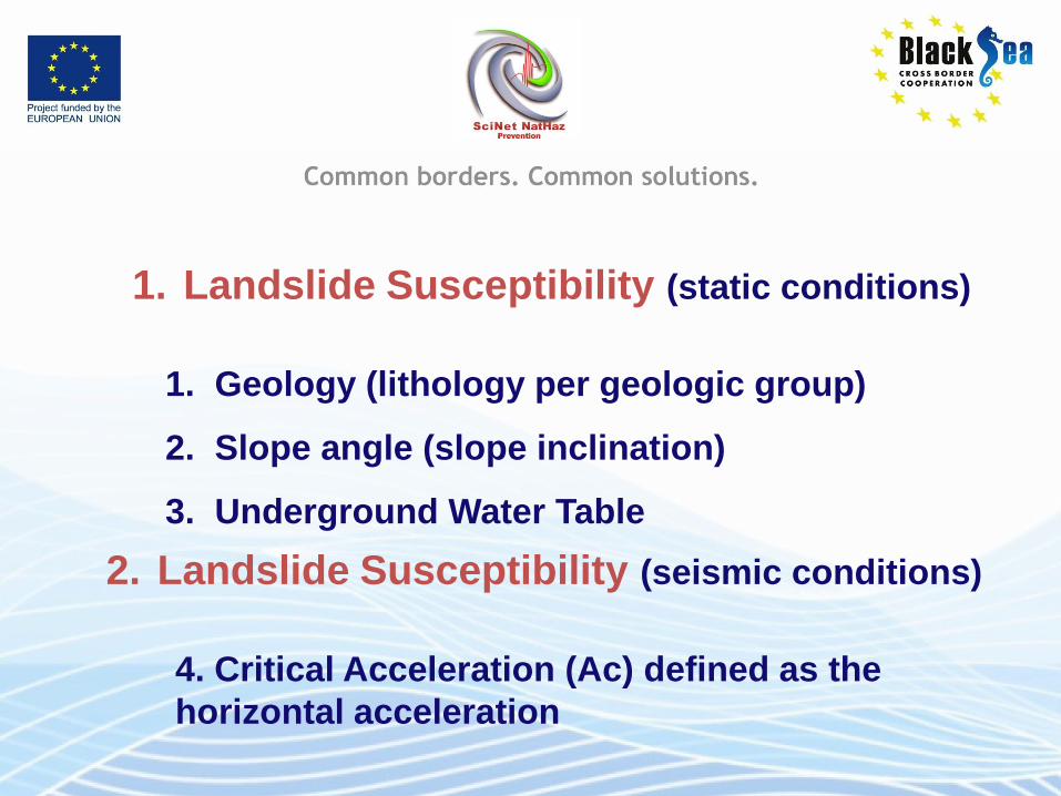
1. Geology (lithology per geologic group)
2. Slope angle (slope inclination)
3. Underground Water Table
1. Landslide Susceptibility (static conditions)
2. Landslide Susceptibility (seismic conditions)
4. Critical Acceleration (Ac) defined as the
horizontal acceleration
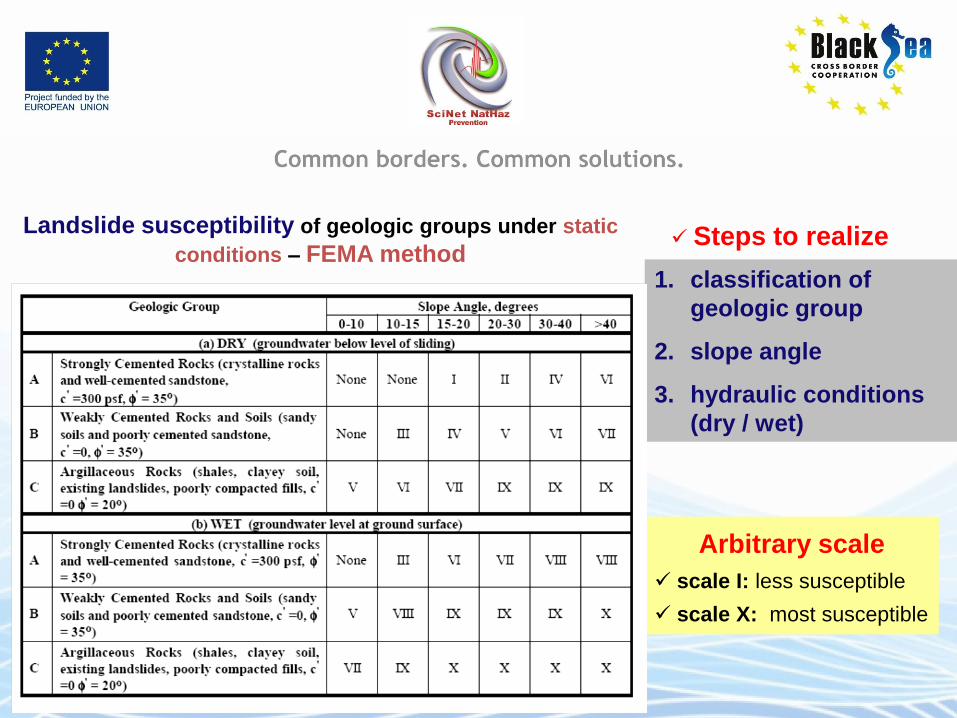
Landslide susceptibility of geologic groups under static
conditions – FEMA method Steps to realize
1. classification of
geologic group
2. slope angle
3. hydraulic conditions
(dry / wet)
Arbitrary scale
scale I: less susceptible
scale X: most susceptible
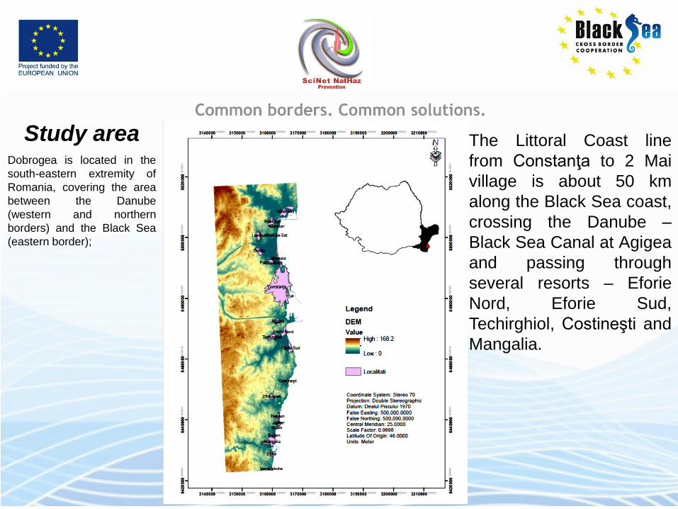
Study area Dobrogea is located in the
south-eastern extremity of
Romania, covering the area
between the Danube
(western and northern
borders) and the Black Sea
(eastern border);
The Littoral Coast line
from Constanţa to 2 Mai
village is about 50 km
along the Black Sea coast,
crossing the Danube –
Black Sea Canal at Agigea
and passing through
several resorts – Eforie
Nord, Eforie Sud,
Techirghiol, Costineşti and
Mangalia.

Geological map
This area includes three tectonic
units – Northern, Central and
Southern Dobrogea. The
tectonic units are separated by
two major crustal faults,
approximately oriented NW-SE:
Peceneaga-Camena (between
North and Central Dobrogea)
and Capidava-Ovidiu (between
Central and the Southern units).
The common feature of the
three units of Dobrogea is
the vast Quaternary cover,
having various thicknesses
loess layers.
There are in small
percentage: green schist,
limestone and redish clay
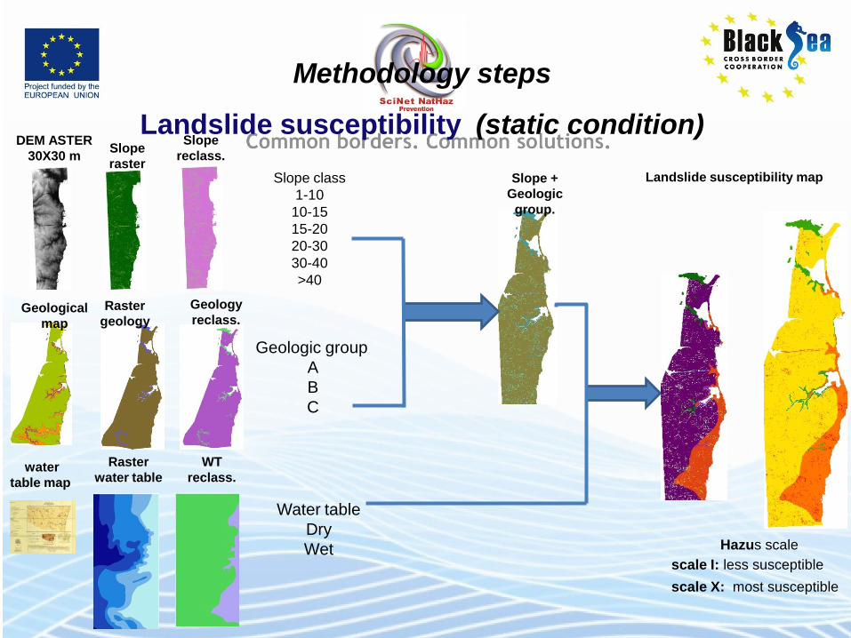
Methodology steps
Landslide susceptibility (static condition) DEM ASTER
30X30 m Slope
raster
Slope
reclass.
Geological
map
Raster
geology
Geology
reclass.
water
table map
Raster
water table
WT
reclass.
Slope +
Geologic
group.
Geologic group
A
B
C
Slope class
1-10
10-15
15-20
20-30
30-40
>40
Water table
Dry
Wet
Landslide susceptibility map
Hazus scale
scale I: less susceptible
scale X: most susceptible
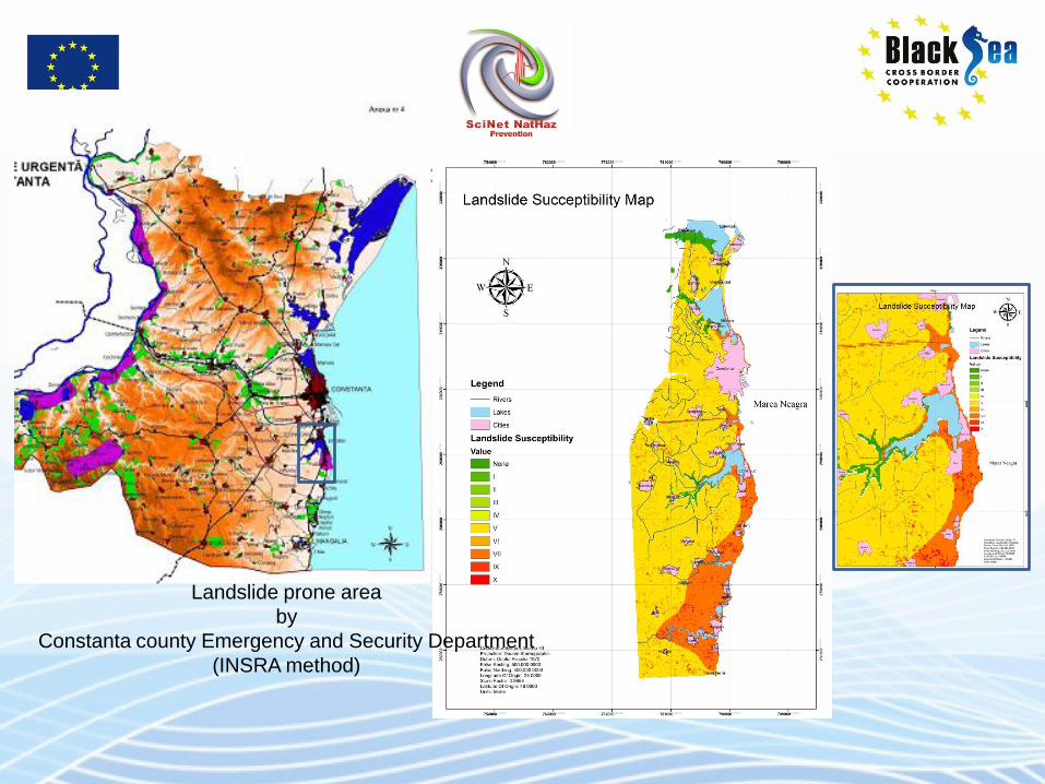
Landslide prone area
by
Constanta county Emergency and Security Department
(INSRA method)
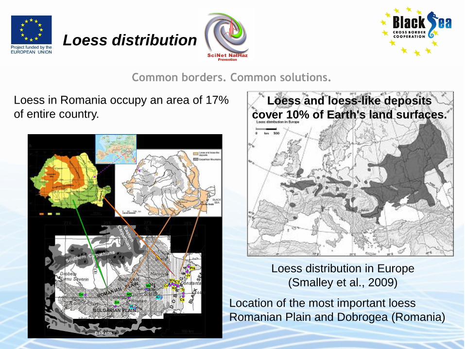
Loess distribution
Loess in Romania occupy an area of 17%
of entire country.
Loess distribution in Europe
(Smalley et al., 2009)
Location of the most important loess
Romanian Plain and Dobrogea (Romania)
Loess and loess-like deposits
cover 10% of Earth's land surfaces.
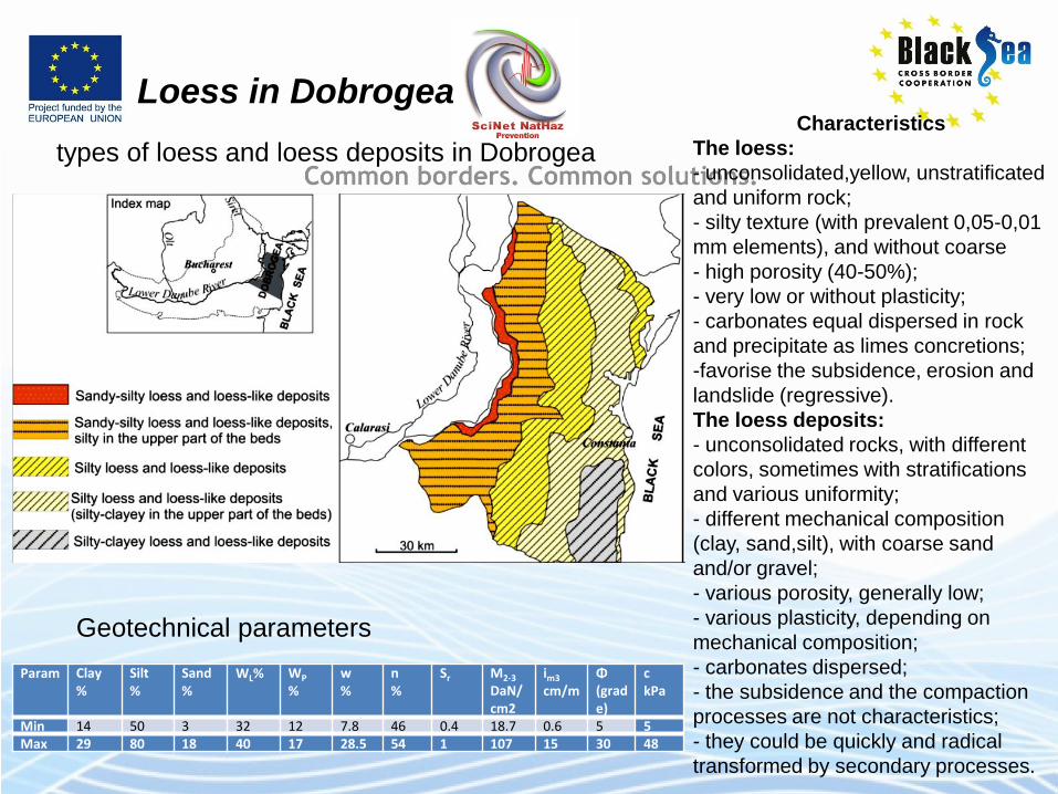
Loess in Dobrogea
types of loess and loess deposits in Dobrogea Characteristics
The loess:
- unconsolidated,yellow, unstratificated
and uniform rock;
- silty texture (with prevalent 0,05-0,01
mm elements), and without coarse
- high porosity (40-50%);
- very low or without plasticity;
- carbonates equal dispersed in rock
and precipitate as limes concretions;
-favorise the subsidence, erosion and
landslide (regressive).
The loess deposits:
- unconsolidated rocks, with different
colors, sometimes with stratifications
and various uniformity;
- different mechanical composition
(clay, sand,silt), with coarse sand
and/or gravel;
- various porosity, generally low;
- various plasticity, depending on
mechanical composition;
- carbonates dispersed;
- the subsidence and the compaction
processes are not characteristics;
- they could be quickly and radical
transformed by secondary processes.
Param Clay %
Silt %
Sand %
WL% WP %
w %
n %
Sr
M2-3 DaN/cm2
im3 cm/m
Φ (grade)
c kPa
Min 14 50 3 32 12 7.8 46 0.4 18.7 0.6 5 5
Max 29 80 18 40 17 28.5 54 1 107 15 30 48
Geotechnical parameters
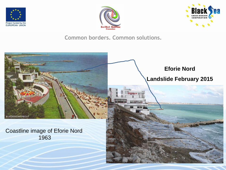
Eforie Nord
Landslide February 2015
Coastline image of Eforie Nord
1963
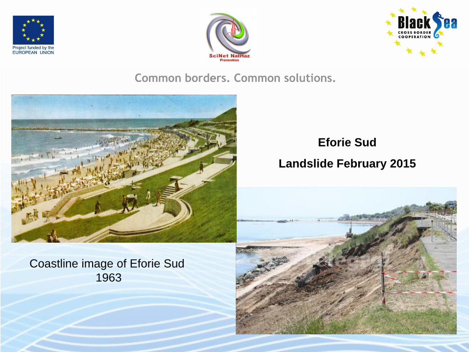
Coastline image of Eforie Sud
1963
Eforie Sud
Landslide February 2015
Thank you !