


Understanding Sriperumbudur | baseline social and economic indicators
Upload
igcsCategory
view
37download
1
21/04/2015
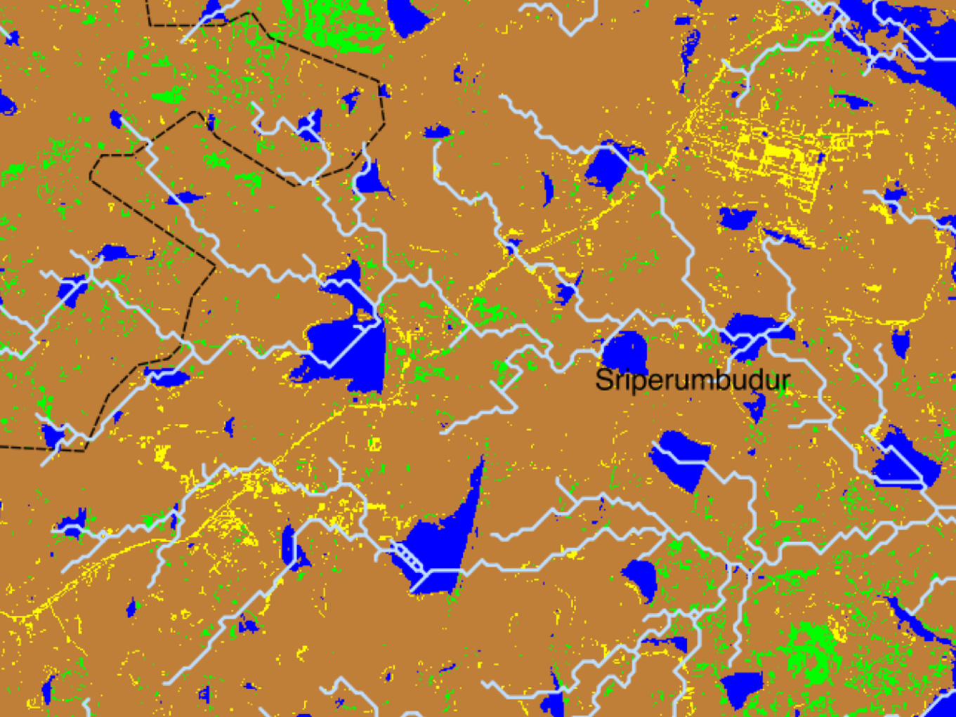
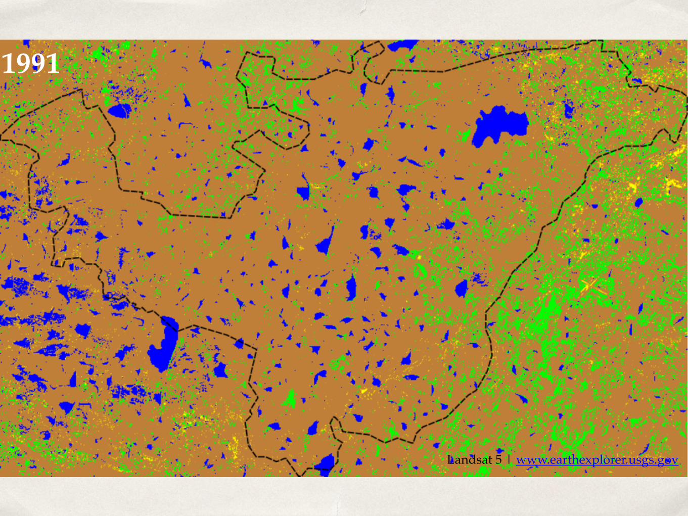
Sriperumbudur: Land-cover changes, spatial population trends and basic hydrology | Preliminary explorations using LANDSAT5, SRTM and Census data.Siddharth Hande

Land-cover changes 1991 | 2000 | 2009
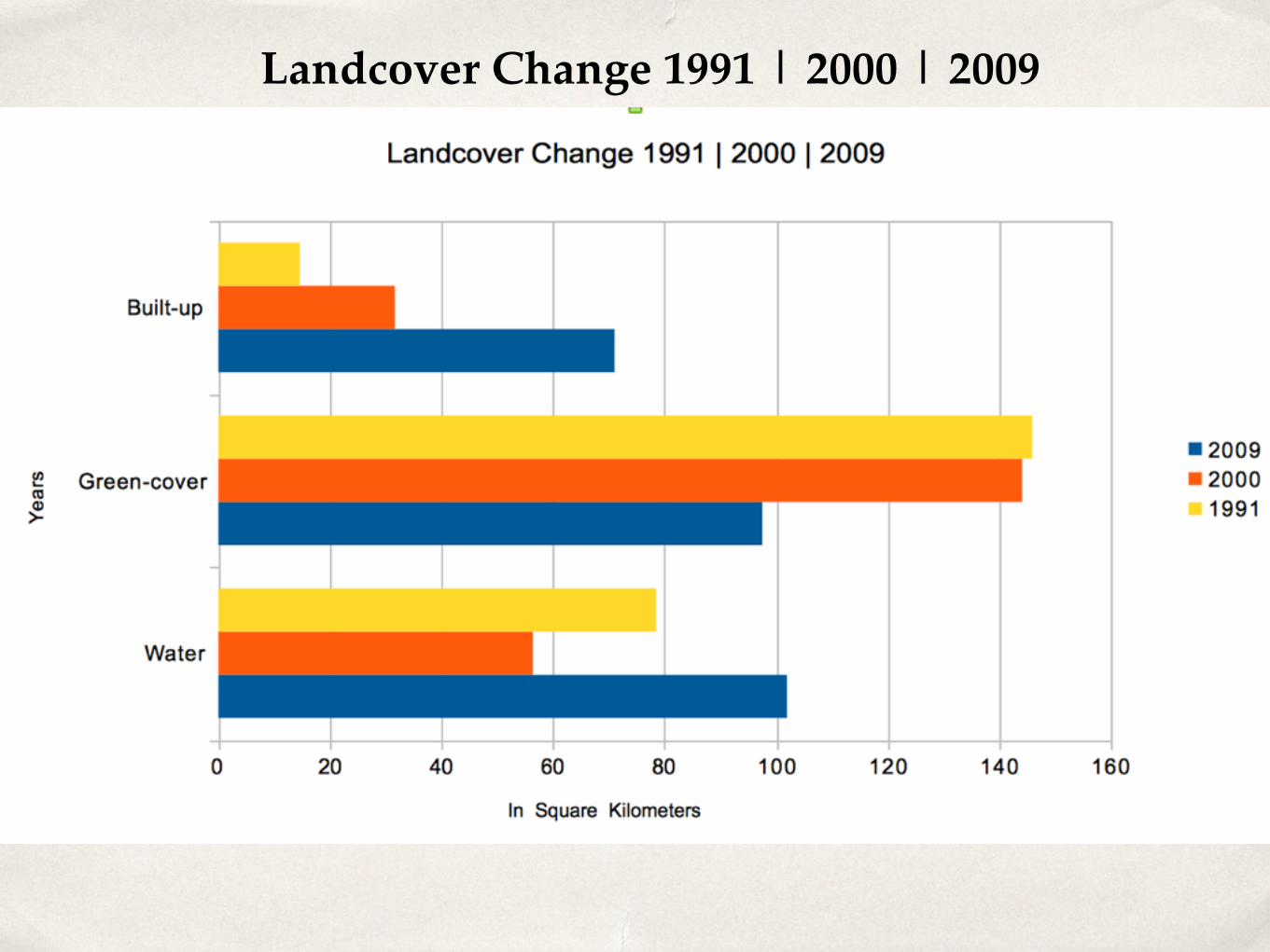
Landcover Change 1991 | 2000 | 2009

Spatial Population Trends
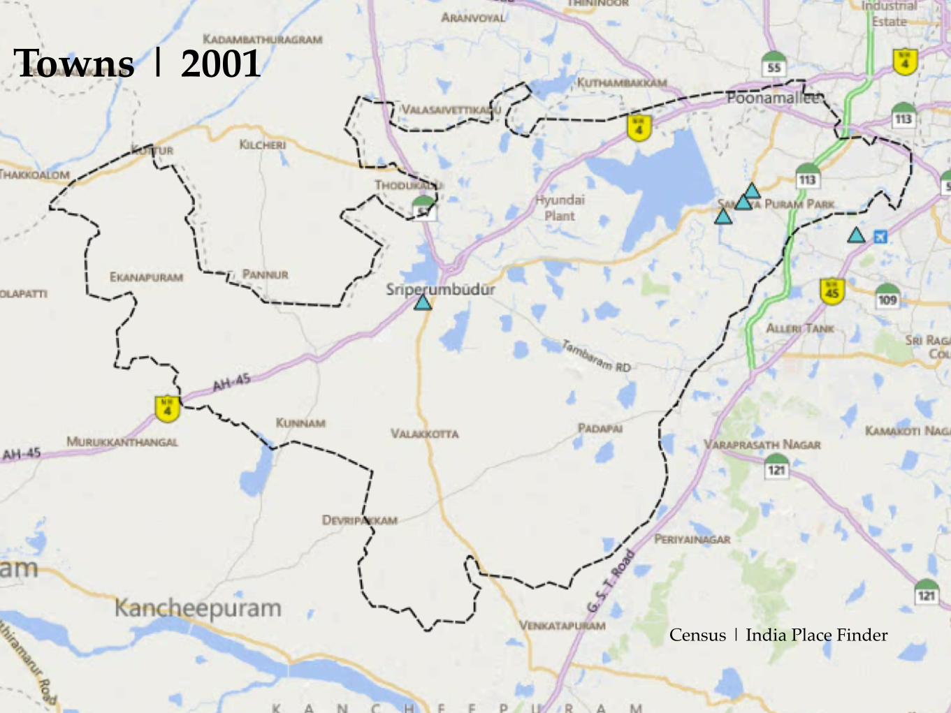
Towns | 2001
Census | India Place Finder
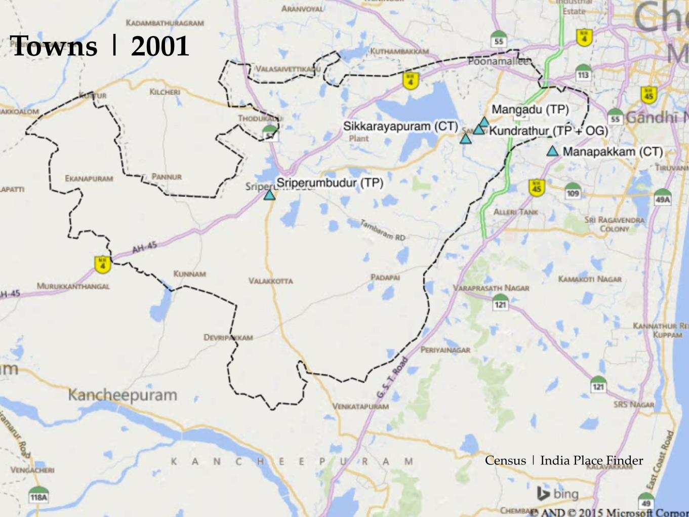
Towns | 2001
Census | India Place Finder
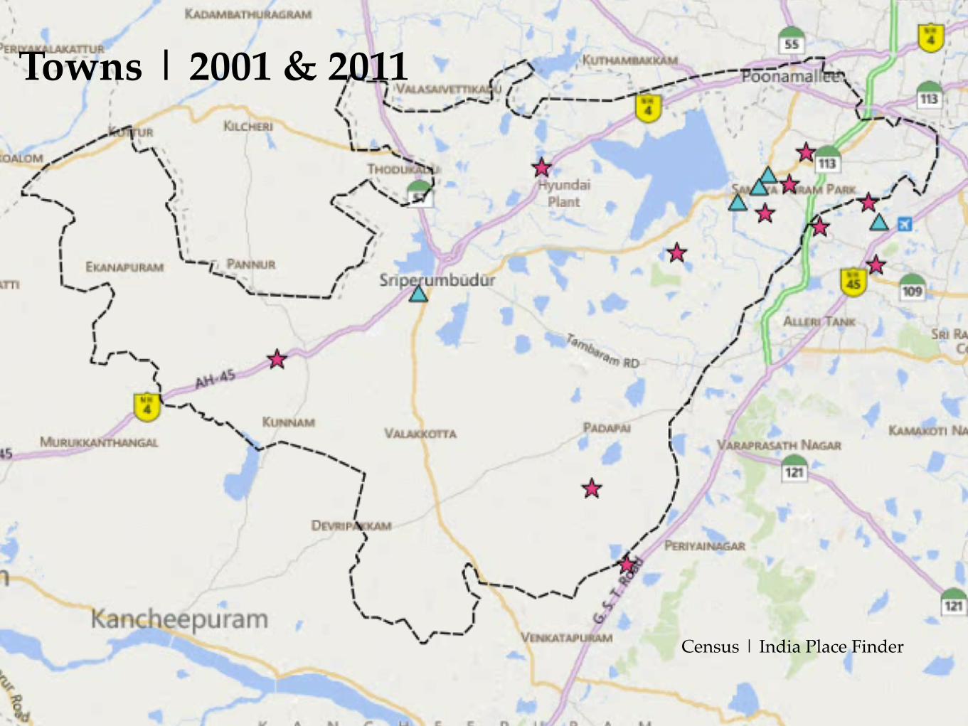
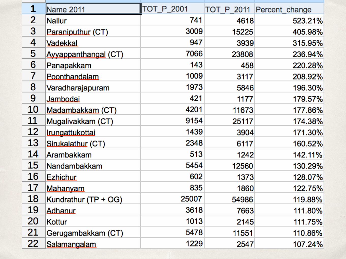
Towns | 2001 & 2011
Census | India Place Finder
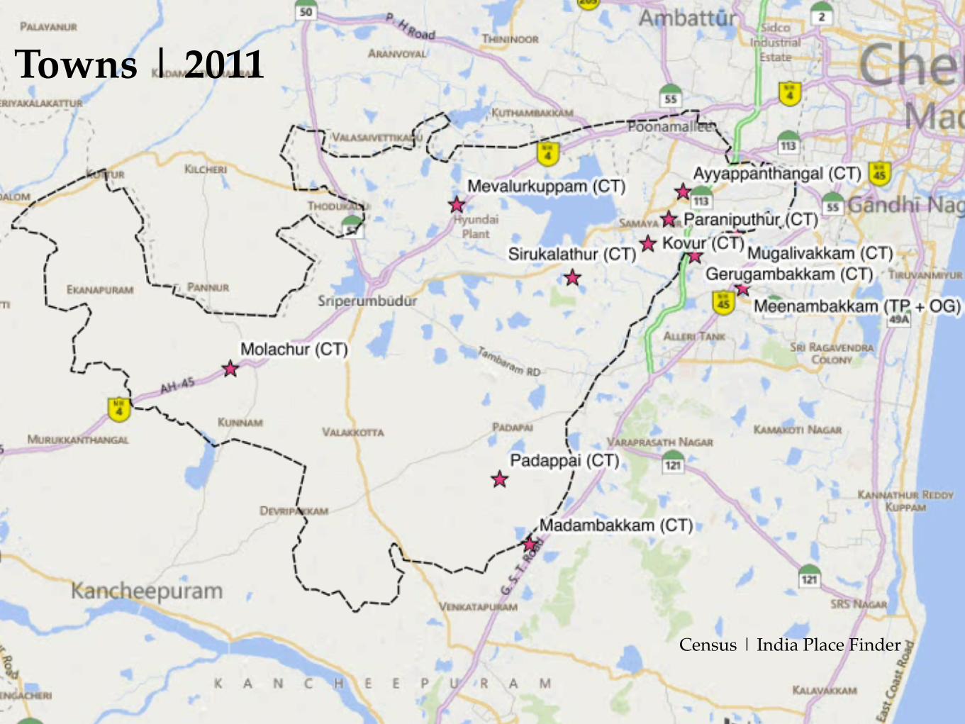
Towns | 2011
Census | India Place Finder

Towns | 2011 | CMA Boundary
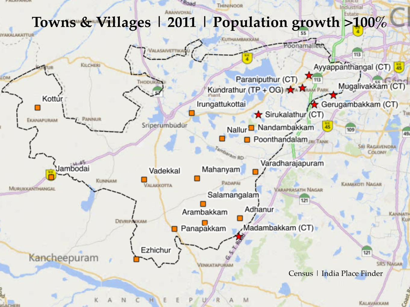
Towns & Villages | 2011 | Population growth >100%
Census | India Place Finder
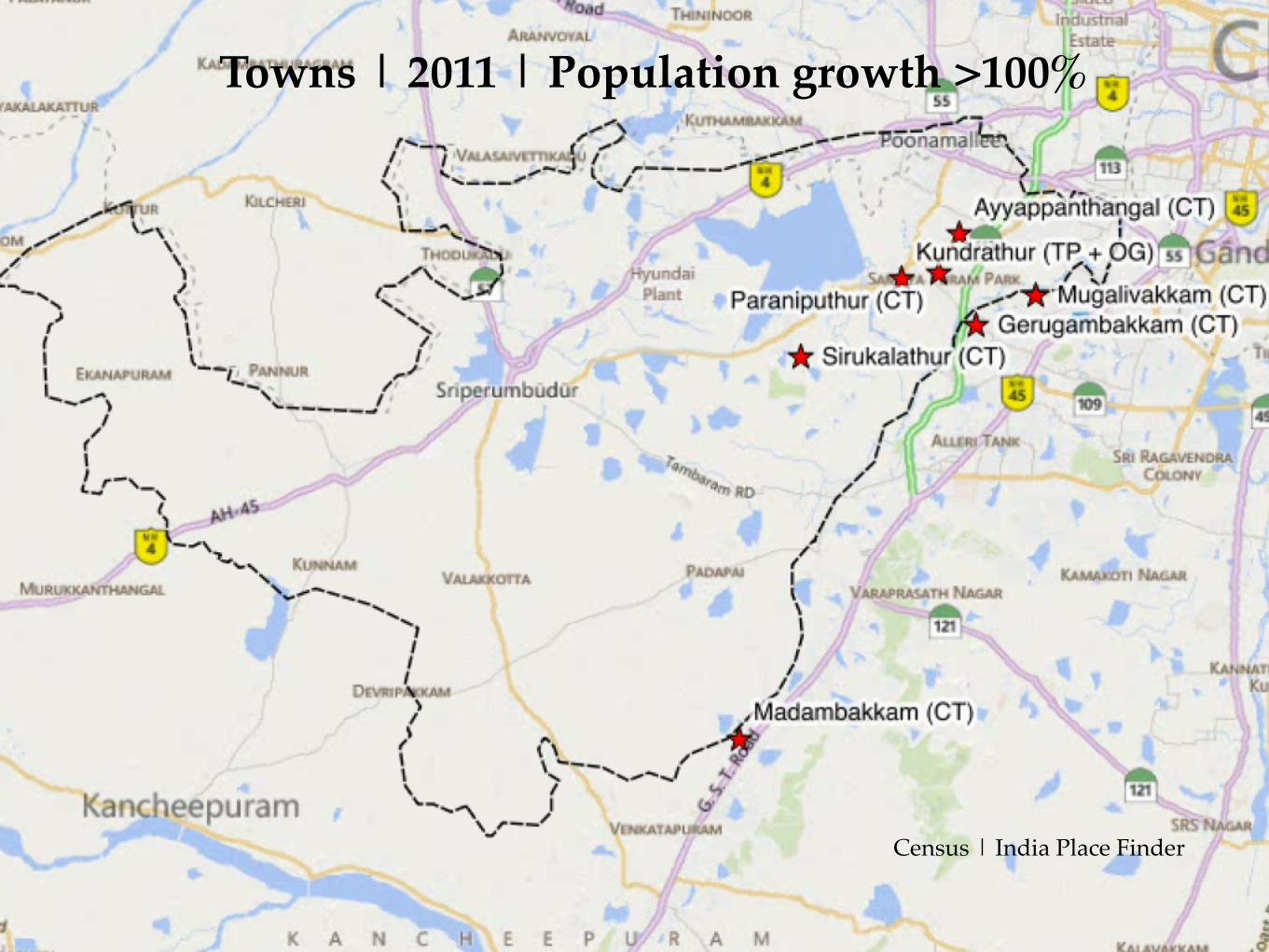
Towns | 2011 | Population growth >100%
Census | India Place Finder
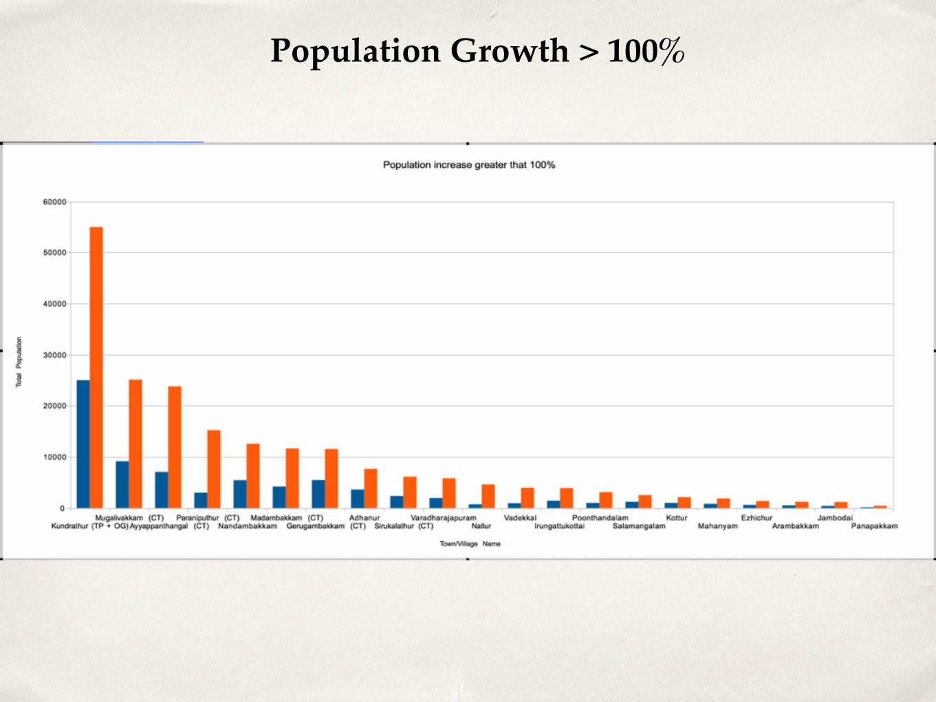
Population Growth > 100%

Hydrology
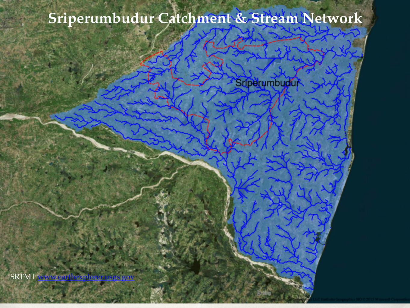
Sriperumbudur Catchment & Stream Network
SRTM| www.earthexplorer.usgs.gov
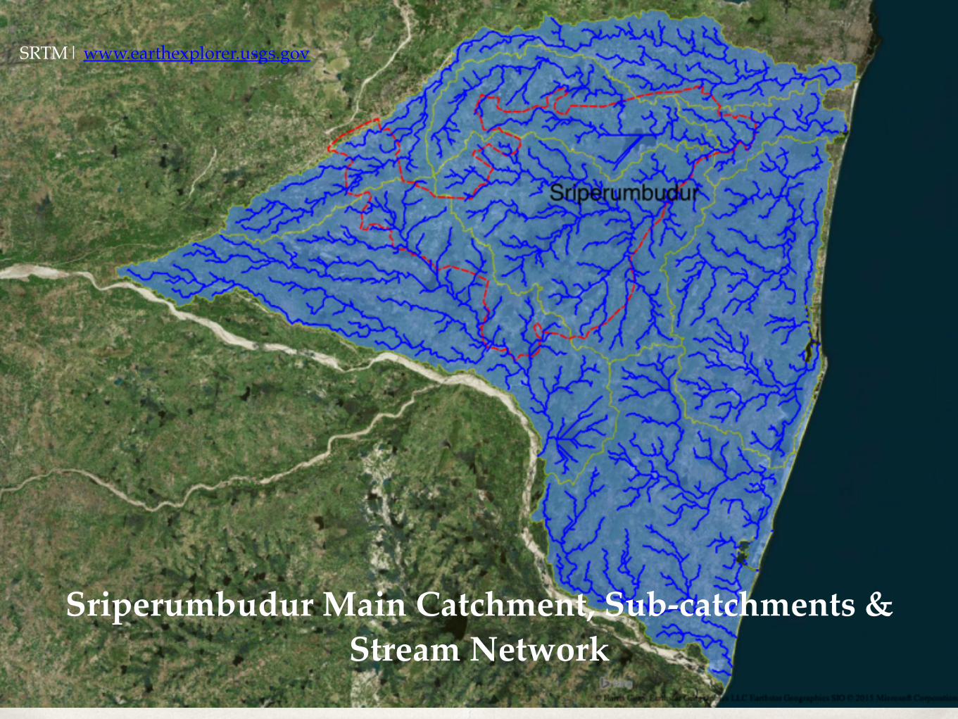
Sriperumbudur Main Catchment, Sub-catchments & Stream Network
SRTM| www.earthexplorer.usgs.gov
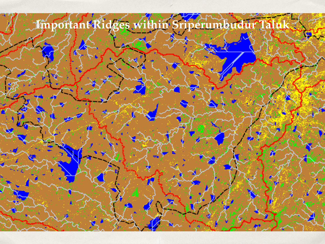
Important Ridges within Sriperumbudur Taluk