LAKE PONTCHARTRAIN CAUSEWAY & SOUTHERN TOLL PLAZA...
11
PHOTOGRAPHS WRITTEN HISTORICAL AND DESCRIPTIVE DATA FIELD RECORDS HAER LA-21-A HAER LA-21-A LAKE PONTCHARTRAIN CAUSEWAY & SOUTHERN TOLL PLAZA BRIDGE, CANOPY Causeway Boulevard Metairie Jefferson Parish Louisiana HISTORIC AMERICAN ENGINEERING RECORD National Park Service U.S. Department of the Interior 1849 C Street NW Washington, DC 20240-0001
Transcript of LAKE PONTCHARTRAIN CAUSEWAY & SOUTHERN TOLL PLAZA...
PHOTOGRAPHS
WRITTEN HISTORICAL AND DESCRIPTIVE DATA
FIELD RECORDS
HAER LA-21-AHAER LA-21-A
LAKE PONTCHARTRAIN CAUSEWAY & SOUTHERN TOLL PLAZABRIDGE, CANOPYCauseway BoulevardMetairieJefferson ParishLouisiana
HISTORIC AMERICAN ENGINEERING RECORDNational Park Service
U.S. Department of the Interior1849 C Street NW
Washington, DC 20240-0001

HISTORIC AMERICAN ENGINEERING RECORD
LAKE PONTCHARTRAIN CAUSEWAY
AND SOUTHERN TOLL PLAZA HAER LA-21-A
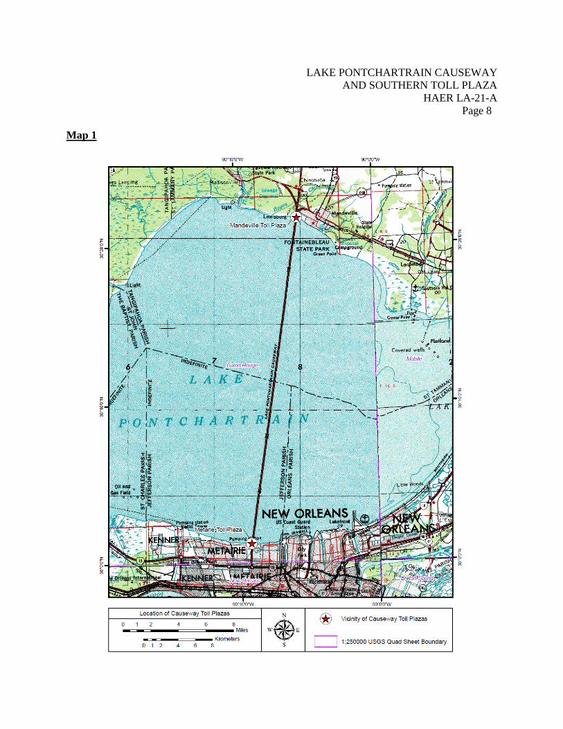
Location: The Lake Pontchartrain Causeway spans Lake Pontchartrain from Causeway Boulevard in Metairie, Jefferson Parish to Highway 190, Mandeville, St. Tammany Parish, Louisiana. The southern Toll Plaza was located at the Jefferson Parish terminus of the Lake Pontchartrain Causeway.
The southeast corner of the canopy was located at latitude 30.020556, longitude -90.154167. This coordinate represents the location of the southeast corner. This information was acquired using Google Earth imagery. There are no restrictions on the release of this information to the public.
Dates of Construction: The canopy was constructed in 1955-56 and demolished in 2011. Engineer: Palmer & Baker, Inc. designed the first span to almost exclusively consist
of identical panels, caps, and pilings. This allowed for all pieces of the bridge to be prefabricated off site, cutting costs and time needed to build such a large structure. The firm of Palmer & Baker, Inc. began as a one-man operation in 1939. Walter F. Palmer, then Vice-President of the firm of Wilberding & Palmer, moved to Mobile, Alabama, in 1939 to open the firm’s southern office. He was joined two years later by Robert Baker, a former chief engineer with Wilberding & Palmer.1 Palmer, a transportation engineer had substantial experience working with prefabricated concrete structures and brackish water. In 1938, the City of Mobile hired Palmer under a contract with the Works Progress Administration to construct the Bankhead Tunnel in Mobile Bay. Workers constructed seven sections of prefabricated, 10.4′ wide tubes at the Alabama Drydock and Shipbuilding Company, towed the sections one mile to the site, and installed.2 The mixture of fresh and salt water in the Bay caused challenges when ballasting the elements. When completed in 1950, the tunnel contained two one-way lanes of traffic equipped with hurricane protection gates.3
1 The Times-Picayune, “Engineer Firm Strarted in 1939,” 29 August 1956, 19.
Palmer also designed tunnels for Houston and Galveston.
2 The Palm Beach Post, August 28, 1948, 4. 3 Association Internationale des Tunnels et de L’Espace Souterrain-International Tunneling and Underground Space

LAKE PONTCHARTRAIN CAUSEWAY AND SOUTHERN TOLL PLAZA
HAER LA-21-A Page 2
The second span was designed by David Volkert & Associates. The Company was founded in New Orleans, Louisiana, in 1925 as Doullut & Ewin, Inc. as an engineering and construction company. The firm moved to Mobile, Alabama, and reorganized in 1946.4 Clients of the firm included the Cities of Mobile, Alabama; Pensacola, Florida; and New Orleans, Louisiana; the states of Alabama, Florida, Louisiana, and Tennessee; the U.S. Army Corps of Engineers; the Bureau of Aeronautics; and the Pure Oil Company.5 The firm again reorganized in 1963 to become David Volkert & Associates. Volkert & Associates personnel had experience with bridge construction, tunnel installation, and port development. By 1967, the firm had designed causeways and bascule bridges in Miami and Brevard County, Florida, and the Patpsco Avenue Bridge in Baltimore.6
Builder: The Louisiana Bridge Company, a joint venture between Brown & Root, Inc. of Houston, Texas, and the T.L. James Company of Ruston, Louisiana, implemented Palmer & Baker’s design for the Lake Pontchartrain Causeway. Like Palmer & Baker, Brown & Root, Inc. also had extensive experience with construction projects in salt water environments. In 1947, the firm built the first oil platform in the Gulf of Mexico beyond the sight of land. This feat led to the expansion of the offshore oil and gas industry worldwide.7 The T.L. James Company previously constructed Camp Ruston, a camp northwest of Ruston for the detention of European World War II prisoners of war.8
Following award of the contract, the Louisiana Bridge Company worked with the Raymond Concrete Pile Company to construct a yard in Mandeville near the planned site for the northshore Toll Plaza. All pieces of the bridge were produced at this location. The Raymond Concrete Pile Company utilized their concrete manufacturing technology to produce prestressed concrete cylinders which could withstand the corrosive conditions of Lake Pontchartrain.
Association, “Bankhead Tunnel, Mobile, Alabama” (2009). 4 David Volkert & Associates, Path to Success, 2012, http://www.volkert.com/history.htm (accessed 7 August 2012). 5 Ewin Engineering Corporation, “Ewin Engineering Corporation,” 1950, http://www.volkert.com/PDF%20Files/Ewin_Engineering%20Brochure_1925-1950.pdf (accessed & August 2012). 6 David Volkert & Associates, “David Volkert & Associates,” 1964, http://www.volkert.com/PDF%20Files/DVA_Historic_Brochure_1964.pdf (accessed 7 August 2012). 7 Joseph A. Pratt, Tyler Priest, and Christopher J. Castaneda. Offshore Pioneers: Brown & Root and the History of Offshore Oil and Gas (Houston: Brown & Root by Gulf Publishing Company: 1997), 1-3, 100-104. 8 Louisiana Tech University Special Collections, “Camp Ruston”, (2010).

LAKE PONTCHARTRAIN CAUSEWAY AND SOUTHERN TOLL PLAZA
HAER LA-21-A Page 3
In 1955, the Raymond Concrete Pile Company and the Louisiana Bridge Company built the facility for $6 million, employing approximately 750 workers. Engineers designed, planned, and built the plant to maximize efficiency in construction of the bridge. Workers dredged a canal from the Lake to the interior of the facility to facilitate loading materials on and off barges. Plant workers manufactured pilings on the east side of the plant and constructed spans on the western portion. Concrete mixing machines and spouts separated the two.
James E. Walters, a World War I veteran with a varied professional career, oversaw construction of the first Lake Pontchartrain Causeway. Walters was a sailor, rancher, and bronco-buster prior to becoming an engineer. He oversaw construction of the Pickwick Landing Dam on the Tennessee River during the Great Depression and spent much of World War II conducting aircraft salvage.9 Under Walters’ direction and utilizing prefabrication techniques, the first span was completed four months ahead of schedule.10
Construction on the second span began in June 1967. The GNOEC chose another joint Brown & Root-T.L. James & Company-Raymond International (formerly the Raymond Concrete Pile Company) called Prestressed Concrete Products, Inc. to build the span utilizing the same prefabrication techniques that had proven successful before.11 Prestressed Concrete Products, Inc. manufactured nearly all components of the second bridge at the plant in Mandeville and transported by barge to the construction site in Lake Pontchartrain.12
James E. Walters, project engineer for the first span, was by then Executive Vice-President of the Prestressed Concrete Pile Company and once again directed construction.
Original Owner and Use: Greater New Orleans Expressway Commission; canopy Last Owner and Use: Greater New Orleans Expressway Commission; canopy
9 The St. Tammany Farmer 31 August 1956:1 10 The Times-Picayune, August 31, 1956, “Motorcade Reaches St. Tammany End of Causeway”, 1. 11 The St. Tammany Farmer, May 10, 1969, “Dedication of Causeway’s Twin a Giant Safety Step.”, 19-20, 22. 12 Gulf Engineers & Consultants, Krebs, LaSalle, Lemieux Construction, Inc. [GEC-KLL], GNOEC Consulting Engineers’ Annual Report of the Lake Pontchartrain Causeway, 2-4.

LAKE PONTCHARTRAIN CAUSEWAY AND SOUTHERN TOLL PLAZA
HAER LA-21-A Page 4
Significance: The southern toll plaza of the Lake Pontchartrain Causeway included a
police building, toll booth, canopy, and administration building. When completed in 1956, the Lake Pontchartrain Causeway was the world’s longest bridge. This record was broken by completion of the parallel span in 1969. At 23.87 miles long, the Causeway is the world’s longest continuous span over water. The prestressed, pre-cast concrete structural system displays mid-twentieth century technology that typifies modern bridge construction techniques. In addition, the Causeway is significant in the development of the Jefferson and St. Tammany Parish communities and the expansion of the greater New Orleans area.
Description: The canopy at the southern Toll Plaza Complex (HAER LA-21-A) was the
original canopy installed when the first span was constructed in 1956. (Figures 1, 2) The southshore canopy consisted of four flared columns supporting a flat roof which span all lanes of northbound traffic. The lanes measure approximately 20′-0″. (Figure 3) Employees of the Louisiana Bridge Company built the structure of reinforced concrete supported by 14′-0″ columns with creosote-treated wood piles beneath grade.13 The Greater New Orleans Expressway Commission (GNOEC) limited vehicles to 13′-6″, although the distance from grade to the bottom of the canopy was 15′-0″.14
Although limited, elements of the International Style of architecture are visible in the original Toll Plaza canopies. International Style developed within the Modernist movement of the 1920s and 1930s. The moniker came from a 1932 exhibit of “Modern Architecture” at the Museum of Modern Art in New York City.15
International Style used skeleton frames and unadorned, “modern” materials to express a feeling of balance and functionalism. Buildings most often featured flat roofs and bands of horizontal windows. Unlike the Art Deco movement which reveled in height and decoration, architects within the International movement preferred a simple, horizontal design, even when constructing skyscrapers. The flat roof, horizontal design, and visible use of concrete are hallmarks of the International Style visible in the original Toll Plaza canopies.
13 Palmer & Baker, Inc., Plans,23. 14 GNOEC 2010. 15 Poppeliers, John C., S. Allen Chambers, Jr., Nancy B. Schwartz. What Style is It? A Guide to American Architecture. Building Watchers Series, Historic American Building Survey, (New York: National Trust for Historic Preservation by John Wiley & Sons, Inc., 1983), 62.

LAKE PONTCHARTRAIN CAUSEWAY AND SOUTHERN TOLL PLAZA
HAER LA-21-A Page 5
History: One of the most iconic features of the canopy is not original to the
structure. The red “Lake Pontchartrain Causeway” sign was not included in plans for the canopy. More than 600 cars jammed the Causeway on opening day, August 30, 1956, for the opportunity to pay a toll under the canopy and be among the first to cross the world’s longest bridge. Originally, three traffic lights, one for each, flashed green or red to alert motorists of open toll lanes. The GNOEC added the signage to the southshore canopy sometime in the six years following the bridge’s construction.16
Sources: American Public Works Association. “The Lake Pontchartrain Causeway…. A “Dream” of a
Bridge.” August 1962. Available in the vertical files of the City Archives, New Orleans. Association Internationale des Tunnels et de L’Espace Souterrain-International Tunneling and
nderground Space Association. “Bankhead Tunnel, Mobile, Alabama.” 2009. Accessed April 28, 2010. www.its-aites.org.
David Volkert & Associates. Path to Success. 2012. Accessed August 7, 2012. ,
http://www.volkert.com/history.htm. --. “David Volkert & Associates.” 1964. Accessed August 7, 2012.
http://www.volkert.com/PDF%20Files/DVA_Historic_Brochure_1964.pdf. Ewin Engineering Corporation. “Ewin Engineering Corporation.” 1950. Accessed August 7, 2012.
http://www.volkert.com/PDF%20Files/Ewin_Engineering%20Brochure_1925-1950.pdf. Greater New Orleans Expressway Commission. 1st Year Report of the Greater New Orleans
Expressway Commission, 1955-1956. 1956. Available at the St. Tammany Parish Public Library.
Greater New Orleans Expressway Commission. Dedication and Formal Opening Lake
Pontchartrain Causeway, Thursday, August 30, 1956 Jefferson Parish-St. Tammany Parish. 1956. Available in vertical files, New Orleans Public Library.
16 American Public Works Association. “The Lake Pontchartrain Causeway…. A “Dream” of a Bridge.” August 1962, 20.
LAKE PONTCHARTRAIN CAUSEWAY AND SOUTHERN TOLL PLAZA
HAER LA-21-A Page 6
Gulf Engineers & Consultants and Krebs, LaSalle, LeMieux Construction, Inc. GNOEC Consulting
Engineers’ Annual Report of the Lake Pontchartrain Causeway. 1996. Available at the St. Tammany Parish Public Library.
Historic photos in the collection of the Greater New Orleans Expressway Commission. Palm Beach Post, August 28, 1948. Accessed April 28, 2010. www.news.google.com. Palmer & Baker, Inc., Plans for the Lake Pontchartrain Causeway and associated Toll Plazas,
1953-56. Available in the collection of the Greater New Orleans Expressway Commission.
Poppeliers, John C., S. Allen Chambers, Jr., Nancy B. Schwartz. What Style is It? A Guide to
American Architecture. Building Watchers Series, Historic American Building Survey. New York: National Trust for Historic Preservation by John Wiley & Sons, Inc., 1983.
Pratt, Joseph A., Tyler Priest, and Christopher J. Castaneda. Offshore Pioneers: Brown & Root
and the History of Offshore Oil and Gas. Houston: Brown & Root by Gulf Publishing Company: 1997. Accessed April 28, 2010. www.books.google.com.
The St. Tammany Farmer, August 31, 1956, “Once a Chauffeur, Now a Big Construction Man.”.
Available on microfilm, Covington Branch of St. Tammany Parish Library System. ---. May 10, 1969, “Dedication of Causeway’s Twin a Giant Safety Step.” Available on
microfilm, Covington Branch of St. Tammany Parish Library System. The Times-Picayune, August 29, 1956. “Engineer Firm Started in 1939.” Available online through
subscription database, accessed August 7, 2012. www.nola.com/t-p/.
--. August 31, 1956, “Pontchartrain’s 24-Mile Span is Formally Opened to Traffic.” Available on microfilm, East Bank Regional Library, Jefferson Parish Public
Library system.
---. May 10, 1969, “Over 19 Million Vehicles Have Crossed Bridge.” New Orleans, Louisiana. Available on microfilm, East Bank Regional Library, Jefferson Parish Public Library
System. Historian: Kelly Sellers Wittie, R. Christopher Goodwin & Associates, Inc. Project Information: Following the unprecedented damage caused by Hurricanes Katrina and
Rita, the U.S. Army Corps of Engineers (USACE) committed to a 100

LAKE PONTCHARTRAIN CAUSEWAY AND SOUTHERN TOLL PLAZA
HAER LA-21-A Page 7
year level of protection in southeast Louisiana. This project calls for the construction and floodwall improvements along the south shore of Lake Pontchartrain as part of the Hurricane Storm Damage Risk Reduction System. In 2009, the USACE determined these improvements will produce an adverse effect on the Lake Pontchartrain Expressway and the southern Toll Plaza, properties determined to be eligible for inclusion in the National Register of Historic Places. In accordance with Section 106 of the National Historic Preservation Act (36 CFR Part 800), the USACE executed a Memorandum of Agreement (MOA) with the Louisiana State Historic Preservation Officer, Greater New Orleans Expressway Commission (GNOEC), and the Coastal Protection and Restoration Authority of Louisiana. As part of the MOA, USACE agreed to document the Lake Pontchartrain Bridge and the structures of the Southern Toll Plaza and prepare an accompanying narrative history.
In December 2011, the USACE implemented the plan to improve floodwall protections on Lake Pontchartrain at the Causeway. Since that time, the USACE has demolished the buildings of the southern Toll Plaza and constructed an elevated bridge section to route drivers from Causeway Boulevard in Metairie onto the historic bridge. These alterations allow the USACE to complete a 15′ floodwall along the lakeshore to protect the greater New Orleans metro area from flooding.
LAKE PONTCHARTRAIN CAUSEWAY AND SOUTHERN TOLL PLAZA
HAER LA-21-A Page 8
Map 1

LAKE PONTCHARTRAIN CAUSEWAY AND SOUTHERN TOLL PLAZA
HAER LA-21-A Page 9
Map 2

LAKE PONTCHARTRAIN CAUSEWAY AND SOUTHERN TOLL PLAZA
HAER LA-21-A Page 10
Map 3