Cymothoidae from Fishes of Kuwait (Arabian Gulf) (Crustacea ...
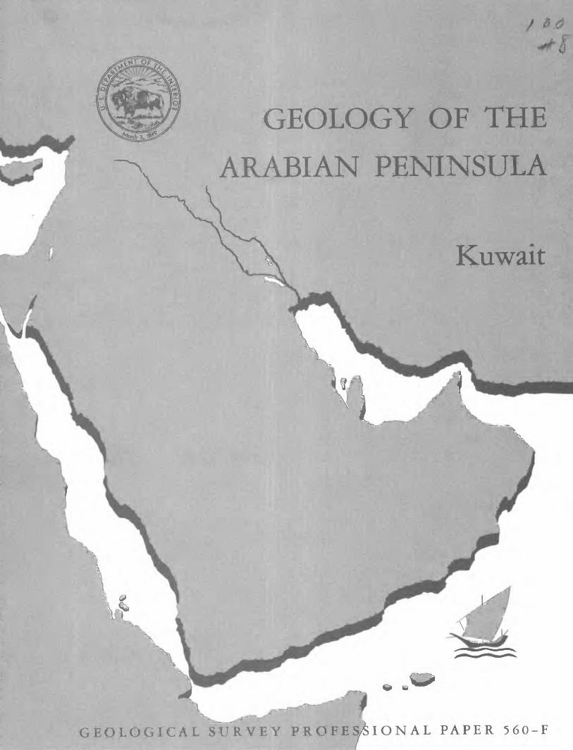
PENINSULA
Kuwait
SURYEY PROBES/SIGNAL PAPER 560-F
Geology of the Arabian PeninsulaKuwaitBy D. I. MILTON
GEOLOGICAL SURVEY PROFESSIONAL PAPER 560-F
A review of the surface geology of Kuwait as
shown on USGS Miscellaneous Geologic Investi
gations Map I-2?O A, "Geologic Map of the
Arabian Peninsula" 1963
UNITED STATES GOVERNMENT PRINTING OFFICE, WASHINGTON : 1967
UNITED STATES DEPARTMENT OF THE INTERIOR
STEWART L. UDALL, Secretary
GEOLOGICAL SURVEY
William T. Pecora, Director
For sale by the Superintendent of Documents, U.S. Government Printing Office Washington, D.C. 20402 - Price 20 cents (paper cover)
FOREWORDThis volume, "The Geology oj the Arabian Peninsula" is a logical consequence of the
geographic and geologic mapping project of ^he Arabian Peninsula, a cooperative venture between the Kingdom of Saudi Arabia and the Government of the United States. The Arabian- American Oil Co. and the U.S. Geological Survey did the fieldwork within the Kingdom of Saudi Arabia, and, with the approval of the governments of neighboring countries, a number of other oil companies contributed additional mapping to complete the coverage of the whole of the Arabian Peninsula. So far as we are aware, this is a unique experiment in geological cooperation among several governments, petroleum companies, and individuals.
The plan for a cooperative mapping project was originally conceived in July 1953 by the late William E. Wrather, then Director of the U.S. Geological Survey, the late James Terry Duce, then Vice President of Aramco, and the late E. L. deGolyer. George Wadsworth, then U.S. Ambassador to Saudi Arabia, and Sheikh Abdullah Sulaiman, then Minister of Finance of the Government of Saudi Arabia, lent their support to the plan. In November of the follow ing year, 1954, Director Wrather approved the U.S. Geological Survey's participation and designated G. F. Brown responsible for the western Arabian shield region in which he had previously worked under U.S. foreign-aid programs. In January 1955 F. A. Davies, Chairman, Board of Directors, Arabian-American Oil Co., approved Aramco's participation and appointed the late R. A. Bramkamp, chief geologist, responsible for compilation of the area within the Kingdom where the sediments crop out. This responsibility fell to L. F. Ramirez following the death of R. A. Bramkamp in September 1958.
R. A. Bramkamp and G. F. Brown met in New York in February 1955 and planned the program, including scales of maps, areas of responsibility, types of terrain representation, and bilingual names. Thus there was established a cooperative agreement between the King dom of Saudi Arabia, the U.S. Department of State, and the Arabian-American Oil Co. to make available the basic areal geology as mapped by Aramco and the U.S. Geological Survey.
The agreement specified publication of a series of 21 maps on a scale of 1:500,000, each map covering an area 3° of longitude and 4° of latitude. Separate geologic and geographic versions were to be printed for each of the quadrangles; both versions were to be bilingual in Arabic and English. A peninsular geologic map on a scale of 1:2,000,000 was to conclude the project.
High-altitude photography, on a scale of 1:60,000, of the Kingdom of Saudi Arabia was initiated during 1949 by the Aero Service Corp. and completed in 1959. Both third-order vertical and horizontal control and shoran were utilized in compiling the photography. This controlled photography resulted in highly accurate geographic maps at the publication scale which then served as a base for the geologic overlay. The topography of the sedimentary areas was depicted by hachuring and that of the shield region by shaded relief utilizing the airbrush technique.
The first geographic quadrangle was published in July 1956 and the last in September 1962. While preparation of the geographic sheets was in progress, a need arose for early publication of a l:2,000,000-scale peninsular geographic map. Consequently, a preliminary edition was compiled and published in both English and Arabic in 1958. The second edition, containing additional photography and considerable new topographic and cultural data, was published in 1963. The first of the geologic map series was published in July 1956 and the final sheet in early 1964. The cooperative map project was completed in October 1963 with the publication of the 1:2,000,000-scale "Geologic Map of the Arabian Peninsula" (Miscel laneous Geologic Investigations Map 1-270 A).
ni
IV FOREWORD
As work on the quadrangles progressed, geologists, companies, and governments working in areas adjacent to the Kingdom of Saudi Arabia were consulted by Aramco and invited to participate in the mapping project. The number of cooperating participants was expanded to 11, which included the operating oil companies in the peninsula and which are identified elsewhere in this text; the Overseas Geological Surveys, London; the Government of Jordan; F. Geukens, who had worked in Yemen; and Z. K. Beydoun, who had studied the Eastern Aden Protectorate. With the close cooperation of the authors, the new data were added to data already plotted on the base map of the Arabian Peninsula.
As the geological coverage of the peninsular map grew, the need for a text to accompany the map became apparent to both the U.S. Geological Survey and the Aramco geologists. Exploratory conversations were begun by Aramco with companies working in the other countries of the Arabian Peninsula for their participation in the preparation of a monograph on the geology of the Arabian Peninsula. Each author prepared a description of the geology of the area for which he was responsible, as shown in the sources of geologic compilation diagram" on the peninsular map. The U.S. Geological Survey undertook the publishing of the volume as a professional paper, and the Government of Saudi Arabia was to finance its printing. It was early agreed that there would be no effort to confine the contributions to a standard format and that no attempt would be made to work out an overall correlation chart other than shown on the "Geologic Map of the Arabian Peninsula." Thus, the individual style of authors of several nationalities is preserved.
Cooperation and relations have been of the highest order in all phases of the work. The project would not have been possible without the full support of the U.S. Department of State, the Kingdom of Saudi Arabia, and all contributors. In fact, the funds which made publi cation of this volume possible were contributed by the Saudi Arabian Government.
The data provided by the maps and in the professional paper provide information for an orderly scientific and economic development of a subcontinent.
O. A. SfcfGER,
Arabian-American Oil Co. (Retired).
W. D. Jfc^rfsTON, JR., \S Former Chief, Foreign Geology Branch,
£7.$. Geological Survey.
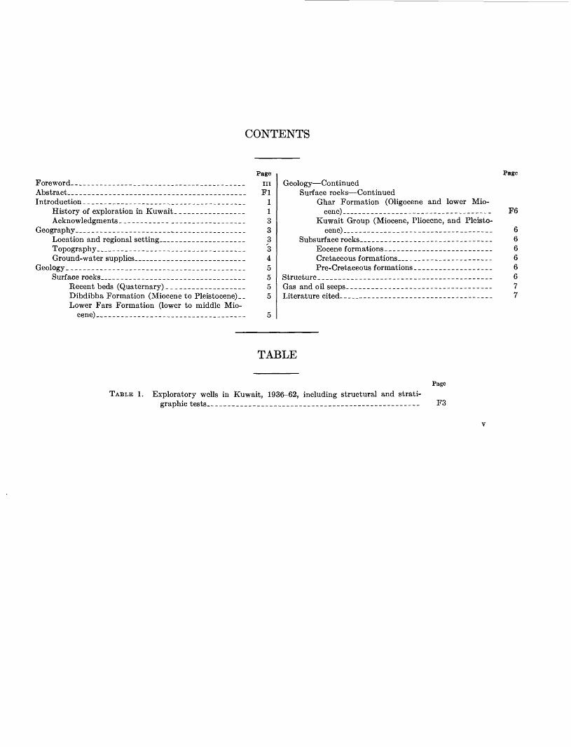
CONTENTS
Foreword--_-_-_____--_-____-_____-____-_____-_____Abstract.__________________________________________Introduction _______________________________________
History of exploration in Kuwait _________________Acknowledgments ____________ __________________
Geography_ _______________________________________Location and regional setting___________________Topography_ _________________________________Ground-water supplies.________________________
Geology ___________________________________________Surface rocks___________________________________
Recent beds (Quaternary)___________________Dibdibba Formation (Miocene to Pleistocene) __ Lower Fars Formation (lower to middle Mio
cene) ____________________________________
Page
inFl
11333345555
Geology ContinuedSurface rocks Continued
Ghar Formation (Oligocene and lower Mio- cene)_..__.._
Kuwait Group (Miocene, Pliocene, and Pleisto- cene) _ _____________--_----___-___----__
Subsurface rocks_______-____--__----_-----_---_-Eocene formations. ____--___--__-__------__-Cretaceous formations _ ____________________Pre-Cretaceous formations ___________________
Structure______---_----_-_--_----------------------Gas and oil seeps- -__-__--_____------_------_-------Literature cited. _________-__________---_----_-_-_-_-
Page
F6
66666677
TABLE
TABLE 1. Exploratory wells in Kuwait, 1936-62, including structural and strati- graphic tests. --__-________-__-_______---_____----_------_------
Page
F3

GEOLOGY OF THE ARABIAN PENINSULA
KUWAIT
By D. I. MILTON x
ABSTRACT
Kuwait has a desert topography of low to moderate relief. Only in the Jal-Az-Zor escarpment can the relief be termed bold. Bocks ranging in age from early Miocene to Recent are exposed within the boundaries of Kuwait. Low dips and similarity of lithology make correlation of formations difficult. Maximum thicknesses of 3,200 feet of Eocene beds, 10,000 feet of Cretaceous beds, and 4,500 feet of Jurassic beds have been penetrated by the drill, and one well was drilled 427 feet into beds of Triassic age. Gentle folds are present within Kuwait, and apparently these folds, with the exception of those in eastern Kuwait aris ing from the Zagros orogeny, have been steadily growing since at least middle Cretaceous time. Oil and gas seeps are present at Bahra, bitumen at Burgan, and gas at Magwa. Relatively little potable water has been discovered within the State, but large volumes of brackish water are available.
INTRODUCTION
HISTORY OP EXPLORATION IN KUWAIT
Interest in the oil possibilities of Kuwait began in 1914 with the visit of S. L. James, who held a British Admiralty commission. He described the seepages at Bahra and Burgan and recommended that shallow wells be drilled to define any structures associated with these seeps. Additional investigations of Kuwait were made in 1917 by S. L. James and G. W. Halse; in 1926, by B. K. N. Wyllie and A. G. H. Mayhew; in 1931, by T. Dewhurst; and in 1931-32, by P. T. Cox.
Negotiations by American and British oil companies for a concession in Kuwait began in 1929. These nego tiations were not successful until 1934 when after the formation of the Kuwait Oil Co., Ltd., a British cor poration a concession was granted on December 23. The Kuwait Oil Co., Ltd., of which 50 percent is owned by the Gulf Oil Corp. and 50 percent by British Petro leum Co. Ltd., was granted exclusive rights to explore and produce oil in Kuwait by His Excellency Shaikh Ahmad Al Jabir Al Sabah, the late Euler of Kuwait. The concession was for 75 years and covered the whole
1 Of the Kuwait Oil Co., Ltd.
of Kuwait State, including all islands and territorial waters up to 6 nautical miles offshore from the low- water mark.
In 1951, with the consent of His Excellency Shaikh Abdulla Al Sabah, Ruler of Kuwait, the rights and obligations under the concession were assigned by the Kuwait Oil Co., Ltd., to the owning companies the Gulf Kuwait Co., a wholly owned subsidiary of Gulf Oil Corp., and BP (Kuwait) Ltd., a wholly owned sub sidiary of British Petroleum Co. Ltd. each being vested with an undivided half interest therein; the Kuwait Oil Co., Ltd., was appointed as a purely operat ing company to manage and carry on the work under the concession on behalf of the owners. In that same year the Concession Agreement was extended by 17 years (and now expires in the year 2026), and the own ing companies renounced all claims that the concession covered the islands of Kubar, Qaru, or Umm al Maradim.
In 1962, the owners relinquished their exploration rights to approximately half of the area covered by the original concession.
In the winter of 1931-32, two prospect holes were drilled by the Anglo-Persian Oil Co., Ltd. One was near Bahra on the north shore of Kuwait Bay and the other near the oil seeps at Burgan. Both of these holes were shallow and only partly penetrated the Miocene sands which occur at the surface. On March 16, 1935, after the Concession Agreement had been signed, a geo logical party composed of R. O. Rhoades and G. H. Growl of Gulf Oil Corp. arrived in Kuwait. They were accompanied by G. M. Shaw of Anglo-Iranian Oil Co., Ltd., and later P. T. Cox of the same company joined the party. A preliminary survey was made, and then Shaw and Cox returned to Iran on March 24. From the beginning of April to May 20,1935, Rhoades and Growl made detailed surveys in the vicinity of Bahra where oil and gas seeps are present, in the M'dairah district,
Fl
F2 GEOLOGY OF THE ARABIAN PENINSULA
and reexamined in more detail the Th'ar Ridge which is now called the Ahmadi Ridge. Cox returned to Kuwait from May 27 to June 3,1935, and in conjunction with Rhoades compiled a report covering these surveys. This report recommended that deep wells be drilled near the sites of the three seepages at Bahra, Burgan, and Madaniyat.
Evidence obtained during the geological surveys in dicated a gentle anticline in the Miocene beds at Bahra (Fox, 1956). It was recommended that an exploratory well to test the Eocene and Cretaceous formations be drilled at the crest of this anticline. Bahra 1, which was the first wildcat well within Kuwait, was spudded on May 30, 1936.
It was hoped that a stratigraphic succession similar to that at Bahrain would be penetrated. Geological in formation from Bahra 1 showed that broad lithological similarities between this well and Bahrain were present although the individual formations had thickened con siderably in the Bahra area. In April 1937, Bahra 1 reached the total depth of 7,950 feet in sandstones of middle Cretaceous age. These sandstones can be cor related with the lower producing formation of Bahrain. No commercial accumulation of oil was found, although the Cenomanian limestones had slight shows of oil.
While Bahra 1 was being drilled, a geophysical survey of Kuwait was started by a party from Gulf Oil Corp. equipped to do gravity, magnetic, and seismic work. In the early part of the survey the gravity results were more promising than the magnetic results, so the mag netic survey was stopped and the personnel were added to the gravity party. The entire land area of Kuwait was surveyed by the gravity party in one working sea son, which was from September 1936 through May 1937.
Seismic operations wTere continued during this same season, and results of both gravity and seismic studies confirmed a structural area of interest south of Kuwait Bay in the vicinity of the Burgan oil seep. On the basis of the surface geology and subsequent seismic interpre tations, the second exploratory well, Burgan 1, was lo cated in this area. Drilling commenced on October 16, 1937, and on February 23,1938, an oil-bearing formation was penetrated at 3,671 feet (driller's depth). After casing was cemented, the well was tested and oil flowed to the surface. Because of the lack of testing equipment in Kuwait, a definite production rate was not obtained. However, the well was tested in December 1938, and made 4,386 barrels per day on a 1-inch choke. In the period 1938-42 eight more wells were drilled on the Burgan structure, and a productive area of considerable size was outlined. Also during this time an exploratory well was started at Madaniyat. This well had reached a depth of 2,580 feet in the Upper Cretaceous when all
drilling was suspended in 1942, owing to the interna tional situation.
In 1945 an extensive development program was ini tiated and the first cargo of Kuwait crude oil was shipped in June 1946, aboard the S.S. British Fusilier. Madaniyat 1 was not deepened when drilling operations were resumed.
Since 1945 various seismic surveys have been made, and at the present time the original concession area has been covered by reconnaissance reflection work. Areas of particular potential have been surveyed in much more detail. Structure-drilling programs have been carried out in a few selected areas, the most important of which is the Ahmadi Ridge.
While the above exploratory work was in progress, results indicated several areas of potential warranting investigation by the drill. When the development drill ing program in the Burgan field had reached a point where equipment and personnel could be released, an exploration drilling program was started. The first effective exploratory well on this program was a deep test to investigate lower geological formations in the Burgan field. This well, now BG-113, was spudded on March 4, 1950, and reached its total depth of 13,853 feet on July 25, 1951. At total depth BG-113 was in beds of Triassic (?) age, but no commercial shows of oil or gas were found below the Burgan Formation.
The next wildcat was sited to test a seismic structure lying about 15 miles north of the center of the Burgan field. This well, Magwa 1, was spudded on August 23, 1951, and on October 4,1951, penetrated the uppermost oil-bearing sands of the Wara Formation. Magwa 1 was drilled to 7,373 feet in the Ratawi Formation, but only slight oil shows were present below the Burgan sands. The well was completed as a producer from the Burgan Formation on January 30, 1952, and is the discovery well for the Magwa field.
During 1951 and 1952, seismic and structure-drilling results indicated that the Th'ar or Ahmadi Ridge was the surface expression of an anticline. On August 21, 1952, Ahmadi 1 was spudded to test this structure. This well obtained commercial production from the Wara and Mauddud Formations and was completed at a total depth of 5,349 feet on December 14, 1952; it is the dis covery well for the Ahmadi field.
Since 1952 exploration drilling has been extended to areas outside southeast Kuwait, where favorable struc tural conditions were indicated by seismic work. Oil accumulations have been found at Raudhatain, Sabriya, Minagish, Umm-Gudair, and Bahra 2 in the period 1953-62. Data on exploratory drilling done by Kuwait Oil Co. within its concession are shown in table 1.
Table 1 shows that Kuwait Oil Co., to the end of 1962,
KUWAIT F3
drilled 18 new-field wildcats, of which 9 were discov eries, a discovery rate of 50 percent. Also two deeper pool tests were drilled. In one of these, RA-27, testing of the lower intervals is awaiting special equipment, and the other, BG-113, was effectively dry in the lower for mations. At the end of 1962 four new-field wildcats were being drilled; all are on seismic structures.
ACKNOWLEDGMENTS
Owing to the paucity of outcrops most surface geo logical work was completed in Kuwait in the early years of the concession. Most of the information for this re port has been taken from unpublished reports in the files of Kuwait Oil Co., particularly those reports pre pared by P. T. Cox and R. O. Rhoades, 1935; J. D. Moody, 1947; I. E. Higginbottom, 1954; J. T. O'B. Perry and B. H. Al Refai, 1957; and D. I. Milton and C. C. S. Davies, 1961. The geologists who have con tributed the greater part of the information on the sur face geology of Kuwait are R. O. Rhoades of Gulf Oil Corp. (deceased), P. T. Cox of British Petroleum Co. (retired) and J. D. Moody, formerly with Kuwait Oil Co. The work of all Kuwait Oil Co. geologists, past and present, has been drawn upon and is gratefully acknowledged.
GEOGRAPHY
LOCATION AND REGIONAL SETTING
The State of Kuwait, comprising an area of approxi mately 5,700 square miles, lies on the western shore at the head of the Persian Gulf (Arabian Gulf) in the northeastern part of the Arabian Peninsula. It is bor dered on the north and west by Iraq and on the south by Saudi Arabia and the Neutral Zone, jointly con trolled by Kuwait and Saudi Arabia.
TOPOGRAPHY
The ground surface of Kuwait rises gradually from the shores of the Persian Gulf (Arabian Gulf) toward the southwest in gentle undulations. Altitudes range from 0 feet in the eastern part to about 900 feet above sea level at the extreme southwestern corner of the State. Local relief is low except in the Jal-Az-Zor escarpment along the north shore of Kuwait Bay, the Ahmadi Ridge paralleling the east coast of Kuwait, the small hills at Wara and Burgan, and the Wadi al Batin along the western border. The relief can be called bold only in the Jal-Az-Zor escarpment.
The Jal-Az-Zor escarpment, about 50 miles in length, is the most prominent topographic feature. Local re-
TABLE 1. Exploratory wells in Kuwait, 1936- 62, including structural and stratigraphic tests
Well name
Bahral. ........
Madam yat I...,.Burgan 113.-- _
Magwa 1. .. _ ..
Umm Gudair 1
Raudhatain 1 _
Bahra 2. _,_-__ Sabriya 1. .......
Magwa 41--- ....Mutribal Minagish I---...Dibdibba I.. ,.Mutriba 2- _ . - ..Mityaha 1-.-- ...
Mityaha 2. ......Mityaha 3 __ . Raudhatain 28
Burgan274..- _Dibdibba 2. ..
Minagish 5_ ___
Dibdibba 3.-
Umm Oudair 2. .
Umm Gudair 3 Raudhatain 27- ..
Bahra 3 ------ _
Medina l-_ __ ..Bubiyan 1- __ .. Khashman 1 __
Classification
New-fieldwildcat,
. .do ......
do ......Deeper pool
test.
wildcat, do
... ..do ......
do
... ..do ..... -- do ... ...
-.do- ... . do... ...... -do ...... do... ...- do .....Structure
hole, . .do -.... do... ......New-field
wildcat. ... ..do ... ...Structure
hole. New-field
wildcat. Structure
hole. New-field
wildcat, - do- ..-.Deeper pool
test. New-field
wildcat, do ... -.do ..... .do .....
Locating method
seismic. ..do ... ......
drill. do ... ..
do .... ... - do . - ...
do -do -. ..... do .... ..... do -do ....... -... . .do ...
do ..do ..... ... -.do .... ....
-do ....... ...- do .........
-do ...
-do ... ......
.. do..... ........
- do .........Seismic
subsurface.
.do .. ..... ... . .do .... ..... ... ..do. .... .....
Spud date
May 30, 1936
Oct. 16,1937
Aug. 23,1951
A ncr 91 1Q^9
Feb. 14,1954
CJorrf- 19 iQ'vt
July 4, 1956Aug. 11,1956
May 24, 1957Oct. 4, 1958July 27,1959QoT-if O IQfifl
Or»f 9fi IQfifi
Jan. 7, 1961Mar. 27, 1961 May 11 1961
Aug. 26,1961
Nov. 9,1961T\pp O IQfil
Mar. 19, 1962
May 24, 1962June 15,1962
Sept. 9,1962Nov. 26,1962 Dec. 4, 1962
Completion date
Apr. 14,1937
May 14,1938
Tnlv 1^? 1049
July 31,1951
Dec. 14,1952
A tier ft 1 Q*U.
Nov. 28, 1955
May 7, 1957
Nov. 28, 1959Aug. 26,1959Oct. 11,1959Apr. 1, 1962Jan. 4, 1961
Mar 24 1961Aug. 8, 1961 Aug. 1, 1961
Oct. 30,1961
Mar. 11, 1962
T?nV» 95 1Qfi9
May 18 1962
Aug. 3,1962Nov. 23, 1962
..... do..... ... do .do ...
Total depth (feet)
7 Q'VI
3 692
2 CQA
1O QCO
7 **7^
5,349
8,017
10, 301
8,48810,200
S ojn
11, 516
9 43815, 610
8 noo
7 Qfi7
8,6189 4.7C
5,6358 CKA
19 R*wl
8 Q7ft
9,275
9 04.K
12,983
..........
Deepest for mation or rock age
Warn
TYiaccip c>\
..... do ... ...
Hith.... ...
.... -do- ....Shuaiba. .... .. -do
..... do
..... do ......Hith
-do .do .... . ..... do:
Pay zone
Wara.-.
\Vsrs~lVt fliiclclucl
Zubair.
-.do -
do. -do
-do ..do do
... -.do .... .... - ..do -
-do ... ...
.. do ... ....
..... do. ... -Testing not
completed.
i ::::. -
Remarks
Suspended drilling owing to war.Pre-Burgan formations dry.
Discovery well Magwa field.
taceous limestone. No production.
completed in Zubair.
shows also in Burgan.
Drilled for velocity and stratigraphicinformation. Do.Do.
Drilled for velocity and stratigraphicinformation.
Discovery well west Umm Gudair.
Originally drilled to 10,320 as aZubair development well.
F4 GEOLOGY OF THE ARABIAN PENINSULA
lief reaches about 400 feet at al Mutla near the south west end of Kuwait Bay. The escarpment has a re markably straight course in a N. 40° E. direction from al Atraf to about the center of the north shore of Kuwait Bay. In the area of Bahra 1 the Jal-Az-Zor swings northward in a gentle arc through east to a southeast direction. This new trend is maintained to the end of the escarpment near Subiyah at the northeast corner of the bay. The base of the scarp is covered by loose sediment which slopes uniformly toward the bay, and only the upper 100 to 150 feet has bold relief. Behind the escarpment the surface slopes gently away from the edge into a broad, shallow depression.
In southeastern Kuwait the hills at Wara and Burgan and to a lesser degree at Gurain and Madaniyat show relatively bold relief. The Wara hill is the most striking and has local relief of about 100 feet. The Burgan hills are roughly circular in shape and stand about 150 feet above the surrounding plain. The hills at Madaniyat and Gurain are much lower and more rounded in form.
The Ahmadi Eidge parallels the coastline south of Kuwait city and rises to heights of 385 feet above sea level. The crest of the ridge is about 5 miles inland, and both east and west slopes are very gentle, few mappable beds being traceable over any distance.
The Wadi al Batin, where it forms the western border of Kuwait, has an average width of 5 to 7 miles and relief as great as 200 feet. The greater part of its course has a direction of N. 35° E. Only the upper parts of the side slopes are being scoured by drainage, and in the extreme southwestern part of Kuwait, a few ravines have steep walls 15 to 20 feet high. In these a few hard beds can be traced for short distances. The bottom of the Wadi al Batin is being aggraded.
In the northern and western parts of Kuwait the sur face is covered by widespread gravel plains. Parallel gravel-capped ridges trend northeastward; although only a few feet in altitude above the general level of the surface, they are very conspicuous and characteristic features of this area. These ridges are barren of vege tation, but there is some vegetation in the sandy depres sions separating them.
Apart from the hills and ridges mentioned earlier, the southeastern quarter of Kuwait is low lying and gen erally flat. Very little gravel occurs at the surface, which is mainly composed of windblown sand. Numer ous mudflats (sabkhat) are present in low-lying areas where inland drainage basins are present.
The northeastern part of Kuwait includes low-lying muddy shores and several offshore islands, the largest of which is Bubiyan. This area is believed to be the site of deltaic and estuarine deposition by the Tigris-
Euphrates River system. None of the islands, which at the surface are mainly silt and clay with some wind blown sand, rise above 10 feet in altitude. Surrounding these islands are areas of extensive mudflats.
GROUND-WATER SUPPLIES
Historically, Kuwait is well known for several im portant watering places which are used by Bedouins in their travels through the northeastern part of the Arabian Peninsula. These oases, at Jahra, Subahiya, and Tawil, obtain water at shallow depth in the surface sands. The water supplies are virtually permanent although there is a gradual deterioration in water quality late in the year before the replenishing rains fall.
The Kuwait Oil Co. and the State Government have carried out extensive water exploration programs since 1946. These programs have delineated the extent and potential of major ground-water supplies within the State of Kuwait. These accumulations are of three types and are present in three separate and distinct aquifers.
Where the topography is such that topographic highs form concentrating drainage surfaces, some rainwater collects in the surface sands at depths less than 20 feet. These accumulations are of very limited extent, and the water quality has usually deteriorated so much by the end of the summer that it is barely usable by humans. Also percolation through the surface sands, which con tain a high proportion of gypsum and gypsiferous clays, usually results in a high sulf ate content.
In 1960, a well drilled in north Kuwait by the State found an accumulation of potable water in the Dibdibba Formation at approximately 100 feet. This well was drilled in a topographic low to the west of the Raud- hatain oil field where the Raudhatain anticline has reversed the regional dip. In 1961, reserves of 100 bil lion gallons were estimated for this reservoir. The water is now being delivered to Kuwait city for inclu sion in the State water system.
Additional exploration has revealed other fresh-water accumulations in north Kuwait where subsurface con ditions are similar to those at Raudhatain. To the west of the Sabriya oil field a water accumulation is being developed for the State water system, although the water is of poorer quality than that at Raudhatain. Elsewhere in north Kuwait small accumulations of fresh water have been found, but none are of sufficient- volume to warrant extensive development.
The Dammam Limestone, which is volumetrically the most important aquifer in Kuwait, occurs at depths ranging from the surface near Ahmadi to 1,200 feet in northeastern Kuwait. The formation dips at about 9
KUWAIT F5
feet per mile from southwest to northeast except where interrupted by post-Eocene structures. Throughout Kuwait numerous water wells have been drilled to this formation, and its potential as an aquifer is reasonably well known. The static fluid level falls at approximately 4 feet per mile from southwest to northeast, and the total-dissolved-solids content increases in this same direction.
The southwestern quarter of Kuwait contains water of usable quality, having less than 5,000 ppm (parts per million) total dissolved solids; the best water in that quarter is at the extreme southwestern corner and has 2,281 ppm total dissolved solids. Away from this area the water in the Dammam rapidly becomes very saline. The Dammam water is used for irrigation and industry and is added to distilled water for human consumption.
All water in formations below the Dammam is ex tremely saline and is not usable without treatment.
GEOLOGY
SURFACE BOCKS
Rocks ranging in age from early Miocene to Kecent are exposed on the surface throughout the State of Kuwait. The very low dips and similarity of lithology make correlation of formations difficult, as marker beds can be traced accurately for only short distances. Along the Jal-Az-Zor escarpment three formations can be rec ognized, owing to the presence of fossiliferous clays of the Lower Fars Formation which separate the over lying Dibdibba Formation from the Ghar Formation. Where the Lower Fars cannot be recognized, no sub division is possible, and the entire sequence is called the Kuwait Group.
Detailed descriptions of the formations follow.
RECENT BEDS (QUATERNARY)
Kecent deposits within Kuwait consist of the follow ing types:
Beach deposits are composed of reworked sandstone from the Kuwait Group; these sands may be cemented with calcium carbonate and are current bedded. Some oolitic limestones and shelly limestones also occur. The fossils within these beds have been correlated with present species.
Extensive deltaic and tidal mudflats are found in northeastern Kuwait, Bubiyan Island, and along the north shore of Kuwait Bay. These are composed pre dominantly of plastic clay and silt having a high saline content. The material is considered by the author and others to have been deposited by the Tigris-Euphrates Kiver system.
Deposits formed in inland drainage basins are usually very fine silt and clay with a variable percentage of sand and a very high salt content.
Windblown sand is common.
DIBDIBBA FORMATION (MIOCENE TO PLEISTOCENE)
The Dibdibba Formation in Kuwait consists of all beds above the f ossilif erous horizons of the Lower Fars Formation except for Recent deposits. The formation is composed of sands and gravels with minor clay and gypsiferous sandy clay beds. The beds show poor to medium stratification and in places the sands are cemented by calcium carbonate and gypsum. The upper part of the formation consists of coarse gravels de posited in sheets and trains. These gravels are composed of metamorphic and igneous rock debris. J. D. Moody (unpub. data, 1947) has recognized two dis tinct groups of pebbles on the basis of shape analysis. One group has a high average roundness whereas the other has medium to low average roundness. The first group is composed of quartz and metamorphic rocks with lesser amounts of silicic igneous rocks and is con sidered by Moody to have been derived from Najd and the Hijaz. The second group is composed of various types of silicic and mafic volcanic rocks and is thought by Moody to have been derived from the lava flows of the Syrian Desert and northern Arabia.
These gravels differ widely in size, but a general in crease in average size is noticeable toward the west. In ravines along the east side of the Wadi al Batin, ellipti cal boulders, as much as 2 feet in length along the major axis, have been found.
No diagnostic fossils have been found in the Dib dibba Formation. In that the Dibdibba grades down ward into the Lower Fars Formation of Miocene age, the lower part might be at least this old. If the volcanic rocks found in the gravels in the upper part of the for mation are derived from the lava flows of northern Arabia, which are reported to be of Pliocene and Pleis tocene age, these gravels could not have been deposited before the late Pleistocene. For these reasons the Dib dibba Formation is believed to range in age from Miocene through Pleistocene.
LOWER FARS FORMATION (LOWER TO MIDDLE MIOCENE)
The only outcrop that is definitely Lower Fars For mation occurs in the Jal-Az-Zor escarpment in the Bahrah area as a 125-foot unit and is comparatively distinct from the formations above and below. The lithology as described by Cox and Rhoades (unpub. data, 1935) consists of alternating red and yellow sand-

F6 GEOLOGY OF THE ARABIAN PENINSULA
stones, red and green clays, and various intermediate clayey sandstones and silty clays.
Fossils are moderately common, but individual fossil beds cannot be traced laterally for more than 1 or 2 miles. The most persistent fossil is a small lamelli- branch which, according to Cox and Rhoades, is similar to the Clausinellas of the Lower and Middle Fars beds of Iran. The lamellibranch is found alone or associ ated with Ostrea vestita, Ostrea latimarginata, Dendri- tina cf. D. rangii, Turritella sp., Lucina sp., and Balanus sp. The presence of the above species and lateral corre lation with the Lower Fars of Iran places the Lower Fars of Kuwait in the lower to middle Miocene.
GHAR FORMATION (OI.IGOCENE AN1> LOWER MIOCENE)
At the foot of the Jal-Az-Zor escarpment the Ghar Formation can be definitely identified owing to the presence of the overlying Lower Fars. In the vicinity of Bahrah approximately 100 feet of section is exposed. The lithology consists of current-bedded coarse-grained to pebbly sandstones which show a nodular sugary- weathering surface. Some of the sandstones are firmly cemented and calcareous, and a few green clay beds are scattered through the section. Information from the Kuwait Oil Co.'s Bahra 1 well shows that the Ghar is 800 feet thick in this area and that it directly overlies the Dammam Formation of Eocene age.
No fossils have been identified in the section, but from stratigraphic considerations alone, Owen and Nasr (1958) have assigned the Ghar Formation to the Oligocene and lower Miocene.
KUWAIT GROUP (MIOCENE, FXJOCENE, AND PLEISTOCENE)
South of Kuwait Bay where the Lower Fars is absent, no subdivision of the beds above the Dammam Forma tion can be made, so they are simply called the Kuwait Group. Outcrops in southeast Kuwait consist chiefly of gray to yellow clayey sandstones with some pebbly sandstones. No more than 30 feet of continuous section is exposed at any one place and consequently lateral correlations are not possible.
In this area, at Wara and Burgan, there are hills which are capped by hard brown-weathering siliceous sandstone and chert. At Gurain hill, which is near the Kuwait boundary with the Neutral Zone, a thin bed of hard white cherty limestone approximately 2 feet thick occurs at the top. According to Cox and Rhoades (unpub. data, 1935), this limestone is due to chemical precipitation, and its exact position in the sequence is doubtful.
SUBSURFACE ROCKS
A brief description of the lithology of the subsurface formations which have been penetrated by drilling is as follows.
EOCENE FORMATIONS
The formations identified as being of Eocene age range in thickness from 2,500 feet in southeast Kuwait to 3.200 feet in west Kuwait and range in age from Pale- ocene to middle Eocene. The sequence is composed pre dominantly of limestone except for an evaporite sequence (Rus Formation) of middle Eocene age. The contact with the Cretaceous is conformable.
CRETACEOUS FORMATIONS
The Cretaceous ranges in thickness from 6,000 feet in southeast Kuwait to 10,000 feet in northwest Kuwait. The lithology consists predominantly of limestone and subordinate shale and two major sandstone formations which are present in the Lower and middle Cretaceous. These are the Zubair Formation of Early Cretaceous age which is approximately 1,300 feet thick, and the Burgan Formation of middle Cretaceous age which is approxi mately 1,100 feet thick.
PRE-CRETACEOUS FORMATION'S
Although the top of the Jurassic has not been ac curately determined, it is at present (1964) chosen as the top of the first anhydrite bed below rocks of Early Cretaceous age. This anhydrite is believed to be equiv alent to the Hith Anhydrite of Saudi Arabia. Very little information is available about formations older than Cretaceous, as only two wells in Kuwait have penetrated formations below the Hith Anhydrite. A deep test in the Burgan field was drilled to 13,853 feet and at this depth was in rocks believed to be of Triassic age. At present, 4,500 feet of rock in this well is be lieved to be of Jurassic age. Of this 4,500 feet, the uppermost 1,500-foot section is evaporite beds and the remaining 3,000-foot section is limestone and some marl, shale, and thin anhydrite. The beds assigned to the Triassic consist of 627 feet of clay, marl, shale, and sandstone. Mutriba 2 in northwest Kuwait was drilled 1,715 feet below the Hith Formation. The upper 1,610 feet is evaporite beds and the lower 105 feet is dense limestone.
STRUCTURE
Regionally, Kuwait lies at the edge of the Arabian foreland on the southwest flank of the Persian Gulf geo- syncline. The regional dip is to the northeast at about 9 feet per mile. This regular-dip surface is interrupted by the Kuwait arch and by other major structures,
KUWAIT F7
which are present at Raudhatain, Umm Gudair, and Minagish. These structures are very gentle and no dips over 3° have been identified. Subsurface information indicates that these structures have been growing almost steadily since at least middle Cretaceous times, and pos sibly they are as old as Late Jurassic. The evidence in dicates that the growth of the structures is the result of vertical movement rather than horizontal compression, especially in pre-Miocene times, but the exact cause of this movement has not been determined. The exception to the above is the Ahmadi structure, which appears to be the result of horizontal compression in post-Eocene times and is probably related to the Zagros orogeny.
GAS AND OIL SEEPS
At Bahra a seepage of thick tarry oil occurs and a gas seep is also present in the area. Subsurface data have shown that this oil is coming from the Lower Fars or
upper Ghar and is present in north Kuwait where struc tural features occur in the Miocene beds.
At Burgan a bitumen seep is present in the center of the oil field. Subsurface information shows that the oil comes from the underlying Eocene formations, which are saturated with tar and heavy oil. Faults have prob ably been the means by which this Eocene oil reached the surface and weathered to bitumen.
The gas seeps at Magwa are also above Eocene gas and tar accumulations and are probably due to faulting.
LITERATURE CITED
Fox, A. F., 1956, Oil occurrences in Kuwait: Internat. Geol.Gong., 20th, Mexico, 1956, Symposium sobre Yacimientos dePetr61eo y Gas, v. 2, p. 131-158.
Owen, R. M. S., and Nasr, Sami N., 1958, Stratigraphy of theKuwait-Basra area, in Weeks, L. G., ed., Habitat of oil>* * * a symposium: Tulsa, Okla., Am. Assoc. PetroleumGeologists, p. 1252-1278.
U.S. GOVERNMENT PRINTING OFFICE: 1967 O 238-237