Korean Demilitarized Zone (DMZ) · Korean portion), and Kaesung-jikhalsi Panmun-joon Panmunjom-ri...
20
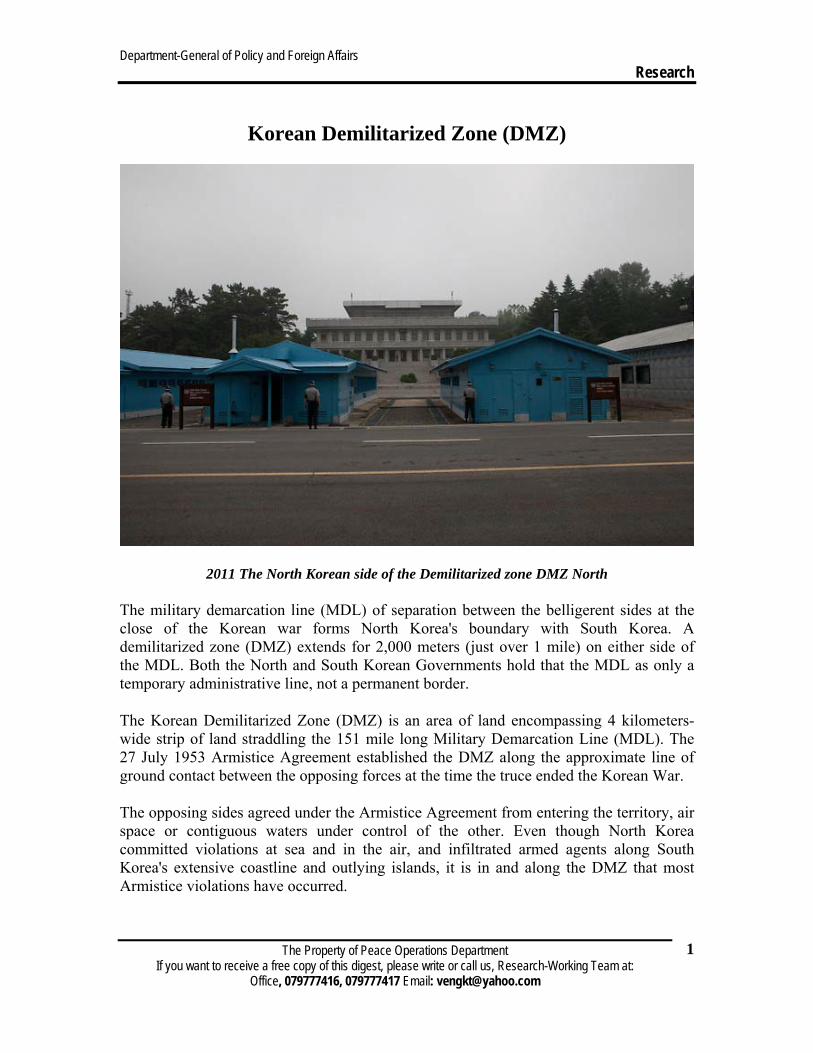
Department-General of Policy and Foreign Affairs Research The Property of Peace Operations Department If you want to receive a free copy of this digest, please write or call us, Research-Working Team at: Office, 079777416, 079777417 Email: [email protected] 1 Korean Demilitarized Zone (DMZ) 2011 The North Korean side of the Demilitarized zone DMZ North The military demarcation line (MDL) of separation between the belligerent sides at the close of the Korean war forms North Korea's boundary with South Korea. A demilitarized zone (DMZ) extends for 2,000 meters (just over 1 mile) on either side of the MDL. Both the North and South Korean Governments hold that the MDL as only a temporary administrative line, not a permanent border. The Korean Demilitarized Zone (DMZ) is an area of land encompassing 4 kilometers- wide strip of land straddling the 151 mile long Military Demarcation Line (MDL). The 27 July 1953 Armistice Agreement established the DMZ along the approximate line of ground contact between the opposing forces at the time the truce ended the Korean War. The opposing sides agreed under the Armistice Agreement from entering the territory, air space or contiguous waters under control of the other. Even though North Korea committed violations at sea and in the air, and infiltrated armed agents along South Korea's extensive coastline and outlying islands, it is in and along the DMZ that most Armistice violations have occurred.
Transcript of Korean Demilitarized Zone (DMZ) · Korean portion), and Kaesung-jikhalsi Panmun-joon Panmunjom-ri...
Department-General of Policy and Foreign Affairs Research
The Property of Peace Operations Department If you want to receive a free copy of this digest, please write or call us, Research-Working Team at:
Office, 079777416, 079777417 Email: [email protected]
1
Korean Demilitarized Zone (DMZ)
2011 The North Korean side of the Demilitarized zone DMZ North
The military demarcation line (MDL) of separation between the belligerent sides at the close of the Korean war forms North Korea's boundary with South Korea. A demilitarized zone (DMZ) extends for 2,000 meters (just over 1 mile) on either side of the MDL. Both the North and South Korean Governments hold that the MDL as only a temporary administrative line, not a permanent border.
The Korean Demilitarized Zone (DMZ) is an area of land encompassing 4 kilometers-wide strip of land straddling the 151 mile long Military Demarcation Line (MDL). The 27 July 1953 Armistice Agreement established the DMZ along the approximate line of ground contact between the opposing forces at the time the truce ended the Korean War.
The opposing sides agreed under the Armistice Agreement from entering the territory, air space or contiguous waters under control of the other. Even though North Korea committed violations at sea and in the air, and infiltrated armed agents along South Korea's extensive coastline and outlying islands, it is in and along the DMZ that most Armistice violations have occurred.
Department-General of Policy and Foreign Affairs Research
The Property of Peace Operations Department If you want to receive a free copy of this digest, please write or call us, Research-Working Team at:
Office, 079777416, 079777417 Email: [email protected]
2
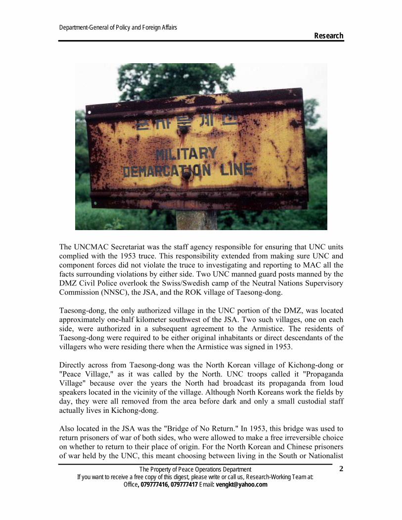
The UNCMAC Secretariat was the staff agency responsible for ensuring that UNC units complied with the 1953 truce. This responsibility extended from making sure UNC and component forces did not violate the truce to investigating and reporting to MAC all the facts surrounding violations by either side. Two UNC manned guard posts manned by the DMZ Civil Police overlook the Swiss/Swedish camp of the Neutral Nations Supervisory Commission (NNSC), the JSA, and the ROK village of Taesong-dong.
Taesong-dong, the only authorized village in the UNC portion of the DMZ, was located approximately one-half kilometer southwest of the JSA. Two such villages, one on each side, were authorized in a subsequent agreement to the Armistice. The residents of Taesong-dong were required to be either original inhabitants or direct descendants of the villagers who were residing there when the Armistice was signed in 1953.
Directly across from Taesong-dong was the North Korean village of Kichong-dong or "Peace Village," as it was called by the North. UNC troops called it "Propaganda Village" because over the years the North had broadcast its propaganda from loud speakers located in the vicinity of the village. Although North Koreans work the fields by day, they were all removed from the area before dark and only a small custodial staff actually lives in Kichong-dong.
Also located in the JSA was the "Bridge of No Return." In 1953, this bridge was used to return prisoners of war of both sides, who were allowed to make a free irreversible choice on whether to return to their place of origin. For the North Korean and Chinese prisoners of war held by the UNC, this meant choosing between living in the South or Nationalist
Department-General of Policy and Foreign Affairs Research
The Property of Peace Operations Department If you want to receive a free copy of this digest, please write or call us, Research-Working Team at:
Office, 079777416, 079777417 Email: [email protected]
3
China (Taiwan), or being repatriated to North Korea or the People's Republic of China. Many thousands chose not to return to their communist homelands. Only a handful of prisoners held by the Korean Peoples Army/Chinese Peoples Volunteers went north.
Near the "Bridge of No Return" was the site of the 18 August 1976 "ax murder" incident. In the aftermath of that incident, the JSA was divided similarly to the rest of the DMZ. No military guard personnel from either side were permitted to cross the MDL, although a limited number of MAC members and assistants, NNSC personnel and civilians were permitted to cross in either direction on certain occasions.
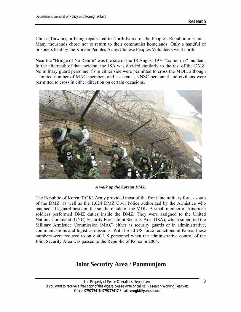
A walk up the Korean DMZ.
The Republic of Korea (ROK) Army provided most of the front line military forces south of the DMZ, as well as the 1,024 DMZ Civil Police authorized by the Armistice who manned 114 guard posts on the southern side of the MDL. A small number of American soldiers performed DMZ duties inside the DMZ. They were assigned to the United Nations Command (UNC) Security Force-Joint Security Area (JSA), which supported the Military Armistice Commission (MAC) either as security guards or in administrative, communications and logistics missions. With broad US force reductions in Korea, these numbers were reduced to only 40 US personnel when the administrative control of the Joint Security Area was passed to the Republic of Korea in 2004.
Joint Security Area / Panmunjom
Department-General of Policy and Foreign Affairs Research
The Property of Peace Operations Department If you want to receive a free copy of this digest, please write or call us, Research-Working Team at:
Office, 079777416, 079777417 Email: [email protected]
4
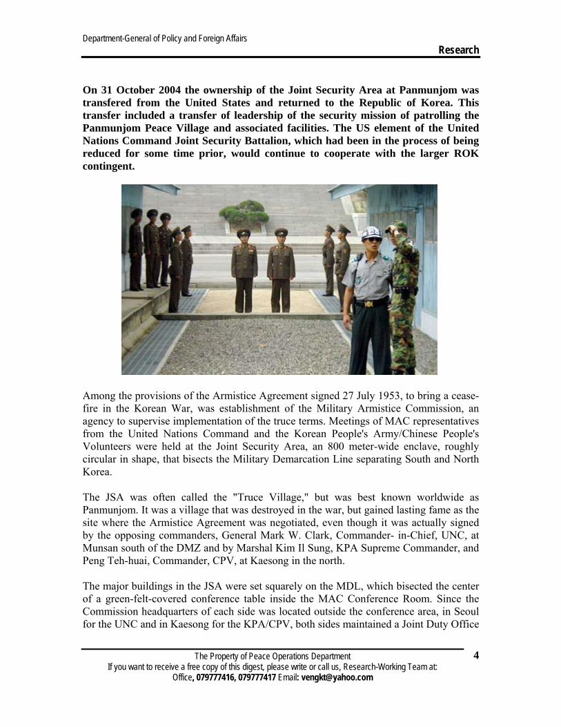
On 31 October 2004 the ownership of the Joint Security Area at Panmunjom was transfered from the United States and returned to the Republic of Korea. This transfer included a transfer of leadership of the security mission of patrolling the Panmunjom Peace Village and associated facilities. The US element of the United Nations Command Joint Security Battalion, which had been in the process of being reduced for some time prior, would continue to cooperate with the larger ROK contingent.
Among the provisions of the Armistice Agreement signed 27 July 1953, to bring a cease-fire in the Korean War, was establishment of the Military Armistice Commission, an agency to supervise implementation of the truce terms. Meetings of MAC representatives from the United Nations Command and the Korean People's Army/Chinese People's Volunteers were held at the Joint Security Area, an 800 meter-wide enclave, roughly circular in shape, that bisects the Military Demarcation Line separating South and North Korea.
The JSA was often called the "Truce Village," but was best known worldwide as Panmunjom. It was a village that was destroyed in the war, but gained lasting fame as the site where the Armistice Agreement was negotiated, even though it was actually signed by the opposing commanders, General Mark W. Clark, Commander- in-Chief, UNC, at Munsan south of the DMZ and by Marshal Kim Il Sung, KPA Supreme Commander, and Peng Teh-huai, Commander, CPV, at Kaesong in the north.
The major buildings in the JSA were set squarely on the MDL, which bisected the center of a green-felt-covered conference table inside the MAC Conference Room. Since the Commission headquarters of each side was located outside the conference area, in Seoul for the UNC and in Kaesong for the KPA/CPV, both sides maintained a Joint Duty Office

Department-General of Policy and Foreign Affairs Research
The Property of Peace Operations Department If you want to receive a free copy of this digest, please write or call us, Research-Working Team at:
Office, 079777416, 079777417 Email: [email protected]
5
at the JSA to provide continuous liaison. The JDOs would meet to pass communications from the senior member or secretary of their sides.
Military Police of both sides provided security for the JSA with guard forces of no more than 35 security personnel on duty at any given time. The administrative facilities for both guard forces are located within the JSA. The UN Command security forces were maintained by a US-ROK UNC Security Battalion. The total force fluctuated, with some 350 members of the ROK Army and 250 members of the United States military during the 1990s. Plans to reduce the US precense all over Korea resulted in a dramatic reduction in US personnel. By the time authority over the Joint Security Area was transfered to the Republic of Korea in 2004, the US component numbered only 40 personnel.
This is a picture showing the line that separates North Korea and South Korea from one another.
Also found in the JSA are the offices and conference room for the Neutral Nations Supervisory Commission.
Military and civilian guests were permitted to visit the JSA as guests of the respective sides. Currently, the UNC sponsored nearly 100,000 visitors each year, most of them tourists who come on visits arranged by the Korea Tourist Bureau or military personnel whose visit was encouraged to ensure their better understanding of the situation in Korea. The KPA/CPV also bring guests, but these number less than 10,000 annually.
The Joint Security Area was one of the 42 camps north of Seoul authorized Hardship Duty Pay of $150 per month as of 1 January 2001. The Hardship Duty Pay is paid to troops who are permanently assigned to areas where it is authorized or who serve 30 consecutive days of temporary duty in those areas. Several factors are considered in determining whether a location qualified for the pay: climate, physical and social isolation, sanitation, disease, medical facilities, housing, food, recreational and
Department-General of Policy and Foreign Affairs Research
The Property of Peace Operations Department If you want to receive a free copy of this digest, please write or call us, Research-Working Team at:
Office, 079777416, 079777417 Email: [email protected]
6
community facilities, political violence, harassment and crime. The extra pay provides meaningful financial recognition to troops assigned in areas where living conditions are substantially below US standards.
Description
Among the people of the world, Koreans especially appreciate freedom and peace because of the civil war that separated them and the divided country in which they now live. Koreans eagerly long for a peaceful unification.
Where is Panmunjom?
Panmunjom is located inside the Demilitarized Zone (DMZ), and it is the most forward location in the DMZ that can be visited by civilians. The administrative address is Kyunggi-do Paju-si Jinseo-myun Neolum-li (for the South Korean portion), and Kaesung-jikhalsi Panmun-joon Panmunjom-ri (for the North Korean side). Although Panmunjom is the common name of the area, the official name of the negotiating site is the Joint Security Area (JSA). Panmumjom is located in the western portion of the 155-mile long DMZ on the Military Demarcation Line (MDL) and it demonstrates the great sorrow of the divided country. Panmumjom is located 62 kilometers northwest of Seoul, the capital of South Korea, and 215 kilometers south of Pyongyang, the capital of North Korea, 10 kilometers from Kaesong.
The history of Panmunjom
The name Panmunjom can be traced back to the time of the original armistice negotiations between the UNC and the Communist forces. The actual site of the "truce tent" negotiations is located about 1 kilometer north of the JSA. On that location today is a North Korean army museum, which can be observed from the UNC Guard Post 3 in the JSA. The museum was originally built for the signing of the Korea Armistice Agreement that occurred on 27 July 1953.
Department-General of Policy and Foreign Affairs Research
The Property of Peace Operations Department If you want to receive a free copy of this digest, please write or call us, Research-Working Team at:
Office, 079777416, 079777417 Email: [email protected]
7
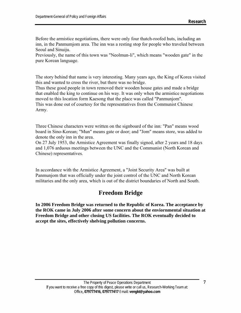
Before the armistice negotiations, there were only four thatch-roofed huts, including an inn, in the Panmumjom area. The inn was a resting stop for people who traveled between Seoul and Sinuiju. Previously, the name of this town was "Neolmun-li", which means "wooden gate" in the pure Korean language.
The story behind that name is very interesting. Many years ago, the King of Korea visited this and wanted to cross the river, but there was no bridge. Thus these good people in town removed their wooden house gates and made a bridge that enabled the king to continue on his way. It was only when the armistice negotiations moved to this location form Kaesong that the place was called "Panmunjom". This was done out of courtesy for the representatives from the Communist Chinese Army.
Three Chinese characters were written on the signboard of the inn: "Pan" means wood board in Sino-Korean; "Mun" means gate or door; and "Jom" means store, was added to denote the only inn in the area. On 27 July 1953, the Armistice Agreement was finally signed, after 2 years and 18 days and 1,076 arduous meetings between the UNC and the Communist (North Korean and Chinese) representatives.
In accordance with the Armistice Agreement, a "Joint Security Area" was built at Panmunjom that was officially under the joint control of the UNC and North Korean militaries and the only area, which is out of the district boundaries of North and South.
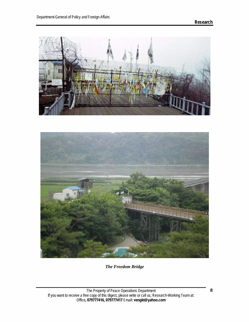
Freedom Bridge
In 2006 Freedom Bridge was returned to the Republic of Korea. The acceptance by the ROK came in July 2006 after some concern about the enviornmental situation at Freedom Bridge and other closing US facilities. The ROK eventually decided to accept the sites, effectively shelving pollution concerns.
Department-General of Policy and Foreign Affairs Research
The Property of Peace Operations Department If you want to receive a free copy of this digest, please write or call us, Research-Working Team at:
Office, 079777416, 079777417 Email: [email protected]
8
The Freedom Bridge
Department-General of Policy and Foreign Affairs Research
The Property of Peace Operations Department If you want to receive a free copy of this digest, please write or call us, Research-Working Team at:
Office, 079777416, 079777417 Email: [email protected]
9
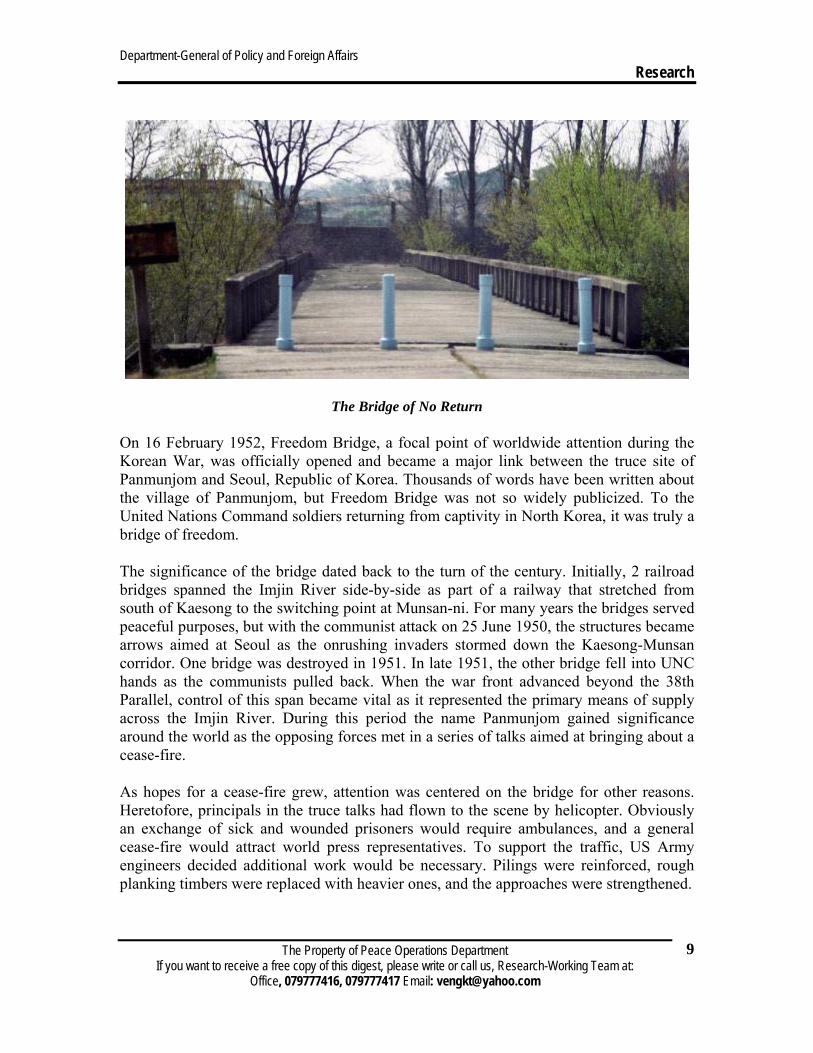
The Bridge of No Return
On 16 February 1952, Freedom Bridge, a focal point of worldwide attention during the Korean War, was officially opened and became a major link between the truce site of Panmunjom and Seoul, Republic of Korea. Thousands of words have been written about the village of Panmunjom, but Freedom Bridge was not so widely publicized. To the United Nations Command soldiers returning from captivity in North Korea, it was truly a bridge of freedom.
The significance of the bridge dated back to the turn of the century. Initially, 2 railroad bridges spanned the Imjin River side-by-side as part of a railway that stretched from south of Kaesong to the switching point at Munsan-ni. For many years the bridges served peaceful purposes, but with the communist attack on 25 June 1950, the structures became arrows aimed at Seoul as the onrushing invaders stormed down the Kaesong-Munsan corridor. One bridge was destroyed in 1951. In late 1951, the other bridge fell into UNC hands as the communists pulled back. When the war front advanced beyond the 38th Parallel, control of this span became vital as it represented the primary means of supply across the Imjin River. During this period the name Panmunjom gained significance around the world as the opposing forces met in a series of talks aimed at bringing about a cease-fire.
As hopes for a cease-fire grew, attention was centered on the bridge for other reasons. Heretofore, principals in the truce talks had flown to the scene by helicopter. Obviously an exchange of sick and wounded prisoners would require ambulances, and a general cease-fire would attract world press representatives. To support the traffic, US Army engineers decided additional work would be necessary. Pilings were reinforced, rough planking timbers were replaced with heavier ones, and the approaches were strengthened.
Department-General of Policy and Foreign Affairs Research
The Property of Peace Operations Department If you want to receive a free copy of this digest, please write or call us, Research-Working Team at:
Office, 079777416, 079777417 Email: [email protected]
10
Liberty Lane, the route from Panmunjom to the bridge, would long be remembered by those who made the journey. Within a l,000-yard neutral circle in the rice paddies of Panmunjom, the repatriates were checked, examined, and sped on their way toward Freedom Village, a 35-tent reception station set up at Munsan-ni. Some came out by helicopter, but most traveled by ambulance across Freedom Bridge.
On 15 June 1998, the four-lane Tongil "Grand Unification Bridge" opened, replacing the 'one-way' traffic span Freedom Bridge that represented the only link from Panmunjom to the south for so many years.
Freedom Bridge was one of the 42 camps north of Seoul authorized Hardship Duty Pay of $150 per month as of 1 January 2001. The Hardship Duty Pay is paid to troops who are permanently assigned to areas where it is authorized or who serve 30 consecutive days of temporary duty in those areas. Several factors are considered in determining whether a location qualified for the pay: climate, physical and social isolation, sanitation, disease, medical facilities, housing, food, recreational and community facilities, political violence, harassment and crime. The extra pay provides meaningful financial recognition to troops assigned in areas where living conditions are substantially below US standards.
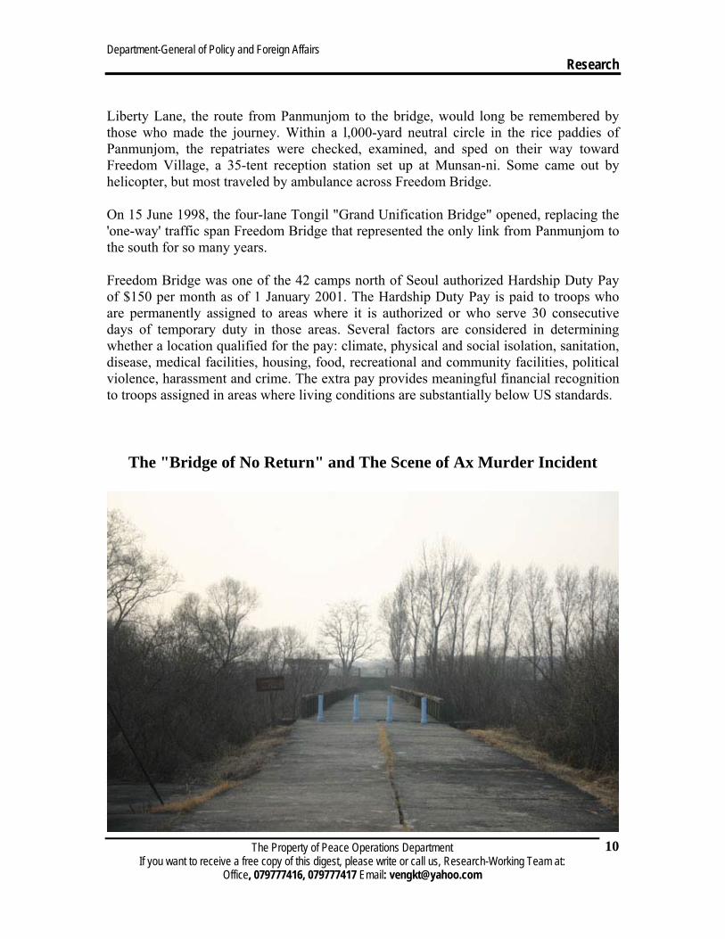
The "Bridge of No Return" and The Scene of Ax Murder Incident
The "Bridge of No Return" is located at the west end of the JSA and is bisected by the MDL. In front of the "Bridge of No Return" is also where the tragic Ax Murder Incident occurred in 1976. Before the incident, the "Bridge of No Return" was the only pathway connecting North and South. Currently the bridge is blocked off with a wall on the North Korean end. Today, that route goes via the "72 Hours Bridge". The Brige is called the "72 Hours Bridge" because North Koreans built it in three days. The "Bridge of No Return" got its name from the prisoner repatriation operation after the Armistice Agreement was signed . The prisoners were exchanged across this bridge and given a choice to either cross the bridge to return to their original country or to remain on the side of their captors. However, once they crossed the bridge, they were not allowed to cross back to the other side and hence the name the "Bridge of No Return". The numbers of the prisoners exchanged from 5 August to 6 September 1953 were 13,444 UNC and 82,493 Communist troops. The guard posts on each side of the bridge were the setting for the popular korean movie "JSA".
Department-General of Policy and Foreign Affairs Research
The Property of Peace Operations Department If you want to receive a free copy of this digest, please write or call us, Research-Working Team at:
Office, 079777416, 079777417 Email: [email protected]
11
The Peace House
The Peace House is also under the control of the South Korean government. It is located about 130 meters south of the Freedom House and was constructed in December 1980. The Peace House hosts non-military businesses such as political, economical and athletic exchanges between North and South. Twice a day, routine regular phone contact is made with Tongil Gak (the Unification Pavilion) on the north side of the JSA. South-North military officers held their first meeting here to negotiate the details of linking of the Kyongui railroad.
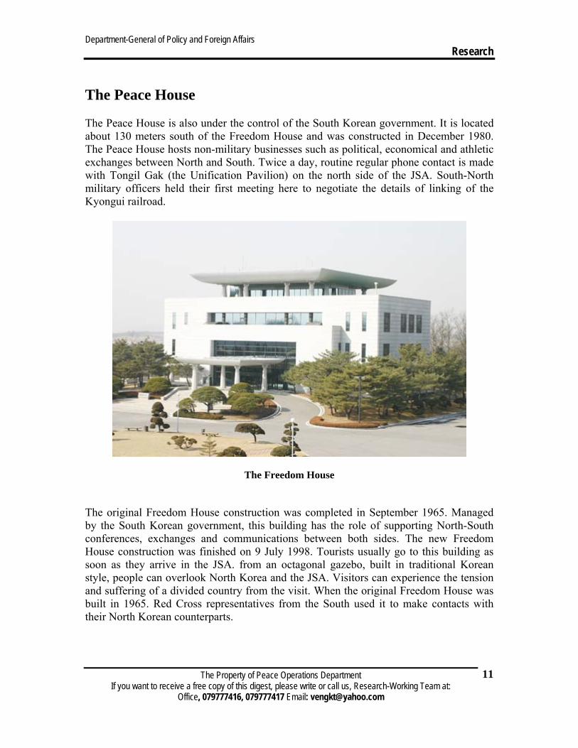
The Freedom House
The original Freedom House construction was completed in September 1965. Managed by the South Korean government, this building has the role of supporting North-South conferences, exchanges and communications between both sides. The new Freedom House construction was finished on 9 July 1998. Tourists usually go to this building as soon as they arrive in the JSA. from an octagonal gazebo, built in traditional Korean style, people can overlook North Korea and the JSA. Visitors can experience the tension and suffering of a divided country from the visit. When the original Freedom House was built in 1965. Red Cross representatives from the South used it to make contacts with their North Korean counterparts.
Department-General of Policy and Foreign Affairs Research
The Property of Peace Operations Department If you want to receive a free copy of this digest, please write or call us, Research-Working Team at:
Office, 079777416, 079777417 Email: [email protected]
12
Composition and duties
The United Nations Command Security Battalion—Joint Security Area was constituted on May 5, 1952, as Army Unit 8020, United Nations Command Military Armistice Commission Support Group (Provisional). Originally authorized five officers and ten enlisted soldiers, the unit quickly grew to over 1,400 officers and men charged with supporting almost 32,000 soldiers, civilians, and diplomats involved in negotiating and then enforcing the Armistice Agreement. By the end of February 1954 the scope of work declined considerably and the number of soldiers assigned to the unit declined as well.
For the next fifty years the unit underwent several organizational and name changes, although the original mission to secure the Joint Security Area remains the same today as it was in 1952. On June 11, 1979, the name was changed from US Army Support Group (Joint Security Area) to United Nations Command Support Group—Joint Security Area, and further changed to United Nations Command Security Force—Joint Security Area on December 23, 1985. On October 15, 1994, UNC Commander directed that the unit be known by its present designation, the United Nations Command Security Battalion—Joint Security Area .
Originally a purely US Army organization, the unit almost immediately incorporated ROK soldiers (KATUSAs) into its ranks. In addition, ROK Army officers served as liaison officers. In the mid 1970s the JSA consisted of the JSF company with three platoons of one U.S. and one ROKA officer, and thirty enlisted men, supported by a battalion staff. The three platoons were led by the U.S. officer with the ROK officer being the executive officer, and US Army platoon sergeants. The platoons consisted of three squads, with equal numbers of U.S. and KATUSA soldiers. Sometime after 1979, another (fourth) platoon was added to the JSF to allow time for training during platoon work rotations. In July 1987 the four platoons of the Joint Security Force (JSF) company were reorganized to mix KATUSA and US soldiers at all levels. At the platoon level, two platoons were led by US Army lieutenants and ROKA platoon sergeants, and two were led by ROKA lieutenants and US Army platoon sergeants. In November 1987 the unit received a ROK Army major as its first deputy commander.
On April 25, 1992, the JSF company became a KATUSA-pure formation. Captain Yin Sung-Hwan became the first ROK commander, assisted by a US Army lieutenant as his executive officer. The number of US Army personnel assigned to the unit fell below 200 for the first time since 1952. American forces assigned to the JSA assumed mainly administrative and support roles.
On October 31, 2004, a ROK Army battalion assumed responsibility for the Joint Security Area.[18] This modified light infantry battalion consists of a battalion headquarters, a headquarters company, two security companies, and a civil affairs company. The number of US personnel assigned decreased further, reflecting the UNC
Department-General of Policy and Foreign Affairs Research
The Property of Peace Operations Department If you want to receive a free copy of this digest, please write or call us, Research-Working Team at:
Office, 079777416, 079777417 Email: [email protected]
13
Commander's desire to minimize the USFK presence near the Korean Demilitarized Zone. The commander of the ROKA JSA Battalion serves as the UNCSB-JSA Deputy Commander. The UNCSB-JSA Commander's principal responsibility now lies in his operational control of selected ROKA formations during both Armistice and wartime periods.
Both sides face each other in spaces between the blue meeting houses, where the demarcation line is marked by blocks of concrete. All South Korean guards in this area are armed with pistols, and stand in a modified Tae Kwon Do stance with solid facial expressions, clenched fists, and sunglasses, which is meant to intimidate the North Koreans. They must be at least 177 cm tall, and have a black belt in Tae Kwon Do or Judo to serve there. All North Korean border guards are armed with pistols,and are well-fed officers who stand in rigid military posture. In each space, two North Korean soldiers stand facing each other rather than the South, so that neither one can defect to the South, and another guard stands behind them facing the North to prevent anyone else from defecting. In front of him is a two-man guard post.[1
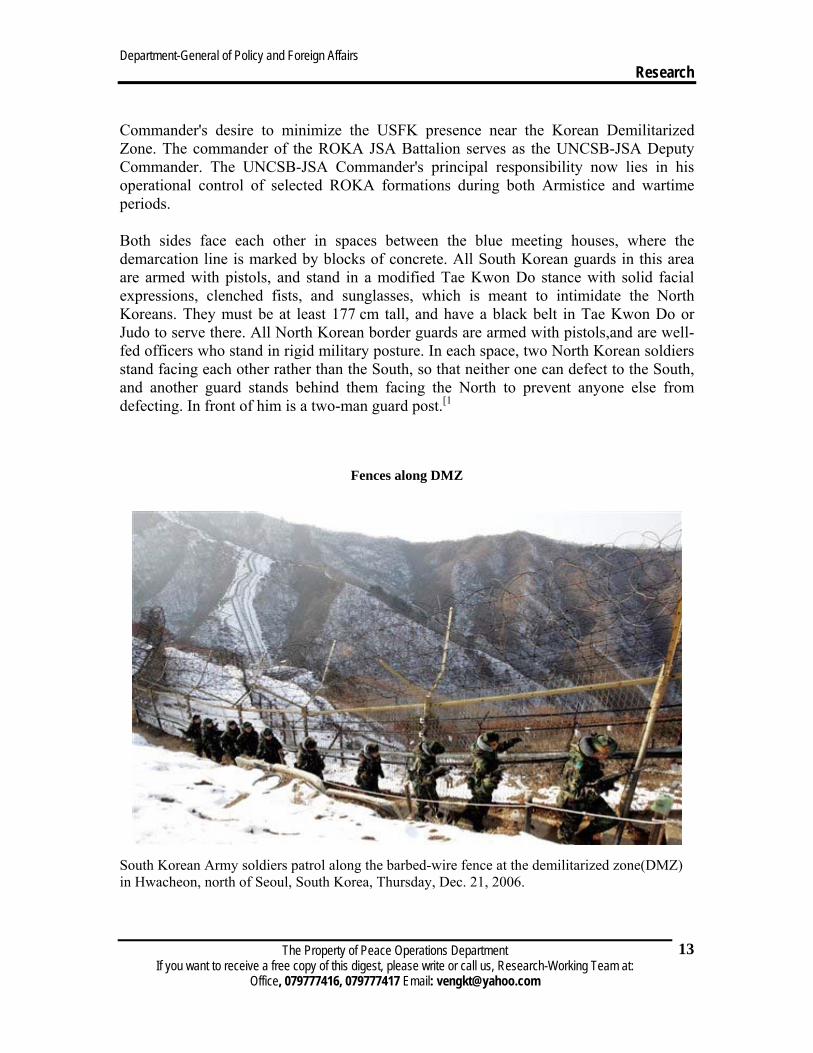
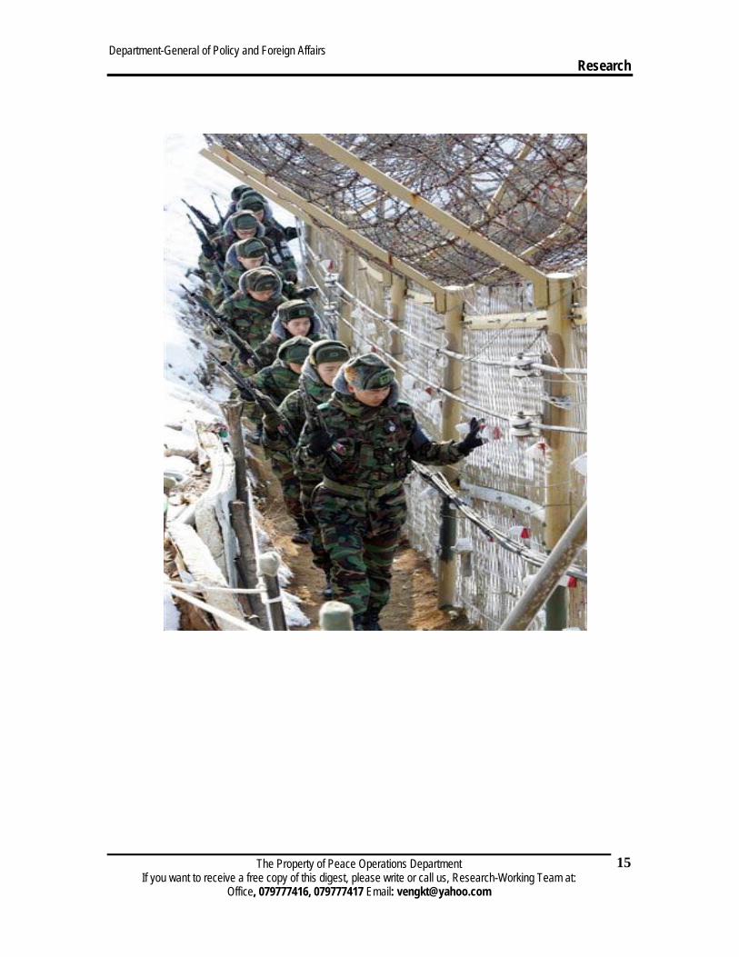
Fences along DMZ
South Korean Army soldiers patrol along the barbed-wire fence at the demilitarized zone(DMZ) in Hwacheon, north of Seoul, South Korea, Thursday, Dec. 21, 2006.
Department-General of Policy and Foreign Affairs Research
The Property of Peace Operations Department If you want to receive a free copy of this digest, please write or call us, Research-Working Team at:
Office, 079777416, 079777417 Email: [email protected]
14
Department-General of Policy and Foreign Affairs Research
The Property of Peace Operations Department If you want to receive a free copy of this digest, please write or call us, Research-Working Team at:
Office, 079777416, 079777417 Email: [email protected]
15
Department-General of Policy and Foreign Affairs Research
The Property of Peace Operations Department If you want to receive a free copy of this digest, please write or call us, Research-Working Team at:
Office, 079777416, 079777417 Email: [email protected]
16
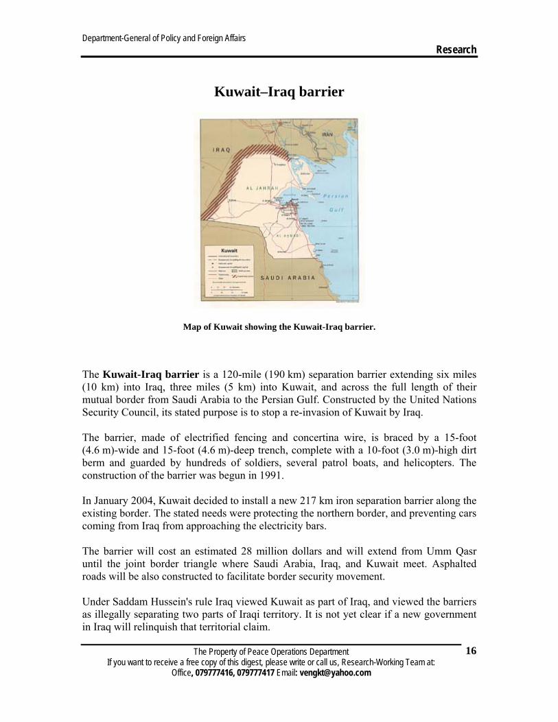
Kuwait–Iraq barrier
Map of Kuwait showing the Kuwait-Iraq barrier.
The Kuwait-Iraq barrier is a 120-mile (190 km) separation barrier extending six miles (10 km) into Iraq, three miles (5 km) into Kuwait, and across the full length of their mutual border from Saudi Arabia to the Persian Gulf. Constructed by the United Nations Security Council, its stated purpose is to stop a re-invasion of Kuwait by Iraq.
The barrier, made of electrified fencing and concertina wire, is braced by a 15-foot (4.6 m)-wide and 15-foot (4.6 m)-deep trench, complete with a 10-foot (3.0 m)-high dirt berm and guarded by hundreds of soldiers, several patrol boats, and helicopters. The construction of the barrier was begun in 1991.
In January 2004, Kuwait decided to install a new 217 km iron separation barrier along the existing border. The stated needs were protecting the northern border, and preventing cars coming from Iraq from approaching the electricity bars.
The barrier will cost an estimated 28 million dollars and will extend from Umm Qasr until the joint border triangle where Saudi Arabia, Iraq, and Kuwait meet. Asphalted roads will be also constructed to facilitate border security movement.
Under Saddam Hussein's rule Iraq viewed Kuwait as part of Iraq, and viewed the barriers as illegally separating two parts of Iraqi territory. It is not yet clear if a new government in Iraq will relinquish that territorial claim.
Department-General of Policy and Foreign Affairs Research
The Property of Peace Operations Department If you want to receive a free copy of this digest, please write or call us, Research-Working Team at:
Office, 079777416, 079777417 Email: [email protected]
17
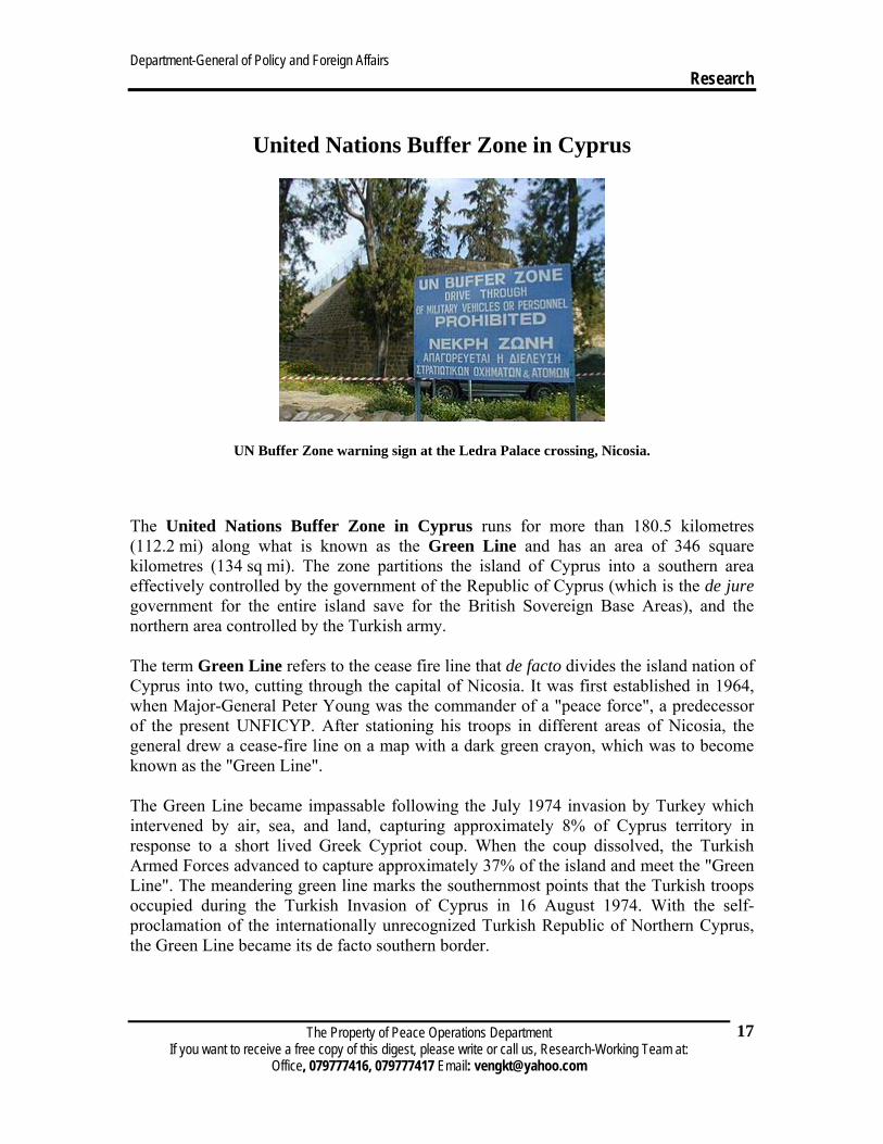
United Nations Buffer Zone in Cyprus
UN Buffer Zone warning sign at the Ledra Palace crossing, Nicosia.
The United Nations Buffer Zone in Cyprus runs for more than 180.5 kilometres (112.2 mi) along what is known as the Green Line and has an area of 346 square kilometres (134 sq mi). The zone partitions the island of Cyprus into a southern area effectively controlled by the government of the Republic of Cyprus (which is the de jure government for the entire island save for the British Sovereign Base Areas), and the northern area controlled by the Turkish army.
The term Green Line refers to the cease fire line that de facto divides the island nation of Cyprus into two, cutting through the capital of Nicosia. It was first established in 1964, when Major-General Peter Young was the commander of a "peace force", a predecessor of the present UNFICYP. After stationing his troops in different areas of Nicosia, the general drew a cease-fire line on a map with a dark green crayon, which was to become known as the "Green Line".
The Green Line became impassable following the July 1974 invasion by Turkey which intervened by air, sea, and land, capturing approximately 8% of Cyprus territory in response to a short lived Greek Cypriot coup. When the coup dissolved, the Turkish Armed Forces advanced to capture approximately 37% of the island and meet the "Green Line". The meandering green line marks the southernmost points that the Turkish troops occupied during the Turkish Invasion of Cyprus in 16 August 1974. With the self-proclamation of the internationally unrecognized Turkish Republic of Northern Cyprus, the Green Line became its de facto southern border.
Department-General of Policy and Foreign Affairs Research
The Property of Peace Operations Department If you want to receive a free copy of this digest, please write or call us, Research-Working Team at:
Office, 079777416, 079777417 Email: [email protected]
18
This line is also referred to as the Attila Line on some maps, named after the Turkish code-name for the 1974 military intervention: Operation Atilla. The closed off zone has become a haven for Cyprus' wildlife, an example of an involuntary park.
Traffic across the buffer zone was very limited until 2003, when the number of crossings and the rules governing them were relaxed.
Vietnamese Demilitarized Zone
From Wikipedia
The Vietnamese Demilitarized Zone was established as a dividing line between North and South Vietnam as a result of the First Indochina War.
During the Second Indochina War (popularly known as the Vietnam War), it became important as the battleground demarcation separating North Vietnamese territory from South Vietnamese territory.
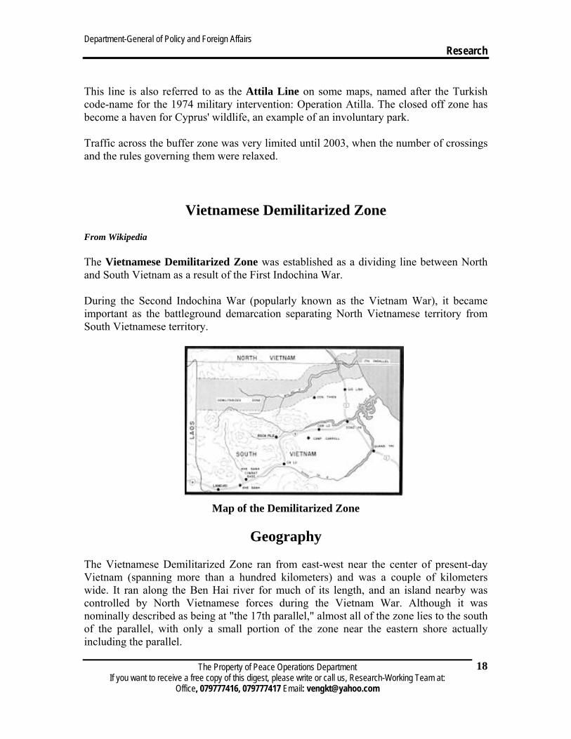
Map of the Demilitarized Zone
Geography
The Vietnamese Demilitarized Zone ran from east-west near the center of present-day Vietnam (spanning more than a hundred kilometers) and was a couple of kilometers wide. It ran along the Ben Hai river for much of its length, and an island nearby was controlled by North Vietnamese forces during the Vietnam War. Although it was nominally described as being at "the 17th parallel," almost all of the zone lies to the south of the parallel, with only a small portion of the zone near the eastern shore actually including the parallel.
Department-General of Policy and Foreign Affairs Research
The Property of Peace Operations Department If you want to receive a free copy of this digest, please write or call us, Research-Working Team at:
Office, 079777416, 079777417 Email: [email protected]
19
It was around a hundred kilometers north of the city of Huế.
The First Indochina War Main article: First Indochina War
The First Indochina War (also called the French Indochina War) was fought in French Indochina from 1946 through 1954 between France and the French-controlled State of Vietnam on the one side, and the Communist-dominated independence movement, the Viet Minh, on the other. The Viet Minh won the war, gaining effective control of all northern Vietnam except an enclave around Hanoi.
In 1954, France gave up its control of Vietnam, and the Viet Minh was recognized as the government of northern Vietnam.
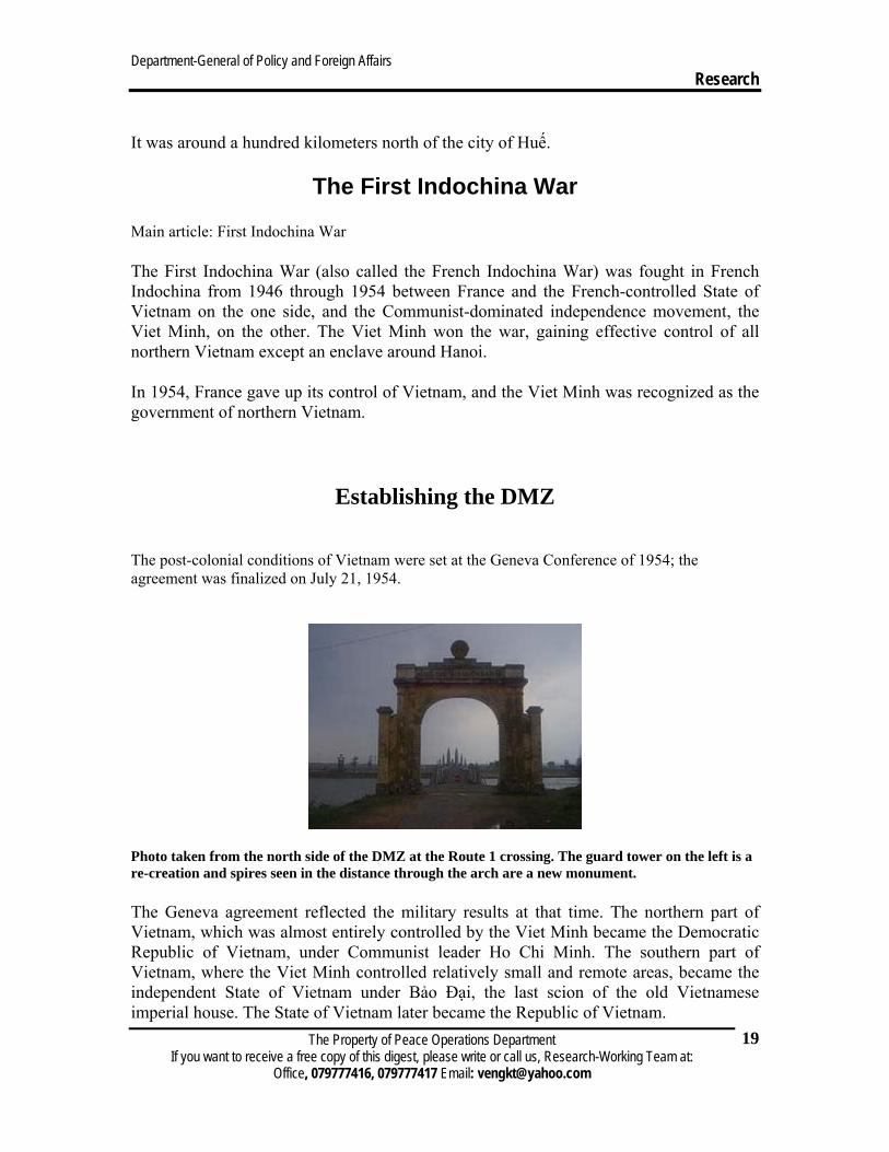
Establishing the DMZ The post-colonial conditions of Vietnam were set at the Geneva Conference of 1954; the agreement was finalized on July 21, 1954.
Photo taken from the north side of the DMZ at the Route 1 crossing. The guard tower on the left is a re-creation and spires seen in the distance through the arch are a new monument.
The Geneva agreement reflected the military results at that time. The northern part of Vietnam, which was almost entirely controlled by the Viet Minh became the Democratic Republic of Vietnam, under Communist leader Ho Chi Minh. The southern part of Vietnam, where the Viet Minh controlled relatively small and remote areas, became the independent State of Vietnam under Bảo Đại, the last scion of the old Vietnamese imperial house. The State of Vietnam later became the Republic of Vietnam.
Department-General of Policy and Foreign Affairs Research
The Property of Peace Operations Department If you want to receive a free copy of this digest, please write or call us, Research-Working Team at:
Office, 079777416, 079777417 Email: [email protected]
20
The boundary between these two zones was established at the Ben Hai River, which enters the South China Sea at 17 degrees 0 minutes 54 seconds N latitude. The boundary followed the Ben Hai to its headwaters, about 55 km WSW, and thence to the Laotian border.
The area within 5 km on either side of the border was declated to be a demilitarized zone. Troops of both governments were barred from this area.