KLAHOMA DEPARTMENT OF RANSPORTATION · OKLAHOMA DEPARTMENT OF TRANSPORTATION ... Archaeological...
30
i OKLAHOMA DEPARTMENT OF TRANSPORTATION CULTURAL RESOURCES STUDIES A MANUAL FOR CULTURAL RESOURCES STAFF AND DEPARTMENT CONSULTANTS OCTOBER 2017
Transcript of KLAHOMA DEPARTMENT OF RANSPORTATION · OKLAHOMA DEPARTMENT OF TRANSPORTATION ... Archaeological...

i
OKLAHOMA DEPARTMENT OF TRANSPORTATION CULTURAL RESOURCES STUDIES
A MANUAL FOR CULTURAL
RESOURCES STAFF AND DEPARTMENT
CONSULTANTS
OCTOBER 2017
i
OKLAHOMA DEPARTMENT OF TRANSPORTATION CULTURAL RESOURCES STUDIES
TABLE OF CONTENTS
OKLAHOMA DEPARTMENT OF TRANSPORTATION CULTURAL RESOURCES STUDIES ........... i TABLE OF CONTENTS ............................................................................................................................... i ACRONYMS REFERRED TO IN CULTURAL RESOURCES DOCUMENTATION ............................. ii INTRODUCTION ........................................................................................................................................ 1 I. Screened Exemptions ................................................................................................................................ 1 II. Phase I Cultural Resources Investigations ............................................................................................... 2
Records Review and Background Research ............................................................................................. 2 Records Review - Archaeological resources. ....................................................................................... 3 Records Review –Built Environment. .................................................................................................. 3 Defining Areas of Potential Effect – Archaeological Resources. ........................................................ 3 Defining Areas of Potential Effect –Built Environment. ..................................................................... 3 Consultation with Native American Tribes. ......................................................................................... 4
Field Investigations (Survey – Phase I). ................................................................................................... 4 Transects and shovel tests in Archaeological Survey........................................................................... 5 Artifact Collection during Archaeological Survey ............................................................................... 6 Site Recording and Assessment – Prehistoric Archaeological Resources. .......................................... 7 Site Recording and Assessment – Historic Period Archaeological Resources. ................................... 9 Historic Period Archaeological Sites ................................................................................................... 9 Historic Period Isolated Finds ............................................................................................................ 11 Site Recording and Assessment—Resources of the Built Environment ............................................ 11 Site Recording and Assessment – Places of Religious and Cultural Significance. ............................ 13
III. Phase I Investigations – CR Report Standards ..................................................................................... 14 Standard Form Reports ........................................................................................................................... 14 Expanded Narrative Reports. .................................................................................................................. 19
IV. Additional Studies and Evaluations ...................................................................................................... 20 Phase II Testing. ..................................................................................................................................... 21 Phase III Mitigation/Data Recovery. ...................................................................................................... 22 Treatment of Human Remains Discovered During Phase I, II or III Studies. ........................................ 22
V. Post-review Discoveries ......................................................................................................................... 23 VI. Consultation and Concurrence .............................................................................................................. 23 VII. Off-Project Areas, Borrow Pits, and Utilities ...................................................................................... 24
Appendix A: Standards of Uniformity for Cultural Resources Survey Reports ....................................... A-1 Appendix B: Scope of Work for Cultural Resources Survey ................................................................... B-1
ii
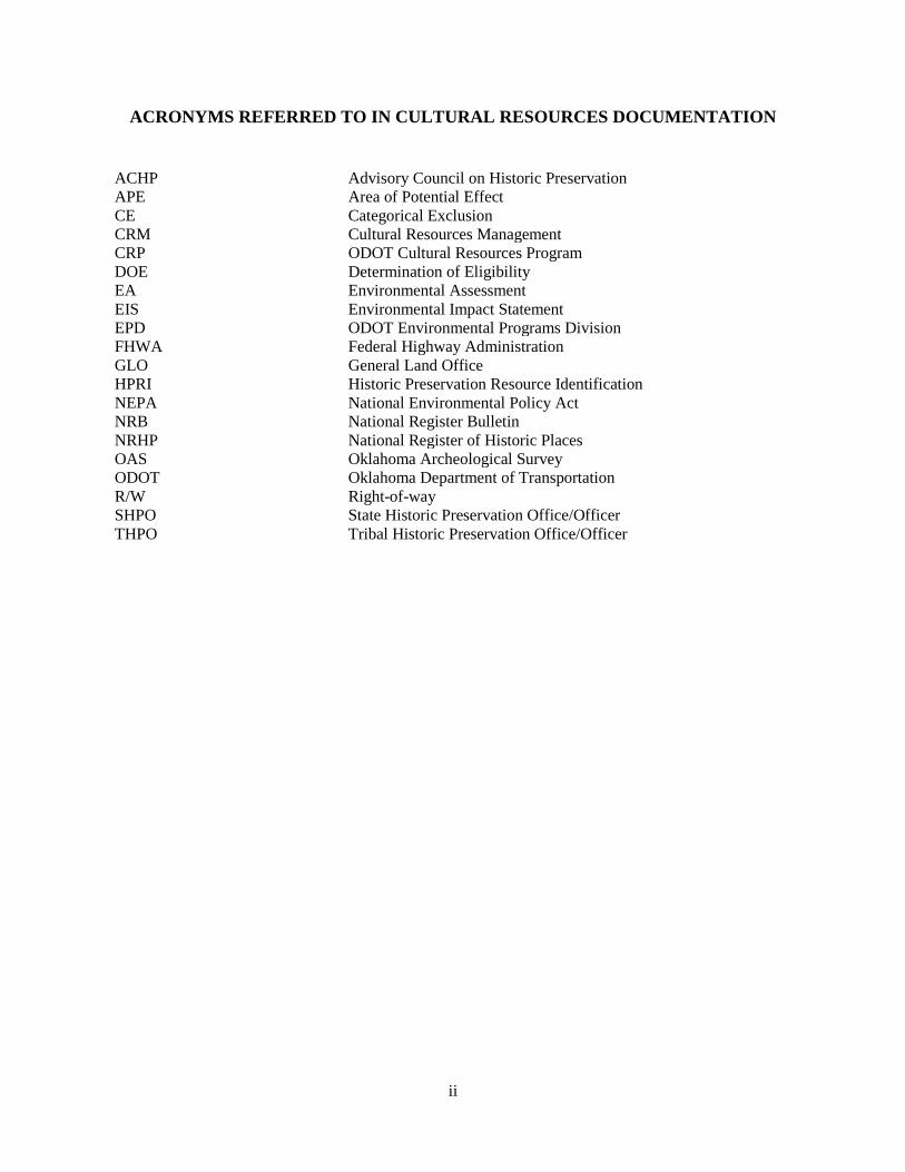
ACRONYMS REFERRED TO IN CULTURAL RESOURCES DOCUMENTATION ACHP Advisory Council on Historic Preservation APE Area of Potential Effect CE Categorical Exclusion CRM Cultural Resources Management CRP ODOT Cultural Resources Program DOE Determination of Eligibility EA Environmental Assessment EIS Environmental Impact Statement EPD ODOT Environmental Programs Division FHWA Federal Highway Administration GLO General Land Office HPRI Historic Preservation Resource Identification NEPA National Environmental Policy Act NRB National Register Bulletin NRHP National Register of Historic Places OAS Oklahoma Archeological Survey ODOT Oklahoma Department of Transportation R/W Right-of-way SHPO State Historic Preservation Office/Officer THPO Tribal Historic Preservation Office/Officer
1
INTRODUCTION This manual provides guidance on procedures, scoping, evaluating, and documenting cultural resources on ODOT’s Federal Aid projects. This is to be used by all cultural resources specialists including ODOT-CRP staff and consultants, as well as environmental project managers, engineers, and environmental specialists who assist in planning and implementation of transportation projects in Oklahoma. The reader should have a thorough familiarity with Sections 106 and 112 of the National Historic Preservation Act of 1966, as amended, and National Register Bulletin (NRB) 15 – How to Apply the National Register Criteria for Evaluation. The concepts and definitions used here are derived directly from these sources. Section 106 regulations, codified in 36 CFR 800.2(a)(1), and Section 112 of the NHPA requires agencies responsible for protecting historic properties to ensure that all actions taken by their employees or contractors meet the Secretary of Interior's Professional Qualification Standards, identified in 36 CFR 61. The National Park Service developed the Qualification Standards to ensure that a consistent level of expertise would be applied nationally to the identification, evaluation, registration, documentation, treatment, and interpretation of historic and archaeological resources. The qualifications define minimum levels of education and experience required to perform identification, evaluation, registration, and treatment activities. Cultural Resources Principal Investigators (Archaeologists and Architectural Historians) must meet the Secretary of Interior's Professional Qualification Standards and be approved by ODOT-CRP to produce Section 106 documentation for any ODOT project. While this document addresses a variety of cultural resources investigations including identification, evaluation, and mitigation, its focus is to present ODOT standards for identification and evaluation of historic properties for FHWA undertakings conducted under Section 106 of the NHPA. Commonly called Phase I Cultural Resources Investigations, these investigations include archaeological pedestrian survey and architectural reconnaissance survey. This level of investigation and evaluation is the most common form of study conducted by ODOT-CRP and the consultant CR Specialists. Phase II archaeological NRHP evaluations or testing and intensive architectural survey and Phase III archaeological data recovery and mitigation are also completed by ODOT-CRP and consultants, however scopes of work that will address specific methodologies or research goals necessary for the study will be issued for these types of investigations on a case by case basis. ODOT-CRP maintains a website that contains the report template, forms, and other program information. Please refer to the site for additional information, resources, departmental contacts, and other links: http://www.odotculturalresources.info/. This site is updated regularly.
I. Screened Exemptions Minor projects that require no new R/W or that are in previously disturbed settings where there is no potential for historic properties will be reviewed internally by ODOT-CRP staff. These types of projects are discussed under 36 CFR 800.3(a)(1) as undertakings that do not have the potential
2
to cause effects to historic properties. ODOT-CRP classifies these types of undertakings as Screened Exemptions. Screened Exemptions must include a file search with the OAS and SHPO’s DOE and NRHP list, and review of other available resources, such as historic maps, aerial photographs, or cultural resource reports. At times, a field visit may be warranted. If no historic properties are identified during the file search and the project is determined to be: a) not an undertaking, as defined in 36 CFR 800.16, or b) an undertaking that does not have the potential to affect historic properties, an internal memo will be prepared and submitted to the Division NEPA Project manager for the project files. After the file search, if the project does not fit the criteria mentioned above, it will become a Phase I Cultural Resources Investigation as defined in the next section. In accordance with the regulations, depending on the nature of the undertaking and its potential to affect historic properties, ODOT-CRP may invite formal consultation with OAS/SHPO, Native American Tribes, or other consulting parties regarding such projects.
II. Phase I Cultural Resources Investigations In order to accommodate a variety of project alternatives, ODOT conducts environmental studies, including cultural resources investigations, within a NEPA study area. For the purposes of ODOT projects, the NEPA study area represents the initial APE for cultural resources investigations. The APE may be refined as the project progresses. ODOT-CRP has recognized certain tasks to: a) identify cultural resources within the NEPA study area, and b) provide sufficient documentation and National Register of Historic Places (NRHP) assessment of cultural resources to ODOT-CRP for submittal to the State Historic Preservation Office (SHPO) and other consulting parties. These tasks are discussed in this section.
Records Review and Background Research The primary purpose of background studies for cultural resource field investigations is to identify known and previously recorded cultural resources within the proposed study area. Broader review of secondary historic and archaeological literature is also valuable in developing a general cultural or historic context for which resources within the study area may be interpreted. Such secondary research is specifically necessary on larger projects involving numerous alternative alignments where it is anticipated that a variety of effects can be anticipated. The following project information should be obtained from the NEPA Project Manager before a records review is performed:
1. Project name/description and state job piece number (JP#); 2. NEPA study area location shown on standard ODOT county road maps or the
equivalent, 3. NEPA study area shown on a USGS quadrangle map or aerial photograph (with map
name and study area dimensions clearly shown), or set of project plans illustrating proposed R/W. When the NEPA study area is defined by project plans, shapefiles should be requested from the NEPA project manager.
4. Project scope including type of project (bridge replacement, widening, new lanes, new alignment, etc.).
5. Landowner information
3
When the exact location of a new alignment is not yet known, a general corridor should be shown on the county and USGS maps. The width of this corridor must encompass all possible alternatives. Records Review - Archaeological resources. File searches must be performed in person at the OAS to identify known archaeological sites within one mile of the project area before fieldwork is initiated. The location and characteristics of all sites within one mile of the proposed project shall be reviewed, along with the context for which these resources were recorded (i.e. formal Section 106 consultation, research grant project, or avocational recording). The original site forms and cultural resources reports produced for the investigations that recorded the resources shall be reviewed to assess the significance of each site. Even though the OAS USGS topographic maps contain some information shown on late 19th century GLO maps, the primary GLO map source and all other available historic maps or aerial photographs shall be reviewed. If resources are identified within the study area, their locations shall be tagged by the investigator for field inspection, as they may indicate the remains of previous occupations. Landform and setting information shall also be reviewed to determine possible locations of unrecorded prehistoric archaeological sites. The file search will also note any locations within the study area which were previously surveyed. When performing a site file search, ODOT-CRP staff and consultants must comply with OAS procedures. Records Review –Built Environment. ODOT-CRP Staff and/or consultants shall review the lists of NRHP and DOE properties available from the SHPO and ODOT-CRP office and shall identify all known historic properties of the built environment in the study area. If the locations are not clear from the review of the NRHP or DOE list, then the investigator will review the specific resource files at SHPO. Defining Areas of Potential Effect – Archaeological Resources. The APE for archaeological resources is influenced by the scale and nature of an undertaking. As such, the APE is defined as the area potentially disturbed by the undertaking’s earthmoving or construction activities. This should correspond to the proposed project R/W or the footprint of the project. If the proposed R/W is not known at the time of the records review, archaeological studies shall be conducted within the NEPA study area. Defining Areas of Potential Effect –Built Environment. Because of the greater potential for indirect effects on above-ground historic properties, the APE for resources of the built environment may include additional properties outside the study area. For instance, in rural settings the investigator may encounter a farmstead complex of five buildings with only one building in the NEPA study area. In a more urban setting in a town, it may include a home inside the NEPA study with an outbuilding outside the study area. In each of these instances, the APE shall include all buildings, structures, or objects within the complex or parcel. In some cases, the proposed undertaking may introduce elements that necessitate increasing the built environment’s APE beyond the parcel or building complex boundary. These types of undertakings might introduce noise or vibration or include elevation of existing grades or right-of-way acquisition that might introduce visual or other effects. For undertakings that include the

4
introduction of these elements, the consultant must confer with the ODOT-CRP to determine the APE for resources of the built environment. If consultation with Native American tribes or other local groups indicates the presence of a place of religious or cultural significance in a specific location, the APE may be refined to include the boundaries of such properties. Consultation with Native American Tribes. As part of the Section 106 process, ODOT-CRP conducts tribal consultation for all Federal-aid undertakings on behalf of the Federal Highway Administration. Tribal consultation is handled by the ODOT-CRP Tribal Liaison. At no time shall consultants contact Native American tribes for FHWA undertakings. In general, the process for tribal consultation is as follows:
1. The Tribal Liaison reviews the project information and determines which federally-recognized tribes to consult and initiates consultation. Initial project notification is sent to the Tribe’s highest elected official and designated point(s) of contact for historic preservation. The notification includes a project description and maps of the project area, and requests information on areas of cultural or religious significance that may be affected by the undertaking.
2. Tribes are provided 30 days to respond to the initial letter. No environmental fieldwork of any kind can begin until after the 30 day period lapses.
3. Once a cultural resources report is finalized, the Tribal Liaison submits it to the tribes for review and comment. Again, tribes are given 30 days to provide their comments. However, if within that 30-day period, the tribe requests an extension to complete their internal review process, it is usually granted.
4. As indicated in Section 106 of the NHPA, ODOT considers a lack of response to a consultation request within 30 days as evidence that the group has no substantive concerns.
5. If, as part of the consultation process, a tribe expresses concerns regarding the effect that a project may have on a NRHP-eligible resource of cultural and religious significance to the tribe, all further consultation is conducted through the ODOT-CRP.
FHWA, ODOT, and several tribes have Programmatic Agreements that refine these procedures to meet the tribe’s specific consultation needs. Staff and consultants working for ODOT are cautioned that all cultural resources location information provided by the Oklahoma Archeological Survey or Native American tribes is to be treated as confidential and should not be disclosed to the general public except as required to ensure the consideration or avoidance of such resources in project planning and construction.
Field Investigations (Survey – Phase I). As defined in the Code of Federal Regulations (36 CFR Part 61), an archaeologist who meets the SOI professional standards must be present during fieldwork. Most ODOT projects that require
5
new R/W or that will have construction within largely undisturbed existing R/W will receive field investigation or cultural resources survey. The purpose of cultural resources survey is to identify historic properties which may be affected by the proposed undertaking. Central to the theme of identifying historic properties is the need to assess 45-year-old or older properties that are encountered within the study area during field investigations for their potential eligibility for inclusion on the NRHP. ODOT-CRP staff and consultants are expected to thoroughly review National Register Bulletin 15 – How to Apply the National Register Criteria for Evaluation to evaluate resources encountered during field investigations. Transects and shovel tests in Archaeological Survey. Investigators are expected to conduct a reasonable and good faith effort in their shovel test methodology for all ODOT undertakings. This effort is expected to incorporate data obtained from records review and background research, potential site density, geologic and geomorphologic conditions, topography, and thorough review of historic maps and aerial photographs. Background research shall be coupled with observations of actual field conditions in order to establish the intensity and extent of shovel testing. In general, shovel testing should be conducted at a maximum of 30 m intervals. Archaeological survey is expected to reflect, at minimum, these criteria, which should result in systematic and thorough coverage of an entire study area. If, based on background information and conditions in the field, the PI determines shovel testing at a larger than 30 m interval is appropriate, then the reasoning for this change must be clearly justified in the methodology section of the report and documented in Figure 2. The archaeological Principal Investigator shall be thorough in their discussion of the methodology in the cultural resources report. Should limited background information be available, the Principal Investigator is expected to prepare a field methodology that reflects this. Shovel tests shall be excavated to culturally sterile deposits and screened through ¼ inch hardware cloth. After notes and soil profiles are taken, shovel tests shall be refilled with excavated artifacts that were field-described, drawn or photographed (as warranted). A representative sample of artifacts for each site should be photographed and identified or described in detail. Temporal diagnostics should be photographed. Commonly, shovel testing alone will be inadequate to ascertain the potential for deeply buried cultural deposits. Therefore, it is appropriate to perform deep testing (below 1 m) using an auger to supplement the shovel testing regimen. In rare occasions, backhoe trenching may be necessary, but these will be determined on a case-by-case basis in consultation with ODOT-CRP staff. In general, the above standards will be applied to the entire NEPA study area. In certain circumstances areas may be identified that have an elevated probability for encountering cultural resources. In these cases, the methodology should be amended to ensure that those locations are more thoroughly investigated. The amended methods may include close interval shovel testing, intensive close interval pedestrian transects, and supplemental auger tests, among others, and should reflect and conform to the specific conditions of the study area. In rare circumstances where a portion of the NEPA study area—based on background research and field observation—is determined to have been completely destroyed by natural or human processes, that portion of the study area may be excluded from shovel testing. Shovel tests will not be excavated in these areas, but the destroyed area must be thoroughly detailed in the report

6
and outlined on an aerial map. In general, however, commonly encountered disturbances such as agricultural activities, utility easements, landscaping, and other minor constructions do not rise to level of exclusion and must be examined for the presence of cultural resources using the appropriate field methods. Artifact Collection during Archaeological Survey. In general, ODOT follows a no-collection policy for Phase I surveys. ODOT does not authorize or permit sample collections of non-diagnostic materials (lithic debitage, biface fragments, fire-cracked rock, faunal remains, unmarked historic metal/glass/ceramics, slag, brick and other structural debris, etc.) during Phase I investigations. Such materials should be described and photographed while in the field to accurately characterize the assemblage. Noteworthy diagnostic artifacts (complete projectile points, prehistoric pottery, date-marked historic materials, etc.) that are critical to the evaluation of a site or are subject to imminent loss as a result of vandalism, erosion, impending construction, or other factors, may be collected for analysis. As a general guide, collected artifacts should have the potential to answer or address significant regional research questions or represent poorly understood or underrepresented periods. If a diagnostic artifact is collected, its location should be precisely recorded before removing it from the site. Any diagnostic artifacts collected from a site will be presented with photographs or drawings and detailed analysis in the survey report. After acceptance of the report, any collected artifacts will be delivered to ODOT-CRP staff washed, labeled with provenience information, and placed in curation-level plastic bags (e.g. 4 mil poly). Should the property owner wish to retain ownership of artifacts recovered from private land, then the artifacts will be returned to the property owner after appropriate archaeological analysis. In accordance with state and federal regulations, artifacts shall never be collected from Tribal or federal land. Access to Study Area and Landowner Contact. Under Oklahoma Statute 69-702, surveyors working on proposed state highway projects can enter private property for the purpose of completing their survey activities, providing that the property owner was duly notified. Cultural resources specialists working for ODOT are covered under this policy. Oklahoma Statute 69-702 does not extend to Indian land (this term is defined in 25 CFR 169). As defined in 36 CFR 800.16.x, “Tribal lands” means all lands within the exterior boundaries of any Indian reservation and all dependent Indian communities.” In Oklahoma, this definition can be extended to “land held in trust for the tribe”. Tribes can also own land as private property. If landowner information or prior Native American consultation indicates Indian land in the study area, approval to conduct the survey in these parcels must be obtained in advance. ODOT’s landowner notification process currently includes other federal land managing agencies that may have holdings in the study area. ODOT maintains an absolute no-collection policy on tribal, trust, or allotment land and all federal land. ODOT projects will often involve investigations on private land. For projects involving study areas that extend beyond the existing R/W, landowners, including federal agencies and tribes, will be contacted as part of ODOT’s environmental study notification process. Even though the
7
landowner notification process has been initiated, some landowners, tenants, or renters in the project area may not be aware that a roadway project is under consideration. As such, the field investigator is responsible for keeping property notification letter(s) and the landowner list on their person during the investigations. In addition, a business card or some other documentation identifying your official status should be carried while in the field. It is appropriate and desirable to solicit information from local people about cultural resources in the study area; however, such locations should be verified by field investigation and available archival resources used to corroborate information. Potential resources mentioned by informants will only be verified if they are within the study area. Cultural Resources teams may use their own discretion in contacting landowners prior to survey. If you encounter “no trespassing” signs or you have other reasons to suspect the reaction to your presence could be hostile, it is appropriate to delay entry until contact with the landowner is established. If approached by landowners or nearby residents during a survey, the investigator should immediately identify him/herself and describe the purpose of the survey. If requested to leave, do so immediately, and notify the ODOT-CRP point of contact and the NEPA Project manager. Site Recording and Assessment – Prehistoric Archaeological Resources. Prehistoric Archaeological Sites. Prehistoric resources will be recorded as "sites" if they contain a definable surface artifact scatter or subsurface artifacts encountered in shovel tests, visible surface features, or soils with buried deposits. Field investigations shall attempt to define the site boundaries and characterize the resource. Prehistoric archaeological sites shall be delineated with cruciform-patterned shovel tests noting the horizontal and vertical distribution of artifacts within the study area. Two close interval negative shovel tests are required to define the boundary. The cruciform shall be expanded on positive shovel tests. If the site contains surface features, shovel testing is still required to determine the presence of subsurface cultural materials. Site boundaries shall be based on the distribution of surface features and artifacts in concert with shovel testing. The assessment of prehistoric sites must consider the potential for subsurface deposits by shovel tests, auger tests, and examination of natural exposures such as stream banks or road cuts. Investigators shall attempt to evaluate the potential NRHP-eligibility and project effect on recorded archaeological sites during the Phase I Survey. If a site appears to possess—or suggests a likelihood of containing—intact features and buried or potentially intact cultural deposits and cannot be accurately assessed with the information generated by the Phase I investigation, further investigation (Phase II testing) may be recommended to render an assessment of a site’s NRHP eligibility. Detailed justification should be provided to support a “not eligible” assessment. Similarly, detailed justification of recommendations for additional investigation should explain why a site could not be accurately assessed with the Phase I investigation. Should a site be assessed as eligible for inclusion in the NRHP based on the Phase I investigation, the presence of intact buried cultural deposits, datable cultural features, organic preservation, and/or diagnostic artifacts shall be documented. Any recommendations for further investigations should focus on portions of the site in the proposed R/W. ODOT rarely performs testing or mitigation excavation outside the APE or proposed R/W. Sites will be recorded on OAS site forms. Once the report and forms are reviewed
8
by ODOT-CRP, the ODOT-CRP reviewer will assign a Smithsonian trinomial to the site. A sketch plan showing the site area and location of major concentrations, datum with GPS coordinates, features, and shovel tests must be prepared and attached to the OAS site form. This plan must show the relationship of the site to the study area and/or proposed R/W. Site dimensions must be presented in feet and meters in the report and site form. Depths of deposits may be presented in metric. For sites with multiple shovel tests, a shovel test log is necessary for inclusion with the site form. The site form must contain a statement of eligibility of the site or recommendation for additional investigation. Often the boundaries of a prehistoric site extend beyond the NEPA study area. Should a prehistoric archaeological site extend beyond the study area, the portion of the site within the study area shall be evaluated and assessed for NRHP eligibility. Field investigations and delineations of these resources must extend beyond the study area under the following conditions:
1. when the study area extends beyond the existing R/W and 2. landowners have been contacted via ODOT’s environmental study notification process. If
the study area is confined to existing R/W, it is unlikely that landowners have been contacted to inform them that agents of ODOT will be on their property.
In cases where site delineation is conducted outside the study area, the manifestation must appear to be largely contained within the study area or the site must appear to be a surface expression site, such as a lithic procurement area associated with gravel deposits, which is typically identified as a resource that is not eligible for inclusion in the NRHP. If it appears that the majority of the site is outside the study area, the portion outside the study area shall be left unevaluated. To explain a prehistoric site that has been evaluated as not eligible within the study area, the report’s author shall discuss the site as follows:
“The eligibility of site [trinomial] as a whole for inclusion in the National Register of Historic Places (NHRP) has not been determined. This study considered only those portions of the site within the study area, and accessible by ODOT. The portion of the site within the study area does not have characteristics that would qualify the site for inclusion in the NRHP (pursuant to 36 CFR 60.4). Based on this evaluation, the proposed undertaking would have no effect on any characteristics of the site within the study area that would qualify it for inclusion in the NRHP."
Prehistoric Isolated Finds. Prehistoric isolated finds consist of one or few prehistoric artifacts that are not associated with each other and do not appear to reflect a cultural event, activity, or occupation. Examples of isolated finds can include scattered artifacts found only in secondary depositional settings such as active creek beds, gravel roads, redeposited fill, or materials that result from an activity such as an isolated point, or a few flakes from a single episode of tool resharpening. These finds may be assigned temporary project numbers and described in the cultural resources report, but they are not given Smithsonian trinomials. Prehistoric isolated finds shall be investigated with shovel tests to confirm that they are in secondary context and lack association and data potential. Pursuant to 36 CFR 60.4 and National Register Bulletin 15, prehistoric isolated finds do not contain sufficient integrity to test hypotheses, corroborate currently available information, or reconstruct a sequence of archaeological cultures and are
9
therefore assessed as not eligible for inclusion in the NRHP under criterion D. Noteworthy prehistoric isolated finds (complete projectile points, prehistoric pottery) in ODOT right-of-way that have the potential to answer or address significant regional research questions or represent poorly understood or underrepresented periods may be collected. If a temporally diagnostic prehistoric artifact is collected, its location should be precisely recorded prior to collection. Any collected isolated finds will be presented with photographs or drawings and detailed analysis in the survey report. After acceptance of the report, collected artifacts will be delivered to ODOT-CRP staff washed, labeled with provenience information, and placed in curation-level (4 mil poly) plastic bags. Site Recording and Assessment – Historic Period Archaeological Resources. Historic-period archaeological resources largely include cultural resources that date to the late-19th through the mid-20th century. To avoid confusion with “historic property”, a term specifically identified in 36 CFR 800.16(l)(1), do not refer to these sites as “historic”. Sites conforming to this time period shall be discussed in the report and site form with the qualifiers “19th” or “20th” century, with “early”, “mid” or “late” qualifiers. Cultural Resources Specialists must thoroughly review all available historic maps and aerials prior to engaging fieldwork to assist in determining the presence of 19th and 20th century archaeological resources, the period of construction and/or occupation of such sites, and their potential for being encountered during investigations. In addition, Cultural Resources Specialists should refer to SHPO’s Fact Sheet 12 for further clarification in 19th and 20th century archaeological site discussions. Historic Period Archaeological Sites. Generally, historic period archaeological sites will contain ruins, foundations, or artifact scatters indicative of occupation prior to 45 years ago to be recorded and evaluated as archaeological sites. The assessment of these sites should consider the likely availability of other sources of information about the cultural period, economic pattern, or social groups they represent. In addition, the investigator should consider the historical context and nature of research questions that the site could firmly address. As indicated in SHPO’s Fact Sheet 12, site integrity and significance are critical to evaluating and assessing historic period sites for NRHP eligibility. The site must retain a level of preservation necessary to address important research questions, such as those identified in a statewide preservation plan or similar documents, and the site should contain isolable components. See 36 CFR 60.4 and NRB 15. In order to determine integrity, field investigations, including shovel testing and feature documentation shall be conducted to establish the site’s vertical and horizontal boundaries. Due to the potential for historic period sites to be confined to predictable areas that can often be verified with maps or historic aerials, field investigations—shovel test examination of features and delineation of the site outside the study area is necessary. If the following conditions exist, then the site must be investigated and assessed outside the study area:
1. The study area extends beyond the existing R/W and
10
2. landowners have been contacted via ODOT’s environmental study notification process. When the study area is confined to existing R/W, it is unlikely that landowners have been contacted to inform them that agents of ODOT will be on their property. In the instances where landowners have not been contacted, all archaeological investigations must be confined to the study area. In instances where the archaeological site extends outside the study area, but could only be evaluated within the study area, the report’s author shall discuss the site as follows:
“The eligibility of site [trinomial] as a whole for inclusion in the National Register of Historic Places (NHRP) has not been determined. This study considered only those portions of the site within the study area, and accessible by ODOT. The portion of the site within the study area does not have characteristics that would qualify the site for inclusion in the NRHP (pursuant to 36 CFR 60.4). Based on this evaluation, the proposed undertaking would have no effect on any characteristics of the site within the study area that would qualify it for inclusion in the NRHP."
Since 19th and very early 20th century sites are less likely to contain surface features, shovel testing is required to delineate the site and to confirm the presence of a single 19th or early 20th century component. Metal detection survey may also be a suitable method for delineating such resources illustrated on GLOs or early 20th century maps. As indicated above, field investigations and delineations of these resources outside the study area is acceptable only when the study area extends beyond the existing R/W and landowners have been contacted via ODOT’s environmental study notification process. Most mid-20th century sites may largely be delineated based on the presence of surface features shovel testing to confirm the site distribution and to provide additional confirmation of the period(s) of occupation/temporal components through in-field artifact examination. Diagnostic artifacts and a representative sample of other artifacts must be photo documented. Certain features, such as surface depressions, shall be investigated with shovel test(s) to determine the depth and character of cultural deposits. The investigator shall determine whether the deposits consist of modern trash/material culture or historically relevant materials, and whether the deposits retain integrity. In-field artifact analysis, coupled with historic map and/or aerial photograph research, will help determine a possible date of construction, occupation, and abandonment of the site. With site integrity established (when intact features are present on historic period archaeological sites) deed research and other methods of determining potential historic association shall be conducted to establish the site’s significance. The results of the deed research shall be used in conjunction with the diagnostic artifacts and map research to determine the individual(s) with which the site is likely associated. Once a period of occupation and occupant are identified, the investigator must review the literature to determine whether the site occupation is associated with an event or person of significance. Sites will be recorded on OAS site forms and, once reviewed by ODOT-CRP, assigned a trinomial by the ODOT-CRP reviewer. A site trinomial shall never be obtained from OAS by consultant CR Specialists. A sketch map illustrating the site area, location of shovel tests, and location of concentrations and features must be prepared for attachment to the OAS site form. This plan must show the relationship of the site to the study area and/or proposed R/W. Site dimensions (length, width, and depth) must be presented in feet and meters and historic period site features must be
11
described in feet. A shovel test log must be included in the site form. The site form must contain a statement of NRHP eligibility of the site. Data obtained during the Phase I survey and/or archival review should be adequate to assess potential NRHP-eligibility and likely effects for most 19th and 20th century archaeological sites. Historic Period Isolated Finds. Some resources may be too minimal or disturbed to warrant recording as sites, but must still be identified in the report to inform other ODOT environmental specialists of their presence. These resources may represent modern material culture that lack traceable associations with persons or events, or cannot be isolated to a specific period. These resources are typically isolated and have no associated archaeological materials. They may consist of types of features such as isolated concrete foundations, pads, or stem walls; signs; drainage ditches and erosion control features; isolated oilfield machinery or features; farm equipment or vehicles; small isolated dumps and roadside scatters of 20th century artifacts and debris lacking a conclusive association with an occupation or features. Abandoned occupation features of “questionable” age such as foundations, slabs, cellars or well houses are also historic period isolated finds. Historic period isolated finds shall be investigated with shovel testing or surface survey to confirm that they are isolated, and shall be assigned a number, described in the final report, and placed on the Figure 1 map that accompanies the report. Given their lack of context and association, no artifacts should be collected from historic period isolated finds. Site Recording and Assessment—Resources of the Built Environment Buildings and structures that were constructed 45 years prior to the let date (or more) will be documented on SHPO Historic Preservation Resource Identification Forms by an architectural historian that meets the SOI standards and submitted to ODOT-CRP with the initial draft of the cultural resources report. Instructions for properly completing HPRI forms can be found on the Oklahoma State Historic Preservation Office’s website at http://www.okhistory.org/shpo/nr/2015prelimopinion.pdf. All HPRI forms should include an address. If one is not available, then distance from the nearest intersection should be given (i.e., 500 feet west of the intersection of SH-51 and County Road NS-123). All locations should be given in latitude and longitude coordinates and UTMs. Should a complex of such buildings or structures be encountered within the APE as defined above, it shall be documented using the primary property as the resource number, followed by a letter designation for each ancillary property. For example, “Building/Structure 1A” will identify the primary resource in Complex 1. Building/Structure 1B, 1C, 1D, etc. will be used to identify ancillary resources within the complex. All resources 45 years or older will be designated first, followed by modern resources. HPRI forms do not need to be completed for modern resources; however they should be noted in the primary resource form. All resources of the built environment within the complex, regardless of age, shall be listed in the comments section of the Building/Structure 1A form. Should the complex be situated within an urbanized area and contain only the primary building and detached garage, for example, the resources may be recorded as Structure 1A and 1B and
12
recorded on a single HPRI form. A map of the resource location shall be attached to each of the forms. When documenting a complex, an aerial photograph that calls out individual resources of the complex shall be attached to each of the forms. The resources should be labeled, as should surrounding roads for the purposes of placing the complex in context. The boundaries of the study area shall be clearly depicted on the plan map as well. Each HPRI form should have a at least two photographs of the building, however a photograph of each façade is preferable. ODOT has completed a statewide survey and re-evaluation of steel truss and arch bridges on the existing state and county road system commonly referred to as Spans of Time: Oklahoma Historic Highway Bridges (King 1993; Rev 2007). In most cases, no further documentation of these structures will be necessary, although investigators will make sure any such bridges within the study area were evaluated as part of the Spans of Time survey. If a truss or arch bridge was omitted from the study, specific documentation of the structure must be provided on an ODOT bridge form. Before completing such forms for truss or arch bridges omitted from the 1993 or 2007 study, please consult with the ODOT-CRP regarding the structure’s potential significance. Bridges that have been documented in Spans of Time will be presented in the report as such: “The bridge over XXX Creek/River (ODOT Structure #XXXX [NBI XXXXX]) is a <bridge type> constructed in <date>. This bridge is documented in the 2007 Re-Evaluation of Spans of Time: Oklahoma Historic Highway Bridges and determined to be <eligible/not eligible> for inclusion in the NRHP.” In November, 2012, the ACHP issued a Program Comment for common concrete and steel bridges constructed after 1945. The Program Comment excludes certain bridges from case-by-case Section 106 review. ODOT has prepared a list of these structures, which can be found on the website: http://www.odotculturalresources.info/post-1945-bridges.html. Forms do not need to be completed for these structures. These structures shall be described in the report as presented below: “The bridge over XXX Creek/River (ODOT Structure #XXXX [NBI XXXXX] is a <bridge type> constructed in <date>. This bridge is of the type discussed in the Program Comment for post-1945 concrete and steel bridges and was not documented.” ODOT has completed a context and evaluation of Depression-era Works Programs bridges in Oklahoma constructed between 1933 and 1945. Information regarding these structures can be found at http://www.odotculturalresources.info/depression-era-works-programs.html. This study contains a tabulated list of NRHP eligibility of these structures, similar to Spans of Time. Bridges that have documented in the Oklahoma Historic Bridge Survey: Depression-Era Works Program Bridges & Road-Related Resources will be presented in the report as such: Category 1 bridges (determined not eligible for NRHP early on in the project) “The bridge over XXX Creek/River (ODOT Structure # XXXX [NBI XXXXX]) is a <bridge type> constructed in <date>. This bridge is listed in Category 1 of the Programmatic Agreement
13
for bridges constructed under Depression-era Relief Programs and was not documented as part of the undertaking. Category 1 bridges are considered not eligible for inclusion in the NRHP.” Category 2 bridges (no NRHP determination made, but are exempt from review as part of the undertaking – similar to Program Comment structures) “The bridge over XXX Creek/River (ODOT Structure # XXXX [NBI XXXXX]) is a <bridge type> constructed in <date>. This bridge is listed in Category 2 of the Programmatic Agreement for bridges constructed under Depression-era Relief Programs and was not documented as part of the undertaking. Category 2 bridges are exempt from further consideration under Section 106.” Category 3 bridges (NRHP eligibility confirmed through the study) “The bridge over XXX Creek/River (ODOT Structure # XXXX [NBI XXXXX]) is a <bridge type> constructed in <date>. This bridge was individually assessed in the Oklahoma Depression-era Bridges and Road related Resources, 1933-1945 Historic Context and National Register of Historic Places Evaluation (July 2015) and determined to be <eligible/not eligible> for inclusion in the NRHP.” If a WPA stamp is observed on one of the Category 1 or 2 structures or an isolated culvert not part of a concentration, an abbreviated bridge form will be used to document the structure for placement in ODOT’s Google Earth layer. The format for this additional language is to be included in the Comments and description of findings should be as follows: “The bridge/isolated culvert over XXX Creek/River (ODOT Structure # XXXX [NBI XXXXX]), constructed in <date> was observed to have a WPA stamp on the <curb, post, etc.>. The structure was recorded for inclusion in the Google Earth layer documenting New Deal transportation projects in Oklahoma (http://www.odotculturalresources.info/depression-era-works-programs.html). Forty-five years old and older bridges that are not included in specific bridge inventories and studies discussed above or that are not part of the ACHP Program Comment shall be documented using the Oklahoma Bridge Survey and Inventory Form for non-truss bridges. Bridge forms shall contain a photograph across the deck of the bridge in each direction, and detailed photos that include the wing walls, the piers, the bridge rails, and the underside of the bridge as well as a USGS topographic map indicating the bridge structure/NBI number and location. These structures shall be described in the report as presented below: “The bridge over XXX Creek/River (ODOT Structure #XXXX [NBI XXXXX]) is a <bridge type> constructed in <date>. Documentation regarding the bridges was submitted to the Oklahoma Department of Transportation Cultural Resources Program and the bridge is considered to be <eligible/not eligible> for inclusion in the NRHP.” Site Recording and Assessment – Places of Religious and Cultural Significance. In most cases, it is anticipated that Places of Religious and Cultural Significance will be brought
14
to ODOT’s attention as a result of consultation with Tribes and other consulting parties. However, investigators shall make note of any locations in the study area that contain artificial clearings, arbors, food preparation areas, and unexpected concentrations of artifacts and features suggestive of a ritual or traditional use by Native Americans or other groups. All such locations must immediately be brought to the attention of ODOT-CRP, who may then initiate additional consultation with interested parties. Specific information regarding these properties may be of a sensitive nature and not included in the cultural resources report.
III. Phase I Investigations – CR Report Standards Drafts of all consultant-prepared reports must be submitted to ODOT-CRP for approval. Once approved, copies of the consultant reports shall be provided to ODOT-CRP for submission to reviewing agencies, consulting parties, and departmental files. This submittal shall include all archaeological site and site update forms, Historic Preservation Resource Identification forms and photos, bridge forms, and other supporting documentation. The number of final reports will vary by project. Consult with ODOT-CRP to determine the number of final reports and associated forms needed.
Standard Form Reports ODOT has a short report form which is currently used by ODOT-CRP staff and is accepted by the OAS and Oklahoma SHPO (completed example attached). This form is used for all projects that involve relatively few effects to historic properties and do not entail the complex analysis of multiple design alternatives. Phase I inventory reports prepared for ODOT projects shall thoroughly document the background information used to define the context for which cultural resources might be identified, present the methodology used to identify historic properties, and provide a sound evaluation of their NRHP eligibility. If resources are recorded that cannot be assessed within the scope of Phase I investigations, the author shall provide thorough recommendations for additional evaluation or mitigation. Enough information should be presented to allow a reviewer to have a firm understanding of the types and location of cultural resources in the study area and their significance, without the need to reference appended resource forms. Though extended background and research design sections are not necessary for most Phase I reports, sufficient background information must be provided to support the methodological approach and findings. Report Contents. All cultural resources reports must be approved by ODOT-CRP prior to submission to reviewing agencies. ODOT-CRP will submit the approved report to the SHPO, State Archaeologist, Native American Tribes (through the Tribal Liaison), and other consulting parties. All reports shall contain the following sections: 1. PROJECT DESCRIPTION. For efficiency in review, this section should be discussed as three paragraphs:
a. Purpose and need; description of the proposed undertaking and existing roadway information. If different alternatives for the project are under consideration, these should
15
be clearly described.
b. size of the study area or new R/W if plans are being used for the study area, including full study area dimensions and acreage of study area. Widths of the study area must reference the existing road centerline when appropriate. The termini of the study area should reference their location from known landmarks such as intersections.
c. description of existing bridge(s) and whether it has been assessed for NRHP eligibility as part of a previous thematic study or exempted from review under a program comment or other agreement using the bridge paragraph format noted in the Built Environment section.
2. ENVIRONMENTAL SETTING.
a. Geomorphic/Physiographic Region. This section should state and discuss the geomorphic or physiographic region(s) the study area falls within. b. Geology and soils. This sections should describe the geology and soils of the study area; age of landform, and stratigraphy of soil series. This section may address hydrology and should provide context regarding the potential for buried archaeological deposits. c. Vegetation. This section should describe the vegetation of the study area, and may include factors such as modern development, vegetation coverage, seasonal standing water, snow cover, etc., which could have affected ground visibility, and depth of archaeological materials, archaeological site preservation, and site potential.
3. CULTURAL BACKGROUND. Background Research. This section documents that a search of OAS site files and SHPO’s National Register of Historic Places and Determination of Eligibility lists was performed. Native American tribes consulted shall also be presented in this section. “Other sources” shall include a list of all historic maps and aerial photographs reviewed for the project as well as any additional documentation or reports. The results of the background research shall describe mapped or previously recorded cultural resources (sites and resources of the built environment) within the study area, as well as archaeological sites recorded within one mile of the study area. A brief discussion of the context for which they were recorded will also be included. Discussions of all prior cultural resources projects and archaeological sites found in the NEPA study area or one-mile vicinity should include the type of resource, who recorded the site, when the site was recorded, and the type of survey or project that lead to the recording of the site. When possible, each site discussion should include a description of the artifacts and features as well as whether the site was recorded as a surface expression only or if any subsurface artifacts or features were identified. If the site is located in the project vicinity (within one mile of the study area but not within the study area), the distance (in feet) between the study area boundary and the site location must be included. Finally, the NRHP eligibility of the site shall be noted.
16
The background section must state the NRHP eligibility of all resources previously recorded within one mile of the study area. The background information should reference information provided in the topography and vegetation section to present site/resource potential, potential archaeological site distribution, and types of sites and resources likely to be encountered. This information should be used to inform the survey methodology. Should the Tribal consultation disclose any resources of religious or cultural significance, these may be discussed in the report. These resources shall be presented in a format determined in consultation with the Tribal Liaison. Field Investigation Methodology. This section presents the level of investigations that were conducted within the study area and must support the level of intensity of survey. ODOT requires a discussion of transect width and shovel test interval. The investigator must clearly explain what constitutes the reasonable and good faith effort to identify historic properties. Areas that were determined during the background research to have a potential to contain cultural resources must be clearly identified with supporting information, and a thorough discussion of the appropriate methodology must be presented. Areas excluded from pedestrian survey because of destruction or denial of access shall also be clearly identified in this section. If areas are denied access, the investigator must make a statement of the potential for historic properties on the parcel for which access has been denied. Such discussion can include a statement to whether the area exhibits evidence of disturbance. If previously recorded resources have been identified in the study area, the methodology employed to relocate or reevaluate these resources shall be mentioned here, as well as in the background description. 4. RESULTS OF INVESTIGATIONS Archaeological Resources. The report must include complete narrative descriptions of all archaeological sites and isolated finds recorded within the study area. Archaeological site descriptions shall discuss the distance of the resource from the roadway centerline (in feet), the vertical and horizontal distribution of artifacts, soil color and texture, evidence of site stability or disturbance, integrity of the site deposits, the presence or lack of features, and the description of recovered artifacts. Descriptions provided in the report shall mirror the description provided in the site form. Previously recorded archaeological resources within the study area shall be investigated thoroughly and evaluated for NRHP eligibility. When previously recorded archaeological resources are mapped within 100 feet of the study area on the OAS maps, the adjacent study area shall be thoroughly investigated for evidence of archaeological materials. These sites shall be presented in the report with a description of whether evidence of the resource was observed in the study area during the investigations. An OAS Site Update form will also be submitted for any previously recorded archaeological site within the NEPA study area – regardless of whether or not archaeological materials were observed during the current investigation. If the original site form is not available or not in the current format, an OAS Site Survey form should be used. Forms shall be updated with photographic documentation and plan maps as necessary. All resource descriptions must include the preparer's assessment of NRHP-eligibility or
17
recommendation for additional investigation, referring to the criteria presented in 36 CFR 60.4 and in accordance with NRB 15. If prehistoric archaeological resources extend beyond the study area, this should be stated and presented as an unassessed portion of the site. These resources may be investigated and delineated as discussed in Section II above. If historic period archaeological resources extend beyond the study area, these resources may be investigated and delineated as discussed in Section II above. If many archaeological sites are involved, a tabular summary of the sites and NRHP-eligibility may be included. Sites within the study area shall be illustrated on the Figure 1 map, discussed below. Built Environment. Buildings, objects, and structures that are 45 years or older will be investigated and photographed as indicated in the Oklahoma SHPO Review and Compliance Manual. At least two photographs adequately illustrating front and side elevations will be taken of each 45-year-old or older resource. Should a complex of buildings or structures (such as a farm complex) be documented, photographs shall be taken of the complex illustrating each resource’s relationship to each other and the roadway corridor. The report shall summarize clearly the type of resource, architectural style, modifications and age of the resource. This information may also be presented in tabular format in the report, if convenient. Farmsteads or other building complexes must be evaluated as a NRHP District. In certain situations, such as urban areas and small towns, streetscape photographs, as well as an assessment of potential NRHP eligibility of these resources as a District, may be warranted. For projects extending into towns, the report shall contain a brief context and a discussion of the resources for NRHP eligibility as a District. The report shall state that the Historic Preservation Resource Identification forms are being provided for SHPO review. Photos of resources will be attached to their respective Historic Preservation Resource Identification form(s). At the time of the preparation of this manual, the Oklahoma SHPO has indicated that photographs that accompany HPRI forms may be printed as digital copies on 8 ½ x 11 paper. ODOT will allow a maximum of two labeled photographs per page for HPRI forms. Bridges. As previously stated, ODOT has prepared a NRHP eligibility evaluation of steel truss and arch bridges throughout the state. This report includes nearly all truss and arch bridges in the state. Truss and arch bridges encountered during the cultural resources survey should be cross-referenced with those listed in the study and discussed in the cultural resources report. The ACHP has issued a Program Comment for steel and concrete bridges constructed after 1945. This database should be cross-checked to determine whether post-1945 bridges within the study area need to be documented. Field investigations shall be conducted to confirm that the bridge is the type described for the project. Other non-truss bridges greater than 45 years of age should be documented on an Oklahoma Bridge Survey and Inventory Form and submitted to the ODOT-CRP for a NRHP eligibility determination. This determination will be included in the report. ODOT has completed a context and evaluation of Depression-Era Works Programs bridges in Oklahoma constructed between 1933 and 1945. Such bridges encountered during the cultural resources survey should be cross-referenced with those listed in the study and discussed in the cultural resources report. Cemeteries. When cemeteries are identified during field investigations, the investigator shall note
18
the location and provide this information to ODOT-CRP. Cemeteries observed in the NEPA study area shall be discussed in the report, to include distance from the roadway centerline and whether the cemetery is well-marked, fenced, and maintained. Detailed inventory of interred individuals is not usually necessary; however, the resource shall be reviewed and evaluated under Criterion consideration d. Cemeteries recorded within the study area or adjacent to the NEPA study area must be documented on a Cemetery Historic Preservation Resource Identification form available from ODOT-CRP or SHPO. In some circumstances, unmarked graves have been known to be outside of the modern cemetery boundary. In these cases, methods are required to adequately determine if any burials are outside of the cemetery and within the NEPA study area. Appropriate methods include but are not limited to detailed archival research, probing, and geophysical testing. It may be necessary to produce additional figures in the report illustrating the cemetery location and the direction of its growth. Cemeteries will rarely be recorded as archaeological sites. Cemeteries shall be described in the report as follows: “The XXX Cemetery was observed within the NEPA study area of the project [legal location and distance from centerline]. The cemetery is well-marked and maintained. Cemeteries are not typically considered eligible for inclusion in the NRHP. This cemetery does not appear to possess attributes necessary for inclusion in the NRHP under Criterion consideration d, however a SHPO Cemetery Form has been completed for this resource. The cemetery will be avoided during the project.” It will be necessary to confirm with the NEPA Project Manager that the cemetery will be avoided. Places of Religious and Cultural Significance. Please consult with ODOT-CRP regarding the inclusion, description, and assessment of such resources in the report. 5. RECOMMENDATIONS. Staff and consultants should recommend further evaluation or avoidance of cultural resources only if the level of effort employed in the Phase I cultural resources survey did not provide sufficient information to accurately evaluate the resource, or the resource is believed to be eligible for inclusion in the NRHP. Avoidance shall always be recommended for cemeteries, regardless of their NRHP-eligibility. The term “significant” or “historic property” should never be used except when describing NRHP-eligible resources. Archaeological Resources. NRHP eligibility assessments and recommendations must be provided for all archaeological resources in ODOT study areas and summarized in the “Recommendations” section of reports. Archaeological resources in the study area must be evaluated and placed in one of the following classes:
a. not eligible for inclusion in the NRHP with no further investigations warranted b. unevaluated for inclusion in the NRHP under the scope of Phase I identification,
with a recommendation for further evaluations to assess significance and integrity c. NRHP-eligible with avoidance or full mitigation recommended.
Built Environment. Assessments and recommendations regarding 45 years old buildings, structures, and objects are typically based on their ability to convey their significance under Criterion C; however, should the studies determine that the resource is eligible for inclusion in the NRHP under Criteria A or B, this shall also be presented and summarized here.
19
Places of Religious and Cultural Significance. The assessment and recommendations regarding such resources will be handled by ODOT-CRP. Additional Comments Regarding Recommendations. The “Comments Regarding Recommendations” section of all reports must contain a clause requiring notification of the ODOT-CRP staff and other appropriate agencies if subsurface archaeological materials are exposed during construction activities. The investigator shall also recommend avoidance of the resources outside the study area presented in the background section that have been assessed as NRHP eligible or for which NRHP eligibility is unknown. This avoidance is to ensure that the location is not used for contractor-selected off-site project related activities such as borrow locations, staging areas, asphalt plants, etc. If off-site avoidance measures are included, the detailed legal locations of all affected areas must be provided. ODOT-CRP staff will coordinate with ODOT NEPA Project Managers to ensure implementation of the recommended avoidance or mitigation measures. All recommendations must be approved by the Director of ODOT-CRP before submitting reports to the SHPO, State Archaeologist, or any other reviewing agencies. Report Figures. The report shall contain a minimum of two figures and in most cases the report will have three or four. Figure 1 will be a USGS 7.5 minute topographic map at a scale of 1:24,000. This map should include the following information, clearly labeled: township and range, name and year of USGS quadrangle, scale, north arrow, limits of the study area, and all newly recorded and previously identified cultural resources in the study area. If different construction alternatives are under consideration, each alternative should be clearly marked on the maps. This map shall be attached as a separate sheet (or sheets) at the back of the report and be removable to protect sensitive site location information. Figure 2 will be produced on an aerial base map indicating areas where different archaeological methods were employed. In the report, the methods must explicitly state why specific areas were subjected to different methods. Please note that the different methods should be determined by the conditions found in the field and not only by the probability based on the background research. Figure 3 will contain photographs of the study area. The number of these photographs will be dependent upon the scale and nature of the investigations. A minimum of four photographs must be included. Include two photographs of each water crossing displaying the bank, cuts, or terraces. Photographs and illustrations of specific resources shall be attached to their respective resource form and not included in the short report.
Expanded Narrative Reports. Expanded narrative reports are required for large projects, those that entail several design alternatives, significant effects to cultural resources, and/or complex recommendations. Such reports shall contain background sections including an introduction, environmental setting, cultural context, methodology, results, and conclusions. These sections must be relevant to the immediate study area and types of cultural resources recorded during the study. Descriptions of previous work, regional prehistory, geology, and environment which do not directly relate to the
20
interpretation and assessment of specific cultural resources identified and affected by the proposed project should not be included. Examples of the ODOT expanded report format can be obtained from ODOT-CRP upon request. Expanded narrative report formats and usage must be approved by ODOT-CRP prior to initiation of studies or preparation of report. Forms. For standard report formats, ODOT-CRP uses the OAS’s archaeological site and site update forms, the Oklahoma SHPO’s Historic Preservation Resource Identification and Cemetery forms, and ODOT-CRP’s bridge forms to document archaeological resources and resources of the built environment. These forms contain the description of the resources and the graphic documentation of the resource, such as archaeological site or building complex plan maps, building and bridge photos, and archaeological site overview photographs which are not contained in the report. Forms shall be completed using the instructions provided by the respective review agency (OAS or SHPO). Newly identified archaeological sites will require consultation with ODOT-CRP to obtain a site trinomial. The trinomial will be provided to consultants upon review of the draft report from ODOT-CRP. Under no circumstance is a consultant to request a site trinomial directly from the OAS. The forms shall clearly state the NRHP eligibility of the resource and recommendations. Each resource shall be accompanied by a USGS 7.5 minute topographic map at 1:24,000 scale, photographic documentation and plan maps illustrating the location of archaeological features and artifacts/artifact concentrations, or resources within a building complex in relation to the NEPA study area and centerline of the roadway. Any previously identified unassessed or NRHP-eligible property within the NEPA study area will be re-examined and forms will be updated. Any updates for previously recorded archaeological sites will be completed using the Oklahoma Archaeological Survey Site Form Update or Oklahoma Archaeological Site Survey Form if the original site form is not in the current format. The form shall explicitly state the NRHP eligibility of the site. Any updates for resources of the built environment shall be documented on HPRI forms clearly stating the NRHP eligibility of previously unassessed resources and documenting any modifications that may have altered the previous NRHP-eligible determination of a resource. Forms shall be updated with photographic documentation and plan maps, if necessary.
IV. Additional Studies and Evaluations Under certain circumstances, ODOT-CRP or consultants will be tasked with completing additional cultural resources evaluations. These may be classified as Phase II or Phase III studies. The purpose of Phase II testing or evaluation is to provide additional information to determine whether archaeological sites identified during the Phase I investigations satisfy criteria for listing the NRHP. Phase III refers to efforts to remove and document, or excavate, and analyze and disseminate the information stored within the threatened part of the site. In most cases, it is possible to satisfactorily complete the NRHP-assessment of cultural resources with the information from the Phase I investigation, and redesign a project to avoid an effect to historic properties. Any Phase II or III investigations performed for ODOT will be the subject of project-specific scopes of work that may be reviewed by the Oklahoma State Archaeologist and Oklahoma SHPO. For the purposes of this manual, Phase II and III investigations are discussed in the context of archaeological site evaluation.
21
Phase II Testing. Phase II work is typically required to complete the evaluation of archaeological sites that (1) could not be subjected to any subsurface evaluation during Phase I, or (2) could not be accurately assessed with the information generated by the Phase I survey. In these cases, the proposed level of additional testing should be specifically recommended in the Phase I Final Report. The following general considerations should inform decisions regarding the timing and scope of Phase II investigations for ODOT projects: If previous work suggests a site may have the potential to contain human graves or cultural deposits and materials better preserved in place than excavated, an effort should be made to undertake Phase II evaluation very early in the planning process. In many cases, this allows avoidance of the site to remain a realistic alternative if it proves to contain such material. However, when evaluated early in the process, sites are typically in private ownership, and permission from the landowner is necessary to complete the work. As a condition for granting access, property owners have the right to require the return of all recovered artifacts and place other restrictions on the scope of investigations. It is also important to remember that avoidance of a site may mean that it remains in private ownership with few Federal or State legal controls on its subsequent development. Thus, avoidance of a significant site does not ensure a resource’s preservation. Phase II testing shall not exceed the minimal level necessary to determine a resource’s significance and integrity. Phase II evaluations are considered an extension of normal Phase I study. Phase II evaluation can be completed through a variety of methods, such as excavation of a series of additional screened shovel tests, test units, machine trenching, mechanical stripping of plowzone, deep augering and coring, or in some cases geophysical investigations with ground-truthing of anomalies. The methodology employed will vary and will be identified in project-specific scopes of work and possibly through consultation with the State Archaeologist, SHPO, Tribes and other consulting parties. Phase II analysis and reports shall describe the resources encountered and justify the NRHP-assessment to reviewing agencies. The length and complexity of Phase II testing reports will vary depending on the extent of work performed and the content of the recovered information. Limited test excavations resulting in the recovery of only minimal materials from clearly non-significant sites may be documented in brief letter reports to review agencies. Such reports will not contain lengthy background sections, extensive analysis, or broadly synthetic conclusions. More extensive excavations resulting in the recovery of relatively large amounts of material or cultural features with significance for addressing regional or continental research questions may be published in the Oklahoma Department of Transportation’s Reports in Highway Archaeology series. Regardless of their length and complexity, all Phase II reports shall contain: (1) a management history of the project, including the objectives and methodology of the testing operation, (2) descriptions of recovered materials, (3) illustrations, tables, profiles, and plans, and (4) final significance assessments and management recommendations. Reports published in the Reports in Highway Archaeology series may contain more thorough background sections, detailed artifact analyses and distributional interpretations, and a broader scientific or historical interpretation of the sites(s).
22
Phase III Mitigation/Data Recovery. Avoidance is the preferred option for NRHP eligible properties. Unfortunately, avoidance of properties encountered during the development of highway projects is not always possible. Phase III comprises a wide variety of specific treatment measures to mitigate adverse effects to historic properties that cannot be avoided. By nature, Phase III mitigation is project and resource specific, but can include treatments as varied as data recovery excavation of archaeological sites, photographic documentation of historic buildings, construction of protective berms, erosion-control devices or visual barriers, use of design exceptions to minimize intrusions on historic districts, and relocation or marketing of historic bridges. Standards for such work are developed on a case-by-case basis and will be the subject of specific MOAs of Scopes of Work. As such, they are not presented here. All Phase III mitigation requires negotiation of a formal MOA with SHPO and/or the State Archaeologist, THPO (when applicable), Tribes, and consulting parties, including the Advisory Council on Historic Preservation.
Treatment of Human Remains Discovered During Phase I, II or III Studies. If human remains are encountered during Phase I inventories, Phase II test excavations or Phase III data recovery, all excavation work must immediately cease in the find area and the remains covered by a layer of backdirt to protect them from erosion or further disturbance. Such discoveries must immediately be brought to the attention of the ODOT-CRP, who will contact the State Archaeologist, Tribes, and other officials as required by the Oklahoma Burial Protection Act. The presence of human remains at an archaeological site shall not be reported to the general public. Such remains should never be exposed for viewing or photographed, except as required for appropriate personnel to evaluate the discovery. No human remains shall be removed from an archaeological site unless specifically authorized by the ODOT-CRP after consulting with appropriate regulatory and Tribal officials. Any decisions regarding detailed laboratory analysis of recovered human remains shall be made in consultation with the Oklahoma State Archaeologist, Native American tribes, or modern descendants believed most likely related to the interments. ODOT shall defer decisions regarding final disposition or reburial of such remains until the appropriate Tribe or descendant group is notified and coordination is undertaken. ODOT will attempt to avoid further excavation or project-related disturbance of sites containing human remains. If avoidance of the site is not feasible, and subsequent Phase III mitigation is necessary, treatment of human remains will be done in consultation with appropriate Tribes or other descendent groups, and conform to Federal and State laws governing the treatment of cemeteries and graves.
23
V. Post-review Discoveries ODOT-CRP follows the post-review discoveries processes codified in 36 CFR 800.13. In addition, ODOT Standard Construction Specifications (Section 107.09 and 202.04a) require that contractors and construction crews promptly notify the ODOT-CRP if cultural materials are encountered during ODOT project construction activities. Occasionally, such reports are also made by private citizens, other agencies, or Tribes. If the discovery occurs on easements or property obtained from Federal agencies, Tribal governments, or Indian-owned or trust land, the Federal agency and Tribal authorities must also be notified. Investigations and reviews of such reports shall be expedited and given highest priority by ODOT-CRP staff. CRP staff shall work with ODOT construction engineers and inspectors to minimize work stoppages caused by the discovery of archaeological remains in construction zones. At times, controlled monitoring of continuing construction activities may be necessary to help evaluate the depth and integrity of discovered cultural remains. Generally, if observed archaeological deposits appear limited in content and clearly lack the integrity for NRHP-eligibility, ODOT-CRP staff should verbally authorize a resumption of construction activities, followed by a written report or memo to the respective ODOT Division, the Oklahoma State Archaeologist and /or SHPO, and other consulting parties. If construction operations uncover human remains or other deposits which appear to be eligible for inclusion in the NRHP, and further project construction will result in their loss, formal consultation with federal agencies, the State Archaeologist, SHPO, and Tribes will be necessary. Further disturbance to such remains must be prohibited until the appropriate officials have had an opportunity to comment on the discovery. Although avoidance of such resources might normally be recommended in project planning, it may not be a viable alternative when project construction is already underway. Depending on the significance and preservation of the exposed remains, large-scale controlled emergency excavations may be necessary. Even in this case, the principal focus must remain on ways to clear the project area and expedite resumption of construction. At times, the extent of disturbance to cultural resources discovered in active construction zones is such that the integrity, context, or content of remaining deposits in the immediate find location is limited. If equally significant cultural deposits appear in undisturbed locations outside the direct construction zone, it may be necessary to recommend placement of controlled testing and mitigative work in these areas, rather than in the disturbed areas.
VI. Consultation and Concurrence The Federal Highway Administration (FHWA) has overall responsibility for the Federal-Aid Highway program in Oklahoma. FHWA has delegated authority for the conduct of this program, including all aspects of Section 106 compliance, to ODOT. All project-related correspondence and reports regarding ODOT undertakings must be reviewed and approved in advance by ODOT-CRP before their release to outside agencies or the public. The Director of ODOT-CRP will typically process all formal letter correspondence with reviewing agencies, other federal and state offices, and other consulting parties. The Tribal Liaison will be responsible for correspondence
24
with Tribes. When necessary to mitigate adverse effects to historic properties caused by Federal undertakings, ODOT has authority on behalf of FHWA to negotiate formal Section 106 consultation agreements with public, private, and/or tribal authorities. FHWA will be a signatory on such agreements. Consultation may involve many different agencies and consulting parties and ODOT will identify these consulting parties in accordance with 36 CFR 800.2.
VII. Off-Project Areas, Borrow Pits, and Utilities ODOT-CRP staff and consultants should be aware that, during construction, many projects will require use of off-project locations such as borrow pits, equipment staging locations, haul roads, etc. These sites are selected by the construction contractors during project construction. The location of these areas will not be known during Phase I cultural resources survey. ODOT employs two related procedures to help minimize potential impacts to cultural resources from such off-project activities. Plan Notes. If known historic properties or non-assessed cultural resources or cemeteries are present within one mile of the project area, or such resources have been identified through consultation, notes will be added to project plans recommending their avoidance for any offsite construction-related activities. The locations of avoidance areas are usually identified by legal locations, with no details regarding the specific nature and significance of the sites. ODOT-CRP is responsible for providing such information to ODOT design and construction divisions. If project development and environmental review are overseen by outside consulting firms, inclusion of such notes on project plans are the responsibility of the environmental consultants. Off-site Facility File Searches and Inspections. The ODOT borrow pit/off-site facility program is an internal process and, as defined by FHWA policy, not a FHWA Section 106 undertaking. ODOT requires all borrow pits and other off-site facilities areas to undergo a file search with ODOT-CRP prior to fill removal or other disturbance. Such checks are the responsibility of the contractor, and are typically done by phone, e-mail, or through the ODOT-CRP web page. Locations found to contain previously recorded cultural resources are usually recommended for avoidance and an alternate borrow area is suggested. ODOT-CRP may conduct a field inspection and/or formal survey for borrow locations in areas containing previously recorded archaeological sites or areas with high site potential for archaeological resources. When no previously recorded archaeological resources are located in proposed borrow areas, inspections of the proposed pit and other off-site locations are performed by ODOT construction inspectors. If the inspectors identify any cultural resources, they are required to immediately contact ODOT-CRP before authorizing use of the site for construction purposes. Any archaeological sites recorded through this review process will be assigned trinomials and filed with the OAS. Any report or discovery of cultural resources in an off-project area should be treated as an inadvertent find and investigated as quickly and efficiently as possible. Emphasis of the investigation should be on expedited assessment of the archaeological remains and identification and survey of a suitable alternate location for the proposed activity. In most cases, such avoidance is possible.
25
Should the proposed borrow/off-site facility be under the jurisdiction of another federal agency through permitting, funding, or land ownership, the borrow/off-site facility may be subject to review as a Section 106 undertaking by that agency. In these cases, ODOT-CRP will not complete a file review for the off-site facility. Utilities in ODOT’s Right of Way. The ODOT utilities program is an internal process and is not a FHWA Section 106 undertaking. ODOT requires all utility requests to undergo a file search with ODOT-CRP prior to ground disturbance. Such checks are the responsibility of the contractor, and are typically done through the ODOT-CRP web page. Locations found to contain previously recorded cultural resources are usually recommended for avoidance. ODOT-CRP may conduct a field inspection and/or formal survey for utility locations in areas containing previously recorded archaeological sites or areas with an elevated potential for containing archaeological resources. Sind off-project facilities and utility reviews are internal ODOT processes, each have their own specific guidance that is filed at the CRP office.

1
Appendix A: Standards of Uniformity for Cultural Resources Survey Reports

1
Appendix B: Scope of Work for Cultural Resources Survey