KIMBA Magic FM 105.9 Magic FM Pt Lincoln 89.9 Vision Radio 87.6 ... This uniquely designed structure...
20
Halfway across Australia KIMBA
Transcript of KIMBA Magic FM 105.9 Magic FM Pt Lincoln 89.9 Vision Radio 87.6 ... This uniquely designed structure...

Halfway across Australia
KIMBA
AcknowledgementsEditorial: Kimba Tourism Committee and District Council of KimbaPhotography: Barb Woolford, Fresh Eyre Photography, Sue Beinke and Pat BeinkeLayout and Design: WorldWide Printing Solutions NorwoodEdward John Eyre Sculptures on front cover are at White’s Knob, 6km west of Kimba
kimba factsPopulation: Approx. 1,050
District Area: 3,500 square kilometres
Average rainfall : 339.2mm
Temperature: Winter: 16.2°C
Summer: 30.63°C
Coordinates: 33° 14’S 136° 41’E
Elevation 280m
In an Emergency:Fire 000Police 000Police Assistance 131 444Ambulance 000Hospital (08) 8627 2400GP Services (08) 8627 2500
District Council of Kimba:9 Cross Street, Kimba 9am – 5pm Mon – FriPhone (08) 8627 2026Email – [email protected] – www.kimba.sa.gov.au
Kimba Visitor Information Centre:Located in the Council building9 Cross Street, Kimba 9am – 5pm Mon-FriPhone (08) 8627 2026
RV Dumping Point: ‘Dumping point’ for recreational vehicles is at the Recreation Reserve, North Terrace, Kimba, next to the town oval.
contentsEvents Calendar ................................................................. pg. 3
Welcome to Our Place .................................................. pg. 3
Attractions ............................................................................. pg. 4
Township Tourist Walk/Drive .................................... pg. 6
Town Map .............................................................................. pg. 7
Kimba Region and Gawler Ranges Map ......... pg. 8
Kimba Attractions ............................................................ pg. 10
The Gawler Ranges ......................................................... pg. 12
Roora Reserve Nature Trail ......................................... pg. 14
Parks and Reserves .......................................................... pg. 15
The History of Kimba and its Farming ............... pg. 17
Business and Services in Kimba ............................. pg. 19
Radio StationsFlow FM 106.9 ABC Local Radio 639 Triple J 103.5 ABC National 107.7 5CC 765 5AU 1242 Magic FM 105.9 Magic FM Pt Lincoln 89.9 Vision Radio 87.6
Television StationsABC – Digital Television Channel SBS – Digital Television Channel HD One – Digital Television Channel Seven Central, 7Two and 7mate – Digital Television Southern Cross 10 – Digital Television Channel Gem and Go – Digital Television Channel Eleven – Digital Television Channel Imparia – Digital Television Channel
Phone CoverageTelstra Next G Network Optus Network
2
events calendar
January26th Australia Day breakfast annually in
Lions/Apex Central Park
March2nd Week Gawler Ranges Dry Lake Races
Mid-Late Tennis, Cricket and Basketball Finals
AprilEarly to mid Yeltana Show Jumping Championships
- 2 day event
Early Men’s Fours and Mixed Fours Bowls Competition
25th Anzac Day Service and March
May Mid Nonning Gymkhana
July Last Sun Kimba Golf Club Mens Open
September2nd Sat Eastern Eyre Football/Netball Grand
Final
Last Sat Kimba Agricultural Show and Shearing Competition
October2nd Thurlga Station Cricket Match
November11th Remembrance Day service starting
at 10.45 am in the Memorial Cross garden, High Street
December Mid Kimba Christmas Celebrations and
Pageant
*NOTE Dates correct at time of printing (subject to change)*
WelcomeHalfway across Australia on Eyre Highway, Kimba is a friendly picturesque town. It is the Eastern Gateway to the spectacular Gawler Ranges, which are a 100 kilometres drive north-west, offering visitors the chance to experience the open spaces and solitude of the outback. Pastoral leases were first granted around Kimba in 1872 and the first crops sown in 1908, leading to the district’s reputation today as one of South Australia’s major grain belts. Kimba is now a thriving community with most modern facilities including two supermarkets, a laundromat, internet access at the community library, and a variety of accommodation and mechanical services.
It is a beautiful rural community of approximately 1,050 residents, who have chosen to live, work, raise families and retire in a safe, serene environment. You will find the community friendly and relaxed; they are open to visitors and eager to help those in need. The town has all the amenities needed to assist the traveller. Quiet, peaceful and friendly, a community built on hard work, honesty and family values. Enjoy the relaxed environment that you will find in Kimba and districts.
Kimba Phone AppDownload our free Kimba App: Kimba – Halfway Across Australia on your Apple or Android phone to discover the self guided tours and attractions ready to be experienced in Kimba.
welcome to our place
DisclaimerWe have taken every care in this brochure to accurately present the facts, pictorial and written information, advertising and personal views of all sources and contributions at the time of printing. We do not accept liability for any material in this brochure that may be regarded or claimed to be misleading, deceptive or inaccurate.
3
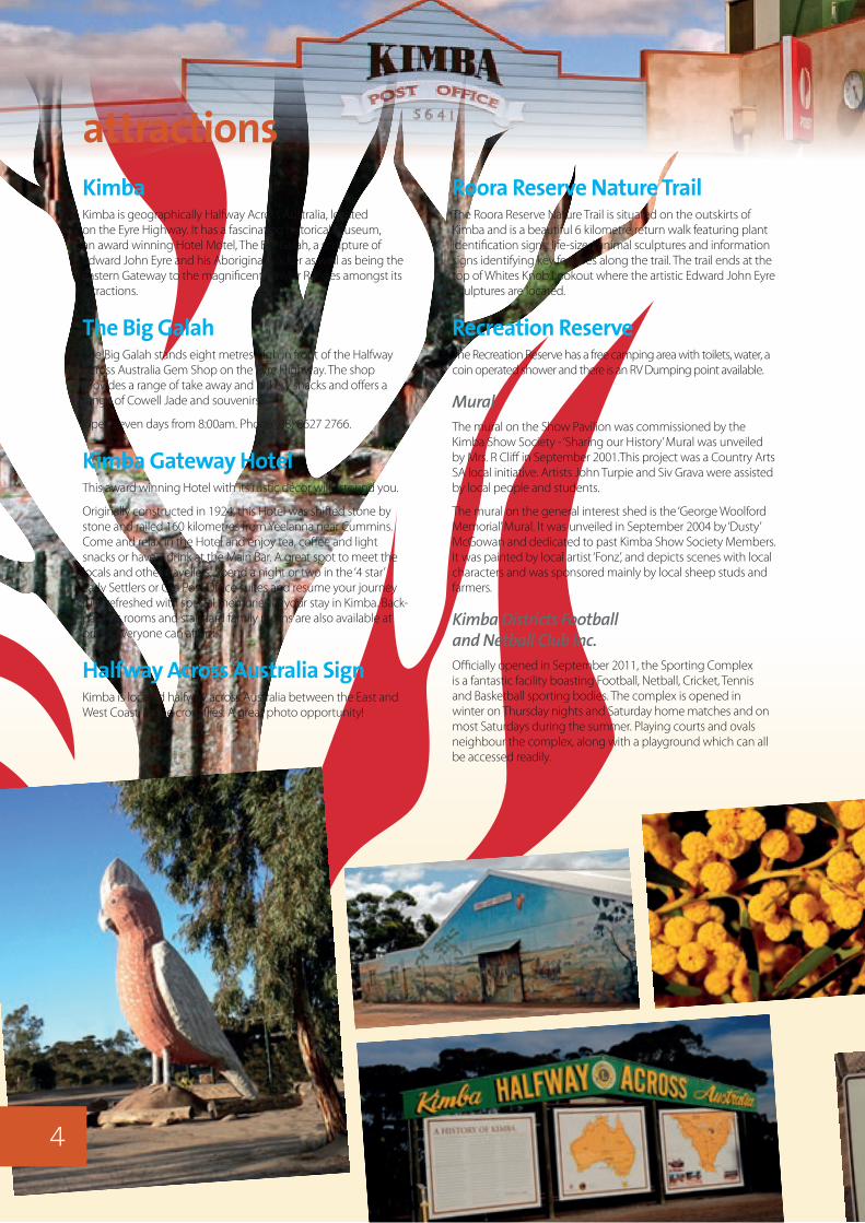
KimbaKimba is geographically Halfway Across Australia, located on the Eyre Highway. It has a fascinating historical museum, an award winning Hotel Motel, The Big Galah, a sculpture of Edward John Eyre and his Aboriginal tracker as well as being the Eastern Gateway to the magnificent Gawler Ranges amongst its attractions.
The Big GalahThe Big Galah stands eight metres high in front of the Halfway Across Australia Gem Shop on the Eyre Highway. The shop provides a range of take away and bakery snacks and offers a range of Cowell Jade and souvenirs.
Open seven days from 8:00am. Phone (08) 8627 2766.
Kimba Gateway HotelThis award winning Hotel with its rustic décor will astound you.
Originally constructed in 1924, this Hotel was shifted stone by stone and railed 160 kilometres from Yeelanna near Cummins. Come and relax in the Hotel and enjoy tea, coffee and light snacks or have a drink at the Main Bar. A great spot to meet the locals and other travellers. Spend a night or two in the ‘4 star’ Early Settlers or Old Post Office suites and resume your journey fully refreshed with special memories of your stay in Kimba. Back-packers rooms and standard family rooms are also available at prices everyone can afford.
Halfway Across Australia SignKimba is located halfway across Australia between the East and West Coast, as the crow flies. A great photo opportunity!
attractionsRoora Reserve Nature TrailThe Roora Reserve Nature Trail is situated on the outskirts of Kimba and is a beautiful 6 kilometre return walk featuring plant identification signs, life-sized animal sculptures and information signs identifying key features along the trail. The trail ends at the top of Whites Knob Lookout where the artistic Edward John Eyre Sculptures are located.
Recreation ReserveThe Recreation Reserve has a free camping area with toilets, water, a coin operated shower and there is an RV Dumping point available.
MuralThe mural on the Show Pavilion was commissioned by the Kimba Show Society - ‘Sharing our History’ Mural was unveiled by Mrs. R Cliff in September 2001.This project was a Country Arts SA local initiative. Artists John Turpie and Siv Grava were assisted by local people and students.
The mural on the general interest shed is the ‘George Woolford Memorial’ Mural. It was unveiled in September 2004 by ‘Dusty’ McGowan and dedicated to past Kimba Show Society Members. It was painted by local artist ‘Fonz’, and depicts scenes with local characters and was sponsored mainly by local sheep studs and farmers.
Kimba Districts Football and Netball Club Inc.Officially opened in September 2011, the Sporting Complex is a fantastic facility boasting Football, Netball, Cricket, Tennis and Basketball sporting bodies. The complex is opened in winter on Thursday nights and Saturday home matches and on most Saturdays during the summer. Playing courts and ovals neighbour the complex, along with a playground which can all be accessed readily.
4
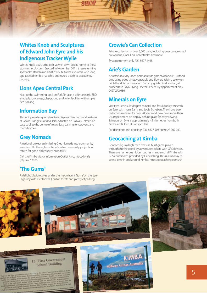
Whites Knob and Sculptures of Edward John Eyre and his Indigenous Tracker WylieWhites Knob boasts the best view in town and is home to these stunning sculptures. Erected in November 2011, these stunning spectacles stand as an artistic tribute to the explorers who long ago tackled terrible hardship and risked death to discover our country.
Lions Apex Central ParkNext to the swimming pool on Park Terrace, it offers electric BBQ, shaded picnic areas, playground and toilet facilities with ample free parking.
Information BayThis uniquely designed structure displays directions and features of Gawler Ranges National Park. Situated on Railway Terrace, an easy stroll to the centre of town. Easy parking for caravans and motorhomes.
Grey NomadsA national project assimilating Grey Nomads into community volunteer life through contribution to community projects in return for good old country hospitality.
Call the Kimba Visitor Information Outlet for contact details (08) 8627 2026.
‘The Gums’A delightful picnic area under the magnificent ‘Gums’ on the Eyre Highway with electric BBQ, public toilets and plenty of parking.
Crowie’s Can CollectionPrivate collection of over 3,000 cans, including beer cans, related breweriana, Coca Cola collectables and more.
By appointment only (08) 8627 2468.
Arie’s GardenA sustainable dry lands permaculture garden of about 120 food producing trees, vines, vegetable and flowers, relying solely on rainfall and its conservation. Entry by gold coin donation, all proceeds to Royal Flying Doctor Service. By appointment only 0427 272 686.
Minerals on EyreVisit Eyre Peninsula’s largest mineral and fossil display ‘Minerals on Eyre’, with hosts Barry and Jodie Schubert. They have been collecting minerals for over 20 years and now have more than 2400 specimens on display behind glass for easy viewing. ‘Minerals on Eyre’ is approximately 45 kilometres from both Kimba and Cleve at Carrapee Hill.
For directions and bookings (08) 8627 5039 or 0427 207 039.
Geocaching at KimbaGeocaching is a high-tech treasure hunt game played throughout the world by adventure seekers with GPS devices. There are numerous hidden caches in and around Kimba with GPS coordinates provided by Geocaching. This is a fun way to spend time in and around Kimba. http://geocaching.com.au/
5
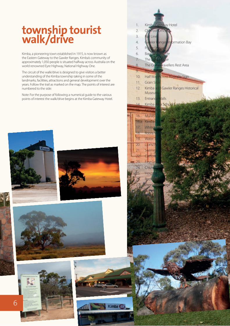
Kimba, a pioneering town established in 1915, is now known as the Eastern Gateway to the Gawler Ranges. Kimba’s community of approximately 1,050 people is situated halfway across Australia on the world renowned Eyre Highway, National Highway One.
The circuit of the walk/drive is designed to give visitors a better understanding of the Kimba township taking in some of the landmarks, facilities, attractions and general development over the years. Follow the trail as marked on the map. The points of interest are numbered to the side:
Note: For the purpose of following a numerical guide to the various points of interest the walk/drive begins at the Kimba Gateway Hotel.
township tourist walk/drive
1. Kimba Gateway Hotel
2. Old Post Office
3. Rail Line
4. Gawler Ranges Information Bay
5. Police Station
6. Bank of Adelaide
7. The Bake House
8. The Gums Travellers Rest Area
9. Big Galah
10. Half Way Across Australia Sign
11. Grain Silos
12. Kimba and Gawler Ranges Historical Museum
13. Entrance Walls
14. Kimba Area School Community Library
15. Kimba Area School
16. Murals
16.a Kimba District Football and Netball Club
17. Whites Knob
18. Roora Walking Trail
19. Water Tanks
20. Lions/Apex/Central Park
21. Swimming Pool
22. Catholic Church
23. First Government School Building
24. Church of England
25. Hospital
26. Rock for Water
27. Vennings Garage
28. J.L Pike
29. The Big Store
30. Palmers Pioneer Store
31. Kimba Soldiers Memorial Institute
32. Institute Memorial Gardens
33. TAFE Campus
34. Ellis Garage
35. Electricity Supply
6

The Distance of the Tourism Walk/Drive is 6.1 kilometres and will take approximately 15 to 30 minutes of your time if you drive or considerably longer to walk.
[To include the Roora Trail walk, the distance is 6 kilometres. There are two optional loops adding 1.7 kilometres to the trail]
reservoirtanks
MILLER
STEPHENS
ENRIG
HT
FRIC
K ST
FREETH
WILLIAM
FERR
Y ST
RAILW
AY
YATE
S
SHARRAD
ELLIS
HWY
NUGENT
HOPCRAFT
HANN
AN
CALD
WEL
L
VINTA
GE
CANT
FRANCIS ROADKI
NG
PARK
ROORA
SAMPSON
BEINKE CT
HOGAN CT
WES
T
HIGH
WOH
LING
GRUN
D
WHY
TE
DUM
P
KIMBA
SOUTH
MATHEW
S
CROSS
NORTH
SOUTH
BUCKLEBOO
ROAD
RAILW
AY
COWELL KIMBA RD
NORTH
CLEV
E
MARTIN
SCHA
EFER
CRES
CEN
T
STREET
ST
ROAD
STREET
TERR
ACE
ROAD
CRES
CENT
DRIVE
ROAD
ROAD
ROAD
DRIVE
DRIV
E
ROAD
ROAD
DRIVE
TERR
ACE
ROAD
HASK
ETT
STREET
TERR
ACE
STRE
ET ROAD
AVEN
UE
ROAD
TERRACE
TERRACE
GROVE
STREET
TERRACE
TERRACE
TERR
ACE
TERRACE
ROAD
TERRACE
AVEN
UE
ROAD
EYRE
HIGHWAY
EYRE
HIGH
WAY
JACOBS DRIVE
OLD EYRE
NOTHROUGH
ROAD
0 100 200 300 400metres
N
Information Bay
Toilets
BBQ / Picnic Area
Visitor Information
Laundromat
Internet Access
Playground
Shower (coin operated)
Caravan & RV Dump Point
Fuel Outlet
Truck Parking Bay
Accommodation
Pay Phone
Caravan Park
Camping (free)
Swimming Centre
©District Council of Kimba, 2015. Produced by Carto Graphics.
ToPort
Augusta144km,
Adelaide
ToWudinna103km,Ceduna& WA
ToWhites Knob Lookout,
Edward John EyreSculptures - 3km& Gawler Ranges
ToCowell89km
MiningVillage
Recreation Reserve
Parklands
RooraWalking
Trail
Library
HalfWaySign
RSL
The HarvestChristianCentre
Kimba &Gawler Ranges
HistoricalMuseum
KimbaArea School
KimbaCemetery
To Cleve70km
DistrictCouncil
of Kimba
HealthCentre
SwimmingCentre
CentralPark Silos
SilosGawlerRangesInfo.Bay
UnitingChurch Police
Big Galah
The GumsRest
Stop
KimbaDistrict Hospital
& Medical Practice
PostOffice
EmergenceyServiceCentre
KimbaPioneer
MemorialVillage
AnglicanChurch
CatholicChurch
TAFE
KimbaSoldiersMemorial Hall& Gardens
Carto Graphics
Produced by
www.cartographics.com.au
COWELL KIMBA RD
7

Lake
Gai
rdne
r
Nat
iona
l Pa
rk
Gaw
ler
Ran
ges
Nat
iona
l Pa
rk
Gaw
ler
Rang
esCo
ns R
es
Kulli
paru
Cons
Par
k
Coca
taCo
ns P
ark
Heg
gato
nCo
ns R
es
Mal
gra
CRCa
ralu
eB
luff
CR
Cort
linye
CR
Moo
ngi
CR
Moo
tra
Cons
Res
Sheo
akH
ill C
R
Sheo
akH
ill C
P
The
Plug
Ran
geCo
ns R
es
Corr
obin
nie
Hill
Cons
Par
k
Bar
wel
lCo
ns P
ark
Pink
awill
inie
Cons
erva
tion
Park
Cara
ppee
Hill
Cons
Par
k
Dar
ke R
ange
Cons
Par
k
Ham
bidg
eW
ilder
ness
Pro
tect
ion
Are
a
Coca
taCo
nsPa
rk
Lake
Gill
esCo
nser
vatio
nPa
rk
Lake
Acra
man
Lake
Gai
rdne
r
Lake
War
ram
boo
Lake
Yani
nee
Lak
e W
anna
man
na
Lake
G
illes
Nuk
eyDa
m
Lake
Mac
Farla
ne
Mac
kay
Flat
Moo
nlig
htFl
at
Brya
nt
P
lain
Wom
bat
Flat
Bayl
ey P
lain
s
Pold
a B
asin
Botenella Hills
Uno Range
Gaw
ler
Darke Range
Rang
es
Eure
ka B
luff
Cara
lue
Bluf
f
Wau
lkin
na H
illSi
ster
s H
illN
umm
ee H
illMou
nt D
oubl
e
Nuk
ey B
luff
Yelta
nna
Hill
Yarn
a H
ill
Yarin
gie
Hill
Kola
ymer
rika
Hill
Yarin
da H
ill
Wirr
igen
daH
ill
Wip
ipip
pee
Hill
Wilc
herr
y H
ill
Wee
dnan
naH
ill
Mou
ntW
edge
Wau
rea
Hill
War
oona
Peak
Una
lla H
ill
Uco
ntitc
hie
Hill
Uca
rro
Hill
Sprin
g H
illM
ount
Not
t
Thur
lga
Hill
Thre
e Cr
own
Hill
Tcha
rkul
du H
ill
Mou
nt S
turt
Mou
nt S
tanl
ey
Scru
bby
Peak
Scru
bby
Hill
Mou
nt S
aint
Mun
go
Roun
d H
ill
Rock
wat
er H
ill
Mou
ntPy
ram
id
Prom
inen
t Hill
Pord
iaH
ill
Mou
ntPo
llard
Pint
hapu
t Hill
Phea
sant
Hill
Pete
rlum
bo H
ill
Mou
nt P
artr
idge
Mou
ntN
onni
ngN
eura
nipp
e H
ill
Moo
nare
eH
ill
Min
nipa
Hill
Mill
er H
ill
Men
dea
Hill
Corr
obin
nie
Hill
Kyan
cutta
Hill
Kund
ery
Hill
Mou
nt K
olen
do
Kolb
alla
Hill
Kodo
do H
ill
Kapp
awan
ta H
ill
Kapp
akoo
la H
ill
Jum
pupp
y H
ill
Mou
nt J
oy
Mou
nt Iv
e
Mou
nt H
iltab
a
Gyps
um H
ill
Mou
ntGr
anite
Mou
nt G
aird
ner
Mou
nt F
riday
Mou
nt F
airy
Euril
la H
ill
Mou
ntDe
sper
ate
Dark
e Pe
ak
Mou
nt D
ampe
r
Cotto
n N
ob
Coor
ia H
ill
Coni
cal
Hill
Cond
ada
Hill
Coca
taH
ill
Chilp
uddi
e H
ill
Char
ba H
ill
Mou
ntCe
ntre
Cara
ppee
Hill
Cam
poon
aH
ill
Calli
ss H
ill
Butte
rfiel
d H
ill
The
Bulla
nt
Bram
field
Hill
Mou
ntBo
sanq
uet
Bond
Hill
Blac
k H
ill
Belt
Hill
Barn
a H
ill
Ebun
bani
eH
illRo
ckho
le H
ill
Low
Hill
The
Hor
sesh
oe
Mur
ray
Hill
Jarr
etH
ill
Gran
iteH
ill
Blac
kH
illBa
rker
Hill
Euril
la H
ill
Har
risBl
uff
Mic
collo
Hill
Yala
nda
Hill
Curt
inye
Hill
Carp
ie P
unth
aH
ill
Sheo
ak H
ill
Mou
ntM
esse
nger
Poot
itnie
Hill
Mou
ntO
linth
us
Mou
ntM
icco
llo
26
23
28
28
51
18
14
15
11
3230
34
14
45
16
18
26
45
69
60
42
13
59
37
2131
14
6
38
51
16
22
12
20
1610
72
8
21
22
21
20
14
14
23
16
18
Hilt
aba
HS
Moo
nare
e H
S
Mou
nt Iv
e H
S
Old
Pan
eyH
SPond
anna
Out
stat
ion
Pane
y H
S
Thur
lga
HS
Yard
ea H
S
Buck
lebo
o H
S
Kole
ndo
HS
Low
Hill
s W
ools
hed
Non
ning
HS
Uno
HS
Siam
HS
Wilc
herr
y H
S
McL
achl
an R
S
Cara
lue
RS
Kona
nda
RS
Cond
ada
RS
Pinb
ong
RS
Pold
inna
RS
Min
nipa
Wud
inna
Kim
ba
Moo
ngi
Cock
abid
nie
Cor
ner
Coot
ra
Wud
inna
East
Kopi
Nan
tum
a
Bar
na
Wad
dike
e
Koon
gaw
aM
ount
Dam
per
Mou
nt W
edge
Pyge
ry
Yani
nee
Karc
ulta
by
Man
galo
Buc
kleb
oo
Dar
ke P
eak
Kyan
cutt
a
War
ram
boo
Kiel
pa
Lock
B91
B90
1
1
Bartley Road
L PTrack
Coni
cal H
ill Tr
ack
4WD
Only
–
Road
Woo
lford
Road
Yardea
Track
FlatTurkey
Pane
y
Old
Scen
icRo
ute
L P Track
one w
ay
TrackSturts
one way
4WDonly
Yardea
Road
Buck
leboo
Stoc
k
Route
Liene
rts-W
oolfo
rdTr
ack
Tola
Rock
s
Clem
ents
Rd
Basc
ombe
Pink
awilli
nie
Wud
inna E
ast
Drekurmi
Pile Pudla
Road
Road
Road
Road
Road
Road
Rd
Buck
leboo
Stoc
k
Route
Wilcherry Road
Middleb
ack
Barns
Barns
Road
Road
Allen
Road
Road
Highway
Strin
ger
High
way
Kyan
cutta
– E
lliston
R
oad
Port
Kenn
y
Road
Cow
ell
Gawler
Bird
seye
Buck
leboo
RoadCleve
Road
Thurlga –
Hiltaba –
RangesRoad
Iron
Knob
Road
Hilta
ba –
Iron
Knob
Road
Kimba
Balumbah Kinnard Road
Old Ey
re
Hwy
Road
Hig
hway
Eyre
Highway
Eyre
Eyre
Highway
Tod
High
way
Wal
tum
ba T
ank
Cam
pgro
und
A
cces
s to
Lake
Gai
rdne
r
Poon
dann
aR
ock
Pild
appa
Roc
k
Podi
nna
Roc
k
Pyge
ry R
ocks
Pars
ons R
ocks
Pold
aR
ock
Littl
e W
udin
na R
ock
Turt
leR
ocks
Dar
keM
emor
ial
Wad
dike
eR
ocks
Dar
ke's
Gra
ve
Peel
la R
ocks
Yarw
ondu
tta R
ocks
Org
an P
ipes
Pold
aPu
mpi
ng S
tatio
n
Wud
inna
Hill
Wag
anny
Cam
pgro
und
Ent
ry F
ees
App
ly
Ent
ry F
ees A
pply
Ent
ry F
ees
App
lySton
e D
am
Scru
by P
eak
Cam
pgro
undKod
odo
Cam
pgro
und
Yand
inga
Cam
pgro
und
Old
Pan
eyC
ampg
roun
d
Kol
ay H
utC
ampg
roun
d
Chi
lluni
eC
ampg
roun
d
Mat
tera
Cam
pgro
und
Lake
Gai
rdne
r Pri
vate
Acc
ess
Enq
uiri
es a
nd G
ate
Key
ava
ilabl
efr
om M
t Ive
Hom
este
ad
Polic
eman
sPo
int
Kol
ay M
iric
a F
alls
Pond
anna
Rui
ns
Wag
on
Secr
etR
ocks
Buc
kleb
oo R
ecre
atio
n A
rea
Goy
ders
Mem
oria
l
Obs
erva
tion
Are
a
Whi
tes K
nob,
Edw
ard
John
Eyr
eSt
atue
Bas
com
beR
ocks
Look
out
To K
ingo
onya
& Co
ober
Ped
y
To P
ooch
era
Stre
aky
Bay
& Ce
duna
To W
irrul
la&
Cedu
naTo
Wirr
ulla
& Ce
duna
To P
ort K
enny
& St
reky
Bay
To K
ingo
onya
& Co
ober
Ped
y
To Ir
on K
nob
& W
hyal
la
To Ir
on K
nob
& W
hyal
la
To C
leve
To C
umm
ins
& Po
rt L
inci
oln
To E
llist
on
To W
hyal
la
KIM
BA
REG
ION
& G
AW
LER
RAN
GES
© D
istr
ict
Coun
cil o
f Kim
ba, P
rodu
ced
by C
arto
Gra
phic
s
01
02
0km
30
N
Maj
or R
oad
Seco
ndar
y Ro
ad –
sea
led
; uns
eale
d
Othe
r Roa
d –
seal
ed ;
unse
aled
Vehi
cula
r Tra
ck -
4WD
reco
mm
ende
d
Rout
e N
umbe
r
Road
Dis
tanc
e –
km
Park
or R
eser
ve
26
Railw
ay ;
Railw
ay S
idin
gLege
nd
B90
Loca
lity
Tow
n
Bar
na
Kim
ba
Info
rmat
ion
Cam
ping
No
Cam
ping
Fuel
Self-
regi
stra
tion
Stat
ion
Rang
er S
tatio
n
Gre
atAu
stra
lian
Bigh
t
Sout
hern
Oce
an
NT
SOU
TH
A
UST
RALI
A
WA
QLD
NSWVIC
Kang
aroo
Isla
nd
EYRE
PEN
INSU
LA
Nul
larb
or P
lain
GA
WLE
R R
AN
GE
S
Mou
ntGa
mbi
er
Port
Linc
oln
Port
Augu
sta
Brok
enHi
ll
AD
ELA
IDE
Coob
er P
edy
Cedu
na KIM
BA
Lake
Gai
rdne
r
Nat
iona
l Pa
rk
Gaw
ler
Ran
ges
Nat
iona
l Pa
rk
Gaw
ler
Rang
esCo
ns R
es
Kulli
paru
Cons
Par
k
Coca
taCo
ns P
ark
Heg
gato
nCo
ns R
es
Mal
gra
CRCa
ralu
eB
luff
CR
Cort
linye
CR
Moo
ngi
CR
Moo
tra
Cons
Res
Sheo
akH
ill C
R
Sheo
akH
ill C
P
The
Plug
Ran
geCo
ns R
es
Corr
obin
nie
Hill
Cons
Par
k
Bar
wel
lCo
ns P
ark
Pink
awill
inie
Cons
erva
tion
Park
Cara
ppee
Hill
Cons
Par
k
Dar
ke R
ange
Cons
Par
k
Ham
bidg
eW
ilder
ness
Pro
tect
ion
Are
a
Coca
taCo
nsPa
rk
Lake
Gill
esCo
nser
vatio
nPa
rk
Lake
Acra
man
Lake
Gai
rdne
r
Lake
War
ram
boo
Lake
Yani
nee
Lak
e W
anna
man
na
Lake
G
illes
Nuk
eyDa
m
Lake
Mac
Farla
ne
Mac
kay
Flat
Moo
nlig
htFl
at
Brya
nt
P
lain
Wom
bat
Flat
Bayl
ey P
lain
s
Pold
a B
asin
Botenella Hills
Uno Range
Gaw
ler
Darke Range
Rang
es
Eure
ka B
luff
Cara
lue
Bluf
f
Wau
lkin
na H
illSi
ster
s H
illN
umm
ee H
illMou
nt D
oubl
e
Nuk
ey B
luff
Yelta
nna
Hill
Yarn
a H
ill
Yarin
gie
Hill
Kola
ymer
rika
Hill
Yarin
da H
ill
Wirr
igen
daH
ill
Wip
ipip
pee
Hill
Wilc
herr
y H
ill
Wee
dnan
naH
ill
Mou
ntW
edge
Wau
rea
Hill
War
oona
Peak
Una
lla H
ill
Uco
ntitc
hie
Hill
Uca
rro
Hill
Sprin
g H
illM
ount
Not
t
Thur
lga
Hill
Thre
e Cr
own
Hill
Tcha
rkul
du H
ill
Mou
nt S
turt
Mou
nt S
tanl
ey
Scru
bby
Peak
Scru
bby
Hill
Mou
nt S
aint
Mun
go
Roun
d H
ill
Rock
wat
er H
ill
Mou
ntPy
ram
id
Prom
inen
t Hill
Pord
iaH
ill
Mou
ntPo
llard
Pint
hapu
t Hill
Phea
sant
Hill
Pete
rlum
bo H
ill
Mou
nt P
artr
idge
Mou
ntN
onni
ngN
eura
nipp
e H
ill
Moo
nare
eH
ill
Min
nipa
Hill
Mill
er H
ill
Men
dea
Hill
Corr
obin
nie
Hill
Kyan
cutta
Hill
Kund
ery
Hill
Mou
nt K
olen
do
Kolb
alla
Hill
Kodo
do H
ill
Kapp
awan
ta H
ill
Kapp
akoo
la H
ill
Jum
pupp
y H
ill
Mou
nt J
oy
Mou
nt Iv
e
Mou
nt H
iltab
a
Gyps
um H
ill
Mou
ntGr
anite
Mou
nt G
aird
ner
Mou
nt F
riday
Mou
nt F
airy
Euril
la H
ill
Mou
ntDe
sper
ate
Dark
e Pe
ak
Mou
nt D
ampe
r
Cotto
n N
ob
Coor
ia H
ill
Coni
cal
Hill
Cond
ada
Hill
Coca
taH
ill
Chilp
uddi
e H
ill
Char
ba H
ill
Mou
ntCe
ntre
Cara
ppee
Hill
Cam
poon
aH
ill
Calli
ss H
ill
Butte
rfiel
d H
ill
The
Bulla
nt
Bram
field
Hill
Mou
ntBo
sanq
uet
Bond
Hill
Blac
k H
ill
Belt
Hill
Barn
a H
ill
Ebun
bani
eH
illRo
ckho
le H
ill
Low
Hill
The
Hor
sesh
oe
Mur
ray
Hill
Jarr
etH
ill
Gran
iteH
ill
Blac
kH
illBa
rker
Hill
Euril
la H
ill
Har
risBl
uff
Mic
collo
Hill
Yala
nda
Hill
Curt
inye
Hill
Carp
ie P
unth
aH
ill
Sheo
ak H
ill
Mou
ntM
esse
nger
Poot
itnie
Hill
Mou
ntO
linth
us
Mou
ntM
icco
llo
26
23
28
28
51
18
14
15
11
3230
34
14
45
16
18
26
45
69
60
42
13
59
37
2131
14
6
38
51
16
22
12
20
1610
72
8
21
22
21
20
14
14
23
16
18
Hilt
aba
HS
Moo
nare
e H
S
Mou
nt Iv
e H
S
Old
Pan
eyH
SPond
anna
Out
stat
ion
Pane
y H
S
Thur
lga
HS
Yard
ea H
S
Buck
lebo
o H
S
Kole
ndo
HS
Low
Hill
s W
ools
hed
Non
ning
HS
Uno
HS
Siam
HS
Wilc
herr
y H
S
McL
achl
an R
S
Cara
lue
RS
Kona
nda
RS
Cond
ada
RS
Pinb
ong
RS
Pold
inna
RS
Min
nipa
Wud
inna
Kim
ba
Moo
ngi
Cock
abid
nie
Cor
ner
Coot
ra
Wud
inna
East
Kopi
Nan
tum
a
Bar
na
Wad
dike
e
Koon
gaw
aM
ount
Dam
per
Mou
nt W
edge
Pyge
ry
Yani
nee
Karc
ulta
by
Man
galo
Buc
kleb
oo
Dar
ke P
eak
Kyan
cutt
a
War
ram
boo
Kiel
pa
Lock
B91
B90
1
1
Bartley Road
L PTrack
Coni
cal H
ill Tr
ack
4WD
Only
–
Road
Woo
lford
Road
Yardea
Track
FlatTurkey
Pane
y
Old
Scen
icRo
ute
L P Track
one w
ay
TrackSturts
one way
4WDonly
Yardea
Road
Buck
leboo
Stoc
k
Route
Liene
rts-W
oolfo
rdTr
ack
Tola
Rock
s
Clem
ents
Rd
Basc
ombe
Pink
awilli
nie
Wud
inna E
ast
Drekurmi
Pile Pudla
Road
Road
Road
Road
Road
Road
Rd
Buck
leboo
Stoc
k
Route
Wilcherry Road
Middleb
ack
Barns
Barns
Road
Road
Allen
Road
Road
Highway
Strin
ger
High
way
Kyan
cutta
– E
lliston
R
oad
Port
Kenn
y
Road
Cow
ell
Gawler
Bird
seye
Buck
leboo
RoadCleve
Road
Thurlga –
Hiltaba –
RangesRoad
Iron
Knob
Road
Hilta
ba –
Iron
Knob
Road
Kimba
Balumbah Kinnard Road
Old Ey
re
Hwy
Road
Hig
hway
Eyre
Highway
Eyre
Eyre
Highway
Tod
High
way
Wal
tum
ba T
ank
Cam
pgro
und
A
cces
s to
Lake
Gai
rdne
r
Poon
dann
aR
ock
Pild
appa
Roc
k
Podi
nna
Roc
k
Pyge
ry R
ocks
Pars
ons R
ocks
Pold
aR
ock
Littl
e W
udin
na R
ock
Turt
leR
ocks
Dar
keM
emor
ial
Wad
dike
eR
ocks
Dar
ke's
Gra
ve
Peel
la R
ocks
Yarw
ondu
tta R
ocks
Org
an P
ipes
Pold
aPu
mpi
ng S
tatio
n
Wud
inna
Hill
Wag
anny
Cam
pgro
und
Ent
ry F
ees
App
ly
Ent
ry F
ees A
pply
Ent
ry F
ees
App
lySton
e D
am
Scru
by P
eak
Cam
pgro
undKod
odo
Cam
pgro
und
Yand
inga
Cam
pgro
und
Old
Pan
eyC
ampg
roun
d
Kol
ay H
utC
ampg
roun
d
Chi
lluni
eC
ampg
roun
d
Mat
tera
Cam
pgro
und
Lake
Gai
rdne
r Pri
vate
Acc
ess
Enq
uiri
es a
nd G
ate
Key
ava
ilabl
efr
om M
t Ive
Hom
este
ad
Polic
eman
sPo
int
Kol
ay M
iric
a F
alls
Pond
anna
Rui
ns
Wag
on
Secr
etR
ocks
Buc
kleb
oo R
ecre
atio
n A
rea
Goy
ders
Mem
oria
l
Obs
erva
tion
Are
a
Whi
tes K
nob,
Edw
ard
John
Eyr
eSt
atue
Bas
com
beR
ocks
Look
out
To K
ingo
onya
& Co
ober
Ped
y
To P
ooch
era
Stre
aky
Bay
& Ce
duna
To W
irrul
la&
Cedu
naTo
Wirr
ulla
& Ce
duna
To P
ort K
enny
& St
reky
Bay
To K
ingo
onya
& Co
ober
Ped
y
To Ir
on K
nob
& W
hyal
la
To Ir
on K
nob
& W
hyal
la
To C
leve
To C
umm
ins
& Po
rt L
inci
oln
To E
llist
on
To W
hyal
la
KIM
BA
REG
ION
& G
AW
LER
RAN
GES
© D
istr
ict
Coun
cil o
f Kim
ba, P
rodu
ced
by C
arto
Gra
phic
s
01
02
0km
30
N
Maj
or R
oad
Seco
ndar
y Ro
ad –
sea
led
; uns
eale
d
Othe
r Roa
d –
seal
ed ;
unse
aled
Vehi
cula
r Tra
ck -
4WD
reco
mm
ende
d
Rout
e N
umbe
r
Road
Dis
tanc
e –
km
Park
or R
eser
ve
26
Railw
ay ;
Railw
ay S
idin
gLege
nd
B90
Loca
lity
Tow
n
Bar
na
Kim
ba
Info
rmat
ion
Cam
ping
No
Cam
ping
Fuel
Self-
regi
stra
tion
Stat
ion
Rang
er S
tatio
n
Gre
atAu
stra
lian
Bigh
t
Sout
hern
Oce
an
NT
SOU
TH
A
UST
RALI
A
WA
QLD
NSWVIC
Kang
aroo
Isla
nd
EYRE
PEN
INSU
LA
Nul
larb
or P
lain
GA
WLE
R R
AN
GE
S
Mou
ntGa
mbi
er
Port
Linc
oln
Port
Augu
sta
Brok
enHi
ll
AD
ELA
IDE
Coob
er P
edy
Cedu
na KIM
BA
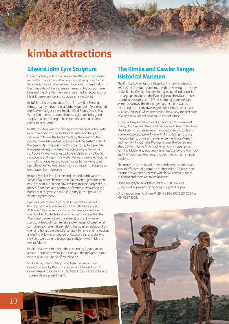
Edward John Eyre SculptureEdward John Eyre, born in England in 1815, is remembered as the first man to cross this continent from Sydney to the Swan River. He was the first man to record this exploration of the three sides of the peninsula named in his honour. Lake Eyre and the Eyre Highway are also named in recognition of his skill, perseverance and courage as an explorer.
In 1838 he led an expedition from Streaky Bay. Passing through sandy terrain and scrubby vegetation, Eyre reached the Gawler Ranges where he identified Sturt’s Desert Pea. Water had been scarce and Eyre was glad to find a good supply at Baxter’s Range. The expedition ended at Depot Creek, near Mt Arden.
In 1840 this trek was reversed by Eyre’s overseer, John Baxter. Recent rain had ensured adequate water and the party was able to follow the tracks made by their wagons the previous year. Meanwhile Eyre explored the eastern side of the peninsula. It was very hard for the horses to penetrate the dense vegetation. Feed was scarce and water more so. About 45 kilometres east of the sculptures, Eyre found good grass and a spring of water. He was so relieved that he named the place Refuge Rocks, “for such they were to us in our difficulties”. At Port Lincoln, Eyre arranged for supplies to be shipped from Adelaide.
In 1841 Eyre left Port Lincoln and headed north west to Streaky Bay where he met John Baxter. Arrangements were made to ship supplies to Fowler’s Bay and the party set out for W.A. Poor feed and shortage of water so weakened the horses that they were not able to carry all the provisions wanted by the men.
Eyre was determined to explore beyond the Head of the Bight and was very aware of the difficulties ahead. At Fowler’s Bay he sent non-essential supplies and four men back to Adelaide by ship. It was at this stage that the Aboriginal tracker joined the expedition. Lack of water, scarcity of feed, difficult terrain and extremes of weather all combined to make this trek along the coast so arduous that men and horses perished. Fortunately for Eyre and his tracker, a whaling ship was anchored at Rossiter’s Bay and the two survivors were able to recuperate sufficiently to finish the trek to Albany.
Erected in November 2011, these stunning figures are an artistic tribute to Edward John Eyre and the Indigenous men whose bush skills he so often relied on.
Sculpted by Roland Weight and Marcus Possingham Commissioned by the District Council of Kimba Tourism Committee and funded by the District Council of Kimba and Tourism Development Grant.
kimba attractionsThe Kimba and Gawler Ranges Historical Museum The Kimba Gawler Ranges Historical Society was formed in 1971 by local people concerned with preserving the history of the Kimba District. Located in mallee parkland opposite the large grain silos on the Eyre Highway the Museum has occupied this site since 1973, developing as needed and as money allows. The first project under taken was the relocating of an early dwelling (Pioneer House) which was built around 1908 when the Haskett Bros grew the first crop of wheat on a natural plain south east of Kimba.
An old railway turnstile gives foot access to Government sheds, Dog Fence, water conservation and Blacksmith Shop. The Museum houses some amazing pioneering tools and a pine and pug cottage. Now with 17 buildings housing historical items, come and experience the living Museum and wander through the Pioneer House. The Government Shed Settlers Home, One Teacher School, Pioneer Store, Farming Machinery, Stationary Engines, ‘Clancy’ the Fire Truck and the Telephone Exchange are also interesting historical displays.
The museum is run by volunteers and demonstrations are available for school groups on arrangement. Coaches and tourists are welcome, there is wheelchair access to most buildings and there are toilet facilities.
Open Tuesday to Thursday 9:00am – 11:00am and 2:00pm – 4:00pm, and on Sunday 1:30pm- 4:00pm.
Or by appointment, phone 0429 163 906, (08) 8627 2684 or (08) 8627 2303.
10
Day TripsKimba is an ideal town to base yourself for day trips. There are numerous parks and reserves that you could spend the day exploring such as:
• Caralue Bluff (27km)
• Secret Rocks (40km)
• Lake Gilles Conservation Park (31km)
• Carappee Hill (53km)
Other towns that you could spend a day visiting include:
• Cleve (69.6km)
• Cowell (88.8km)
• Arno Bay (95.2km)
• Whyalla (142.7km)
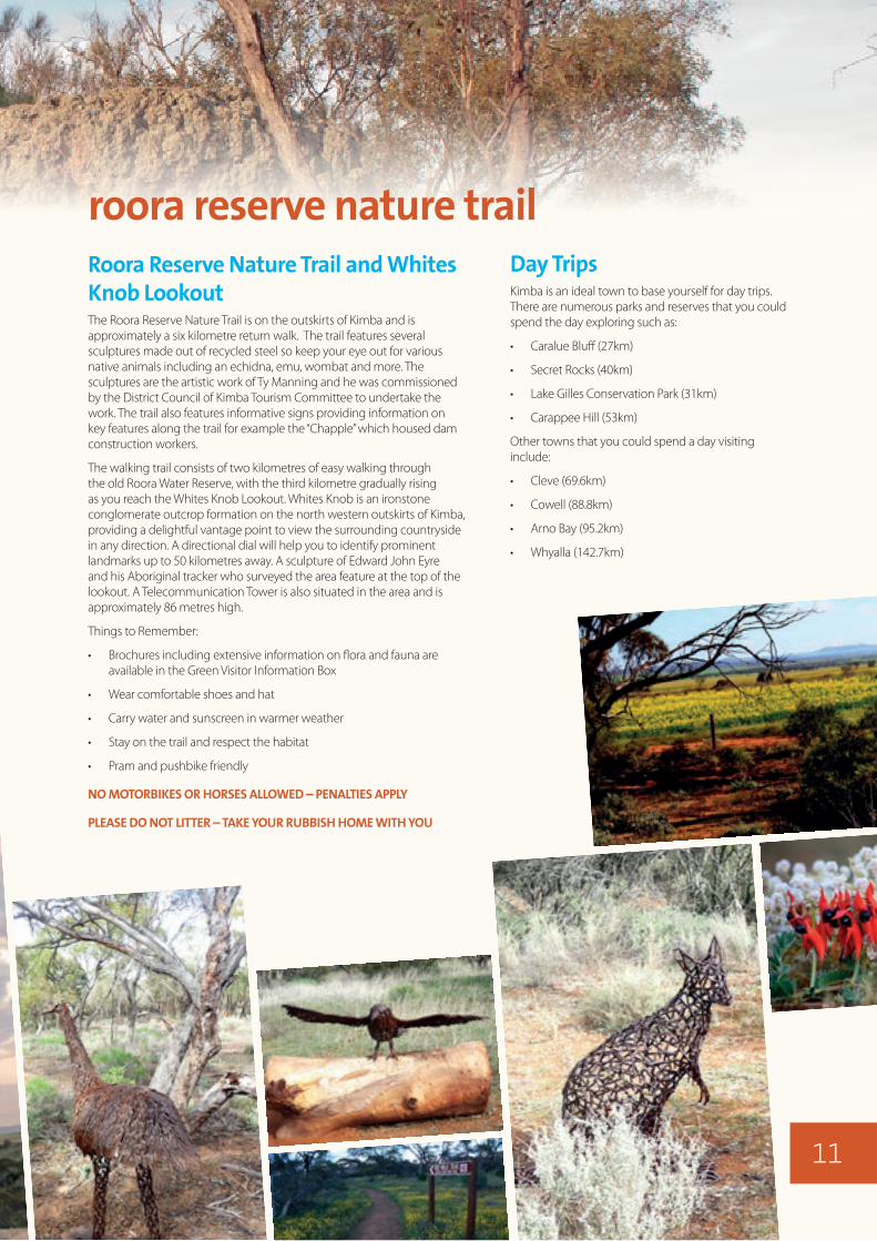
Roora Reserve Nature Trail and Whites Knob LookoutThe Roora Reserve Nature Trail is on the outskirts of Kimba and is approximately a six kilometre return walk. The trail features several sculptures made out of recycled steel so keep your eye out for various native animals including an echidna, emu, wombat and more. The sculptures are the artistic work of Ty Manning and he was commissioned by the District Council of Kimba Tourism Committee to undertake the work. The trail also features informative signs providing information on key features along the trail for example the “Chapple” which housed dam construction workers.
The walking trail consists of two kilometres of easy walking through the old Roora Water Reserve, with the third kilometre gradually rising as you reach the Whites Knob Lookout. Whites Knob is an ironstone conglomerate outcrop formation on the north western outskirts of Kimba, providing a delightful vantage point to view the surrounding countryside in any direction. A directional dial will help you to identify prominent landmarks up to 50 kilometres away. A sculpture of Edward John Eyre and his Aboriginal tracker who surveyed the area feature at the top of the lookout. A Telecommunication Tower is also situated in the area and is approximately 86 metres high.
Things to Remember:
• Brochures including extensive information on flora and fauna are available in the Green Visitor Information Box
• Wear comfortable shoes and hat
• Carry water and sunscreen in warmer weather
• Stay on the trail and respect the habitat
• Pram and pushbike friendly
NO MOTORBIKES OR HORSES ALLOWED – PENALTIES APPLY
PLEASE DO NOT LITTER – TAKE YOUR RUBBISH HOME WITH YOU
roora reserve nature trail
11

gawler ranges national parkThe Park is located in the spectacular southern Gawler Ranges. This virtually untouched Park consists of ancient rolling hills interspersed with wide-open plains and fascinating geological features including Kolay Mirica Falls, Mt Allalone, Waulkinna Hill and the stunning Organ Pipes. Seasonal water flows make these sites even more impressive.
At least 21 rare and threatened species occur in the Park including Major Mitchell’s Cockatoo and the beautiful Yellow-footed Rock-wallaby.
The striking beauty, abundant wildlife and vibrant seasonal wildflowers attract many visitors to Gawler Ranges National Park. The Park provides access tracks for both 2WD and 4WD vehicles as well as opportunities for bushwalking and cycling.
Bush camping is available in designated camping areas.
Adjacent to Waganny 2WD campground, Waulkinna Hill is a granite hill with spectacular rock formations sculpted over the millennia. A great place for a quiet picnic or a short climb will provide sweeping views of Sturt Lake and an array of seasonal wildflowers.
Old Paney Homestead, built in 1888, provides a glimpse into the rich pastoral heritage of the Gawler Ranges. Nearby Policeman’s Point is the site of the first police camp in the region and a short walk will take you to a beautiful gorge that flows seasonally in a series of waterfalls and rock holes.
Access is suitable for 2WD vehicles via the Old Paney Scenic Route.
Please note the possibility of periodical closures of the park for feral animal control (commonly in August and February/March). For more information regarding park information including closures ring (08) 8648 1883, (08) 8625 3144 or go to: www.environment.sa.gov.au/parks/Find_a_Park/Browse_by_region/ Eyre_Peninsula/Gawler_Ranges_National_Park
Entry and camping fees apply.
Pastoral HistoryEdward John Eyre was the first white man to traverse the Gawler Ranges in 1839. In 1857 Yardea Station was the first pastoral lease taken up in the area. The years 1857 and ’58 must have been good rain over the country as all the explorers spoke of ‘permanent’ fresh water lakes, of which there are none, except after good rains.
The Land Regulations of the day required pastoralists to stock their runs with 19 sheep per square kilometre in the late 1860’s. This saw approximately 90,000 sheep being shorn at properties such as Nonning Station. Harsh arid conditions and unreliable water supply found those sheep numbers unsustainable.
12
3
To Yardeaand Iron Knob
To Wudinna
PINKAWILLINIECONSERVATION PARK
Yandinga
0 kilometres 5 10
Park boundary
2WD track
4WD track
Lake, mainly dry
Campground
Self-registration station
Hut
Building
This track isclosed during
the fire banseason
OLD PANEY SCENIC ROUTE
MATTERA
TR
ACK
TUR
KEY FLAT TRACK
LP
TRAC
K
CONICAL HILL T
RACK LP TR
ACK
MIN
NIP
A
–YAR
DEA
RO
AD
BARNS
ROAD
STU
RTS
T
RACK
O
ne W
ay
Standley Flat
O
neW a y
Kododo Hill
ScrubbyPeak
OrganPipes
MountCentre
398m
310m
Mount Granite
GAWLER RANGESNATIONAL PARK
EurekaBluff
Conical Hill
PondannaOutstation
Paney Hill
Stone Dam PaneyBluff
Matteracampground
Old PaneyHomestead
PolicemansPoint
NukeyBluff
Mount Double
‘Paney’ andPark Office
Kolay Hut
Kolay MiricaFalls
Chilluniecampground
Mount Allalone
Wagannycampground
Shearingshed
MountSturt
GAWLER RANGESNATIONAL PARK
To Minnipa
To Kimba
Waulkinna Hill
413m 431m
465m
444m
348m
362m
454m
Sites of interest
Historic sites in the park include the Old Paney Homestead, Policemans Point precinct, Stone Dam, and Pondanna Outstation, where agriculture was attempted early last century. The Friends of Gawler Ranges National Park have restored the house at Pondanna Outstation and this house is now available for hire. For more information and bookings, phone (08) 8680 2090.
Notable landmarks include Paney Bluff, Mount Allalone, Mount Sturt, Conical Hill and Scrubby Peak. Other scenic sites of interest include Kolay Mirica Falls, The Organ Pipes and Yandinga Gorge.
Rhyolite atKolay Mirica Falls
Old PaneyHomestead
www.environment.sa.gov.au
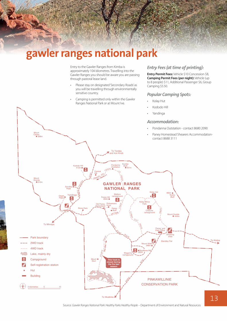
Entry Fees (at time of printing):Entry Permit Fees: Vehicle $10 Concession $8, Camping Permit Fees (per night): Vehicle (up to 8 people) $11, Additional Passenger $6, Group Camping $5.50.
Popular Camping Spots:• Kolay Hut
• Kododo Hill
• Yandinga
Accommodation:• Pondanna Outstation - contact 8680 2090
• Paney Homestead Shearers Accommodation- contact 8688 3111
gawler ranges national parkEntry to the Gawler Ranges from Kimba is approximately 104 kilometres. Travelling into the Gawler Ranges you should be aware you are passing through pastoral lease land.
• Please stay on designated ‘Secondary Roads’ as you will be travelling through environmentally sensitive country.
• Camping is permitted only within the Gawler Ranges National Park or at Mount Ive.
Source: Gawler Ranges National Park: Healthy Parks Healthy People – Department of Environment and Natural Resources
13
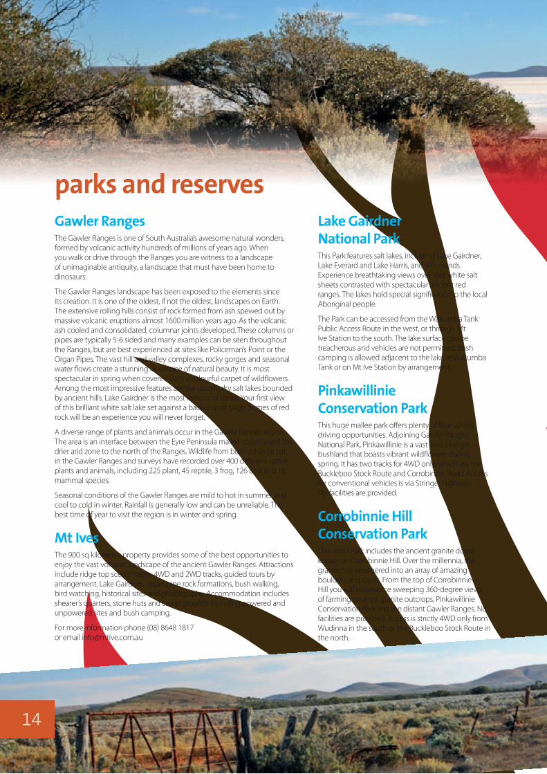
parks and reservesGawler RangesThe Gawler Ranges is one of South Australia’s awesome natural wonders, formed by volcanic activity hundreds of millions of years ago. When you walk or drive through the Ranges you are witness to a landscape of unimaginable antiquity, a landscape that must have been home to dinosaurs.
The Gawler Ranges landscape has been exposed to the elements since its creation. It is one of the oldest, if not the oldest, landscapes on Earth. The extensive rolling hills consist of rock formed from ash spewed out by massive volcanic eruptions almost 1600 million years ago. As the volcanic ash cooled and consolidated, columnar joints developed. These columns or pipes are typically 5-6 sided and many examples can be seen throughout the Ranges, but are best experienced at sites like Policeman’s Point or the Organ Pipes. The vast hill and valley complexes, rocky gorges and seasonal water flows create a stunning landscape of natural beauty. It is most spectacular in spring when covered with a colourful carpet of wildflowers. Among the most impressive features are the usually dry salt lakes bounded by ancient hills. Lake Gairdner is the most famous of these. Your first view of this brilliant white salt lake set against a backdrop of huge domes of red rock will be an experience you will never forget.
A diverse range of plants and animals occur in the Gawler Ranges region. The area is an interface between the Eyre Peninsula mallee country and the drier arid zone to the north of the Ranges. Wildlife from both zones occur in the Gawler Ranges and surveys have recorded over 400 different native plants and animals, including 225 plant, 45 reptile, 3 frog, 126 bird and 18 mammal species.
Seasonal conditions of the Gawler Ranges are mild to hot in summer and cool to cold in winter. Rainfall is generally low and can be unreliable. The best time of year to visit the region is in winter and spring.
Mt IvesThe 900 sq kilometre property provides some of the best opportunities to enjoy the vast volcanic landscape of the ancient Gawler Ranges. Attractions include ridge top scenic tracks, 4WD and 2WD tracks, guided tours by arrangement, Lake Gairdner, organ pipe rock formations, bush walking, bird watching, historical sites and photography. Accommodation includes shearer’s quarters, stone huts and camp grounds including powered and unpowered sites and bush camping.
For more information phone (08) 8648 1817 or email [email protected]
Lake Gairdner National ParkThis Park features salt lakes, including Lake Gairdner, Lake Everard and Lake Harris, and 315 islands. Experience breathtaking views over vast white salt sheets contrasted with spectacular ancient red ranges. The lakes hold special significance to the local Aboriginal people.
The Park can be accessed from the Waltumba Tank Public Access Route in the west, or through Mt Ive Station to the south. The lake surface can be treacherous and vehicles are not permitted. Bush camping is allowed adjacent to the lake at Waltumba Tank or on Mt Ive Station by arrangement.
Pinkawillinie Conservation ParkThis huge mallee park offers plenty of four-wheel driving opportunities. Adjoining Gawler Ranges National Park, Pinkawillinie is a vast area of virgin bushland that boasts vibrant wildflowers during spring. It has two tracks for 4WD only, which are the Buckleboo Stock Route and Corrobinnie Road. Access for conventional vehicles is via Stringer Highway. No facilities are provided.
Corrobinnie Hill Conservation ParkThis small Park includes the ancient granite dome known as Corrobinnie Hill. Over the millennia, the granite has weathered into an array of amazing boulders and caves. From the top of Corrobinnie Hill you will experience sweeping 360-degree views of farming country, granite outcrops, Pinkawillinie Conservation Park and the distant Gawler Ranges. No facilities are provided. Access is strictly 4WD only from Wudinna in the south or the Buckleboo Stock Route in the north.
14

Lake Gilles Conservation ParkThis Park is a semi-arid mallee landscape comprising salt lakes, low sandy rises, gypsum dunes and isolated stony hills. Access to the lake via the Eyre Highway seventeen kilometres east of Kimba is suitable for conventional vehicles. The northern area adjacent to the lake is accessible only by 4WD. No facilities are provided.
Secret RocksAlso known as Refuge Rocks, this impressive granite hill was discovered by Edward John Eyre in 1841 when his expedition party used it as a rest camp when exploring the ‘great west’. Camping and picnicking is permitted in front of the rocks. It is located thirty five kilometres east of Kimba on the Old Whyalla Road.
For more information email [email protected]
Bascombe Rocks LookoutA pleasant 20 kilometre drive along the sealed Buckleboo Road through undulating farming country will bring you to Bascombe Rocks. From atop the granite outcrops you have panoramic views of the surrounding native bushland. Around the base of the Rocks investigate the innovative water catchments that were built by the early pioneers of the district and can still be seen today. After it rains the rock holes fill with water and here you will discover hundreds of lively tadpoles. After exploring the Rocks relax with a drink or lunch under the picnic shelter.
Caralue BluffCaralue Bluff Conservation Reserve covers an area of around 2,200 hectares and is located 27 kilometres west of Kimba. There is a picnic ground on the western side and you can go bushwalking and hill climbing to overlook a large part of the Eyre Peninsula hinterland.
Carappee HillCarappee Hill Conservation Park is the most extensive and highest exposed granite rock on Eyre Peninsula, at 495 metres above sea level. It contains numerous soaks, frequented by kangaroos and other wildlife. Situated approximately 53 kilometres south west of Kimba. Take an energetic climb to the top following the painted white arrows from the southern corner, or stroll on the eastern side. It was dedicated as a conservation park in 1973 and covers an area of approximately 920 hectares. There are also picnic areas and bush toilets.
freecampingFree Camping Areas and FacilitiesKimba is a RV friendly town which provides all amenities to meet your needs. There are free camping options available including:
The Lions Apex Central ParkShort term parking (up to 3 days) located on Park Terrace. Facilities include public toilets, BBQ area, gazebo and playground.
Recreation ReserveLong or short term camping up to 7 days (longer stays need to be negotiated with Council) located on North Terrace. Facilities include coin operated shower, public toilets, shady trees, RV Dumping point, and playground.
The GumsShort term camping (1 night) located on Eyre Highway. Facilities include public toilets and shady trees.
15

In 1839, three years after South Australia was declared a colony, the first white man known to pass through the Kimba District was explorer Edward John Eyre. For thousands of years prior to this, Aboriginal tribes from the Gawler Ranges tracked through the area until 1905, when the first settlers came. Leases were held over the 60 square miles (100 square kilometres). The hundred of Kelly, surveyed in 1898, was the first area settled.
The railway line reached Kimba in 1913 and the township declared in 1915. A vigilance committee managed district affairs until the formation of The District Council of Kimba in 1924.
From 1924 to 1929 Kimba gained a hospital, institute, school, police station, post office, hotel, banks, shops, garages and the town and district prospered. Twenty-three one teacher schools were erected throughout the settlement. The railway line extended north to Buckleboo in 1926. Permanent water had always been Kimba’s biggest drawback until 1973 when water was piped from Polda. A separate pipeline was completed in the last decade which carries water from the River Murray.
The first crop of wheat was sown in 1908 on 20 acres (8 hectares) land which was ploughed with a horse-drawn five foot (1.5 metre) plough. Technology has continued to develop since these early days of agriculture, from the change from axe to crawler tractor to clear the land, from horse teams to tractors in the 1940’s to 1950’s to pull machinery, and stump rakes replacing hand picking of stumps. Crops that were harvested with stripper and winnower were replaced by combine harvester (Header).
Today crops are sown with sophisticated tractors and sowing equipment, using computers and GPS systems to not only steer the equipment, but also allow the farmer to vary inputs such as seed, fertilizer and other crop protection products. Modern machines are capable of applying these inputs precisely to varying soil types or production zones. Harvesters now monitor and record yield variances across paddocks, with this information going back to the farm office for evaluation and used in planning seeding inputs to maximise crop yields on varying soil types.
Livestock, particularly sheep, have always been a big part of the districts economy, with many flocks seen as we travel around.
Throughout the district’s history, yields of crops and pastures have increased with the adoption of innovative practices and improvements in plant breeding and the area continues to prosper in a low and variable rainfall environment.
Our farmers will continue to produce food so desperately needed throughout the world.
the history of kimba and its farming
16
ACCOMMODATIONKimba Gateway Hotel High Street, ph. 8627 2888
Kimba Caravan Park Motel Eyre Highway, ph. 8627 2222
Olive House Bed & Breakfast Railway Terrace, ph. 0428 274 008
ACCOUNTANCYKessling & Associates High Street, ph. 8627 2663
AGRICULTURAL SUPPLIESWCT Rural 57 High Street, ph. 86272557
Landmark 55 High Street, ph. 86272181
Platinum Agriculture 28-32 High Street, ph. 8627 2788
Agsave Merchandise Martin Terrace, ph. 8627 2227
EP Ag n Fert Pty Ltd 1-2 Miller Crescent, ph. 8627 2233 Troy Maitland 0499 272 544
AUTOMOTIVE AIRCONDITIONINGVenning Auto Electrics Buckleboo Road, contact Quentin on 0428 240 755
Bridgestone Tyre Centre 27 High Street, ph. 8627 2556
ATM FACILITIESANZ High Street 24 hour ATM access
Australia Post High Street Business hours only
Kimba Friendly Grocer and Newsagent High Street, Also a Bank SA Agent Business hours only
Kimba Gateway Hotel High Street Business hours only
BANKS ANZ High Street, ph. 7603 5100 24 hour ATM access
Bank SA High Street, ph. 8627 2490
BILL PAY OUTLETAustralia Post 44 High Street, 9am-5pm ph. 8627 2020
BUILDERSDylan Eatts, ph. 0427 962 951
Davey Contractors, ph. 0428 272 408
BUTCHERChestwood Meats 51 High Street, ph. 8627 2068
CANVAS GOODSKev’s Canvas contact Kevin on 86272267
CARPENTER & JOINEREatt’s Building Services 28 High Street, ph. 8627 2261
CHEMISTKimba Pharmacy 46 High Street, ph. 8627 2060
CHURCHESAnglican Church Cross Street, ph. 8627 2175
Catholic Church West Terrace, ph. 8627 2467
Harvest Christian Church High Street, ph. 8627 2592
Uniting Church High Street, ph. 8627 2027
CLOTHING & APPARAEL Blossoms Florist and Giftware 37 High Street, ph. 8327 2268
OP Shop 48 High Street, second hand clothing & goods.
CRASH REPAIRS/MECHANICS & HIREKimba Motor Service High Street, ph. 8627 2380
Pringles Ag Plus High Street, ph. 8627 2071
Ramsey Bros. 3 Miller Crescent, ph. 8627 2371
Docking Mechanical Services & Crane Hire ph. 0427 224 624
Williams Bobcat Hire ph. 0427 274 049
DISTRICT COUNCIL OF KIMBAOpen weekdays from 9am-5.00pm 37 West Terrace, ph. 8627 2026
Centrelink Access Point phone and fax facilities
ELECTRICAL REPAIRSDavey Contractors contact Barry on 0427 976 278
DC Electrical contact Dylan on 0428 784 933
FLORIST/GIFTWARE & SOUVENIRS Blossoms Florist & Giftware 37 High Street, ph. 8627 2268
Big Galah Half Way Across Australia
Gem Shop Eyre Highway, ph. 8627 2766
Kimba Friendly Grocer and Newsagent High Street, ph. 8627 2006
Kimba Pharmacy 46 High Street, ph. 8627 2060
Shell Roadhouse Eyer Highway, ph. 8627 2222
GROCERY OUTLETIGA South Terrace, ph. 8627 2015
Kimba Friendly Grocer and Newsagency High Street, ph. 8627 2006
HAIRDRESSING & BEAUTY CAREHair Around Town 27 West Terrace., ph. 8627 2351
TK Kenny Hairdressing Tues - Thurs, ph. 0400 615 077
Kelly’s Beauty and Nails ph 0428 831 175
HARDWARE STORESEatt’s Timber and Hardware 28 High Street, ph. 8627 2261
J & M Hardware 28 Cross Street., ph. 8627 2122
HEALTH & FITNESSFully equipped gym. For session times and further information contact Clarrie Hutchins on 0428 272 432.
HOSPITALGP Doctor consults 3 days per week ph. 8627 2500
Physiotherapist, occupational therapist, dietician, speech therapist and podiatrist consult at the Hospital Martin Terrace, ph. 8627 2400
Community Services 8627 2856
LAUNDROMAT Adjacent to the Half Way Across Australia Gem Shop See Gem Shop Assistants for access, ph. 8627 2766
LIBRARYKimba Community Library - Offers free internet access West Terrace, ph. 8627 2221
MEDICAL CENTRE 36 Park Tce
Kate Francis Natural Therapist, visits Tuesday and Wednesday ph. 0428 272 173
Physiotherapist visits on Tuesdays fortnightly ph. 0487 244 682
Chiropractor visits Wednesdays fortnightly ph. 8646 0880
Rural Counsellor Gladys Fleming visits Tuesday ph. 0427 252 148
Courtney Wohling Naturopath visits Thursday, Friday and Saturday fortnightly, ph. 0459 031 953
PHOTOGRAPHYFresh Eyre Photography ph. 0428 272 676
PLUMBEREatts Plumbing contact Andrew on 0427 272 473
POLICESituated on Railway Terrace ph. 8627 2013
ROADHOUSE/CARAVAN PARK/MOTELShell Roadhouse After hours access to fuel available Eyre Highway, ph. 8627 2040
TAKEAWAYCafé Kimba High Street, ph. 8627 2010
Kimba Gateway Hotel High Street, ph. 8627 2007
Shell Roadhouse Eyre Highway, ph. 8627 2040
Eileen’s Café Cross Street, ph. 0427 272 123
Big Galah Eyer Highway, ph. 8627 2766
TRANSPORT/FREIGHT SERVICESKimba Transport 1 Grund Road, ph. 8627 2212
Phillips Livestock & Bulk Carriers ph. 8627 2662
TYRE OUTLETSBridgestone Tyre Centre 27 High Street, ph. 8627 2556
WCT Kimba High Street, ph. 8627 2557
STEEL FABRICATIONSKE & DM Pahl Cowell Road, contact Kym on 8627 2028
Lienert Engineering ph. 8627 2506
businesses and services in kimba
17

J&M Hardware7 Cross St • Kimba SA 5641
T 08 8627 2122 • F 08 8627 2016 [email protected]
OPeNING HOUrSMonday – Friday8:30am – 5:30pm Saturday 8:30am – 11am
If we don’t have it,we will try and get it for you!
General Hardware
Garden
Homewares
electrical
5000-1537027.indd 1 4/01/2013 12:27:39 PM
KIMBA ROADHOUSE
MOTEL & CARAVAN
PARK
Tel: 08 8627 2222 Email: [email protected]
www.kimbamotel.com.au
24 hour fuel facility
14 Motel Rooms (Golden Chain)
22 drive thru Powered Sites (Top Parks)
5 Acres of land for Tent Sites
35 seater Licensed Restaurant
Variety of takeaway and dine in options available including
hotdogs, hamburgers, seafood, Indian Curries, Pizzas, Fish
and Chips, Big Breakky, Fresh Sandwiches, Toasted Sandwiches,
Rosie’s Chicken and lots more
Real Machine Coffee, Tea, Milk Shakes, Thick Shakes, Cold Drinks
• Opals• Worldwide Gems• Souvenirs & Specialty Gifts• Hot Bakery• Ample Parking• Local Jade Green and
Rare Black Jade • Toilet Facilities • Laundromat • Picnic Area• Coaches Welcome
Hrs: Weekdays 8-5pm, Weekends: 9-3pm, Closed Public Hols.Proprietors: Roger and Dianne Venning
Ph: (08) 86272766 After Hours: (08) 86272112 Fax: (08) 86272696
Email: [email protected]
Big Galah
Country grown, taste the differen
ce
Chestwood Meatspty ltd
51 High Street KimbaPh/fax 8627 2068
C M
HairAround Town
Ladies’ & Men’s HairdresserSports & Remedial Massage Practitioner
Waxing & Spray Tanning
27 West Terrace KIMBA p 08 8627 2351
18

K I M B A
specialising in fabulous flowers for:weddings
funerals
birthdays & new arrivals
special occasions, fantastic giftware & homewares
ladies’ clothing
jewellery
open: 9:30am - 5pm monday to friday
37 high street kimba sa
m 0427 274 048 p 08 8627 2268
Blossomsflorist & giftware
Ful ly sel f contained comfor table and spacious
three bedroom home that accommodates
up to s ix guests
Olive House64 West Terrace, Kimba
Hannah 0428 274 [email protected]
Serving Mahalia coffee from Robe, SAFresh, light, tasty mealsAll food house madeOffering milkshakes, iced drinks and smoothies
cornр of High Street and Cross StreetOpen M�day to Friday
9.30-4.30
0427 272 123
Many sweet treats including cakes, biscuits, slices,
cheesecakesGluten & sugar
free optionsKid friendly, kids
corner, kids menuGreat spot for a quick
catch up, business meeting, lunch date
or a family treat
• Extensive Menu • Dine in or Takeaway •• Great Coffee • All Day Breakfast • Chickens •
• Daily Lunch Specials • Burgers • Pizzas •
Catering and function room available for all occasions.
BYO Licence on request.
- T H E -
CAFÉ KIMBA
43 High Street, KimbaPhone: (08) 8627 2010facebook.com/kimbacafe
Acrylic nails, shellac, manicure, pedicure, waxing, tinting, facials, tanning, makeup
Unit 5 Cross Street (village) Kimba0428 831 175
- 27 Motel Rooms- Bottle Shop
- Open from 10am, 7 days a week- Serving Lunch 12pm to 2pm &
Dinner 6pm to 8.30pm Daily
- Function Rooms Available
40 High StreetPhone: (08) 8627 2888
Email:[email protected]
Kimba Gateway Hotel
19
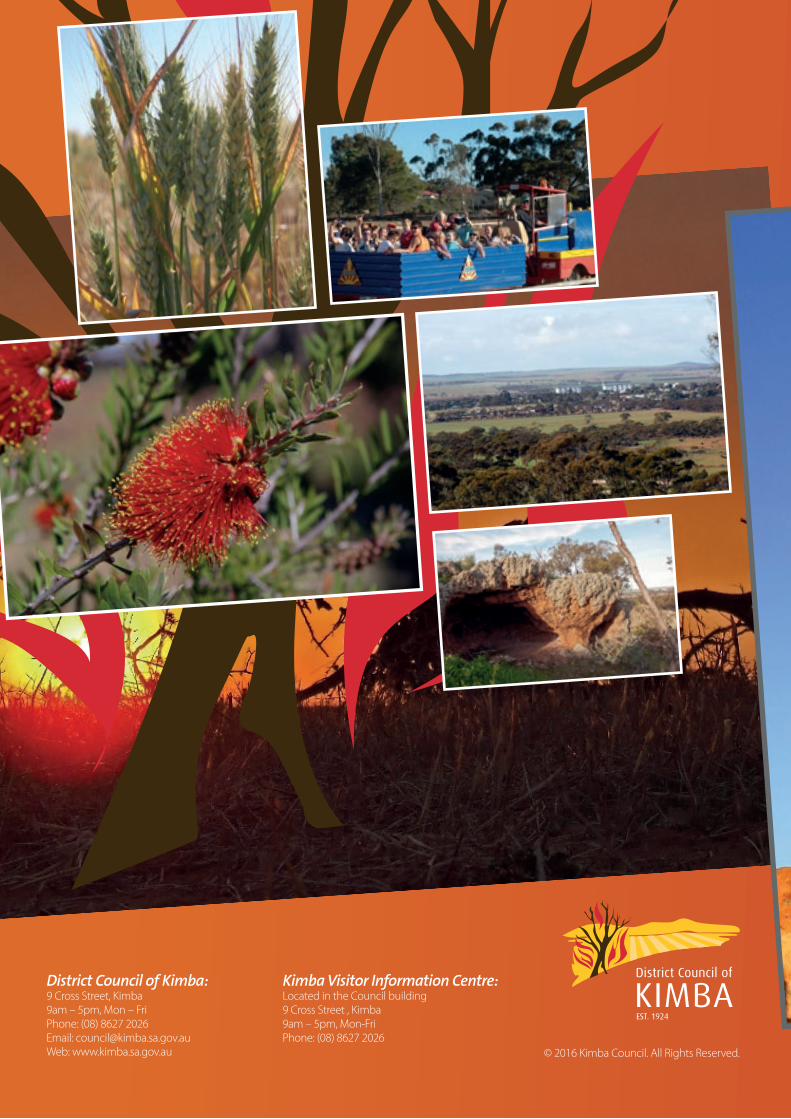
District Council of Kimba:9 Cross Street, Kimba 9am – 5pm, Mon – FriPhone: (08) 8627 2026Email: [email protected]: www.kimba.sa.gov.au
Kimba Visitor Information Centre:Located in the Council building9 Cross Street , Kimba 9am – 5pm, Mon-FriPhone: (08) 8627 2026
© 2016 Kimba Council. All Rights Reserved.