KAPS 2015, Fall Issue - Amazon Web...
38
KAPS 2015, Fall Issue Kentucky Association of Professional Surveyors, 2015 - Issue 3 KAPS 2015 Fall Seminar Registration Photo provided by KAPS
Transcript of KAPS 2015, Fall Issue - Amazon Web...

KAPS 2015, Fall IssueKentucky Association of Professional Surveyors, 2015 - Issue 3
KAPS 2015
Fall Seminar Registration
Photo provided by KAPS

2
Kentucky Association of Professional Surveyors
The Interior Angle, Fall 2015
ADVERTISEMENT POLICYThe Interior Angle is the official publication of the Kentucky Association of Professional Surveyors (KAPS). It is published quarterly for the purpose of communicat-ing with the professional surveying community, related professions and others with an interest in surveying. The Interior Angle is financed primarily by membership dues although advertisements are welcome from service and product industries relating to the needs and activities of the profession. The Interior Angle is provided to KAPS members and similar organizations on a complimentary basis.
Articles and advertisements appearing in this publication are not the policy of the association unless specifically so stated. The association does not assume any responsibility for statements made or opinions expressed in the articles, advertisements or other portions of this publication. Ar-ticles may not be reproduced in whole or in part without the written permission of the editor.
The Interior Angle welcomes and encourages comments, opinions and responses by readers. Letters should be ad-dressed to:
Editor — The Interior Angle124 Walnut StreetFrankfort, KY 40601
Letters must be signed and include a daytime telephone number. The name of the letter’s author may be withheld if requested. Letters may be edited for clarity and length.
The Interior Angle is published quarterly by the Kentucky Association of Professional Surveyors. All advertise-ments contained within The Interior Angle are published as a service to readers. Their publication does not imply or express any endorsement or recommendation by KAPS. The rates are as follows:
Size Per Issue/Per YearFull Page $175.00/$600.001/2 Page $100.00/$350.001/4 Page $65.00/$225.00Business Card $50.00Business Card (KAPS Member) $25.00Classified $40.00Classified (KAPS Member) $20.00
Corporate Members receive a free business card ad in ev-ery issue.
Publisher - Colleen Comer [email protected] - Doug Comer, PLS, [email protected] Walnut StreetFrankfort, KY 40601(502) 695-2349 • (800) 866-3029
Table of Contents
From the President’s Desk - Page 4
The Board Report - Page 8
2015 Calendar of Events - Page 19
Fall Seminar Schedule - Page 20
Frank Lenik - Surveying Merit Badge - Page 23
2016 KAPS Conference Save the Date - Page 24
Bud Salyer - Boundary Line Agreements - Page 25
Advisory Opinion - Page 27
KAPS Board Report - Page 30
2015 Trig Star Contest - Page 33
Golf Outing Pictures - Page 34
Job Opening - Page 35
KAPS Registration Form - Page 37

3
Kentucky Association of Professional Surveyors
The Interior Angle, Fall 2015
KAPS 2015Officers & Directors
President . . . . . . . . . . . . . . . . . Tom Clayborn, PLSPresident-Elect . . . . . . . . . . . . . . Jason Graves, PLSVice President, External Affairs . . . . . . . . . . . . . . Dan Farrell, PLSVice President, Internal Affairs . . . . . . . . . . . Kevin Phillips, PLSPast President . . . . . . . . . . . . . Jonathon Payne, PLSSecretary . . . . . . . . . . . . . Richard Montgomery, PLSTreasurer . . . . . . . . . . . . . . . . . . . . . Tom Crabtree, PLS
Ex-Officio DirectorsProfessional Development Chair . . . . . . . . . . . . . . . . . . . . . Mike Ladnier, PLSNSPS Governor . . . . . . . . . . . . . . .Craig Palmer, PLSKY State Board of Licensure Liaison . . . . . . . . . Chris Gephart, PLSKSPE Liaison . . . . . . . . . . . . . . . . .William Bowie, PLSGIAC Liaison . . . . . . . . . . . . . . . Paul Schrader, PLSKAMP Liaison (Non-Voting) . . . . . . Steve Lilly, PLS
Directors
Greg Barker, PLS Tom Crabtree, PLSJames Mayo, PLS
Chapter Chairs
Audubon . . . . . . . . . . . . . . . . . . Mike Ladnier, PLSBarren River . . . . . . . . . . . . . . . Bob Neuhaus, PLSBluegrass Capitol . . . . . . . . . . . Kevin Phillips, PLSFalls of the Ohio . . . . . . . . . . . . Jason Graves, PLSGreen River . . . . . . . . . . . . . . . Robert Smith, PLSHighlands . . . . . . . . . . . . . Johnny Justice, PLS, PEJackson Purchase Area . . . . . Matthew Clark, PLSNortheast . . . . . . . . . . . . . . . . . Mike Ruggles, PLSNorthern Kentucky . . . . . . . . . . . Earl Strater, PLSSoutheast . . . . . . . . . . . . . . . . . . . Curtis Felts, PLS
KAPS Office StaffMolly Forrest, Administrative Assistant
An Affiliate of the AmericanCongress on Surveying and Mapping and
The National Society of Professional Surveyors
KAPS 2015Standing CommitteeChairs & Co-Chairs
Annual Conference . . . . . . . . . . . . . Tom Clayborn, PLS Annual Picnic . . . . . . . . . . . . . . . . . . .Tom Clayborn, PLSBy-Laws . . . . . . . . . . . . . . . . . . . . . Tom Bushelman, PLSCounty Surveyors . . . . . . Richard Montgomery, PE, PLSEducation . . . . . . . . . . . . . .Dr. Ronald E. Gallagher, PLS Ethics & Professional Practice . . . . . Chris Gephart, PLSFinance . . . . . . . . . . . . . . . . . . . . . . . . James Mayo, PLSLegislative . . . . . . . . . . . . . . . Richard Montgomery, PLSMembership . . . . . . . . . . . . . . . . . .Jonathon Payne, PLSMinimum Standards . . . . . . . . . . . . .Chris Gephart, PLSNominating . . . . . . . . . . . . . . . . . . . . Jason Graves, PLSPast Presidents . . . . . . . . . . . . . . . Jonathon Payne, PLSPolicy Manual . . . . . . . . . . . . . . . . Tom Bushelman, PLSProfessional Development . . . . . . . . .Mike Ladiner, PLSPublic Relations . . . . . . . . . . . . . . . . . Kevin Phillips, PLSPublications / Newsletter . . . . . . . Doug Comer, PLS, PEScholarship . . . . . . . . . . . . . . . . . . . . . John St. Clair, PLS
Josh Calico, PLS John Ledington, PLS
Richard Montgomery, PLS
On the Cover:
Beautiful day for the Golf Outing, but no so for the Picnic. First
rainout in recent history!

4
Kentucky Association of Professional Surveyors
The Interior Angle, Fall 2015
From the President's DeskTom Clayborn, PLS2015/2016 KAPS President270-903-2505 - [email protected]
Walter Johnson, a $500 check. Many thanks to Brian Cox on his efforts. Brian tells me we had 18 students take the test this year. Hopefully this program can grow the next few years with more volunteers presenting the Trig-Star test to their local high schools. Each of us should consider contacting our local high schools next year to see if there is interest it presenting the Trig Star test in your community. This is a great way to promote the surveying profession to the high school students of Kentucky.
Please accept my many thanks for those who serve and have volunteered to serve KAPS in various capacities. As your president, I appreciate your support and hope you will not hesitate to contact me with questions, comments, suggestions or concerns. Together we will strive to successfully resolve issues faced by our profession. Again, I am honored to serve with all of you.
Tom Clayborn, PLS2015 KAPS [email protected]
Mark Your Calendars:
• KY Board of Licensure Meeting: Friday, October 09, 2015, 8:30 A.M., Kentucky Engineering Center, 160 Democrat Drive, Frankfort, KY 40601
• KAMP GIS Conference: October 12-14, 2015, Owensboro convention center, Owensboro, KY.
• 5th KAPS Board of Directors Meeting: Saturday, December 5, 2015, 10:00 A.M., Ramada Plaza, 9700 Bluegrass Parkway, Louisville, KY 40299
• 2016 KAPS Annual Conference: February 17 – 20, 2015, Ramada Plaza, 9700 Bluegrass Parkway, Louisville, KY 40299
I hope everyone has had a successful summer. Fall and winter are around the corner and I hope you find success in these seasons as well. We have been busy at KAPS preparing for the fall seminars and the upcoming 2016 Conference among other things.
We have worked hard in preparing for the fall seminars. The Audubon, Falls of the Ohio, Jackson Purchase and the Northern Chapters have scheduled and prepared seminars within their specific chapter areas. I really appreciate these chapters stepping up, preparing and scheduling their own seminars. We have also scheduled various other seminars throughout the Commonwealth. All these seminars will educate and provide a chance for networking and I encourage your support for their efforts. Thanks to all who have worked hard to prepare for the seminars.
I am pleased to announce that we will have Mr. Jeff Lucas present four classes at the 2016 conference in Louisville. Jeff is a regular columnist in POB magazine and has taught numerous seminars throughout the United States. I look forward to Jeff’s presentation at our next conference as well as all the other great speakers we have lined up to instruct an array of topics. I am grateful to the conference committee for working hard in preparing for our event.
KAPS will be presenting our surveying 101 seminar at the KAMP GIS Conference in Owensboro on October 12,, 2015. This seminar has been well received over the past few years by the GIS community and it is a great way to educate the GIS community on what we do as a profession. With great effort, Jon Payne has lined up all the speakers for this event.
I want to thank Jason Graves and all who have helped with organizing, scheduling and staffing the KAPS booth at the State Fair this year. This has been a great way to put the face of surveying and KAPS into the eye of the general public. I believe the more public exposure to the surveying profession the greater the understanding of the benefit of using our services which can only strengthen our profession.
We have a state winner in the NSPS Trig Star competition this year. KAPS presented the winner,

5
Kentucky Association of Professional Surveyors
The Interior Angle, Fall 2015
Like us on Facebook!https://www.facebook.com/pages/Kentucky-Association-of-Professional-Surveyors/244997045576230?fref=ts
KAPS Welcomes New Members
Ryan Beck - Falls of the OhioDonald F. Chandler, II - Southeast
Christopher D. Morris - Northern KYJeremy Mullins - Bluegrass Capital

Featuring: • Hybrid Lock• Hybrid Resection• Hybrid Switch• Auto-Localization• Faster Field Work• Compatible with all
Topcon Robotic Instruments
“Topcon's unique Hybrid Positioning solution combinesGNSS, optical, and automated data work flow to offerthe ultimate in flexible, non-stop productivity.”
For more information contact our knowledgeable sales team today at 1.800.251.1280 or e-mail us athayesinstrument.com.
Other Services: Restore factory lubricants for smootheroperation; Clean Optics and Mechanical Drive Systems; Instrument Case Repair and Cleaning; Firmware Updates;Data Collection Software Updates and Upgrades; along withCalibrate Optical Plummets.
“Discount Pricing Everyday”502 S Cannon Blvd I Shelbyville, TN 37160 I Phone:931.685.9505 I Toll-Free 800.251.1280 I www.hayesinstrument.com
Hayes Instrument and Topcon offers
“The Total Package”The next generation of Hybrid Technology
sweeping the market!
Maximize your Measurement and Field Performance byCombining the Best of Both Worlds in Robotic Optical
Measurements and GNSS RTK Network Rover.
A family of software solutionsthat streamlines the workflowfor surveyors,contractors, engineers and mapping professionals.
The Total Package Hybrid 060515_Layout 1 6/5/15 3:01 PM Page 1

S5 / S7 / S9 S5
S7
S9
The New Trimble®All Trimble
Robotic Options
ROBOTIC TOTAL STATIONS
Measure further and faster with the Trimble® DR Plus EDM
Make your job easier, day after day, project after project. Built on proven Trimble technologies––including Trimble SurePoint and MagDrive™ technology, and our DR Plus EDM––this is the no nonsense workhorse that works efficiently and dependably while maintaining the highest possible accuracy.
The Trimble. S7 Total Station combines scanning, imaging and surveying into one powerful solution. Now you only need one instrument on the job site to perform all your data capture.
The Trimble S9 combines all of our top field technologies with our highest level of accuracy and our most advanced engineering features.
Trimble® S5
Trimble® S7
Trimble® S9
yourprecision.com 1-844-459-13001400 Hugh Avenue, Louisville KY 40213 502-459-13001275 Industry Road, Lexington, KY 40505 859-621-31881120 Elm Hill Pike Ste 105, Nashville, TN 37210 615-748-1998301 Winona Street, Knoxville, TN 37917 865-296-3338
TOLL FREE

8
Kentucky Association of Professional Surveyors
The Interior Angle, Fall 2015
The Board ReportB. David Cox, Executive DirectorKentucky State Board of Licensure for Professional Engineers and Land SurveyorsKentucky Engineering Center, 160 DEMOCRAT DRIVE • Frankfort, Kentucky 40601
Board Members John Usher, PE, PhD is now a member of our Board based on his position as Acting Dean of the Speed School of Engineering at the University of Louisville. He replaces Neville Pinto, PhD who is now the Acting Provost at the University of Louisville.
Board member Jim Riney, PE, PS, was elected NCEES Southern Zone Assistant Vice President at the recent zone meeting. Congratulations to Jim!
In addition, Kentucky is well represented on NCEES national committees:
Bob Fentress, PLS, Board Member – Law Enforcement Committee
Jonathan Buckley, General Counsel – UPLG Committee
Jim Riney, PE, PLS, Board Member – Future of Surveying Task Force
David Cox, Executive Director – Finance Committee
Exam Results Pass rates for the April 2015 “paper and pencil” exams; the first % is the Kentucky pass rate and the second is the national average:
PE Exam: First Time Takers 68%; 67% Repeaters 34%; 31% Total 60%; 55%
PS Exam: First Time Takers 50%; 78% Repeaters 100%; 45% Total 67%; 66%
Pass rates for the Computer Based Testing (CBT) exams for the first testing window of the year:
FE Exam: First Time Takers 76%; 75% Repeaters 14%; 34% Total 68%; 67%
FS Exam: First Time Takers 50%; 53% Repeaters 0% (no takers); 17% Total 50%; 40%
Board and Committee Meetings Agendas Agendas for upcoming and past Board and committee meetings can be viewed at: https://v3.boardbook.org/Public/PublicHome.aspx?ak=1001362
This link is also available on our website at: http://kyboels.ky.gov/Pages/Whats-New.aspx
Mapping Sciences / GIS We were unable to promulgate the agreed upon document into a useable formal regulation. Since GIS is not a regulated profession, we were required to draft from the licensed surveyor perspective and to make a part of our standards of practice regulation. This resulted in the document being split into several pieces based on the various sections of the existing standards of practice regulation and we could not include it in “list” form. As a result, our document lost its identity and usefulness in such a draft.
The Board voted to not proceed with the regulatory process but instead to treat the document as an “Advisory Opinion” and use it for educational purposes. In addition, we will use it to guide our enforcement function relative to interpreting our definition of the practice of surveying. We encourage KAMP and KAPS to use it to educate their membership and also for KAMP to encourage the use of the disclaimer.

9
Kentucky Association of Professional Surveyors
The Interior Angle, Fall 2015
Thanks to both groups for participating in this process. The Board believes the resulting document will be of great benefit to all of us.
The agreed upon document is as follows:
Definition of Terms
Authoritative – An accurately and precisely established location of a feature, object or boundary sufficient for use in establishing property rights, legal proceedings, or to protect the safety of the public from hazardous assets or other man-made or natural features.
Precise Location – A description of the position of a feature, object or boundary that meets or exceeds surveying accuracy standards per 201 KAR 18:150 Sections 7 and 8.
Generalized Location - A description of the position of a feature, object or boundary using general mapping accuracy standards that do not meet or exceed surveying accuracy standards per 201 KAR 18:150 Sections 7 and 8.
The definition of the practice of land surveying includes all activities where, regardless of the technology or method employed, the resulting work product represents the precise location of a feature, object, or boundary with reference to the surface or subsurface of the earth, and is a work product upon which the public is intended to reasonably rely as being the precise location of that feature, object, or boundary so located. These activities must be accomplished by or under the direct supervisory control of a professional land surveyor.
Land surveying does not encompass work products which represent only a generalized location of a feature, object, or boundary upon which the public would not reasonably rely as the precise location of that feature, object, or boundary. The following items are not to be included as activities within the definition of the practice of land surveying:
1. The creation of general maps:
a. Prepared by private firms or government agencies for use as guides to motorists, boaters, aviators, pedestrians, or for purposes of coordinating/administering public services, asset management and emergency response activities;
b. Prepared for publication in a gazetteer or atlas as an educational tool or reference publication;
c. Prepared for or by education institutions for use in the curriculum of any course of study;
d. Produced by any electronic or print media firm as an illustrative guide to the geographic location of any event; or
e. Prepared by laypersons for conversational or illustrative purposes. This includes advertising material and users guides.
2. The transcription of previously georeferenced data into a GIS or LIS by manual or electronic means, and the maintenance thereof, provided the data are clearly not intended to indicate the authoritative location of property boundaries, the precise definition of the shape or contour of the earth, or the precise location of fixed works of humans.
3. The transcription of public record data, without modification except for graphical purposes, into a GIS- or LIS-based cadastre (tax maps and associated records) by manual or electronic means, and the maintenance of that cadastre, provided the data are clearly not intended to authoritatively represent property boundaries. This includes tax maps and zoning maps.
4. The preparation of any document by any government agency that does not depict real property boundaries. This includes civilian and military versions of quadrangle topographic maps, military maps, satellite

10
Kentucky Association of Professional Surveyors
The Interior Angle, Fall 2015
imagery, and other such documents.
5. The incorporation or use of documents or databases prepared by any governmental agency into a GIS/LIS, including census and demographic data, quadrangle topographic maps, and military maps.
6. Inventory maps and databases created by any organization, in either hard-copy or electronic form, of physical features, facilities, or infrastructure that are wholly contained within properties to which they have rights or for which they have management, service or administrative responsibility. The distribution of these maps and databases outside the organization must contain appropriate metadata describing, at a minimum, the accuracy, method of compilation, data source(s) and date(s), and disclaimers of use clearly indicating that the data are not intended to be used as a survey product.
7. Maps and databases depicting the distribution of natural resources or phenomena prepared by foresters, geologists, soil scientists, geophysicists, biologists, archaeologists, historians, or other persons qualified to document such data.
8. Maps and georeferenced databases depicting physical features and events prepared by any government agency where the access to that data is restricted by statute. This includes georeferenced data generated by law enforcement agencies involving crime statistics and criminal activities.
9. Work products containing the following written disclaimer in at least ten point font:
“This work product represents only generalized locations of features, objects or boundaries and should not be relied upon as being legally authoritative for the precise location of any feature, object or boundary.”
Proposed Regulation Change – Seals and
Signatures The Board has approved the following draft changes to the Seals and Signatures regulation and staff will work with the Legislative Research Commission (LRC) to promulgate the changes. The only change is to substitute the word “digital” for “electronic”. When the regulation was first promulgated in 2003, “electronic” was the terminology used. Now, the industry standard is to use the term “digital” so we are making the change. Below is the regulation draft:
201 KAR 18:104. Seals and signatures.
RELATES TO: KRS 322.290(13), 322.340
STATUTORY AUTHORITY: KRS 322.340, 322.290(4), (13)
NECESSITY, FUNCTION, AND CONFORMITY: KRS 322.340 and 322.290(13) require the board to promulgate administrative regulations regulating the design of seals and the use of seals and signatures in electronic transactions. This administrative regulation establishes the requirements for the use of seals and signatures in electronic transactions.
Section 1. Definitions.
(1) “Document” means reports, specifications, drawings, plans or plats in physical form pertaining to engineering or land surveying which require certification by application of a seal or stamp, a signature and a date.
(2) “Electronic document” means an electronic data file which is capable of being viewed by use of a computer and video monitor or converted into a document by use of a computer and printer or plotter.
(3) “Digital [Electronic] signature” means a digital signature with an authentication process attached to or logically associated with an electronic document which shall carry the same weight, authority and effect as an original signature.
(4) “Electronic transmission” means the transmission of electronic data files from one (1)

11
Kentucky Association of Professional Surveyors
The Interior Angle, Fall 2015
computer to another, and shall include the manual delivery of electronic data storage media from one (1) person or entity to another.
(5) “Licensee” means a person licensed as a professional engineer or professional land surveyor pursuant to KRS Chapter 322.
(6) “Original signature” means the handwritten name of a person applied to a document that identifies the person, serves as a means of authentication of the contents of the document, provides responsibility for the creation of the document and provides for accountability for the contents of the documents.
(7) “Original seal or stamp” means a rubber stamp or embossing seal meeting the design requirements set out in Section 5 of this administrative regulation.
(8) “Signature” means either original signature or digital [electronic] signature.
Section 2. (1) When documents are to be presented to a client or to a public or governmental entity, at least one (1) copy shall bear the licensee’s original seal or stamp, original signature and date.
(2) Any other copy of the documents may contain a facsimile of the licensee’s stamp, signature and date applied manually by the use of stamps or by the use of a computer and printer or plotter.
Section 3. A digital [An electronic] signature shall be permitted in place of an original seal, signature and date when the following criteria are met:
(1) It is a unique identification of the licensee;
(2) It is verifiable;
(3) It is under the licensee’s direct and exclusive control;
(4) It is linked to the electronic document in such a manner that causes changes to be easily determined and visually displayed if any
data in the electronic document file is changed subsequent to the digital [electronic] signature having been affixed to the electronic document;
(5) An attempt to change the electronic document after the digital [electronic] signature is affixed shall cause the digital [electronic] signature to be removed or altered significantly enough to invalidate the digital [electronic] signature; and
(6) If the electronic document is to be electronically transmitted, the electronic document is converted to a read-only format.
Section 4. (1) A licensee may electronically transmit an electronic document without affixing a digital [an electronic] signature provided there is inserted the following language in lieu of an image of a seal or stamp, signature and date: “This shall not be considered a certified document.”
(2) This language shall not be required for documents electronically transmitted to a commercial printer or blueprint service for the purpose of reproducing documents or to the licensee’s employer or employees.
Section 5. Approved Stamps and Seals. The stamps and seals used by a licensee shall be similar in design and conform to the size restrictions established in “Approved Stamps and Seals” (1999).
Section 6. Incorporation by Reference. (1) “Approved Stamps and Seals”, (1999) is incorporated by reference.
(2) This material may be inspected, copied, or obtained, subject to applicable copyright law, at the Kentucky Board of Licensure for Professional Engineers and Land Surveyors, 160 Democrat Drive, Frankfort, Kentucky 40601, Monday through Friday, 8 a.m. to 4:30 p.m. (29 Ky.R. 2999; Am. 30 Ky.R. 277; eff. 8-13-2003.)
Proposed Regulation Change – Code of Professional Practice and Conduct The Board has approved the following draft changes to the Code of Conduct regulation as it

12
Kentucky Association of Professional Surveyors
The Interior Angle, Fall 2015
relates to conflicts of interest and staff will work with the Legislative Research Commission (LRC) to promulgate the changes. We have had recent enforcement issues which demonstrated the need to strengthen the wording. In addition, we have added Section 12, allowing a licensee to request our opinion on a specific matter and to rely upon that opinion as a “safe harbor”.
201 KAR 18:142. Code of professional practice and conduct.
RELATES TO: KRS 322.180(3), 322.290(11)
STATUTORY AUTHORITY: KRS 322.290(11)
NECESSITY, FUNCTION, AND CONFORMITY: KRS 322.290(11) requires the board to promulgate a code of professional practice and conduct, which shall be binding upon persons licensed under KRS Chapter 322. This administrative regulation establishes a code of professional practice and conduct.
Section 1. Definitions. (1) “Conflict of interest” means any circumstance in which a licensee [licensee’s] has a private or personal [or financial] interest sufficient to appear to influence, or possibly influence, the objective exercise of the licensee’s professional duty to [is contrary to the interests of] the public, his or her employer, or current [or past] client; for the purposes of this definition, the private or personal interests of the licensee shall include the personal or business interests of the members of the licensee’s family, his or her close relatives, or business associates.
(2) “Direct supervisory control” in the practice of engineering means that an engineer licensee directly supervises and takes responsibility for consultation, investigation, evaluation, planning, design and certification of an engineering project and includes only that work performed by an employee as defined in subsection (4) of this section.
(3) “Direct supervisory control” in the practice of land surveying means that a surveyor licensee who certifies a work product directly supervises and takes responsibility for the survey and includes only that work performed by an employee
as defined in subsection (4) of this section.
(4) “Employee” means a person who works for a licensee or his or her employer for wages or a salary and includes professional and technical support personnel contracted on a temporary or occasional basis, if the compensation is paid directly by the licensee or his or her employer. It does not include a person who provides services to the licensee as an outside consultant or specialist.
(5) “Licensee” means any natural person licensed by the board to practice professional engineering or professional land surveying, or any business entity permitted under KRS 322.060.
(6) “Work product” means any engineering or land surveying plan, plat, document or other deliverable requiring certification that is intended to represent activities conducted in the practice of engineering or land surveying.
Section 2. The engineer or land surveyor shall conduct his or her practice in order to protect the public health, safety, and welfare.
(1) The practice of professional engineering and land surveying is a privilege, and not a right.
(2) If a licensee’s judgment is overruled and a licensee has reason to believe the public health, safety or welfare may be endangered, the licensee shall inform his or her employer or client of the possible consequences and, if not resolved, notify appropriate authorities.
Section 3. A licensee shall issue all professional communications and work products in an objective and truthful manner.
(1) A licensee shall be objective and truthful in all professional reports, statements or testimony and shall include all material facts.
(2) If serving as an expert or technical witness before any tribunal, a licensee shall express an opinion only if it is founded on adequate knowledge of the facts in issue, on the basis of technical competence in the subject matter, and upon honest conviction of the accuracy and
13
Kentucky Association of Professional Surveyors
The Interior Angle, Fall 2015
propriety of that testimony, and shall act with objectivity and impartiality. A licensee shall not ignore or suppress a material fact.
(3) A licensee shall not issue a statement or opinion on professional matters connected with public policy unless the licensee has identified himself or herself, has disclosed the identity of the party on whose behalf the licensee is speaking, and has disclosed any pecuniary interest the licensee may have in the matter.
(4) A licensee shall not maliciously injure the professional reputation, prospect, practice or employment of another licensee.
(5) A licensee shall not accept a contingency fee for serving as an expert witness before any tribunal.
(6) A licensee shall maintain for a period of not less than five (5) years, calculations and documents necessary to support work products.
(7) A professional land surveyor shall maintain records for boundary surveys under 201 KAR 18:150, Section 10(2) and (3).
(8) The requirements of subsections (6) and (7) of this section shall be satisfied for the individual licensee employed by a business entity permitted by the board in conformance with KRS 322.060 by that permitted entity’s compliance with subsections (6) and (7) of this section.
(9) A licensee shall not solicit or submit proposals for professional services containing a false, fraudulent, misleading, deceptive or unfair statement regarding the cost, quality or extent of services to be performed.
(10) A licensee shall not misrepresent his or her professional qualifications or experience, or those of the licensee’s associates.
Section 4. A licensee shall avoid conflicts of interest. The public, as well as a professional’s employer and clients, have the expectation that the professional engineer or land surveyor shall act objectively and independently. Conflicts of interest involve the abuse, actual or potential, of
the trust people have in professional engineers and land surveyors.
(1) If a situation occurs in which a reasonable person would think that a licensee’s professional judgment is likely to be compromised [possibility of a conflict of interest exists], a licensee shall promptly disclose the possibility of the conflict of interest to[notify] his or her employer, or client [or past client], and shall, if reasonably possible, withdraw from participation in the situation which gave rise to the conflict of interest.
(2) A licensee shall not accept a valuable consideration from more than one (1) party for services pertaining to the same [identical] project, unless the circumstances are fully disclosed to all other principal parties directly involved in the project.
(3) A licensee shall not solicit or accept a valuable consideration from any vendor, contractor, or client, or their agents [either] for acceptance, rejection, approval, or disapproval of any work performed by others, or for specifying materials or equipment [, or from contractors, their agents or other parties dealing with a client or employer] in connection with work for which the licensee is responsible.
(4) A licensee serving as a member, advisor, or employee of a governmental body shall not, when utilizing either his status as a licensed professional, or his skill, experience, or knowledge as a licensed professional , participate in decisions in which he or she has a private or personal interest, and shall not review or approve work that was performed by the licensee, or by others or on behalf of a business entity in which the licensee has any control, or private or personal interest [ shall not solicit or submit proposals for professional services containing a false, fraudulent, misleading, deceptive or unfair statement regarding the cost, quality or extent of services to be performed ].
[(5) A licensee not misrepresent his or her professional qualifications or experience, or those of the licensee’s associates.
(6) A licensee serving as a member, advisor,

14
Kentucky Association of Professional Surveyors
The Interior Angle, Fall 2015
or employee of a governmental body shall not participate in decisions with respect to professional services offered or provided by him or her or by a business entity in which the licensee is a principal, officer or employee, to that governmental body.]
Section 5. A licensee shall solicit or accept engineering or land surveying work only on the basis of his or her, or the licensee’s firm’s or associates’ qualifications for the work offered.
(1) A licensee shall not offer or accept any valuable consideration in order to secure specific work, exclusive of commissions paid by individual licensees for securing salaried positions through employment agencies. A licensee may participate in design-build projects.
(2) A licensee may advertise professional services if the advertising is not false or misleading.
Section 6. A licensee shall not knowingly associate with any person engaging in fraudulent, illegal or dishonest activities. (1) A licensee shall not permit the use of his or her, or the licensee’s business entity’s name by any person or business entity that he or she knows or has reason to believe is engaging in fraudulent, dishonest or illegal activities.
(2) A licensee shall not aid or abet the illegal practice of engineering or land surveying.
Section 7. A licensee shall perform his or her services only in the areas of his or her competence.
(1) A licensee shall undertake to perform professional assignments only if qualified by education or experience in the specific technical field involved.
(2) A licensee may accept an assignment requiring education or experience outside his or her own field of competence, but only to the extent that his or her services are restricted to those parts of the project in which the licensee is competent. All other parts of the project shall be certified by licensed associates, consultants or employees.
(3) If a question of the competence of a licensee to perform a professional assignment in a specific technical field is an issue and cannot be otherwise resolved to the satisfaction of the board, the board, upon a majority vote or upon request by the licensee, may require the licensee to satisfactorily complete an examination the board deems appropriate and relevant.
Section 8. Except as provided by this section, a licensee shall not certify any work product dealing with subject matter in which he or she lacks competence by virtue of education or experience, or any work product not prepared by him or her under his or her direct supervisory control.
(1) A professional engineer may review and certify the work product of another professional engineer if:
(a) The review and certification are made at the request of the other professional engineer;
(b) He or she does not remove or obliterate the identity of the other professional engineer;
(c) He or she performs and retains in his or her possession for not less than five (5) years all calculations and documents necessary to perform an adequate review; and
(d) He or she confirms that the other professional engineer was licensed when the work was created.
(2) If a professional engineer undertakes to review only a portion of the work product of another professional engineer, his or her certification shall clearly identify the portion reviewed.
(3) A professional engineer may modify the work product of another professional engineer, whether or not the project has been built, if he or she retains in his or her possession for not less than five (5) years a record of his or her modifications.
(4) If a professional engineer modifies the work product of another professional engineer, his or

15
Kentucky Association of Professional Surveyors
The Interior Angle, Fall 2015
her certification shall clearly identify, by words or graphics, that portion that was modified.
(5) A professional engineer may incorporate in his or her work product the designs of manufactured or standard components developed by manufacturers, suppliers or professional or technical societies and associations.
(6) If, in the professional land surveyor’s reasonable judgment, his or her personal participation is not required in performing a particular aspect of a project, he or she may delegate those tasks to an employee, if all work is actually reviewed by the licensee.
(7) The need for a professional land surveyor to make a site visit shall be dictated by the nature, size and complexity of a project. However, the failure to make a site visit in a substantial percentage of surveys may be construed as a failure to exercise direct supervisory control.
(8) While an employee may investigate the circumstances of a potential project, only a licensee may establish the scope of work to be performed.
Section 9. The professional engineer or professional land surveyor shall avoid conduct likely to discredit or reflect unfavorably upon the dignity or honor of his or her profession.
Section 10. If a licensee has knowledge or reason to believe that any person or other licensee is in violation of KRS Chapter 322 or any administrative regulation adopted by this board, the licensee shall present that information to the board in writing and shall cooperate with the board in furnishing information within his or her knowledge.
Section 11. (1) A licensee shall not, directly or indirectly, contact a board member concerning any ongoing disciplinary action, or any existing investigation being conducted by the board staff.
(2) Any communication by a licensee concerning an ongoing disciplinary action or an existing investigation shall be directed to a board staff member.
Section 12. A licensee who is in doubt about the ethical propriety of any professional act or omission contemplated by that licensee, may request an informal opinion from the Executive Director of the Board. Such request shall be in writing, or email with the subject line of: “Request for Advisory Opinion Pursuant to KAR 201 18:142”; the request must include the name and address of the licensee making the request, a phone number and email address at which the licensee can be contacted, and all relevant information.
Based on the information provided in the request, the Executive Director will respond in writing as to the ethical propriety of the act or course of conduct in question. No licensee shall be disciplined for any professional act performed by that licensee in compliance with the written advisory opinion furnished by the Executive Director pursuant to the licensee’s written request, provided that the licensee’s written request clearly, fairly, accurately and completely states such licensee’s contemplated professional act and all relevant information.
(27 Ky.R. 2603; Am. 3122; 3239; eff. 6-8-2001; 35 Ky. R. 2337; 2768; 36 Ky.R. 25; eff. 7-31-2009; T.Am. 4-4-2011; 39 Ky.R. 2383; 40 Ky.R. 278; eff. 9-6-2013.)
Principles of Surveying Exam April 2016 will be the last “paper and pencil” exam for the Principles of Surveying (PS). After that date it will be part of the Computer Based Testing (CBT) system which already includes the Fundamentals exams; both FE and FS. The exam will be given year round at PearsonVue testing centers and applicants will be able to choose their own date and location.
The conversion will include several changes to our application procedures. With the change to CBT, PS exam applicants will be able to register directly with NCEES just as the FE and FS candidates currently do. Once the applicant has passed the PS (must pass FS before NCEES will allow registration for the PS) and obtained the necessary experience, he or she can apply with us for licensure. The application for licensure will be reviewed for all components; education,

16
Kentucky Association of Professional Surveyors
The Interior Angle, Fall 2015
experience, and examinations (as well as references). If approved, the candidate would then take the 2 hours Kentucky state specific exam. Once passed, their license would be issued.
Even though procedures are changing next year, the requirements for licensure are not. They remain the same and candidates will be evaluated the same way they currently are. All education, experience, and examinations requirements must be met before a license is issued.
We are hopeful the new procedures will encourage additional qualified people to take the exam and ultimately become licensed. The ability to schedule the exam year round will also help with work and personal schedules.
NCEES is also working on converting the 24 existing PE exams to CBT. This is a slower process and will result in several years where some PE exams are CBT and some paper and pencil. Currently, there is not estimated date for the first PE exam conversion to CBT.
ENFORCEMENT ACTIONS SUMMARY For The Period April 25, 2015 – July 24, 2015
JODY DEAN SLONE JEFFREY NEAL WALTERS, PLS PIKE TECHNICAL SERVICES, INC. In 2012, the Board received information that Jody Dean Slone had practiced professional land surveying in Kentucky without a license. An investigation revealed that in 2011 Mr. Slone accepted several assignments to survey residential lots. Having no licensed land surveyor on staff, Pike Technical Services contracted with former employee, Jeffrey Neal Walters, PLS to supervise and certify Mr. Slone’s work. It was determined that this arrangement violated several sections of the statutes and regulations governing the practice of land surveying in this state. Mr. Walters’ supervision of Mr. Slone did not meet the minimum requirements as set forth in the Code of Professional Practice and Conduct because Walters was not a full time employee of Pike Technical Services. In fact, Walters was employed in a full time capacity at an area coal
company and only supervised Slone’s work on a part time basis. Pike Technical Services did not have a valid surveying business entity permit, and could not qualify for such a permit, because it did not employ a licensed land surveyor in a full time capacity at the firm. Mr. Slone was, in effect, surveying without a license because he had all the client contact and was not being adequately supervised by a licensed surveyor. The matter was resolved with the parties, as follows:
JODY DEAN SLONE entered into an Agreed Injunction which bars Mr. Slone from further unlicensed practice. No penalty was assessed for the current violation; however the Agreed Injunction calls for a fine of $1000 and seven (7) days in jail for any future violation. The Agreed Injunction was entered in the Franklin Circuit Court on June 30, 2015.
JEFFREY NEAL WALTERS, PLS entered into a Consent Decree wherein he acknowledged that his actions constituted violations of the Code of Professional Practice and Conduct 201 KAR 18:142 as well as KRS 322.180 Sections 5 and 16. Mr. Walters agreed to the following sanctions: (1) a letter of Reprimand, (2) a $2000 fine, and (3) Mr. Walters must successfully complete the online course in professional ethics offered by New Mexico State University. The Board accepted the Consent Decree on July 25, 2015.
PIKE TECHNICAL SERVICES, INC. entered into a Consent Decree wherein the firm acknowledged that it had engaged in the unlicensed practice of land surveying through its employee, Jody Dean Slone, and had operated as a surveying business entity without a valid permit from the Board, in violation of KRS 322.060. The firm agreed to pay a $1000 fine.
It should noted that shortly after the events in question, Jeffrey Neal Walters returned to work at Pike Technical Services, Inc. as a full time, pay-rolled employee and the firm then filed for reinstatement of its surveying business entity permit. The firm is now in full compliance.
ADAM R. ROARK In 2013, the Board received information that Adam R. Roark of Harlan had practiced professional

17
Kentucky Association of Professional Surveyors
The Interior Angle, Fall 2015
engineering in Kentucky without a license, in violation of KRS 322.020. Specifically, it was alleged that Mr. Roark was holding himself out as an engineer and had issued a report in which he provided an engineering opinion as to the cause of a landslide. A Board investigation substantiated the allegations. To resolve this matter, Mr. Roark entered into an Agreed Injunction which bars Mr. Roark from further unlicensed practice. No penalty was assessed for the current violation; however the Agreed Injunction calls for a fine of $1000 and seven (7) days in jail for any future violation. The Agreed Injunction was entered in the Franklin Circuit Court on May 15, 2015.
GEORGE MEYER ARMSTRONG, PE, PLS In October 2014, the Ohio Board of Registration for Professional Engineers and Land Surveyors disciplined the professional engineering license of George Meyer Armstrong, PE, PLS of Independence, Kentucky. In a settlement agreement, Mr. Armstrong admitted that he sealed documents which had been previously prepared by a person or persons not under Mr. Armstrong’s control or supervision. Mr. Armstrong also admitted that he failed to maintain required business records pertinent to the project. After reviewing the Ohio action, the Kentucky Board of Licensure determined that a reciprocal disciplinary action would be warranted pursuant to KRS 322.180 Section 11. The matter was resolved through a Consent Decree wherein Mr. Armstrong agreed to the following sanctions: (1) a Letter of Reprimand, (2) Probation of his Kentucky professional engineering license until such time as he satisfies the terms of probation of his license in Ohio. During the course of the probation, Mr. Armstrong will provide a quarterly list of all of his Kentucky engineering projects and will upon request provide documents pertaining to those projects for Board review. The Board of Licensure approved the Consent Decree on July 24, 2015.
HAROLD RAY GASTON, PE In April 2015, a review of Board records revealed that the business entity permit for Gaston Engineering, PSC had expired on December 31, 2008 and had not been renewed or reinstated. Upon further investigation, the owner of the firm, Mr. Harold Ray Gaston, PE of Madisonville confirmed that the firm had continued to provide
engineering services after the permit expired, in violation of KRS 322.060. During a subsequent audit of his Continuing Professional Development (CPD) credits, Mr. Gaston failed to provide documentation of his participation in any CPD activities during the years 2011, 2012, 2013 and 2014 as required by 201 KAR 18:196 Section 9. These matters were resolved through a Consent Decree wherein Mr. Gaston acknowledged the violations and agreed to the following sanctions (1) a fine of $6000, (2) Mr. Gaston will complete the online course in engineering ethics offered by Texas Tech University within six months, (3) Mr. Gaston will provide proof of completion of 60pdh of qualifying CPD activities to satisfy his obligation for the 2011/2012 and 2013/2014 reporting periods within 90 days. Additionally, Mr. Gaston agreed to apply for a business entity permit for his firm within 30 days. The Board of Licensure approved the Consent Decree on July 24, 2015.
ROBÉRT HINOJOSA, PE In February 2015, the Board of Licensure received information that Robért Hinojosa, PE of Miramar Florida had provided engineering services in Kentucky through his firm, RJH & Associates, Inc. and that the firm did not hold a business entity permit as required by KRS 322.060. A brief investigation confirmed this allegation. It was also determined that Mr. Hinojosa maintained a website on which he represented that the firm is authorized to provide engineering services in Kentucky. The issue was resolved through a Consent Decree wherein Mr. Hinojosa acknowledged the violations and agreed to accept a Letter of Reprimand and pay a $1000 fine. The Board of Licensure approved the Consent Decree on July 24, 2015.
STEVEN T. ALVINE, PE In April 2015, the Board of Licensure became aware that in 2009, Steven T. Alvine, PE of Omaha Nebraska had been disciplined by the Oklahoma State Board of Licensure for Professional Engineers and Land Surveyors. A check of Board records revealed that Mr. Alvine failed to disclose this disciplinary action when renewing his Kentucky professional engineering license. The issue was resolved through a Consent Decree wherein Mr. Alvine acknowledged that his failure to disclose the Oklahoma action on his Kentucky renewal constituted a violation of KRS 322.180

18
Kentucky Association of Professional Surveyors
The Interior Angle, Fall 2015
Section 1. Mr. Alvine agreed to accept a Letter of Reprimand and pay a $1000 fine. The Board of Licensure approved the Consent Decree on July 24, 2015.
TERRY M. FARMER, PE In 2011, the Board of Licensure became aware that the Kentucky Transportation Cabinet had terminated Terry M. Farmer, PE of Hyden, Kentucky from his position as Transportation Engineer Supervisor due to his violation of GAP-810 (General Administration and Personnel Policy). Specifically, Mr. Farmer deliberately entered inaccurate data relating to a culvert near property in which he and his mother shared an ownership interest, into the “Pontis” database that would potentially benefit himself and his family and did not correct it. He also used his position as a bridge inspector and state engineer to write memoranda on Transportation Cabinet letterhead to benefit him and his family. Mr. Farmer appealed his dismissal, ultimately to the Kentucky Court of Appeals, and his dismissal was upheld. Additionally, the Kentucky Executive Branch Ethics Commission initiated an action against Mr. Farmer for allegedly violating the Executive Branch Code of Ethics. That action is currently on appeal. A Board of Licensure review of the case determined that Mr. Farmer’s actions as described in the Personnel action and upheld by the Court of Appeals violate the Code of Professional Practice and Conduct, 201 KAR 18:142, Sections 3 and 4; and S KRS 322.180, Sections 3 and 12. The matter was resolved through a Consent Decree in which Mr. Farmer acknowledged the violations and agreed to the following sanctions: (1) a Letter of Reprimand, (2) Mr. Farmer will complete the online course in engineering ethics offered by Texas Tech University within one year, (3) Mr. Farmer will provide proof to the Board that he has satisfied any obligation to pay the civil penalty imposed on him by the Executive Branch Ethics Commission not later than 180 days after all appeals are exhausted. The Board of Licensure approved the Consent Decree on July 24, 2015.
MICHAEL JOSEPH KEAL, PE In 2013, the Board of Licensure received information that Michael Joseph Keal, PE had provided land surveying services through his firm, Keal & Associates even though the firm
had allowed its surveying business entity permit to expire and no longer employed a licensed professional land surveyor on a full time basis. An investigation determined that the firm requested not to renew its surveying business entity permit in 2006, and allowed its engineering permit to expire in 2008. Despite not having the permits, Mr. Keal continued to accept and perform surveying and engineering assignments on behalf of Keal & Associates. In instances where a surveyor’s certification was required, Mr. Keal recruited a former employee to supervise and certify his work on a contract basis. The matter was resolved through a Consent Decree in which Mr. Keal acknowledged that his actions constituted violations of KRS 322.020 and KRS 322.060, and agreed to the following sanctions: (1) a Letter of Reprimand, (2) a $5000 fine, (3) Mr. Keal will complete the online course in engineering ethics offered by Texas Tech University within six months, (4) Mr. Keal agrees that Keal & Associates will obtain the necessary permit(s) before offering or providing engineering or land surveying services in Kentucky, (5) Mr. Keal agrees not to engage in the practice of land surveying individually until such time as he is licensed by the Board as a professional land surveyor, and (6) Mr. Keal’s professional engineering license shall be on probation for two years, during which time he will make a quarterly report of all engineering and surveying projects undertaken by himself or his firm and will upon request provide project documents for Board review. The Board of Licensure approved the Consent Decree on July 24, 2015.
WILLIAM THOMAS LEACH, PLS In 2013 Mr. William Thomas Leach, PLS, of Dry Ridge entered into a Consent Decree in settlement of a disciplinary action against him. Among other things, the Consent Decree placed Leach’s license on probation for two years and required that he submit project files for Board review. Those reviews revealed some continuing deviations in Mr. Leach’s work from the surveying Standards of Practice, 201 KAR 18:150. In a new Consent Decree, Mr. Leach agreed to remain on probation for one additional year during which time his work will continue to be monitored. The Board accepted the Consent Decree on July 24, 2015.

19
Kentucky Association of Professional Surveyors
The Interior Angle, Fall 2015
October 8 Committee Meetings Frankfort KYOctober 9 Board Meeting Frankfort KYOctober 30 PE, STR Vertical, PS Exams Louisville KYOctober 31 STR Horizontal Exam Louisville KY
2015 Calendar of Events
2015 Board of DirectorsSam Williams, PE, PLS Chair1555 Old Frankfort Pike Lexington, KY 40504 (859) [email protected]
Kenneth Sperry, PEVice Chair3 HMB CircleFrankfort, KY 40601(502) 695 [email protected]
Robert Fentress, PLS Treasurer133 Locust HillFrankfort, KY 40601(502) [email protected]
Linda Bridwell, PEBoard Member2300 Richmond RoadLexington, KY 40502(859) [email protected]
James Pedigo, PLSBoard Member65 Aberdeen DriveGlasgow, KY 42141(270) [email protected]
Neville Pinto, PhDBoard MemberUniversity of LouisvilleLouisville, KY 40292(502) [email protected]
James Riney, PE, PS Board Member 416 W. Third St. Owensboro, KY 42301 (270) 929-5685 [email protected]
Charles Scroggin, PEBoard Member2517 Sir Barton WayLexington, KY 40509(859) [email protected]
James Sigler, PE Board Member400 E. Vine St. #300 Lexington, KY 40507 (859) [email protected]
Beverly Smith, Board Member 1600 Man O’ War Blvd. Lexington, KY 40513 [email protected]
John Walz, PhDBoard MemberUniversity of KentuckyLexington, KY 40506(859) [email protected]

20
Kentucky Association of Professional Surveyors
The Interior Angle, Fall 2015
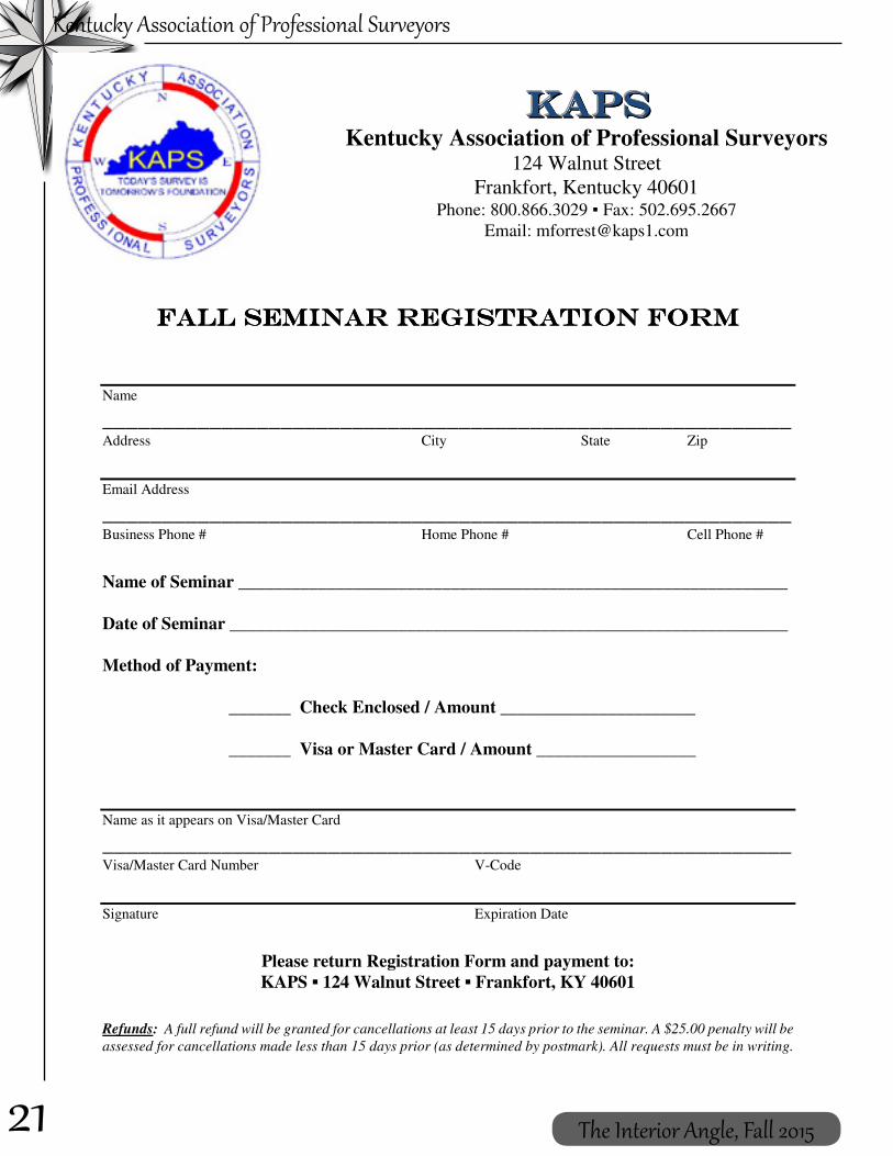
124 Walnut Street Frankfort, Kentucky 40601 Phone: 800.866.3029 Fax: 502.695.2667 Email: [email protected]
ONLINE REGISTRATION IS NOW AVAILABLE AT WWW.KAPS1.COM *Refunds: A full refund will be granted for cancellations at least 15 days prior to the seminar;
a $25 penalty will be assessed for cancellations made less than 15 days prior; all requests must be in writing.
21
Kentucky Association of Professional Surveyors
The Interior Angle, Fall 2015
Name
__________________________________________________________ Address City State Zip
Email Address
__________________________________________________________ Business Phone # Home Phone # Cell Phone #
Name of Seminar ______________________________________________________________ Date of Seminar _______________________________________________________________ Method of Payment:
_______ Check Enclosed / Amount ______________________ _______ Visa or Master Card / Amount __________________
Name as it appears on Visa/Master Card
__________________________________________________________ Visa/Master Card Number V-Code
Signature Expiration Date
Please return Registration Form and payment to: KAPS 124 Walnut Street Frankfort, KY 40601
Refunds: A full refund will be granted for cancellations at least 15 days prior to the seminar. A $25.00 penalty will be
assessed for cancellations made less than 15 days prior (as determined by postmark). All requests must be in writing.
Kentucky Association of Professional Surveyors
124 Walnut Street
Frankfort, Kentucky 40601 Phone: 800.866.3029 Fax: 502.695.2667
Email: [email protected]
22
Kentucky Association of Professional Surveyors
The Interior Angle, Fall 2015
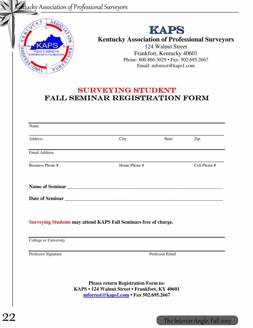
Name
__________________________________________________________ Address City State Zip
Email Address
__________________________________________________________ Business Phone # Home Phone # Cell Phone #
Name of Seminar ______________________________________________________________ Date of Seminar _______________________________________________________________ Surveying Students may attend KAPS Fall Seminars free of charge.
College or University
Professor Signature Professor Email
Please return Registration Form to: KAPS 124 Walnut Street Frankfort, KY 40601
[email protected] • Fax 502.695.2667
Kentucky Association of Professional Surveyors
124 Walnut Street
Frankfort, Kentucky 40601 Phone: 800.866.3029 Fax: 502.695.2667
Email: [email protected]

23
Kentucky Association of Professional Surveyors
The Interior Angle, Fall 2015
Surveying Merit Badge; A recruitment tool par excellence
Frank Lenik, [email protected]
There are few challenges facing the profession of land surveying today which are as great as the need to revitalize our ranks with young and technologically savvy individuals. We all recognize the aging of our colleagues but cannot seem to identify the reasons for the lack of new blood coming into the field. New tools and technologies have been introduced,but the application of these tools to our methodologies has been slow.
One of the storied tools for education and outreach has been the Boy Scout Surveying Merit Badge. As a former scout and scout leader, I recognize the value of the merit badge system as a way to introduce young people to various fields as a way to encourage them to grow and learn about the world around them. I typically attend a troop meeting or camporee to teach the scouts about the highlights of surveying and guide them through the requirements for the badge.
Recently however, I was introduced to a new and exciting way to work with scouts to earn this merit badge which I believeis a game changer. This idea was shared with me by the students at the Pennsylvania State University in Wilkes Barre, Pennsylvania. If you are unfamiliar with the school I will just say that it is one of the premier Surveying Engineering institutions in the United States. PSU offers three options to its students, a two year associate degree in Surveying Technology, a four year bachelor’s degree in Surveying Engineering and a five year concurrent program which results in both a bachelor’s degree in Surveying Engineering and a bachelor’s degree in Civil Engineering.
The Penn State model is really quite ingenious. Rather than teaching the scouts at some remote
location where their attention is easily diverted, the students and faculty invite local scout troops to visit their campus for a Surveying Merit Badge day. The program run by the surveying students themselves and includes a field component, a computer lab component and a barbecue prepared by the students.
The main strengths of the program are the peer to peer sharing of the knowledge of our profession and the introduction of the Penn State Surveying Engineering program to middle and high school age youth who will soon be looking to enter into the higher education system.What better emissaries of our field than those who are young and excited about it and how better to attract new students to our college programs than to invite them in for hands on experience?
As your liaison to the NSPS Young Surveyors Network and Chairman of the Youth Outreach subcommittee I challenge you to share this idea with every educational institution in your region. I further ask that you share with NSPS any ideas which you have on how we can grow and sustain our profession. I welcome your comments and can be reached via email at [email protected], via twitter @franklenik, or on facebook at National Surveyors Week.

24
Kentucky Association of Professional Surveyors
The Interior Angle, Fall 2015
c nference
2016
enc cn f rfen rer
FEBRUARY 18-20 Ramada Plaza Hotel & Conference Center, Louisville, KY
Surveyors with a Unified Voice
KAPS is a proud affiliate of
details coming soon • www.kaps1.com

25
Kentucky Association of Professional Surveyors
The Interior Angle, Fall 2015
One of the most misunderstood elements of boundary retracement is the boundary agreement, particularly oral boundary agreements. I get questions about this from surveyors in three forms. The first is, “What if the adjoining parties want to agree on a boundary?” The second is, “What if either or both parties claim there is an existing boundary line agreement.” The third is, “Is a written boundary agreement better than an oral agreement.” In order to answer these questions, one must understand what is a valid boundary line agreement.
It is elementary law that title to land can be transferred only by deed, by will, or by inheritance. There is no other way to convey land. Early courts did not approve of boundary line agreements—oral or written--on the theory that they contravened the statute of frauds; i.e., they were an attempt to transfer title to land without a deed. That is, if there was a locatable line between two properties and the owners simply agreed to locate it somewhere else, one—and maybe both—would be conveying land to the other, and that would require a deed.
However, the courts soon recognized that with the inherent confusion of boundaries in this state, there should be some means by which landowners could resolve their differences without resorting to lawsuits. There followed a set of rules under which a parole or written boundary line agreement would be approved. Those rules are as follows:
1. The location of the true line must be uncertain. This can occur in two situations. First, the line is uncertain if the deed descriptions are so vague that there is no reasonable way to find the line on the ground, or there is a good description but a total loss of all record monuments so that a competent surveyor, using all approved methods, cannot locate the
boundary with any certainty. Second, even if both deeds can be located on the ground, and the lines overlap, but senior title cannot be determined, the true boundary is uncertain. One of these conditions must exist before a boundary can be deemed uncertain. As a practical matter, if one of the parties employs a surveyor to locate the boundary and the surveyor is able to form an opinion as to the location, a legal boundary agreement cannot be made. The line must be objectively uncertain; i.e., it must meet this test to the degree that if the issue was ever raised in litigation, the court would agree that the true line could not be located.
2. There must be a dispute between the parties as to the true location of the boundary. “Dispute” does not imply hostile attitudes or threats of violence. A dispute exists if the parties cannot agree on where the true line is, even if there are no hard feelings.
3. The parties must agree on where to establish a “new” boundary between their properties.
4. The agreed boundary must be plainly and clearly marked. The marking must be such that a person interested in finding the location of the boundary between the two properties would be able to see the markings at any point along the line. Obviously, an iron pin at each end of a 2,000 foot line, with nothing in between, would not be clearly and plainly marked. A fence would be the most satisfactory “marked line”, but a painted line or blazed trees could serve as well.
5. The parties must take actual possession up to the marked line. The character of possession and occupation required is less than would be needed for a claim of adverse possession. However, if the parties simply went through the woods blazing trees and afterwards never carried out any occupational activity on the ground, it
Boundary Line AgreementsBud Salyer, Esq.

26
Kentucky Association of Professional Surveyors
The Interior Angle, Fall 2015
is doubtful if a court would find that anyone had taken “actual possession up to the marked line.”
6. There must be continuing acquiescence or mutual recognition of the line for a “long time.” The courts have not defined what a “long time” means, or established any minimum period. Fifteen years would certainly satisfy the requirements, but a lesser period might suffice if the occupation is clearly notorious and the parties have obviously recognized and lived by the line.
A written boundary agreement is no more binding than an oral agreement. However, if there is a written agreement, it is more difficult for one party to deny that an agreement was ever made. A written agreement may add some certainty as to what was actually agreed on. Otherwise, all the elements above must be present. Note, however, that if there is a written agreement for the line to be in one place, and the parties mutually mark and occupy at a different location, the marked line will control.
Now, every single one of the six elements set out above must be satisfied before a boundary agreement, parole or otherwise, is enforceable. For example, if the line is uncertain, and the parties disagree on the true line, and they agree on a location, and they occupy to it and live with it for 50 years, but never get around to actually marking it, there is no agreement.
What significance does an existing boundary agreement have for the practicing surveyor?
Actually, none. An agreed line—written or oral--is a work in progress and a surveyor cannot recognize the legal significance of the agreement until a court has put its stamp of approval on it. Any surveyor who locates a line on the mere fact that a client--or both parties--acknowledge that there is an existing agreement is acting foolishly and recklessly. If there is such a claim, the surveyor should treat the situation as he would if the parties did not have an agreement, but want one.
The practice of drawing an agreed line on a plat and having both parties sign the plat is utterly worthless. When the parties want an agreed line, the surveyor should ask the parties to go together and clearly mark an agreed line. The marked line should then be surveyed, with a plat and description prepared and marked as to its intended use (e.g., “Proposed Agreed Boundary Between XXX and YYY.”). The parties should then take the plat and description to an attorney and have cross-quit-claim deeds prepared. This is also what should be done when both parties claim there is already an existing agreement.
Once the deeds are prepared, exchanged and recorded, the surveyor may then incorporate that record line into a survey of the remainder of the client’s land. Just remember, though—it is no longer an agreed boundary. It is a conveyance to be recognized as if it had been made years before the surveyor appeared on the scene.
Georgia ∙ Kentucky ∙ North Carolina ∙ South Carolina ∙ Tennessee
1-800-388-6660 www.VaughnMelton.com
Professional Consulting Engineers and Land Surveyors

27
Kentucky Association of Professional Surveyors
The Interior Angle, Fall 2015
ADVISORY OPINIONEXCLUSIONS TO THE PRACTICE OF SURVEYING
Kentucky State Board of Licensure forProfessional Engineers & Land Surveyors
Kentucky Association of Mapping Professionals
Kentucky Association of Professional Surveyors
Definition of TermsAuthoritative – An accurately and precisely established location of a feature, object or boundary sufficient for use in establishing property rights, legal proceedings, or to protect the safety of the public from hazardous assets or other man-made or natural features.
Precise Location – A description of the position of a feature, object or boundary that meets or exceeds surveying accuracy standards per 201 KAR 18:150 Sections 7 and 8.
Generalized Location - A description of the position of a feature, object or boundary using general mapping accuracy standards that do not meet or exceed surveying accuracy standards per 201 KAR 18:150 Sections 7 and 8.
The definition of the practice of land surveying includes all activities where, regardless of the technology or method employed, the resulting work product represents the precise location of a feature, object, or boundary with reference to the surface or subsurface of the earth, and is a work product upon which the public is intended to reasonably rely as being the precise location of that feature, object, or boundary so located. These activities must be accomplished by or under the direct supervisory control of a professional land surveyor.
Land surveying does not encompass work products which represent only a generalized location of a feature, object, or boundary upon which the public would not reasonably rely as the precise location of that feature, object, or boundary. The following items are not to be included as activities within the definition of the practice of land surveying:
1. The creation of general maps:
a. Prepared by private firms or government agencies for use as guides to motorists, boaters, aviators, pedestrians, or for purposes of coordinating/administering public services, asset management and emergency response activities;
b. Prepared for publication in a gazetteer or atlas as an educational tool or reference publication;
c. Prepared for or by education institutions for use in the curriculum of any course of study;
d. Produced by any electronic or print media firm as an illustrative guide to the geographic location of any event; or

28
Kentucky Association of Professional Surveyors
The Interior Angle, Fall 2015
e. Prepared by laypersons for conversational or illustrative purposes. This includes advertising material and users guides.
2. The transcription of previously georeferenced data into a GIS or LIS by manual or electronic means, and the maintenance thereof, provided the data are clearly not intended to indicate the authoritative location of property boundaries, the precise definition of the shape or contour of the earth, or the precise location of fixed works of humans.
3. The transcription of public record data, without modification except for graphical purposes, into a GIS- or LIS-based cadastre (tax maps and associated records) by manual or electronic means, and the maintenance of that cadastre, provided the data are clearly not intended to authoritatively represent property boundaries. This includes tax maps and zoning maps.
4. The preparation of any document by any government agency that does not depict real property boundaries. This includes civilian and military versions of quadrangle topographic maps, military maps, satellite imagery, and other such documents.
5. The incorporation or use of documents or databases prepared by any governmental agency into a GIS/LIS, including census and demographic data, quadrangle topographic maps, and military maps.
6. Inventory maps and databases created by any organization, in either hard-copy or electronic form, of physical features, facilities, or infrastructure that are wholly contained within properties to which they have rights or for which they have management, service or administrative responsibility. The distribution of these maps and databases outside the organization must contain appropriate metadata describing, at a minimum, the accuracy, method of compilation, data source(s) and date(s), and disclaimers of use clearly indicating that the data are not intended to be used as a survey product.
7. Maps and databases depicting the distribution of natural resources or phenomena prepared by foresters, geologists, soil scientists, geophysicists, biologists, archaeologists, historians, or other persons qualified to document such data.
8. Maps and georeferenced databases depicting physical features and events prepared by any government agency where the access to that data is restricted by statute. This includes georeferenced data generated by law enforcement agencies involving crime statistics and criminal activities. 9. Work products containing the following written disclaimer in at least ten point font:
“This work product represents only generalized locations of features, objects or boundaries and should not be relied upon as being legally authoritative for the precise location of any feature, object or boundary.”

29
Kentucky Association of Professional Surveyors
The Interior Angle, Fall 2015

30
Kentucky Association of Professional Surveyors
The Interior Angle, Fall 2015
KAPS Board of DirectorsSaturday, April 11, 2015 10:00 A.M. ESTKentucky Engineering Center, 160 Democrat Drive, Frankfort, KY
CALL TO ORDERKAPS 2015 President, Tom Clayborn, called the April 11, 2015 KAPS Board of Directors Meeting to order.
PROXY VOTES:One proxy was submitted: Earl Strater assigned his proxy to Greg Barker on March 14, 2015. Jason Graves moved to accept the proxy. Mike Ladnier seconded. Motion carried.
MEMBERS PRESENT: Thomas Clayborn –President; Jason Graves – President Elect / Falls of the Ohio Chapter Chair; Jonathan Payne – Past President; Dan Farrell – Vice President of External Affairs; Kevin Phillips – Vice President of Internal Affairs / Bluegrass Capital Chapter Chair; James Mayo –Director; John Ledington – Director; Greg Barker – Director; Josh Calico – Director; Chris Gephart – Kentucky Board of Licensure Liaison; William Bowie – KSPE Liaison; Steve Lilly – KAMP Liaison; Michael Ladnier – Audubon Chapter Chair; Bob Neuhaus – Barren River Chapter Chair; Curtis Felts – Southeast Chapter Chair; Tom Bushelman – By-Laws & Policy Manual Chair
STAFF PRESENT: Molly Forrest – Administrative Assistant
GUESTS PRESENT: Tyler Pence – Falls of the Ohio Chapter Vice-Chair
MEMBERS ABSENT: Richard Montgomery – Director / Secretary; Tom Crabtree – Director / Treasurer; Craig Palmer – NSPS Governor; Paul Schrader – GIAC Liaison; Robert Smith – Green River Chapter Chair; Johnny Justice – Highlands Chapter Chair; Earl Strater – Northern Kentucky Chapter Chair; Matthew Clark – Jackson Purchase Chapter Chair
PRESIDENTS WELCOMEPresident Tom Clayborn welcomed everyone to the meeting. Introductions were made.
ADDITIONS OR REVISIONS TO THE AGENDA*Tom Clayborn would like to discuss TrigStar.**Jon Payne wants to discuss a possible salary survey.
REVIEW AND APPROVAL OF BOARD MEETING MINUTESThe minutes of the February 25, 2015 Board meeting were reviewed. Mike Ladnier made a motion to approve the minutes. Jon Payne seconded. Motion carried.
The minutes of the February 26, 2015 Board meeting were reviewed. Jon Payne made a motion to approve the minutes. Greg Barker seconded. Motion carried.
The minutes of the February 27, 2015 General Membership meeting were reviewed. These minutes will not be approved until the next General Membership Meeting in February, 2016.
KAPS OFFICER REPORTSPresident’s Report – submitted in the Board Packet.
Treasurer’s Report – The Board discussed meeting with the accounting firm of Cook & Cheek to discuss concerns and questions. Those named to the Finance Committee were James Mayo (Chair), Jason Graves, Kevin Phillips, and Tom Crabtree (Treasurer).
The Balance Sheet / Profit & Loss Statement was included in the Board Packet. No action was taken.
Administrative Assistant’s Report – written report submitted; Molly Forrest distributed Chapter Dues checks as well as 2014 Fall

31
Kentucky Association of Professional Surveyors
The Interior Angle, Fall 2015
Seminar Disbursement checks to the Chapter Chairs that were present. Chapter chairs were encouraged to reach out to KAPS members that have not renewed for 2015.
Mrs. Forrest asked for fall seminar submissions to be made prior to May 19th so the Board of Licensure could consider for pre-approval. Fall Seminar details should be discussed with Mike Ladnier.
Mrs. Forrest reported on a request from the West Virginia Society of Professional Surveyors (WVSPS) for mailing addresses of KAPS members. Following some discussion, it was agreed to share the link to the Board of Licensure licensee list.
OLD BUSINESSKAPS Representatives to Attend the April 23 Board of Licensure Surveying Committee Meeting Regarding Mapping Sciences (addition of Danielle Kelly to the KAPS delegation) – President Clayborn mentioned this would most likely be the final meeting regarding the definition of “surveyor.” Danielle Kelly was appointed to take the place of Don Pedigo as part of the KAPS delegation.
Bonnie Atwell Award / “Surveyor in Need” Fund – The award is given to someone who has contributed to the National Society of Professional Surveyors (NSPS) “Surveyor in Need” fund in memory of Bonnie Atwell. John Ledington explained he was the last recipient of the Bonnie Atwell Award (clock). He has turned it over to the KAPS office. The Southeast Chapter will take care of getting the name of the top contributor so the award can be presented again at the 2016 KAPS Conference.
Mason & Dixon Surveying Instrument Restoration Chapter Challenge – Kevin Phillips reminded the Board of the $2,500.00 goal association wide. The following chapters have pledged $250.00 each: Barren River, Falls of the Ohio, and Bluegrass-Capital. The Southeast Chapter and the Jackson Purchase Chapter are considering a donation.
Kentucky State Fair – Jason Graves reported a 10’ x 10’ booth would be $850.00. Giveaway items would need to be purchased as well. The Falls of the Ohio Chapter and the Southeast Chapter of Indiana Society of Professional Land Surveyors (ISPLS) have each offered to pay ¼ of the booth fee. KAPS would be responsible for the remaining half.
Kevin Phillips made a motion to have a budget of $1,500.00 for the State Fair event. Greg Barker seconded.
GIS Pre-Conference Workshop / Surveying 101 for GIS Professionals Pre-Conference Workshop (Monday, October 12 – Wednesday, October 14 in Owensboro) – President Clayborn will try to arrange the same speakers as last year.
NEW BUSINESSNext KAPS Board Meeting – Friday, June 19, 2015, 6:00 p.m. est at the Wickland Historic Mansion, 550 Bloomfield Road (US 62), Bardstown, KY 40004
Northeast Chapter – President Clayborn reported that Mike Ruggles has decided to step down from his Northeast Chapter Chair position leaving that position vacant. Chapter Treasurer, Tim Pugh, is also stepping down from his position. The chapter has five members and three of those are from out of state. Mr. Pugh needs to know what to do with the chapter bank account. Chris Gephart recommended making the chapter “inactive” and placing the funds in escrow. Tom Bushelman will check the By-laws and Policy Manual regarding the steps to make a chapter “inactive”. It was decided to table the issue until the June Board meeting.
Administrative Assistant, Molly Forrest’s Annual Evaluation – President Clayborn reported the Board’s decision to increase Molly Forrest’s pay to $21.00 per hour ($1.00 an hour increase). It was also decided to give her the day after Thanksgiving as a paid holiday. Mrs. Forrest expressed her appreciation to the Board.

32
Kentucky Association of Professional Surveyors
The Interior Angle, Fall 2015
*TrigStar – President Clayborn encouraged the Chapters to consider giving the TrigStar test at public high schools. This would be a good opportunity to introduce the profession to young people. He suggested bringing the idea up at the Chapter meetings.
**Salary Survey – Jon Payne suggested looking into doing a Kentucky Salary Survey. The survey would give people coming into the profession an idea of what to expect salary-wise. Jason Graves made a motion for Mr. Payne to look into the possibilities. Greg Barker seconded the motion. Motion carried.
EX-OFFICIO DIRECTORS REPORTSKAMP Liaison – no written report; Steve Lilly reported KAMP had recently held a quarterly meeting. KAMP general membership is up to three-hundred twenty-three, sixty of which are students. KAMP is in the process of switching software to Wild Apricot which handles all their registration, membership, etc. The software sends out automatic reminders to the membership. KAMP would like to see more surveyors become members of KAMP. The KAMP Board is planning a retreat on May 21 – 22 to discuss KAMPs future. They are very appreciative of the KAPS course at their conference. They would like to reciprocate with a similar course at the KAPS Conference.
KY State Board of Licensure Liaison – no written report; Chris Gephart reported no Board of Licensure (BOL) meetings since his last report. The BOL Enforcement Director submitted his year-end report with seventy-five complaints opened: forty-three engineering; twenty-eight surveying; four engineering and surveying; twenty-eight no action taken; twenty admonishment/warning; fourteen reprimand/fine/probation; and, seven license suspensions.
KSPE Liaison – no written report; William Bowie reported KSPE had just concluded their annual convention. KSPE’s biggest goal for the next year is educational outreach. Mr. Bowie suggested KAPS and KSPE work together on this goal. President Clayborn agreed to work with Derek Guthrie regarding the education initiative.
Professional Development Chair – the Fall Seminar Disbursement report was included in the Board Packet; Mike Ladnier distributed a proposal for KAPS Chapters to receive thirty-five percent of the profits from the fall seminar they are hosting. The proposal outlines the following:
Chapter duties:• Locate and schedule a venue to host
seminar• Schedule the speaker for the seminar• Speaker must be approved by the BOL
for CPD credit• Schedule and provide lunch for
attendees• Schedule a proctor• Promote the seminar in the area; send
out emails
KAPS duties:• Advertise in the Interior Angle• Registration of attendees• Pay for travel and lodging expenses for
speaker• Pay for seminar venue• Pay for lunch for seminar attendees• Will help with approval for BOL CPD
approval• Provide all materials for course,
including certificates
This proposal is to inspire each chapter to help and coordinate their fall seminar in hopes of helping Molly with the coordination of the fall seminars and to help the chapter who provide assistance with a share of the profits.
Mr. Ladnier presented this proposal in the form of a motion. Jon Payne seconded. Motion passed. CHAPTER REPORTS
Audubon – report distributed
Northern Kentucky – no written report; Greg Barker reported the chapter met in March. He mentioned the chapter most likely would not hold a KAPS fall seminar as they will be supporting the TSAB fall seminar.
Southeast – written report submitted

33
Kentucky Association of Professional Surveyors
The Interior Angle, Fall 2015
COMMITTEE REPORTSAnnual Conference – expense/profit report submitted; the difference between budget and expense was $12,111.53 profit.
Annual Golf Outing and Picnic – golf outing, sponsorship, and picnic registration forms included in Board packet. President Clayborn mentioned needing goodie bag items. He encouraged everyone to recruit sponsors, promote the events, and attend.
Membership – each Chapter Chair was given a list of licensed surveyors from their area who are not KAPS members; Jon Payne encouraged the chapters to contact the folks on their list and invite them to become KAPS members. President Clayborn reported only nineteen
percent of licensed Kentucky surveyors are KAPS members. He also suggested purchasing a machine to make membership cards. President Clayborn asked for volunteers to help Mr. Payne on the Membership Committee. President Clayborn and Mike Ladnier decided to join the committee.
ADJOURNMENTJason Graves made a motion to adjourn. Mike Ladnier seconded. Motion carried. Meeting adjourned.
Respectfully submitted by:Molly M. Forrest for Richard Montgomery, PE, PLS, SecretaryEdited for content by:Doug Comer, PE, PLS, Editor
Wally Johnson and Brian Cox
Jason Huther (Principal at Newport Central Catholic) Brian Cox, and Wally Johnson
2015 Trig Star ContestCongratulations to Walter “Wally” Johnson, winner of the 2015 Trig Star contest sponsored by NSPS and KAPS.
Wally placed first among the 21 kids who took the state test in March. Wally placed sixth in the national test held in May. Wally is currently a senior at Newport Central Catholic and plans to take the Trig Star Exam again next year to try for a first place national finish.
For more information, visit http://www.nsps.us.com/index.cfm?fuseaction=page.viewPage&pageID=522&stopRedirect=1

34
Kentucky Association of Professional Surveyors
The Interior Angle, Fall 2015
2015 KAPS Golf Outing
Second Place: Bob Smith, J Hutchinson, David Delk and Buddy Cole
Third Place: Don Pedigo, Kenneth Sperry, David Sigler and Robert Fentress
First Place: The Audubon Chapter of the Kentucky Association of Professional Surveyors team; Clay Williams, Chip Wood, Danny Davis and Brandon Waldrop

35
Kentucky Association of Professional Surveyors
The Interior Angle, Fall 2015
PERMANENT Opportunity: Land Surveyor GS-1371-09/11 SWGJ157707931506484DR (DEU Exter-nal) SWGJ157707931509648R (Status Candidates) Closes: 8 Oct 15Importance: High
If interested and eligible please apply @ www.usajobs.gov
Job Title: Land Surveyor Department: Department of the ArmyAgency: U.S. Army Corps of EngineersJob Announcement Number: SWGJ157707931506484DRSALARY RANGE: $48,403.00 to $76,131.00 / Per YearOPEN PERIOD: Tuesday, September 29, 2015 to Thursday, October 8, 2015SERIES & GRADE: GS-1373-09/11POSITION INFORMATION: Full Time - PermanentPROMOTION POTENTIAL: 11 DUTY LOCATIONS: 1 vacancy in the following location: Louisville, KY WHO MAY APPLY: United States Citizens SECURITY CLEARANCE: Not ApplicableSUPERVISORY STATUS: No
About the Position:SPECIAL NOTICE - PLEASE READ! This position is also being announced under SWGJ157707931509648R for “Status Candidates”. If you are currently a permanent Department of Army employee with status or have other appointment eligibility(s), ensure to review this announcement to determine if you are eligible to apply and receive consideration.
You will function as a Land Surveyor and party chief for the District’s in-house survey team, within the Engineering Division, Civil Engineering Branch, and Civil Section.
This is a developmental position. The target level for this training assignment is GS-1373-11. The incumbent performs developmental assignments under closer than normal supervision. Assignments become progressively more difficult until the full performance level is reached.
Noncompetitive promotion to the target job may be effected provided the incumbent is sufficiently experienced, meets all necessary qualification requirements for promotion to the target job, is per-forming the full scope of the major duties, and is functioning under the supervisory controls as stated in the target job description.
Permanent Change of Station (PCS) allowances may be authorized subject to the provisions of the Joint Travel Regulations and an agency determination that a PCS move is in the Government interest.
Retention, Relocation, and Recruitment Incentives may be authorized.
Who May Apply: U.S. Citizens
TRAVEL REQUIRED *75% or Greater *Extensive travel required - approximately 100%
EDITOR’S NOTE:While this advertisement expires on 08 October, check on www.USAJOBS.gov as this position may be extended until later in the month, or another position posted.

36
Kentucky Association of Professional Surveyors
The Interior Angle, Fall 2015
— Be outstanding in your field!
+LAT: 38°39’56.73”LON: 83°47’00.59”
®
...For the Total Project
Carlson Software Inc.102 West 2nd Street • Maysville, KY 41056 U.S.A.800-989-5028 • 606-564-5028 • www.carlsonsw.com
Since 1983
© Copyright 2014 Carlson Software, Inc. All rights reserved. Carlson Software is a registered trademark of Carlson Software, Inc. All other product names or trademarks belong to their respective holders.
Carlson SurvCE 4.0 utilizes the BRx5’s internal level sensors to display a live digital level bubble in the store points and stake points screen. Plus —
Fully integrated 270-channel GNSS receiver with UHF radio & GSM cell modem
Each receiver can be configured as Base, Rover, or Network Rover
Dual Bluetooth Ports – connects data collector & cell phone
Dual Hot-Swap Batteries – no need to stop work to recharge or replace battery packs
OmniSTAR Capable – submeter differential correction available worldwide
Featuring Carlson Exclusive LDL:(live digital level)
Colors: Cyan, Magenta, Yellow, Black. Files not trapped or preflighted.Prepress company, please Preflight and Trap this art as needed.
Carlson BRx5 Advertisement 8-28-14American Surveyor Full Page 8.125 x 10.75 in + bleed

KAPS MEMBERSHIP APPLICATION
Please complete form: email to [email protected] or fax to 502.695.2667
mail to KAPS 124 Walnut Street Frankfort, KY 40601 Register online at www.kaps1.com

•
•