Kailash Sacred Landscape Conservation Initiative...International Centre for Integrated Mountain...
108
1 Kailash Sacred Landscape Conservation Initiative Feasibility Assessment Report
Transcript of Kailash Sacred Landscape Conservation Initiative...International Centre for Integrated Mountain...

1
Chapter 2 – Description of Target Landscape
Kailash Sacred Landscape Conservation Initiative
Feasibility Assessment Report


International Centre for Integrated Mountain Development, Kathmandu, Nepal, July 2011
EditorsRobert ZomerKrishna Prasad Oli
Kailash Sacred Landscape Conservation Initiative
Feasibility Assessment Report
Kang Rinpoche གངས་རན་པ་ཆ – Gangrénboqí Feng 冈仁波齐峰 – Kailasa Parvata s}nfz kj{t

Published byInternational Centre for Integrated Mountain Development GPO Box 3226, Kathmandu, Nepal
Copyright © 2011
International Centre for Integrated Mountain Development (ICIMOD)
All rights reserved. Published 2011
ISBN 978 92 9115 209 4 (printed)
978 92 9115 211 7 (electronic)
LCCN 2011-312010
Photos: p 6, Sally Walkerman; p 38, Govinda Basnet; all others, Robert Zomer
Printed and bound in Nepal by
Sewa Printing Press, Kathmandu, Nepal
Production team
Isabella Bassignana-Khadka (Consultant editor)Susan Sellars-Shrestha (Consultant editor)Andrea Perlis (Senior editor)A Beatrice Murray (Senior editor)Dharma R Maharjan (Layout and design)Asha Kaji Thaku (Editorial assistant)
Note
This publication may be reproduced in whole or in part and in any form for educational or non-profit purposes without special permission from the copyright holder, provided acknowledgement of the source is made. ICIMOD would appreciate receiving a copy of any publication that uses this publication as a source. No use of this publication may be made for resale or for any other commercial purpose whatsoever without prior permission in writing from ICIMOD.
The views and interpretations in this publication are those of the author(s). They are not attributable to ICIMOD and do not imply the expression of any opinion concerning the legal status of any country, territory, city or area of its authorities, or concerning the delimitation of its frontiers or boundaries, or the endorsement of any product.
This publication is available in electronic form at www.icimod.org/publications
Citation: Zomer, R; Oli, KP (eds) (2011) Kailash sacred landscape conservation initiative – Feasibility assessment report. Kathmandu: ICIMOD

iii
Contents
Foreword vContributors viAcknowledgements viiAcronyms and Abbreviations viiiExecutive Summary ix
1 Introduction 1 Background 1 Methodology and Approach 3
2 Description of Target Landscape 7 Delineation of Target Landscape 7 Overview and Description of the KSL Target Area 7 Physical and Biological Characteristics of the KSL 12 Land Use and Land Cover 18 Biological Diversity 26 Wildlife Habitat Management and Conservation Areas 31
3 Resource Status, Environmental Degradation, and Cultural Integrity 39 Background 39 Major Degradation Trends in Land, Water and Human Environment 39 Biodiversity Loss and Threatened Flora and Fauna 45
4 Community Perceptions 51 Biodiversity and Environment 51 Cultural Values and Resource Management 52 Livelihood Options 53 Policies and Plans 54
5 Identification of Priorities and Gap Assessment 55 Biodiversity and Environment 55 Sustainable Livelihoods 60 Cross-Cutting Issues 61 Transboundary Cooperation 62
6 Policy and Enabling Environment 65 Background 65 International and Regional Obligations 66 National Policies and Legal Instruments 71 Traditional Institutions and Customary Laws 80 Policy Constraints and Conflicts 81 Policy Needs, Gaps, and Priorities 83 Enhancing Regional Cooperation 88
References 91

iv
Tables
1. Basic attributes of the transboundary KSL 92. Basic attributes of KSL-China, KSL-India, and KSL-Nepal 93. Major mountain peaks in the KSL 124. Classification of the KSL by elevation zone 135. Forest management regimes in the KSL 206. Crops grown in KSL-India 217. Agrobiodiversity in Humla District in KSL-Nepal 228. Ecologically and/or culturally significant lakes in the KSL 249. Glacial coverage in the KSL 2410. Demographic patterns in the KSL 2511. Endemic plant species of the KSL 2812. Faunal diversity of the KSL 2913. Protected areas in or adjacent to the KSL 3514. Threatened, rare, and endangered, and vulnerable plant species of the KSL 4615. Globally and regionally threatened fauna of the KSL 4716. Overlapping legal provisions governing natural resources in Nepal 83
Figures
1. Map of the KSL 82. Classification of the KSL by elevation zone 133. Ecoregions of the KSL 154. Land cover map of the KSL 195. Major glaciers in the KSL 256. Number of tourists visiting Mount Kailash in TAR-China 37

v
Foreword
The Kailash Sacred Landscape Conservation Initiative (KSLCI) is the first cooperation of its kind among China, India, and Nepal, and seeks to conserve and sustainably manage a highly unique and special landscape through the application of transboundary ecosystem management approaches. It was conceived and is being implemented in collaboration with partner institutions in all three countries and with the support of ICIMOD and the United Nations Environment Programme (UNEP). This region, like much of the rest of the Hindu Kush-Himalayas, faces many challenges, not the least of which are global warming, globalisation, and environmental degradation. The Kailash region is considered sacred to five major religions and to a large number of people in Asia and throughout the world. As such, its charismatic role as an example of the urgent need to preserve both the cultural global heritage and global biodiversity cannot be overestimated. The initiative directly addresses the challenges laid out in the Convention on Biological Diversity, and promotes the goals and approach described in the Convention’s Programme of Work on Mountain Biodiversity.
The preparatory phase of the initiative developed the basis for implementation of a long-term strategy, and for a participatory and transboundary approach for sustainable development and conservation in the Kailash region. It is envisioned that this will lead to enhanced regional cooperation among China, India, and Nepal for the implementation of ecosystem management approaches in the Kailash Landscape. As a basis for moving forward with implementation, lead partners in each of the three countries have completed comprehensive country feasibility assessments. These have been synthesised into this Feasibility Assessment Report, which constitutes the basic needs and feasibility assessment for the entire target area and also includes the policy and enabling environment analysis. This regional-level report represents the efforts of many scientists and colleagues in each of the three countries, who have spent many days conducting field visits and research to assemble the formidable quantity of information and analysis which is needed to describe the Landscape. It is the core component leading up to the development of a conservation strategy and associated comprehensive environmental monitoring strategic plan for the landscape.
Our thanks and gratitude are extended to all the national partners and other stakeholders who contributed to this consultative process and who are helping to build the regional networks that will be the basis for regional cooperation. National ownership and community-based conservation initiatives are the foundation for the sustainability of the Kailash Initiative, and this document is a first example of this regional cooperation. As the Initiative progresses, building the implementation frameworks, regional networks, and community-based structures to apply ecosystem management and landscape conservation approaches, this participatory process of shared responsibility and differentiated approaches will evolve. With the completion of this feasibility assessment we have moved a big step closer towards providing an example of transboundary ecosystem management approaches that can be replicated throughout the Hindu Kush-Himalayan region.
Andreas Schild Director General, ICIMOD

vi
Contributors
ICIMOD Core Team: RJ Zomer, KP Oli, E Sharma
Contributors: N Chettri, U Sharma, B Shakya, S Chaudhary, S Jaiswal, J Gurung, B Bajracharya, K Uddin
UNEPT Kasten, E Migongo-Bake (Nairobi), S Sinha (Regional Office for Asia and the Pacific)
KSL-China Core TeamShi Peili, Zhou Caiping -- Institute of Geographic Sciences and Natural Resources Research (IGSNRR)Yang Yongping -- Kunming Institute of Botany (KIB)Tian Lide – Institute of Tibetan Plateau Research (ITPR)Luorong Zhandui, Zong Gang, Fan Yibing -- China Tibetology Research Center (CTRC)
KSL-India Core TeamLMS Palni, RS Rawal -- GB Pant Institute of Himalayan Environment and Development (GBPIHED)GS Rawat -- Wildlife Institute of India (WII) N Verma -- Uttarakhand Forest Department (UKFD)M Chandran – Uttarakhand Forest Department (UKFD)
Contributors
K Kumar, DS Rawat, S Sharma, SCR Vishvakarma, GCS Negi, ID Bhatt, AK Sahani, K Chandra Sekar, R Joshi, S Airi -- GBPIHEDBS Adhikari, GS Bhardwaj, S Sathyakumar, VK Melkani, VP Uniyal -- WII
KSL-Nepal Core TeamRP Chaudhary, KK Shrestha, PK Jha -- Central Department of Botany, Tribhuvan UniversityKP Bhatta -- Kailash Sacred Landscape Conservation Initiative (KSLCI) consultant
Contributors
AN Das, S Rimal -- Ministry of Forest and Soil Conservation (MoFSC), NepalM Acharya, R Maharjan, RN Sah, SM Shrestha – Department of Forest, Government of NepalBK Uprety – Ministry of Environment, Government of NepalG Basnet – Kailash Sacred Landscape Conservation Initiative (KSLCI) consultantT Basnet, SK Ghimire, M Siwakoti, M Acharya, KC Paudel, P Bhattarai, RK Gautam, M Limbu -- Tribhuvan UniversityN Belbase – Kailash Sacred Landscape Conservation Initiative (KSLCI) consultantS Bhatta – Department of National Parks and Wildlife Conservation, Government of NepalS Khanal – Independent contributorK Sharma -- Department of Hydrology and Meteorology, Government of NepalMP Upadhyaya – National Agricultural Research Council, Government of NepalKC Paudel -- Department of Plant Resources, Government of Nepal

vii
Acknowledgements
The International Centre for Integrated Mountain Development (ICIMOD), and the ICIMOD Core Team, would like to thank all of the many people from each of the three Kailash Sacred Landscapes (KSL) countries who participated in this effort to provide the baseline survey for the remote KSL region and who put together this report. The many persons who contributed to the Country Feasibility Reports, upon which this current report is based, are too numerous to list here, but their contribution is duly recognised; their names are included in the individual country reports.
ICIMOD would like to thank the United Nations Environment Programme (UNEP) for technical support for the project and for funding provided by the Norwegian Government. Thanks are also due to Deutsche Gesellschaft für Internationale Zusammenarbeit (GIZ)/German Federal Ministry for Economic Cooperation and Development (BMZ) for additional financial support. ICIMOD thanks the Ministry of Environment and Forests of the Government of India, the Ministry of Forest and Soil Conservation of the Government of Nepal, the Chinese Committee on ICIMOD (CNICIMOD), the UNEP Regional Office for Asia and the Pacific (ROAP) in Bangkok, and the UNEP World Conservation Monitoring Centre (UNEP-WCMC), Cambridge, United Kingdom, for their continuous support and technical inputs. In particular, we would like to thank all of the KSL partner organisations and lead institutes for their unswerving dedication to the KSLCI.
Special thanks are due to Mr YR Bhusal, Secretary, and Mr SP Joshi, Joint Secretary, Ministry of Forest and Soil Conservation, Government of Nepal; Mr Hem Pande and Mr BMS Rathore, Joint Secretaries, and Mr Vivek Saxena, Director, Ministry of Environment and Forests, Government of India; Dr RBS Rawat, Principal Chief Conservator of Forests, Forest Department, Government of Uttarakhand State, India; Dr Liu Yi, Director General and Professor, Institute of Geographic Sciences and Natural Resources Research, Chinese Academy of Sciences, and Dr Dong Qi, Bureau of International Cooperation, Chinese Academy of Sciences.

viii
AWLS Askot Wildlife SanctuaryBDA Biological Diversity Act (GOI)CAS Chinese Academy of SciencesCBD Convention on Biological DiversityCBO community-based organisationCEMSP comprehensive environmental monitoring
strategic planCITES Convention on International Trade in
Endangered Species CFUG community forest user group (Nepal)COP Conference of PartiesCNPA Carpathian Network of Protected AreasCS conservation strategyCTRC China Tibetololgy Research CentreDDC district development committee (Nepal)DoA Department of Archaeology (Nepal)ECE Economic Commission for EuropeEIA environmental impact assessmentFAR feasibility assessment reportGBPIHED GB Pant Institute of Himalayan Environment
and Development (Almora, India)GDC geospatial data centreGLCN Global Land Cover NetworkGoI Government of IndiaGoN Government of NepalGTZ German Technical Cooperation (now
Deutsche Gesellschaft für Internationale Zusammenarbeit [GIZ])
HKH Hindu Kush-Himalayas/nHRDI Herbal Research and Development Institute ICIMOD International Centre for Integrated Mountain
DevelopmentIEE initial environmental examinationIGSNRR Institute of Geographic Sciences and
Natural Resources Research (CAS)ILO International Labour OrganizationIPR intellectual property rightIUCN International Union for Conservation of
Nature KIB Kunming Institute of BotanyKSL Kailash Sacred LandscapeKSLCI Kailash Sacred Landscape Conservation
InitiativeLSGA Local Self-Governance Act (Nepal)MAB Man and the Biosphere ProgrammeMAP medicinal and aromatic plantMoFSC Ministry of Forest and Soil Conservation
(Nepal)
MoEF Ministry of Environment and Forests (India)MPCA medicinal plant conservation areasNAPCC National Action Plan on Climate ChangeNBAP National Biodiversity Action Plan (GOI)NBCC National Biodiversity Coordination
Committee (Nepal)NBS Nepal Biodiversity StrategyNBSIP National Biodiversity Strategy
Implementation Plan (Nepal)NGO non-government organisationNMP National Map Policy (India)NTFP non-timber forest productNWAP National Wildlife Action Plan (GOI)PoW Programme of Work PLNA Pasture Land Nationalisation ActPRC People’s Republic of ChinaSEPA State Environmental Protection Agencies
(PRC)SEPC State Environmental Protection Commissions
(PRC)SDAN Sustainable Development Agenda for NepalSOI Survey of IndiaToR terms of referenceTAR Tibet Autonomous Region (China)UKFD Uttarakhand Forest DepartmentUNEP United Nations Environment ProgrammeUNCHE United Nations Conference on the Human
EnvironmentUNGA United Nations General Assembly VDC village development committee (Nepal)WCN World Charter for NatureWCED World Commission on Environment and
DevelopmentWR/HR wildlife reserves/hunting reservesWSSD World Summit on Sustainable Development WII Wildlife Institute of IndiaWRA Water Resources Act (Nepal)WUA Water Users Association
Currency exchange rates used in this report:
US$ 1 is approximately equivalent to 72.00 Nepali Rupees (NPR) 45.00 Indian Rupees (INR) 6.55 Chinese Yuan (RMB)
Acronyms and Abbreviations
ix
Executive Summary
The Kailash Sacred Landscape (KSL) spreads across a vast region that includes remote portions of the Tibet Autonomous Region of China (TAR China) and contiguous areas of Nepal and India. This area is historically, ecologically, and culturally interconnected; it is the source of four of Asia’s most important rivers, and at the heart of this landscape is the sacred Mount Kailash, revered by millions of people in Asia and throughout the world. The region and its people are highly vulnerable to climate change and environmental degradation, as well as threats associated with ongoing globalisation processes and accelerating development.
Mount Kailash (a.k.a. Mount Kailas) is referred to as Gangrénboqí Feng (冈仁波齐峰) in Chinese and as Kailasa Parvata -s}nfz kj{t_ in Sanskrit (with similar names in Hindi, Nepali, and other related South Asian languages). It is revered as Khang Rinpoche (གངས་རན་པ་ཆ) among Tibetans.
The Kailash Sacred Landscape Conservation Initiative (KSLCI) is an attempt on the part of the three neighbouring countries to join hands to help preserve the unique biological diversity, the many ecosystem goods and services, and the value-based cultural heritage of one of the most revered and sacred landscapes in the world. The KSLCI has the following broad objectives: • Enhance cooperation among the regional member countries • Increase collection of climate change data in the KSL • Recognise and strengthen local capacity for community-based participation in conservation and sustainable
development
The present report is a summarised synthesis of three individual Country Feasibility Assessment Reports carried out as the first step of the KSLCI. These reports were based on extensive field work and consultations aimed at delineating the target landscape and preparing a needs analysis for the KSL in general, and the KSLCI in particular.
The methodology consisted of primary and secondary data collection. The primary data were collated mainly from rapid assessment field surveys collected through expert consultations, interaction programmes, group discussions, stakeholder surveys, and individual household surveys. Secondary information was gathered mainly through literature review. The information was analysed to identify gaps and priorities.
The KSL Target Landscape
The delineation of the target landscape by the partners was a major undertaking and is summarised in the KSLCI Target Area Delineation Report (ICIMOD 2010c). The KSL contains the origin of four of Asia’s major rivers: the Brahmaputra, the Indus, the Karnali, and the Sutlej. The landscape exhibits great variability and heterogeneity geographically and culturally, covering at least four major geological and physiographic zones. The variety of bio-climatic zones that exist in the landscape includes, among others, hot and semi-arid regions in the southwest, lush green and humid valleys in the mid-hills, extensive mountain forests, moist alpine meadows, remote and arid trans-Himalayan valleys, and high altitude grasslands and steppes, along with extensive areas of permanent snow and ice.
Due to variations in altitude and topography, the ecosystems of the region vary widely from subtropical to temperate, alpine, and cold high altitude desert types. Similarly, the landscape harbours a high diversity of flora and fauna of both regional and global significance. Indigenous and local/tribal communities have developed locally specific patterns of natural resource use for food, medicine, timber, fibre, and, in earlier times, for barter.

x
Almost 15% of the KSL area is classified as permanent snow or ice, 20% is estimated to be under some form of forest cover, and an additional 18% is bare or uncultivated fallow. In the southern part of the landscape, which is dominated by human habitation, forest patches appear to be smaller and more fragmentary than those in the more northern parts. It is estimated that less than 10% of the KSL is agricultural land; however, agriculture it is a major and important source of livelihood for the local mountain communities. Permanent grazing areas and other pasture lands comprise over 27% of the total area. Transhumance, nomadic herding, and on-farm livestock production are the most important livelihood activities for much of the region.
Water bodies (rivers, lakes, and wetlands) play important ecological, environmental, and cultural roles. There are four major rivers that drain the landscape: the Ganges, Indus, Brahmhaputra, and Sutjej. They are used for multiple purposes including irrigation and hydropower generation, and they support large downstream populations, notably in South Asia and on the Tibetan Plateau. There are a number of ecologically and culturally significant lakes in the KSL. Lake Manasarovar is the most important because of its religious significance for both Hindus and Buddhists.
Over a million people are estimated to live within the KSL, although most of this population is in India and Nepal, with very low population densities at the high elevations on the Tibetan Plateau. The people of this landscape share a cultural heritage and have been linked by historical trade and pilgrimage routes for centuries. These ‘heritage routes’ and remnants of this once-flourishing trade add to the beauty and rich cultural history of the region. In present days, however, these communities are vulnerable; they suffer from the impacts of remoteness which include limited infrastructure and transportation and poor educational and health facilities. The limited livelihood options, together with modern changes in lifestyle due to globalisation and the erratic weather patterns due to climate change, put these indigenous and local communities, the landscape, and its biodiversity at risk and threaten their long-term sustainability.
Resource Status, Environmental Degradation, and Cultural Integrity
Among the major drivers of environmental and cultural disintegration in the KSL are climate change, globalisation, unregulated development activities, population growth, the unsustainable extraction of natural resources, changing cultural norms, and out-migration.
High mountain areas are particularly prone to climate change. In the region this has consequences for hydrological processes, including the melting of glaciers, the melting of permafrost, the drying of wetlands, and changes in precipitation. The increasing temperatures and changes in the amount of precipitation that are part of climate change can also affect the timing of the seasons, which in turn affects species range, agricultural productivity, and the composition and health of natural systems. Also affected are the many globally threatened and/or regionally protected floral and faunal species.
The natural resources of the KSL are vulnerable to overexploitation by illegal trade in timber, medicinal and aromatic plants, and endangered plants and animals, as well as the poaching of wildlife and illegal fishing. The people of the region are also vulnerable; poor subsistence farmers, nomadic livestock herders, and traders are susceptible to the ravages of extreme remoteness, difficult terrain, high climatic variability, and adverse conditions. The cultural integrity of the region is fragmenting because of both an increase in the population in some areas and significant out-migration in others. Although in most parts of the landscape traditional cultural values still prevail and act as a guiding force for environmental protection, this system is deteriorating, particularly in areas and among communities with access to modern infrastructure. Traditional value systems, such as strict norms and taboos relating to the resource utilisation and sustainable resource management of sacred groves, forests, pastures, and water bodies, are rapidly losing ground. Tourism, while it can provide economic and livelihood benefits, can also affect how local communities practise their culture and traditions.
Community Perceptions
Communities in the KSL are well aware of the rich biodiversity and diverse ecosystems that are present throughout the landscape. Some communities noted that, in recent times, there has been degradation – particularly of pasturelands.

xi
They attribute this to the changes in weather patterns. The landscape has a historical tradition of cultural harmony and resource conservation which can be mobilised for environmental and ecological conservation, and there are examples of successful indigenous resource management systems in place throughout the KSL. However, communities also commented on the deterioration of social responsibility and values. For example, many people now harvest herbs before maturity; this has consequences for both present and future generations.
Communities in the KSL are aware that this landscape, with its diverse manifestations of culture and nature, offers immense opportunities for tourism, ranging from adventure tourism to religious tourism, heritage tourism, cultural tourism, and nature or wilderness tourism, and they have prioritised tourism as a sustainable livelihood option. At present the area does not attract tourism to its fullest potential, and while various stakeholder groups are beginning to see the potential of the landscape for tourism, it currently provides benefits to only limited groups of people such as porters, hotel/lodge operators, and agencies based outside the region. Communities have also recognised that horticulture and medicinal plants could offer local communities an opportunity for cash income. They highlighted the increasing problem of water scarcity.
Identification of Priorities and Gap Assessment
In the KSL there is a dearth of information on biodiversity, ecology, environmental conditions, and other important information required for conservation and scientific ecosystem management. A reliable information base on all aspects of natural resource management could function as the baseline for monitoring ongoing changes in the landscape, for the monitoring and evaluation of KSLCI activities and other interventions, as well as for monitoring species-specific conservation plans for threatened and endangered species.
To improve agricultural productivity, resilience, and adaptive capacity to ensure the long-term sustainability of agriculture, it will be necessary to document agrobiodiversity and associated indigenous knowledge, provide benefits of modern techniques and tools, and retain agricultural land by curbing the ongoing conversion into other uses.
Improving the resilience of forests and rangelands to different kinds of perturbations will have multitudinous benefits as the wellbeing of forests and rangelands is intricately linked with the wellbeing of the indigenous and local communities that inhabit them. As these ecosystems provide environmental security for their inhabitants, it will be important to plan and implement needed changes in silvicultural and rangeland management practices, incorporating effective soil and water management.
Protecting and managing water resources and monitoring changes in discharge will help to secure an adequate water supply. Educating and motivating local communities can make a significant difference in improving groundwater quality. Issues of personal and household sanitation, water management, and the safe disposal of domestic liquid and solid wastes can be addressed in awareness programmes.
Prohibition of wildlife poaching and promotion of sustainable harvesting of medicinal and aromatic plants (MAPs) and non-timber forest products (NTFPs) can benefit the long-term sustainability of the landscape and the communities that derive their livelihoods from it. Sustainable resource extraction can be encouraged by supporting the sacred value systems that can be an integral component of indigenous systems of natural resource management. Strengthening these will contribute to maintaining the representative biodiversity at different levels and help to make the whole system sustainable.
Communities in the KSL are economically poor, and various strategies need to be implemented for poverty alleviation. Promoting income generating schemes, enhancing social and physical infrastructure, and developing income generating skills among local residents are options for the region. Tourism presents significant potential for income generation. Sustainable community-based tourism, with a focus on adventure and cultural tourism, is proposed so that the community at large can benefit economically. Other potential income generating schemes include the cultivation and sale of high-value MAPs; off-season vegetable production in greenhouses; fish farming;

xii
apiculture; and employment opportunities in development projects. Opportunities provided by the rich heritage of traditional farming systems and the diversity of high-value medicinal plants and wild edibles need to be harnessed to optimise benefits. The possibilities of premier organic produce, value addition to products, and cultivation and marketing strategies need to be worked out.
It is necessary to address cross-cutting issues such as awareness raising, capacity building, and coordination. Awareness raising on biodiversity and livelihood issues is needed from the community to the policy level. Similarly, building the capacity of individuals, local authorities, community-based organisations (CBOs), and government line agencies is an identified cross-cutting priority across a variety of sectors. Broad areas for capacity building will include the following: biodiversity use and management, agriculture, income generation, and community-based tourism, among others. Improved awareness and capacity should lead to improved coordination of policies including the integration of ecosystem management into local, national, and regional planning and implementation for sustainable development and environmental conservation.
Policy and Enabling Environment
Various international and regional agreements support the concept of transboundary conservation areas and the need for an international regulatory framework for the conservation of flora and fauna. A wide array of treaties and agreements exist at the global, regional, and bilateral levels for implementing the principles of conservation. Some deal with species protection, while others protect habitats. The Convention on Biological Diversity (CBD) accorded international recognition to the concept of transboundary landscape management as an ecosystem management approach to conservation, and its Programme of Work on Mountain Biodiversity did so for mountain-specific activities. While countries in the region are signatories to a number of international legal agreements on conservation, these become effective only when incorporated into national law. All three countries are now in the process, but at different stages, of doing so. They have also signed a few bilateral agreements for transboundary cooperation such as the recent memoranda of understanding between Nepal and China and between Nepal and India.
In addition to international, regional, and national laws, the KSL target landscape has large tribal and herder communities that are governed by social customs and traditional practices. These communities embody traditional lifestyles and have distinct values and worldviews. They have a pluralistic legal system, with local customary laws prevailing along with statutory laws. Customary laws, in many cases, relate to, and are derived from, the use of natural resources and, even where customary authorities and institutions have weakened, important decisions relating to natural resources management may still be made collectively. In developing a policy framework for the management and conservation of the KSL, these local practices, values, and sentiments need to be respected and given due recognition.
Chapter 1 – Introduction
1
1 Introduction
Background
The Kailash Sacred Landscape Conservation Initiative (KSLCI) aims to initiate and promote transboundary biodiversity and cultural conservation, ecosystem management, sustainable development, and climate change adaptation within the Kailash Sacred Landscape (KSL). This landscape covers remote southwestern portions of the Tibet Autonomous Region (TAR) of China, and contiguous areas of northwestern Nepal and India. It is the source of four of Asia’s most important rivers, the Brahmaputra, Indus, Karnali, and Sutlej. At the heart of this landscape lies the sacred Mount Kailash, revered by hundreds of millions of people in Asia and throughout the world.
Mount Kailash (a.k.a. Mount Kailas) is referred to as Gangrénboqí Feng (冈仁波齐峰) in Chinese and as Kailasa Parvata -s}nfz kj{t_ in Sanskrit (with similar names in Hindi, Nepali, and other related South Asian languages). It is revered as Khang Rinpoche (གངས་རན་པ་ཆ) among Tibetans.
The landscape represents a wide range of biophysical, socio-cultural, and environmental conditions, and is considered among the most revered sacred landscapes in the world. The spiritual and sacred values of this landscape attract tens of thousands of pilgrims every year. Unfortunately, the region is equally known for its vulnerability to globalisation and accelerating development, as well as climate change. As a result, the rich and unique biological diversity, ecosystem goods and services, and value-based cultural heritage of this landscape are severely threatened.
Conservation of the upper catchments of vital Himalayan rivers, crucial watersheds, and threatened high altitude ecosystems requires landscape-level planning and an interdisciplinary approach along with transboundary cooperation. The KSL is extremely rich in biodiversity, socio-cultural milieu, and transboundary historical linkages. The people of this landscape share several commonalities including the worship of Mount Kailash as a sacred mountain. Further, the KSL provides a contiguous habitat to threatened high altitude fauna such as the snow leopard (Panthera uncia) and its major prey blue sheep (Pseudois nayaur). The KSLCI aims to provide an impetus to conserve this rich and unique landscape along with its key elements including vulnerable ethnic communities and cultural heritage. These attributes, and many more, identify the KSL as a high priority ‘transboundary landscape’ area requiring an ecosystem management approach, and highlight the urgent need to promote transboundary biodiversity and cultural conservation, ecosystem management, sustainable development, and climate change adaptation in this biologically and culturally rich, unique, and extremely vulnerable region.
Building on existing and earlier efforts to promote landscape and transboundary ecosystem management approaches for biodiversity conservation and sustainable development in the Hindu Kush-Himalayan (HKH) region, the KSLCI was conceived, and is being implemented, as a collaboration between partner institutions in China, India, and Nepal with facilitation and support from the International Centre for Integrated Mountain Development (ICIMOD), United Nations Environment Programme (UNEP) and Deutsche Gesellschaft für Internationale Zusammenarbeit (GIZ, formerly GTZ). The following broad objectives for the KSLCI were formulated in consultation with the three KSL countries:• Enhance cooperation among the regional member countries through development of a strategy for conservation
of the Kailash Sacred Landscape (KSL) and development of a transboundary regional knowledge base• Increase collection of climate change data in the KSL and facilitate coordination among the various actors
and stakeholders by enhancing transboundary collaboration in ecological and climate change monitoring and information exchange networks
• Recognise and strengthen local capacity efforts for community-based participation in conservation and sustainable development, and enhance cultural and socio-ecological resilience

KSLCI Feasibility Assessment Report
2
The process leading up to the current ongoing preparatory phase of the KSLCI included a three-month pre-inception consultation to initiate a participatory process during which ICIMOD consulted with national partners (in particular, nodal and government agencies) in each of the three countries. Subsequently, the KSLCI Inception Workshop was held from 22 to 24 June 2009 in Kathmandu with the main objective of developing a project document outlining cooperation between the three countries. The main outcome of the Inception Workshop was a full endorsement by all three countries to proceed with the current 18 month preparatory phase of the KSLCI to develop a Regional Cooperation Framework supported by a Feasibility Assessment Report (FAR), a Comprehensive Environmental Monitoring Strategic Plan (KSL-CEMSP), and a Conservation Strategy (KSL-CS). This process is being facilitated and supported by UNEP and ICIMOD. The following nodal contacts were identified for China, India, and Nepal. • China: Institute of Geographic Sciences and Natural Resources Research (IGSNRR), Chinese Academy of
Sciences (CAS), Beijing, China• India: GB Pant Institute of Himalayan Environment and Development (GBPIHED), Almora, India • Nepal: Ministry of Forest and Soil Conservation (MoFSC), Kathmandu, Nepal
The project document signed after the KSLCI Inception Workshop explicitly articulates that the aim of the KSLCI is to promote transboundary biodiversity and cultural conservation, ecosystem management, sustainable development, and adaptation to climate change within the KSL by enhancing cooperation among the regional member countries.
As a first step towards project implementation, the Feasibility Assessment Reports (which include the delineation of the KSL target landscape and a Policy and Enabling Environment Assessment) have been a prime focus of the KSLCI’s early efforts, incorporating various baseline surveys and other analytical activities. Each country followed an agreed basic outline and set of reporting guidelines (ICIMOD 2010a) in order to ensure coherence and allow for regional and transboundary synthesis. The feasibility assessment is intended to bring clarity by providing a description and area delineation of the landscape, as well providing a baseline assessment and needs analysis for the KSLCI. In addition, it includes a Policy and Enabling Environment Assessment which identifies gaps in current policy and delineates policy needs to be addressed by the KSL-CS and the KSLCI.
The First Regional Workshop (11 to 13 April 2010) was held to assess the status of project implementation, to enable countries in the transboundary region to share their experiences on the ongoing progress, and to discuss the way forward (ICIMOD 2010b). Partner institutions from China, India, and Nepal presented the preliminary results of their country-level feasibility assessments and discussed ongoing and planned activities in preparation for discussions at the Second Regional Workshop.
China, India, and Nepal each produced a country-level Feasibility Assessment Report. Each country’s lead partners submitted this report to the relevant agencies and ministries in their respective countries for review. The three country-level reports are summarised here, at the regional transboundary integrated KSL level, i.e., across the entire landscape. As far as possible, results have been synthesised to reflect the regional transboundary and ecosystem management perspectives in the KSLCI goals and objectives. However, as this is a compilation based upon country reports, and not all the data were given at the regional scale, numerous results are presented articulated by country.
Basic objectives
The Feasibility Assessment Reports were prepared based on a series of consultations that had the following objectives:• To delineate the KSL target landscape • To conduct a needs analysis for the KSLCI
Outline of major components
The Feasibility Assessment Reports contained the following components: • Description of the target landscape within each country and precise delineation of the landscape boundaries • Description of the biophysical resource status of the target landscape• Status report on the extent of environmental degradation and on the degree of cultural integrity within the target
landscape

Chapter 1 – Introduction
3
• Identification of priorities (i.e., biodiversity, environmental, and cultural) for the target landscape• Community consultations for the purpose of: a) assessing what the community believes to be the best-suited
livelihood options in keeping with their cultural values and b) discovering what their opinions are of existing policies and plans
• A Policy and Enabling Environment Assessment; this activity to be completed under a separate ToR, but incorporated into the final synthesis document
• Gap assessment of all points listed above
The process included:• Detailed geospatial analysis, including land cover mapping and watershed delineation• Delineation of the target landscape by each country within its own national boundaries (based upon ecosystem
management criteria)• Stakeholder consultations (conducted by the partners using various participatory tools) to solicit local perspectives
and community input, assess livelihood options, identify local adaption approaches, and discover climate change impacts
• Rapid ecological survey and field assessment of representative sites• Compilation, analysis, and synthesis of information relevant to biodiversity, and environmental and cultural
conservation within the KSL • Needs assessment for biodiversity, environmental, and cultural conservation in the KSL
Implementing organisations
In China, the Feasibility Assessment Report was prepared by the Institute of Geographic Sciences and Natural Resources Research (CAS) as lead institute, in collaboration with the China Tibetology Research Centre, Kunming Institute of Botany (CAS), and the Institute of Tibetan Plateau Research (CAS).
In India, the nodal ministry, the Ministry of Environment and Forests (MoEF) of the Government of India (GoI), having agreed with the project objectives, designated the GB Pant Institute of Himalayan Environment and Development (GBPIHED) as the lead institute. The Wildlife Institute of India (WII) and Uttarakhand Forest Department (UKFD) were identified as major national partners.
In Nepal, the Ministry of Forest and Soil Conservation and the Nepal KSL Executive Steering Committee commissioned the Tribhuvan University Central Department of Botany as the lead institute to coordinate and prepare the feasibility assessment, in collaboration with the Ministry of Environment, the Department of Forest, the Department of National Parks and Wildlife Conservation, the Department of Plant Resources, and the Department of Hydrology and Meteorology.
The present document is a summary and synthesis of the three individual Country Feasibility Assessment Reports. It was prepared by ICIMOD using only these reports and associated studies submitted by the three countries concerned. All references to secondary and original data and information are based on these. The reader is referred to the original documents for more in-depth information on each country. This summary also includes a description of gaps and future priorities for action in the KSLCI.
Methodology and Approach
Methods overview
The three Country Feasibility Assessment Reports are based on primary and secondary data. Primary data collection was conducted in the field and collected through consultations, interaction programmes, group discussions, and individual household surveys. Secondary information was generated mainly through literature review.
Questionnaires, checklists, datasheets, and a field survey were used to generate primary field level data. Local people were contacted and interviewed to solicit information. Focus group discussions were organised.

KSLCI Feasibility Assessment Report
4
Comprehensive discussions on issues, and wider consultations during the field study, were held with local communities, schools/teachers, health posts, clubs, user groups, business and enterprise groups, and entrepreneurs in the districts/counties. The opinions of the major stakeholders with respect to the KSL were solicited. Consultations with the relevant line agencies and government offices at the national level in the participating countries, as well as stakeholders at the district/county level, were conducted to generate primary information, and to verify the data collected in the field.
The field surveys (rapid assessment surveys) conducted in each of the three countries by lead and major partners included on-site visits, consultations, site inspections and observation of site-specific or significant ecological features.
The study of biophysical and social aspects included land use, biological information (flora and fauna), status of forestry (community forestry, forest types, non-timber forest products (NTFPs) and wildlife habitats), distribution of protected and endangered species found in the area, and wildlife management and wildlife conservation systems.
Local communities in the villages, resource user groups, non-government organisations (NGOs), and community-based organisations (CBOs) were consulted on-site. Issues raised and discussed included conservation sensitivity, the value of biodiversity, present status, problems or difficulties, and potential solutions.
The literature review comprised both published and unpublished reports by the government, non-government, and other local level stakeholders, and the interpretation of maps and photographs. Past management plans and strategies for the area, sectoral management plans, master plans, and draft operational plans of other conservation areas were reviewed. Existing policy, legislation, and institutional arrangements were also reviewed.
The information from the varied sources was used to prepare a comprehensive database for the feasibility assessment in each of the three countries. The information was tabulated, analysed, and prioritised.
Compilation of information and expert consultations
Work elements were assigned by the lead partners in each country in keeping with the expertise and organisations available. Participating institutions all followed a similar procedure for the preparation of the status report; this included:• Collection, compilation, and synthesis of available primary and secondary research-based information• Consultation with subject specialists/experts who have worked in the landscape to update and fill gaps • Consultation with relevant government officials to obtain information and their perception on relevant aspects
Rapid assessment survey
Information is not available for many areas within the KSL and, as such, it was necessary to conduct extensive primary field investigations. Surveys in the target landscape were mostly rapid assessments conducted by teams consisting of experts and researchers from various institutes. During these surveys, some or all of the following types of activities took place:• Rapid generation of information (both qualitative and quantitative) on biodiversity using standard protocols in
different altitudinal transects; preparation/authentication of biodiversity inventories for different groups of flora and fauna
• Listing of threatened and sensitive components of biodiversity (along with their distribution and status), including the perceived cause of the threat and suggested conservation measures
• Filling in information gaps with regards to traditional knowledge and the ethnobiology of the landscape including, in some cases, a reconnaissance and rapid assessment by a team of ethnobiologists
• Obtaining information on medicinal plants and other NTFPs in order to be able to attempt a comprehensive conservation plan for these
• Identifying broad habitat types and key wildlife species; locating crucial corridors for the movement of migratory species
• Obtaining information on rangeland areas, including their current patterns of livestock grazing and assessing their conservation status

Chapter 1 – Introduction
5
• Obtaining information on government forests, forest (van) panchayats, community forests (and their user groups), and forests within conservation areas, with the intention of finding the best possible options for defining the boundaries of the proposed KSL
• Consulting representatives of various communities to obtain information on traditional systems of use and conservation of natural resources, and the community’s perception of the environment and of development in the area
• Updating information on different topics collected from secondary sources• Collecting all available evidence, such as photographs and location-specific information reports and the like, on
the state of the environment and on the state of development in different parts of the target landscape
On-site community consultations
Representatives of different communities were consulted during the field visits to obtain information on the following topics (as appropriate):• The diversity of forests, alpine pastures, meadows and steppes, and types of agriculture (including indigenous
cropping systems), and the dependence on and knowledge of wild bio-resources • Traditional systems of conservation and the use of natural resources • The perception of local people on the extent to which resources have deteriorated, especially forests and alpine
meadows • Trends in agriculture, in particular, trends in the traditional system of mountain farming and other associated
livelihood systems • Cultural values, community perceptions, and collaborative activities• The perceptions of local people on soil and water conservation and what they believe are their best livelihood
options• The local population’s perceptions on changing climate/weather and what they perceive to be the impact on
their livelihoods and natural resources • The local population’s response to the existing/ongoing policies, projects, and programmes currently in force in
the landscape
Stakeholder consultation workshops
Stakeholder consultations were held in all three countries. The participants who attended the workshops can roughly be categorised into four major groups, although the exact composition differed slightly from country to country. These are: 1) representatives from local communities (representatives of forest groups, farmer groups, etc.); 2) representatives from government departments and academic/educational institutions; 3) NGOs/CBOs; and 4) representatives from civil society (such as senior citizens’ groups, advocates, social workers, etc.).
Meetings focused on basic issues: 1) landscape biodiversity – uniqueness and threats; 2) livelihood options and development; 3) adaptation to climate change; 4) cultural and ecological integrity of the landscape; and 5) possibilities for people to participate in the Kailash Sacred Landscape Conservation Initiative.
These discussions were summarised into a list of recommendations, which was included in the National Consultation Reports (available on the KSL website). The recommendations were taken into consideration and included in the Country Feasibility Assessment Reports.
Analysis of information, synthesis, and identification of priorities
• The participating organisations in each country analysed information (from all sources) for each topic and prepared status reports for every sector.
• The reports were submitted to the lead institutes in each country.• The individual country reports were collated by ICIMOD and synthesised into a comprehensive document.
The comprehensive document includes a list of gaps and future priorities for action in the KSL, which became apparent when the reports were compiled and compared.

6

7
Chapter 2 – Description of Target Landscape
2 Description of Target Landscape
Delineation of Target Landscape
A primary objective of the feasibility assessment was the delineation of the target landscape by the partners to provide a sound geographic basis for the KSLCI. The approach and outcome are described in the KSLCI Target Area Delineation Report (ICIMOD 2010c). The process was participatory and iterative. The geographic delineation of the target landscape by national partners was undertaken in consultation with all major stakeholders and was based on conservation priorities, and took into consideration the existing constraints and ecosystem management. Technically, it was supported by a detailed geospatial analysis of the region.
Criteria for delineation of landscape boundaries
The technical delineation of the KSL was an essential initial output of the feasibility assessment. This was completed by each of the partner countries within their own respective borders. It is to be specifically noted that international boundary issues will not be, and have not been, raised by the participating countries while delineating the area, and only internal area scope has been considered. Some of the following criteria were identified in the delineation of the KSLCI target area:• Transboundary ecosystem services and ecosystem contiguity• Key biodiversity areas, including migratory habitats and biodiversity corridors • Endemism of biodiversity and culture• Indicator or flagship, and rare, endangered, and threatened species (and their ranges)• Protected areas/Ramsar sites, and other conservation priority areas • Cultural heritage sites and pilgrimage routes, and existing and potential ecotourism sites • Livelihood linkages of mountain communities • Vulnerability of the area (globalisation, migration, and other change processes) • Urbanisation and infrastructure development • Watershed and river basin coverage for headwater areas of major rivers originating from the landscape • Demarcation of ecological zones
The delineations submitted by the three countries were merged to provide the final regional (transboundary) KSL boundary as shown (Figure 1).
The merged KSL boundary does not include any international or internal administrative boundaries and is only intended to provide the external boundary for the KSL across all three member countries. The merged external KSL boundary in digital format (i.e., as a ArcGIS Shape file) has been reviewed and approved by all of the lead partners. It will, hereafter, be archived as the official KSL boundary and made publically available.
The KSLCI Target Area Delineation Report (ICMIOD 2010c) is the final review by all the country partners, approved after revision, and will serve as the documentation for the geographic delineation of the KSLCI target area
Overview and Description of the KSL Target Area
The KSL is a transboundary mountainous area with highly diverse topography and rugged terrain that spreads from the subtropical foothills of central India and northwestern Nepal (on the northern edge of the Gangetic Basin) across the crest of the Central Himalayas and onto the Tibetan Plateau (in the remote southwestern portion of the Tibet

8
KSLCI Feasibility Assessment Report
Autonomous Region (TAR) of China) to encompasses the greater Mount Kailash region. The KSL covers 31,175 sq.km extending from 79° 49’ 26” E to 82° 26’ 54” E longitude and from 29° 18’ 23” N to 31° 12’ 42” N latitude. The KSL area includes almost all of Pulan County in the TAR-China; most of Pithoragarh District and a small part of Bageshwar District in India; and portions of Humla, Bhajang, Darchula, and Baitadi districts in northwestern Nepal. Over a million people live within the landscape, however, most of this population resides in India and Nepal, with very few persons inhabiting the sparsely populated high-elevation areas on the Tibetan Plateau.
The landscape exhibits great variability and heterogeneity, both geographically and culturally; it covers at least four major geological and physiographic zones, from the Lesser Himalayan Zone in the south (most inhabited), to the Greater Himalayan Zone, the Trans-Himalayan Zone, and the Tibetan Plateau (least inhabited). The terrain comprises a complex physiography that includes steep river valleys and lesser Himalayan ranges. The landscape includes, among others, hot and semi-arid regions (in the southwest), lush green and humid valleys in the mid-hills, extensive mountain forests, moist alpine meadows, remote and arid trans-Himalayan valleys with irrigated highland agriculture, and high altitude grasslands and steppes, along with extensive areas of permanent snow and ice. Almost 20% of the KSL area is estimated to be under some form of forest cover, and more than 27% is classified as rangeland (i.e. various types of grasslands and open shrub), and an additional 18% is bare or uncultivated fallow. Almost 15% of the area is classified as permanent snow or ice, however, additional analysis using multi-temporal imagery is required to obtain a more accurate assessment. The landscape contains a highly diverse array of ecozones, ecosystems, and biomes, endangered and endemic species of flora and fauna, and local cultures and ethnic communities. There are several protected areas of various categories within the circumscribed area of the KSL, including the newly gazetted Api Nampa Conservation Area in far-western Nepal, the Askot Wildlife Sanctuary in India, and the Lake Manasarovar Ramsar Wetland Complex in China.
The KSLCI recognises the important cultural and religious significance of Mount Kailash as the centre of a sacred geographical and cultural landscape that spans this region. This sacred peak (6,638 masl) is located in the Gandise
Figure 1: Map of the KSL

9
Chapter 2 – Description of Target Landscape
Mountains in Pulan County, Ngari Prefecture of West Tibet Autonomous Region (TAR) in China. The geographic coordinates for this peak are 31° 4’ 0” N and 81°18’45”E. Kailash is considered a sacred mountain for at least five religions and associated cultural traditions – Hindu, Buddhist, Jain, Sikh, and Bön – whose practitioners make pilgrimages to this sacred mountain following a tradition dating back thousands of years. It is believed that circumambulating the sacred mountain is auspicious, as is dipping in the waters of nearby Lake Manasarovar (a Ramsar Wetland Site). The Mount Kailash region is the source of four of Asia’s most significant rivers: the Brahmaputra flows far to the east and eventually into the Bay of Bengal, the Indus flows to the north and west and then south into the Arabian Sea, the Sutlej flows to the west and south where it merges with the Indus, and the Karnali to the south through deeply cut gorges to join the Ganges. These rivers are a source of fresh water to millions of people in Asia, particularly in the Indian sub-continent. Some basic attributes of the delineated KSL target area are given in Tables 1 and 2.
A brief summary of the physical and biological characteristics and overview of the KSL target area by country is presented below.
KSL-China
All of the area of the KSL within China is above 3,600 metres above sea level (masl). Much of the high altitude area of the Tibetan Plateau is very sparsely populated; the area is covered by very sparse vegetation or barren land such as sparse to open shrublands and grasslands; lakes and wetlands comprise a substantial portion of the area. The total glacial area is about 262 sq.km, covering 2.5% of the total KSL region. The average altitude of glacier termini is very high, ca. 5,200 masl. The Gurla Mandhata Glacier in the Karnali Basin is one of the largest (182 sq.km) and the Kailash Glacier (79.72 sq.km) is prominent in the Manasarovar Basin and is one of the sources of Lake Rakshastal. The total area of water bodies is approximately 738 sq.km, which is less than 7% of the total area of the KSL-China.
The agricultural area is just over 10 sq.km (or about 0.10% of the total area), 98% of which is located in the Karnali river basin. The dominant cropping system is one crop per year; namely, winter wheat (or barley), peas, potatoes, and rape seed. The area includes both summer and winter pastures for nomadic herders, and herding activity is seen throughout the year. Rangelands account for almost half of the total area, or approximately 5,350 sq.km.
The area is significant for its biodiversity of flora and fauna, both of which are highly vulnerable. The dominant vegetation is mainly north-temperate and worldwide flora. Dominant vegetation communities include the following:
Table 1: Basic attributes of the transboundary KSL
Kailash Sacred Landscape
Total area (sq.km) 31,175
Elevation range (masl) 369–7,678
Ecoregions found within the KSL target area > 7
Population (persons) 1,035,000
Land use (preliminary estimates) sq.km % of KSL
Forest 5,821 18.7
Agricultural production 1,672 5.4
Permanent grazing and other pastures 8,572 27.5
Uncultivated/barren 5,642 18.1
Snow and ice 4,533 14.5
Water bodies/wetlands 839 2.7
Table 2: Basic attributes of KSL-China, KSL-India, and KSL-Nepal
Attribute China India Nepal
Total area (sq.km) 10,843 7,120 13,289
Area by district (sq.km)
all in Pulan County Pithoragarh 6,826 Baitadi 1,491
Bageshwar 294 Bajhang 3,456
Darchula 2,338
Humla 6,004
Elevation range (masl)
3,641–7,678 428–6,895 390–7,336
Ecoregions found within the KSL target area
4 5 6
No. of watersheds 2 4 8
Watershed area (sq.km)
Karnali 3,062 (Peacock Basin)
Manasarovar 7,781
Panar-Saryu 350
Saryu-Ramganga 1,500
Gori-Kali 2,750
Dhauli-Kali 2,650
Population (persons)
8,840 460,000 564,000

10
KSLCI Feasibility Assessment Report
• Alpine steppe or meadow communities• Alpine shrubland• Wetland vegetation (notably in the vicinity of the Manasarovar-Rakshastal area) • Lichens
KSL-China has approximately 300 identified plant species, of which 8 are endemic. It also has more than 100 species of vertebrates, of which 77 genera and 40 families of fish, amphibians, reptiles, birds, and mammals have been recorded. At least 18 CITES (Convention on International Trade in Endangered Species) and nationally-listed species are found in the protected area of the Manasarovar Wetland. At least 30 species of ‘high value’ have been recorded in the KSL-China. The protected animals are concentrated in the Manasarovar area (approximately 975 sq.km), which is a declared Ramsar Site and a nationally protected area.
The population of this area in 2008 was 8,839 persons, 61% of whom live in the Burang Township in the south of Burang County. The population density for this area is approximately 0.63/sq.km and is mainly concentrated in the south Peacock River valley. Agricultural and pastoral populations account for 58% and 42% of the population, respectively. The population growth rate is 0.41%. The ratio of males to females is 0.92:1. From 2000 to 2008, the average growth rate of GDP in Pulan County was 17.2%, which was higher than the average GDP for China as a whole. The main source of income is from livestock husbandry, which accounts for almost 50% of total sources of income.
The KSL-China area is of cultural and religious importance and a large number of tourists visit every year. In 2007, over 70,000 people visited the area (most of them pilgrims), and these included about 18,000 foreign tourists. It is expected that the opening of Ngari Airport and improved highway access will add to the increase in pressure from tourism.
KSL-India
The Indian portion of the KSL target landscape comprises four major hydrological units: the Panar-Saryu (350 sq.km), the Saryu-Ramganga (1,500 sq.km), the Gori-Kali (2,750 sq.km), and the Dhauli-Kali (2,650 sq.km) watersheds, with a total area of approximately 7,250 sq.km. A distinct bioclimatic zonation is evident across an elevational gradient that ranges from above 350 masl to almost 7,000 masl. The total population of this area is more than 460,000 persons. The main languages include Kumaoni (high variability), Beyanse, Bhotia, Hunia (a Tibetan mixed dialect), Hindi, and Nepali. Indigenous ethnic groups in this area include Van Rawats and Bhotiya. Literacy rates for men are quite high (90%) and are somewhat lower for women (63%).
Approximately 50% of the area is forest land, 22% is agricultural land, and there are also significant portions of uncultivated area (10%). Permanent grazing areas and other pasture lands comprise 13% of the area. Dominant cropping systems centre on paddy, jhangora (millet), mandua (finger millet), pulses, and potatoes in the kharif season (October to May), and wheat, barley, masur (red lentil), ginger, and pepper in the rabi season (May to November). Vegetables, for example, potatoes, onions, and radishes, are grown at different times during the year. The livestock population is quite numerous; the local cow is the predominant variety.
There are numerous forest species and a rich diversity of plants. These are distributed along a gradient categorised into four main bioclimatic ecozones ranging from subtropical (300–1,800 masl), through temperate (1,500– 2,800 masl) and subalpine (2,800–3,800 masl), to alpine (3,500–5,000 masl). A case study in the Askot Wildlife Sanctuary (AWLS) revealed an estimated 1,200 plant species representing over 700 genera and 173 families. The area is dominated by west Himalayan forest types (such as the chir pine and oaks), and this is the western most limit of the Tsuga and Macaranga communities. There is a high rate of species richness, particularly of epiphytic orchids (120 species of Orchidaceae). There are 234 near endemic and 24 endemic species (together constituting 21% of flora). Ten species are listed in the Red Data Book, and 11 species have small populations, a narrow geographic range, or are under high pressure use. There are significant sensitive habitats and/or areas (e.g., the timber line zones of the Panchchuli Basin and the Ralam Valley) that are recognised priority sites. Over 172 species are used by local communities, which have a significant amount of indigenous knowledge based on traditional ecological
11
Chapter 2 – Description of Target Landscape
knowledge. The area is very rich in terms of the diversity of medicinal and aromatic plants (MAPs). Several botanical hotspots are known in the area, particularly in the alpine zone (above 3,500 masl).
Fauna reported in this area include at least 90 fish species, 19 reptiles, 9 amphibia, 193 birds, and 38 mammals. The IUCN list of species reported as threatened for this area include 3 that are critically endangered, 7 endangered, 7 vulnerable, and 18 that are near-threatened.
This area is particularly rich in cultural diversity; it has a proud history and many cultural traditions. Different sacredness values within the landscape have contributed to the conservation of biodiversity in the area. In addition to the main pilgrimage routes and associated cultural heritage sites, there are many sites regarded as sacred, religious, or otherwise culturally significant. For example, there are at least six sacred lakes: Parvati Sarovar, Anchari Tal, Jolingkong Lake, Chhiplakot Lake, Maheshwari Kund, and Thamri Kund. In addition, there are many festivals and fairs held in this area throughout the year.
KSL-Nepal
The delineated target area for KSL-Nepal is about 13,289 sq.km, and comprises the Nepalese districts of Baitadi, Bajhang, Darchula, and Humla. The altitudinal gradient ranges from 518 masl to 7,132 masl. The average rainfall ranges from 25 mm (in parts of Humla ) to 1,344 mm in Bhajang. Major rivers in this region include the Humla, Karnali, Mahakali, and Seti rivers. This region contains major pilgrimage routes and several historical trade routes. The area is generally remote; however, there is an airfield at Simikot with connections to Surkhet and Nepalganj. Land-use patterns for these districts indicate that the amount of arable land is quite low, and less than 1% of the total land is irrigated. There is significant forest coverage in the area (24% of the total land area), and more than 18% is pasture and rangelands. The main crops include paddy, barley, millet, maize, and wheat. Generally, this is a food deficit area, with families typically not growing enough food for the full year. In addition, there is a great deal of variability from year to year, and there have recently been several years of drought.
This area is particularly rich in biodiversity, and lies at the intersection of three major floristic regions; namely, the Western Himalayan, Eastern Himalayan, and Central Asiatic. The region falls within the Himalayan Biodiversity Hotspot and comprises five major ecoregions:• Himalayan subtropical broadleaf forest• Himalayan subtropical pine forest• Western Himalayan broadleaf forest• Western Himalayan subalpine conifer forest• Western Himalayan alpine shrub and meadows
Within the KSL-Nepal area, the following have been reported: approximately 83 species of mammals, 455 birds, 38 amphibians and reptiles, and 119 fish species. Of these, 22 mammals, 12 birds, and 1 reptile are on the IUCN Red List. Eight mammals, seven birds, 22 reptiles, and 8 fish are either endemic or have a restricted range. In addition, there are 35 species of mammals and 73 species of birds that are listed in various categories in the Convention on International Trade in Endangered Species (CITES). Ten mammals, four birds, and one reptile are listed as legally protected by the Government of Nepal (GoN). Important fish species include Schisothorax nepalensis (endemic) and Schisothorax raraensis (restricted-range).
Floral diversity is high, this area is estimated to contain over one-third (more than 2,000 species) of all angiosperms in Nepal. Over 400 (mainly useful) plant species were collected in Humla during May 2010. They belong to Fungi, 2 species (family 2, and genus 2), pteridophytes, 9 species (family 5, genus 5), Gymnospermae, 10 species (family 4, genus 8), Angiospermae, 408 species (dicotyledons – family 72, genus 205, species 351; monocotyledons – family 15, genus 39, species 57). There is a wide range of agricultural biodiversity, with globally significant genetic resources and locally important landrace maintained by farmers. Many wild relatives of economically important food crops are also found in the area. Over 200 species of NTFPs are used for food and/or medicine in Bajhang District, of which 38 species (or their products) are commonly traded. A total of 83 species of NTFPs were recorded in Darchula District, of which 73 species (products) are used in ethnomedicine.

12
KSLCI Feasibility Assessment Report
Industries using forest products include Nepali paper factories, furniture industries, fibre-refining factories (allo-bhangro refineries), medicinal herb processing plants, fruit processing plants, rattan factories, bee honey refineries, and honey farms. There is significant trade in, and revenue from, the collection of medicinal plants (and other medicinal resources). There are 18 forest types reported in this region. Most of the forest area is managed by the government; however, a significant portion is under community forest management by the many community forest user groups (CFUGs) in the area.
The total population of this area in 2001 was approximately 564,035 persons, almost half of whom live in the District of Baitadi. Humla, although it is the largest district, has the fewest people and the lowest population density. Gender analysis shows significant male outmigration from the area. The population density ranges from 7 per sq.km in Humla, to 154 per sq.km in Baitadi. The main ethnic groups or castes include Chhetri, Bahun, Thakuri, Tamang, Bhote, Dalit, Lama, and Byasi. More than 90% of the population are Hindus, followed by Buddhists and others. Agriculture is the main occupation for over 70% of the population. Literacy rates are generally low throughout the four districts. Health indicators are also low, reflecting the widespread and abject poverty in the area; there are very few doctors or health-care facilities. Chronic malnutrition is prevalent among children under five, and the percentage of the population with access to safe drinking water is very low. The road network is limited in the region, although several roads are under construction. Baitadi, Bajhang, and Darchula districts together have about 283 km of mainly earthen road (including 53 km blacktopped), while Humla has none.
Physical and Biological Characteristics of the KSL
Physiography
The KSL target area exhibits a great variability and heterogeneity, both geographically and topographically. This area covers four major geological and physiographic zones, from the Lesser Himalayan zone in the south, through the Greater Himalayan Zone, the Trans-Himalayan Zone, and the Tibetan Plateau. The terrain comprises a complex physiographic mosaic of bioclimatic conditions across steep river valleys and various lesser mountain ranges. The landscape includes, among others, hot and semi-arid regions (in the southwest), lush green and humid valleys in the mid-hills, extensive mountain forests, moist alpine meadows, remote and arid trans-Himalayan valleys exhibiting irrigated highland agriculture, and high altitude grasslands and steppes, along with extensive areas of high Himalayan peaks (Table 3) with permanent snow and ice. The KSL spans a steep altitudinal range, from just under 370 masl to 7,694 masl; more than 60% of the total area is above 4,000 masl, and close to 30% is above 5,000 masl (Table 4 and Figure 2). Approximately 16% of the area is below 2,000 masl and more than 25% is below 3,000 masl.
Climate
The climate in the landscape is primarily governed by the monsoon in the southern part (Greater and Lesser Himalayan Zones), by the rain shadow zone (cold desert conditions) over the crest of the Himalayas (Trans-Himalayan zone), and by continental and Central Asian climatic influences on the Tibetan Plateau. Due to variations in altitude and topography, the climate of the region varies widely from subtropical to temperate, alpine, and cold high altitude desert types. In the
Table 3: Major mountain peaks in the KSL
Peak Altitude (masl)
Peak Altitude (masl)
China
Gurla Mandhata 7,694 Kailash (Khang Rinpoche)
6,638
India
Nanda Devi East 7,434 Changuch 6,322
Hardeol 7,151 Nanda Gond 6,315
Trishuli 7,074 Nanda Pal 6,306
Rishi Pahar 6,992 Suli Top 6,300
Nanda Kot 6,861 Kuchela 6,294
Chiring We 6,559 Nital Thaur 6,236
Rajrambha 6,537 Kalganga Dhura 6,215
Chaudhara 6,510 Jonglingkong or Baba Kailash
6,191
Sangthang 6,480 Lalla We 6,123
Panchchuli 6,437 Kalabaland Dhura 6,105
Nagalaphu 6,410 Telkot 6,102
Suitilla (Suj Tilla West) 6,374 Bainti 6,079
Suj Tilla East 6,393 Ikualari 6,059
Bamba Dhura 6,334 Nagling 6,041
Burphu Dhura 6,334 Menaka Peak 6,000
Nepal
Nalakankad 7,336 Nampa 6,757
Api Himal 7,132 Byans 6,670
Saipal 7,031 Guransh 6,644

13
Chapter 2 – Description of Target Landscape
southern part and valleys, the climate is subtropical. Here the average temperature is around 18°C with minimum temperatures of 7°C, and average rainfall in excess of 2,100 mm. Temperature and rainfall patterns of the southern Himalayan ranges are tropical to subtropical up to 2,000 masl; and temperate up to above 3,000 masl. In these locations an increase in minimum temperatures has been recorded since the 1970s. As the average altitude of the KSL-China portion is more than 4,500 masl and the minimum altitude of this region of the Tibetan Plateau is above 3,600 masl, the climate there is cold and arid, with an average of only 200 mm of precipitation annually.
Rivers, river basins, and glaciers
The KSL is the origin of four of Asia’s major rivers: the Brahmaputra, Indus, Karnali, and Sutlej. The KSL-India area can be divided into six hydrographic units or watersheds, which ultimately form part of the larger watershed of the River Kali (also known as Sharda or Mahakali in Nepal). Nearly one-third of the KSL-India area falls in the Goriganga Watershed, while the Dhouliganga and the Ramganga-E contribute about 20% each. In the KSL-Nepal, the Humla Karnali, the Mahakali, and the Seti are the major river basins. The Karnali River originates from south of Manasarovar and Lake Rakshastal in KSL-China. The main tributaries are Bheri, West Seti, Tila, Mugu Karnali, and Humla Karnali. This watershed covers 19 districts including Humla and Bajhang in the KSL-Nepal. Similarly, the Mahakali River originates in the high Himalayas from the Milan Glacier in India and the Lipulekh (Api Himal) in Nepal. The Chamelia River, which runs through Darchula district in Nepal, is one of the major tributaries in this river basin. The Humla Karnali originates in the Kailash area in KSL-China.
Table 4: Classification of the KSL by elevation zone
Elevation (masl) Area (sq.km) % Area
0–1,000 638 2.1
1,000–2,000 4,293 13.8
2,000–3,000 3,111 10.0
3,000–4,000 3,305 10.6
4,000–5,000 11,174 35.8
5,000–6,000 8,435 27.1
6,000–7,000 213 0.7
7,000–8,000 6 0.02
Total 31,175 100.0
Figure 2: Classification of the KSL by elevation zone

14
KSLCI Feasibility Assessment Report
A major portion of the Mahakali Basin lies in India, whereas the Seti River Basin is confined to Nepal. The Mahakali (Sharda in India) is shared between India and Nepal; it has a total basin area of 14,871 sq.km up to the Upper Sharda Barrage, about 34% of which lies in Nepal. The total catchments area is 17,818 sq.km up to the Lower Sharda Barrage. The river also has a barrage to regulate the flow of water for irrigation and hydroelectric power purposes. In spite of the fact that more than half of the project area lies above 3,000 masl, there are a few weather stations or hydrological monitoring sites in the region. Because of poor accessibility, the river basins in the project area are poorly gauged.
The KSL region harbours many glaciers, which, together with permanent snow and ice, cover nearly 14% of the entire KSL area. There are 87 glaciers covering more than 143 sq.km in the Mahakali River Basin and an estimated 10 cu.km of ice reserves (Mool et al. 2001). The total glacial area in KSL-China is about 262 sq.km, covering 2.42% of the total area of KSL-China. More than 80% of these glaciers are oriented on the north side. Because of the semi-arid conditions on the plateau, the average altitude of the glacier termini is very high, about 5,200 masl. Gurla Mandhata is the largest glacier in KSL-China and is the source of the Karnali River. The Kailash Glacier is located in the Manasarovar Basin and is one of the sources of Lake Rakshastal. Most of the glaciers in the KSL-China region have retreated during the last 10 years, indicating a net negative mass balance. The total glacier area in the KSL-China was 266.17 sq.km in 1999 and 262.22 sq.km in 2009, an observed decrease of 3.95 sq.km (1.48% of the total area) during the last 10 years.
Ecoregions, biomes, and life zones
The landscape has a steep ecological gradient from less than 400 masl in the southern portions of the KSL, to above 7,400 masl along the crest of the Central Himalayan Range, traversing a highly diverse set of ecosystems and biomes in a relatively short distance. Biogeographically this landscape lies at the confluence of the Western, Central, Trans-Himalayan, and Tibetan Plateau ecozones where floral and faunal elements converge. The landscape is classified into the following major life-zones or eco-climatic zones based on the altitude and climate: 1) subtropical belt, 2) warm temperate, 3) cool temperate, 4) subalpine, 5) alpine zone of the greater Himalayas, and 6) alpine arid zones of the Trans-Himalayan and Tibetan Plateau regions. The characteristic features of these zones are summarised below:• Subtropical zone (<1,000 masl): The low-lying warm valleys are characterised by a climate that is similar to
that of the tropics, except that they also experience a short and mild winter in January when the temperature can drop to a minimum of 8-10°C. Depending upon corridors and connectivity, this zone exhibits close affinities with the flora and fauna of the Bhabar Belt of Uttarakhand, India, and the lower part of the Baitadi District of Nepal. Notable faunal species include the red jungle fowl and the king cobra, while flora include Shorea robusta, Terminalia chebula, and T. bellirica. Major connectivity in the landscape linking the Bhabar Belt is through the Sharda Valley. The Sharda River (lower stretch of Kali) shares affinities with the Upper Gangetic Plains in terms of aquatic fauna.
• Warm temperate zone (1,000–2,000 masl): The inter-montane valleys and lower hills are characterised by prominent winters (mean minimum temperature in January of 2–3°C). Two species of trees, banj oak (Quercus leucotrichophora) and chir pine (Pinus roxburghii), form the climax species of forest vegetation in this belt depending on the geology, soil, and frequency of fires.
• Cool temperate zone (2,000–3,000 masl): This zone represents the upper montane region marked by prolonged and severe winters with heavy snowfall that may stay on the ground for up to 3 months. Summers are wet as a result of local convections. The forests are generally broadleaf deciduous as well as evergreen. A few south-facing, steeper slopes support coniferous forests and anthropogenic grasslands. This zone is fairly rich in flora and fauna, typical of the mid-elevation zone of the Western Himalayas.
• Subalpine zone (3,000–3,500 masl): This is a narrow belt between the cool temperate and alpine zones, often terminating at a natural timberline. Depending upon the exposure, topography, and degree of anthropogenic pressures, the elevation and nature of the timberline ecotone varies considerably. Being at the junction of two major life zones, the subalpine belt hosts species from both the regions. Several species of flora and fauna in this region can be used as indicators for monitoring changes in the habitat conditions and climate in the region, notably, Rhododendron barbatum, Piptanthus nepalensis, Angelica glauca, Triosteum himalayanum, Syringa emodi, and Calanthe tricarinata. Among faunal species, the Himalayan musk deer, the Royle’s pika, and the Himalayan monal are typically found in this zone.

15
Chapter 2 – Description of Target Landscape
• Alpine zone of the Greater Himalayas (3,500–5,000 masl): The area between the natural tree line and the snowline in the region is a fascinating biome as a result of the extremely harsh climatic conditions, stark seasonality, and patterns of adaptation (morphological and physiological) among the biota. The area remains snow covered for 4 to 6 months with a mean average winter temperature of several degrees below zero. The alpine zone is home to a large number of high value medicinal and aromatic plants, which are collected by the local communities to earn money. It also harbours a large number of threatened and endangered species.
• Alpine arid regions: The Trans-Himalayan and Tibetan Plateau regions lying to the north of the Great Himalayan massif, harbour sparse low growing vegetation cover and are a very low primary productivity area. Unlike most alpine zones of the Greater Himalayas, the alpine arid pastures and rangelands have low species diversity. The typical faunal elements in this region include the endangered snow leopard (Panthera uncia), blue sheep (Pseudois nayaur), red fox (Vulpes vulpes), and Tibetan snowcock (Tetraogallus tibetanus); most of these move freely across the KSL.
The landscape contains a highly diverse array of ecoregions (Figure 3), ecosystems, and biomes, as well as many endangered and endemic species of flora and fauna, and local cultures and ethnic communities. The KSL, lying at the intersection of several major floristic regions, falls within the Himalayan Biodiversity Hotspot. The KSL area contains at least nine major ecoregions that represent distinct habitat types. These include the following: • Himalayan subtropical broadleaf forest: Lying between 500 masl and 1,000 masl, this ecoregion represents the
east-west-directed band of Himalayan subtropical broadleaf forests. At lower elevations, the subtropical broadleaf forests are bounded by the savannas and grasslands. Above 1,000 masl, the broadleaf forests yield to the Himalayan subtropical pine forests. Forests consist of subtropical broadleaf hill forests comprising sal (Shorea robusta) forest. Alnus spp. is an early-successional species that invades landslide areas and forms monospecific stands along with Albisia spp.
• Himalayan subtropical pine forest: This ecoregion consists of east-west directed parallel zones along the mountain slopes between 1,000 masl and 2,000 masl. The dominant species is chir pine (Pinus roxburghii).
Figure 3: Ecoregions of the KSL
16
KSLCI Feasibility Assessment Report
Frequent fires in pine forests inhibit the growth of a well-developed understorey. However, burns frequently support a rich growth of grasses and a number of shrub species such as Berberis and Rubus species and other thorny bushes.
• Western Himalayan temperate/broadleaf forest: This ecoregion represents the temperate broadleaf forests of the western Himalayas between 1,500 masl and 2,600 masl. Two distinct forest types can be recognised in this ecoregion: evergreen broadleaf forests and deciduous broadleaf forests. The former is dominated by Quercus semecarpifolia, Quercus dilatata, Quercus lamellosa, and Quercus incana, usually on the moister southern slopes. Forests, especially on the north-facing slopes and along the higher elevations, are populated by Quercus and Ilex species, sometimes mixed with conifers such as Abies, Picea, Cedrus, and Pinus species.
• Western Himalayan subalpine conifer forest: This ecoregion represents the subalpine conifer forests between 3,000 masl and 3,500 masl. The western extents of the Himalayas have extensive conifer forests of blue pine (Pinus wallichiana), silver fir (Abies spectabilis), West Himalayan fir (Abies pindrow), and spruce (Picea smithiana) mixed with oaks. These subalpine areas have a number of economically important species including a large number of medicinal plants.
• Western Himalayan alpine shrub and meadow: This ecoregion contains several localised hotspots of floral diversity and endemism. It represents the Himalayan alpine meadows and shrublands between about 3,000 masl and 5,000 masl. The alpine scrub flora is dominated by several colourful, dwarf Rhododendron species, along with other shrubby species such as Hippophae tibetana, Cotoneaster microphyllus, and Juniperus species. The rich meadow flora is dominated by herbaceous plants, especially species of Anaphalis, Aster, Cyananthus, Jurinea, Morina, Potentilla, Delphinium, Gentiana, Meconopsis, Pedicularis, Anemone, Aster, Polygonum, Primula, and Saussurea. Willows (Salix species) line the sides of shallow montane streams. At higher elevations, species of Saxifraga, Allium, Corydalis, Eriophyton, Stellaria, and Cremanthodium grow on the alpine scree with scattered rocks and boulders. A steppe-type vegetation of Caragana gerardiana, Lonicera spinosa, Juniperus indica, Hippophae tibetana, Myricaria rosea, and Berberis species is found in the northern extents of the ecoregion.
• Trans-Himalayan (northwestern) alpine shrub and meadow: This remote ecoregion represents some of the most intact and undisturbed habitat for the snow leopard (Uncia uncia), the Himalayan high-altitude carnivore that hunts large mountain ungulates such as ibex (Capra ibex), markhor (Capra falconeri), blue sheep (Pseudois nayur), and tahr (Hemitragus jemlahicus). The ecoregion also hosts the Tibetan wolf (Canis lupus) and large avian predators such as the lammergeier (Gypaetus barbatus) and golden eagle (Aquila chrysaetos), which soar high above the mountain peaks searching for marmots (Marmota himalayana).
• Western Tibetan Plateau alpine steppe: This ecoregion, found in a small far northern section of KSL-China, supports some of the highest densities of ungulates in the region, including the endangered Marco Polo sheep. The alpine vegetation supports numerous mountain sheep and goats, which in turn provide a substantial prey base for the endangered snow leopard. The majority of this ecoregion is prime habitat for the snow leopard and, like its ungulate prey, this large predator often comes into conflict with the region’s domestic animals that use the same rangelands. The predominant vegetation is sparse grasslands and herbaceous vegetation on mountainous slopes. On the alpine slopes or in sheltered ravines, Salix denticulata, Mertensia tibetica, Potentilla desertorum, Juniperus polycarpus, Polygonum viviparum, Berberis pachyacantha, Rosa webbiana, and Spiraea lycoides dominate. In the highest elevations, above 4,500 masl, the vegetation becomes very sparse. Common species found at these altitudes include Delphinium cashmerianum, Glechoma tibetica, Silene longicarpophora, Potentilla fruticosa, and Nepeta spp.
• Gandise Mountains (Central Tibetan Plateau) alpine tundra: This ecoregion is mostly treeless, with sparse wet meadows scattered across dry plains and cold deserts. A variety of wild grazers roam the region, including deer and gazelles, as well as domestic grazing animals such as yaks and goats. Temperatures tend to be extremely cold in this alpine environment, so that even in the warmest month of the year, temperatures average no more than 10°C.
Population and human settlements
Over a million persons are estimated to live within the KSL. Most of this population lives in India and Nepal, with low population densities found at higher elevations. Human settlements are distributed with varying concentrations across the landscape. The concentration of human settlements is greater in the south and in the lower elevation parts

17
Chapter 2 – Description of Target Landscape
of the KSL. Human settlements are also found deep in the interior of the Himalayan and Trans-Himalayan valleys, which include the historical trade routes to the Tibetan Plateau. Over 2,500 settlements (permanent and seasonal) representing more than 1,700 revenue villages, are present in the KSL-India portion of the landscape. Overall, KSL-Nepal estimates slightly more than half a million persons, and KSL-India slightly less. KSL-China reports less than 9,000 persons, living primarily in two or three major settlements.
Connectivity and remoteness
Along the border between India and Nepal, the linkages between communities have traditionally been close; however, recent economic and political changes have increased the barriers between them. Historically, pilgrims and traders (from KSL-India) travelled by foot from Almora, Tanakpur, or Bageshwar north and north-east across the landscape leading to the Tibetan area. Likewise, there are major trading and pilgrimage routes from KSL-Nepal to KSL-China. There are at least six mountain passes across the high mountains leading to KSL-China from KSL-India, and at least two from KSL-Nepal. These passes were used by traders who would carry food grains, jaggery, clothes, and various other commodities from the lower parts of this region and bring rock salt, borax, and wool from Tibet. However, in spite of the fact that these have been historical trade and pilgrimage routes for centuries, in present days, the transport infrastructure remains neglected throughout most of the landscape. Owing to the rugged terrain, the road network is relatively poorly developed in the Himalayan areas. There is better connectivity on the Tibetan Plateau within KSL-China. Some all-weather roads can be found in the Himalayan foothills, but in the mountainous areas there are few. Remoteness is a prevailing factor throughout the landscape and there are a number of villages at a great distance from any road. The majority of connectivity is through foot trails and bridle trails. Within KSL-Nepal, there are currently almost no roads although several are under construction.
Major land cover and land use
Approximately 20% of the total KSL area is forested. There are no forests in KSL-China, but, forests comprise quite a substantial portion of KSL-India (>27%) and KSL-Nepal (>20%). An increase in forest cover (approximately 61 sq.km) was observed between 2001 and 2009 in an assessment done by the Forest Survey of India. The increase included 12 sq.km of dense forest cover and 49 sq.km of open forest. In the southern part of the landscape, which is dominated by human habitation, forest patches appear relatively smaller and fragmentary as compared to those found in the more northern parts.
The agricultural area is low across the whole landscape; it is estimated that less than 10% of the KSL is agricultural land. In the southern portion of the KSL-China area, agricultural production covers just a few sq.km. In KSL-India over 20% of the area is classified as agricultural land and there is also a significant amount of uncultivated area (10%). On the Tibetan Plateau, in the KSL-China portion, the dominant cropping system allows just one crop per year.
The livestock population within the KSL is quite high with local cattle, sheep, and goat breeds being predominant at lower elevations, and yaks, goats, and sheep at higher elevations. Permanent grazing areas and other pasture lands comprise over 27% of the total KSL area. Transhumance, nomadic herding, and on-farm livestock production are the most important livelihood activities in much of the region. A large percentage of the KSL area is occupied by alpine meadows and alpine tundra, and more than 15% of the entire KSL area (at high altitudes) is permanently covered by snow and glaciers.
Vulnerability
Geological instability, steep topography, extreme climatic conditions, and turbulent rivers make the KSL target area vulnerable to various kinds of natural hazards. Fatalities occur on the pilgrimage routes and around Mount Kailash and Manasarovar every year, particularly as a result of extreme weather events. The steep mountainous regions of the KSL are prone to landslides and landslips in the rainy season. Landslides are the most common cause of disrupted connections to and from the area. The impacts of remoteness include poor infrastructure, transportation, and educational and health facilities. The lack of livelihood options, together with modern changes in lifestyle, have made the indigenous communities of the landscape extremely vulnerable. Moreover, given the global climate

18
KSLCI Feasibility Assessment Report
change scenario, the landscape, its people, and its biodiversity are all likely to face acute threats to their continued sustenance and long-term sustainability.
Land Use and Land Cover
Remote sensing analysis of land cover and land use
Accurate and detailed mapping of land cover and land use in the KSL target landscape presents significant difficulties owing to the wide variability in environmental and socio-cultural settings. For the purposes of providing a baseline survey for the feasibility assessment, a rapid land use/land cover assessment was conducted by each of the country partners using satellite data (Landsat/LISS-III) and later merged to give a regional picture (Figure 4). Several factors make land use classification by remote sensing alone (without additional groundtruthing) particularly difficult in the Himalayas; these include the rugged and deeply dissected topography, steep altitudinal gradients, small patch sizes, heterogeneous, fragmented and mosaic land use patterns, sharp ecological ecotones, a high diversity of forest and vegetation types, and extreme remoteness. In addition, variability of seasonal snow cover across the landscape and long periods of cloudiness during the monsoon further complicate the analysis of remote sensing imagery. As such, the rapid assessment land cover/land use analysis presented here must be considered as preliminary, even though, wherever possible, secondary sources were used to validate and improve the results.
A preliminary analysis of the landscape (Table 1) shows that a considerable proportion of the area (close to 15%) is permanently under snow and ice and that forest cover accounts for more than 18%. Among others, alpine meadows and high altitude grasslands and rocks cover substantial areas at the higher altitudes. Agricultural land occupies at least 5% of the landscape on the southern slopes of the Himalayas, mainly at low to mid altitudes. There is very little agricultural production (10 sq.km) in KSL-China, and little arable land (approximately 8%) in KSL-Nepal. In KSL-India, agricultural and uncultivated fallows account for over 20% of the land area. Grasslands (>27%) are the predominant type of land cover and land use, reflecting the important role of herding and livestock activities. Barren land (>18%) is a large proportion of the area in KSL-China (> 40%). While this land is likely also used as grazing areas, albeit with very low vegetation cover, it appears barren in remote sensing images of the scale used here. These and all the results cited in this section need to be further authenticated using multi-season satellite imagery.
Forest utilisation and management
Forests occupy more than 18% of the KSL (over 5,800 sq.km), but are only found in KSL-India and KSL-Nepal. There are no forests in the KSL-China region because of the cold climate, high elevation, and aridity, but there are some trees around agricultural landscapes and settlements.
The following are the major forest types found in the KSL target area:• Tropical moist deciduous forests: These are found between 500 and 1,000 masl and consist of sal (Shorea
robusta) forests. Alnus is an early-successional species that invades landslide areas and forms mono-specific stands along with Albisia species.
• Tropical dry deciduous forests: These are found in drier areas and consist mostly of khair (Acacia catechu) and sheesham (Dalbergia sissoo) forests.
• Subtropical pine forests: These are found between 1,000 masl and 2,000 masl and are dominated by chir pine (Pinus roxburghii). Frequent fires in these forests prevent the understorey from developing, but the forests support a rich growth of grasses and a number of shrubs such as species of Berberis, Rubus, and other thorny bushes.
• Subtropical dry evergreen forests: These are dominated by Olea cuspidata.• Himalayan moist temperate forests: These occur between 1,500 masl and 2,600 masl and consist of oak
forests – Quercus semecarpifolia, Quercus dilatata, Quercus lamellosa, and Quercus incanca.• Himalayan dry temperate forests: These are found especially on north-facing slopes and are characterised by
Quercus and Ilex, sometimes mixed with conifers such as Abies, Picea, Cedrus and Pinus species.• Subalpine conifer forests: These are found between 3,000 masl and 3,500 masl with extensive conifer forests of
blue pine (Pinus wallichiana), fir (Abies spectabilis and Abies pindrow), and spruce (Picea smithiana), mixed with oaks (Quercus species).

19
Chapter 2 – Description of Target Landscape
Forests in the KSL provide various services to local communities, downstream beneficiaries of ecosystem services, and regional and national economies. More than 90% of the population within the KSL depends on fuelwood as a primary source of energy; wood is used for cooking, heating, lighting (to a certain extent), and dairy processing. It is estimated that each household uses 10 bharis (basket loads) of wood in the warm season and 20–30 bharis during winter months, particularly at higher altitudes. In addition to providing fuelwood and fodder to local communities, forests in the KSL provide economically valuable timber and non-timber products (such as resin and medicinal plants). Forests also provide essential environmental services by conserving soil and moisture, and as habitat for diverse wildlife species and other biodiversity. More than 80% of the forests in the KSL are managed by governments; communities manage the remaining 20%. Private forests account for an insignificant portion of forests in the landscape.
Figure 4: Land cover map of the KSL
Source: FAO (2009)
LegendBare rockBare soilBare soil in seasonally flooded area
Closed to open herbaceousClosed to open herbaceous OR rainfed herbaceous cropsClosed to open needle leaved treesClosed to open needle leaved trees OR closed to open broad leaved treesClosed to open seasonally flooded shrubsClosed to open shrubs
GlacierIrrigated herbaceous cropsLakesNon-perennial lakesOpen dwarf shrubs with spares herbaceousPerennial snow
RiversRock debris
Rocky glacier
Seasonal snow
Small herbaceous crops in sloping land
Small herbaceous crops in valley floorSparse broad leaved treesSparse dwarf shrubs with sparse herbaceous
Sparse herbaceous
Sparse herbaceous OR bare rockSparse needle leaved trees
Sparse needle leaved trees OR sparse broad leaved trees
Sparse shrubs with sparse herbaceous
Urban and industrial area

20
KSLCI Feasibility Assessment Report
In KSL-India, forests are broadly classified as either reserved forests, which are managed by the Forest Department, civil forests, which are managed by the Revenue Department, or van panchayats, which are managed by the village forest committees. Of the total forest area in KSL-India, 16.0% (796 sq.km) are reserved forests, 21.5% (1,067 sq.km) are civil forests, and 15.9% (791 sq.km) are van panchayats (Table 5). The remaining 46.6% (2,312 sq.km) are either vested forests that are awaiting transfer for management either under the Forest Department or are van panchayats, or are unmeasured (Benap) forests that were declared as protected forests in 1893 under the Indian Forest Act. There are approximately 1,675 van panchayats in KSL-India. Forests under civil forest management are being converted to van panchayats. Timber is the major forest product and chir pine (Pinus roxburghii) is the major timber species. Resin extracted from chir pines is another significant forest product in KSL-India. Other NTFPs extracted from forests include cinnamon, moss, lichens, grass, and medicinal plants such as bach, asparagus, amla, kutki, salampanja, Aconitum, yarshagumba, ringaal (montane bamboo), and torchwood. NTFPs are harvested based on a conservation, development, and harvest plan. According to this plan, certain areas rich in rare medicinal plants are demarcated for conservation to enhance the gene pool, some areas are selected for plantation for future use, while other areas abundant in those species of medicinal plants are selected for controlled harvest on a rotational basis. Between 2005 and 2009, 605,857 kg of NTFPs were harvested from reserved forests in KSL-India.
In KSL-Nepal, approximately 76.0% (2,679 sq.km) of the forest area is government forest, 23.1% (815 sq.km) is community forest, 0.8% (30 sq.km) is leasehold forest, and less than 1% (0.02 sq.km) is reported as private forest. The community forests are managed through 881 community forest user groups (CFUGs). In KSL-Nepal, forests are a major source of fuelwood for local communities. Timber is also harvested from forests in KSL-Nepal. The value of timber in KSL-Nepal is NPR 696 (i.e., less than US$10) per cubic metre -- a value that is almost four times lower than in India. The major NTFPs are medicinal plants, the bark of the lokta plant (Daphne species), leaves of Taxus wallichiana, and resin (khoto) from the chir pine. Between 2005 and 2009, medicinal plants were the most significant NTFPs in terms of both quantity and revenue generated. There are 67 small-scale industries in KSL-Nepal based on forest resources. Of these, 28 are furniture industries, 17 are fibre (Girardinia diversifolia and Cannabis sativa) refining factories, 14 are handicraft paper (i.e., lokta paper popularly known as ‘Nepali paper’) industries, 6 are rattan (cane) factories, and 2 are medicinal herb refineries.
Agriculture, farming systems, and livestock
Agriculture and agricultural land, although reported as just 5% of the total landscape area by the remote sensing analysis, is a major and important source of livelihood for mountain communities within the KSL. In KSL-India, mountain agriculture comprises a significant area (>20%), as it likely does in Nepal (although here land use data is inadequate), while on the Tibetan Plateau within KSL-China, harsh conditions constrain agricultural production to just 10 sq.km on the southern portion of the lower Peacock (Karnali) River valley.
Agriculture is limited to the lower elevations where the eco-climatic zones are sub-tropical to mid-temperate, but crops such as barley and potatoes are also found at higher elevations and on the Tibetan Plateau. In the hills, agriculture is generally rainfed, but in the valleys it is not uncommon to encounter irrigation particularly in the trans-Himalayan areas and in KSL-China where precipitation is very low. At higher elevations, only one crop (generally highland barley) is grown annually, but at lower elevations, a variety of crops including cereals, pulses, millet, maize, beans, and potato are grown.
In KSL-China, only 0.1% (10.3 sq.km) of the landscape is cultivated. Almost all the agricultural land (98%) is in the Peacock (Karnali) River valley, while a very small portion (2%) occurs in the Manasarovar region. The Karnali River valley is situated at a lower elevation and is more suitable for agriculture. The main crop grown in KSL-China is highland barley. Only one crop is grown per year. In KSL-China most agricultural lands are irrigated because the precipitation is very low (about 200 mm per year).
Table 5: Forest management regimes in the KSL
CountryForest area (sq.km)
Government managed
Community managed
Private Total
India 4,175 790 - 4,965
Nepal 2,709 815 0.02 3,524
Total 6,884 1,605 0.02 8,489

21
Chapter 2 – Description of Target Landscape
In KSL-India, mainly traditional hill agriculture is practised. The area forms an integral part of India’s potential Agricultural Biodiversity Heritage Site (i.e., the Western Himalayan Region). Farming in KSL-India is on small, fragmented, terraced fields carved out of the hill slopes. Almost 98% of the population have small landholdings of less than 2.0 ha; these collectively account for 87% of the total cultivated area. Agriculture is predominantly rainfed and less than 10% of agricultural land is irrigated. Generally, three crops are grown every two years on rainfed hill agricultural land, whereas irrigated valley farmlands produce two crops per year. Farming systems can be broadly categorised as: 1) mixed crop-livestock (47% of total cultivated land and 32% of total livestock); 2) mixed livestock-crop (26% of cultivated land and 34% of total livestock); and 3) livestock-crop (27% of total cultivated land and 34% of total livestock).
In KSL-Nepal, 8.6% (1,117 sq.km) of the landscape is cultivated. The population density is high, it is estimated at 699 persons per sq. km. of agricultural land. Just as in KSL-India, farmland is predominantly rainfed and very little agricultural land is irrigated. Farming is mostly at the subsistence level. Farmers depend on their own inputs for seeds, manure, and human and animal labour. The use of external inputs such as improved seeds, chemical fertilisers and pesticides is non-existent or minimal. The average landholding size is extremely small, and the yield per unit land is very low. Inadequate irrigation facilities, reliance on rain, and minimal use of modern technologies are some of the factors which contribute to low productivity in this area.
Agrobiodiversity within the KSL is particularly high, with farmers relying on local cultivars and land races of various crop species. Such crops are well adapted to the harsh and unpredictable climatic conditions of the higher Himalayas, and local farmers use this to their advantage to avert climate risks. Various local varieties of millet, barley, wheat, and beans have been documented in the landscape. In addition, traditional farming systems, based on indigenous farming technology, are generally practised across the KSL, so there is also a rich traditional knowledge that maintains these genetic resources and the farming landscape. Such knowledge enables local communities to grow food crops even in difficult terrain and under severe climatic conditions. For example, in KSL-India, it is reported that 97 types of crops are cultivated (Table 6).
Local farmers grow diverse and unique crops to fulfil their basic needs and to avert risks from extreme weather events (Table 7). Rice, maize, wheat, finger millet, proso millet, soyabean, black gram, and phaseolus beans are major food crops grown locally. Farmers also grow local cultivars of various crop species. As a general rule, traditionally prepared farmyard manure is used throughout the landscape as fertiliser; there are only a few exceptions to this and these occur in the valleys. Consequently, crop production in the landscape is mainly organic and the cultivation of traditional land races/varieties predominates. Only a small number of improved varieties of food crops, mostly wheat and maize, have been accepted by the indigenous farming communities. The most
Table 6: Crops grown in KSL-India
Crop group No. Crops
Cereals and pseudocereals 8 barley, maize, rice, wheat, amaranth/caulai, amaranth/kedari, chuwa, buckwheat, chinopodium
Millets and minor millets 6 barnyard millet, finger millet, foxtail millet, proso millet, kodo, sorghum
Pulses 15 pigeon pea, chickpea, soybean, khesari, lentil, horsegram, French bean, scarlet bean, lima bean, garden pea, adzuki bean, green gram, black gram, rice bean, cowpea
Oilseeds 11 yellow sarson, brown sarson, toria, sunflower, linseed, perilla, sesame, Indian butter tree, litsea, principea, lepidium
Vegetables 28 okra, elephant foot yam, jack fruit, wax gourd, spinach, cabbage, elephant ear yam, cucumber, pumpkin, meetha karela, white yam, tarur, lablab bean, bottle gourd, ridge gourd, sponge gourd, snake gourd, bitter gourd, tomato, radish, chow-chow, brinjal, potato, broad bean, lai, turnip, carrot, bell pepper
Spices and condiments 10 wild Allium species, onion, garlic, cleome, cinnamon, coriander, turmeric, fenugreek, ginger, hemp
Fruits 19 papaya, orange, lemon, sweet lime (masumba), kaku, loquat, walnut, chestnut, mango, apple, pear, peach, apricot, mulberry, banana, guava, pomegranate, grape, ber
Total 97

22
KSLCI Feasibility Assessment Report
striking feature of agriculture and livestock production in the landscape are the traditional systems of maintaining diversity of genetic resources. As elsewhere in the Himalayas, indigenous communities in the landscape have a great deal of knowledge on traditional agriculture and animal husbandry which they have accumulated through generations. This knowledge has enabled them to sustain agriculture even in this difficult terrain where the conditions typically include steep mountains and high cold deserts. The subsistence agriculture systems practised in the area covers a huge variety of traditional crops and cultivars, about which very little is known outside the region. The species they cultivate harbour an enormous genetic diversity (landrace/varieties) of both regional and global significance.
Livestock farming is an important aspect of agricultural production in the KSL. Livestock include cattle and buffaloes, yak and yak hybrids, goats and sheep, and pigs and poultry. Livestock provides meat (yaks, cattle, goats, sheep, pigs, poultry), milk (yaks, cattle, goats), and wool (yaks, goats, sheep), and are also used as draught (yak, cattle) and pack (yak, cattle, goats, sheep) animals.
In KSL-China, livestock husbandry is the main production system. In Burang County the northern communities of Baga and Hor townships practise livestock husbandry. The staple diet of people in this area consists mainly of milk and meat. In South Pulan township, integrated farming and livestock husbandry is popular. However, livestock husbandry represents only a small part of the agricultural production system in the southern watershed because here the land is very steep and there is a shortage of grassland. The northern part of KSL- China, where the elevation is more than 5,000 masl, is the main summer nomadic herding site. In the winter, the nomadic herding sites are concentrated in the Lake Manasarovar basin and Lake Rakshastal basin areas. Ninety-five percent of the population of the KSL-China area are engaged in agriculture or herding. This population still follows traditional customs and livelihood strategies, with a high degree of self-sufficiency.
In KSL-India, traditional mixed crop and livestock farming is widely practised. The indigenous communities maintain livestock for agricultural and other uses. Livestock include cattle, buffalo, yak and cross-breeds, sheep and Tibetan sheep, goats and Tibetan goats, horses, mules, and poultry. Livestock husbandry is one of the major occupations of communities in KSL-Nepal. The major livestock species are cattle, buffalo, sheep, goats, and yaks and their cross-breeds. Livestock serve various functions, including being widely used for transport, but they are also a form of investment and, when needed, can be sold for cash. At higher elevations, communities practise an indigenous system of cross-breeding yaks with cattle for various purposes. High elevation ethnic communities cross-breed yaks to produce female offspring (jumo, talbuni, or garmu) that are used for milk and male offspring (jhupu, talbu, or garu) that are used as draught and pack animals. Transhumance pastoralism is common among the communities that live at high elevations in Nepal and India. Nomadic herding is common on the rangelands and high pastures of the Tibetan Plateau in KSL-China.
Rangelands and rangeland management
Rangelands, consisting of alpine scrub and meadows, are spread over 8,500 sq.km and account for more than 27% of the KSL. Alpine scrub vegetation in the high mountain pastures is dominated by several colourful, dwarf
Table 7: Agrobiodiversity in Humla District in KSL-Nepal
Crop No. of varieties
Varieties
Finger millet (Eleusine coracana) 8 rato, kalo, agulya, taunya, dallya, jharuwa, rimalaya, biyalnya
Barley (Hordeum vulgare) 5 kalo jau, seto jau, murlaya jau, dhanbali jau, bun jau
Naked barley 3 muralaya uwa, phul uwa, dhanbale uwa
Wheat 3 hyasa, bhabri, papi
Buckwheat 4 gaslayo (sweet), dalya, fuche, chakhau
Proso millet (Panicum miliaceum) 3 rato chino, dhudhya chino, bharbhurya chino
Fox-tail millet (Setaria italica) 3 rato kaguno, kalo kaguno, mal kaguno
Beans 7 malya simi, chukkya simi, chakhurya simi, sukilo simi, rato simi, kalo simi, lahare simi

23
Chapter 2 – Description of Target Landscape
Rhododendron species, along with other shrubby species such as Hippophae tibetana, Cotoneaster microphyllus, and Juniperus species. Rich meadow flora is dominated by herbaceous plants, particularly species of Anaphalis, Aster, Cyananthus, Potentilla, Delphinium, Gentiana, Pedicularis, Polygonum, Primula and Saussurea. Willows (Salix spp.) line the sides of shallow, mountain streams. At higher elevations, species of Saxifraga, Allium, Corydalis, Eriophyton, Stellaria and Cremanthodium grow on alpine scree. On the Tibetan Plateau, the dominant vegetation types are alpine steppe or alpine meadow dominated by Stipa purpurea and Kobresia pygemeae.
In KSL-China, rangelands and high pastures occupy an area of 5,261 sq.km which accounts for 49% of the total landscape area in TAR-China. Rangelands and high pastures are mainly composed of six land cover types: 1) sparse shrublands with sparse herbaceous vegetation (20% of total rangeland area); 2) open shrublands with sparse to open herbaceous vegetation (17%); 3) sparse grasslands (7%); 4) open grasslands (4%); 5) closed grasslands (0.4%); and 6) wetlands (0.9%). Among these, sparse shrublands and sparse grasslands have low vegetation coverage and productivity and thus produce little biomass for wildlife and livestock. Open grasslands, closed grasslands, open shrublands and wetlands have higher productivity and produce higher levels of preferred forage grasses for wildlife and livestock. However, these cover only 22% of the landscape. The livestock density of this rangeland is 28.5 livestock units per ha.
Nearly 13% of the area in KSL-India is rangelands or grazing area. There are five major high altitude pasture areas that collectively occupy 1,520 sq.km. These are situated in the Byans Valley, Darma Valley, Pancha Chuli Valley, Ralam Valley and Johar Valley. In KSL-India, rangelands support more than 40,500 sheep and goats and 1400 cattle and horses. The livestock density in KSL-India rangelands is 27.6 livestock units per ha.
Pastures in KSL-Nepal are either natural or manmade. While pastures at high altitudes (above 3,500 masl) are natural pastures, those at lower elevations (2,700–3,500 masl) are manmade and maintained by activities such as grazing, forest clearing, and fire. These low-altitude pastures are known locally as jairini kharka (pastures with jungles). High altitude pastures include subalpine and alpine meadows that are dominated by forbs and shrubs. Dominant plant species include many woody perennials (Caragana versicolor, Chesneya nubigena, Juniperus indica, Potentilla fructicosa, Salix calyculata, and Salix lindleyana), and grasses and herbs (Bistorta, Carex, Corydalis, Kobresia, Pedicularis and Thalictrum).
The major anthropogenic use of rangelands is for grazing, particularly by pastoralists who practise transhumance and nomadic herding (on the Tibetan Plateau) with yaks and their cross-breeds, or sheep and goats. Transhumance pastoralism generally involves moving to higher pastures in the summer and descending to lower grazing grounds in the winter. This is an indigenous system of rotational grazing which is an informal management system that can prevent the degradation of the rangelands. Rangelands are also an important source of medicinal plants. Some important medicinal plants harvested from rangelands include Cordyceps sinensis, Dactylorhisa hatagirea, Picrorhisa kurrooa, Nardostachys grandiflora, Megacarpea polyandra, Angelica glauca, Swertia spp. and Allium spp. These medicinal plants are both used locally by households and traded.
Hydrology and water resources
Water bodies (rivers, lakes, and wetlands) play important ecological, environmental, and cultural roles within the KSL. There are four major rivers that drain the landscape: the Brahmaputra, Karnali, Sutlej, and Indus. All of these rivers originate on the Tibetan Plateau in KSL-China. The Indus river drains to the west before traversing through Ladakh in India, and eventually running down the length of Pakistan. The Brahmaputra (also know as Tsang-po) eventually empties into the Bay of Bengal, after traversing across the Tibetan Plateau and down through Yunnan Province of China. The two major rivers that drain the KSL to the south are: 1) the Karnali River (referred to as the Peacock River in China, and the Ghaghra River in India) originates at 3,962 masl in the glaciers of Mapchachungo and flows through Pulan County in KSL-China and Humla District in KSL-Nepal to join the Mahakali River (Sharda River in India) at Brahmaghat in India; and 2) the Mahakali River, which originates in the high Himalayas from Milan Glacier in India and Lipulekh (Api Himal) in Nepal. The Mahakali River forms part of the border between India and Nepal. A third river, the Seti River, drains the western part of KSL-Nepal and joins the Karnali River in Doti District, north of Dundras Hill.

24
KSLCI Feasibility Assessment Report
The Karnali River Basin lies between the mountain ranges of Dhaulagiri in Nepal and Nanda Devi in Uttarakhand, India. In the north, it lies in the rain shadow of the Himalayas. The Karnali Basin has a total catchment area of 127,950 sq.km, of which 45% lies in India. The population of this basin’s districts in Nepal increased from 1.9 million people in 1971 to 4.7 million people in 2001, an increase of almost 250% over three decades.
The Mahakali River Basin drains India and Nepal and has a total area of 14,871 sq.km. Approximately 34% of the basin lies in Nepal. The river has a barrage to regulate the flow of water for irrigation and for generating hydroelectric power. In KSL-India, there are four sub-basins that drain into the Mahakali River Basin: the Kutiyangti, the Dhauliganga, the Gorganga, and the Ramganga. The Saryu Sub-Basin is only partially included in the KSL.
The rivers in the KSL are used for multiple purposes including irrigation, hydropower generation, and other human uses. Irrigation is achieved by diverting water from small rivers and rivulets in the landscape. Types of irrigation systems include minor canals (guls), tanks (hauj), and hydrams. In KSL-India, there are many successful examples of traditional canal irrigation systems. Irrigation systems are either managed by the farmers themselves or are supported by the state. At present, there are 713 irrigation schemes in KSL-India, of which 637 are functional. These schemes benefit 866 villages.
Hydropower generation in the KSL includes micro-hydro (<2 MW), small hydro (2–25 MW), and large hydropower (>25 MW) projects. There are 26 hydropower projects under development in the Mahakali Basin of the KSL, 24 in India and 2 in Nepal. Among the projects in KSL-India, three are micro-hydro (for a total installed capacity of 3.50 MW), 13 are small hydro with a total of 101.75 MW, and 8 are large hydropower projects with a total of 1,286 MW. In KSL-Nepal, the Panchshwar Hydropower Station is under construction in Baitadi District, and the Chamelia Hydropower Station is under construction in Darchula District.
There are a number of ecologically and culturally significant lakes in the KSL (Table 8). Among these, Lake Manasarovar in KSL-China is the most important because of its religious significance for both Hindus and Buddhists. It is the highest body of freshwater in the world. Lake Rakshastal, to the west of Lake Manasarovar, is a high-altitude salt water lake. Historically, it was joined with Lake Manasarovar, but was separated by tectonic movements. Today, the two lakes are connected by a natural channel, Ganga Chhu. The waters of Lake Rakshastal are alkaline and devoid of fish-life; its shores are strewn with white cobbles.
Snow and ice cover nearly 15% of the landscape. Glaciers cover approximately 1,586 sq.km (Table 9, Figure 5). Glaciers in KSL-India account for 74.2% of the total glacial area, followed by China (16.5%) and Nepal (9.3%). In KSL-China, there are two significant glaciers: the Gurla Glacier, which is the source of the Karnali River, and the Kailash Glacier, which is one of the sources of Lake Rakshastal.
Settlements, population, and livelihoods
Settlements occupy very little of the KSL area; most are small and rural. In KSL-China, most of the settlements are situated along the Karnali River. The main township is Burang in Pulan County, Ngari Prefecture, TAR-China. It is known as Taklakot among Indians and Nepalis, and is an ancient trading post and staging point for pilgrimages to Mount Kailash.
Settlements in KSL-India, like those in nearby Nepal, are predominantly rural and support 87% of the population, while only 0.38% of total area is classified as urban centres. The area has been settled from ancient times, and settlements are
Table 8: Ecologically and/or culturally significant lakes in the KSL
Lake (location) Area (sq.km)
Altitude (masl)
Lake Manasarovar (KSL-China)
320 4,556
Chhungsa Daha (KSL-Nepal) 0.07 4,907
Lake Rakshastal (KSL-China) 70 4,752
Chhyungar Daha (KSL-Nepal) 0.02 4,679
Khaptad Daha (KSL-Nepal) 0.01 2,900
Parvati Tal (India) NA 4,634
Anchheri Tal (India) NA 3,658
Chhipla Kund (India) NA 3,300
Table 9: Glacial coverage in the KSL
CountryGlaciers
Number Area (sq.km)
% of KSL glacial area
China 262 17
India 382 1,177 74
Nepal 87 147 9
Total 1,586

25
Chapter 2 – Description of Target Landscape
largely associated with historical events in the area; this has produced an interesting pattern of cultural associations. Much of the population has traditionally practised transhumance; they are also involved in trade, livestock rearing, and agriculture. The greatest proportion of settlements (66%) is located in the 1,000–2,000 masl altitudinal zone. Nomadic herders have both permanent and temporary settlements in the higher elevation zones.
The KSL is home to more than one million people (Table 10), of whom slightly more than half are female. The average population density is 33 persons per sq.km, however, most of the population is located in India and Nepal, and very few live in the KSL-China area.
In 2008, the population of KSL-China was 8,839 (52.2% female). Pulan Township accounted for 61% of the total population, while Baga and Hor townships accounted for 17% and 22%, respectively. The population density in KSL-China is only 0.8 persons per sq.km. Residents of KSL-China are either of the Bön faith or are Tibetan Buddhists. Bön is Tibet’s oldest religion. Most residents of Pulan County are of the Bön faith.
In 2001, the population of KSL-India was 462,289 with 51.5% females. The population density in KSL-India is the highest in the KSL with an estimated 65 persons per sq.km. However, the population density is highest at low altitudes – 76% of the total population lives in only 24% of the area. Low elevation areas have most of the fertile land as well as more infrastructure and facilities including electricity, drinking water, and roads. Approximately 76% of the population is literate, but male literacy is higher (90%) than female literacy (63%).
Figure 5: Major glaciers in the KSL
Table 10: Demographic patterns in the KSL
Country Total population
Female(%)
Growth rate (%)
Population density(persons/km2)
China 8,839 52.2 0.41 0.82
India 462,000 51.5 65
Nepal 564,000 51.2 1.8 42
Total/Average
1,034,840 51.3 33
26
KSLCI Feasibility Assessment Report
In 2001, the population of KSL-Nepal was 564,035 with 51.2% females. The annual population growth rate is 1.8%. Population density is 42 persons per sq.km. In 2009, the literacy rate was 47%, which is below the national average of 87%. The female literacy rate is much lower than the male literacy rate. The majority of the population (94%) are Hindus, the remainder are Buddhists who reside mainly in the upper reaches of Humla and Darchula Districts. Most of the population (approximately 87%) is engaged in either self-employed agriculture (including animal husbandry) or agricultural labour. Business opportunities from tourism are emerging as favourable livelihood options in the landscape. Other income generating options include job employment, income from pensions, and remittances.
In KSL-China, 95% of the population are farmers or herdsmen. Between 2001 and 2008, the net income per capita among farmers and herdsmen increased 1.6 times from RMB Yuan 1,745 (approximately US$ 265) to RMB 2,749 (approximately US$ 417). Transportation and occupation are also starting to emerge as major income sources. In addition, primary, secondary, and tertiary industries have developed remarkably in Burang County.
The majority of the population (more than 70%) in KSL-India is also involved in agriculture and animal husbandry. The total working population can be divided into two categories: main workers and marginal workers. Main workers are further grouped into four sub-categories: cultivation, agricultural labour, household industry, and other services. Main workers comprise 27% of the population and marginal workers 16% . Among the main workers, 59.9% are cultivators, 36% other workers, 3.6% are engaged in household industries, and 0.3% in agricultural labour.
In KSL-Nepal, agriculture is the main livelihood option for over 70% of the population, 11% have job employment, while just 3% are engaged in business. The remaining 15% have other livelihood options such as trade, the collection of MAPs and NTFPs, income from remittances and income related to tourism.
Biological Diversity
The Kailash Sacred Landscape is situated in the Hindu Kush-Himalayas -- a recognised global ‘Biodiversity Hotspot’. This region has a large number of endemic and endangered species under acute pressure from environmental change and human activities. The KSL includes many regionally and globally significant sites, as well as locally important protected areas, which are home to many endangered and endemic species of flora and fauna. The KSL itself comprises a highly diverse array of mountain biomes and has a rich biodiversity. The prevailing physiographic diversity and unique biogeographical location of the landscape (at the juncture of the Eastern and Western Himalayas (sensu lato), and with substantial representation of trans-Himalayan and Central Asian-Tibetan Plateau conditions), provides ample opportunities to exhibit a richness representative of the uniqueness of biodiversity components at different levels (i.e., genetic to ecosystem). Its special location, east to west along a Himalayan longitudinal transition, means that it shares biodiversity elements of both the eastern and western Himalayas. It contains a diversity of communities and assemblages across the wide vertical transition (<400 to >6,000 masl). Broadly, the landscape falls into two ecozones (Indomalayan and Palearctic) and represents seven major ecoregions: 1) Himalayan subtropical pine forests, 2) West Himalayan broadleaf forests, 3) West Himalayan subalpine conifer forests, 4) West Himalayan alpine shrubs and meadows, 5) Trans-Himalayan alpine shrub and meadows, 6) Western Tibetan Plateau alpine steppe, and 7) Gandise Mountains alpine tundra. There is also a good representation of elements from the Himalayan subtropical broadleaf forest along the valleys towards the southern extreme of the landscape.
Vegetation
The landscape harbours diverse vegetation types ranging from the categories similar to those found in tropical moist deciduous forests to those found in alpine moist and dry pastures, and dry steppe and alpine tundra. Physiognomically, the forests, scrub (natural and secondary), grasslands (natural and anthropogenic), and alpine meadows represent major categories, which can be further divided into a number of communities and sub-classes. At least 20 vegetation types have been reported.
The landscape contains varied vegetation types ranging from tropical moist deciduous to alpine vegetation, to high altitude tundra. At the lower altitudes (< 800 masl), there are moist tropical and dry deciduous forests of sal (Shorea

27
Chapter 2 – Description of Target Landscape
robusta) mixed with Syzygium, Aegle, Haldina, Acacia, and Terminalia. In some places, there are scrub forests with evergreen species. The common trees in this zone are Shorea robusta, Syzygium cumini (jamun), Anogeissus latifolia (bakli), Aegle marmelos (bael), Haldina cordifolia (haldu), Mitragyna parvifolia (kaim), Mallotus phillippensis (rohini, sindure), Madhuca longifolia var. latifolia (mahua), Dalbergia sissoo (sheesham, sissou), Ficus religiosa (peepal), F. auriculata (timla), F. semicordata (khainu, khanayu), F. virens (pakad), F. benghalensis (bargad, bar), Acacia catechu (khair), Albisia lebbeck (siris), Terminalia alata (asna, asain), T. bellirica (bahera, barro), Oroxylum indicum, Holoptelea integrifolia (dhamina), Streblus asper (sehore), Diospyros melanoxylon, Butea monosperma (dhak, palas), Buchanania lanzan (chirongi), Cassia fistula (amaltas), Lannea coromandelica (jigma jhingan), and Pongamia pinnata (karanj), among others.
At higher altitudes the vegetation changes. Between 1,000 and 3,000 masl, mixed dominant types of Rhododendron arboreum (lali gurans or burans), Quercus leucotrichopora (banj), Lyonia ovalifolia (anyar), and Myrica esculenta (kaphal) first appear. There is also a mixture of Viburnum cotinifolium, Symplocos paniculata, Lonicera quinquelocularis, Neolitsea umbrosa, Cornus macrophylla, among others. The undergrowth consists of Sarcococca saligna, Daphne cannabina, Coriaria napalensis, Deutzia staminea, Myrsine africana, and Elaeagnus spp., together with herbaceous elements. Among the gymnosperms, Pinus roxburghii is the first to appear. These mixed forests are followed by Quercus dilatata (tilonj), Q semecarpifolia (kharsu), Acer spp. (thunder), and Prunus puddum with species of Euonymus, Ilex excelsa, Aesculus indica (pangar), and Carpinus viminea. Some examples of Cotoneaster frigidus and Juglans regia (walnut) also make a scattered appearance. At certain sites pure stands of Pinus roxburghii, Cedrus deodara, Taxus wallichiana (lauth salla), and Abies pindrow (ransula) are also found. On dry slopes Pyrus pashia, Prinsepia utilis, Berberis lycium, and B. chitria are dominant.
The herbaceous growth at this altitude mainly consists of Morina longifolia, Anemone obtusiloba, A. vitifolia, Podophyllum hexandrum, Corydalis spp., Paeonia emodi, Paris polyphylla, and species of Geranium, Viola, Valeriana, and Bergenia, among others. Species of Cypripedium, Pleione, Calanthe, and Cardiocrinum giganteum are occasionally observed. The orchid Gastrochilus distichus makes a frequent appearance in Quercus forests. Phalaenopsis taenialis is also seen perched on Albisia spp. and Lyonia ovalifolia at some places. Rubus paniculatus, Hedera nepalensis, Cayratia trifolia, Smilax glaucophylla, Clematis spp., and Dioscorea spp. are among the common climbers, while Holboellia latifolia, Schisandra grandiflora, and Sabia campanulata are seen occasionally. Jasminum dispermum and Aristolochia dilatata are also seen hanging from rocks. Still higher up, Betula utilis (Bhojpatra) forms the tree limit in this part of the Himalayas. Above this altitude, shrubby or herbaceous plants such as species of Hippophae, Juniperus, Saussurea, Primula, Corydalis, Pleurospermum, and Rheum, Rhododendron anthopogon, and Meconopsis aculeata constitute the vegetative cover.
It is interesting to note that several forest formations are found only in the KSL and have not been reported in other parts of the Western Himalayas; for example, hemlock (Tsuga dumosa) stands in and around the Askot Wildlife Sanctuary exhibit affinities with those of the central and eastern Himalayas. This landscape is the westernmost limit of Tsuga in the Himalayas. In the lower riverine areas of the Gori and Kali Valleys extensive stands of Macaranga pustulata (Vern. Rumal) are found. This fast growing gregarine species is also typical of the eastern Himalayan foothills.
With respect to the climax communities, five species of oak occupy different habitats at successive altitudes, namely, Quercus glauca (<1,500 masl, riverine areas); Q. leucotrichophora (1,100–2,200m; gentle, south facing slopes); Q. lanuginosa (1,500–2,000 m; confined to selected belts of the landscape adjacent to Q. leucotrichophora); Q. dilatata (2,200–3,300 m; shady moist slopes), and Q. semecarpifolia (2,800–3,500 m; gentle, south-facing slopes often forming the timberline). Among various forest formations, banj oak forms a prominent community in parts of the landscape that have been under tremendous anthropogenic pressure for fuelwood, fodder, and land reclamation.
On the high altitude Tibetan Plateau of KSL-China, the dominant vegetation communities are alpine steppe and alpine meadows dominated by Stipa purpurea and Kobresia pygemeae, alpine shrubs, alpine cold arid deserts, and high altitude wetland vegetation. The vegetation is composed of north-temperate and worldwide flora. The dominant steppe or meadow communities are Stipa purpurea, Stipa purpurea var. glareosa, Carex moorcroftii + Leymus

28
KSLCI Feasibility Assessment Report
secalinus, and Stipa purpurea + Kobresia pygmaea. Some alpine shrubs are dominated by Caragana versicolor and Potentila fruticosa var. pumila. The wetland vegetation surrounding the Manasarovar Lake area is dominated by communities of Triglochin maritimum, Carex cryptostachys, Kobresia pygmaea, Carex moorcroftii plus Polygonum sibiricum var. thomsonii. The hydrophyte (wetland) communities are mostly dominated by Potamogeton pectinatus.
Floristic diversity and uniqueness
The Kailash Sacred Landscape lies at the intersection of several major floristic regions. As a result, a varied flora occurs across the landscape due to topographic, climatic, and altitudinal complexities. In general, Eastern and Mediterranean floristic elements dominate on the southern slopes of the Himalayan range. However, north-Indian elements occur at the lower altitudes in the south, and Tibetan flora occur in the northern Trans-Himalayan and Tibetan Plateau zones. To date, only a few botanical collections have been undertaken in the KSL, these areas will require a systematic floristic study. For example, KSL-Nepal likely supports about a third of the total angiosperms (6,500 species) found in Nepal. Based on botanical collections made in Humla in May-June 2010, the largest families are: Asteraceae (18 genera/29species), Poaceae (16/19), Fabaceae (12/16), Brassicaceae (12/15), Lamiaceae (10/10), Scrophulariaceae (9/10), Ranunculaceae (8/26), and Polygonaceae (7/16). Similarly, the largest genera of angiosperms include Anemone and Potentilla (8 species each), Lonicera (7 species), Berberis, Ficus, Rhododendron, and Rubus (6 species each), Acer, Androsace, Artemisia, Clematis, Prunus, Rosa, and Salix (5 species each), and Aconitum, Cotoneaster, Primula, and Thalictrum (4 species each). There are many endemic plant species that occur throughout the landscape, although they are mainly distributed above 2,500 masl. So far, 8 plant species are reported as endemic to KSL-China, 22 to KSL-India, and 13 to KSL-Nepal (Table 11).
The landscape hosts a richness of floristic elements ranging from lower groups to higher ones. Among lower groups, information on algae and fungi is lacking. The review of information and expert consultations, followed by rapid surveys, have yielded the following information with respect to various plant groups in portions of the KSL landscape.
Bryophytes: Based on previous reports and on expert consultations, the KSL-India landscape hosts at least 211 species (54 families, 126 genera) of bryophytes, which include thalloid liverworts (26 species, 21 genera, 11 families); hornworts (4 species, 3 genera, 2 families); leafy liverworts (20 species, 13 genera, 9 families); and mosses (161 species, 89 genera, 32 families).
Pteridophytes: A total of 249 species (+4 sub-species, 5 varieties, and 1 hybrid) of pteridophytes distributed over 35 families and 73 genera are known in the KSL landscape. This group exhibits diversity in habitat conditions, which ranges from terrestrial (147 taxa); epiphytes (13); lithophytes (27); terrestrial and lithophytes (37); and
Table 11: Endemic plant species of the KSL
China India Nepal
AngiospermsArabis attenuataArenaria puranensisBerberis pulangensisCremanthodium petiolatumKobresia burangensisRegneria pulanensisSilene puranensisSwertia ciliata
AngiospermsBerberis lambertiiBerberis osmastoniiEria occidentalisFlickingeria hesperisGentiana tetrasepalaItea nutansSilene kumaonensisTrachycarpus takil
AngiospermsDelphinium himalayaiDraba polunianaEskemukerjea megacarpumGalium saipalenseLomatogonium graciliflorumMeconopsis simikotensisNoccaea nepalensisOreocome depauperataRanunculus himalaicusRhodiola himalensisScrophularia laportiifoliaTaraxacum nepalenseVicatia nepalensis
PteridophytesAsplenium khullariiAsplenium tenuicauleAthyrium kumaonicumChristella dentataDicranopteris linearisLepisorus kashyapiiLepisorus khullariiPhymatopteris nakaikeanumPolypodiodes amoenaPseudophegopterisPteris excelsaPteris khullariiPteris vittataPyrrosia mannii

29
Chapter 2 – Description of Target Landscape
epiphytes and lithophytes (35 taxa). Based on their population sizes and frequency of occurrence, a larger number of taxa (114) occurred only rarely, fewer (90) occurred commonly, and fewer still (55) occurred occasionally.
Lichens: The wide altitudinal range of the landscape (between 400 and 6,000 masl) provides diverse habitats for the growth of cryptogams including lichens. The landscape contains nearly 16% of the total lichen flora of the Indian subcontinent. A total of 391 lichen species (96 genera and 44 families) have been reported in the landscape. The family Parmeliaceae (19 genera) and Physciaceae (11 genera) dominate the area. Verrucariaceae, Pyrenulaceae, Collemataceae, Acarosporaceae, Pertusariaceae, and Thelotremataceae are the other common families represented by two or three genera of each. Among genera, Lecanora is most species rich (27 species) followed by Cladonia (25), Heterodermia (18), Pertusaria (17), Caloplaca (17), and Usnea (15). The dense forest sites in the KSL provide an immense substratum for the growth of many bark or wood inhabiting (corticolous) lichens that are represented by 246 species. However, 132 species were reported growing on rocks (saxicolous) and 42 species on soil (terricolous). Alpine and higher temperate areas show dominance of rock and soil inhabiting lichens, while the lower to middle temperate areas have a dominance of epiphytic lichens.
Gymnosperms: There are at least 13 species (9 genera and 4 families) of gymnosperms in the KSL. Of these, Pinus roxburghii (900–1,800 masl), P. wallichiana (2,300–3,500 masl), and Abies pindrow (2,300–3,000 masl) are common and found frequently. The presence of Tsuga dumosa in the landscape is unique as it forms exclusive representation for the entire western Himalayas. While Cupressus torulosa, Abies spectabilis, and Taxus baccata subsp. wallichiana form occasional patches, the presence of Picea smithiana is very rare. Cedrus deodara is largely present in scattered exclusive patches, mostly as sacred groves.
Angiosperms: Owing to its unique biogeographical position and diversity of habitat conditions across a wide altitude range, the landscape exhibits a very high richness of angiosperms. The review of information and expert consultations revealed the presence of at least 2,306 taxa (2,293 species, 4 subspecies, and 9 varieties) of angiosperms (160 families: dicots 139, monocots 21; 1,043 genera: dicots 738, monocots 205).
Faunal diversity
Altitudinal variation and diverse climatic conditions provide a diversity of faunal habitats in the KSL. More than 93 mammal species, 497 bird species, 56 herpeto-fauna, and 134 fish species occur in the landscape (Table 12). The diversity of habitat conditions in the landscape supports a very high faunal richness. The baseline literature regarding the target landscape is very sparse, but, to date, at least sixteen faunal groups have been documented in the region. The terrain is largely inaccessible and the conditions are often hostile, which explains the limited number of research expeditions and excursions by explorers and surveyors.
The known invertebrates are represented by 157 species under 12 different groups. Among these, Lepidoptera (45 species) is the most species-rich whereas Hemiptera is represented by just one species. Some new records in the region have been documented in the present venture, including the Triodes spp. and Parnassius spp.
The lower elevations of the temperate zone are the main habitat of herpetofauna. There are at least 38 species of amphibians and reptiles in the KSL, representing 4 orders, 10 families, and 25 genera. Fewer numbers of species occur in highland areas (11 species) than in the mid-hills (30 species). Four species of reptiles and amphibians are listed in IUCN’s Red List; among them, one species, the elongated tortoise (Indotestudo elongate), is listed in the endangered category. Similarly, five species are cited in the CITES Appendices. KSL-Nepal hosts three endemic amphibian species: the Khaptad pelobatid toad (Scutiger nepalensis), Bajang frog (Paa ercepeae), and small paa frog (Paa minica). Similarly, it is also home to the Nepalese rock gecko (Cyrtopodion nepalense) and Nepalese ground skink (Asymblepharus nepalensis), an endemic reptile. A significant number of toads, frogs, lizards, and snakes
Table 12: Faunal diversity of the KSL
Country Mammals Birds Herpeto-fauna Fish
China 9 29 - -
India 38 191 26 90
Nepal 83 455 38 119
Total* 93 497 56 134* Total number of fauna is not additive

30
KSLCI Feasibility Assessment Report
have been reported in the KSL-Nepal signifying the large contribution of this area to the gene pool of Nepalese herpeto-diversity. At least 16 amphibia and reptiles are restricted to the KSL.
The KSL supports a large number of fish fauna (134 species). During rapid surveys conducted for the present investigation, a good catch of Asela and Mahasher were observed in the markets of Darchula and Jauljibi, respectively, in KSL-Nepal. The catch composition of the Mahakali River is as follows: Schisothorax spp. (60%), Tor spp. (19%), Garra and Labeo spp. (5% each), Pseudoechinus spp. (2.5%), Glypothorax and Barilius spp. (2% each), and Puntius spp. (1%). The wide altitudinal gradient for Himalayan snowfed rivers, the diversity of temperatures, and the rocky substratum provide diverse niches for a variety of fish, but limit their distribution. For example, there are occurrences of Sisoridae such as Glyptothorax sp. and Pseudecheneis sp., which are fish with a special adhesive apparatus that has evolved to suit the torrential conditions of the Himalayan riverine system. The fish diversity of far western Nepal is poorly studied. The rivers located in far western Nepal are natural habitats of world famous game fish such as mahseer (Tor putitora), katle (Neolissochielus hexagonolepis), and asala (Shisothorax species), and so on. Mahseer, also known as the Himalayan golden mahseer, is one of the largest freshwater fish in the Indian sub-continent and individuals can attain more than 100 kg of body weight. In KSL-China, seven species of fish belonging to two families and three genera are found in Lake Manasarovar, of which Schisopygopsis stoliczkae maphamyumensis subsp. nov is an endemic species specific to this lake.
Avifauna is the most species rich faunal group in the landscape. To date, at least 193 species have been reported. The KSL-India portion falls within the boundary of the Western Himalaya’s Endemic Bird Area (EBA-128), which has a priority rating of ‘critical’, and which supports a total of 11 restricted range species of different threat categories. To date, no species of those listed in the EBA-128 have been documented in KSL-India. However, as the Western Himalayas (EBA-128) covers the entire area of KSL-India, the possibility of their presence cannot be ruled out. There are 65 bird species listed for the KSL-China area, and 455 species for KSL-Nepal. In KSL-Nepal, over 125 species of birds were verified from different habitats during the field visit to Humla district (2,800–5,000 m) in May-June 2010: blue rock pigeon (Columba livia), oriental turtle dove (Streptopelia orientalis), grey-backed shrike (Lanius tephronotus), and chestnut-eared bunting (Emberisa fucata) were commonly found in the area; and 33 other bird species were recorded as abundant. The Kailash area significantly contributes to Nepalese bird diversity as it is a habitat for at least six bird species that have not been reported elsewhere in the county. These include red-necked phalarope (Phalaropus lobatus), white-cheeked tit (Aegithalos leucogenys), Tytler’s leaf warbler (Phylloscopus tytleri), black-chinned yuhina (Yuhina nigrimenta), spectacled finch (Callacanthis burtoni), and yellowhammer (Emberisa citronella). This area hosts a significant number of breeding bird species.
The mammalian fauna of the KSL is quite diverse and is represented by viable populations of unique Himalayan endemics such as snow leopard, Himalayan musk deer, Himalayan tahr, Himalayan wolf, and Himalayan marmot, among others. The fauna in KSL-China mainly belongs to the Changthang Plateau sub-region of the Palaearctic Region and include wild asses, Tibetan antelope, Tibetan gazelle, Himalayan brown bear, Eurasian lynx, and wild yak. Wildlife is mainly distributed in the north and middle alpine areas of KSL-China.
NTFPs, MAPs, and culturally important species
A high diversity of locally, globally, and culturally significant medicinal plants are found in the landscape. In earlier times, local communities used plants mostly for sustenance or for barter in lieu of other commodities. Indigenous communities have developed locally specific patterns of natural resource use with a wide array of plant species used for food, medicine, timber, and fibre. Healers of different ethnic communities use plant species in traditional medicine. However, there is limited knowledge on the ethnobotany of the landscape. A quick assessment to document useful plant species in the Humla District of KSL-Nepal as part of the baseline survey recorded a total of 167 species of vascular plants, 4 species of mushrooms (including Morchella species), and 1 species of lichen employed for various purposes. The largest number of species was cited for medicinal purposes (92 species, 53% of total species) and food (78 species, 45%). Besides medicine and food, the other important use categories included social-religious (29 species, 17%), fuel/timber (26 species, 15%), and fodder (14 species, 8%). About 79 species (46% of total) have multiple uses.

31
Chapter 2 – Description of Target Landscape
Species reported from the KSL-Nepal area include important NTFPs, and medicinal and edible plants. A number of edible plants also have trade value at both the local and international levels. Culturally important plant species are used by local communities during rituals, as fashion accessories during festivals, or as household goods, while others hold trade value.
NTFPs/medicinal plants: Aconitum bisma, Aconitum ferox, A. spicatum, Asparagus filicinus, Berginea ciliata, Dactylorhisa hatagirea, Delphinium himalayai, Fritillaria cirrhosa, Juniperis indica, Morchella conica, Nardostachys grandiflora, Neopicrorhisa scrophulariiflora, Paris polyphylla, Parnassia nubicola, Podophyllum hexandrum, Prinsepia utilis, Rheum australe, Rhododendron anthopogon, Taxus wallichiana, Thymus linearis, and Valeriana wallichii.
Edible plants: Aconogonum molle, Allium wallichii, Amaranthus caudatus, Arundinaria falcata, Asparagus racemosus, Berberis asiatica, Cannabis sativa, Chenopodium album, Dendrocalamus hamiltonii, Diplazium stoliczae, Fragaria nubicola, Hippophae salicifolia, H. tibetana, Juglans regia, Lindera neesiana, Morchella conica, Morus alba, Phytolaca acinosa, Polygonatum verticillatum, Prunus napaulensis, Pyrus pashia, Rosa sericea, Rubus ellipticus, Rumex nepalensis, Smilax aspera, Typhonium diversifolium, and Urtica dioica.
Some of these edible plants also have trade value at both the local and international level.
Cultural and ritual plants: Abies pindrow, A. spectabilis, Acer caesium, A. cappadocicum, Artemisia indica, Betula utilis, Buddleia asiatica, Juniperus indica, Nardostachys grandiflora, Valeriana hardwickii, V. jatamansii, Rhododendron anthopogon, and R. lepidotum.
In KSL-China there are more than 30 officially listed species of great economic, scientific, or commercial value. In addition, there is a Swiss-Tibetan Medical College that produces Tibetan medicines based on the many medicinal herbs and other ingredients found in this area.
Wildlife Habitat Management and Conservation Areas
Major habitats and key wildlife species
The KSL is divisible into several distinct physiographic units that can be designated as broad habitat types. Each habitat type comprises peculiar biophysical attributes to suit a group of species or communities adapted to such conditions, and each species within the community is evolved to use its habitat as per its fundamental or realised niche. For the purpose of landscape level conservation planning, the following major habitats and characteristic faunal species have been identified: • High altitude cold and arid deserts, grasslands, and steppes: Occurring for the most part above 4,000 masl
in the Trans-Himalayan regions and on the Tibetan Plateau, these areas are dominated by alpine steppe, shrubs and desert vegetation supporting a wide variety of wildlife. The dominant steppe or grassland communities are characterised by treeless vegetation, specialised plants and animals adapted for harsh climatic conditions, short growing seasons, and low biomass production. The wetland vegetation surrounding the Manasarovar Lake and other wetlands areas provide important wildlife habitats. Wildlife species include snow leopard, wild yak (Bos mutus), Tibetan antelope (Pantholos hodgsoni), brown bear (Ursus arctos), Tibetan wild ass or kiang (Equus hemionus kiang), Tibetan woolly hare (Lepus oiostolus), Tibetan wolf (Canis lupus), Himalayan marmots (Marmota himalayana), black-necked crane (Grus nigricollis), and Tibetan snow cock (Tetraogallus tibetanus). Wide ranging carnivores, particularly snow leopard and Tibetan wolf, are known to have large home ranges and move between the countries within the KSL.
• Alpine and sub-nival habitats: The area between the natural timberline (3,500+200 masl) and the perpetual snowline (5,500+200 masl) is characterised by treeless vegetation, specialised plants and animals adapted for harsh climatic conditions, a short growing season, and low biomass production. The alpine zone occupies nearly 30% of the geographical area of the KSL and includes diverse terrain features and environmental gradients. The most charismatic species of wildlife representing this habitat is the endangered snow leopard (Panthera uncia or Uncia uncia); it occupies the apex of the food pyramid and is regarded as the flagship species for conservation in this zone. Common herbivores sharing the alpine habitat include Himalayan tahr (Hemitragus jemlahicus) and

32
KSLCI Feasibility Assessment Report
blue sheep (Pseudois nayaur). A few species are restricted to the lower alpine regions: goral (Nemorhaedus goral), Himalayan musk deer (Moschus chrysogaster), Asiatic black bear (Selenarctos tibetanus), Himalayan yellow-throated marten (Martes flavigula), and red foxes (Vulpes vulpes). Based on the relief features, geology, and general location, two distinct categories of alpine habitats are discernible: the moist alpine habitats of the Greater Himalayas typically represented by the species mentioned above, and the dry alpine habitats adjacent to the Tibetan Plateau. In the latter zone, quite a few species of Tibetan origin are encountered including Tibetan woolly hare (Lepus oiostolus), Tibetan wolf (Canis lupus), Himalayan marmots (Marmota himalayana), and Tibetan snow cock (Tetraogallus thibetanus). In the north-western part of the landscape, there are reports of Tibetan wild ass or kiang (Equus hemionus kiang) occasionally using the alpine arid pastures and moving back and forth across international boundaries of India and PR China. Likewise, wide ranging carnivores, particularly snow leopard and Tibetan wolf, are also known to have large home ranges and move between the countries within the KSL.
• Timberline ecotone and subalpine forests: The timberline ecotone in the region represents an important and ecologically sensitive habitat in the landscape. This zone is highly climate-sensitive. A small change in the temperature can lead to shifts in the boundaries, which may ultimately affect overall biodiversity and ecosystem functioning at these altitudes. As ecotones represent a series of communities adapted to specific sets of environmental conditions juxtaposed over a short distance, such areas are considered appropriate for the long-term monitoring of climate change. Major physiognomic types along the timberline ecotone in this landscape include scattered forests of Betula utilis, Rhododendron arboreum, Quercus semecarpifolia, Abies spectabilis, Sorbus microphylla, Acer caesium, and krummholz (stunted forest formations) dominated by Rhododendron campanulatum. Key mammalian fauna at and around the timberline zone are red fox (Vulpes vulpes), Asiatic black bear (Selenarctos thibetanus), yellow-throated marten (Martes flavigula), red giant flying squirrel (Petaurista petaurista), Himalayan musk deer (Moschus chrysogaster), serow (Capricornis sumatraensis), and Himalayan tahr (Hemitragus jemlahicus). Among the small mammals, Royle’s mountain vole (Alticola roylei) and Royle’s pika (Ochotona roylei) are common. The krummholz formation is frequently used as cover by a large number of species including several pheasants and other avifauna, especially summer migrants.
• Cool temperate grassy slopes: A significant proportion of the upper temperate belt in this landscape is characterised by steep and often rocky slopes dominated by grasses. These slopes have evolved as a result of frequent fires (anthropogenic). Common grasses on the slopes include Chrysopogon gryllus, Themeda anathera, T. tremula, Adropogon munroi, and Cymbopogon distans. Important species of wild ungulates in these habitats include Himalayan tahr and goral. Himalayan yellow-throated marten, red fox, common leopard, and Asiatic black bear can be sighted occasionally. Such slopes are also rich in a variety of birds including partridges, pipits, vultures, and a number of raptors.
• Temperate forests and scrub: The middle elevation (1,200–3,000 masl) forests and secondary scrub in this landscape supports a large number of forest formations including dry and moist categories (both conifers and broadleaf). Numerous stages of secondary succession, both natural and anthropogenic, exist throughout the region. It is difficult to single out a particular habitat in this belt owing to a preponderance of human habitation and cultivation. Remote and inaccessible localities support typical temperate faunal assemblages including Asiatic black bear, wild pig (Sus scrofa), sambar (Cervus unicolor), barking deer (Muntiacus muntjac), flying squirrel, and Himalayan langur (Semnopithecus entellus himalayensis). A wide variety of resident and migratory avifauna use these forests extensively.
• Subtropical forests and secondary scrub: Low-lying, generally gentle and moist places in the landscape (below 1,200 masl) have long been transformed for human habitation or agriculture. However, a few dry, rocky, and inaccessible places far from sources of water support scattered broadleaf open forests and scrub vegetation. Prominent forest formations under these habitats include mixed broadleaf of sal (Shorea robusta) and sain (Terminalia tomentosa), subtropical Euphorbia scrub, and occasionally chir pine. Key faunal elements in these habitats are barking deer (Muntiacus muntjac), sambar (Cervus unicolor), Indian porcupine (Hystrix indica), wild pig (Sus scrofa), Himalayan langur, and rhesus macaque. Unlike the eastern region, this area is characterised by the low diversity of arboreal species such as primates and squirrels. The open grassy slopes and woodlands (common in the western region) have more grazing ungulates such as goral (Nemorhaedus goral), and a wide variety of avifauna.
• Riparian habitat: Riverine areas represent important habitats in the landscape. Rivers and streams are critical aquatic corridors that link the landscape. The state of these rivers and streams reflects the general health of the

33
Chapter 2 – Description of Target Landscape
entire landscape. Almost all human habitations in the landscape are either along the major rivers or their many tributaries, or next to springs that emerge from an impermeable layer and eventually flow down to the river. As in all other such places, the lives of the people living here are deeply intertwined with the rivers in numerous ways. A number of tree species form almost pure stands along riverine areas in this landscape, examples of these include Alnus nepalensis, Macaranga pustulata, Toona ciliata, Hippophae salicifolia, Debregeasia hypoleuca, and Salix wallichiana. Several species of mammals, birds, and lower vertebrates use these habitats throughout the year.
Habitats for migratory species and connectivity corridors
As there are no detailed studies on the long distance and local migration patterns of the various faunal groups, crucial corridors and migratory routes have not yet been delineated in this landscape. Based on the existing forest cover, extant habitats, and local information collected by the survey teams in each of the countries, a few areas have been identified as important corridors and migratory routes for mammals and birds; however, this preliminary data needs field verification and further detailed study.
KSL-China
• Manasarovar Wetland Complex: The wetlands of Lake Manasarovar are an important habitat for migratory birds. This lake is one of the western migration corridors of the black-necked crane (Grus nigricollis); in winter, these cranes migrate from the southeastern Xinjiang Autonomous Region, China, to western Qinghai and Changthang, in northern TAR-China, and then to the Yalungzangbo River. Some of these cranes also cross the Himalayas to Bhutan.
• Changthang–Manasarovar Corridor: There is an existing natural and fairly undisturbed corridor linking the Changthang National Protected Area to the north of the Lake Manasarovar Ramsar Wetland Protected Area. Large mammals and migratory birds can, for the most part, freely migrate within and through the KSL-China region.
KSL-India
• Pindari–Namik–Khalia Alpine Corridor: The tract between the upper reaches of Pindari (Bageshwar District) and Namik-Khalia Ridge (Pithoragarh District) is linked by a narrow alpine belt. This stretch is home to a number of western Himalayan mammals and avifauna. The contiguity of this landscape is extremely critical for the genetic exchange by various Himalayan fauna.
• Khaliya–Humdhura Corridor: The Humdhura Ridge is one of the most prominent ridges running in a north-south direction linking the lower parts of the Didihat Block with that of Munsiary. This ridge serves as an important corridor for avifauna and a number of lower animals.
• Barjikang–Burphu Dhura–Rajrambha: The Barjikang-Bhurphu Dhura ridge between the Johar and Ralam valleys forms one of the most important corridors for the migration of flora and fauna between the two valleys. The area is prime habitat for blue sheep and snow leopard, and it may be critical for the maintenance of genetic continuity between Johar and Ralam. Likewise, the Rajrambha and Naginidhura form an important corridor between the Barjikang and Panch Chuli basin for the genetic continuity of flora and fauna.
• Riverine corridors along the Gori and Ramganga rivers: Both the Gori and Ramganga rivers support rich riverine vegetation on their banks. These forests serve as important corridors for migratory birds as well as dispersal routes for a variety of orchids. Hence, the extant riverine stretches are of utmost conservation significance.
• Riverine areas of the Sarayu–Ramganga–Sharada regions: On the lower reaches of the landscape, the riverine areas of the Sarayu–Ramgang–Sharada corridors are maintenance travel and dispersal routes for flora and fauna. Detailed studies of important species of avifauna (especially kalij and red jungle fowl) along these corridors could reveal important facts about their biogeography.
KSL-Nepal
• Wetlands and migratory bird habitats: Wetlands on the northern side of Humla District are important habitats for birds and mammals. Important Bird Areas include the wetlands in the protected areas of Khaptad and Rara, and the Humla and Mahakali rivers and their tributaries. Other potential Important Bird Areas recorded

34
KSLCI Feasibility Assessment Report
during the field survey of Humla District are grassland, the slopes of Chehate forest of Khagal VDC (village development committee), and the Kumuti area in Syuja VDC. Similarly, some forests and pasturelands of Thehe and Chipra VDC are important habitats for cheer pheasant and Tyler’s leaf warbler. In Baitadi District, the border area of Darchula and Baitadi districts is an important habitat for birds. The Mahakali River, Seti River, Chaulani River, Dhikgaad, Surnaya River, Jamadi, Satgaad, Kansigaad, Ishori Ganga, Garma, Koteni Gaad, Nilgad Gaad, and Lichodi Gaad are important wetlands. A wide variety of colourful butterflies, moths, and insects are an important feature of the wetlands ecosystem. The wetland areas of the Khaptad National Park support over 20 species of wetland dependant birds and 9 species of mammals. In a recent study, more than 50 species of birds, 2 species of mammals (Ochotona roylei and Semnopithecus entellus), 2 species of herpeto-fauna (Bajang frog, Paa ercepeae; and Himalayan ground skink, Asymblepharus himalayanus) were observed. Khaptad Daha and the Tribeni Wetland Complex have been proposed as Ramsar Sites by the Government of Nepal.
• Contiguous habitats along the northern edge of KSL-Nepal to Shey Phoksundo: Humla, Bajhang, and Darchula districts of Nepal provide a diversity of natural forests and large pasturelands. These are still well connected and form a relatively unrestricted range, particularly at higher altitudes (above 3,500 masl). Mammals, including endangered animals such as snow leopard, wild yak, Tibetan antelope, and kiang inhabit the Nepal-China border in Humla District. The habitat of the musk deer are the dense conifer forests of Humla, Bajhang, and Darchula districts. Near contiguity of the landscape with Shey Poksundo and Rara Lake provides an additional benefit of forming a contiguous landscape. The protected areas of KSL-Nepal can be connected with wildlife habitats across the trans-border areas to KSL-China and KSL-India by establishing (or rehabilitating) some corridors.
Conservation areas and their management
In KSL-China, the Changthang Protected Area, with an area of 298,000 sq.km, covers part of Burang County and the KSL-China target area. It was established in 1993 as a national protected area in order to protect important animals such as the Tibetan antelope (Pantholos hodgsoni), Tibetan wild ass (Asinus kiang), wild yak (Bos mutus), Procapra picticaudata, brown bear (Ursus arctos), snow leopard (Panthera uncia/Uncia uncia) and black-necked crane (Grus nigricollis). In 2008, the Manasarovar watershed was established as a wetland protected area of TAR-China in order to protect Lake Manasarovar and Lake Rakshastal, their fish, vertebrates, and wetland vegetation.
In KSL-India, the target landscape includes one legally defined protected area (Askot Wildlife Sanctuary) and a globally recognised mountain Biosphere Reserve (the Nanda Devi Biosphere Reserve – NDBR) located adjacent to its upper north-western boundary. The contiguity of the landscape with the NDBR provides the additional benefit of forming a contiguous landform with exceptionally high conservation and socioeconomic value.
The KSL-Nepal area includes three important protected areas; two within the KSL boundary and one adjoining area. The three protected areas (Khaptad National Park, Api-Nampa Conservation Area, and Rara National Park) adjoining KSL-Nepal are rich natural and cultural areas. In addition, Shey Phoksundo National Park nearly adjoins the eastern boundary to form a contiguous landform with exceptionally high conservation and socioeconomic value. Protected areas in the KSL occupy significant portions of the landscape (Table 13). Among these, the Api-Nampa Conservation Area (1,902 sq.km) in Nepal was newly established in 2010.
Cultural, religious, and historical heritage sites
The KSL region is considered a ‘cultural hotspot’, as it has a deep and rich cultural tradition and diversity, and many significant cultural heritage sites -- now threatened by poverty, socioeconomic and environmental change, and unregulated development.
Mount Kailash and Lake Manasarovar in KSL-China are the most significant religious heritage sites in the KSL. Mount Kailash is sacred to followers of at least five religions – Hinduism, Buddhism, Jainism, Sikh, and Bön – who believe that circumambulating the sacred mountain is auspicious.

35
Chapter 2 – Description of Target Landscape
Lake Manasarovar (known locally as Mapam Yumco) is significant to both Hindus and Buddhists. According to Hinduism, the lake was created in the mind of Lord Brahma, one of the three most important gods in the Hindu pantheon, hence, its name, mind (manas in Sanskrit) and lake (sarovara). Today, Lake Manasarovar is visited by thousands of Hindu pilgrims who take ritual baths in its waters. Buddhists associate the lake with the legendary Anavatapta Lake (Anotatta in Pali) where Queen Maya is believed to have conceived Gautama Buddha. In stark contrast is Lake Rakshastal to the west of Lake Manasarovar. In Hindu mythology, this lake is believed to be the residence of a demon (rakshas), the ten-headed demon King Ravana of Ceylon. Lake Rakshastal is a lifeless salt-water lake, and its waters are considered poisonous by local people.
There are several monasteries (gompas) of importance throughout the KSL. There are six important Buddhist monasteries around the Mount Kailash area in KSL-China: Tarchen Gompa, Chukku Gompa, Dirapuk Gompa, Zutulpuk Gompa, Silung Gompa, and Gyengtak Gompa. There are eight gompas around Lake Manasarovar: Chiu Gompa, Cherkip Gompa, Langbona Gompa, Sera Lung Gompa, Yerngo Gompa, Thrugo Gompa, Gossul Gompa, and Bön Ri Gompa.
In KSL-Nepal, the landscape hosts the regionally renowned monasteries of Namkha Khyun Dzong Gompa in Yalbang, Drikung Kagyu Waltse Rinchenling Gompa in Halji-Limi, and Reling Gompa. The Halji monastery was reportedly established by Rinzin Zampo (985–1055 AD). About forty years ago, two other villages of Limi Valley built their own monasteries: Kunzom Dhongak Chhoeling monastery in Tila and Phenzeling monastery in Zhang. The monasteries in the region subscribe to different sects of Tibetan Buddhism, for example, the monastery in Yalbung follows the Ningmapa sect, whereas the one in Tumkot follows the Shakyapa sect, and the ones in Limi valley follow the Drikung Kagyu sect. The monastery of Halji, besides being one of the oldest monasteries in the region, derives its importance from the fact that the previous head of the Kagyupa sect resided in this monastery. Besides these well-known monasteries, there are several monasteries that are maintained at the household level. The monastery in Yalbung has monastic schools offering classes in Buddhist studies equivalent to college level. These monasteries, apart from assisting people in spiritual aspirations, play a vital role in the conservation of wildlife. The southern part of KSL-Nepal is predominantly Hindu and a major attraction is the Kharpunath Temple. Apart from these cultural monuments, the rituals, festivals, and transhumant way of life are other important cultural features.
Other important cultural sites in the landscape include various mountain peaks, such as Adi Kailash in India, which is a peak that has a striking resemblance to Mount Kailash. It is situated above the sacred lake, Parvati Tal or Jolingkong Lake at 4,634 masl, and is a popular pilgrimage destination. Adi Kailash is also known as Chotta (Little) Kailash. In KSL-Nepal, both Byash Himal (at 7,100 masl) named for the hermit Byash in Darchula district (it is also called Api-West), and Chanla Himal (6,563 masl) in Humla district, are considered sacred mountains.
Sacred water bodies and rivers
Like mountains, the rivers in the KSL region have a special place in the life of the local population. The rivers of the landscape have played a significant role in shaping the cultural life of the landscape since time immemorial. Unlike the River Ganga, these rivers do not receive much reverence in the pan-Indian context, however, they are considered as sacred as the Ganga by the people living in their valleys. For them, each tributary is a synonym of the Ganga and carries an equally sacred notion. Confluences of these rivers are considered sacred and many rituals are performed
Table 13: Protected areas in or adjacent to the KSL
Name Country Year established
Area (sq.km)
Altitude range (masl)
Nanda Devi Biosphere Reserve:– Core Area– Buffer Area– Transition Area
India 1982712
5,148546
1,900–7,816
Khaptad National Park:– Core Area– Buffer Zone
Nepal 1984225216
1,296-3276
Askot Wildlife Sanctuary India 1987 599.9 1,650
Api-Nampa Conservation Area Nepal 2010 1,902 518–7,132
Manasoravar Wetland Complex China 2008 975 4,550–4,700
Changthang Protected Area China 1993 298,000 4,300–5,100

36
KSLCI Feasibility Assessment Report
there. These confluences are usually associated with Shiva and every year on Shivaratri, Makar Shankranti (Magh), and Vishuvat Shankranti, people assemble at these sites for ritual bathing and other worship. Tapovan (Darchula), Taleshwar (Jhulaghat), Jauleshwar (Jauljibi), Rameshwar (Ghat), Pancheshwar, and Thal are some of the important river confluences. Pancheshwar, the confluence of the Kali and Saryu rivers, is perceived with utmost veneration both by people in India and Nepal. Similarly, the principal deity of Pancheshwar -- Chaumu (a manifestation of Shiva) -– is equally revered by both. Every year several Jaat come to Pancheshwar to offer puja to the deity.
Linguistic diversity
The cultural canvas of the landscape is reflected in its linguistic diversity. The spoken dialects include Central Pahari, an Indo-Aryan language that is distinct from Eastern Pahari (which prevails beyond the River Kali), and Nepali languages and dialects. However, the intermixing of two different linguistic groups (i.e., Indo-Aryan and Tibeto-Burman), particularly in the border areas of India, Nepal, and TAR-China, has given rise to a unique linguistic landscape. Johari, Rung, Sõryali, Askoti, Sirali, and Gangoli are among the common dialects spoken in their respective regions of KSL-India. There are also non-Aryan languages interacting with the mainstream ones. In a small area on the north-eastern flank of KSL-India, the Van Raut or Raji speak the Raji language belonging to the Austric language family. Similarly in the Johar, Darma, Byans, and Chaudas regions, the inhabitants speak languages of the Tibeto-Burman family, such as Rangkas, Darmiya, Chaudasi, and Byansi. All these dialects have in one way or another shaped the cultural diversity of the landscape. This diversity is also seen in various folk festivals of the region.
Historical importance and pilgrimage
The region falls across the historic salt-grain trade routes that have survived for centuries engendering a local trading economy and flourishing culture. However, political changes in the region and the influx of salt from India have brought this trade to an almost complete halt. These ‘heritage routes’ and remnants of this once-flourishing trade add to the beauty and rich cultural history of the region.
For centuries, a nomadic lifestyle, transhumance, and migration have been the defining characteristic features of the socioeconomic life of the local people in the KSL. This lifestyle has resulted in a regional interdependence and transborder connectivity among the inhabitants, in spite of the harsh living conditions and the inaccessibility due to the remote and difficult terrain. Several of the major routes to TAR-China from the Indo-Gangetic plains pass through the KSL.
The pilgrimage to Kailash-Manasarovar is the best known of the historically and culturally important heritage routes. It also represents the changing historical landscape of the region. In India, the traditional Kailash pilgrimage starts from Baramdeo (Tanakpur) in the foothills, and passes through Senapani, Champawat, Rameshwar, Gangolihat, and Pithoragarh to Lipulekh. In Nepal, the route passes from Simikot (in Humla District) to the border at Hilsa. In addition to the Kailash pilgrimage and trade route, the landscape historically provided east-west connectivity for trading as well as religious activities. A popular route from Kumaun and Garhwal to western Nepal and to Muktinath, which passed through the Sõr region, was also widely used. It entered into Nepal at Jhulaghat.
Tourism
The KSL target landscape, with its diverse manifestations of culture and nature, offers immense opportunities for tourism from adventure tourism, to religious tourism, heritage tourism, cultural tourism, and nature or wilderness tourism. Nevertheless, at present the area does not attract tourism to its fullest potential. The major factors that contribute to poor marketing of the area as a tourist destination include a lack of awareness of the tourist potential, extreme remoteness, poor infrastructure facilities, and restricted mobility near border areas (for security reasons). More recently, various stakeholder groups are beginning to see the potential of the landscape for tourism.
There are currently four major tourism destinations in the KSL: Mount Kailash and Lake Manasarovar in TAR-China; Narayan Swami Ashram and Adi Kailash in India; and the trek from Simikot to Hilsa (en route to Kailash) and the Limi Valley of Humla District in Nepal. While the former three destinations attract mostly religious tourists, the Simikot/Hilsa/Limi Valley Trek is a well recognised adventure/cultural tourism destination.

37
Chapter 2 – Description of Target Landscape
Mount Kailash and Lake Manasarovar: Sacred Mount Kailash and Lake Manasarovar attract thousands of tourists every year (Figure 6). In 2007, a record number (72,645) visited the area, 75% from China and 25% from outside the area. The number declined drastically (2,361) in 2008 because of civil unrest in TAR-China. There are three major access routes: 1) via the highway from Lhasa, TAR-China, or via the Arniko Highway, Nepal; 2) via Darchula in India; and 3) via Hilsa on the Sino-Nepalese border, which can be reached from Simikot either by foot (trekking, generally preferred by western tourists) or by helicopter (generally preferred by Indian tourists).
Narayan Swami Ashram: Situated at an altitude of 2,734 masl, the Narayan Swami Ashram (hermitage) is a spiritual/socio-educational centre established by Narayan Swami in 1936. It is accessed via the city of Pithoragarh by road along a distance of 136 km.
Adi Kailash: Also known as Chotta (Little) Kailash, Adi Kailash is equally revered by Hindu pilgrims. A pilgrimage to Adi Kailash and Parvati Tal (Jolingkong Lake) is considered similar to visiting Mount Kailash and Lake Manasarovar. The trip to Adi Kailash is long and arduous, it usually takes at least two weeks and involves a high pass (Sin La at 5,495 masl). As a result, the entire circuit is rarely completed. The annual number of tourists to Adi Kailash is low; only 79 tourists visited the area in 2009, and the highest number ever recorded was 271 in 2008.
Simikot/Hilsa/Limi Valley Trek: The Limi Valley in north Humla, Nepal, is a remote valley that is generally visited en route to or from Mount Kailash in TAR-China. There are three main villages in the valley: Halji (3,750 masl), Til (3,950 masl), and Jang (4,000 masl). The valley is home to three culturally important monasteries: the 11th Century Rinchenling Gompa in Halji; the 11th Century Dongark Chuling Til Gompa in Til; and the 12th Century Pfelgling Gompa in Jang. The Limi Valley is accessed by foot from Simikot. Simikot has an airport which is connected to Nepalganj. The trek from Hilsa to Simikot can be completed in about 6 days, or 7 to 8 days if accessed via the Limi Valley.
Adventure activities: The landscape offers the opportunity for adventure activities, which have the potential to attract different types of tourists. Some of the potential areas for adventure tourism are as follows:• Mountaineering: Several snow-covered peaks such as Panchachuli, Seshnag, Omparvat, Adi Kailash,
Burfudhura, Api, and Nampa can be of interest to mountaineers. Mountaineering expeditions also involve local people as porters, guides, helpers, and so on The peaks of the KSL have not been explored extensively and, therefore, a strategic approach is needed to harness this potential.
• Trekking: The landscape already has a few identified treks, which could be further developed by creating en-route transits and transboundary connections.
• Glacier expeditions: There are several glaciers that feed the major snow-fed rivers of the region. • Canoeing/river rafting: Most of the snow-fed rivers of the region have a desirable gradient, water, and velocity
and can be potential sites for canoeing and river rafting. To some extent the Kali and Gori are already being enjoyed for river rafting activities.
• Angling: Angling for golden mahasheer at Pancheshwar, the confluence of the Kali and Saryu rivers, is popular. Jauljibi, the confluence of the Kali and Gori rivers, is also popular because of an abundance of fish.
• Paragliding, parasailing: This activity requires a long and open ground. On occasion, the air-strip at Pithoragarh has been used, but a proper survey of some other sites is needed to fully understand the potential.
• Culture and heritage treks: Shrines along the river valleys invite visitors to enjoy their fairs and festivities. Unique folk festivals and archaeological sites such as those at the Kasnai Temple, a single rock-cut temple of the Thal series of Sun Temples in the region, provide opportunities for culture and heritage tourism. Khaptad National Park has sacred sites such as the Khaptad Daha (2,900 masl), Tribeni (3,050 masl, confluence of three rivers), and the Sahashra Linga (3,200 masl) (where thousands of pilgrims visit during Ganga Dashehara and Janaipurnima). The Kharpunath Temple in Humla also has potential for cultural and heritage treks.
Figure 6: Number of tourists visiting Mount Kailash in TAR-China
Foreign Chinese
2002 2003 2004 2005 2006 2007 2008
80,00070,00060,00050,00040,00030,00020,00010,000
0
Num
ber o
f tou
rists
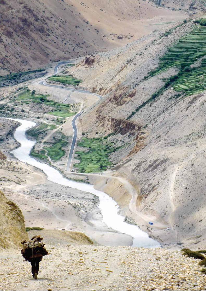
38

39
Chapter 3 – Resource Status, Environmental Degradation, and Cultural Integrity
3 Resource Status, Environmental Degradation, and Cultural Integrity
Background
The KSL is biologically and culturally rich; it has a unique heritage and deep cultural significance. However, this remote landscape is under pressure, and subject to various drivers of change, which impact both on its environment and culture. The drivers of environmental degradation and cultural disintegration in the KSL are many, they include: climate change, globalisation, ongoing developmental activities (transport, communication, and other infrastructure), population growth, and the unsustainable extraction of natural resources. Major existing and emerging environmental degradation issues are primarily associated with ecological fragility, deforestation, poor management of natural resources, poverty, and inappropriate farming practices. The cumulative impact of these threats results in the accelerated loss of biodiversity and the disintegration of the cultural base. Other important issues include changing cultural norms and a high degree of emigration from the mountainous areas.
While there is no doubt that the general loss of cryosphere and the degradation of rangelands and forests have all taken their toll, there is nevertheless a significant portion of this landscape that remains environmentally pristine and where the people live in socio-cultural harmony. With careful planning, using an integrated landscape approach, it is still possible to restore the degraded ecosystems, strengthen and enhance traditional knowledge, promote transboundary cooperation, and generate awareness among local communities for pre-adaptation to climate change.
Major Degradation Trends in Land, Water, and Human Environment
As elsewhere in the Himalayas, glaciers in the KSL are showing signs of retreat. For example, in KSL-India, the area covered by glaciers in the Dhauliganga Valley shows a loss of 66 sq.km in the glaciated area of this basin between 1962 and 2005, a net loss of 15.5% (GBPIHED 2009). Observations made during field work suggest that the small glaciers and ice fields, which are abundant in the landscape, may be more vulnerable to global climate warming than the larger ones. But, the larger glaciers are also shrinking and fragmenting into smaller glaciers. In KSL-China, glacial melting on Mount Gurla over the past three decades (1976 to 2003) reduced the total glacier area from 84 sq.km to 77 sq.km. The rate of glacial melting is also accelerating. The total glacier area in KSL-China shrank by an average of 0.17, 0.19, and 0.77 sq.km per annum during the periods 1976–90, 1990–99, and 1999–2003, respectively. Ice cores collected in 2006 from the Gurla Glacier suggest no net accumulation of mass (ice) since at least 1950. Gurla is the highest altitude glacier (6,050 masl) documented to be losing mass annually. Researchers speculate that a similar loss of mass can be expected in other high-elevation glaciers located at low and mid-latitudes especially if the temperature increases. Additional warming in the future is likely to accelerate the rate of glacial fragmentation and retreat, and this will have a profound effect on the downstream availability of water resources in the KSL and beyond.
KSL-China is located on the Tibetan Plateau in the arid climate zone. As a result, the natural vegetation is extremely sensitive to climate change and especially to changes in annual precipitation. During the last 20 years, the annual air temperature increased by 1.2°C, while the annual precipitation decreased by about 50 mm (25% of the total annual precipitation). The last 10 years have been the warmest recorded for the past 36 years. Both decreased precipitation and increased evapotranspiration caused by climate warming have exacerbated drought in this

40
KSLCI Feasibility Assessment Report
landscape. As a result, grasslands are degrading, glaciers are retreating, lakes are shrinking, and the amount of barren land is increasing. Melting of permafrost in these regions may have uncertain effects on water resources and carbon cycles.
Throughout the landscape, there can be seasonally severe shortages of both drinking water and water for irrigation. Assessing the extent to which extensive deforestation, land use change, forest fires, and climate change have each contributed to the shortage of water will require extensive research. For example, many of the natural springs in KSL-India have dried up due to interference with their natural recharge zone. It is speculated that this was caused mainly by land development activities and road construction, which diverted underground channels. A reduction in precipitation has added to the problem of deforestation. Notwithstanding the lack of clear data, it appears that the discharge of perennial springs, which are primary sources of drinking water in rural areas, is decreasing, and that some have even disappeared or become seasonal.
Household discharge and urban effluents, including industrial waste such as batteries, pesticides, medicines, and paint, are a major cause of water pollution in and around settlements. A lack of wastewater treatment plants results in the direct discharge of such waste into freshwater systems. However, the extent to which the quality of the water has degraded as a result of such pollution has not been documented.
Farming systems in these mountain areas seem to be degrading. The following have been observed: 1) a decrease in the net sown area, 2) a predominance of wasteland, 3) a decline in agricultural production, 4) a decline in soil fertility due to high erosion and nutrient leaching through runoff, 5) an increase in the number of scattered and small land holdings, 6) crop damage by wild animals, 7) a decline in the number of land races and traditional varieties, 8) agricultural land converted to residential use, and 9) agricultural fields abandoned by farmers who have out-migrated.
Livestock production and diversity in the KSL also seems to be on the decline, the following have been observed: 1) a growing number of less productive livestock; 2) an increase in the demand for fodder and a consequent shortage of green fodder during the winter and summer season, 3) a decline in the number of land races and breeds and the unscientific introduction of exotic breeds, and 4) a decrease in the amount of land available for grazing. In KSL-China, the rapid growth of the economy, overgrazing, and an increase in the population have caused grassland degradation and desertification. These, in turn, have triggered a variety of environmental problems, such as soil erosion, water loss, a loss of arable land as a consequence of landslides and soil movement, and a loss of biodiversity. There has also been a growing trend of rearing goats for cashmere production. Goat rearing is a severe threat to alpine ecosystems, especially steppes and sparse meadows.
Deforestation is rampant in KSL-Nepal, and in KSL-India. Habitat loss in the mid-western and far-western Himalayan subalpine conifer forests is severe; it is estimated that over 70% of the natural vegetation has been lost (Mittermeier 2004). KSL-Nepal still contains some of the most pristine forests in the western Himalayas, but in future these will require adequate conservation measures.
The aesthetics of the landscape have been degraded by mining (especially for soapstone), the haphazard construction of roads, the unscientific disposal of debris, the development of hydropower projects (without the benefit of either environmental impact assessment or the implementation of environmental management plans), and the overcrowding of houses in towns and cities. Other associated problems that need to be tackled are the safe disposal of waste (particularly non-biodegradable waste), the implementation of sewerage systems, and the provision of safe drinking water.
While out-migration from villages at higher altitudes has been a problem for the last four to five decades, in recent years the landscape has experienced out-migration on an unprecedented scale. Even people from the valleys where the agriculture is good are flocking to the small towns, usually in search of education for their children. This trend is contributing to the decline of valley agriculture and putting increased pressure on small towns, which have not been designed to accommodate large populations.

41
Chapter 3 – Resource Status, Environmental Degradation, and Cultural Integrity
Over time, the cultural landscape has experienced changes in socio-cultural values. The changing lifestyles and priorities of the younger generation have resulted in a declining interest in traditional value systems and cultural norms.
Degradation of natural vegetation and habitats
Conversion of forest land for development activities
There is a demand for forest land to be used for development activities such as rural infrastructure (roads, electricity, water supply, hospitals, schools, and so on) and also for large-scale development activities such as hydropower projects, mining, and irrigation. These projects, while they are required for community development, can also take a heavy toll on some forest areas and their associated biodiversity, and can fragment contiguous forests and habitats. In KSL-Nepal, forests are being rapidly depleted in all districts. Forests near the border, especially on the banks of the Humla, Karnali, and Mahakali rivers where most of the settlements are located, are degraded. Timber from Humla is exported to Tibet (Taklakot) and timber from Darchula is exported to India. In some places, trees are cut down as part of traditional shifting cultivation practices. Trees have even been cut down on very steep slopes to provide agricultural land. With the construction of the Hilsa-Simikot road, there is a real possibility that that the local forests will be degraded more rapidly as the presence of the road will mean that large volumes of timber can be transported more easily to meet the increasing demand from KSL-China. The timber species in high demand are Abies spectabilis and Taxus wallichiana; both of which are government protected. While the export of timber can, in principle, be regulated by the District Forest Office, the efforts of this Office have been ineffective to date. There is evidence to suggest that there is reduced timber exports when the local people have alternative employment options through ‘food for work’ programmes.
Unsustainable extraction of timber
Timber harvesting and export from KSL-Nepal is of major concern. KSL-Nepal illegally supplies close to 3,000 cu.m (more than 100,000 cu.ft) of timber annually to China and India. A large portion of this timber is cut at high altitude from slow-growing subalpine forests along the northern frontier of KSL-Nepal. It is supplied, mainly via the border town of Hilsa, to Taklakot in TAR-China where there is considerable demand. In KSL-Nepal, the illegal and unsustainable extraction of forest resources is relatively easy as forest management is weak and there is a lack of understanding of scientific forest management.
Unsustainable collection of non-timber forest products, medicinal and aromatic plants, and other bio-resources
The unsustainable extraction of non-timber forest products (NTFPs) in the KSL is of major concern. Important NTFPs, such as lichens and various medicinal plants, are not collected scientifically and there is no accurate data available on their trade. Although many NTFPs are collected in small quantities for household use, a large quantity of NTFPs are harvested for trade. Although several areas have been designated for the legal harvesting of these products, the harvest is not scientific and is not sustainable. Many plants are harvested before reaching maturity. To date, the availability and harvesting of such produce has not been investigated scientifically. The collection of yarshagumba (Cordyceps sinensis) has recently become a major economic activity for the local communities. The high cash value of this product has, in some cases, even resulted in conflict among communities. Large scale collection and a consequently high density of collectors in the alpine meadows have resulted in a great demand for fuelwood and, to some extent, the destruction of the habitat. Sustainable harvest protocols need to be developed for NTFPs and MAPs.
Invasive alien species
Invasive alien species out-compete native species resulting in habitat degradation and ecosystem disturbance. Invasion by alien species such as Lantana and Ageratina are found both in uncultivated waste lands and in forest areas; they have a significant impact on the ecology and habitat value of these areas. Common alien species found in the KSL at lower altitudes include Ageratina adenophora (Eupatorium adenophorum), Chromolaena odorata, Parthenium hysterophorus, Eichhornia crassipes, Ipomoea carnea ssp. fistulosa, Lantana camara, Ageratum conyzoides, Amaranthus spinosus, Bidens pilosa, Cassia tora, Cassia occidentalis, and Xanthium strumarium.

42
KSLCI Feasibility Assessment Report
Human-wildlife conflict
Increasing forest cover in some areas of KSL-India, and the emigration of villagers to cities has resulted in the conversion of agricultural land to forests. A consequence of this land use change is an increase in the frequency with which wild herbivores, wild pigs, and black bears disturb the remaining agricultural areas. Crops can be severely damaged and there are higher incidences of human-carnivore confrontations. The invasion of alien species such as Lantana and Ageratina has also decreased the availability of fodder in forest areas and has thus reduced the hunting grounds for carnivores such as the common leopard. Increased lopping has resulted in the loss of acorns (from oak trees), which are a major food source for herbivores such as pigs, monkeys, and bears. Now that wild areas are fragmented due to fencing, road construction, and other development activities, wild animals such as leopards are forced to look for food in the villages where they prey on domestic animals. Villagers retaliate by considering the elimination rather than the conservation of these animals. Villagers trap leopards and wild pigs who roam in their settlements.
Impacts of tourism
Alpine areas, rangelands, and cultural heritage sites in the KSL overlap with important tourism sites. In recent years tourism has, to some degree, also contributed to the degradation of these areas through unsustainable activities such as solid waste pollution, the trampling of soil and vegetation, and resource extraction. In addition, the infrastructure needed to sustain tourism can negatively affect structures of aesthetic and cultural value. For example, many tourists, particularly pilgrims, harvest juniper and other woody shrubs as a fuel source to cook food. The woody shrubs that grow in high altitude areas, where harsh environmental and edaphic factors severely retard plant growth and propagation, are scarce; destroying these reduces the shrubland cover. The degraded ecosystems are subject to wind erosion and desertification. In particular, the areas immediately adjacent to Mount Kailash and Lake Manasarovar already show the significant impact of 70,000 or more visitors per year. There are issues of waste disposal, sanitation, and water pollution, adverse impacts on the Ramsar Wetlands, as well as inappropriate and unattractive infrastructure development. Sacred lakes, such as Lake Manasarovar and Parvati Tal (India), are prone to water pollution from ritual bathing by pilgrims. The belief that these waters have purifying qualities results in thousands of pilgrims participating in ritual baths and discarding personal items in the waters.
Forest fires
Forest fires, both accidental and deliberate, are a regular phenomenon in both KSL-India and KSL-Nepal, especially in chir and blue pine forests. Fires can be a serious problem during drought years. Some fires are deliberately set to eliminate the slippery needle litter and/or to induce the new growth of grasses during the lean season. Fires can also spread from nearby wheat fields which are sometimes burned after harvest. However, these fires rarely cause serious damage to the forests; typically they only burn the ground flora, and can actually enhance regeneration. Forest fires in oak areas are not very common, but when they do occur they can cause serious damage to the entire forest as they spread slowly and smoulder on slow burning leaf litter and humus.
Encroachment of chir pine in oak forests
The regulation of green felling in KSL-India for commercial activities has resulted in the improper and unhealthy recruitment of chir pine while reducing the availability of free firewood to the rural households. This practice has promoted the overexploitation of oaks for fuelwood and, consequently, degraded oak forests have been invaded by chir pine. Pole crops, which could be thinned out, are not available to villagers, who would otherwise use them for vegetable crops and cattle sheds. These are often illegally cut from forests. The unworked chir pine forests also have a heavy fuel and litter load and, hence, are more vulnerable to forest fires.
Impacts on lower plant groups
The landscape supports a high diversity of lower plant groups including lichens, which are poikilohydric in nature with the result that a slight change in their immediate surroundings can result in their disappearance from the area. The thinning of forests changes the ecological regimes and threatens their existence. Forest fires and grazing have a profound effect on lichens in the soil. Lichens can be lost rapidly due to fires or grazing and the loss can
43
Chapter 3 – Resource Status, Environmental Degradation, and Cultural Integrity
last for many years as lichens are slow growing and usually require a minimum of 5 to 10 years for their proper development. The growth of lichens in populated areas is poor due to heavy human activity.
Problems due to illegal trade and overexploitation of natural resources
As discussed above, the illegal harvesting and exporting of timber is widespread throughout KSL-Nepal. Bajhang, Baitadi, Darchula, and Humla Districts illegally supply some 3,000 cu.m of timber annually to TAR-China and India. A large amount of this timber is supplied to Taklakot in KSL-China, mainly via the border town of Hilsa. There is weak enforcement of forest management in the KSL-Nepal. This facilitates illegal and unsustainable resource extraction.
The alpine and subalpine zones of the KSL are important sites for indigenous biodiversity. These areas have traditionally been used for pastoral activities by transhumant communities. Over time, it has been observed that the grazing lands in these zones have been increasingly infested with non-palatable invasive species. Many non-migrant communities drive their scrub cattle to these areas for grazing during the summer monsoon, contributing to the rapid deterioration of these rangelands through loss of soil and moisture. In recent decades, sheep and goat herding in the high altitude villages of KSL-India has declined considerably; this has been replaced by a new trend – the use of some of these pastures by herders from Himachal Pradesh. This influx of large herds of livestock and summer season congregation of scrub cattle around the timberline and subalpine forests is causing immense disturbance to the sensitive native/endemic species and their assemblages.
The emergence of yarshagumba (Cordyceps sinensis, or locally keera ghas) as one of the most lucrative wild resources from the alpine areas of the landscape has contributed to the degradation of pristine habitats. Large scale camping and the consequences of human activity early during the growing season negatively impacts on the alpine ecology. In order to prevent this practice from destroying the alpine environment, it will be necessary to develop a sustainable harvest protocol.
The poaching of wildlife and forest products is quite common in the KSL. Musk deer are hunted for musk pods, Himalayan bear for bile, and to some extent, leopard for their organs, all of which are smuggled into China. Continued poaching can be attributed to the vastness and ruggedness of the area, the fact that human habitation in the higher Himalayas is very sparse, weak regulatory mechanisms, coupled with proximity to international markets and high demand.
Himalayan musk deer are in decline in the region. The illegal poaching and trade of ‘musk’ to cater to international markets is partly to blame. Furthermore, livestock grazing and anthropogenic pressure on their natural habitats has resulted in a reduction in numbers of this species. The musk deer is now restricted to a few isolated pockets in the landscape. The status of mountain ungulates such as the blue sheep, Himalayan tahr, and goral is also of serious concern.
Illegal methods of capture and poaching are depleting the fish fauna. Common practices of illegal fishing include the use of bleaching powder, poisoning by agave, blasting using gelatine sticks, and the use of electric current. These methods are quite dangerous as they not only kill large fish, but also damage other aquatic life and the ecology (i.e., small fish, other aquatic animals, and the substrate). The threatened and vulnerable species of fish include the deep-bodied mahseer (Tor tor) and the golden mahseer (Tor putitora). In addition to capture by individuals, these fish are also threatened by the consequences of planned hydropower projects in the area -- adequate conservation measures are needed.
The KSL area has generally received very little input in terms of management and protection, largely due to poor infrastructure, remoteness, and lack of resources. The ever increasing demand for certain wildlife products (in illegal markets), coupled with porous international borders between India, Nepal, and China, has made this landscape more vulnerable to poaching and other illegal activities. In recent decades, several consignments of bear gall, musk pods, shahtoosh, and the bones and skins of tigers and leopards have been seized in the KSL. Poaching is reported to be particularly high in the case of Himalayan musk deer, Asiatic black bear, snow leopard, and medicinal plants such as yarshagumba (Cordyceps sinensis), salampanja or panch aule (Dactylorhisa hatagirea), and atis (Aconitum

44
KSLCI Feasibility Assessment Report
heterophyllum). As there are very few alternate livelihood opportunities for the economically marginalised inhabitants of the area, they often resort to the wildlife trade and play into the hands of moneylenders and rich traders who pay huge amounts of money in advance for illegal wildlife products.
Socioeconomic changes and status of cultural integrity
Changes in population and livelihoods have been observed in all the countries of the KSL. In KSL-China, the population more than doubled from 4,000 in 1960 to 8,839 in 2008. This population growth has been attributed to a stable political situation, which has facilitated economic development, as well as improvements in living and sanitary conditions. Post-1980, family planning was implemented in KSL-China, as a result of which population growth slowed down, but ‘low birth rate, low death rate, and low growth rate’ came into effect. Socioeconomic conditions have also improved dramatically in KSL-China. From 2000 to 2008, gross domestic product (GDP) increased from RMB Yuan 31.9 million to RMB 112.3 million (US$ 4.8 million to US$ 17.1 million). This represents an average GDP growth rate of 17.2% which is higher than the national GDP growth rate. The net income per capita also increased almost 1.6 times from RMB Yuan 1,746 (US$ 266) in 2001 to RMB Yuan 2,749 (US$ 418) in 2008.
In KSL-India, the population increased 2.7 times from 168,477 in 1901 to 462,289 in 2001. The highest population growth (20.7%) was during the decade 1961–1971, while the lowest growth rate (-12.0%) was recorded during 1971–1981. The proportion of main workers and marginal workers also changed from 1981 to 2001: main workers decreased from 83% to 62% while marginal workers increased from 17% to 38%. There is a trend towards out-migration from KSL-India, but this has not been carefully documented. Income from remittances is consequently high and has been calculated at INR 30,347 (US$ 674) per household.
In KSL-Nepal, the annual population growth for the decade between 2001 and 2009 was 1.8%. This region was self-sufficient in food production until the mid-1960s, but since then it has been a food deficit area with episodes of famine. The region is highly vulnerable, due to high climatic variability and adverse weather conditions. Fluctuation in precipitation and snowfall in the upper part of KSL-Nepal is a major reason for reduced food production. Moreover, cutting of the trade link with Tibet has adversely affected the traditional system of trade and migration, and the livelihoods of local people. There has been a decline in animal husbandry (particularly sheep) and a concomitant decline in other sources of income (such as honey production and local cloth weaving) (Adhikari 2008). The only alternative for local people in the face of such changes has been to migrate to India, other parts of Nepal, or, to a lesser extent, China. The overall health ranking of these districts is poor even when compared to other districts in Nepal. Although there are several health services and institutions such as hospitals, health centres, and Ayurvedic clinics, the ratio of population per doctor is very high. There is a high incidence of diarrhoea in all four districts in KSL-Nepal. Among the four districts, the incidence of tuberculosis is highest in Baitadi, malaria and HIV positive cases are more prevalent in Darchula, and typhoid is prevalent in Bajhang.
Traditional cultural values still prevail in most parts of the KSL and act as a guiding force for environmental protection. However, this system is quickly disappearing, particularly in areas and communities that have access to modern infrastructure and lifestyles. Traditional beliefs and rituals, which are intimately intertwined with the management of the ecosystems, are now only practised in remote villages. The institutions of sacred groves, forests, pastures, and even sacred water bodies, along with the strict norms and taboos that relate to resource utilisation and sustainable resource management, are rapidly losing ground.
Historically, local communities residing on either side of the Mahakali River (which forms the international boundary between India and Nepal) have been exchanging commodities such as butter, honey, wool, and other NTFPs for as long as anyone can remember. Some other examples of existing transboundary cooperation between the two countries are: 1) Pithoragarh District and adjacent parts of Kumaon have contributed significantly towards providing higher education to people from the remote areas of western Nepal, especially the Byans valley; 2) the people of Byans (in both India and Nepal) speak the same dialect and share the same culture and marital relations, and worship the same deities; 3) people in Budhi and Garbyang share pastures and several NTFPs amicably; and 4) several tributaries of the Mahakali flow from both countries and bring enormous ecosystem services to lower parts

45
Chapter 3 – Resource Status, Environmental Degradation, and Cultural Integrity
of the landscape. The waters of the Mahakali, the aquatic fauna, and other ecosystem services are shared by people on either side. However, in recent years, the fast changing political and economic environment has severely impacted on cross-border cultural integrity.
Biodiversity Loss and Threatened Flora and Fauna
Background
Many rare, endangered, and threatened species of flora and fauna are reported in the KSL. In the absence of accurate population estimates, it is difficult to ascertain the status of several species at a regional scale. Numerous species found in the eastern Himalayas occur in the KSL at their westernmost limit, and, as such, appear to be very rare in the western Himalayas. Likewise, a few species that may be common in the western Himalayas are only found in extremely low numbers in the KSL. Habitat specificity, taxonomic distinctness, and persistence through ecological or evolutionary time are additional variables which determine the rarity and sensitivity of most of the taxa. In the absence of recent population estimates for most of the species across their global distribution range, the earlier definition of IUCN (1994) is used for ‘rare’ species, i.e., “taxa with small world populations that are not at present endangered or vulnerable but are at risk…these taxa are usually localised within restricted geographical areas or habitats or are thinly scattered over a more extensive range”.
Threatened and endangered flora
Although there is a need for more detailed research on the flora in the landscape, an initial assessment indicates that there are at least 20 globally threatened or regionally protected plant species in the KSL (Table 14).
Literature on the vascular flora of KSL-India (Sahni and Raisada 1957; Rawat 1984; Samant and Pangtey 1993; Dhar et al. 1997) confirms that the area is floristically under-explored. At least 25 species are recommended for highest priority in situ conservation. These include brahmakamal (Saussurea obvallata), the state flower of Uttarakhand; Terminalia chebula, a high-value medicinal tree in the subtropical belt; Turpinia nepalensis, one of the rarest trees of Uttarakhand, which is confined to Ghandhura region; and Sinarundinaria anceps, a hill bamboo endemic to KSL-India, which forms an important habitat for endangered Himalayan musk deer, serow, and several other birds. There is acute livestock grazing pressure on Sinarundinaria anceps in most of its range and, as a result, it is declining rapidly. This species is recommended for long-term monitoring. A more detailed list of flora to be considered for highest priority for in situ conservation and population studies is given below:• Psilotum nudum (Linn.) P. Beauv. (Psilotaceae)• Cyathea spinulosa Wall. ex Hook. (Cyatheaceae) • Juniperus semiglobosa Regel (Cupressaceae)• Berberis osmastonii Dunn. (Berberidaceae)• Berberis lamberti Parker (Berberidaceae • Cleyera japonica Thunb. (Theaceae)• Pinguicula alpina Linn. (Lentibulariaceae)• Onosma pyramidale Hook. f. (Boraginaceae)• Trachycarpus takil Becc. (Arecaceae): Vern. Thakal.• Lilium wallichianum Schultes (Liliaceae)• Dendrobium normale Falc. (Orchidaceae) • Flickingeria hesperis Seidenf. and Arora. (Orchidaceae)• Herminium kumaunensis Deva and Naithani (Orchidaceae)• Ponerorchis renzii Deva and Naithani (Orchidaceae)
The incidence of sensitivity is higher for lower plants. For example, of the 391 species of lichens so far catalogued in KSL-India, more than 200 species are known only from a single location. Many lichen families or genera comprise only a single species, and many species of the same families or genera are confined to a particular locality. Six species from the landscape are known to be endemic to the area; they are identified only from their type locality and are designated as ‘rare elements’. They are 1) Lobaria himalayensis Upreti and Divakar; 2) Myelochroa

46
KSLCI Feasibility Assessment Report
macrogalbinica Divakar Upreti and Elix; 3) Myelochroa upretii Divakar and Elix; 4) Lithothelium himalayensis Upreti and Aptroot; 5) Caloplaca abuensis Y. Joshi and Upreti;and 6) Caloplaca himalayana Y. Joshi and Upreti.
The unsustainable harvesting of plants, particularly for trade, is a major threat to floral diversity in the KSL. Plants with high trade value or food value are usually uprooted or harvested prematurely, often preventing propagation. Plants of high trade value include Bergenia ciliata, Nardostachys grandiflora, Neopicrorhisa scrophulariiflora, and Swertia chirayita. Edible plant species harvested from the wild include Arisaema erubescens (tuber), Morchella species (whole plant), Rosa macrophylla (roots), and Sorbus cuspidata (fruit).
Threatened faunal diversity
The KSL is home to many globally threatened and regionally protected faunal species (Table 15). Within the KSL, there are 6 globally threatened mammal and 6 globally threatened bird species including the red panda (Ailurus fulgens), musk deer (Moschus chrysogaster), Tibetan antelope (Pantholops hodgsonii), and snow leopard (Uncia uncia), and the critically endangered red-headed vulture (Sarcogyps calvus), and the endangered Saker falcon (Falco cherrug) and Egyptian vulture (Neophron percnopterus). In total, there are 20 mammalian species and 21 bird species that are globally or regionally significant and are protected within the different countries of the KSL.
Table 14: Threatened, rare, endangered, and vulnerable plant species of the KSL (listed by IUCN and CITES)
Family Species IUCN CITESPresenceChina India Nepal
Apocynaceae Rauvolfia serpentina EN II √
Arecaceae Trachycarpus takil VU √
Asteraceae Lactuca filicina EN √
Saussurea bracteata EN √
Berberidaceae Berberis lambertii VU √
Berberis osmastonii R √
Boraginaceae Onosma pyramidale DD √
Caryophyllaceae Silene kumaonensis R √
Compositae Artemisia wellbyi DD II √
Crassulaceae Rhodiola crenulata DD II √
Rhodiola discolor DD II √
Rhodiola fastigiata DD II √
Rhodiola quadrifida DD II √
Rhodiola tibetica DD II √
Cupressaceae Juniperus semiglogosa LC/DD II √
Cyatheaceae Cyathea spinulosa VU √
Lichen Lichens (jhyau) DD √
Orchidaceae Dactylorisa hatagirea DD II √
Eria occidentalis R II √
Fllickingeria hesperis R II √
Pinaceae Abies spectabilis LC √
Poaceae Sinochasea trigyna DD II √
Scrophulariaceae Neopicrorhisa scrophulariflora VU √
Taxaceae Taxus wallichiana DD II √
Theaceae Cleyera japonica DD √
Valerianaceae Nardostachys grandiflora VU II √
IUCN categories: CR = critically endangered; EN = endangered; LC = of least concern; R = rare; VU = vulnerable; NT = near; DD = data deficientCITES categories: Appendix I = most endangered, threatened with extinction, trade prohibited; Appendix II = may become threatened if trade is not regulated; Appendix III = export permit and certificate of origin required for trade

47
Chapter 3 – Resource Status, Environmental Degradation, and Cultural Integrity
A great variety of wildlife inhabit the KSL-China area, including Asiatic wild ass, buffalo, argali, snow leopard, and golden eagle, with at least 25 species listed as nationally protected. The hunting of wildlife, bird egg collection, and grassland degradation, together with the lack of protection for endangered wildlife, are all areas of major concern. In the past, the major threats to biodiversity in this region were rangeland degradation due to overgrazing and rat infestation. Global warming accelerates the trend towards rangeland degradation and desertification. The establishment of the Changthang National Protected Area in the north of KSL-China has contributed to an increase in
Table 15: Globally and regionally threatened fauna of the KSL (listed by IUCN and CITES)
Latin name IUCN CITES
Presence
China India Nepal
MammalsAilurus fulgens EN I √Bos mutus VU I √ Canis himalayensis CR I √ Canis lupus LC I √ √Equus kiang LC II √ Hemitragus jemlahicus NT √ Lutra lutra NT I √ √ Lynx lynx LC II √ Macaca assamensis NT II √ √Marmota himalayana LC III √ Moschus chrysogaster EN I √ √Naemorhedus goral NT I √ Ovis ammon NT I √ √Panthera pardus NT I √ Pantholops hodgsonii EN I √ √Procapra picticaudata NT √ Pseudois nayaur LC I √ √ Uncia uncia EN I √ √ √Ursus arctos LC II √ √
BirdsAegypius monachus NT II √ Aquila chrysaetos LC II √ Aquila rapax LC II √ Athene noctua LC II √ Bubo bubo LC II √ Buteo hemilasius LC II √ Catreus wallichii VU I&II √ √Falco cherrug EN II √ Falco tinnunculus LC II √ Grus nigricollis VU I √ Gypaetus chrysaetos II √ Gyps himalayensis LC I √ Haliaeetus leucoryphus VU II √ Lerwa lerwa LC √ Lophophorus impejanus LC I √ Lophura leucomelanos LC √ Milvus korschun II √ Neophron percnopterus EN II √ Sarcogyps calvus CR II √ Tetraogallus tibetanus LC I √ Tragopan satyra NT III √ IUCN categories: CR = critically endangered; EN = endangered; LC = of least concern; R = rare; VU = vulnerable; NT = near; DD = data deficientCITES categories: Appendix I = most endangered, threatened with extinction, trade prohibited; Appendix II = may become threatened if trade is not regulated; Appendix III = export permit and certificate of origin required for trade
48
KSLCI Feasibility Assessment Report
the population of endangered wildlife species. However, the competition between protected animals and livestock for habitat and grasses is a concern to herders and resource managers.
In KSL-Nepal, eight species of mammals are legally protected by the Government of Nepal, 30 species are listed in the 1995 National Red Data Book, 35 species are under CITES appendixes, and 23 species are listed in the IUCN Red List categories. The snow leopard (Panthera uncia), Tibetan antelope (Pantholops hodgsoni), Asiatic wild-dog/dhole (Cuon alpines), red panda (Ailurus fulgens), and particoloured flying squirrel (Hylopetes alboniger) are listed in IUCN’s endangered category. There are 8 mammalian species that have not been reported in other parts of Nepal: Horsefield’s shrew (Crossidura horsfieldi), Pearson’s horseshoe bat (Rhinolophus pearsonii), Rufous horseshoe bat (Rhinolophus rouxi), bent wing bat (Miniopterus schreibersii), little tube-nosed bat (Murina aurata), hog badger (Arctonyx collaris), Himalayan field mouse (Apodemus gurkha) [Nepal endemic], and Tibetan antelope (Pantholops hodgsoni).
The major threat to fauna is habitat loss, which has implications for predator-prey dynamics, breeding, and migration. Habitat loss in the landscape occurs due to deforestation, overgrazing, and development. Tourism is another cause of habitat loss/degradation, for example, the clearing of faunal habitats for tourist infrastructure, the trampling of faunal habitats by tourists and pilgrims, and the disturbance of nesting/breeding habitats.
The poaching of wildlife for illegal trade is a significant threat to faunal diversity in the KSL. Species particularly prone to poaching are snow leopard, Tibetan antelope, and red panda (for their pelts), musk deer (for musk pods), and black bear (for bile). In Nepal, one musk pod can fetch as much as NPR 7,000 (approximately US$ 100) in the local market. Such illegal trade of wildlife products is fuelled by poverty, high demand, as well as weak law enforcement in the region.
Threatened lower vertebrates and invertebrates
At least 19 fish species are listed in the 1995 National Red Data Book as meriting legal protection. Among them, 1 species, the mahseer (Tor tor) is endangered, 8 species are vulnerable, and 10 species are in the susceptible categories. Chuche asala (Schisotharaichthys annandalei) is an endemic species reported in the KSL area. Two other fish species are reported only from this region in KSL-Nepal: rato machha (Carassius carassius), and tengana (Glyptosternum blythii). Of the various fish species, the deep bodied mahseer (Tor tor) and the golden mahseer (Tor putitora) are threatened and vulnerable due to intensive dynamiting, and may become further threatened due to upcoming hydropower projects unless adequate conservation measures are taken. A list of reptiles, amphibians, and invertebrates is still under preparation. The following species of amphibians from the Gori and Kali valleys in KSL-India have been identified: • Least concern: Duttaphrynus himalayanus, Duttaphrynus melanostictus, Xenophrys parva, Amolops formosus,
Amolops marmoratus, Nanorana liebigi, Nanorana polunini • Near threatened: Nanorana ercepeae• Vulnerable: Nanorana minica, Scutiger nepalensis• Data deficient: Polypedates teraiensis, Chirxalus dudhwaensis
There is no detailed inventory of butterflies or other invertebrates available for the landscape.
Agrobiodiversity – threats and challenges
Despite the fact that the KSL has maintained a rich tradition of agriculture, it has not escaped the impacts of modernisation. The communities in the region, which in earlier times practised self-sufficient agriculture, are now more inclined to obtain food from outside. The huge diversity of domesticated edible plants, which was traditionally maintained through diverse crop compositions and rotations, is being rapidly lost. Traditional crops growing in KSL-Nepal are also threatened by fluctuations in weather patterns. Food production per capita, especially in KSL-Nepal, is declining, and the region receives substantial food subsidies. Food subsidies have had an adverse impact on agrobiodiversity and have exacerbated the loss of traditional varieties of crops.

49
Chapter 3 – Resource Status, Environmental Degradation, and Cultural Integrity
The agricultural sector in the KSL is faced with threats and is undergoing changes such as: 1) a decrease in the net sown area and a growing predominance of wasteland; 2) the fragmentation of land holdings and a decline in production; 3) declining soil fertility; 4) the conversion of agriculture lands to other uses (mainly human settlements); 5) crop damage by wild animals; and 6) a declining interest in agriculture among the younger generation and a tendency to emigrate.
Considering the above, the highest priorities with respect to agriculture in the target landscape are to: 1) ensure the long-term sustainability of traditional forms of agriculture and to maintain the genetic diversity of plant resources and the diverse practices needed for their cultivation; 2) document the indigenous knowledge practices of different community groups associated with domesticated biodiversity; 3) ensure that indigenous communities benefit from modern techniques and tools; and 4) ensure that agricultural lands are retained for agriculture by curbing the ongoing practice of converting land to other uses. All this will require substantial policy interventions to empower local communities. To encourage people to maintain heritage agriculture they will need to be rewarded both economically and ecologically.
Cultural and religious heritage sites
Loss of cultural integrity is of concern in the KSL. Indigenous people are striving to preserve their traditional norms, values, and practices in order to preserve their cultural identity. These factors play a key role in the socioeconomic development and cultural identity of the region. Both KSL-India and KSL-Nepal are multilingual and multi-religious in nature. Religion is a deep-rooted belief among the people of the entire KSL region, binding them together to perform community activities and to preserve their cultural identity and resources. Globalisation, tourism, and changes in livelihood options, particularly out-migration, are some of the major threats to this cultural integrity. Traditional practices and beliefs, including those related to natural resource management, are now generally confined to remote villages. Deteriorating values of social responsibility also threaten conservation. The institutions of sacred groves, forests, pastures, and even sacred water bodies, along with the strict norms and taboos that relate to their resource utilisation and to their sustainable resource management, are being eroded.
Cultural and religious heritage sites in the landscape are destinations for pilgrims as well as for tourists who come to appreciate both the cultural and adventure aspects of the KSL. The fact that tourists and pilgrims come in large numbers has a substantial impact on the environment of the sites around Mount Kailash and Lake Manasarovar.
The number of visitors to KSL-China over the last ten years averaged 30,000 persons annually; these numbers peaked in 2007 (70,000 persons) and dropped in 2008. In the immediate vicinity of Mount Kailash and Lake Manasarovar, large numbers of pilgrims and tourists coupled with a poor to non-existent infrastructure, means that there is significant pressure on the fragile environment. The thousands of tourists who visit this relatively limited area produce large amounts of waste and rubbish, which is poorly managed and disposed of.
Within KSL-Nepal there are several poorly maintained historical and religious sites in need of repair. These include particularly small (but sometime quite ancient) gompas found at higher elevations, and temples at lower elevations. However, some monasteries, especially the Yalbang monastery, have played a vital role in encouraging people to practise conservation. Many people have reported that, at the request of the abbot of this monastery, hunting in Hepka village was reduced significantly. Similarly, the conservation practices in the Limi Valley are good examples of best practices.
Development and regional planning without involving the indigenous communities also poses a significant threat to the landscape. The traditional knowledge commonly possessed by indigenous peoples is rapidly disappearing as the elders pass away and as those who remain succumb to the encroachment of market forces that bring modern methods. Once lost, this knowledge and know-how is not easy to retrieve as it may not be known to the current inhabitants or local resource managers.

50
KSLCI Feasibility Assessment Report
Impacts of tourism
Tourism provides economic and livelihood benefits to numerous residents in the landscape. However, unregulated tourism can also lead to environmental and cultural degradation. Many of the tourism destinations in the Kailash Sacred Landscape are particularly vulnerable because, situated as they are at high elevations, they recover more slowly from environmental damage.
Tourism can also affect how locals practice their culture and traditions. Local residents are less likely to wear their traditional clothes except during festivals and ritual occasions. Traditional perceptions of nature are also likely to change. Sacred sites, such as sacred groves and water bodies, can be more prone to disturbance and degradation.
A new airport, the Ngari Gunsa Airport (4,274 masl), offers flights from Lhasa to the Mount Kailash area. The 1,098 km journey from Lhasa, which normally took two or three days by road, can now be completed in 1.5 hours. The presence of this new airport is expected to increase the number of tourists visiting Mount Kailash. An increase in the number of tourist will put added pressure on the region’s environmental resources. Recently, Pulan County, TAR, where Mount Kailash is located, submitted plans for the development of tourism in the Kailash area.
At present, tourism activities in KSL-India appear highly centralised with select agencies monopolising a large chunk of existing tourism. Field consultations along the yatra (pilgrimage) routes of Kailash Manasarovar and Adi Kailash revealed that the benefits from tourism do not flow down to the local residents to the extent desired. Local residents are involved only to the extent that they are employed as porters or guides, or to lease out their ponies. Opportunities for promoting community-based tourism in the KSL need to be identified and promoted.
Currently, tourism flows in KSL-Nepal are not large enough to have a visible environmental impact, at least not when compared to other major trekking routes in the Annapurna or Everest regions in Nepal. Nevertheless, in many places, problems such as poor solid waste management are already beginning to emerge. Almost all tourist groups carry their own fuel so there is no direct pressure on forest resources. Local people living along major trekking routes are already beginning to experience cultural impacts from tourism. In spite of the presence of tourists, there is no notable improvement in the level of hygiene and sanitation; both are still poor in the area.
Climate change
High mountain areas are particularly prone to climate change, with the KSL appearing to be a highly vulnerable region. The average annual temperature of KSL-Nepal increased at a rate of 0.06ºC per year over the 30 year period from 1975 to 2006. Similarly, Pulan County, TAR-China, has recorded increases in air temperatures at a rate of 0.05ºC per year for the past 35 years (1973–2008). Changes in the temperature have been accompanied by changes in precipitation. TAR-China has experienced droughts which have affected rangeland productivity. In both KSL-India and KSL-Nepal, climate change is reported to have affected crop productivity, decreased water availability, and contributed to the expansion of invasive species and the prevalence of tropical diseases. Assessment of the impacts of climate change in the KSL requires further research and analysis. Climate change in the region has consequences for hydrological processes, including the melting of glaciers, the melting of permafrost, the drying of wetlands, and changes in precipitation. The increasing temperatures or changes in the amount of precipitation that are part of climate change can also affect the seasonal timing, which in turn affects the range, distribution, and productivity of agricultural production, the livelihoods of mountain communities, and the composition and health of natural systems.

51
Chapter 4 – Community Perceptions
4 Community Perceptions
Biodiversity and Environment
Communities in the KSL are well aware of the rich biodiversity and diverse ecosystems that are present throughout the landscape. However, local communities reported that in recent times there has been degradation – particularly of pasturelands. They attribute this to changes in weather patterns as a consequence of climate change.
In India and Nepal, traditional systems of conservation are considered effective in conserving biodiversity. For example, the concept of sacred species and sacred groves has been effective in instilling in local communities a respect for nature. Festivals and fairs are celebrated in honour of nature and her components, and nature is worshipped in the different manifestations of goddesses. Cultural traditions and the influence of local monasteries and temples have also played a significant role in reducing poaching in some local communities. However, as lifestyles change, traditional systems lose their importance, and good practices of natural resource management are lost. People are now less interested in such traditions and values with the result that these alone are no longer sufficient to curb environmental degradation and biodiversity loss.
In KSL-China, local herders thought that rangeland degradation was not due to overgrazing, but global warming. Their perception, based upon direct observation of increasing temperatures and decreased precipitation, is strengthened by media reports on climate change. They generally believe that rangelands can support their livestock and that the rangelands are self-sufficient and replenish naturally. Under pressure of overgrazing, some herdsmen near lakes, including Lake Manasarovar, drain wetland meadows composed of hydrant Kobresia and use them for grazing areas. This accelerates the degradation of wetlands.
In KSL-India, the following major points were highlighted by communities during the field survey and community consultations: the landscape is rich in high altitude flora and fauna and human interference has been minimal. Because of this, they believe that the area offers an opportunity to create a high Himalayan indigenous reserve that can be an example to the entire world of the healthy co-existence of nature and humans. The KSL offers opportunities for the cultivation of precious life-saving medicinal plants, valuable aromatic herbs, and edible wild plants. Scientific and technical know-how for cultivation, post-harvest processing, and value-addition are needed. Forest fires rank among the major threats to biodiversity, but garnering public support to look into preventive measures is a major challenge. Local agriculture will need to be able to adapt to a changing climate scenario. Scientific research and input will be needed to develop new crop calendars as changing weather patterns are pushing local know-how to its limits. Awareness of possible technological interventions for the promotion and diversification of agriculture or horticulture is urgently required.
In KSL-Nepal, local people have realised and adapted, to some extent, to the changes in climate. According to them, the amount of snow on the peaks and glaciers has been depleting rapidly, and they blame the increased frequency of avalanches and the increased rate of glacial retreat for this. They also report that for the last 10 to 15 years snowfall in the area seems to start prior to the usual season, but that the frequency and intensity of snowfall seems to be substantially less. As a result, their cereal crops are damaged annually. However, at the same time, they have started to grow vegetable and horticultural crops such as garlic, onion, tomato, beans, apples, and so on as alternative crops, which, according to them, could not be grown 10 years ago. They attribute these changes in their agricultural practices to a rise in temperature in the region.
People in Tinkar, Darchula (KSL-Nepal) reported that over the decades the cropping calendar has also changed owing to a general warming. For example, in earlier times, naked barley and naphal (a local variety of wheat) sown

52
KSLCI Feasibility Assessment Report
after the first of Baisakh (mid-April) would not mature until harvesting time in October. However, now these crops can be planted as late as the first week of Jestha (mid-May), almost one month later, and mature for harvesting at the same time.
In KSL-Nepal, local communities noted that people who are not resident in the area pose a threat to the local biodiversity. They reported that people from outside the community, generally from district headquarters, come to extract resources such as plants with high trade value. These non-residents have already exhausted the biodiversity in their area and have now moved on to other areas to do the same.
In KSL-China, local people expressed the hope that their government would help them to improve infrastructure by tourism planning. They expected good sanitation facilities, the organised collection and sanitary disposal of garbage, and public toilets in the sacred area. They are aware that under sacred Mount Kailash and around the sacred lakes, people should cherish the value of nature. They regard sacred Kailash as one of the world’s common tourism resources. Therefore, all buildings should be in harmony with the local religious architecture and the natural landscape. Local inhabitants expressed their reluctance to having their sacred mountains and lakes polluted by pilgrims and travellers. They suggested that more people be employed to collect rubbish and that more toilets with treatment capacity be constructed along the road to circling Kailash and Lake Manasarovar. They also regard fuelwood logging as the destruction of vegetation causing erosion. They hope that the government will invest enough in infrastructure construction to ameliorate these problems. Some suggested the construction of simple shops and restaurants along the circling road. They also recommended that polluted water from washing and bathing should be treated so as not to defile the water of the holy lake.
Cultural Values and Resource Management
There are examples of successful indigenous resource management systems in place throughout the KSL. In KSL-Nepal’s Limi Valley in Humla District there is a successful indigenous system of natural resource management in place, despite the absence of local government. However, communities also commented on the deterioration of social responsibility and values. For example, many people now harvest herbs before maturity; this has consequences for both present and future generations. However, the landscape has a historical tradition of cultural harmony and resource conservation, which can be mobilised for environmental and ecological conservation.
The following perceptions were highlighted during the community consultations: • The revival of historical trade and pilgrimage routes and cultural ties with neighbouring countries will benefit the
people and ecology of the landscape. • The landscape offers a virtually virgin area for adventure activities especially mountaineering, trekking, and
ecotourism. However, the benefits of increased tourism activities need to trickle down to local communities. This is possible through building capacities and skills.
• The inhabitants of the landscape are traditionally livestock herders, and there is ample scope to improve this tradition in order to harness greater benefits.
• The waters of torrential rivers in the landscape have great potential for power generation through hydro-electric projects; but impact assessments for such developmental activities are urgently required. The local community is aware of existing bad practices and feel that these need to be addressed on a priority basis. People are generally not in favour of large dams.
• Transport facilities and road networks are a high priority; however, local people are also aware that the local ecology needs to be taken into consideration when such development takes place. For example, proper disposal of muck/overload is essential. Water, health, sanitation, and education issues also need to be addressed urgently.
• Out-migration from remote villages is a big concern. Skill development and employment generation activities for youth will require priority consideration.
• Preservation/promotion of local dialects/language, art, belief systems, and traditions will help in the conservation and sustainable development of the landscape. This can be ensured through awareness campaigns and by including these in the education curriculum.

53
Chapter 4 – Community Perceptions
Livelihood Options
Communities in the KSL prioritised tourism as a sustainable livelihood option. Tourism currently provides benefits only to limited groups of people such as porters and hotel/lodge operators, and agencies based outside the region. Diversifying and building local capacity in the tourism sector would help to involve more people in tourism so that more benefits could filter down to the community level.
Communities in TAR-China and India also recognised horticulture as an alternative livelihood option. In TAR-China, this would involve greenhouse farming as off-season vegetable production has potential in the landscape.
Medicinal plants offer local communities an opportunity for cash income. Cordyceps sinensis was seen as an increasingly important source of income in both KSL-India and KSL-Nepal. The cultivation of medicinal plants was also viewed as having scope in the landscape, but expertise and technical knowhow are required to develop this further.
Development projects including road construction, hydropower schemes, and building construction were perceived as potential employment opportunities for local communities. Out-migration from remote villages was perceived as a major issue in both KSL-India and KSL-Nepal. Skill development and employment generation activities for youth were recommended for priority consideration.
The inhabitants of the landscape are traditionally primarily animal herders and traders. There is ample scope for improving these traditions to harness greater benefits at the local level. The revival of historical trade/pilgrimage routes and cultural ties with neighbouring countries was perceived as being potentially important for improving livelihoods.

54
KSLCI Feasibility Assessment Report
The impacts of climate change on agriculture and livestock production were of major concern to communities in the KSL. Local people believe that, in order to maintain the agricultural productivity of farming systems, it is necessary to introduce significant modifications to adapt to the changing climate scenario. Scientific and research inputs are needed to determine changes in crop calendars. Proper awareness of available technological interventions for the promotion/diversification of agriculture/horticulture is also required. The uncertainty and variability of climate in mountain regions will require more research and analysis. In KSL-India, a greater focus on planting broadleaf trees to increase forest cover and soil fertility was highlighted. Proper attention by authorities and communities was perceived as necessary to check/stop forest fires. As the needles from chir pine and blue pine trees are a major cause of forest fire, one possible option would be to somehow use these in some commercial venture.
Increasing water scarcity was highlighted in all portions of the KSL. Increasing water conservation and storage, and the use of low cost rainwater harvesting methods were put forward as potentially useful approaches. The locals also suggested the planting of broadleaf trees to increase the forest cover and infiltration, and improved watershed management, mainly by reducing deforestation.
In KSL-China, the perception was that traditional livelihood strategies based on grazing in the Manasarovar watershed and cropping in the Karnali Basin are sufficient to support local people in Burang County as productivity is relatively high and population density is low. Although Burang is known as the food basket of Ngari District of TAR-China, local people hope to increase their cash income by developing tourism. In 2004, Baga township set up a yak transportation scheme. The town government enacted a ‘Regulation of Yak Transportation for Service to Tourists and Pilgrims’. Service quality was recognised by tourists and tourism has developed rapidly in recent years. Local people earn more than RMB 2,000 (approximately US$ 305) per capita from tourism services. Tourism has become the most viable alternative livelihood for herdsmen in the northern higher altitude areas. At slightly lower elevations, in the agricultural areas of the Karnali Basin, there are fewer opportunities for farmers to directly profit from tourism. Greenhouse vegetable production is an alternative livelihood option for rural farmers. People living in Burang township can undertake border trading and can provide catering services for travellers.
Policies and Plans
In KSL-India, in many cases, policies regarding natural resource management were perceived as giving rise to conflict between local communities and the government. Such policies were viewed by local communities as restricting their use and traditional rights over natural resources. In KSL-India, with the implementation of the Wildlife Act (1991) in the Askot Wildlife Sanctuary, communities resented the fact that they were no longer able to enjoy the same benefits that they enjoyed when the area was under reserved forests, civil forests, and van panchayats. In KSL-Nepal, the implementation of community and leasehold forests was reported to have interrupted the traditional use of forests and pastures by local communities.
Development projects are also hampered when policies relating to natural resources are implemented. In KSL-India, the Wildlife Act (1991) was perceived as an impediment to the development of the landscape. Local communities suggested that the government consider the development of roads and health and education infrastructure in the landscape.
In KSL-China, stakeholders noted the efforts made by the government in recent years to enhance tourism development and promote environmental protection in the region. Monasteries and heritage sites have been restored; examples include the Khorzhak Monastery in the Karnali River Basin, and gompas on the way around Kailash and Manasarovar. It is anticipated that both the Ngari Gunsa Airport (opened in July 2010) and the high-grade highway from Lhasa to Pulan County will encourage more tourists to visit the sacred Mount Kailash and associated holy lakes. Local people cherish this chance and hope to profit from the consequent socioeconomic development. Stakeholders insisted that the conservation status of Kailash should be strengthened to conserve the environment and preserve cultural diversity, which might otherwise be negatively impacted by the pressure arising from the increasing number of tourists. Stakeholders mentioned ecotourism as an alternative livelihood for development.
55
Chapter 5 – Identification of Priorities and Gap Assessment
5 Identification of Priorities and Gap Assessment
Priorities in relation to biodiversity and the environment, sustainable livelihood options, and transboundary issues were identified by each of the countries in the KSL. Cross-cutting issues and major gaps were also identified.
Biodiversity and Environment
Enhanced biodiversity and environmental knowledge base
In the KSL there is a dearth of information on biodiversity, the ecology, environmental conditions, and other important information required for conservation and scientific ecosystem management. There is an identified and urgent need to develop a reliable information base for the KSL on all aspects of natural resource management; these include assessing biodiversity (cataloguing taxonomic groups of flora and fauna), assessing human and livestock populations, and establishing baselines to monitor changes in land use. High priority areas include the establishment of climatic, environmental, and ecological monitoring (including permanent long-term ecological research sites), and in-depth information on threatened and flagship species of flora and fauna, including their abundance, distribution, auto-ecology, and life cycles. Another high priority is improved understanding of rangeland ecosystems and knowledge for sustainable rangeland management.
A detailed resource inventory in collaboration with local users and other organisations is urgently required to establish a baseline information system to support management decisions. Glacier inventories and studies to assess how they are evolving (trends of retreat and fragmentation) are needed to provide an understanding of the hydrological response patterns and changing climate change scenario. The extent and status of glaciers and associated alpine habitats in the region need to be investigated using state-of-the-art approaches and techniques. Environmental data is available from only a few scattered sites and so far there is no spatially representative or systematic data collection in this region. The installation of appropriate hydro-meteorological monitoring instruments, data transmission and networking facilities, and regular data collection, storage, processing, and dissemination facilities is required. The following are required to build up an effective geo-database for natural resource management: delineation of forest/rangeland areas, and digitised mapping with different layers including legal status, forest/rangeland type, dominant species, slopes, aspect, springs, lakes, streams and glaciers, administrative units, infrastructure, management units, working circles, and plantations.
This KSL environmental and ecological knowledge base should also function as the baseline for monitoring ongoing changes in the landscape, as well as for the monitoring and evaluation of KSLCI activities and other interventions in the landscape.
Biodiversity conservation and management
Species-specific conservation plans are important conservation tools that must be implemented on a high priority basis for the threatened and endangered species in the KSL. One of the most charismatic mega-fauna, and a major flagship species for the conservation of alpine and sub-nival ecosystems in this landscape, is the endangered snow leopard (Panthera uncia). The Government of India formulated Project Snow Leopard to help conserve this species and its habitat in its entire range within the country. For the state of Uttarakhand, the northern parts of Askot Wildlife Sanctuary that form part of KSL-India have been identified as priority areas for the implementation of this project.

56
KSLCI Feasibility Assessment Report
This project visualises the overall conservation of the high altitude ecosystem at a landscape level. In the KSL target area, it would require transboundary cooperation from the regional partners. A similar project would be required on the conservation of aquatic ecosystems in the lower part of the landscape for the conservation of the golden mahseer. Other faunal and floral species requiring conservation and recovery include the Himalayan musk deer, satyr tragopan (Tragopan satyra), brahmkamal (Saussurea obvallata), and other species on the list of threatened and endangered species. Threatened plant species require both in-situ efforts to conserve existing populations, and special ex-situ back-up for the multiplication and subsequent re-introduction of some of these into their natural habitats.
Many species will continue to decline in abundance and distribution in the wild, but the restoration and maintenance of selected species is possible. The tiger population has been maintained; a total of 360–370 individuals were recorded in 2005 and approximately 340–350 in 1992–2000. Approximately 27% of potential snow leopard habitats have been protected. A Snow Leopard Conservation Action Plan (2004) and Tiger Conservation Action Plan (2008) have been developed, and Vulture Conservation and Elephant Conservation Action Plans are in the process of being approved. Altogether 30 species of NTFPs/MAPs have been prioritised by the Government of Nepal; these include threatened plant species such as Aconitum heterophyllum, Cordyceps sinensis, Dactylorhisa hatagirea, Neopicrorhisa scrophulariiflora, Taxus wallichiana, and others that occur in KSL-Nepal.
Riverine habitats in the KSL landscape are severely threatened and increasingly vulnerable to pressures induced by human activities. These habitats harbour a large number of epiphytic orchids while also functioning as important corridors for the movement of migratory birds. In this context, the lower Gori Valley in KSL-India has long been recognised as an important orchid hotspot in the Western Himalayas. It hosts as many as 121 species of orchids. Important host trees for orchids in this valley are tun (Toona ciliata), mawa (Engelhadrtia spicata), and banj (Quercus leucotrichophora), all of which need protection. The lower Gori Valley also supports a seemingly isolated population of the Assamese macaque (Macaca assamensis), and two rare species of snakes have also been recorded.
The conservation of Biologically Important Areas, including sites that harbour rare, threatened, and endemic plants, Key Bird Areas, Key Plant Areas, and other types of localities and sacred sites that have been identified in the landscape need to be given the highest priority for conservation. Among others, the alpine zone supports soil inhabiting (terricolous) lichens, which sometimes form biological soil crusts in cooperation with blue-green algae and mosses. These crusts are highly vulnerable to changes in climatic and topographic conditions, and can be used for ecosystem monitoring. As alpine habitats are generally fragile, the study of lichens in these habitats can give a significant insight into environmental changes.
The following need to be prioritised in order to conserve native flora and fauna: control of alien invasive species, restoration of degraded habitats, stabilisation of landslide prone areas and eroded slopes, soil and moisture conservation work (especially on either side of newly constructed motorable roads), restoration of mining sites, and evaluation of sites for upcoming hydropower projects. In this context, recent guidelines issued by the Ministry of Environment and Forests, GoI and the GBPIHED (GBPIHED 2010) could be used as best practices to be replicated in the landscape.
The following high-priority action points have been identified for the better management of biodiversity and wildlife in the landscape: • Protection and management of biological resources in the KSL requires strengthening -- This can be accomplished
by the development and implementation of scientific management plans (from the landscape level to the community level) by locally responsible authorities with the participation of local communities. There is a need for well-trained, well-equipped, and motivated people to manage this landscape at the field level. Coordination between different line departments is essential to ensure long-term conservation goals.
• Regular coordinated monitoring of endangered or indicator species/taxa and their habitats by government line agencies, scientific institutions/universities, and local communities at different levels. The sustainable use of natural resources and ensuring the integrity of the core zones, protected areas, and critical wildlife habitats is crucial for biodiversity conservation.

57
Chapter 5 – Identification of Priorities and Gap Assessment
• Livestock grazing is a major management issue that needs to be addressed at the landscape level -- Policy guidelines for sustainable livestock grazing should be developed and adopted for this landscape after appropriate consultation with the local communities.
• Management of human-wildlife conflict – This will not only ensure local community support for conservation, but also help in protecting endangered large carnivores from retaliatory killings. A number of site-specific measures could be attempted with the support of local communities, these include: community-level supervised grazing, rotational grazing, the strengthening of night shelters for livestock, livestock insurance schemes, and the strengthening of indigenous crop-protection methods.
• Additional livelihood options, value addition to products/services, and economic development of local communities would reduce dependency on natural resources and help strengthen wildlife conservation.
• There is an urgent need to increase transboundary co-operation between China, India, and Nepal to ensure habitat connectivity and to protect species that suffer from poaching and that form part of the illegal wildlife trade.
Improving agricultural productivity, resilience, and adaptive capacity
There is need to provide support to enhance the resilience and adaptive capacity of agricultural production in the KSL target landscape, both in KSL-India and KSL-Nepal. In KSL-China, the diversification of production using modern techniques and greenhouses is an option. The following priorities were identified to address major threats to sustainability and agrobiodiversity: • Ensure the long-term sustainability of traditional forms of agriculture so as to maintain diversity of genetic resources
and diverse practices related to their cultivation.• Document agrobiodiversity and the associated indigenous knowledge and practices of local communities.• Provide the benefits of modern techniques and tools to indigenous communities.• Retain agricultural land by curbing the ongoing practice of conversion into other uses.
These measures will require substantial policy interventions and the empowerment of local communities. In order to encourage people to maintain traditional agriculture practices, these need to be made rewarding, both economically and ecologically.
Improving management, resilience, and adaptive capacity of forests and rangelands
There are intricate linkages between forests and rangelands, and the indigenous communities that inhabit them. These ecosystems provide environmental security for their inhabitants; consequently, the indiscriminate use of forests and the degradation of rangelands is cause for great concern and increasing the resilience of forests to different kinds of perturbations (human and natural) is a major priority. Planning and effective programme implementation to introduce needed changes in silvicultural and rangeland management practices, and to incorporate effective soil and water management practices, are essential. Carrying capacity assessment, economic valuation, and sustainable harvesting strategies from forests and rangelands would help to reduce the ever mounting pressure on natural ecosystems and to improve the quality of life for local communities. The development of a culture of continuous learning and capacity building, experience sharing, and the effective use of modern tools and techniques for increased participation of ever more skilled human resources is important. Encouraging landscape-level forest and rangeland restoration programmes can contribute to maintaining natural ecosystem processes and biodiversity values.
Deforested areas, degraded rangelands, and drained wetlands are evident throughout the KSL and represent ecosystems in immediate need of improved management and restoration. Strategies include addressing threats to ecosystem degradation, revising and upgrading protected area plans, preparing species-specific conservation plans, and declaring and protecting Biologically Important Areas or conservation areas within the landscape. Although several forest species are harvested regularly, quantitative estimates of their availability are not known for the majority, with the exception of major timber species. The quantitative survey and mapping of important forest products such as medicinal plants, lichens, minor surface minerals, yarshagumba, and other products needs to be conducted. Taxus wallichiana and Tsuga dumosa are two rare tree species that need to be assessed in order to evaluate the degree to which they are endangered.
58
KSLCI Feasibility Assessment Report
Development, inadequate conservation efforts, and the poor management of forests has resulted in loss of biodiversity in some parts of the region. Reasons cited include inadequate coordination among forest offices, communities, relevant agencies, and user groups and committees. In some cases, forest areas are being converted for rural development activities, as well as for large-scale infrastructure development. It is recommended that development activities safeguard vulnerable biodiversity and incorporate programmes that restore damaged ecosystems. Environmental and social impact assessments should be conducted for every project.
Overgrazing is a major issue in the alpine and Tibetan Plateau ecoregions of the KSL. Local communities believe that free grazing is beneficial to both animals and grasslands, because livestock manure helps maintain soil fertility. While this may have been a valid practice in the past, increasing rangeland degradation, decreasing precipitation, and increasing livestock/wildlife conflict highlight the need to review ecosystem management approaches. There is no monitoring of the total number of people currently involved in transhumance or the number of their livestock. This data must be generated for better understanding of the carrying capacity and management of grazing lands. The grazing routes of different herders should also be mapped. The carrying capacity of grazing lands needs to be evaluated before developing any grazing policy or strategy.
Protecting and managing water resources
The status of glaciers and their associated alpine habitats needs to be investigated using state-of-the-art techniques. Glaciated areas, including adjoining alpine habitats especially timberline and snowline, need to be included in effective protected area networks or other approaches to maintain the sustainability of these fragile areas. Ecosystem restoration programmes should be launched for the rehabilitation of adjacent degraded habitats. Also, traditional knowledge on glaciers needs to be explored and documented. Public awareness campaigns need to be conducted for high altitude inhabitants and other stakeholders to explain the role of glaciers, their dynamics, and the likely impacts of glacier retreat. The strengthening of glacial research by establishing site-specific glacier research centres can help to identify site-specific conservation measures.
Changes in the discharge of natural springs need to be monitored and provisions should be made for recharging dry springs. Hand pumps should be installed and maintained at feasible sites. Local communities can play an active role in these activities along with government line agencies.
Groundwater pollution must be monitored. Hand pumps operating in such areas should be identified. Unhygienic practices near hand pumps should also be determined and adequately managed.
Educating and motivating local communities can make a significant difference in improving groundwater quality. Issues of personal and household sanitation, water management, and the safe disposal of domestic liquid and solid wastes can be addressed in awareness programmes. The construction of integrated sanitation complexes can be an appropriate measure. The needs of women especially should be addressed. An important component of the programme is building the capacity of local authorities, NGOs, CBOs, and other support organisations to promote sanitation and protect water supplies.
Rural communities should be encouraged to harvest rainwater from roof-tops. Indigenous technology for rainwater harvesting and aquifer recharge can be revived and improved. Wastage of groundwater can be minimised by installing valves or taps in storage-cum-supply tanks constructed at the outlets of springs.
Re/afforestation should be promoted on mountain slopes and in catchment areas. Catchment area conservation and management can be adopted. Threats to water sources, people’s willingness to participate in management schemes, and technical feasibility should be the main criteria for the formulation of strategies for catchment area management in villages experiencing water scarcity.
The development of mini hydro and hydel projects can be promoted in the landscape. Appropriate hydrological structures for the conservation of soil and water can be designed and constructed at suitable sites. Small hill irrigation systems should also be developed. These can then be successfully managed and operated with the active

59
Chapter 5 – Identification of Priorities and Gap Assessment
participation of farmers. Irrigation schemes constructed by the state can also be handed over to farmer groups for operation and maintenance.
Systematic exploration for the mapping of aquifers, identification of their recharge zones, and establishment of groundwater sanctuaries near these recharge zones is necessary. The application of remote sensing/geographical information system (RS/GIS), intelligent instrumentation, and various modelling techniques for the estimation of changing trends for hydrological units is required at the micro-watershed level.
Recognising the role of ecosystem services
The landscape provides numerous ecosystem services contributing to the livelihoods of mountain communities and downstream users. There is an urgent need to incorporate recognition of these ecosystem services and their value into development and conservation plans and programmes, as well as into climate change adaptation strategies. For example, ecosystems play an important role in mitigating natural disasters, so ecosystem restoration can be a cost-effective approach to addressing these issues. Planners and managers should identify critical sites where natural ecosystems provide important and vital ecosystem services.
Sustainable resource extraction
Wildlife poaching and the unsustainable harvesting of MAPs and NTFPs threaten the long-term sustainability of the landscape. NTFPs are collected in large quantities without proper monitoring. Thus, the sustainable management of MAPs and NTFPs, and sustainable methods for the conservation of flora and fauna are needed. Of the many faunal species threatened with extinction, two wildlife species -- Himalayan black bear and Himalayan musk deer -- are poached for bear bile and musk pod, respectively. Collective hunting by villagers and commercial poaching by local elites is pervasive in the landscape. Illegal trade usually includes export via TAR-China and across the Indian border. The collection of yarshagumba (Cordyceps sinensis) and guchhi chyayu (Morchella sp.) is an emerging issue, which sometimes leads to conflict over collection rights and marketing.
Strengthening indigenous systems of natural resource management
Sacred value systems are an integral component of indigenous systems of natural resource management. Thus, the preservation and revival of existing socio-cultural value systems is considered a fundamental and essential component of resource conservation. There is a need to protect, empower, invigorate, and revive such systems. To a large extent, the ecological life support systems in the landscape were preserved because different forms of land use were governed by religious beliefs, customary rules, and embedded sacred values that made the whole system sustainable. Sacred values have contributed to maintaining the representative biodiversity elements at different levels. Therefore, certain guidelines should be put in place to safeguard the sacred areas, groves, and other features, and to promote traditional knowledge and the practices that ensure their conservation. In view of the fact that local knowledge is quickly disappearing, it will be important to document traditional systems of conservation and use, as these can be used to conserve and promote sustainable resource management.
Park-people conflict
Establishment of protected areas restricts traditional rights and the use of natural resources by local communities, and can result in people-park conflict. Cases of human-wildlife conflict are also high in such instances. The possibility for such conflict, needs to be addressed through significant and meaningful community participation and should be considered a priority when planning or executing conservation or development interventions.
Addressing climate change impacts and adaptation
The impacts of climate change on biodiversity and the environment in the KSL have not been well documented. The landscape hosts a diversity of ecosystems and presents a significant opportunity for the transect-level monitoring of climate change impacts in the region. Early indications show that higher elevations, especially on the Tibetan plateau, are warming at a rapid rate and that precipitation tends to be decreasing, although the incidence of

60
KSLCI Feasibility Assessment Report
extreme precipitation events seems to be increasing. Given these worrying trends, and the many implications and broad array of impacts that climate change can have on biodiversity, ecosystems, the environment, and livelihoods of mountain communities and downstream users, planning for adaptation should receive the highest priority. In particular, both sustainable development and environmental conservation should take into account the implications of climate change on biodiversity, agricultural production, and natural systems.
Sustainable Livelihoods
Poverty alleviation and alternative livelihood options
Communities in the KSL are economically poor. Various strategies need to be implemented in the KSL for poverty alleviation. Promoting income generating schemes, enhancing social and physical infrastructure, and developing income generating skills among local residents are potential options for the region. Tourism presents one of the highest potentials for income generation. Sustainable community-based tourism, with a focus on adventure and cultural tourism, is proposed so that the community at large can benefit economically. Other potential income generating schemes include the cultivation and sale of high-value MAPs; off-season vegetable production in greenhouses; fish-farming; apiculture; and employment opportunities in development projects. Opportunities provided by the rich heritage of traditional farming systems and the diversity of high value medicinal plants and wild edibles need to be harnessed for optimal benefits. The possibilities of geographical indicators, premier organic produce, value addition to products, and cultivation and marketing strategies need to be worked out for the overall development of the landscape. The identification and development of markets should be an important component of income generating schemes.
Minimising out-migration
Both historical migration from the higher hills, as well as recent trends of migration even from agriculturally rich valleys, have long-lasting negative socio-cultural and environmental consequences. This issue needs to be addressed at the earliest. Improved educational facilities, skill building, vocational education, and employment opportunities within the landscape would help in curbing this trend. Technological interventions for providing alternate livelihoods and income opportunities (e.g., off-season vegetable cultivation, fish farming, MAP cultivation, beekeeping, mushroom culture, and biobriquetting) would help to keep young people from emigrating.
Food security
Residents of KSL-Nepal face acute food deficiency every year. Providing support for maintaining and developing agricultural production and agrobiodiversity is a major strategy for achieving food security in the landscape. Supporting technological innovations for agriculture and livestock production, including improvements in irrigation, is another strategy for achieving food security. Interventions in the agricultural sector should not conflict with other priorities such as conserving agrobiodiversity.
Improving infrastructure
Road networks, educational infrastructure, and health services are on the priority agendas of indigenous communities. However, there is a need to keep ecological and aesthetic considerations in mind while framing such developments in the landscape. The KSL has the potential to become a prototype for such ecologically sound infrastructure development initiatives in the Himalayas and in other mountain regions.
Traditional knowledge and heritage
The KSL is rich in traditional knowledge of natural resource use and conservation. The out-migration of the younger generation to urban areas, as well as globalisation, is resulting in loss of such knowledge. It is essential that such traditional knowledge and heritage be conserved in the landscape. Moreover, ensuring intellectual property rights (IPR) and access to genetic resources and benefit sharing is an important priority among communities in the KSL.

61
Chapter 5 – Identification of Priorities and Gap Assessment
The traditional agricultural system, which is by default largely organic, is currently facing multiple problems. One of these is that indigenous communities are showing less interest in continuing with traditional practices. These traditional systems need to be strengthened and enhanced to provide continuing opportunities for gene pool conservation, and for harnessing the proven adaptive capacity and risk reduction strategies of traditional agriculture and transhumant pastoralism. Poor farming communities will need to use these to adapt to changing climate patterns and related ecological consequences. Incentives to farmers and pastoralists to cultivate landrace of crops and to breed pure landrace of livestock should be explored.
Community-based sustainable tourism
Tourism is considered a significant tool for alleviating poverty in the landscape. The landscape provides opportunities for both religious and ecosystem based tourism. The changing scenario provides an opportunity to combine the two. There are numerous opportunities for adventure tourism, nature tourism, and cultural tourism in the landscape. These need to be developed and promoted for the livelihood enhancement of local communities. While the potential of religious places can be harnessed for the enjoyment of spiritual tourists; ecological components such as nature walks and bird watching can be developed to add to their overall value.
Other priority issues related to tourism include tourism infrastructure, waste management, sanitation and hygiene, and capacity building. The KSL offers opportunities for adventure activities especially mountaineering, trekking, gliding, river rafting, and so on. However, there is a need to work out plans and programmes in such a way that increased tourism activities benefit local communities. This would require strengthening local capacities and skills to realise and exploit the opportunities offered by the landscape.
Appropriate protection, maintenance, and restoration of religious, sacred, and cultural sites is also a high priority to maintain both the cultural integrity and economic potential of cultural tourism in the KSL.
Climate change adaptation and risk mitigation
Climate change adaptation and disaster mitigation are important for ensuring the sustainable livelihoods of communities in the KSL who are vulnerable to climate risks and hazards. The existing indigenous knowledge and technology in agriculture, irrigation, and resources can be used to help these communities adapt to climate change, as well as to mitigate disasters. Transhumant pastoralism is a way of life for numerous communities in the landscape. These pastoralists are among those most at risk from climate change; fortunately, they also have the greatest potential to adapt to such changes. There is a need to work with this community to enable them to employ their indigenous adaptive strategies, and to help them exploit new opportunities provided by changing conditions. The proven adaptive capacity and risk reduction strategies of traditional agriculture and transhumant pastoralism need to be strengthened and enhanced in order to allow them to continue to provide opportunities to poor farming communities. These indigenous communities are particularly vulnerable because, while they continue to suffer from remoteness and the associated attributes of poor infrastructure, difficult transportation, poor educational and health facilities, and lack of livelihood options, they have also been exposed to and have some aspirations to a modern lifestyle
Cross-Cutting Issues
Awareness raising
It is necessary to raise awareness on biodiversity and livelihood issues from the community to the policy level. Awareness raising is fundamental to the development of the institutional and community-based networks required to implement transboundary ecosystem management and the goals and objectives of the KSLCI. Raising awareness of the goals and aims of this project will help to facilitate the participatory process, and is absolutely essential to achieve the high level of stakeholder buy-in required to successfully implement the various components of the KSLCI. It is particularly important to disseminate information and to raise awareness, both within the KSL proper and within the KSL member countries. Building community and national trust is an essential first step and an absolute prerequisite

62
KSLCI Feasibility Assessment Report
before proceeding to the implementation phases. National awareness raising within the KSL member countries will be required to broaden the participation and national ownership of KSLCI efforts. Likewise, information dissemination and international outreach can both promote regional cooperation for transboundary conservation, and support it by providing an international focus for various efforts within the region, including: conservation, research and scientific inputs, stimulating an interest in the preservation of cultural heritage, and ecotourism.
Capacity building
Capacity building of individuals, local authorities, CBOs, and government line agencies in the Kailash Sacred Landscape is an identified cross-cutting priority across a variety of sectors. Broad areas for capacity building will include the following: biodiversity use and management, agriculture, income generation, and community-based tourism. The capacity of community user groups, local panchayats, van panchayats, and local institutions should be increased for the conservation of cultural heritage at the community and local level. It will be important to develop a culture that promotes continuous training and capacity building, experience sharing, the effective use of modern tools and techniques for the increased participation of skilled local manpower in conservation, sustainable development, and vulnerability reduction.
Coordination
In order to achieve landscape level conservation and ecosystem management in the KSL, coordination is vital among government line agencies, non-government agencies, CBOs, and communities, both within the KSL and among KSL member countries.
Policies
Policies that promote conservation and sustainable livelihoods ranging from site-level to transboundary are necessary. These include, but are not limited to, the establishment of protected areas and conservation areas, the designation of important biodiversity areas, and the promotion and facilitation of legal transboundary tourism and trade. Further discussion is provided in Chapter 6 on Policy and Enabling Environment.
Integrated planning
Planning that integrates conservation and sustainable livelihoods is essential for the landscape. Holistic approaches that include the integration of ecosystem management into local, national, and regional planning and implementation for sustainable development and environmental conservation are essential to conserve the unique biological and cultural diversity of this region.
Transboundary Cooperation
Landscape-level conservation and ecosystem management
A wide range of the issues identified in this feasibility assessment were found to be common among the three countries of the KSL. Ecosystem management was identified as essential for both the conservation of biodiversity and the sustainable use of resources. For example, the home ranges of many wildlife species, such as the snow leopard and migratory birds, extend beyond the political boundaries within the landscape. Issues of transboundary habitat loss and protection, as well as issues of illegal logging, wildlife trade, and trade in endangered medicinal plants can only be addressed regionally through transboundary cooperation. In addition, a host of other issues including the improved monitoring of biodiversity and the environment, water management and disaster risk reduction, rural development, food security, preservation of cultural heritage and rural social fabric, and climate change adaptation may also benefit from transboundary cooperation.
Both transboundary tourism and trading offer alternative livelihood options that can potentially contribute in a significant way to the prosperity of the region while reducing pressure on natural resources. Ongoing and planned development, and particularly infrastructure development such as roads within the region, will require the proper

63
Chapter 5 – Identification of Priorities and Gap Assessment
management of transboundary implications if they are not to exacerbate transboundary issues such as illegal timber harvesting, environmental degradation, and other issues. In all three country reports, transboundary cooperation for landscape-level conservation was found to be of vital importance in the KSL.
Tourism development
Transboundary cooperation for sustainable tourism in the KSL was identified as a priority issue by all three countries. Tourism, particularly religious tourism, in the landscape flows from Nepal and India to KSL-China (Mount Kailash and Lake Manasarovar). Currently, the benefits of such activities as the yatra (pilgrimage) to Kailash do not percolate to local communities to the extent desired. Promoting and showcasing the unique indigenous cultural heritage of the landscape and its rural life, if appropriately implemented, can contribute to cultural preservation and the maintenance of cultural heritage sites.
An important objective of tourism development must be to ensure that benefits also accrue to the local communities in terms of income and enriched knowledge sharing. However, skill development and capacity building initiatives are required to effectively promote community owned and operated transboundary ecotourism.
A transboundary ecosystem approach is required to ensure that the outcomes of tourism development enhance conservation and sustainable development throughout the KSL. Once this is ensured, and transboundary cooperation is developed to encourage and facilitate community-based ecotourism, it is expected that there will be large opportunities for fusing transboundary tourism with transboundary cooperation for conservation. Similarly, there is an urgent need for promoting community-based tourism as an alternative livelihood strategy in the landscape. Historical transboundary and cultural routes throughout the region, especially those associated with religious pilgrimage and the salt trade, provide potential tourist routes, which can be developed and can be of great value as ecotourism destinations. The models developed and lessons learned from the KSL can be applied to other potential sites for promoting transboundary tourism in the region in the future.
Trade regulation and improvement
Both legal and illegal transboundary trade occurs throughout the KSL. Illegal trade takes advantage of the porous borders in the region. Transboundary cooperation is necessary and essential to deal with this issue as it has ramifications for the conservation of the environment and biological diversity. There is no data on the quantity of wildlife products exported or imported by poachers from these regions across the India-Nepal-China borders, however, the illegal trade across the Sino-Nepal and Sino-India border is thriving. Wildlife and wildlife products are in high demand as they are used in both Tibetan medicine and traditional Chinese medicine (Yi-Ming et al. 2000). In addition, many Himalayan plant species are also active ingredients in Ayurvedic and herbal medicines, popular both regionally and globally. Another related concern is the fact that large amounts of timber are being illegally exported from Nepal to China. All of these trade-related issues are extremely pertinent to conservation and ecosystem management and can only be addressed though transboundary cooperation.
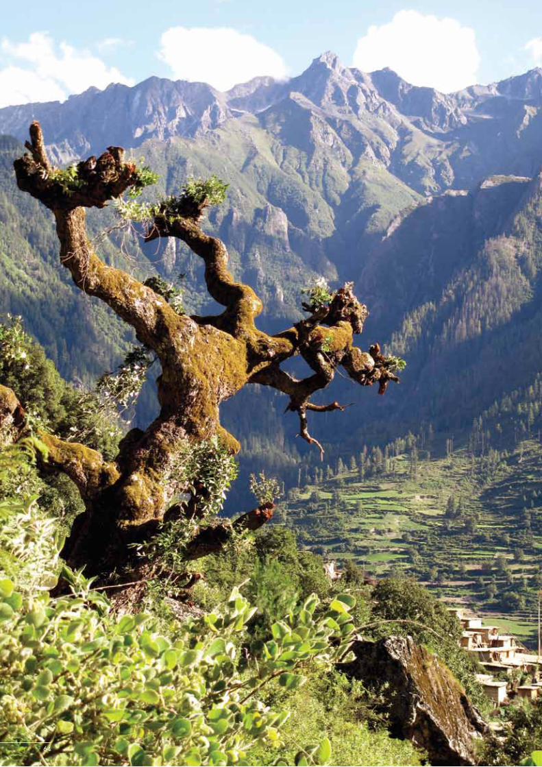
64

65
Chapter 6 – Policy and Enabling Environment
6 Policy and Enabling Environment
Background
One of the major aims of this feasibility assessment was to develop a better understanding of existing policy constraints and opportunities within the context of regional cooperation and the ecosystem management of landscapes and natural resources in the KSL. The assessment of the policy and enabling environment includes a review and analysis of the global, regional, and national policies that aim to facilitate international cooperation in the management of biologically and culturally rich areas that cross national borders. The ecosystem management of such areas requires co-management arrangements, to which community participation in the protection of the biological and cultural integrity of sacred natural sites is central. The analysis also identifies policy gaps in the management of such areas of bio-cultural significance at all levels – international, national, and local. Finally, it sets out what the national partners have identified as the basic principles for enhancing regional cooperation for transboundary conservation. The present assessment identifies gaps in current policy and delineates policy needs to be addressed by the KSLCI and the KSL-CS.
Each country provided a Country Policy and Enabling Environment Assessment Report as part of its Country Feasibility Assessment. These reports have been submitted to the relevant agencies and ministries within each of the countries by the lead country partners. The individual country reports were summarised and synthesised by ICIMOD to prepare this current summary. The reader is referred to each country's original Country Policy and Enabling Environment Assessment Report for more detailed information. The reports were prepared based on common basic objectives.
The basic objectives of the policy and enabling environment assessment were to:• Bring clarity on policy issues relevant, and specifically related, to enhancing regional cooperation within the
context of the KSLCI• Provide an overview of the enabling (policy) environment, and identify constraints to implementation of the KSLCI• Produce a policy-based needs analysis for the KSLCI • Identify gaps in current policy and delineate policy needs to be addressed by the KSLCI
Major components were:• The identification, delineation, and description of policies and other enabling mechanisms, including
international, regional, and national legal frameworks pertaining to biodiversity, forests, the environment, culture, and livelihoods that are likely to have implications for the KSL or for the KSLCI
• The identification of state level policies and programmes in the area of conservation and livelihoods that may have implications for the KSL or for the KSLCI, and of customary laws and protocols for the protection of bio-resources and their associated traditional knowledge in the KSL
• The identification of policy constraints and potential conflicts that may impede or otherwise hinder the implementation of the KSLCI, technical cooperation, and data sharing
• The formulation of policy priorities and basic principles for the enhancement of regional cooperation
The process included:• The identification of relevant policies and enabling environment by the process of expert consultations and review• A detailed review of available information such as secondary sources of data and other relevant information• Stakeholders’ consultations with experts, practitioners, and communities• The compilation, analysis, and synthesis of available information
66
KSLCI Feasibility Assessment Report
• The assessment of policy needs for the enhancement of regional cooperation within the context of the KSLCI based on information synthesised from the above activities.
International and Regional Obligations
This section provides a very brief overview of the various international and regional agreements that support the concept of transboundary conservation areas. It relies heavily on the extensive literature review and analysis on this topic presented in the KSL-India assessment. The presentation of international conventions and regional agreements here is to reiterate and reaffirm the host of provisions that the respective governments within the KSL have agreed to, and will need to comply with, to fulfil their international and regional obligations. International law can only be enforced effectively when national law is harmonised with the international conventions either by amending existing legislation or enacting new laws. As such, it is pertinent to carry out a quick review of the existing international regime to ascertain if national laws are aligned with the provisions of the international and regional treaties that the countries are party to. In order to do so it is also necessary to review each county's national conservation and development laws. All national laws are, and will remain, applicable to the respective country areas within the proposed KSL.
Principles, strategies, and charters
International cooperation and the development of international law is a central and essential part of domestic policy and law development in all countries of the region to protect rare and endangered species subject to international trade; to protect and wisely use wetlands, especially those shared by one or more countries; and to conserve migratory species and species of global concern. Transboundary conservation through enhanced regional cooperation, and by facilitating the integration of a network of regional protected areas, are emerging approaches in the conservation of biological diversity and transboundary landscape and ecosystem management.
At the international level, the concept of ‘transboundary protection or regional cooperation for conservation’ is well-known and well-established. This concept is found in various conventions, bilateral agreements, charters, and principles. The fact that there is a need for an international regulatory framework for the conservation of flora and fauna shows that the problem transcends national boundaries. The transboundary dimension is evident in the international laws established to minimise threats to endangered species due to trade, conserve wetland habitats, avoid capture during migration, and help preserve species of global concern. The original impetuous for such legislation came from international concern about the overexploitation of wildlife and the widespread loss of biodiversity; this transboundary concern and facilitation for regional approaches has been enshrined in a series of international agreements signed since the early 1970s .
Some of the major relevant international and regional agreements, to which, in most cases, all three countries (China, India, and Nepal) are party, and which may have a bearing on the transboundary conservation of flora and fauna, sacred sites, or ecosystem management at the landscape level within the context of the KSLCI, are summarised here .
Declaration of the United Nations Conference on the Human Environment (UNCHE) (1972)
The concept of transboundary protection first emerged clearly in the principles laid down in this declaration in 1972 in Stockholm. Principle 21 recognises a state’s right to exploit its own resources pursuant to its own environmental policies, subject to ensuring that its activities do not cause any environmental damage. Principle 22 requires states to cooperate in developing laws regarding liability and compensation for damage to habitats that could harm species that cross or reside within the borders of neighbouring states.
UNEP Principles of Conduct in the Field of the Environment for the Guidance of States in the Conservation and Harmonious Utilisation of Natural Resources Shared by Two or More States (1978)
Shared natural resources represent an intermediate category; the resources do not fall wholly within the exclusive control of one state, but neither are they the common property of all states. The essence of this concept is a limited

67
Chapter 6 – Policy and Enabling Environment
form of community interest, usually involving a small group of states in geographical contiguity that exercise shared rights over the resources, which in this case could include international watercourses and migratory species. According to Resolution 3129 XXVIII of the UN General Assembly (UNGA) in 1973, adequate international standards for the conservation and utilisation of natural resources common to two or more states are to be established; it affirmed that there should be cooperation between states on the basis of information exchange and prior consultation. The UNGA has called on states to use these principles as guidelines in the formulation of bilateral or multilateral conventions (UNGA Resolution 34/186 (1979)). The following can be considered shared natural resources: river systems, enclosed and semi-closed seas, air-sheds, mountain chains, conservation areas, and migratory species (UNEP/ GC/ 44 (1975) Paragraph 86). Principles 1, 3, and 4 (cited below) are of significance in this context.• Principle 1 endorses the view that shared resources are subject to obligations of transboundary cooperation and
equitable utilisation. • Principle 3 affirms responsibility for ensuring that adverse environmental effects on other states or on areas
beyond national jurisdiction are avoided or reduced to the maximum extent possible, particularly where the utilisation or conservation of the resources may be affected or endangered in the other states.
• Principle 4 calls for states to make environmental impact assessments before engaging in any activity with respect to resources that may significantly affect the environment of another state sharing the resource.
World Charter for Nature (WCN) (1982)
Article 11 of the Charter requires that activities within a state’s jurisdiction or control do not cause damage to natural systems in other states, or in areas beyond national jurisdictions, and that nature in the latter is safeguarded. Activities causing irreversible damage must be examined beforehand; environmental impact assessment must be undertaken; agriculture, grazing, and forest practices must be adapted to the natural characteristics and constraints of the given areas.
Report of the World Commission on Environment and Development (WCED) (1987)
This report delineates a set of legal principles for environmental protection and sustainable development. Twelve principles (nos. 9–20) were grouped together as ‘Principles, Rights and Obligations Concerning Transboundary Natural Resources and Environmental Interferences’. As per these principles, states should use transboundary natural resources in a reasonable manner; prevent and abate harmful interference; take precautionary measures to limit risk and to establish strict liability for harm done; apply as a minimum, the same standards for environmental conduct and impacts concerning such resources as are applied domestically; cooperate in good faith to achieve optimal use and prevention of abatement of interference with such resources; provide prior notification and assessment of activities having significant transboundary effects and engage in prior consultation with concerned states; cooperate in monitoring, scientific research, and standard setting; develop contingency plans for emerging situations; and provide equal access and treatment in administrative and judicial proceedings to all affected or likely to be so.
Global conventions, and regional and bilateral agreements
A wide array of treaties and agreements exist at the global, regional, and bilateral level that use the aforementioned principles in conservation. Some deal with species protection, while others deal with habitat protection. The following treaties introduce new approaches to protection; all of these recognise the need for international and regional cooperation in conservation and development.
Convention on Biological Diversity
International recognition was accorded to the concept of transboundary landscape management as an ecosystem management approach to conservation in the Seventh Conference of Parties (COP) to the Convention on Biological Diversity (CBD). The significance of regional cooperation among signatory countries to the Convention was emphasised. The CBD COP7 adopted the Programme of Work on Mountain Biodiversity for mountain specific activities. It also acknowledged the need for regional cooperation and an ecosystem management approach for biodiversity conservation. Article 8 (j) of the CBD recognises the need to respect, preserve, and maintain the

68
KSLCI Feasibility Assessment Report
knowledge, innovations, and practices of indigenous and local communities embodying traditional lifestyles relevant for the conservation and sustainable use of biological diversity. It promotes their wider application with the approval and involvement of the holders of such knowledge, innovations, and practices and encourages the equitable sharing of benefits arising from the utilisation of such knowledge, innovations, and practices.
Man and the Biosphere Programme (1971)
The Man and the Bioshpere Programme (MAB) focuses on the reduction of biodiversity loss, improvement of livelihoods, and enhancement of social, economic, and cultural conditions for environmental sustainability. The objective of MAB is to “contribute to minimising biodiversity loss through the use of ecological and biodiversity sciences in policy and decision making; promote environmental sustainability through the World Network of Biosphere Reserves; and enhance the linkages between cultural and biological diversity”. This programme promotes the use of the regional networks of biosphere reserves as a vehicle for knowledge sharing, research and monitoring, education and training, and testing of participatory decision-making.
Cultural and sacred sites receive special attention under MAB. MAB emphasises establishing a knowledge base on local cultural practices that foster the sustainable use of biodiversity in biosphere reserves; using local and indigenous knowledge as a basis for equitable biodiversity governance; and raising awareness of the role of sacred natural sites, cultural landscapes, and intangible heritage in ecosystem management and the sustainable use of biodiversity.
Ramsar Convention on Wetlands (1971)
The Ramsar Convention provides a framework for the conservation of wetland habitats. It establishes a List of Wetlands of International Importance. Inclusion in the list is based on the ecological and overall scientific importance of the wetland and particularly on its importance as a waterfowl habitat. Parties to the Ramsar Convention are obliged to formulate and implement planning measures to promote the conservation of those wetlands included in the list, and to use wetlands in their territory as wisely as possible (Article 3(1)). Article 4 requires each party to promote the conservation of wetlands and waterfowl by establishing nature reserves in wetland areas, whether or not they are included in the list, and to provide adequate supervision of these reserves.
Convention for the Protection of World Cultural and Natural Heritage (World Heritage Convention) (1972)
The Preamble to the Convention declares that the deterioration or disappearance of cultural or natural heritage constitutes a harmful impoverishment of the heritage of all nations, and recognises the duty of the international community to cooperate for the protection of cultural and natural heritage. This Convention, like the Ramsar Convention, functions on the basis of the listing of World Heritage Sites.
Convention on International Trade in Endangered Species of Wild Fauna and Flora (CITES) (1973)
The CITES states that wild fauna and flora must be protected for future generations, and that people and states are the best protectors of their own wild fauna and flora, noting that international cooperation is essential for protection from overexploitation through international trade. The Convention categorises wildlife species by their degree of vulnerability. The most endangered species are placed in Appendix 1 and trade in these species is completely prohibited (with declared exceptions). Appendix 2 permits some degree of trade with prior permission if it is not detrimental to the survival of the species. Appendix 3 pertains to those species for which countries voluntarily regulate trade. CITES does not prescribe any specific sanctions for violation; each country needs to execute its own national legislation to implement the necessary provisions and penalties.
Convention on the Conservation of Migratory Species of Wild Animals (Bonn Convention) (1979)
The Bonn Convention provides a framework within which states can cooperate in undertaking scientific research, restoring habitats, and removing impediments to the migration of species listed in Appendix I (endangered migratory species). It also provides for the conclusion of formal agreements among range states of particular migratory species listed in the Convention’s Appendix II as having an unfavourable conservation status. Mandatory obligations are

69
Chapter 6 – Policy and Enabling Environment
required for the protection of Appendix I species, whereas only agreements are required for the protection of Appendix II species. The agreements, as necessitated for Appendix II species, are open to all range states whether they are party to the Convention or not. The Convention stresses that states are the protectors of the species within their national boundaries, although conservation and effective management of migratory species requires the concerted action of all states within whose boundaries these species spend any part of their life cycle. Of the three participating countries in the KSL, India is the only contracting party.
Convention for the Safeguarding of Intangible Cultural Heritage (2003)
This Convention underscores the importance of safeguarding intangible cultural heritage and considers intangible cultural heritage as a mainspring of cultural diversity and a guarantee of sustainable development. The Convention recognises that the process of globalisation and social transformation gives rise to grave threats of deterioration, disappearance, and destruction of intangible cultural heritage, and recognises that communities, in particular indigenous communities, play an important role in the production, safeguarding, maintenance, and recreation of intangible cultural heritage. Intangible cultural heritage is manifested inter alia in the following: oral traditions and expressions (including language); the performing arts; social practices (rituals and festive events); knowledge and practices concerning nature; and traditional craftsmanship. It reinforces the need for the international community to safeguard such heritage in the spirit of cooperation and mutual assistance.
United Nations Declaration on the Rights of Indigenous Peoples (2007)
This Declaration recognises the urgent need to respect and promote the inherent rights and characteristics of indigenous people, especially their right to their lands, territories, and resources, from which they derive their political, economic, and social structures and their cultures, spiritual traditions, histories, and philosophies. The Declaration further recognises that control by indigenous people over developments affecting them and their lands, territories, and resources will enable them to maintain and strengthen their institutions, cultures, and traditions, and to promote their development in accordance with their aspirations and needs. There is also recognition of the fact that respect for indigenous knowledge, cultures, and traditional practices contributes to sustainable and equitable development and proper management of the environment. The Declaration encourages states to comply with, and effectively implement, all international instruments, particularly those that relate to human rights and apply to indigenous peoples, in consultation and cooperation with the people concerned.
International Labour Organization’s (ILO's) Convention 169 (1989)
ILO’s Convention 107 of 1957, which has been replaced by Convention 169 of 1989, is relevant in this context. Convention 169 concerns indigenous and tribal peoples in independent countries, of which Article 14(1) of Part II deals with land claims:
“The rights of ownership and possession of the peoples concerned over the lands which they traditionally occupy shall be recognised…. measures shall be taken in appropriate cases to safeguard the right of the peoples concerned to use lands not exclusively occupied by them but to which they have traditionally had access for their subsistence and traditional activity. Particular attention should be paid to the situation of the nomadic peoples and shifting cultivators in this respect.”
Regional agreements
Some examples of regional agreements that express a similar need for cooperation in conservation are given here.
Economic Commission for Europe – Convention on Environmental Impact Assessment in a Transboundary Context (1991)
This Convention provides that “parties shall either individually or jointly take all appropriate and effective measures to prevent, reduce, and control significant adverse transboundary environmental impacts from proposed activities". This is the first convention to lay down detailed rules, procedures, and practices for transboundary environmental impact assessment. It requires each party to establish an environmental impact assessment procedure that permits

70
KSLCI Feasibility Assessment Report
public participation and the preparation of appropriate documentation. Other states likely to be affected must be notified and given the opportunity to enter into consultations and make representations on the assessment, which must be taken into account in any final decision on a proposed activity. This Convention is only open to members of the United Nations Economic Commmission for Europe (UNECE) and the European Commission (EC).
Convention on the Protection of the Alps (Alpine Convention) (1992)
The main purpose of the Alpine Convention is to pursue a comprehensive policy for the preservation and protection of the Alps by applying the principles of prevention, payment by the polluter, and cooperation. The following countries are members: Austria, France, Germany, Liechtenstein, Slovenia, Switzerland, and the European Economic Community. The member countries have agreed to take appropriate measures to: • Respect, preserve, and promote the cultural and social independence of the indigenous population and to
guarantee the basis for their living standards, in particular, environmentally sound settlement and economic development
• Promote mutual understanding and cooperation between Alpine and extra-Alpine populations• Ensure the economic and rational use of land and ensure the sound and harmonious development of the whole
region through integral planning and coordination• Prevent air pollution, promote soil conservation, and improve water management• Preserve and promote a system of farming that suits local conditions and is environmentally sound• Preserve, reinforce, and restore the role of forests• Restrict activities harmful to the environment; harmonise tourism and recreational activities with ecological and
social requirements• Develop a system of waste collection, utilisation, and disposal that meets the special topographic, geological,
and climatic requirements of the Alpine region
Framework Convention on the Protection and Sustainable Development of the Carpathians (2003)
The Carpathian Convention was adopted with the aim of strengthening international cooperation in the field of biological diversity and landscape conservation in the mountain regions of Europe. The Carpathian framework was built on experience gathered from the Alpine Convention model. It uses the tool of the Carpathian Network of Protected Areas (CNPA) for the implementation of the provisions of the Carpathian Convention. Among the goals of the CNPA are:• Protection and restoration of nature and the sustainable use of natural and cultural resources• Implementation of European Union (EU) policy towards nature conservation, including regional and global
environmental conservations and instruments (CBD, Ramsar Convention, Berne Convention, Pan European Biological and Landscape Diversity Strategy, etc.) in the framework of the Carpathian Convention
• Promotion of sustainable livelihoods and the sustainable development of the Carpathians
Declaration on Environment and Development
Two important international documents which deserves a mention here and are relevant to the protection of mountain ecosystems are Chapter 13 of the Declaration on Environment and Development, which through Agenda 21 re-emphasises the need for protection of mountain areas, and the Plan of Implementation of the World Summit on Sustainable Development (WSSD).
Bilateral agreements within the region
Although few binding agreements for the conservation and development of transboundary landscapes were developed in the past, bilateral agreements have been emerging in the region. There have recently been two agreements in the field of biodiversity conservation between Nepal and China, and between Nepal and India undertaken by the Department of National Parks and Wildlife Conservation, Nepal in 2010. These two bilateral cooperation initiatives provide the basis for more elaborate regional cooperation in the future. • The Memorandum of Understanding (MOU) on Cooperation in the Field of Forestry and Biodiversity
Conservation between the Ministry of Forest and Soil Conservation, Government of Nepal and the State

71
Chapter 6 – Policy and Enabling Environment
Forestry Administration, People’s Republic of China (PRC) was signed on 3 June 2010. This MOU expresses the commitment to implement the obligations of multilateral agreements and conventions to protect the environment and conserve biodiversity. Major areas of cooperation include: formulating forestry policies and strategies, forest management, addressing adverse effects on forests, wildlife conservation (by stopping the illegal hunting of animals and the illegal trade of their body parts), scientific research, and public awareness.
• A resolution was signed between Nepal’s Department of National Parks and Wildlife Conservation, India’s National Tiger Conservation Authority, and India’s Ministry of Environment and Forests on 29 July 2010. This resolution on transboundary conservation is an outcome of the Fourth Nepal-India Consultative Meeting. The resolution focused on, inter alia, the conservation of endangered species (including tiger, rhino, and elephant), capacity building, joint monitoring arrangements, and cooperation on recognised priority landscapes.
National Policies and Legal Instruments
International laws become legally binding only when they are incorporated into national law, otherwise they cannot be enforced unless they are accompanied by their own enforcement mechanisms (as is the case with the World Trade Organization). Some conventions explicitly enjoin member states to take legal implementation measures by amending their existing laws or by legislating to incorporate provisions for the agreements. For example, in many countries, the signing of an international agreement is not sufficient to make it enforceable in that country; it has to be ratified after receiving approval from the Cabinet and appropriate changes must be made to existing laws, which requires parliamentary or legislative action. The national and sub-national policies and laws mentioned below are discussed in greater detail in the respective Country Policy and Enabling Environment Assessment Reports.
KSL-China: National policies and legal instruments
Environmental and biodiversity conservation
Environmental conservation is a major concern in China, and a declared priority at all levels of government. Three principal organisations govern environmental concerns in China: 1) the National People’s Congress formulates policies, passes legislation, and supervises enforcement; it works through the Environmental and Resource Protection Committee; 2) the State Environmental Protection Commissions (SEPCs) of the State Council develop and adopt policies and legislation at the state level; 3) the State Environmental Protection Agencies (SEPAs) of the State Council administer and supervise the implementation of laws; in addition, at the local level, the Environmental Protection Bureaus (EPBs) function under the SEPAs.
The Chinese Government has attached importance to the protection and development of TAR for four decades. During recent years, with the promotion of ‘scientific thinking on development’, a series of policies have been formulated which support, and can provide the context for, the implementation of the KSLCI within KSL-China.
Over the past 13 years, 1982 to 1994, the Standing Committee of the People's Congress of the Tibet Autonomous Region, and the People's Government of the TAR and its various departments, enacted and implemented more than 30 relevant local regulations, government standardisation documents, and departmental rules and regulations, which form a relatively systematic local legal regime for environmental protection. The Regulations for Environmental Protection in the TAR and other special regulations for different areas of ecological and environmental protection, such as land management, the administration of mineral resources, forest protection, grassland protection and control, water and soil conservation, wild animals protection, the administration of nature reserves, and pollution treatment are important rules and regulations that cover almost all areas of ecological and environmental protection.
In the National Plan for Eco-environmental Improvement and the National Program for Eco-environmental Protection formulated by the State Council in 1998 and 2000, respectively, great attention has been paid to ecological improvement and environmental protection in the TAR. A separate plan was drawn up to designate the permafrost zone on the Qinghai-Tibet Plateau as one of the country's eight major areas for ecological improvement. On the basis of this, the People's Government of the TAR formulated the Eco-Environmental Improvement Plan of the TAR in 2000, which provides an overall programme and arrangement for Tibet's eco-environmental improvement.

72
KSLCI Feasibility Assessment Report
The Central Government has increased its investment in the TAR, especially after the Fourth Forum on Work in the TAR in 2001. It is felt that, to achieve sustainable development in the TAR, the tourism sector and green agriculture need to be developed as pillar-industries to promote economic growth. The TAR has a unique natural geography and cultural environment, which attracts a large number of tourists and visitors. A series of ecological projects, such as natural forest protection, the restoration of farmland to forest and pasture, afforestation in Lhasa and its vicinity, wildlife protection, and the creation of nature reserves have already been put into operation.
In February 2009, the State Council adopted the Eco-Security Shelter Construction and Protection Planning of TAR (2008--2030), followed by the Implementation Proposals for the Eco-security Construction and Protection Plan of TAR. These plans provide for, among other things, the protection of natural grasslands, prevention of forest fires, protection of wildlife, and conservation of biodiversity in significant wetlands. The Central Government has made a significant commitment of funds towards the implementation of these activities. This programme, which seeks to promote ecosystem recovery and ensure stability in the delivery of ecosystem services, is considered an important step by China towards adaptation to climate change.
In order to protect the extremely fragile alpine environment in the TAR, the People’s Congress and TAR Government promulgated a series of regulations including the following: Environment Protection Ordinance of TAR, Forest Protection Regulations of TAR, Regulations on Grassland Administration in TAR, People’s Government Announcement on the Protection of the Water Resources in TAR, and the Environmental Protection Regulation of Construction Projects in TAR. There are a number of local regulations and administrative rules, including more than 20 documents on wildlife protection, which underpin the legal basis for strengthening environmental protection. Mechanisms have been set up to help reduce the use of traditional fuel sources by promoting the use of renewable energy sources such as biogas, solar energy (sunrooms, solar cookers), and geothermal energy. Arrangements are in place to help protect shrubs around scenic spots and to improve rangeland management by changing traditional modes of grazing. The prevailing belief is that, although the mode of grassland management should value the culture of local herdsmen, it should, nevertheless, ensure that the grasslands are not overburdened. This is especially relevant for the core areas of KSL-China surrounding Mount Kailash and the Manasarovar Wetland Complex Protected Area.
Governments and institutions at all levels are promoting alternative livelihood opportunities. While this policy is considered desirable, it is cautious to remember that identified new opportunities should not put additional burdens on the fragile ecology of the Tibetan Plateau. Developing eco-tourism and specialty industries that have relatively little impact on the environment has been a policy priority in coordinating economic development and environmental conservation in the TAR. This is reflected in the legislation by the central government and local government regarding the management and promotion of the tourism sector: The TAR’s Tourism Development Planning, TAR’s Tourism Management Regulations, Ngari District’s Tourism Development Planning of Mount Kailash and Lake Manasarovar (2008--2020), Feasibility Report of Greening and Beautifying around the Holy Lake Manasarovar in Burang County, and detailed Planning of Mount Kailash/Gang Rin PoChe and Lake Manasarovar/Ma Pang Yumcho International Tourism Area Construction in Ngari District. These documents provide important references and guidelines for the KSLCI.
The aforementioned policies, regulations, and planning are applicable and will be of use to enhance good cooperation in the KSL transboundary landscape, and will be helpful in implementing environment protection using the KSLCI.
Implementation of polices and mechanisms
Central and local governments have formulated policies and mechanisms on the ecological compensation of grasslands and on forest strategies for energy alternatives in the TAR, and have promoted the use of renewable energies such as biogas, solar energy (sunrooms, solar cookers), and geothermal energy instead of traditional fuels through financial subsidies. The responsibility for protecting shrubs around scenic spots has been shouldered by the local township administration, which has made rules prohibiting deforestation. Regulations were made to enhance rangeland management and to change the traditional modes of grazing by promoting exclosure grazing,

73
Chapter 6 – Policy and Enabling Environment
rotational grazing, and fencing for longer periods. In order to protect grasslands, the exploitation of alluvial gold must be forbidden because such activities entail the severe destruction of grassland vegetation. These policies and implementation plans create favourable conditions for further cooperation through the KSLCI and provide the basis for the implementation of alternative livelihood strategies.
As a member of the UNEP standing council, China has deliberated the ‘Technical Support and Capacity-building of the Bali Strategic Plan’, which can provide a good international environment for implementing the KSLCI. International cooperation in environmental protection is considered to be part of China’s diplomatic mission. International cooperation for environmental protection is conducive, not only to bringing in foreign capital, technology, and management experience from abroad to accelerate the development of environmental protection in China, but also to safeguarding China’s legitimate rights and interests, enhancing China’s international status and economic development, and reducing tensions with external partners. Overall, the Chinese Government’s approach towards international cooperation for environmental protection is conducive to helping the development and implementation of the KSLCI. China is entering a strategic transition period with respect to environment and development. China has also committed to enhance its capacity to fulfil its obligations in international conventions; this will be beneficial for the launching of the project. In short, China's laws, regulations, systems, and policies are for the most part already amenable to transboundary cooperation, vigorous protection, and the sustainable development of the environment in the KSLCI target area. A detailed review of existing policies and the enabling environment and a more detailed overview of the legal basis and response measures are needed to achieve transboundary cooperation are given in the KSL-China Policy and Enabling Environment Assessment Report.
KSL-India: National policies and legal instruments
In order to fulfil its obligations towards international agreements in the area of conservation, India has a comprehensive and exhaustive framework of laws and policies. India also has guiding principles that govern the conservation of its bio-cultural heritage, just like soft laws available at the international level (which take the form of declarations and principles that provide guidance in the areas of transboundary conservation of natural and cultural resources). As a federal country, the law and policy making power is divided between the centre (Parliament) and the state (State Legislature). To get a full understanding, national laws and policies have to be considered with the relevant laws of the State of Uttarakhand (as the area proposed under KSL-India lies in this state). A non-exhaustive listing of the major national and sub-national policy instruments relevant to the conservation of nature and to the sustainable utilisation of natural resources is given here.
Rights-based laws
• National Rural Employment Guarantee Act (2006)• Right to Information Act (2005)• Scheduled Tribes and Other Traditional Forest Dwellers (Recognition of Forest Rights) Act (2006)• Panchayat (Extension to Scheduled Areas) Act (1996)
Environment and biodiversity policies
• National Environment Policy (2006)• National Biodiversity Action Plan (2008)• National Wildlife Action Plan (2002–2016)• National Mission on Sustaining the Himalayan Ecosystem (2010)• Biological Diversity Act (2002)• Environment (Protection) Act (1986)
Forest and wildlife policies
• National Forest Policy (1988)• Indian Forest Act (1927)
74
KSLCI Feasibility Assessment Report
• Indian Forest Act (Uttaranchal Amendment) Act (2001)• Wildlife (Protection) Act (1972)• Forest (Conservation) Act (1980)• Village Forest Joint Management Rules (1997)• Uttaranchal (Uttarakhand) Panchayat Forest Rules (2001)• Regulation of medicinal plants in Uttarakhand with special reference to cooperative trading
The Constitution of India (1950) directs states to value and preserve the heritage of composite culture and to protect and improve the natural environment including forests, lakes, rivers, and wildlife, and to have compassion for living creatures. In recent decades, the Constitution has devolved power to local governments in order to empower local people, especially women and men from marginalised sections of society (such as the scheduled castes and scheduled tribes). Rights-based laws have recently been enacted, these include the National Rural Employment Guarantee Act (2006), the Right to Information Act (2005), and the Scheduled Tribes (Recognition of Forest Rights) Act (2006), which empowers tribal communities and protects their access to forests and their use of forest resources.
The Environmental Protection Act (1986), Wildlife (Protection) Act (1972), and Forest Act (1927) and its successive amendments are the prominent instruments used to manage natural resources and to minimise threats to the ecological integrity of India. In particular, the National Wildlife Action Plan guides all major programmes for wildlife and protected area conservation and management. Several State Governments have adopted enabling legal provisions to facilitate these processes and allow benefits to be shared at the local level.
The Wildlife (Protection) Act (1972), a key protected area legislation, identifies ‘National Park’ and ‘Wildlife Sanctuary’ as the dominant categories of protected area. Two new legal categories of protected area have been added after the 2003 amendment; these are the ‘Community Reserve’ and ‘Conservation Reserve’, which accommodate the aspirations of local communities for more inclusive conservation efforts, and address conservation at the landscape level. The State Forest Departments are responsible for identifying potential areas which could be designated as conservation or community reserves. The Central Government has not yet framed a clear legal structure for the equitable sharing of benefits arising from the establishment and management of protected areas in the country. The 2006 amendment of the Wildlife (Protection) Act provides for the creation of conservation foundations to support protected area management.
The National Environment Policy (NEP) formulated in 2006 (GOI/MoEF 2006), builds on other policies relating to different aspects of the environment, but does not displace these policies (National Forest Policy (1988), National Conservation Strategy and Policy Statement on Environment and Development (1992), and Policy Statement on Abatement of Pollution (1992), National Agriculture Policy (2000), National Population Policy (2000), and National Water Policy (2002)). The National Environment Policy recognises mountains as the most fragile ecosystems threatened by anthropogenic pressures. The policy acknowledges the transboundary character of environmental problems and clearly seeks regional cooperation for the conservation of biological resources and for the protection of the environment. Specific measures proposed for the conservation of mountains include the following:• Adopt appropriate land-use planning and watershed management practices for the sustainable development of
mountain ecosystems.• Adopt ‘best practice’ norms for infrastructure construction in mountain regions to avoid or minimise damage to
sensitive ecosystems and to avoid degradation of the landscape.• Encourage the cultivation of traditional varieties of crops and horticulture by promoting organic farming and by
enabling farmers to realise a price premium.• Promote sustainable tourism through the adoption of ‘best practice’ norms of eco-friendly and responsible tourism,
creation of appropriate facilities and access to ecological resources, and multi-stakeholder partnerships, to enable local communities to gain livelihoods, while leveraging the financial, technical, and managerial capacities of investors.
• Take measures to regulate the flow of tourists into mountain regions to ensure that these remain within the carrying capacity of the mountain ecology.
• Consider unique mountain landscapes as entities with ‘incomparable value’, in developing strategies for their protection.

75
Chapter 6 – Policy and Enabling Environment
The National Biodiversity Action Plan (NBAP) (2008) was formulated with the objective of augmenting the natural resource base and encouraging its sustainable utilisation. It proposes the creation a protected area network that includes the consolidation of Biosphere Reserves, the establishment of Ramsar Sites, and the augmentation of ex-situ efforts and other initiatives for the conservation of genetic resources. The policy aims to promote, consolidate, and strengthen bilateral, regional, and multilateral cooperation on issues related to biodiversity.
The National Wildlife Action Plan (NWAP) (2002–2016) supports protected areas, the protection of wildlife outside protected areas in the landscape, and recovery programmes for critically endangered species and habitats, among other things. The Action Plan explicitly mentions transboundary protected areas. On 15 October 2003, the Ministry of Environment and Forests constituted a taskforce with the mandate of identifying potential areas that could be declared Transboundary Protected Areas and to prepare a Memorandum of Understanding between the concerned countries to safeguard such protected areas. The framework for implementation under this component includes, inter alia: identifying and promoting common values, developing cooperative agreements, promoting coordinated and cooperative activities, involving and benefiting local people, achieving coordinated planning and protected area development, working towards funding sustainability, monitoring, and assessing progress, obtaining and maintaining the support of decision-makers, and dealing with armed conflicts. The NWAP supports eco-development and community-oriented activities by addressing people-animal conflicts, strengthening the co-existence agenda, determining inviolate spaces, relocating villages from core critical wildlife habitats, fostering ecotourism, and providing assistance to activities in transboundary protected areas.
The National Forest Policy (1988) emphasises the ecological role of forests and envisages that the rights and concessions from forests are to be primarily for the bona fide use of communities (especially tribals) living within and around forest areas. Such communities are required to be motivated to protect and develop the forests from which they derive benefits. The policy stipulates that the rights and concessions of tribal communities (and other communities living within and near forests) relating to the forest produce must be fully protected.
The National Policy on Farmers (2002) is premised on the fact that the majority of the hungry live in rural India and depend on agriculture for their livelihoods. The policy promotes the involvement of women in the documentation of traditional knowledge through Community Biodiversity Registers. It supports tribal and rural women and men in revitalising their in situ on-farm conservation traditions. It supports participatory plant breeding procedures involving scientists and local conservers in improving the productivity of landrace. It supports and encourages traditional modes of conservation such as sacred groves. The policy suggests the setting up of farmer-level gene and seed banks to conserve traditional varieties and it particularly refers to the protection of traditional varieties of rice.
The National Action Plan on Climate Change (NAPCC) 2008, through eight National Missions, contains multi-pronged, long-term, and integrated strategies for achieving key goals with respect to climate change in India. The NAPCC envisages, among other things, a National Mission for Sustaining the Himalayan Ecosystem, aimed at evolving management measures for sustaining and safeguarding Himalayan glaciers and mountain ecosystems. The mission, among others, aims to: 1) improve understanding of the cryosphere; 2) establish an observational and monitoring network for the Himalayan environment; and 3) promote community-based management through incentives to community organisations and panchayats for the protection of forested lands.
The Biological Diversity Act (BDA) (2002) was enacted to fulfil India’s commitment to implement the provisions of the CBD. The BDA focuses on the specific requirement of the CBD to regulate access to bio-resources. The BDA provides for prohibitions on intellectual property right, such as patents over biological resources or related knowledge without the permission of the GoI. The BDA reinforces the State’s sovereignty over its biological resources. It also places a prohibition on the transfer of Indian genetic material outside the country without the approval of the GoI. The BDA provides for the measures for the sharing of benefits from the use of biological resources, and for the integration of biodiversity into the plans, programmes, and policies of various departments. The BDA provides for setting up of an institutional framework and biodiversity funds at the national, state, and local levels to achieve the goals of the BDA (GoI 2009).

76
KSLCI Feasibility Assessment Report
State-specific policies and programmes
There are a host of state policies, laws, and programmes implemented through various government agencies in Uttarakhand State that are relevant and influence the policy environment for implementing the KSLCI. As forests and rangelands are the dominant component of the KSL, the experience gained in Uttarakhand State is very relevant. At present, the reserve forest is under the control of the Forest Department; civil and soyam land is under the Revenue Department; and van panchayats are under the control of both the Forest and Revenue Departments (see the India-KSL Policy and Enabling Environment Assessment Report for the more detailed outline of relevant policies and programmes in Uttarakhand State).
Customary laws
The target area in of Uttarakhand is a remote part of the country with a large tribal population. Tribal communities embody traditional lifestyles and have distinct values, worldviews, and legal norms. The region is also a legally pluralistic area and local customary laws prevail alongside statutory laws. Most aspects of life in these remote areas are governed by social customs and traditional practices. In recent times, the notion of customary laws has been broadened to include locally recognised principles and more specifically norms or rules, which are orally held and transmitted and are applied by community institutions to internally govern, or guide all aspects of life.
KSL-Nepal: National policies and legal instruments
Natural resource management and biodiversity
The conservation of natural resources and biodiversity has been a policy focus of the Government of Nepal since the mid 1950s when its periodic planning process began. This focus has taken the form of forest protection, protected area management, and land use planning. It received added emphasis with the formulation and implementation of the Master Plan for the Forestry Sector (1989), the National Conservation Strategy (1987), and the Eighth Plan (1992–1997), and subsequent Plans.
The current Interim Plan (2008-2010) places emphasis on providing access to forest resources to communities and ensuring their rights over forest products. The Interim Plan commits to following scientific management approaches for the conservation of biodiversity and genetic resources, and creating enabling policy environments for transboundary landscape management, using an integrated approach in the management of extended landscapes (defined by ecosystems). The objectives state that a balanced environment will be maintained by the scientific management of forests, watersheds, biodiversity, and protected areas, and that the access and rights of poor and disadvantaged communities over forest products will be ensured as a means of empowering them socially and economically. This Plan commits to the protection, restoration, and wise use of the natural environment; the prevention of pollution in urban environments; the promotion of sustainable development; the effective implementation of national and international commitments on environmental management; and the prioritisation of the environmental conventions to which Nepal is party and their implementation by formulating action plans. The Ministry of Environment, Science and Technology initiated the formulation of the Climate Change Policy and NAPA (National Adaptation Plan of Action). The draft of the Climate Change Policy has been developed, but has not yet been finalised.
The Interim Plan also calls for protecting and promoting intellectual, cultural, and archaeological heritage; and for developing the tourism industry by developing the necessary infrastructure and diversifying and expanding tourism. Strategies adopted to achieve the abovementioned objectives include: 1) involving local bodies in the protection and promotion of the nation’s cultural heritage; 2) developing the tourism sector as the foundation of the economy by giving it high priority; 3) diversifying and expanding the tourism sector while being mindful of regional balance; and 4) developing rural tourism so that the benefits of tourism can help to increase the living standard of people throughout the country.
The Sustainable Development Agenda for Nepal (SDAN) (2003) maintains that development efforts can never be sustainable if they deplete natural resources and damage ecosystems. SDAN stipulates that environmental conservation should not be an afterthought of economic development, but an intrinsic and inviolable component of poverty reduction and sustainable economic growth.

77
Chapter 6 – Policy and Enabling Environment
The Nepal Biodiversity Strategy (NBS) (2002) emphasises a comprehensive approach to conserve forests, soil, water, and biological diversity, while meeting the basic needs of the people who are dependent on these resources for their livelihoods. The NBS has also adopted a landscape planning approach to protect and manage biodiversity on a sustainable, long-term basis (HMGN 2002). The NBS agenda is also reflected in the current Interim Plan.
The National Biodiversity Coordination Committee (NBCC) was established (as proposed by the NBS) to develop policies for consideration by government and to provide institutional, political, and operational guidance for the implementation of the NBS through the Nepal Biodiversity Strategy Implementation Plan (HMGN 2006). It also proposes that the NBCC approve and publish an Annual Biodiversity Report.
The National Biodiversity Strategy Implementation Plan (NBSIP) (2006–2010) adopted by the Ministry of Forest and Soil Conservation is one of the principal tools for achieving the goals and objectives of the NBS. The NBSIP has a total of 13 priority projects to be implemented from 2006 to 2010. The transboundary biodiversity conservation project identified in the NBSIP is the establishment of the Kanchenjunga Tri-National Peace Park in the Kanchenjunga Landscape. The NBSIP has also proposed projects on forests and biodiversity conservation through community participation in areas outside protected areas.
Legal and statutory measures
The Interim Constitution of Nepal (2007) enshrines Nepal’s commitment to environmental conservation, equitable development, and the protection of human rights. The Interim Constitution ascribes high importance to the protection of the environment, rare and endangered wildlife, forests, plants, and biodiversity, as well as to ensuring the sustainable use and equitable distribution of benefits arising from these.
The Nepal Treaties Act (1991) explicitly provides for the primacy of international treaties over national law and requires implementing legislation to be framed at the national level. Nepal is a party to several international conventions and treaties. The country’s international obligations under various multilateral environmental agreements are given legal standing by the Nepal Treaties Act.
Some principal instruments to implement policies and international obligations, relevant to the KSL include the: Forest Act (1993) and Forest Regulations (1995), Environmental Protection Act (1974), Environmental Regulations (1997), National Parks and Wildlife Conservation Act (1973), Buffer Zone Management Regulations (1996), Pasture Land Nationalisation Act (1974), and Local Self-Governance Act (1999). Several of these are briefly described in this section; a more thorough treatment is provided in the KSL-Nepal Policy and Enabling Environment Assessment Report.
The Forest Act (1993) provides the State with absolute rights over forest resources in national forests. In community forests, the members of the community forest user group (CFUG) have the rights over those resources, but not over land, and they regulate access and benefit. The Forest Act (1993) implicitly recognises both community rights to forest resources and indigenous forest management practices. A leasehold forest can be handed over to any corporate body, industry, or community, and may be used for a number of purposes, as long as these activities are compatible with the conservation and development of the forest. Priority is given to community forests; any part of a national forest suitable for community forest use cannot be converted into leasehold forest. A 'religious forest' can be handed over to any religious body, group, or community and it can be used for any religious purpose, but cannot be used for commercial purposes.
The Environment Protection Act (1996) requires an initial environmental examination (IEE) and/or environmental impact assessment (EIA) for any plans, programmes, or projects that may cause changes in the existing environmental conditions by physical activity, development activity, or change in land use. This includes, for example, preparation of a management plan for a national park, wildlife reserve, conservation area, and buffer zone, including wetlands, and preparation of district forest management plans. An EIA must be conducted for any construction work (GoN exempt) that will take place within a forest area, national park, reserve and conservation area, buffer zone, wetlands area, or environmental conservation area; it is also required when handing over more than 500 hectares of forest area to a single community for its management, as well as for any proposal that will be implemented in national parks, wildlife reserves, wetlands, and conservation areas.

78
KSLCI Feasibility Assessment Report
The National Parks and Wildlife Conservation Act (1973) facilitated the establishment of an impressive network of protected areas, consisting of national parks, wildlife reserves/hunting reserves (WR/HR), and conservation areas (CA). Nepal currently has 10 national parks, 3 wildlife reserves, 1 hunting reserve, and 6 conservation areas (however, some protected areas are declared on paper only). Protected area management approaches include a gradual progression from top-down management to community-based wildlife conservation. The Fourth Amendment (1993) added the category Buffer Zone, to be declared around a national park or wildlife reserve. The Buffer Zone Regulations (1996) and Buffer Zone Guidelines (1999) provide a policy and legal framework for the programme. The Buffer Zone initiative provides for the formation of local committees as guardians and beneficiaries of the area. The concept calls for the strict control of forests in the national park, together with intensified agriculture and forestry on public and private properties outside the parks. The 11 Buffer Zones that have been declared are managed with the involvement of communities. The establishment of the Annapurna Conservation Area and other conservation areas based on an integrated conservation and development concept has provided a successful example of community-based conservation programmes complementing local development efforts (Sharma and Wells 1996; Gurung 2006). Within the KSL area, the Api-Nampa Conservation Area was designated as a conservation areas by the GoN in 2010.
Hydrology and water resources
The Water Resources Act (WRA) 1992 grants formal statutory control over water resources. The WRA allows for the formation of water users associations (WUAs) as a way for communities and groups to utilise water resources for collective benefit. Water-related projects initiated by the government may be handed over to a WUA, which then becomes the ‘owner’ of the infrastructure.
The Aquatic Animals Protection Act (1961) is one of Nepal’s oldest pieces of legislation; it indicates the early recognition of the value of water, wetlands, and aquatic life. Such stringent provisions are good for the conservation of aquatic life and biodiversity, however, they are rarely enforced. The Act may also contradict the letter and spirit of the National Wetlands Policy, which emphasises and encourages people’s participation and involvement in the management and conservation of wetlands, as well as the rights of indigenous and local people, particularly those dependent on fishing and aquatic resources.
Rangelands and agriculture
The Pasture Land Nationalisation Act (PLNA) (1974) nationalised all pasture land and vested ownership in the GoN; the relevant VDCs were granted the responsibility of managing the lands. The VDCs are required to protect and improve the pasture lands and to ensure that the land is not used for any purpose other than pasturing animals; anyone can graze their animals on this land subject to paying a fee. Although enacted in 1974, this law is only enforced in three districts.
The Seed Act (1988) promotes quality seed production and distribution to increase the yield of agricultural crops and has helped maintain crop diversification. It does not explicitly safeguard rights over traditional varieties or landraces.
The National Agriculture Policy (2004) provides for leasing marginal, pasture, degraded forest, and unused common lands to the poor and marginalised target population. These groups can use the land for the cultivation of cash crops, horticulture, grass, forage, fodder, agroforestry, medicinal plants, sericulture, and other perennial tree crops in order to contribute to land improvement and poverty alleviation. It also calls for the improvement of degraded forests and natural water bodies for biodiversity conservation, as well as for the utilisation and development of the agroforestry system. The policy stresses the importance of conservation farming through local participation in watershed management and the control of riverbank cutting. However, it does not specify any coordinated effort with other policies or agencies to achieve the stipulated provisions.
Cultural and religious heritage sites
The Local Self-Governance Act (LSGA) (1999) was enacted as part of Nepal’s efforts to support decentralisation. Under this law, local governing bodies, including VDCs, hold the right to manage specified natural resources,

79
Chapter 6 – Policy and Enabling Environment
and are empowered to prepare and implement programmes with regard to forests, vegetation, biodiversity, soil conservation, and environmental conservation. A VDC has ‘full title’ over certain property situated within the village development area, including ‘public property’ not owned by an individual or the government or a DDC (district development committee), including public drainage and sewerage; roads and bridges; ponds, water spouts, taps, wells, and ghats; temples, inns, houses; and grazing fields. ‘Natural heritage’ is also included in this list of assets.
The Ancient Monuments Protection Act (1956) provides for the conservation of cultural heritage and is administered by the Department of Archaeology (DoA). The objective is to protect ancient monuments, restrict trade in archaeological objects, and limit excavation in places where there are ancient monuments and archaeological and historical or artistic objects in order to maintain tranquillity and order. It provides a detailed definition of ancient monuments, which includes any monument, building, temple, monastery, or stupa of historical, artistic, scientific, or architectural importance that is more than 100 years old. It empowers the government to declare any area or place where an ancient monument is located as a protected monument area. Ancient monuments are divided on the basis of their ownership into two categories, namely: private ancient property and public ancient property. They are also divided on the basis of their importance into three categories: international, national, and local. Ownership of public ancient monuments is vested in the Department of Archaeology and it is the duty of the Department of Archaeology to protect, maintain, and renovate public ancient monuments. The Act established an Ancient Monument Fund for the protection of ancient monuments of historical and artistic importance.
Tourism
The Tourism Act (1978) is the main piece of legislation dealing with tourist activities and prescribes controls for the operation of the tourism industry. The only environmental aspect of the Act is that it requires mountaineering expedition teams to comply with prescribed conditions in order not to pollute the environment.
The Nepal Tourism Board Act (1997) aims to develop, expand, and promote tourism while conserving and promoting natural and cultural heritage and the environment. In line with the aforementioned objectives, the powers and functions of the Board include the following:• Formulating and implementing programmes needed for infrastructure development, tourism service, facility
expansion, human resource development, conservation of ecology of tourism sites, and other programmes in the tourist destination areas in order to establish, improve, develop, extend, promote, and protect tourism
• Motivating the private sector to bring the country’s religious and culturally important sites, high mountains, and panoramic natural beauty to the attention of potential tourists by managing and effectively utilising the existing tourism-related physical infrastructure
• Developing Nepal as an 'adventure destination' by operating recreational and adventure tourism activities based on water, land, and air without causing adverse effects on the original culture and traditions and by encouraging the private sector to participate in promoting adventure tourism
• Encouraging the participation of local communities in various activities related to the protection of historically important sites, temples, and stupas
• Giving priority to strengthening tourism infrastructure and facilities for rural tourist destinations by developing new tourist destinations and motivating local communities to run rural tourism developments programmes
• Developing religious tourism by protecting and promoting religious pilgrimage sites and by expanding facilities and services in such places to attract more tourists, and by promoting such places as international religious centres
The objectives, powers, and functions of the Nepal Tourism Board can be useful in developing the KSL-Nepal area as a touristic centre with important cultural, natural, recreational, and religious attributes. Such development could contribute to the conservation of biodiversity and to the reduction of poverty in the area, provided that the objectives are taken seriously by all the actors involved in tourism activities.
Transboundary movement of animals/diseases
The Livestock Health and Livestock Services Act (1998) obliges the GoN to establish temporary or permanent quarantine checkposts, to prohibit the import of animals suffering from disease, and to return livestock, animal/

80
KSLCI Feasibility Assessment Report
livestock products, and livestock production equipment/inputs that are prohibited back to their country of origin. If there is any likelihood of these spreading contagious diseases, the GoN can order their destruction. The Act requires that any party wishing to engage in the export or import of biologics, fingerlings, chicks, and animal feed has first to obtain approval from the GoN.
Traditional Institutions and Customary Laws
The KSL target landscape is in a remote part of each of the three countries, and in the case of KSL-India and KSL-Nepal has considerable tribal and indigenous populations. Some of these regions are also legally pluralistic, local customary laws and statutory laws existing side-by-side. Most aspects of life in such remote areas are governed by social customs and traditional practices. Tribal and herder communities embody traditional lifestyles and have distinct values, views of the world, and legal norms.
Customary laws are now considered to include locally recognised principles and more specifically norms or rules, which are orally held and transmitted and are applied by community institutions to govern internally or guide all aspects of life. Customary laws, in many cases, relate to, and are derived from, the use of natural resources. Tribal communities and indigenous people may have a holistic worldview and share spiritual beliefs. For these communities, everything that relates to the land, soil, biodiversity, forests, and so on, is said to contain spirits or gods and thus to have intrinsic sacred value. This sacred value is attached to the origin of most natural resources. These spirits are respected and feared; moreover, people may believe in a supernatural or higher order that values the sanctity of nature. Communities and traditional cultures fear that if nature is exploited it will respond with poor harvests, disease, or general disorder within the natural world. Within these traditional cultures, customary values and principles guide all aspects of people’s lives. Some of the important principles documented are:• Reciprocity: Equal exchange in society and with nature• Equilibrium: Balance/harmony in society and nature• Duality: Everything has a complementary opposite; traditional and western systems can co-exist.
In areas predominantly inhabited by tribal and indigenous people, one commonly finds a concept of collective heritage. People believe that bio-resources and knowledge are developed collectively and cumulatively. They believe that, as bio-resources come from nature, or creation, individuals cannot claim them. Such resources are openly shared within and between villages and between different generations. Even where customary laws are eroded, sharing values are still evident. Land, natural resources on the land, and related knowledge are often held collectively, as is the collective value that arises from communal activities and labour sharing. Customary decision making is also most often collective. Even where customary authorities and institutions have weakened, important decisions relating to natural resources management are still often taken collectively.
This world view engenders the concept of 'collective bio-cultural heritage', which includes collective management, biodiversity, landscapes, cultural and spiritual values, and customary laws. Livelihoods and spiritual values are tied up with the landscape, and people strongly believe in the mountain gods. As such, the Himalayas in local parlance is often referred to as ‘dev bhoomi’, abode of the gods. Protection of the collective bio-cultural heritage requires a range of local tools, such as collective land rights, access and benefit sharing protocols, biodiversity registers, and use of soft IPRs (such as collective trademarks and geographical indications). Strengthening traditional knowledge systems in order to promote community food and nutrition is important; however, market-based tools often undermine cultural incentives.
Management regimes and bio-cultural protocols that are developed to protect the bio-cultural heritage of sacred areas need to keep local sentiments and practices in mind. Local sacred sites have to be identified and documented with the help of local people. People use these sites for various purposes and have developed ingenious ways of protecting them using a variety of means, such as taboos and sanctions, which are strongly adhered to and respected by members of the community. These local practices, values, and sentiments need to be respected and given due recognition when developing a policy framework for governing the management and conservation of the KSL.

81
Chapter 6 – Policy and Enabling Environment
Policy Constraints and Conflicts
KSL-China: Policy constraints and conflicts
Data collection, mapping, and monitoring
The Tibet Autonomous Region’s Implementation Regulations of Grassland Law of the People’s Republic of China requires local agriculture departments to conduct grassland resource assessments every five years and a special topic investigation every three years. The relevant administrative department in county governments should document grassland resources and establish a database of grassland areas, grades, carrying capacity, and grassland construction. The TAR government needs to establish monitoring stations for grassland resource dynamics based on climate, eco-region, and the types of grassland and production features. The relevant administrative departments in the county are responsible for monitoring grassland areas, grades, the composition of vegetation, productivity, and natural and biological disasters, as well as the effectiveness of grassland protection and construction. This can provide local governments with up-to-date information for monitoring and early warning.
To monitor the ecology, climate change, and biodiversity, the KSLCI involves the use of remote sensing and the establishment of meteorological stations. Activities related to the monitoring of vegetation, ecological diversity, geographic terrain and land use/land cover change, and remote sensing fall into the 'mapping' category and should follow the rules set out for such. Mapping should comply with the Surveying and Mapping Law of People’s Republic of China in the Tibet Autonomous Region and follow the general instructions put forth in the Interim Approaches of Foreign Organisations or Individuals Surveying and Mapping in China (effective 1 March 2007). In addition, as the KSL target area is located on the border with India and Nepal, it is likely that much of the survey data will be confidential. In the process of mapping and surveying the project, there will most probably be information produced about the regional geography including elevation, depth, size, length, and hydrology, as well as data on the status of grassland vegetation and biodiversity. The existing laws and the particular geographical location are likely to impose a certain limit on implementing the project.
Pulan County has a meteorological observatory in Karnali Basin (in Burang Township), which has climate records dating from the 1970s. The station has monitored local climate change, which has been extrapolated to higher altitudes for researching the impacts of climate change on grassland vegetation. The establishment of meteorological stations is governed by a set of regulations issued by China's Meteorological Administration together with the State Security Bureau (effective 1 January 2007) called the Foreign-Related Meteorological Observation and Data Management Regulations. Under these regulations, no organisations or individuals can use these meteorological observation sites or collect original meteorological data without the permission of the State Meteorological Administration; also, no one can establish meteorological observation facilities with a foreign organisation without permission. Meteorological stations cannot be established in areas where there are defence or military installations or in areas that are militarily sensitive or in other places that are sensitive for the country’s security. As such, there is a distinct possibility of restrictions on the establishment of meteorological stations in the KSL-China area, because of its particular location. In addition, local Tibetan communities will not allow scientific facilities to be established in or near sacred sites, and this must be taken into consideration. To establish meteorological stations, application has to be made to the Meteorological Administration of TAR to obtain official permission, and negotiations held with the local government and local Tibetan communities to select appropriate sites.
Technical cooperation and proposed data sharing mechanisms
If permitted by the Chinese Government and the various concerned authorities, the KSLCI will receive data about land use and land cover and vegetation change through remote sensing and other monitoring. The management of mapping results is governed by Chinese law. According to the Provisions of the People's Republic of China Concerning the Administration of Achievements in Survey and Mapping, foreign organisations or individuals can engage in survey and mapping activities in cooperation with Chinese institutions with permission from the Chinese Government. While the monitoring data belongs to the Chinese partners, it is nevertheless required to submit a copy of the mapping and other results to the Administration Department of the State Council. The relevant departments

82
KSLCI Feasibility Assessment Report
will define the scope and assign the appropriate security (secrecy) level according to the Management on Mapping Scope of the Provisions of the State Confidence (2003). The approved mapping results can then safely be shared without compromising national security or other national interests. There are some restrictions on the use of mapping results to construct a web-based information sharing platform.
According to the Tibetan Autonomous Region’s Meteorological Regulations, organisations or individuals that do not belong to the meteorological departments should hand over meteorological data to TAR’s Administration Department of Meteorology. The confidential management of meteorological data and the sensitive location of the KSL may restrict the sharing of meteorological information, particularly in web-sharing platform formats.
Hydrological data may be classified as confidential according to the Hydrology Regulation of the People’s Republic of China. Consequently, it will not be possible to share hydrological data on lakes and rivers in Burang County, even within the context of the KSLCI.
The establishment of a platform for data sharing will require further communication and exchange with the relevant departments of governments, as well as verification of the relevant law. The data sharing component of the KSLCI project is subject to further verification, research, communication, and evaluation because of the particular geographical features and location of the KSL. As well, it will be necessary to look into the legal, institutional, departmental, and other relevant laws involved with the implementation of the project.
KSL-India: Policy constraints and conflicts
There is an urgent need to streamline different regulations and approaches to forest management in India, which are now under the jurisdiction of different authorities. At present, the Reserve Forest is under the control of the Forest Department, civil and ‘soyam’ land is under the control of the Revenue Department, and van panchayats are under the control of both the Forest and Revenue departments. A clear land use, planning, and management policy needs to be put in place for the various categories of forests under different departments for management. Such a policy is fundamental to the conservation and regeneration of forests in the KSL target area. The various laws applicable to the forests of the region have led to the creation of multiple institutions for the management of forests. This fragmented management could lead to further complications in the management and use of resources and in the implementation of various laws, policies, and schemes of the government. Likewise, the authority of the van panchayats over their forests and forest resources has been diluted with recent amendments to the Panchayat Forest Rules (2001), which accord more power to the Forest Department.
The granting a 'transit pass' to contractors for the transportation of such forest produce not covered under the UP Transit of Timber and Other Forest Produce Rules (1978) can result in the transportation of illicit timber and forest produce.
The Forest Rights Enactment (2006) was created with the intention of recognising the rights of tribal communities and other traditional forest dwellers by securing access and tenure through a framework of rights and responsibilities, and by granting authority and duty to protect, regenerate, and conserve community forest resources. It introduces the concepts of custom, customary, and traditional access, and traditional forest dwellers. The process of defining these terms and ascertaining these rights based on an articulated clear understanding is taking considerable time and could lead to the emergence of contrary views vis-a-vis conservation. Thus, a careful analysis of these terms needs to be undertaken in relation to the proposed geographical area.
The illegal harvesting and trade of plants and wildlife from the target landscape is a major problem. The existing law enforcement mechanisms require review and further strengthening. This would require mechanisms for effective coordination among different agencies.
Technical cooperation and proposed data sharing mechanisms
The National Map Policy (NMP) (2005) authorises the Survey of India (SOI) to issue detailed guidelines on the implementation of the NMP. All up-to-date information on SOI maps is available at the various offices, map sales

83
Chapter 6 – Policy and Enabling Environment
counters, and geospatial data centres (GDC) under the SOI. The available information includes all relevant details of maps such as scale, information content, date of data capture, price, mode of data dissemination, whether the Ministry of Defence has given clearance for issue as an open series map, and so on. The Ministry of Defence from time to time issues detailed guidelines on various aspects of map access and use. These instructions and guidelines will have to be adhered to while developing the regional cooperation framework for the KSLCI.
There is a limitation in the implementation of international agreements, which are often considered to be soft law unless incorporated in the national legislation, or come with an inbuilt dispute resolution mechanism, e.g., such as in the World Trade Organization. This is with particular reference to the several conventions, agreements, and declarations, which are not effectively enforced at the national level, as these do not come with strong enforcement mechanisms.
KSL-Nepal: Policy constraints and conflicts
Transboundary landscape management
Although Nepal’s forestry and protected area legislation is considered to be a model for environmental legislation, there is hardly any mention of transboundary landscape management. In spite of that, if the KSLCI is to be developed and implemented in the KSL area, the initiative needs to take into account a host of different pieces of legislation and policies, which range from rules on forestry and protected areas to seeds and tourism.
Inconsistencies in the statutory regime
Inconsistencies in the statutory framework, especially between the different forest-related acts and regulations and the Local Self-Governance Act (LSGA)(1998) and LSGA Regulations (1999), have remained a source of ambiguity in the governance of natural resources and have at times been at the source of conflict over resource use rights. For example, the LSGA empowers VDCs to sell specified natural resources and products, and stipulates that the proceeds of such sales are to be deposited in the VDC fund, while the Forest Act empowers CFUGs to sell the same products (Sections 2(c) and 25(1)). Religious forest user groups established under the Forest Act do not have the right to sell forest products, nor can user committees established under the National Parks and Wildlife Conservation Act (1973) sell forest products outside buffer zones. While there may be overlaps with the membership of a VDC and various users groups or committees, contradictory provisions concerning the right to use natural resources creates the potential for conflict. There is similar potential for conflict between VDCs under the LSGA and water users associations under the Water Resources Act. Such conflicts have not been reported in the KSL-Nepal, as the VDCs have not yet asserted their rights under the LSGA (Table 16).
Policy Needs, Gaps, and Priorities
In spite of the plethora of national legislation and state/local policies and programmes available in the KSL target area for conservation, development, and livelihoods, there are several gaps that need to be closed in order to attain the objectives of this landscape conservation initiative, and to build a coherent implementation and enforcement strategy. In each of the KSL countries there are specific international and national obligations for conserving the environment, forest, and water resources. In addition there are schemes and programmes for addressing employment, livelihoods, and development needs.
Table 16: Overlapping legal provisions governing natural resources in Nepal
Resource Legal provision
Equitable access
Participation in decision-making and management
Equitable benefit sharing
Rights
Land - WRA LA LA
Timber FA, WRA FA, LSGA, WRA FA FA
Fuelwood FA, WRA FA, LSGA, WRA FA FA
NTFPs FA, WRA FA, LSGA, WRA FA FA
Grass/fodder FA, WRA FA, LSGA, WRA FA, LSGA FA
Drinking water WRA LSGA, WRA WRA WRA
Irrigation water WRA LSGA, WRA WRA WRA
FA = Forest Act (1993); LA = Land Act (1964); LSGA = Local Self-Governance Act (1999); WRA = Water Resources Act (1992)
Source: Belbase and Thapa (2007)

84
KSLCI Feasibility Assessment Report
The following issues for each of the countries were delineated by the respective national partners while considering the policy and enabling environment of the transboundary KSLCI.
KSL-China: Policy needs, gaps, and priorities
The KSL is located at the juncture of the Sino-Indian-Nepalese border. Its special location, fragility, environmental sensitivity, and the significant religious status of its sacred mountain and lake for pilgrims requires the cooperation of all three countries. Each country should take responsibility to protect the environment and culture, develop the economy, and promote the development of this region by working jointly with its neighbours. A relevant platform for cooperation can support long-term sustainable development, and if the cooperation succeeds, it can become a model of South-South cooperation.
Improved knowledge base: In order to achieve sustainable development in the KSL, field work is necessary to obtain information on the degradation or pollution of sacred sites, grassland degradation and land desertification, overgrazing, the condition of various species and vegetation that are threatened, the effects of traditional culture loss, and wildlife-livestock conflict. By establishing a dynamic knowledge platform to acquire this information, this data can be used to support governments in developing appropriate policies. In order to establish this database, scholars should establish a long-term cooperative research mechanism.
Data collection and data sharing: Current information and data for the KSL on biodiversity, ecology, and the environment are lacking. It is necessary to establish monitoring and dynamic information platforms to effectively share information and knowledge in the region. Policies and agreements within the context of the KSLCI should address this issue, but also comply with all laws, rules, and regulations of the PRC relevant to the KSL-China area.
Livestock information base: There is a need to establish a dynamic information platform to acquire information on the total number of livestock in the KSL to evaluate their impact on the environment. This information is required to support the development of science-based polices, such as to plan a relevant substitution and compensation system.
Improved information on religious tourism: Each year, a large numbers of pilgrims come to Kailash for pilgrimage, however, there is very little information about the exact numbers of pilgrims, the identity of the pilgrims, and the influence that these pilgrimages have on the environment. This information is required to help the government and relevant institutes develop and implement policies and the KSLCI aims and goals.
Construction, mining, and quarrying industry policies: Although the construction industry and the quarrying and mining industries can help alleviate poverty by providing alternative livelihoods in Burang, these activities may also have a significantly negative impact on the fragile ecology of the Tibetan Plateau. It is necessary to build a relevant knowledge platform in order to better understand and measure the influence and impacts of these two industries, so that relevant policies can be formulated.
Energy policies: Energy is one of the main bottlenecks restricting the implementation of alternative livelihood and development strategies in KSL-China. Thus, it is necessary to establish a relevant information platform, evaluation platform, and counselling platform to better understand what energy resources are available and what alternate fuels can be considered for the core region, the buffer region, and the developing region, and to provide input for improved policy formation and implementation.
Functional zonation: The main elements that will determine the boundaries of the proposed core region and buffer zones in KSL-China are the condition and dynamics of the grassland, the carrying capacity of the grassland, its biodiversity value, and its use by wildlife and herders. It is necessary to establish a dynamic and robust knowledge base of these, as well as of the socioeconomic elements such as the lifestyle, culture, and values of local herdsmen, to determine the specific ecosystem service functions of the core region and buffer regions.
Balancing sustainable development and conservation: Economic and social development in the KSL-China region cannot be promoted at the cost of destroying the environment. Some forms of environmental degradation are

85
Chapter 6 – Policy and Enabling Environment
irreversible. On the other hand, the environment in KSL-China cannot simply be protected at the cost of sacrificing economic and social development. Therefore, economic and social development must be implemented and achieved in a balanced and sustainable manner. This will be achieved through the support of the government of TAR-China, local citizens, and the participation of all stakeholders and partners.
KSL-India: Policy needs, gaps, and priorities
Official designated status for the KSL: While the 'biosphere reserve' concept reflects a potentially appropriate approach to zonation management, or designation, for the KSL, it has yet to receive legislative affirmation, and does not have a legal definition in the Wildlife (Protection) Act (1972). Hence, a lack of clarity exists with respect to rules and regulations for the management of biosphere reserves. The eastern part of the Nanda Devi Biosphere Reserve (a UNESCO World Heritage Site) falls within the target landscape. Recognition extended to a network of protected areas in the region can help conservation imperatives. Forest areas in the landscape are already classified under the broad administrative categories of 'reserved forests', 'civil forests' and 'van panchayats'. Moreover, the entire area of Askot Wildlife Sanctuary is located in the target landscape.
Sacred sites: In spite of the fact that there are several traditionally recognised sacred sites in the landscape, there has been no attempt to provide them with legal protection. Many sites in the area could potentially be granted Community Reserve status, thereby according them state recognition of their traditional sacred status. The provisions of the Wildlife Amendment Act (2002) should not be extended to this new category of protected area, rather, the law should recognise the customary laws and practices that local communities have used to protect these sacred sites and in so doing garner local support and cooperation.
Forests and rangelands: Forests and rangelands form an integral component of the environmental and socio-cultural milieu of the landscape. Some of the priorities identified in the KSL-India Feasibility Assessment Report with respect to forests in the landscape need due consideration in the formulation of policies and action plans.
Gaps and priorities related to forests and rangelands in the target landscape:
• Survey and demarcation: The delineation of forest and rangeland areas and digitised maps (with different layers) are needed.
• Mapping of civil forests and van panchayats: At present the Forest Department maps only show reserved forests and do not show the areas occupied by van panchayats and civil forests or indicate what type of forests they are. These areas have to be delineated on the ground and mapped to show their boundaries and forest types, and the areas need to be calculated afresh using modern techniques on a GIS platform.
• People-animal conflict: This is a salient issue which needs to be addressed using multiple strategies such as education and awareness, protection measures such as fencing, developing corridors between isolated forest/rangeland areas, improving the habitat of the prey base, regularly monitoring wild animals and their movement, among other things.
• Prevention of diversion of forest area to non-forestry activities: Much forested area is being diverted to rural development activities and for large scale infrastructure development. A strategy has to be formulated to identify areas that can be spared for such activities in cases where no alternative non-forest land is available. Forest land can be sacrificed only in the event that there is no other viable alternative. When it is necessary to convert forest areas, this should be followed up by restoring the damaged ecosystem around the development area. The rivers of the landscape carry a lot of silt and are not suitable for hydro projects. Large dams should not be allowed in the landscape under any circumstances. The tunnelling of hills to divert water to turbines has multifaceted effects, not only on the hydrology of the landscape, but also on the geological stability of the landscape.
• Grazing and transhumance data: The total number of persons currently involved in annual migration and the number of livestock that accompany them are not monitored or recorded by any department. This data needs to be collected. The carrying capacity of the grazing lands, both in terms of the number of cattle and the number of days of grazing, needs to be evaluated before embarking on any grazing policy or strategy.
• Timber harvest: The scientific management of forests for the harvesting of timber has not taken place for the last few decades because of a ban on the green felling of trees. The result of this policy has been that there is now a

86
KSLCI Feasibility Assessment Report
large scale accumulation of fuel load, a heavy and unhealthy regeneration of pines, an increase in the number of forest fires, and a scarcity of legal fuelwood.
• Quantitative estimates of species of economic, ecologic, ethno-botanic, and other importance: Although several forestry species are regularly harvested, there are no quantitative estimates of the availability of most of these, the only exception being major timber species. A strategy needs to be developed for the quantitative survey and mapping of important forest produce such as medicinal plants, lichens, minor surface minerals, yarshagumba, and others.
• Declaration of protected/conservation areas: The landscape contains only one protected area, the Askot Wildlife Sanctuary, which is only in its notification stage. The boundaries have not yet been finalised and, as a result, there is open public resentment. This issue needs to be resolved at the earliest. It is necessary to identify the areas that need to be declared protected areas of different types such as national parks, wildlife sanctuaries, conservation areas, and community protected areas.
Poaching of wildlife and wildlife trade: The poaching of wildlife and forest products is common throughout the landscape. Musk deer, Himalayan bear, and leopard are hunted and smuggled to China (via Nepal) -- this has been a regular menace. Even though hunting and trade are now stringently regulated by the government, this situation is still of great concern. The regulations are difficult to enforce because of the vastness and ruggedness of the landscape and the fact that human habitation in the higher Himalayas is sparse; this is compounded by the fact that the regulatory mechanism is weak and international markets are close by, making this illegal trade very lucrative. This issue needs immediate attention; the existing law enforcement mechanisms require review and further strengthening, and there needs to be effective coordination among different agencies.
Unsustainable extraction of bio-resources: The target landscape is rich in bio-resources and associated traditional knowledge. The extraction and sale of several high value plant products has increased considerably in the region during recent decades due to the steady rise in the price of these commodities in the global market. This, coupled with the degradation of natural habitats and a lack of adequate regeneration of high value MAPs and NTFP species, has raised serious concern. Some of the strategies proposed to address the issue of overharvesting of plant resources on the basis of wider consultation have been given in the KSL-India Feasibility Assessment Report. A summary of these strategies is included here:• Establish medicinal plant conservation areas (MPCAs): MPCAs, if properly established, can serve as in
situ conservation sites for indigenous medicinal plants; they can also serve as samples of habitats of natural vegetation for a variety of purposes including research, monitoring, and conservation education. The MPCA network should not be viewed as a parallel system of protected areas, but as a complementary system. The location of MPCAs can only be decided after conducting detailed visits to different forest types and rangelands in the field. The MPCA sites can be selected based on the following criteria: 1) the area is still relatively undisturbed, 2) it is generally located in a micro watershed; and 3) harbours viable breeding populations of the medicinal plant species in question. Keeping these criteria in mind, it is recommended to select at least one MPCA in each of the four eco-climatic zones of this landscape. The MPCAs should be treated as ‘no harvest’ sites. The area should be given complete protection from fire, grazing, harvesting, and other disturbances. Conventional forest management operations such as planting, weeding, watering, produce collection, and so on are not encouraged.
• Herbal gardens and NTFP nurseries: The Uttarakhand Forest Department and Herbal Research and Development Institute (HRDI) are well-established government institutions responsible for the conservation and development of the herbal sector in the state. This landscape requires at least two to three herbal gardens for the ex situ conservation of high value medicinal plants. Both the agencies also need to collaborate and coordinate to strengthen existing nurseries and encourage the propagation of NWFP species.
• Improvising trade on MAPs and bringing an equitable benefit-sharing mechanism: Most of the MAPs in the landscape are currently traded through middle men and the trade is largely dictated by distant markets. The community institutions and government agencies need to work out modalities for improved and sustainable harvest plans and equitable benefit sharing mechanisms. In this context, for different forest ranges and van panchayats, conservation, development, and harvest plans have already been visualised by the Uttarakhand Forest Department, and, in consultation with communities, need to be developed as a priority.

87
Chapter 6 – Policy and Enabling Environment
• Promoting wild edibles as functional food and commercial produce: Wild edibles, on account of their nutritional and pharmaceutical potential, have emerged as a potential resource for addressing issues of sustainable rural development in the region. There is a need to systematically harness the potential of the wide resource base in the landscape. The large-scale propagation of high value wild edibles and the promotion of their plantation can help to remove pressure from wild populations.
Community and indigenous rights: The target landscape hosts a sizeable tribal population, which is dependent on forest resources. These resources and the rights of the community to these resources have yet to be recorded. In view of the recent enactment of the Forest Rights Act, and given the presence of Rajis and Bhotias in the region, it is now an opportune time to commission a study to understand the status of community forest resources and the process of recognition of community forest rights in the region. The deep knowledge of the Rajis needs to be protected and preserved. It is suggested to develop a binding regional agreement with Nepal and China to protect this traditional knowledge related to the use of medicinal plants, particularly from bio-piracy. As the resource and knowledge may also transcend national borders, Nepal and China also need to document this knowledge by creating biodiversity registers and by adopting strong provisions for access and benefit sharing.
Safeguarding local genetic diversity: The introduction of exotic and alien species of flora and fauna (including fish) needs to be done with due diligence and precautions. Given the fragility and richness of bio-genetic resources in the landscape, and given the dependence of the local and tribal population on these resources for the fulfilment of their spiritual, medicinal, and livelihoods needs, all precautions as given in the Forest Act, Forest Conservation Act, and Environment Protection Act need to be complied with before approving any act that may be detrimental to the wellbeing of the local population.
Fisheries and livelihood improvement: Developing hill fisheries in the remote and border areas of the country for food and ecotourism has a high potential for harnessing livelihood and employment opportunities for local communities. Some policies need to be in place for the sustainability of this effort. These should include developing appropriate protective legislation for adopting aquaculture practices on a large-scale in natural ecosystems, and can include declaring breeding grounds for important, endemic, endangered and vulnerable species as sanctuaries (at least during the breeding seasons); linking with the tourism policy for the development of fisheries for sport; developing legislation for the management and regulation of activities in all water bodies including lakes and ponds; and recognising social practices and customary laws in the conservation of sacred lakes.
Lessons learned: Besides looking at the gaps in national policy frameworks, it is suggested that the KSLCI look into gaps in other regional/international initiatives. It is proposed to commission an evaluation of the regional cooperation frameworks established earlier (Mount Everest and Mount Kanchenjunga) to assess the efficacy of earlier frameworks. Does the framework have a legal status? Is it recognised in courts of law? Would it be more beneficial to consider transforming this framework into a regional convention like the Alpine and Carpathian Conventions for better implementation and compliance by the participating governments and citizens? Is it necessary to develop detailed protocols under the regional conventions covering areas of importance such as sustainable transport, tourism, forest conservation and landscape management, sustainable development, rural livelihoods, soil protection, and migratory species?
Good practices: There seems to be a dearth of ‘good policy practices’ from the region in the areas of women's empowerment, traditional wisdom and community efforts in conservation, and equitable access to shifting cultivation. These should be documented and disseminated at the earliest. It is suggested that this would be an appropriate activity for the proposed KSLCI.
KSL-Nepal: Policy needs, gaps, and priorities
Transboundary landscape management: Periodic plans issued by the GoN provide for the scientific management of forests and protected areas. One of the strategies of the Interim Plan (2008–2010) is to adopt scientific management systems for the conservation of biodiversity and genetic resources. This Plan creates an enabling

88
KSLCI Feasibility Assessment Report
policy environment for the Ministry of Forest and Soil Conservation to promote transboundary landscape management, which implies using an integrated approach in the management of extended landscapes (defined by ecosystems rather than boundaries) in which both the conservation and sustainable use of components of biodiversity are considered. Thus it could be inferred that the most recent Interim Plan supports transboundary landscape management. In addition, in 2002, the Nepal Biodiversity Strategy adopted the landscape planning approach to protect and manage biodiversity on a sustainable, long-term basis. Nepal favours such transboundary initiatives for conservation and sustainable development goals.
Stakeholder involvement: It is essential to take on board the local bodies, and indigenous and local communities in the KSLCI, as the success of such an initiative in the KSL-Nepal will depend upon the active involvement of local bodies and local communities. Therefore, a first priority should be to focus on the involvement and capacity building of these actors and stakeholders, along with others in the target area. As there are different user groups, such as CFUGs, in the proposed KSL area, it is important to gain their confidence and support. The more they are informed, consulted, and involved in the initiative, the less likely there will be hindrances during the development of the KSLCI and its implementation.
Phased implementation: As China, India, and Nepal have their own different legal systems, and to err on the side of caution, it could be useful to explore options for non-legally binding policy instruments that could be easily adopted by all three countries. As the countries start implementing the different components of the initiative, they might prefer to develop a legally binding instrument.
Conservation area designation: There has been widespread appreciation and support for designating conservation areas in accordance with the National Parks and Wildlife Conservation Act. This could be one of the most viable management options for the KSLCI.
Advocacy for policy innovation: The Ministry of Forest and Soil Conservation has launched and provided a legal basis for innovative models of forest and protected area management such as community forestry, leasehold forestry, conservation areas, and buffer zones. Again, it has the opportunity to take the lead in developing and providing an enabling policy environment for innovative transboundary landscape and ecosystem management through regional cooperation in the KSL.
Enhancing Regional Cooperation
Given the imminent need for transboundary cooperation in the conservation of biological and genetic diversity, there are several articles in the CBD that give impetus to regional cooperation. Article 5 of the CBD affirms the need to cooperate with other contracting parties in relation to areas beyond national jurisdiction. Article 14(1c) alludes to the promotion of regional cooperation in the context of minimising adverse environmental impacts. Both these articles are supplemented by several other COP decisions such as V/6, VI/12, and VII/11, which support the international framework for increasing regional cooperation.

89
Chapter 6 – Policy and Enabling Environment
Some of the existing regional frameworks are the Andean Pact (which came into force in July 1996); the African Model Law (which came into force in 2003); the Central American Agreement (which has just recently come into force); and the Draft ASEAN Framework.
The three KSL countries have several bilateral and tri-partite agreements relevant to the environment. For example, India and Nepal have signed several agreements relating to the sharing of waters of rivers flowing from Nepal to India or passing through the boundaries of the two countries; the Mahakali Treaty is a case in point. It is likewise pertinent to take into consideration the local and customary laws of the communities inhabiting the KSL.
Important topics for enhanced regional cooperation include the following:
• Policies on sustainable forest and wildlife management that meet the multiple functions of the forests and the multiple demands on the forests.
• The need to recognise and respect sustainable customary practices and norms of local communities related to natural and biological resource management
• Policies related to sustainable ecotourism suitable to the fragile and biodiversity-rich mountain ecosystems and that also provide benefits to the local people
• Policies promoting renewable energy and cleaner production technologies to minimise the impact on the fragile mountain ecosystem
• Practices to protect the traditional knowledge systems of local people in different areas, and to ensure an understanding among the three countries on protocols of access and benefit sharing related to knowledge and bio-genetic resources
• Policies on mineral extraction that minimise impact on the fragile mountain ecosystem • Policies that integrate the sustainable use of water resources with land-use planning and a river basin
management approach• Policies that aim to conserve springs, lakes, and other water bodies of local and international significance to
meet the needs of the local population and migratory species• Policies that aim to sustainably manage surface and groundwater resources to ensure that the various needs of
multiple stakeholders in the region are met by providing them with an adequate supply of good quality surface and groundwater
• The promotion of environmentally sound agricultural practices; efforts should also be made to document, validate, and promote traditional practices that are ecologically sound and sustainable – these could include promoting traditional seeds, networks for seed exchange, seed storage, saving practices, and so on
• Policies facilitating research and the exchange of information
Enhanced regional cooperation requires identifying and promoting common values, developing cooperative agreements, promoting coordinated and cooperative activities, involving and benefiting local people, achieving coordinated planning and protected area development, working towards funding sustainability, monitoring, and assessing progress, and obtaining and maintaining the support of decision makers.

90

Chapter 1 – Introduction
91
References
Adhikari, J (2008) Food crisis in Karnali: A historical and politico-economic perspective. Kathmandu: Martin Chautari
Belbase, N; Thapa, LB (2007) ‘Environmental justice and rural communities, Nepal’. In Moore, P; Pastakia, F (eds) Environmental justice and rural communities: Studies from India and Nepal. Bangkok: IUCN
Dhar, U; Rawal, RS; Samant, SS (1997) ‘Structural diversity and representativeness of forest vegetation in a protected area of Kumaun Himalaya, India: Implications for conservation.’ Biodiversity and Conservation 6: 1045–1062
DNPWC-Nepal (2010) Protected areas. Kathmandu: Department of National Parks and Wildlife Conservation. www.dnpwc.gov.np/protected-areas.asp (accessed 1 August 2010)
FAO (2009) Land cover map of the Himalayan region. Rome: FAO, Global Land Cover Network (GLCN), Regional Harmonisation Programme. www.glcn.org/databases/hima_landcover_en.jsp (accessed 2 August 2010)
GBPIHED (2009) Annual report. Almora: GB Pant Institute of Himalayan Environment and Development
GBPIHED (2010) Governance for sustaining Himalayan ecosystem (G-SHE): Guidelines and best practices. New Delhi: Government of India, Ministry of Environment and Forests; Almora: GB Pant Institute of Himalayan Environment and Development
GOI (2006) National environmental policy. New Delhi: Government of India, Ministry of Environment and Forests. ww w.envfor.nic.in/nep/nep2006e.pdf (accessed 4 August 2010)
GOI (2009) India’s fourth national report to the Convention on Biological Diversity. New Delhi: Government of India, Ministry of Environment and Forests
Gurung, GS (2006) Reconciling biodiversity conservation priorities with livelihood needs in Kangchenjunga Conservation Area, Nepal, Human Geography Series 23. Zurich: University of Zurich
HMGN (2002) Nepal biodiversity strategy. Kathmandu: His Majesty’s Government of Nepal, Ministry of Forest and Soil Conservation
HMGN (2006) National biodiversity implementation plan. Kathmandu: His Majesty’s Government of Nepal, Ministry of Forest and Soil Conservation
ICIMOD (2010a) Kailash Sacred Landscape Conservation Initiative: Guidelines for feasibility assessment report and policy and enabling environment assessment report. Unpublished report by ICIMOD, Kathmandu, Nepal
ICIMOD (2010b) Kailash Sacred Landscape Conservation Initiative: Developing a transboundary framework for conservation and sustainable development in the Greater Mount Kailash region of Nepal, India, and China, First Regional Workshop Report, April 2010. Kathmandu: ICIMOD and UNEP
ICIMOD (2010c) Kailash Sacred Landscape Conservation Initiative: Developing a transboundary cooperation framework for conservation and sustainable development in the Greater Mount Kailash region of China, India, and Nepal. Target Area Delineation Report. Kathmandu: ICIMOD
Mittermeier, RA (2004) Hotspots revisited. Mexico: Cemex
Mool, PK; Bajracharya, SR; Joshi, SP (2001) Inventory of glaciers, glacial lakes, and glacial lake outburst floods: Monitoring and early warning systems in the Hindu Kush-Himalayan region – Nepal. Kathmandu: ICIMOD
Nayar, MP; Sastry, ARK (eds) (1987–90) Red data book of Indian plants, Volume I-III. Calcutta: Botanical Survey of India
Rawat, GS (1984) Studies on the high altitude flowering plants of Kumaon Himalaya. PhD thesis, Kumaun University, Department of Botany, Naini Tal, India
Sahni, KC; Raisada, MB (1957) ‘Observations on the vegetation of Panchachuli.’ Indian Forester 81: 300–317

KSLCI Feasibility Assessment Report
92
Samant, SS; Pangtey, YPS (1993) ‘Rediscovery of some rare and endangered shrubs and climbers of Kumaun Himalaya.’ Journal of Economic and Taxonomic Botany 17(3): 509–512
Sharma UR; Wells, MP (1996) ‘Nepal.’ In Lutz, E; Caldecott, J (eds) Decentralisation and biodiversity conservation, pp64–76. Washington DC: The World Bank
Yi-Ming, L; Zenxiang, G; Xinhai, L; Sung, W; Niemela, J (2000) ‘Illegal wildlife trade in the Himalayan region of China.’ Biodiversity and Conservation 9: 901–918
Primary source documents developed by KSLCI partners:• KSLCI (2010a) KSL China Feasibility Assessment Report• KSLCI (2010b) KSL India Feasibility Assessment Report• KSLCI (2010c) KSL Nepal Feasibility Assessment Report
Chapter 1 – Introduction
93
About ICIMOD
The International Centre for Integrated Mountain Development, ICIMOD, is a regional knowledge development and learning centre serving the eight regional member countries of the Hindu Kush-Himalayas – Afghanistan, Bangladesh, Bhutan, China, India, Myanmar, Nepal, and Pakistan – and based in Kathmandu, Nepal. Globalisation and climate change have an increasing influence on the stability of fragile mountain ecosystems and the livelihoods of mountain people. ICIMOD aims to assist mountain people to understand these changes, adapt to them, and make the most of new opportunities, while addressing upstream-downstream issues. We support regional transboundary programmes through partnership with regional partner institutions, facilitate the exchange of experience, and serve as a regional knowledge hub. We strengthen networking among regional and global centres of excellence. Overall, we are working to develop an economically and environmentally sound mountain ecosystem to improve the living standards of mountain populations and to sustain vital ecosystem services for the billions of people living downstream – now, and for the future.
About UNEP
The United Nations Environment Programme (UNEP), established in 1972, is the voice for the environment within the United Nations system. UNEP acts as a catalyst, advocate, educator, and facilitator to promote the wise use and sustainable development of the global environment. To accomplish this, UNEP works with a wide range of partners, including United Nations entities, international organisations, national governments, non-governmental organisations, the private sector and civil society.

KSLCI Feasibility Assessment Report
94
International Centre for Integrated Mountain DevelopmentGPO Box 3226, Kathmandu, NepalTel +977-1-5003222 Fax +977-1-5003299Email [email protected] Web www.icimod.org
ISBN 978 92 9115 209 4