Joana M. SIMOES - London's Global University · Conception and implementing of a warning flood...
12
Joana M. SIMOES Address: (Permanent) (Temporary) R.Ricardo Espirito Santo 81 Holland Road n o 10, 5 dto London W14 8HL 1200-791 Lisbon UK Portugal Phone: +351213973401 +44(0)7956085420 Email: [email protected] [email protected] Date of Birth: Nationality: 26 th September, 1974 Portuguese Website: http://www.casa.ucl.ac.uk/JoanaMargarida/ Main Interests Object Oriented Programming, GIS, Spatial Modelling, Complex Systems, Epidemics, Linux. Education Ph.D. in Geography, January 2007 CASA-UCL, London, UK An Agent-Based Approach to Spatial Epidemics through GIS MSc in Civil Engineering, Hydraulics and Water Resources, May 2002 IST, Lisbon, Portugal Distributed flood modelling, using raster support Undergraduate in Geography and Regional Planning ( Physical Geography variant), July 1996 FLUL, Lisbon, Portugal Extra Curricular Subjects: Introduction to Meteorology, Marine Hydraulics, Neural Net- works. Employment CADCORP Computer Aided Corporation London, UK Senior GIS Developer 2008-Present Cadcorp is a world leader in OGC compliant GIS software, that comprehends a whole range of GIS products (web GIS, GIS for mobile devices, etc). The work developed on the context of this role concerned extending/upgrading functionalities for these products. In technical terms it involved C++ programing, with the use of MFC, STL and COM objects. It also involved the knowledge of the specs of a wide variety of data formats. http://www.cadcorp.com/
Transcript of Joana M. SIMOES - London's Global University · Conception and implementing of a warning flood...

Joana M. SIMOES
Address:(Permanent) (Temporary)R.Ricardo Espirito Santo 81 Holland Roadno10, 5dto London W14 8HL1200-791 Lisbon UKPortugalPhone:+351213973401 +44(0)7956085420Email:[email protected] [email protected]
Date of Birth: Nationality:26th September, 1974 Portuguese
Website:http://www.casa.ucl.ac.uk/JoanaMargarida/
Main InterestsObject Oriented Programming, GIS, Spatial Modelling, Complex Systems, Epidemics, Linux.
EducationPh.D. in Geography, January 2007CASA-UCL, London, UKAn Agent-Based Approach to Spatial Epidemics through GIS
MSc in Civil Engineering, Hydraulics and Water Resources, May 2002 IST, Lisbon, PortugalDistributed flood modelling, using raster support
Undergraduate in Geography and Regional Planning ( Physical Geography variant), July1996 FLUL, Lisbon, Portugal
Extra Curricular Subjects: Introduction to Meteorology, Marine Hydraulics, Neural Net-works.
EmploymentCADCORPComputer Aided Corporation
London, UK
Senior GIS Developer 2008-PresentCadcorp is a world leader in OGC compliant GIS software, that comprehends a whole rangeof GIS products (web GIS, GIS for mobile devices, etc). The work developed on the contextof this role concerned extending/upgrading functionalities for these products. In technicalterms it involved C++ programing, with the use of MFC, STL and COM objects. It alsoinvolved the knowledge of the specs of a wide variety of data formats.http://www.cadcorp.com/
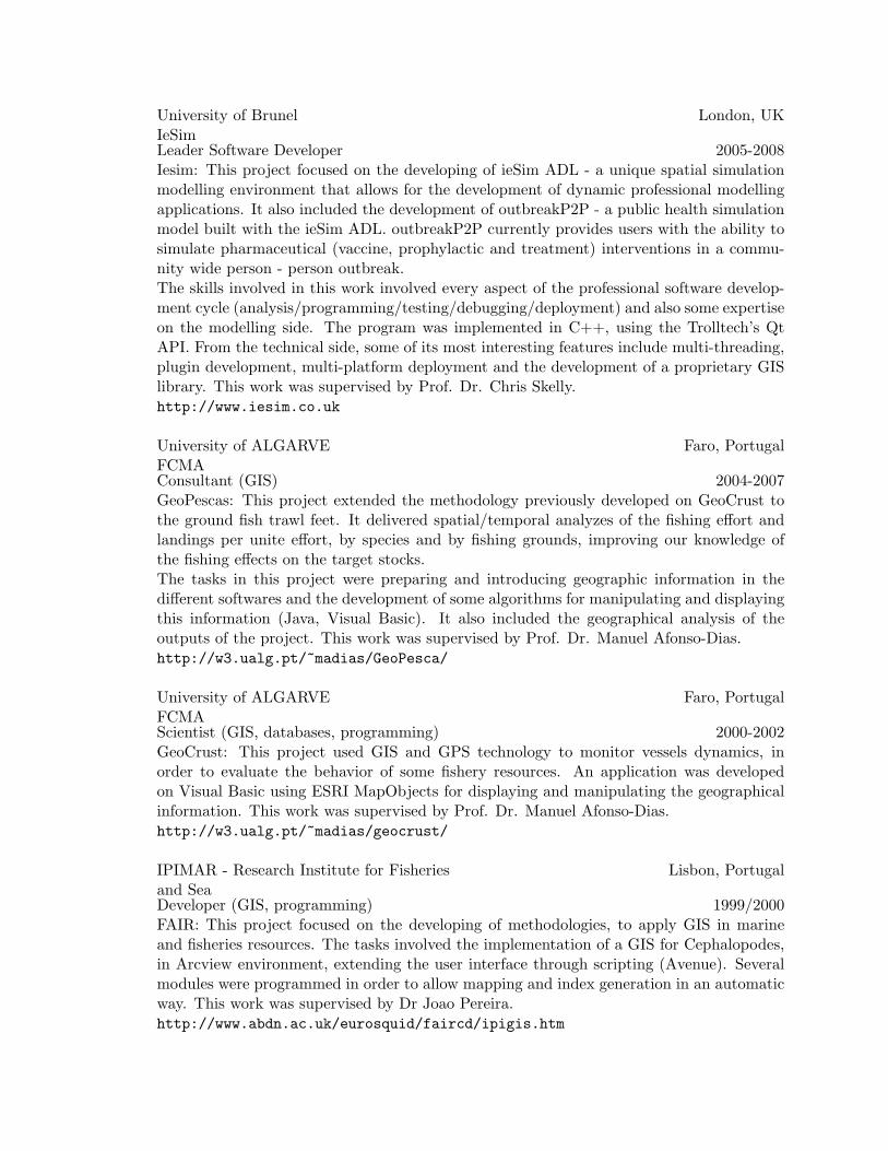
University of BrunelIeSim
London, UK
Leader Software Developer 2005-2008Iesim: This project focused on the developing of ieSim ADL - a unique spatial simulationmodelling environment that allows for the development of dynamic professional modellingapplications. It also included the development of outbreakP2P - a public health simulationmodel built with the ieSim ADL. outbreakP2P currently provides users with the ability tosimulate pharmaceutical (vaccine, prophylactic and treatment) interventions in a commu-nity wide person - person outbreak.The skills involved in this work involved every aspect of the professional software develop-ment cycle (analysis/programming/testing/debugging/deployment) and also some expertiseon the modelling side. The program was implemented in C++, using the Trolltech’s QtAPI. From the technical side, some of its most interesting features include multi-threading,plugin development, multi-platform deployment and the development of a proprietary GISlibrary. This work was supervised by Prof. Dr. Chris Skelly.http://www.iesim.co.uk
University of ALGARVEFCMA
Faro, Portugal
Consultant (GIS) 2004-2007GeoPescas: This project extended the methodology previously developed on GeoCrust tothe ground fish trawl feet. It delivered spatial/temporal analyzes of the fishing effort andlandings per unite effort, by species and by fishing grounds, improving our knowledge ofthe fishing effects on the target stocks.The tasks in this project were preparing and introducing geographic information in thedifferent softwares and the development of some algorithms for manipulating and displayingthis information (Java, Visual Basic). It also included the geographical analysis of theoutputs of the project. This work was supervised by Prof. Dr. Manuel Afonso-Dias.http://w3.ualg.pt/~madias/GeoPesca/
University of ALGARVEFCMA
Faro, Portugal
Scientist (GIS, databases, programming) 2000-2002GeoCrust: This project used GIS and GPS technology to monitor vessels dynamics, inorder to evaluate the behavior of some fishery resources. An application was developedon Visual Basic using ESRI MapObjects for displaying and manipulating the geographicalinformation. This work was supervised by Prof. Dr. Manuel Afonso-Dias.http://w3.ualg.pt/~madias/geocrust/
IPIMAR - Research Institute for Fisheriesand Sea
Lisbon, Portugal
Developer (GIS, programming) 1999/2000FAIR: This project focused on the developing of methodologies, to apply GIS in marineand fisheries resources. The tasks involved the implementation of a GIS for Cephalopodes,in Arcview environment, extending the user interface through scripting (Avenue). Severalmodules were programmed in order to allow mapping and index generation in an automaticway. This work was supervised by Dr Joao Pereira.http://www.abdn.ac.uk/eurosquid/faircd/ipigis.htm

COBA - Engineering and EnvironmentalConsultants
Lisbon, Portugal
GIS Analyst/Technician 1999This work consisted in analyzing Aerial photomaps and use GIS to count and evaluate oliveproperties.http://www.coba.pt/grupo.asp
INAG - Water Institute Lisbon, PortugalResearch Assistant 1996/1997The MSc project in Hydraulics and Water Resources was integrated on the research project:Conception and implementing of a warning flood system in real time, in Trancao Watershed.http://www.civil.ist.utl.pt/~jh/ficha4.html
CEG - Center for Geographical Studies Lisbon, PortugalResearch Assistant 1995/1996MAREN: Evaluation methodologies of the National Ecological Areas (REN). The tasksin this project consisted on acquiring and correcting information in GIS and developing adatabase-like software in Visual Basic, that stores the data from the interviews and generatesreports.http://www.ceg.ul.pt/areas/maren.html
TeachingUniversity of Algarve, FCMA Faro, PortugalInstructor 17-21 September, 2007Introduction to Geographical Information Systems. 40 hours course that corresponds to 1,5ECTS. The course is integrated in the Geopescas project as an initiative to promote theknoweledge of GIS amongst interested scientists and professionals from biology/fisheries.
CEPPA/ISPU Maputo, MozambiqueLecturer 2 May-9 June, 2007Lecturing of a GIS module in the MSc in Conservation and Avaliation of Fisheries Resources(24 hours).
UCL, Geography Dept. London, UKTutor 2004/2005Tutor of second year geography undergraduate students.
UCL, Geography Dept. London, UKDemonstrator Winter 2005GEOG3010: Earth Observation. Professor Paul Saichs. Undergraduate Course.
UCL, Geography Dept. London, UKDemonstrator Autumn 2005GEOG2021: Environmental Remote Sensing. Professor Paul Lewis. Undergraduate Course.
UCL, Geography Dept. London, UK
Demonstrator Winter 2003GEOG3010: Data Acquisition and Interpretation. Undergraduate Course.
UCL, Geomatic Engineering Dept. London, UKDemonstrator Autumn 2002, Autumn 2003Virtual Campus. MSc in GIS and MSc in Remote Sensing.
IST, Civil Engineering Dept. Lisbon, PortugalDemonstrator 1998Hydraulics laboratory classes. Undergraduate Course.
Afilliation• Researcher-member of e-GEO, Centre for Studies of Geography and Regional Plan-
ning, UN-L, on the research field: Methodology and Technology of Geographic Infor-mation (since January, 2004).http://egeo.fcsh.unl.pt/uk/00332.asp
• Honorary researcher at Centre for Advanced Spatial Analysis (CASA) (since 2007).http://www.casa.ucl.ac.uk
Awards• Young Researcher Award (Scholarship), FCT, Portugal, Summer 1996.
• PhD Award (Scholarship), FCT, Portugal, 2002-2006.
• ESRC Award (PhD fees only), UK, 2002-2006.
Honors• C. Pinto, J. Simoes and M. AfonsoDias. Award for the best Poster/PC Demo pre-
sentation given to GeoCrust software demonstration in the Third International Sym-posium on GIS Spatial Analyses in Fishery and Aquatic Sciences, Xangai, China,August, 2005. http://www.esl.co.jp/Sympo/3rd/
Skills• Languages: Portuguese (native), fluent english (written and spoken), working experi-
ence with Spanish. Basic understanding of french.
• Programming Languages: Strong experience with C++, both in Windows and Linuxenvironments (MS Visual Studio and g++). Good knowledge of the Trolltech Qt API,including user interface development, multithreading and develeloping of libraries andplugins. Knowledge of C.
• Scripting Languages: BASH shell scripting, LATEX.
• Operating Systems: Good knowledge of Linux and Windows, both as user and pro-grammer.
• Web: Basic knowledge of Apache, PHP and DHTML.
• GIS: Good experience as a user, a developer and also as a trainer. Working knowledgeof ArcGis, MapObjects, QGIS, GRASS and Shapelib.

• Databases: Oracle (client side) and MySQL.
• Miscellaneous: Strong verbal and written communication skills, excellent troubleshooting and debugging skills.
Working PapersJ. Simoes. Simulating Vaccination Strategies in Proceedings of the 14th European Collo-quium on Theoretical and Quantitative Geography, 2005.
J. Simoes. A Complex Systems Approach to Spatial Epidemics in Proceedings of SMOCS -Conference on Stochastic Modelling of Complex Systems, 2005.
J. Simoes. Modelling the Spreading of Infectious Diseases using Mobility Networks in Pro-ceedings of CUPUM - the Ninth International Conference on Computers in Urban Planningand Urban Management, 2005.
J. Simoes. Spatial Epidemic Modelling in Social Networks in AIP ( American Institute ofPhysics) CNET2004 Conference Proceedings 776, ISBN: 0-7354-0262-0, 2005.
J. Simoes, C. Pinto, M. Afonso-Dias. Methodology for Monitoring and Management ofthe Crustacean Trawl Fleet. Example of GeoCrust 1.0 GIS in Finisterra special editionCartography and Geographic Information Systems, 2005.
M. Afonso-Dias, J. Simoes and C. Pinto A dedicated GIS to estimate and map fishing effortand landings for the Portuguese crustacean trawl fleet. GIS/Spatial Analyses in Fishery andAquatic Sciences (Vol. 2). Fishery-Aquatic GIS Research Group, Saitama, Japan, 2004.
J. Simoes. Agent Based Modeling: Application to Spatial Epidemiology in Proceedings ofthe 33rd Annual Conference of the Regional Science International Association, 2003.
J. Simoes, J. Reis Hipolito. Modcheias, a Hidrological Model for the Definition of FloodedAreas in Proceedings of the II Congresso Iberico sobre Gestion y Planificacion del Agua,2002.
J. Simoes. Flood distributed Modeling using Raster Support in Proceedings of SistemasInformaticos na Gestao de Recursos Territoriais e Naturais, 1998.
Submitted PapersJ. Simoes. Epidemic Modelling using vector format in Proceedings of the V Congresso daGeografia Portuguesa. Submitted: November,2004.
J. Simoes. Agent Based Modelling in Proceedings of the Workshop Jornadas E-Geo 2004.Submitted: May,2004.
Scientific SoftwareJ. Simoes. and C. Skelly. outbreakP2P. Public health simulation model built with the ieSimADE. outbreakP2P currently provides users with the ability to simulate pharmaceutical
(vaccine, prophylactic and treatment) interventions in a community wide person - personoutbreak.
J. Simoes. and C. Skelly. Iesim ADL. Spatial simulation modelling environment that al-lows for the development of dynamic professional modelling applications. This softwarewas developed in C++in both, Windows and Linux plattforms and was supported by thedevelopment of a GIS library.
J. Simoes. SPEMOD. Software written in C++that implements an agent-based model formodelling spatially an epidemic outbreak. All GIS algorithms were implemented natively.
J. Simoes and C. Pinto, M. Afonso-Dias. GEOCRUST. GIS-like software, to estimate and mapfishing effort and catch rates for the Portuguese crustacean trawl fleet. It was programmedin Visual Basic, with ESRI MapObjects.
J. Simoes, J. Reis Hipolito. MODCHEIAS. Distributed flood model, developed in Visual Basic,with ESRI MapObjects.
J. Simoes. IPIMAR Cephalopod GIS. Arcview based GIS, developed in Avenue. It allowsthe automatic generation of maps and indexes, concerning marine and fisheries resources.
J. Simoes. MAREN. Database-like program, designed to insert data from the interviews col-lected during this project and generate reports. The software was programmed in VisualBasic.
Invited TalksJ. Simoes. Spatial Epidemic Modelling: an Application of GIS and Complexity Theory.Seminar: ”Complexity in Geography”, integrated on the MSc in Geographical InformationSystems and Territorial Modelling Applied to Regional Planning, FLUL, Lisbon, Portugal,15th December, 2007.
J. Simoes. EpiSIM: Spatial Epidemic Modelling based in Agents and GIS. First Conferenceof Health and Geographic Information Technologies, organized by e-GEO (FCSH-UNL) andGeoPoint, Lisbon, Portugal, June, 2007.
J. Simoes. Capturing the Dynamics of Spatial Epidemics using a Agent Based Approach.Alergic ( Artificial Life Reading Group), University of Sussex, Brighton, UK, February,2005.
J. Simoes. Agent Based Modelling. Workshop Jornadas EGeo 2004, FCSH, Lisbon, Portu-gal, October, 2004.
J. Simoes. An artificial life approach to spatial epidemics. Alergic ( Artificial Life ReadingGroup), University of Sussex, Brighton, UK, April, 2004.
J. Simoes. Distributed Flood Modelling using Raster Support. IV Jornadas de Geografia ePlaneamento, University of Minho, November, 2002.
PresentationsC. Pinto, J. Simoes & M. Afonso-Dias.GeoPescas - a website for the dissemination of georef-erenced information from the Portuguese crustacean trawl fishery. ICES C.M. 2006/N:20,2006.
M. Afonso-Dias, C. PINTO & J. Simoes. GeoCrust 2.0 - a computer application for mon-itoring the Portuguese Crustacean Trawl fishery using VMS, landings and logbooks data.ICES C.M. 2006/N:19, 2006.
J. Simoes. Modelling a Mumps Outbreak through Spatially Explicit Agents. Potentials ofComplexity Science for Business, Governments, and the Media 2006, Collegium Budapest,Hungary, August, 2006.
J. Simoes. Modelling the Spreading of Infectious Diseases using Mobility Networks. CUPUM2005 - the Ninth International Conference on Computers in Urban Planning and UrbanManagement, UCL, London, UK, July, 2005.
J. Simoes. A Complex Systems Approach to Spatial Epidemics. SMOCS 2005 - Conferenceon Stochastic Modelling of Complex Systems, Queensland, Australia, July, 2005.
J. Simoes. A Complexity Approach to Spatial Epidemics. CASA third-year report seminar,CASA, London, UK, January, 2005.
J. Simoes. Epidemic Modelling using vector format. V Congresso da Geografia Portuguesa,University of Minho, Guimares, Portugal, October, 2004.
J. Simoes. Epidemic Modelling on Social Mobility Networks. CNET2004, Science of Com-plex Networks: from biology to the Internet and WWW, University of Aveiro, Aveiro,Portugal, August-September, 2004.
J. Simoes. Using CA and GIS to model the Propagation of Infectious Diseases. CASAupgrade MPhil/PhD seminar, CASA, London, UK, November, 2003.
J. Simoes. Agent Based Modeling: Application to Spatial Epidemiology. 33rd Annual Confer-ence of the Regional Science International Association London, University of Saint Andrews,Scotland, UK, August, 2003.
J. Simoes. Using GIS and CA to model the propagation of infectious diseases. First-yearprogress presentation on CASA research colloquia, CASA, London, UK, March, 2003.
J. Simoes, J. Reis Hipolito. Modcheias, a hydrological model for the definition of flooded ar-eas. II Congresso Iberico sobre Gestion y Planificacion del Agua, Sevilla, Spain, November,2002.
J. Simoes, M. Afonso-Dias, C. Pinto. A MapObjects application, using GPS data, forfisheries management. 16th ESRI EMEA user conference, Lisbon, October, 2001.
M. Afonso-Dias, C. Pinto, J. Simoes. Spatial Distribution of the Portuguese crustacean trawl

fleet fishing effort in 1998-1999. Life Histories, Assessment and Management of CrustaceanFisheries, La Coruna, Spain, October, 2001.
J. Simoes. and C. Paulo. MODCHEIAS and Geographical Information Systems - Real TimeFlood Forecast. Climate and Environmental Change, University of Evora, Evora, Portugal,August, 2001.
J. Simoes. Flood distributed modelling using raster support. Sistemas Informaticos naGestao de Recursos Territoriais e Naturais. Castelo Branco, Portugal, July, 1998.
A. Ramos-Pereira, M. Laranjeira, J. Simoes, G. Mota. Evaluation methodologies of RENon PDM. Planeamento do Territorio e Politicas de Gestao das Cidades. Braga, Portugal,April, 1996.
Other ActivitiesAttendance to the ”Trolltech Developer Days”, in 2006 and 2007, in Munich.
Refereeing for Environmental and Planning B: Planning and Design and for the specialissue of Computer, Environment and Urban Systems, on the topic of Simulation in SpatialAnalysis and Modeling (GeoComputation2005).
Review of the book M. Neteler and H. Mitasova (2003), Open Source GIS - A GRASS GISApproach. Environmental and Planning B: Planning and Design, vol 31, Issue 3, 2004.
Workshop on Artificial Life: Rule 110. Bielefield, Germany, March, 2004.
Demonstration (with C. Pinto and M. Afonso-Dias) of the final software developed onGeoCrust project. Second International Symposium on GIS/Spatial Analyzes in Fisheryand Aquatic Sciences, Brighton, UK, September 2002.
Demonstrations (with C. Pinto and M. Afonso-Dias) of the software developed withinGeoCrust project:
• General Fisheries Inspection (IGP), Lisbon, Portugal, April, 2002.
• DGPA, Lisbon, Portugal, February, 2002.
• Regional Department for Fisheries (DRP), Funchal, Madeira, Portugal, February,2002.
• Institute for Fisheries and Sea (IPIMAR), Lisbon, Portugal, December, 2001.
• Whale Factory, Horta, Azores, Portugal, November, 2001.
ESA Summer School: Satellite Navigation Systems for Science and Application. Alpbach,July, 2001.
Presentation of the MapObjects based software, developed in the GeoCrust project. GISDay event, University of Minho, Guimaraes, Portugal, November, 2000.
Presentation of the Cephalopodes GIS. Meeting of the FAIR project, Aberdeen, Scotland,

UK, February, 2000.
Other InterestsScuba Diving certification, Portugal, 2002.
Lifeguard Certification, Portugal, 1994.
Course: Introduction to Drawing I and II, on the Fine Arts Society, Lisbon, Portugal,1992-1993.

Appendix: Screenshots

Figure 1: INTERVENE, 2007;
Figure 2: SPEMOD, 2005;
Figure 3: GEOCRUST, 2002
RCSfile: cv-us.tex,v Date: 2008/01/2 19:34:00 Revision: 2.0

Figure 4: MODCHEIAS, 2002
Figure 5: IPIMAR Cephalopod GIS, 2000