Jerker Tamelander - Mainstreaming CC in IW Projects Presentation

facebook.com/statistiskacentralbyranscb
@SCB_nyheter statistiska_centralbyran_scb www.linkedin.com/company/scb
Building and maintaining a point-
based georeference framework for
statistics –
preliminary conclusions from the GEOSTAT 2 project
Jerker Moström
Statistics Sweden

© NASA Earth Observatory (Landsat 8 - OLI)
”Västmanland wildfire” -On July 31-September 11 (2014) -National emergency declared -15 000 hectares destroyed - 1 death - Worst wildfire since 1950s

10 km
20 k
m
Municipality 1
Municipality 4
Municipality 3
Municipality 2

This story is about need for:
High resolution data
Up-to-date information
Data decoupled from administrative geographies
Urgent response

Challenge for NSIs to:
Increase ability to link data to accurate and high
precision spatial location (point-based foundation)
Step-up use of administrative data to increase
ability to enhance temporal resolution
Create flexible production settings to provide a rich
variety of statistical outputs (spatially and
thematically) at low costs and with short production
time.

The GEOSTAT 2 project:
Propose a model for a point-based geospatial
reference framework based on address, buildings
and dwelling registers
A priority of the proposed setup has been the ESS
vision of a fully geocoded population census 2021
The model could be considered suitable for
statistics in the widest possible sense

A point-based foundation?
Id, Pop A, 1 B, 1 C, 1
Id, X, Y A, 1, 3 B, 2, 2 C, 3, 1
Id, Pop A, 1 A, 1 A, 1
Id, Region A, Block A
3
1
1
1
Unit record data Unit record data
Location data Location data
Point-based Area-based VS
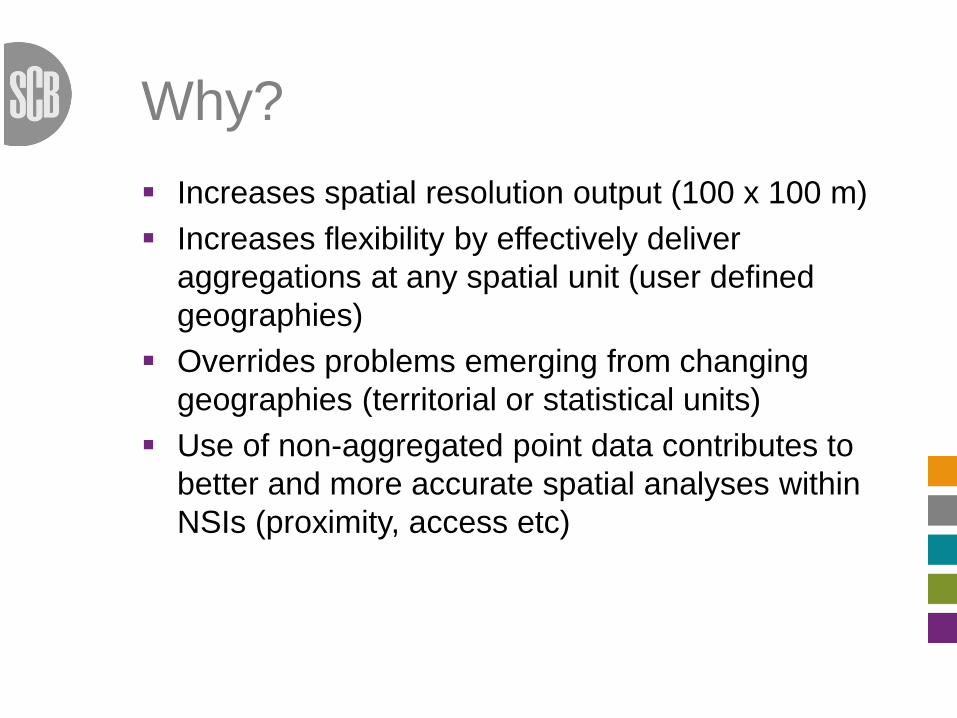
Why?
Increases spatial resolution output (100 x 100 m)
Increases flexibility by effectively deliver
aggregations at any spatial unit (user defined
geographies)
Overrides problems emerging from changing
geographies (territorial or statistical units)
Use of non-aggregated point data contributes to
better and more accurate spatial analyses within
NSIs (proximity, access etc)

Generic characteristics
Use of high quality point-based location data with
time stamps (address, building/dwelling or
cadastral parcel)
Geocoding of statistical information at unit record
level
Use of standardized identifiers/geocodes to
connect statistical information with location data

Three main approaches
”In-house”
”Hybrid”
”Data broker”

Provide recommendations on:
Identifying users and their needs
Recognising geospatial data sources
Assessing geospatial data sources
Assessing data processing capacity
Building georeferenced survey frame
Geospatial data maintenance
Constrains on data dissemination
Creation of geospatially referenced statistical
products

GSBPM
Goal to mainstream geospatial data management
by means of the Generic Statistical Business
Process Model (GSBPM)
National excercises resulting in:
Proposed improvement of the GSBPM (UNECE)
Guidance as to how the GSBPM can be used to
improve internal producton processes
Rina Tammisto, Statistics Finland will talk more
about this later!

What about the Global Statistical-
Geospatial Framework?
GEOSTAT 3
”Internal” NSI
scope
Broader scope
NSIs and NMCAs
etc
GEOSTAT 2

Thank you!
On behalf of the GEOSTAT 2 project consortium:
Marie Haldorson, Jerker Moström & Karin
Hedeklint (Sweden)
Erik Engelien/Ola Nordbeck (Norway)
Rina Tammisto (Finland)
Vincent Loonis (France)
Ingrid Kaminger (Austria)
Amelia Wardzińska-Sharif (Poland)
Ana Santos (Portugal)

For more information and
forthcoming results. Please visit:
www.efgs.info/geostat/geostat2/