
Jackson County - Oregon · Jackson County 87-2-CPA 006-87A 5/13/1988 Adopted Desc. Amend the...
129
Following are pages that show all plan amendments adopted by the county and the cities in the county and submitted to DLCD since January of 1987. The list shows the county amendments first and then the cities alphabetically. Within a jurisdiction the amendments are sorted by adoption date with the older ones first. Page numbering returns to page 1 with each city. For each amendment the first line includes the name of the jurisdiction, local file number, DLCD file number, local adoption date and any LUBA case number for those amendments that were appealed to LUBA. We have not provided information on LUBA decisions, but provide the case number to indicate that the amendment was appealed. Below the amendment identification information are descriptions labeled "Proposed Desc." and "Adopted Desc." The Proposed Description is a more complete description of the amendment as it was proposed amendment and submitted to DLCD . This is the description that accompanied DLCD's Proposed Notice of Amendments. The adopted amendment description is a more limited description or is missing. Both descriptions are provided because not all amendments went through the department's proposed amendment process and to note changes to a proposed amendment prior to adoption. Fonts are not consistent in the document. These are an artifact of the input process and do not affect the data content. No doubt you will discover some errors in this database. The data has been converted from one database program to another and includes more than 12,000 records in both the proposed and adopted plan amendment databases. The department provides this general information to assist local governments and others in determining when local land use changes were made. It is our best effort at identifying adopted amendments but should always be verified with the appropriate local government before proceeding. Please let your regional representative know if we can be of any additional assistance with respect to this data. Jackson County Page Number : 1
Transcript of Jackson County - Oregon · Jackson County 87-2-CPA 006-87A 5/13/1988 Adopted Desc. Amend the...

Following are pages that show all plan amendments adopted by the county and the cities in the county and submitted to DLCD since January of 1987. The list shows the county amendments first and then the cities alphabetically. Within a jurisdiction the amendments are sorted by adoption date with the older ones first. Page numbering returns to page 1 with each city.
For each amendment the first line includes the name of the jurisdiction, local file number, DLCD file number, local adoption date and any LUBA case number for those amendments that were appealed to LUBA. We have not provided information on LUBA decisions, but provide the case number to indicate that the amendment was appealed.
Below the amendment identification information are descriptions labeled "Proposed Desc." and "Adopted Desc." The Proposed Description is a more complete description of the amendment as it was proposed amendment and submitted to DLCD . This is the description that accompanied DLCD's Proposed Notice of Amendments. The adopted amendment description is a more limited description or is missing. Both descriptions are provided because not all amendments went through the department's proposed amendment process and to note changes to a proposed amendment prior to adoption.
Fonts are not consistent in the document. These are an artifact of the input process and do not affect the data content. No doubt you will discover some errors in this database. The data has been converted from one database program to another and includes more than 12,000 records in both theproposed and adopted plan amendment databases.
The department provides this general information to assist local governments and others in determining when local land use changes were made. Itis our best effort at identifying adopted amendments but should always be verified with the appropriate local government before proceeding.
Please let your regional representative know if we can be of any additional assistance with respect to this data.
Jackson County
Page Number : 1

LUBA #Adoption DateLocal File # DLCD File #Jackson County86-7-OA 001-87AJackson County 4/22/1987
AMEND TO EXEMPT ACQUISITIONS OF LAND BY A PUBLIC AGENCY FOR PUBLIC PURPOSES FROM PARTITIONING REQUIREMENTS WHERE THE ACQUISITION DOES NOT RESULT IN ADDITIONAL PARCELS IN PRIVATE OWNERSHIP.
Adopted Desc.
Amend the land development ordinance to exempt acquisitions of land by a public agency for public purposes from partitioning requirements which the acquisition does not result in the creation of additional parcels in private ownership.
Proposed Desc.
87-7-OA 010-87BJackson County 12/23/1987
ESTABLISH A LIMITED USE (LU) ZONE DESIGNATION.Adopted Desc.
Amend the comprehensive plan and zoning to establish a Limited Use plan and zoning designation to apply to reasons exception areas.
Proposed Desc.
87-11-CPA 008-87BJackson County 12/24/1987
Adopted Desc.
Amend the comprehensive plan and zoning from Rural Residential (RR-5) to General Industrial (GI) for approx. 1.09 acre located at 8147 Blackwell Road.
Proposed Desc.
001-88AJackson County 3/2/1988
AMENDS PLAN AND LAND DEVELOPMENT CODE TO REFLECT CHANGES MADE BY THE 1987 LEGISLATURE RELATIVE TO DESTINATION RESORTS
Adopted Desc.
Revise destination resort requirements to comply with 1987 statutory changes.Proposed Desc.
86-3-CPA 002-87AJackson County 4/4/1988
EXCEPTION TO GOALS 3, 11, AND 14.Adopted Desc.
Amend the comprehensive plan and zoning from Exclusive Farm Use (EFU) to General Commercial for approximately 19.3 acres located on South Pacific Highway 99 between Medford and Phoenix. The applicant proposes relocation of a farm equipment sales and service dealership to the site. An exception to the requirements of Goals 3, 11, and 14 is proposed. See <pa> pa.tracksheets.3 for more information.
Proposed Desc.
Page Number : 1

LUBA #Adoption DateLocal File # DLCD File #Jackson County87-13-CPA 011-87BJackson County 4/18/1988
INCLUDES AN EXCEPTION.Adopted Desc.
Amend the comprehensive plan and zoning from Exclusive Farm Use (EFU) to Rural Limited Industrial (RLI) for approxi. 4.1 acres located approximately 2 1/2 miles by from Dead Indian Road.
Proposed Desc.
87-2-CPA 006-87AJackson County 5/13/1988
Adopted Desc.
Amend the comprehensive plan and zoning from Forest Resource (FR-160) to Woodland Resource (WR) for approximately210 acres located west of Meadows Road and Sweet Lane in the Sams Valley area.
Proposed Desc.
87-15-CPA 004-88Jackson County 6/29/1988
Adopted Desc.
Amend the comprehensive plan from Urban Residential to Urban Residential (UR-4.5) and zoning from Suburban Residential (SR-1) to Urban Residential (UR-4.5) for approximately 1.7 acres located on Avenue "G", between 28th and 26th Streets within White City.
Proposed Desc.
87-14-CPA 006-88Jackson County 11/30/1988
Adopted Desc.
Amend the comprehensive plan from Agricultural Lands to Forest and zoning from EFU (Exclusive Farm Use) to OSR (Open Space Reserve) for 38.5 acres located south of Greensprings Highway, approximately 1/2 mile west of Buckhorn Springs Road.
Proposed Desc.
88-1-UBGA 007-88Jackson County 12/15/1988
42.6 ACRES RRES TO RRES.Adopted Desc.
SEE PATRACKSHEET FOR MORE INFORMATION.Proposed Desc.
Page Number : 2

LUBA #Adoption DateLocal File # DLCD File #Jackson County87-3-OA 005-88Jackson County 12/15/1988
CLARIFY LANGUAGE AND POLICIES IN THE LAND DEVELOPMENT CODE.Adopted Desc.
Amend the Land Development Ordinance to clarify language and policies, streamline and shorten procedures and make general housekeeping amendments.
Proposed Desc.
87-13-CPA 011-87BJackson County 2/15/1989
Adopted Desc.
Amend the comprehensive plan and zoning from Exclusive Farm Use (EFU) to Rural Limited Industrial (RLI) for approxi. 4.1 acres located approximately 2 1/2 miles by from Dead Indian Road.
Proposed Desc.
89015
87-12-CPA 011-88Jackson County 3/16/1989
FROM SUBURBAN RESIDENTIAL (SR-2.5) TO LIMITED USE (LU)Adopted Desc.
Amend the comprehensive plan and zoning from SR-2.5 (Suburban Residential) to LU (Limited Use) for 10.39 acres located at 46611 Highway 62, north of the intersection with First Street, near Prospect.
Proposed Desc.
88-10-CPA 013-88Jackson County 5/19/1989
SUBURBAN RESIDENTIAL (SR-2.5) TO RURAL SERVICE COMMERCIAL (RS). INCLUDES AN EXCEPTION.
Adopted Desc.
Amend the comprehensive plan and zoning from SR-2.5 (Suburban Residential) to RS (Rural Service Commercial) for 0.44acre located 300' west of the intersection of Savage Creek Road and Highway 99. The proposal includes an exception.
Proposed Desc.
88-11 CPA 001-89Jackson County 7/12/1989
FROM EXCLUSIVE FARM USE (EFU) TO OPEN SPACE RESERVE (OSR).Adopted Desc.
Amend the comprehensive plan and zoning from EFU (Exclusive Farm Use) to OSR (Open Space Reserve) for 71.24 acres located at 4000 East Antelope Road, abouth 2 1/2 miles south of its intersection with Dry Creek Road, Eagle Point.
Proposed Desc.
Page Number : 3

LUBA #Adoption DateLocal File # DLCD File #Jackson County87-8-CPA 012-87B'Jackson County 8/2/1989
FROM EXCLUSIVE FARM USE TO DESTINATION RESORT.Adopted Desc.
NOTE: This is a reproposal and remand hearing on four issues for Clear Springs Destination Resort.Proposed Desc.
89111
89-1-CPA 002-89Jackson County 8/2/1989
INCLUDES AN EXCEPTION TO GOAL 2. FROM EXCLUSIVE FARM USE TO FARM RESIDENTIAL.Adopted Desc.
Amend the comprehensive plan and zoning from EFU (Exclusive Farm Use) to F-5 (Farm Residential) for 1.5 acres located at the intersection of Kubli and North Applegate Roads, one- half mile east of the Josephine-Jackson County line. This proposal includes an exception.
Proposed Desc.
88-9-CPA 014-88Jackson County 10/16/1989
Adopted Desc.
Amend the comprehensive plan and zoning from EFU (Exclusive Farm Use) to OSR (Open Space Reserve) for 322.42 acreslocated east of Foothill Road and south of North Roxy Drive.
Proposed Desc.
88-4-CPA 003-89Jackson County 1/24/1990
Adopted Desc.
Amend the comprehensive plan and zoning from Woodland Resource to Open Space Reserve for 21.6 acres located at 2075 Upper Applegate Road, Jacksonville.
Proposed Desc.
89-5-CPA 006-89Jackson County 5/21/1990
Adopted Desc.
Amend the comprehensive plan and zoning from SR-2.5 (Surburan Residential) to GC (General Commercial) for 0.53 acre located at 2327 Charles Lane and west of Lozier Lane, Medford.
Proposed Desc.
Page Number : 4

LUBA #Adoption DateLocal File # DLCD File #Jackson County89-4-CPA 007-89Jackson County 7/3/1990
INCLUDES AN EXCEPTION.Adopted Desc.
Amend the comprehensive plan and zoning from SR-1 (Suburban Residential) to LU (Limited Use) for 0.73 acre located at 8206 East Evans Creek Road, Wimer. The proposal includes an exception. NOTE: This is a revised proposal and was submitted without text.
Proposed Desc.
CP 90-2 005-90Jackson County 10/24/1990
From RCOM to UCOM 305 acres and RIND to UIND for 169 acres.Adopted Desc.
Amend the comprehensive plan to expand the urban growth boundary to accommodate growth to the year 2010.Proposed Desc.
90-11DA 009-90Jackson County 12/12/1990
Adopted Desc.
Amend the zoning ordinance make changes in the National Flood Insurance Program mandated by FEMA (Federal Emergency Management Agency).
Proposed Desc.
90-6-OA 006-90Jackson County 12/26/1990
Adopted Desc.
Amend the Land Development Ordinance to allow a master plan approved by both the Parks and Planning Commissions and adopted by the Board of County Commissioners to regulate the phasing and the development of parks.
Proposed Desc.
90-11DA 009-90Jackson County 12/26/1990
Adopted Desc.
Amend the zoning ordinance make changes in the National Flood Insurance Program mandated by FEMA (Federal Emergency Management Agency).
Proposed Desc.
Page Number : 5

LUBA #Adoption DateLocal File # DLCD File #Jackson County89-3 CPA 008-89Jackson County 12/26/1990
Adopted Desc.
Amend the comprehensive plan and zoning from WR (Woodland Resource) to OSR (Open Space Reserve) for 68.12 acres located at 7933 Highway 238, Jacksonville.
Proposed Desc.
87-11-CPA 008-87BJackson County 12/26/1990
Adopted Desc.
Amend the comprehensive plan and zoning from Rural Residential (RR-5) to General Industrial (GI) for approx. 1.09 acre located at 8147 Blackwell Road.
Proposed Desc.
Goal 5 009-88Jackson County 1/2/1991
Adopted Desc.
REVISED HEARING DATE: 5-23-90Proposed Desc.
PZ 90-11 002-90Jackson County 2/6/1991
Other is Open Space Reserve (OSR).Adopted Desc.
Amend the comprehensive plan from Industrial to Commercial and zoning from M-2 (Heavy Industrial) to C (General Commercial) and TC (Tourist Commercial) zone for 101 acres located in and around the Clackamette Lake, adjacent to I-205/Highway 213.
Proposed Desc.
90-13 OA 012-90Jackson County 5/29/1991
Adopted Desc.
Amend the zoning ordinance to clarify minor and major home occupations.Proposed Desc.
Page Number : 6

LUBA #Adoption DateLocal File # DLCD File #Jackson County90-14 OA 011-90Jackson County 5/29/1991
Adopted Desc.
Amend the Land Development Ordinance relating to lot or parcel line adjustments.Proposed Desc.
91-4-OA 003-91Jackson County 6/17/1991
Adopted Desc.
Amend the comprehensive plan by correcting mapping criteria to allow the property around the Medford-Jackson County Airport and in the Central Point Urban Growth Boundary as designated Airport Development-Mixed Use (AD-MU) zone.
Proposed Desc.
90-15 001-91Jackson County 8/21/1991
Adopted Desc.
Amend zoning ordinance to exempt the adoption of a Jackson County Public Park overlay zone from the provisions of Chapter 277.
Proposed Desc.
90-15 001-91Jackson County 8/21/1991
Adopted Desc.
Amend zoning ordinance to exempt the adoption of a Jackson County Public Park overlay zone from the provisions of Chapter 277.
Proposed Desc.
91-7-OA 008-91Jackson County 8/21/1991
Adopted Desc.
Amend the Land Development Ordinance to correct a reference error.Proposed Desc.
Page Number : 7

LUBA #Adoption DateLocal File # DLCD File #Jackson County90-12-OA 010-90Jackson County 8/21/1991
Adopted Desc.
Amend the zoning ordinance to allow batch plants as a conditional use and differentiate between aggregate and mineral extraction.
Proposed Desc.
90-2-CPA 004-91Jackson County 11/26/1991
Adopted Desc.
Amend the zoning from EFU (Exclusive Farm Use) to Open Space Reserve for approximately 115 acres located along Antelope Road, seven miles northeast of Medford.
Proposed Desc.
90-6 CPA 006-91Jackson County 3/17/1992
Adopted Desc.
Amend the comprehensive plan and zoning from EFU (Exclusive Farm Use) to OSR (Open Space Reserve) for 80 acres located north of Highway 238, approximately 4 miles west of Ruch.
Proposed Desc.
91-10-OA 015-91Jackson County 4/22/1992
Adopted Desc.
Amend the zoning ordinance to make changes and delete sections regarding "minor" or "major" home occupations.Proposed Desc.
91-2-CPA 014-91Jackson County 7/1/1992
Adopted Desc.
Amend the comprehensive plan and zoning from F-5 (Farm Residential) to RLI (Rural Limited Industrial) for 3.02 acres located on Frontage Road, south of I-5 at the Rock Point Interchange. The proposal includes an exception to Goal 14.
Proposed Desc.
Page Number : 8

LUBA #Adoption DateLocal File # DLCD File #Jackson County91-8-CPA 010-91BJackson County 7/8/1992
Add site for historic designation list.Adopted Desc.
Amend the comprehensive plan to add an overlay designation to Wagner Creek School and to add it to the Jackson County Register of Historic Landmarks. The property is located on the west side of Wagner Creek Road, approximately three miles south of the City of Talent.
Proposed Desc.
91-7 CPA 011-91Jackson County 7/8/1992
Add site to the historic designation list.Adopted Desc.
Amend the zoning ordinance to add an overlay designation to the Derby School and Gymansium and to add it to the JacksonCounty Register of Historic Landmarks. The 1.80 acres is located on the north side of the Butte Falls Highway, approximately one-half mile east of the junction of Crowfoot and Butte Falls Highway.
Proposed Desc.
88-9-CPA 014-88Jackson County 8/5/1992
EFU to Open Space Reserve.Adopted Desc.
Amend the comprehensive plan and zoning from EFU (Exclusive Farm Use) to OSR (Open Space Reserve) for 322.42 acreslocated east of Foothill Road and south of North Roxy Drive.
Proposed Desc.
92-20-OA 020-92Jackson County 10/21/1992
Major home occupations as a conditional use.Adopted Desc.
Amend the zoning ordinance to delete reference to major home occupations as a conditional use in the EFU district.Proposed Desc.
89-6-CPA 007-91Jackson County 10/27/1992
Adopted Desc.
Amend the comprehensive plan and zoning from OSR (Open Space Reserve) to LU (Limited Use) for 4.99 acres located at the intersection of State Highway 140 and Kershaw Road.
Proposed Desc.
Page Number : 9

LUBA #Adoption DateLocal File # DLCD File #Jackson County90-6 CPA 006-91Jackson County 10/28/1992
EFU to OSRAdopted Desc.
Amend the comprehensive plan and zoning from EFU (Exclusive Farm Use) to OSR (Open Space Reserve) for 80 acres located north of Highway 238, approximately 4 miles west of Ruch.
Proposed Desc.
92-23-OA 022-92Jackson County 1/27/1993
Regarding primary roads and secondary roads.Adopted Desc.
Amend the zoning ordinance to remove restriction limiting access to Whetstone Industrial Park properties and allow access from Kirkland Road or Table Rock Road with approval from the Jackson County Public Work Department and Oregon Department of Transportation.
Proposed Desc.
90-8-CPA 009-91Jackson County 1/27/1993
EFU (Exclusive Farm Use) to WR (Woodland Resource).Adopted Desc.
Amend the comprehensive plan and zoning from EFU (Exclusive Farm Use) to WR (Woodland Resource) for 86 acres located southwest of Gold Ray Road and north of Blackwell Road, approximately 6 miles northwest of the City of Central Point.
Proposed Desc.
92-4-OA 011-92Jackson County 3/11/1993
Adoption of the new Trans. Rule.Adopted Desc.
Amend the zoning ordinance to make amendments regarding definitions; design and development standards; subdivisions; roads, streets and bicycle paths; requirements for dedication; establishment of zoning regulations; supplemental provisions; and site plan review provisions to bring the ordinance into compliance with the Transportation Rule, delete dedicated ways and amend the private road standards. REVISED HEARING DATE
Proposed Desc.
89-8-CPA 003-90Jackson County 3/31/1993
Adopted Desc.
Amend the comprehensive plan and zoning from RR-5 (Rural Residential-5) to SR-2.5 (Suburban Residential-5) for 9 acres located at 3482 Ross Lane, approximately two miles north of Jacksonville.
Proposed Desc.
Page Number : 10

LUBA #Adoption DateLocal File # DLCD File #Jackson County92-25-OA 024-92Jackson County 4/28/1993
Parcel area requirement, FR district to 160 acre minimum lot size.Adopted Desc.
Amend the comprehensive plan and Land Development Ordinance to limit land divisions in Forest Resource District to 160-acre minimum lot sizes, but allow development on smaller legal parcels.
Proposed Desc.
92-24-OA 023-92Jackson County 4/28/1993
Agricultural element.Adopted Desc.
Amend the Agricultural Element of the comprehensive plan to recognize the priority use for farm land shall be for farm use.Proposed Desc.
93-5-OA 004-93Jackson County 6/9/1993
Adopted Desc.
Amend the Land Development Ordinance to expand the Rural Residential (RR-5) District by adding a RR-10 and RR-00 district to prevent the creation of additional parcels and intensification of development in areas with develop- ment constraints.
Proposed Desc.
93-1-OA 002-93Jackson County 6/30/1993
Comply with state law, important farm land as part of periodic review.Adopted Desc.
Amend the zoning ordinance to: (1) implement the IFL (Important Farm Land) zone; (2) make changes to the use standards to comply with state law; and (3) establish a minimum parcel size for divisions in the IFL zone based on median unit sizes for specific uses from US Census data, with 160 acre parcel size the largest minimum size.
Proposed Desc.
93-03-OA 003-93Jackson County 6/30/1993
Comply with state law, Goal 3 and 4 w/uses, as part of periodic review.Adopted Desc.
Amend the zoning ordinance to create the criteria for IFL the (Important Farm Land) zone and to regulate land uses to comply with statewide Goal 3 (Agriculture).
Proposed Desc.
Page Number : 11

LUBA #Adoption DateLocal File # DLCD File #Jackson County92-11-OA 015-92Jackson County 6/30/1993
Comply with Goal 3 as part of periodic review.Adopted Desc.
Amend the comprehensive plan to update the Agricultural Land Element which includes two separate EFU qualifying zones: "Farm Land" is land with commercial agricultural potential, "Other Farm Land" is land with Class IV soils thas has very limited capability for commercial farm use. REVISED HEARING DATE
Proposed Desc.
92-17-OA 007-93Jackson County 6/30/1993
Adopted Desc.
Amend the comprehensive plan to make revisions to the Mineral and Aggregate Resource Element, and Mapping Criteria for the aggregate resource district.
Proposed Desc.
92-4-CPA 021-92Jackson County 8/4/1993
Adopted Desc.
Amend the comprehensive plan and zoning from SR 2.5 (Surburban Residential) to GC (General Commercial) for 3.98 acres located inside the Medford UGB, north of McAndrews Road near its intersection with Ross Lane. This proposal includes an exception to Goal 14.
Proposed Desc.
93-4-OA 005-93Jackson County 8/18/1993
Adopted Desc.
Add an new land use regulation MUO (Medford Urban Overlay) zone to the Jackson County Land Development Ordinance. This proposal will establish a mechanism for encouraging contract annexation and urban development in the urbanizing area.
Proposed Desc.
93-1POD 010-93AJackson County 12/15/1993
Adopted Desc.
Amend the comprehensive plan and zoning to add the JCPP (Jackson County Public Park) overlay zone to 306 acres which allows the adoption of a Master Plan for Givan Park located on Agate Road.
Proposed Desc.
Page Number : 12

LUBA #Adoption DateLocal File # DLCD File #Jackson County92-6-CPA 001-93Jackson County 12/23/1993
Adopted Desc.
Amend the comprehensive plan and zoning from SR-1 (Suburban Residential) to UR-4.5 (Urban Residential) for 7.12 acres located by Avenue G, Avenue F, 28th Street and 29th Street, in the White City urban containment boundary.
Proposed Desc.
92-3 UGBA 016-92Jackson County 4/13/1994
Adopted Desc.
Amend the comprehensive plan to give the City of Rogue River full jurisdiction for all land use actions and issuance of development permits within their 960-acre urban growth boundary and give the city authority over these lands while the county would receive notice of pending actions and have the opportunity to comment and appeal the city's final decision. The county would be responsible for the collection of development fees, while inspections are dual.
Proposed Desc.
92-4-OA 011-92Jackson County 5/4/1994
Adopted Desc.
Amend the zoning ordinance to make amendments regarding definitions; design and development standards; subdivisions; roads, streets and bicycle paths; requirements for dedication; establishment of zoning regulations; supplemental provisions; and site plan review provisions to bring the ordinance into compliance with the Transportation Rule, delete dedicated ways and amend the private road standards. REVISED HEARING DATE
Proposed Desc.
91-1-OA 001-92Jackson County 5/4/1994
Adopted Desc.
Note: See pa long tracking sheet.Proposed Desc.
93-24-OA 006-94Jackson County 6/29/1994
Adopted Desc.
Amend the Rural and Suburban Lands Element of the comprehensive plan.Proposed Desc.
Page Number : 13

LUBA #Adoption DateLocal File # DLCD File #Jackson County91-1 CPA 005-92Jackson County 6/29/1994
Adopted Desc.
Amend the zoning from Jackson County SR-2.5 (Suburban Residential) to GC (General Commercial) for 8.04 acres located on the southeast side of West McAndrews Road, approximately 600 feet east of its intersection with North Ross Land. NOTE: This property in within the urban growth boundary.
Proposed Desc.
94-3 OA 009-94Jackson County 6/29/1994
Adopted Desc.
Amend the zoning ordinance to delete rock concerts and simlar events, add definitions of both temporary and mass gatherings, add, as a conditional use extended mass gatherings to the General Commercial, Light Industrial, General Industrial and Airport Development- Mixed use zoning districts. Remanded from LUBA 6/26/96. Create a new section to comply with LUBA's decision.
Proposed Desc.
93-12,13,14 016-93Jackson County 7/20/1994
Adopted Desc.
Amend the agricultural element of the comprehensive plan and the farm zones to comply with HB 3661.Proposed Desc.
93-18,19,20 015-93Jackson County 7/20/1994
Adopted Desc.
Amend the forest element of the comprehensive plan and the forest zones to comply with HB 3361.Proposed Desc.
93-6-OA 010-93Jackson County 7/22/1994
Adopted Desc.
Amend the Fire Safety Requirements and Guidelines of the zoning ordinance to comply with HB 3661.Proposed Desc.
Page Number : 14

LUBA #Adoption DateLocal File # DLCD File #Jackson County92-2-OA 019-92Jackson County 9/28/1994
Same.Adopted Desc.
Amend the zoning ordinance to provide regulations for the location, construction, alteration, quantity and quality testing of water wells within the unincorporated areas of the county.
Proposed Desc.
87-6-CPA 004-87AJackson County 10/12/1994
Adopted Desc.
Amend the comprehensive plan and zoning from Suburban Residential (SR-2.5) to General Commercial (GC) for approximately 2.5 acres located on the north side of Corey Road, east of Crater Lake Highway 62.
Proposed Desc.
94-12-OA 017-94Jackson County 11/9/1994
Same.Adopted Desc.
Amend the zoning ordinance to clarify agricultural uses, add public works, service or utility to those eligible for parcel area reductions and add fire safety standards adopted July 20, 1994 in the RR-5, RR-10 and RR-00 (Rural Residential) districts.
Proposed Desc.
93-21 OA 001-94BJackson County 12/28/1994
Adopted Desc.
Amend the zoning ordinance to establish criteria for kennels requiring conditional use permits. Also include the definition to be consistent with animal control and USDA. Establishes criteria for kennels requiring conditional use permits.
Proposed Desc.
92-8-CPA 013-93Jackson County 3/29/1995
Adopted Desc.
Amend the comprehensive plan and zoning from SR-1 (Suburban Residential) to LU (Limited Use) for 1.5 acres located at 5953 Table Rock Road in the vicinity of Central Point.
Proposed Desc.
Page Number : 15

LUBA #Adoption DateLocal File # DLCD File #Jackson County94-75 HR 024-94Jackson County 5/3/1995
Adopted Desc.
Amend the comprehensive plan and zoning to apply the SR-2.5 with (area of special concern) overlay to the property knownas the Madden-McCasky House. Add the site to the Jackson County Register of Historic Landmarks.
Proposed Desc.
94-20-OA 020-94Jackson County 5/17/1995
Adopted Desc.
Revise the county development ordinance to add a new chapter establishing mechanisms for contract annexations. This proposal applies the overlay district to all property within the City of Phoenix's urban growth boundary outside city limits.
Proposed Desc.
93-22-OA 008-95Jackson County 6/21/1995
Adopted Desc.
Amend the public facilities element of the comprehensive plan. NOTE: Those portions of the element relating to solid and hazardous waste management are being processed under periodic review and are not part of this notice.
Proposed Desc.
93-2-UBGA 017-93Jackson County 7/26/1995
Adopted Desc.
Amend the City of Shady Cove's urban growth boundary to include 390 acres to allow an 18 hole golf course located between the Rogue River to the east and south, and Rogue River Drive to the west and Long Branch Road to the north. The proposal includes an exception. LUBA APPEAL #'s 95-173, 174, 205, 225.
Proposed Desc.
95-4-OA 016-95Jackson County 8/23/1995
Adopted Desc.
Amend the sign ordinance to regulate the size, location, and construction of signs in order for the county to comply with the recent court decisions.
Proposed Desc.
Page Number : 16

LUBA #Adoption DateLocal File # DLCD File #Jackson County94-21-OA 027-94Jackson County 9/6/1995
Adopted Desc.
Amend the White City Urban Containment Boundary Land Development Ordinance to add a chapter establishing provisions governing relocation of residential dwelling units and street tree planting program.
Proposed Desc.
94-7-CPA 005-95Jackson County 10/18/1995
Adopted Desc.
Amend the comprehensive plan (and zoning) from Urban Residential-8/Suburban Resiential-1 (and UR-8/SR-1) to Urban Residential-6 (and UR-6) on 5.78 acres located on Falcon Avenue, White City. The property is located within the White City Urban Containment Boundary.
Proposed Desc.
93-8-CPA 006-95Jackson County 11/1/1995
Adopted Desc.
Amend the comprehensive plan (and zoning) from Rural Residential (and RR-5) to General Commercial (and GC) on .83 acre located at 1407 Highway 99 North. The property is located within the City of Ashland's UGB.
Proposed Desc.
95-18-OA 025-95Jackson County 11/22/1995
Adopted Desc.
Amend the Land Development Ordinance to provide for one six-month extension of time on manufactured dwelling storage permits.
Proposed Desc.
95-1-CPA 007-95Jackson County 11/29/1995
Adopted Desc.
Amend the comprehensive plan by taking goal exceptions and adopting a new urbanization policy to allow the extension of 12 inch water line from an existing main located inside the urban growth boundary to serve property located on Willow Springs Road.
Proposed Desc.
Page Number : 17

LUBA #Adoption DateLocal File # DLCD File #Jackson County95-12-OA 021-95Jackson County 12/13/1995
Adopted Desc.
Amend the zoning ordinance to comply with HB 2963 regarding certain provisions relating to water rights records.Proposed Desc.
95-18-OA 024-95Jackson County 1/17/1996
Adopted Desc.
Amend the Fire Safety Requirements of the Land Development Ordinance.Proposed Desc.
94-1 HR 001-94AJackson County 2/14/1996
Adopted Desc.
Amend the comprehensive plan to add 20 historic resources to the Jackson County Register of Historic Landmarks located in the Applegate River drainage basin. Apply the ASC (Area of Special Concern) overlay to the subject area.
Proposed Desc.
94-21 HR 002-94Jackson County 2/14/1996
Adopted Desc.
Amend the comprehensive plan to add 50 historic resources to the Jackson County Register of Historic Landmarks and apply the ASC (Area of Special Concern) overlay to the subject properties. The areas lie in the Klamath River Drainage Basin and Southern Bear Creek Drainage Basin.
Proposed Desc.
95-2-HR 011-95Jackson County 2/14/1996
Adopted Desc.
Amend the comprehensive plan to include the Prospect Hotel, 39 Mill Creek Drive, Prospect, on 1 acre, as a Historic Landmark to the Historic Landmarks, Historic District, and Historic Corridors ordinance.
Proposed Desc.
Page Number : 18

LUBA #Adoption DateLocal File # DLCD File #Jackson County95-1-HR 012-95Jackson County 2/14/1996
Adopted Desc.
Amend the comprehensive plan to include the Hanley House located at 1053 Hanley Road on 36.61 acres subject to the provisions of the county's Historic Landmarks, Historic District, and Historic Corridors ordinance.
Proposed Desc.
95-5-CPA 011-96Jackson County 3/19/1996
Adopted Desc.
Amend the comprehensive plan (and zoning) from Exclusive Farm Use (and EFU) to Rural Residential (and RR-5) on 5.24 acre parcel located on the east side of Old Siskiyou Highway 99, approximately 2400 feet south of Greensprings Highway 66.
Proposed Desc.
97-066
95-20-OA 027-95Jackson County 4/3/1996
Adopted Desc.
Amend the Land Development Ordinance to allow some parcels to go below the minimum parcel size under special and certain circumstances.
Proposed Desc.
96-3-OA 004-96Jackson County 5/15/1996
Adopted Desc.
Amend the Land Development Ordinance, Chapter 210, regarding forest/woodland areas identified as forest land.Proposed Desc.
96-6-OA 006-96Jackson County 6/4/1996
Adopted Desc.
Amend the comprehensive plan to modify the Public Facilities and Services Element by removing county review of private community water and public water systems to comply with Goal 11 and OAR 660-22 which will also require revising the county's codified ordinance.
Proposed Desc.
Page Number : 19

LUBA #Adoption DateLocal File # DLCD File #Jackson County96-15-OA 016-96Jackson County 10/15/1996
Adopted Desc.
Amends the Land Development Ordinance of the Forest Resource District (Chapter 210) to correct a citing reference.Proposed Desc.
96-17-OA 017-96Jackson County 10/15/1996
Adopted Desc.
Amend the Land Development Ordinance of the Exclusive Farm Use district (Chapter 218) to correct citing reference and make other minor changes.
Proposed Desc.
96-19-OA 018-96Jackson County 10/15/1996
Adopted Desc.
Amend the conditional use permit section (Chapter 260) of the land development ordinance.Proposed Desc.
94-10-CPA 023-95Jackson County 10/16/1996
Adopted Desc.
Amend the comprehensive plan (and zoning) maps from Farm Residential (and F-5) to Suburban Residential (and SR-2.5) on 10.01 acres located between Hillside Drive and Old Stage Road.
Proposed Desc.
96-10-OA 013-96Jackson County 12/11/1996
Adopted Desc.
Amend the comprehensive plan to comply with the State Transportation Rule by incorporating the 1996 Bicycle Plan into the Transportation Element.
Proposed Desc.
Page Number : 20

LUBA #Adoption DateLocal File # DLCD File #Jackson County96-13-OA 014-96Jackson County 12/11/1996
Adopted Desc.
Amend the zoning map to comply with the State Transportation Rule by incorporating the 1996 Bicycle Plan into the Transportation Element section of the LDO.
Proposed Desc.
96-1-HR 015-96Jackson County 1/22/1997
Adopted Desc.
Amend the comprehensive plan and zoning maps from RR-5, SR-1, SR-2.5, EFU, F-5, WR, and IC to Overlay (ASC #90-4) to nominate Old Stage Road for the Jackson County Register of Historic Landmarks, located in the west foothills of Bear Creek Valley, from Jacksonville city limits towards the city of Gold Hill.
Proposed Desc.
96-24-OA 030-96Jackson County 1/30/1997
Adopted Desc.
Amend the land use ordinance to create a Rural Industrial (RI) District to comply with the unincorporated communities rule,OAR 660-22. This proposal was received with 40 days notice.
Proposed Desc.
96-25-OA 031-96Jackson County 1/30/1997
Adopted Desc.
Amend the comprehensive plan map designations to include the newly created Rural Industrial District. This proposal was received with 40 days notice.
Proposed Desc.
Trail Unicorp 006-97Jackson County 3/19/1997
Adopted Desc.
Amend the comprehensive plan text to include the Trail Rural Service Center; and the comprehensive plan map and zoning map to create an unincorporated community boundary.
Proposed Desc.
Page Number : 21

LUBA #Adoption DateLocal File # DLCD File #Jackson CountySavage Crk Un. 007-97Jackson County 3/19/1997
Adopted Desc.
Amend the comprehensive plan text to include the Savage Creek Rural Service Center; and the comprehensive plan map and zoning map to create an unincorporated community boundary.
Proposed Desc.
96-21-OA/9CP/RM 025-96Jackson County 4/22/1997
Adopted Desc.
Amend the comprehensive plan and zoning of the Especially Sensitive Winter Range map from Rural Residential - 5 / ASC #90-1 to Rural Residential - 5; and remove the sub-area 1-T and 1-U designation on 402.56 acres located in the Grizzly Unit, north of Highway 66, north and south of Dead Indian Memorial Road. Added to proposal: unit identified by the ODFW as " Other Winter Range " known as the " Dead Indian Memorial Road Unit ".
Proposed Desc.
96-6-CPA 023-96Jackson County 5/14/1997
Adopted Desc.
Amend the comprehensive plan (and zoning) from Forest Resource (and FR) to Aggregate Resource (and AR) to allow the continuance of an aggregate operation on 160 acres located adjacent to the Josephine County line, north of Interstate-5.
Proposed Desc.
95-2-CPA 005-96Jackson County 5/14/1997
Adopted Desc.
Amend the comprehensive plan (and map) from Woodland Resource (and WR) to Rural Residential (and RR-5) on 19 acres located on West Evans Creek Road in the Wimer area. This proposal requires an exception.
Proposed Desc.
97-107
94-8-CPA 014-95Jackson County 5/21/1997
Adopted Desc.
Amend the comprehensive plan (and zoning) from Rural Service Commercial, restricted by covenant (and RS, restricted by covenant) to Limited Use (and LU) on 1 acre located east of McKee Bridge Road, near the intersection of Applegate Road.
Proposed Desc.
Page Number : 22

LUBA #Adoption DateLocal File # DLCD File #Jackson County96-1-CPA 026-96Jackson County 5/21/1997
Adopted Desc.
Amend the comprehensive plan and zoning from Suburban Residential (SR-1) to Urban Residential (UR-H) on 10 acres located north of Avenue C and South of Avenue E, between 29th and Atlantic Avenue in the White City Urban Containment Boundary (UBG).
Proposed Desc.
96-8-CPA 028-96Jackson County 5/21/1997
Adopted Desc.
Amend the comprehensive map (and zoning map) from RR-10 to SR-1 on 1 acre located at the end of Sam Evans Place, Ashland. Includes the removal of a restrictive covenant originally placed on the property due to it being a substandard size in partitioning.
Proposed Desc.
96-20-OA 024-96Jackson County 6/4/1997
Adopted Desc.
Amend the Land Development Ordinance to add a section to the property line adjustment chapter regarding resource zones.Proposed Desc.
97-164
Foots Crk Un. 008-97Jackson County 7/9/1997
Adopted Desc.
Amend the comprehensive plan text to include the Foots Creek Rural Service Center; and the comprehensive plan map and zoning map to create an unincorporated community boundary.
Proposed Desc.
97-17-0A 014-97Jackson County 1/28/1998
Adopted Desc.
Amend the zoning ordinance to exempt the Forest Resource (FR, WR & OSR) and Exclusive Farm Use (EFU) Districts from conditional use permits under the Jackson County Code Chapter 260. Conditional uses in these districts including aggregate resources and surface mining site approval, shall be reviewed pursuant the provisions found in either chapters 210and 218.
Proposed Desc.
Page Number : 23

LUBA #Adoption DateLocal File # DLCD File #Jackson County97-15-OA 012-97Jackson County 1/28/1998
Adopted Desc.
Amend the Land Development Code creating a new chapter and adding standards, "Home Occupations."Proposed Desc.
97-12-CPA 004-97Jackson County 1/28/1998
Adopted Desc.
Amend the zoning map from SR-1 to UR-4.5 on 10.33 acres located on Avenue F in White City.Proposed Desc.
97-6-CPA 005-97Jackson County 2/25/1998
Adopted Desc.
Amend the comprehensive plan map and zoning map from Suburban Residential (SR-1) to Urban Residential (UR-4.5) on approximately 4 acres located on Avenue C in White City. This proposal was received with only 42 days notice.
Proposed Desc.
96-5-CPA 002-97Jackson County 9/16/1998
Adopted Desc.
Amend the comprehensive plan map and zoning map from Exclusive Farm Use (EFU) to Rural Residential (RR-00) on 6.21acres located at the intersection of Tresham Lane and Wheeler Roads and on Kildee Avenue. This proposal includes an application to grant a committed and built exception to Statewide Planning Goal 3.
Proposed Desc.
94-4-CPA 016-94Jackson County 9/30/1998
Adopted Desc.
Amend the comprehensive plan (and zoning) from RR-5 (and GC) to Light Industrial (and LI) for approximately 15.3 acres located on the south side of Highway 140. A "reason" exception was added that was not in the proposal.
Proposed Desc.
Page Number : 24

LUBA #Adoption DateLocal File # DLCD File #Jackson County97-13-CPA 002-98Jackson County 10/21/1998
Adopted Desc.
Amend the comprehensive plan map (and zoning map) from Rural Residential (and RR-5) to Limited Use (and LU) for .70 acres located at 23531 Highway 62 in Shady Cove. This proposal includes an exception.
Proposed Desc.
97-8-CPA 016-97Jackson County 12/2/1998
Adopted Desc.
Amend the comprehensive plan map and zoning map from Exclusive Farm Use (EFU) to Rural Residential (RR-5) for 20 acres located at Foots Creek Road, north of Hosmer Lane. This proposal is taking an exception to Goal 3 and 4.
Proposed Desc.
98-1-CPA 004-98Jackson County 12/2/1998
Adopted Desc.
Amend the comprehensive plan map and zoning map from General Industrial (GI) to General Commercial (GC) on 1.75 acres located at 7625 Crater Lake Highway, White City. This proposal includes an exception to Goal 14.
Proposed Desc.
1999-5-0A 007-99Jackson County 6/16/1999
Adopted Desc.
Amend the zoning ordinance to delete "Major Partition" of Section 285.080, and add and delete portions of Section 285.090. This proposal was received with 23 days notice.
Proposed Desc.
1999-3-OA 004-99Jackson County 6/16/1999
Adopted Desc.
Amend the Jackson County Land Development Ordinance to allow the Board of County Commissioners to review quasi-judicial applications which have been remanded by the Land Use Board of Appeals, the Oregon Court of Appeals, or the Oregon Supreme Court, when the remand requires interpretation of the ordinance or comprehensive plan.
Proposed Desc.
Page Number : 25

LUBA #Adoption DateLocal File # DLCD File #Jackson County1999-4-0A 006-99Jackson County 6/18/1999
Adopted Desc.
Amend the zoning ordinance to delete Section 280.70, Accessory Structures, to eliminate the need to review accessory structures as a land use decision. This proposal was received with 23 days notice.
Proposed Desc.
1999-OA 05-99Jackson County 8/17/1999
Same.Adopted Desc.
Amend the Land Development Ordinance to exempt signs on buildings owned by the State of Oregon, the County, and the White City Urban Unincorporated Community Boundary. This proposal was received with 44 days notice.
Proposed Desc.
95-5-CPA 011-96Jackson County 8/17/1999
Adopted version: The new zoning for the parcel is Rural Residential (RR-00) not (RR-5).Adopted Desc.
Amend the comprehensive plan (and zoning) from Exclusive Farm Use (and EFU) to Rural Residential (and RR-5) on 5.24 acre parcel located on the east side of Old Siskiyou Highway 99, approximately 2400 feet south of Greensprings Highway 66.
Proposed Desc.
1999-7-0A 012-99Jackson County 8/18/1999
Same. Emergency Ord# 99-36Adopted Desc.
Amend the land development ordinance to delete the reference to lots or parcels 2.5 acres or larger in Sections 05.060 and 280.090. This proposal was received with only 42 days notice.
Proposed Desc.
1999-5-CPA 011-99Jackson County 8/31/1999
SameAdopted Desc.
Amend the zoning map from UR-6, Urban Residential to GI, General Industrial for 3.57 acres located along the Union Pacific railroad tracks and south of the Rogue Valley Highway 99. This proposal was received without text.
Proposed Desc.
Page Number : 26

LUBA #Adoption DateLocal File # DLCD File #Jackson County1999-7-0A 012-99AJackson County 9/15/1999
Permanent Ordinance #99-37Adopted Desc.
Amend the land development ordinance to delete the reference to lots or parcels 2.5 acres or larger in Sections 05.060 and 280.090. This proposal was received with only 42 days notice.
Proposed Desc.
1998-5-CPA 001-99Jackson County 12/1/1999
Same.Adopted Desc.
Amend the comprehensive plan map (and zoning map) from SR-1, Suburban Residential to UR-H, Urban High Density Residential for 5.58 acres located at Avenue E. and Atlantic Avenue. This notice received with 39 days notice.
Proposed Desc.
1998-5-CPA 002-99Jackson County 12/1/1999
Same.Adopted Desc.
Amend the comprehensive plan map (and zoning map) from SR-1, Suburban Residential to URH, Urban High Density Residential (and SR-1, Suburban Residential to URH, Urban High Density Residential) for 5.58 acres, located on both sides of Avenue E. Avenue, and Atlantic Avenue.
Proposed Desc.
94-6-CPA 019-94Jackson County 12/7/1999
Same.Adopted Desc.
Amend the comprehensive plan (and zoning) from Exclusive Farm Use (and EFU) to General Industrial (and GI) on approximately 1.5 acres at 3100 Willow Springs Road. This proposal requires an exception.
Proposed Desc.
1997-1-HR 008-99Jackson County 12/15/1999
Same.Adopted Desc.
Amend the comprehensive plan map, and zoning map from SR2.5, Suburban Residential-2.5 to SR2.5w/ASC-90-4, Suburban Residential-2.5 with Area of Special Concern 90-4 for 3.50 acres, located at 883 Old Stage Road in Jacksonville, and to include the William Bybee House, into the Jackson County Register of Historic Landmarks. This proposal was received with 38 days notice.
Proposed Desc.
Page Number : 27

LUBA #Adoption DateLocal File # DLCD File #Jackson County1999-6-0A 010-99Jackson County 12/15/1999
Same.Adopted Desc.
Amend the comprehensive plan to update the population element to reflect the new population forecasts.Proposed Desc.
1998-1-HR 009-99Jackson County 12/15/1999
Adopted version: ordinance 99-43 included property legally described as 38-1W-26C tax lots 300, 301, and 302 for a total of 19.82 (proposed amendment stated 15.65 acres which is incorrect)
Adopted Desc.
Amend the comprehensive plan map, and zoning map from EFU, Exclusive Farm Use to EFUw/ASC-90-4, Exclusive Farm Use with Area of Special Concern 90-4 for 15.65 acres, located at 6897 Wagner Creek Road near the City of Talent, and to include the Beeson-Foss Ranch property, into the Jackson County Register of Historic Landmarks. This proposal was received with 38 days notice.
Proposed Desc.
97-5-CPA 001-98Jackson County 1/5/2000
Same.Adopted Desc.
Amend the comprehensive plan map (and zone map) from Exclusive Farm Use (and EFU) to Rural Residential (and RR-5) for 65.47 acres located on John Day Drive, north of the Rogue River. This proposal includes an exception to Goal 3.
Proposed Desc.
2000-012
1998-1-HR 009-99Jackson County 2/2/2000
The proposal was for 15.65 acres, the adoption was change to 25.30 acres.Adopted Desc.
Amend the comprehensive plan map, and zoning map from EFU, Exclusive Farm Use to EFUw/ASC-90-4, Exclusive Farm Use with Area of Special Concern 90-4 for 15.65 acres, located at 6897 Wagner Creek Road near the City of Talent, and to include the Beeson-Foss Ranch property, into the Jackson County Register of Historic Landmarks. This proposal was received with 38 days notice.
Proposed Desc.
1999-3-CPA 014-99Jackson County 4/11/2000
Same.Adopted Desc.
Amend the comprehensive plan and zoning maps from SR-1, Suburban Residential to UR-6, Urban Residential for 1.03 acres, located at 3880 Antelope Road within the unicorporated area known as White City.
Proposed Desc.
Page Number : 28

LUBA #Adoption DateLocal File # DLCD File #Jackson County1999-1-CPA 019-99Jackson County 4/11/2000
Same.Adopted Desc.
Amend the comprehensive plan and zoning maps from SR-1, Suburban Residential to UR-6, Urban Residential for 1.95 acres, located at 7095 30th Street, in the Community of White City.
Proposed Desc.
1999-4-CPA 015-99Jackson County 4/17/2000
Same.Adopted Desc.
Amend the comprehensive plan and zoning maps from SR-1, Suburban Residential to UR-6, Urban Residential for 1.0 acres, located at 2747 Falcon Street within the unicorporated area known as White City.
Proposed Desc.
2000-1-OA 008-00Jackson County 5/9/2000
Footers were added to Chapters 30, 224, 272, 277, 285, and 290; added a new subsection (B) to 15.020(2); rearranged wording in subsection 254.070(3)(A); added the graphic on page 280-37.
Adopted Desc.
Amend the land development ordinance to correct syntax, capitalization and reference errors.Proposed Desc.
1998-4-CPA 018-99Jackson County 5/30/2000
Same.Adopted Desc.
Amend the comprehensive plan map and zoning map #5 from F-5, Farm Residential to RS, Rural Service Commercial for 0.22 acres, to recognize a convenience store that has existed on the property since 1951, and located at 14780 Highway 62 north of Eagle Point. This proposal includes an exception.
Proposed Desc.
1999-14-CPA 001-00Jackson County 5/30/2000
Same.Adopted Desc.
Amend the comprehensive plan and zoning maps from SR-1, Suburban Residential-1 to UR-6, Urban Residential-6 for 3 parcels totaling 3.99 acres, located on Wilson Way and Avenue "E" in Unincorporated Community of White City.
Proposed Desc.
Page Number : 29

LUBA #Adoption DateLocal File # DLCD File #Jackson County1999-10-CPA 002-00Jackson County 6/26/2000
Same.Adopted Desc.
Amend the comprehensive plan and the zoning map from GI, General Industrial to GC, General Commercial for 0.58 acres, located at 2265 Antelope Road in the Community of White City.
Proposed Desc.
1999-8-CPA 006-00Jackson County 6/26/2000
Same.Adopted Desc.
Amend the comprehensive plan and zoning map from SR-1, Suburban Residential to Urban Residential for 0.55 acres, located off of 24th Street and north of Avenue "F" (Falcon), in the Community of White City.
Proposed Desc.
2000-3-OA 014-00Jackson County 9/6/2000
Same.Adopted Desc.
Amend the zoning ordinance, Chapter 218-Exclusive Farm Use (EFU) District to clarify that urban facilities can be allowed on lands within an acknowledged urban growth boundaries even if the property is zoned Exclusive Farm Use. This proposal was received with 42 days notice before the first evidentiary hearing.
Proposed Desc.
2000-4-OA 016-00Jackson County 9/6/2000
Same.Adopted Desc.
Amend the Transportation Element of the comprehensive plan to allow urban facilities and services to be extended within the urban growth boundaries on resource zoned property. This proposal was received with only 32 notice to first evidentiary hearing.
Proposed Desc.
2000-2-OA 013-00Jackson County 9/6/2000
same.Adopted Desc.
Amend the zoning ordinance, Chapter 210-Forest Resource (FR) District to clarify that urban facilities can be allowed on lands within anacknowledged urban growth boundaries even if the property is zoned Forest Resource. This proposal was received with 42 days noticebefore the first evidentiary hearing.
Proposed Desc.
Page Number : 30

LUBA #Adoption DateLocal File # DLCD File #Jackson County1999-13-CPA 010-00Jackson County 9/13/2000
Same.Adopted Desc.
Amend the comprehensive plan and zoning maps from SR-1, Suburban Residential to UR-H, Urban Residential-High for 8.48 acres, located on the south side of "C" Avenue between 27th and 28th Streets within the Community of White City.
Proposed Desc.
97-14-CPA 009-97Jackson County 9/13/2000
Same.Adopted Desc.
Amend the comprehensive plan map and zoning map from Exclusive Farm Use-EFU to Rural Service Commercial-RS on a 1.10 acre parcel located at Table Rock Road adjacent to Tou Velle Tavern.
Proposed Desc.
2000-5-0A 017-00Jackson County 9/13/2000
Same.Adopted Desc.
Amend the land development ordinance Chapter 285, "Administration of Land Development Ordinance" to expand the definition of "Applicant" in six areas by adding text. This proposal was received without notice of a final hearing date.
Proposed Desc.
98-2-CPA 005-98Jackson County 10/31/2000
The proposal wass for a plan and zoning map change and exceptions to Goal 3, 12, and 14.Adopted Desc.
Amend the comprehensive plan map and zoning map from RR to State Highway 238 Bypass on 1/2 mile of land, and from EFU to StateHighway 238 Bypass on an additional 1/2 mile of land; both located north of Jacksonville. This proposal includes an exception to Goal 3.
Proposed Desc.
2000-5-0A 017-00Jackson County 11/1/2000
Same.Adopted Desc.
Amend the land development ordinance Chapter 285, "Administration of Land Development Ordinance" to expand the definition of "Applicant" in six areas by adding text. This proposal was received without notice of a final hearing date.
Proposed Desc.
Page Number : 31

LUBA #Adoption DateLocal File # DLCD File #Jackson County2000-1-CPA 009-00Jackson County 11/1/2000
Same.Adopted Desc.
Amend the comprehensive plan and zoning maps from SR-1, Suburban Residential to UR-6, Urban Residential-6,000 square feet for four 1.1 acre parcels, for a total of 4.4 acres, located on the southeast corner of the intersection of Antelope Road and 27th Street in theCommunity of White City.
Proposed Desc.
1999-2-UGBA 003-00Jackson County 11/8/2000
Same.Adopted Desc.
Amend the comprehensive plan and zoning maps from CountyEFU, Exclusive Farm Use to CityR, City Residential for 1.10 acre portion of a 4.75 acre parcel, located on First Street in the City of Butte Falls; and annex the property into the City and expand the Urban Growth Boundary to include the property. This proposal includes an exception.
Proposed Desc.
1999-3-UGBA 004-00Jackson County 11/8/2000
Same.Adopted Desc.
Amend the comprehensive plan and zoning maps from CountyFR, County Forest Resource to CityC, City Commercial for 3.60 acres portion of a 355.28 acre parcel, located on the northside of the Butte Falls Highway in the City of Butte Falls; and annex the property into the City and expand the Urban Growth Boundary to include the property. This proposal includes an exception.
Proposed Desc.
1999-9-CPA 007-00Jackson County 11/8/2000
Adopted Desc.
Amend the comprehensive plan and the zoning map from SR-1, Suburban Residential to UR-6, Urban Residential-6 units per acre for 6.62 acres, located near the southwest corner of the intersection of Atlantic Avenue and Avenue "F" (Falcon), in the Community of White City.
Proposed Desc.
1999-11-CPA 012-00Jackson County 1/31/2001
Same.Adopted Desc.
Amend the comprehensive plan map (and zone map) from General Industrial (GI) to General Commercial (GC) on a 8.22 acre parcel located within the White City Urban Unincorporated Community at Agate Road and Highway 140.
Proposed Desc.
Page Number : 32

LUBA #Adoption DateLocal File # DLCD File #Jackson County2000-3-CPA 019-00Jackson County 6/27/2001
Same.Adopted Desc.
Amend the comprehensive plan and zoning maps from OSR, Open Space Reserve to LU, Limited Use to permit expansion of the Medford Regional Waste Water Reclamation and Treatment Plant located on two tax lots of 197.87 acres. The parcel is located north off Kirtland Road, at its intersection with West Kirtland Road adjacent to the Unincorporated Community of White City. This proposal includes an exception to Statewide Planning Goal 4.
Proposed Desc.
2000-4-CPA 021-00Jackson County 7/10/2001
The original proposal asked for a Comprehensive and Zoning Map #4 amendment fro SR-1 to UR-4.5. Based on the JC Planning Commission Recommendation a change to UR-6 was approved.
Adopted Desc.
Amend the comprehensive plan and zoning map from SR-1, Suburban Residential to UR-4.5, Urban Residential-4,500 Square Feet for two parcels of property on 5.00 acres, located at 3776 and 3802 Avenue "F", on the south side of Falcon Avenue, 300 yards west of the intersection of Falcon and Atlantic Avenues in the Unincorporated Community of White City.
Proposed Desc.
2001-03-0A 004-01Jackson County 7/10/2001
Same.Adopted Desc.
Amend the development ordinance Chapter 218-Exclusive Farm Use (EFU) District to be in compliance with BoC (Board of County Commissioners) Ordinance # 2000-29 adopted 09/06/2000 by adding/deleting text in 40 areas and renaming 30 subsections of the Chapter.
Proposed Desc.
20001-1-0A 003-01Jackson County 7/10/2001
Same.Adopted Desc.
Amend the development ordinance Section 05.020, ROADS to add subsection-3 Transportation Facilities as an Allowed Use; delete subsection-4, Modification or Reconstruction of Existing Roads; move subsection-5, New Roads Crossing Resource Zone Lands to subsection-4 and add/delete text to the section. This proposal will identify transportation facilities within Urban Growth Boundaries as an allowed use in order to encourage incorporated cities to plan the necessary urban facilities and services to provide for eventual urban development.
Proposed Desc.
2000-5-CPA 002-01Jackson County 7/10/2001
Same.Adopted Desc.
Amend the comprehensive plan and zoning maps from EFU, Exclusive Farm Use to LU, Limited Use for 9.00 acres, located at 7956 High Banks Road, and northwest of the City of Central Point.
Proposed Desc.
Page Number : 33

LUBA #Adoption DateLocal File # DLCD File #Jackson County2000-7-CPA 001-01Jackson County 7/10/2001
The original proposal asked for a comprehensive plan and zoning map#4 amedment fro SR-1 to UR-4.5. Based on the Jackson County Planning Commission's recommendation,a change to Urban Residential (UR-6) was Approved.
Adopted Desc.
Amend the comprehensive plan map (and the zoning map) from SR, Suburban Residential to UR, Urban Residential (and from SR-1, Suburban Residential to UR-4.5, Urban Residential-4.5 acre) for 3.38 acres, located at 8025 and 8041 Atlantic Avenue in the Unincorporated City of White City.
Proposed Desc.
2000-6-CPA 020-00Jackson County 7/11/2001
A zone change from EFU to LU was approved in addition to the originally proposed reasons exception to Statewide Planning Goal 3 and the conditional use permit.
Adopted Desc.
Amend the comprehensive plan and zoning maps from EFU, Exclusive Farm Use to EFU/E, Exclusive Farm Use/Economic to establish a restaurant, meeting place, and retail/deli/wine tasting facility in a historic building on 27.06 acres, located at 2310 Voorhies Road, south of the City of Medford and west of Interstate 5. This proposal includes an exception to Statewide Goal 3.
Proposed Desc.
1999-7-CPA 005-00Jackson County 7/23/2001
The proposed amendment had 514 acres involved; the adopted amendment totals 1,153.36 acres.Adopted Desc.
Amend the comprehensive plan and zoning maps from EFU, Exclusive Farm Use to AR, Aggregrate Resource; and Aggregrate Rources to Aggregrate Resource to expand a current and working Aggregrate Resource Site for approximately 519 acres, located in two sections south and east of Highway 140 and approximately 1 mile from Highway 140 near the Brownsboro-Meridan Road Intersection.
Proposed Desc.
2000-1-SWR 005-01Jackson County 8/22/2001
Same.Adopted Desc.
Amend the comprehensive plan to allow the extension of the sewer lines to two lots, approximately 8 acres located at 9270 Highway 62,containing a health hazard outside of the Medford Urban Growth Boundary.
Proposed Desc.
2001-4-CPA 008-01Jackson County 12/12/2001
Same.Adopted Desc.
Amend the comprehensive plan and zoning maps from SR-1,Suburban Residential to UR-6, Urban Residential for 1.00 acre, located at 7088 30th Street in the Unincorporated Community of White City.
Proposed Desc.
Page Number : 34

LUBA #Adoption DateLocal File # DLCD File #Jackson County2001-3-CPA 007-01Jackson County 12/12/2001
Same.Adopted Desc.
Amend the comprehensive plan and the zoning maps from SR-1, Suburban Residential to UR-6, Urban Residential for 1.74 acres, located at 8333 29th Street in the Unincorporated Community of White City.
Proposed Desc.
2001-9-OA 015-01Jackson County 12/12/2001
Same.Adopted Desc.
Amend the comprehensive plan Map Designation Element to add/delete text and renumber subsections in fifteen areas to remove the requirement to take an exception to the Statewide Planning Goals on non-farm and non-forest lands.
Proposed Desc.
2001-8-OA 014-01Jackson County 12/12/2001
Same.Adopted Desc.
Amend the land and development ordinance Subsection 277.080(1) "Standards and Criteria for Minor Map Amendments" to add and delete text in one area to remove the requirement to take an exception to the Statewide Planning Goals on non-farm and non-forest lands.
Proposed Desc.
2001-7-OA 013-01Jackson County 12/12/2001
Same.Adopted Desc.
Amend the comprehensive plan Rural and Suburban Lands Element to add and delete text to twenty-three areas to remove the requirement to take an exception to the Statewide Planning Goals on non-farm and non-forest lands.
Proposed Desc.
2001-6-OA 012-01Jackson County 12/12/2001
Same.Adopted Desc.
Amend the comprehensive plan Goal Exceptions Element to add and delete text to two areas to remove the requirement to take an exception to the Statewide Planning goals on non-farm and non-forest lands.
Proposed Desc.
Page Number : 35

LUBA #Adoption DateLocal File # DLCD File #Jackson County2001-5-OA 011-01Jackson County 12/12/2001
Same.Adopted Desc.
Amend the comprehensive plan Economy Element to add and delete text to eleven areas to remove the requirement to take an exception to the Statewide Planning Goals on non-farm and non-forest lands.
Proposed Desc.
2001-4-OA 010-01Jackson County 12/12/2001
Same.Adopted Desc.
Amend the comprehensive plan Agricultural Lands Element to add and delete text in four areas to remove the requirement to take an exception to the Statewide Planning Goals on non-farm and non-forest lands
Proposed Desc.
1996-7-CPA 017-99Jackson County 1/30/2002
Same.Adopted Desc.
Amend the comprehensive plan and zoning maps from EFU, Exclusive Farm Use to RR, Rural Residential-5 for 11.56 acres, located at 25550 Highway 62, south of the City of Shady Cove. This proposal was received without a notice of the first evidentiary hearing, and includes an exception.
Proposed Desc.
96-21-OA/9CP/RM 025-96AJackson County 2/6/2002
Same. Local File Number 1996-21-OA-RMAdopted Desc.
Amend the comprehensive plan and zoning of the Especially Sensitive Winter Range map from Rural Residential - 5 / ASC #90-1 to Rural Residential - 5; and remove the sub-area 1-T and 1-U designation on 402.56 acres located in the Grizzly Unit, north of Highway 66, north and south of Dead Indian Memorial Road. Added to proposal: unit identified by the ODFW as " Other Winter Range " known as the " Dead Indian Memorial Road Unit ".
Proposed Desc.
96-21-OA/9CP/RM 025-96BJackson County 2/6/2002
Same. Local File Number 1996-9-CPA-RM.Adopted Desc.
Amend the comprehensive plan and zoning of the Especially Sensitive Winter Range map from Rural Residential - 5 / ASC #90-1 to Rural Residential - 5; and remove the sub-area 1-T and 1-U designation on 402.56 acres located in the Grizzly Unit, north of Highway 66, north and south of Dead Indian Memorial Road. Added to proposal: unit identified by the ODFW as " Other Winter Range " known as the " Dead Indian Memorial Road Unit ".
Proposed Desc.
Page Number : 36

LUBA #Adoption DateLocal File # DLCD File #Jackson County95-2-CPA 005-96Jackson County 3/25/2002
Same. Re-adoption of LUBA Appeal Number 1997-107 (5/29/1997).Adopted Desc.
Amend the comprehensive plan (and map) from Woodland Resource (and WR) to Rural Residential (and RR-5) on 19 acres located on West Evans Creek Road in the Wimer area. This proposal requires an exception.
Proposed Desc.
2002-043
2001-5-CPA 017-01Jackson County 5/15/2002
Same.Adopted Desc.
Amend the comprehensive plan and zoning maps from SR-1, Suburban Residential to UR-6, Urban Residential and RR-5, Rural Residential-5 acre to U-6 Urban Residential for three parcels on 10.00 acres, located at 3860, 3880, and 3932 Avenue "A" in the Unincorporated Community of White City. This proposal was received with 42 days notice before the first evidentiary hearing.
Proposed Desc.
2001-10-CPA 018-01Jackson County 5/15/2002
Same.Adopted Desc.
Amend the comprehensive plan and zoning maps from EFU, Exclusive Farm Use to FR, Forest Resource for 160.84 acres, located north side of Dead Indian Memorial Road, approximately 1.2 miles past the Howard Prairie turn-off and about 0.2 miles past Lilly Glen.
Proposed Desc.
003-02 003-02Jackson County 7/17/2002
Adopted Desc.
This proposal is the first of a three phase text amendment. Amend the comprehensive plan and map designation element in the following areas: consolidate Farm Residential and Rural Residential; revise the Rural Residential purpose and criteria to clarify Statewide Planning Goal 14 requirements; create a Rural Use and Rural Community Commercial designations; update the Overlay Districts section; add text to the Woodland and Forest Resource sections; and delete the Future Annexation section. The first evidentiary hearing was held on September 13, 2002. This proposal supercedes DLCD File Numbers 018-00, which was withdrawn by the County, and DLCD File Number 009-01 which was closed out.
Proposed Desc.
2002-2-OA 008-02Jackson County 9/4/2002
Same.Adopted Desc.
Amend the land development ordinance Section 280.080-Sign Requirements by adding/delete text and section in thirteen areas.Proposed Desc.
Page Number : 37

LUBA #Adoption DateLocal File # DLCD File #Jackson County2002-1-CPA 005-02Jackson County 10/29/2002
Same.Adopted Desc.
Amend the comprehensive plan and zoning maps from SR-1, Suburban Residential-1 acre to UR-6, Urban Residential-6+ units per acre for 1.48 acres, located at 3881 Avenue "C" in the Unincorporated Community of White City to develop single family lots.
Proposed Desc.
2002-6-CPA 012-02Jackson County 12/12/2002
Same. Permanent ordinance scheduled for signing on 12/31/2002.Adopted Desc.
Amend the comprehensive plan and zoning map from RR-00, Rural Residential-00 to Rural Residential-00 for 6.83 acres located at 5811 S. Pacific Highway, south of Oak Street in the City of Talent. This proposal includes an reasons exception to Statewide Planning Goal 11-Facilities to permit a sewer extention to property outside the Talent Urban Growth Boundary to service a conditionally permittedfire station.
Proposed Desc.
2002-6-CPA 012-02AJackson County 12/31/2002
Same.Adopted Desc.
Amend the comprehensive plan and zoning map from RR-00, Rural Residential-00 to Rural Residential-00 for 6.83 acres located at 5811 S. Pacific Highway, south of Oak Street in the City of Talent. This proposal includes an reasons exception to Statewide Planning Goal 11-Facilities to permit a sewer extention to property outside the Talent Urban Growth Boundary to service a conditionally permittedfire station.
Proposed Desc.
2002-4-CPA 009-02Jackson County 2/19/2003
Same.Adopted Desc.
Amend the Comprehensive Plan Map and Zoning Map from Suburban Residential to Urban Residential on 1 acre located at 3725 Avenue A in White City.
Proposed Desc.
2002-3-CPA 010-02Jackson County 3/19/2003
Same.Adopted Desc.
Amend the Comprehensive Plan Map and Zoning Map from Suburban Residential (SR-1) to Rural Service Commercial (RS) on 2.65 acres located on Table Rock Road near the intersection with Gregory Road, Central Point. Purpose is to more accurately reflect the current use of auto repair shop, and body and fender shop. Property is outside the Urban Growth Boundary in an existing Goal 3 exception area. Proposal was received 38 days before the first evidentiary hearing.
Proposed Desc.
Page Number : 38

LUBA #Adoption DateLocal File # DLCD File #Jackson County2001-2-CPA 007-02Jackson County 4/23/2003
Same.Adopted Desc.
Amend the comprehensive plan and zoning maps from SR-2.5, Suburban Residential-2.5 acre to LU, Limited Use for 4.53 acres to allow a 60-space Recreation Vehicle Park to be built, located on Old Stage Road, near the southeast corner of Interstate 5-Exit 40, and the City of Gold Hill.
Proposed Desc.
2002-5-CPA 011-02Jackson County 4/23/2003
Same.Adopted Desc.
Amend the Comprehensive Plan Map and Zoning Map from Suburban Residential (SR-1) to Urban Residential (UR-H) on 1.01 acres located at 7818 Wilson Way, White City.
Proposed Desc.
2002-2-SWR 004-02Jackson County 4/30/2003
Same. LUBA APPEAL on 05/20/2003. Remanded back to county on 07/16/2003.Adopted Desc.
Amend the comprehensive plan public facilities section to extend the Bear Creek Valley Sanitary Sewer Service to forty-eight residentialproperties along Griffin Creek, and taking a reasons exception to Statewide Planning Goal 11-Public Facilities and Services. The properties along Griffin Creek are located in Sundown Subdivision on 54.90 acres, south of the City of Medford's Urban Growth Boundary, on the west side of Griffin Road, east side and west side of Syringa Road. This proposal was received with 27 days notice before the first evidentiary hearing.
Proposed Desc.
2001-6-CPA 001-03Jackson County 5/28/2003
Same.Adopted Desc.
Amend the comprehensive plan and zoning maps from SR-1, Suburban Residential to UR-H, Urban Residential for 2.99 acres, located at 3407 Avenue C in the Unincorporated Community of White City.
Proposed Desc.
Page Number : 39

LUBA #Adoption DateLocal File # DLCD File #Jackson County2001-11-CPA 001-02Jackson County 9/17/2003
Minor text and map changes made to the land development code sessions, comprehensive plan elements, and comprehensive plan and zoning map. Includes additional regulations to address the requirements of the Transportation Planning Rule, additional regualtions for relocated dwellings, addition of area zoned Neighorhood Commercial.
Adopted Desc.
Amend the comprehensive plan and map in the following ways: add a MU-NC, Mixed Use-Neighborhood Commercial designation with a minimum 10,000 square feet designation per acre; add a PL Public Lands designation; Transportation Element add policies relating to street connectivity, mandating that new development install streets consistent with plan; Urban Element-Policy 9 udate to reflect that subsequent improvements to public facilities no adequately serve the entire area at urban density. Amend the land development ordinance and the White City Urban Community Plan in the following ways: in the LDO-add a MU-NC, Mixed Use-Neighborhood Commercial designation with a minimum 10,000 square feet designation per acre; in the LDO-add a PL Public Lands District; in LDO Section 277.050 and 060 add criteria for major comprehensive plan and zoning amendments; in the WCUUCP Policy 1-add text; in the WCUUCP Policy 5-remove the language regarding a two-map system. Amend the White City Urban Unincorpated Community Plan Map in the following areas to establish new zoning districts: UR-10 to UR-4, UR-8 to UR-6, UR-6 to UR-8 UR-4.5 to UR-10, and UR-H to UR-30 for approximately 3,600 acres located in various areas of the Community. Revised Notice: The first evidentiary hearing has been changed from March 29, 2002 to Aprile 8, 2003, and the final hearing has been changed from November 13, 2002 to October 8, 2003.
Proposed Desc.
1998-3-CPA 016-99Jackson County 10/15/2003
The adopted amendment will change the zone to RR-00 ( previous porposal was for RR-10) which will maintain the existing density.Adopted Desc.
Amend the comprehensive plan and zoning maps from OSR, Open Space Reserve to RR-10, Rural Residential-10 for 101.43 acres, located at 16421 Jones Road off Antioch Road, in Sam's Valley, north of Central Point. This proposal was received without a notice of the first evidentiary hearing, and includes an exception.
Proposed Desc.
2001-10OA, 2003..... 002-03Jackson County 1/12/2004
No substantial revisions except regarding destination resorts where existing COunty Standards repalced proposed statutory based standards. Minor edits to clarify meaning and supplement cross references made in various sections.
Adopted Desc.
Amend the following elements of the comprehensive plan: General Introduction, Map Designations, Definitions, Natural Hazards, Public Facilities and Services, Rural and Suburban Lands, Transportation, and Urban Lands. Amend the development code consisting of thirteen chapters, ninety-three sections. Amend the comprehensive plan map (and the zoning map) from Urban Residential to White City Urban Residential (and from F-5, Forest to RR-5, Rural Residential; Suburban Residential to Urban Residential) for name changes only, located in Unincorporated Jackson County. Repeal the Codified Ordinance Chapter 1044, separate plans, and zoning maps. This proposal is part of a Periodic Review Order No. 001477.
Proposed Desc.
2003-2-CPA 004-03Jackson County 4/21/2004
The comprehensive plan and land development ordinance were changed prior to approval by the Board of Commissioners. Supple,emtal criteria and findings were submitted to the Board.
Adopted Desc.
Amend the comprehensive plan and zoning maps from EFU, Exclusive Farm Use to WR, Woodland Resource for approximately 5.04 acres, located approximately 2.0 miles north of the intersection of Sykes Creek Road and East Evans Creek Road, on Sykes Creek Road. This proposal was received with 43 days notice before the first evidentiary hearing.
Proposed Desc.
Page Number : 40

LUBA #Adoption DateLocal File # DLCD File #Jackson County2002-7-CPA 013-02Jackson County 4/21/2004
Due to legislative adoption of the White City Urban Unincorporated Community Plan, the proeviously requested UR-6 zoning district no longer exists. The WCUR-8 zone is the most comparable zone now.
Adopted Desc.
Amend the comprehensive plan and zoning map from SR-1, Suburban Residential to UR-6, Urban Residential for 1.48 acres, located at3881 Avenue C in the Unincorporated Community of White City to eliminate the split zoning and bring the zone into conformance with the comprehensive plan designation.
Proposed Desc.
LRP2003-00007 001-04Jackson County 6/16/2004
Our Map Designation Element of the Comprehensive Plan changed during the time the application was submitted and final approval. The criteria in our land development ordinance for a Minor Comp Plan and Zoning Map amendment also changed.
Adopted Desc.
Amend the comprehensive plan map (and the zoning map) from EFU, Exclusive Farm Use to FOS, Forest / Open Space (and from EFU, Exclusive Farm Use to WR, Woodland Resource) for 60.50 acres, located approximately 3.6 miles south of the intersection of Old Stage Road N. and Galls Creek Road, and just south of the property at 3784 Galls Creek Road.
Proposed Desc.
2003-3-CPA 006-03Jackson County 6/16/2004
Our Map Designation Element of the Comprehensive Plan changed during the time the application was submitted and final approval. The criteria in our Land Development Ordinance for a Minor Comprehensive Plan and Zoning Map Amendment also Changed.
Adopted Desc.
Amend the comprehensive plan and zoning maps from WR, Woodland Resource to EFU, Exclusive Farm Use for 30.00 acres, located at 733 Old Trail Creek Road near the Unincorporated Community of Trail, approximately 0.70 mi from the intersection of Old Trail Creek Road and State Highway 227. This proposal was received with 41 days notice before the first evidentiary hearing.
Proposed Desc.
Page Number : 41

LUBA #Adoption DateLocal File # DLCD File #AshlandN/A 001-88Ashland 7/19/1988
INCORPORATE THE DOWNTOWN PLAN AS AN ACTION PLAN.Adopted Desc.
Amend the comprehensive plan to incorporate the "Downtown Plan" as an action plan.Proposed Desc.
89-027 001-89Ashland 7/7/1990
FLOODPLAIN REGULATIONS.Adopted Desc.
Amend the zoning ordinance's floodplain regulations to conform with revised Federal Emergency Management Agency regulations.
Proposed Desc.
90-145 004-90Ashland 7/10/1990
Adopted Desc.
Amend the comprehensive plan to update the Energy, Water, and Air Conservation Element. The proposed amendment is being conducted as part of periodic review.
Proposed Desc.
NA 003-90Ashland 5/24/1991
Adopted Desc.
Amend the comprehensive plan to update the Population Element Plan. The proposed amendment is being conducted as part of periodic review.
Proposed Desc.
91-038 001-91Ashland 6/28/1991
Adopted Desc.
Amend the comprehensive plan to generally update the Economy Element.Proposed Desc.
Page Number : 1

LUBA #Adoption DateLocal File # DLCD File #AshlandPA 92-063 003-92Ashland 11/4/1992
Adopted Desc.
Amend the Site Design and Use Standards Chapter of the zoning ordinance. Modify Ashland's Site Design and Use Guidelines for reviewing commercial development.
Proposed Desc.
93-048 001-92Ashland 2/16/1993
Public Facilties to Health Care.Adopted Desc.
Amend the comprehensive plan from Public Facilities to Health Care and zoning from R-2 (Low Density Residential) to HC (Health Care) for approximately 21.0 acres located on Maple Street and Catalina Drive, west of North Main Street. Also amending the comprehensive plan to adopt the "Ashland Hopsital Master Facilities Plan" as a sub-area development plan.
Proposed Desc.
92-033 002-92Ashland 10/21/1993
Adopted Desc.
Amend the zoning ordinance to revise the permitted and conditional uses in the C-1 (Commercial) zone and the E-1 (Employment) zone.
Proposed Desc.
PA-96-116 001-96Ashland 1/7/1997
Same.Adopted Desc.
Amend the land use ordinance to revise the annexation section, Chapter 18.106, regarding adequate transportation and affordable housing requirements. This proposal was received with only 22 days notice.
Proposed Desc.
PA 97-027 001-97Ashland 5/21/1997
Adopted Desc.
Amend the zoning ordinance relating to wireless communciation facilities. Addressed in the proposed changes are visual impacts standards, design standards, and collocation standards.
Proposed Desc.
Page Number : 2

LUBA #Adoption DateLocal File # DLCD File #AshlandPA-97-067 002-97Ashland 9/16/1997
Adopted Desc.
Amend the traveller's accommodation ordinance, removing the requirement that the use be subject to an annual review for the first three years prior to obtaining a permanent approval. This proposal was received with only 28 days notice.
Proposed Desc.
97-044 003-97Ashland 12/2/1997
Propa #8646.Adopted Desc.
Amend the zoning ordinance to address regulation pertaining to tree protection, erosion control and building design in order to minimize the impact associated with hillside development. This proposal was received with only 5 days notice. This proposal was remand back to the city on 09/24/1998 under Luba No. 97-260.
Proposed Desc.
97-260
PA 97-108 005-97Ashland 1/6/1998
Adopted Desc.
Amend the zoning ordinance revising the requirements for minimum size for a manufactured houisng development site to be no less than one acre. This proposal was received with only one day notice.
Proposed Desc.
97-107 004-97Ashland 2/18/1998
Adopted Desc.
Amend the zoning ordinance to make modifications to the C-1 and E-1 zoning districts regarding restaurants, nightclubs and bars. This proposal was submitted without a 45-day notice.
Proposed Desc.
002-98Ashland 8/4/1998
Adopted Desc.
Amend the comprehensive plan to adopt design standards for new and remodeled buildings proposed in the "Downtown Commercial Zone".
Proposed Desc.
Page Number : 3

LUBA #Adoption DateLocal File # DLCD File #Ashlandstreet standards 003-98Ashland 2/2/1999
Amend the land Use ordinance to revise section 5, Hillside Standards, and add Section VII, Local improvement Districts.Adopted Desc.
Amend the Land Use Ordinance to revise street design standards. This proposal was received with 42 days notice.Proposed Desc.
PA-99-066 001-99Ashland 8/3/1999
Same.Adopted Desc.
Amend the comprehensive plan and zoning maps from M-1, Heavy Industrial to E-1, Employment-1 with a Residential Overlay, for approximately 22 acres, located between Hersey Street and "A" Street.
Proposed Desc.
PA-2000-039 001-00Ashland 5/30/2000
Same.Adopted Desc.
Amend the comprehensive plan map (and the zoning map) from MFR, Multi-Family Residential to CD, Downtown Commercial (and from R-2, Low Density Multi-Family to C-1-D, Retail Commercial with Downtown Overlay) for 0.75 acres, located 410 Siskiyou Boulevard and Gresham Street. Amend the zoning ordinance to add and delete text to the side yard setback requirements within the C-I-D zoning district. This proposal was received without notice of a first evidentiary hearing date and with 42 days notice before the final hearing date.
Proposed Desc.
2002-042 003-02Ashland 6/4/2002
The adopted chapter does not include regulations for single family zoned property which contains a dwelling - vacant property, multi-family residential, and commercial properties still requiring permits and review.
Adopted Desc.
Amend the land use ordinance to add a new chapter number "18.61, Tree Preservation and Protection" consisting of nineteen sections to preserve and recognize the importance of trees on public and private lands located throughout the City. This proposal was received with 6 days notice before the first evidentiary hearing. Revised Notice: The first hearing has been continued from April 9 to May 14, 2002.
Proposed Desc.
2002-020 002-02Ashland 7/9/2002
Adopted Desc.
Amend the zoning map from E-1, Employment District to E-1 with R-Overlay, Employment-1 with Residential Overlay for two tax lots on approximately 3.78 acres located east of Rogue Place. This proposal was received with 15 days notice prior to the first evidentiary hearing.
Proposed Desc.
Page Number : 4

LUBA #Adoption DateLocal File # DLCD File #Central PointZoning Code 001-87BCentral Point 3/16/1989
AMEND ZONE CODE TEXT.Adopted Desc.
Adoption of miscellaneous amendments to the zoning code.Proposed Desc.
89-1 UGBA 001-90Central Point 6/17/1991
Adopted Desc.
Amend the Urban Growth Boundary to add 23 acres located on the south side of Upton Road, north of Bear Creek and the Jackson County Expo Park. The proposal includes an exception.
Proposed Desc.
001-93Central Point 4/16/1993
Adopted Desc.
Amend the zoning ordinance to add and revise various portions of the Central Point Municipal Code.Proposed Desc.
NA 002-93Central Point 10/25/1993
Adopted Desc.
Amend the zoning ordinance to comply with HB 2835 regarding placement of manufactured housing in all areas planned forsingle family residential use within the urban growth boundary.
Proposed Desc.
NA 001-94Central Point 5/24/1994
Adopted Desc.
Amend the comprehensive plan from High Density Residential to General Commercial and zoning from R-3 (Multiple-Family Residential) to C-4 (Tourist and Office Professional) for 0.63 acre located in the general vicinity of Freeman Road.
Proposed Desc.
Page Number : 1

LUBA #Adoption DateLocal File # DLCD File #Central PointNA 002-94Central Point 6/7/1994
Adopted Desc.
Amend the comprehensive plan and zoning from: (1) R-1 (Low Density Residential) to R-3 (High Density Residential) for approximately 16 acres located north of the extension of Hopkins, West of I-5 Interchange; (2) R-2 (Medium Density Residentail) to R-1 (Low Density Residential) for approximately 4 acres located on the east side of Bursell, south of Pittview, north of Libby.
Proposed Desc.
N/A 001-95Central Point 9/26/1995
Adopted Desc.
Amend the zoning ordinance to make "padlots" a permitted use in all zoning districts.Proposed Desc.
96031 005-96Central Point 9/19/1996
Adopted Desc.
Amend the comprehensive plan (and zoning) maps from Residential (and R-2) to Thoroughfare Commercial (and C-5) on approximately 6.52 acres located on the east side of North Pacific Highway.
Proposed Desc.
96-015 002-96Central Point 9/19/1996
Adopted Desc.
Amend the comprehensive plan (and zoning) map from Residential Two-Family (and R-2) to Thoroughfare Commercial (and C-5) on 3.72 acres located on Highway 99 just north of Crater High School. This proposal was submitted without text.
Proposed Desc.
CEN-96-03 003-96Central Point 10/7/1996
Adopted Desc.
Amend the comprehensive plan (and zoning) map from Neighborhood Convenience Shopping (and C-1) to Residential Single Family (and RSF) on 12.96 acres located at the northeast corner of the intersection of Upton Road and Tenth Streets. This proposal was submitted without text.
Proposed Desc.
Page Number : 2

LUBA #Adoption DateLocal File # DLCD File #Central PointCPMC 8.24 002-97Central Point 8/7/1997
Adopted Desc.
Amnd the land use regulation to modify the current setback requirements for floodway boundaries to comply with the requirements of FEMA.
Proposed Desc.
97025 ZTA 001-97Central Point 8/7/1997
Adopted Desc.
Amend the comprehensive plan map (and zoning map) from Residential Single-Family (and R-1-10 & R-1-8) to Residential Multi-Family (and R-3) on 32.2 acres located on Gebhard Road, north of Beebee Road.
Proposed Desc.
97029-ZTA 004-97Central Point 10/8/1997
Adopted Desc.
Amend the zoning map from R-1-8 (8,000 square foot minimum lot size) to R-1-6 (6,000 square foot minimum lot size) on 12.96 acres near the intersection of Upton Road and 10th Street. This proposal was received with 42 days notice.
Proposed Desc.
CPMC16.12060 003-97Central Point 11/26/1997
Adopted Desc.
Amend the ordinance to allow land divisions to be platted in phases as long as the total time period for platting all phases of the land division does not exceed five years.
Proposed Desc.
98019 area 1 001-98Central Point 9/18/1998
Adopted Desc.
Amend the urban growth boundary agreement with Jackson County regarding policy. Amend the comprehensive plan (and zoning) from Jackson County M-2 General Industrial and M-1 Industrial (and M-2, M-1) to city High/Low Density Residential (and R-1-8, R-3) for 155.9 acres in the area known as Area #1.
Proposed Desc.
Page Number : 3

LUBA #Adoption DateLocal File # DLCD File #Central Point98019area 2 002-98Central Point 9/18/1998
Adopted Desc.
Amend the urban growth boundary agreement with Jackson County regarding policy. Amend the comprehensive plan (and zoning) from Jackson County Light Industrial (and M-1) to city High/Low Density Residential, Commercial (and R-3, R-1-6, and C-4) for 30.8 acres in the area known as area #2.
Proposed Desc.
98019 area 3 003-98Central Point 9/18/1998
Adopted Desc.
Amend the urban growth boundary agreement with Jackson County regarding policy. Amend the comprehensive plan (and zoning) from Jackson County Light Industrial, Low/Medium Density Residential, and Parks & Open Spaces (and M-1, R-1-8, R-2, and BCG) to city General Commercial, General/Light Industrial, (and C-2, C-4, M-2, and M-1) for 147.7 acres in the area known as Area #3.
Proposed Desc.
98019 area 4 004-98Central Point 9/18/1998
Adopted Desc.
Amend the urban growth boundary agreement with Jackson County regarding policy. Amend the comprehensive plan (and zoning) from Jackson County High/Low Density Residential (and R-1-8, R-1-6, R-3) to city Light Industrial/Neighborhood Commercial (and M-1, C-N) for 11.8 acres in the area known as Area #4.
Proposed Desc.
None 001-03Central Point 3/27/2003
Same.Adopted Desc.
Amend the zoning ordinance and zoning map to reduce the minimum lot size from 10,000 square feet to 8,000 square feet for 11.00 acres, located on Hanley Road near the its intersection with Diego Court. The reduced lot size will allow more efficient use of land and public facilities within the city. This proposal was received with 41 days notice before the first evidentiary hearing and without text.
Proposed Desc.
03-049 009-03Central Point 10/23/2003
Council adopted new land use regulation, but deferred review of zone changes.Adopted Desc.
Amend the comprehensive plan map (and the zoning map) from Residential to Public - Other Facilities and Utilities; Residential to Public - Parks and Open Space (and from R-1-6, Single Family Residental-6,000 square feet to Civic; R-1-8, Single Family Residential-8,000 Square feet to Civic) for five parcels on 18.10 acres, located East of W. Vilas Road; and North of W. Vilas Road and east of Naples Drive. The city intends to redesignate residential lands for public land uses.
Proposed Desc.
Page Number : 4

LUBA #Adoption DateLocal File # DLCD File #Central Point03-49 007-03Central Point 11/20/2003
Same.Adopted Desc.
Amend the comprehensive plan map (and the zoning map) from Industrial General to High Density Residential (and from M-2/TOD-GC, Industrial General/Transit Oriented Development-General Commercial to R-3/TOD-LMR/TOD-MMR, Multiple Family Residential/Transit Oriented Development-Low Density Mixed Residential/Transit Oriented Development-Medium Mixed Residential; R-1-6, Single Family Residential to R-3, Multiple Family Residential) for 35.79 acres to redevelop the old Central Point Lumber Company Mill Site, located between Haskell Street and State Highway 99.
Proposed Desc.
03-349 010-03Central Point 12/11/2003
The change to R-3 affects only two of the parcels originally proposed for amendment.Adopted Desc.
Amend the comprehensive plan map (and the zoning map) from Public-Junior High to Public-Open Space; Commercial Neighborhood to Residential High Density (and from R-1-6, Single Family Residential-6,000 square feet to R-3, Multiple Family Residential; R-1-8/CN, Single Family Residential-8,000 square feet/Commercial Neighborhood Convenience for thirteen parcels on 29.04 acres, located south of Scenic Avenue and N. Third Street.
Proposed Desc.
03-049 006-03Central Point 12/11/2003
Same.Adopted Desc.
Amend the zoning map from TOD-GC, Transit-Oriented Development-General Commercial to TOD-MMR, Transit-Oriented Development-Medium Mix Residential for 1.43 acres, located northeast of North Front Street, northwest of Maple Street and generally west of North First Street.
Proposed Desc.
03-049 003-03Central Point 2/12/2004
Same.Adopted Desc.
Amend the municipal code moving changing the location of fences from Section 15 to Section 17. Amend Chapter 17 add text to make fences more consistent with the Federal Emergency Management Agency policy.
Proposed Desc.
03-049 008-03Central Point 3/15/2004
While the original proposal included a change to Civic for one parcel, the Council adopted R-1-6 zoning for the entire area.Adopted Desc.
Amend the zoning map from R-1-8, Single Family Residential-8,000 square feet to Civic; and R-1-8, Single Family Residential-8,000 square feet to R-1-6, Single Family Residential-6,000 square feet for 34.14 acres, located at Bursell Road and Pittview Avenue.
Proposed Desc.
Page Number : 5

LUBA #Adoption DateLocal File # DLCD File #Eagle PointNA 001-91Eagle Point 7/23/1991
Adopted Desc.
Amend the zoning ordinance to add the definition of "manufactured housing" and comply with state legislation (HB 2863).Proposed Desc.
002-91Eagle Point 10/22/1991
Adopted Desc.
Amend the zoning ordinance to allow temporary placement of a recreational vehicle, mobile or manufactured home due to medical hardship.
Proposed Desc.
PA 92-7 003-92Eagle Point 9/22/1992
Adopted Desc.
Amend the comprehensive plan to delete previously designated routes and to designate new routes for collectors and minor arterials.
Proposed Desc.
NA 003-93Eagle Point 4/26/1994
Adopted Desc.
Amend the zoning ordinance to comply with state law (HB 2835) relating to the placement of manufactured housing.Proposed Desc.
94 ZO REV 001-94Eagle Point 10/25/1994
Adopted Desc.
Amend the zoning ordinance to allow up to 120 days to reach a final decision for site plan approvals.Proposed Desc.
Page Number : 1
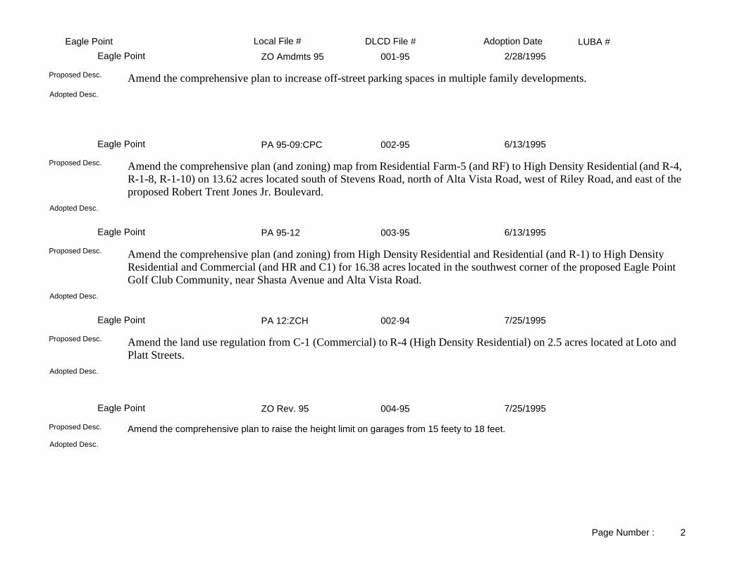
LUBA #Adoption DateLocal File # DLCD File #Eagle PointZO Amdmts 95 001-95Eagle Point 2/28/1995
Adopted Desc.
Amend the comprehensive plan to increase off-street parking spaces in multiple family developments.Proposed Desc.
PA 95-09:CPC 002-95Eagle Point 6/13/1995
Adopted Desc.
Amend the comprehensive plan (and zoning) map from Residential Farm-5 (and RF) to High Density Residential (and R-4, R-1-8, R-1-10) on 13.62 acres located south of Stevens Road, north of Alta Vista Road, west of Riley Road, and east of the proposed Robert Trent Jones Jr. Boulevard.
Proposed Desc.
PA 95-12 003-95Eagle Point 6/13/1995
Adopted Desc.
Amend the comprehensive plan (and zoning) from High Density Residential and Residential (and R-1) to High Density Residential and Commercial (and HR and C1) for 16.38 acres located in the southwest corner of the proposed Eagle Point Golf Club Community, near Shasta Avenue and Alta Vista Road.
Proposed Desc.
PA 12:ZCH 002-94Eagle Point 7/25/1995
Adopted Desc.
Amend the land use regulation from C-1 (Commercial) to R-4 (High Density Residential) on 2.5 acres located at Loto and Platt Streets.
Proposed Desc.
ZO Rev. 95 004-95Eagle Point 7/25/1995
Adopted Desc.
Amend the comprehensive plan to raise the height limit on garages from 15 feety to 18 feet.Proposed Desc.
Page Number : 2

LUBA #Adoption DateLocal File # DLCD File #Eagle Point97-10:ZCN/DAHACK 001-97Eagle Point 9/23/1997
Adopted Desc.
Amend the zoning map from RF to R-1-12,000 on 21.75 acres located north of Stevens Road, northeast of Main Street, and east of Tabor Avenue. This proposal was received with 39 days notice.
Proposed Desc.
97-12 ANX 002-97Eagle Point 1/27/1998
Adopted Desc.
Amend the zoning map from Jackson County RR-5 to city R2 (Pud) to annex approximately 2.7 acres located at Reese Creek Road. This is a corrected proposal summary.
Proposed Desc.
PA 97-15 003-97Eagle Point 1/27/1998
Adopted Desc.
Amend the zoning map to annex .45 acres located at 589 Stevens Road. Also change the zone map from Jackson County RR to City R-2 (Residential) for subject property.
Proposed Desc.
N/A 003-01Eagle Point 8/14/2001
Same.Adopted Desc.
Amend the zoning map from CountyEFU, County Exclusive Farm Use to City LR/MR, Low Density Residential-6,000 Square Feet/ Medium Density Residential for 5.08 acres, located on the south side of Reese Creek Road, and on the west side of a new planned street called "Barton Road", and next to the city limits in the northeastern part of the City . The parcel will be annexed into the City. This proposal is related to DLCD File No. 002-01. This proposal was received with 34 days notice before the first evidentiary hearing.
Proposed Desc.
01/02-05 CP Amend 001-01Eagle Point 8/14/2001
Same.Adopted Desc.
Amend the comprehensive plan Chapter XI - Parks, Recreation, Open Space and Historic Preservation Element to add language to the definition of "...aesthetically pleasing appearance..." associated with any development of hillside viewsheds. This proposal was received with 39 days notice before the first evidentiary and final hearing dates.
Proposed Desc.
Page Number : 3

LUBA #Adoption DateLocal File # DLCD File #Eagle PointN/A 002-01Eagle Point 10/16/2001
Same.Adopted Desc.
Amend the zoning map from zoning map from County EFU, County Exclusive Farm Use to City LR, Low Density Residential (Public) forfour parcels on 26.86 acres, located on the north side of Reese Creek Road in the northeastern portion of the City next to the City Limits. The four parcels will be annexed into the City. This proposal is related to DLCD File No. 003-01. This proposal was received with 34 days notice before the first evidentiary hearing.
Proposed Desc.
PA 01/02-07 005-01Eagle Point 10/23/2001
Same.Adopted Desc.
Amend the zoning code to allow High Density Residential Mixed Use Development (HDRMU) in the Central Commercial District in the downtown area, and repeal Ordinance No. 9-121 that did not allow HDRMU.
Proposed Desc.
01/02-30: ANX 002-02Eagle Point 6/11/2002
Same.Adopted Desc.
Amend the comprehensive plan from County Rural to City Residential for five parcels on 44.90 acres, located along Crater Lake (State Highway 62) Highway. This proposal was received without text, and 39 days notice before the first evidentiary hearing.
Proposed Desc.
01/02-32:ZCH 003-02Eagle Point 6/11/2002
Same.Adopted Desc.
Amend the zoning map from RF, Residential Farm to R-1-8, Single Family Residential-8,000 square feet for two parcels on 5.32 acres, located at Palima Drive and Stevens Road. This proposal was received without text, 25 days notice before the first evidentiary hearing, and 32 day notice before the final hearing.
Proposed Desc.
02/03-01:ANXZCi+ 004-02Eagle Point 9/10/2002
Same.Adopted Desc.
Amend the Comprehensive Plan Map (and Zoning Map) from County F-5 to City Single Family Residential (and City R-1) on 10 acres located northeast of Alta Vista Road at the south end of the current city limits on the west side of the area which jutts southern most on the eastern side. This proposal was received without text. Subject property to also be annexed into the City. This proposal was received 43 days before the first evidentiary hearing.
Proposed Desc.
Page Number : 4

LUBA #Adoption DateLocal File # DLCD File #Eagle Point02/03-10: ANX/2CIT 005-02Eagle Point 1/28/2003
Same.Adopted Desc.
Amend the zoning map from CountyRR, Rural Residential to City R-1-8, Single Family Residential for 6.67 acres, located south of Alta Street, and annex the parcel into the City. This proposal was received without text.
Proposed Desc.
02/03-15: ANX/ZCH 001-03Eagle Point 3/25/2003
Same.Adopted Desc.
Amend the zoning map from CountyRR, County Rural Residential to City R-2, City Medium Family Residential for 9.63 acres, located on the north side of Stevens Road, east of Cascade View Drive.
Proposed Desc.
03/04-13:ZCH (Walch) 002-04Eagle Point 3/23/2004
Same.Adopted Desc.
Amend the zoning map from County FR 5, County Forest Resource-5 acre to City R-1-10, City Single Family Residential-10,000 squarefeet for 1.20 acres, locate at 880 Vista Park Drive. This proposal was received without text, and 39 days notice before the first evidentiary hearing.
Proposed Desc.
004-03Eagle Point 9/28/2004
The acreage was reduced from 60.00 acres to 25.00 acres. The text remains essentially the same.Adopted Desc.
Amend the zoning ordinance in the following ways: add a new Section 3.400 BP- Business Park Overlay District consisting of nine subsections defining the requirements of the new district; and creating the "BP - Business Park Overlay District for a specific portion of the Light Industrial Zone; revise the I-1 Limited Industrial District sections to implement the new business park overlay. Amend the comprehensive plan and zoning maps from LI, Light Industrial to LI w BP, Light Industrial with Business Park Overlay for 65.00 acres, located west of State Highway 62 to the Urban Growth Boundary, south of Linn Road, and north of Nick Young Road. Revised Notice: The revised notice changes the final hearing date from October 28, 2003 to May 18, 2004.
Proposed Desc.
Page Number : 5

LUBA #Adoption DateLocal File # DLCD File #Gold HillNA 001-88Gold Hill 12/5/1988
Adopted Desc.
Amend the zoning ordinance from R-3 (Residential Mutiple Family District) to C-3 (Commercial Central District) located at 1550 2nd Avenue.
Proposed Desc.
NA 001-91Gold Hill 7/22/1991
Adopted Desc.
Amend the comprehensive plan from Light Industrial to High Density Residential and zoning from LI (Limited Industrial) to R-3 (Multiple Family Residential) for 8.8 acres located at 2nd Avenue and S.P. Railroad tracks. NOTE: The proposal was submitted without text.
Proposed Desc.
NA 002-91Gold Hill 7/22/1991
Adopted Desc.
Amend the comprehensive plan from Light Industrial to High Density Residential and zoning from LI (Limited Industrial) to R-2 (Multiple Family Residential) for 8.8 acres located near the intersection of 2nd Avenue and the access road to the quarry west of town, immediately south of the railroad tracks.
Proposed Desc.
NA 001-93Gold Hill 1/3/1994
Adopted Desc.
Amend the zoning ordinance to allow manufactured homes in the R-1 (Residential) zones.Proposed Desc.
Page Number : 1

LUBA #Adoption DateLocal File # DLCD File #JacksonvilleOrd. No. 333 001-89Jacksonville 9/5/1989
Adopted Desc.
Amend the zoning ordinance to add a limitation on new subdivison applications for the period of one year from date of final denial unless new evidence is submitted or conditions have changed.
Proposed Desc.
NA 002-88Jacksonville 2/13/1990
Adopted Desc.
Amend the permited uses in the R-3 (Multiple-Family Residential) zone. Amend the city code to require lots created by a minor partition to have access to a public street.
Proposed Desc.
NA 003-89Jacksonville 9/4/1990
Adopted Desc.
Amend the comprehensive plan and zoning from R-3 (Multiple Family Residential) to C-1 (Commercial) for 0.91 acre located at 830 N. 5th Street.
Proposed Desc.
NA 001-91Jacksonville 3/5/1991
Adopted Desc.
Amend the comprehensive plan to create a site plan committee and review procedures.Proposed Desc.
NA 001-88Jacksonville 4/2/1991
Adopted Desc.
Amend the zoning ordinance to allow retail sales in conjunction with Historic Building tours as a conditional use in R-1 (Single Family Residential) zones.
Proposed Desc.
Page Number : 1

LUBA #Adoption DateLocal File # DLCD File #JacksonvilleNA 002-92Jacksonville 12/1/1992
Adopted Desc.
Amend the zoning ordinance relating to sign regulations.Proposed Desc.
NA 002-93Jacksonville 7/20/1993
Adopted Desc.
Amend the comprehensive plan from Multi-family Residential to Public and Semi-Public, zoning from R-3 (Mulit-family) to HC (Historic Commercial) with the Special Protection zone added for 0.9 acre. The property is located at 206 North Fifth Street and is known as the Jacksonville Museum.
Proposed Desc.
NA 001-93Jacksonville 7/20/1993
CIACAdopted Desc.
Amend the comprehensive plan to update the Citizen Involement Chapters.Proposed Desc.
NA 003-92Jacksonville 7/20/1993
Adopted Desc.
Amend the comprehensive plan to redefine the citizen involvement program and redefine the responsiblities for the CCI (Committee for Citizen Involvement) and CAC (Citizens Adivisory Committees).
Proposed Desc.
NA 003-93Jacksonville 8/3/1993
Adopted Desc.
Amend the zoning ordinance to create a new "Special Protection" zone. Apply the Special Protection zone to 172 acres of public and semi-public lands as designated in the comprehensive plan.
Proposed Desc.
Page Number : 2

LUBA #Adoption DateLocal File # DLCD File #JacksonvilleNA 007-93Jacksonville 4/19/1994
Adopted Desc.
Amend the zoning ordinance to comply with the state law (HB 2835) relating to the placement of manufactured housing.Proposed Desc.
NA 006-93Jacksonville 5/3/1994
Adopted Desc.
Amend the comprehensive plan and land use regulations in order to comform with state law regarding Tentative Subdivision Plans and Subdivision Final Plats.
Proposed Desc.
NA 005-93Jacksonville 5/3/1994
Adopted Desc.
Amend the zoning ordinance to repeal Minor and Major Partition Chapters and replace with a Partition and Property Line Ajustment Chapter.
Proposed Desc.
409 002-94Jacksonville 6/21/1994
Adopted Desc.
Create an environmental standards chapter to add setback requirements for agricultural, forest and stream interfaces.Proposed Desc.
NA 005-94Jacksonville 10/18/1994
This adoption was adopted with DLCD file # 003-94 (5743). Amends the zoning ordinance to allow for greater flexibility in determining "historic signs" and greater enforcement capability.
Adopted Desc.
Amend the sign ordinance portion of the zoning ordinance to provide a greater flexibility for older signs and a greater enforcement capability.
Proposed Desc.
Page Number : 3

LUBA #Adoption DateLocal File # DLCD File #JacksonvilleNA 004-94Jacksonville 10/18/1994
Adopted Desc.
Amend the zoning ordinance to provide for termination of discontinued uses.Proposed Desc.
NA 001-94Jacksonville 6/20/1995
Adopted Desc.
Amend the zoning ordinance to provide more variety of home enterprises. This proposal was submitted without text.Proposed Desc.
N/A 001-95Jacksonville 10/17/1995
Adopted Desc.
Amend the zoning ordinance to simplify and clarify the enforcement measures.Proposed Desc.
JA-96-01 001-96Jacksonville 7/16/1996
Adopted Desc.
Amend the comprehensive plan applying open spaces to approximately 200 acres, which was developed from the 1991 vision statement providing parks, recreation areas, scenic and wildlife areas in order to enhance the urban enviroment.
Proposed Desc.
JA-96-02 002-96Jacksonville 10/1/1996
Adopted Desc.
Amend the comprehensive plan (and zoning) map to comply with new historic and open space elements and to provide for needed housing.
Proposed Desc.
Page Number : 4

LUBA #Adoption DateLocal File # DLCD File #JacksonvilleN/A 001-97Jacksonville 11/18/1997
Adopted Desc.
Amend the Economic Element of the comprehensive plan to establish comformance with the Statewide Planning Goals and other unamended comprehensive plan goals.
Proposed Desc.
002-97Jacksonville 1/6/1998
Adopted Desc.
Amend the City Municipal Code's procedural sections of Title 18 (Historic Protection Regulations). This proposal was received with only 33 days notice.
Proposed Desc.
Title 16 / Title 18 002-98Jacksonville 7/7/1998
Adopted Desc.
Amend the municipal code to revise land divison regulations and change location of design standards in the document. This proposal was received with 41 days notice.
Proposed Desc.
None 001-99Jacksonville 8/17/1999
Adopted version has slight differences in text verbage.Adopted Desc.
Amend the Zoning Ordinance, and Subdivision Final Plats Section to cleanup/ clarify and restructure part of the ordinance.Proposed Desc.
None 001-00Jacksonville 8/15/2000
Same, except original would have added the use to PUD zoning also.Adopted Desc.
Amend the zoning ordinance to allow Senior Housing Facilities as a conditional use in the MF, Multi-Family and GC, General Commercial zoning districts.
Proposed Desc.
Page Number : 5

LUBA #Adoption DateLocal File # DLCD File #Jacksonville002-98HUJacksonville 11/20/2001
The adopted Urban Growth boundary is smaller, therefore there are fewer Comprehensive plan designations outside of the City Limits.Adopted Desc.
Amend the comprehensive plan text to replace Chapter XI Housing of the Housing and Urbanization element. NOTE: This proposal has been closed out because it is being done under the periodic review process. This proposal was closed out in error, only a portion was periodic review.
Proposed Desc.
NONE 002-99Jacksonville 3/5/2002
Minor alterations on traffic standards revisions of multifamily and general commercial to partial performances zones and the relief of Britt parking standards.
Adopted Desc.
Amend the municipal code titles 17 and 18 to adopt the Downtown Core Redevelopment Plan to address transportation, land use, and urban design issues in the downtown core area of the city. This file is stored in the acknowledgment room in blue zoning ordinance binder.
Proposed Desc.
None 001-03Jacksonville 7/15/2003
The discussion regarding the Watershed was deleted since it was contentious and, being outside of our UGB, was not required to be part of our land use plan.
Adopted Desc.
Amend the comprehensive plan to update and replace the 1982 Public Facility, Land Use and General Implementation Chapters, with a new Public Facility and General Implementation Chapter. This proposal was received after the first evidentiary hearing of March 14, 2003.
Proposed Desc.
Page Number : 6

LUBA #Adoption DateLocal File # DLCD File #MedfordDCA-87-1 002-87AMedford 3/19/1987
HOUSEKEEPING CHANGES INCLUDING CORRECTING PERMITTED USES IN CERTAIN ZONES, AMENDINGOFF-STREET PARKING STANDARDS, ADDING REQUIREMENTS FOR UNDERGROUND UTILITIES, CLARIFYING PROCEDURAL REQUIREMENTS, CLARIFYING CERTAIN TERMS.
Adopted Desc.
Amend the Land Development Ordinance to make numerous housekeeping changes including correcting permitted uses in certain zones, amending off-street parking standards, adding requirements for underground utilities, clarifying procedural requirements, clarifying certain terms, and correcting typographical errors.
Proposed Desc.
DCA-87-3 005-87AMedford 5/21/1987
MISCELLANEOUS AMENDMENTS DEALING WITH STATUTORY REQUIREMENTS PERMITTED USES, AND TYPOGRAPHICAL ERRORS
Adopted Desc.
See <PA>PA.TRACKSHEETS.3 for more information.Proposed Desc.
CP873-ZC8710 007-87AMedford 8/6/1987
Adopted Desc.
Amend the comprehensive plan from Urban Residential to Urban High Density Residential and zoning to MFR-20 (Multiple Family Residential-20 units per acre) for approximately 2.5 acres located on Merriman Road.
Proposed Desc.
DCA-87-6 010-87BMedford 8/20/1987
ALLOW ARTERIAL AND COLLECTOR FRONTAGE STREET IMPROVEMENTS FOR MINOR PARTITIONS TO BE DEFERRED THROUGH A DEFERRED IMPROVEMENT AGREEMENT.
Adopted Desc.
Amendment to allow arterial and collector frontage street improvements for minor partitions to be deferred through a deferred improvement agreement.
Proposed Desc.
Page Number : 1

LUBA #Adoption DateLocal File # DLCD File #MedfordDCA-87-7 011-87BMedford 9/17/1987
ALLOW MANUFACTURING OF WOOD CONTAINERS, WOOD BUILDINGS, MOBILE HOMES, MISCELLANEOUSWOOD PRODUCTS, MOBILE HOME DEALERS, NEW AND USE CAR DEALERS, ETC. IN THE I-L (INDUSTRIAL,LIGHT) ZONE.
Adopted Desc.
Amend the Land Development Code to allow the manufacturing of Wood Containers, Wood Buildings and Mobile Homes, Miscellaneous Wood Products, Mobile Home Dealers, New and Used Car Dealers, Boat Dealers, Recreation and Utility Trailer Dealers, and Motorcycle Dealers in the I-L (Industrial, Light) zone.
Proposed Desc.
DCA-87-8 012-87BMedford 10/1/1987
AMEND THE DEVELOPMENT CODE RELATED TO NOTICE REQUIREMENTS, YARD REQUIREMENTS, DEVELOPMENT STANDARDS, STREET REQUIREMENTS, AND PARKING REQUIREMENTS.
Adopted Desc.
Amend the Land Development Code to make eight zone code text amendments.Proposed Desc.
DCA-87-5 009-87AMedford 10/23/1987
FLOODPLAIN REGULATIONS TO CONFORM WITH FEMA REQUIREMENTS.Adopted Desc.
Amend the zoning ordinance's floodplain regulations to conform with revised Federal Emergency Management Agency regulations.
Proposed Desc.
CP-87-5 014-87BMedford 11/5/1987
REASSIGNS THE RESPONSIBILITIES FOR CCI FROM A COMPOSITE COMMITTEE, DESCRIBED IN THECITIZEN INVOLVEMENT PROGRAM TO THE PLANNING COMMISSION.
Adopted Desc.
Amend the comprehensive plan to transfer the duties of the Committee for Citizens Involvement (CCI) to the Planning Commission.
Proposed Desc.
DCA-87-11 013-87BMedford 11/12/1987
Adopted Desc.
Amend the Land Development Code to change the requirement for publishing notice of amendments from 45 days to 10 days.
Proposed Desc.
Page Number : 2

LUBA #Adoption DateLocal File # DLCD File #MedfordCP-87-4 018-87BMedford 11/20/1987
Adopted Desc.
Amend the comprehensive plan from Urban High Density to Service-Commercial for approximately 2.75 acres located on Shadow Court.
Proposed Desc.
DCA-87-9 017-87BMedford 12/4/1987
Adopted Desc.
Amend the Land Development Code to set standards for street lighting and deferral of frontage street improvements on arterial and collector streets.
Proposed Desc.
DCA-87-12 019-87BMedford 12/17/1987
TO ALLOW SMALL ANIMAL VETERINARY CLINICS AS A CONDITIONAL USE IN C-S/P (SERVICE COMMERCIAL AND PROFESSIONAL) AND C-C (COMMUNITY COMMERCIAL) ZONES
Adopted Desc.
Amend the zoning ordinance to allow small animal veterinary clinics as a conditional use in the C-S/P (Service Commercial and Professional) and the C-C (Community Commercial) zones.
Proposed Desc.
GF-87-96 021-87BMedford 1/7/1988
DESIGNATE 48 ACRES ON THE SOUTH SIDE OF CEDAR LINKS DRIVE AS OPEN SPACE.Adopted Desc.
Amend the comprehensive plan to designate approximately 48 acres located on the south side of Cedar Links Drive as Open Space.
Proposed Desc.
CP-87-6 020-87BMedford 1/8/1988
Adopted Desc.
Amend the comprehensive plan from Urban Residential to Service Commercial and zoning from CL (Limited Commercial) to C-SP (Service Commercial and Professional Office) for approximately 1.5 acres located on the east side of Table Rock Road.
Proposed Desc.
Page Number : 3

LUBA #Adoption DateLocal File # DLCD File #MedfordDCA-87-13 022-87BMedford 2/8/1988
AMEND MANUFACTURED HOUSING SUBDIVISION STANDARDS ELIMINATING THE AGE RESTRICTION ONMANUFACTURED HOUSING UNITS.
Adopted Desc.
Amend the Manufactured Housing Subdivision Standards to delete the requirement that manufactured homes be new and previously unoccupied.
Proposed Desc.
CP-88-1 002-88Medford 6/3/1988
Adopted Desc.
Amend the comprehensive plan from Heavy Industrial to Commercial and zoning from I-H (Heavy Industrial) to C-G (General Commercial) for approximately 3 acres located between Edwards Street and Clark Street and between Central Avenue and the railroad tracks.
Proposed Desc.
DCA-88-4 003-88Medford 9/2/1988
Adopted Desc.
Amend the Land Development Code to allow Florist Shops, News Stands and Optical Goods Stores as a permitted use in the C-S/P (commercial Service/Professional Office) zone.
Proposed Desc.
CP-87-2 007-88Medford 11/3/1988
Adopted Desc.
Amend the comprehensive plan from Urban Residential to Urban High Density Residential and zoning from SFR-4 (Medium Density Single Family) to SFR-10 (Urban Residential) and MFR-20 (Urban High Density Residential) for 11 acres located in the Beatty Manzanita Study Area.
Proposed Desc.
DCA-88-07 005-88Medford 11/4/1988
Adopted Desc.
Amend the zoning ordinance to clarify single-family and multiple-family residential housing; and allow a multi- family duplex wilthin the SFR-10 (High Density Single-Family Residential) zone.
Proposed Desc.
Page Number : 4

LUBA #Adoption DateLocal File # DLCD File #MedfordCP-87-2 006-87AMedford 11/4/1988
Adopted Desc.
Amend the comprehensive plan from Single Family Residential to Multiple Family Residential for approximately 15 acres located in the Beatty/Manzanita area.
Proposed Desc.
CP-88-2 006-88Medford 11/13/1988
Adopted Desc.
Amend the comprehensive plan and zoning to add 15 acres to the Urban Growth Boundary and designate the are as Heavy Industrial property. The site is between South Pacific Highway and Myer Lane. The proposal includes an exception.
Proposed Desc.
CP-88-3 009-88Medford 12/19/1988
Adopted Desc.
Amend the comprehensive plan from Commercial to Service Commercial and zoning from C-L (Limited Commercial) to C-S/P (Service Commercial) and SFR-10 (Single-Family Residential 10 units per acre) for 0.61 acre located at the intersection of S. Oakdale Avenue and J Street.
Proposed Desc.
DCA-88-5 010-88Medford 12/19/1988
CLARIFY THE PUBLIC HEARING REQUIREMENT AT THE PLANNING COMMISSION LEVEL. MAKES THEPLANNING DIRECTOR THE APPROVING AUTHORITY FOR FINAL PLATS.
Adopted Desc.
Amend the zoning to clarify the public hearing requirement for procedural class "C" and "D" plan authorizations. Amend the comprehensive plan to allow the Planning Director the approving authority for final plats.
Proposed Desc.
DCA-88-2 011-88Medford 12/19/1988
ALLOW RESIDENTIAL USES IN COMMERCIAL ZONES UNDER THE MFR-30 STANDARDS; C-B OVERLAY ZONE WOULD ALSO ALLOW AS PERMITTED USES, NEW RESIDENTIAL USES.
Adopted Desc.
Amend the zoning ordinance to allow residential uses as permitted uses in the CB (Central Business) district.Proposed Desc.
Page Number : 5

LUBA #Adoption DateLocal File # DLCD File #MedfordDCA-88-6 008-88Medford 1/6/1989
EXLUDING PARKS FROM THE BEARK CREEK ZONING DISTRICT.Adopted Desc.
Amend the Bear Creek zoning district to exclude parks with adopted master plans and modify requirements related to conditional uses and referred agencies.
Proposed Desc.
CP-88-4 012-88Medford 2/3/1989
FROM LIMITED COMMERCIAL TO SERVICE COMMERCIAL AND PROFESSIONAL OFFICE.Adopted Desc.
Amend the comprehensive plan from Commercial to Service Commercial and zoning ordinance from C-L (Limited Commercial) to C-S/P (Service Commercial and Professional Office) for 3.4 acres located on the south side of E. Main Street between Cottage and Tripp Streets.
Proposed Desc.
DCA-89-1 001-89Medford 4/21/1989
ADD REGIONAL HOSPITAL SIGNS TO THE SERVICE COMMERCIAL AND PROFESSIONAL OFFICE (C-S/P) ZONE.
Adopted Desc.
Amend the zoning ordinance to allow "regional hospital signs" in the C-S/P (Service Commercial and Professional Office District.
Proposed Desc.
DCA-88-10 002-89Medford 4/21/1989
INCLUDE GOVERNMENT OFFICES AS A CONDITIONAL USE IN THE MFR-20 AND MFR-30 ZONES.Adopted Desc.
Amend the zoning ordinance to include "Goverment Offices" as a coniditional use in the MFR-20 (Multiple-Family Residential-20 units per acre) and MFR-30 (Multiple-Family Residential-30 units per acre).
Proposed Desc.
DCA-89-2 003-89Medford 6/2/1989
AMENDING SECTION OF CODE (CUL-DE-SAC) BY DELETING THE LAST SENTENCE AND DELETING THE WORD ANY.
Adopted Desc.
Amend the zoning ordinance to allow Cul-de-Sac's longer than 450 feet without following the ordinance's exception criteria.Proposed Desc.
Page Number : 6

LUBA #Adoption DateLocal File # DLCD File #MedfordDCA 89-6 007-89Medford 11/20/1989
ALLOW DIRECT MAIL ADVERTISING SERVICES AS A PERMITTED USE IN THE I-L (LIGHT INDUSTRIAL), I-G (GENERAL INDUSTRIAL) AND THE I-H (HEAVY INDUSTRIAL) ZONES.
Adopted Desc.
Amend the zoning ordinance to allow "Direct Mail Advertising Services" as a permitted use in the I-L (Light Industrial), I-G(General Industrial) and I-H (Heavy Industrial) zones.
Proposed Desc.
DCA 89-4 008-89Medford 11/20/1989
FROM C-C TO C-C WITH ADDITION OF CENTRAL BUSINESS OVERLAY DISTRICT.Adopted Desc.
Amend the zoning ordinance to add CBO (Central Business Overlay) to the C-C (Central Business) zone for approximately 4 acres located at 360 East Jackson Street.
Proposed Desc.
DCA 89-5 006-89Medford 11/20/1989
SUBSTITUTE HISTORIC COMMISSION FOR THE PLANNING COMMISSION IN THE DELIBERATION OF THE DEMOLITION OF AN HISTORIC STRUCTURE.
Adopted Desc.
Amend the zoning ordinance to change the authority for approval of demolitions of historic structures from the Planning Commission to the Historic Commission.
Proposed Desc.
CP 89-3 011-89Medford 1/19/1990
City wide.Adopted Desc.
Amend the comprehensive plan allow the General Industrial zone to be applied in areas designated Light Indstrial on the plan map. Change the name of the "Light Industrial" plan designation to "General Industrial".
Proposed Desc.
DCA 89-3 009-89Medford 3/2/1990
FROM C-C TO C-C WITH ADDITION OF FREEWAY OVERLAY DISTRICT.Adopted Desc.
Amend the zoning to add Freeway Overlay zone to the C-C (Community Commercial) for 2.12 acres located at 81 Stewart Avenue.
Proposed Desc.
Page Number : 7

LUBA #Adoption DateLocal File # DLCD File #MedfordDCA 89-7 001-90Medford 3/2/1990
Adopted Desc.
Amend the zoning ordinance to change the minimum lot depth from 200 feet to 100 feet in the C-C (Community Commercial) zone.
Proposed Desc.
CP 89-4 002-90Medford 3/19/1990
Adopted Desc.
Amend the comprehensive plan from Urban High Density Residenaitl to Urban Residential for 13.2 acres. Amend the comprehensive plan from Urban Residential to Urban High Density Residential for 15.8 acres. The properties are located southeast of the intersection of Brookdale Avenue, and the eastward extension of McAndrews Road, immediately to the north of the McAndrews extension at the southern terminus of Thrasher Lane and 800 feet south of Lone Pine.
Proposed Desc.
DCA 90-1 003-90Medford 4/2/1990
Adopted Desc.
Amend the zoning to add CB (Central Business) overlay zone to the MFR-20 (Multi-Family Residential-20), C-C (Commercial and C-S/P (Service Commercial) zones for approximately 5 acres located between East Main Street and Tenth Street (includes the Enid Rankin Center and parking lots).
Proposed Desc.
DCA-88-1 001-88Medford 6/2/1990
Adopted Desc.
Amend the zoning ordinance to: 1) change the Boundary Line Adjustment to be consistent with state definitions; 2) amend the definition of Sign; 3) reestablish a fee for Minor Comprehensive Plan Amendments; and 4) add service levels for Arterial and Collector Streets.
Proposed Desc.
CP-89-1 004-89Medford 6/2/1990
Adopted Desc.
Amend the comprehensive plan from Light Industrial and Urban Residential to Urban High Density Residential and zoning from I-L (Light Industrial) to MFR-20 (Multiple-Family Residential 20 units per acre) for 12.65 acres located on the east side of Crater Lake Avenue and approximately 600 feet north of Delta Waters Road.
Proposed Desc.
Page Number : 8

LUBA #Adoption DateLocal File # DLCD File #MedfordDCA 90-03 004-90Medford 6/26/1990
REDUCE THE MAXIMUM HEIGHT OF SIGNS FROM 60 TO 50 FEET, FROM A MAXIMUM OF 300 SQUAREFEET IN AREA TO 250 SQUARE FEET IN AREA WITHIN THE FREEWAY OVERLAY ZONE.
Adopted Desc.
Amend the zoning ordinance to reduce the maximum height of signs from 60 feet to 50 feet and from a maximum of 300 feet in area to 250 square feet in area, within the Freeway Overlay zone.
Proposed Desc.
CP 90-1 006-90Medford 7/20/1990
CLARIFY STANDARDS FOR SANITARY SEWERS, WATER FACILITIES, STORM DRAINAGE FACILITIES.Adopted Desc.
Amend the comprehensive plan Public Facilities Element to clarify adequacy standards for sanitary sewers, water facilities, storm drainage facilities and streets.
Proposed Desc.
DCA 90-4 007-90Medford 8/6/1990
ADD OFF-STREET PARKING STANDARDS FOR FURNITURE STORES.Adopted Desc.
Amend the zoning ordinance to include individual standards for off-street parking section for furniture stores.Proposed Desc.
CP-89-02 005-89Medford 8/18/1990
Adopted Desc.
Amend the comprehensive plan from Urban Residential to High Density Urban Residential and zoning from SFR-4 (Single-Family Residential 4 units per acre) to MFR-20 (Multiple-Family Residential 20 units per acre) for 5.25 acres located north of Morrow Road approximately 300 feet from the intersection with Corona Avenue.
Proposed Desc.
CP 90-03 008-90Medford 8/20/1990
Adopted Desc.
Amend the comprehensive plan from Heavy Industrial to Urban Residential and zoning from I-H (Heavy Industrial) to SFR-10 (Single Family Residential-10) for approximately 5.5 acres located east of North Ross Lane, approximately 1,200 feet south of Rossanley Drive.
Proposed Desc.
Page Number : 9

LUBA #Adoption DateLocal File # DLCD File #MedfordCP 90-2 005-90Medford 10/5/1990
From RCOM to UCOM 305 acres and RIND to UIND 169 acres.Adopted Desc.
Amend the comprehensive plan to expand the urban growth boundary to accommodate growth to the year 2010.Proposed Desc.
DCA 90-7 009-90Medford 10/19/1990
Adopted Desc.
Amend the zoning ordinance to allow a maximum fifty percent reduction in the number of shrubs required in the frontage landscaping when lawn is used as a replacement.
Proposed Desc.
DCA 90-5 010-90Medford 10/19/1990
Adopted Desc.
Amend the zoning ordinance to modify the off-street parking requirements for dwelling unit conversions within the Central Business overlay.
Proposed Desc.
CP 90-4 011-90Medford 10/19/1990
Adopted Desc.
Amend the comprehensive plan from General Industrial to Commercial and zoning from I-L (Light Industrial) to C-C (Community Commercial) for 39.38 acres located on the west side of Crater Lake Highway.
Proposed Desc.
DCA-88-3 004-88Medford 11/4/1990
Adopted Desc.
Amend the zoning ordinance to clarify existing language regarding impact fees for neighborhood parks.Proposed Desc.
Page Number : 10

LUBA #Adoption DateLocal File # DLCD File #MedfordDCA-87-2 008-87AMedford 11/20/1990
Language changes differ from the proposal.Adopted Desc.
Amend the Land Development Code to include sign regulations.Proposed Desc.
DCA 90-08 012-90Medford 12/7/1990
Adopted Desc.
Amend the zoning ordinance to allow all "permitted" residential housing types within a residential planned unit development.
Proposed Desc.
CP 90-05 013-90Medford 12/7/1990
Adopted Desc.
Amend the comprehensive plan from Commercial to Urban High Density Residential and the zoning from C-L (Limited Commercial) to MFR-20 (Multiple-Family Residential-20) for 1 acre located west of Valley View Drive approximately 350 feet south of Spring Street.
Proposed Desc.
DCA 90-09 014-90Medford 12/21/1990
Adopted Desc.
Amend the zoning ordinance to permit manufactured houses on individual lots on all SFR (Single-Family Residential) zones and to establish standards for the placement of manufactured houses.
Proposed Desc.
CP 90-6 015-90Medford 1/8/1991
Adopted Desc.
Amend the comprehensive plan from Urban High Density Residential to Commercial and zoning from MFR-20 (Multiple Family Residential-20) to C-C (Community Commercial) for approximately 1 acre located north of Barnett Road and approximately 550 feet east of Ellendale Drive.
Proposed Desc.
Page Number : 11

LUBA #Adoption DateLocal File # DLCD File #MedfordCP 90-7 017-90Medford 2/21/1991
Adopted Desc.
Amend the comprehensive plan from Urban Residential to Urban High Density and zoning from Jackson County SR-2.5 (Suburban Residential) to city MFR-30 (Multiple-Family Residential) for approximately 1.4 acres located on the west side of Western Avenue.
Proposed Desc.
CP 91-3 001-91Medford 6/6/1991
Adopted Desc.
Amend the comprehensive plan from Urban Residential to Service Commercial and zoning from SFR-10 (Single-Family Residential-10) to (C-S/P Service Commission and Profession Office) for 0.115 acre located on the north side of E. Jackson Street approximately 130 feet east of Crater Lake Avenue.
Proposed Desc.
CP 91-2 002-91Medford 7/19/1991
Adopted Desc.
Amend the comprehensive plan from Urban High Density Residential to Service Commercial and zoning from SFR-10 (Single Family Residential-10) to C-S/P (Service Commercial and Professional) for 1.59 acres (8 parcels) located on the north side of West Main Street, between Summit Street and Rose Avenue.
Proposed Desc.
CP 91-9 006-91Medford 8/15/1991
Adopted Desc.
Amend the comprehensive plan to redefine the existing Civic Center designation and expand the boundary to encompass the area defined in the City Center Revitalization Plan.
Proposed Desc.
CP 91-8 005-91Medford 8/16/1991
Adopted Desc.
Amend the comprehensive plan to change the text which describes the Regional Service Center designation.Proposed Desc.
Page Number : 12

LUBA #Adoption DateLocal File # DLCD File #MedfordCP 91-7 007-91Medford 8/16/1991
Adopted Desc.
Amend the comprehensive plan from Urban Residential to Commercial and zoning from SR 2.5 (Suburban Residential) to C (Commercial) for 8.16 acres on the south side of McAndrews Road, approximately 600 feet east of North Ross Lane.
Proposed Desc.
CP 91-10 010-91Medford 10/3/1991
Adopted Desc.
Amend the comprehensive plan from Urban High Density Residential to Commercial and zoning from SFR-6 (Single Family Residential) to C (General Commercial) for 0.9 acre located between Berrydale Avenue and North Pacific Highway.
Proposed Desc.
CP-91-4 011-91Medford 10/17/1991
Adopted Desc.
Amend the comprehensive plan from Urban Residential to Commercial and zoning from SFR-10 (Single-Family Residential 10 units per acre) to Commercial for approximately 0.65 acre located at the northeast corner of the intersection of Stewart Avenue and King Street.
Proposed Desc.
DCA-91-8 012-91Medford 10/21/1991
Adopted Desc.
Amend the language of the Animal Hospitals and Veterinary Clinics section of the Land Development Code to not require current 100 foot setback from adjacent residential area when the entire facility is fully enclosed.
Proposed Desc.
DCA 91-3 008-91Medford 11/11/1991
Adopted Desc.
Amend the zoning ordinance to update the requirements for parking, handicapped parking and paving.Proposed Desc.
Page Number : 13

LUBA #Adoption DateLocal File # DLCD File #MedfordPA 91-11 013-91Medford 11/11/1991
Adopted Desc.
Amend the comprehensive plan from Urban Residential to Urban High Density Residential and zoning from SFR-6 (Single Family Residential) to MFR-20 or MFR-30 (Multiple Family Residential) for 8.56 acres approximately 220 feet east of Table Rock Road, south of Midway Road.
Proposed Desc.
DCA 91-2 009-91Medford 11/11/1991
Adopted Desc.
Amend the Development Code to clarify the location of the triangular shaped area at the intersection of two streets for better visibility.
Proposed Desc.
DCA 91-5 015-91Medford 11/11/1991
Adopted Desc.
Amend the zoning ordinance to delete the specific section regarding Parks and Recreation Dedication and Fees which were previously consolidated into Chapter 3 of the Medford Code.
Proposed Desc.
DCA 91-7 014-91Medford 11/22/1991
Adopted Desc.
Amend the zoning ordinance regarding onstreet parking within a mobile home park.Proposed Desc.
DCA 91-5 016-91Medford 11/22/1991
Adopted Desc.
Amend the zoning ordinance to remove the conditional use permit requirement from the Airport Approach overlay, and require Site Plan and Architectural Review for all development within the Airport Approach Overlay.
Proposed Desc.
Page Number : 14

LUBA #Adoption DateLocal File # DLCD File #MedfordDCA 91-6 018-91Medford 12/6/1991
Adopted Desc.
Amend the zoning ordinance to add an "Accessory Uses in Group (Congregate) Living Facilities" section to allow incidential personal services including barber shops, beauty shops, automated banking services, travel agents, and pharmacies in such facilities
Proposed Desc.
DCA 91-9 019-91Medford 12/6/1991
Adopted Desc.
Amend the zoning ordinance to make adjustments to the SFR-1.5 (Low Density Single Family Residential) zone regarding definitions and development standards.
Proposed Desc.
DCA 91-10 020-91Medford 12/6/1991
Adopted Desc.
Amend the zoning ordinance to clarify services and facilities by adding the description "Category A" to the criteria for a zone change.
Proposed Desc.
CP 91-12 017-91Medford 12/6/1991
Adopted Desc.
Amend the Street Classification Map to add a neighborhood circulation plan for properties located between Delta Park Subdivision Unit No. 1 and Delta Waters Road.
Proposed Desc.
CP 91-6 004-91Medford 12/6/1991
Adopted Desc.
Amend the comprehensive plan from Urban Residential to Service Commercial) and zoning from SFR-4 (Single Family Residential) to C-S/P (Service and Professional Office Commercial for 0.53 acre located on the north side of Siskiyou Boulevard, approximately 450 feet west of Murphy Road.
Proposed Desc.
Page Number : 15

LUBA #Adoption DateLocal File # DLCD File #MedfordCP 91-13 021-91Medford 1/3/1992
Adopted Desc.
Amend the comprehensive plan from Urban Residential and Urban High Density Residential to Commercial and zoning from SR-2.5 (Suburban Residential) to C (Commercial) for 2.9 acres located north and south of West McAndrews Road (Highway 238), approximately 300 feet east of North Ross Lane.
Proposed Desc.
CP 91-15 024-91Medford 1/17/1992
Adopted Desc.
Amend the Public Facilities Element goals and policies for the Southwest Medford Limited Service Area to remove some of the limitations on development.
Proposed Desc.
DCA 91-12 025-91Medford 2/11/1992
Adopted Desc.
Amend the zonining ordinance by adding an Airport Radar Overlay.Proposed Desc.
CP 92-18 002-92Medford 3/5/1992
Adopted Desc.
Amend the comprehensive plan from Urban High Density Residential to Service Commercial and zoning from MFR-20 (Multiple-Family Residential) to C-S/P (Service Commercial and Professional Office) for 0.61 acres located on west Poplar Drive, approximatley 450 feet north of East McAndrews Road.
Proposed Desc.
CP 92-3 005-92Medford 5/21/1992
Adopted Desc.
Amend the comprehensive plan to change the text regarding the arterial and collector street system.Proposed Desc.
Page Number : 16

LUBA #Adoption DateLocal File # DLCD File #MedfordDCA 92-2 004-92Medford 5/21/1992
Adopted Desc.
Amend the zoning ordinance to allow professional baseball parks additional signage.Proposed Desc.
DCA 92-3 009-92Medford 7/17/1992
Adopted Desc.
Amend the zoning ordinance to define "Drug and Alcohol Treament Facility" and to indicate in which zones this use is allowed.
Proposed Desc.
DCA 92-4 010-92Medford 7/17/1992
Adopted Desc.
Amend the zoning ordinance to allow specific types of signage at Miles Field professional baseball park in lieu of the signage permitted in the basic sign regulations.
Proposed Desc.
DCA 92-1 008-92Medford 7/17/1992
Adopted Desc.
Amend the zoning ordinance to define "Residential Care Facility" and to adjust in which zones they are permitted.Proposed Desc.
CP 90-8 011-92Medford 8/6/1992
Jackson County and Medford adoption.Adopted Desc.
Amend the comprehensive plan to revise the joint City-County Urbanization Policies, which guide the development and the conversion from rural uses to urban uses of those lands outside the city limits but within the urban growth boundary.
Proposed Desc.
Page Number : 17

LUBA #Adoption DateLocal File # DLCD File #MedfordCP-92-2 006-92Medford 8/7/1992
Adopted Desc.
Amend the comprehensive plan from Urban Residential to Service Commercial and zoning from SFR-4 (Single Family Residential) to C-S/P (Service Commercial and Professional Office) for 5.0 acres located on the north side of Barnett Road, extending west from North Phoenix Road approximately 800 feet.
Proposed Desc.
CP 92-1 012-92Medford 9/4/1992
Adopted Desc.
Amend the Urban Residential to Commercial and zoning from SFR-4 (Single Family Residential) to C-L (Limited Commercial) for 6.3 acres located southwest of the intersection of Foothill and Lone Pine Roads, extending approximately 500 and 600 feet south and west.
Proposed Desc.
CP 92-4 015-92Medford 12/3/1992
Population Element.Adopted Desc.
Amend the comprehensive plan to add a new "Population Element" to replace the existing element.Proposed Desc.
DCA 92-7 017-92Medford 12/3/1992
Adopted Desc.
Amend the zoning ordinance to clarify the standards and increase the size of shopping center sign.Proposed Desc.
DCA 92-6 014-92Medford 12/3/1992
Regarding issues on appeals.Adopted Desc.
Amend the zoning ordinance regarding appeals and scope of review.Proposed Desc.
Page Number : 18

LUBA #Adoption DateLocal File # DLCD File #MedfordDCA 92-8 018-92Medford 12/3/1992
Permitted uses in the IG, CS/P, CL, CC and CG zone.Adopted Desc.
Amend the zoning ordinance to allow "nonstore retailers" as a permitted use in the I-G (General Industrial) zone and "video tape rental" as a permitted use in the C-S/P (Service Commercial and Professional Office), C-L (Limited Commercial), C-C (Community Commercial) and C-G (General Commercial) zoning.
Proposed Desc.
CP 91-17 013-92Medford 12/3/1992
Regarding water system and densities.Adopted Desc.
Amend the comprehensive plan to eliminate that protion of the Lone Pine/Foothills Limited Service Area below 1,650 feet in elevation.
Proposed Desc.
CP 92-7 019-92Medford 2/19/1993
Adopted Desc.
Amend the zoning ordinance to designate a planned extension of Delta Waters Road from Crater Lake Highway (62) to a point approximatley 1400 feet north as an arterial street.
Proposed Desc.
CP 92-8 020-92Medford 4/2/1993
Adopted Desc.
Amend the comprehensive plan to add a neighborhood circulation plan between Salyer Street and Seroba Circle to the street classification map.
Proposed Desc.
CP 93-3 002-93Medford 6/17/1993
Adopted Desc.
Amend the comprehensive plan from Urban Residential to Commercial and zoning from SR 2.5 (Suburban Residential) to C-G (General Commercial) for 0.72 acre located on the south side of McAndrews Road, opposite the intersection of Sweet Road.
Proposed Desc.
Page Number : 19

LUBA #Adoption DateLocal File # DLCD File #MedfordCP 93-2 003-93Medford 6/17/1993
Adopted Desc.
Amend the comprehensive plan from Urban High Density Residential to Service Commercial and zoning from SFR-4 (Single Family Residential) to C-S/P (Service Commercial and Professional) for 6.5 acres located south of Barnett Road andeast of Murphy Road.
Proposed Desc.
CP 93-1 004-93Medford 6/17/1993
Adopted Desc.
Amend the comprehensive plan from Urban Residential to Urban High Density Residential/Service Commercial and zoningfrom SFR-4 (Single Family Residential-4) to MFR 20/30 (Mulitple-Family 20/30) and C-S/P (Service Commercial/ Professional) for 19.5 acres located southwest of the intersection of Barnett and and Phoenix Road.
Proposed Desc.
CP 93-4 001-93Medford 7/2/1993
Adopted Desc.
Amend the comprehensive plan from Urban Residential to Urban High Density Residential and zoning from SFR-4 (Single Family Residential) to MFR-20/30 (Multiple-Family Residential) for 0.33 acre located on the west side of N Keene Way, and near Perri Place.
Proposed Desc.
DCA 93-1 005-93Medford 7/19/1993
Adopted Desc.
Amend the zoning ordinance to change the minimum lot depth and setback requirements in the SFR-2 (Single Family Residential) zones.
Proposed Desc.
CP 93-7 007-93Medford 8/5/1993
Adopted Desc.
Amend the comprehensive plan and zoning from I-H (Heavy Industrial) to I-L (Light Industrial) for 5.17 acres located northwest and southwest corners of Crater Lake Highway and Burlcrest Drive.
Proposed Desc.
Page Number : 20

LUBA #Adoption DateLocal File # DLCD File #MedfordCP 93-5 006-93Medford 8/20/1993
Adopted Desc.
Amend the comprehensive plan from Urban Residential to Urban High Density Residential and zoning SFR-4 (Single Family Residential) to MFR-20/30 (Multiple-Family Residential) for 9.82 acres located south of Barnett Road, between Larson Creek and the east terminus of Alameda Street.
Proposed Desc.
CP 93-8 008-93Medford 9/2/1993
Adopted Desc.
Amend the comprehensive plan to incorporate the intergovernmental agreement relative to annexations.Proposed Desc.
CP 93-9 009-93Medford 10/7/1993
Adopted Desc.
Amend the comprehensive plan from General Industrial to Urban High Density Residential and zoning from RR-5 (Rural Residential) and I-G (General Industrial) to MFR-20/30 (Multipla Family Residential) for 10.6 acres located on Hondeleau Land and Coker Butte Road, approximately 500 feet west of Springbrook Road.
Proposed Desc.
DCA 93-2 010-93Medford 11/4/1993
Adopted Desc.
Amend the zoning ordinance to add lanugage regarding mobile food units, definitions for mobile food units and push carts, and allow mobile food vending from trailer.
Proposed Desc.
CP 93-11 012-93Medford 11/4/1993
Adopted Desc.
Amend the comprehensive plan from Urban Residential to Service Commercial and zoning from SFR-10 (Single-Family Residential-10) to C-S/P (Service Commercial and Professional Office) for 0.30 acre located on the north side of Jackson Street, between Mary and Mae Streets.
Proposed Desc.
Page Number : 21

LUBA #Adoption DateLocal File # DLCD File #MedfordCP 93-12 013-93Medford 12/9/1993
Adopted Desc.
Amend the comprehensive plan from Commercial to General Industrial and zoning from Jackson County EFU (Exclusive Farm Use) to city I-L (Light Industrial) for 18.83 acres located at the northeast corner of the intersection of Rogue Valley Highway 99 and south Stage Road.
Proposed Desc.
CP 93-13 015-93Medford 1/21/1994
Adopted Desc.
Amend the "Public Facilities Element of the comprehensive plan by deleting the Southwest Medford Limited Service Area.Proposed Desc.
DCA 93-4 003-94Medford 3/18/1994
Adopted Desc.
Amend the Land Development Code sections "Nonconformities" and "Nonconforming Development" to clarify the language regarding a tax lot that is made nonconforming through eminent domain proceedings.
Proposed Desc.
CP 93-6 001-94Medford 3/18/1994
Adopted Desc.
Amend the comprehensive plan from Urban Residential to Commercial and zoning from SFR-4 (Single-Family Residential)to Commercial for 10.89 acres located near the intersection of Barnett and North Phoenix Roads.
Proposed Desc.
DCA 93-7 005-94Medford 4/7/1994
Adopted Desc.
Amend the zoning ordinance to allow overnight parking of recreational vehicles as an accessory use to a hospital.Proposed Desc.
Page Number : 22

LUBA #Adoption DateLocal File # DLCD File #MedfordDCA 93-3 004-94Medford 4/7/1994
Adopted Desc.
Amend the zoning ordinance to increase the maximum lot size allowed and create a minimum density for all housing types.Proposed Desc.
DCA 93-5 006-94Medford 5/6/1994
Adopted Desc.
Amend the comprehensive plan and zoning ordinance to incorporate requirements of the Transportation Planning Rule.Proposed Desc.
CP 93-15 014-93Medford 5/6/1994
Adopted Desc.
Amend the comprehensive plan to implement a new "Economic Element" to replace the existing element.Proposed Desc.
DCA 93-6 002-94Medford 6/2/1994
Adopted Desc.
Amend the Land Development Code to bring it into compliance with recent state legislation contained in the Oregon Revised Statutes and make other miscellanous changes.
Proposed Desc.
CP 94-1 008-94Medford 7/21/1994
Adopted Desc.
Amend the comprehensive plan by designating a section of Beall Lane from North Pacific Highway west to the urban growth boundary as an arterial street.
Proposed Desc.
Page Number : 23

LUBA #Adoption DateLocal File # DLCD File #MedfordCP 94-2 009-94Medford 7/21/1994
Adopted Desc.
Amend the comprehensive plan by extending the designation Cherry Lane as a collector street from a point east of North Phoenix Road, then east and north to Hillcrest Road.
Proposed Desc.
CP 94-3 010-94Medford 7/21/1994
Adopted Desc.
Amend the comprehensive plan by extending the designation of Coker Butte Road as an arterial street from a point east of Crater Lake Highway, then east to the urban growth boundary.
Proposed Desc.
CP 94-4 011-94Medford 7/21/1994
Adopted Desc.
Amend the comprehensive plan by extending Crater Lake Highway as an arterial street from a point north of Vilas Road, then north to the urban growth boundary.
Proposed Desc.
CPZ 1-94 012-94Medford 7/21/1994
Adopted Desc.
Amend the comprehensive plan and zoning from R-2 (Residential) to PO-S (Public Land Open Space) for approximately 3.0 acres located on the west side of Pioneer Road, approximately 150 north of Easy Street.
Proposed Desc.
CP 94-6 013-94Medford 7/21/1994
Adopted Desc.
Amend the comprehensive plan by extending the designation of Rossanley Road as a collector street from a point west of Ross Lane, then west to the urban growth boundary.
Proposed Desc.
Page Number : 24

LUBA #Adoption DateLocal File # DLCD File #MedfordCP 94-5 014-94Medford 7/21/1994
Adopted Desc.
Amend the comprehensive plan by extending the designation of North Phoenix Road as an arterial street from a point north of Coal Mine Road, then south to the urban growth boundary.
Proposed Desc.
DCA 94-1 015-94Medford 7/21/1994
Adopted Desc.
Amend the zoning ordinance to allow the creation of lots within a lot or "common area" and condominiums, without planned unit development approval.
Proposed Desc.
CP-94-15 017-94Medford 11/17/1994
Adopted Desc.
Amend the comprehensive plan Street Classification Map reflecting Juanipero Way as a collector street from Murphy Road to North Phoenix Road and a southerly extension of Golf View Drive from Barnett Road to Juanipero Way.
Proposed Desc.
DCA-94-5 018-94Medford 11/17/1994
Adopted Desc.
Revise the land use regulations to include drug and alcohol treatment facilities as a conditional use in the MFR-20 and MFR-30 zones.
Proposed Desc.
CP 94-8 016-94Medford 11/17/1994
Adopted Desc.
Amend the comprehensive plan (and zoning) from General Industrial (and SFR-4) and Urban Residential (and I-L) to Urban High Density Residential (and MFR-20/30) for 14.85 acres located west of Crater Lake Avenue, and south of Delta Waters Road.
Proposed Desc.
Page Number : 25

LUBA #Adoption DateLocal File # DLCD File #MedfordDCA-91-1 019-94Medford 12/2/1994
Adopted Desc.
Amend the land use regulations to change the buffering standards between various land uses.Proposed Desc.
DCA 94-6 022-94Medford 12/15/1994
Adopted Desc.
Amend the zoning ordinance to allow a single-family dwellings on nonconforming lots in the MFR-20 and MFR-30 (Multiple Family Residential) zone.
Proposed Desc.
CP 94-19 021-94Medford 12/15/1994
Adopted Desc.
Amend the comprehensive plan (and zoning) from Urban High Density Residential (and SFR-6) to Commercial (and C-C orC-G) for 0.36 acre located on the SE corner of Howard and Berrydale.
Proposed Desc.
DCA 94-2 020-94Medford 12/15/1994
Adopted Desc.
Amend the land development code, Sections 10.287, 10.721, 10.731, 10.732, 10.746, and 10.797, and add Section 10.780 to make adjustments to the landscape and irrigation standards.
Proposed Desc.
DCA-94-10 001-95Medford 3/6/1995
Adopted Desc.
Amend zoning map from Community Commercial to Community Commercial with Freeway Overlay District on 4.2 acres located on the south side of Hilton Road between Biddle Road and Bullock Road.
Proposed Desc.
Page Number : 26

LUBA #Adoption DateLocal File # DLCD File #MedfordDCA-94-7 003-95Medford 4/7/1995
Adopted Desc.
Amend the Land Development Code, Sec. 198, stating that nothing shall be construed to require the city to determine economic impact of a proposed annexation on special districts.
Proposed Desc.
CP 93-14 007-94Medford 4/7/1995
Adopted Desc.
Amend the comprehensive plan by connecting North Phoenix/ Foothill Road as an arterial street from a point on North Phoenix Road and south of its intersection with Hillcrest Road, then northwest to the intersection of Foothill Road and Hillcrest Road.
Proposed Desc.
DCA-94-11 006-95Medford 4/21/1995
Adopted Desc.
Amend the Land Development Code to clarify the listing of dwelling units in commercial zones and to address minor discrepancies which exist between Section 10.337, Commercial and Industrial uses determination and a Standard Industrial Classification (SIC) Manual.
Proposed Desc.
CP-95-1 004-95Medford 4/21/1995
Adopted Desc.
Amend the street classification map and comprehensive plan by extending the designation of Haul Road as an arterial.Proposed Desc.
CP-95-2 005-95Medford 5/4/1995
Adopted Desc.
Amend the comprehensive plan to change the inventory of historic sites under Goal 5.Proposed Desc.
Page Number : 27

LUBA #Adoption DateLocal File # DLCD File #MedfordDCA 95-1 007-95Medford 6/16/1995
Adopted Desc.
Amend the zoning ordinance to create a special use provision so that two unattached single-family dwellings may be constructed in lieu of the standard multiple-family duplex.
Proposed Desc.
DCA-95-3 010-95Medford 8/3/1995
Adopted Desc.
Amend the Land Development Code to allow outdoor sales for recognized, organized groups on private property in all commercial zones within the city.
Proposed Desc.
DCA-94-8 011-95Medford 8/3/1995
Adopted Desc.
Amend the Land Development Code to establish street frontage setback minimums for vehicle entrances and to allow an average front yard setback option.
Proposed Desc.
CP-95-3 013-95Medford 9/8/1995
Adopted Desc.
Amend the comprehensive plan to designate South Stage Road, east of South Pacific Highway, as an arterial street.Proposed Desc.
DCA-95-4 014-95Medford 9/8/1995
Adopted Desc.
Amend the Land Development Code to extend the existing deadline associated with removing or enclosing outfield billboard signs and allow an outfield clock not visible from outside the Miles Field/Professional Baseball Park.
Proposed Desc.
Page Number : 28

LUBA #Adoption DateLocal File # DLCD File #MedfordDCA-95-6 021-95Medford 10/5/1995
Adopted Desc.
Amend the land use regulations to create streetscape standards for Riverside Avenue from Jackson Street to McAndrews, and amend the Central Business District, Sidewalk Specifications, and Front Yard Landscaping Requirements.
Proposed Desc.
CP-95-6 016-95Medford 10/18/1995
Adopted Desc.
Amend the comprehensive plan (and zoning) from Commercial (and Limited Commercial, CL) to Service Commercial (and Service Commercial and Professional Office, C-S/P) on approximately .23 acres located on the southwest corner of East Main and Tripp Streets. This proposal was received without text.
Proposed Desc.
DCA-95-2 022-95Medford 11/16/1995
Adopted Desc.
Amend the Land Development Code to allow the operation and maintenance of sidewalk cafes in the Central Business Overlay area.
Proposed Desc.
DCA-95-5 012-95Medford 11/20/1995
Adopted Desc.
Amend the Residential Uses of the Land Development Code and add a new section to create a special use provision allowing accessory dwelling units within all single-family residential zones.
Proposed Desc.
CP-95-8 018-95Medford 12/7/1995
Adopted Desc.
Amend the comprehensive plan by designating Diamond Street as a collector street. This proposal was received without text.
Proposed Desc.
Page Number : 29

LUBA #Adoption DateLocal File # DLCD File #MedfordCP-95-9 019-95Medford 12/7/1995
Adopted Desc.
Amend the comprehensive plan by designating the extension of Lozier Lane, from Stewart Avenue, south to Orchard Home Drive, as a collector street and redesignating Thomas Road and Orchard Home Drive, from Stewart Avenue to Sunset Drive and Cunningham Avenue, as standard residential streets. This proposal was received without text.
Proposed Desc.
CP-95-10 020-95Medford 12/7/1995
Adopted Desc.
Amend the comprehensive plan by designating Holly Street as a collector from Holmes Avenue to Garfield Street. This proposal was received without text.
Proposed Desc.
CP-95-7 017-95Medford 12/21/1995
Adopted Desc.
Amend the comprehensive plan by designating an arterial street alignment from the western urban growth boundary, east through Willow Way, crossing the South Pacific Highway, north connecting Highland Drive at Barnett Road. This proposalwas received without text.
Proposed Desc.
CP-95-12 024-95Medford 1/4/1996
Adopted Desc.
Amend the comprehensive plan (and zoning) to: (1) Realign South Stage Road as an arterial street between Orchard Home Drive and Griffin Creek Road; (2) Redesignate Griffin Creek Road between the southern urban growth boundary and northern section of South Stage Road as a collector street; and, (3) Remove the existing arterial designation from the section of South Stage Road between Orchard Home Drive and Griffin Creek Road.
Proposed Desc.
DCA-95-7 026-95Medford 1/4/1996
Adopted Desc.
Amend the Land Development Code to make revisions to the agricultural buffering standards.Proposed Desc.
Page Number : 30

LUBA #Adoption DateLocal File # DLCD File #MedfordDCA-94-4 023-95Medford 1/4/1996
Adopted Desc.
Amend the Land Development Code to establish arterial and collector street frontage standards.Proposed Desc.
CP-95-14 028-95Medford 1/18/1996
Adopted Desc.
Amend the comprehensive plan's street classification map by designating the extension of McLoughlin Drive as a collector street from 165 feet of Milhoan Drive at Delta Waters Road, north to the northern urban growth boundary.
Proposed Desc.
CP 94-14 008-95Medford 2/1/1996
Adopted Desc.
Amend the comprehensive plan (and zoning) from Urban Residential (and SFR-4) to Urban High Density Residential (and MFR-20) for 3.88 acres located on the north side of Delta Waters Road, just east of Cody Street.
Proposed Desc.
CP-95-13 025-95Medford 2/1/1996
Adopted Desc.
Amend the comprehensive plan by adding a conceptual neighborhood circulation plan for southwest Medford, between Stewart Avenue and South Stage Road and west of Holly Street.
Proposed Desc.
CP 91-19 003-92Medford 3/21/1996
Adopted Desc.
Amend the comprehensive plan (and zoning) from Commercial (and EFU, Exclusive Farm use) to Urban Residential (and SFR-6 or SFR-10, Single Farmily Residential-6 10 units per acre) on 33 acres located on South Pacific Highway, South State Road. NOTE: This is a reproposal of previous amendment denied by council.
Proposed Desc.
Page Number : 31

LUBA #Adoption DateLocal File # DLCD File #MedfordCP 94-21 009-95Medford 3/21/1996
Adopted Desc.
Amend the comprehensive plan (and zoning) from Urban Residential (and SFR-6) to Service Commercial on .14 acre (1 parcel) located at Crater Lake Avenue, north of Queen Anne Street. NOTE: This is a reproposal of previous amendment denied by council.
Proposed Desc.
CP-95-17 001-96Medford 4/4/1996
Adopted Desc.
Amend the comprehensive plan (and zoning) maps from Urban High Density Residential (and Low Density Multiple-Family Residential, MFR-20) to Urban Residential (and High Density Single-Family, SFR-10, PUD) on approximately 12 acres located south of the intersection of Golfview and Creek View Drives.
Proposed Desc.
CP-95-19 002-96Medford 4/4/1996
Adopted Desc.
Amend the comprehensive plan (and zoning) from Heavy Industrial (and I-H, Heavy Commercial) to Commercial (and C-GGeneral Commercial) on 1.2 acres located on the west side of Central, south of Court Street.
Proposed Desc.
DCA-96-4 003-96Medford 9/19/1996
Adopted Desc.
Amend the Land Development Code section regarding Parking in a Required Yard to delete the paving restriction in single-family residential areas, only.
Proposed Desc.
DCA-96-7 004-96Medford 10/4/1996
Adopted Desc.
Amends the Land Development Code to add a Multiple-Family Residential zone of 15 units per acre (MFR-15). Also residential-related housekeeping admentments.
Proposed Desc.
Page Number : 32

LUBA #Adoption DateLocal File # DLCD File #MedfordCP-96-1 005-96Medford 10/4/1996
Adopted Desc.
Amend the comprehensive plan to create an Urban Medium Density Residential designation with density of 10 to 15 units per acre to be consistent with the newly proposed MFR-15 zoning district. (See DLCD #004-96.)
Proposed Desc.
CP-96-3 006-96Medford 11/7/1996
Adopted Desc.
Amend the comprehensive plan from General Industrial to Urban High Density Residential on 4.83 acres located at the south side of Coker Butte Road, and the east side of Crater Lake Avenue.
Proposed Desc.
DCA-96-10 007-96Medford 11/7/1996
Adopted Desc.
Amend the Land Development Code to increase the number of dwelling units allowed on minor residential streets (those 28 feet wide).
Proposed Desc.
DCA-96-1 008-96Medford 11/20/1996
Adopted Desc.
Amend the Land Development Code to add a section regarding limitation of exactions.Proposed Desc.
DCA-95-8 027-95Medford 12/21/1996
Adopted Desc.
Amend the Land Development Code to make minor changes to the Commercial and Industrial Development Intensity Calculation, Clear View of Intersecting Streets, and General Design Requirements for Parking sections.
Proposed Desc.
Page Number : 33

LUBA #Adoption DateLocal File # DLCD File #MedfordCP-96-5 012-96Medford 2/7/1997
Adopted Desc.
Amend the comprehensive plan text to include the newly created zone of Regional Commercial (C-R) and to revise other commercial zone designations. Also amend the comprehensive plan map from Regional Service Center to Commercial on 93 acres located south of Barnett Avenue between Interstate 5 and South Pacific Highway.
Proposed Desc.
DCA-96-11 011-96Medford 2/20/1997
Adopted Desc.
Amend the development code to add a Regional Commercial (C-R) zone and revise allowed uses and standards in commercial and industrial zones.
Proposed Desc.
CP-96-6 001-97Medford 4/4/1997
Adopted Desc.
Amend the comprehensive plan map from Urban High Density Residential to Urban Residential on 3.1 acres located at the terminus of Hondeleau, south of Coker Butter Road.
Proposed Desc.
ZC-96-22 010-96Medford 4/4/1997
Adopted Desc.
Amend the zoning map from Community Commercial (C-C) to Regional Commercial (C-R) on four areas called the Crater Lake Plaza, Medford Center, Rogue Valley Mall, and South Gateway Center. Also from General Industrial (I-G) to Regional Commercial (C-R) on the location currently the National Guard Armory.
Proposed Desc.
DCA-97-36 003-97Medford 5/1/1997
Adopted Desc.
Amend the code to revise building height calculation and add commercial antenna regulations.Proposed Desc.
Page Number : 34

LUBA #Adoption DateLocal File # DLCD File #MedfordCP-96-8 004-97Medford 5/15/1997
Adopted Desc.
Amend the comprehensive plan to revise the street classification map to designate Springbrook Road as a collector street from Delta Waters Road to Coker Butte Road.
Proposed Desc.
DCA-96-2 005-97Medford 6/19/1997
Adopted Desc.
Amend the land development code to replace the Planned Unit Development section.Proposed Desc.
CP-97-87 007-97Medford 7/18/1997
Adopted Desc.
ORGINAL PROPOSAL: Amend the comprehensive plan adopting the Rogue Valley Metropolitan Planning Organization Regional Transportation Plan. NOTE: The City's Transportation Plan is scheduled to be completed by Dec. 1997. This proposal is for the RVMPO only. UPDATED PROPOSAL:
Proposed Desc.
97-153
Land Code 009-97Medford 8/7/1997
Adopted Desc.
Amend the Land Development Code to make minor changes to signage allowed in shopping centers.Proposed Desc.
CP-97-35 008-97Medford 9/18/1997
Adopted Desc.
Amend the comprehensive plan map from Urban High Density Residential (MFR-30) to Service Commercial (C-S/P) on approximately 4 acres located on the north side of Barnett Road 200 feet east of the intersection of Highland Drive.
Proposed Desc.
Page Number : 35

LUBA #Adoption DateLocal File # DLCD File #MedfordCP-97-39 011-97Medford 10/2/1997
Adopted Desc.
Amend the comprehensive plan map from Commercial (SFR-10 & C-N) to Service Commercial/Professional (C-S/P) on two parcels totalling approximately .34 acre located on the northwest corner of East Jackson and Effie Streets.
Proposed Desc.
CP-97-30 012-97Medford 11/14/1997
Adopted Desc.
Amend the comprehensive plan map from Urban Residential to Urban High Density Residential on 7.34 acres located between Table Rock Road and Interstate 5, approximately 1200 feet north of Midway Road. This proposal was received with only 43 days notice.
Proposed Desc.
CP 97-75 013-97Medford 1/16/1998
Adopted Desc.
Amend the comprehensive plan to adopt a Circulation Plan for North Medford, an area north of Delta Waters Road, south of Vilas Road, and between the airport and eastern urban growth boundary.
Proposed Desc.
DCA 97-191 001-98Medford 3/19/1998
Adopted Desc.
Amend the zoning ordinance to revise yard requirements, lot coverage and setbacks.Proposed Desc.
CP- 97-144 005-98Medford 4/2/1998
Adopted Desc.
Amend the comprehensive plan from Service Commercial to Commercial for .70 acre located near Barnett Road and Ellendale Drive. This proposal was received with only 42 days notice.
Proposed Desc.
Page Number : 36

LUBA #Adoption DateLocal File # DLCD File #MedfordCP 97-97 003-98Medford 4/2/1998
LUBA #98-072Adopted Desc.
Amend the comprehensive plan, zoning maps and regulations to adopt the Southeast Plan Map. The proposed acreage involved is approximately 1000 acres located east of North Phoenix Road between Hillcrest Road and Cole Mine Road. This proposal was received with only 42 days notice
Proposed Desc.
98-071
CP 97-129 004-98Medford 4/16/1998
Adopted Desc.
Amend the comprehensive plan from Urban Residential to Urban High Density Residential for two parcels totaling 5.81 acres located at Lozier Lane and Stewart Avenue. This proposal was received with only 42 days notice.
Proposed Desc.
DCA 96-12 002-98Medford 4/17/1998
Adopted Desc.
Amend the land development code to revise regulations regarding landscaping and irrigation plans on development projects. This proposal was received with only 42 days notice.
Proposed Desc.
DCA-97-161 011-98Medford 5/21/1998
Adopted Desc.
Amend the land development code to allow a mobile food unit to exceed the maximum of 128 square feet with approval of a conditional use permit.
Proposed Desc.
DCA 97-174 007-98Medford 6/18/1998
Adopted Desc.
Amend the zoning ordinance to futher define and regulate the height and location of wireless communication towers. This proposal wasreceived with only 42 days notice.
Proposed Desc.
Page Number : 37

LUBA #Adoption DateLocal File # DLCD File #MedfordDCA-94-9 002-95Medford 8/6/1998
Adopted Desc.
Amend Article II of the Land Development Code by adding provisions for expiration dates to land divisions, site plan and architectural commission, and historic commission actions. THIS PROPOSAL RESUBMITTED 6/22/1998. Original submittal received 2/1/1995 with final hearing date: 4/6/1995.
Proposed Desc.
CP-98-2 010-98Medford 8/6/1998
Adopted Desc.
Amend the comprehensive plan map from Urban Residential to Urban High Density Residential on three parcels totaling 5.35 acres located on the southwest corner of Stewart Avenue and Orchard Home Drive.
Proposed Desc.
CP-97-215 012-98Medford 8/20/1998
Adopted Desc.
Amend the comprehensive plan map from General Industial to Commercial on 12.05 acres located on the northwest and southwest corners of Biddle Road Airport Road.
Proposed Desc.
CP-98-58 013-98Medford 8/20/1998
Adopted Desc.
Amend the comprehensive plan map from Urban Residential to Service Commercial on .87 acres located on the west side of Corona Avenue and 200 feet north of East McAndrews Road.
Proposed Desc.
CP-98-99 001-99Medford 2/19/1999
Adopted Desc.
Amend the comprehensive plan map from Urban High Density to Commercial for .48 acres located on the north side of Barnett Road, west of Crestbrook Drive.
Proposed Desc.
Page Number : 38

LUBA #Adoption DateLocal File # DLCD File #MedfordDCA-98-170 002-99Medford 6/4/1999
Adopted Desc.
Amend the Land Development Code to delete and add new language to the Zone Change Criteria Section.Proposed Desc.
CP-99-81 004-99Medford 11/19/1999
Same.Adopted Desc.
Amend the comprehensive plan map from HI, Heavy Industrial to IG, General Industrial for 113.35 acres, located on the westside of Crater Lake Highway, approximately 250 feet south of Burlcrest Drive.
Proposed Desc.
CP-99-104 006-99Medford 12/3/1999
Same.Adopted Desc.
Amend the general land use plan map of the comrehensive plan from UR, Urban Residential to SC, Service Commercial for 0.16 acres, located west side of Craker Lake Avenue and approximately 200 feet south of Jackson Street.
Proposed Desc.
CP-98-92 005-99Medford 12/3/1999
Same.Adopted Desc.
Amend the public facilities element and street classification map of the comprehensive plan to change the designation of Owen Drive, east of Springbrook Road, from an arterial to a collector street.
Proposed Desc.
DCA-99-146 007-99Medford 12/17/1999
Same.Adopted Desc.
Amend the land development code to establish new development standards and review procedures to: amend Section 10.031(Exceptions to Development Permit Requirement), add Section 10.247a (CUPs Exempt from Site Plan and Architectural Commission Review), amend Section 10.350 (Application of Airport Approach Provisions), amend Section 10.780 (General landscape and Irrigation Requirements), add Section 10.781 (Concealment of Trash Receptacles), add Section 10.782 (Concealment of Heating, Ventilation and Air Conditioning (HVAC) Equipment), and add Section 10.783 (Location of Wall Mounted Utility Services).
Proposed Desc.
Page Number : 39

LUBA #Adoption DateLocal File # DLCD File #MedfordCP-99-120 008-99Medford 1/7/2000
Same.Adopted Desc.
Amend the comprehensive plan map from UHDR, Urban High Density Residential to UMDR, Urban Medium Density Residential for 4.93 acres, located on the northwest corner of Skypark Drive and Crater Lake Avenue.
Proposed Desc.
CP-99-102 009-99Medford 2/3/2000
The condition for a restrictive covenant was deleted from the report.Adopted Desc.
Amend the comprehensive plan map from UHDR, Urban High Density Residential to CC, Community Commercial for 0.94 acres, located on the southside of Barnett road approximately 400 feet east of Ellendale Drive.
Proposed Desc.
CP-99-152 010-99Medford 2/17/2000
Same. Note: This adoption was found behind a periodic review work task adoption notification on 3/14/2000. The mail date was missed because of the above reason.
Adopted Desc.
Amend the land use plan map to remove a restrictive covenant from a piece of property intended to be used for a portion of the Bear Creek Greenway for 4.95 acres, located southside of South Stage Road approximately 1500 feet of South Pacific Highway.
Proposed Desc.
CP-99-160 001-00Medford 4/21/2000
Same.Adopted Desc.
Amend the comprehensive plan map from UHDR, Urban High Density Residential to UMDR, Urban Medium Density Residential for 3.51 acres, on one parcel and a portion of a second parcel, located on the west side of the future southernly expansion of Arrowhead Drive in the vicinity of Dragon Tail Place.
Proposed Desc.
DCA-99-31 003-99Medford 5/5/2000
Adopted amendment reinserted mobile home parks in order to differentiate them from manufactured homes. Site Plan 1"=40 to 1"=50. Eliminated the foundation or stand diagram form the submittal requirements. Changed the minimum street width requirements. Changed the street construction standard to be consistent with OAR-660-0050(8). Changed the off-street parking requirements to be consistent with OAR 918-600-0050(7).
Adopted Desc.
Amend the land development code to update, delete, and revise text in the current manufactured dwelling park regulations. This proposal was received with 44 days notice before the first evidentiary hearing.
Proposed Desc.
Page Number : 40

LUBA #Adoption DateLocal File # DLCD File #MedfordCP-97-87 003-00Medford 9/7/2000
Same.Adopted Desc.
Amend the comprehensive plan to adopt the Rogue Valley Metropolitan Planning Organization - Interim Regional Transportation Plan Update 2000-2020 as element of the plan. The RVMOP-IRTU is a regional plan covering the Cities of Medford, Phoenix, and Central Point; Jackson County Rural Unincorporated Communities; and unincorporated land of Jackson County. This proposal was originally proposed as the Regional Transportation Plan 1995-2015, DCLD FILE No. 007-97(8358), Local File No. CP-97-87; and was appealed to LUBA under a Notice of Intent to Appeal - LUBA No.97-153, on the 8th of August,1997.
Proposed Desc.
CP-00-64 004-00Medford 12/21/2000
Same.Adopted Desc.
Amend the comprehensive plan map from UHDR, Urban High Density Residential to SC, Service Commercial for 1.93 acres, located on the west side of Golf View Drive at its intersection with Creek View Drive.
Proposed Desc.
001-01Medford 8/17/2001
Minor verbage changes - (E) Elements of Analysis, Number 15.Adopted Desc.
Amend the land development code to establish standards for transportation traffic impact analysis studies, by amending the folowing sections: 10.012, Definitions - adding nine new definitions; 10.460, Traffic Impact Report - changing the name to "Traffic Impact Analysis"; 10.461, Applicability - delete the reference to "report" in the section, define the detail and scope of the traffic impact analysis.
Proposed Desc.
DCA-01-61 002-01Medford 9/11/2001
Amortization - Existing units that do not meet the new regulations may continue as a permitted use except that within 12 months must do the following: Pay applicable systems development charges (may extend payment period for a single additional 6-month period); pay all applicable utility rates for water, sewer, storm drainage, and streets; review stacking so that each unit shall have a minimum 60 feet of vehicle stacking for each service window (if this is not possible, the unit will no longer be permitted).
Adopted Desc.
Amend the land development code to change development standards for mobile food vendors by adding/deleting text, and renumber subsections in the following sections: 10.012, "Definitions, Specific"; 10.840, "Elimination of Mobile Food Units"; 10.841, "Authorization";10.857, "Temporary use of movable structures and vehicles"; 10.823, "Small Food Vendors"; 10.337, "Uses Permitted in Commercial and Industrial Zoning Districts".
Proposed Desc.
DCA-01-10 003-01Medford 10/23/2001
Minor editorial word changes to clarify standards.Adopted Desc.
Amend the development code to adjust and clarify development standards for single-family and multi-family residential development in the following sections: 10.012 Definitions, Specific; 10.700 Lot Design Standards; 10.708 Residential Density Calculation; 10.710 Detached Single-Family Dwellings.
Proposed Desc.
Page Number : 41

LUBA #Adoption DateLocal File # DLCD File #MedfordCP-02-15 003-02Medford 6/20/2002
Modified to not require a stipulation limiting the amount of traffic generated from the site.Adopted Desc.
Amend the comprehensive plan map from Urban High Density Residential to Service Commercial for 0.32 acre, located south and east of State Street, approximately 120 feet east of Olympic Avenue.
Proposed Desc.
001-02Medford 6/21/2002
Addition of notification of enclaved property owners and public hearings to be held.Adopted Desc.
Amend the land development code in the following areas to speed up the annexation process: Section 10.122 Authority of the Planning Commission; Section 10.146 Referral Agencies Distribution; Section 10.150 General Procedural Requirements; Section 10.185 Class "B" Actions; Section 10.192 Application for Annexation; Section 10.194 Annexation of Territory Surrounded by the City.
Proposed Desc.
DCA-02-66 004-02Medford 8/15/2002
Adopted Desc.
Amend the Land Development Code to allow through lots to be created in commercial and industrial zones to allow for a larger number of street accesses and better street circulation.
Proposed Desc.
CP-02-38 005-02Medford 10/17/2002
Same.Adopted Desc.
Amend the Comprehensive Plan Map from Urban Residential to a mix of Urban High Density Residential, Service Commercial, and Commercial on approximately 20 acres located on the south side of Hillcrest Road between South Foothill Road and North Phoenix Road. A realignment of North Phoenix Road is also proposed.
Proposed Desc.
DCA-02-173 008-02Medford 12/19/2002
Same.Adopted Desc.
Amend the following sections of the land development code; 10.428-Higher Order Street System, 10.429-Commercial Street System, 10.430-Residential Street System, and 10.430A-Standards Applicable to All Streets to modify the total amount of right-of-way width required for streets in order to be consistent with the dimensions of the improved right-of-way. The amendments will create consistencybetween the width dedicated, and the width improved.
Proposed Desc.
Page Number : 42

LUBA #Adoption DateLocal File # DLCD File #MedfordCP-02-63 006-02Medford 1/16/2003
Same.Adopted Desc.
Amend the Comprehensive Plan Map from General Industrial to Airport on 10.8 acres, and from Airport to General Industrial on a different 10.8 acres, for a total of 21.6 acres located on the northeast and southeast corners of Lawnsdale Road and Biddle Road and on the east side of Biddle Road at the northern terminus of Terminal Spur Road. This proposal was received 44 days before the first evidentiary hearing.
Proposed Desc.
DCA-01-195 002-02Medford 2/6/2003
Same except for SFR-6 or SFR-10 Zone Changes, the area to be rezoned is two (2) acres or larger (proposed amendment was five (5) acres or larger).
Adopted Desc.
Amend Sections 10.227 Zone Change Criteria, 10.228 Removal of Specific Development Conditions on Zone Changes, and 10.329 Heavy Commercial, C-H of the Land Development Code to create additional criteria for zone changes. Revised Notice: The first evidentiary hearing has been rescheduled from April 12, 2002 to February 6, 2003, and the final hearing from April 17, 2002 to February6, 2003.
Proposed Desc.
DCA-02-136 001-03Medford 3/20/2003
Same. Minor Wording Changes.Adopted Desc.
Amend the land development code in sixteen areas to create streetscape standards for the Central Business District: Section 10.358 (3) Central Business District, CB Sidewalk Design.
Proposed Desc.
CP-02-233 002-03Medford 5/1/2003
Same.Adopted Desc.
Amend the comprehensive plan map from Service Commercial to Commercial for four parcels on 4.93 acres, to develop the property with professional offices and retail commercial uses. The parcels are located on the north side of East McAndrews Road, approximately 250 feet east of Biddle Road, and west off Poplar Drive within the City Limits.
Proposed Desc.
DCA-02-229 003-03Medford 5/15/2003
Same.Adopted Desc.
Amend Sections 10.165 - Class "B" Action and Decision Time and Section 10.186 - Application General of the land development code in order to eliminate the 120-day time limit for making decisions on Class "B" Land Use Actions, and increase the time limit for determining the completeness of an application from 5 working days to 30 working days.
Proposed Desc.
Page Number : 43

LUBA #Adoption DateLocal File # DLCD File #MedfordDCA-03-09 005-03Medford 6/5/2003
Same with the following additions: Permit duplexes on lots of 6,000 square feet or less if duplex existed or application for construction had been accepted prior to May 15, 2003.
Adopted Desc.
Amend section 10.713 - Duplex Dwellings of the land development code to eliminate the allowance for duplexes on 5,000 to 6,000 square foot lots in the SFR-10, Single Family Residential - 10 units per acre zone.
Proposed Desc.
CP-02-241 004-03Medford 6/19/2003
Additional conditions of approval as per Supplemental Conditions Approval and Findings of the Planning Department dated June 13, 2003.
Adopted Desc.
Amend the comprehensive plan map from Urban Residential to Service Commercial for 0.61 acre, located at the northeast corner of Barnett Road and Maaike Drive.
Proposed Desc.
CP-03-74 007-03Medford 9/18/2003
Same.Adopted Desc.
Amend the General Land Use Plan Element of the comprehensive plan to permit the SFR-OO - Single Family Residential-one unit per existing lot zone in all General Land Use Plan Map designations.
Proposed Desc.
DCA-03-73 006-03Medford 9/18/2003
Same.Adopted Desc.
Amend the land development code Sections 10.300 - Establishment of Zoning Districts; 10.306 - Residential Land Use Classification; 10.307 - SF-OO, Single Family Residential - 1 Dwelling unit per existing lot; 10.314 - (Table) Permitted Uses in Residential Zones, 10.710 - (Table) Development Standards for Residential Zones; and 10.1200 - Signs in Single-Family Residential Zoning Districts to create a new SFR-OO - Single Family Residential Zone - one dwelling unit per existing lot and associated standards and permitted uses; the location of the new zone is for parcels that have been annexed into the City, but still have the County zoning. The new zone will allow the City to have a zone with low enough density to be comparable to that of the County's rural residential, farm, agricultural, or open space zones.
Proposed Desc.
CP-03-81 010-03Medford 11/6/2003
Same.Adopted Desc.
Adopt the "Bear Creek Master Plan" consisting of ten sections and four appendices as an element of the Medford Comprehensive Plan.Proposed Desc.
Page Number : 44

LUBA #Adoption DateLocal File # DLCD File #MedfordCP-03-159 009-03Medford 11/6/2003
Language added which exempts Medford Rural Fire District No. 2 from the inability to annex property.Adopted Desc.
Amend the comprehensive plan text to eliminate annexation policies no longer in practice, to streamline the annexation process, and to eliminated the enabling legislation for contract annexations.
Proposed Desc.
DCA-03-111 008-03Medford 11/6/2003
Added requirements for concurrent rezoning at the time of annexation deleted Section 7e.Adopted Desc.
Amend the land development code Sections 10.122 - Authority of the Planning Commission, 10.196 - Application Form, 10.197 - Annexation Criteria, 10.198 - Annexation Impact Analysis to revise the application requirements and review procedures for annexations.
Proposed Desc.
DCA-03-239 001-04Medford 3/18/2004
Same.Adopted Desc.
Amend Section 10.157 of the land development code requiring applicants to post a public notice on the subject property for certain site-specific land use actions.
Proposed Desc.
DCA-03-225 012-03Medford 3/18/2004
Same. with revised findings.Adopted Desc.
Amend the land development code Section 10.227 to increase the acreage required for a zone change to SFR-6 or SFR-10 from 2.00 acres to 5.00 acres where the density is proposed to increase. This proposal is related to DLCD File No. 001-02 (12004) which was adopted on June 21, 2002.
Proposed Desc.
CP-03-276 003-04Medford 5/20/2004
Same.Adopted Desc.
Amend the comprehensive plan map from General Industrial to Urban High Density Residential for 7.07-acre portion of a 16.64 acre parcel, located northeast of the terminus of Ford Drive, and east of Crater Lake Avenue.
Proposed Desc.
Page Number : 45

LUBA #Adoption DateLocal File # DLCD File #MedfordCP-03-269 004-04Medford 5/20/2004
Same.Adopted Desc.
Amend the comprehensive plan to update the plan and adopt by reference the updated 2001-2023 Rogue Valley Transportation Plan ( TSP ).
Proposed Desc.
DCA-04-10 002-04Medford 6/3/2004
Same.Adopted Desc.
Amend the land development code Section 10.251 Application, Exception to allow the standards of Article VI-Sign Standards to be reviewed under an Exception Application.
Proposed Desc.
Page Number : 46

LUBA #Adoption DateLocal File # DLCD File #PhoenixANX-87-1 001-87APhoenix 6/1/1987
Adopted Desc.
Amend the comprehensive plan from Light Industrial to Commercial and zoning from RR-5 (Rural Residential 5) to C-1 (General Commercial) for approximately 11.5 acre located on Highway 99.
Proposed Desc.
CZ-87 002-87APhoenix 7/6/1987
REVISE EXISTING COMMERCIAL ZONING DISTRICTS, CREATE A NEW COMMERCIAL HIGHWAY DISTRICT
Adopted Desc.
1) Revise the city's existing commercial zoning districts (e.g., C-1, General Commercial; C-T, Commercial Tourist). 2) create a new Commercial Highway District. 3) Amend the comprehensive plan and zoning from Light Industrial (L-I) to Commercial Highway (C-H) for approximately 30 acres located on U.S. Highway 99.
Proposed Desc.
Off-St. Park 003-87BPhoenix 9/21/1987
REVISE AND EXPAND THE OFF-STREET PARKING AND LOADING REQUIREMENTSAdopted Desc.
Amend the zoning ordinance to revise and expand the Off- Street Parking and Loading requirements.Proposed Desc.
CZ-87 002-87APhoenix 9/21/1987
Adopted Desc.
1) Revise the city's existing commercial zoning districts (e.g., C-1, General Commercial; C-T, Commercial Tourist). 2) create a new Commercial Highway District. 3) Amend the comprehensive plan and zoning from Light Industrial (L-I) to Commercial Highway (C-H) for approximately 30 acres located on U.S. Highway 99.
Proposed Desc.
C-H Zoning 004-87BPhoenix 1/4/1988
APPLY ZONES AND COMP PLAN MAP DESIGNATIONS TO ANNEXED PROPERTIES AND EXTEND DISTRICT BOUNDARY TO INCLUDE ANNEXED PROPERTIES WITHIN THE STUDY
Adopted Desc.
Amend the comprehensive plan from Light Industrial and Commercial to High Density Residential and Commercial and zoning from L-I and C-1 to C-1 and R-3 for approximately 65 acres located in the South Pacific Highway area.
Proposed Desc.
Page Number : 1

LUBA #Adoption DateLocal File # DLCD File #PhoenixC-H Zoning 004-87BPhoenix 1/18/1988
Adopted Desc.
Amend the comprehensive plan from Light Industrial and Commercial to High Density Residential and Commercial and zoning from L-I and C-1 to C-1 and R-3 for approximately 65 acres located in the South Pacific Highway area.
Proposed Desc.
ANX-88-1 001-88Phoenix 4/4/1988
Adopted Desc.
Amend the comprehensive plan from Light Industrial to Commercial General and zoning from LI (Light Industrial) to C-1 (General Commercial) for approximately 4.6 acres located north of the intersection of North Phoenix Road and Fern Valley Road.
Proposed Desc.
ZA-88-1 003-88Phoenix 8/1/1988
REGULATES RV PARKING AND OCCUPANCY.Adopted Desc.
Amend the zoning ordinance to make revisions to parking regulations concerning recreational vehicles.Proposed Desc.
ZA-88-2 004-88Phoenix 9/19/1988
REGULATE OUTDOOR STORAGE BY ANY BUSINESS IN THE CITY REGARDLESS OF ZONE.Adopted Desc.
Amend the zoning ordinance to define garage sales, outdoor sales and define standards for outdoor sales and storage.Proposed Desc.
NA 005-88Phoenix 11/30/1988
Adopted Desc.
Amend the zoning ordinance to replace the existing zone map and attachments with a newzone map, and add a freeway sign overlay zone to an area of approximately 50 acres.
Proposed Desc.
Page Number : 2

LUBA #Adoption DateLocal File # DLCD File #PhoenixNA 006-88Phoenix 11/30/1988
Adopted Desc.
Adopt a codified plan map.Proposed Desc.
CA 92-2 002-92Phoenix 6/7/1993
Adopted Desc.
Amend the zoning ordinance to allow for bed and breakfast as a conditional use in the residential zones.Proposed Desc.
CP 93-1 001-93Phoenix 10/18/1993
Adopted Desc.
Amend the comprehensive plan and zoning from L-I (Light Industrial) to R-1 (Single Family Residential) for 16.53 acres located at 4100 Fern Valley Road.
Proposed Desc.
A97-1 005-97Phoenix 10/2/1997
Adopted Desc.
Amend the zoning map from S.R. 2.5 (Jackson Co.) to Single Family Residential (R-1) and to annex 3.35 acres located at 3906 Hilsinger Road.
Proposed Desc.
A97-2 006-97Phoenix 10/2/1997
Adopted Desc.
Amend the zoning map from Farm Residential in Jackson County (F-5) to Single Family Residential (R-1) and to annex 6.6 acres located at the south end of Pear Tree Lane. They are not sure of the final hearing date.
Proposed Desc.
Page Number : 3

LUBA #Adoption DateLocal File # DLCD File #PhoenixA96-2 002-96Phoenix 10/20/1997
Adopted Desc.
Amend the zoning to annex 3 parcels totaling 5.4 acres located at 3885 and 3951 Colver Road.Proposed Desc.
A97-4 007-97Phoenix 1/5/1998
Adopted Desc.
Amend the zoning map from SR2.5 to R-2 Single-Family Residential for .84 acres located at 3838 Colver Road. This proposal will annex this parcel from Jackson County to Phoenix.
Proposed Desc.
Z098-1 001-98Phoenix 4/20/1998
Adopted Desc.
Amend the zoning map from Industrial (I) to Mixed Use (M-X) for 2.55 acres to facilitate development of a 13-unit Residential/Commercial/Industrial Condominium located at the north side of W. First Street. This proposal was received without text.
Proposed Desc.
A98-1 002-98Phoenix 5/4/1998
Adopted Desc.
Amend the zoning map to annex two parcels totaling 13.34 acres located at 3850 Fern Valley Road. Also change the zone map from Jackson County (F-5) Farm Residential to city (CH) Highway Commercial Temporary Business Zone District.
Proposed Desc.
A00-1 001-00Phoenix 4/3/2000
Same.Adopted Desc.
Amend the zoning map from CountySR, County Suburban Residential to CityR-1, City, Single Family Residential for 0.38 acres, locatedat 3654 Colver Road and to be annexed into the City.
Proposed Desc.
Page Number : 4

LUBA #Adoption DateLocal File # DLCD File #PhoenixZOOO-1 002-00Phoenix 5/1/2000
We did not send a copy of the draft code with the 01/25/2000 Notification.Adopted Desc.
Amend the sign code to regulate signs through the following sections: permits, definition, prohibited signs, nonconforming and abandoned signs, and zoning district sign standards for residential, commercial, and industrial.
Proposed Desc.
A00-1 001-00Phoenix 4/3/2001
Same.Adopted Desc.
Amend the zoning map from CountySR, County Suburban Residential to CityR-1, City, Single Family Residential for 0.38 acres, locatedat 3654 Colver Road and to be annexed into the City.
Proposed Desc.
ZO 01-01 001-01Phoenix 12/3/2001
The assessor's map used by staff did not show all the tax lots to be included in the zone change. This has been corrected and shows on the map included with this notice.
Adopted Desc.
Amend the zoning map from R-1, Single Family Residential to L-I, Light Industrial for two parcels on 0.40 acres, located at 415 N. "C" Street and 601 5th Street. This amendment was received with 19 days notice prior to the first evidentiary hearing, 26 days notice prior to the final hearing, and without text.
Proposed Desc.
Z002-01 001-02Phoenix 6/17/2002
SameAdopted Desc.
Amend the zoning map, to conform with the comprehensive plan map, from R-1, Single Family Residential to C-H, Highway Commercial or IB, Interchange Business for 4.1 acres located at the south end of Pear Tree Lane.
Proposed Desc.
A02-01/Z.0.02-01 002-02Phoenix 6/17/2002
Same.Adopted Desc.
Amend the zoning map from County G-C, County General Commercial to City C-1, City Commercial for 1.96 acres, located at 4150 S Pacific Highway; County RR-5, County Rural Residential to City R-1, City Single Family Residential for 0.35 acre, located at 615 Cheryl Lane; County RR-5, County Rural Residential-5 acre to City Single Family Residential for five parcels on 1.39 acres, located on N Rose Street at 800, 900, 910, 920, and one other property on Rose Street; County RR-5, County Rural Residential-5 acre for 1.00 acre, located at 248 Bolz Road; County RR-5, County Rural Residential-5 acre to City Single Family Residential for four parcels on 0.98 acre,located at 301and 303 Cheryl Lane, and two parcels without address on Cheryl Lane; County RR-5, County Rural Residential-5 acre to City R-2, City Medium Family Residential for 3.00 acres, located at 200 and 300 Karen Way, and 101 Cheryl Lane. All the parcels will be annexed into the City to eliminate the unincorporate pockets of County zoning. This proposal was received without text.
Proposed Desc.
Page Number : 5

LUBA #Adoption DateLocal File # DLCD File #PhoenixCP02-01 / Z002-03 003-02Phoenix 10/7/2002
Same.Adopted Desc.
Amend the comprehensive plan text in the following ways: (1) add a reference to the market and financial analysis of 2001; (2) add a new element called the City Center Plan which will define and consist of the following topics: Retention of Existing Buildings, Topography/Natural Features, Major Buildings, Housing, Parks, Greenway, Commercial, Industrial, and Transportation. Amend the zoning ordinance to add a new Chapter 2.2 - City Center District consisting of nine sections and one table defining the business district, and strengthening the heart of the community. Amend the zoning map from General Commercial to City Center District for approximately 23.00 acres, located in the downtown area of the City.
Proposed Desc.
A02-03/Z.O. 02-04 005-02Phoenix 2/18/2003
Sub-area "F" has been removed from this annexation and rezoning action.Adopted Desc.
Annexation and rezoning of 13 parcels totaling 23.17 acres of county land which are currently surrounded by city limits of Phoenix. Proposed Desc.
A02-04/ZO-02-05 006-02Phoenix 3/3/2003
Same.Adopted Desc.
Amend the zoning map from County G-1, General Commercial to City I, Industrial or M-X, Mixed Use for 0.50 acres, located at 1792 Houston Road. This parcel will be annexed into the city. This proposal was received without text.
Proposed Desc.
A02-01/Z.0.02-01 002-02APhoenix 6/17/2003
Same.Adopted Desc.
Amend the zoning map from County G-C, County General Commercial to City C-1, City Commercial for 1.96 acres, located at 4150 S Pacific Highway; County RR-5, County Rural Residential to City R-1, City Single Family Residential for 0.35 acre, located at 615 CherylLane; County RR-5, County Rural Residential-5 acre to City Single Family Residential for five parcels on 1.39 acres, located on N Rose Street at 800, 900, 910, 920, and one other property on Rose Street; County RR-5, County Rural Residential-5 acre for 1.00 acre, located at 248 Bolz Road; County RR-5, County Rural Residential-5 acre to City Single Family Residential for four parcels on 0.98 acre,located at 301and 303 Cheryl Lane, and two parcels without address on Cheryl Lane; County RR-5, County Rural Residential-5 acre to City R-2, City Medium Family Residential for 3.00 acres, located at 200 and 300 Karen Way, and 101 Cheryl Lane. All the parcels will be annexed into the City to eliminate the unincorporate pockets of County zoning. This proposal was received without text.
Proposed Desc.
A03-01 001-03Phoenix 10/6/2003
Same.Adopted Desc.
Amend the zoning map from County SR 2.5, County Suburban Residential to City R-1, City Single Family Residential for 2.90 acres, located on the west side of Hilsinger Road, approximately 250 feet south of W. 1st Street.
Proposed Desc.
Page Number : 6

LUBA #Adoption DateLocal File # DLCD File #PhoenixA02-02 004-02Phoenix 12/16/2003
Annexation was approved but County zoning was retained (f-5, Farm Residential).Adopted Desc.
Amend the zoning map from County Zoning (F-5) to Interchange Business Zoning on 19.14 acres, this includes annexation of 3 properties located within the urban growth boundary. The 3 properties are located on North Phoenix Road.
Proposed Desc.
A04-01/Z.0.04-02 002-04Phoenix 6/7/2004
Same.Adopted Desc.
Amend the zoning map from Jackson County SR2.5, Jackson County Suburban Residential-2.5 acre to City R-1, City Single Family Residential for two parcels on 1.10 acres, located at 1435 and 1437 Pacific Lane, and the two parcels will be annexed into the City of Phoenix.
Proposed Desc.
AO4-02/ZO 04-03 004-04Phoenix 7/19/2004
Same.Adopted Desc.
Amend the zoning map from Jackson County SR 2.5, Jackson County Suburban Residential 2.5 acre to City R-1, City Single Family Residential for 2.82 acres, located at 1730 Camp Baker Road, and annex the property into the City. This proposal was received withouttext.
Proposed Desc.
ZO 04-04 005-04Phoenix 8/16/2004
Adopted version reduced acreage from 5.51 to 1.94 acres.Adopted Desc.
Amend the zoning map from Jackson County F-5, Jackson County Farm-5 acre to City I-B, City Interchange Business for 5.51 acres, located on the west side of S. Phoenix Road and south of Furry Road. This proposal was received without text.
Proposed Desc.
Page Number : 7

LUBA #Adoption DateLocal File # DLCD File #Rogue River95-006 002-95Rogue River
Adopted Desc.
Amend the land use regulations to add policies regarding paving performance and maintenance bonds, street liability, and fire hydrants.
Proposed Desc.
N/A 001-88Rogue River 5/13/1988
Adopted Desc.
Amend the comprehensive plan from C-1, General Commercial to R-2, High Density Residential and zoning from R-1-6, Single Family Residential to R-2, High Density Residential for 2.16 acres located between First and Second Streets and between Oak and Cedar Streets.
Proposed Desc.
PR 002-90Rogue River 2/28/1991
Adopted Desc.
Cmend the comprehensive plan and zoning ordinance to make changes related to periodic review.Proposed Desc.
PR 002-90Rogue River 8/24/1991
Adopted 8/24/91 was the ordinance related to the manufacture housing (HB 2863).Adopted Desc.
Cmend the comprehensive plan and zoning ordinance to make changes related to periodic review.Proposed Desc.
NA 001-91Rogue River 10/10/1991
Adopted Desc.
Amend the comprehensive plan and zoning from Commercial to Public for 1.19 acres located on Classick Drive.Proposed Desc.
Page Number : 1

LUBA #Adoption DateLocal File # DLCD File #Rogue RiverNA 003-93Rogue River 2/10/1994
Adopted Desc.
Amend the zoning ordinance to: (1) change the display requirements for business in the Commercial zone; (2) change garage requirements for residential uses; (3) add definition for bed and breakfast establishments; and (4) add new section covering overnight motor vehicles.
Proposed Desc.
NA 001-93Rogue River 4/13/1994
Same.Adopted Desc.
Amend the Rogue River/Jackson County Urban Growth Boundary agreement.Proposed Desc.
94-019 001-94Rogue River 5/12/1995
Adopted Desc.
Revise the land use regulations by changing article numbers in the zoning ordinance; adding requirements for recreational vehicle parks; and changing parking requirements for medical office.
Proposed Desc.
95-003 001-95Rogue River 5/25/1995
Adopted Desc.
Amend the zoning ordinance to: 1) allow the rebuilding of a single family residence in a commercial zone; 2) increase parking requirements; and 3) change fencing requirements for height limitations.
Proposed Desc.
95-006 002-95Rogue River 1/11/1996
Adopted Desc.
Amend the land use regulations to add policies regarding paving performance and maintenance bonds, street liability, and fire hydrants.
Proposed Desc.
Page Number : 2

LUBA #Adoption DateLocal File # DLCD File #Rogue River98-ORDI 001-98Rogue River 4/23/1998
Same.Adopted Desc.
Amend the zoning ordinance to change Manufactured Dwelling Parks from permitted to conditional use in the R-2 (Multi-family) zone. Also revise garage requirements.
Proposed Desc.
98-Ord-02 002-98Rogue River 4/23/1998
SameAdopted Desc.
Amend the zoning ordinance to apply regulations for "mobile business" structures.Proposed Desc.
98-007 003-98Rogue River 3/25/1999
Adopted Text did approve revision of the Planned Unit Development.Adopted Desc.
Amend the land use ordinance text to move City Council and Hearings Board duties to the Planning Commission, to add development plan reviewer and pre-application conference requirements, and to add planned unit development regulations.
Proposed Desc.
98-ORD-008 006-98Rogue River 3/25/1999
Same.Adopted Desc.
Amend the Amendment to the Zoning Ordinance Text to clarify the notification process to the Department of Land Conservation and Development.
Proposed Desc.
98-ORD-005 004-98Rogue River 3/25/1999
Same.Adopted Desc.
Amend the land use ordinance to establish annexation procedures for property within the urban growth boundary.Proposed Desc.
Page Number : 3

LUBA #Adoption DateLocal File # DLCD File #Rogue RiverN/A 001-99Rogue River 5/27/1999
SameAdopted Desc.
Amend the Flood Damage Ordinance of the zoning ordinance to include certain definitions, include a section on recreational vehicles and to change the manufactured dwelling section.
Proposed Desc.
98-ORD-006 005-98Rogue River 3/25/2000
Same.Adopted Desc.
Amend the land use ordinance to revise subdivision and land partitioning standards and procedures by repealing and replacing previous ordinances.
Proposed Desc.
A-02-01/ZA-02-01 001-02Rogue River 7/24/2003
Same.Adopted Desc.
Amend the zoning map from County Suburban Residential-1 acre to City R-1-8, City Single Family Residential-8,000 square feet for 0.31 acre, located at 205 W. Evans Creek Road; and annex the parcel into the city due to failing well and septic system. This proposal was received with 29 days notice before the first evidentiary hearing, and without text.
Proposed Desc.
CPA-03-01, ZOA-03-01 001-03Rogue River 8/28/2003
There have been minor changes during the public hearings. The city council decided not to adopt Article 13 - Riparian Ordinance as part of this proposal. They have postponed the decision until they have more workshops on this issue.
Adopted Desc.
Amend Goal 12 - Transportation of the comprehensive plan by adopting a new Transportation System Plan consisting of seven sections and two appendices to guide the city for the next twenty years in transportation system planning. Amend Ordinance No. 373 - Zoning Ordinance in fifteen areas to implement the TSP. Amend the Land Division Ordinance in fifteen areas to implement the TSP. Amend the Zoning Ordinance and Land Division Ordinance to add and delete text in several areas to add and implement the Stormwater Plan; and make other housekeeping changes. This proposal was received with 43 days notice before the first evidentiary hearing.
Proposed Desc.
Page Number : 4

LUBA #Adoption DateLocal File # DLCD File #Rogue RiverZOA-03-02 002-03Rogue River 1/8/2004
Use not specially listed shall be determined as to its acceptability by the City Planner. This determination shall be based on the purposestatement. the City Planner's interpretation may be contested by appealing to the Planning Commission for a code interpretation. The Planning Commission decision may be appealed to the City Council.
Adopted Desc.
Amend the zoning ordinance to revise the permitted uses and conditional uses sections of the M-1 or Industrial - General District remove storage use, Mini-storage facilities as a permitted use; and add Veterinary Clinics and Auto body shops as a permitted use; remove Veterinary Clincs and Auto body shops as a conditional use. This proposal was received with 43 days notice before the first evidentiary hearing.
Proposed Desc.
Page Number : 5

LUBA #Adoption DateLocal File # DLCD File #Shady Cove89-01 001-89Shady Cove 1/15/1989
Adopted Desc.
Amend the zoning from Air Park Commercial to R-1-20 (Air Park Residential) for 7.77 acres located east of airport off Rogue River Drive.
Proposed Desc.
89-02 002-89Shady Cove 6/15/1989
Adopted Desc.
Amend the zoning from Commercial to Public Land for 3.29 acres located at Rogue River Drive and State Highway 62.Proposed Desc.
004-89Shady Cove 10/5/1989
Adopted Desc.
Amend the zoning from R-1-20 (Low Density Residential) to to GC (General Commercial) for 2.32 acres and R1-20 (Low Density Residential) to R-3 (High Density Residential) for 6.09 acres located at 20754 Highway 62.
Proposed Desc.
Zone 89-3 003-89Shady Cove 10/5/1989
Adopted Desc.
Amend the zoning ordinance from R1-6 (Low Density Residential) to R-3 (High Density Residential) for 0.13 acre located at 23071 Highway 62 (Shady Cove Trailer Lodge Mobile Home Park).
Proposed Desc.
ZC 90-01 001-90Shady Cove 4/19/1990
Adopted Desc.
Amend the zoning from R-3 (Multiple Density Residential-3) to GC (General Commercial) for 0.46 acre located at 85 Mallory Lane.
Proposed Desc.
Page Number : 1

LUBA #Adoption DateLocal File # DLCD File #Shady CoveOrd. 22-04 001-91Shady Cove 9/19/1991
Adopted Desc.
Amend the zoning ordinance to adopt the subdivision regulations for the entire city.Proposed Desc.
ZCV 95-04 001-95Shady Cove 6/15/1995
Adopted Desc.
Amend the comprehensive plan and zoning maps from Low Density Residential (and R1-6) to High Density Residential (and R-3) on .85 acre located at 46 and 54 Birch Street and 55 Cedar Street.
Proposed Desc.
ZC 95-02 002-95Shady Cove 6/15/1995
Adopted Desc.
Amend the zoning map from Residential 1-40 to Residential 1-20 on 26.7 acres located at 270 Old Ferry Road.Proposed Desc.
Ord 22-13(2) 007-95Shady Cove 12/7/1995
Adopted Desc.
Amend the Subdivision Ordinance 22-13 to define "Lot" and "Lot Line Adjustment," to add additional language regarding bonds and cash for improvements, and to allow for and define "Deferred Improvement Agreement."
Proposed Desc.
ZC96-01 001-96Shady Cove 9/25/1996
Adopted Desc.
Amend the zoning map from Public Use (and P) to General Commercial (andGC) on approximately 2.5 acres located at the corner of Highway 62 and Rogue River Drive.
Proposed Desc.
Page Number : 2

LUBA #Adoption DateLocal File # DLCD File #Shady CoveZC96-02 002-96Shady Cove 9/25/1996
Adopted Desc.
Amend the comprehensive plan (and zoning) maps from Low Density Residential (and R1-40) to Public Use (and P) on approximately 5.5 acres located at 7570 Rogue River Drive.
Proposed Desc.
Page Number : 3

LUBA #Adoption DateLocal File # DLCD File #TalentNA 001-89Talent 8/16/1989
Adopted Desc.
Amend the comprehensive plan and zoning from C-3 (Retail Wholesale Commercial) to MH (Mobile Home) for 4.3 acres located at the corner of Creel an South Pacific Highway.
Proposed Desc.
NA 002-89Talent 9/20/1989
Adopted Desc.
Amend the comprehensive plan and zoning from LI (Light Industrial) to MH (Mobile Home) for property located on the southeast corner of Colver Road and the Southern Pacific Railroad crossing.
Proposed Desc.
CP 90-1 003-89Talent 2/21/1990
Same. Ordinance number 502.Adopted Desc.
Amend the comprehensive plan and zoning from C-3 (Commercial) to R-2 (High Density Residential) for 13.95 acres located at Highway 99 and Valley View Road.
Proposed Desc.
ZC 92-3 004-92Talent 1/20/1993
Same. Ordinance Number 570.Adopted Desc.
Amend the zoning from R-1-6 (Low Density Residential) to C-2 (Central Business Commercial) for 0.57 acre located at 110E Wagner Creek.
Proposed Desc.
CPA 93-1 001-93Talent 8/19/1993
Same.Adopted Desc.
Amend the zoning ordinance to prohibit manufactured housing in the Historic district.Proposed Desc.
Page Number : 1

LUBA #Adoption DateLocal File # DLCD File #TalentZC 93- 002-93Talent 8/19/1993
Same. Ordinance Number 578, Council Bill 93-7.Adopted Desc.
Amend the zoning from R-1-6 (Residential) to C-1 (Neighborhood Commercial) for 0.20 acres located at 103 W. Wagner Street.
Proposed Desc.
CPA 94-1 001-94Talent 5/18/1994
Same. Ordinance Number 583, Council Bill 94-5.Adopted Desc.
Amend the zoning ordinance to comply with the state law (HB 2835) relating to the placement of manufactured housing.Proposed Desc.
CPA 94-2 002-94Talent 7/20/1994
Same. Ordinance Number 586, Council Bill 94-8.Adopted Desc.
Amend the land use regulation amendment to enlarge the minimum lot sizes in the single family zones from 4800 and 6800 square feet to 5700 and 7600 square feet.
Proposed Desc.
TEXT 95-2 002-95Talent 10/19/1995
Same. Ordinance Number 602, Council Bill 95-11. This was repealed by Ordinance 613.Adopted Desc.
Amend the subdivision and partition ordinance of the land use regulations for availability of water and sewer services.Proposed Desc.
TEXT 95-7 003-95Talent 10/19/1995
Same. Ordinance No. 601, Council Bill 95-10.Adopted Desc.
Amend the land use regulations to delete obsolete language for construction permits and include agricultural buildings in permitting process.
Proposed Desc.
Page Number : 2

LUBA #Adoption DateLocal File # DLCD File #TalentTEXT 95-8 004-95Talent 10/19/1995
Same. Ordinance Number 601, Council Bill 95-10.Adopted Desc.
Amend the land use regulations to change definition of "Dwelling Manufactured or Factory Built" to include "modular" homes.
Proposed Desc.
TEXT 95-1 001-95Talent 3/21/1996
Same. Ordinance Number 604 Council Bill 96-1-B.Adopted Desc.
Amend the land use regulations to increase minimum side yard setback in residential zones from 5 feet to 7 feet.Proposed Desc.
WATER TRTMT 001-97Talent 2/6/1997
Adopted Desc.
Establish a moratorium on construction and land development within the city limits due to the inability of current water treatment plants to meet expected future demand. This proposal was received with only 29 days notice.
Proposed Desc.
WATER TRTMT 001-97Talent 3/19/1998
Adopted Desc.
Establish a moratorium on construction and land development within the city limits due to the inability of current water treatment plants to meet expected future demand. This proposal was received with only 29 days notice.
Proposed Desc.
1999 Moratorium 001-99Talent 3/4/1999
Adopted amendment includes findings of compliance with comprehensive plan and State land use goals.Adopted Desc.
Amend the land use ordinance to adopt a construction moratorium due to inadequate supply of potable water and a temporary ban on certain types of land use applications.
Proposed Desc.
99 050
Page Number : 3

LUBA #Adoption DateLocal File # DLCD File #TalentCPA 99-3 002-99Talent 10/6/1999
SameAdopted Desc.
Amend the comprehensive plan to update the Natural Hazards section and to prevent any mitigating damage done by natural hazards.Proposed Desc.
CPA-99-3 003-99Talent 10/6/1999
Same. Ordinance Number 99-673-0.Adopted Desc.
Amend the comprehensive plan to update the Natural Hazards section, to add Goal 1: manage land use that reduces risks to life and property in the event of natural hazards (floods, failure of dam at Emigrant Lake, landslides, earthquakes, and wildfires) and Goal 2: prepared response for Community Development Department (maintain accurate inventory data and maps of hazard areas, provide information on an immediate basis for emergency response, information on recovery process after disaster).
Proposed Desc.
TXT 01-07 001-02Talent 7/3/2002
More emphasis was given to commerical signs and the design standard applicable to the Old Town district.Adopted Desc.
Amend the sign ordinance to revise, update and reorganize the 1980 version. The new sign ordinance will be named Signs, Billboards, and Advertisements consist of eleven sections dealing with new definitions, administration, exempt signs, permitted signs, prohibited signs, non-conforming signs, variances, safety, construction,maintenance, and inspection.
Proposed Desc.
TXT 03-2 001-03Talent 1/21/2004
Changed from Administratively permitted use to Quasi-judical; residency requirements for property owner eliminated; Maximum square footage increased to 750.
Adopted Desc.
Amend the zoning ordinance to add a Accessory Dwelling Units Section to provide for the creation of legal ADUs in a manner that enhances residential neighborhoods and helps residents meet their housing needs. This proposal was received with 44 days notice before the first evidentiary hearing.
Proposed Desc.
REZ 04-01 001-04Talent 7/7/2004
Highway subzone identified as District from Downtown subzone; both are still C2 zone, however.Adopted Desc.
Amend the zoning map from C-3, Retail-Wholesale Commercial to C-2 Central Business District Commercial for 46.97 acres, located on State Highway 99E, between Colver Road and Rapp Road; and along West Valley View Road between State Highway 99 and Mountain View. This proposal was received with out text.
Proposed Desc.
Page Number : 4

LUBA #Adoption DateLocal File # DLCD File #TalentCPA 04-01/ REZ 04-02 002-04Talent 8/18/2004
Same.Adopted Desc.
Amend the comprehensive plan map (and the zoning map) from Light Industrial to Commercial (and from LI, Light Industrial to C3, Retail-Wholesale Commercial) for 2.26 acres, located at 100 east Rapp Road.
Proposed Desc.
REZ 04-02 005-04Talent 11/3/2004
Same.Adopted Desc.
Amend the zoning map from MH, Manufactured Home to R-2, High Density Residential for approximately 10.00 acres, located at the Oak Valley Subdivision, north of W. Valley View Road. This proposal was received with 31 Days notice before the first evidentiary hearing, 42 days notice before the final hearing, and without text.
Proposed Desc.
DCA 04-01 003-04Talent 11/3/2004
Article 8 was removed to receive special attention; the plan is to proceed through review and adoption under file no. DCA 04-01(b).Adopted Desc.
Amend the zoning ordinance in the following Articles: "3" - Low Density Residential Zone-R1-8; "4" - Low Density Residential Zone-R1-6; "6" - High Density Residential Zone R-2; "8" - Downtown Zone-C-2 to revise and add text to refining uses and dimensional standards in the following sections: description and purpose; permitted outright; site development plan review; public hearing; yard setback regulation; lot area; lot coverage restriction; landscaping, fences, walls, and signs; garages; single family transition areas and buffering. Amend Articles 15 - Provisions and Article 19 - Landscaping, Retention and Provisions of Trees to revise the buffering standards. This proposal was received with 42 days notice before the first evidentiary hearing.
Proposed Desc.
Page Number : 5


