Introduction to Cartography GEOG 2016 E Lecture-7 Geographical Information System.
24
Introduction to Cartography GEOG 2016 E Lecture-7 Geographical Information System
-
date post
19-Dec-2015 -
Category
Documents
-
view
232 -
download
0
Transcript of Introduction to Cartography GEOG 2016 E Lecture-7 Geographical Information System.
Introduction to CartographyGEOG 2016 E
Lecture-7Geographical Information System
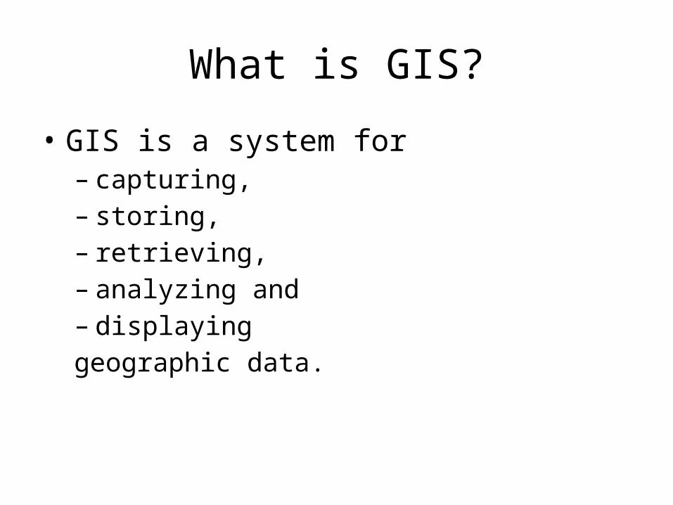
What is GIS?
• GIS is a system for– capturing,– storing,– retrieving,– analyzing and– displayinggeographic data.
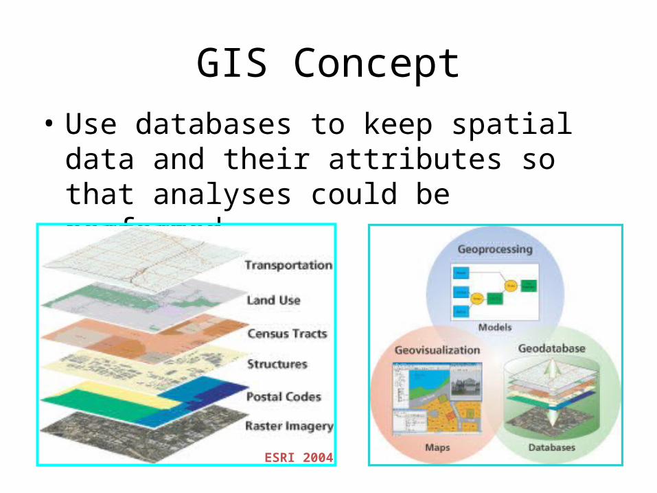
GIS Concept• Use databases to keep spatial data and their
attributes so that analyses could be performed.
ESRI 2004
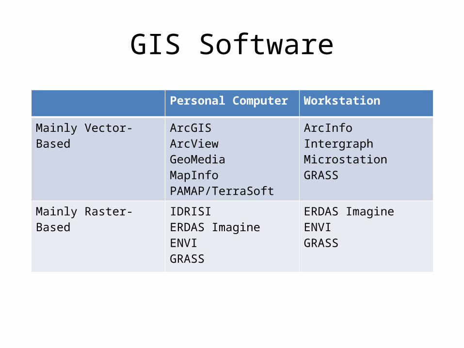
GIS Software
Personal Computer Workstation
Mainly Vector-Based ArcGISArcViewGeoMediaMapInfoPAMAP/TerraSoft
ArcInfoIntergraphMicrostationGRASS
Mainly Raster-Based IDRISIERDAS ImagineENVIGRASS
ERDAS ImagineENVIGRASS
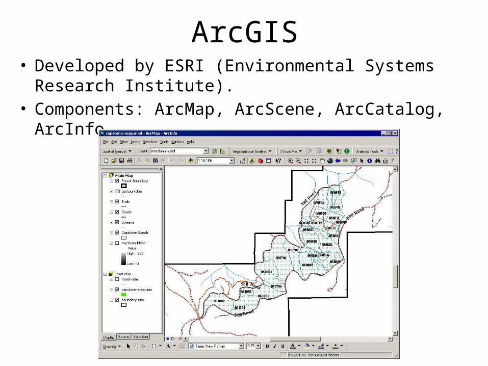
ArcGIS• Developed by ESRI (Environmental Systems Research
Institute).• Components: ArcMap, ArcScene, ArcCatalog, ArcInfo
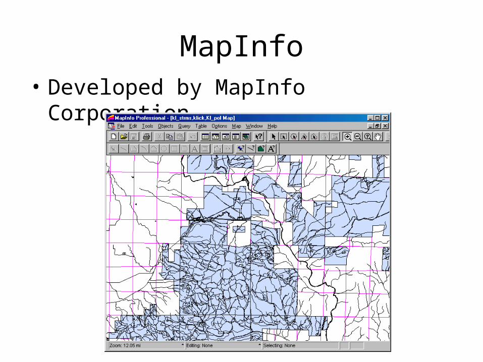
MapInfo• Developed by MapInfo Corporation.
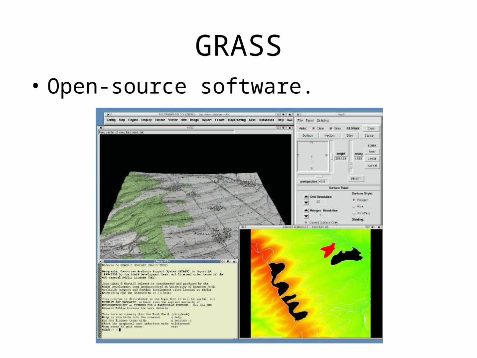
GRASS• Open-source software.
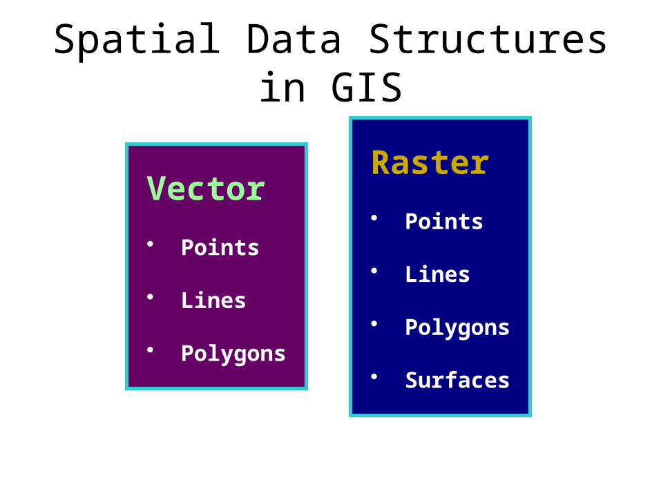
Spatial Data Structures in GIS
Vector • Points
• Lines
• Polygons
Raster • Points
• Lines
• Polygons
• Surfaces
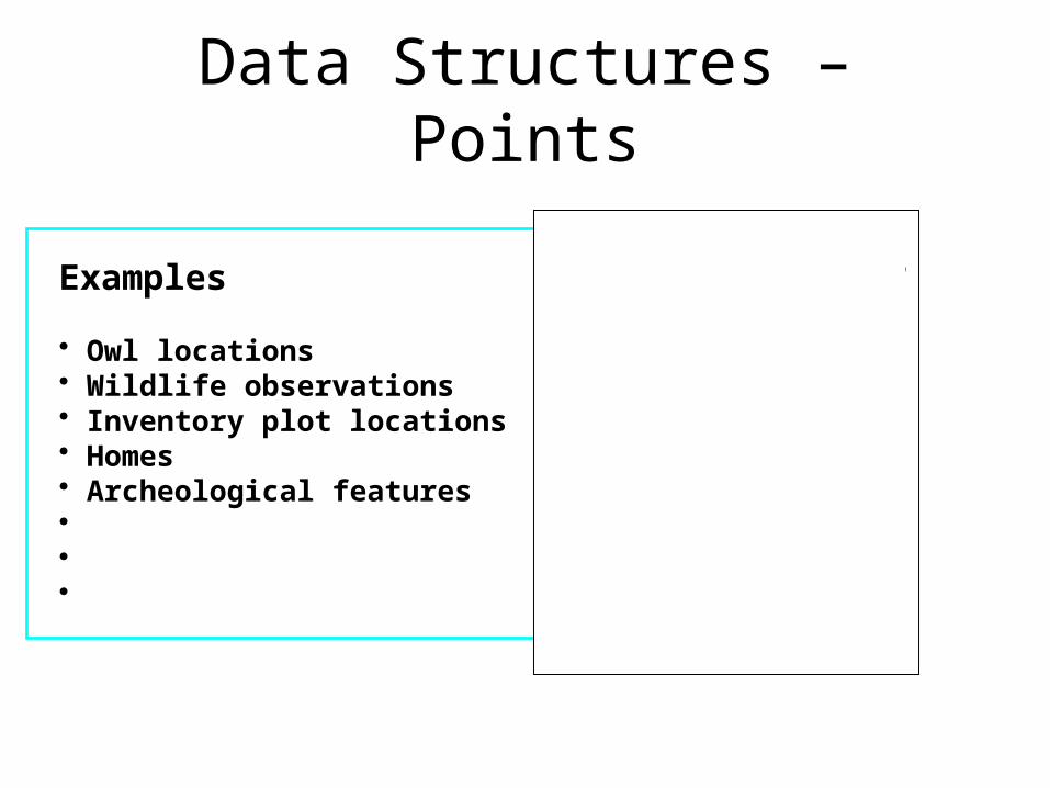
Data Structures – Points
Examples
• Owl locations• Wildlife observations• Inventory plot locations• Homes• Archeological features• • •
# # ####
#
###
#
##
####
######
#
## ##
##
# ###
#
# #
##
##
##
#
#
#
## #
#
#
#
#
#
# ##
#
##
# ##
#
#
#
#
#
#
#
##
# #
#
#
#
# #
#
###
# # ##
####
# ##
# #
##
# #
##
#
#
##
# #
Data Structures – Lines
Examples
• Roads• Streams• Contour lines• Logging trails / corridors• Cruise lines• Trails• • •
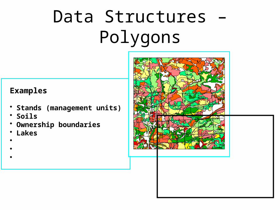
Data Structures – Polygons
Examples
• Stands (management units)• Soils• Ownership boundaries• Lakes• • •
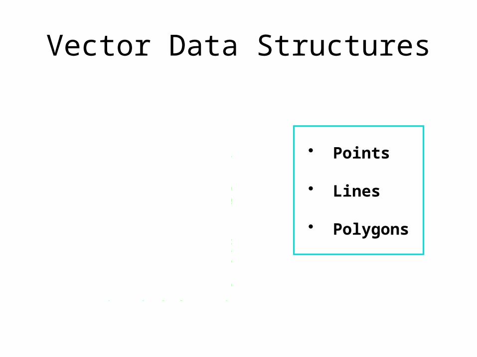
Vector Data Structures
#
#
#
#
#
#
• Points
• Lines
• Polygons
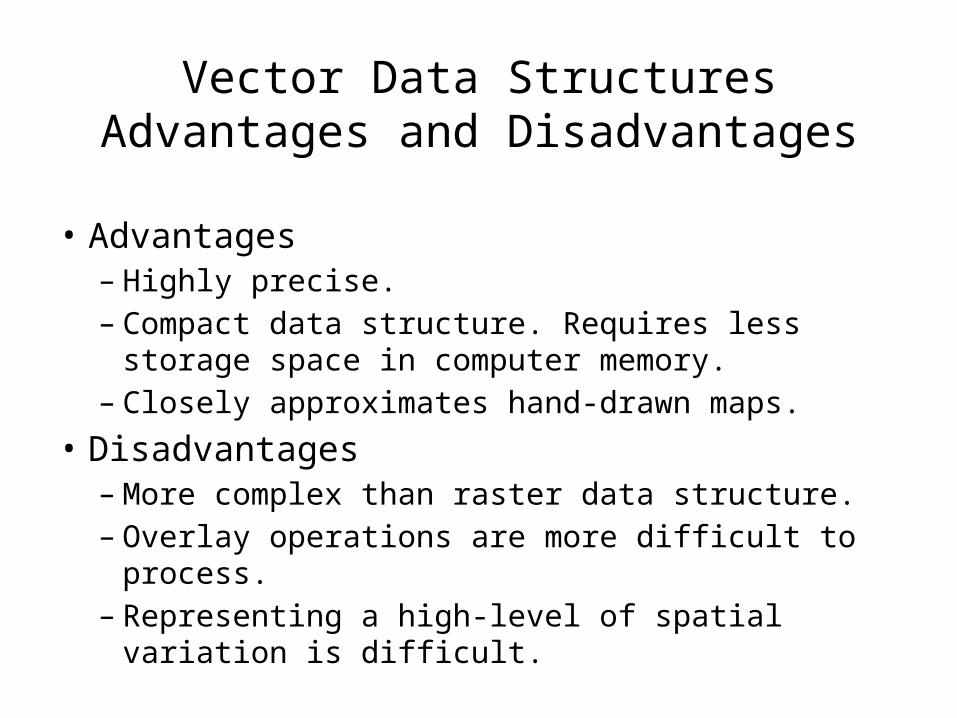
Vector Data StructuresAdvantages and Disadvantages
• Advantages– Highly precise.– Compact data structure. Requires less storage space
in computer memory.– Closely approximates hand-drawn maps.
• Disadvantages– More complex than raster data structure.– Overlay operations are more difficult to process.– Representing a high-level of spatial variation is
difficult.
Raster Data Structures

Raster Data Structures – Grid Cells
Examples
• Spectral reflectance (image)• Other EM radiation (thermal)• Classified data• Rasterized vector data• Digital elevation models• Scanned data
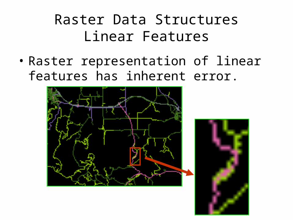
Raster Data StructuresLinear Features
• Raster representation of linear features has inherent error.
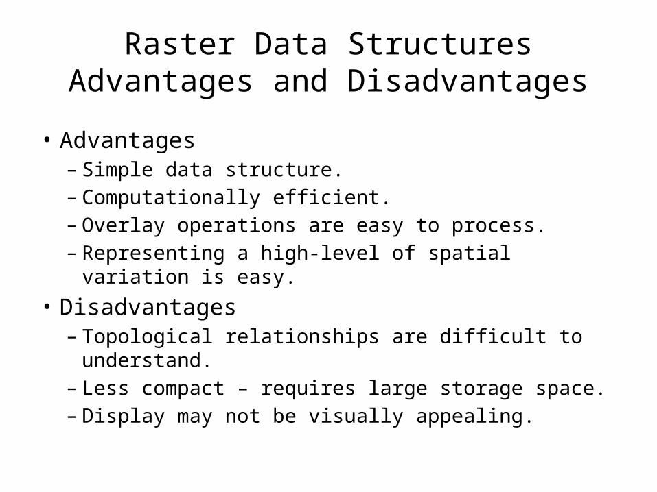
Raster Data StructuresAdvantages and Disadvantages
• Advantages– Simple data structure.– Computationally efficient.– Overlay operations are easy to process.– Representing a high-level of spatial variation is easy.
• Disadvantages– Topological relationships are difficult to understand.– Less compact – requires large storage space.– Display may not be visually appealing.
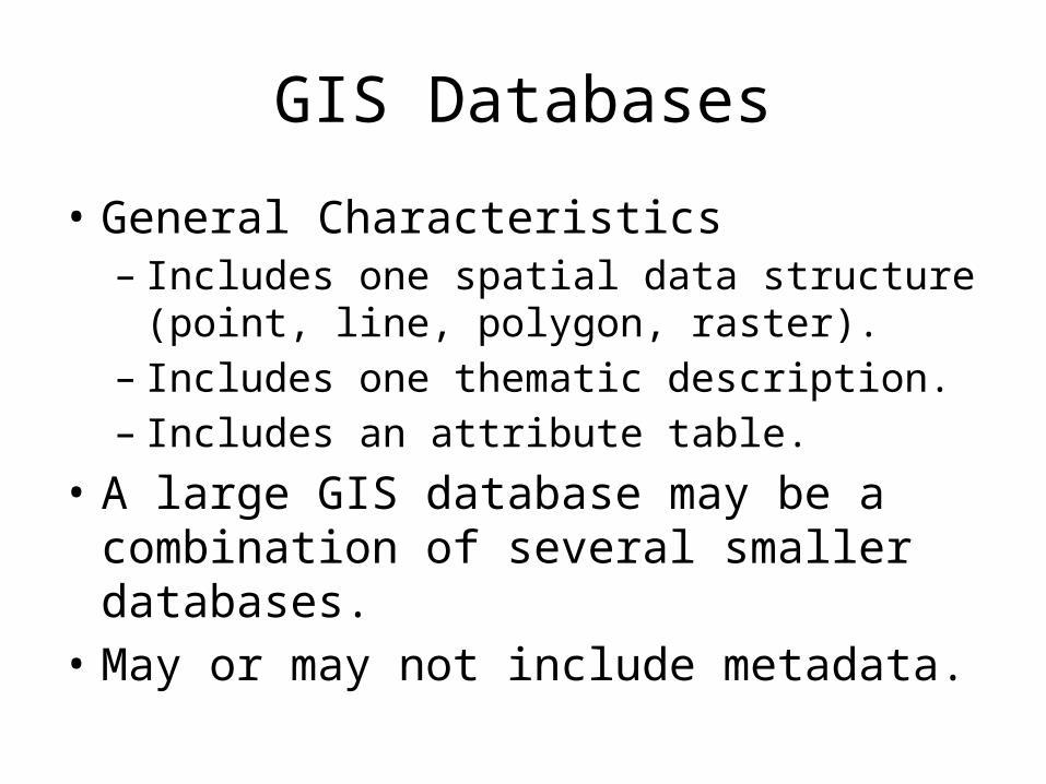
GIS Databases
• General Characteristics– Includes one spatial data structure (point, line,
polygon, raster).– Includes one thematic description.– Includes an attribute table.
• A large GIS database may be a combination of several smaller databases.
• May or may not include metadata.
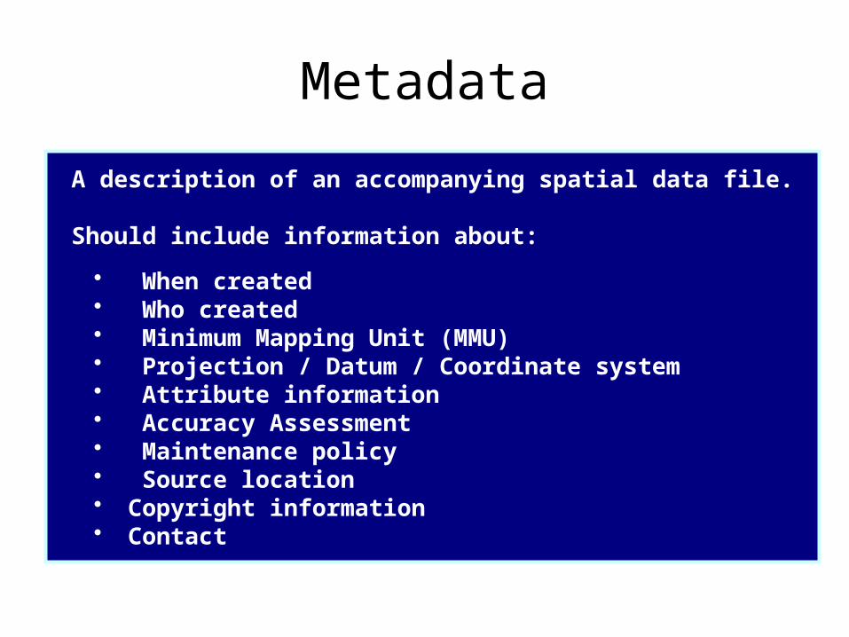
Metadata
A description of an accompanying spatial data file.
Should include information about:
• When created• Who created• Minimum Mapping Unit (MMU)• Projection / Datum / Coordinate system• Attribute information• Accuracy Assessment• Maintenance policy• Source location• Copyright information• Contact
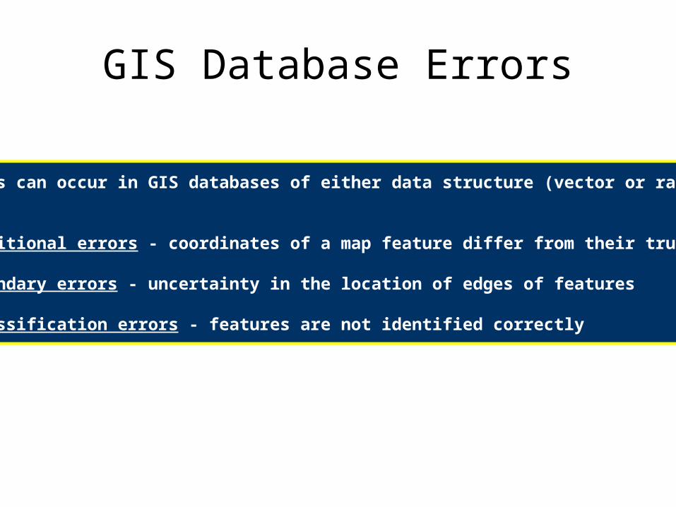
GIS Database Errors
These errors can occur in GIS databases of either data structure (vector or raster):
1) Positional errors - coordinates of a map feature differ from their true locations
2) Boundary errors - uncertainty in the location of edges of features
3) Classification errors - features are not identified correctly
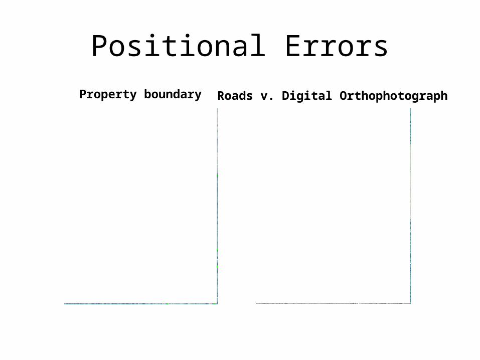
Positional ErrorsProperty boundary Roads v. Digital Orthophotograph
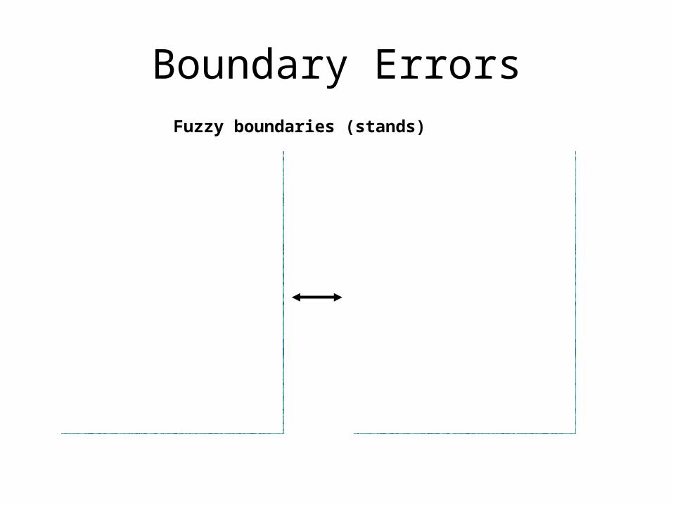
Boundary ErrorsFuzzy boundaries (stands)
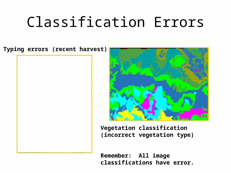
Classification Errors
Typing errors (recent harvest)
Vegetation classification (incorrect vegetation type)
Remember: All image classifications have error.
GIS Terminologies
• Coverage– A GIS layer.
• Shapefile– Digital file format of ESRI’s ArcView software.
• DEM– Digital Elevation Model in raster data format.
• TIN– Digital Elevation Model in vector data format.