Intro to ArcGIS
103
Intro to ArcGIS Kate Dougherty, Geosciences & Maps Librarian Tutorial created for version 10.1 in February 2013
description
Intro to ArcGIS. Kate Dougherty, Geosciences & Maps Librarian Tutorial created for version 10.1 in February 2013. Overview. What is GIS? Common uses Software Interface & navigation Adding layers Customizing & displaying layers. Select features by attribute Select features by location - PowerPoint PPT Presentation
Transcript of Intro to ArcGIS
Intro to ArcGIS
Kate Dougherty, Geosciences & Maps LibrarianTutorial created for version 10.1 in February 2013
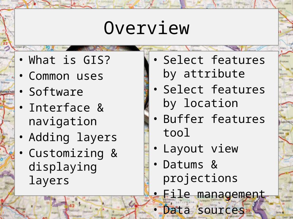
Overview
• What is GIS?• Common uses• Software• Interface & navigation• Adding layers• Customizing &
displaying layers
• Select features by attribute
• Select features by location
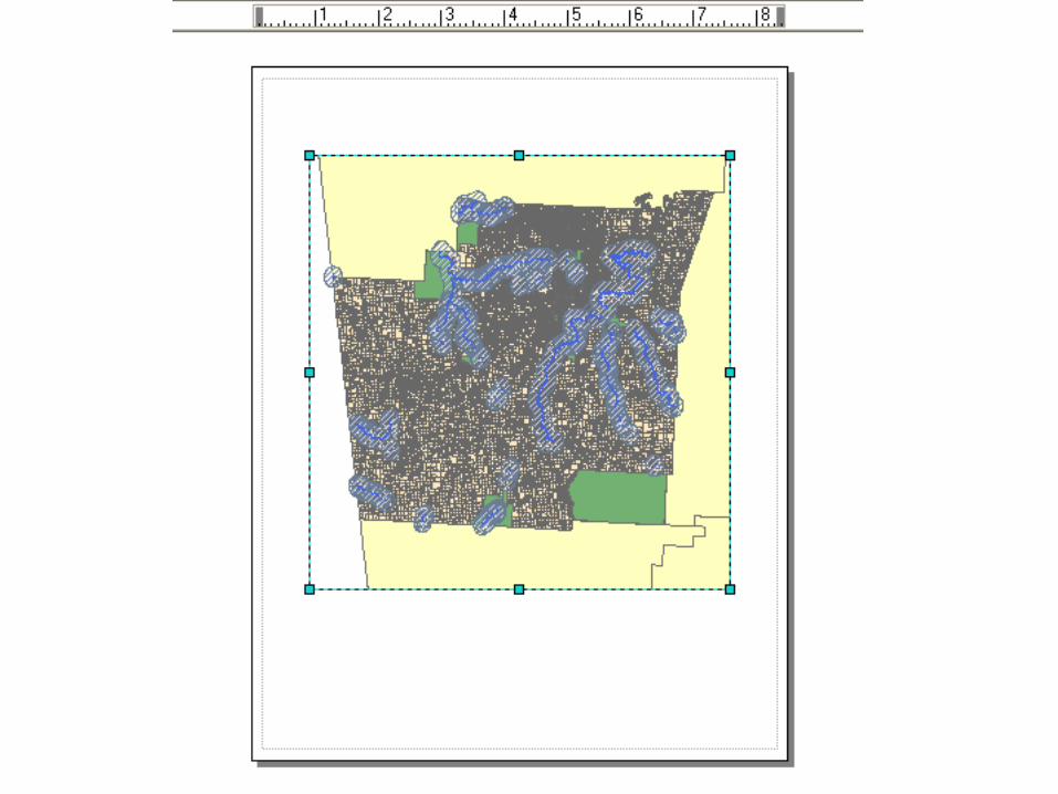
• Buffer features tool• Layout view• Datums & projections• File management• Data sources
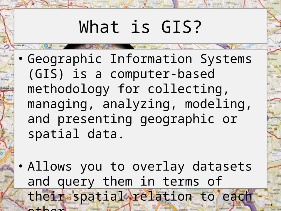
What is GIS?
• Geographic Information Systems (GIS) is a computer-based methodology for collecting, managing, analyzing, modeling, and presenting geographic or spatial data.
• Allows you to overlay datasets and query them in terms of their spatial relation to each other
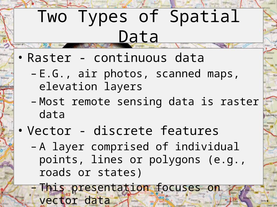
Two Types of Spatial Data
• Raster - continuous data– E.G., air photos, scanned maps, elevation layers – Most remote sensing data is raster data
• Vector - discrete features– A layer comprised of individual points, lines or
polygons (e.g., roads or states)– This presentation focuses on vector data
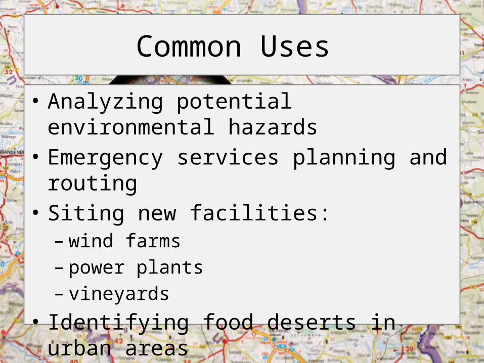
Common Uses
• Analyzing potential environmental hazards• Emergency services planning and routing• Siting new facilities: – wind farms– power plants– vineyards
• Identifying food deserts in urban areas• Much more!
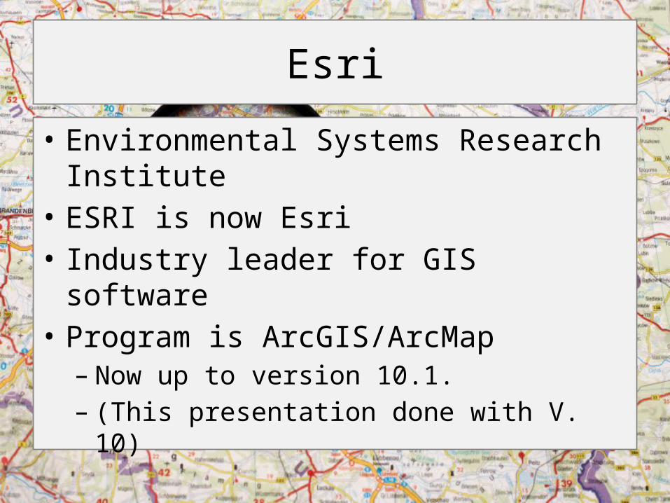
Esri
• Environmental Systems Research Institute• ESRI is now Esri• Industry leader for GIS software• Program is ArcGIS/ArcMap– Now up to version 10.1. – (This presentation done with V. 10)
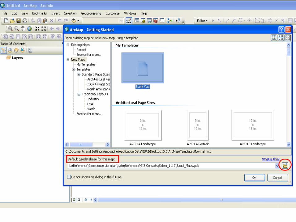
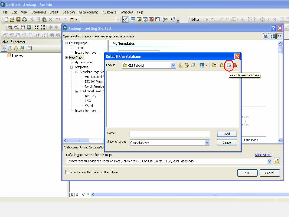
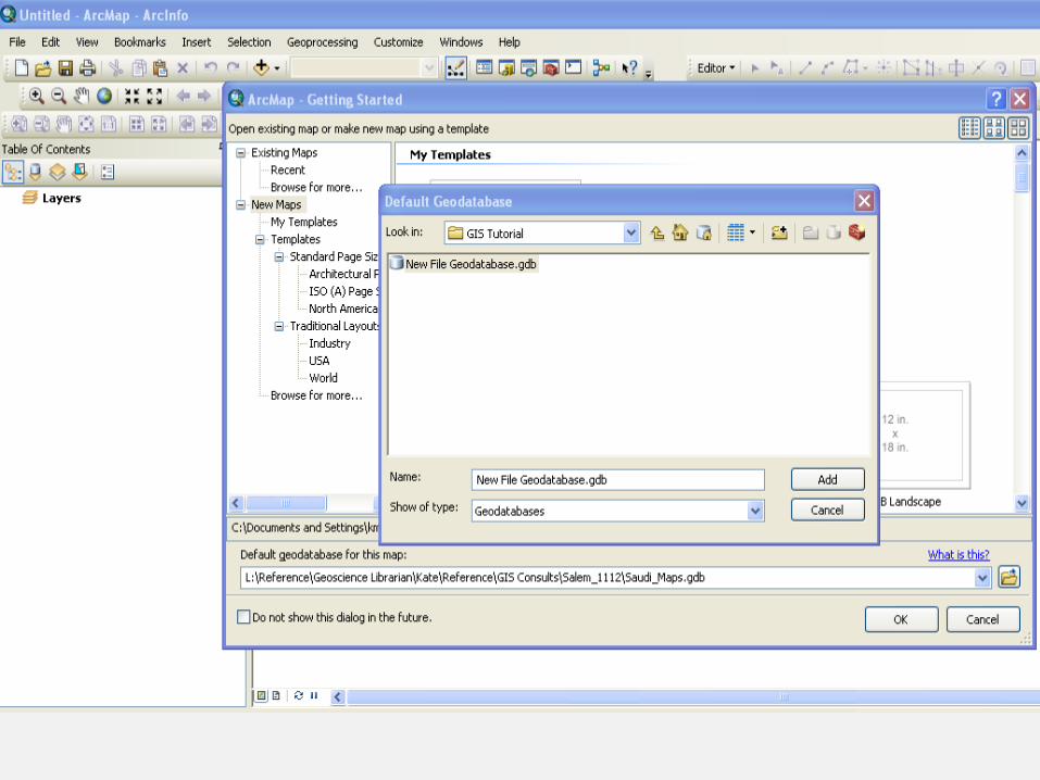
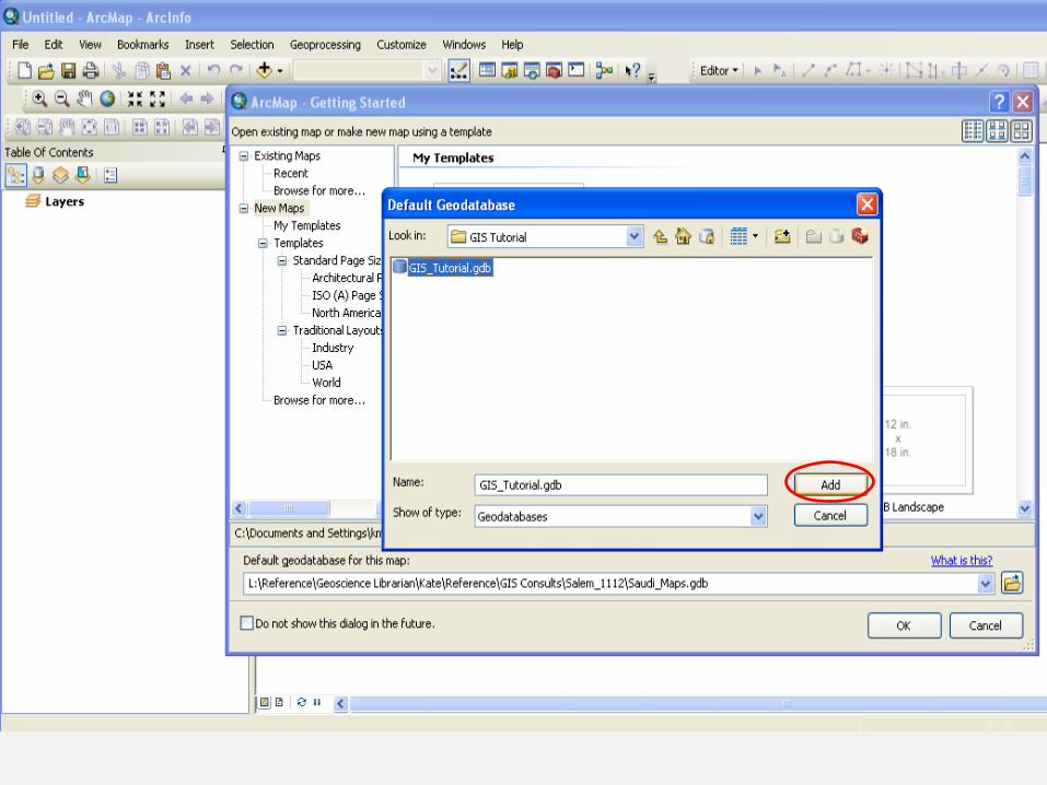
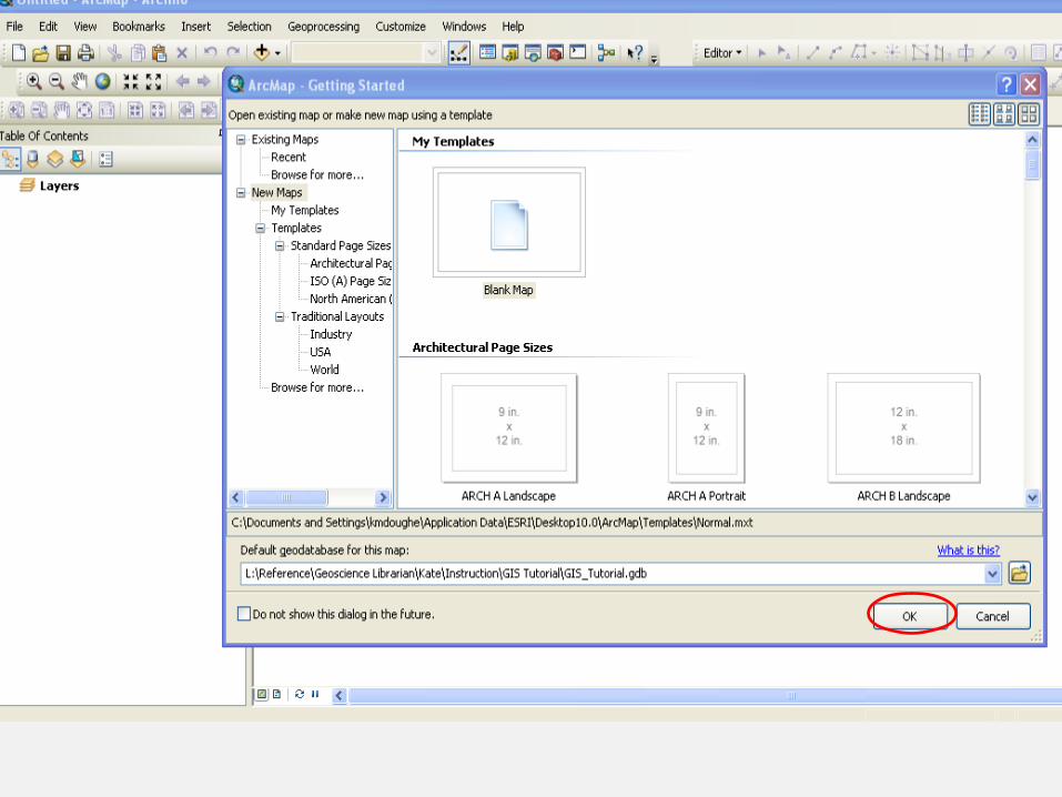
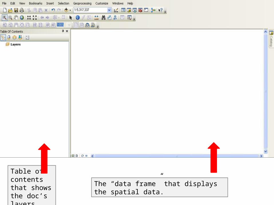
Table of contents that shows the doc’s layers.
The “data frame” that displays the spatial data.
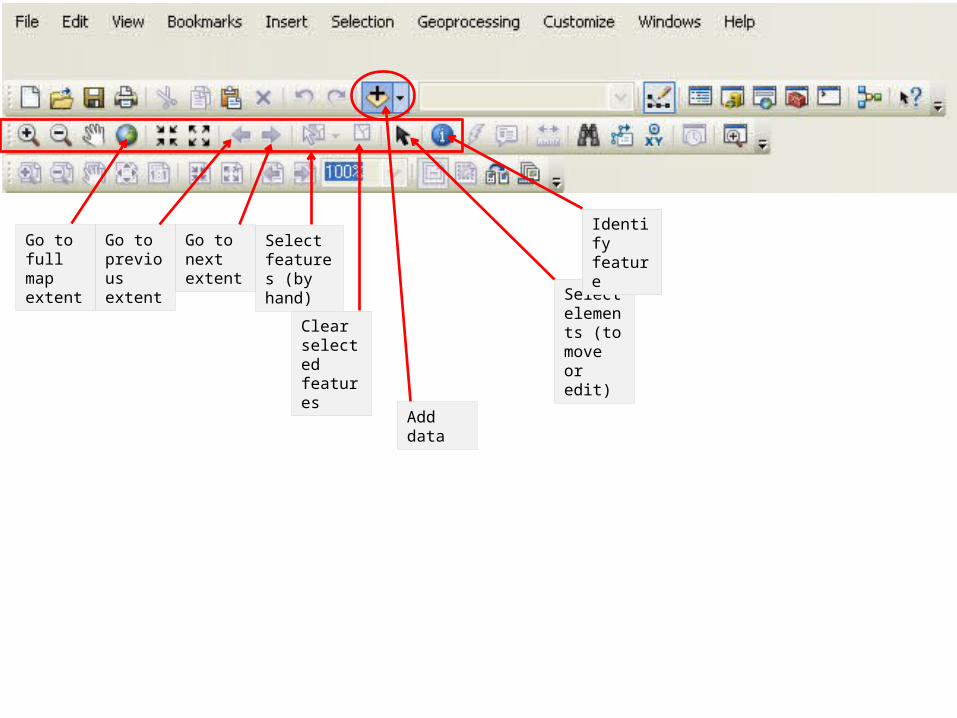
Go to full map extent
Go to previous extent
Go to next extent
Select features (by hand)
Clear selected features
Select elements (to move or edit)
Identify feature
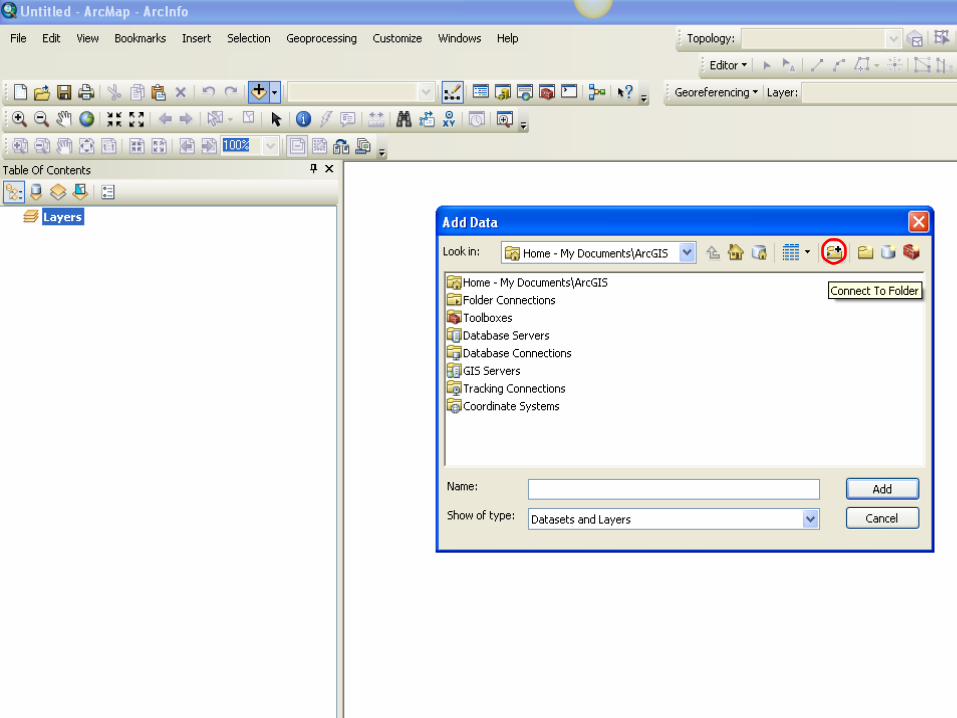
Add data
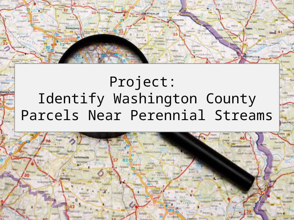
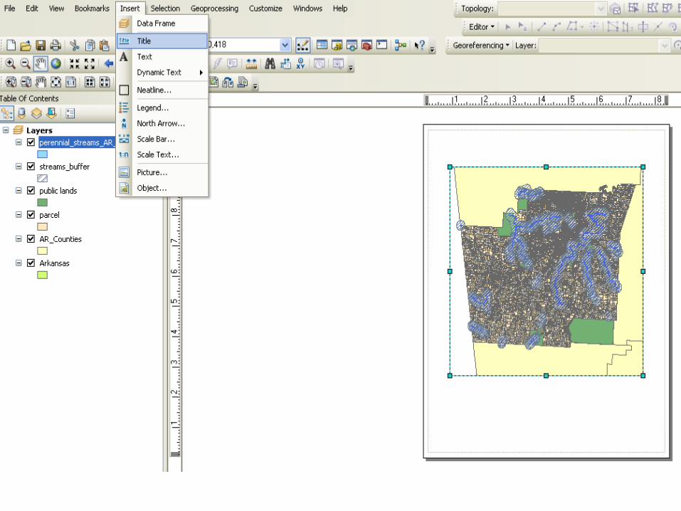
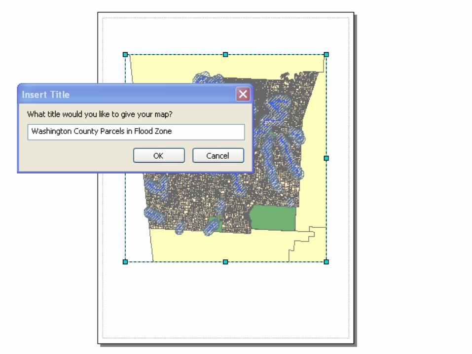
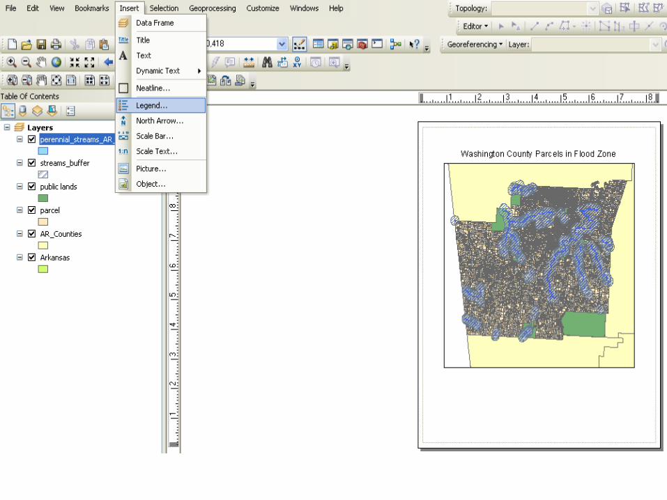
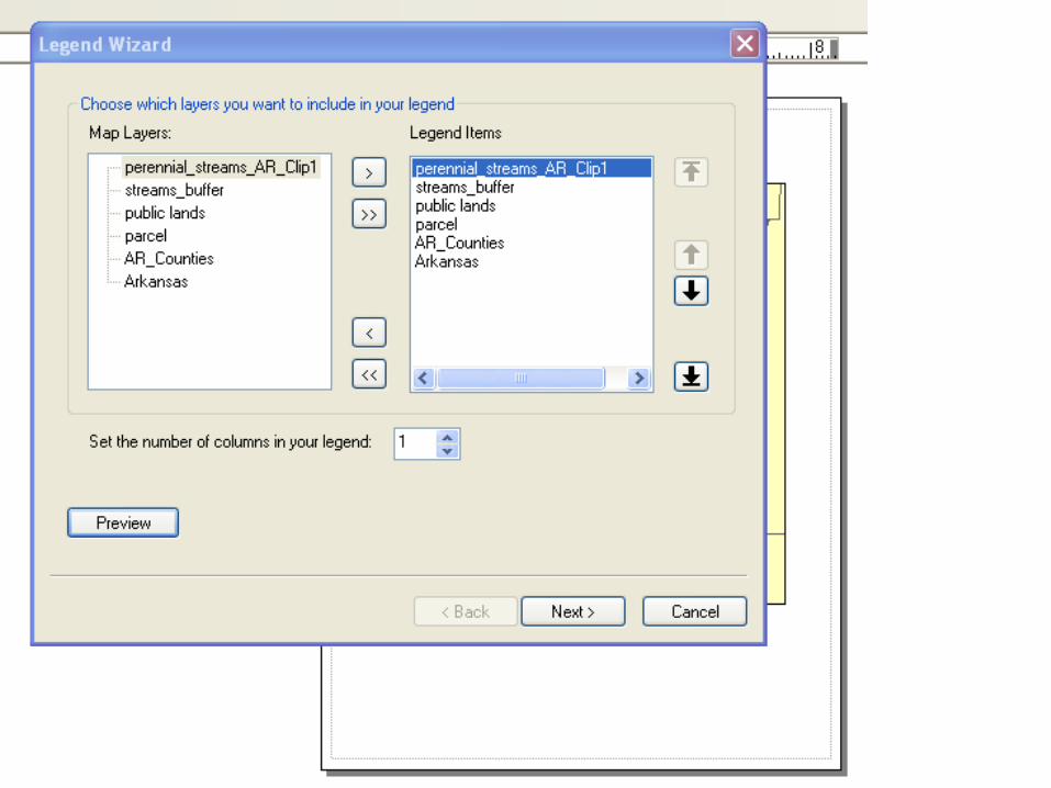
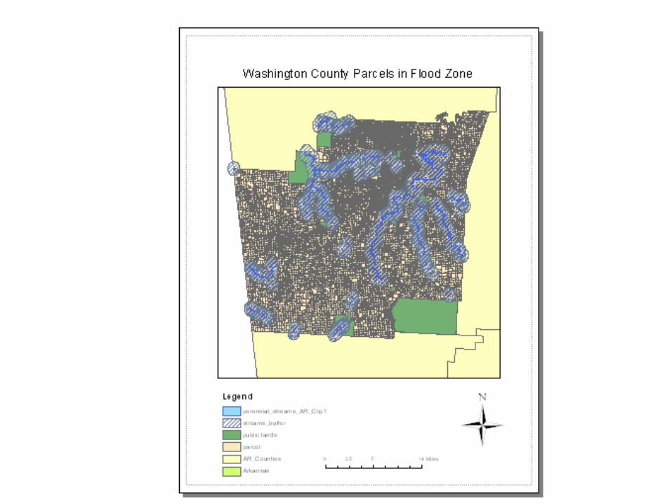
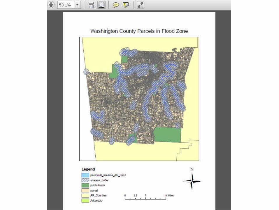
Project: Identify Washington County Parcels
Near Perennial Streams
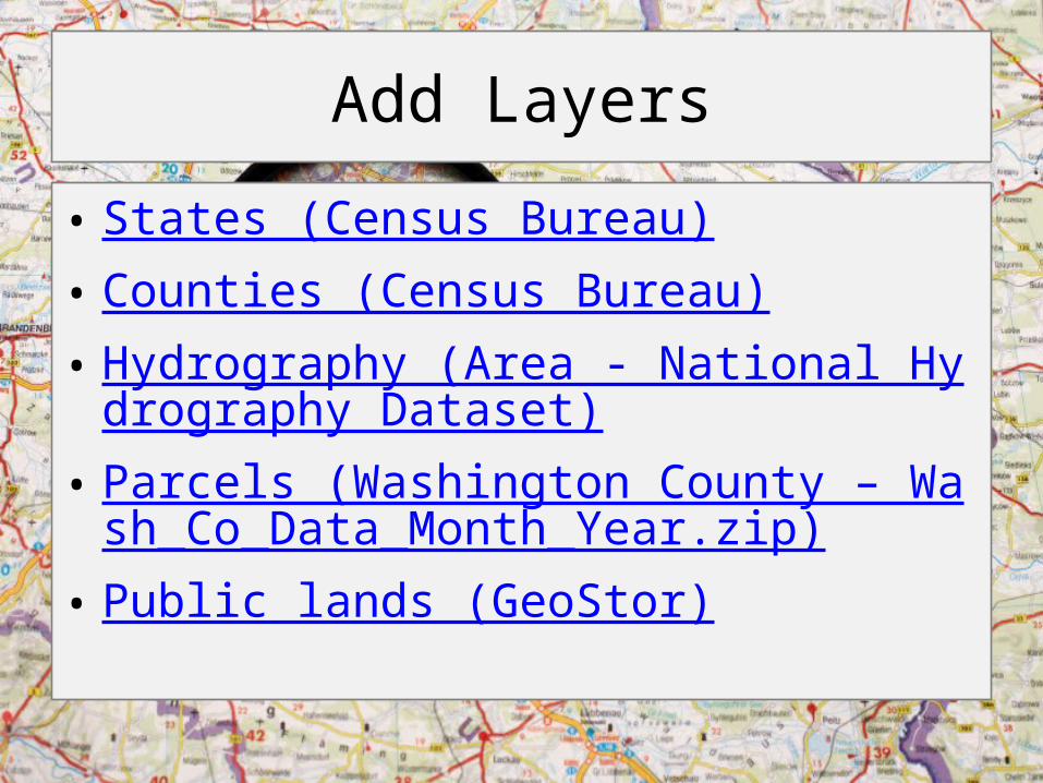
Add Layers
• States (Census Bureau)• Counties (Census Bureau)• Hydrography (Area - National Hydrography Dat
aset)• Parcels (Washington County – Wash_Co_Data
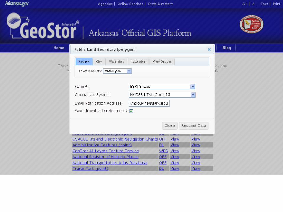
_Month_Year.zip)• Public lands (GeoStor)
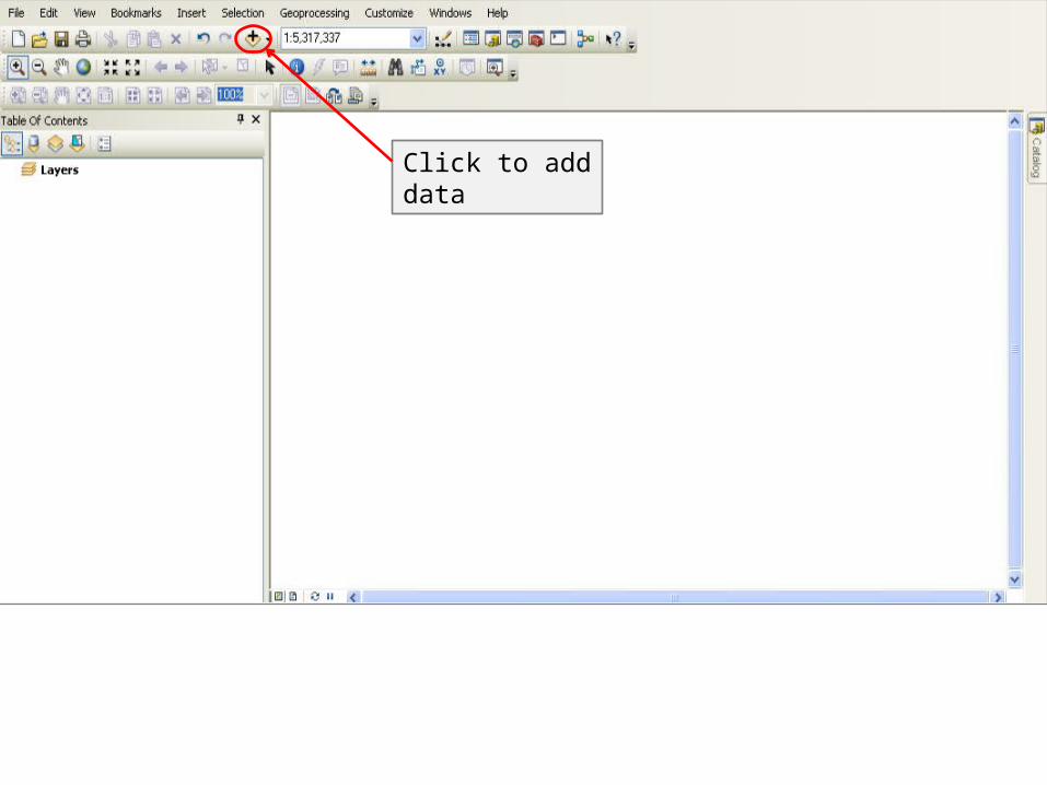
Click to add data
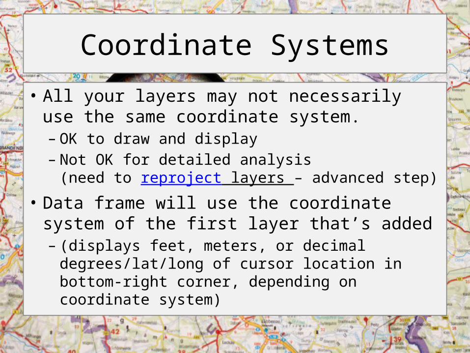
Coordinate Systems
• All your layers may not necessarily use the same coordinate system.– OK to draw and display– Not OK for detailed analysis
(need to reproject layers – advanced step)• Data frame will use the coordinate system of the
first layer that’s added – (displays feet, meters, or decimal degrees/lat/long of
cursor location in bottom-right corner, depending on coordinate system)
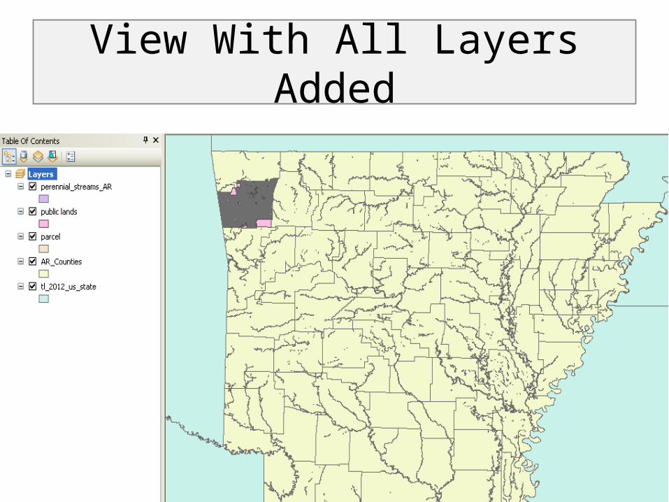
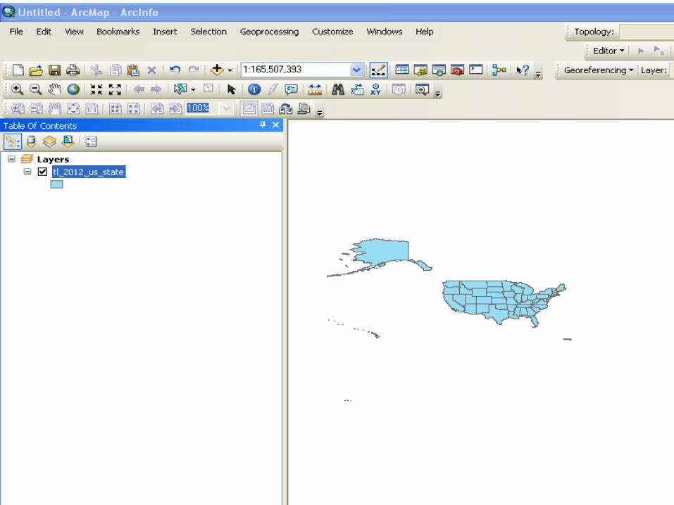
View With All Layers Added
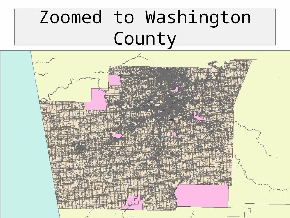
Zoomed to Washington County
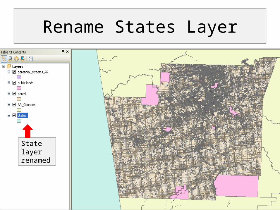
State layer renamed
Rename States Layer

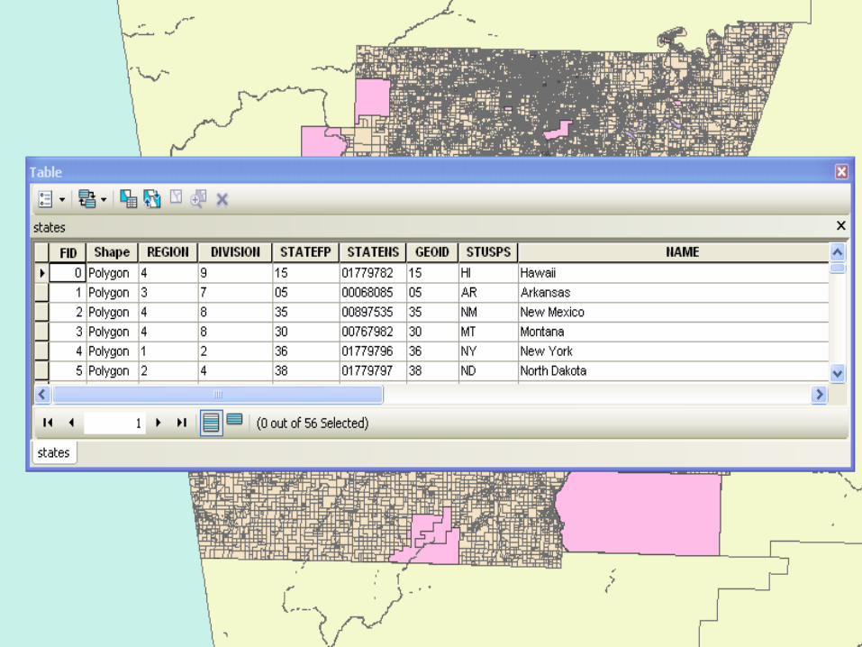
Open the Attribute Table
Customizing Layers
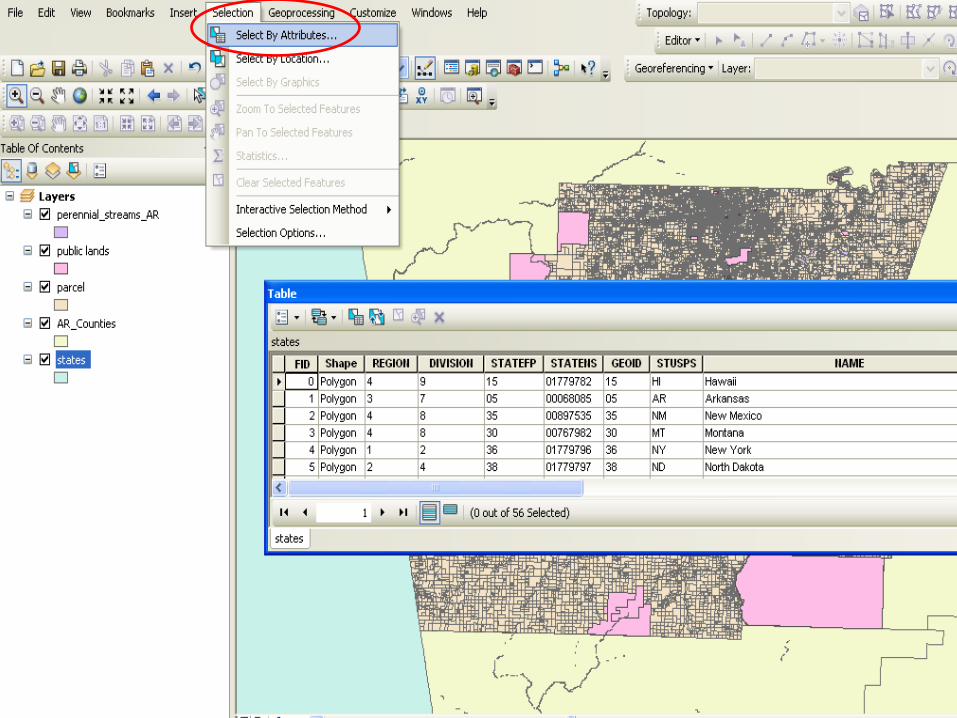
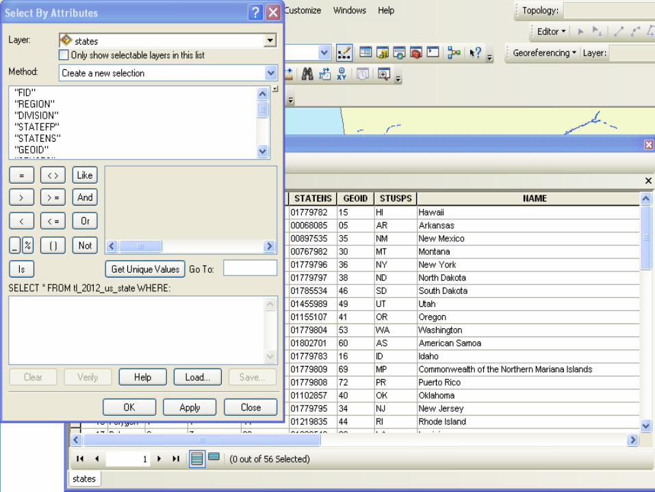
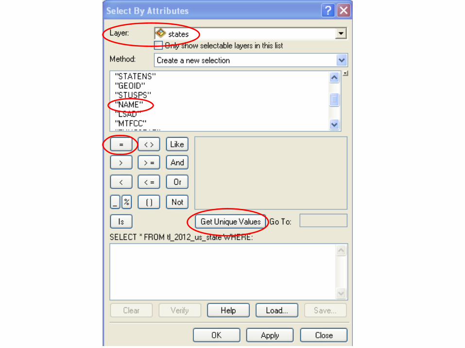
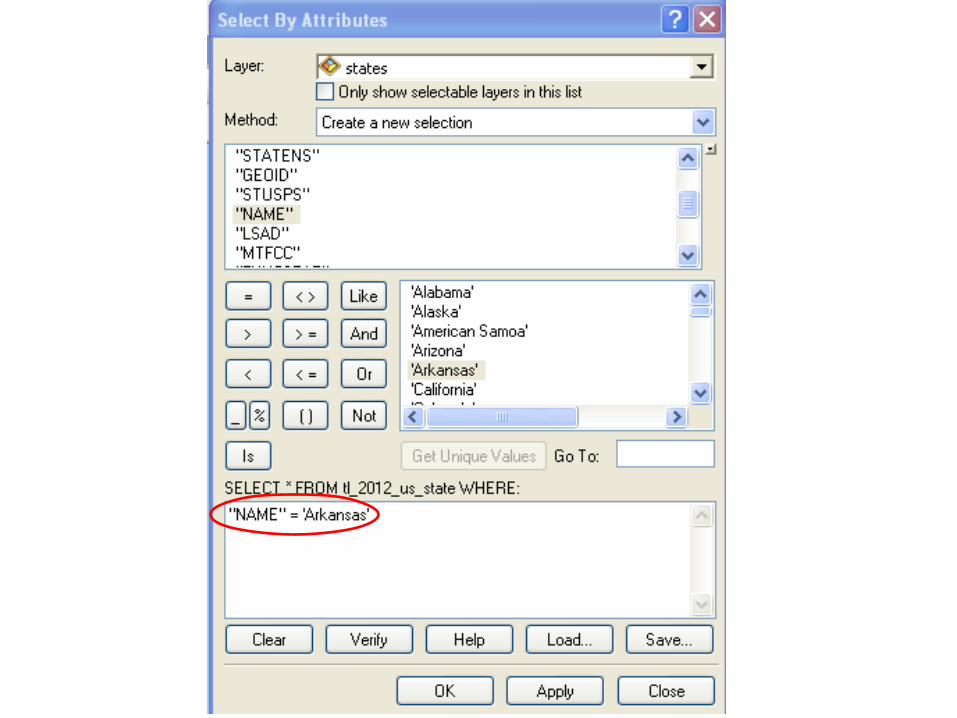
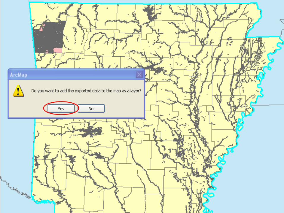
Select by Attribute Tool
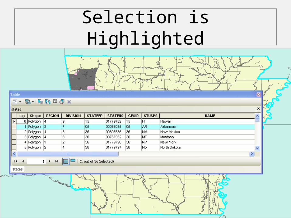
Selection is Highlighted

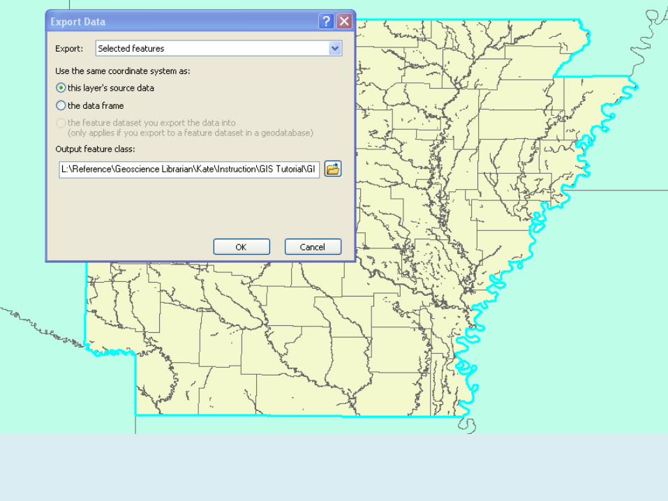
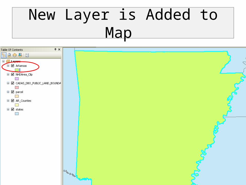
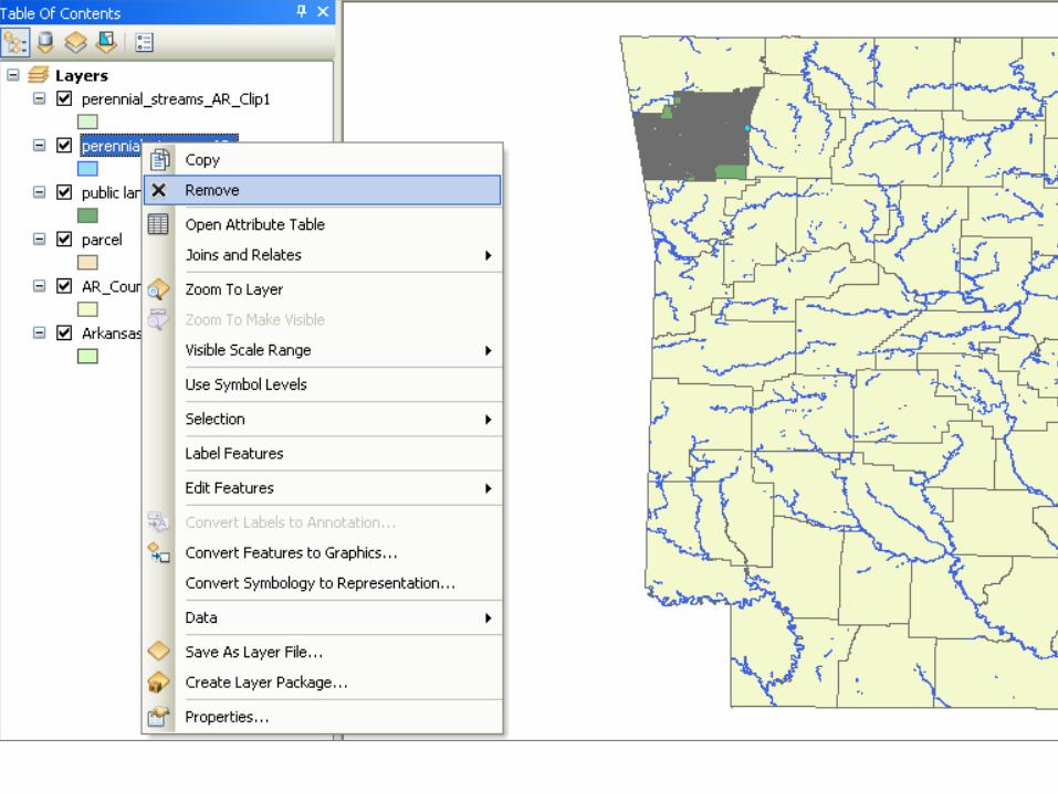
New Layer is Added to Map
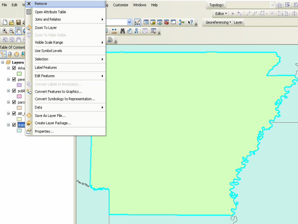
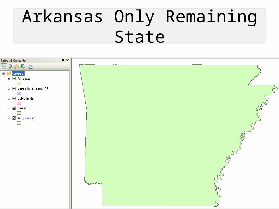
Arkansas Only Remaining State
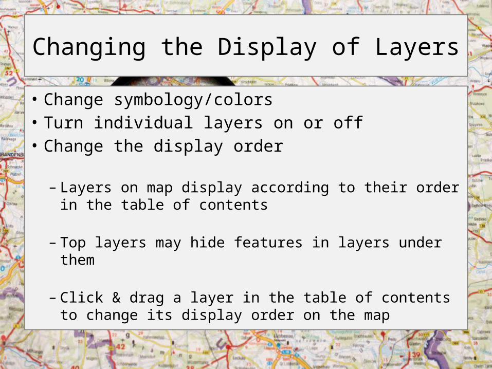
Changing the Display of Layers
• Change symbology/colors• Turn individual layers on or off • Change the display order
– Layers on map display according to their order in the table of contents
– Top layers may hide features in layers under them
– Click & drag a layer in the table of contents to change its display order on the map
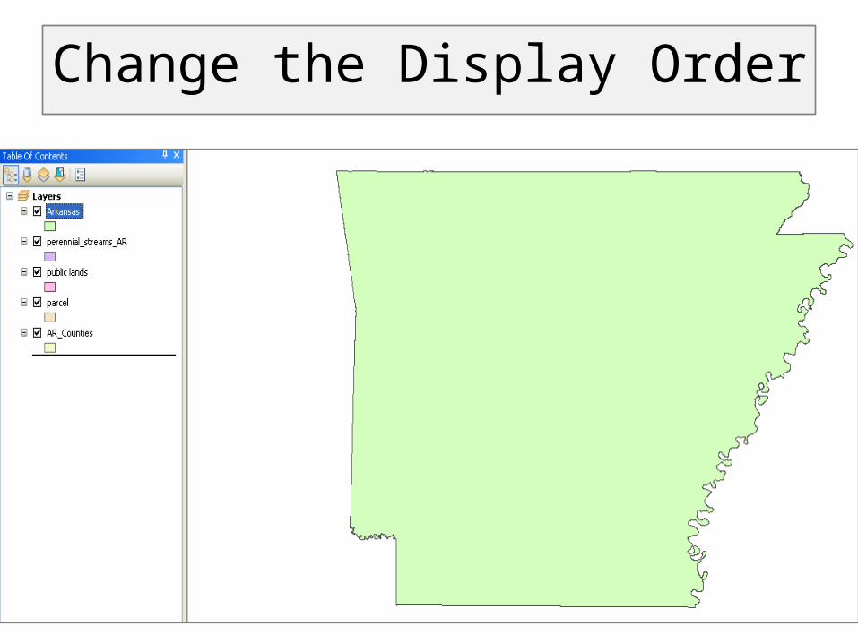
Change the Display Order
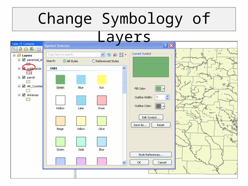
Change Symbology of Layers
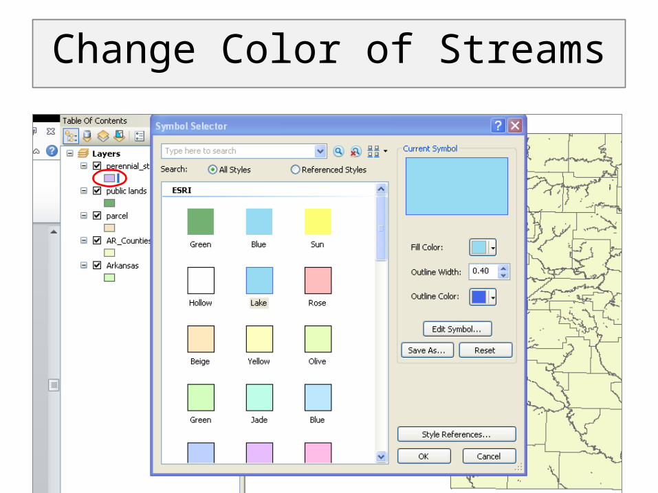
Change Color of Streams
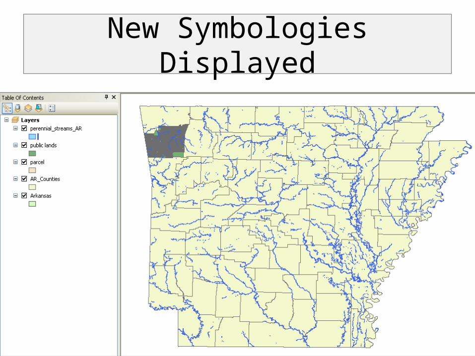
New Symbologies Displayed
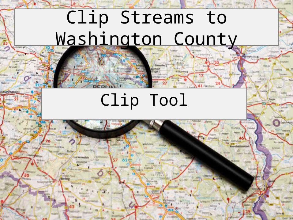
Clip Streams to Washington County
Clip Tool
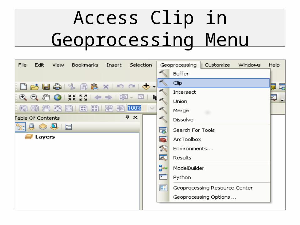
Access Clip in Geoprocessing Menu
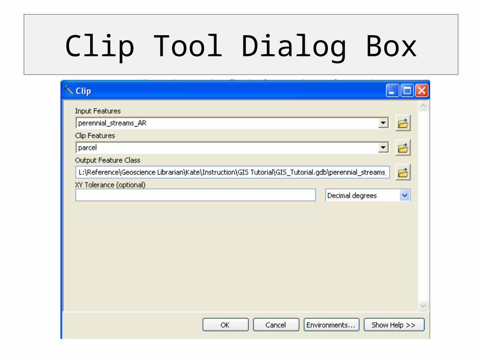
Clip Tool Dialog Box
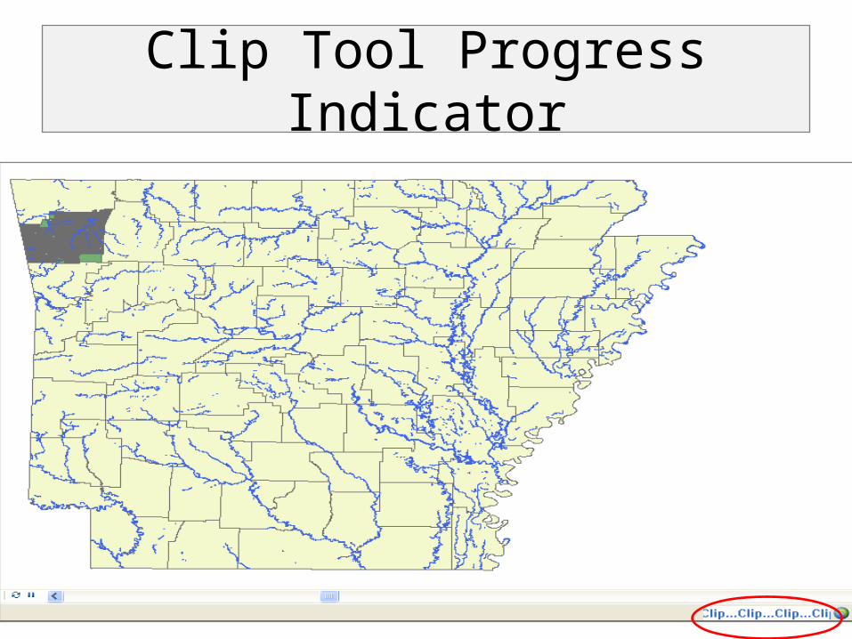
Clip Tool Progress Indicator
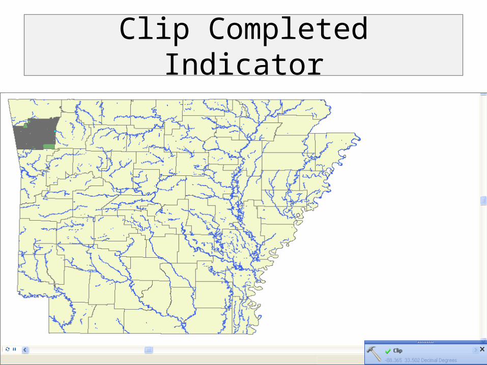
Clip Completed Indicator
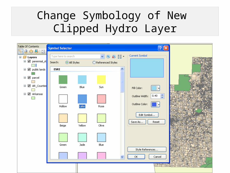
Change Symbology of New Clipped Hydro Layer
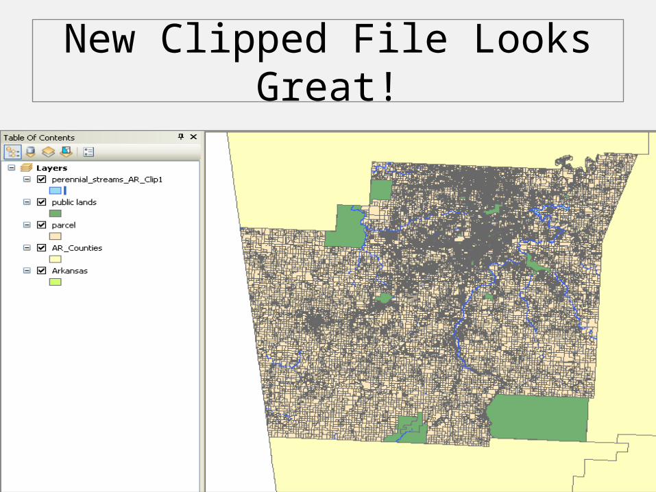
New Clipped File Looks Great!
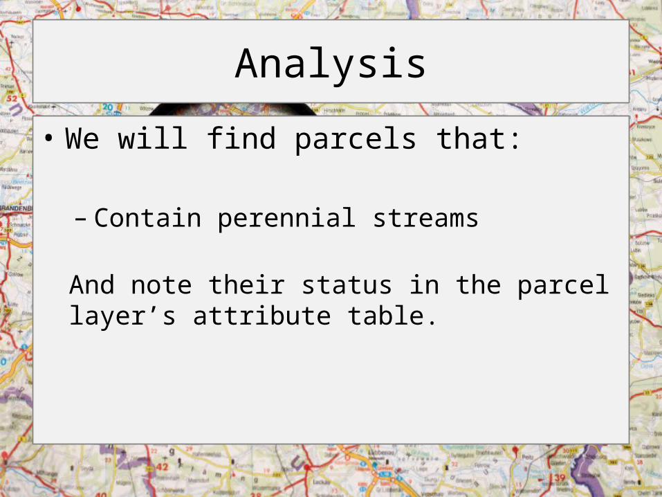
Analysis
• We will find parcels that:
– Contain perennial streams
And note their status in the parcel layer’s attribute table.
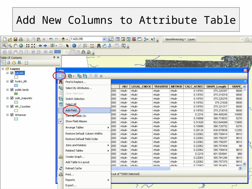
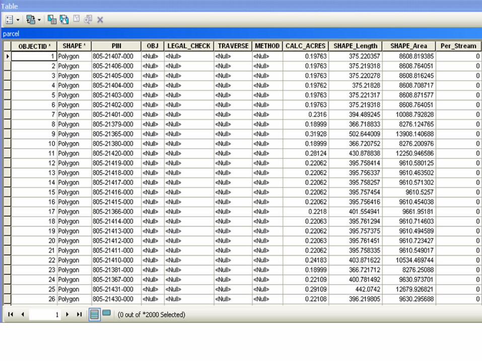
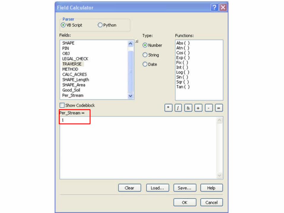
Add New Columns to Attribute Table
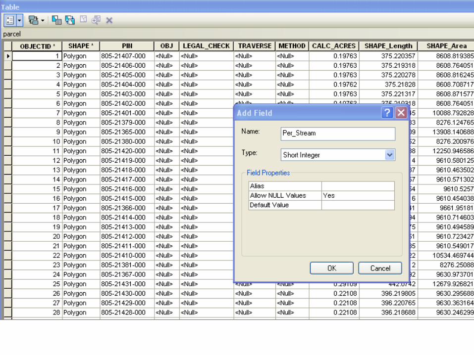
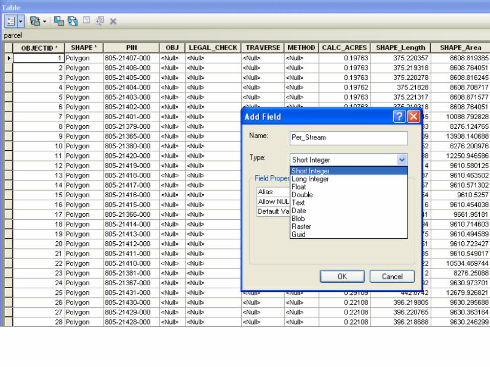
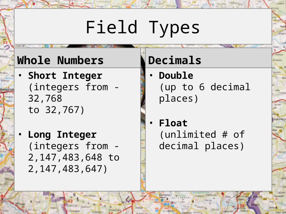
Field Types
Whole Numbers• Short Integer
(integers from -32,768 to 32,767)
• Long Integer (integers from -2,147,483,648 to 2,147,483,647)
Decimals• Double
(up to 6 decimal places)
• Float (unlimited # of decimal places)
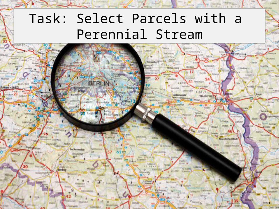
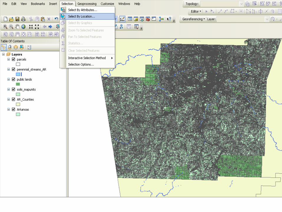
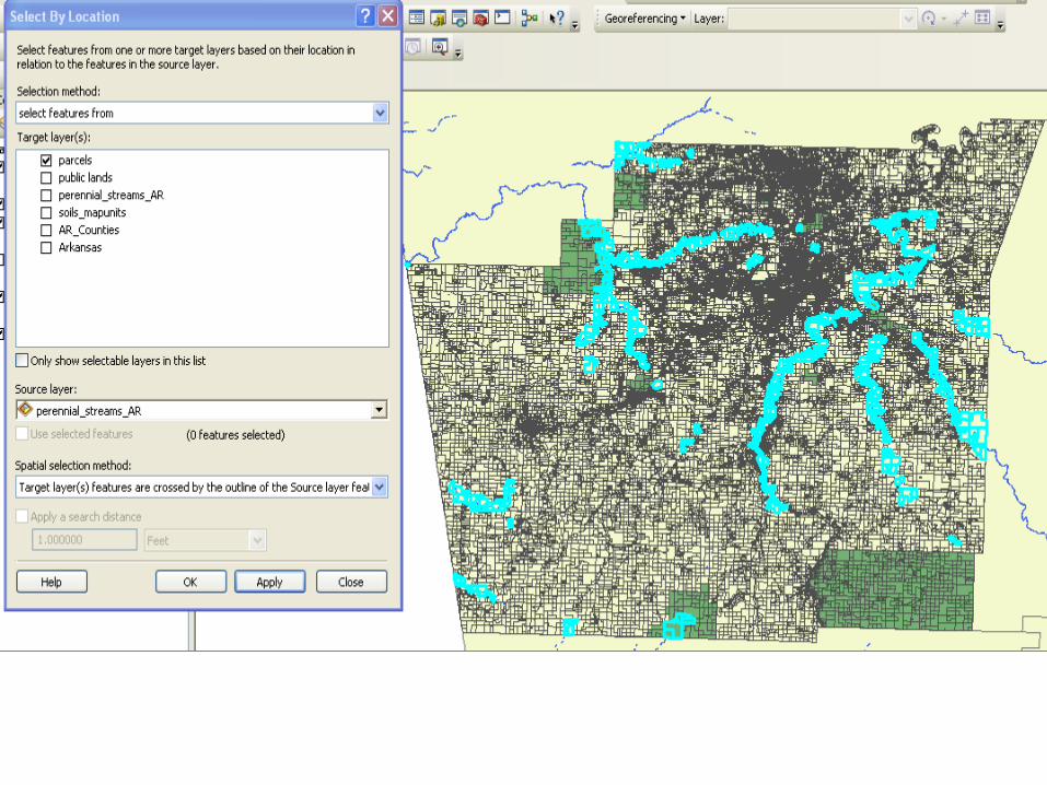
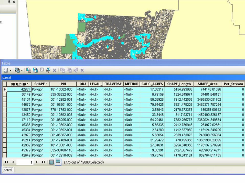
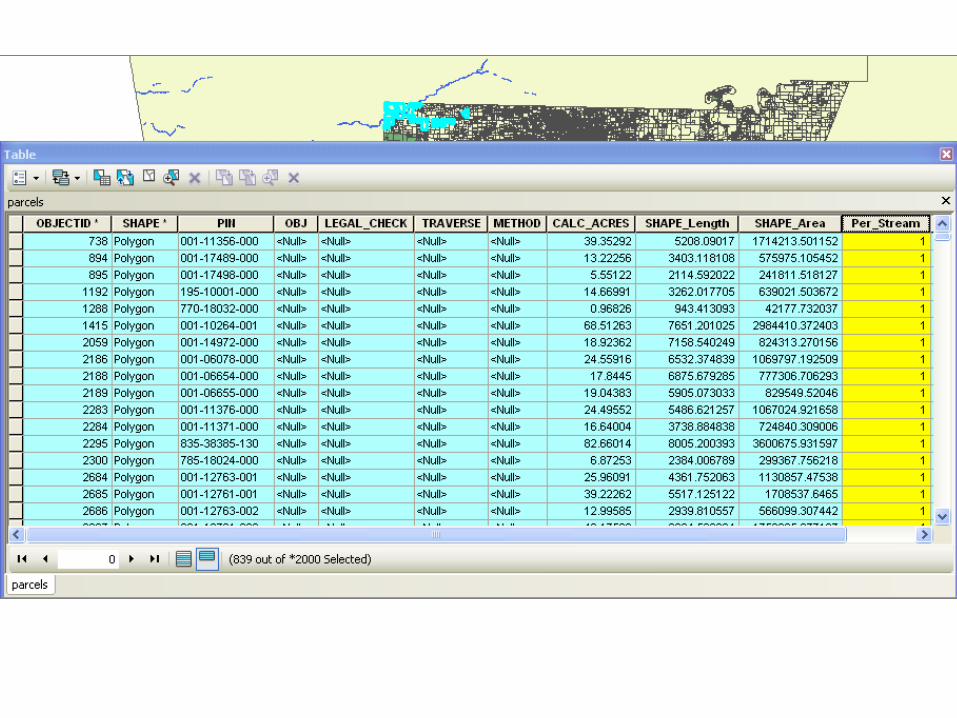
Task: Select Parcels with a Perennial Stream
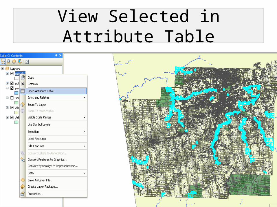
View Selected in Attribute Table
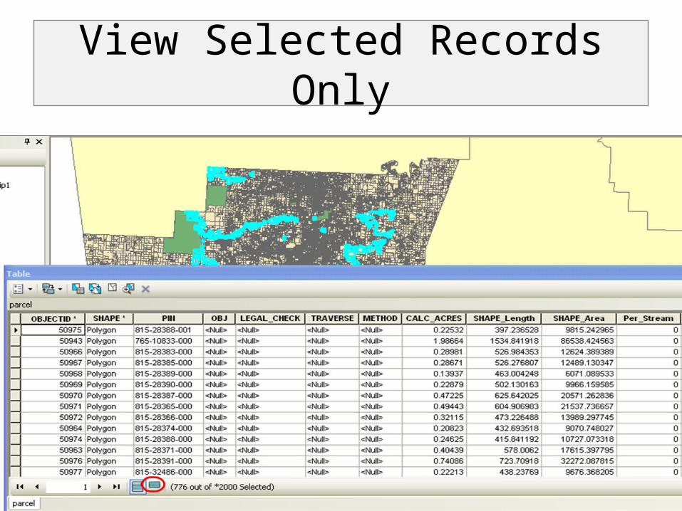
View Selected Records Only

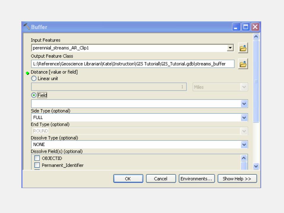
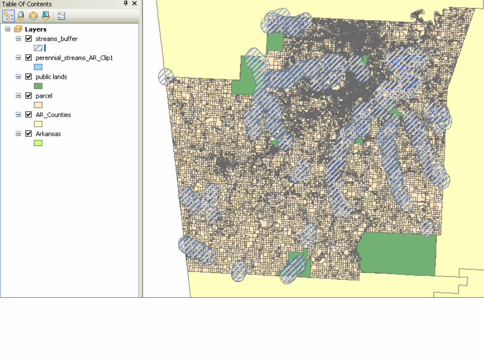
Task: Select Parcels in a “flood Zone” Within a Distance of Perennial Streams
• Use the buffer tool to draw a “buffer zone” around specified features

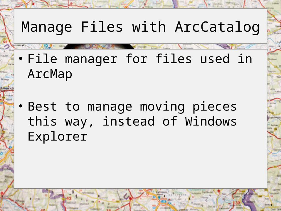
Manage Files with ArcCatalog
• File manager for files used in ArcMap
• Best to manage moving pieces this way, instead of Windows Explorer
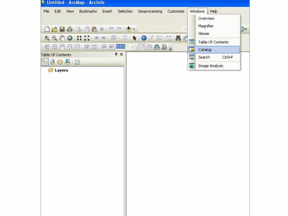

ArcCatalog Window
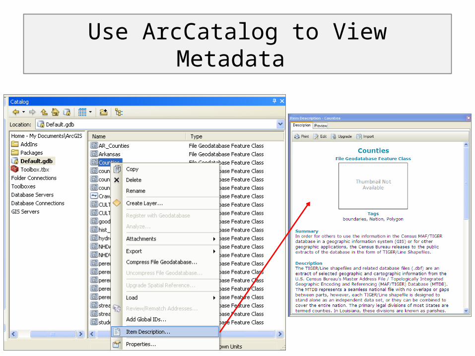
Use ArcCatalog to View Metadata
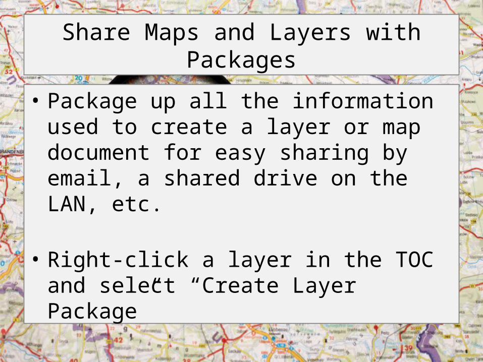
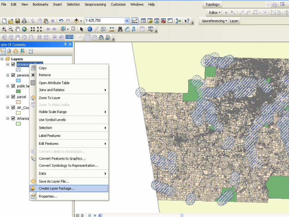
Share Maps and Layers with Packages
• Package up all the information used to create a layer or map document for easy sharing by email, a shared drive on the LAN, etc.
• Right-click a layer in the TOC and select “Create Layer Package”
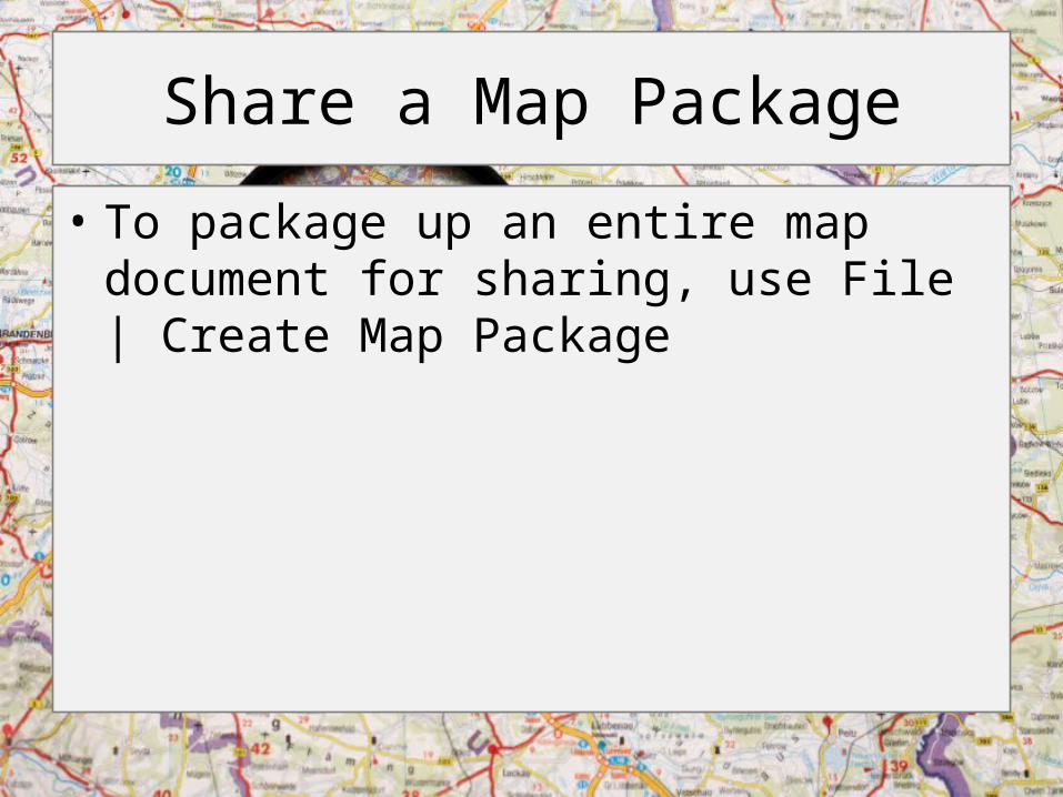
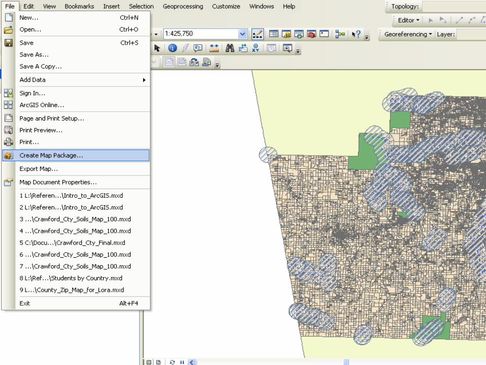
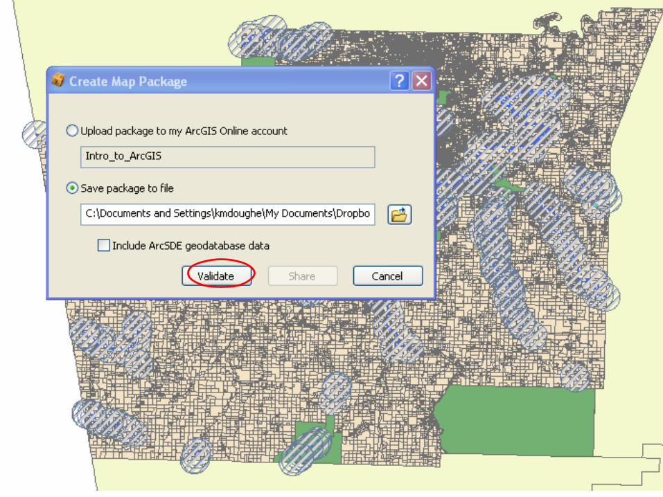
Share a Map Package
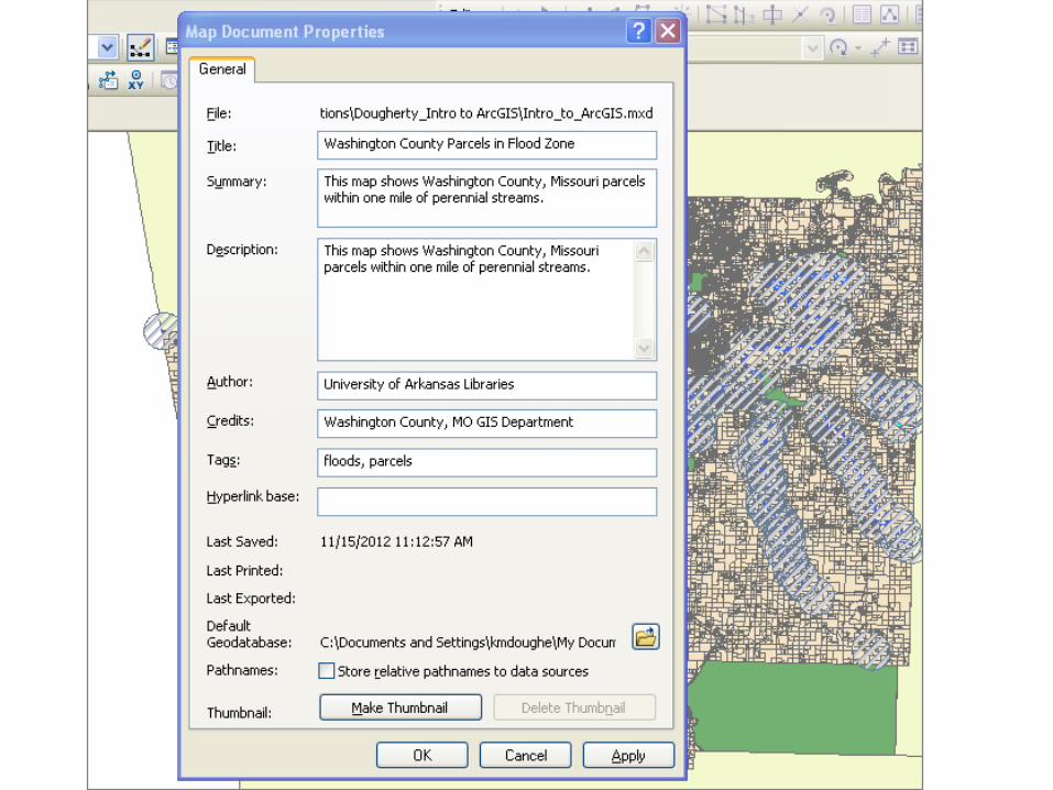
• To package up an entire map document for sharing, use File | Create Map Package
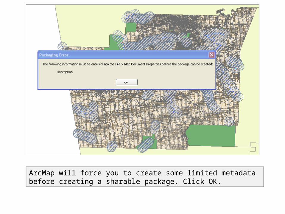
ArcMap will force you to create some limited metadata before creating a sharable package. Click OK.
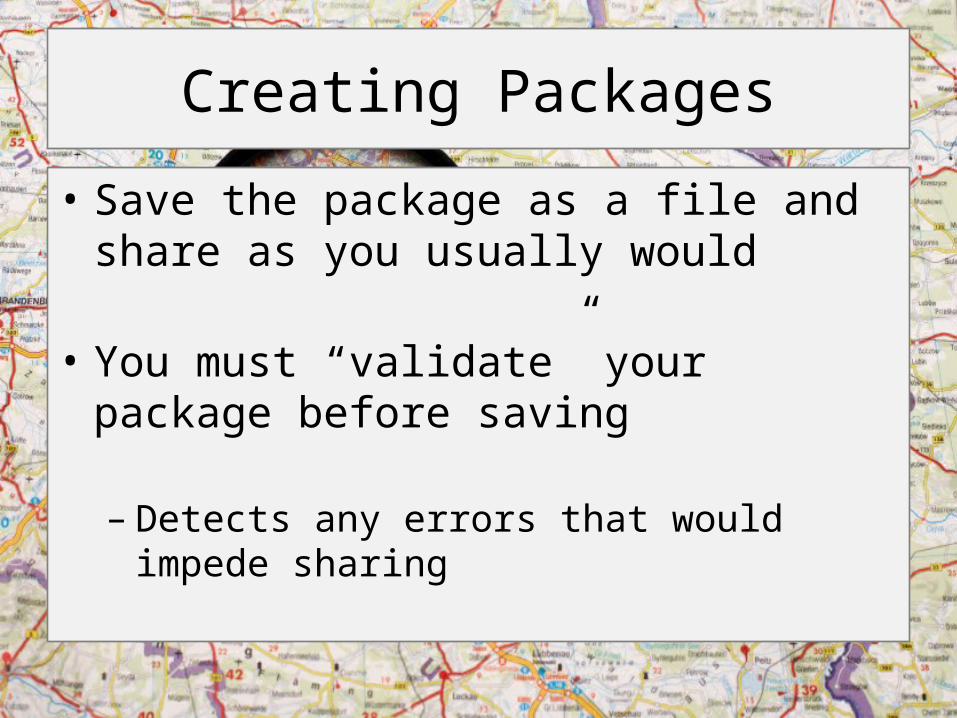
Creating Packages
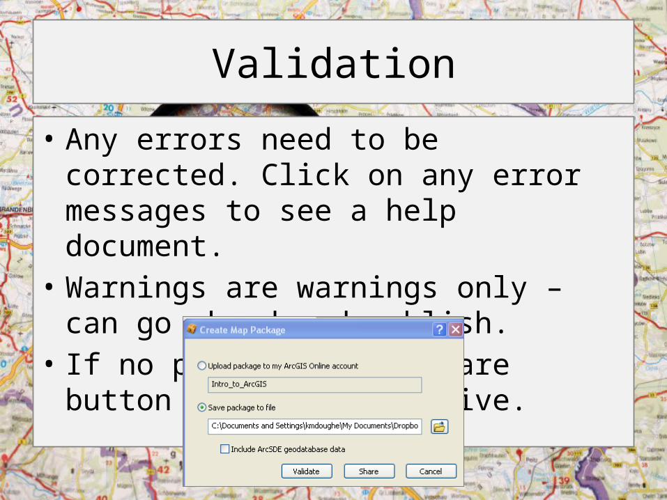
• Save the package as a file and share as you usually would
• You must “validate” your package before saving
– Detects any errors that would impede sharing
Validation
• Any errors need to be corrected. Click on any error messages to see a help document.
• Warnings are warnings only – can go ahead and publish.
• If no problems, the share button will become active.
What Else Can You Do with GIS?
• Join stats based on geography (i.e., states) to a states GIS layer and view the data spatially– Excel, CSV, text formats
• Create/digitize your own data
• import GPS data
• Analyze viewsheds and shadows
• Use web map services for mashups in your own applications
• Much more!
GIS Software at University of Arkansas
• Reference desk machine (version 10.1)
• Campus-wide license – administered by the Center for Advanced Spatial Technologies (CAST)
• Free software
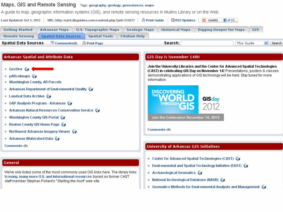
Sources of GIS Data
• Search for selected base layers (reference maps) from right within the application
• GeoStor (Arkansas state portal)• geo.data.gov (federal portal)• National Map (USGS)• TIGER/Census Shapefiles (reference layers –
boundaries, roads)
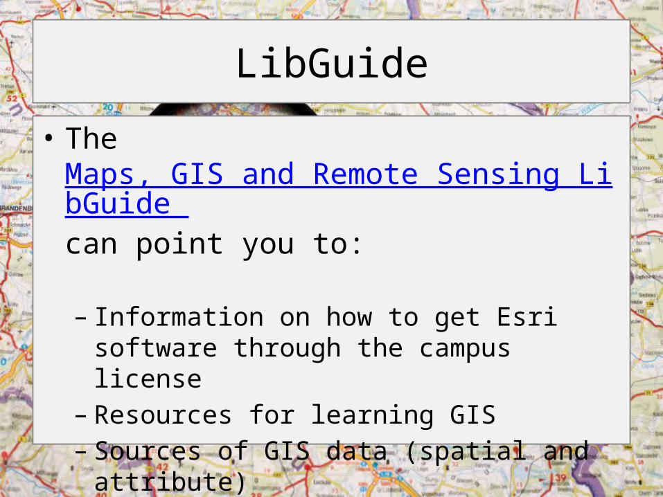
LibGuide
• The Maps, GIS and Remote Sensing LibGuide can point you to:
– Information on how to get Esri software through the campus license
– Resources for learning GIS– Sources of GIS data (spatial and attribute)

Good luck!
Thank you!