Integrating Wetlands into Watershed Protection … Wetlands into Watershed Protection Efforts ......
82
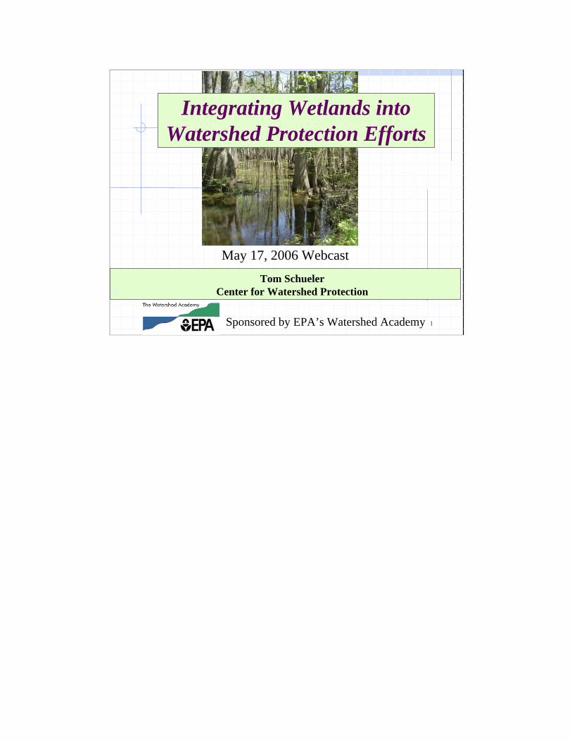
1 0 May 17, 2006 Webcast Integrating Wetlands into Watershed Protection Efforts Tom Schueler Center for Watershed Protection Sponsored by EPA’s Watershed Academy
Transcript of Integrating Wetlands into Watershed Protection … Wetlands into Watershed Protection Efforts ......
1
0
May 17, 2006 Webcast
Integrating Wetlands into Watershed Protection Efforts
Tom SchuelerCenter for Watershed Protection
Sponsored by EPA’s Watershed Academy
2
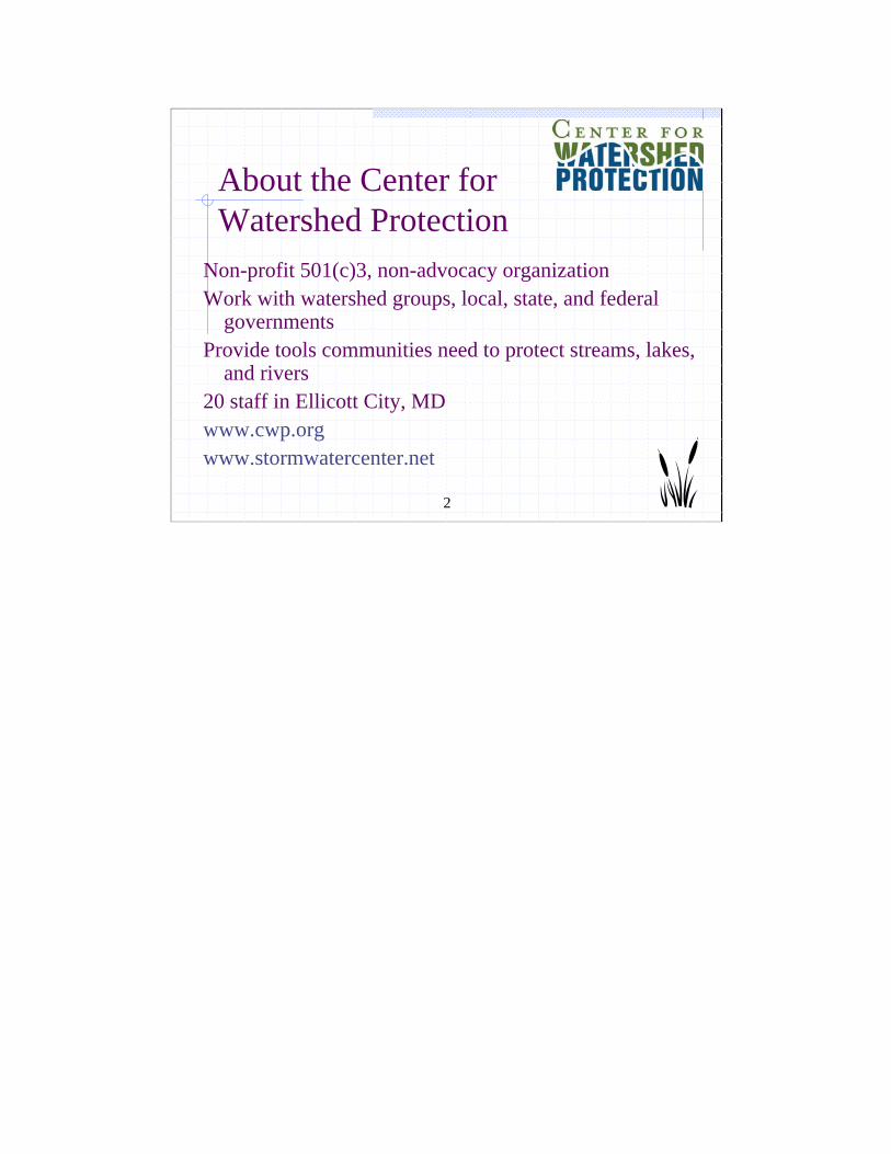
About the Center forWatershed Protection
Non-profit 501(c)3, non-advocacy organizationWork with watershed groups, local, state, and federal
governmentsProvide tools communities need to protect streams, lakes,
and rivers20 staff in Ellicott City, MD www.cwp.orgwww.stormwatercenter.net
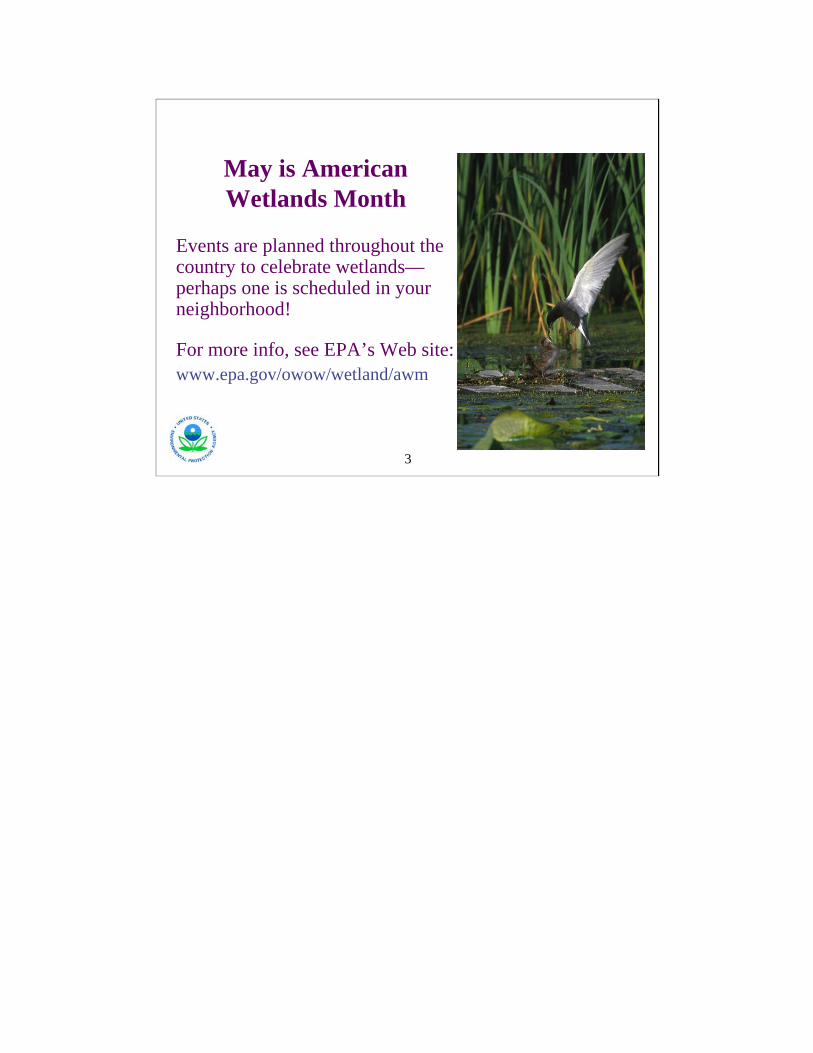
May is American Wetlands Month
Events are planned throughout the country to celebrate wetlands—perhaps one is scheduled in your neighborhood!
For more info, see EPA’s Web site:www.epa.gov/owow/wetland/awm
3
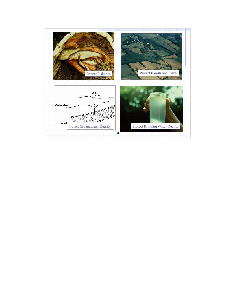
4Protect Drinking Water QualityProtect Groundwater Quality
Protect FisheriesProtect Fisheries Protect Forests and Farms
5
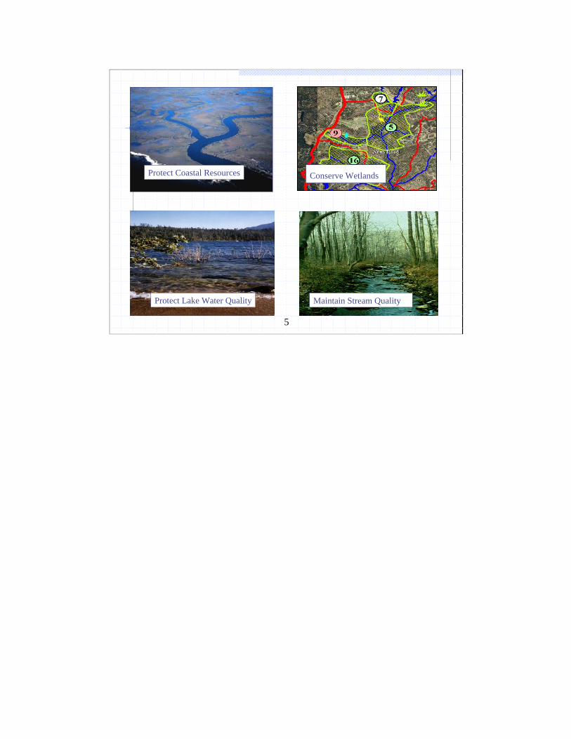
Conserve Wetlands
Protect Lake Water Quality Maintain Stream Quality
Conserve WetlandsProtect Coastal Resources

6
Key Themes
Wetlands and Watershed FunctionsImpact of Land Development on WetlandsThe Case for Local Wetland ProtectionThe Eight Tool ApproachResources
7
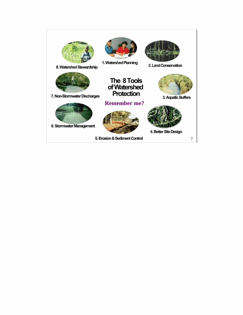
Remember me?
7
8
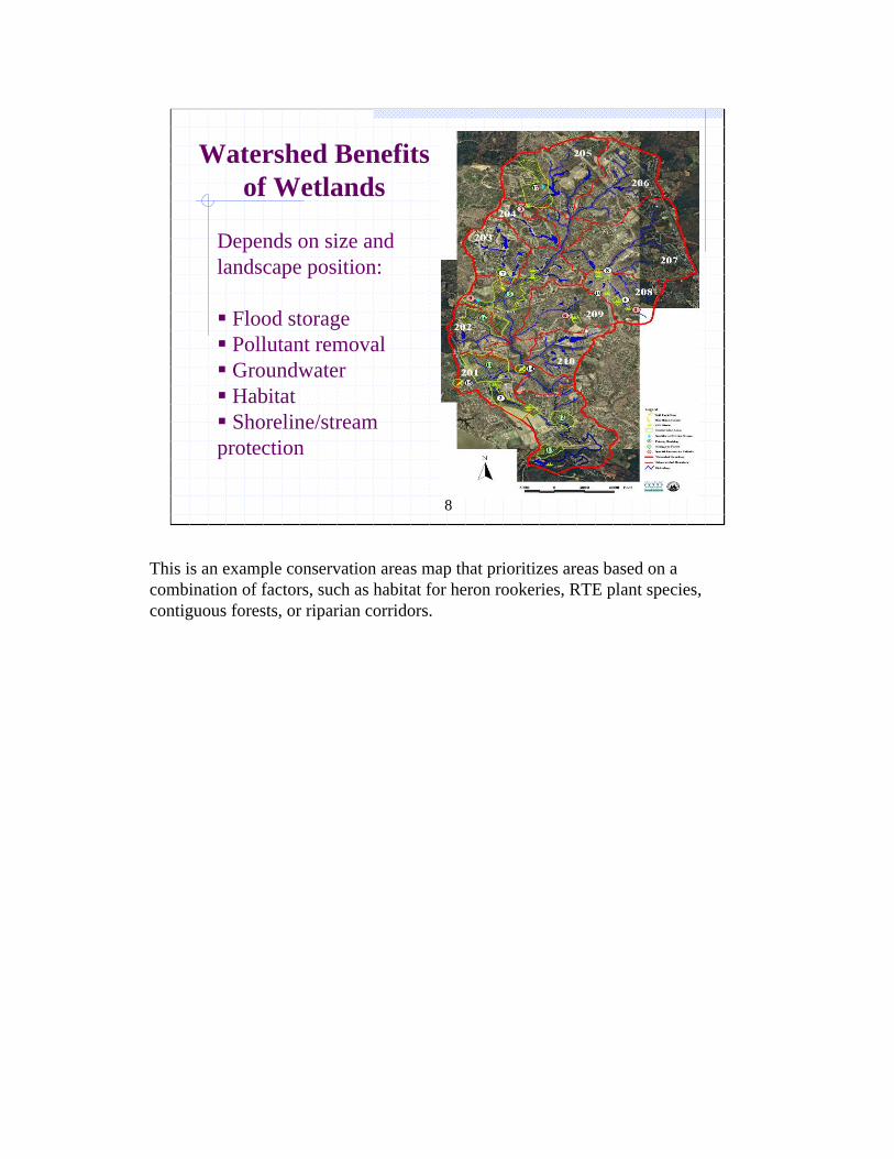
Depends on size and landscape position:
Flood storagePollutant removal Groundwater Habitat Shoreline/stream
protection
Watershed Benefits of Wetlands
This is an example conservation areas map that prioritizes areas based on a combination of factors, such as habitat for heron rookeries, RTE plant species, contiguous forests, or riparian corridors.
9
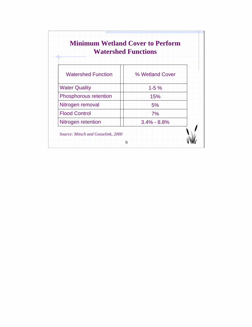
3.4% - 8.8%Nitrogen retention 7%Flood Control5%Nitrogen removal
15%Phosphorous retention1-5 %Water Quality
% Wetland CoverWatershed Function
Source: Mitsch and Gosselink, 2000
Minimum Wetland Cover to Perform Watershed Functions
10
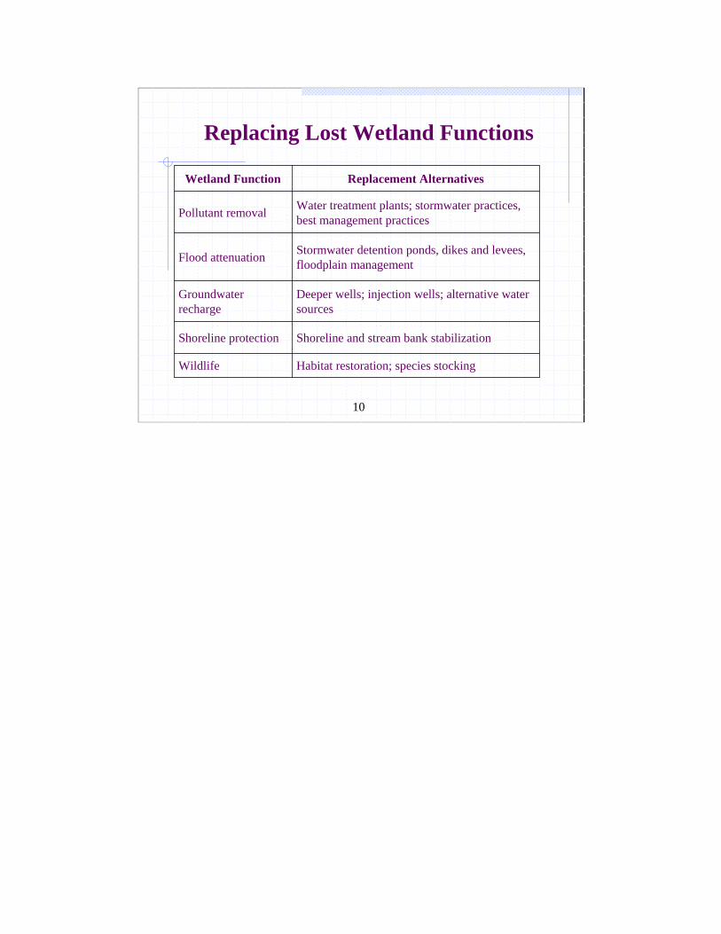
Habitat restoration; species stockingWildlife
Shoreline and stream bank stabilization Shoreline protection
Deeper wells; injection wells; alternative water sources
Groundwater recharge
Stormwater detention ponds, dikes and levees, floodplain management Flood attenuation
Water treatment plants; stormwater practices, best management practicesPollutant removal
Replacement AlternativesWetland Function
Replacing Lost Wetland Functions
11
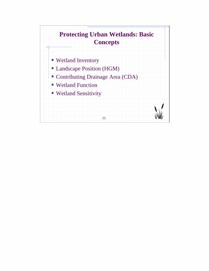
Protecting Urban Wetlands: Basic Concepts
Wetland InventoryLandscape Position (HGM)Contributing Drainage Area (CDA)Wetland FunctionWetland Sensitivity
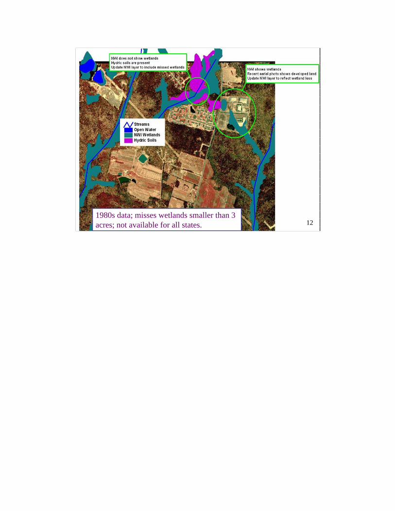
121980s data; misses wetlands smaller than 3 acres; not available for all states. 12
13
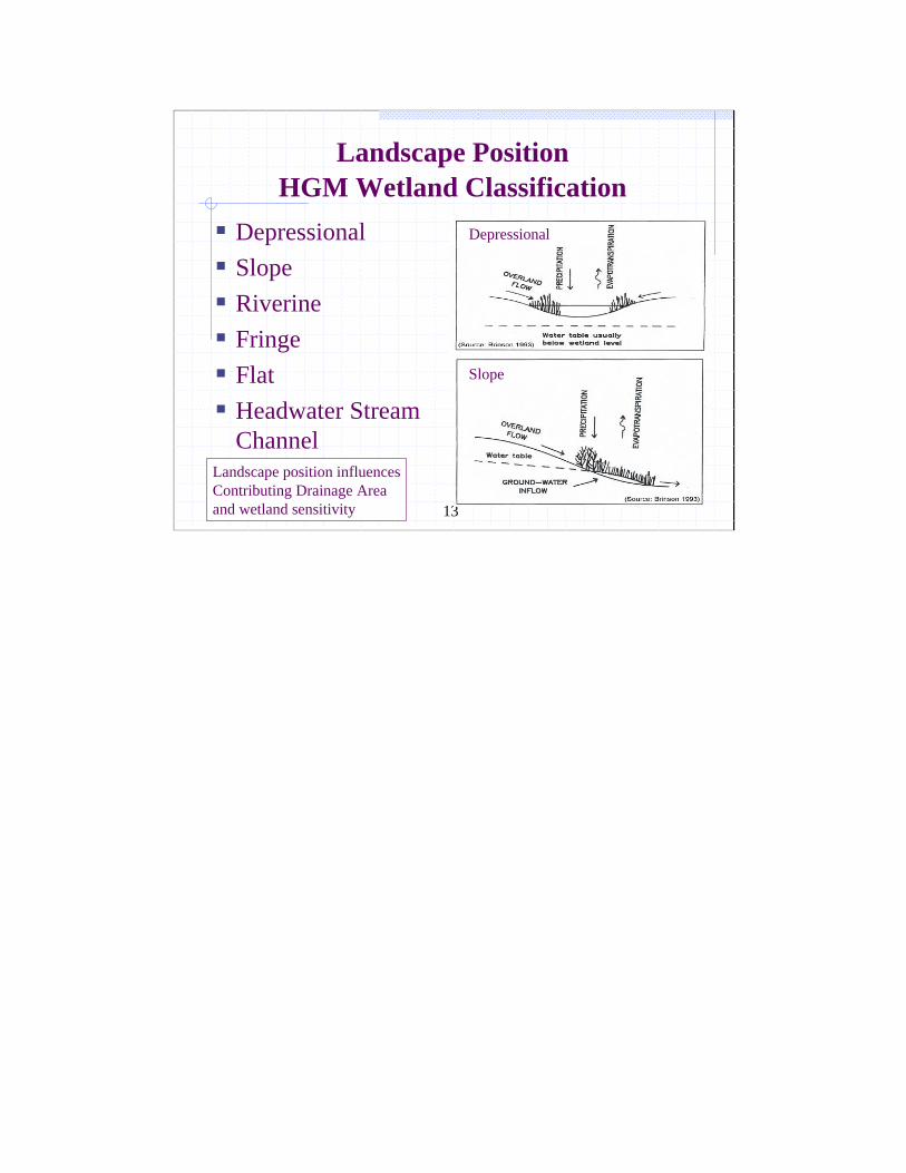
Landscape Position HGM Wetland Classification
Depressional Slope Riverine Fringe FlatHeadwater Stream Channel
Landscape position influencesContributing Drainage Area and wetland sensitivity
Depressional
Slope
14
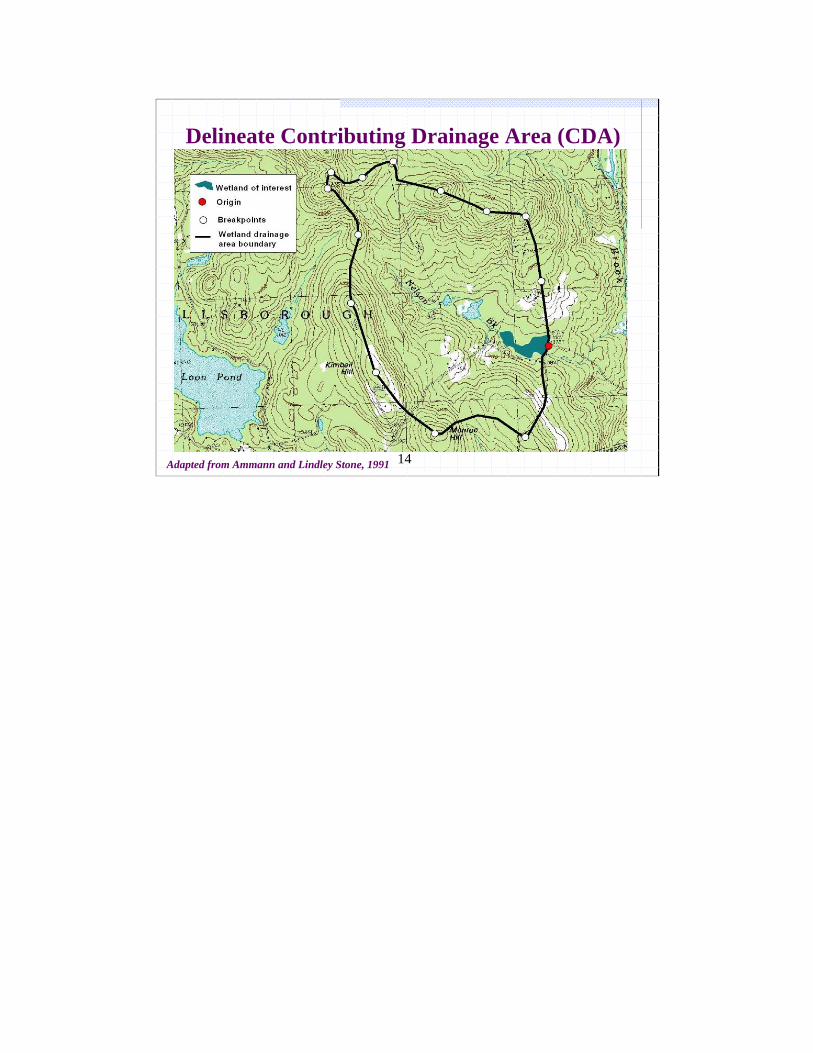
Delineate Contributing Drainage Area (CDA)
Adapted from Ammann and Lindley Stone, 1991
15
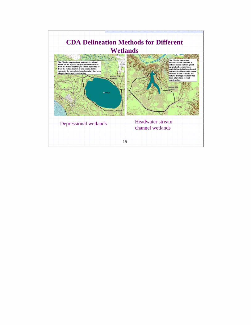
CDA Delineation Methods for Different Wetlands
Depressional wetlands Headwater stream channel wetlands

16
Not all wetlands have the same quality and watershed functions
16
17
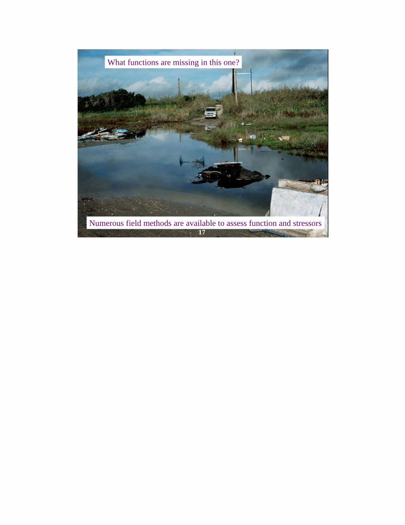
What functions are missing in this one?
Numerous field methods are available to assess function and stressors17

18
Phragmites marshesReed canary grass meadowsPurple loosestrife Floodplain forestsFringe wetlandsTreatment wetlandsCattail marshesHighly degraded wetlands
Sedge meadowsBogs and fensConiferous swampsLowland hardwood swampsSeasonally flooded basinsVernal poolsWetlands containing rare,
threatened or endangered (RTE) species
Not Very SensitiveNormally Sensitive

19
Q& A Break
Picture by Donald J. Leopold, from Welsch et al., 1995
20
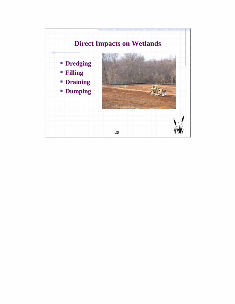
Direct Impacts on Wetlands
Dredging Filling Draining Dumping
21
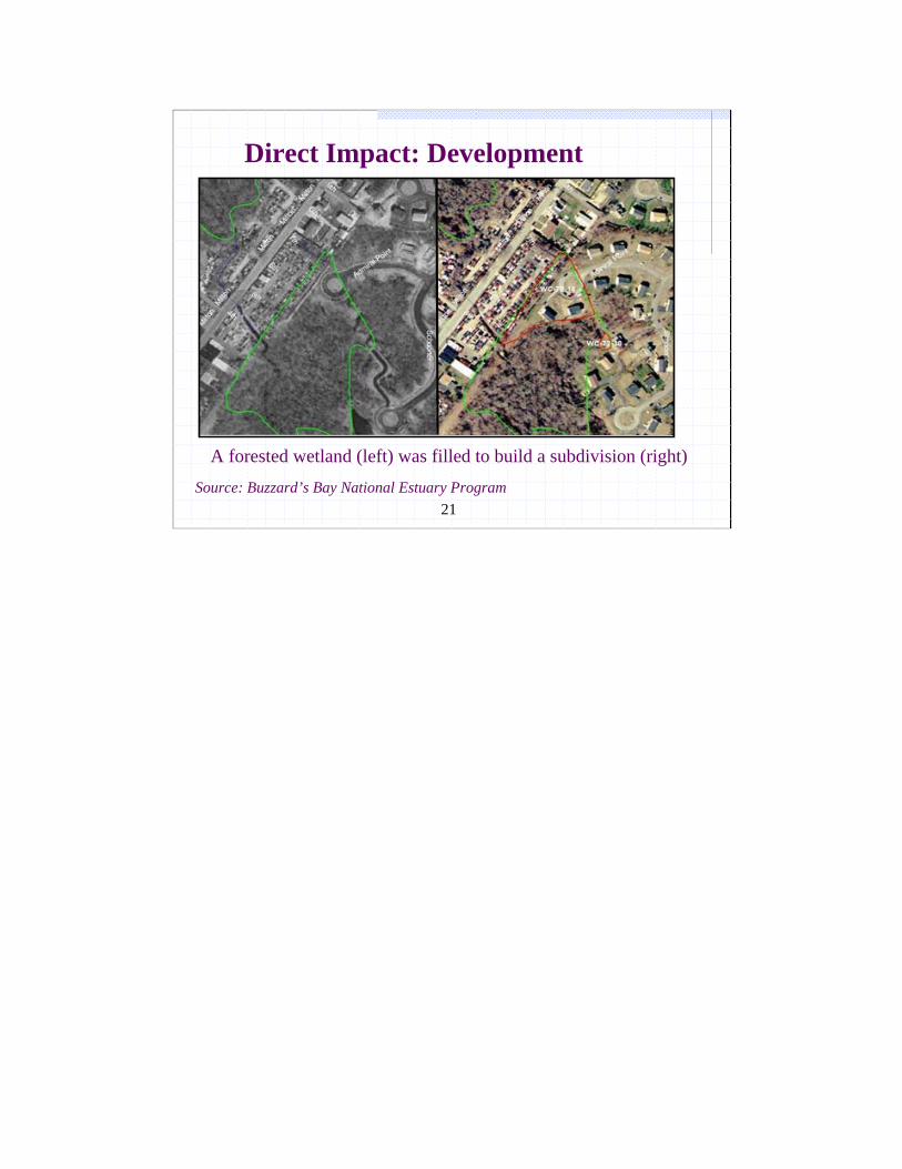
A forested wetland (left) was filled to build a subdivision (right)
Direct Impact: Development
Source: Buzzard’s Bay National Estuary Program
22
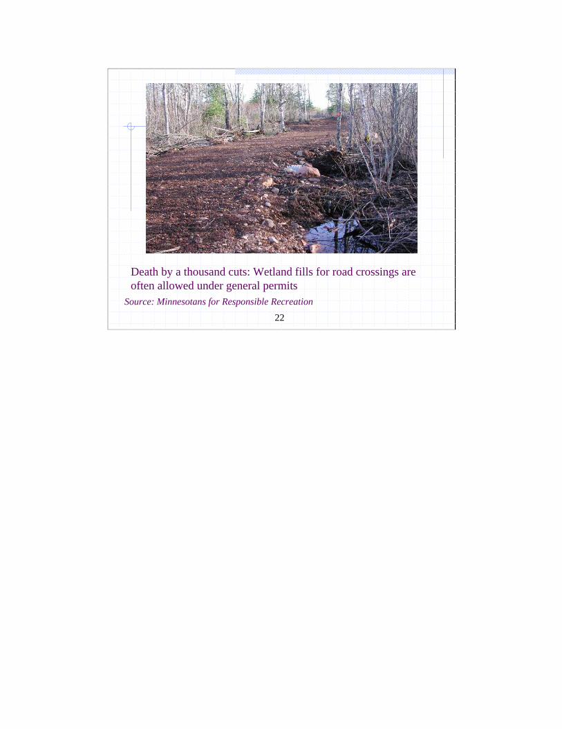
Source: Minnesotans for Responsible Recreation
Death by a thousand cuts: Wetland fills for road crossings are often allowed under general permits
23
24
Wetland Loss Continues in Urban Watersheds
Smaller and isolated wetlands are not fully protectedMitigation often occurs out of the watershed Mitigation does not always replace the same wetland type (e.g., out-of-kind) Mitigation is not done or is unsuccessful (NAS, 2001)
25
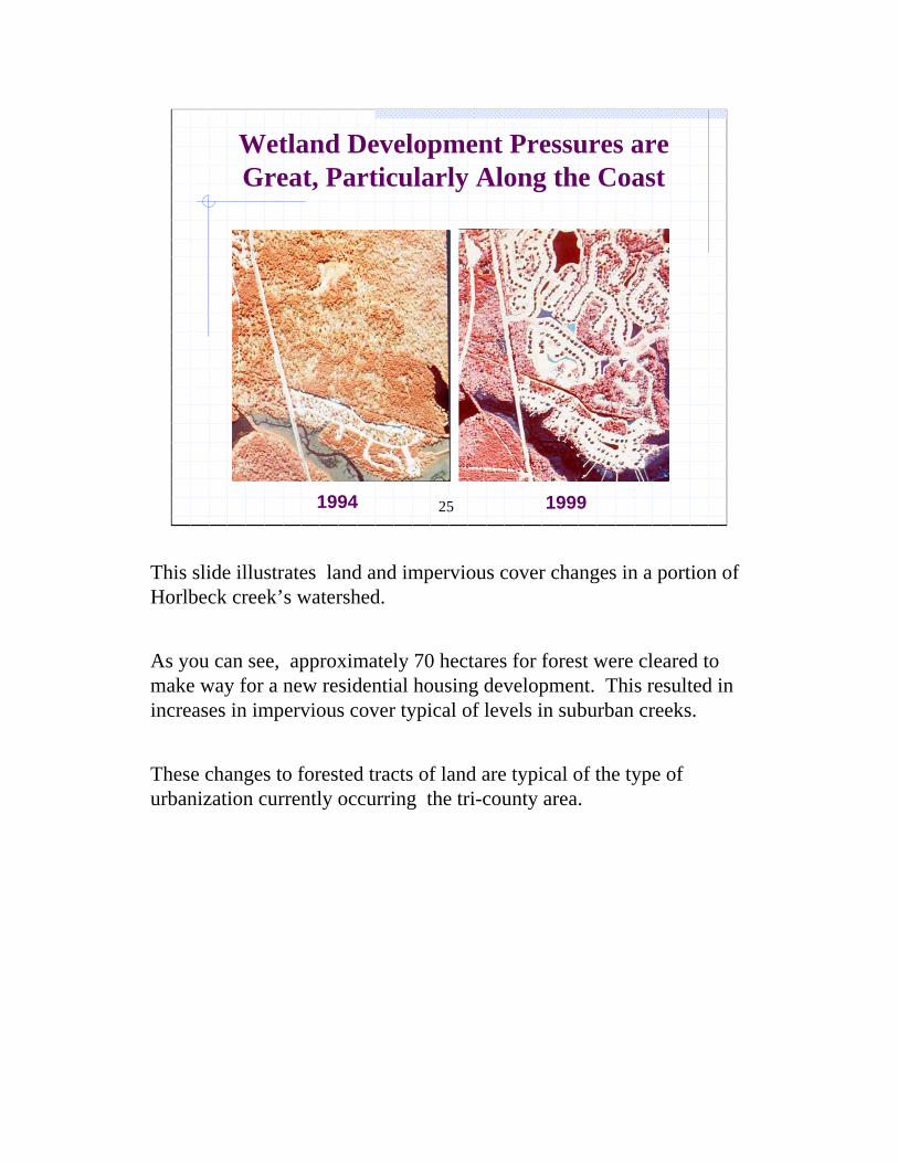
Wetland Development Pressures are Great, Particularly Along the Coast
1994 1999
This slide illustrates land and impervious cover changes in a portion of Horlbeck creek’s watershed.
As you can see, approximately 70 hectares for forest were cleared to make way for a new residential housing development. This resulted in increases in impervious cover typical of levels in suburban creeks.
These changes to forested tracts of land are typical of the type of urbanization currently occurring the tri-county area.
26
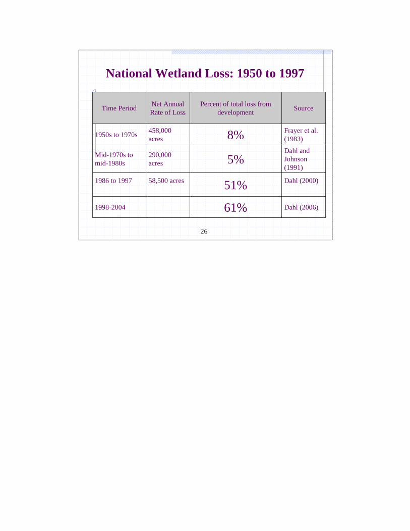
National Wetland Loss: 1950 to 1997
Dahl (2000)51%58,500 acres 1986 to 1997
Dahl (2006)61%1998-2004
Dahl and Johnson (1991)
5%290,000 acres
Mid-1970s to mid-1980s
Frayer et al. (1983)8% 458,000
acres 1950s to 1970s
SourcePercent of total loss from development
Net Annual Rate of LossTime Period
27
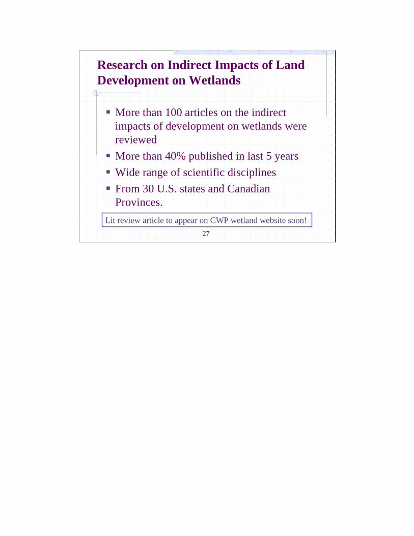
Research on Indirect Impacts of Land Development on Wetlands
More than 100 articles on the indirect impacts of development on wetlands were reviewedMore than 40% published in last 5 yearsWide range of scientific disciplinesFrom 30 U.S. states and Canadian Provinces.
Lit review article to appear on CWP wetland website soon!
28
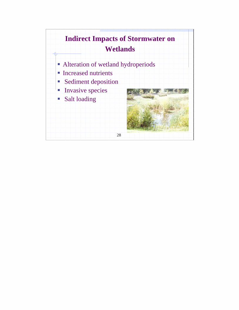
Indirect Impacts of Stormwater on Wetlands
Alteration of wetland hydroperiodsIncreased nutrients Sediment deposition Invasive speciesSalt loading
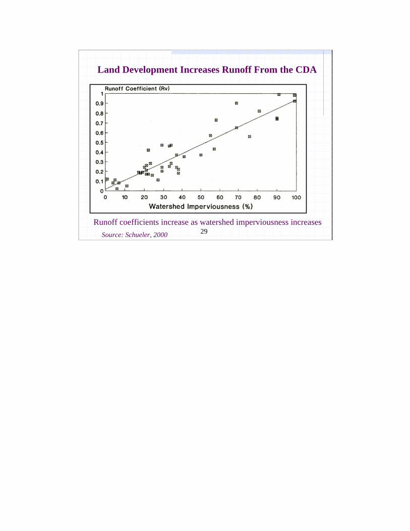
29Runoff coefficients increase as watershed imperviousness increases
Source: Schueler, 2000
Land Development Increases Runoff From the CDA
30
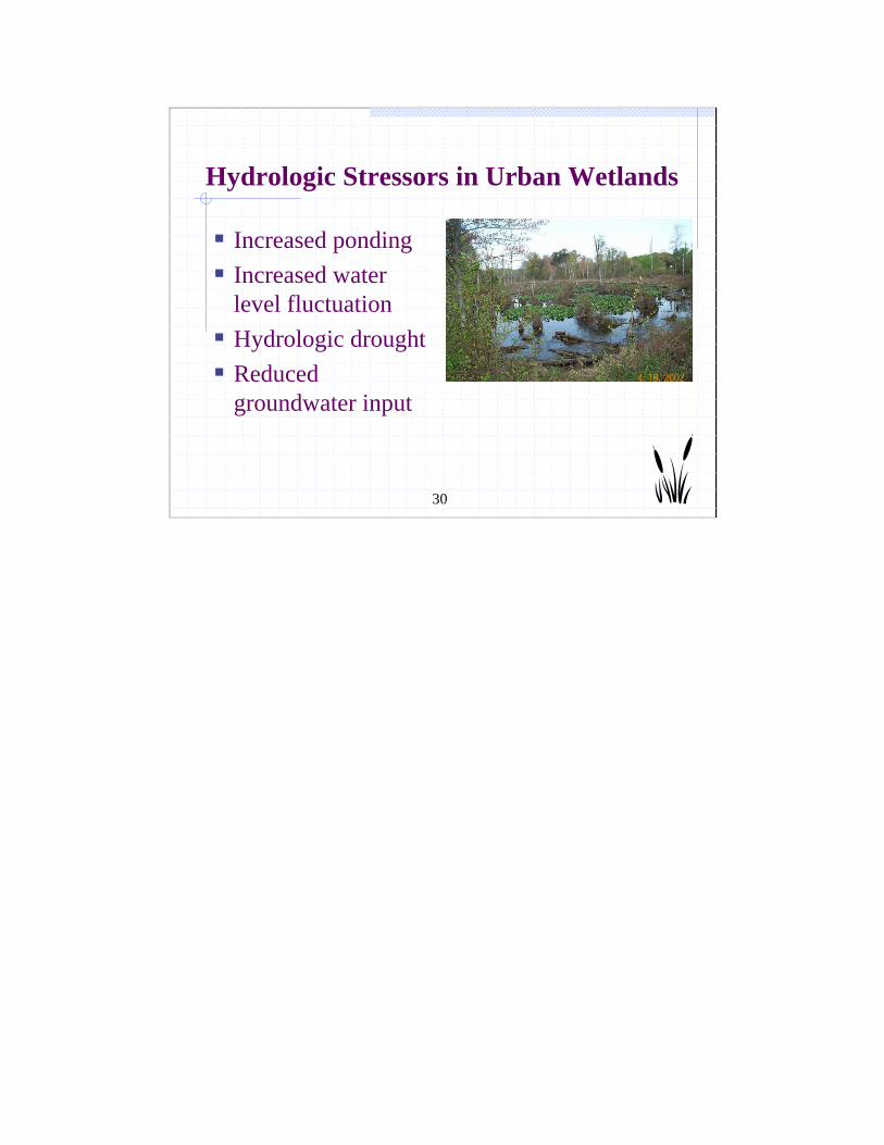
Hydrologic Stressors in Urban Wetlands
Increased pondingIncreased water level fluctuationHydrologic drought Reduced groundwater input

31
Too much stormwater inundation kills trees31
32
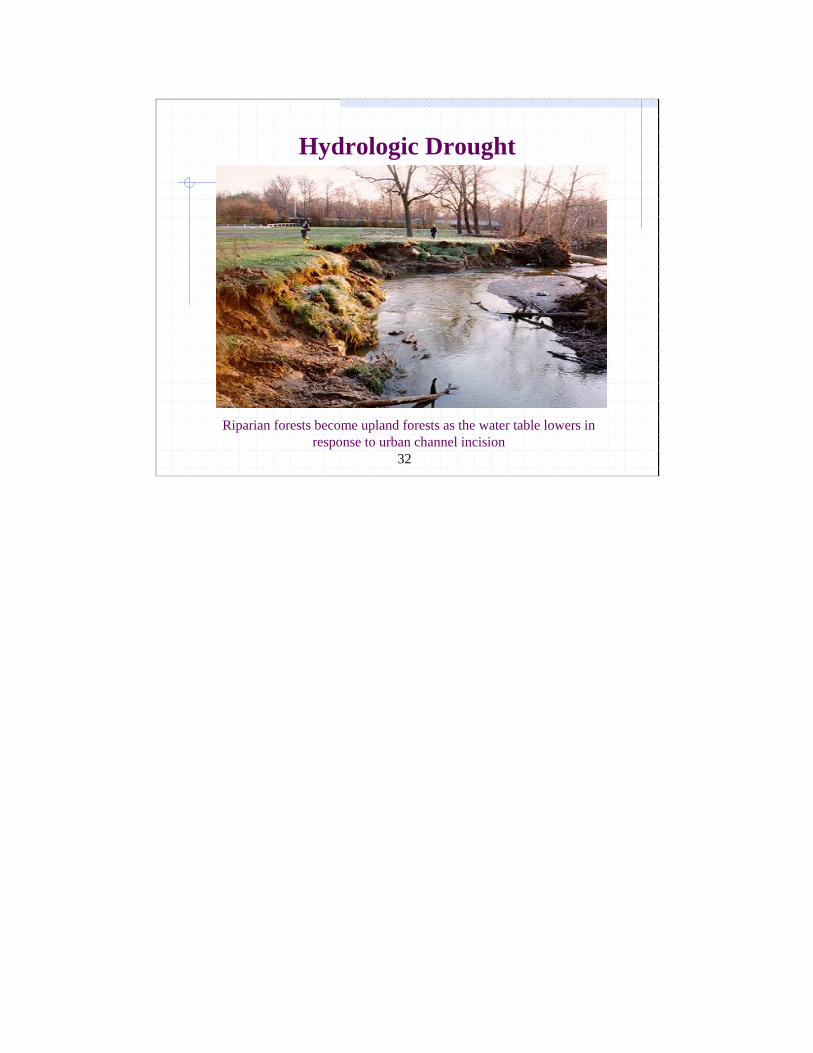
Hydrologic Drought
Riparian forests become upland forests as the water table lowers in response to urban channel incision

33
Road crossings interrupt urban streams and can affect hydrology of streams and wetlands
34
Impacts on Wetland Hydroperiod
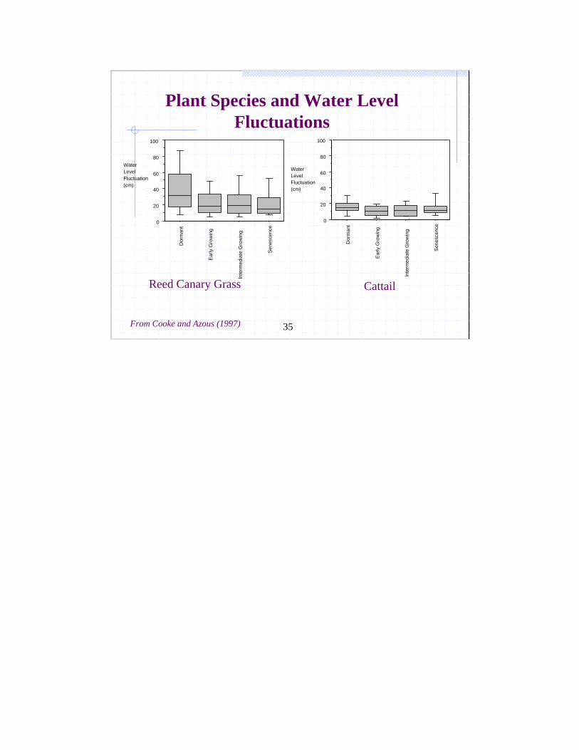
Stormwater increases the water level fluctuation (WLF) within the wetlandEven a modest WLF or “bounce”:
Reduces wetland plant richnessReduces thin stemmed speciesPromotes invasive speciesReduces amphibian diversity
35
0
20
40
60
80
100
Dor
man
t
Early
Gro
win
g
Inte
rmed
iate
Gro
win
g
Sene
scen
ce
Water Level Fluctuation (cm)
Water Level Fluctuation (cm)
0
20
40
60
80
100
Dor
man
t
Ear
ly G
row
ing
Inte
rmed
iate
Gro
win
g
Sen
esce
nce
From Cooke and Azous (1997)
Plant Species and Water Level Fluctuations
Reed Canary Grass Cattail
36
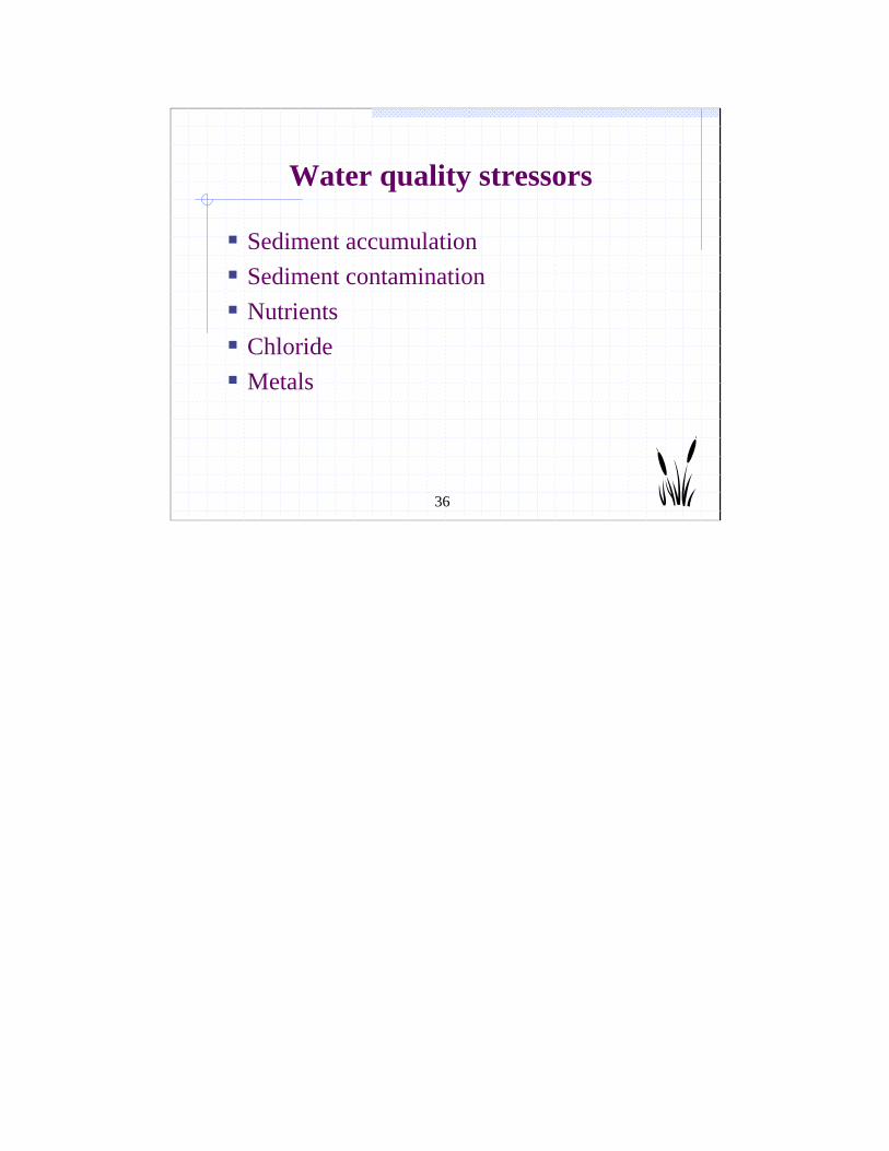
Water quality stressors
Sediment accumulationSediment contaminationNutrientsChlorideMetals
37
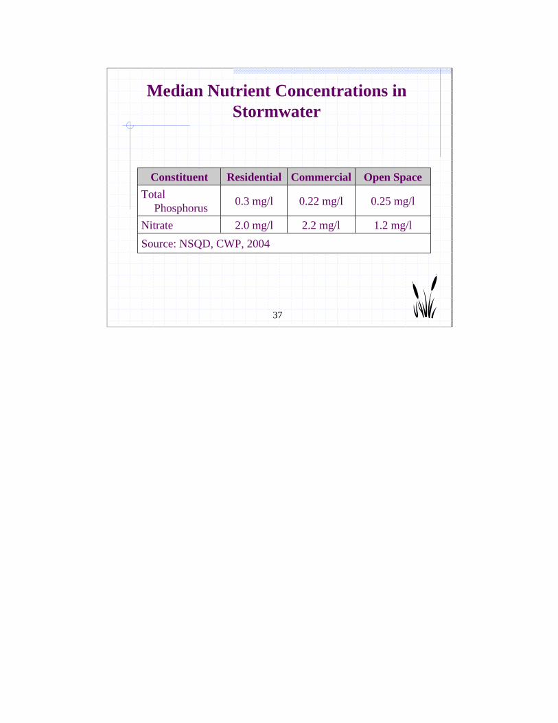
Median Nutrient Concentrations in Stormwater
Source: NSQD, CWP, 20041.2 mg/l2.2 mg/l2.0 mg/lNitrate
0.25 mg/l0.22 mg/l0.3 mg/lTotal Phosphorus
Open SpaceCommercialResidentialConstituent

38
Flow x Concentration = Annual Nutrient Load
39
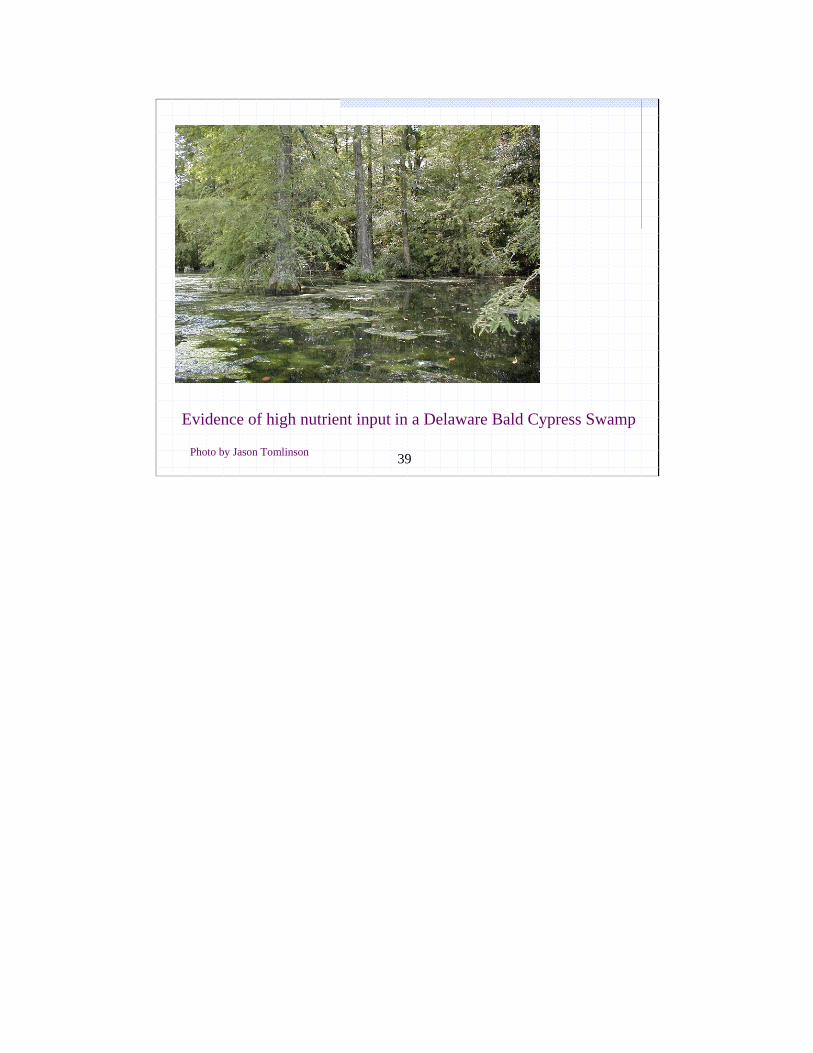
Evidence of high nutrient input in a Delaware Bald Cypress Swamp
Photo by Jason Tomlinson
40
Biological Response: Plant Community
50% of studies link changes in hydroperiod and WLF to:
Reduced plant species richnessLoss of sensitive plant speciesIncreased number of invasive plants Tree mortality (60% of freshwater wetlands are forested)
Some wetland communities are more sensitive than others (fens, bogs).
41
Biological Response: Animal Community
Hydrological and water quality stressors and changes in plant community lead to declining species richness for
MacroinvertebratesAmphibians ReptilesBirds
Other factors such as proximity to roads, culverts and other disturbance play a role.
42
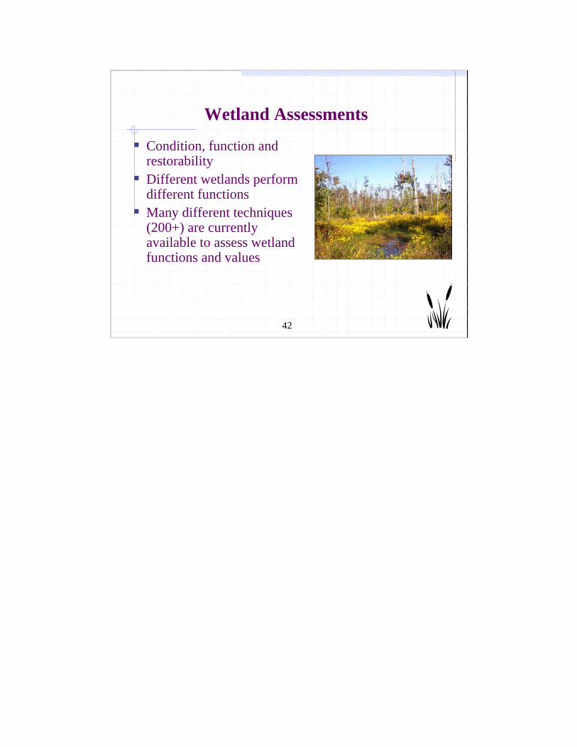
Wetland Assessments
Condition, function and restorabilityDifferent wetlands perform different functionsMany different techniques (200+) are currently available to assess wetland functions and values
43
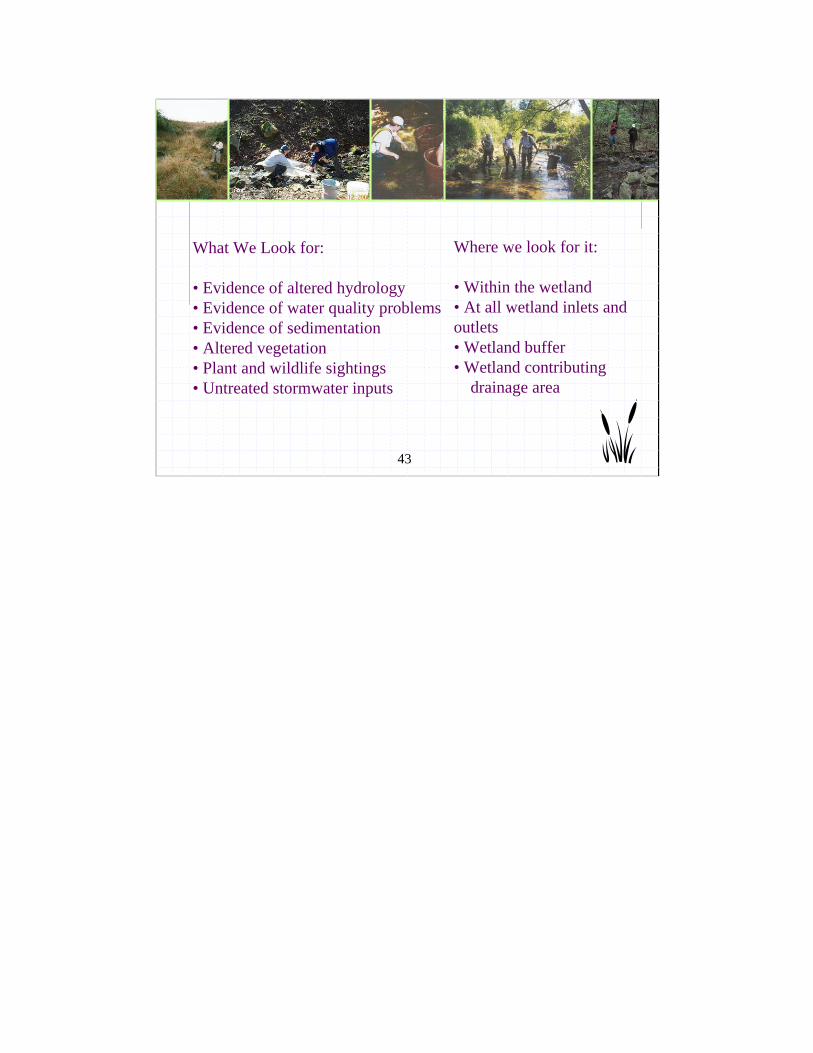
What We Look for:
• Evidence of altered hydrology• Evidence of water quality problems• Evidence of sedimentation• Altered vegetation• Plant and wildlife sightings• Untreated stormwater inputs
Where we look for it:
• Within the wetland• At all wetland inlets and outlets• Wetland buffer• Wetland contributing
drainage area
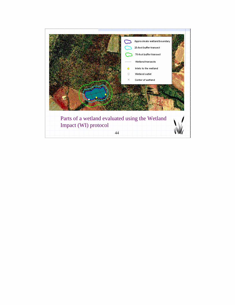
44
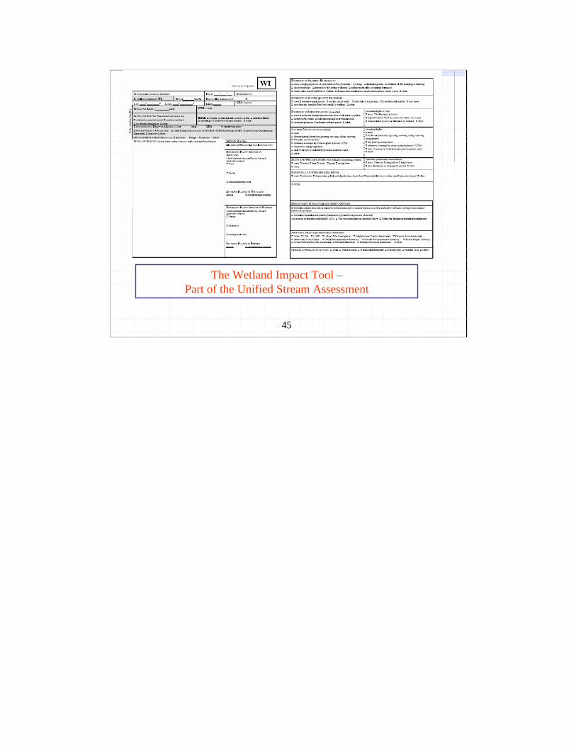
Parts of a wetland evaluated using the Wetland Impact (WI) protocol
45
The Wetland Impact Tool –Part of the Unified Stream Assessment
46
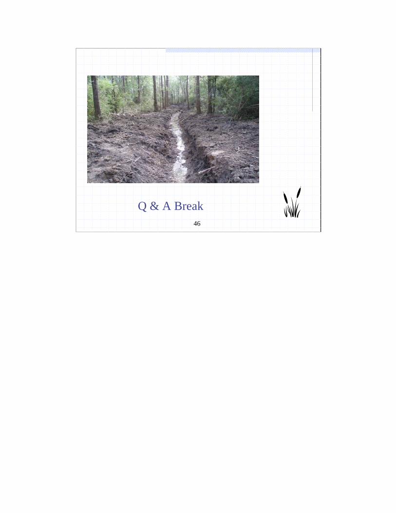
Q & A Break
47
Why Current Wetland Permitting is Not Enough
Wetland hydrology is not protectedLocated in low point of a site and receives stormwater discharges Quality/sensitivity not considered in stormwater permitting Wetlands and stormwater are managed in different silosDoes not address cumulative impacts at watershed level

48
Benefits of Local Watershed Approach to Wetland Management
Manage indirect impacts through land use and local development ordinances. Manage cumulative impacts at watershed levelAddress “no net loss” of wetland function Protect high quality and vulnerable wetlandsIdentify best wetland restoration and mitigation sitesConsider adoption of local wetland protection regulationsInform better permit decisionsID opportunities for voluntary wetland conservation and restoration
49
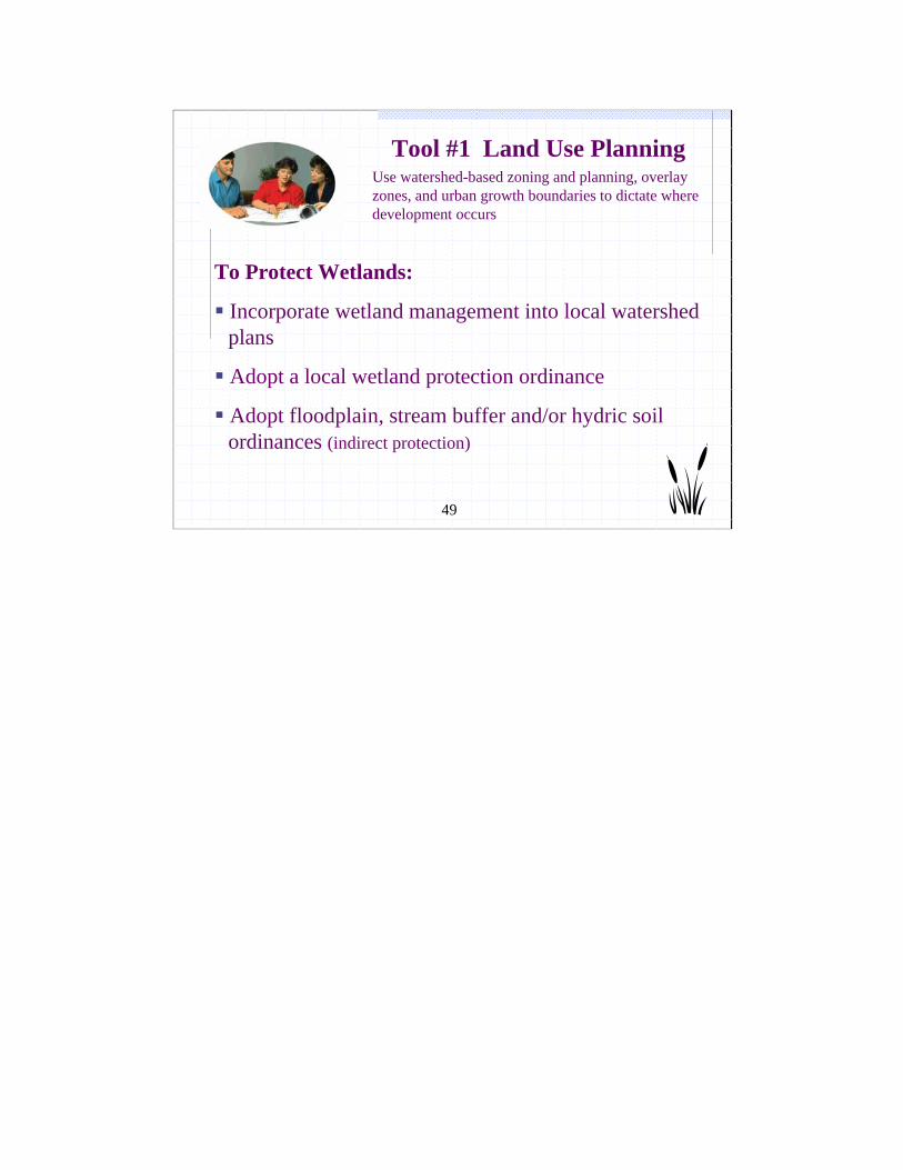
To Protect Wetlands:
Incorporate wetland management into local watershed plans
Adopt a local wetland protection ordinance
Adopt floodplain, stream buffer and/or hydric soil ordinances (indirect protection)
Use watershed-based zoning and planning, overlay zones, and urban growth boundaries to dictate where development occurs
Tool #1 Land Use Planning
50
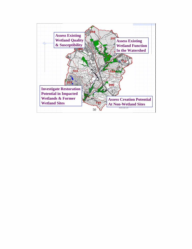
Assess Existing Wetland Quality& Susceptibility
Assess ExistingWetland FunctionIn the Watershed
Investigate RestorationPotential in ImpactedWetlands & FormerWetland Sites
Assess Creation PotentialAt Non-Wetland Sites
50
51
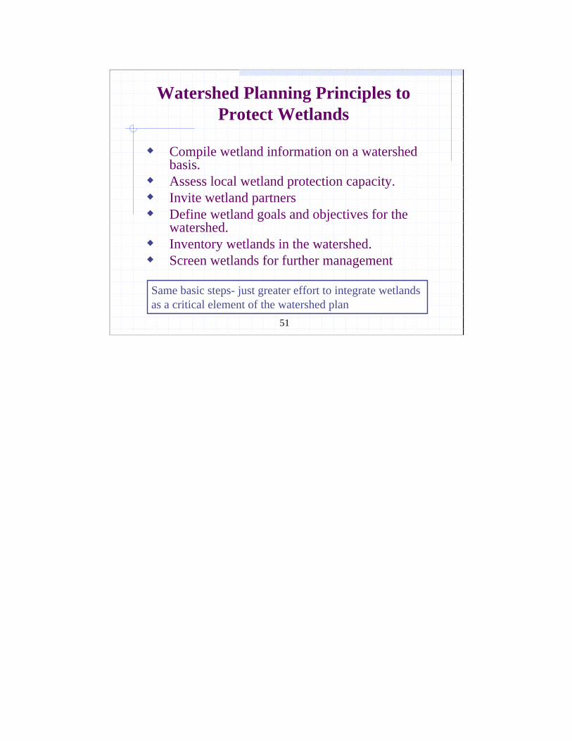
Watershed Planning Principles to Protect Wetlands
Compile wetland information on a watershed basis.Assess local wetland protection capacity.Invite wetland partnersDefine wetland goals and objectives for the watershed.Inventory wetlands in the watershed.Screen wetlands for further management
Same basic steps- just greater effort to integrate wetlands as a critical element of the watershed plan
52
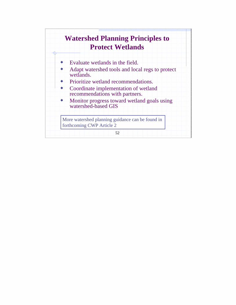
Watershed Planning Principles to Protect Wetlands
Evaluate wetlands in the field.Adapt watershed tools and local regs to protect wetlands.Prioritize wetland recommendations.Coordinate implementation of wetland recommendations with partners.Monitor progress toward wetland goals using watershed-based GIS
More watershed planning guidance can be found in forthcoming CWP Article 2
53
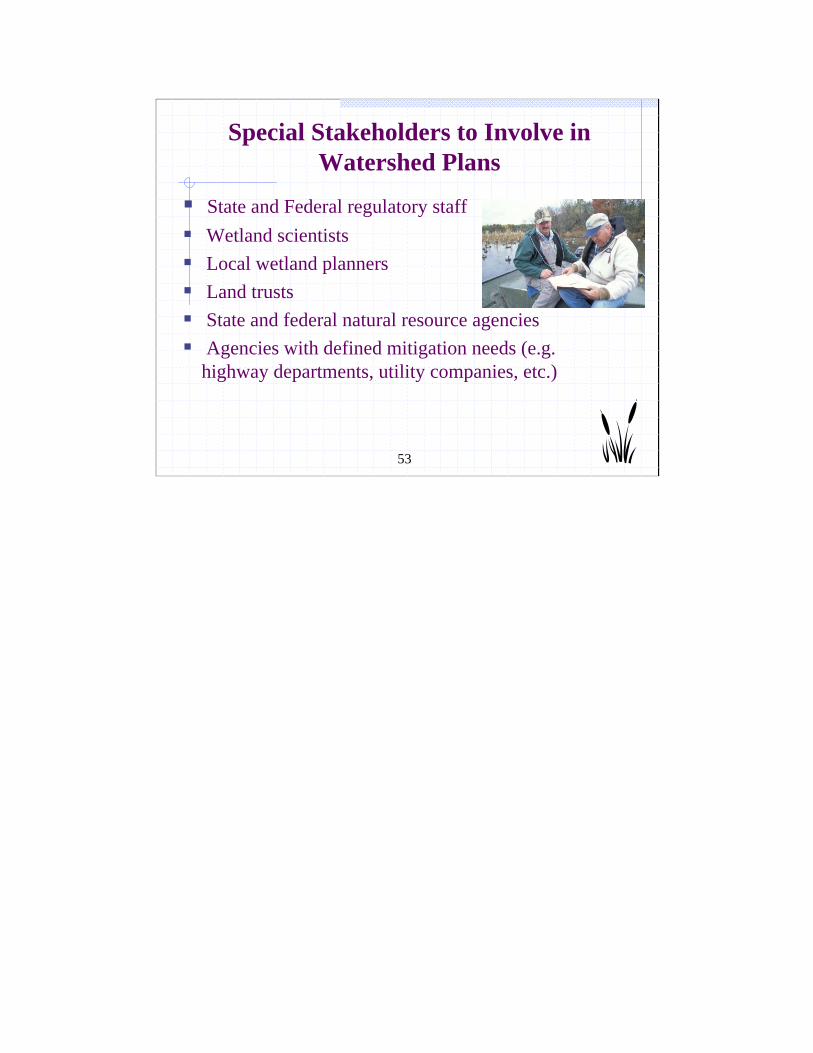
Special Stakeholders to Involve in Watershed Plans
State and Federal regulatory staffWetland scientistsLocal wetland plannersLand trustsState and federal natural resource agenciesAgencies with defined mitigation needs (e.g. highway departments, utility companies, etc.)
54
Wetland partners can add a lot to the plan
Provide statistics to support acreage goals for wetland protection, conservation and restorationRates and causes of historic and current wetland loss in the watershedSummarize recent state and federal permitting activity.Identify sensitive wetland community types in the watershed.Recommend wetland assessment protocols.
55
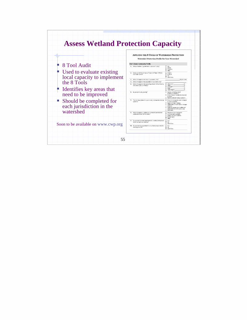
Assess Wetland Protection Capacity
8 Tool Audit Used to evaluate existing local capacity to implement the 8 ToolsIdentifies key areas that need to be improvedShould be completed for each jurisdiction in the watershed
Soon to be available on www.cwp.org
56
Q & A Break
57
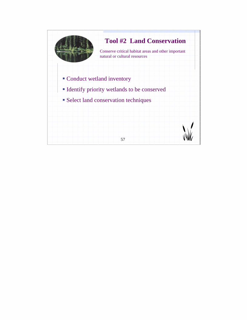
Conserve critical habitat areas and other important natural or cultural resources
Tool #2 Land Conservation
Conduct wetland inventory
Identify priority wetlands to be conserved
Select land conservation techniques

58
Create a Wetland Inventory
1. Update existing wetland maps2. Estimate historic wetland coverage3. Delineate wetland contributing drainage areas4. Estimate wetland functions5. Estimate wetland condition6. Forecast effects of future land use changes on
wetlands
59
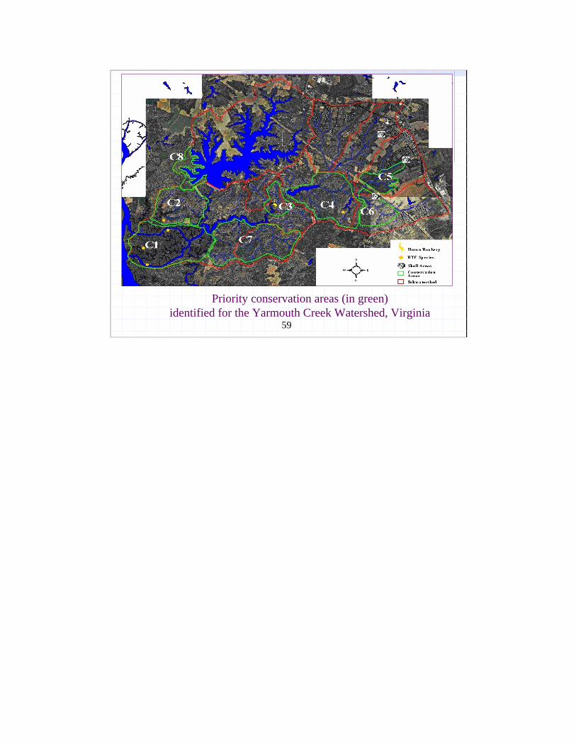
Priority conservation areas (in green)identified for the Yarmouth Creek Watershed, Virginia
60
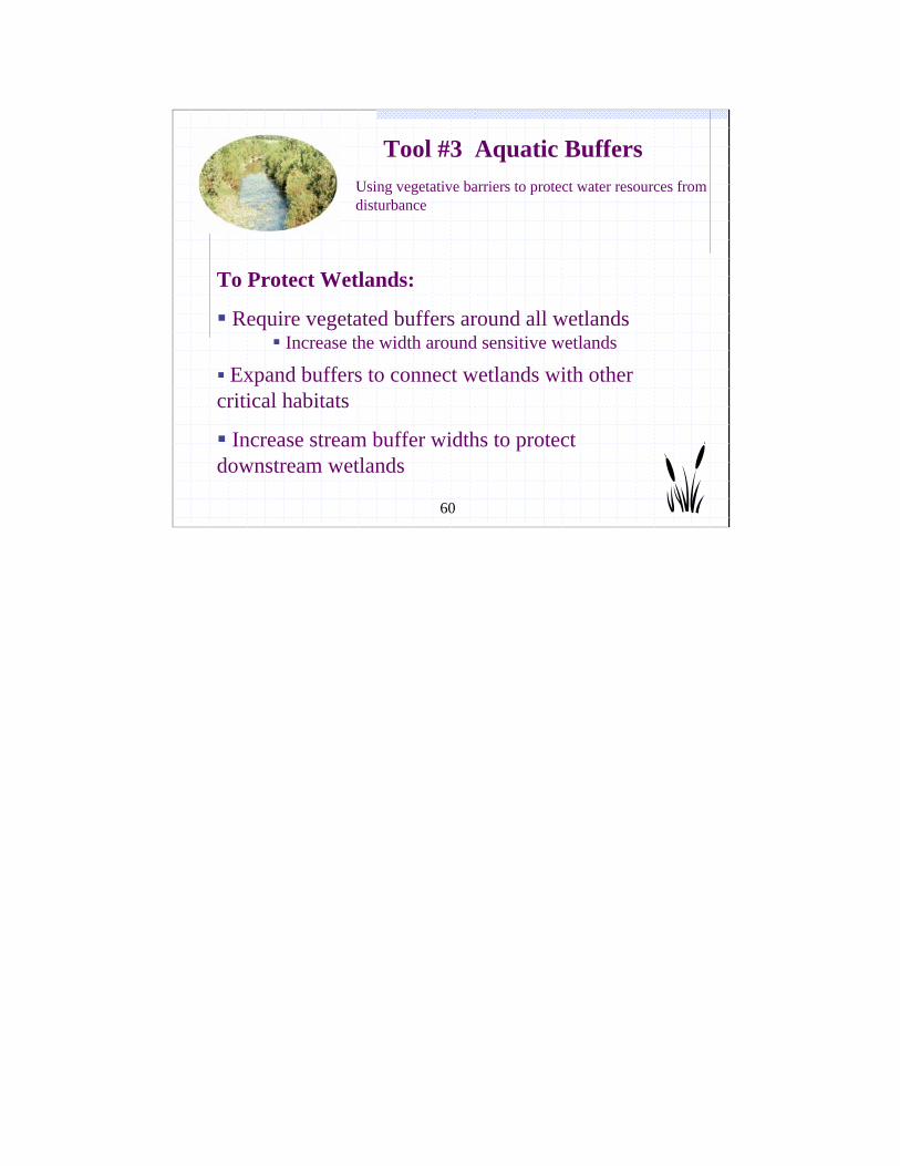
Using vegetative barriers to protect water resources from disturbance
Tool #3 Aquatic Buffers
To Protect Wetlands:
Require vegetated buffers around all wetlandsIncrease the width around sensitive wetlands
Expand buffers to connect wetlands with other critical habitats
Increase stream buffer widths to protect downstream wetlands

61
Expand stream buffersto pick up adjacent wetlands
61
62
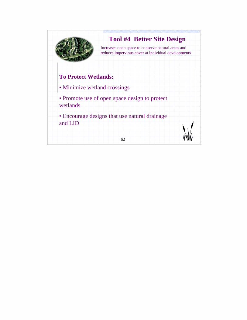
Increases open space to conserve natural areas and reduces impervious cover at individual developments
Tool #4 Better Site Design
To Protect Wetlands:
• Minimize wetland crossings
• Promote use of open space design to protect wetlands
• Encourage designs that use natural drainage and LID

63
LID and Wetlands
Maximize on-site recharge and infiltration Minimize site impervious cover (IC) Disconnect rooftop and other IC Use pervious areas for filtering Use swales rather than curb/guttersConserve existing forest cover Reforest turf areas
64
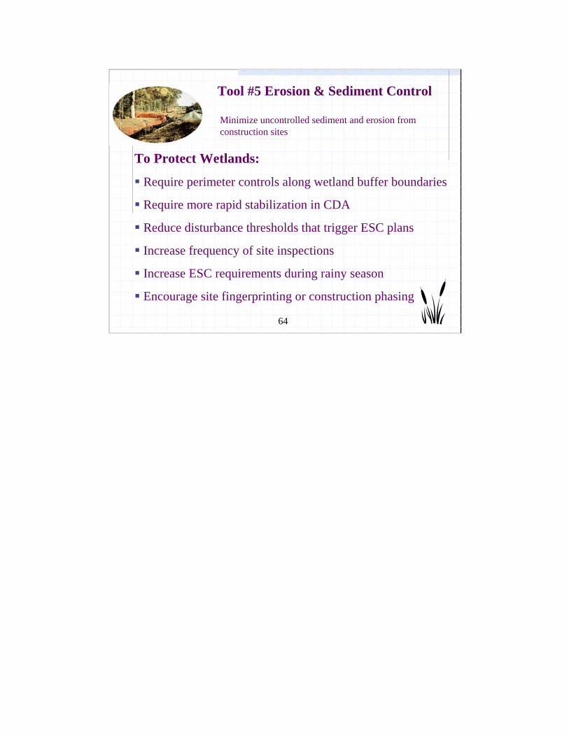
Minimize uncontrolled sediment and erosion from construction sites
Tool #5 Erosion & Sediment Control
To Protect Wetlands:
Require perimeter controls along wetland buffer boundaries
Require more rapid stabilization in CDA
Reduce disturbance thresholds that trigger ESC plans
Increase frequency of site inspections
Increase ESC requirements during rainy season
Encourage site fingerprinting or construction phasing
65
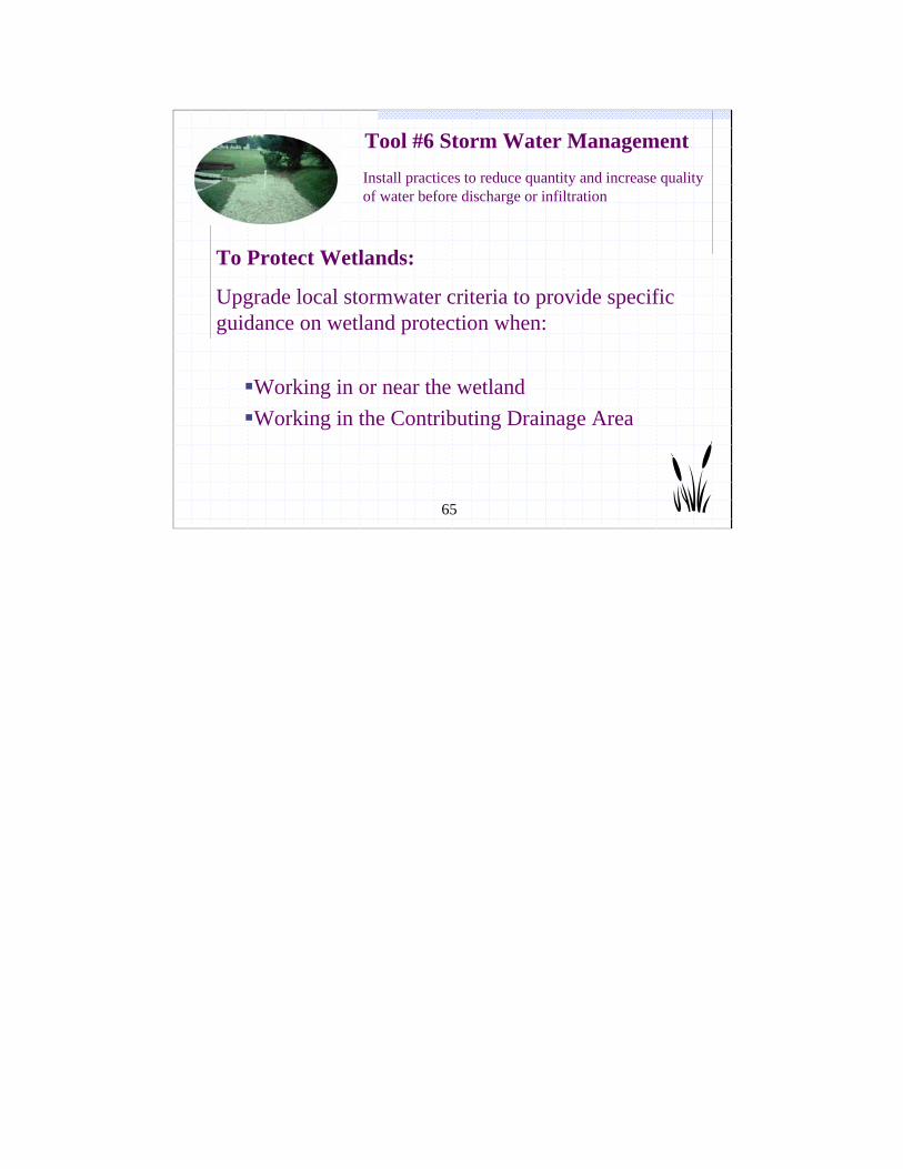
Install practices to reduce quantity and increase quality of water before discharge or infiltration
Tool #6 Storm Water Management
To Protect Wetlands:
Upgrade local stormwater criteria to provide specific guidance on wetland protection when:
Working in or near the wetland Working in the Contributing Drainage Area

66
Stormwater Criteria When Working In or Near Wetlands
Prohibit use of natural wetlands for stormwater treatmentDiscourage constrictions at wetland outletsNo discharge of untreated stormwater into wetlandsFingerprint stormwater treatment practices (STPs) around natural wetlands Avoid locating STPs in wetland buffers
Tip: Include these restrictions when adopting or revising Local MS4 stormwater ordinances
67
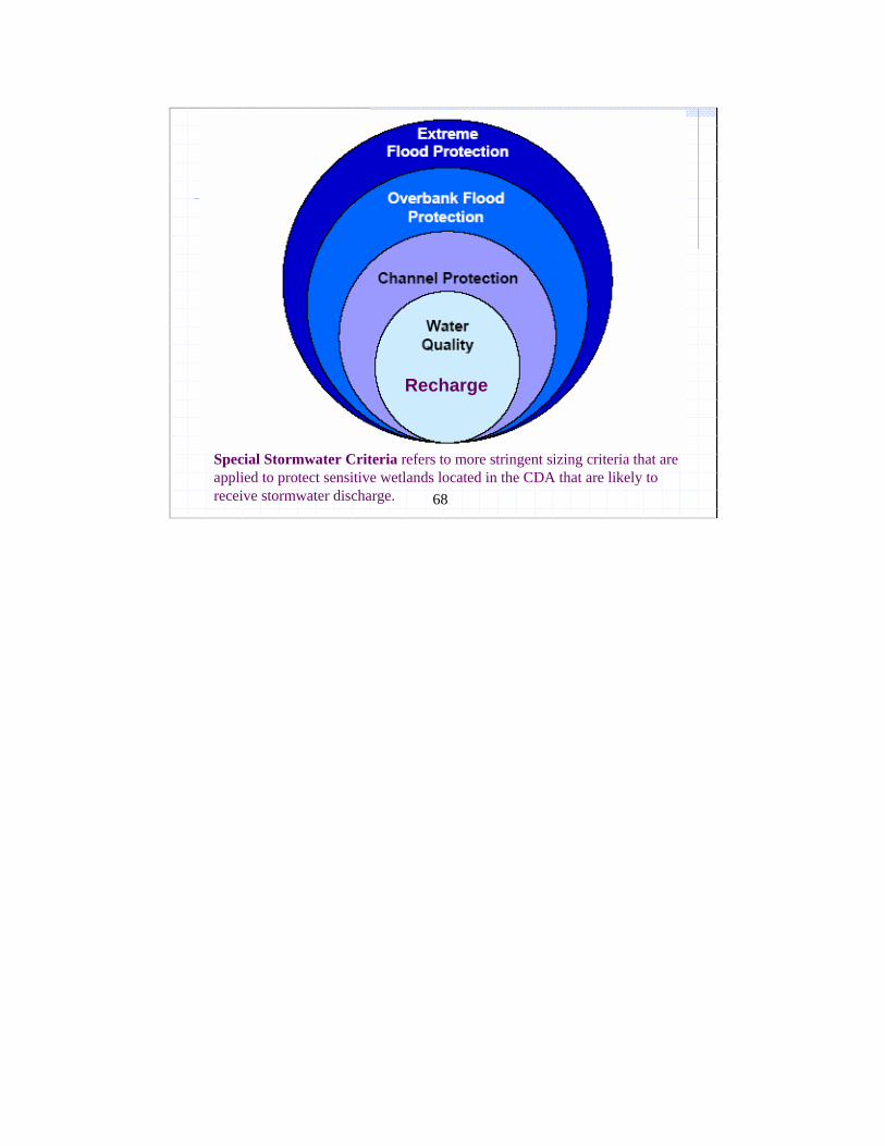
Stormwater Criteria When Working in the Contributing Drainage Area
Special Stormwater Sizing CriteriaRecharge Water Quality Hydroperiod Standards
Preferred Stormwater Practices
68
Recharge
Special Stormwater Criteria refers to more stringent sizing criteria that are applied to protect sensitive wetlands located in the CDA that are likely to receive stormwater discharge.
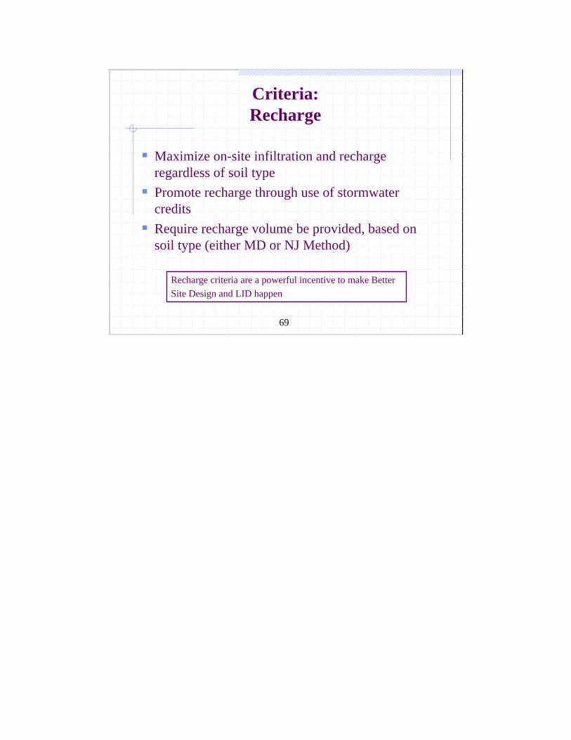
69
Criteria:Recharge
Maximize on-site infiltration and recharge regardless of soil typePromote recharge through use of stormwater credits Require recharge volume be provided, based on soil type (either MD or NJ Method)
Recharge criteria are a powerful incentive to make Better Site Design and LID happen
70
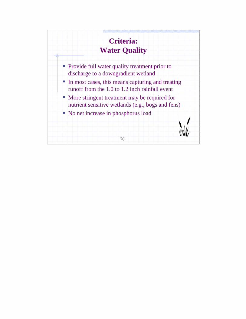
Criteria:Water Quality
Provide full water quality treatment prior to discharge to a downgradient wetlandIn most cases, this means capturing and treating runoff from the 1.0 to 1.2 inch rainfall eventMore stringent treatment may be required for nutrient sensitive wetlands (e.g., bogs and fens)No net increase in phosphorus load
71
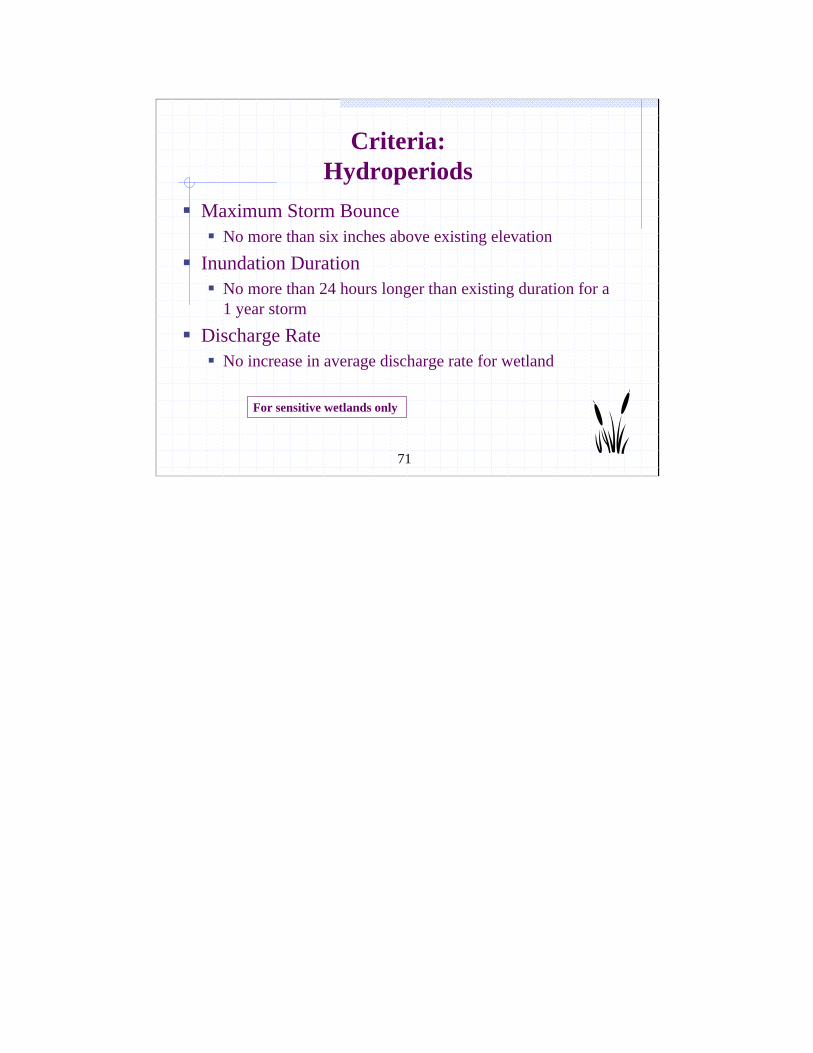
Criteria:Hydroperiods
Maximum Storm Bounce No more than six inches above existing elevation
Inundation Duration No more than 24 hours longer than existing duration for a 1 year storm
Discharge Rate No increase in average discharge rate for wetland
For sensitive wetlands only
72
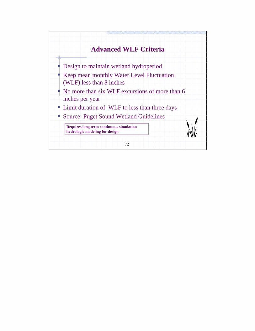
Advanced WLF Criteria
Design to maintain wetland hydroperiodKeep mean monthly Water Level Fluctuation (WLF) less than 8 inchesNo more than six WLF excursions of more than 6 inches per year Limit duration of WLF to less than three daysSource: Puget Sound Wetland Guidelines
Requires long term continuous simulation hydrologic modeling for design
73
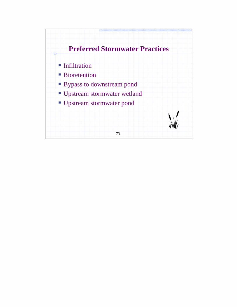
Preferred Stormwater Practices
InfiltrationBioretention Bypass to downstream pond Upstream stormwater wetlandUpstream stormwater pond
74Copyright 2000, Center for Watershed Protection
Hmmm..look a lot like degraded natural wetlands
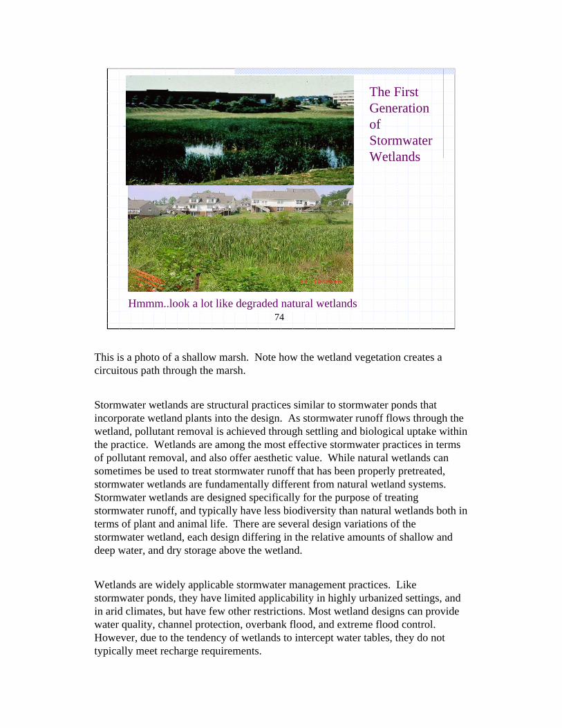
The First Generation of Stormwater Wetlands
This is a photo of a shallow marsh. Note how the wetland vegetation creates a circuitous path through the marsh.
Stormwater wetlands are structural practices similar to stormwater ponds that incorporate wetland plants into the design. As stormwater runoff flows through the wetland, pollutant removal is achieved through settling and biological uptake within the practice. Wetlands are among the most effective stormwater practices in terms of pollutant removal, and also offer aesthetic value. While natural wetlands can sometimes be used to treat stormwater runoff that has been properly pretreated, stormwater wetlands are fundamentally different from natural wetland systems. Stormwater wetlands are designed specifically for the purpose of treating stormwater runoff, and typically have less biodiversity than natural wetlands both in terms of plant and animal life. There are several design variations of the stormwater wetland, each design differing in the relative amounts of shallow and deep water, and dry storage above the wetland.
Wetlands are widely applicable stormwater management practices. Like stormwater ponds, they have limited applicability in highly urbanized settings, and in arid climates, but have few other restrictions. Most wetland designs can provide water quality, channel protection, overbank flood, and extreme flood control. However, due to the tendency of wetlands to intercept water tables, they do not typically meet recharge requirements.
75
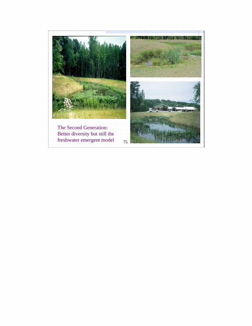
The Second Generation: Better diversity but still thefreshwater emergent model
76
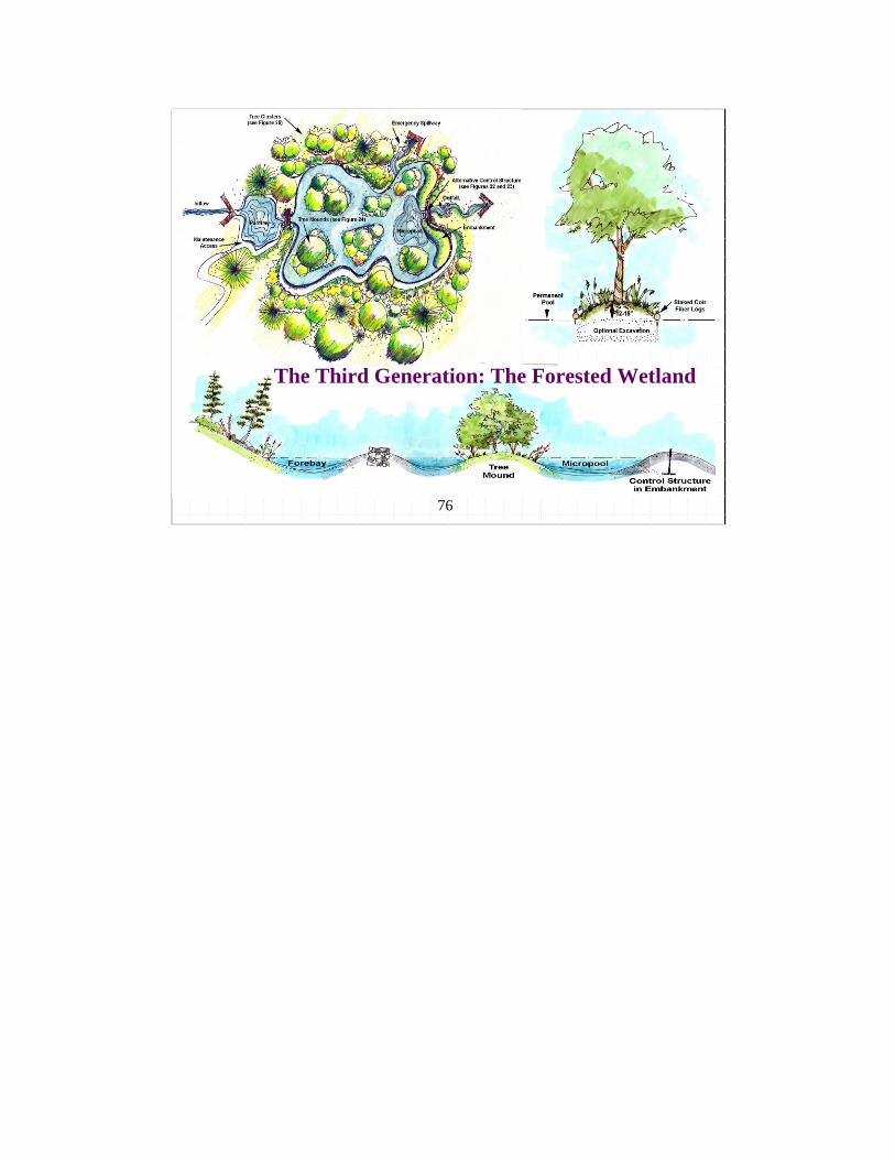
The Third Generation: The Forested Wetland
77
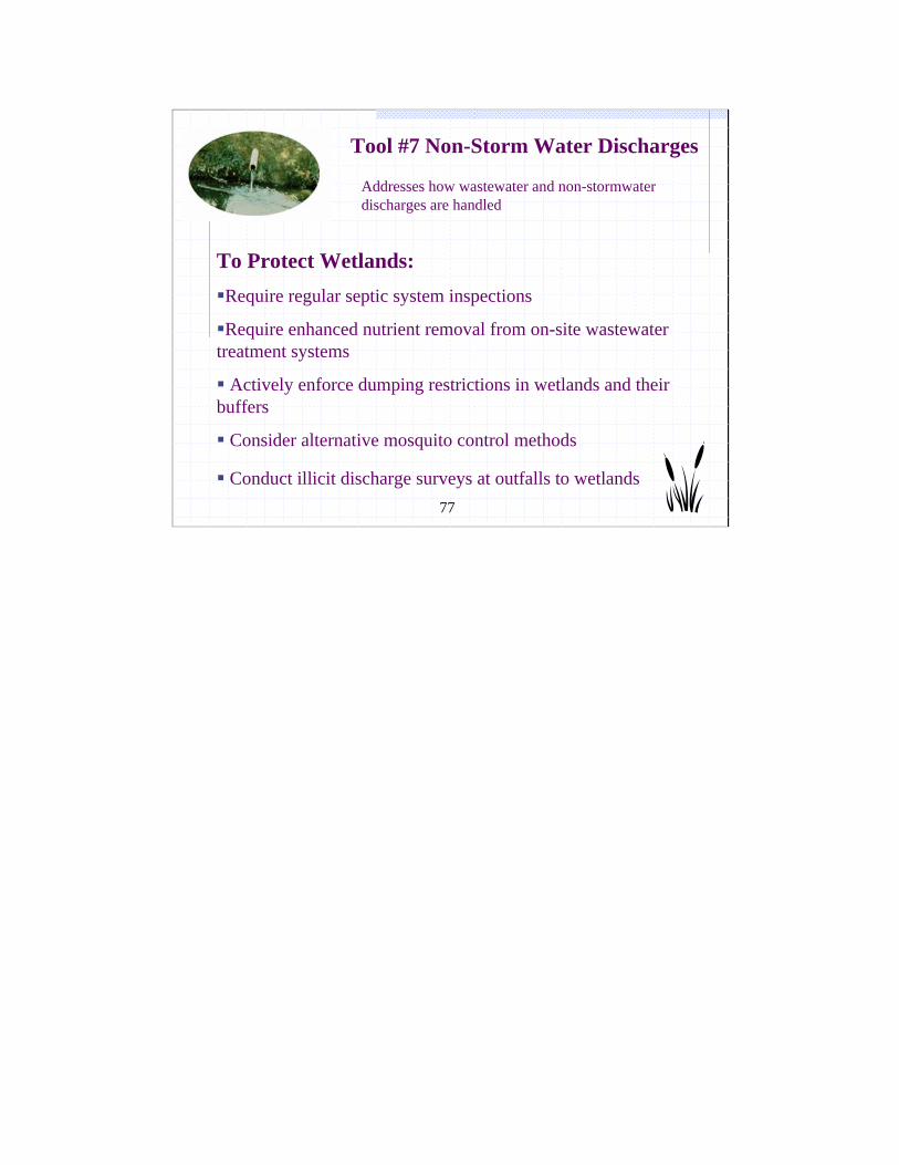
Addresses how wastewater and non-stormwater discharges are handled
Tool #7 Non-Storm Water Discharges
To Protect Wetlands:Require regular septic system inspections
Require enhanced nutrient removal from on-site wastewater treatment systems
Actively enforce dumping restrictions in wetlands and their buffers
Consider alternative mosquito control methods
Conduct illicit discharge surveys at outfalls to wetlands
78
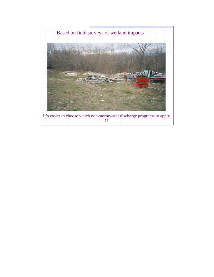
Based on field surveys of wetland impacts
It’s easier to choose which non-stormwater discharge programs to apply
79
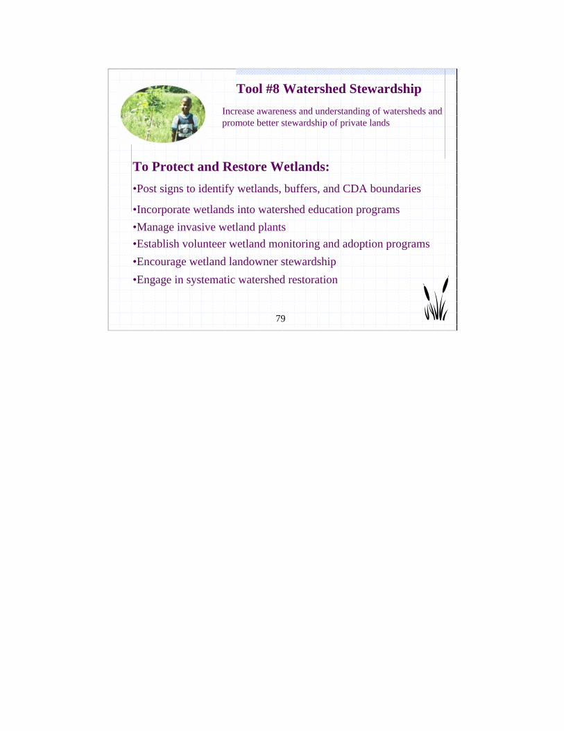
Increase awareness and understanding of watersheds and promote better stewardship of private lands
Tool #8 Watershed Stewardship
To Protect and Restore Wetlands:•Post signs to identify wetlands, buffers, and CDA boundaries
•Incorporate wetlands into watershed education programs •Manage invasive wetland plants •Establish volunteer wetland monitoring and adoption programs•Encourage wetland landowner stewardship•Engage in systematic watershed restoration
80
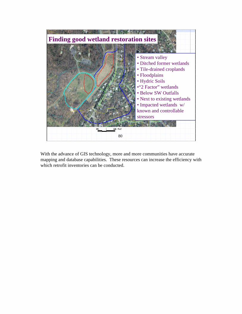
Finding good wetland restoration sites
• Stream valley • Ditched former wetlands• Tile-drained croplands• Floodplains• Hydric Soils•“2 Factor” wetlands• Below SW Outfalls• Next to existing wetlands • Impacted wetlands w/ known and controllable stressors
With the advance of GIS technology, more and more communities have accurate mapping and database capabilities. These resources can increase the efficiency with which retrofit inventories can be conducted.

81
Q & A BreakPicture by Donald J. Leopold, from Welsch et al., 1995

82
Wetland Resources
Article 1: Wetland Impacts, Watershed Woes?Article 2: Protecting Wetlands Locally Through Watershed Planning Article 3: Adapting Watershed Tools to Protect Wetlands
Available at http://www.cwp.org/wetlands/articles.htm
Additional Resources