INDIANA COUNTY SUBDIVISION ORDINANCE
77
INDIANA COUNTY SUBDIVISION ORDINANCE \ 20 I 21 )-\L_ INDIANA COUNTY PLANNING COMMISSION Adopted November, 1962 Amended August, 1981 July, 1987 July, 1990
Transcript of INDIANA COUNTY SUBDIVISION ORDINANCE
INDIANA COUNTY SUBDIVISION ORDINANCE
\ 20 I 21
)-\L_
INDIANA COUNTY PLANNING COMMISSION
Adopted November, 1962
Amended August, 1981 July, 1987 July, 1990
INDIANA C01lllT'i SUBDIVISION ORDINANCE
ADOPTED - November 7, 1962
AMENDED - August 26, 1981 July 22, 1987 July ll, 1990
PREPARED FOR
INDIANA C01lliT'i BOARD OF COMMISSIONERS
BY
THE INDIANA COUNTY PLANNING COMMISSION
INDIANA COUNTY COURTHOUSE
INDIANA, PENNSYLVANIA 15701
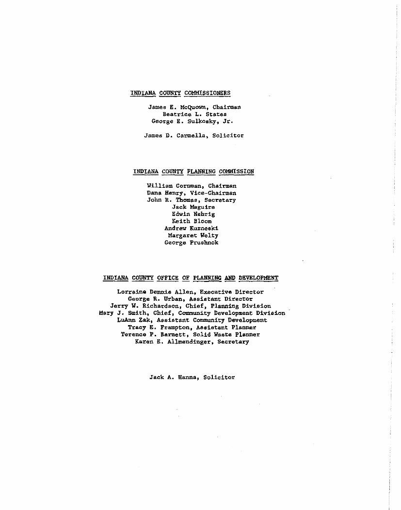
INDIANA COUNTY COMMISSIONERS
James E. Mcquown, Chairman Beatrice L. States
George E. Sulkosky, Jr.
James D. Carmella, Solicitor
INDIANA COUNTY PLANNING COMMISSION
William Cornman, Chairman Dana Henry, Vice-Chairman John R. Thomas, Secretary
Jack Maguire Edwin Nehrig Keith Bloom
Andrew Kuzneeki Margaret Welty
George Prushnok
INDIANA COUNTY OFFICE OF PLANNING ~ DEVELOPMENT
Lorraine Dennis Allen, Executive Director George R. Urban, Assistant Director
Jerry w. Richardson, Chief, Planning Division Mary J. Smith, Chief, Community Development Division
LuAnn Zak, Assistant Communit:y Development Tracy E. Frampt:on, Assistant Planner
Terence P. Barnett, Solid Waste Planner Karen E. Alllllendinger, Secretary
Jack A. Hanna, Solicitor
TABLE OF CONTENTS
ARTICLE I - PURPOSE . . . . . . . . . . . . . . . . . . . . . .. . . . . ARTICLE II - .JURISDICTION AND SANCTIONS . .. . . . . . . .. . . . . . . .
Section 201 Section 202 Section 203 Section 204 Section 205
ARTICLE Ill - DEFINITIONS
Section 301 Sect:!.on 302
ARTICLE IV - PROCEDURE
Section 401 Section 402 Section 403 Section 403.1 - Step 1: Section 403.2 - Step 2:
Section 403.3 - Step 3: Section 403.4 - Step 41 Section 403.S - Step 5:
Sect.ion 403.6 - Step 6:
Section 403.7 - Step 7: Section 403.8 - Step 8: Section 404 Section 405
Section 406 Section 407 Section 407.1 -Section 407.2 -Section 408
Grant of Power Effect of Subdivision Ord:!.nance Jurisdiction Preventive Remedies Enf o~cement Remedies
. . . . . . . . . . .. . . . . . . . . . Inclusions Def:!.nit:!.ons of Special Terms
. . . . . . . . . . . . . . . . . . . . . . . . Statement of Intent Regulatory Subdivision Review Procedure Pre-Application Conference Preparat:!.on and Submittal of the Preliminary Plan, Supporting Data, Subdivision Appiication and Fee
Preliminary Plan Review Other Agency Reviews and Approvals Approval from Pennsylvania Department of Tranaportation
Preparation and Submittal of the Final Plan, Supporting Data, and Subdivision Application
Final Plan Review Recording of Final Plan and Deeds Effect of Plan Approval on Official Map Effect of Ordinance Amendments on Applications for Approval of Plans
Amendments to Recorded Plans Single-Lot Subdivision Procedure Design Standards Procedure Minor Subdivision Procedure
l
2
2 2 3 4 4
5
5 5
11
11 11 11 11
12 13 14
14
14 15 16 16
17 18 19 19 19 20
TABLE OF CONTENTS (CO!lTINUED)
ARTICLE V - REQUIREMENTS FOR PI.AH SUBMITTAL • • • • • • • • • • • • • •
Section 501 Section 502
Preliminary Plan Requirements Final Plan Requirements
ARTICLE VI - DESIGN STANDARDS . . . . . . . .. . . .. . .. . . .. . . Section 601 Section 602 Section 603 Section 604 Section 605 Section 606 Section 607 Section 608 Section 609 Section 610 Section 611 Section 612 Section 613
Application Natural Features Flood Pla:!.ri Management Stol:til Water Management Street Design Specifications Street Design Cul-de-sac Streets Street Intersections Private Drive Streets Blocks Lots and Lot Size Easements Reservations for Public Use
ARTICLE Vll - IMPROVEMENTS . . . . . . .. .. . . . . . . . . . . . . . . . Section 701 Section 702 Section 702.l -Section 702.2 -Section 702.3 -Section 702.4 -Section 102.s -Section 703 Section 703.l -Section 703.2 -Section 704 Section 704.l -Section 704.2 -Section 705 Section 706 Section 707 Section 708
Application Installation of Impr6vements Improvement ~uarantee Partial Release from Improvement Guarantee Full Release from Improvement Guarantee Maintenance Guar.antee · Remedies to Effect Coaipletiou'of Improvements Monuments -and Markers , Monuments Markers Streets Local Street Construction Collector and Major Street Construction Sewage Disposal Water Supply Storm Water Runoff Street Name Signs
ARTICLE VIII - ALTERNATIVE LAND SUBDIVISION TYPES . . . . . . . . . . . .
21
21 23
26
26 26 26 27 28 28 ~9 30 30 31 32 33 33
35
35 35 35 37 37 39 39 40 40 40 40 41 42 42 43 43 43
44
TABLE OF CONTENTS (CONTINUED)
ARTICLE IX - ADMINISTRATION . . . . . . . . . . . . . . . . . . . . . Section 901 Section 902 Section 903 Section 904 Section 905 Section 906 Section 907 Section 908 Section 909 Section 910 Section 911
APPENDIX A
APPENDIX B
APPENDIX C
Grant of Power Reconsideration Appeals Application Fees Waivers or Modif icationa Revision and Amendment Planning Commission Records Conflict ~ith Other Regulations Liability Sever ability Effective Date
- LOCAL MUIJICIPALITIES WITH SUBDIVISION REGULATIONS
- SUBDIVISION PROCEDURAL GUIDE
- SCHEDULE OF FEES
APPENDIX D - SAMPLE FORMS - REVIEWS BY LOCAL AND STATE AGENCIES
APPENDIX E - PRELIMINARY PLAN CERTIFICATBS
APPEllD!X F - FINAL PLAN CERTIFICATBS , •
APPENDIX G - CUL-DE-SAC DESIGN STANDARDS
APPENDIX B - CLEAR SIGHT TRIANGLES AT LOCAL STREET INTERSECTIONS
APPENDIX I - LEVELING AREAS AT STREET INTBRSECTIOHS
APPENDIX J - SAMPLE AGREEMENT FOR MAINTENANCE OF RIGHT-OF-WAY
APPENDIX K - LOCAL STREET CONSTRUCTION; CROSS SECTIONS
APPENDIX L - SUGGESTED FORMAT - SKETCH PLAN
APPENDIX M - SUGGESTED FORMAT - PRELIMINARY PLAN
APPENDIX N - SUGGESTED FORMAT - FIHAL PLAN • • •
45
45 45 45 45 45 46 46 46 46 47 47
48
49
52
53
57
58
62
63
64
65
67
68
69
70

INDIANA COUNTY SUJ!DIVISION ORDINANCE
AN ORDINANCE PROVIDING FOR THE REGULATION OF LAND SUBDIVISION AND THE REVIEW AND APPROVAL OF SUJ!DIVISION PLANS WITHIN THE JURISDICTION OF INDIANA COUNTY.
UNDER THE AUTHORITY OF THE PENNSYLVANIA MUNICIPALITIES PLANNING CODE, ACT 247 OF 1968, AS AMENDED, THE COUNTY OF INDIANA DOES HEREBY ENACT THE INDIANA COUNTY SUBDIVISION ORDINANCE, AS ORIGINALLY ADOPTED IN llOVEMIIER, 1962, AND AMENDED IN AUGUST, 1981; JULY, 1987; Alfi JULY, 1990.
ARTICLE I
PURPOSE
The purpose of the regulations within this Ordinance is to assure new building sites are suitable for construction purposes, and to provide for harmonious land development in Indiana County by creating conditions favorable to the health, safety, and general welfare of the residents of Indians County. This is accomplished through the regulations of this Ordinance which include:
a. Providing a uniform p~oeedure for the reviev and approval of subdivision plans;
b, Requiring minimum lot sizes for efficient on-lot sewage disposal and water supply;
c. Restricting development in flood hazard areas;
d. Requiring municipal planning and soils testing for on-lot sewage disposal;
e. Requiring proper access for new lots to a public street;
f, Assuring new streets are compatible with the topography of the land and conform to local construction standards;
g. Providing for adequate erosion control and storm water management; and
h. Providing a guarantee that all public tmProvements will be installed and maintained within a subdivision.
The regulations and procedures within this Ordinance assure property ovnera that all plans will be considered on an established public policy.
l
ARTICLE II
JURISDICTION AND SANCTIONS
Act 247 of 1968 (as amended), the "Pennsylvania Municipalities Planning Code," grants the governing body of each municipality within the Commonwealth of Pennsylvania the power to regulate subdivisions within the municipality by enacting a subdivision ordinance.
202 ~ Effect of Subdivision Ordinance
No subdivision of any parcel of land ehall be made, nor improvements in connection therewith shall be laid out, constructed, opened or dedicated for public use or travel, e~cept in accordance with the provisions of this Ordinance.
All subdivision plans proposed for land within. Indiana County, except those located within a local municipality .having properly adopted land subdivision regulations by ordinance, shall be submitted to and be approved by the Indiana County Office of Planning and Development or Indiana County Planning Commission. This approval must be received before the plans or deeds for lots within the plans are recorded with the Indiena County Recorder of Deeds.
203 = Jurisdiction
A certified copy of this Ordinance and all amendments shall be sent to every municipality within Indiana County.
,The power of Indiana County to enact, amend, and repeal this Ordinance is limited to land in those local municipalities within the County which have no subdivision ordinance in effect. The proper.enactment of a subdivision ordinance by any local municipality shall act as a repeal of this ordinance within the municipality adopting such ordinance. The proper enactment procedures require that a certified copy of such ordinance must be filed with the Indiana County Planning Commission within thirty day~ of ad.option. These local municipalities which have filed certified copies of their Ordinances with tha Indiana County Planning Commission are listed in Appendix A.
Applications and plans for subdivisions located within a local municipality which has properly adopted a subdivision ordinance shall be forwarded on receipt by the local 111unicipal:lty t.o the Indiana County Office of Planning and Development for review and comment. Local l!lUnicipalities shall not
approve such applications and plans until the County comments are received, or until the expiration of 30 days from the date the application and plans were received by the County.
Any local municipality may adopt by reference this Ordinance, and may by separate ordinance designate the Indiana County Planning Commission, with the Commission's concurrence, as its official administrative agency for review and approval of plans.
~ ~ Preventive REmedies
In addition to other remedies, Indiana County may institute and maintain appropriate actions by law or in equity to restrain, correct or abate violations, to prevent unlawful construction, to recover damages and to preent unlawful construction, to recover damages and to prevent illegal occupancy of a building, structure or premises. The description by metes and bounds in the instrument of transfer or other documents used in the process of selling or transferring shall not exempt the seller or transferor from such penalties or from the remedies herein provided.
A municipality may refuse to issue any permit or grant any approval necessary to furtber improve or develop any real property which has been developed or which has resulted from a subdivision of real property in vio• lation of this Ordinance. This authority to deny such a permit or approval shall apply to any of the following applicants:
(1) The owner of record at the time of such violation.
(2)
(3)
The vendee or lessee of the owner of record at the time of violation without regard as to whether such current owner actual or constructive knowledge of the violation.
such had
The current owner to the time of current owner had tion.
of record who acquired the property subsequent violation without regard as to whether such
actual or constructuve knowledge of the viola-
(4) The vendee or lessee of the current owner of record who acquired the property subsequent to the time of violation without regard as to whether such vendee or lessee had actual or constructive knowledge of the violation.
As an additional condition for issuance of a permit or the granting of an approval to any such owner, current owner, vendee or lessee for the devel· opment of any such real property, the municipal.ity may require compliance with the conditions that would have been applicable to the property at the time the applicant acquired an interest in such real property.
3
~ = Enforcement Remedies
District justices shall have initial jurisdiction in proceedings brought under this section.
kn.7 person, ·partnership or corporation who or which has violated.the provisiono of this"Subdivision Ordinance sh~ll, upon being found liable therefor in a civil enforcement proceeding commenced by Indiana County, pay a judgment of not more than $500 plus all court costs, including reasonable attorney fees incurred by the County as a result thereof, No judgment shall commence or be imposed, levied or payable until the date of the determination of a violation by the district justice. If the defendant neither pays nor timely appeals the judgment, the County may enforce the judgment pursuant to the applicable rules of civil procedure. .Each day that a Violation continues shall constitute a separate violation-, unlese the district justice determining that there has been a violation- further determines that there was a good faith basis for the person, partnership or corporation violating the ordinance to have believed that there vaa no such Violation, in which event there shall be deemed to have been only one such violation until the fifth day following the date of the determination of a violation by the district justice and thereafter each day that a violation continues shall constitute a separate violation.
The Indiana County Court of Camnon Pleae, upon petition, may grant an order of stay, upon cause shown, tolling the per diem judgment pending a final adjudication of the violation and judgment.
Nothing contained in this section shall be construed or interpreted to grant to any person or entity other than Indiana County the right to commence any action for enforcement pursuant to this section.
ARTICLE III
DEFINITIONS
30 I - Inclusions
Words in the singular include the plural and words in the plural include the singular. The word "persona" includes a corporation, and unincorporated association; nbuildingn includes a "st·ructure" and shall be construed as if followed by the vords "or part thereof". The vord "streetu includes 11 road 11 , "highway" and "lane"; ''watercourse" includes "dt:'ain", »ditch" and 11 straam11 • The word "may" is permissive; the words "shallu and 11will11 are mandatory.
302 ~ Definitions of Special ~
Accessory Use/Seructure - A use or structure subordinate to the principal use or structure on the same lot and serv1ng a purpose customarily incidental to the principal use or structure.
Alley - A strip of land over which there is a public or private rightof-way, on which no dwellings front, and which is designed to serve as secondary access to two or more lota.
~ - A tract of land bordered on one side by a street and on the remaining sides by streets, railroad rights-of-way, waterways, undeveloped areas and/or other definite barriers.
Building - A combination of materials to form a permanent having walls and a roof. Included shall be all mobile trailers utilized for human habitation.
structure homes and
Building Setback Line - A line within a lot defining the required minimum distance betWeen any building and the front property or rightof-way line.
Cartway - That portion of a street or alley which is improved, designated, intended, used or capable of being used for vehicular travel.
£!!!!! Sight Triangle - An area of unobstructed vision at street intersections, defined by lines of sight between points at a given distance from the intersection of the street center lines.
Comprehensive ~ - The general plan utilized to guide the growth, protection and development of tndiana County, adopted by the County and/or by any of the Townships or Boroughs located within the County,
5
Decision - Final adjudication of any board or other body granted jurisdiction under the Ol:dinance to do so, either by reason of the grant of exclusive jurisdiction or by reason of appeals from determinations. All decisions shall be appealable to the Court of Common Pleas.
Determination - final action by an officer, body or vith the administration of any land use ordinance thereunder, except the folloving:
(1) the governing body; or
agency charged or applications
(2) the planning agency, only if and to the extent the planning agency is charged with final decision on preliminary or final plans under the subdivision ordinance provisions. Determinations shall be appealable only to the boards designated as having jurisdiction for such appeal.
Developer - Any landowners or agent of said landcnnier, who makes o~
causes to be made a subdivision of land.
Develop!llent - A:ny man-made change to improved or unimproved real estate, including but not limited to buildings, mobile homes, or other structures, mining, dredging, filling, grading, paving, excavation or drilling operations.
Easement - A defined right of use for certain lands granted for a special purpose not inconsistant with the general property rights of the owner ..
Flood Plain - A relatively flat or low area adjoining a river, stream ;;;:--;;atereeurae which is subject to partial or complete inundation of water; or an area subject to the unusual and rapid accumulation of runoff of surface water from any sour~e ..
Floodway - That portion of the 100 year flood plain including the channel of a river or other water courses and the adjacent land areas which are required to carry and discharge the 100 year f.lood, and where the activities permitted elsevhere in the flood plain district will not comulatively increase the vater surface elevation more than one foot at any given point. The detailed study of the Regulatory Flood provides specific flood profiles and allows for the delineation of both f loodway and flood fringe areas within the bounds of the flood plain.
Homeowners Association - An incorporation of lot owners for the purpose of providing for ownership and maintenance of community improvements ..
6
Improvement - The physical additions, installations and changes required to render usable and desirable lots from raw acreage.
Improvement Guarantee - Any acceptable financial security the Planning Commission as being adequate to cover the costs of any and all required improvements.
~ Agency - Any public agency, organization or local that has a direct int.erest in ensuring that a partic,ula.r improvement is properly installed, and is so designated lead agency by the Planning COIXlmission.
approved by conotruction
municipality subdivision
as being a
~ Municipality - Any political subdivision located within the boundaries of Indiana County.
Lot - A designated parcel, tract or area of otherwise as permitted by law and to be used 1
unit.
land established,by a plat or developed or built upon as a
Maintenance Agreement - A legally enforceable document which outlines the maintenance responsibilities for private subdivision impTovements.
Nonbuilding !:.':!! - A designated parcel, tract or area of land proposed to be conveyed as an addition to an existing adjacent building lot or to be established as an independent lot upon which no residential structure nor sewage dispo9al system may be placed. These lots must be used for accessory puT'pOses only.
Ordinance - !!.!! Indiana County Subdivision Ordinance.
Original~ - Parcel of land, as described in the deed of record on .November 7, 1962, from which the proposed lot(s) are to be created by the subdivision procedure~
~ - A map or plan of a subdivision, whether preliminary or final.
Plan, ~ - A complete and exact subdivision plan prepared for official recording as required by this Ordinance.
Plan, Preliminary - A general subdivision plan showing existing features of land and proposed streets and lot layout within and· adjacent to a subdivision as required by this Ordinance.
Plan, Sketch - A rough sketch ehowing the contemplated development of the subdivision and its relationship to adjacent land.
Planning CommiSeion - The words Planning Commission, County Planning Commission or Commission shall mean the Indiana County Planning Commission.
7
Public Hearin& - a formal meeting held pursuant to public notice governing body or planning agency, intended to inform and obtain comment, prior to taking action in accordance ~ith this Ordinance.
by the public
Public Meeting - a forum held pursuant to notice under the act of July 3, 1986 (P.L. 388, No. 84), known as the "Sunshine Act.• Public Notice - notice published once each week for two successive weeks in a newspaper of general circulation in the municipality. Such notice shall state the time and place of the hearing and the particular nature of the matter to be considered at the hearing. The first publication shall not be more than 30 days and the second publication shall not be less than seven days from the date of the hearing.
Regulatory ~ - the flood which has been selected to serve ss the basis on which the flood plain management provisions of this and other Ordinances have been prepared; for purpose of this Ordinance, the 100 year flood, as identified by the Federal Insurance Administration.
Regulatory ~ Elevation - the 100 year flood elevation based on the information contained in the Official Flood Insurance Study.
Report - any letter, review, memorandum, compilation or similar writing made by any body, board, officer or consultant other than a solicitor to any other body, board, officer or consultant for the purpose of assisting the recipient of such report in the rendering of any decision or determination. All reports shall be deemed recommendatory and advisory only and shall not be binding upon the recipient, board, officer, body or agency, nor shall any appeal lie therefrom. Any report used, received or considered by the body, board,officer or agency rendering a determination or decision shall be made available for inspection to the applicant and all other parties to any proceeding upon request, and copies thereof shall be provided at cost of reproduction.
Reverse Frontage ~ - A lot having its front and rear lot lines abutting the right-of-way of a street.
Riaht-of-Way - A strip of land reserved or dedicated for a street, alley, or other public improvement purpose.
Sight Distance - The distance an object is visible along a street from any given point on the centerline of said street.
Single-Lot Subdivision - A subdivision consisting of the first and second lots subdivided from an original tract.
Street - Any public or private way, road, intended to be used for vehicular traffic. fied as follows:
8
avenue, or highway used or Streets shall be classi-
A. Major - Those streets serving large volumes of comparatively high•peed traffic and functioning as an inter-coamiunity link.
B. Collector - Streets which serve to collect and distribute volumes of traffic from local streets to major streets and designed to carry intermediate vol\lllles of comm.unity traffic.
c. Local - Streets which are used for access to abutting properties ;;n;r--which carry limited volumes of traffic. These streets are designed to discourage through traffic•
Street, Cul-de-sac - A local street having one end open to vehicular traffic and being permanently terminated by a vehicular tum-around at the opposite end.
Street, Dead End - A street with only one vehiculaT outlet but ~hich
has a temporary tum-around and which is designed to be continued when adjacent open land is subdivided. ··
Street, Half - A street parallel and adjacent to a property line having a:r.;;;ser right-of-way width than required for improvement and dedication of the street.
Street, Private - Any street which is not a Public Street.
Street, Private ~ - Any approved street ~hich serves not more than two lots and which is intended for private construction and maintenance.
Street, Public - Any street which bas been dedicated to and adopted by a local municipality as a part of its official road system.
Structure - Any manmade object constructed or erected on the land or attached to the land, including, but not limited to buildings and similar items,
Subdivision - The division or redivision of a lot, tract or parcel of land by any means into two or more lots, tracts, parcels or other divisions of land including changes in existing lot lines' for the purpose, whether immediat_e or future, of lease, partition by the court for distribution to heirs or devisees, transfer of ownership or building or lot development. Provided, however, that the subdivision by lease of land for agricultural purposes into parcels of more than ten acres, not involving any new street or easement of access or residential dwellings shall be exempted.
9
Variance - An authorization from the Planning Commission for a developer to proceed with a minor deviation from the terms of this Ordinance because of unusual conditions which create a hardship for the developer.
Water Sur.vey - An inventory of the source, quantity, yield, and use of groundwater and surface~water resources.
10
ARTICLE IV
PROCEDURE
401 ;: Statement of Intent
In order to conserve time, effort, and expense throughout the subdivision review process, the developer shall comply with the procedural guidelines set forth in this Article. The detailed, step-by-step procedures have been established to coordinate efforts between the developer, Planning Commission, local municipalities, and other review agencies. A procedural guide for use by all developers is provided in Appendix B.
~ ;: Regulatory
There shall be no subdivision of any tract of land, nor shall any improvements in conjunction with the subdivision be constructed for public or private use except in accordance with the procedural .Provis~onS contained in this Article. It is the sole responsibility of the developer to comply with all procedural requirements.
A developer shall not proceed with any improvements within a subdivision until the Planning Commission grants approval of the preliminary plan for the subdivision. Furthermore, lots may not be sold or transferred nor any deeds recorded for any lots in the plan without the developer obtaining from the Planning Commission the unconditional approval of the final plan.
~ ;: Subdivision Review Procedure
A developer seeking approval of a subdivision plan proposed for any lend within the jurisdiction of the Indiana County Planning Commission under this Ordinance shall follow the procedures end submit the information outlined in this section.
~ ;: Step .!..:. Pre-Application Conference
The developer shall meet informally with the staff of the Indiana County Office of Planning and Development to discuss the subdivision proposal. The Staff will advise the developer on procedures and requirements, and suggest professional assistance. The d6veloper must be prepared to discuss details concerning the proposed subdivision and be prepared to submit the following:
J1

A. Sketch Plan - The sketch plan shall shO<il the proposed streets, lots, existing conditions, and improvements. plan shall be for review and cO!lllllent purposes only, ~ be considered as a plan which has been submitted al. A suggested format for the sketch plan is located L.
layout of The sketch and shall
for approvin Appendix
B. Flood Plain Determination - The developer should be prepared to locate the proposed boundaries of the development on the applicable flood plain map of the host municipality.
After this conference with the developer, the Planning Staff will indicate the suitability of the plan for further consideration and submittal of a preliminary or final plan to the Planning Commission.
~ ~ Step ~ Preparation and Submittal of EE!. Preliminary Plan, Supporting Data, Subdivision Application ~ ~
The initial plan filed with the Indiana County Planning Commission for subdivision review shall be considered as a preliminary plan. However, if the plan and supporting data comply in all aspects with the requirements for both preliminary and final plans, the Planning Commission mey in the case of a minor subdivision involving no new improvements proceed to final action at the first coneideraton of the plan.
The preliminary plan is not intended to be recorded. Its purpose is to shO<il graphically all facts needed to enable the Planning Commission to determine whether the proposed subdivision will comply with the objectives and requirements of this Ordinance. The preliminary plan does not have to be prepared by a registered engineer or surveyor. but must comply with all of the standards and requirements outlined in this Ordinance. A suggested format for the preliminary plan is located in APpendix M.
The preliminary plan and supporting data shall comply with the requirements of Section 501 of this Ordinance.
An original drawing and four copies of the preliminary plan shall be submitted to the Planning Commission by the developer. Four copies of any supporting data must be submitted with the plans. The Planning Commission mey table until its next meeting any plan which is not filed at least ten days in advance of the regular monthly meeting or any special meeting.
The appropriate application form is available at the Office of Planning and Development, and must be completed and submitted with an applicetion fee. The proper fee will be outlined on a "Schedule of
12
Fees• established and approved by the Indiana County Board of Commissioners. This "Schedule of Fees" may be revised at any time by the Commissioners. A copy of the current "Schedule of Fees" iS on file in the Office of Planning and Development, and a copy is provided in Appendix C.
The application will not be considered complete for review until all plans, supporting data, the application fo+i!', and the proper fee have been submitted to the Office of Planning and Development. .·The Office of Planning and Development Staff will determine when an application is complete for review by the Planning Commission.
~ ~ Step !;, Prelimiilary !'.ill Review
The Planning Commission will review the preliminary plan and supporting data to determine compliance with the subdivision r~~ulations. Before acting on any subdivision plan, the Planning Commission may hold a public hearing thereon after proper public notice.
The decision of the Planning Commission to approve, conditionally approve, or deny approval shall be made at a public meeting and be communicated to the developer within 90 days following the date of the next regular meeting following the filing date of the application. In the event that there is no meeting within 30 days after the date the complete subdivision application was filed, the Planning Commission must render a decision within 120 days after the filing of the complete application, The decision of the Planning Commission shall be in writing and be communicated to the developer personally or mailed to him at his last known address no later than 15 days following the decision.
The Planning Commission may grant approval to a preliminary plan with conditions Which are subject to acceptance by the developer. The decision of the Planning co ... ission to grant the approval with conditions shall be in writing and communicated to the developer personally or mailed to him at his last known address no later than 15 days folloving the decision. The written decision must list.all conditions which must be satisfied prior to the granting of an unconditional preliminary approval by the Planning Commisdon. The developer must accept or reject in writing any conditions within 30 days of receipt of the written decision. Approval of the plan shall be automatically rescinded on rejection of the conditions by the developer or failure by the developer to accept or reject such conditions within the 30 day time period,
When the application, plans, by ~he Planning Commission,
and/or supporting data are not approved the decision shall specify the defects
13
found in the submittals, describe the requirements which have not been met, and cite to the specific proiiisions of the Ordinance on which the decision baa been made by the Commission.
Failure of the Planning Commission to render a decision and cate it to the developer within the time and in the manner ber~in shall be deemed an approval of the application in presented, unless the applicant has agreed in -writing to an of time or change in the prescribed manner of communicating sion.
403.4 ~Step ~ ~Agency Reviews and ApProvals
communirequired
terms as extension the deci-
Following approval of the prelii1>inary plan, and before review of the final plan by the Planning Commission, the developer must coordinate his development activities with other local, State, and federal agencies to ensure compliance with other requirements from the respective agencies. The Office of Planning and Development Staff will provide a list of review agencies for the developer. The Planning Commission will not review any final plan until proof has been received by the Commission that the developer has complied with all requirements of the review agencies. This proof must be in the form of a comment letter, approval, permit, and/or improvement guarantee. Samples of forms which may be utilized for comments and approvals are contained in Appendix D.
Approval ~ Pennsylvania Department of Transportation
No plan which will require access to a highway under the jurisdiction of the Pennsylvania Department of Transportation shall be finally approved unless the plan contains a notice that a highway occupancy permit is required pursuant to section 420 of the Act of June 1, 1945 (P.L. 1242, No. 428), known as the •state Highway Law,• before driveway access to a State highway is permitted. The plan shall be marked to indicate that access to the State highway shall be only as authorized by a highway occupancy permit.
Indiana County shall not be held liable for damages to persons or property arising out cf the issuance or denial of a driveway permit.
403.6 Step ~ Preparation and Submittal £!. .!;!!!. ~ Plan, Supporting Data, and Subdivision Application
The final plan shall b~ prepared by a registered surveyor or engineer, comply with the requirements of Section 502 of this Ordinance, and conform to the approved preliminary plan. A suggested format for the final plan is located in Appendix N.
The developer may submit the plan in phases for final approval. The developer shall submit the original drawing and four copies of the final plan to the Planning Comnission. Four copies of any supporting data must be submitted with the plans. The Planning Comnission may table until its next meeting any plan which is not filed at least ten days in advance of the regular monthly meeting or any special meeting. The application will not be considered complete for review until all plans and supporting data have been submitted to the Office of Planning and Development. The Office of Planning and Development Staff will determine when an application is complete for review by the Planning Commission.
The Planning Commission will review the final plan and supporting data to determine compliance with the subdivision regulations. Before acting on any subdivision plan, the Planning Commission may hold a public hearing thereon after proper public notice.
The decision of the Planning Commission to approve, conditionally approve, or deny approval shall be made at a public meeting and be communicated to the developer within 90 days following the date of the next regular meeting following the filing date of the application. In the event that there is no meeting within 30 days after the date the complete subdivision application was filed, the Planning Commission must render a decision within 120 days after the filing of the complete application. The decision of the Planning Commission shall be in writing and communicated to the developer personally or mailed to him at his last known address no later than 15 days following the decisions.
The Planning Commission may grant approval to a final plan with conditions which are subject to acceptance by the developer. The decision of the Planning Comnission to grant the approval with conditions sru.il be in writing and comawnicated to the developer personally or mailed to him at his last known address no later than 15 days following the decision. The written decision must list all conditions which must be satisfied prior to the granting of an unconditional final approval by the Planning Comnission. The developer must accept or reject in writing any conditions within 30 days of receipt of the written-decision. Approval of the plan shall be automatically rescinded on rejection of the conditions by the developer or failure by the developer to accept or reject such conditions within the 30 day time period.
15
When the application, plans, and/or supporting data are not approved by the Planning Commission, the decision shall specify the defects found in the aubmittals, describe the requirements which have not been met, and cite to the specific provisions of the Ordinance on which the decision has been made by the Commission.
Failure of the Planning Commission to render a decision and cate it to the'developer within the time and in the manner herein shall be deemed an approval of the application in presented, unless the applicant has agreed-in writing to an of tilne or change in the prescribed manner of communicating sion.
Before approving any final plan with proposed improvements, ning Commission shall require strict compliance with the improvement requirements outlined in Article VII.
~ .:: Step !:_ Recording fil. ~ Plan ~ ~
communirequired
terms as extension the deci-
the Plandetailed
Within 90 days after approval of the final plan by the Planning Commission or Office of Planning and Development and before conveyance of any deed out of the plan, the developer ahall record the approved final plan with the Recorder of Deeds of the County of Indiana. The developer shall be responsible for the the payment of any recording fee.
The Recorder of Deeds shall not accept any plan for recording unless such plan officially notes the approval of the Indiana County Office of Planning and Development or the Indiana County Planning Commission.
The approval action of the Planning Commission or Office of Planning and Development shall become null and void if the plan is not recorded within 90 days. The recorded plan shall include all applicable certifications as noted in Article V and the Appendices of this Ordinance.
The recordi_ng of the plan shall not constitute grounds for i>ssessment increases until such time as lota are sold or improvements are installed on the land within the approved plan.
~ _::_ Effect fil. Plan Approval 2!! Official Map
After a plan has been approved and recorded in accordance with this Ordinance, all streets and public grounds on the plan shall become a part of the official map of the local municipality without a public hearing.
16
~ Effect ~ Ordinance Amendments ~ Applications ~ Approval of ~
From the time an application for approval of a preliminary or final plan is duly filed as provided in this Ordinance, and while such application is pending approval or disapproval, no change or amendment of this Ordinance shall effect the decision on such application adversely for the applicant, and the applicant shall be entitled to a decision in accordance with the provisions of the governing Ordinance as it stood at the time the application was duly filed. In addition, when a preliminary application and plan have been duly approved, the applicant shall be entitled to final approval in accordance with the terms of the approved preliminary application. However, if an application is properly and finally denied, any subsequent application shall be subject to any intervening change in governing regulations.
When an application for approval of a preliminary or final plan·.has been approved without conditions or approved by the applicant'• acceptance of conditions, no subsequent change or amendment fo this Ordinance shall be applied to affect adversely the right of the applicant to commence and to complete any aspect of the approved development in accordance with the terms of such approval within five years from such approval. llhere final approval is preceded by preliminary approval, the five year period shall be counted from the date of the preliminary approval.
In the case of any doubt as to the terms of a preliminary approval, the terms shall be construed in light of the provisions of this Ordinance as they stood at the time when the application for euch approval was duly filed.
ln the case of a preliminary plan calling for the installation of improvements beyond the five year period, a schedule shall be filed by the developer with the preliminary plan delineating all proposed sections as well as deadlines within which applications for final plan approval of each section are intended to be filed. Such schedule shall be updated annually by the applicant on or before the anniversary of the preliminary plan approval, until final plan approval of the final section has been granted, and any modification in the aforesaid schedule shall be subject to approval of the Planning Commission at its discretion. Each section in any residential subdivision, except for the last section, shall contain a minimum of twenty-five percent of the total number of dwelling units as depicted on the preliminary plan, unless a lesser percentage is approved by the Planning Col!lmission at its diScretion. Provided the developer has not defaulted with regard to or violated any of the conditions of the preliminary plan approval, including compliance .with landowner's aforeaaid achedule of submission of final plans for the various sections, then the aforesaid proteetions afforded by substantially completing the improvements depicted on the final plan within five years shall apply and for any section or. sections,
.beyond the initial section, in which the required improvements have not been substantially completed within said five year period, the aforesaid protections shall apply for an additional term or terms of three years from
the date of final plan approval for each section. Failure of the developer to adhere to the aforesaid schedule of submission of final plans for the various sections shall subject any such section to any and all changes in this Ordinance enacted by Indiana County subsequent to the date of the initial preliminary plan submission.
~ ~ Amendments to Recorded f!!!!!.
Proposed amendments to recorded plans must be submitted to the Planning Commission for review and approval.
If modifications to streets, easements, rights-of-way or other improvements are involved, the lead agency shall be notified and written approval received from the agency prior to final approval being granted by the Planning Commission for the proposed amendment.
Amendments to a recorded plan can be approved by the Planning Commission under the following conditions:
A. The developer shall notify all persons owning lots in the ~ecorded plan by return receipt mail of the nature of the proposed amendment (a), and the date, time, and place the Planning Commission shall consider the proposed amendment(s). Proof of this notification shall be submitted to the Planning Commission.
B. No lot shall be created that is smaller than the minimum lot sizes required by this Ordinance.
c. No changes may be made to easements reserved for drainage.
D. No lot shall be created which does not abut on an approved public or p~ivate street.
E. There shall be no negative impact on the character of the development.
Where the proposed amendment involves the changing of lot and/or street lines, the developer shall prepare a plan amendment in accordance with Section S02 of this Ordinance, and submit the proposed plan amendment with supporting data for review by the Planning Commission. Following final approval from the Planning Commission, the developer shall record the plan amendment in accordance with Section 403.7. All such amended plans shall provide a reference to the Plan Book number and page, and date of the recording of the originally approved plan.
407 ~ Single-Lot Subdivision Procedure
Subdivisions consisting of the first and second lots from an original tract of land may be granted final approval by the Staff of the.Office of Planning and Development. These office approvals will be ratified by the Planning Commission at the next meeting of the COll!llliesion following the single-lot approvals. The Planning Staff may grant the final approval if the developer complies with the following design standards and procedural requirements.
407.l ~Design Standards
A. The .proposed single-lot subdivision must comply with all design standards in Article VI.
8. The proposed public street requirements in
lot(s) must have direct frontage on an existing or a private drive street which complies with all Section 608.
c. The single-lot subdivision shall not include proposals for any public improvements.
~ ~ Procedure
A. The developer should contact the Office of Planning and Develop• ment to discuss the procedural requirements and design standards for single-lot subdivisions. The Planning Staff may at its discretion require reviews and/o~ approvals from any agency as outlined in Sections 403.4 and 403.5 if applicable to the proposed subdivision.
B. If access to a public street is proposed by way of a private street, the developer shall submit copies of ownership, construction and maintenance agreements for the priVate street.
c. Following receipt of all approvals as required above, the er shall submit evidence of the approvals, and a copy proposed deed (with bearings and distances in the deed tion) or survey drawing for the single-lot subdivision Office of Planning and Development.
developof the
descripto the
D. An axecuted affadavit must be submitted th&t the proposed subdivision is the first and/or second lot(s) from the original tract.
E. The Planning Staff will grant final approval to subdivision if the developer has complied with all design requirements.
19
the single-lot procedu~al and
F. When the single-lot subdivision is not approved by the Office of Planning and Development, the Staff shall specify the defects found in the submittals, describe the requirements which have not been met, and cite to the specific provisions of the Ordinance on which the decision has been made by the Staff,
G. The single-lot subdivision must be recorded in accordance with the requirements of Section 403.7 of this Ordinance following final approval by the Planning Staff.
Additionally, the Planning Staff may approve nonbuilding lots which are proposed as additions to existing building lots or as independent lots for accessory uses only (garages, storage sheds, etc.). Most of these, lots do not comply with minimum lot size and access requirements. The developer shall comply with all applicable design and procedural requirements as outlined in this Section and Article VI before approval is granted by the Staff.
408 ::. ~ Subdivision Procedure
A subdivision plan shall be considered as a minor subdivision if the proposed plan meets the following conditions:
A. The proposed subdivision contains ten lots or less, (including the residual. tract) all of which have direct and sufficient frontage on an existing public street; and,
Bm No new construction .or extension of public sewe~ and/or water lines is required to serve any or all of the lots.
At the discretion of the Planning Commission, a developer seeking approval of a minor subdivision may disregard the preliminary plan preparation and review procedures, and proceed directly to final plan review after compliance with Sections 403.4 and 403.5 of this Ordinance, All applicable steps in the final plan procedure shall apply to a minor subdivision.
Any subdivision plan which does not meet the conditions of a minor subdivision shall be considered a major subdivision. A developer seeking approval of a major subdivision shall comply with all steps in this Article.
20
ARTICLE V
REQUIR£MENTS FOR PLAN SUBMITTAL
501 ~ Preliminary Plan Requirements
A. General Information -
1. The preliminary plan shall be prepared at a scale of either 50 feet to the inch or 100 feet to the inch;
2. Subdivision name or identifying title;
3. Municipality in which the subdivision is located;
4. North arrow, graphic scale and the date of the plan;
s. Name and address of the owner of the property;
6. Name of the person who prepared the plan;
7. Indication of the total number and use of all lots;
8. Contours at vertical intervals of five feet. The Planning Commission may relieve tl\j.a requirement if, due to the character of the topography, five foot contour intervals are not necessary to properly administer these regulations in connection with the proposed subdivision;
9. Where the preliminary plan covers only a portion of the property owned by the developer, and future plans include subdivision of the remaining ares, a sketch shall be submitted of the street and lot layout for the remaining area; and
10. Applicable pteliminary plan certificates as designated in Appendix E of this Ordinance.
B. Existing Features • The preliminary plan shall show the following:
l. Tract boundaries with total acreage of the property.
2. The location of the property with respect to surrounding property and streets, the names of all adjoining property owneTs of record, the names of adjoining developments, and the names and numbers of adjoining streets;
3. All existing watercourses, tree masses, and other significant natural features;
4. The location of the proposed subdivision with respect to the local municipality's flood plain areas including information on boundaries of the 100 year flood plain, proposed lots and sites, end flood or erosion protective facilities.
S. All existing buildings, sewer lines, water mains, drainage culverts, petroleum or petrolewn product lines, fire hydrants, power transmission lines, and other significant man-made features which would affect the plan of subdivision;
6. All existing streets on and abutting the tract including name, number, right-of-way width and cartway width; and
7. All existing property lines, easements or rights-of-way and the purpose for which the easements or rights-of-way have been established.
C. Proposed Features - The preliminary plan shall show the following:
1. Location and width of all proposed streets and right-of-way easements;
2. Proposed layout of lots showing dimensions, areas in square feet or acreage, numbers> and lot lines;
3, Proposed layout of water distribution, sewage collection, and storm water drainage systems;
4. Parcels of land proposed to be dedicated or reserved for schools, parks, playgrounds, or other public purposes;
S. Minimum building setback lines; and
6. Where the subdivision lies partially or completely in the flood plain area or where the development borders on the flood plain area, the preliminary plan map shall include detailed information giving the location and elevation of proposed roads, public utilities and building lots. The plan shall also accurately identify the boundaries of the 100 year flood plain.
D • Supporting Information - The property owner shall submit the following information where applicable:
22
1. Community~ Supply•
A PUC Certificate 0£ Public Convenience, an application for a Certificate, an agreement to provide water service from a cooperative association of lot owners, or a written agreement from a municipal authority or utility that a commun3.ty water supply is available.
2. Community ~ System:
A report prepared by a registered engineer on the feasibility of connecting to an existing community sewer system Which has been revie'W'ed and approved by the owner of the system.
3. St.orm water management plano; and
4. A site grading plan for the entire subdivision.
~ = !!!!!!! !!.!!!! Reguirements
A. General Information
1. The final plan shall be prepared by a registered surveyor or engineer in accordance with the act of May 23, 1945 known as the "Professional Engineers Registration Law." The surveyor or engineer shall certify the accuracy of the plan.
2. The final plan shall be at a scale of either 50 feet to the inch or 100 feet to the inch;
3. The final plan shall conform to the approved preliminary plan;
4. The final plan and all necessary certifications, dates, and signatures shall be permanently drawn on linen or other reproducible sheets. The sheet size must be acceptable to the Indiana County Recorder of Deeds for recording purpO.:f ea.
5. Name and seal of the registered engineer or su~eyor who prepared the plan;
6. Applicable final plan certificates as designated in Appendix F of this Ordinance.
B. Existing .!!.!!! Proposed Features - The final plan shall ciQntain the same information as shown on the approved preliminary plan, any changes or additions required by the Planning Commission, and/or
• other review agency officials, and the following:
1. Tract and lot boundaries with bearj.ngs and distances;
23
2. Sufficient survey data (lengths of lines, tangent bearings, etc.) to readily determine bearings, and lengths of proposed streets;
radii, curves, the locations,
3. Dimensions and bearings of every lot line;
4. St~eet names;
5. ~ocation of permanent reference monuments and markers;
6. The exact location and elevation of all proposed buildings, structures, roads and public utilities to be constructed in the flood plain areas. The plan shall also accurately identify the boundaries of the 100 year flood plain area.
7~ Location, size and invert elevation of all sanitary and storm sewers, and location of all manholes, inlets and culverts within the subdivision; and
8. Location of proposed water lines where the subdivision will be served by a central vater system.
c. Supportina Information - The property ""'1er shall submit the following information where applicable:
l. Cross-sections and profiles of the proposed streets which show grades at centerline, and are drawn to scale and elevations acceptable to the Planning Commission and the local inunic:l.pality.
2. State permits and a sanitary sewer plan of the proposed facilities for a community sewer system. The plan must be prepared by a registered engineer. If the proposal is to connect to an existing sewer system, the owner of the syatem shall review and approve the plan in writing.
3. A water distribution plan of the proposed facilities for a community water system. The plan must be prepared by a registered engineer. If the proposal is to connect to an existing water system, the owner of the system shall review and approve the plan in writing.
4. Plane for storm. water management and erosion control have been reviewed and approved by the Indiana Conservation District.
which County
5. Ar.y protective covenants applied by the developer on the plan of lots shall be placed directly on the final plan drawings or as an attachment for recording with the Recorder of Deeds.
24
6. The developer must show evidence of compliance "1.th all requirements concerning public improvements as outlined in Article VII.
7. Proof of review and approval/permit from all applicable review agencies as provided by the Office of Planning and Development.
25
ARTICLE VI
DESIGN STANDARDS
601 = Application
The deoign standards outlined in this Article shall be utilized by developers, surveyors, and engineers in preparing subdivision planet and will be applied by the Indiana County Planning COlll!llission when reviewing plans for approval. These standards shall be considered as minimum standards for the developer to comply with in the deaign, development, and improvement of a subdivision. Where strict compl~ance with the standards is clearly impractical due to site conditions, the Planning Commission may modify the standards to permit reasonable utilization -of the property while securing substantial compliance with the intent and purpose of these regulations.
602 = Natural Features
A. Sites with moderate slopes are preferable to either very steep or very level l~nd. Improvement costs and erosion potential increase sharply on sites with slopes over 10%, and very level land presents problems vith on site eeGitage disposal and storm water drainage.
B. Existing natural features such as trees and watercourses which would add value to residential development• shall be preserved in the design of a subdivision as conservation measu~es.
C. Land located within a flood hazard area shall not be subdivided for any use which may endanger life and/or property, or aggravate a flood hazard. Development in flood hazard areas must comply with the rules and regulations of the National Flood Insurance Program, and ot~er state and local flood regulations as may be adopted and/or amended.
603 = ~ Plain Management
A. Lots located within the 100 year flood plain shall be subject to the following•
!. Any lot created or revised shall have no more than 50% of its area within the flood plain, with the exception that large lots may be exempted provided a minimum of one acre of said lot is outside the flood plain.
26
2. Lot access to a public road shall not be restricted or prevented by flood plain areas.
B. If the Office of Planning and Development and/or the local municipality determine that only a portion of the proposed plan can be safely developed, they shall limit development to that part and shall require the developer to proceed in accordance with this det.ermination ..
c. When the developer does not intend to develop the plan.himself and the Office of Planning and Development and/or the local municipality determine that additional controls are .required to ensure safe development, they shall require the developer to impose appropriate deed restrictions on the land. Such deed restrictions .shall be inserted on every deed and noted on every recorded plan.
D. All construction within the flood plain area must be completed in accordance with all local and State flood plain regulations.
~ .:. Storm Water Management
A. The developer shall provide the subdivision with an adequate storm water drainage system. The storm water drainage system shall be separate and independent of any sanitary sewer system. The design and operation of this system shall be conaietant with the Pennsylvania Storm Water Management Act of 1978 and any applicable local regulations, and shall be subject to the review and approval of the Indiana County Conservation District.
B. The soal of the proposed drainage system is to ensure that the maximum rate of storm water runoff is no greater during and after development than prior to development.
C. Proposed drainage facilities shall be located in the street rights-of-way where feasible, or in perpetual, unobstructed easements appropriate width. Drainage easements shall be. shown on the plan for all existing watercourses.
D. When storm sewers are readily accessible and have adequate capacity, the developer shall connect his storm water facilities to the existing sewers following approval from the local municipality and/or authority.
E. Storm sewers or drainage channels which release water onto adjoining land shall empty into a natural watercourse if available. Appropriate drainage rights must be secured from the affected, adjoining, property owners and be indicated on the plan.
27
F. Any erosion control facilities recommended by the Indiana County Conservation District must be fully implemented by the developer.
G. No disturbance of watercourses shall be permittedt including earthen diversions or filling of stream beds, construction of roads or structures in vatercouraes, or operation of.~ equipment therein, without the approval of the Pennsylvania Department of Environmental Resources and the Indiana County Conse-rvation District.
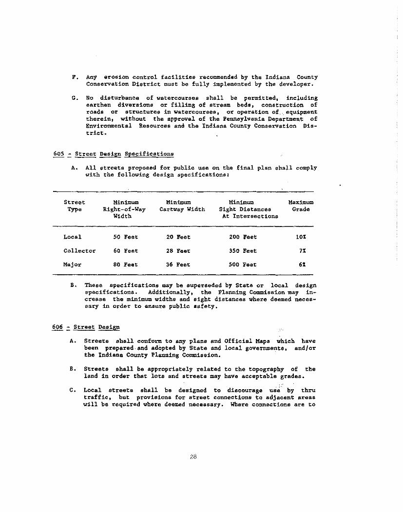
605 - Street Design Specifications
A. All streets proposed for public use on the final plan shall comply with the following design specifications:
Street Minimum MinimWll Minimum Maximum Type Right-of-Way CartYay Width Sight Distances Grade
Width At Intersections
Local 50 Feet 20 Feet 200 Feet 10%
Collector 60 Feet 28 Feet 350 Feet 7%
Major 80 Feet 36 Feet 500 Feet 6%
B. These specifications may be superseded by State or local design specifications. Additionally, the Planning Commission may increase the minim= widths and sight distances where deemed necessary in order to ~nsure public safety.
606 = Street Design
A. Streets shall conform to any plans and Official Maps Yhich have been prepared.and adopted by State and local governments, and/or the Indiana County Planning COl!llllission.
8. Streets shall be appropriately related to the topography of the land in order that lots and streets may have acceptable grades.
C. Local streets shall be designed to discourage use by thru traffic, but provisions for street connections to adjacent areas will be required where deemed necessary. Where connections are to
be made, the proposed street system shall extend recorded streets at the same right-of-way and cartway in no case at less than the required minimum widths.
existing widths,
or but
D. Half-streets shall be prohibited except to complete an existing half-street in an adjacent tract.
E. Where a subdivision borders on or contains an existing or proposed major street, the Planning Commisaion may require marginal access streets, rear service alleys, reverse frontage lots and/or screening in order to protect bordering lots, reduce the number of intersections with the major street, and separate local and thru traffic.
F. Areas reserved for future street extensions into adjoining tracts must be shown on the plans and be designated for this purpose. No building lots may utilize these areas as their only public access. These areas will not be dedicated to public use until the streets are extended into an adjoining tract.
G. No dead-end streets are permitted without an adequ~te ~urna~ound
as outlined in Section 607.
H. The finished excavation of proposed streets located within the 100 year flood plain shall be no more than two feet below the Regulatory Flood Elevation. The Office of Planning snd Development may require, where necessary, profiles and elevations of st~eets to determine compliance with this requirement. Drainage openings shall be sufficient to discharge flood flows without increasing flood heights.
607 ~ Cul-de-sac Streets
A. Cul-de-sac streets which are designed for permanent public use shall not exceed l,000 feet in length.
B, Adequate turnarounds shall be provided at the closed end of a permanent cul-de-sac street. Turnarounds shall he one of three designs and constructed to the specifications of the design as found in Appendix G. The final design shall be approved by the local municipality.
C. Any road with a temporary dead-end which has been authorized through approved stage development shall be provided with a suitable all-weather turnaround. The use of such turnaround must be guaranteed to the public. It shall be the responsibility of the developer to properly remove the turnaround and repair its area
29
when the street is extended unless the design is compatible with future street extensions. These removal and repair requirements shall apply to both temporary and permanent cul-de-sacs when street extensions are proposed.
608 .:. Street Intersections
A. Streets shall be designed to intersect as nearly as possible at right angles~ Streets shall not intersect at an angle of less than seventy degrees.
B. Intersections involving the junction of more than two streets shall be avoided.
c. Clear sight triangles of one hundred feet measured along local street center lines from their point of junction shall be provided at all intersections, and no building nor obetruction· shall be permitted within such sight triangles (Please see Appendix B).
D. Intersections with major streets shall be located not less than 800 feet apart, measured from center line to center line.
E. Streets intersecting from opposite eides with a comm.on street shall be designed either directly opposite one another (four-way intersection) or with a minimum offset of 200 feet between their center lines.
F. All curbs and intersections shall be rounded by a minimum radius of
l. Major and Collector Streets 20 Feet
2. Local Streets 15 Feet
G. Intersections shall be designed with a flat grade wherever deemed practical by the Indiana County Planning Commission. The approach to any intersection shall have a leveling area which haa no greater than a two percent grade at a distance of 60 feet- from the nearest right-of-way line of the intersecting street (Please see Appendix 1) •
609 - Private !?!!!!. Streets
A. Private drives may be permitted only when they serve not•more two separate lots that have no other access to a public,road. original tract vill not be counted as one of the two separate if the tract utili2es the private drive street for access.
30
than The
lots
B. The right-of-way width of a private drive street shall be 50 feet.
c.
The Planning CO!IIlllission may permit widths less than 50 feet if it is impossible to reserve this right-of-way area within the property. All private drive rights-of-way must be surveyed, and bearings and distances must be shown on the plan drawings. The plan must note that the street(s) is private and that the local municipality has no obligation in maintenance.
The cartway width and construction specifications must be agreeable to the developer, lot owners who utilize the private drive, and the owners of any properties which contain the right-of-way. Proof of this agreement must be submitted to the Planning Commis• sion.
D. The following maintenance requirements shall be incorporated as conditions for final approval. These conditions shall be placed in writing on the final plan, or attached thereto, and shall be part of the property deed(s).
1. Each lot owner having a right to uee the private drive street shall be equally responsible for the maintenance of the street, and such maintenance responsibilities shall be listed in a Maintenance Agreement. A sample Maintenance Agreement is located in Appendix J.
2. The Maintenance Agreement shall run with the land and with any future conveyance of the property. The Agreement shall be incorporated in and made part of the conveyance binding on the parties, their successors and assignees.
3. The local municipality shall not be obligated to accept any responsibility for the maintenance of a private drive street.
E. There shall be no further subdivision of any lot served by a private drive street until such time as public streets are constructed to serve the.- lots.
~.:.Blocks
A. Blocks shall not exceed 1,200 feet in length or be less than 600 feet in length.
B. Blocks shall have sufficient width to provide for two tiers of lots of appropriate depth in accordance with the lot size requirements in Section 611.
31
C, At the discretion of the Planning Commission, public crosswalk easements of at least ten feet in width shall be provided in blocks exceeding 1000 feet to facilitate pedestrian access to shopping areas. schools, playgrounds, parks, and other community facilities.
A. When a proposed subdivision is located in a municipality which bas properly adopted zoning regulations, the minimum lot frontage, area and setbacks shall be controlled by the zoning regulations if they are more restrictive than the lot regulations in this Artie.le.
B. The following minimum lot sizes are designated for residential uses in those areas which do not have more restrictive zoning regulations:
l. Where both water supply and sanitary sewage disposal are provided by on-lot facilities, residential lots shall have a minimum area of 20,000 square feet, aiid a minimum width of 100 feet measured at the lding setback line.
2. Where either water supply or sanitary sewage disposal are provided by on-lot facilities, residential lots ehall heve a minimum area of ll,250 square feet, and a minimum width of 75 feet measured at the building setback line.
3. Where both water supply and sewage disposal are provided through public facilities, reaidential lots shall have a minimum area of 7,200 square feet, and a minimum width of 60 feet measured at the building setback line.
4. For lots intended for more than one family, the minimum lot area shall be increased by S,000 square feet for each additions! family dwelling unit.
5. The Planning Commission msy approve lots which do not comply with the minimum lot size, sewage testing, and/or public access requirements for nonhuilding purposes. No ··sewage disposal system nor residential structure shall be placed on a lot approved for nonbuilding purposes, The Planning Commission will stamp the survey drawing to denote·spproval .is for nonbuilding purposes only. The deed for transfer of the property must elso contain this nonbuilding restriction, and an executed nonbuilding statement must be provided by the developer and buyer of the lot.
A:ny proposed change in the use of lots which have been approved for nonbuilding purposes must be reviewed and approved by the Planning Commission. Evidence must be submitted to the Planl}ing Commission that there is compliance with all regulations in this Ordinance.
c. The Planning Commission may require that the minimum size of residential lots be increased when compliance with the Pennsylvania Department of Environmental Resources regulations warrant such increase:.
D. The depth of a lot shall not exceed three times the width.
E. There shall be a minimum building setback line in residential areas of 25 feet from the right-of-way of existing or proposed local or collector streets, and 50 feet from the right-of-way of existing OT proposed major streets.
F. Side lot lines shall be substantially radial or at right angles to street lines.
G. Every lot in a subdivision shall front on a dedicated or public street, unless a private drive street has been approved by the Planning Commission.
612 .:: Easements
A. Easements for utilities shall have minimum widths of ten feet. Before determining the exact location and width of easements, the developer shall discuss his plan with the local public utilities to assure the proper location of easements for the installation of such service ..
B. Where possible, easements shall be centered on or adjacent to rear or side lot lines. They shall be drawn only to the edge of the street rights-of-way and shall not be shown on the rights-of-way.
C. Where a subdivision is traversed by a watercourse, drainage channel, or stream, there shall be provided a drainage easement conforming to the line of such watercourse and of such width as will be adequate to preserve natural drainage.
613 .:. Reservations ~ Public Use
If the developer proposes to reserve an area for public use (ie: schools, parks, other neighborhood and public facilities), the following standards shall be applied to the character, extent and location of the reserved area.:
33
A. Such areas sha11 be labeled on the plan as "reserved", and shall indicate the particular type of public use for which the area is being reserved.
B. Areas reserved for public use shall be accessible through frontage on a public street and/or pedestrian rights-of-vay at least 15 feet in width, and be a suitable size and loaction for their designated uses.
c. The developer must establish and assure the future ownership of the permanent, public use area, as Yell as indicating the provisions for the maintenance of the area. Additionally, the local municipality may accept the dedication of such land or any interest therein for public use and maintenance.
ARTICLE VII
IMPROVEMENTS
701 ~ Application
All improvements proposed in the final plan shall be completed by the developer in accordance with the requirements of the lead agency and this Article.
702 ~ Installation of Improvements
The Planning Commission will identify the lead agency for each improvement proposed by the developer. In most situations the lead agency will be the ultimate owner of the improvement. The developer shall contact the lead agency to discuss the specifications for installation of the improvements. Where the lead agency has not established any specifications, the Planning Commission will require compliance with the specifications outlined in this Article, and any other specifications which are applicable to the proposal.
Following completion by the developer and acceptance by the all required subdivision improvements, the lead agency shall plan drawings before the plan can be finally approved by Commission.
lQhl ~ Improvement Guarantee
lead sign
t:he
agency of the final Planning
In lieu of the completion of any improvements required as a condition for the· final approval of a subdivision plan, the developer shall provide for the deposit of a financial security in an .,..cunt sufficient to cover the cost of any improvements or common amenities. Such financial security shall be deposit:ed with, and in favor of Indiana County.
When requested by the developer, in order to facilitate financing, the Planning Commission shall furnish the developer with a signed copy of a resolution indicating approval of the final plan contingent on the developer obtaining a satisfactory financial security. The final plan shall not be signed nor recorded until the financial improvements agreement is EQtecuted. The resolution or letter of contingent approval shall expire and be deemed to be revo~ed if the financial security agreement is not executed within 90 days unless a written extension is granted by the Planning Commission, such extension shall not be unreasonably withheld and shall be placed in writing at the request of the developer.
35
The Planning Commission shall determine what types of financial security are acceptable for the purpose of guaranteeing construction of improvements. Irrevocable letters of credit and restrictive or escrO'W' accounts from Federal or Commonwealth chartered lending institutions shall be deemed acceptable financial security. Such financial security shall be secured from a bonding company, or Federal or Commonwealth chartered lending institution chosen by the party posting the financial security, provided said bonding company or lending institution is authorized to conduct such business within the CommonWealth.
Such bond, lie, the before the
or other security shall provide for, and secure to the pubcompletion of any improvements which may be required on or date fixed in the formal action of approval or accompanying
agreement for completion of the improvements.
The amount of financial security to be posted for the completion of the required improvements shall be equal to 110% of the cost of completion estimated as of 90 days following the date scheduled for completion by the developer. Annually, Indiana County may adjust the amount of the financial security by comparing the actual cost of the improvements which have been completed and the estimated cost for the completion of the remaining improvements as of the expiration of the 90th day after either the original date scheduled for completion or a rescheduled date of completion. Subsequent to said adjustment, Indiana County may require the developer to post additional security in order to assure that the financial security equals said 110%. Any additional security shall be posted by the developer in accordance with this section.
The amount of financial security required shall be based on an estimate of the cost of completion of the required improvements, submitted by the developer and prepared by a professional engineer licensed as such in the Commonwealth of Pennsylvania, and certified by such engineer to be a fair and reasonable estimate of such cost. Indiana County upon the recommendation of the lead agency engineer, may refuae to accept such estimate for good cause shown. If the developer and the County are unable to agree upon an estimate, then the estimate shall be recalculated and recertified by another professional engineer licensed as such in the Commonwealth of Pennsylvania and chosen mutually by the County and the developer. The estimate certified by the third engineer shall be presumed fair and reasonable and shall be the final estimate. In the event that a third engineer is so chosen, fees for the services of said engineer shall be paid equally by the lead agency and the developer.
If the developer posting the financial security requires more than one year from the date of posting of the financial security to complete the required improvements, the amount of financial security may be increased by an additional 10% for each one-year period beyond the first anniversary date from posting of financial security, or to an
required of the
amount not exceeding 110% of the cost of completing the improvements as reestablished on or about the expiration preceding one-year period by using the above bidding procedure.
In the ceae where subdivision activity is projected over a period of years, the Planning Commission may authorize submission of final plans by section or stages of development subject to such requirements or guarantees as to improvements in future s~ctions or stages of development as it finds essential for the prote.ction of any finally approved section of the development.
z~ ~ Partial Release ~ Improvement Guarantee
As the work of installing the required improvements proceeds, the developer posting the financial security may request the Planning Commission to release or authorize the release of such portions of the financial security necessary for payment to the contractor or contractors performing the work. Any such requests shall be in writing addressed to the Planning Commission, and the Planning Commission shall have 45 days from receipt of such request within which to allow the lead agency engineer to certify, in writing, to the Planning Commission that such portion of the vork on the improvements has been completed in accordance with the approved plan and specifications. On such certification, the Planning Commission shall authorize release by the bonding company or lending institution of .an amount as estimated by the lead agency engineer fairly representing the value of the improvements completed or, if the Planning Commission fails to act within said 45-day period, the Planning Commission shall be deemed to have approved the release of funds as requested, The Platuling Commiss~on may retain 10% of the estimated cost of the improvements prior to £1.nal release.
~ ~ ~ Release ~ Improvement Guarantee
When the developer has completed all of the necessary and appropriate improvements, the developer shall notify the Planning Commission in writing, by certified or registered mail, of the completion of the aforesaid improvements and shall send a copy thereof to. the lead agency engineer to inspect all of the aforesaid improvements. The engineer shall, thereupon, file a report, in writing, with the Planning Commission end lead agency and shall promptly mail a copy of the same to the developer by certified or registered mail. The report shall be made and mailed within 30 days after receipt by the lead agency engineer of the aforesaid authorization from the Planning Commission1 said report shall be detailed and shall indicate approval or rejection of said improvements, either in whole or in part, and if said improvements, or any portion thereof, shall not be approved or shall be rejected by the lead agency engineer, said report shall contain a statement of reasons for such nonapproval or rejection.
37
The Planning Commission shall notify the developer, within 15 days of receipt of the engineer's report, in writing by certified or registered mail of the action of the Planning Commission with relation thereto.
If the Planmng Commission or the lead agency engineer fails to c=ply with the time limitation provisions contained herein, all improvements will be deemed to have been approved and the developer shall be released from all liability, pursuant to its performance guaranty bond or other security agreement~
If any portion of the said ~provements shall not be approved or shall be rejected by the Planning Commission the developer shall proceed to complete the same and, upon completion, the same procedure of notification, as outlined herein, shall be followed.
Nothing herein, however, shall be construed in limitation of the developer's right to contest or question by legal proceedings or otherwise, any determination of the Planning Commission or the lead agency engineer. Where herein reference is made to the lead agency engineer, he shall be as a consultant thereto' ..
The Planning Commission and lead agency may prescribe that the developer shall reimburse the lead agency for the reasonable and necessary expense incurred for the inspection of improvements. Such reimbursement shall be based upon a schedule established by ordinance or resolution. Such expense shell be reasonable and in accordance with the ordinary and customary fees charged by the lead agency engineer or consultant for work performed for similar services in the community, but in no event shall the fees exceed the rate or cost charged by the engineer or consultant to the lead agency when fees are not reimbursed or otherwise imposed on applicants.
1. In the event the developer disputes the amount of any such expense in connection with the inspection of :Improvements, the developer shall, within ten working days of the date of billing, notify the Planning Commisaion and lead agency that such expenses are disputed as unreasonable or unnecessary, in which case the Planning Commission shall not delay or disapprove a subdivision application due to the developer's request over disputed engineer expenses.
2. If, within 20 days fr= the date of billing, the Planning Commission and the developer cannot agree on the amount of expenses which are reasonable and neceaeary, then the developer and Planning Commission shall jointly, by mutual agreement, appoint another professional engineer licensed as such in the .C=monwealth of Pennsylvania to review the said expenses and make a determination as to the amount thereof which is reasonable and necessary.
3. The professional engineer so appointed shall hear such evidence and review such documentation as the professional developer in his or her sole opinion deems necessary a~d render a decision within 50 days of the billing date. The applicant shall be required to pay the entire amount dete>:mined in the decision iumediately.
4. In the event that the Planning Commission and developer cannot agree on the professional engineer to be appointed within 20 days of the billing date, then, on application of either party, the President Judge of the Court of Common Pleas of the judicial district in which the municipality is located (or if at the time there be no President Judge, then the senior active judge then sitting) shall appoint such engineer, who, in that case~ shall be neither~the County, lead agency~ nor any professional engineer who has been retained by, or performed services for, the municipality , lead agency, or the developer within the preceding five years.
5. The fee of the appointed professional engineer for determining the reasonable and necessary expenses ~hall be paid by the developer if the amount of payment required in the decision is equal to or greater than the original bill. If the amount of payment required in the decision is less than the original bill by $1,000 or more, the lead agency shall pay the fee of the professional engineer, but othe~ise the lead agency and the developer shall each pay one-half of the fee of the appointed professional engineer.
~i ~ Maintenance Guarantee
On completion of some or all of the required improvements, Indiana County may require the posting of a financial security to secure the structural integrity and functioning of said improvements iD accordance with the design and specifications as depicted with the final plan for a term not to exceed 18 months from the date of.·acceptance of the dedication. This financial security for maintenance: shall be in the same form as otherwise required in this section for the installation of required improvements. However, in no event shall the financial security for maintenance exceed 151 of the actual cost of the installation of said improvements.
~ ~ Remedies .!:.!< Effect Completion £! l!!provements
In the event thet any improvements which may be required have not been installed as provided in this Ordinance or in accordance with the approved final plan, Indiana County may enforce any corporate bond, or other security by appropriate legal and equitable remedies, If proceeds of such bond, or other security are insufficient to pay the cost
of installing or making repairs or corrections to all the improvements covered by said security, Indiana County may institute appropriate legal or equ.itable action eo recover the monies necessary to complete the remainder of the improvements. All of the proceeds, whether resulting from the security or from any legal or equitable action brought against the developer, or both, shall be used solely for the installation of the improvements covered by such security, and not for any other municipal purpose.
703 ..:. Monuments and Markers
The developer shall place permanent reference monuments in all subdivisions as required herein. Any monuments or markers that are removed during construction and/or grading of the site shall be placed in original locations by a registered engineer or surveyor at the expanse of the person removing them.
~ .:. Monuments
Monuments shall be made of pre-cast concrete with a minimum diameter of six inches.and a minimum length of 30 inches, and shall be set flush with the finished grade. A brass pin shall be set in the top of each monument and scored or marked to indicate the exact point of crossing of the intersecting lines.
Monuments shall be set permanently:
a. At the intersection of all lines forming angles in the boundary of the subdivision or land development; and
b. At the intersection of all street lines.
ill:..£.:. Markers
Markers shall consist of magnetic metal pipes or bars at least 24 inches long and not less than three-quarters (3/4) inch in diameter, and shall be set flush with the finished grade. They shall be scored to indicate the exact point of crossing of intersecting lines.
Markers shall be set permanently at all lot corners.
704 .:. Streets
All streets, except those approved as Private Drive Streets, shall be irrevocably dedicated in writing by the developer to the local municipality immediately on completion and acceptance of construction. Such streets
40
shall be graded to the elevations and ditllensions shown on the plans, profiles, and cross-sections submitted by the developer for final plan review, and as approved by the local municipality and the Planning Commission.
1£.i.:.! .:. ~ Street Construction
All local streets shown on the approved final plan shall be constructed in accordance with the specifications for street construction of the State and local municipality. Where such street conetruction specifications or agreements between the developer and local officials on specifications do not exist, the Planning COam.iesion may impose the following standards (See Appendix. Kl:
A. Preparation of Subgrade
The subgrade shall be formed by shaping the graded roadway surface to the approved profile. The surface shall be brought to a firm, thoroughly compacted condition for the width of the base course by rolling with an power roller. Any soft or unsuitable material shall be removed and replaced ~ith suitable material.
B. Installation of Cartway
Installation of the cartway by the developer shall comply with one of the following methods of construction unless otherwise approved by the Planning Commission.
1. CP-2 Surfacing
a. Course Aggregate
The first course shall conform to Pennsylvania Department of Transportation standards for No. 4 aggregate and shall be g~aded gravel, crushed gravel, cruehed stone, or crushed slag, meeting the approval of the local municipality. This shall be compacted to a four inch layer.
b. Top Course
The top course shall consist of granulated slag or graded gravel equivalent to Pennsylvania Department of- Transportation standards for No. 2-A aggregate, spread and compacted into a four inch layer. The depth after final compaction shall be as indicated on the approved plans and the surface shall be brought to a crown.
c. Surface Course
This is a standard CP-2 surface course with initial primer and a No. 2-B stone dragged and rolled as applied; then
three successive layers of No. 1-B stone, and tar applied to build up the appropriate tar and chip surface.
2. Bituminous Surfacing
a. Base Course
The base course shall coneist of a layer of hot-mixed, bitilminous, concrete base course (BCJ!C) installed according to PennDOT specifications, Form 408. This shall be compacted by an approved power roller to a four inch layer.
b. Surface Course
This surf ace course shall consist of a layer of one of the following: lD-2, FB-1, or FB-2 mixed and installed according to PennDOT specifications, Form 408. This shall be compacted to a one inch layer. If the base course has deteriorated prior to the installation of surfacing, it shall be brought to a suitable condition prior to laying the surface course.
704.2 = Collector and Hajor Street Construction
Specifications for the construction of collector and major streets shall be established by the Planning Commission after consultation with the local municipality and Pennsylvania Department of Traneportation.
~ = Sewage Disposal
Where a public sewage system is accessible to the subdivision, the developer shall provide the subdivision with a complete sanitary sewage collection system to be connected to the public system. The developer shall receive and submit to the Indiana County Planning Commission a letter from the local municipality and sewage authority which assures the sewage system has adequate capacity, and permits the connections to the public system. All necessary mains and laterals for connections from the lots to the public system as shown on the final plan shall be installed by the developer, in accordance with requirements of the Pennsylvania Department of Environmental Resources and the local sewage authority.
Where a public sewer system is not reasonably accassible and proposed sewage treatment is on-site through subsurface disposal, the developer must submit copies of soil test results and an approval letter to the Planning Commission that the proposed development will be suitable for onsite, sewage disposal. The approval letter must bear the signature of a representative of the Department of Environmental Resources in accordance
42
with the requi~ements of the Pennsylvania Sewage Facilities Act, as amended.
706 .:. ~ Supply
If water is to be provided by means other than by private wells owned and maintained by the individual owners of lots within the subdivision, applicants shall present evidence to the Planning ·Commission,· as the case may be, that the subdivision is to be supplied by a certificated public utility, a cooperative association of lot owners, or by a municipal corporation, authority or utility. A copy of a Certificate of Public Convenience from the Pennsylvania Public Utility Commission or an application for such certificate, a cooperative agreement or a commitment or agreemant to serve the area in question, whichever is appropriate, shall be acceptable evidence.
707 .:. ~ ~ Runoff
Where deemed necessary by the Planning Commission, the local municipality, and the Indiana County Conservation District, the developer shall provide the subdivision with sn adequate storm water drainage system. This system shall be consistent with any State and local regulations. In the absence of such regulations, a storm water drainage system shall be reviewed by the Indiana County Conservation District, and shall meet the following objectives:
A. Assure that the maximum rate of storm water runoff is no greater during and after development than prior to development; and
B. Manage the quantity, velocity, and direction of storm water runoff in a manner which adequately protects health and property.
708 .:. Street Name ~
Street name signs shall be installed in those local municipwlities which require such signs and shall be installed according to standards established by the municipalities.
ARTICLE VIII
ALTERNATIVE LAND SUBDIVtSlON TYPES
The Planning Commission recognizes that there are subdivision types which differ significantly from the design of conventional, residential subdivisions to Yarrant a separate classification and special review in accordance with regulations which are not specifically outlined in this Ordinance. Alternative land subdivision types include Commercial, Industrial, Townhouse and Planned Residential Subdivisions,
If the Planning Commission receives a proposal from a developer for an alternative land subdivision type, an outline of the procedural requirements will be provided to the developer for review and approval of the subdivision. The plan for this subdivision shall be reviewed by the Planning Commission in accordance with accepted standards and principles of subdivision site planning and development.
44
ARTICLE IX
ADMINISTRATION
901 .:. ~ 2.! ~ The Indiana County Commissioners hereby designate the Indiana County Office of Planning and Development and Indiana County Planning Commission to act and have full authority in the administration of this Ordinance and any subsequent amendments thereto.
902 .:. Reconsideration
Developers aggrieved by a decision of the Indiana County Planning Commission may request within 30 days of the decision to appear before the Planning Commission to present additional information and request reconsideration of the original finding, decision or recommendatiOn.
903 .:. Appeals
Any person, officer of the municipality, firm, or corporation which deems itself aggrieved by any decision of the Planning Commission may appeal the decision to the proper court within 30 days of the issuance of said decision.
904 .:. Application Fees
The Indiana County Commissioners may establish and/or amend by. resolution a schedule of review fees which shall be charged to the developer. Fees shall be payable to the "County of Indiana·• when the preliminary and final subdivision applications are submitted. The application shall not be considered as complete until such time as the fees have been paid in full. Review fees may include reasonable and necessary charges by the Countyts professional engineer or consultant fo~ review and report thereon to the municipality. A schedule of Fees adopted by the Board of Commissioners is located in Appendix C.
905 ~ Waivers ££. Modifications
The Indiana County Planning Commission may grant a modification of the requirements of one or more provisions if the literal enforcement will exact undue hardship because of peculiar conditions pertaining to the land
in question, provided that such modification will not be contrary to the public interest and that the purpose and intent of the ordinance is observed.
All requests for a modification shall be in writing and shall accompany and be a part of the application for subdivision approval. The request shall state in full the grounds and facts of unreasonableness or hardship on which the request ie based, the provision or provisions of the ordinance involved and the minimum modification necessary:.
The Planning Commission shall keep a written record of all action on all requests for modification.
906 ~ Revision and Amendment
The Indiana County Board of Commissioners may revise, modify, and amend this Ordinance by appropriate action taken at a scheduled public meeting, all in accordance·with the applicable provisions of the Pennsylvania Municipalities Planning Code, Act 247, as amended.
907 ~ Planning Commission Records
The Planning Commission shall keep a written record of its findings, decisions, and recommendations related to all subdivision plans filed with it for review and approval. All records of the Planning Commission shall be public records.
908 ~ Conflict ~ Other Regulations
Wherever there is a difference between minimum standards or dimensions specified in these regulations and those contained in any other official regulations of Indiana County, or, the official regulations of any local municipality in which the subdivision is proposed, the more restrictive standard shall apply.
909 ;:. Liability
The approval of a subdivision plan, or of any improvement, shall not constitute a represen~ation, guarantee, or warranty of any kind or nature by the Planning Commission or Indiana County, or any official, employee, or appointee thereof, of the safety of any land, improvement, property or use from any cause whatsoever, and shall create no liability on, or a cause of action against the Planning Commission or Indiana County or such official, employee or appointee for any damage that may result pursuant thereto.
46
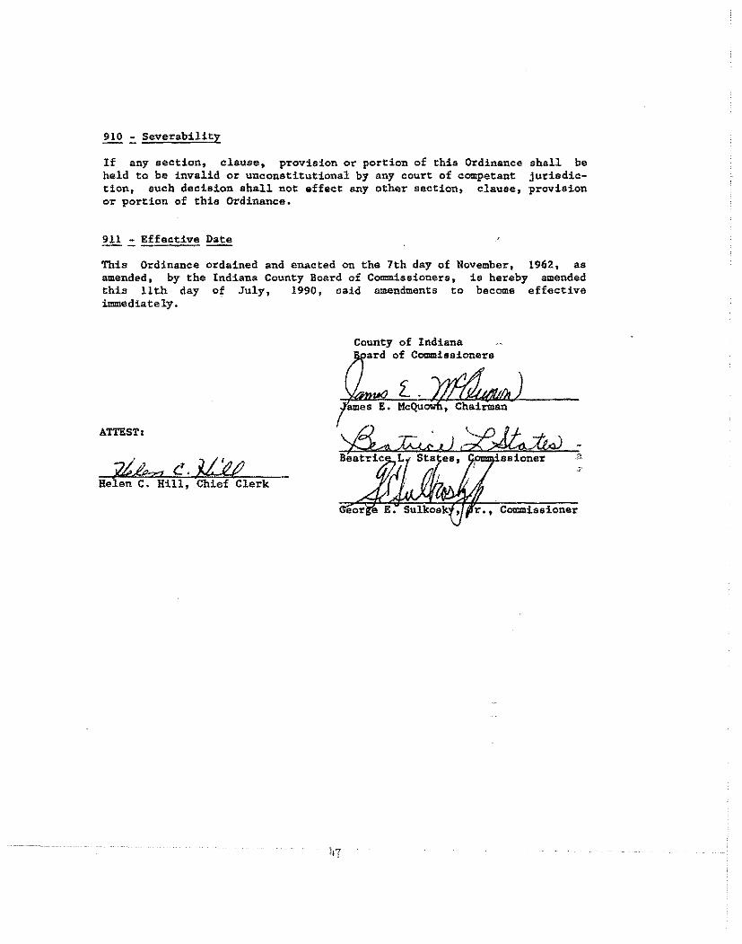
910 .:. Severability
If any section, clause, provision or portion of this Ordinance held to be invalid or unconstitutional by any court of competant tion, such decision shall not effect any other section, clause, or portion of this Ordinance.
2!l .:. Effective Date
shall be jurisdicprovision
This Ordinance ordained and enacted on the 7th day of November, 1962, as amended, by the Indiana County Board of Commissioners, is hereby amended this 11th day of July, 1990, said amendments to become effective immediately.
County of Indiana ard of Commissioners
z:. .
ATTESTt
Helen C. Hill, Chief Clerk
r., Commissioner
APPENDIX A
LOCAL MUNICIPALITIES WITH SUBDIVISION REGULATIONS
1. Blairsville Borough
2. Indiana Borough
3. White Township
45
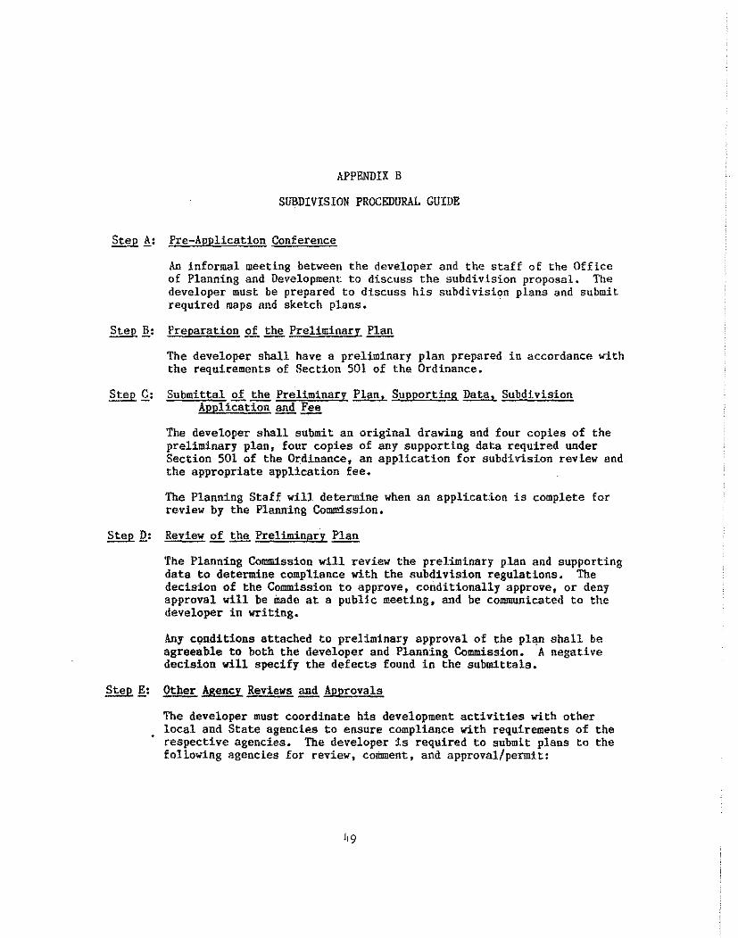
APPENDIX B
SUBDIVISION PROCEDURAL GUIDE
Step ,!: Pre-Aoplication Conference
An informal meeting between the developer and the staff of the Office of Planning and Development to discuss the subdivision proposal. The developer must be prepared to discuss his subdivision plans and submit required maps and sketch plans.
Step ].: Preparation of the Preliminarr f1.!m
The developer shall have a preliminary plan prepared in accordance with the requirements of Section 501 of the Ordinance.
Step£: Submittal of the Preliminary Plan, Supporting Data, Subdivision Application and Tu!!_
The developer shall submit sn original drawing and four copies of the preliminary plan, four copies of any supporting data required under Section 501 of the Ordinance, an application for subdivision review and the appropriate application fee.
The Planning Staff will determine when an applicat:Lon is complete for review by the Planning Commission,
Step Q: Review of .!:.h!l. Preliminary Plan
The Planning Commission will review the preliminary plan and supporting data to determine compliance with the subdivision regulations, The decision of the Commission to approve, conditionally approve, or deny approval will be made at a public meeting, and be communicated to the developer in writing.
Any c0nditions attached to preliminary approval of the plan shall be agreeable to both the developer and Planning Commission. A negative decision will specify the defects found in the submittals.
Step .!?_: Other Agency Reviews and Approvals
The developer must coordinate his development activities with other local and State agencies to ensure compliance with requirements of the respective agencies. The developer is required to submit plans to the following agencies for review, comment, and approval/permit:
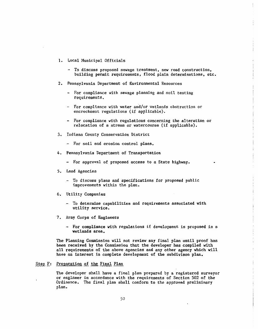
1. Local Municipal Officials
- To discuss proposed sewage treatment, new road construction, building permit requirements, flood plain determinations, etc.
2. Pennsylvania Department of Environmental Resources
For compliance with sewage planning and soil testing requirements.
For compliance with water and/or wetlands obstruction or encrochment regulations (if applicable).
For compliance with regulations concerning the alteration or relocation of a stream or watercourse (if applicable).
3. Indiana County Conservation District
For soil and erosion control plans.
4, Pennsylvania Department of Transportation
- For approval of proposed access to a State highway.
5. Lead Agencies
- To discuss plans and specifications for proposed public improvements within the plan.
6. Utility Companies
- To determine capabilities and requirements associated with utility service.
7. Army Corps of Engineers
For compliance with regulations if development is proposed in a wetlands area,
The Planning Commission will not review any final plan until proof bas been received by the Commission that the developer has compiled with all requirements of the above agencies and any other agency which will have an interest in complete development of the subdivison plan.
Step f: Preparation of the Final Plan
The developer shall have a final plan prepared by a registered surveyor or engineer in accordance with the requirements of Section 502 of the Ordinance. The final plan shall conform to the approved preliminary plan.
50
Step .Q:: Submittal of ~Final Plan, Supporting Data, ~ Subdivison Application
The developer may submit the plan in phases for final approval. An original drawing and four copies of the final plan, and four copies of any supporting data required under Section 502 of the Ordinance shall be submitted for review by the Planning Commission.
The Planning Staff will determine when an application is complete for review by the Planning Commission.
Step .!!.: Review of the Final Plan
The Planning Connnission will review the final plan. and supporting data to determine compliance with the subdivision regulations. The decision of the Commission to approve, conditionally approve or deny approval will be made at a public meeting, and be communicated to the developer in writing,
Any conditions attached to final approval of the plan shall be agreeable to both the developer and Planning Commission, A negative decision will specify the defects found in the submittals.
Step !: Recording of Fina],. f!!!.!!.
Within 90 days after approval of the final plan by the Planning Commission and before conveyance of any deed out of the plan, the developer must record the approved final plan with the Recorder of Deeds of the County of Indiana. The developer shall be responsible for the payment of any recording fees.
51
APPENDIX C
A fee schedule adopted by the Indiana County Commissioners for revi"'1 of subdivision plans is on file in the Indiana County Office of Planning and Development, 801 Yater Street, Indiana, PA 15701.
52
APPENDIX D
SAMPLE FORMS
REVIEWS BY LOCAL AND STATE AGENCIES
51
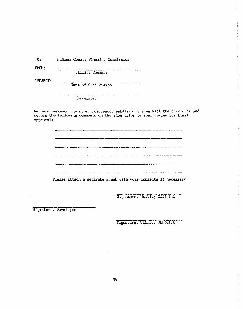
TO: Indiana County Planning Commission
FROM: Utility Company
SUBJECT: Name of Subdivision
Developer
We have reviewed the above referenced subdivision plan with the developer and return the following comments on the plan prior to your review for final approval:
Please attach a separate sheet with your comments if necessary
Signature, Utility Official
Signature, Developer
Signature, Utility Official
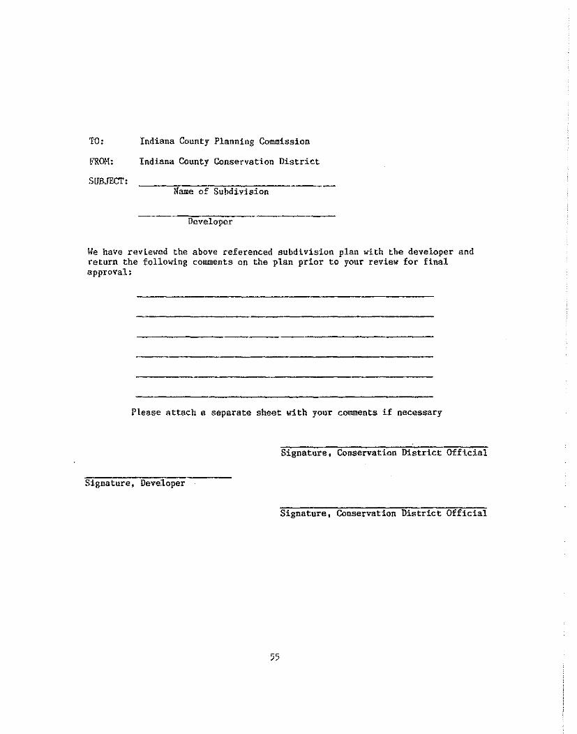
TO: Indiana County Planning C..ommission
!"ROM: Indiana County Conservation District
SUBJECT: Name of Subdivision
Developer
We have reviewed the above referenced subdivision plan with the developer and return the following comments on the plan prior to your revlew for final approval:
Please attach a separate sheet with your comments if necessary
Signature, Conservation District Official
Signature, Developer
Signature, Conservation District Official
55
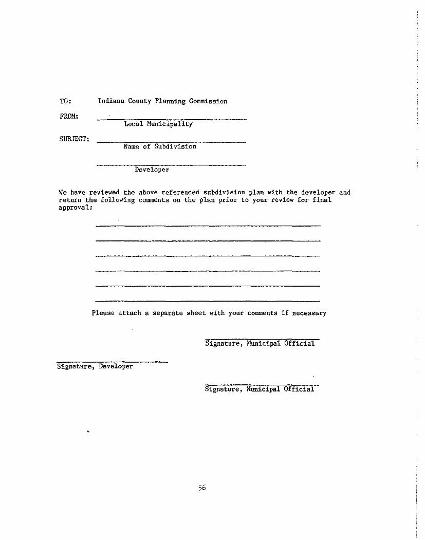
TO: Indiana County Planning Commission
FROM: Local Municipality
SUBJECT: Name of Subdivision
Developer
We have reviewed the above referenced subdivision plan with the developer and return the following comments on the plan prior to your review far final approval:
Please attach a separate sheet with your comments if necessary
Signature, Municipal Official
Signature, Developer
Signature, Municipal Official
56

!. Preliminary Approval:
APPENDIX E
PRELIMLllARY PLAN CERTIFICATES
Preliminary approval granted by the Indiana C-Ounty Planning Commission this -------day of , 19 __ •
Chatrman Secretary
2. Developer's Statement .Qf Intent:
I/We ~have designed for my/our land situated in the Township/Borough of , County of Indiana, Commonwealth of Pennsylvania, lots and streets according to this plan which is intended to be recorded. Witness my/our hand and seal this ·day of , 19 __ •
(SEAL)
3. Acknowledgement of Developer's Statement of Intent:
On the day of , 19 , before me, the subscriber, a Notary Public of the Commonwealth of Pennsylvania, personally appeared ---:---,---,,---.,---,,,,..,-,.-;---,:---.....--..,.--.,.--:--:----;-· who acknowledges this plan to be the official plan of streets, lots, and property shown thereon, situated in the Township/Borongh of , County of Indiana, Commonwealth of Pennsylvania, and desire that this plan be.approved and recorded according to law.
(SEAL) Notary Public
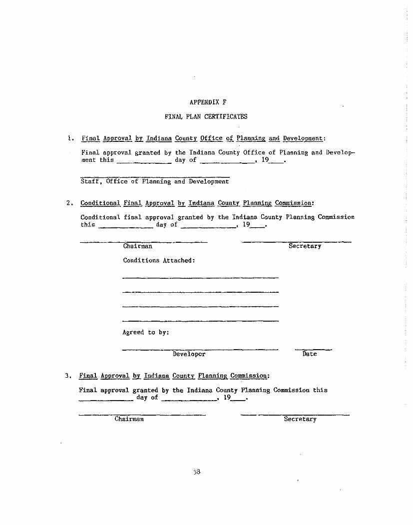
APPENDIX F
FINAL FLAM CERTIFICATES
l. Final Approval fil:. Indiana County Office of Planning and ~pment:
Final approval granted by the Indiana County Office of Planning and Develop-ment this day of _ , 19 __ •
Staff, Office of Planning and Development
2. Conditional Final !l!P.r..2!l!!E.Y. Indiana County Planning Commission:
Conditional final approval granted by the Indiana County Planning Commission this day of , 19 __ •
Chairman Secretary
C~nditions Attached:
Agreed to by:
Developer Date
3. ~Approval fil:. Indiana County Planning Commission:
Final approval granted by the Indiana County Planning Commission this ------- day of , 19 __ •
Chairman Secretary
58
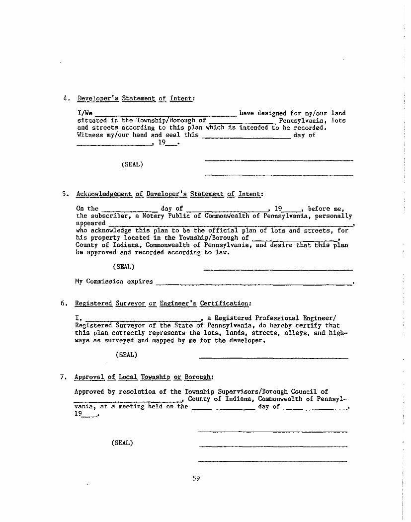
4. Developer's Statement of Intent:
I/We---------~,..-----=----- have designed for my/our situated in the Township/Borough of Pennsylvania, and streets according to this plan which is intended to be recorded. Witness my/our hand and seal this day of ---------· 19 __ •
(SEAL)
5. Acknowledgement .Q!. Developer's Statement of Intent:
land lots
On the day of , 19 , before me, the subscriber, a Notary Public of Commonwealth of Pennsylvania, personally appeared -=--:---,-,--,,----,-.-,,----o-=c,-,-=-,,---=-~---=-----~~' who acknowledge this plan to be the official plan of lots and streets, for his property located in the Township/Borough of , County of Indiana, Commonwealth of Pennsylvania, and desire that this plan be approved and recorded according to law.
(SEAL)
6, Registered Surveyor or Engineer's Certification:
I, , a Registered Professional Engineer/ Registered Surveyor of the State of Pennsylvania, do hereby certify that this plan correctly represents the lots, lands, streets, alleys, and highways as surveyed and mapped by me for the developer.
(SEAL)
7, Approval of Local Township or Borough:
Approved by resolution of the Township Superv:l.sors/Borough Council of ---,---~-~.,..---:,..-,:"'='"~----,• County of Indiana, Commonwealth of Pennsyl-vania, at a meeting held on the day of
~-~~-~---19 __ •
(SEAL)
59
8. Approval of~ Municipal Planning Commission:
Approved by the ---------Commission --------
Township/Borough Planning 19 __ •
(SF.AL)
9. Recorder's Certificate:
COMMONWEALTH OF PENNSYLVANIA (County of Indiana)
On this the day of . ...,,,..--~,-------.,--• 19 __ , before me, the Recorder of Deeds, in and for said state and county personally appeared who in due form acknowledges the within plan --------------------to be his act and deed, and desires the same to be recorded as such. Tn witness thereof, I hereunto set my hand and seal.
Recorder of Deeds (SEAL)
10. Plan Amendment Certification:
a. Amendment approved to this plan on the day of ---~----• 19 __ , by the Indiana County Planning Commission, Amended plan recorded in the office of the Indiana County Recorder of Deeds in Plan Book Number , page on , 19~.
b. This plan has been approved as an amended plan to the.---,,---,---,~ Subdivision as recorded in the office of the Indiana County Recorder of Deeds in Plan Book Number , page or
11. Acceptan~ Qf Improvements fil:. Lead Agency:
The following improvement(s) in the -~~~~~--~-~-~~~~~~
Subdivision has been inspected and is accepted by the ~-~~~~~~~
(Lead Agency)
(SEAL) Lead Agency Official
Go Date
Improvement(s):
12. Private Street Certificate:
A. The following private street agreements have been incorporated as conditions for final approval of the -----------~~---,... Subdivision, located in (Township/Borough):
1) The local municipality shall not be obligated to accept any responsibility for the maintenance nor upkeep of any private street.
2) There shall be no further subdivision of the subject lot(s) until such time as adequate public streets are available to serve the lot(s),
3) Maintenance Agreement (attached or recorded in Deed Book I----· page ) •
4) Ownership Statement (attached or recorded in Deed Book # -----· page ---------~
61
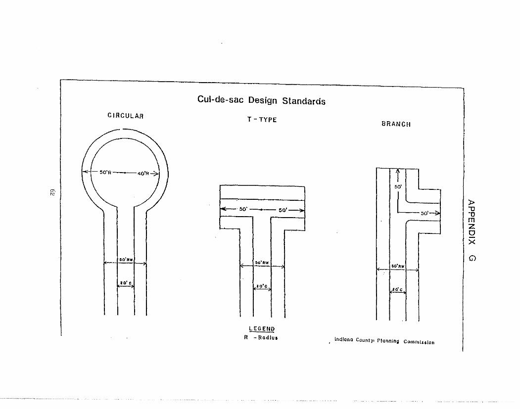
"" "''
CIRCULAR
,.,,,_ 50'A ----
llO'AW
20• c
Cul-de-sac Design Standards
T -TYPE
~·50'
,, ao'RW
io'c
LEGEND R - Rodlu1
~o·--;o.
BRANCM
~ I~ m z 0 >< G)
~o~
.io'c
l11d/ono Counly1 Piannlng Co1ntlll.1ialon
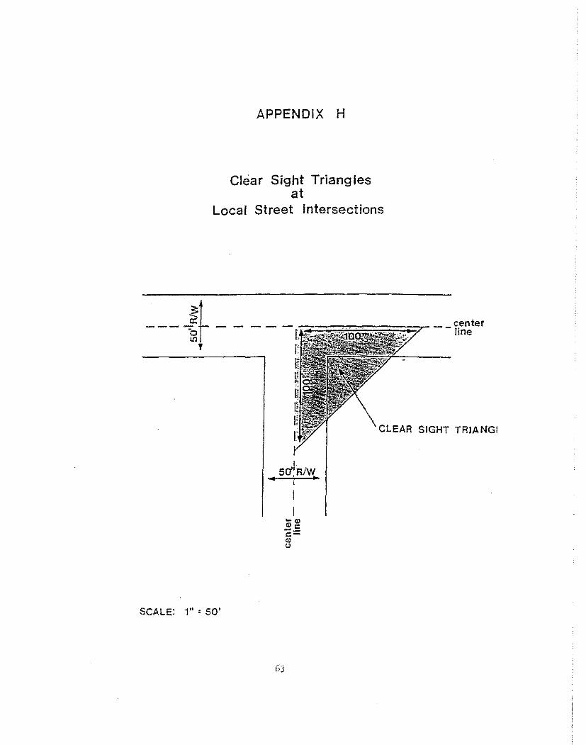
APPENDIX H
Clear Sight Triangles at
Local Street Intersections
--- !~ --'
CLEAR SIGHT TRIANGI
So'IR/W
SCALE: 1" ' 50'
63
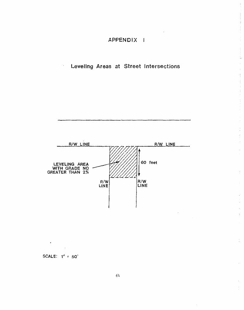
APPENDIX
Leveling Areas at Street Intersections
R/W LINE
LEVELING AREA WITH GRADE NO
GREATER THAN 2%
SCALE: 1" ' 50'
R/W LINE
R/W LINE
60 feet
R/W LINE
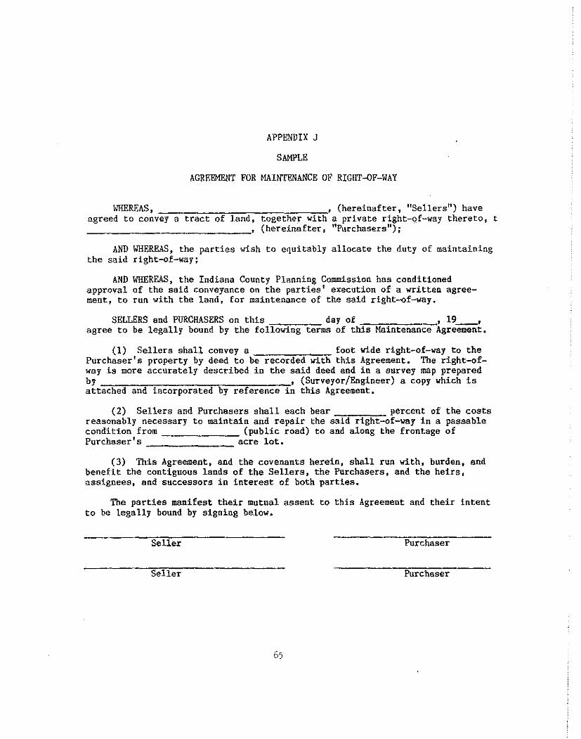
APPENDIX J
SAMPLE
AGREEMENT FOR MAINTENANCE OF RIGHT-OF-WAY
WHEREAS, , (hereinafter, "Sellers") have agreed to convey a tract of land, together with a private right-of-way thereto, t
-------"------' (hereinafter 1 "Purchasers");
AND WHEREAS, the parties wish to equitably allocate the duty of maintaining the said right-of-way;
AND WHEREAS, the Indiana County Planning Commission has conditioned approval of the said conveyance on the parties' execution of a written agreement, to run with the land, for maintenance of the said right-of-way.
SELLERS and PURCHASERS on this day of , 19 , agree to be legally bound by the following terms of this Maintenance Agreeiileiit.
(1) Sellers shall convey a foot wide right-of-way to the Purchaser's property by deed to be recorded with this Agreement. The right-ofway is more accurately described in the said deed and in a survey map prepared by , (Surveyor/Engineer) a copy which is attached and incorporated by reference in this Agreement,
(2) Sellers and Purchasers shall each bear percent of the costs reasonably necessary to maintain and repair the said right-of-way in a passable condition from (public road) to and along the frontage of Purchaser's acre lot.
(3) This Agreement, and the covenants herein, shall run with, burden, and benefit the contiguous lands of the Sellers, the Purchasers, and the heirs, assignees, and successors in interest of both parties.
The parties manifest their mutual assent to this Agreement and their intent to be legally bound by signing below.
Seller Purchaser
Seller Purchaser
65
STATE OF PENNSYLVANIA
COUN'fY OF INDIANA SS:
On this, the day of -------' 19 , before me the undersigned officer, personally appeared -- (above nained parties) known to me (or satisfactorily proven) to be the persons whose names are subscribed to the within instrument, and acknowledged that they executed the same for the purposes therein contained.
IN WITNESS WHEREOF, I hereto set my hand and official seal:
Title
SBA.I,
66.
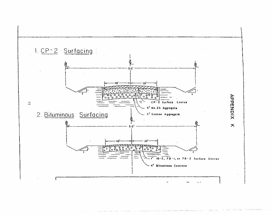
l.CP-2 Surfacing
l ,-
1
50'
,£1. -I~+" ----j . ·- ..... · ..... /?¥ - ... . . . .// . : ..... ,..,,f;!ll ...... .. -- -..
l t
' -71•
2
.s- CP· 2 Surface Cour11e
411
No. 2A Aggregate
2. Bituminous Surfacing 4'" Coor•• Aoor•~at•
5 o' --------------------
r--"·_J_ "':-1 ~· 2
-16 {) <J D () b D () -b--~ ·-..:= l> ti. p,tl 'OA [);ti. C> Q l> '1 A pt> /;t:. ....=::-- - ----=-- I - ·-- --- -- ~· •
-~~l0·2. FB·l.or FS-2. Surface Cllut~c
4 11 Blluminou1 Concte1e
..
)> '"O "O m z 0 x ;,;;
z <t -1 0.
l<t :: 0: 0 LI..
Cl 0: <t 0 z <t lCJJ
APPENDIX L
68
• ;; '
'.;'l 0
~ 0
0 II .....
c: "' c.
z < ...J 0..
>a: <( z -2 -...J w c:: 0..
Cl c::: C3 z 15
. CJ')
APPENDIX M "'
,. a: <(
:E
-'
"' 0: c..
w 0 :J _, <.l
!: 0
" _, <
-· ii o~
;i
~· "; - ., ~ =1
~; .;;; ?~ •• •• ,. ..
:: c • e· • > • ;;, §
• • ;J :: • 0 -• c • " • . • " ~ 0
" ~ ;::
' '-,: ~
z " 0 u
<I ;: < c =
• ' J
•
• -
" • , ; = "' "'
i I
f " . ~ -~ Q
< • 0 •
• c • • " -0
<.J

Cl z c: <( <( ...J Cl c.. z <( I- ...J en <i:
z -
APPENDIX
--
'TO
N
:§ " -; -g :l u :!! c ,. :;:;. 0 c "'
'° w f-0 %
= ::;:: g
" ,:;; Q
~; ~ c- • .. . :n
-"' 3 0
" '-
::-= ~ ()
.;: ~ 0 "
' ; i
' I I
I I ~
• ' Q I -~ -> -"' -~ < " a
' I i I
I -~ < u •
.. • •