Improving Street Design Through 'Link and Place'
42
Improving Street Design Through ‘Link and Place’ Peter Jones Centre for Transport Studies, UCL, London West Midlands Urban Design Forum, 2 nd October 2015
-
Upload
made -
Category
Environment
-
view
529 -
download
0
Transcript of Improving Street Design Through 'Link and Place'
Improving Street Design Through ‘Link and Place’
Peter Jones Centre for Transport Studies, UCL, London
West Midlands Urban Design Forum, 2nd October 2015

LINK street as a movement conduit
PLACE street as a destination in its own right
PRINCIPLES: Dual functions of streets
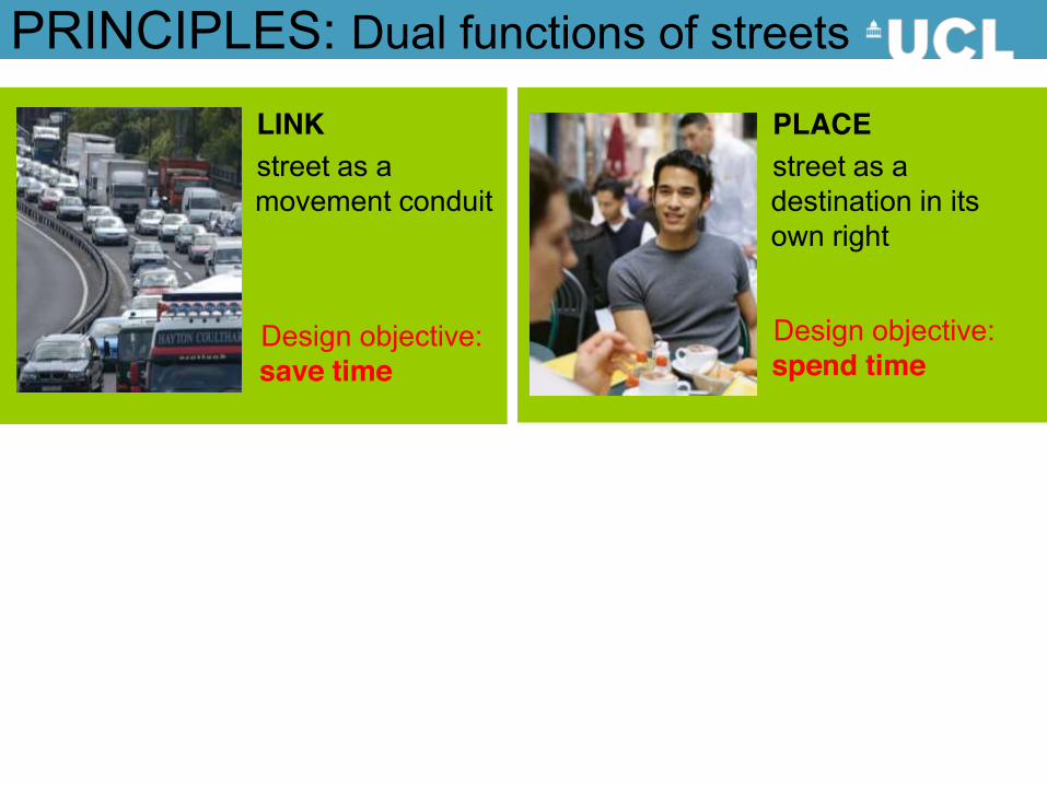
LINK street as a movement conduit
PLACE street as a destination in its own right
Design objective: save time
Design objective: spend time
PRINCIPLES: Dual functions of streets

LINK street as a movement conduit
PLACE street as a destination in its own right
Design objective: save time
Design objective: spend time
PRINCIPLES: Dual functions of streets
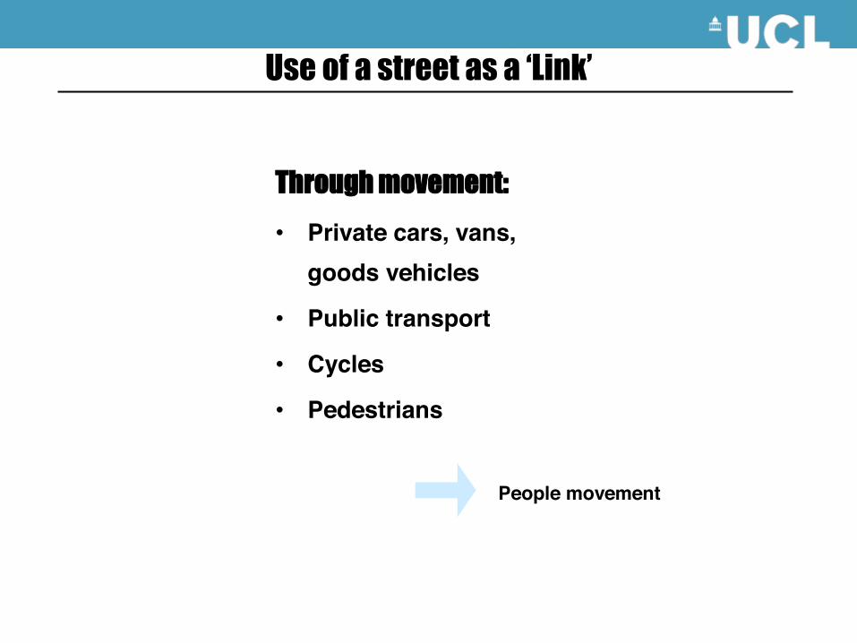
Through movement:
• Private cars, vans, goods vehicles
• Public transport
• Cycles
• Pedestrians
Use of a street as a ‘Link’
People movement
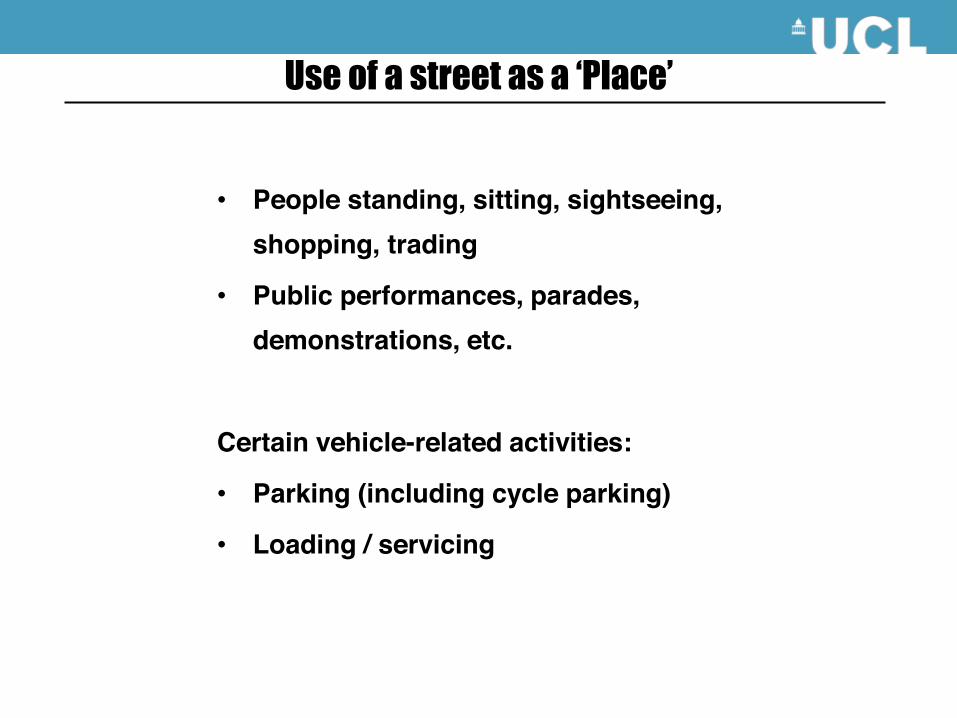
• People standing, sitting, sightseeing, shopping, trading
• Public performances, parades, demonstrations, etc.
Certain vehicle-related activities:
• Parking (including cycle parking)
• Loading / servicing
Use of a street as a ‘Place’
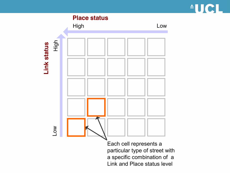
Place status
Link
sta
tus
High Low
Hig
hLo
w
Each cell represents a particular type of street with a specific combination of a Link and Place status level
The Link/Place matrix
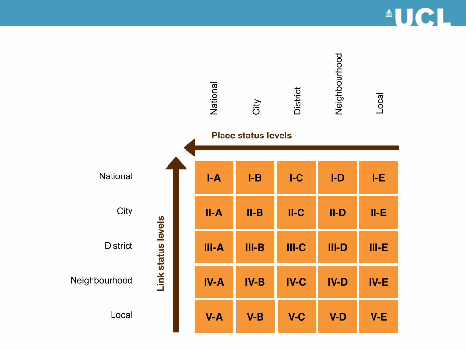
Neighbourhood
Local
District
City
National
Loca
l
Nei
ghbo
urho
od
Dis
trict
City
Nat
iona
l
I-E
II-E
III-E
V-A
IV-E
V-B V-C V-D V-E
Place status levels
Link
sta
tus
leve
ls
I-A
II-A
I-B I-C
II-B
I-D
II-C II-D
IV-A
III-B III-C III-D
IV-B IV-C IV-D
III-A
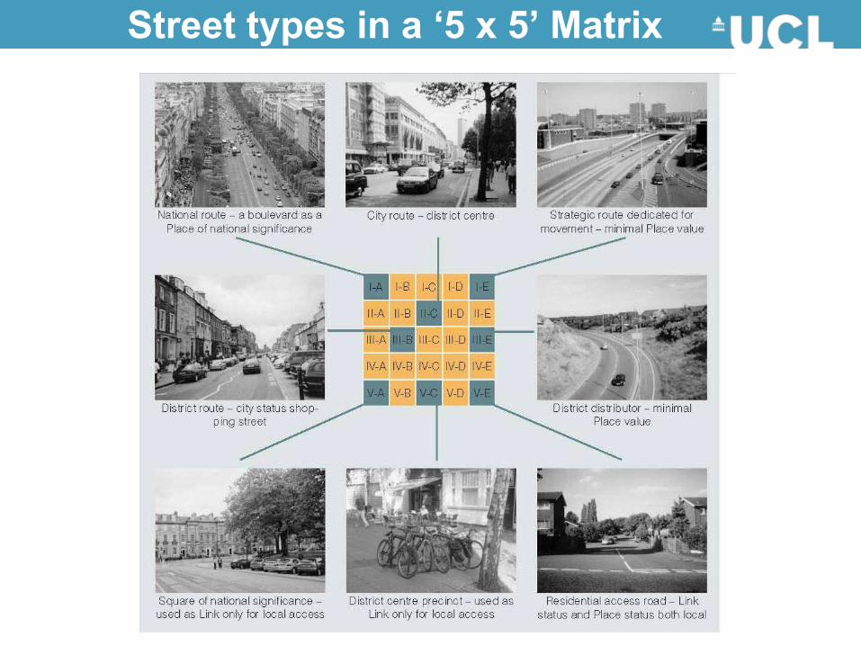
Street types in a ‘5 x 5’ Matrix
Application to Greater London by TfL
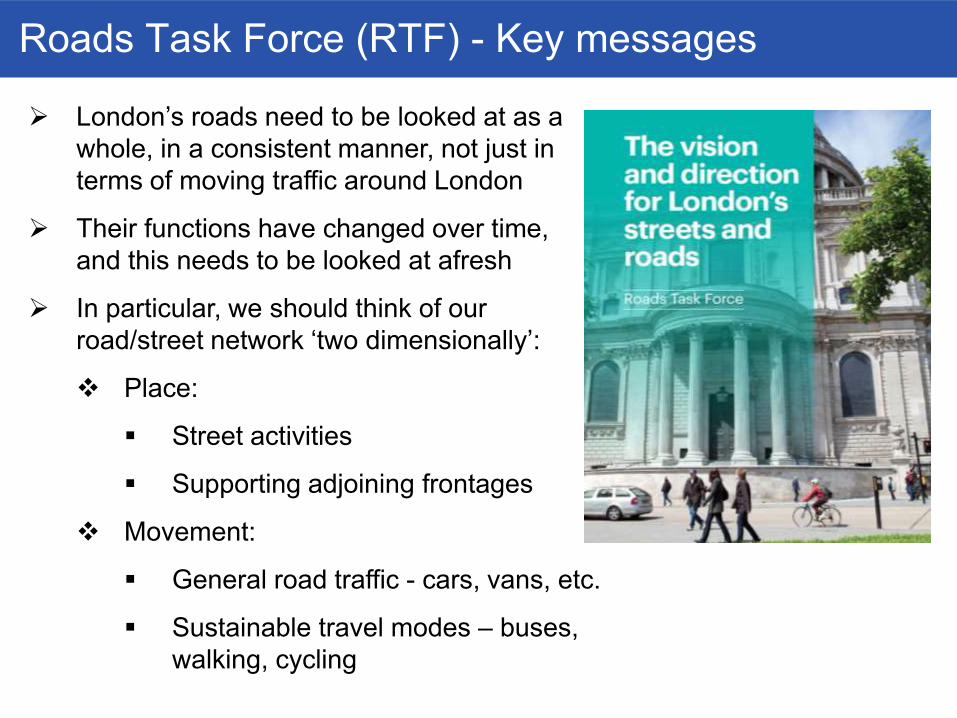
Roads Task Force (RTF) - Key messages
¾ London’s roads need to be looked at as a whole, in a consistent manner, not just in terms of moving traffic around London
¾ Their functions have changed over time, and this needs to be looked at afresh
¾ In particular, we should think of our road/street network ‘two dimensionally’:
� Place:
� Street activities
� Supporting adjoining frontages
� Movement:
� General road traffic - cars, vans, etc.
� Sustainable travel modes – buses, walking, cycling

Street Types: the intended outcome
¾ A common set of nine ‘street family types’, but with flexibility for boroughs to use a finer level of classification, to meet local needs
¾ Within this general classification, there will be variation within a street type in terms of:
� Modal priorities
� Land use dominance
¾ This will ultimately provide a functional understanding of the role of different streets in London, and the kinds of interventions required to improve the role they play for Boroughs & Greater London
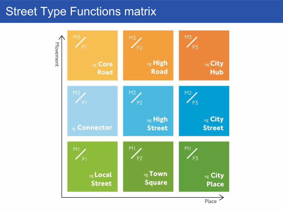
Street Type Functions matrix

Street Types: process and outputs (7/x) Outputs: a set of jointly owned planning tools
� Workshops create a map which can be used locally or combined for a pan-London perspective
� For use by Borough officers, TfL planners, consultants, and designers
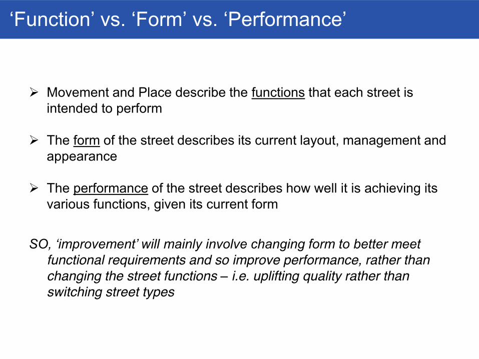
‘Function’ vs. ‘Form’ vs. ‘Performance’
¾ Movement and Place describe the functions that each street is intended to perform
¾ The form of the street describes its current layout, management and
appearance ¾ The performance of the street describes how well it is achieving its
various functions, given its current form
SO, ‘improvement’ will mainly involve changing form to better meet functional requirements and so improve performance, rather than changing the street functions – i.e. uplifting quality rather than switching street types
Application to Street Design
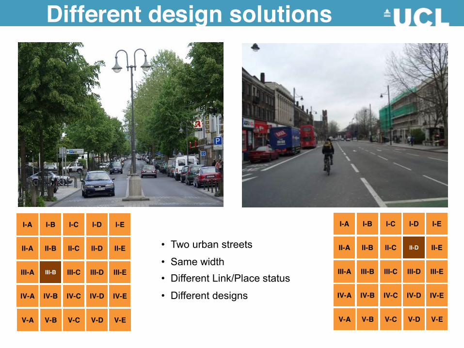
Different design solutions
• Two urban streets
• Same width • Different Link/Place status
• Different designs
I-E
II-E
III-E
V-A
IV-E
V-B V-C V-D V-E
I-A
II-A
I-B I-C
II-B
I-D
II-C II-D
IV-A
III-C III-D
IV-B IV-C IV-D
III-A III-B
I-E
II-E
III-E
V-A
IV-E
V-B V-C V-D V-E
I-A
II-A
I-B I-C
II-B
I-D
II-C
IV-A
III-B III-C III-D
IV-B IV-C IV-D
III-A
II-D
Neighbourhood
Local
District
City
National
Loca
l
Nei
ghbo
urho
od
Dis
trict
City
Nat
iona
l I-E
II-E
III-E
V-A
IV-E
V-B V-C V-D V-E
Place status levels Li
nk s
tatu
s le
vels
I-A
II-A
I-B I-C
II-B
I-D
II-C II-D
IV-A
III-B III-C III-D
IV-B IV-C IV-D
III-A
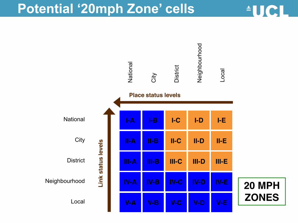
Potential ‘20mph Zone’ cells
20 MPH ZONES
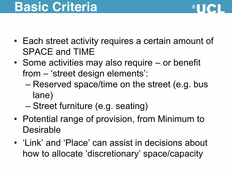
Basic Criteria
• Each street activity requires a certain amount of SPACE and TIME
• Some activities may also require – or benefit from – ‘street design elements’: – Reserved space/time on the street (e.g. bus
lane) – Street furniture (e.g. seating)
• Potential range of provision, from Minimum to Desirable
• ‘Link’ and ‘Place’ can assist in decisions about how to allocate ‘discretionary’ space/capacity
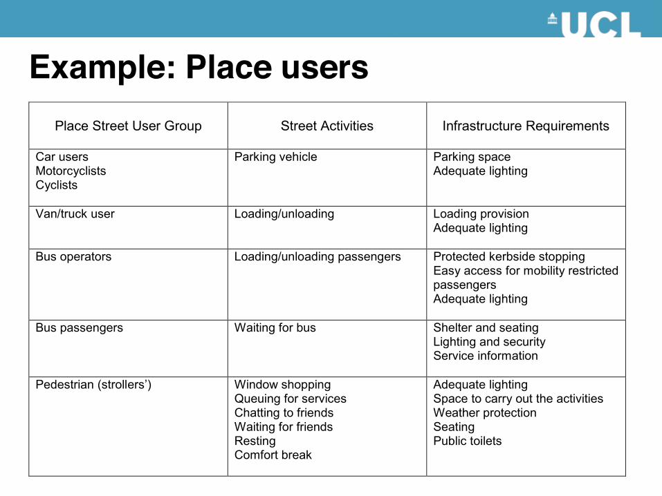
Example: Place users
Place Street User Group
Street Activities
Infrastructure Requirements
Car users Motorcyclists Cyclists
Parking vehicle Parking space Adequate lighting
Van/truck user Loading/unloading Loading provision Adequate lighting
Bus operators Loading/unloading passengers Protected kerbside stopping Easy access for mobility restricted passengers Adequate lighting
Bus passengers Waiting for bus Shelter and seating Lighting and security Service information
Pedestrian (strollers’) Window shopping Queuing for services Chatting to friends Waiting for friends Resting Comfort break
Adequate lighting Space to carry out the activities Weather protection Seating Public toilets
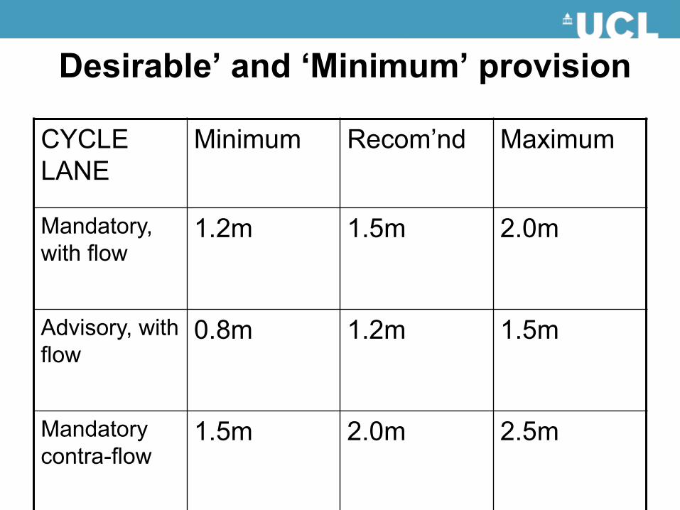
‘Desirable’ and ‘Minimum’ provision
CYCLE LANE
Minimum Recom’nd Maximum
Mandatory, with flow
1.2m 1.5m 2.0m
Advisory, with flow
0.8m 1.2m 1.5m
Mandatory contra-flow
1.5m 2.0m 2.5m
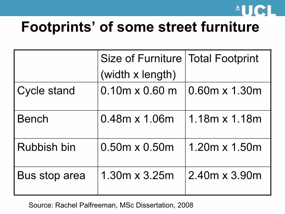
‘Footprints’ of some street furniture
Size of Furniture (width x length)
Total Footprint
Cycle stand 0.10m x 0.60 m 0.60m x 1.30m
Bench 0.48m x 1.06m 1.18m x 1.18m
Rubbish bin 0.50m x 0.50m 1.20m x 1.50m
Bus stop area 1.30m x 3.25m 2.40m x 3.90m
Source: Rachel Palfreeman, MSc Dissertation, 2008

Link Place Carriageway Running lanes for
through traffic Pedestrian crossings
Parking and loading bays
Footway Pedestrian/cycle movement zones Traffic direction/ information and regulatory signs
Street furniture and social space
Mapping activities onto spaces

The ‘trade-off’ triangle
Link
spac
e ca
paci
ty
Total street width
ENVELOPE OF OPTIONS
Place space capacity
A
B
Link
spac
e ca
paci
ty
Total street width
ENVELOPE OF OPTIONS
Place space capacity
A
B
Total street width
ENVELOPE OF OPTIONS
Place space capacity
A
B
Total street width = 15m
Place space capacity
Link
spac
e ca
paci
ty
[5m,10m]Total = 15m
Link = 10m
Link = 5m
Place = 5m Place = 10m
[10m,5m]Total = 15m
Total street width = 15m
Place space capacity
Link
spac
e ca
paci
ty
[5m,10m]Total = 15m
Link = 10m
Link = 5m
Place = 5m Place = 10m
[10m,5m]Total = 15m
In simple terms…
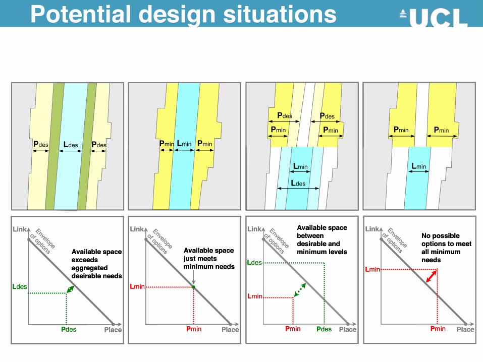
Potential design situations
Pdes PdesLdes Pmin PminLmin
Pmin Pmin
Lmin
Pdes Pdes
Ldes
Lmin
Pmin Pmin
Place
Link
Ldes
Pdes
Envelope
of options
Place
Link
Lmin
Pmin
Envelope
of options
Place
Link
Lmin
Ldes
PdesPmin
Envelope
of options
Place
Link
Lmin
Pmin
Envelope
of options
No possible options to meet all minimum needs
Available space between desirable and minimum levelsAvailable space
just meets minimum needs
Available space exceeds aggregated desirable needs
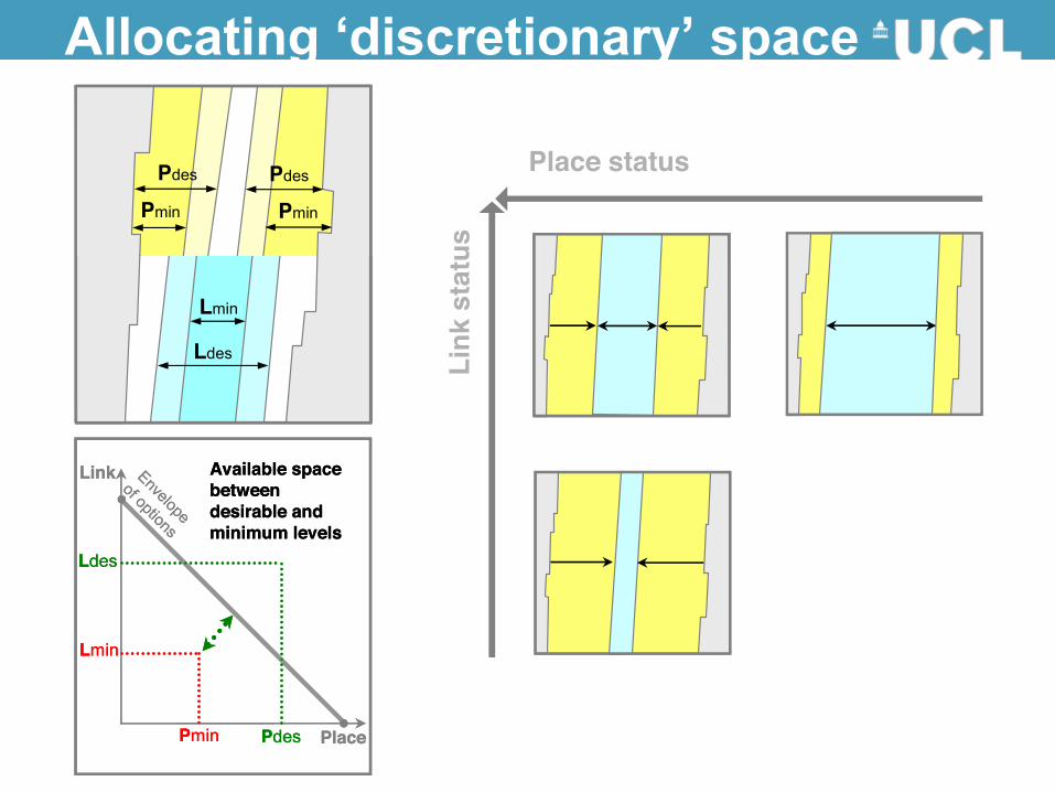
Allocating ‘discretionary’ space
Pdes PdesLdes Pmin PminLmin
Pmin Pmin
Lmin
Pdes Pdes
Ldes
Lmin
Pmin Pmin
Place
Link
Ldes
Pdes
Envelope
of options
Place
Link
Lmin
Pmin
Envelope
of options
Place
Link
Lmin
Ldes
PdesPmin
Envelope
of options
Place
Link
Lmin
Pmin
Envelope
of options
No possible options to meet all minimum needs
Available space between desirable and minimum levelsAvailable space
just meets minimum needs
Available space exceeds aggregated desirable needs
Position of the street segment in the Link/Place matrix determines relative space to allocate to Link and Place requirements
Link
sta
tus
Place status
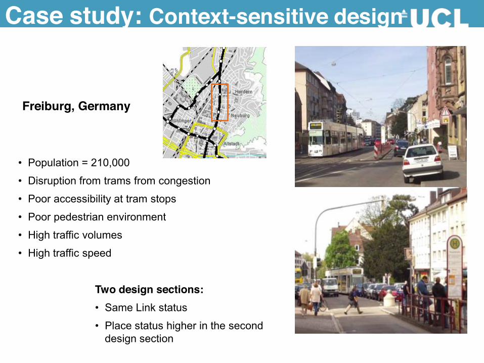
Case study: Context-sensitive design
Freiburg, Germany
• Population = 210,000
• Disruption from trams from congestion
• Poor accessibility at tram stops
• Poor pedestrian environment
• High traffic volumes
• High traffic speed
Two design sections: • Same Link status
• Place status higher in the second design section
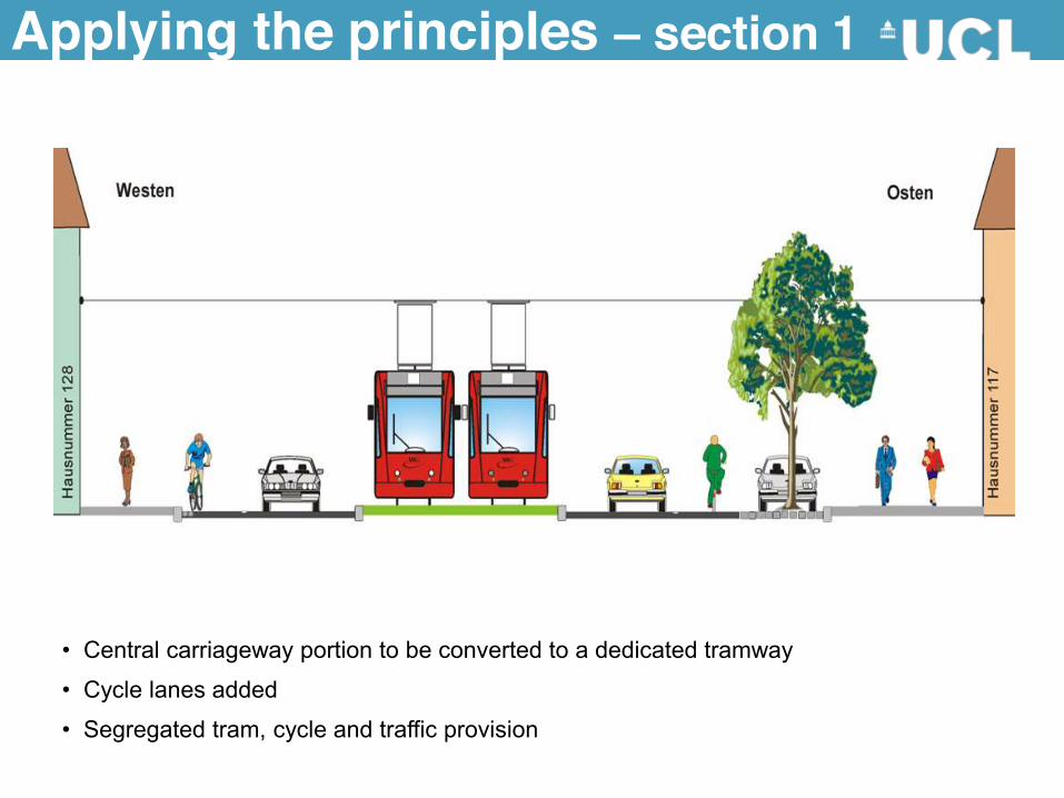
Applying the principles – section 1
• Central carriageway portion to be converted to a dedicated tramway
• Cycle lanes added
• Segregated tram, cycle and traffic provision
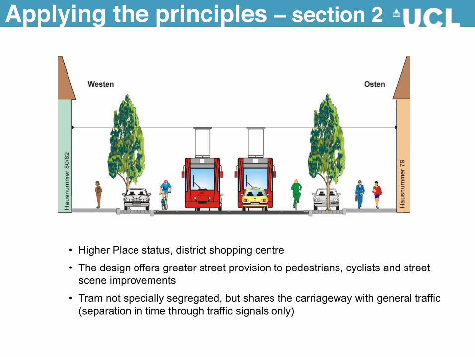
• Higher Place status, district shopping centre
• The design offers greater street provision to pedestrians, cyclists and street scene improvements
• Tram not specially segregated, but shares the carriageway with general traffic (separation in time through traffic signals only)
Applying the principles – section 2
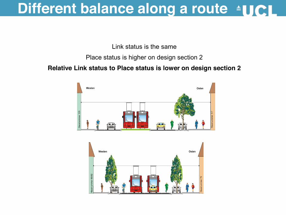
Different balance along a route
Link status is the same
Place status is higher on design section 2
Relative Link status to Place status is lower on design section 2
Engaging the Public in Street Design
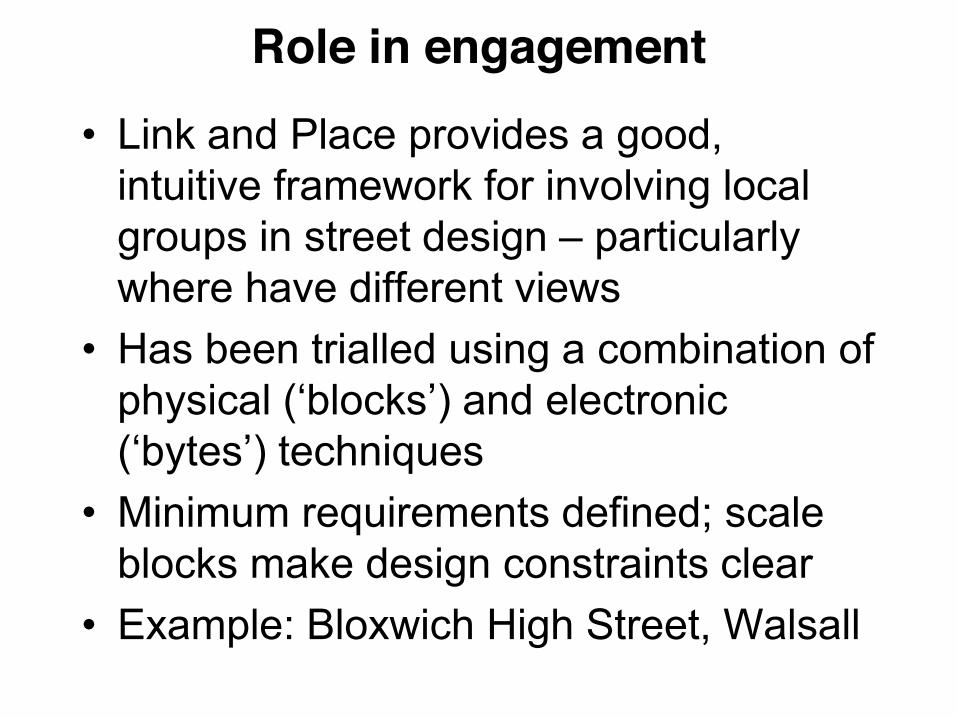
• Link and Place provides a good, intuitive framework for involving local groups in street design – particularly where have different views
• Has been trialled using a combination of physical (‘blocks’) and electronic (‘bytes’) techniques
• Minimum requirements defined; scale blocks make design constraints clear
• Example: Bloxwich High Street, Walsall
Role in engagement

Public engagement process
• Workshop 1 – Describes the background to and reasons for
the exercise – Allows groups of stakeholders to use the
Blocks to propose their own solutions. • Workshop 2
– Stakeholders are shown their own plans, along with the planners solution, in LineMap.
– The aspects of each plan can be discussed on screen, and combined into a new plan.
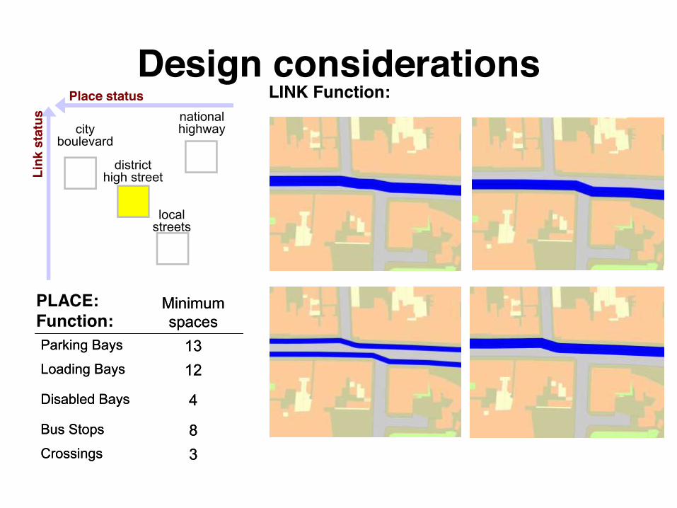
Design considerations national highwaycity
boulevard
district high street
local streets
Place status
Link
sta
tus
LINK Function:
38
4
1213
Minimum spaces
Crossings
Bus Stops
Disabled Bays
Loading Bays
Parking Bays
38
4
1213
Minimum spaces
Crossings
Bus Stops
Disabled Bays
Loading Bays
Parking Bays
PLACE: Function:
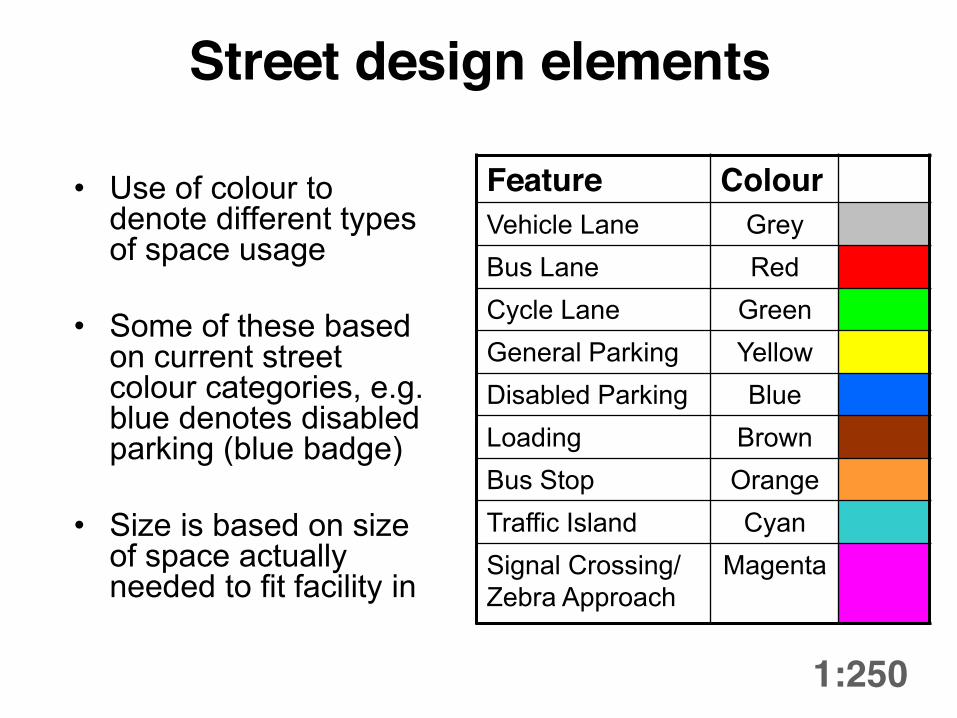
Street design elements
1:250
• Use of colour to denote different types of space usage
• Some of these based on current street colour categories, e.g. blue denotes disabled parking (blue badge)
• Size is based on size of space actually needed to fit facility in
Feature Colour Vehicle Lane Grey Bus Lane Red Cycle Lane Green General Parking Yellow Disabled Parking Blue Loading Brown Bus Stop Orange Traffic Island Cyan Signal Crossing/ Zebra Approach
Magenta
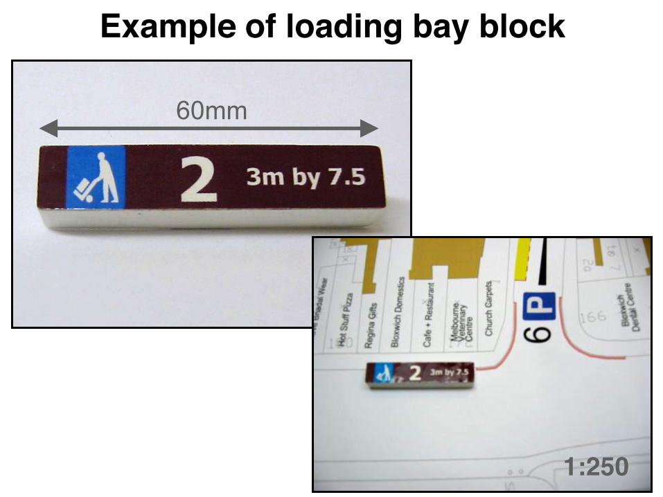
60mm
Example of loading bay block
1:250
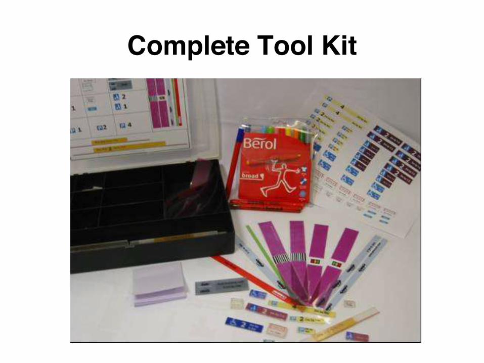
Complete Tool Kit

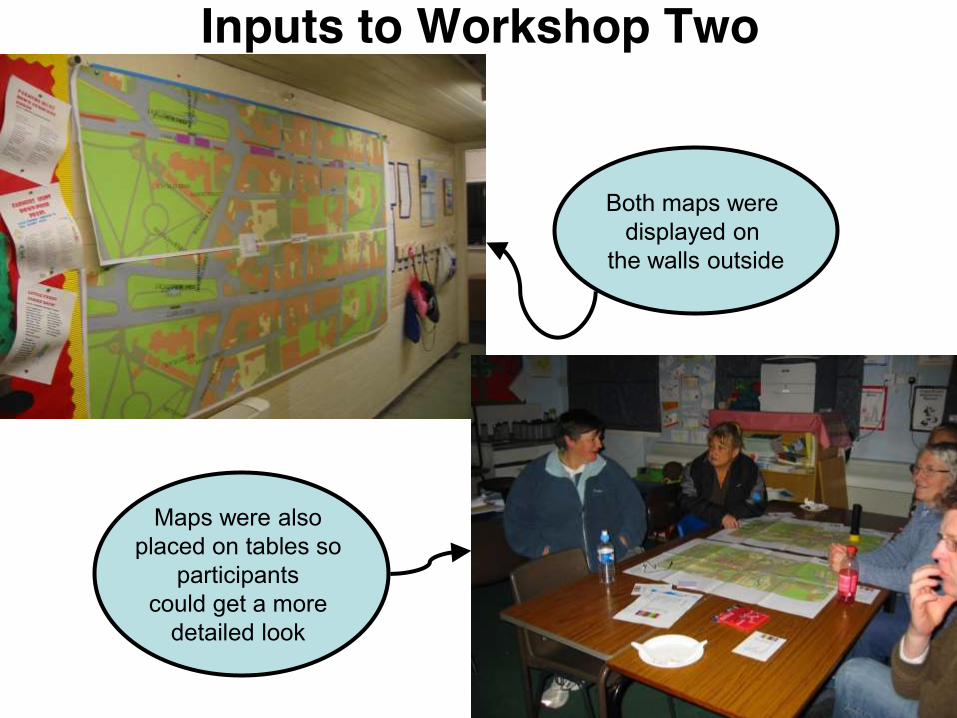
Inputs to Workshop Two
Both maps were displayed on
the walls outside
Maps were also placed on tables so
participants could get a more
detailed look
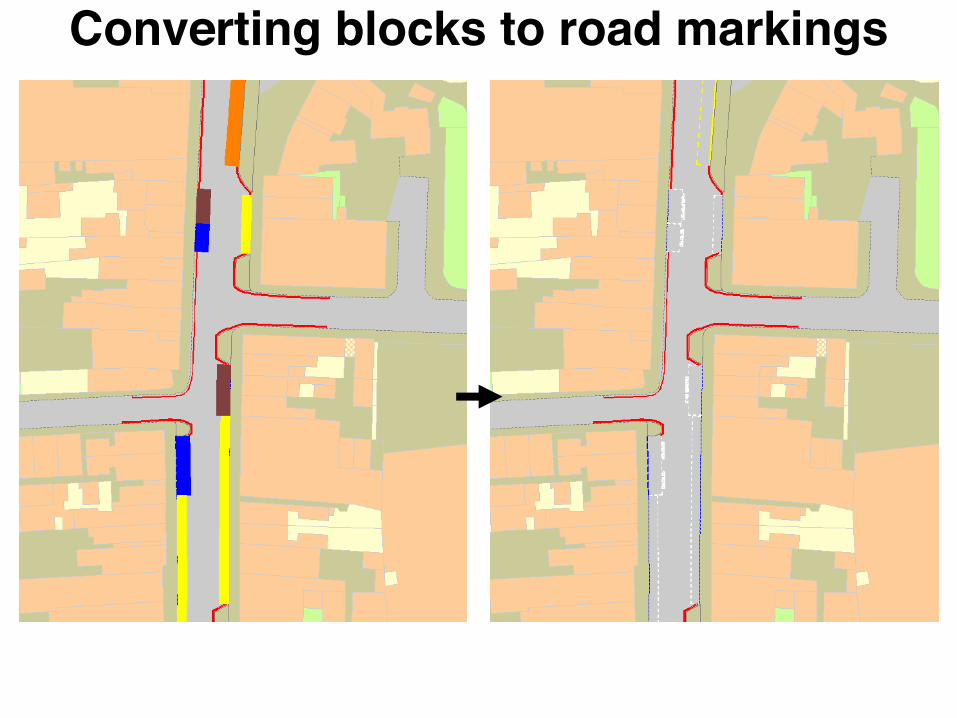
Converting blocks to road markings
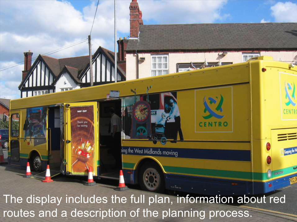
The display includes the full plan, information about red routes and a description of the planning process.
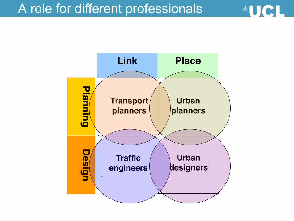
A role for different professionals
Traffic
engineers .
Urban
designers
Link Place
Planning D
esign
Transport planners
Urban
planners