Improving global agricultural cropland though integration and expert elicitation Steffen Fritz Linda...
16
Improving global agricultural cropland though integration and expert elicitation Steffen Fritz Linda See Christoph Perger
-
Upload
elfreda-flowers -
Category
Documents
-
view
214 -
download
0
Transcript of Improving global agricultural cropland though integration and expert elicitation Steffen Fritz Linda...

Improving global agricultural cropland though integration and expert elicitation
Steffen FritzLinda See
Christoph Perger

Activities of IIASA in the wider field of Early warning
• Global/regional land use models – impact of certain policies on GHG emissions, impact on food prices
• Crop modeling using crop modelling (e.g. Epic model), comparison of ASCAT Soil Moisture with EPIC soil moisture
• Evaluating the potential of mobile phones in cropland mapping and Early Warning applications


Current State of maps and possible improvements in data collection
• Global Land Cover and cropland maps in particular disagree
• Lots of national maps have been produced which can be integrated (e.g. Africover)
• Google earth offers enormous potential to cross check and validate maps
• Mobile phones allow to collect data – e.g. pictures on the ground
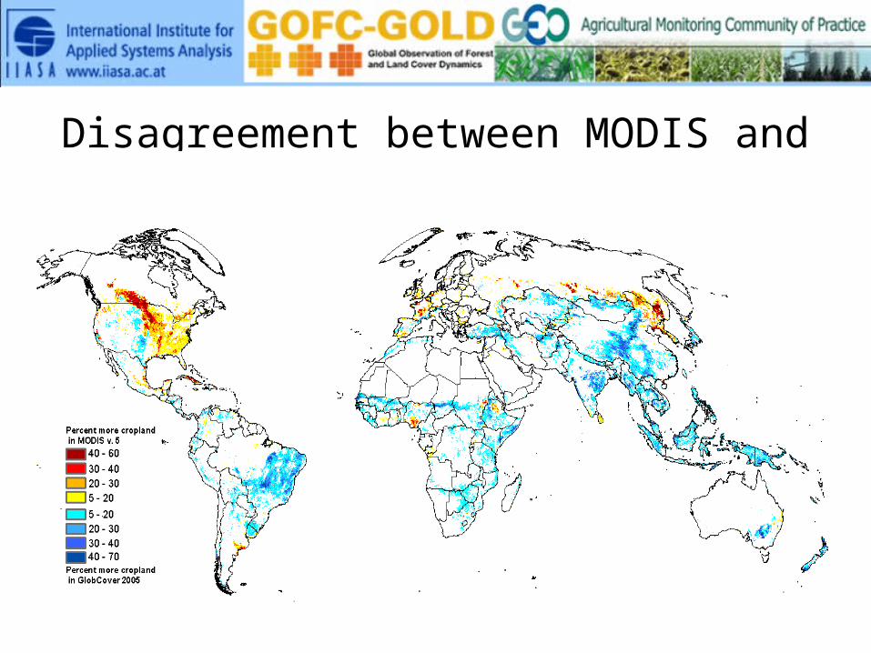
Disagreement between MODIS and GlobCover
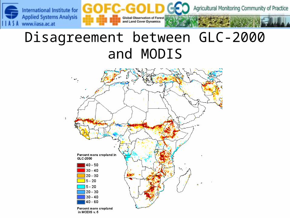
Disagreement between GLC-2000 and MODIS
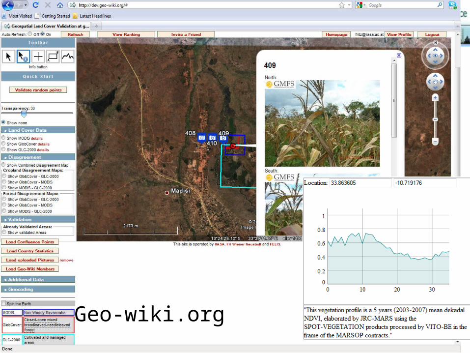
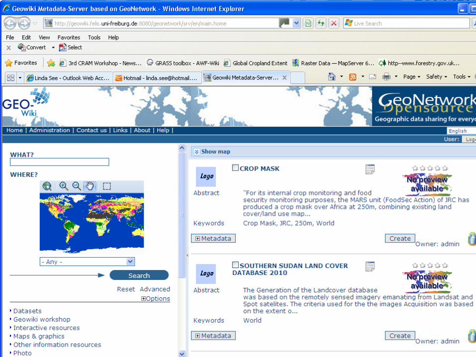
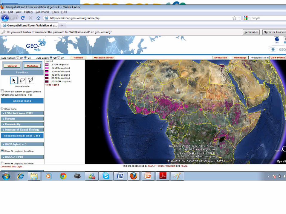
www.geo-wiki.org
Geo-wiki.org


Dataset Year(s)Hybrid cropland extent map of Africa 2000 to 2011
Hybrid cropland extent map of Africa Various temporal extents
Africover for East African countriesMap of cropland extent for Senegal
20002005
Cropland extent from the CORINE land cover dataset 2005
Cropland extent for South Africa 2010Cropland extent for several states in India 2010-2011
Map of cropland extent for Australia 2010
Cropland extent for the USA 2010 Updated annually
Cropland extent for China 2000
Cropland extent for Southern Sudan 2010
Cropland extent for Mali 2007Cropland extent for Nigeria 2007Cropland extent for Burkina Faso 1983Cropland extent for Gambia UnknownCrop masks for sugar cane and summer crops in Brazil 2010 Updated
annually
Cropland extent for one oblast in Kazakhstan 2005
Data Shared at the Workshop
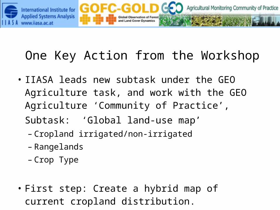
One Key Action from the Workshop• IIASA leads new subtask under the GEO Agriculture
task, and work with the GEO Agriculture ‘Community of Practice’, Subtask: ‘Global land-use map’– Cropland irrigated/non-irrigated– Rangelands– Crop Type
• First step: Create a hybrid map of current cropland distribution.

How to make a ‘hybrid product’ • Data integration – Kind of ensemble for cropland maps– Use national and sub-national statistics– Use experts via feedback on current maps to
improve at certain locations– Integrate validation points collected from very
high resolution (e.g. geo-wiki) and ground points/ pictures from mobile phones

Fritz et al., 2011, A new calibrated cropland dataset for sub-saharan Africa, JGR

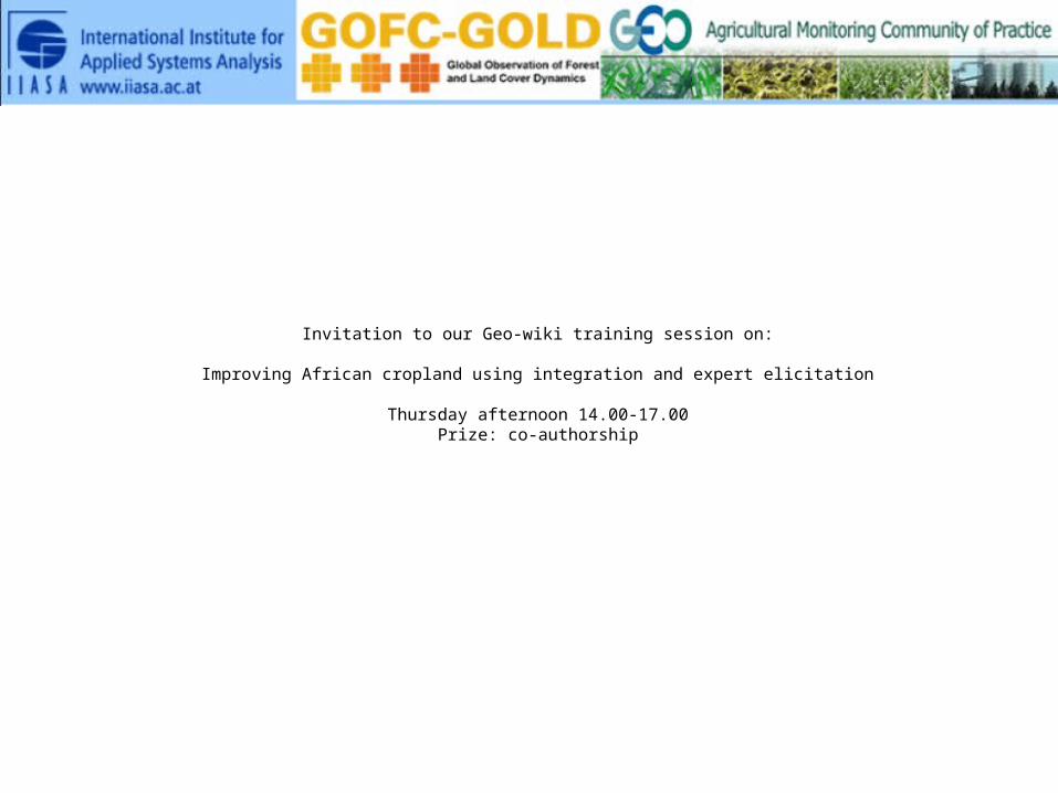
Invitation to our Geo-wiki training session on:
Improving African cropland using integration and expert elicitation
Thursday afternoon 14.00-17.00Prize: co-authorship