


Implementing Open Source Tile Caching in a Large...
28
Implementing Open Source Tile Caching in a Large Scale US Army Project TileCache in Army Mapper FOSS4G September 9, 2010 Kristofor Carle – SYNCADD Systems Inc. Unclassifie d 1 of 28 Kristofor Carle / [email protected]
-
Upload
nguyentruc -
Category
Documents
-
view
223 -
download
0
Transcript of Implementing Open Source Tile Caching in a Large...

Implementing Open Source Tile Caching in a Large Scale
US Army ProjectTileCache in Army Mapper
FOSS4GSeptember 9, 2010
Kristofor Carle – SYNCADD Systems Inc.
Unclassified
1 of 28Kristofor Carle / [email protected]

Outline
• Introduction to Army Mapper
• Web Map Viewer• user generated map files
• SLDs
• dynamic data
• Challenges with TileCache Implementation
• Performance Testing
Unclassified
2 of 28Kristofor Carle / [email protected]
Unclassified
3 of 28Kristofor Carle / [email protected]
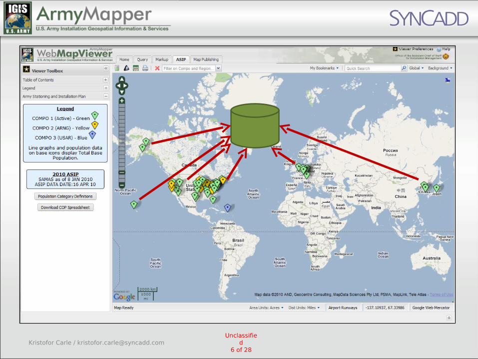
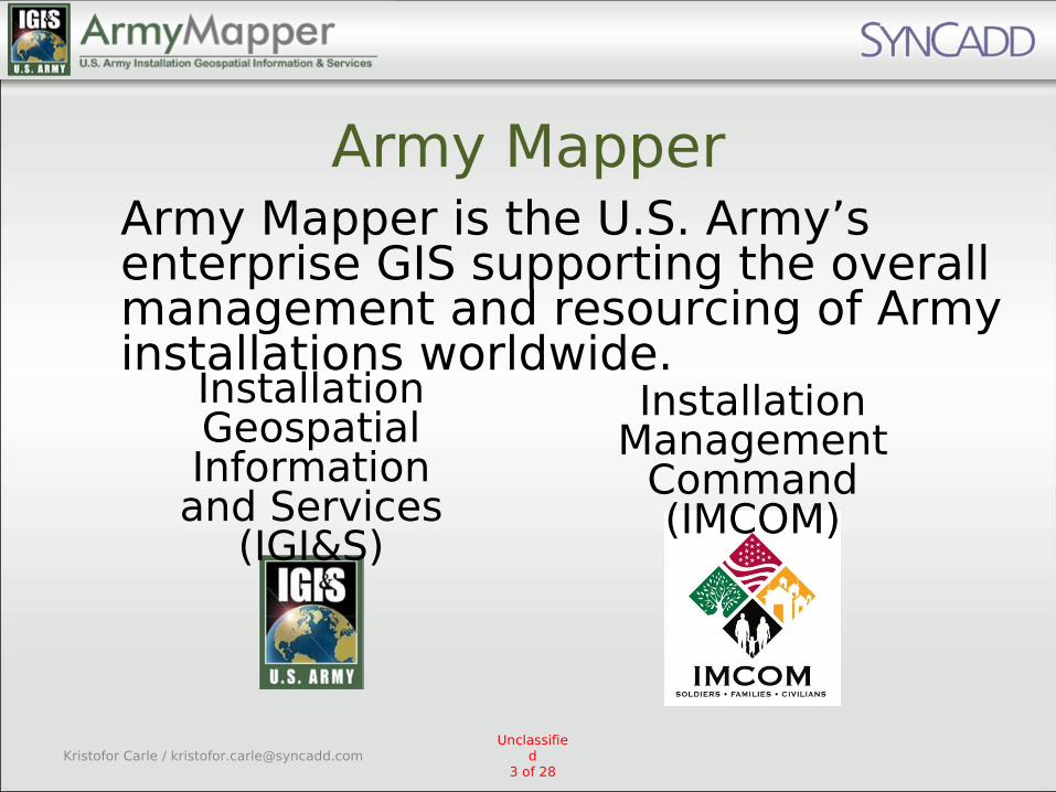
Army MapperArmy Mapper is the U.S. Army’s enterprise GIS supporting the overall management and resourcing of Army installations worldwide.
Installation Geospatial Information and Services
(IGI&S)
Installation Management
Command (IMCOM)
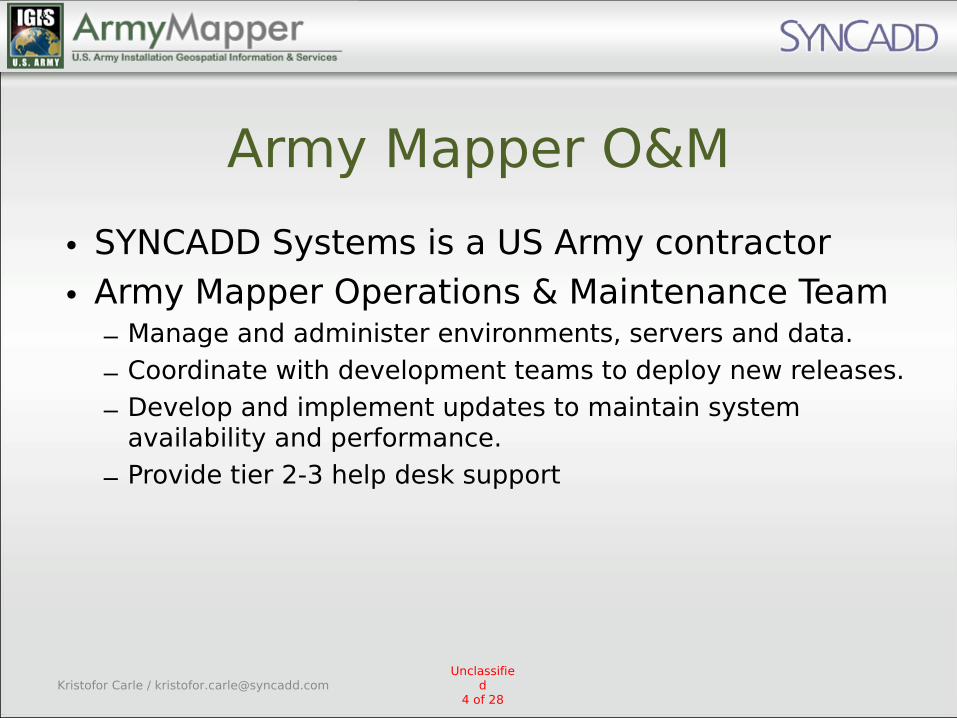
Army Mapper O&M
• SYNCADD Systems is a US Army contractor
• Army Mapper Operations & Maintenance Team– Manage and administer environments, servers and data.
– Coordinate with development teams to deploy new releases.
– Develop and implement updates to maintain system availability and performance.
– Provide tier 2-3 help desk support
Unclassified
4 of 28Kristofor Carle / [email protected]
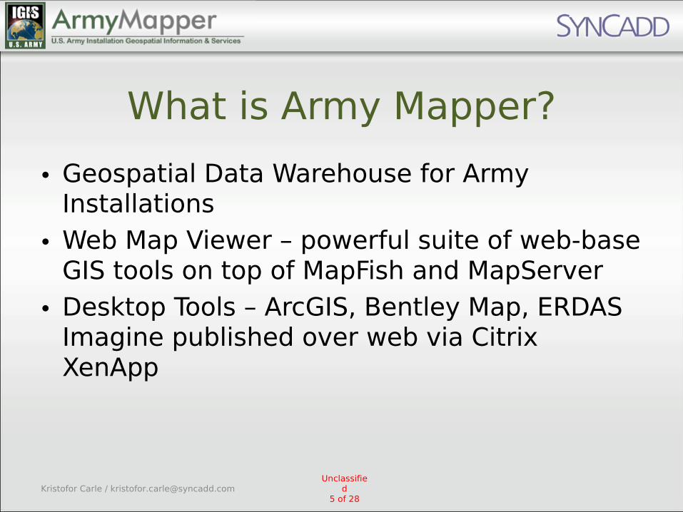
What is Army Mapper?
• Geospatial Data Warehouse for Army Installations
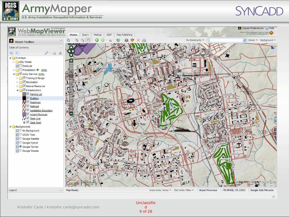
• Web Map Viewer – powerful suite of web-base GIS tools on top of MapFish and MapServer
• Desktop Tools – ArcGIS, Bentley Map, ERDAS Imagine published over web via Citrix XenApp
Unclassified
5 of 28Kristofor Carle / [email protected]

Numbers
• 200+ US Army Installations
• Thousands of data layers for each installation
• Terabytes of data
• 60+ servers, multiple environments
• Thousands of users
• Integrations with other Army data setsAll of these are increasing!
Unclassified
8 of 28Kristofor Carle / [email protected]

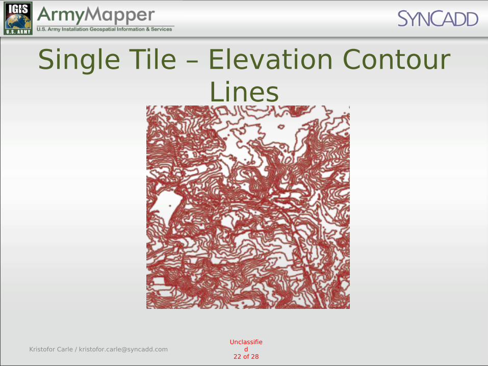
User Generated Map Files
• pick from up to 1,345 layers – add custom symbology and labeling
– share the map with other users
• new feature in Army Mapper– increased demand on MapServer and database
– now need to support rendering of large complex data sets like detailed elevation contour lines
Unclassified
10 of 28Kristofor Carle / [email protected]

Other Web Map Viewer Features
• Customizable Symbology– color, line type, line weight, fill type,
transparency, label field, label font, and more• Query Tools– spatial selection, query builder, buffer, identify
• Markup tools – points, lines, polys, text, and icons– Exportable to KML, GeoRSS
• Integration with Army business data for planning/analysis
Unclassified
11 of 28Kristofor Carle / [email protected]

TileCache vs. GeoWebCache
• Dynamic layer requests– Layers=roads,buildings,airports,golfcour
se,etc.
• User generated custom MapServer map files including up to 1,345 layers
• TileCache can build composites
Unclassified
12 of 28Kristofor Carle / [email protected]
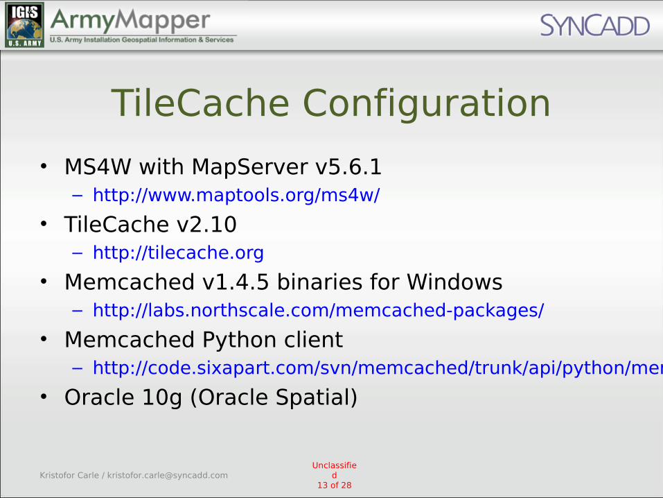
TileCache Configuration
• MS4W with MapServer v5.6.1– http://www.maptools.org/ms4w/
• TileCache v2.10– http://tilecache.org
• Memcached v1.4.5 binaries for Windows– http://labs.northscale.com/memcached-packages/
• Memcached Python client– http://code.sixapart.com/svn/memcached/trunk/api/python/memcache.py
• Oracle 10g (Oracle Spatial)
Unclassified
13 of 28Kristofor Carle / [email protected]
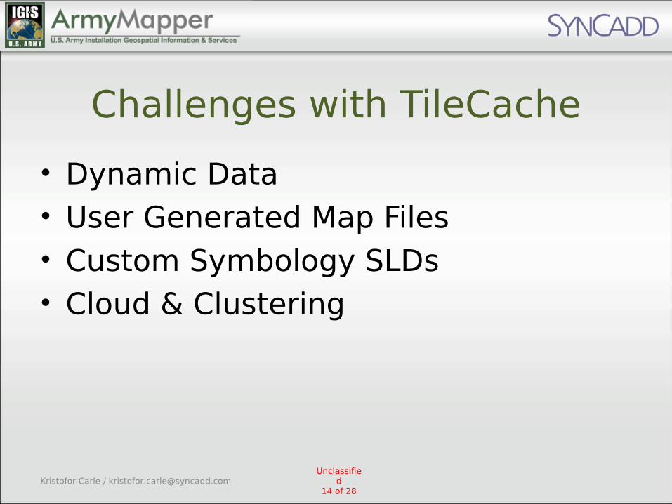
Challenges with TileCache
• Dynamic Data• User Generated Map Files• Custom Symbology SLDs• Cloud & Clustering
Unclassified
14 of 28Kristofor Carle / [email protected]
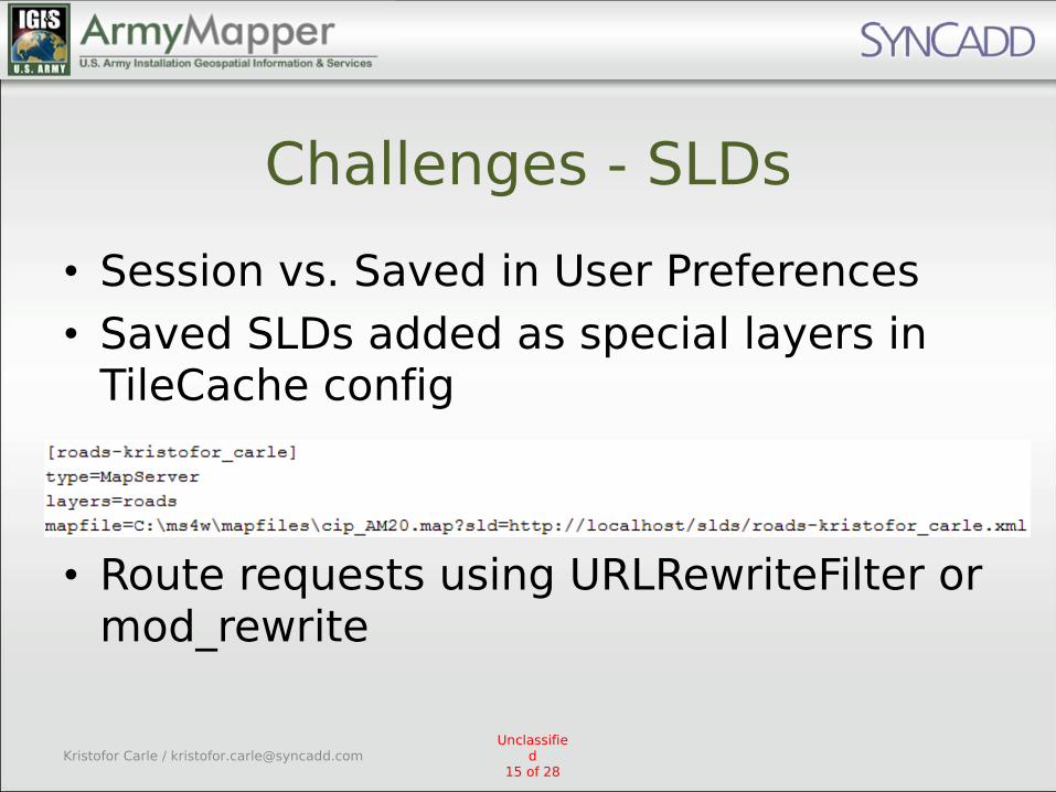
Challenges - SLDs
• Session vs. Saved in User Preferences• Saved SLDs added as special layers in
TileCache config
• Route requests using URLRewriteFilter or mod_rewrite
Unclassified
15 of 28Kristofor Carle / [email protected]
Challenges - User Map Files
• Need to automatically add maps and their layers to the TileCache.cfg
• Also need to seed scripts that know how to rebuild the cache
• Performance significance depends onMap popularity– can be private, public, or shared with specific
users
Unclassified
16 of 28Kristofor Carle / [email protected]

Dynamic Data• Army Mapper has an automated data publishing
migration process
• For each updated layer– tilecache_seed.py --force layer_name
• To update only a single installation use– tilecache_seed.py --force layer_name --bbox
[installation’s extent]
• This might have to run overnight for some layers!
Unclassified
17 of 28Kristofor Carle / [email protected]
Challenges - Cloud & Clustering
• Centralized or separate cache on each server?– Use a shared space on the SAN for disk
cache
• Memcached– performance impact during seeding– have to rebuild when server is rebooted
Unclassified
18 of 28Kristofor Carle / [email protected]
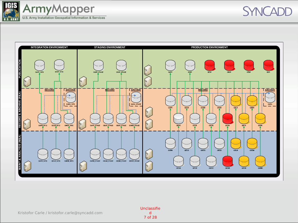
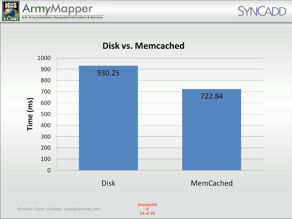
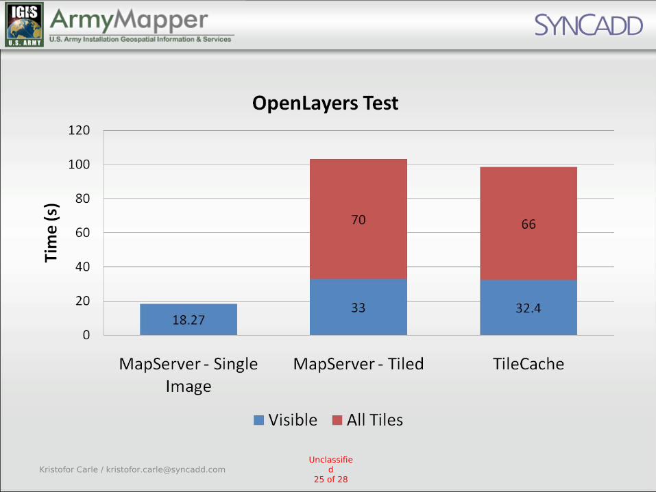
Performance Testing
• Requesting a Single Tile Using Apache Jmeter– Roads & Buildings– Elevation Contour Lines
• OpenLayers –MapServer (tiled), MapServer (single
image), TileCache
• MemcachedUnclassifie
d19 of 28
Kristofor Carle / [email protected]
Conclusion
• Tile Caching is a must for Army Mapper to overcome long render times on some layers
• Possible to overcome challenges related to dynamic content and large datasets
• Need further testing on production level multi-CPU machines for better comparison with OpenLayers single tile mode
Unclassified
26 of 28Kristofor Carle / [email protected]

Hear more about Open Source GIS policy in the US Government
Open Government, Open Data, Open Architecture and Open Source Software
GIS Policy For U.S. Army Installation Management: 2010
by Jaymes Cloninger
Immediately following this presentation.
Unclassified
27 of 28Kristofor Carle / [email protected]