
Identification of Tree Locations in Geographic Images
31
Identification of Identification of Tree Locations in Tree Locations in Geographic Images Geographic Images By By David T. Brown David T. Brown Roger V. Hoang Roger V. Hoang Matthew R. Sgambati Matthew R. Sgambati Frederick C. Harris, Jr. Frederick C. Harris, Jr.
description
Identification of Tree Locations in Geographic Images. By David T. Brown Roger V. Hoang Matthew R. Sgambati Frederick C. Harris, Jr. Overview. VFire CAVE Application Where it fits in VFire Design Abilities Results. Acknowledgements. - PowerPoint PPT Presentation
Transcript of Identification of Tree Locations in Geographic Images

Identification of Identification of Tree Locations in Tree Locations in
Geographic ImagesGeographic ImagesByBy
David T. BrownDavid T. Brown
Roger V. HoangRoger V. Hoang
Matthew R. SgambatiMatthew R. Sgambati
Frederick C. Harris, Jr.Frederick C. Harris, Jr.
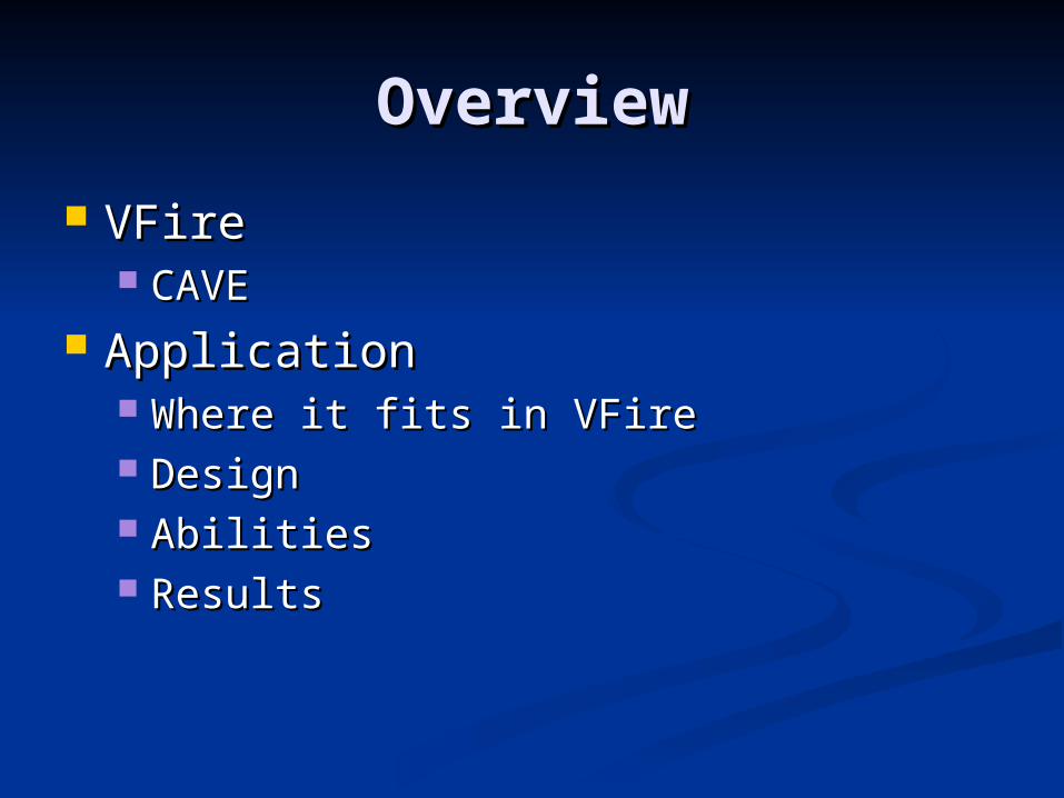
OverviewOverview
VFireVFire CAVECAVE
ApplicationApplication Where it fits in VFireWhere it fits in VFire DesignDesign AbilitiesAbilities ResultsResults

AcknowledgementsAcknowledgements
STTC CAVE Project STTC CAVE Project (ARO# N61339-04-C-0072) (ARO# N61339-04-C-0072) at the Desert Research Instituteat the Desert Research Institute
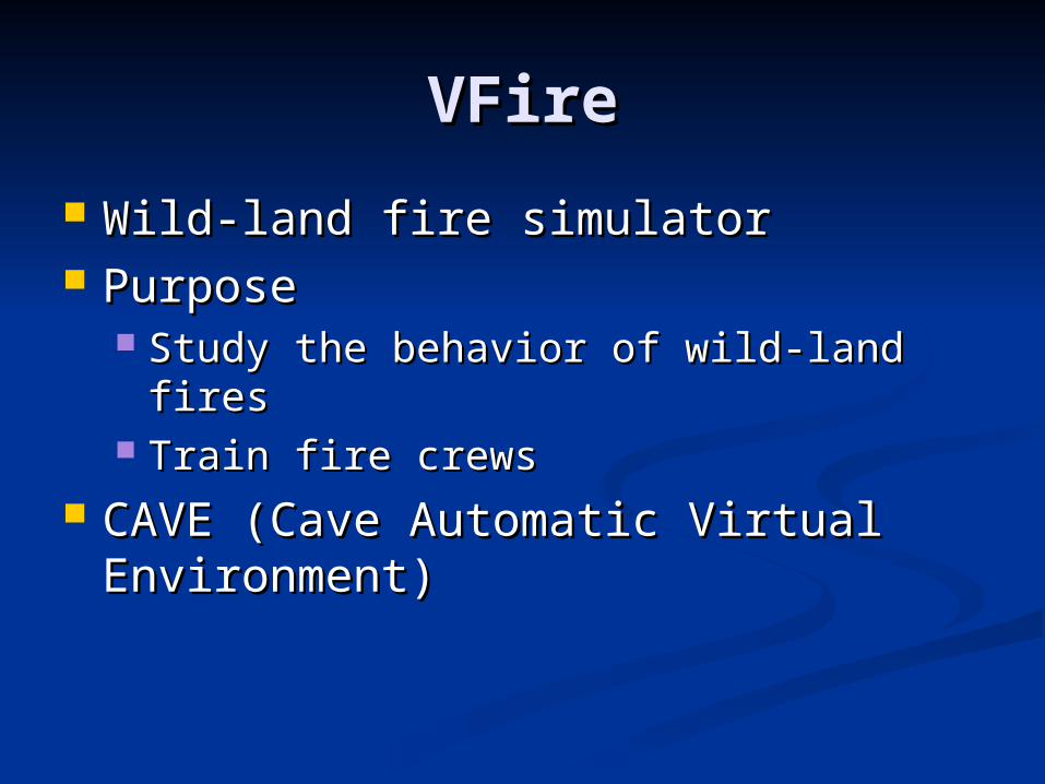
VFireVFire
Wild-land fire simulatorWild-land fire simulator PurposePurpose
Study the behavior of wild-land firesStudy the behavior of wild-land fires Train fire crewsTrain fire crews
CAVE (Cave Automatic Virtual CAVE (Cave Automatic Virtual Environment)Environment)
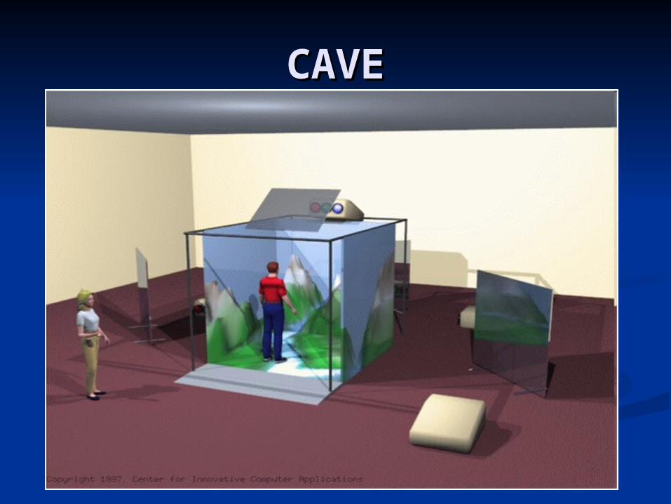
CAVECAVE

CAVE: Head TrackingCAVE: Head Tracking

CAVE: Input DeviceCAVE: Input Device

VFireVFire

VFireVFire
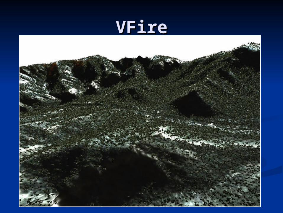
VFireVFire

DesignDesign
Functional/Nonfunctional Functional/Nonfunctional RequirementsRequirements
Use Case DiagramUse Case Diagram System StructureSystem Structure ClassesClasses
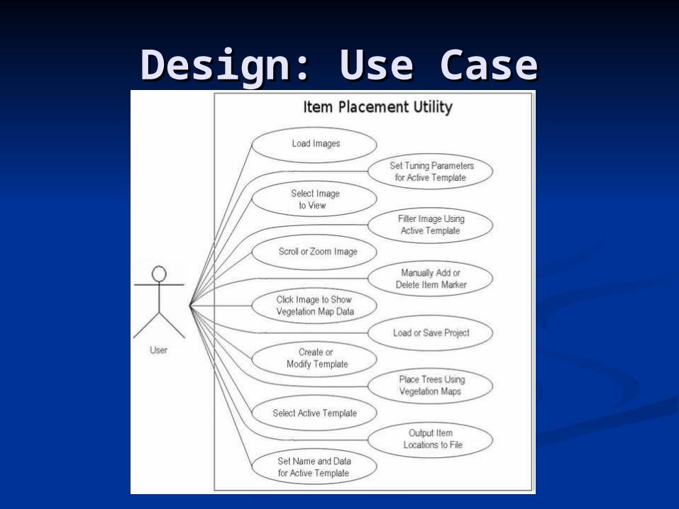
Design: Use CaseDesign: Use Case

Design: System StructureDesign: System Structure

Design: ClassesDesign: Classes
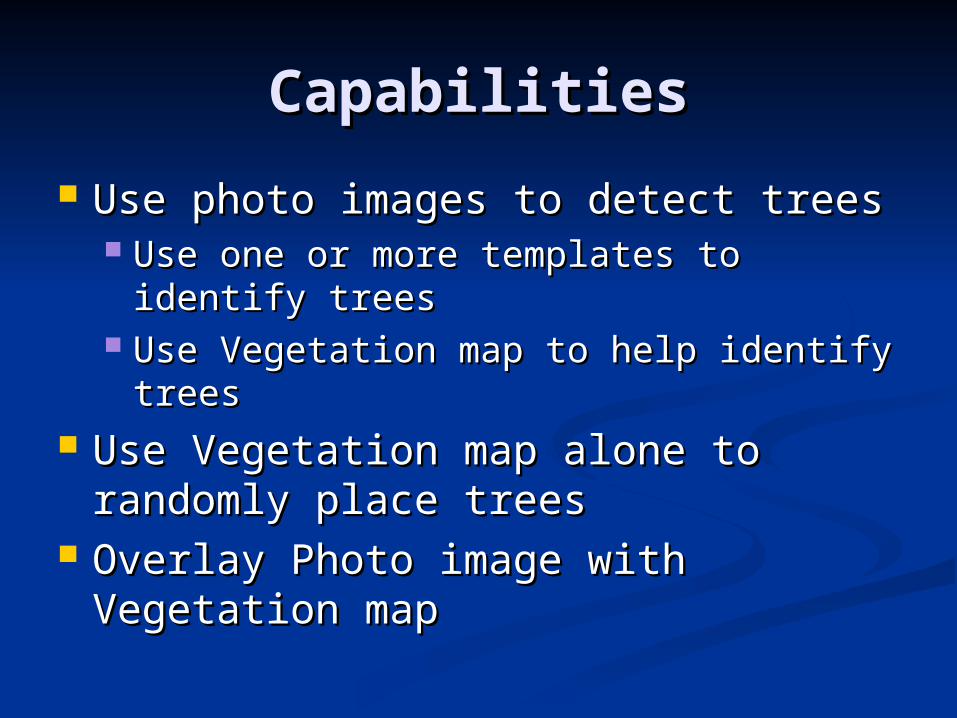
CapabilitiesCapabilities
Use photo images to detect treesUse photo images to detect trees Use one or more templates to identify Use one or more templates to identify
treestrees Use Vegetation map to help identify Use Vegetation map to help identify
treestrees Use Vegetation map alone to Use Vegetation map alone to
randomly place treesrandomly place trees Overlay Photo image with Overlay Photo image with
Vegetation mapVegetation map
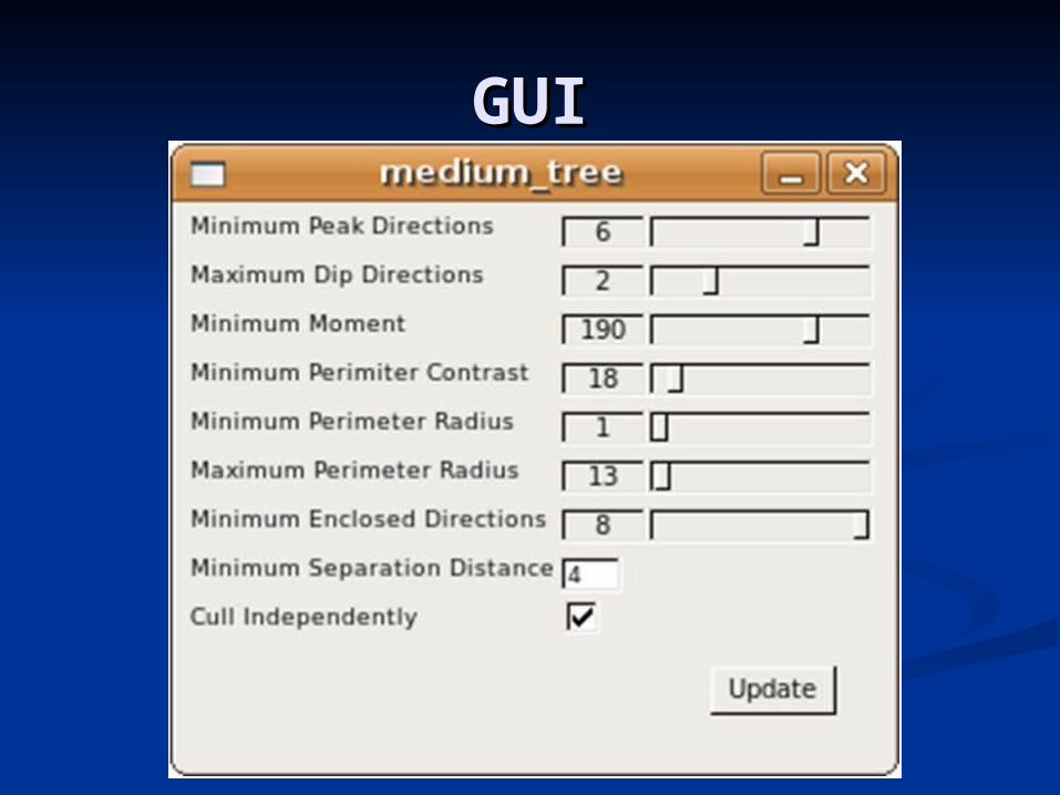
GUIGUI
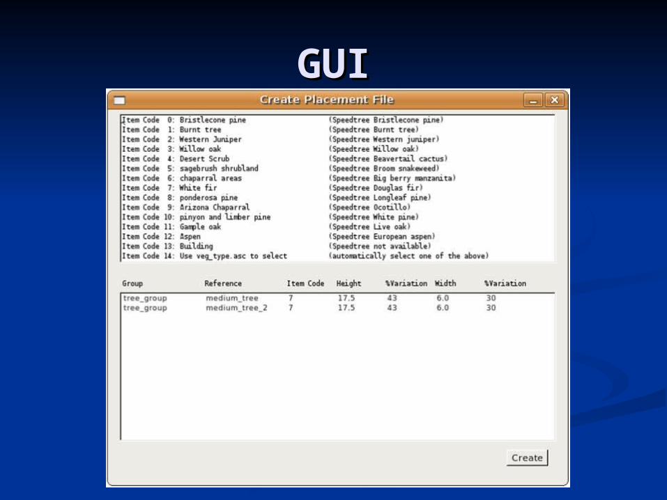
GUIGUI
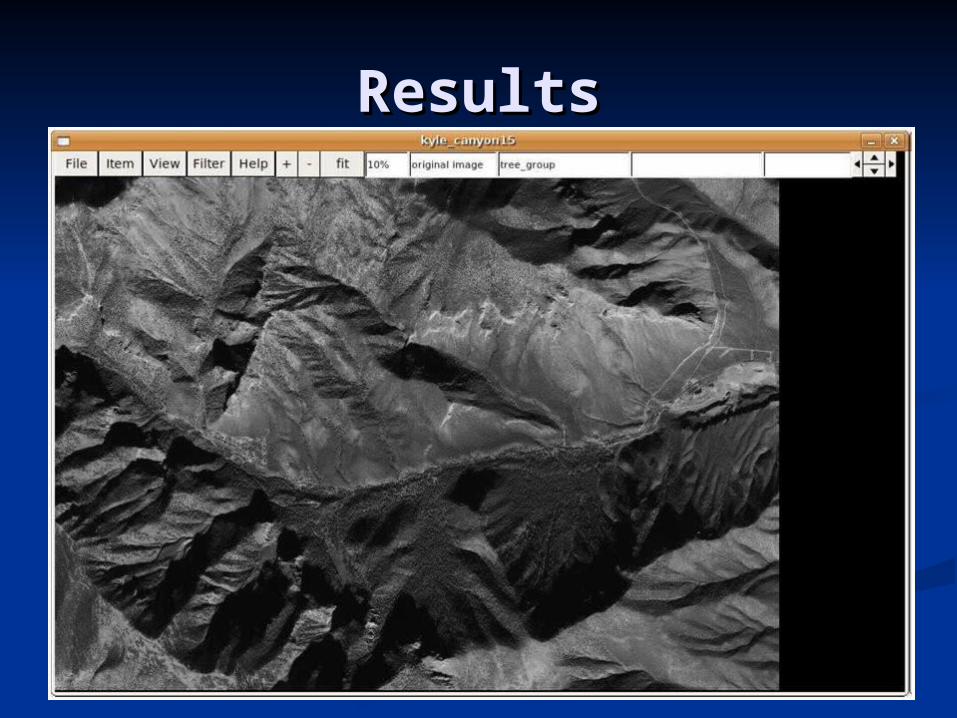
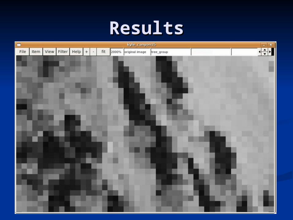
ResultsResults
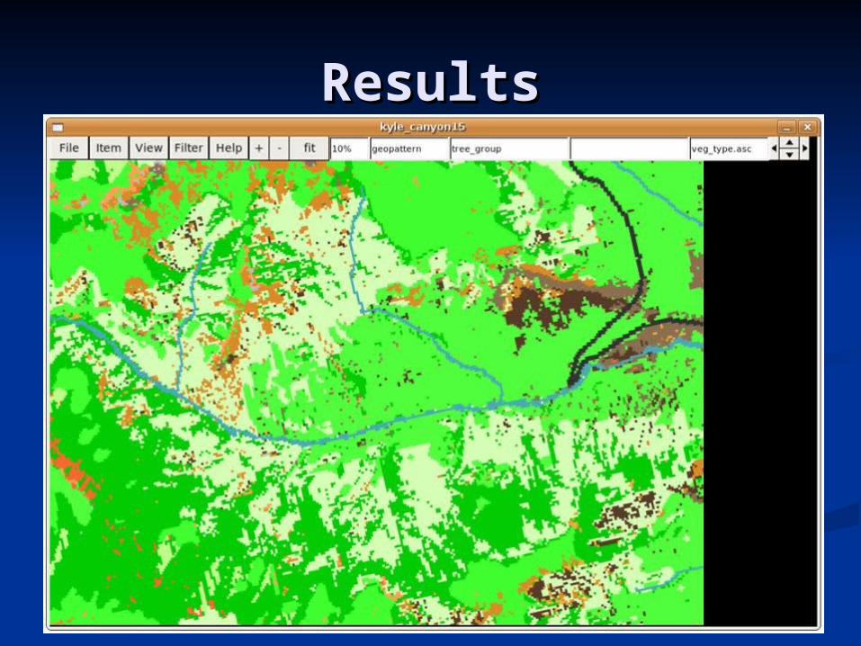
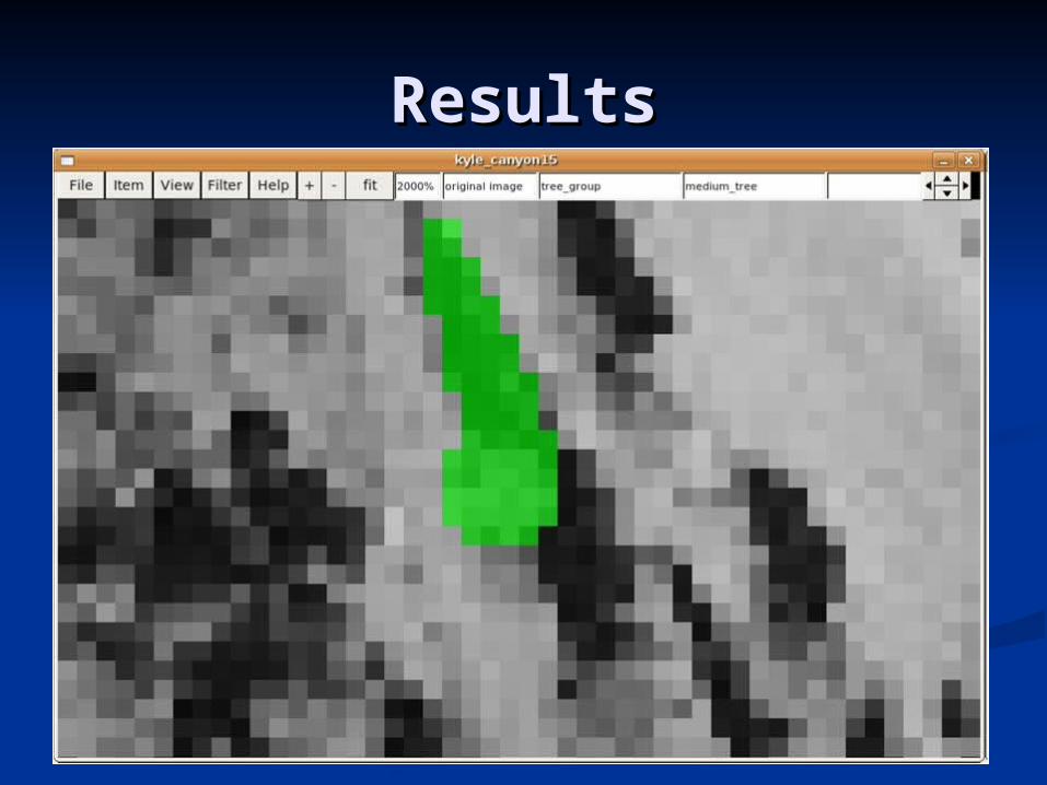
ResultsResults
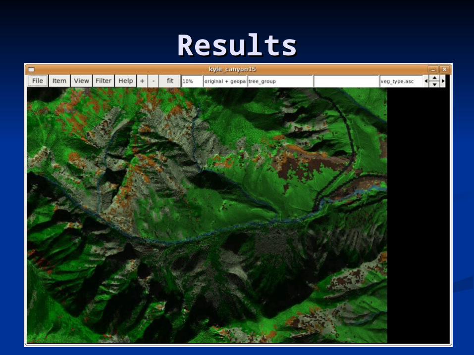
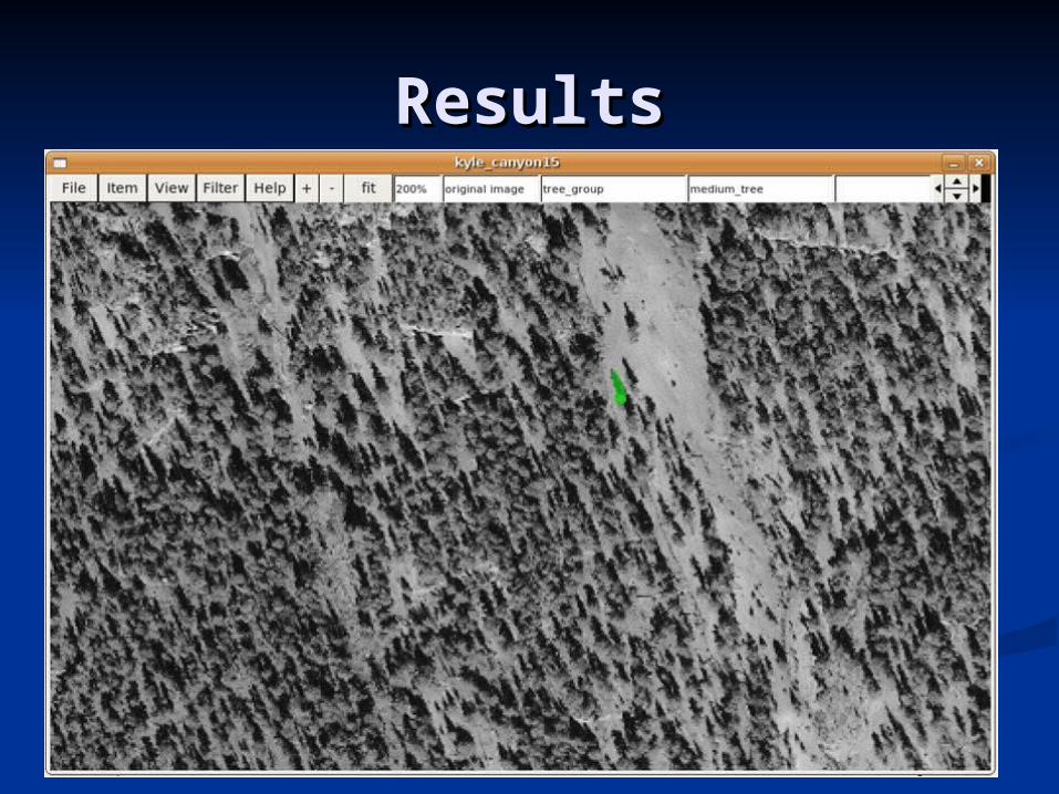
ResultsResults
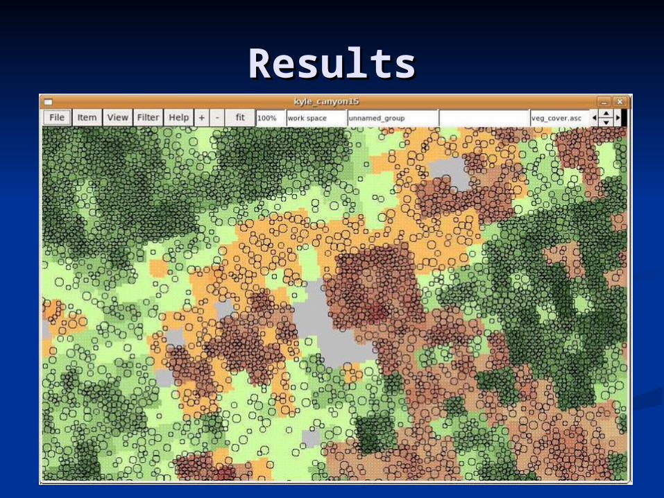
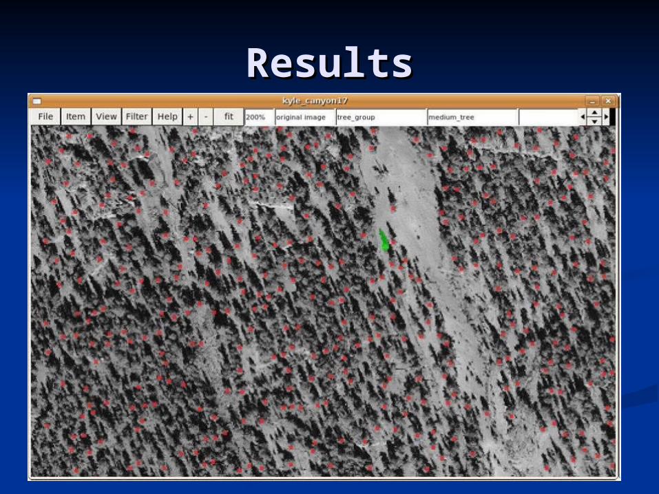
ResultsResults
ResultsResults
ResultsResults
ResultsResults
ResultsResults
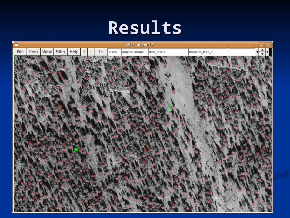
ResultsResults
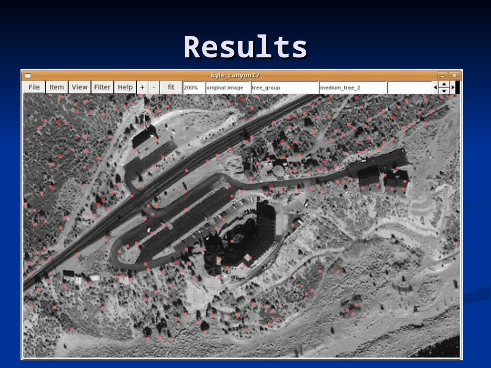
ResultsResults
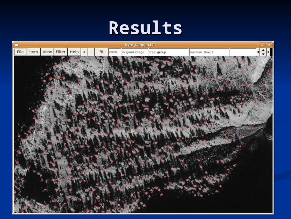
ResultsResults
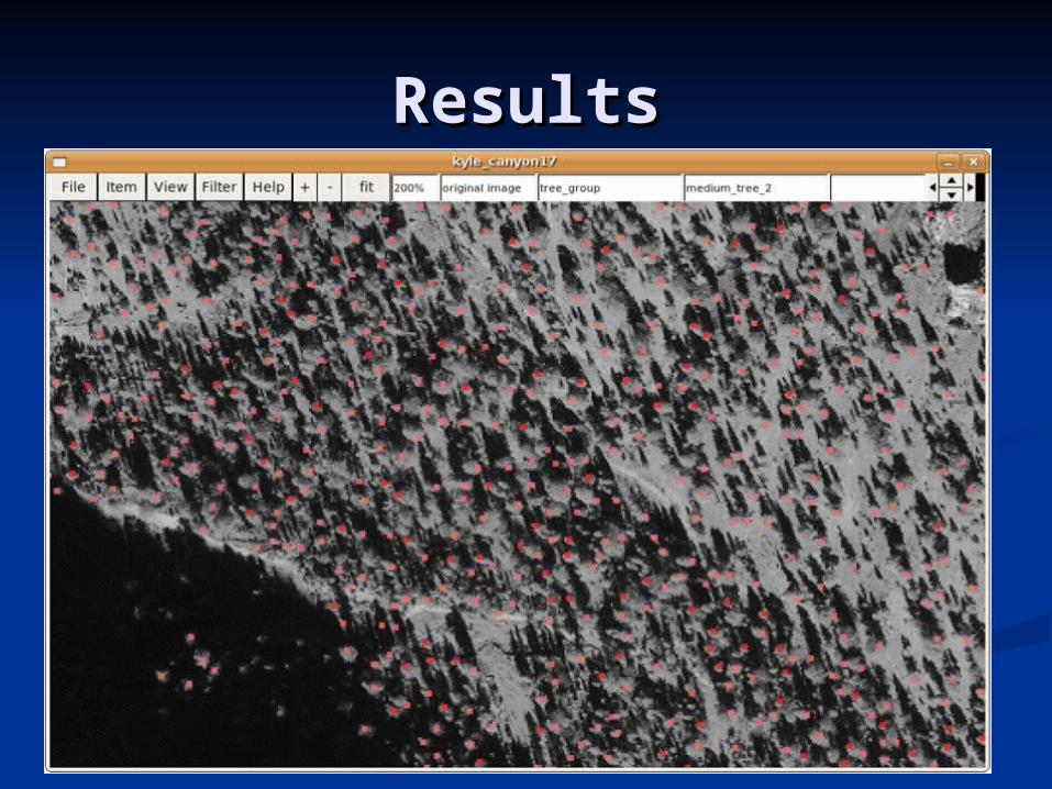
ResultsResults
ConclusionConclusion
VFireVFire CAVECAVE
ApplicationApplication Where it fits in VFireWhere it fits in VFire DesignDesign AbilitiesAbilities ResultsResults
Future WorkFuture Work
Ability to delete large numbers of treesAbility to delete large numbers of trees Ability to change the highlighting colorsAbility to change the highlighting colors Ability Ability to change tuning parameters for to change tuning parameters for
the same template in different regionsthe same template in different regions Ability to detect artificial structuresAbility to detect artificial structures Speed up the applicationSpeed up the application Try to obtain images with less shadowsTry to obtain images with less shadows


