
How the Problem of Degradation, Desertification ... Activities... · How the Problem of...
38
How the Problem of Degradation, Desertification, How the Problem of Degradation, Desertification, Protection, and Natural Resources Management are Protection, and Natural Resources Management are Addressed at RCMRD Addressed at RCMRD U.S. Geological Survey U.S. Geological Survey Center for Earth Resources Center for Earth Resources Observation and Science (EROS) Observation and Science (EROS) Sioux Falls, South Dakota, USA Sioux Falls, South Dakota, USA Training Center Training Center Regional Centre for Mapping of Regional Centre for Mapping of Resources for Development Resources for Development (RCMRD) (RCMRD) Nairobi, Kenya Nairobi, Kenya Image of Study area: 1986 Image of Study area: 2000
Transcript of How the Problem of Degradation, Desertification ... Activities... · How the Problem of...

How the Problem of Degradation, Desertification, How the Problem of Degradation, Desertification, Protection, and Natural Resources Management are Protection, and Natural Resources Management are
Addressed at RCMRDAddressed at RCMRD
U.S. Geological SurveyU.S. Geological SurveyCenter for Earth Resources Center for Earth Resources Observation and Science (EROS)Observation and Science (EROS)Sioux Falls, South Dakota, USASioux Falls, South Dakota, USA
Training CenterTraining CenterRegional Centre for Mapping of Regional Centre for Mapping of Resources for Development Resources for Development (RCMRD)(RCMRD)Nairobi, KenyaNairobi, Kenya
Image of Study area: 1986 Image of Study area: 2000

RCMRDRCMRD
App
licat
ions
of C
oars
e to
Hig
h R
esol
utio
n Sa
telli
te Im
ager
y fo
r L
and
Prod
uctiv
ity A
sses
smen
t & M
anag
emen
tHow the Problem of Degradation, Desertification, Protection, and
Natural Resources Management are Addressed at RCMRD
Bamako , Mali
6 - 17 February, 2006
Erick Khamala, RCMRD, Nairobi, Kenya

App
licat
ions
of C
oars
e to
Hig
h R
esol
utio
n Sa
telli
te Im
ager
y fo
r L
and
Prod
uctiv
ity A
sses
smen
t & M
anag
emen
t
• Capacity building
• Awareness creation
• Spatial Data Infrastructure Development
• Projects
• Research and Development
RCMRD does this through:

App
licat
ions
of C
oars
e to
Hig
h R
esol
utio
n Sa
telli
te Im
ager
y fo
r L
and
Prod
uctiv
ity A
sses
smen
t & M
anag
emen
t
Awareness Creation
To decision makers and Professionals through Seminars, Workshops, Conferences

App
licat
ions
of C
oars
e to
Hig
h R
esol
utio
n Sa
telli
te Im
ager
y fo
r L
and
Prod
uctiv
ity A
sses
smen
t & M
anag
emen
t
Capacity Building
• Formal Training (regular and tailor-made courses)
• On the job training (joint implementation of projects)
• Data distribution (especially free datasets)
• Partnering with stakeholders to setup functional GIS Units
• Providing technical backstopping

Development of Spatial Data Infrastructure(SDI)
• Spatial datasets (vector, raster)
• Satellite data distribution
• Socio-economic information
• Other important information
App
licat
ions
of C
oars
e to
Hig
h R
esol
utio
n Sa
telli
te Im
ager
y fo
r L
and
Prod
uctiv
ity A
sses
smen
t & M
anag
emen
t
Datasets Available at RCMRDA
pplic
atio
ns o
f Coa
rse
to H
igh
Res
olut
ion
Sate
llite
Imag
ery
for
Lan
d Pr
oduc
tivity
Ass
essm
ent &
Man
agem
ent
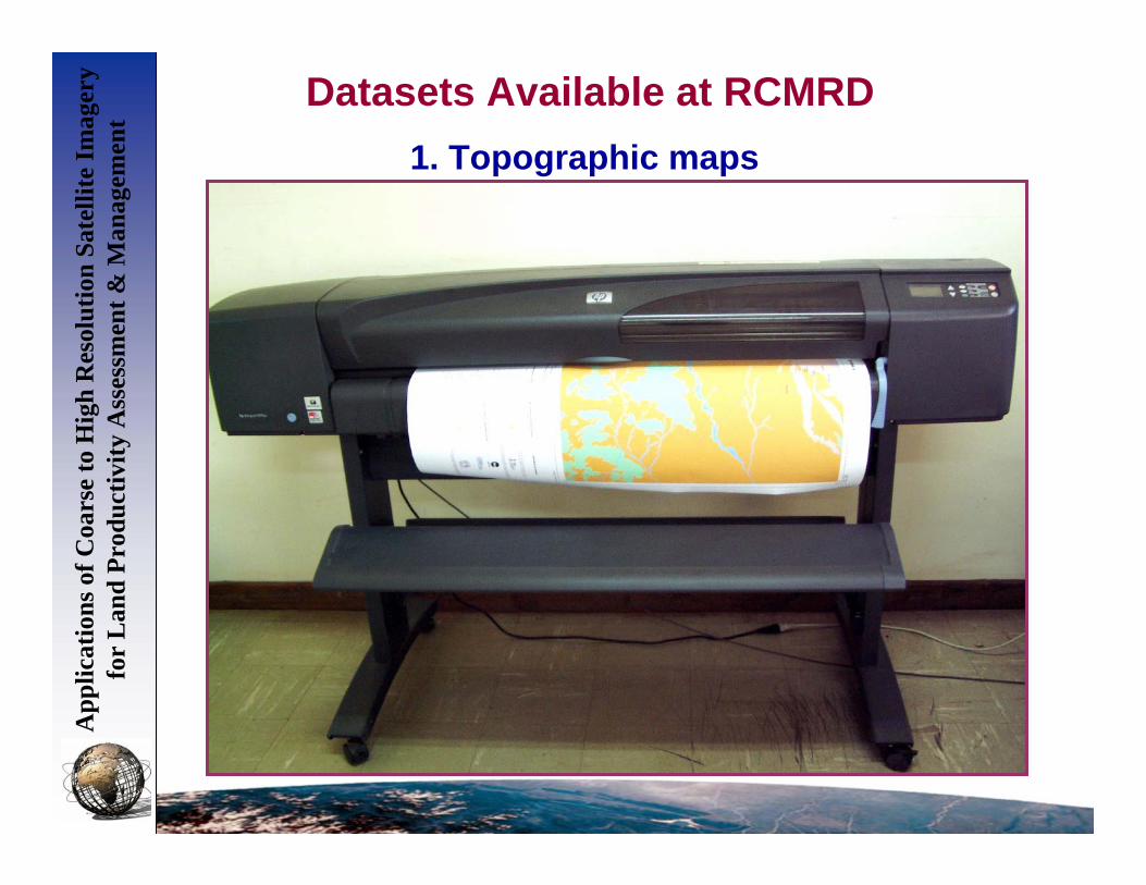
1. Topographic maps

App
licat
ions
of C
oars
e to
Hig
h R
esol
utio
n Sa
telli
te Im
ager
y fo
r L
and
Prod
uctiv
ity A
sses
smen
t & M
anag
emen
tDatasets Available at RCMRD (Cont….)
2. Thematic mapsLANDCOVER CREATION STATUS
LANDC OVER C REATI ON ST AT USRain fed h erb ac eo us c ro pSc att er ed (in na tu ra l veg et atio n o r oth er ) Rain fed h erb ac eo us c ro p ( fie ld d en sity 20- 40 % of po lyg on ar ea )Isola te d ( in nat ur al v ege ta tion or o the r) Ra infe d he rba ce ou s cr op (f ield de nsit y 1 0- 20% poly go n a re a)Irr iga ted h erb ac eo us c ro pRain fed sh ru b c ro pSc att er ed (in na tu ra l veg et atio n o r oth er ) Rain fed sh ru b c ro p ( fie ld d en sity 20- 40 % of po lygo n ar ea)Fo re st p lan tat ion - und iff ere nt iate dRain fed tr ee cr opSc att er ed (in na tu ra l veg et atio n o r oth er ) Rain fed tr ee cr op (f ield de nsit y 2 0-4 0% of poly gon a re a)Rice field sMu ltilaye re d tre es (b ro ad leav ed ev erg re en )Close d tre esOpe n tre es (6 5- 40 % cro wn cov er )Ve ry op en tr ee s ( 40- 15 % cr own co ver )Close d to ope n woo dy v eg eta tion ( thic ket )Close d shr ub sOpe n shr ub s ( 45 -4 0% cr ow n co ve r)Ope n low s hr ub s ( 65- 40 % cr own co ver )Close d tre es on te mp or ar ily flo od ed lan dMa ng rov e ( T re es)Ope n to close d he rba ce ou s ve ge tat ionSh ru b sav ann ahTr ee s a nd shr ub s s ava nn ahSp ar se sh rub sOpe n to close d he rba ce ou s ve ge tat ion on te mp or ar ily flo od edClose d her ba ce ous ve ge tat ion on pe rm an en tly f loo ded la ndNatu ra l wa ter bo die sBa re a re asUrb an an d a sso cia ted ar ea s, rur al set tlem en ts
LEGEND
N
Land use / land cover map
App
licat
ions
of C
oars
e to
Hig
h R
esol
utio
n Sa
telli
te Im
ager
y fo
r L
and
Prod
uctiv
ity A
sses
smen
t & M
anag
emen
tDatasets Available at RCMRD (Cont….)
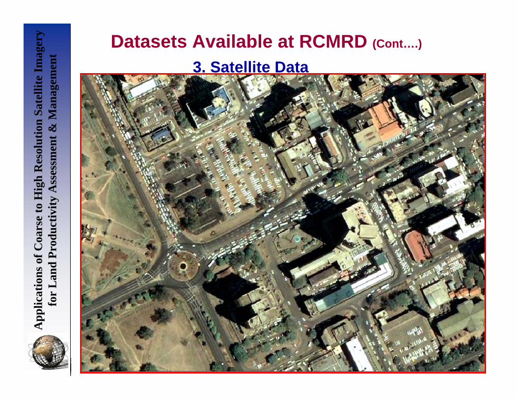
3. Satellite Data1973
1986
2001

Projects
App
licat
ions
of C
oars
e to
Hig
h R
esol
utio
n Sa
telli
te Im
ager
y fo
r L
and
Prod
uctiv
ity A
sses
smen
t & M
anag
emen
t
• Early Warning Systems (Short-term and Long Term EWS)
• Resource Mapping (natural resources, urban mapping etc)
• Digital Spatial Database Development(especially map automation – scanning and digitization)
• Sector based Solutions(e.g for Agro-based industries, Communication sector)

App
licat
ions
of C
oars
e to
Hig
h R
esol
utio
n Sa
telli
te Im
ager
y fo
r L
and
Prod
uctiv
ity A
sses
smen
t & M
anag
emen
t
1. Early Warning Systems
• For Drought monitoring & Food Security
• For Environmental Monitoring (e.g land cover change
• For Disaster Prediction (e.g floods)
• For Disease mapping and Prediction (e.g Rift Valley Fever, spread of HIV/AIDS)
Projects (Cont…)

Food & Agriculture
Organization
World Food Programme IGAD
Regional Centre for Mapping of
Resources for Development
FEWSNET LEWS
US Partners
International/ Regional Partners
App
licat
ions
of C
oars
e to
Hig
h R
esol
utio
n Sa
telli
te Im
ager
y fo
r L
and
Prod
uctiv
ity A
sses
smen
t & M
anag
emen
t
Continuous Early Warning Systems
Short-Term EWS

The case of Mt. Kilimanjaro
Environmental Monitoring and Prediction
Long-Term EWSA
pplic
atio
ns o
f Coa
rse
to H
igh
Res
olut
ion
Sate
llite
Imag
ery
for
Lan
d Pr
oduc
tivity
Ass
essm
ent &
Man
agem
ent

The glaciers of the Kilimanjaro have been shrinking due to regional climate changes… some 82% of the glaciers have disappeared between 1912 and 2000.
Reduced precipitation and higher temperature appear to be the underlying causes for the disappearance of the glaciers.
Long-Term EWSThe case of Mt. Kilimanjaro (Cont..)A
pplic
atio
ns o
f Coa
rse
to H
igh
Res
olut
ion
Sate
llite
Imag
ery
for
Lan
d Pr
oduc
tivity
Ass
essm
ent &
Man
agem
ent

Long-Term EWS
Drastic shift downwards of the upper forest line… from 3,700 to 3,100 meters also between 1976 and 2000.
130 km2 of Erica forest have been destroyed, in about 25 years.
The case of Mt. Kilimanjaro (Cont..)A
pplic
atio
ns o
f Coa
rse
to H
igh
Res
olut
ion
Sate
llite
Imag
ery
for
Lan
d Pr
oduc
tivity
Ass
essm
ent &
Man
agem
ent

Reduced precipitation and higher temperature have increased the vulnerability of the forest to fires.
Fires frequency and intensity in the Erica forest have increased significantly beyond the regenerating ability of the forest.
The case of Mt. Kilimanjaro (Cont..) Long-Term EWSA
pplic
atio
ns o
f Coa
rse
to H
igh
Res
olut
ion
Sate
llite
Imag
ery
for
Lan
d Pr
oduc
tivity
Ass
essm
ent &
Man
agem
ent

The case of Mau Forest, Kenya
Image of Study area: 1986 Image of Study area: 2000
Long-Term EWSA
pplic
atio
ns o
f Coa
rse
to H
igh
Res
olut
ion
Sate
llite
Imag
ery
for
Lan
d Pr
oduc
tivity
Ass
essm
ent &
Man
agem
ent

Extent of Mau Forest in 1986 Extent of Mau Forest in 2000
Area = 435,071.8 Ha (4,350.718 Km2) Area = 352,603.5 Ha (3,516.035 Km2)
Total area of deforested land = 82,468.3 Ha (824.683 Km2)
Average rate of deforestation = 5,890.6 Ha per year (58.906 Km2)
The case of Mau Forest (Cont..) Long-Term EWSA
pplic
atio
ns o
f Coa
rse
to H
igh
Res
olut
ion
Sate
llite
Imag
ery
for
Lan
d Pr
oduc
tivity
Ass
essm
ent &
Man
agem
ent

Map: Changes at Divisional Level
The case of Mau Forest (Cont..)
Km2
Cover Type
Graph: Land cover areas as at 2000
No change in forest cover
Deforested areas
Afforested areas
LEGEND
Long-Term EWS

The case of Mau Forest (Cont..) Long-Term EWS
Landslide Risk Map of Olokurto Division
Division’s Statistics
• Area under forest = 57,358 Ha
• Deforested area = 9,332 Ha
• Afforested area = 5,374 Ha
There were reported cases
of landslides in this area
In 2004

November 1984
The Case of Land use / land cover changes in South Kordofan Region, Sudan
November 2000

927511643Seasonal River
424327Perenial River
4154738131Open Shrubland
1818225Closed Shrubland
191129802Open Grassland
939020455Closed Grassland
16713058S. Scale RainfedAgriculture
2187620415L. Scale RainfedAgriculture
26403044Open Forest
21170Closed Forest
Area in Sq. Km for Nov 2000
Area in Sq. Km for Nov 1984Class
The case of Land use / land cover changes in South Kordofan Region, Sudan (Cont…)
App
licat
ions
of C
oars
e to
Hig
h R
esol
utio
n Sa
telli
te Im
ager
y fo
r L
and
Prod
uctiv
ity A
sses
smen
t & M
anag
emen
t

Disaster PredictionThe Case of Predicting Flooding: Nzoia River Basin(Done in collaboration with USGS to validatethe USGS hydrological model)

App
licat
ions
of C
oars
e to
Hig
h R
esol
utio
n Sa
telli
te Im
ager
y fo
r L
and
Prod
uctiv
ity A
sses
smen
t & M
anag
emen
t Predicting Disease OutbreaksThe Case Rift Valley Fever in GHA
App
licat
ions
of C
oars
e to
Hig
h R
esol
utio
n Sa
telli
te Im
ager
y fo
r L
and
Prod
uctiv
ity A
sses
smen
t & M
anag
emen
t

App
licat
ions
of C
oars
e to
Hig
h R
esol
utio
n Sa
telli
te Im
ager
y fo
r L
and
Prod
uctiv
ity A
sses
smen
t & M
anag
emen
t
2. Resource MappingProjects (Cont…)
App
licat
ions
of C
oars
e to
Hig
h R
esol
utio
n Sa
telli
te Im
ager
y fo
r L
and
Prod
uctiv
ity A
sses
smen
t & M
anag
emen
t
Mapping Gums & Resins in The GHA Region

Eastern AfricaRegional Gums& Resins Map
App
licat
ions
of C
oars
e to
Hig
h R
esol
utio
n Sa
telli
te Im
ager
y fo
r L
and
Prod
uctiv
ity A
sses
smen
t & M
anag
emen
t

App
licat
ions
of C
oars
e to
Hig
h R
esol
utio
n Sa
telli
te Im
ager
y fo
r L
and
Prod
uctiv
ity A
sses
smen
t & M
anag
emen
tA
pplic
atio
ns o
f Coa
rse
to H
igh
Res
olut
ion
Sate
llite
Imag
ery
for
Lan
d Pr
oduc
tivity
Ass
essm
ent &
Man
agem
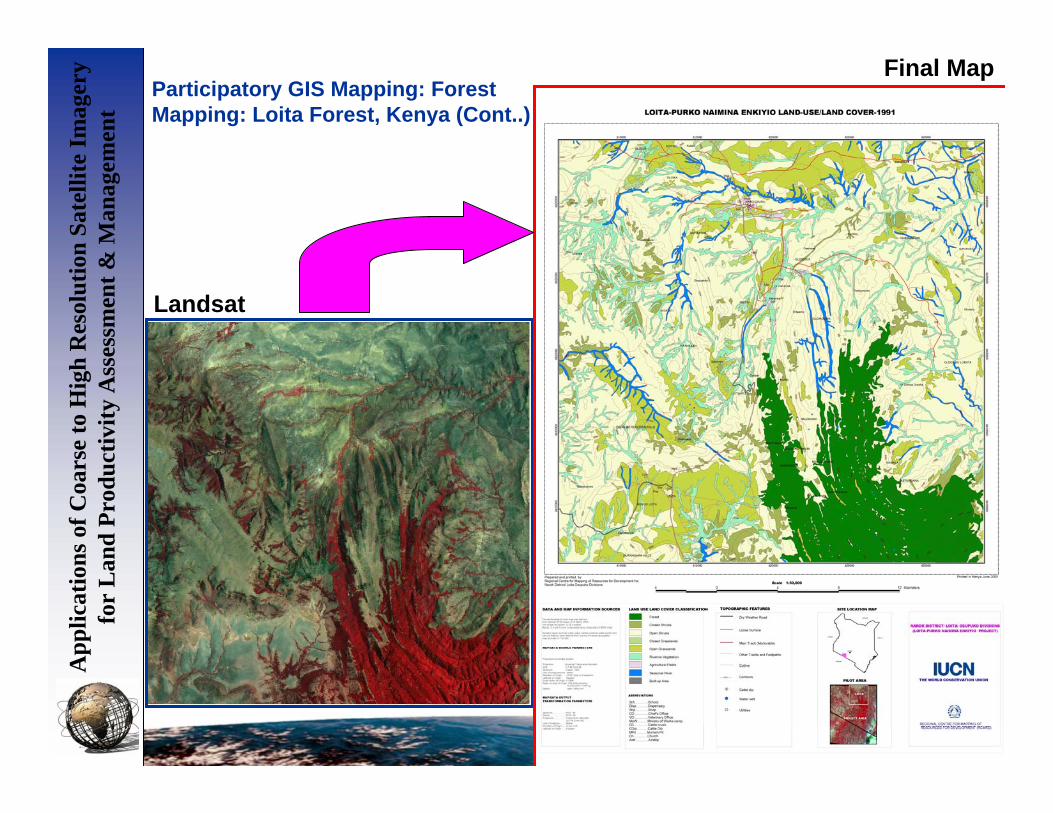
ent Participatory GIS Mapping:
Forest Mapping: Loita Forest, KenyaResource Mapping (Cont..)
App
licat
ions
of C
oars
e to
Hig
h R
esol
utio
n Sa
telli
te Im
ager
y fo
r L
and
Prod
uctiv
ity A
sses
smen
t & M
anag
emen
tA
pplic
atio
ns o
f Coa
rse
to H
igh
Res
olut
ion
Sate
llite
Imag
ery
for
Lan
d Pr
oduc
tivity
Ass
essm
ent &
Man
agem
ent
Participatory GIS Mapping: Forest Mapping: Loita Forest, Kenya (Cont..)
Landsat
Final Map

App
licat
ions
of C
oars
e to
Hig
h R
esol
utio
n Sa
telli
te Im
ager
y fo
r L
and
Prod
uctiv
ity A
sses
smen
t & M
anag
emen
tA
pplic
atio
ns o
f Coa
rse
to H
igh
Res
olut
ion
Sate
llite
Imag
ery
for
Lan
d Pr
oduc
tivity
Ass
essm
ent &
Man
agem
ent
Urban MappingThe case of South Sudan
Resource Mapping (Cont..)

App
licat
ions
of C
oars
e to
Hig
h R
esol
utio
n Sa
telli
te Im
ager
y fo
r L
and
Prod
uctiv
ity A
sses
smen
t & M
anag
emen
tA
pplic
atio
ns o
f Coa
rse
to H
igh
Res
olut
ion
Sate
llite
Imag
ery
for
Lan
d Pr
oduc
tivity
Ass
essm
ent &
Man
agem
ent QuickBird image of Juba City, South Sudan, September 2005

App
licat
ions
of C
oars
e to
Hig
h R
esol
utio
n Sa
telli
te Im
ager
y fo
r L
and
Prod
uctiv
ity A
sses
smen
t & M
anag
emen
tA
pplic
atio
ns o
f Coa
rse
to H
igh
Res
olut
ion
Sate
llite
Imag
ery
for
Lan
d Pr
oduc
tivity
Ass
essm
ent &
Man
agem
ent
Mapped buildings, roads, rivers, land use

App
licat
ions
of C
oars
e to
Hig
h R
esol
utio
n Sa
telli
te Im
ager
y fo
r L
and
Prod
uctiv
ity A
sses
smen
t & M
anag
emen
tA
pplic
atio
ns o
f Coa
rse
to H
igh
Res
olut
ion
Sate
llite
Imag
ery
for
Lan
d Pr
oduc
tivity
Ass
essm
ent &
Man
agem
ent
3. Digital Spatial Database Development
Projects (Cont…)

App
licat
ions
of C
oars
e to
Hig
h R
esol
utio
n Sa
telli
te Im
ager
y fo
r L
and
Prod
uctiv
ity A
sses
smen
t & M
anag
emen
tA
pplic
atio
ns o
f Coa
rse
to H
igh
Res
olut
ion
Sate
llite
Imag
ery
for
Lan
d Pr
oduc
tivity
Ass
essm
ent &
Man
agem
ent
4. Sector Based Solutions (Case of Agro-Industries)
Projects (Cont…)

App
licat
ions
of C
oars
e to
Hig
h R
esol
utio
n Sa
telli
te Im
ager
y fo
r L
and
Prod
uctiv
ity A
sses
smen
t & M
anag
emen
tA
pplic
atio
ns o
f Coa
rse
to H
igh
Res
olut
ion
Sate
llite
Imag
ery
for
Lan
d Pr
oduc
tivity
Ass
essm
ent &
Man
agem
ent
Developing thematic GIS layers and solutions

App
licat
ions
of C
oars
e to
Hig
h R
esol
utio
n Sa
telli
te Im
ager
y fo
r L
and
Prod
uctiv
ity A
sses
smen
t & M
anag
emen
t
Research and Development
• Early Warning Systems
• Environmental Change Detection and Prediction
• Mapping techniques
• Software & hardware

App
licat
ions
of C
oars
e to
Hig
h R
esol
utio
n Sa
telli
te Im
ager
y fo
r L
and
Prod
uctiv
ity A
sses
smen
t & M
anag
emen
t
Live Demoon
Role of GIS in National Spatial Data Infrastructure Development
(NSDI)

App
licat
ions
of C
oars
e to
Hig
h R
esol
utio
n Sa
telli
te Im
ager
y fo
r L
and
Prod
uctiv
ity A
sses
smen
t & M
anag
emen
t
Contacts
Erick KhamalaRemote Sensing Officer
Regional Centre for Mapping of Resources for Development (RCMRD)
P.O Box 632 – 00618, Ruaraka, Nairobi, KenyaTel: 254-20-8561448 (DL) 8560227, 8561775
Fax: 254-20-8561673, 8563767Email: [email protected], [email protected]
Web: www.rcmrd.org

App
licat
ions
of C
oars
e to
Hig
h R
esol
utio
n Sa
telli
te Im
ager
y fo
r L
and
Prod
uctiv
ity A
sses
smen
t & M
anag
emen
t
Thank YouFor your attention


