Hornby and Wray - Lancashire · PDF fileHornby and Wray Here are two lovely ... octagonal...
2
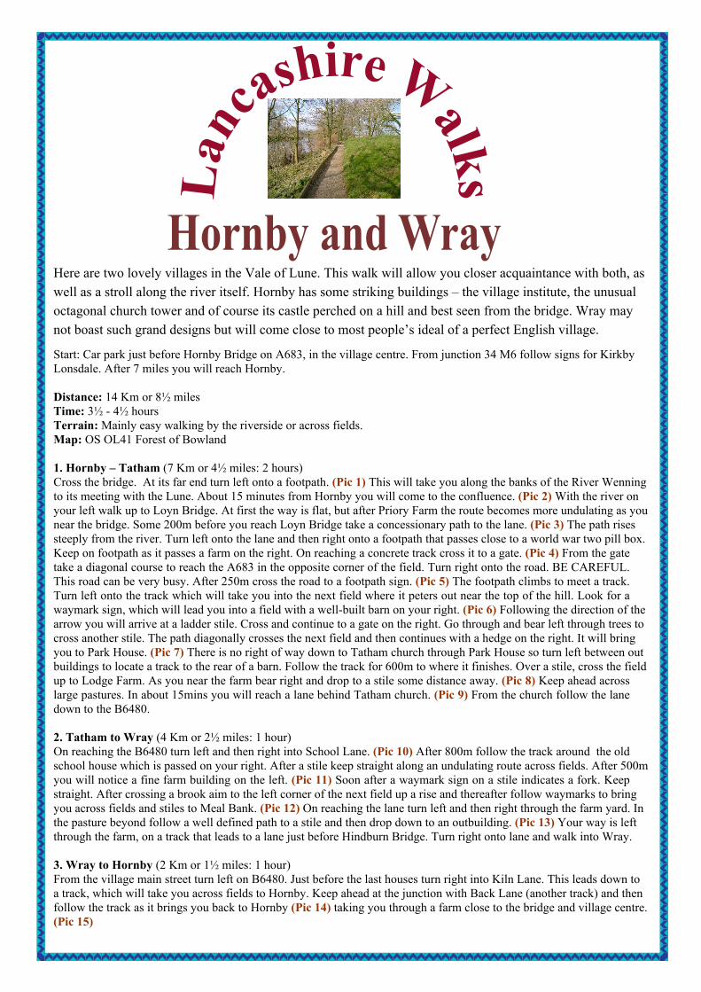
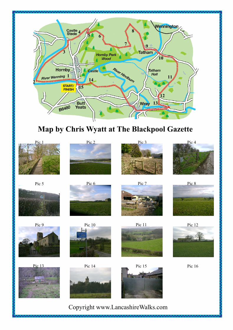
L a n c a s h i r e W a l k s Hornby and Wray Here are two lovely villages in the Vale of Lune. This walk will allow you closer acquaintance with both, as well as a stroll along the river itself. Hornby has some striking buildings – the village institute, the unusual octagonal church tower and of course its castle perched on a hill and best seen from the bridge. Wray may not boast such grand designs but will come close to most people’s ideal of a perfect English village. Start: Car park just before Hornby Bridge on A683, in the village centre. From junction 34 M6 follow signs for Kirkby Lonsdale. After 7 miles you will reach Hornby. Distance: 14 Km or 8½ miles Time: 3½ - 4½ hours Terrain: Mainly easy walking by the riverside or across fields. Map: OS OL41 Forest of Bowland 1. Hornby – Tatham (7 Km or 4½ miles: 2 hours) Cross the bridge. At its far end turn left onto a footpath. (Pic 1) This will take you along the banks of the River Wenning to its meeting with the Lune. About 15 minutes from Hornby you will come to the confluence. (Pic 2) With the river on your left walk up to Loyn Bridge. At first the way is flat, but after Priory Farm the route becomes more undulating as you near the bridge. Some 200m before you reach Loyn Bridge take a concessionary path to the lane. (Pic 3) The path rises steeply from the river. Turn left onto the lane and then right onto a footpath that passes close to a world war two pill box. Keep on footpath as it passes a farm on the right. On reaching a concrete track cross it to a gate. (Pic 4) From the gate take a diagonal course to reach the A683 in the opposite corner of the field. Turn right onto the road. BE CAREFUL. This road can be very busy. After 250m cross the road to a footpath sign. (Pic 5) The footpath climbs to meet a track. Turn left onto the track which will take you into the next field where it peters out near the top of the hill. Look for a waymark sign, which will lead you into a field with a well-built barn on your right. (Pic 6) Following the direction of the arrow you will arrive at a ladder stile. Cross and continue to a gate on the right. Go through and bear left through trees to cross another stile. The path diagonally crosses the next field and then continues with a hedge on the right. It will bring you to Park House. (Pic 7) There is no right of way down to Tatham church through Park House so turn left between out buildings to locate a track to the rear of a barn. Follow the track for 600m to where it finishes. Over a stile, cross the field up to Lodge Farm. As you near the farm bear right and drop to a stile some distance away. (Pic 8) Keep ahead across large pastures. In about 15mins you will reach a lane behind Tatham church. (Pic 9) From the church follow the lane down to the B6480. 2. Tatham to Wray (4 Km or 2½ miles: 1 hour) On reaching the B6480 turn left and then right into School Lane. (Pic 10) After 800m follow the track around the old school house which is passed on your right. After a stile keep straight along an undulating route across fields. After 500m you will notice a fine farm building on the left. (Pic 11) Soon after a waymark sign on a stile indicates a fork. Keep straight. After crossing a brook aim to the left corner of the next field up a rise and thereafter follow waymarks to bring you across fields and stiles to Meal Bank. (Pic 12) On reaching the lane turn left and then right through the farm yard. In the pasture beyond follow a well defined path to a stile and then drop down to an outbuilding. (Pic 13) Your way is left through the farm, on a track that leads to a lane just before Hindburn Bridge. Turn right onto lane and walk into Wray. 3. Wray to Hornby (2 Km or 1½ miles: 1 hour) From the village main street turn left on B6480. Just before the last houses turn right into Kiln Lane. This leads down to a track, which will take you across fields to Hornby. Keep ahead at the junction with Back Lane (another track) and then follow the track as it brings you back to Hornby (Pic 14) taking you through a farm close to the bridge and village centre. (Pic 15)
Transcript of Hornby and Wray - Lancashire · PDF fileHornby and Wray Here are two lovely ... octagonal...
Lan
cashire WalksHornby and Wray
Here are two lovely villages in the Vale of Lune. This walk will allow you closer acquaintance with both, aswell as a stroll along the river itself. Hornby has some striking buildings – the village institute, the unusualoctagonal church tower and of course its castle perched on a hill and best seen from the bridge. Wray maynot boast such grand designs but will come close to most people’s ideal of a perfect English village.
Start: Car park just before Hornby Bridge on A683, in the village centre. From junction 34 M6 follow signs for KirkbyLonsdale. After 7 miles you will reach Hornby.
Distance: 14 Km or 8½ milesTime: 3½ - 4½ hoursTerrain: Mainly easy walking by the riverside or across fields.Map: OS OL41 Forest of Bowland
1. Hornby – Tatham (7 Km or 4½ miles: 2 hours)Cross the bridge. At its far end turn left onto a footpath. (Pic 1) This will take you along the banks of the River Wenningto its meeting with the Lune. About 15 minutes from Hornby you will come to the confluence. (Pic 2) With the river onyour left walk up to Loyn Bridge. At first the way is flat, but after Priory Farm the route becomes more undulating as younear the bridge. Some 200m before you reach Loyn Bridge take a concessionary path to the lane. (Pic 3) The path risessteeply from the river. Turn left onto the lane and then right onto a footpath that passes close to a world war two pill box.Keep on footpath as it passes a farm on the right. On reaching a concrete track cross it to a gate. (Pic 4) From the gatetake a diagonal course to reach the A683 in the opposite corner of the field. Turn right onto the road. BE CAREFUL.This road can be very busy. After 250m cross the road to a footpath sign. (Pic 5) The footpath climbs to meet a track.Turn left onto the track which will take you into the next field where it peters out near the top of the hill. Look for awaymark sign, which will lead you into a field with a well-built barn on your right. (Pic 6) Following the direction of thearrow you will arrive at a ladder stile. Cross and continue to a gate on the right. Go through and bear left through trees tocross another stile. The path diagonally crosses the next field and then continues with a hedge on the right. It will bringyou to Park House. (Pic 7) There is no right of way down to Tatham church through Park House so turn left between outbuildings to locate a track to the rear of a barn. Follow the track for 600m to where it finishes. Over a stile, cross the fieldup to Lodge Farm. As you near the farm bear right and drop to a stile some distance away. (Pic 8) Keep ahead acrosslarge pastures. In about 15mins you will reach a lane behind Tatham church. (Pic 9) From the church follow the lanedown to the B6480.
2. Tatham to Wray (4 Km or 2½ miles: 1 hour)On reaching the B6480 turn left and then right into School Lane. (Pic 10) After 800m follow the track around the oldschool house which is passed on your right. After a stile keep straight along an undulating route across fields. After 500myou will notice a fine farm building on the left. (Pic 11) Soon after a waymark sign on a stile indicates a fork. Keepstraight. After crossing a brook aim to the left corner of the next field up a rise and thereafter follow waymarks to bringyou across fields and stiles to Meal Bank. (Pic 12) On reaching the lane turn left and then right through the farm yard. Inthe pasture beyond follow a well defined path to a stile and then drop down to an outbuilding. (Pic 13) Your way is leftthrough the farm, on a track that leads to a lane just before Hindburn Bridge. Turn right onto lane and walk into Wray.
3. Wray to Hornby (2 Km or 1½ miles: 1 hour)From the village main street turn left on B6480. Just before the last houses turn right into Kiln Lane. This leads down toa track, which will take you across fields to Hornby. Keep ahead at the junction with Back Lane (another track) and thenfollow the track as it brings you back to Hornby (Pic 14) taking you through a farm close to the bridge and village centre.(Pic 15)
Pic 1 Pic 2 Pic 3 Pic 4
Pic 5 Pic 6 Pic 7 Pic 8
Pic 9 Pic 10 Pic 11 Pic 12
Pic 13 Pic 14 Pic 15 Pic 16
Copyright www.LancashireWalks.com
Map by Chris Wyatt at The Blackpool Gazette
12
3
45 6
7
8
9
10
11
1213
1415