Earth’s Tides Objectives: Define tides What causes tides How often tides occur Types of tides.

Guideline: State Development Assessment Provisions
State Code 8: Coastal development and tidal works
EPP/2018/4294
Version 2.00
Page 2 of 32 • EPP/2018/4294 • Version 2.00 • Effective 01/03/2019
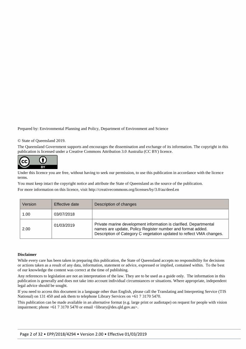
Prepared by: Environmental Planning and Policy, Department of Environment and Science
© State of Queensland 2019.
The Queensland Government supports and encourages the dissemination and exchange of its information. The copyright in this
publication is licensed under a Creative Commons Attribution 3.0 Australia (CC BY) licence.
Under this licence you are free, without having to seek our permission, to use this publication in accordance with the licence
terms.
You must keep intact the copyright notice and attribute the State of Queensland as the source of the publication.
For more information on this licence, visit http://creativecommons.org/licenses/by/3.0/au/deed.en
Version Effective date Description of changes
1.00 03/07/2018
2.00 01/03/2019
Private marine development information is clarified. Departmental names are update, Policy Register number and format added. Description of Category C vegetation updated to reflect VMA changes.
Disclaimer
While every care has been taken in preparing this publication, the State of Queensland accepts no responsibility for decisions
or actions taken as a result of any data, information, statement or advice, expressed or implied, contained within. To the best
of our knowledge the content was correct at the time of publishing.
Any references to legislation are not an interpretation of the law. They are to be used as a guide only. The information in this
publication is generally and does not take into account individual circumstances or situations. Where appropriate, independent
legal advice should be sought.
If you need to access this document in a language other than English, please call the Translating and Interpreting Service (TIS
National) on 131 450 and ask them to telephone Library Services on +61 7 3170 5470.
This publication can be made available in an alternative format (e.g. large print or audiotape) on request for people with vision
impairment; phone +61 7 3170 5470 or email <[email protected]>.
Guideline: State Development Assessment Provisions State Code 8: Coastal development and tidal works
Page 3 of 32 • EPP/2018/4294 • Version 2.00 • Effective 01/03/2019
Contents 1.0 Overview ................................................................................................................................................................. 4
Purpose ..................................................................................................................................................................... 4
Structure of this guideline .......................................................................................................................................... 4
2.0 Background information .......................................................................................................................................... 4
3.0 Responding to the assessment criteria .................................................................................................................. 8
Table 8.2.1: All development..................................................................................................................................... 8
Development in the erosion prone area ................................................................................................................ 8
Artificial waterways .............................................................................................................................................. 11
Coastal protection work ....................................................................................................................................... 12
Water quality ........................................................................................................................................................ 15
Category C and R areas of vegetation ................................................................................................................ 16
Public use of and access to state coastal land ................................................................................................... 16
Matters of state environmental significance ........................................................................................................ 19
Table 8.2.2: All operational work ............................................................................................................................. 21
Private marine development ................................................................................................................................ 21
Disposal of solid waste or dredged material from artificial waterways ................................................................ 21
Disposal of dredged material other than from artificial waterways ...................................................................... 22
All dredging and any disposal of dredged material in tidal water ........................................................................ 23
Reclamation ......................................................................................................................................................... 24
Table 8.2.3 Operational work which is not assessed by local government ............................................................ 24
4.0 Supporting documents .......................................................................................................................................... 26
Description of the Land and Proposed Development ............................................................................................. 26
Coastal Hazard Assessment Report ....................................................................................................................... 26
Artificial Waterways ................................................................................................................................................. 26
Engineering Report: ............................................................................................................................................. 26
Water Quality Monitoring Plan ................................................................................................................................ 27
5.0 Glossary of terms .................................................................................................................................................. 28

Guideline: State Development Assessment Provisions State Code 8: Coastal development and tidal works
Page 4 of 32 • EPP/2018/4294 • Version 2.00 • Effective 01/03/2019
1.0 Overview
Purpose
This guideline provides guidance to address State Code 8: Coastal development and tidal works code (the code) in the State Development Assessment Provisions. (https://planning.dsdmip.qld.gov.au/planning/better-development/the-development-assessment-process/the-states-role/state-development-assessment-provisions).
This document is not a statutory document. This guideline is advice only and applies to coastal development and tidal works assessable under the Planning Regulation 2017. Applicants must refer and respond to the code.
Structure of this guideline
Section 2 provides background information and key concepts relevant for coastal processes and resources and coastal protection and management applicable to complying with the code.
Section 3 provides the context for and information on how to respond to particular performance outcomes (PO) and specific information requirements. It should be noted that for this section if the PO has no relevance to the proposed development a response of “Not Applicable” and a statement as to why it is not relevant is required.
Section 4 provides information regarding the content of supporting documents that may be required to assess a development application against the code.
Section 5 provides a glossary of terms used in this guideline.
2.0 Background information The following concepts are important in understanding the requirement of the code and relate to the State’s interests in protecting the coastal environment and protecting people and property from coastal hazards.
Coastal management district
The coastal management district (CMD) is declared under the Coastal Protection and Management Act 1995 (Coastal Act) as coastal areas that require protection or management, especially with respect to the area’s vulnerability to erosion, value in maintaining or enhancing coastal resources, or for planning and development of the area. Generally lots projected to be permanently inundated by water or exposed to greater coastal erosion from sea level rise are included.
The coastal management district defines an area where the State assesses certain developments listed under the Planning Regulation 2017.
Coastal resources
Coastal resources consist of the natural and cultural resources of the coastal zone and include physical features, processes, places or objects that have ecological, economic or social value. Coastal resources of Queensland include:
beaches and dune systems;
coastal processes especially the movement of sand along the coast and the natural fluctuations of the coast;
rocky foreshores and headlands;
habitat, plant and animal diversity;
coastal waterways, wetlands and heathlands;
coral reefs;
cultural resources and sites; and
quarry material such as sand or gravel.
Coastal resources have significant natural resource and ecosystem service values that support the State’s economic and social prosperity (e.g. scenic amenity, recreation and tourism, cultural and social significance, food production, medicines and construction material). Expansion of urban and industrial development can create significant pressures on these resources.
Coastal processes
Coastal processes are the natural processes occurring on the coast and in tidal water including:
wind, waves, tides and currents which transfer energy to the coast and drive other processes;

Guideline: State Development Assessment Provisions State Code 8: Coastal development and tidal works
Page 5 of 32 • EPP/2018/4294 • Version 2.00 • Effective 01/03/2019
sediment transport to and along the coast;
sediment accumulation or erosion onshore and offshore which builds or destroys landforms including foreshores, beaches, dunes, delta plains;
the growth and spread of plants and succession of plant communities, especially where plants have a specific role in trapping sediment and building landforms (mangrove and dune colonizing grasses) and stabilizing sediments against erosion;
water and nutrient movement, accumulation or loss which affects ecological or other processes including the growth and spread of plants and nutrient filtering; and
changes in sea-level both temporary and permanent from weather events and climate change.
Coastal compartment
A coastal compartment is a section of the coast that is relatively uniform with respect to the landform type, sediment type and coastal processes including sediment transport and exposure to wave and wind conditions. Typically coastal compartments extend from a sediment source to a point where the sediment flow from the source is changed (e.g. a river mouth or headland) or along an uninterrupted coast, where changes in wind and wave exposure identifiably change the landform (beach ridges to shore parallel dunes to parabolic dunes).
Coastal compartments may be identified at the primary level (large section of coastline influenced major landforms and processes) secondary level (series of beaches between two significant coastal landforms) or tertiary level (a single beach).
Active beach system
An active beach system is the area where sand can move across and along the shore over a long time period under the influence of waves, tides and wind. It includes frontal dune systems, the beach and offshore sand deposits which periodically move onshore and offshore. An active beach system can include terminal sand deposits where sand is accumulating in the present day but is moved on only under rare circumstances (river flood tide deposits, large sand spits).
Sediment transport processes
Sediment transport is an important complex of coastal processes where sediments are moved down rivers to the coast and then along the coast by flood flows, wave action and tidal currents. In the long-term this process has built the extensive coastal plains (river deltas, beach ridges and dune-fields) where many settlements are located today. In the shorter term, sediments are transferred onshore and offshore in cyclical fluctuations associated with variations in waves and water levels during storms. This is observed as beach and dune erosion and dune rebuilding after storms.
The disruption of sediment transport processes such as halting sand flows due to constructing works or extracting material risks triggering erosion and loss in adjacent areas. The consequence of this can be:
the loss of beaches for recreation;
loss of dunes which protect communities from coastal hazards;
direct erosion threats to development requiring costly protection or remediation works;
economic loss through its effect on tourism; and
degradation of coastal amenity which affects community enjoyment of the coast.
Accretion is the natural build-up of coastal landforms with sediment supplied by wave, tidal flow or wind processes, usually assisted by vegetation trapping the sediment. A typical example of accretion is dune build-up with sand blown up from the beach and sand spit growth.
Performance outcomes in the code are intended to ensure coastal processes are maintained to preserve beaches, which are highly valued recreational and aesthetic assets, and prevent new erosion threats which can be caused by removing sediment, or disrupting its transport along the coast and impact on existing development.
Natural coastal landforms, physical coastal processes and natural ecosystems and habitats are interdependent and provide essential ecosystem services. Coastal vegetation (e.g. dunes, freshwater estuarine and marine wetlands) stabilises sediment and processes nutrients which promotes healthy groundwater and surface water processes and water quality. Dunes have highly permeable soils functioning as aquifers, by holding groundwater in the intergranular voids between sand grains. Dunes regulate the hydrology of freshwater wetlands and perform an important role in water quality polishing and groundwater movement along the shoreline between freshwater wetlands, land and sea.
Coastal landforms
Coastal landforms are those areas built from sediments supplied to the coast and exposed to or shaped by coastal processes. The landforms built by coastal processes reflect the type of sediment supplied to the coast and the

Guideline: State Development Assessment Provisions State Code 8: Coastal development and tidal works
Page 6 of 32 • EPP/2018/4294 • Version 2.00 • Effective 01/03/2019
wave and wind energy conditions at the locality. Coastal landforms include beaches, dunes, beach-ridges, river deltas, mangrove plains, headlands and land adjacent to tidal waterways and estuaries. Coastal landforms are often temporary as they are a store of sediment that may at some point in the future be eroded away and redeposited at another location.
Where long-term supply of sediment to the coast exceeds the capacity of waves and tides to move it away, landforms gradually build over time and the sediments are permanently isolated from modern day coastal processes. This can be clearly seen in the extensive dune fields and beach ridge plains and river delta plains on the Queensland coast. Most of these landforms are isolated from present day coastal processes but those parts near the coast and part of the active coastal processes system are mapped as the erosion prone area.
The role of vegetation
The role of coastal vegetation must be considered as an important ecological element in building and maintaining sediment-based coastal landforms. Dunes are built due to the ability of plants to continuously trap and bind windblown sand. Similarly, mangroves trap waterborne sediment and build extensive coastal plains. Therefore retention of native coastal vegetation is important for the recovery and rebuilding of dunes and other coastal landforms after erosion events and in preventing dune degradation from wind erosion.
Coastal vegetation and dune systems are significant environmental infrastructure as they provide the first line of storm protection and buffering, water filtering and habitat to support biodiversity.
Coastal erosion
Coastal erosion is a part of the natural fluctuations of the coast but it can become a permanent feature when triggered by development. Typical causes of permanent erosion include where:
longshore transport out of a beach compartment is greater than the incoming longshore transport due to interruption of the sediment flow by works which block the sand flow (groynes, waterway entrance training);
sand is removed from the active beach system by dredging, or ‘locked up’ behind seawall or other development;
there is a landward loss of sediment by windborne transport where dune vegetation is damaged or removed; and
the flow of water in a waterway is changed (increased volume or velocity) and the channels respond to the new conditions by channel widening (erosion).
Coastal erosion can have serious consequences for development and the community. The worst case is the complete loss of the development and the economic value it provides (such as tourism). What also must be considered is the consequences of protecting the development, with regards to both the direct cost of the works and the impact on the natural system such as the loss of the beach and its aesthetic, recreational and economic values.
Areas at highest risk from coastal erosion have been defined and declared as erosion prone areas under the Coastal Protection and Management Act 1995. Erosion prone areas are areas that are vulnerable to erosion or permanent inundation from tidal waters within a 100 year planning period.
Ideally areas within erosion prone areas should be retained in their natural state where they can act as a buffer between land uses and the coast to allow the natural fluctuations of the coast to occur, without the need for intervention to protect human life and property. In the past, development has occurred within areas vulnerable to erosion and in many cases this development amounts to substantial private and public investment. Protection works for the built environment in these areas can result in adverse impacts to coastal resources and their values. Such protection works need to be managed to minimise their impacts.
In areas under constant threat of erosion, a strategy of retreat from erosion prone areas is the preferred option. However, where an area has been developed to a scale and intensity that retreat is not achievable, property protection works may be needed to defend development and infrastructure from coastal processes. In such circumstances, any further building or infrastructure, including extensions to existing buildings or the location of services (including water, power and sewerage), should not extend any further seaward than the alignment of nearby buildings.
The erosion prone area is indicatively mapped by the State in the Development Assessment Mapping System (DAMS) which is located on the website of the Department of State Development, Manufacturing, Infrastructure and Planning (DSDMIP). The statutory erosion prone area is described by plans located at https://www.qld.gov.au/environment/coasts-waterways/plans/hazards/erosion-prone-areas Development applications that involved development near or in the erosion prone area may need to survey the statutory erosion prone area to determine its actual extent. See the Coastal hazard technical guide https://www.qld.gov.au/__data/assets/pdf_file/0025/67462/hazards-guideline.pdf for information on mapping erosion prone areas.

Guideline: State Development Assessment Provisions State Code 8: Coastal development and tidal works
Page 7 of 32 • EPP/2018/4294 • Version 2.00 • Effective 01/03/2019
Shoreline erosion management plans
The Department of Environment and Science’s (DES) preferred method for managing shoreline erosion, including estuaries and tidal reaches of rivers, is preparing and implementing a Shoreline Erosion Management Plan (SEMP). A SEMP is used to investigate the causes and expected future impacts of erosion; analyse management options; and recommend a solution, with consideration to social, economic and environmental issues. A SEMP can also include information about related policy requirements that may impact how erosion is managed, for example fish habitat area policies regulated under the Fisheries Act 1994. Further information about how to prepare a SEMP is available from the Queensland Government website at https://www.qld.gov.au/environment/coasts-waterways/plans/coastal-management/about-coastal-management.
SEMPs are commonly undertaken by local government either for council controlled land or on behalf of a community. But individuals or groups may also prepare a SEMP. SEMPs may form part of a broader strategic management or adaptation framework for a local government area or region which also considers land use, dune management, recreational opportunity and commercial activities.
Beach nourishment
Beach nourishment is the process of replacing sand on a beach lost through coastal erosion with new sand from outside the active beach system. Beach nourishment generally doesn’t change the underlying cause of coastal erosion and as such is usually planned as a management strategy involving multiple campaigns. Beach nourishment can also be used in conjunction with other coastal defence strategies, such as restoring and vegetating coastal dunes, or to help offset erosion brought about by the changes in sediment transport due to modification of the foreshore by the construction of seawalls or groynes.
Beach nourishment can be required where there is a sand supply deficit to the coast, meaning more sand is moved out of the coastal compartment from longshore transport than enters the coastal compartment. The sand deficit often only becomes obvious after severe weather events when beaches erode during a storm and do not rebuild due to an inadequate supply of sediment being transported into the area. In most situations importing sand to repair the beach profile and maintain the existing dune structure is preferred over installing erosion control structures so as to retain the values of the coastline, particular beaches.
Sand used for beach nourishment should generally be sourced from an inactive terminal deposit within the same coastal compartment as the intended nourishment location, or from outside of the active beach system (i.e. offshore or onshore sand deposits). If sand is simply moved from one location to another within the active beach system, the coastal process can quickly move the sand back to the source to restore equilibrium, therefore creating no enduring benefit.
The sand used should also be of a similar size and type to the receiving environment because different sand characteristics can lead to the sediment responding differently to wave action, resulting in a different rate of erosion or beach slope compared to the existing beach system.
The final slope of the nourished beach should be stable and generally match adjacent beach sections. Sand that is incorrectly placed in the beach zone (unstable slope or uneven placement along the foreshore) can result in rapid erosion of the imported sand, making the nourishment efforts ineffective or adversely impact adjacent coasts.
Tidal prism volume
The tidal prism volume is the volume of water between the high tide mark and the low tide mark within a waterway or estuary. The tidal prism volume is generally the amount of water entering or leaving the waterway or estuary during a tidal cycle at spring tide.
Works that change the tidal prism volume, such as artificial tidal lakes, dry land marinas or canals, can increase the risk or severity of erosion along the banks of the estuary, and also result in degraded water quality due to the system’s inability to adequately flush, resulting in pollutants from surface water runoff being maintained for longer periods within the system.

Guideline: State Development Assessment Provisions State Code 8: Coastal development and tidal works
Page 8 of 32 • EPP/2018/4294 • Version 2.00 • Effective 01/03/2019
3.0 Responding to the assessment criteria The following section provides contextual information and information requirements specific to each PO of the code. Table references, headings and POs (boxed text) align with those in the code.
Table 8.2.1: All development
Development in the erosion prone area
Context
Erosion prone areas are areas along the coast and tidal waterways identified by the State and considered at risk from coastal erosion or permanent inundation by the sea. Development is generally not supported within the erosion prone area in the coastal management district, to ensure that this area is retained in its natural state to allow coastal processes to naturally occur and to avoid increasing the risk to people and infrastructure. However certain development types must be located in an erosion prone area where they require access to tidal water or they are essential for community purposes.
Development considerations
Applications relevant to this PO should demonstrate:
For PO1(1) that the development is of a type listed in PO1(1)(a)-(d); and
For PO1(2):
1. why the development must be located within the erosion prone area; or
2. if it is not essential to be located in the erosion prone area why it cannot be located outside of the erosion prone area or on a more landward part of the lot.
For PO1(1)(d), redevelopment is intended to allow for minor extensions or replacing buildings that have been damaged or destroyed. Applications for redevelopment will have to demonstrate that it is to extend or replace permanent built structures of value. Examples of redevelopment under this PO include:
replacing a structure with a structure that is substantially the same; or
adding less than 50m2 of the existing building footprint to a structure; or
adding another storey to a single storey building. Applications that propose to substantially change the size, monetary value or intensity of use are not redevelopment for the purposes of this PO.
PO1 Development does not occur in the erosion prone area unless the development:
1) is one of the following types of development:
a) coastal-dependent development; or
b) temporary, readily relocatable or able to be abandoned; or
c) essential community infrastructure;
d) redevelopment of an existing permanent building or structure that cannot be relocated or
abandoned; and
2) cannot feasibly be located elsewhere.
Guideline: State Development Assessment Provisions State Code 8: Coastal development and tidal works
Page 9 of 32 • EPP/2018/4294 • Version 2.00 • Effective 01/03/2019
Context
The long-term stability of beaches, dunes and other coastal landforms depend on maintaining coastal processes including the movement of sediment along the coast and the cyclical storage and release of sediment in dunes, spits and other landforms. Vegetation plays a crucial role in trapping sediment and building landforms.
The disruption of sediment transport processes such as halting sand flows due to constructing works or dredging sand, risks triggering erosion at adjacent sites. This leads to loss of recreational beaches and coastal amenity, erosion threats to development requiring costly protection works, remediation works and economic loss through its effect on tourism.
Human-induced changes to dune systems and degradation of dune vegetation can reduce the protection provided to inland development from coastal hazards, cause wind erosion problems, and trigger erosion in adjacent areas.
One way to avoid impacting on coastal processes and maintain the protective function of landforms and vegetation is by returning the erosion prone area to the State and placing it in a tenure that preserves these values in perpetuity. The State will accept the surrender of freehold land back to the State and its dedication as a Reserve for beach protection and coastal management, where it considers this will benefit coastal management and the land can be appropriately managed.
The Coastal Protection and Management Act 1995 provides two ways to surrender land to the State as part of the development application for reconfiguring a lot:
the voluntary surrender of land (s115A); or
the State imposing a land surrender requirement on the lot proposed to be reconfigured during the development assessment process. This compels the land owner to surrender the land in an erosion prone area to the State (s110).
For more information on Land surrender under the Coastal Protection and Management Act 1995 refer to the Department of Environment and Science guideline: Land surrender for coastal management (https://environment.des.qld.gov.au/coastal/development/pdf/gl-cd-land-surrender.pdf).
Development considerations
Applications relevant to this PO should demonstrate that the proposed development:
For PO2(1):
1. has identified coastal processes operating at the site and indicated how these will be maintained (e.g. locating development as far landward as possible, and fencing sensitive dune areas); and
2. avoids intensifying the use of the premises by not expanding seaward of built structures in the erosion prone area within a coastal management district.
For PO2(2):
1. maintains native vegetation on coastal landforms where its removal or damage may: a. destabilise the area and increase the potential for erosion; or b. interrupt natural sediment trapping processes or dunes, beach or land building processes; or c. encourage weed invasion or the displacement of native coastal vegetation; or d. expose inland vegetation to the damaging effects of marine conditions including salt spray and wind
damage; and 2. maintains sediment volumes of dunes or near-shore coastal landforms. Where a reduction in sediment volumes
cannot be avoided, increased risks to development from coastal erosion are mitigated by location or design; and 3. does not reduce dune crest heights, for example by levelling; and 4. rehabilitates degraded areas and prevents new damage to vegetation by pedestrian control or similar works.
PO2 Development other than coastal protection work:
1. avoids impacting on coastal processes; and
2. ensures that the protective function of landforms and vegetation is maintained.
Note: In considering reconfiguring a lot applications, the state may require land in the erosion prone area to be surrendered to the State for coastal management purposes under the Coastal Protection and Management Act 1995.
Where the planning chief executive receives a copy of a land surrender requirement or proposed land surrender notice
under the Coastal Protection and Management Act 1995, this must be considered in assessing the application.
Guideline: State Development Assessment Provisions State Code 8: Coastal development and tidal works
Page 10 of 32 • EPP/2018/4294 • Version 2.00 • Effective 01/03/2019
Context
Erosion prone areas should be managed to provide and maintain an undeveloped buffer between permanent development and the foreshore to allow natural fluctuations of the coast to occur with minimal interruption or impact on development.
Inappropriately located and designed structures, facilities and activities within the erosion prone area can adversely impact on coastal processes and result in increased erosion, loss of amenity, on-going public costs and risks to personal and public safety and infrastructure both at the site and in adjacent areas.
Development considerations
Applications relevant to this PO should demonstrate that the proposed development, in order of priority: For PO3(1):
1. is located outside of the erosion prone area; or 2. is located as far landward as practicable; or 3. is located landward of the alignment of nearby permanent development; or 4. has an adequate setback on the parcel for the construction of coastal protection work in the future.
For PO3(2):
1. is designed to withstand the impacts of coastal erosion without requiring the installation of coastal protection works either now or in the future; or
2. includes erosion control works as close as practical to the development; or 3. is consistent with an endorsed Shoreline Erosion Management Plan for the area, or planning scheme provisions
for location and construction of erosion control works.
Context
Applications should ensure development avoids increasing the exposure of people and property to coastal erosion, or where this is to occur, the risk is assessed and the development includes measures to ensure the risk is removed or not increased.
An increase in the exposure of the community to the risk results from any of the following in an erosion prone area:
an increase to the number of premises or dwelling houses on the development site, or an increase in the number of habitable rooms on site; or
an increase to the number of persons working on site; or
an increase to the value of assets (monetary or market) on the development site other than redevelopment.
Development considerations
Applications relevant to this PO should demonstrate that the proposed development:
1. is located outside of the erosion prone area or where this is not possible the risk of erosion is mitigated through design, maintenance or the installation of coastal protection structures; or
2. does not result in an intensification of use in the erosion prone area (such as creating additional lots or a material change of use), or where the intensification is unavoidable, the threat of coastal hazards is mitigated through location, design of the building or through installing or maintaining on site erosion control structures.
PO3 Development is located, designed and constructed to minimise the impacts from coastal erosion by:
1. locating the development as far landward as practicable; or
2. where it is demonstrated that 1 is not feasible, mitigate or otherwise accommodate the risks posed
by coastal erosion.
PO4 Development does not significantly increase the risk or impacts to people and property from coastal erosion.
PO5 Development other than coastal protection work avoids directly or indirectly increasing the severity of coastal erosion either on or off the site.

Guideline: State Development Assessment Provisions State Code 8: Coastal development and tidal works
Page 11 of 32 • EPP/2018/4294 • Version 2.00 • Effective 01/03/2019
Context
Beach compartments and coastal/tidal landforms will remain stable in the long term (without net erosion or build-up) where the sediment volume in the active beach system is not reduced and there is a balance between the sediment entering and leaving the coastal compartment. However, where there is a disruption in the rates of longshore transport, usually by the blocking of the sediment supply to or from an area, or sediments that would normally be part of coastal processes are removed or isolated, coastal erosion can occur.
Actions on an individual parcel of land which disrupt coastal processes, such as river entrance training which blocks sand transport or development on dunes, which lock up sand that would naturally erode to rebuild beaches can affect adjacent properties in the locality.
Therefore development needs to consider adverse impacts in the whole coastal compartment to ensure development is designed and managed to prevent or minimise the severity of new erosion within the system.
Erosion can also be increased in tidal rivers and waterways by development that increase the tidal prism of the waterway (artificial tidal canals and lakes, dry land marinas) and therefore increases tidal flow volume and velocity. Waterways can respond to this by channel-widening which causes bank erosion on downstream properties.
Development considerations
Applications relevant to this PO should demonstrate for the proposed development:
1. how coastal processes in the locality will be affected by the development; and 2. the likely impacts on adjacent areas including accelerated erosion (localised scour, temporary coastal
realignment, long term chronic erosion); and 3. measures that will compensate for a reduced sand volume in an area (e.g. adding sand to the beach system), or
a disruption in sand transport along the coast (e.g. by using a system where sand bypasses the development) to ensure the system maintains its sediment balance; and
4. how the development maintains tidal prism volume for the waterway.
Context
Coastal building lines are declared in those areas that are already developed for urban purposes and are highly vulnerable to coastal erosion. The intent of the coastal building line is to:
provide a common alignment for building work;
set back development from the coastline which reduces the erosion risk to people and property;
provide space on the lot seaward of the development for construction of future erosion control structures wholly on the lot and not on State land.
Generally, no building work, including houses, sheds or swimming pools, would be permitted seaward of a coastal building line. Only works for the protection of existing buildings from sea erosion, such as seawalls, would be permitted seaward of a coastal building line.
Development considerations
Applications relevant to this PO should demonstrate that the proposed development is located landward of the coastal building line; or
1. justify why the proposed development cannot be located landward of the coastal building line; and 2. demonstrate how development seaward of the coastal building line is protected from coastal erosion both now
and in the future.
Artificial waterways
PO6 In areas where a coastal building line is present, building work is located landward of the coastal building line unless coastal protection work has been constructed to protect the development.
PO7 Development of artificial waterways, canals and dry-land marinas minimises impacts on coastal resources by:
1. maintaining the tidal prism volume of the natural waterway to which it is connected;
2. demonstrating a whole-of-life strategy for the disposal of dredged material.

Guideline: State Development Assessment Provisions State Code 8: Coastal development and tidal works
Page 12 of 32 • EPP/2018/4294 • Version 2.00 • Effective 01/03/2019
Context
The construction of canals, dry-land marinas and artificial waterways can have significant and permanent adverse environmental impacts which must be managed to protect coastal resources.
There are two key impacts:
1. Increasing tidal prism volumes of the natural waterway to which the development attaches.
This can increase the volume of tidal water flowing in the natural waterway. This can then trigger bank erosion downstream as channels widen to accommodate the increased flow affecting other property owners and coastal resources. Approaches for addressing this issue include limiting the exchange of water between the artificial waterway and the adjoining natural waterway or balancing filling and excavation to ensure minimal net change in tidal prism volume.
2. New capital and maintenance dredging requirement and the need to dispose of this dredged material.
Artificial waterways generally require on-going dredging for the life of the project to ensure vessel accessibility. Maintenance dredging can result in a significant amount of material that requires disposal. Therefore storage, treatment, and disposal of dredged material for the life of the project needs to be considered as part of the development application to ensure it can be adequately dealt with and will not adversely impact on the marine environment. Disposal of dredged material to tidal water is generally not supported except where it is for a beneficial reuse.
Development considerations
Applications relevant to this PO should demonstrate that the proposed development:
For PO7(1):
1. does not alter the tidal prism volume of the natural waterway it is connected to, either in normal or under flood conditions; and
2. does not result in increased water flows or water level changes that cause erosion impacts either on or off the site; and
3. ensures that the flood storage of the catchment is not decreased through the construction of the artificial waterway or associated land uses.
For PO7(2):
1. ensures that all capital and maintenance dredging required for the construction of and continued use of the artificial waterway is determined, and a whole of life strategy, including the storage, rehandling, treatment and disposal of the dredged material to land, is provided.
Supporting references
Guideline: Development involving an artificial waterway (https://environment.des.qld.gov.au/coastal/development/pdf/gl-development-artificial-waterway-em2036.pdf)
Guideline: Dredging and allocation of quarry material (https://environment.des.qld.gov.au/assets/documents/regulation/cpm-gl-dredging.pdf)
Coastal protection work
Context
Beach nourishment is a solution to shoreline erosion that seeks to maintain existing coastal processes and natural landforms by importing sand to an area to balance the sand lost from an eroding coast. This is preferred to using erosion control structures such as sea walls or groynes which can cause the permanent loss of the beach, transfer erosion, to adjacent areas and affect beach amenity.
Sand for beach nourishment needs to come from an inactive terminal deposit (spits and river deltas) or from
PO8 Works for beach nourishment minimise adverse impacts on coastal processes and avoid any increase in the severity of erosion on adjacent land by:
1. sourcing sand from an area that does not adversely impact on the active beach system;
2. ensuring imported sand is compatible with natural beach sediments and coastal processes of the receiving beach.
Guideline: State Development Assessment Provisions State Code 8: Coastal development and tidal works
Page 13 of 32 • EPP/2018/4294 • Version 2.00 • Effective 01/03/2019
outside of the active beach system (offshore, land based quarries). Material is to be of a type and size that generally matches that of the receiving beach system. Sand of different characteristics can be used but the consequences need to be carefully examined first.
Beach nourishment is rarely a ‘one off solution’ and repeat campaigns may be required in the future. Therefore long term sand supply sources may also need to be investigated for this solution to be successful in the long term.
Development considerations
Applications relevant to this PO should demonstrate that the proposed development:
For PO8(1):
1. sources sand from outside the active beach system (offshore deposits, onshore sand); or 2. where the sand is sourced from a part of the active beach system, the sand is a terminal deposit (spit end or
waterway delta) and its removal will not adversely affect coastal processes.
For PO8(2):
1. bases sand volume requirements on a technical analysis of the sand deficit or historical loss at the site; and 2. uses sediment that is of a type and size which is similar to that of the native sediment found at the placement
location; or 3. where a source of sand is different from the native sand an investigation, demonstrates that the material will not
be ineffective (e.g. finer material rapidly eroded away) or adverse impacts can be mitigated (e.g. using an increased volume of a finer material); and
4. ensures the placement of the material does not disrupt coastal processes at the location and does not interfere with long-term use of the locality or environmental values of the site.
Context
Managing erosion with hard structures such as seawalls and groynes can adversely affect coastal processes by locking up sediments behind the structure or accelerating erosion seaward of the site or at adjacent areas. These impacts can be minimised by constructing erosion control structures when there is no other option available such as retreat or beach nourishment; and by not constructing erosion control works unless there is an imminent threat to building works.
For areas which are under imminent threat of erosion, a strategy of retreat from the erosion prone area is the preferred option. Where erosion control structures must be constructed their adverse impacts must be minimised by placing the structure as far landward as possible, or using beach nourishment to compensate for erosion acceleration.
Where a council has prepared a Shoreline Erosion Management Plan, the recommendations of that plan is the preferred approach for deciding the location and design of coastal protection works.
Development considerations
Applications relevant to this PO should demonstrate that the proposed development:
1. is required due to an imminent threat to existing development (imminent threat for the purposes of assessment is the area potentially affected by erosion from a one in 100-year design storm event).
For PO9(1):
1. cannot feasibly use beach nourishment as a coastal protection method in this location.
For PO9(2):
1. is considered infill where there are erosion control structures on adjacent lots; or 2. is consistent with the recommendations in an endorsed shoreline erosion management plan; and
PO9 Erosion control structures are only constructed where there is an imminent threat to building works or infrastructure, and there is no feasible option for either:
1. beach nourishment; or
2. relocation or abandonment of structures.
Statutory note: The monetary value of buildings or infrastructure should be more than the cost of associated erosion control structures.

Guideline: State Development Assessment Provisions State Code 8: Coastal development and tidal works
Page 14 of 32 • EPP/2018/4294 • Version 2.00 • Effective 01/03/2019
3. is required to protect structures that cannot be relocated or abandoned due to the high monetary value of the existing building; or
4. the development provides essential community infrastructure which requires it to remain in its current location.
Supporting references
See Coastal hazard technical guide, Determining coastal hazard areas section on the short-term component of erosion prone areas (https://www.qld.gov.au/__data/assets/pdf_file/0025/67462/hazards-guideline.pdf).
Context
Erosion control structures can have an adverse effect on coastal processes and adjacent landforms and these impacts need to be identified and mitigated by the design and location of the works.
This is generally achieved by locating the works as far landward as practical or importing sand into the system to balance accelerated erosion. Design of the works can also assist, such as by providing a slope and roughness of the works which dissipates rather than reflects wave energy.
When erosion control structures are constructed individually over time, they tend to have differing alignments, designs and design standards. To avoid a piecemeal approach it is desirable that adjoining erosion control structures along a coastal sector are constructed in a continuous alignment that considers the shape of the coastline in the vicinity of the proposal. Where a council has prepared a Shoreline Erosion Management Plan (SEMP) which has been endorsed by DES, the recommendations of that plan is the preferred approach for deciding the location and design of coastal protection works. Where a SEMP has not been prepared the alignment of the erosion control structure should be established in consultation with the state (DSDMIP and DES) and the local government.
Development considerations
Applications relevant to this PO should demonstrate that the proposed development:
For PO10(1):
1. locates the proposed erosion control structure as close as practicable to the building works or infrastructure it is intended to protect unless otherwise directed by an endorsed Shoreline Erosion Management Plan; and
2. only extends along the coast for a sufficient length to protect such works.
For PO10(2):
1. identifies increased erosion as a result of the development and either imports sand or take other measures, to mitigate this erosion seaward of the site or at neighbouring sites.
For PO10(3):
1. has design characteristics to minimise interference with coastal processes including optimised slope and wave energy dissipation characteristics (slope and roughness). All structures must comply with the relevant Australian Standards which may include - a. AS/NZS 1170.0:2002, Structural design actions, Part 0: General principles. b. AS/NZS 1170.1:2002 (R2016), Structural design actions, Part 1: Permanent, imposed and other actions. c. AS/NZS 1170.2:2011 (R2016), Structural design actions, Part 2: Wind actions. d. AS 1170.4—2007, Structural design actions, Part 4: Earthquakes actions in Australia. e. AS4678—2002, Earth-retaining structures. f. AS4997—2005, Guidelines for the design of maritime structures.
PO10 Erosion control structures minimise interference with coastal processes, or any increase to the severity of erosion on adjacent land by:
1. locating the erosion control structure as far landward as practicable and directly adjacent to the structure it is intended to protect;
2. where required and feasible, importing sand to the site to mitigate any increase in the severity of erosion;
3. the design of the structure.

Guideline: State Development Assessment Provisions State Code 8: Coastal development and tidal works
Page 15 of 32 • EPP/2018/4294 • Version 2.00 • Effective 01/03/2019
Water quality
Context
Water quality may be impacted by development through surface water and stormwater run-off and directly releasing contaminants to waters.
Environmental values describe what a particular waterway is used for, such as drinking, farming, or aquatic ecosystems. Water quality objectives are numerical measures (e.g. concentrations) or descriptive statements that are to be achieved by development, for example, through stormwater treatment, to protect the value.
Whether development must maintain or enhance water quality objectives depends on the quality of water and objectives being sought. For example, in areas with high ecological values, those values are to be maintained. In disturbed areas, water quality is to be improved to achieve the defined water quality objectives.
Environmental values and water quality objectives for particular areas are identified in the Environmental Protection (Water) Policy 2009. The Queensland Water Quality Guidelines 2009 provides environmental values and water quality objectives for waters where no catchment-specific values have been established.
Prescribed water contaminants are identified under Schedule 9 of the Environmental Protection Regulation 2008. They include organic material, industry waste, hard rubbish and acidic material (such as acid sulfate soil).
Development considerations
Applications relevant to this PO should demonstrate that the proposed development:
For PO11(1):
1. is located, designed and managed to avoid impacting the environmental values of the receiving waters as determined by the Environmental Protection (water) Policy 2009.
For PO11(2):
1. identifies the water quality objectives of the receiving waters as determined by the Environmental Protection (water) Policy 2009; and
2. incorporates measures as part of the siting and design of the development to maintain or enhance water quality released to tidal waters to achieve the water quality objectives outlined in the Environmental Protection (Water) Policy 2009.
For PO11(3):
1. does not release a prescribed water contaminant to tidal waters by; a. ensuring all prescribed water contaminants are contained on the site or filtered from the water released from
the site through adequate storage or water treatment methods (e.g. stormwater treatment, erosion and sediment controls); and
b. monitor all intended releases to ensure they do not contain a prescribed water contaminant and provide operational responses to incidents where the water quality does not meet the required standard as defined by the Environmental Protection (Water) Policy 2009.
An Erosion and Sediment Control Plan (ESCP) will be required to ensure that the construction phase will be in compliance with the Earthworks - AS3798 (Guidelines on Earthworks) and Erosion & Sediment Control – Best Practice documents as specified by the International Erosion Control Association (Australasia).
Development may also be required to develop a site based storm water management plan in accordance with Section 2.3 of the Queensland Urban Drainage Manual 2013.
Supporting references
Monitoring and Sampling Manual 2009 (https://environment.des.qld.gov.au/water/pdf/monitoring-man-2009-v2.pdf.)
For determining the relevant environmental values and water quality objectives for your site see Environmental
PO11 Development:
1. maintains or enhances environmental values of receiving waters;
2. achieves the water quality objectives of Queensland waters;
3. avoids the release of prescribed water contaminants to tidal waters.
Note: See Environmental Protection (Water) Policy 2009 for the relevant water quality objectives.

Guideline: State Development Assessment Provisions State Code 8: Coastal development and tidal works
Page 16 of 32 • EPP/2018/4294 • Version 2.00 • Effective 01/03/2019
Protection (Water) Policy 2009 (https://legislation.govnet.qld.gov.au/LEGISLTN/CURRENT/E/EnvProWateP09.pdf).
Category C and R areas of vegetation
Context
PO12 is intended to avoid any detrimental impacts on Category C and Category R regulated vegetation.
Category C vegetation is regrowth vegetation classified as 'endangered', 'of concern' or ‘least concern’ regional ecosystems that has not been cleared for at least 15 years (i.e. not remnant vegetation) and is located on freehold land, indigenous land, or State leasehold land granted for agricultural or grazing purposes.
Category R vegetation is any native woody vegetation located within 50m of a watercourse within the Burdekin, Mackay, Whitsundays or Wet Tropics Great Barrier Reef catchments.
Development considerations
Environmental offsets cannot be required for mitigating impacts on Category C and R vegetation. Instead, development will focus on avoiding impacts and where avoidance is not feasible – minimising impacts on these regional ecosystems.
Information requirements for PO12 are the same as for PO16 with one significant difference - offset requirements do not apply to Category C and R vegetation.
When preparing an ecological assessment, differentiate discussion of Category C and R vegetation from other vegetation categories to assist assessment.
Supporting references
Method for mapping Matters of State Environmental Significance for use in land use planning and development assessment, Department of Environment and Science. (https://environment.des.qld.gov.au/management/planning-guidelines/pdf/epp-ep-mses-land-use-planning.pdf).
State Planning Policy State Interest Guideline – Biodiversity, Department of Infrastructure, Local Government and Planning, April 2016 (http://www.dlgrma.qld.gov.au/resources/guideline/spp/spp-state-interest-guideline-biodiversity.pdf
Public use of and access to state coastal land
Context
Public access and use of the coast should be maintained or enhanced for current and future generations.
For State coastal land, including beaches and tidal waterways, loss of public access by private use such as for marine access structures, particularly those connected to State land, is not supported. However where private land directly abuts tidal water, any marine access structures should minimise the use of, or impact on, the amenity of State land. The requirements for this are expanded in PO14 below.
For new development on the coast consideration needs to be given to whether there is an expectation of access to the coast, how new public access can be provided and how this can be achieved without impacting on coastal resources.
There may be instances where access to State coastal land may not be desirable, such as for public safety due to operational reasons or security. This includes facilities such as airports, ports, boat harbours and marinas, mining and gas terminals and jetties.
Establishing public access through sensitive areas such as dunes may degrade or destabilise these areas,
PO13 Development maintains or enhances public use of and access to and along state coastal land (except where this is contrary to the protection of coastal resources or public safety).
PO12 Development:
1. avoids impacts on category C areas of vegetation and category R areas of vegetation; or
2. minimises and mitigates impacts on category C areas of vegetation and category R areas of vegetation after demonstrating avoidance is not reasonably possible.
Guideline: State Development Assessment Provisions State Code 8: Coastal development and tidal works
Page 17 of 32 • EPP/2018/4294 • Version 2.00 • Effective 01/03/2019
especially by damaging vegetation which can lead to wind erosion and dune blow-outs. Access must be located, designed, constructed and maintained to avoid these adverse impacts and should consider solutions appropriate to the level of use and risk from providing the access.
Development considerations
Applications relevant to this PO should demonstrate that the proposed development:
1. is located, designed and operated to, in order of preference; a. maintain existing access to, and along, the foreshore, unless restriction is necessary for the safe and secure
operation of the development or to protect the public or coastal resources; or b. minimise any loss of access to, and long, the foreshore; and c. offset any loss of access to, and along, the foreshore by providing for an alternative access in the general
location. 2. has considered the expectation of new access to the coast, for example from a new facility or residential
development, and how that access can be provided in an environmentally sensitive way. 3. that is adjacent to State coastal land, including land under tidal water, is located and designed to allow safe and
unimpeded access to, over, under or around built structures located on the foreshore.
Context
Where private land abuts tidal water, it is generally accepted that the property owner should be able to access a navigable waterway from the land and that private marine development such as jetties, pontoons and boat ramps may be required to facilitate access by a vessel.
Tidal land abutting private land is generally owned by the State (State tidal land) and is available for use by the public. Private marine development over State tidal land can displace or restrict public use and can also interfere with coastal processes and environmental values in tidal water. The intent of the State in managing its land is to:
allow private marine development on State tidal land for a marine access purpose only (private marine
development for recreational or commercial purposes, such as decks, boardwalks and storage facilities, are not
supported unless tenure over the land has been obtained; and
minimise private use of State tidal land so as to allow public use to continue to the greatest extent possible (this
includes access to land required for waterway management purposes); and
not allow private marine development to impede access along a navigable waterway or between a navigable
waterway and any other waterfront lot.
Development considerations
Applications relevant to this PO should demonstrate that the proposed development:
For PO14(1):
1. ensures any private marine development on State tidal land is for a marine access purpose only; and
For PO14(2):
1. is located and designed to minimise the use of State tidal land by ensuring: a. the private marine development is located only where private land directly adjoins tidal water (e.g. there is no
State land, such as Esplanade or Reserve, between a lot and tidal water); and b. only one private marine development of its type is established on State tidal land fronting the waterfront lot
(e.g. a jetty or a pontoon but not both); and c. it is located in an area deemed appropriate for the use (a water allocation area); and d. size of the private marine development is the minimum size needed to achieve the marine access for a
vessel (the deck of a jetty/pier or pontoon must not be wider than 3m unless there is an engineering requirement for the extra width (e.g. a dry-berth pontoon) thereby reducing the area required for a private marine access purpose); and
PO14 Private marine development ensures that works:
1. are used for marine access purposes only;
2. minimise the use of state coastal land
3. do not interfere with access between navigable waterways and adjacent properties.

Guideline: State Development Assessment Provisions State Code 8: Coastal development and tidal works
Page 18 of 32 • EPP/2018/4294 • Version 2.00 • Effective 01/03/2019
e. the structure is not to be roofed or otherwise covered; and f. redundant structures are removed.
Note that ‘Owner’s consent’ from the State will be required for private marine development on unallocated State land (https://www.qld.gov.au/environment/land/state/owner-consent/).
For PO14(3):
1. Does not impede access to or from a navigable waterway for any adjacent properties (this is generally assumed to be an access corridor of a minimum of 3m in width from the lot to a navigable waterway).
Supporting references
The application form for owner’s consent is available from the Queensland Government webpage (https://www.qld.gov.au/environment/coasts-waterways/plans/resources).
Guideline: Preparing a water allocation area for tidal works in natural waterways (https://environment.des.qld.gov.au/coastal/development/pdf/preparing-water-allocation-area-tidal-works.pdf) provides information on preparing a water allocation area plan.
Context
Placing erosion control structures to protect private properties on State land can displace or prevent public use of State land. The use of public land for private purposes (property protection) is not supported.
In some instances placing erosion control structures on public land may be the only option, such as where there are engineering constraints (e.g. building foundation stability) or no available area on the freehold land. There may also be an existing endorsed Shoreline Erosion Management Plan which directs the alignment of the erosion control structure elsewhere. For existing development this can be problematic and negotiations will be required to be able to use State land and to obtain an appropriate tenure.
New development on land must consider the future need to locate erosion control structures wholly on the premises and set aside sufficient area on the seaward side of the development to ensure structures can be built on the premises now or at a later date if required.
Development considerations
Applications relevant to this PO should demonstrate that the proposed development, in order of priority:
1. locates the erosion control structure as directed by an endorsed Shoreline Erosion Management Plan; or 2. locates the erosion control structure in the same lot as the building it is intended to protect; or 3. justifies why the structure cannot be placed in the same lot as the development it is intended to protect; and
demonstrate that there is no feasible alternative.
Note that ‘Owners consent’ from the State or tenure over the land may be required in the case of structures proposed partially or wholly on State coastal land (https://www.qld.gov.au/environment/land/state/owner-consent/).
Supporting references
The application form for owner’s consent is available from the Queensland Government webpage at https://www.qld.gov.au/environment/coasts-waterways/plans/resources.
PO15 Development ensures erosion control structures are located within the premises they are intended to protect unless there is no feasible alternative.

Guideline: State Development Assessment Provisions State Code 8: Coastal development and tidal works
Page 19 of 32 • EPP/2018/4294 • Version 2.00 • Effective 01/03/2019
Matters of state environmental significance
Context
MSES is protected by the ‘avoid, minimise, offset’ policy hierarchy.
If development within an area containing MSES has demonstrated that it cannot avoid adverse impacts, then it should be demonstrated how impacts are minimised and mitigated. Residual significant impacts are to be offset. As SARA places an emphasis on the avoidance of detrimental impacts on MSES, it should not be assumed that offsets will be automatically supported.
If offsetting is being considered, a pre-application meeting with SARA is recommended to determine whether offsetting is a feasible option.
Development considerations
Proposals will need to include scaled plans clearly identifying the extent of on-site MSES and the location of proposed development.
To determine the extent of MSES on site, refer to:
the SPP Interactive Mapping System on the DILGP website; or
Environmental Reports Online (MSES) from the Queensland Government website: (https://apps.des.qld.gov.au/report-request/environment/).
Note that MSES mapping is indicative and does not map the extent of MSES marine plants and fish passage waterways. Specific survey and mapping is recommended to confirm the extent of MSES on-site.
Submission of an ecological assessment prepared to the standards specified in Appendix A of the State Planning Policy Guideline – Biodiversity is required if:
detailed site survey confirms the development site is at a location where the extent or description on-site MSES differs from the current MSES mapping;
details site survey reveals that the site is located in areas with marine plants or traversed by waterways allowing fish passage (for mapping methodology refer to Guide for the determination of waterways using the spatial data layer Queensland waterways for waterway barrier works, 2013 (https://www.daf.qld.gov.au/__data/assets/pdf_file/0007/75886/spatial-data-layer-user-guide-jan-13.pdf));
development is located within MSES on-site or adjoins MSES (on or off the site) and may cause an impact on MSES.
Development which does not avoid or minimise impacts on MSES may not be approved if applications cannot demonstrate how development avoids and minimises impacts on MSES.
To assist assessment of PO16 of development within MSES, it is recommended that ecological assessments address the ‘avoid, minimise and mitigate’ framework, in particular, how the development proposal reduces impacts on MSES though location and design measures.
If there is an impact on MSES, submit a report which determines whether there is a significant residual impact
PO16 Development:
1. avoids impacts on matters of state environmental significance; or
2. minimises and mitigates impacts on matters of state environmental significance after demonstrating avoidance is not reasonably possible; and
3. provides an offset if, after demonstrating all reasonable avoidance, minimisation and mitigation measures are undertaken, the development results in an acceptable significant residual impact on a matter of state environmental significance.
Statutory note: (3) For Brisbane core port land, an offset may only be applied to development on land identified as E1 Conservation/Buffer, E2 Open Space or Buffer/Investigation in the Brisbane Port LUP precinct plan. For the Brisbane Port LUP, see www.portbris.com.au.
Note: Guidance for determining if the development will have a significant residual impact on the matter of state environmental significance is provided in the Significant Residual Impact Guideline, Department of State Development, Infrastructure and Planning, 2014. Where the significant residual impact is considered an acceptable impact on the matter of state environmental significance and an offset is considered appropriate, the offset should be delivered in accordance with the Environmental Offsets Act 2004.

Guideline: State Development Assessment Provisions State Code 8: Coastal development and tidal works
Page 20 of 32 • EPP/2018/4294 • Version 2.00 • Effective 01/03/2019
(SRI) in accordance with the DILGP Significant Residual Impact Guideline.
SARA will advise in writing whether SRI on MSES are acceptable and, if so, will also advise the applicant to prepare an Offset Delivery Plan in accordance with the ‘environmental offset framework’ in the Queensland Government website and refer to Queensland Environmental Offsets Policy – General Guide, September 2015.
Supporting documents
Environmental Offsets Regulation 2014 (Qld).
Guide for the determination of waterways using the spatial data layer Queensland waterways for waterway barrier works, 2013 (https://www.daf.qld.gov.au/__data/assets/pdf_file/0007/75886/spatial-data-layer-user-guide-jan-13.pdf).
Method for mapping Matters of State Environmental Significance for use in land use planning and development assessment, Department of Environment and Heritage Protection. (https://environment.des.qld.gov.au/management/planning-guidelines/pdf/epp-ep-mses-land-use-planning.pdf)
Queensland Environmental Offsets Policy – General Guide, July 2017. (https://environment.des.qld.gov.au/assets/documents/pollution/management/offsets/offsets-policy-general-guide.pdf).
Significant Residual Impact Guidelines – For matters of state environmental significance and prescribed matters under the Sustainable Planning Act 2009, Department of Infrastructure, Local Government and Planning, 2014 (https://environment.des.qld.gov.au/assets/documents/pollution/management/offsets/offsets-policy-general-guide.pdf.)
State Planning Policy State Interest Guideline – Biodiversity, Department of Infrastructure, Local Government and Planning, April 2016 (http://www.dlgrma.qld.gov.au/resources/guideline/spp/spp-state-interest-guideline-biodiversity.pdf).
Guideline: State Development Assessment Provisions State Code 8: Coastal development and tidal works
Page 21 of 32 • EPP/2018/4294 • Version 2.00 • Effective 01/03/2019
Table 8.2.2: All operational work
Private marine development
Context
Private marine access structures are located on the bed and bank of tidal waterways and therefore can have adverse impacts on the coastal processes, environmental values and landforms. Where private use occurs on State land and in the adjacent tidal water, the development must be located and designed to limit impacts on coastal resources and coastal processes.
Development considerations
Applications relevant to this PO should demonstrate that the proposed development is located and designed to:
1. maintain existing waterway banks in their natural state without the need for erosion control structures; and 2. not disrupt water flow and the natural transport of sediment past the site which could trigger erosion of the bed
and bank; and 3. rely on the natural channel depth and bed level of the waterway without the need for dredging for navigable
access.
Disposal of solid waste or dredged material from artificial waterways
Context
Material that has been excavated from land is a waste product, and disposal of waste material from land into tidal waters is not supported unless it is for a beneficial use. This includes material excavated to construct artificial waterways (e.g. lakes and canals) or material dredged out of the artificial waterway to maintain the development over time. Although capital dredging to establish an artificial waterway creates new tidal water, the material on the bed of the waterway is still considered solid waste from land for the purpose of this assessment.
It is important to recognise the potential value of dredged material as a resource. Possible beneficial reuses include engineered uses (land reclamation, beach nourishment, filling and capping material), agriculture uses, construction material and environmental enhancement (e.g., maintaining coastal processes, restoration and establishment of wetlands, nesting islands, artificial reefs). Some of these uses include placing material in tidal water and in such cases the material is not considered a waste.
Development applications need to provide a whole of life strategy to ensure that all capital and maintenance dredging required for the construction of and continued use of the artificial waterway is determined, including the storage, rehandling, treatment and disposal of the dredged material to land.
Development considerations
Proposals to dispose of solid waste from land or dredged material from artificial waterways for beneficial reuse must demonstrate:
1. waste material from capital dredging will be disposed of to land; and 2. waste material from maintenance dredging will not be disposed of to tidal water by providing a whole-of-life
dredged material disposal plan including an analysis of future dredging volumes and the characteristics of the material; and
3. that the dredged material in all or part should be returned to tidal water where suitable to maintain coastal processes (refer PO19); and
4. that the dredged material has suitable physical properties for the beneficial reuse in tidal water and evidence is provided as to how this can occur (noting that future approvals may be required) (refer PO20).
PO17 Private marine development does not require the construction of coastal protection work, shoreline or riverbank hardening or dredging for marine access purposes.
PO18 Solid waste from land and dredged material from artificial waterways is not disposed of in tidal water unless it is for beneficial reuse.

Guideline: State Development Assessment Provisions State Code 8: Coastal development and tidal works
Page 22 of 32 • EPP/2018/4294 • Version 2.00 • Effective 01/03/2019
Disposal of dredged material other than from artificial waterways
Context
Dredging is often required for the construction or maintenance of tidal works including navigation access channels, harbour swing basins, berth pockets, and berth approach or departure paths in port areas. Removing this material reduces the amount of sediment within the natural system and can alter coastal processes resulting in changes to tidal waterways and erosion of adjacent coasts. Dredged material can also have value as a resource, such as clean sand, which has value for construction use and can be sold for this purpose. Returning dredged material to an area that supports the coastal processes is considered the highest priority and best use of that material. This can include use for beach nourishment or be returned to the nearby coastal sedimentary environment to maintain coastal processes.
Retaining uncontaminated dredged material in the coastal system to ensure coastal processes are maintained is to be examined first and implemented where feasible prior to it being used or disposed of by any other method.
Note that dredging undertaken in the context of extractive industry—where the primary purpose for removing material from below tidal water is for the commercial use of the quarry material—is not subject to the provisions contained in this policy. Extractive industry is an environmentally relevant activity which is managed in accordance with the provisions of the Environmental Protection Act 1994. Allocations that grant access to the resource for commercial purposes is managed in accordance with the provisions of the Coastal Protection and Management Act 1995.
Development considerations
Proposals to dispose of dredged material removed during construction of a tidal work must determine if:
1. the material to be dredged is part of a natural sediment transport process; and 2. removal could adversely impact on the coast, including erosion of nearby banks of waterways or beaches
banks; and 3. the material can be safely returned to the sediment transport pathway in the vicinity of the works without
adverse impact on coastal resources, including the smothering of seagrass or coral reefs; and 4. the material can be used for remediation of a beach erosion problem adjacent to, or in the general locality of,
the dredging operation by increasing sediment volume in the active beach system; and 5. physical and chemical properties of the material are suitable for beach nourishment at the intended site; and 6. the material is safe for return back to tidal water with respect to its physical and chemical properties (meets the
requirements of PO21).
Supporting references
National Assessment Guidelines for Dredging 2009, Department of Environment and Energy, 2009 (https://www.environment.gov.au/system/files/resources/8776675b-4d5b-4ce7-b81e-1959649203a6/files/guidelines09.pdf)
Context
Disposal of dredged material to tidal water (other than to benefit coastal processes) must be minimised wherever possible to avoid adverse impacts on the coastal environment. This can either occur by disposal to land as a waste material to an approved waste facility, or for beneficial reuse.
Beneficial reuse can include engineered uses (e.g., land reclamation, filling and capping material), agriculture uses, construction material and environmental enhancement (e.g., maintaining coastal processes, restoration and establishment of wetlands, nesting islands, artificial reefs). Some of these uses include returning the material to tidal water and this may require further assessment as a tidal work.
Development considerations
Proposals to dispose of dredged material into tidal water must demonstrate:
1. potential beneficial reuse options for the dredged material have been identified and investigated; or
PO19 Dredged material is returned to tidal water where this is needed to maintain coastal processes and sediment volume.
PO20 Where it is not needed to maintain coastal processes and sediment volume, the quantity of dredged material disposed to tidal water is minimised through beneficial reuse or disposal on land.

Guideline: State Development Assessment Provisions State Code 8: Coastal development and tidal works
Page 23 of 32 • EPP/2018/4294 • Version 2.00 • Effective 01/03/2019
2. that material is to be disposed of to an approved waste management facility unless it can be demonstrated that this is not feasible. For example disposal of dredged material from offshore navigation channels may not be feasible if suitable onshore facilities to receive the type and volume of waste are not available or rehandling facilities for transfer to land are not available.
The National Assessment Guidelines for Dredging (2009) provides guidance on disposal alternatives and waste minimisation assessment.
Supporting references
National Assessment Guidelines for Dredging 2009, Department of Environment and Energy, 2009 https://www.environment.gov.au/system/files/resources/8776675b-4d5b-4ce7-b81e-1959649203a6/files/guidelines09.pdf.
All dredging and any disposal of dredged material in tidal water
Context
Dredging and disposing of dredged material in tidal water can result in adverse impacts on coastal resources and their values including;
increased turbidity and reduced light availability to reef and seagrass communities;
smothering of benthic communities by sediments;
contaminant release including from acid sulfate material;
degradation of water quality;
modifications to physical and habitat processes resulting from changes to bed topography (depth, channel profiles), hydrodynamics (current, wave action);
changes to habitat features and process upon which fisheries depend; and
direct (harm) and indirect (e.g. behavioural) impacts on other aquatic fauna, including migratory species and protected species.
The National Assessment Guidelines for Dredging set out the framework for the environmental impact assessment requirements for disposing dredged material into tidal water to prevent marine pollution and preserve marine ecosystems. Other approvals may also be required for dredging activities. These are listed in Guideline: Dredging and allocation of quarry material.
Development considerations
Applications relevant to this PO should demonstrate that the proposal to dispose dredged material to the marine environment has been investigated in accordance with the requirements of the National Assessment Guidelines for Dredging (2009) and is determined to be acceptable.
A dredge management plan must be submitted that demonstrates how the performance outcome is met and complies with the National Assessment Guidelines for Dredging 2009, Department of Environment and Energy, 2009.
Supporting references
Guideline: Dredging and Allocation of Quarry Material (https://environment.des.qld.gov.au/assets/documents/regulation/cpm-gl-dredging.pdf). National Assessment Guidelines for Dredging 2009, Department of Environment and Energy, 2009 (https://www.environment.gov.au/system/files/resources/8776675b-4d5b-4ce7-b81e-1959649203a6/files/guidelines09.pdf).
PO21 All dredging and any disposal of dredged material in tidal water is:
1. demonstrated to be safe with regard to protection of the marine environment and by meeting the National Assessment Guidelines for Dredging 2009, Department of Environment and Energy, 2009, or later version, and
2. supported by a monitoring and management plan that protects the marine environment and that complies with the National Assessment Guidelines for Dredging 2009, Department of Environment and Energy, 2009, or later version.
Guideline: State Development Assessment Provisions State Code 8: Coastal development and tidal works
Page 24 of 32 • EPP/2018/4294 • Version 2.00 • Effective 01/03/2019
Reclamation
Context
Reclamation results in degradation and permanent loss of intertidal and tidal coastal wetlands, landforms and ecosystems. It can lead to impacts on species, reducing their numbers directly or indirectly by reducing habitat and food sources and increasing marine traffic and boat strikes on species such as turtles and dugong.
It can displace marine ecosystems and interfere with coastal processes including changing water flows and increasing erosion. The process of reclamation causes short term impacts to water quality including increasing turbidity and sediments, and potentially releasing contaminants.
Because of the significant associated environmental impacts that can result from reclamation, it may only occur to support specific development activities listed in PO22(1) – PO22(3). Reclamation for non-coastal dependant development is not supported.
Development considerations
Applications relevant to this PO should demonstrate that:
For PO22(1):
1. the proposed development is one of the development types listed in PO22(1).
For PO22(2):
1. the proposed development is supported by a relevant land use plan or master plan, where there is a demonstrated net benefit for the State or region and no feasible alternative exists.
For PO22(3):
1. reclamation is required on the landward side of an erosion control structure (e.g. seawall or revetment) where the work is required to follow a smooth alignment along the shore based on an endorsed plan for the works (including a planning scheme provision or a shoreline erosion management plan) and the filling is required to support the erosion control structure or connect it to land; or
2. is required to protect coastal resources or coastal processes that have significant value to the community from erosion or exposure to the sea, including filling breaches through dunes which flood wetland areas in behind with seawater or replacing sand lost to erosion to protect trees or places with cultural heritage value.
Supporting references
The application form for owner’s consent is available from the Queensland Government website at https://www.qld.gov.au/environment/coasts-waterways/plans/resources.
Table 8.2.3 Operational work which is not assessed by local government
Context
Severe storms and tropical cyclones are often accompanied by a storm tide which locally elevates water level and presents a hazard to life and property. Development must consider and address the risks from this hazard.
Where local government is the assessment manager of a development proposal assessed under this code it is
PO22 Development does not involve reclamation of land below tidal water, other than for the purposes of:
1. coastal-dependent development, public marine development or community infrastructure; or
2. strategic ports, priority ports, boat harbours or strategic airports and aviation facilities, in accordance with a statutory land use plan or master plan, where there is a demonstrated net benefit for the state or region and no feasible alternative exists; or
3. coastal protection work or work necessary to protect coastal resources or coastal processes.
PO23 Works are located and designed such that they continue to operate safely during and following a defined storm tide event.
AO23.1 Tidal work is designed and located in accordance with the Guideline: Building and engineering standards for tidal works, Department of Environment and Heritage Protection, 2017.
Guideline: State Development Assessment Provisions State Code 8: Coastal development and tidal works
Page 25 of 32 • EPP/2018/4294 • Version 2.00 • Effective 01/03/2019
responsible for assessing impacts from storm tide inundation. Where local government is not involved in assessing a development application, impacts from storm tide inundation are considered by the State. Development applications requiring assessment only by the State are tidal works (not prescribed tidal works) and interfering with quarry material on State coastal land. These development applications are assessed against the requirements outlined in the Guideline: Building and engineering standards for tidal works.
Development considerations
Applications relevant to this PO should demonstrate that the proposed development:
1. is located outside of the area subject to storm tide inundation; or 2. does not increase the risk to people or property exposed to a defined storm tide event as a result of either;
a. an increase to the number of premises or dwelling houses on the development site, or an increase in the number of habitable rooms on site; or
b. an increase to the number of persons living or working on site; or c. an increase to the value of assets (monetary or market) on the development site; or
3. is located and designed to withstand the level of inundation expected from a defined storm event; and 4. ensures all habitable development within an area subject to storm tide inundation is able to be safely evacuated.
Applications should demonstrate that development meets the minimum building and engineering criteria for tidal works under the Operational policy, Building and engineering standards for tidal works.
Supporting references
Storm tide inundation information (https://www.qld.gov.au/environment/coasts-waterways/plans/hazards/about)

Guideline: State Development Assessment Provisions State Code 8: Coastal development and tidal works
Page 26 of 32 • EPP/2018/4294 • Version 2.00 • Effective 01/03/2019
4.0 Supporting documents The supporting documents listed below describe the level of detail required in reports, plans or other documentation to suitably assess the certain development types. These supporting documents are generally required to justify the responses to the relevant POs, however some small scale applications sometimes do not warrant the indicated level of supporting justification. Depending on the nature of the development and site characteristics, further documentation may be required to address the POs in the code.
Description of the Land and Proposed Development
All applications should include a description of the proposed development and a description of the existing site conditions of the proposed development location.
Description of the land intended to be developed should detail:
the property address, tenure and real property description of the land, or the location of the land in relation to the nearest real property boundary;
existing levels of the land (including tidal planes where relevant);
location of the coastal building line in relation to the area of work;
location of the coastal management district in relation to the area of work;
location of the erosion prone area and storm tide inundation;
location of areas of ecological significance on the land;
description of existing vegetation on the land; and
area to be cleared and/or requiring rehabilitation after the works are completed the land to be developed.
Description of the development should include:
location of all built structures, or structures to be modified or demolished, as a result of the proposed development;
description of any operational works occurring on site including expected timeframes;
any machinery to be used or stored on the site and
staging of the development if applicable.
Coastal Hazard Assessment Report
A coastal hazard assessment report identifies the existing coastal hazards within a site and examines how these hazards will adjust to and interact with the proposed development. This will commonly respond to issues regarding erosion prone areas but should also consider storm tide inundation concerns for reports responding to PO23. A coastal hazard report should be written by, or reviewed and endorsed by, an appropriately qualified person.
A coastal hazard assessment report is to:
describe nature of the coastal hazard at the site;
describe the impacts of coastal hazards on the site;
describe all proposed mitigation measures including location, siting, design, construction, and operation procedures;
describe any residual risks likely to be experienced on site or created by the development external to the site;
demonstrate that a development will not increase risk to people and property from coastal hazards; and
demonstrate that a development will not create an adverse coastal hazard impact including an impact on the ongoing operation of development in coastal hazard areas.
Artificial Waterways
Engineering Report:
Artificial waterways are a substantial type of development that has significant, long term impacts on the coastal processes and environmental values. Due to the scale of development and the various impacts to be considered the required submission details for engineered drawings and development description is increased. The following details should be included in the certified plans or engineering report of the development in addition to the information detailed within Description of the Land and Proposed Development and the Coastal Hazard Assessment Report.
Description and certified drawings of the proposed artificial waterway should include:

Guideline: State Development Assessment Provisions State Code 8: Coastal development and tidal works
Page 27 of 32 • EPP/2018/4294 • Version 2.00 • Effective 01/03/2019
general design;
staging proposals, including the layout and access of any proposed structures;
surface level changes;
a typical cross section across land to be reclaimed showing the proposed finished levels and method of protecting the seaward boundary of the reclamation from erosion by the sea in relation to Australian Height Datum;
proposed maximum surface area and depth of the artificial waterway;
the impact of the artificial waterway on the tidal prism;
intended purpose of the artificial waterway and purpose of the land around the artificial waterway;
the property address, tenure and real property description of the land, or the location of the land in relation to the nearest real property boundary, descriptions of the boundaries of the site and of the proposed waterway, in relation to the existing boundaries of the parcels of land adjoining the site;
spot levels or contour lines based on the Australian Height Datum, sufficiently spaced to clearly indicate the topographical features of the land as at the application date;
the location of test bores taken of the soil at the site;
logs of test bores taken to a depth of at least one metre below the bottom of the proposed waterway detailing the distribution and classification of soil types at the site;
adjacent lots with inundated land and leasehold lots identified;
a recent coloured vertical aerial photograph of the site to a scale of not more than 1:12 000 showing the boundaries mentioned above;
information on water quality and stormwater monitoring plans, release limit values and operational responses for breaches of those limits.
Water Quality Monitoring Plan
A water quality monitoring plan should be submitted for any development that will involve an intended release to tidal waters, or any development that significantly alters the land use which would change surface water and stormwater runoff quality (e.g. establishing a shopping centre and parking lot over a previously vegetated site). All water quality monitoring plans should reflect the intended environmental outcomes for the location as determined by the Environmental Protection (Water) Policy 2009.
For information regarding water quality management plan requirements please see Application requirements for activities with impacts to water https://www.qld.gov.au/environment/coasts-waterways/plans/hazards/about.
For determining the relevant environmental values and water quality objectives for your site see Environmental Protection (Water) Policy 2009 https://legislation.govnet.qld.gov.au/LEGISLTN/CURRENT/E/EnvProWateP09.pdf.

Guideline: State Development Assessment Provisions State Code 8: Coastal development and tidal works
Page 28 of 32 • EPP/2018/4294 • Version 2.00 • Effective 01/03/2019
5.0 Glossary of terms Artificial waterway - see section 8 of the Coastal Protection and Management Act 1995.
Note: Artificial waterway means an artificial channel, lake or other body of water. An artificial waterway includes: 1. an access channel; 2. an artificial channel that is formed because land has been reclaimed from tidal water and is intended to allow boating access to allotments on subdivided land; 3. other artificial channels subject to the ebb and flow of the tide; 4. any additions or alterations to an artificial waterway. However, an artificial waterway does not include the following: 1. a swimming pool; 2. an ornamental pond of no more than 5 000 square metres in area; 3. a pond for aquaculture or for treating effluent; 4. a freshwater storage reservoir for domestic water supply; 5. a water storage facility situated on a natural watercourse and used for irrigation or other agricultural purposes; 6. a part of a river, creek or stream in which water flows in a natural channel, whether artificially improved or not; 7. a drain for carrying stormwater or other material; 8. any of the following used for accessing port infrastructure if constructed in the area of a port for which a port authority or port operator is responsible: a. a navigation channel; b. a harbour swing basin; c. a berth pocket; d. a berth approach or departure path.
Beach nourishment means the replenishment of a beach system using imported sediment to balance erosion losses or to re-establish a wider beach and dune system. It does not include the creation of a new beach.
Beneficial reuse means using dredged material for a purpose that provides social, economic or environmental benefits (or a combination of these). It includes beach nourishment, reclamation, environmental restoration purposes (such as restoring wetlands or nesting islands) and use on land for fill or construction purposes.
Category C areas means areas of high value regrowth vegetation classed as ‘endangered’ or ‘of concern’ under the Vegetation Management Act 1999 that are shown on the regulated vegetation management map as category C areas.
Category R areas means regrowth watercourse and drainage feature areas under the Vegetation Management Act 1999 that are shown on the regulated vegetation management map as category R areas.
Coastal building line see the Coastal Protection and Management Act 1995.
Note: Coastal building line means a line declared as a coastal building line under the Coastal Protection and Management Act 1995.
Coastal-dependent development:
1. means development that in order to function must be located in tidal waters or be able to access tidal water; and
2. may include, but is not limited to:
a. industrial and commercial facilities such as ports, harbours and navigation channels and facilities, aquaculture involving marine species, desalination plants, tidal generators, coastal protection works, erosion control structures, public marine development and beach nourishment; b. tourism facilities for marine (boating) purposes; c. community facilities and sporting facilities which require access to tidal water in order to function, such as surf clubs, marine rescue, rowing and sailing clubs; or d. co-located residential and tourist uses that are part of an integrated development proposal (e.g. mixed use development) incorporating a marina, if these uses are located directly landward of the marina and appropriately protected from natural hazards; but
3. does not include:
a. residential development, including canal development, as the primary use; b. waste management facilities, such as landfills, sewerage treatment plants; or c. transport infrastructure, other than for access to the coast.
Coastal erosion means the loss of land or the removal of beach or dune sediments by wave action, wind action, tidal currents or water flows or by permanent inundation due to sea level rise.
Coastal hazard see the Coastal Protection and Management Act 1995
Note: coastal hazard means erosion of the foreshore or tidal inundation.

Guideline: State Development Assessment Provisions State Code 8: Coastal development and tidal works
Page 29 of 32 • EPP/2018/4294 • Version 2.00 • Effective 01/03/2019
Coastal management district see the Planning Regulation 2017.
Note: Coastal management district means a coastal management district under the Coastal Protection and Management Act 1995, other than an area declared under section 54(2) of that Act.
Coastal processes means the natural processes of the coast, including:
1. sediment transport to and along the coast; 2. wind, waves, tides and currents which transfer energy to the coast and drive sediment transport; 3. fluctuations in the location and form of landforms and the foreshore and associated ecosystems from sediment transport (erosion and land building); and 4. changes in sea level; ecological processes (including growth and spread of native plants); and the natural water cycle (for example coastal wetlands’ role in filtration and flood mitigation).
Coastal protection work means any permanent or periodic work undertaken primarily to manage the impacts of coastal erosion or storm tide inundation, including the use of erosion control structures and altering coastal processes such as sediment transport.
Coastal resources means the natural resources of the coastal zone. It includes natural and physical features and landforms, coastal processes, vegetation, wildlife, the marine environment, quarry material, soil, water and air. DA mapping system (DAMS) means the mapping system containing the Geographic Information System mapping layers kept, prepared or sourced by the State that relate to development assessment and matters of interest to the State in assessing development applications.
Note: The DA mapping system is available on the Department of State Development, Manufacturing, Infrastructure and Planning website.
Defined storm tide event (DSTE) means the event, measured in terms of likelihood of reoccurrence, and associated inundation level adopted to manage the development of a particular area. The DSTE is equivalent to a one in 100 year average recurrence interval storm event incorporating:
1. sea level rise; and
2. an increase in cyclone intensity by 10 percent relative to maximum potential intensity.
Note: Where storm tide inundation levels have not been determined by a local study, the defined storm tide event level can be determined by reference to default storm tide inundation area mapping, as depicted in the DA mapping system. In these mapping layers, storm tide inundation is based on default values of 1.5 metres above highest astronomical tide (HAT) for South East Queensland and 2.0 metres above HAT for the remainder of the state. Where required, the storm tide level can be related back to Australian Height Datum by reference to the Queensland Tide Tables.
Defined storm tide event level means the peak water level reached during a defined storm tide event.
Dredged material means mud, sand, coral, shingle, gravel, clay, earth and other material removed by dredging from the bed in tidal water. Dredged material includes dredge spoil, quarry material where it is removed from tidal water as a commercial product and sand dredged for beach nourishment.
Dredging means the mechanical removal of dredged material from below tidal water. It excludes minor adjustments to the bed surface to level troughs and peaks and where bed material is only redistributed locally (bed levelling).
Dry-berth pontoon means a pontoon or floating structure that allows for a vessel to be winched or manoeuvred onto the structure and moored out of the water. It does not include a structure that:
raises the vessel more than 1 metre from the surface of the water at any time; or
includes a crane or mechanical lifting device.
Note: a dry berth pontoon is equivalent to a conventional pontoon and the guideline only allows for one private marine development of its type fronting the waterfront lot. Construction of a second pontoon at a site will not be supported.
Dry-land marina means a marina created by the excavation of land above the high water mark.
Guideline: State Development Assessment Provisions State Code 8: Coastal development and tidal works
Page 30 of 32 • EPP/2018/4294 • Version 2.00 • Effective 01/03/2019
Environmental value see the Environmental Protection Act 1994.
Note: Environmental value means: 1. a quality or physical characteristic of the environment that is conducive to ecological health or public amenity or safety; or 2. another quality of the environment identified and declared to be an environmental value under an environmental protection policy or regulation. The Environmental Protection (Water) Policy 2009 states the environmental values of waters.
Erosion control structure means a structure designed to protect land or to permanently alter sediment transport processes and includes a structure such as a seawall or revetment (rock walls), groyne, artificial reef, or breakwater.
Erosion prone area means an area declared to be an erosion prone area under section 70(1) of the Coastal Protection and Management Act 1995.
Note: The erosion prone area is indicatively shown on the DA mapping system available on the Department of State Development, Manufacturing, Infrastructure and Planning website.
Erosion prone areas are identified in accordance with the methodology set out in the Coastal Hazard Technical Guide, Department of Environment and Heritage Protection, 2013 and use the following factors to account for the projected impacts of climate change by the year 2100:
1. a sea level rise factor of 0.8 metres;
2. an increase in the maximum cyclone intensity by 10 percent.
Essential community infrastructure includes:
1. emergency services infrastructure; 2. emergency shelters; 3. police facilities; 4. hospitals and associated facilities; 5. stores of valuable records or heritage items; 6. infrastructure forming part of the electricity transmission grid or supply network; 7. communications facilities; 8. sewerage treatment plants; 9. water treatment plants.
Marine access purpose means a structure in tidal water used to facilitate vessel access for people between land and a navigable waterway. This includes jetties, pontoons and boat ramps but excludes decks and boardwalks.
Matters of state environmental significance see schedule 2 of the Environmental Offsets Regulation 2014.
Note: Matters of state environmental significance are prescribed environmental matters under the Environmental Offsets Regulation 2014 that require an offset when a prescribed activity will have a significant residual impact on the matter. A matter of state environmental significance is any of the following matters: 1. regional ecosystems under the Vegetation Management Act 1999 that: a. are endangered regional ecosystems; b. are of concern regional ecosystems; c. intersect with a wetland shown on the vegetation management wetlands map;
d. contain areas of essential habitat shown on the essential habitat map for an animal that is endangered wildlife or vulnerable wildlife or a plant that is endangered wildlife or vulnerable wildlife; e. are located within the defined distances stated in the Environmental Offsets Policy 2014 from the defining banks of a relevant watercourse or drainage feature as shown on the vegetation management watercourse and drainage feature map;
f. contain remnant vegetation and are areas of land determined to be required for ecosystem functioning (‘connectivity areas’). 2. wetlands in a wetland protection area or wetlands of high ecological significance shown on the Map of referable wetlands under the Environmental Protection Regulation 2008. 3. wetlands and watercourses in high ecological value waters as defined in schedule 2 of the Environmental Protection (Water) Policy 2009. 4. designated precincts in strategic environmental areas under the Regional Planning Interests Regulation 2014. 5. threatened wildlife under the Nature Conservation Act 1992 and special least concern animals under the Nature Conservation (Wildlife) Regulation 2006. 6. protected areas under the Nature Conservation Act 1992 excluding coordinated conservation areas. 7. highly protected zones of state marine parks under the Marine Parks Act 2004. 8. declared fish habitat areas under the Fisheries Act 1994. 9. waterways that provide for fish passage under the Fisheries Act 1994 if the construction, installation or modification of waterway barrier works carried will limit the passage of fish along the waterway. 10. marine plants under the Fisheries Act 1994.
Guideline: State Development Assessment Provisions State Code 8: Coastal development and tidal works
Page 31 of 32 • EPP/2018/4294 • Version 2.00 • Effective 01/03/2019
11. legally secured offset areas.
Navigable waterway means waters with a sufficient depth and width to allow safe passage by all vessel sizes and types that frequently use the area. This includes areas seaward of a quay line or navigation corridor determined by a managing authority.
Offset means environmental offset under the Environmental Offsets Act 2014.
Note: Environmental offset means an activity undertaken to counterbalance a significant residual impact of a prescribed activity on a prescribed environmental matter, delivered in accordance with the Environmental offsets framework, Department of Environment and Heritage Protection, 2016. The prescribed environmental matters assessed under the SDAP are matters of state environmental significance.
Pontoon see the Coastal Protection and Management Regulation 2017
Note: pontoon means a structure consisting of the following components— (a) a flotation unit; (b) an access walkway for the flotation unit; (c) a system for mooring the flotation unit and access walkway, including, for example, by way of piles or anchored cables; (d) an abutment for the access walkway.
Prescribed environmental matters see the Environmental Offsets Regulation 2014.
Note: A prescribed environmental matter is any species, ecosystem or other similar matter protected under Queensland legislation for which an environmental offset may be provided. A prescribed environmental matter may be a matter of national, state or local environmental significance, however, assessment criteria in the SDAP only relate to matters of state environmental significance. Each of the prescribed environmental matters are listed under the Environmental Offsets Regulation 2014.
Prescribed water contaminants see the Environmental Protection Act 1994.
Note: See schedule 9 of the Environmental Protection Regulation 2008 for a list of prescribed water contaminants.
Private marine development means a work for a non-commercial purpose attached to private land and extending over abutting tidal water.
Private marine development, type means structures that have a similar function. There are two types—
1. for the launching or retrieving of a vessel on to land (e.g. boat ramp); or
2. for the berthing of a vessel to facilitate the loading and unloading of passengers and goods (e.g. a jetty,
pontoon, wharf, mooring pile arrangement).
For example— a boat ramp and a pontoon are considered different types of private marine development as they serve a different function.
Public marine development means development for public use that requires location in or adjacent to tidal water to function.
Reclamation see the Coastal Protection and Management Act 1995.
Note: Reclamation of land under tidal water means raising the land above the high water mark, whether gradually and imperceptibly or otherwise, by carrying out works, including dredging and the depositing of solid material.
Redevelopment means development that affects permanent built structures on an already developed site. Redevelopment includes the expansion of a building footprint or addition of a structure, reconstruction or remodelling an exterior, demolition and replacement of existing structures.
Sea level rise means an increase in sea level caused by global warming due to climate change. Sea level rise is projected to be 0.8 metres from the present day to 2100.
Note: Sea level rise projections based on the best available science are prepared by the Intergovernmental Panel on Climate Change.
Significant residual impact see the Environmental Offsets Act 2014.
Note: Significant residual impact is an impact, whether direct or indirect, of a prescribed activity on all or part of a prescribed environmental matter that:
1. remains, or will or is likely to remain, (whether temporarily or permanently) despite on-site mitigation measures for the prescribed activity;
2. is, or will or is likely to be, significant.
Guidance for determining if a prescribed activity will have a significant residual impact on a matter of state environmental significance is provided in the Significant Residual Impact Guideline, Department State Development, Infrastructure and Planning, 2014.

Guideline: State Development Assessment Provisions State Code 8: Coastal development and tidal works
Page 32 of 32 • EPP/2018/4294 • Version 2.00 • Effective 01/03/2019
State coastal land see the Coastal Protection and Management Act 1995.
Note: State coastal land means land in a coastal management district other than land that is: 1. freehold land, or land contracted to be granted in fee simple by the state; or 2. a state forest or timber reserve under the Forestry Act 1959; or 3. in a watercourse or lake as defined under the Water Act 2000; or 4. subject to a lease or licence issued by the state.
State coastal land includes land that is, or is at any time, covered by tidal water.
State tidal land see the Coastal Protection and Management Act 1995, Schedule
Storm tide inundation means temporary inundation of land by abnormally high ocean levels caused by cyclones and severe storms.
Temporary, readily relocatable or able to be abandoned means a structure that, if threatened by coastal erosion, will be relocated, removed or allowed to be lost rather than protected from the impacts because it is:
1. of low economic value; and 2. is capable of being disassembled, is easily removed, or loss by erosion is of low consequence; and 3. is not an intrinsic part of infrastructure or will have high social value or need; or 4. intended to remain in place for only a short period and then removed, whether or not it is threatened by coastal erosion.
Tidal prism volume means the volume of water for a specified area between the mean high water springs and mean low water springs tidal planes, or the volume of water leaving an estuary during the ebb tide.
Tidal water see the Coastal Protection and Management Act 1995.
Note: Tidal water means: 1. the sea and any part of a harbour or watercourse ordinarily within the ebb and flow of the tide at spring tides; or 2. the water downstream from a downstream limit as defined under the Water Act 2000.
Water quality objectives means the numerical concentration limits, mass or volume limits per unit of time or narrative statements of indicators established for waters to enhance or protection the environmental values for those waters set out in:
1. schedule 1 of the Environmental Protection (Water) Policy 2009, for water mentioned in the policy; or
2. otherwise, the Queensland Water Quality Guidelines 2009.