GOES-R Series Overview Fact Sheet representation of a GOES-R Series satellite above Earth with a ......
2
Visual representation of a GOES-R Series satellite above Earth with a hurricane image to represent visual and infrared imagery capabilities, lightning image to show lightning mapping capabilities, a solar flare for solar imaging capabilities, and a visualization of the magnetosphere to represent space weather monitoring. GOES-R Series NOAA’s most advanced geostationary weather satellites VISIBLE AND INFRARED IMAGERY LIGHTNING MAPPING SOLAR IMAGING SPACE WEATHER MONITORING
Transcript of GOES-R Series Overview Fact Sheet representation of a GOES-R Series satellite above Earth with a ......
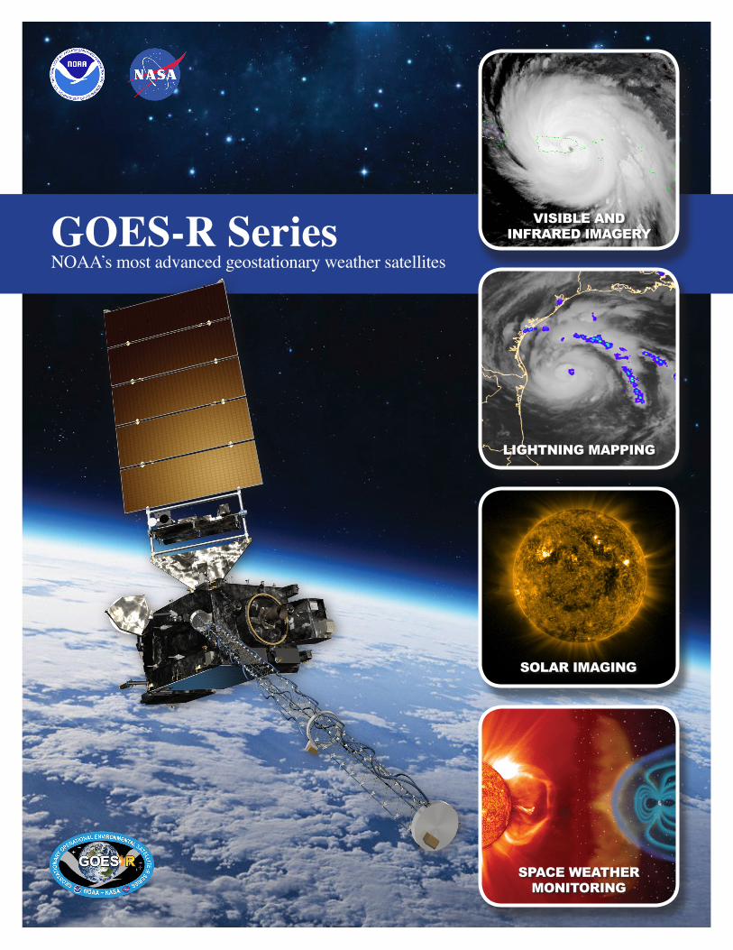
Visual representation of a GOES-R Series satellite above Earth with a hurricane image to represent visual and infrared imagery capabilities, lightning image to show lightning mapping capabilities, a solar flare for solar imaging capabilities, and a visualization of the magnetosphere to represent space weather monitoring.
GOES-R SeriesNOAA’s most advanced geostationary weather satellites
VISIBLE AND INFRARED IMAGERY
LIGHTNING MAPPING
SOLAR IMAGING
SPACE WEATHER MONITORING
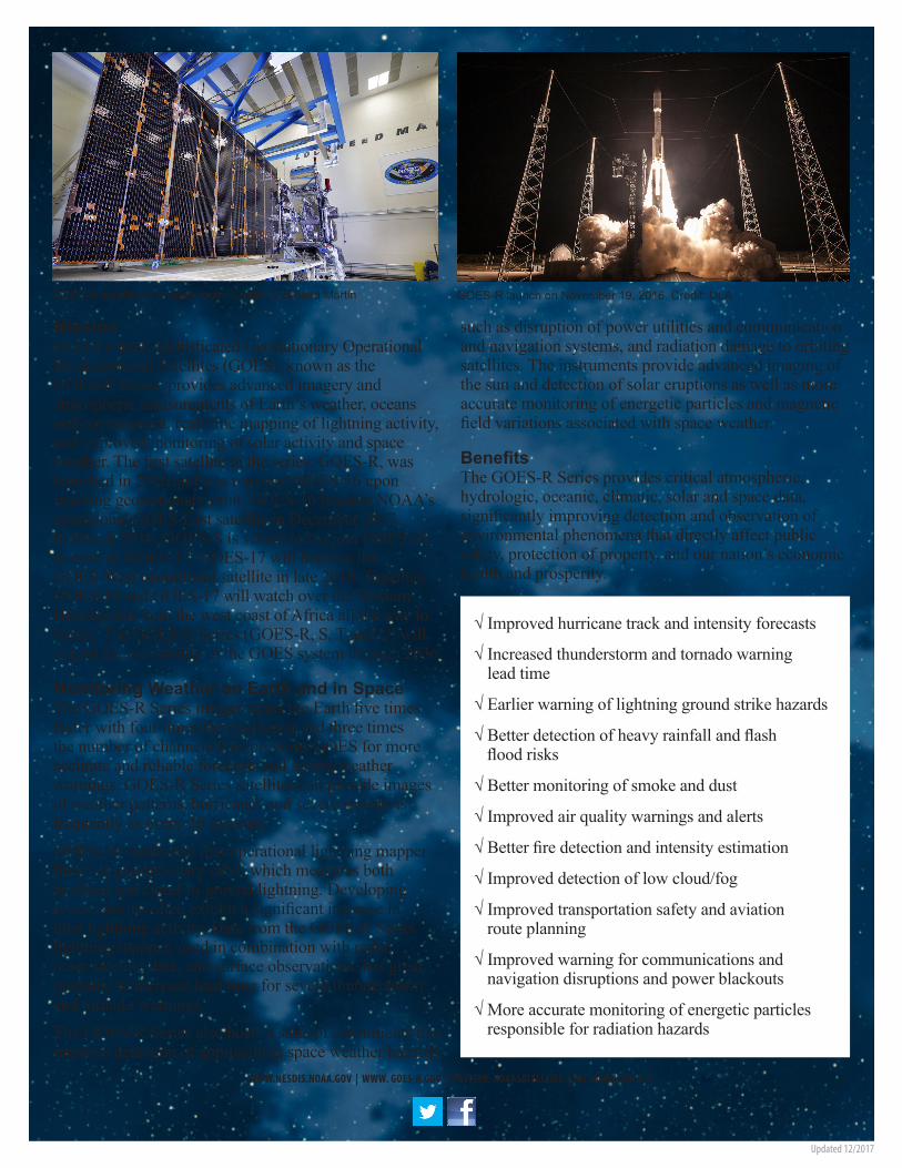
GOES-S satellite in a clean room. Credit: Lockheed Martin GOES-R launch on November 19, 2016. Credit: ULA
MissionNOAA’s most sophisticated Geostationary Operational Environmental Satellites (GOES), known as the GOES-R Series, provides advanced imagery and atmospheric measurements of Earth’s weather, oceans and environment, real-time mapping of lightning activity, and improved monitoring of solar activity and space weather. The first satellite in the series, GOES-R, was launched in 2016 and was renamed GOES-16 upon reaching geostationary orbit. GOES-16 became NOAA’s operational GOES-East satellite in December 2017. In March 2018, GOES-S is scheduled to join GOES-16 in orbit as GOES-17. GOES-17 will become the GOES-West operational satellite in late 2018. Together, GOES-16 and GOES-17 will watch over the Western Hemisphere from the west coast of Africa all the way to Guam. The GOES-R Series (GOES-R, S, T and U) will extend the availability of the GOES system through 2036.
Monitoring Weather on Earth and in SpaceThe GOES-R Series imager scans the Earth five times faster with four times the resolution and three times the number of channels than previous GOES for more accurate and reliable forecasts and severe weather warnings. GOES-R Series satellites can provide images of weather patterns, hurricanes and severe storms as frequently as every 30 seconds.GOES-16 carries the first operational lightning mapper flown in geostationary orbit, which measures both in-cloud and cloud-to-ground lightning. Developing severe storms often exhibit a significant increase in total lightning activity. Data from the GOES-R Series lightning mapper, used in combination with radar, other satellite data, and surface observations, has great potential to increase lead time for severe thunderstorm and tornado warnings. The GOES-R Series also hosts a suite of instruments that improve detection of approaching space weather hazards
such as disruption of power utilities and communication and navigation systems, and radiation damage to orbiting satellites. The instruments provide advanced imaging of the sun and detection of solar eruptions as well as more accurate monitoring of energetic particles and magnetic field variations associated with space weather.
BenefitsThe GOES-R Series provides critical atmospheric, hydrologic, oceanic, climatic, solar and space data, significantly improving detection and observation of environmental phenomena that directly affect public safety, protection of property, and our nation’s economic health and prosperity.
√ Improved hurricane track and intensity forecasts
√ Increased thunderstorm and tornado warning lead time
√ Earlier warning of lightning ground strike hazards
√ Better detection of heavy rainfall and flash flood risks
√ Better monitoring of smoke and dust
√ Improved air quality warnings and alerts
√ Better fire detection and intensity estimation
√ Improved detection of low cloud/fog
√ Improved transportation safety and aviation route planning
√ Improved warning for communications and navigation disruptions and power blackouts
√ More accurate monitoring of energetic particles responsible for radiation hazards
WWW.NESDIS.NOAA.GOV | WWW. GOES-R.GOV | TWITTER: NOAASATELLITES | FACEBOOK: GOES-R
Updated 12/2017


![Program Overview Ground Segment Organization Ground ... · GOES-1 launched in 1975 GOES I series [8-12]: Operational since 1994 GOES N series [13]: N launched May 24 2006, O launched26th](https://static.fdocuments.net/doc/165x107/5f5e7fc04a5dc106c826082d/program-overview-ground-segment-organization-ground-goes-1-launched-in-1975.jpg)