
Global Mapping and Global Clearinghouse initiative International Steering Committee for Global...
65
Global Mapping Global Mapping and and Global Clearinghouse Global Clearinghouse initiative initiative International Steering International Steering Committee for Global Mapping Committee for Global Mapping (ISCGM) (ISCGM) Open Seminar on Implementation Open Seminar on Implementation Models of APSDI Clearinghouse Models of APSDI Clearinghouse April 17, 2002 April 17, 2002
-
date post
20-Jan-2016 -
Category
Documents
-
view
227 -
download
0
Transcript of Global Mapping and Global Clearinghouse initiative International Steering Committee for Global...

Global MappingGlobal Mappingandand
Global Clearinghouse initiativeGlobal Clearinghouse initiative
Global MappingGlobal Mappingandand
Global Clearinghouse initiativeGlobal Clearinghouse initiative
International Steering Committee for International Steering Committee for Global Mapping (ISCGM)Global Mapping (ISCGM)
Open Seminar on Implementation Open Seminar on Implementation Models of APSDI ClearinghouseModels of APSDI Clearinghouse
April 17, 2002April 17, 2002

ContentsContents
1.1. SDI Initiatives and Global MapSDI Initiatives and Global Map
2.2. Global Mapping ConceptGlobal Mapping Concept
3.3. History and Current StatusHistory and Current Status
4.4. Application ExampleApplication Example

SDI Initiatives and Global Map
Hierarchy of SDI InitiativesSDI Initiatives and Global Map
Hierarchy of SDI Initiatives
ISO/TC211ISO/TC211StandardsStandards
GSDIGSDI
RSDIRSDI
NSDINSDI
each countryeach country
GMGMUNGIDBUNGIDB
UNEP/GRIDUNEP/GRID
PCGIAP/APSDIPCGIAP/APSDIPCIDEAPCIDEA
UNCODI-GeoUNCODI-GeoEuroGeographics EUROGIEuroGeographics EUROGI

SDI Initiatives and Global Map
Cooperation with RSDISDI Initiatives and Global Map
Cooperation with RSDI
RegionRegion OrganizationOrganization SDI InitiativeSDI InitiativeAsia/PacificAsia/Pacific PCGIAPPCGIAP APSDIAPSDIEuropeEurope EuroGeographics EuroGeographics EuroGlobalMapEuroGlobalMapAmericasAmericas PCIDEAPCIDEAAfricaAfrica UNCODIUNCODI

SDI Initiatives and Global Map
Global Spatial DatasetSDI Initiatives and Global Map
Global Spatial Dataset
DatasetDataset OrganizationOrganization ContentsContentsGlobal MapGlobal Map ISCGMISCGM ComplexComplexGRIDGRID UNEPUNEP EnvironmentEnvironmentVmapVmap NIMANIMA MapMapGLCCGLCC NASA/IGBPNASA/IGBP LandcoverLandcoverGTOPO30GTOPO30 USGS/EDCUSGS/EDC DEMDEM
SDI Initiatives and Global Map
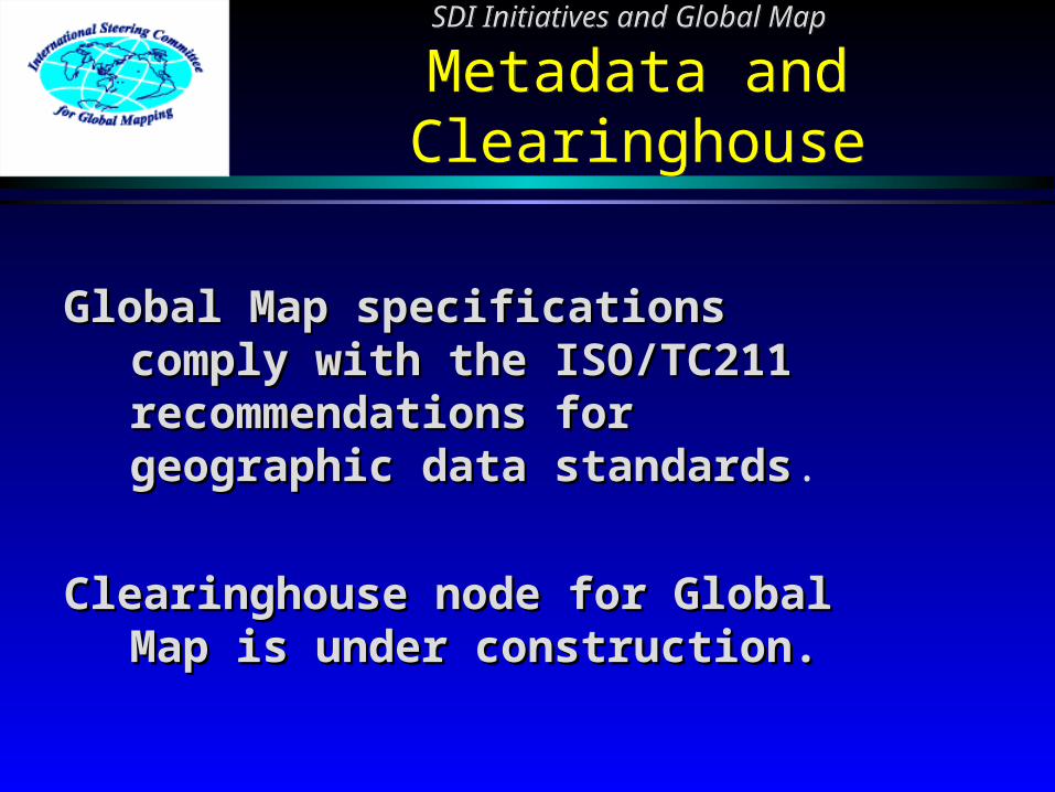
Metadata and ClearinghouseSDI Initiatives and Global Map
Metadata and Clearinghouse
Global Map specifications Global Map specifications comply with the ISO/TC211 comply with the ISO/TC211 recommendations for recommendations for geographic data standardsgeographic data standards.
Clearinghouse node for Global Clearinghouse node for Global Map is under construction.Map is under construction.

Global Mapping ConceptsGlobal Mapping Concepts
Global Environmental ProblemsGlobal Environmental ProblemsGlobal Mapping ConceptsGlobal Mapping Concepts
Global Environmental ProblemsGlobal Environmental Problems
AirAir Global Warming - COGlobal Warming - CO22 Ozone DepletionOzone Depletion Acid RainAcid Rain
Ecosystem in LandEcosystem in Land DeforestationDeforestation Desertification, Soil Degradation, Desertification, Soil Degradation,
etc.etc. Ecosystem in OceanEcosystem in Ocean
Oceanic PollutionOceanic Pollution Degradation of Coral Reef, etc.Degradation of Coral Reef, etc.

Global Mapping ConceptsGlobal Mapping Concepts
River and Road Network in VMAP Level 0River and Road Network in VMAP Level 0Global Mapping ConceptsGlobal Mapping Concepts
River and Road Network in VMAP Level 0River and Road Network in VMAP Level 0

Global Mapping ConceptsGlobal Mapping Concepts
Shaded Map in NepalShaded Map in Nepal (source GTOPO30)(source GTOPO30)
Global Mapping ConceptsGlobal Mapping Concepts
Shaded Map in NepalShaded Map in Nepal (source GTOPO30)(source GTOPO30)
Global Mapping ConceptsGlobal Mapping Concepts
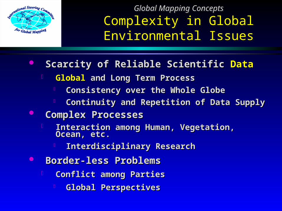
Complexity in Global Complexity in Global Environmental IssuesEnvironmental Issues
Global Mapping ConceptsGlobal Mapping Concepts
Complexity in Global Complexity in Global Environmental IssuesEnvironmental Issues
Scarcity of Reliable Scientific Scarcity of Reliable Scientific DataData GlobalGlobal and Long Term Process and Long Term Process
Consistency over the Whole GlobeConsistency over the Whole Globe Continuity and Repetition of Data Continuity and Repetition of Data
SupplySupply Complex ProcessesComplex Processes
Interaction among Human, Vegetation, Interaction among Human, Vegetation, Ocean, etc.Ocean, etc.
Interdisciplinary ResearchInterdisciplinary Research
Border-less ProblemsBorder-less Problems Conflict among PartiesConflict among Parties
Global PerspectivesGlobal Perspectives

Global Mapping ConceptsGlobal Mapping Concepts
Responsibility of National Responsibility of National Mapping OrganizationsMapping Organizations
Global Mapping ConceptsGlobal Mapping Concepts
Responsibility of National Responsibility of National Mapping OrganizationsMapping Organizations
National Mapping Organizations National Mapping Organizations should continuously provide core should continuously provide core scientific geographic datasets scientific geographic datasets through international through international cooperation with tightening user cooperation with tightening user relations.relations.

Agenda 21 Describes the Need of Agenda 21 Describes the Need of Geographic InformationGeographic InformationCurrently available data is insufficientCurrently available data is insufficient
Contribution from Survey & Mapping Contribution from Survey & Mapping SectorSectorProvision of global geographic information Provision of global geographic information
for global environmental research and for global environmental research and decision makingdecision making
Global MappingGlobal Mapping
Global Mapping ConceptsGlobal Mapping Concepts
Global Mapping was ProposedGlobal Mapping was ProposedGlobal Mapping ConceptsGlobal Mapping Concepts
Global Mapping was ProposedGlobal Mapping was Proposed
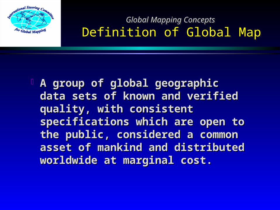
A group of global geographic A group of global geographic data sets of known and verified data sets of known and verified quality, with consistent quality, with consistent specifications which are open to specifications which are open to the public, considered a common the public, considered a common asset of mankind and distributed asset of mankind and distributed worldwide at marginal cost.worldwide at marginal cost.
Global Mapping ConceptsGlobal Mapping Concepts
Definition of Global MapDefinition of Global MapGlobal Mapping ConceptsGlobal Mapping Concepts
Definition of Global MapDefinition of Global Map

Digital Geographic DatasetDigital Geographic Dataset Global CoverageGlobal Coverage
The Global Map covers the whole land The Global Map covers the whole land areaarea..
Consistent SpecificationsConsistent Specifications Spatial resolution: 1 km or 1:1,000,000 Spatial resolution: 1 km or 1:1,000,000
scalescale
Easy AccessibilityEasy Accessibility Open and worldwide distribution at Open and worldwide distribution at
marginal cost.marginal cost.
Global Mapping ConceptsGlobal Mapping Concepts
Global Map - Three PrinciplesGlobal Map - Three PrinciplesGlobal Mapping ConceptsGlobal Mapping Concepts
Global Map - Three PrinciplesGlobal Map - Three Principles

Spatial resolution: 1 km, nearly Spatial resolution: 1 km, nearly equivalent to 1:1,000,000 scale equivalent to 1:1,000,000 scale mapsmaps
Data contents:Data contents: raster dataraster data vector data vector data•• elevationelevation •• drainage drainage•• vegetationvegetation •• transportation transportation •• land useland use •• boundaries boundaries•• land coverland cover •• population center population center
Global Mapping ConceptsGlobal Mapping Concepts
Basic SpecificationsBasic SpecificationsGlobal Mapping ConceptsGlobal Mapping Concepts
Basic SpecificationsBasic Specifications

DEM: DEM: GTOPO30 GTOPO30 (Global 30 arc second elevation (Global 30 arc second elevation dataset)dataset)
(EROS Data Center/USGS)(EROS Data Center/USGS)
Cartography: Cartography: VMAP VMAP (Vector Map)(Vector Map) Level 0Level 0 (US National Imagery and Mapping Agency)(US National Imagery and Mapping Agency)
Land use/cover : Land use/cover : GLCCGLCC (Global Land Cover (Global Land Cover Characterization)Characterization)
(EROS Data Center/USGS(EROS Data Center/USGS and IGBP DIS Land and IGBP DIS Land Cover WG)Cover WG)
Global Mapping ConceptsGlobal Mapping Concepts
Baseline Data in Global MappingBaseline Data in Global MappingGlobal Mapping ConceptsGlobal Mapping Concepts
Baseline Data in Global MappingBaseline Data in Global Mapping

Global Mapping ConceptsGlobal Mapping Concepts
Implementation ofGlobal Mapping Project
Global Mapping ConceptsGlobal Mapping Concepts
Implementation ofGlobal Mapping Project
Respective National Respective National Mapping Organizations’ Mapping Organizations’ voluntary contributionvoluntary contribution
Each NMO has Each NMO has responsibility for the responsibility for the data productiondata production


History and Current StatusHistory and Current Status
1992 --- UNCED1992 --- UNCEDHistory and Current StatusHistory and Current Status
1992 --- UNCED1992 --- UNCED
United Nations Conference on United Nations Conference on Environment and Development Environment and Development (UNCED), Rio de Janeiro(UNCED), Rio de Janeiro Agenda 21Agenda 21
Chapter 40: A call for data at Chapter 40: A call for data at scales from local to global scales from local to global “indicating the status and trends “indicating the status and trends of the planet’s ecosystem, of the planet’s ecosystem, natural resources, pollution and natural resources, pollution and socio-economic variables.”socio-economic variables.”

History and Current StatusHistory and Current Status
1994 --- Izumo Workshop1994 --- Izumo WorkshopHistory and Current StatusHistory and Current Status
1994 --- Izumo Workshop1994 --- Izumo Workshop
International Workshop on Global MappinInternational Workshop on Global Mappingg was held in Nov. 1994 in Izumo, Japan was held in Nov. 1994 in Izumo, Japan
Experts from 14 countries and EU gatheredExperts from 14 countries and EU gatheredResolution of Izumo Workshop was adoptedResolution of Izumo Workshop was adopted
Basic Concepts of Global Mapping were agBasic Concepts of Global Mapping were agreed.reed.

History and Current StatusHistory and Current Status
1996 --- Tsukuba Workshop1996 --- Tsukuba WorkshopHistory and Current StatusHistory and Current Status
1996 --- Tsukuba Workshop1996 --- Tsukuba Workshop
22ndnd International Workshop on International Workshop on Global MappingGlobal Mapping was held in was held in February 1996 in Tsukuba, Japan.February 1996 in Tsukuba, Japan.
The International Steering The International Steering Committee for Global Mapping Committee for Global Mapping (ISCGM) (ISCGM) was established.was established.
11stst ISCGM Meeting ISCGM Meeting was held.was held.
History and Current StatusHistory and Current Status
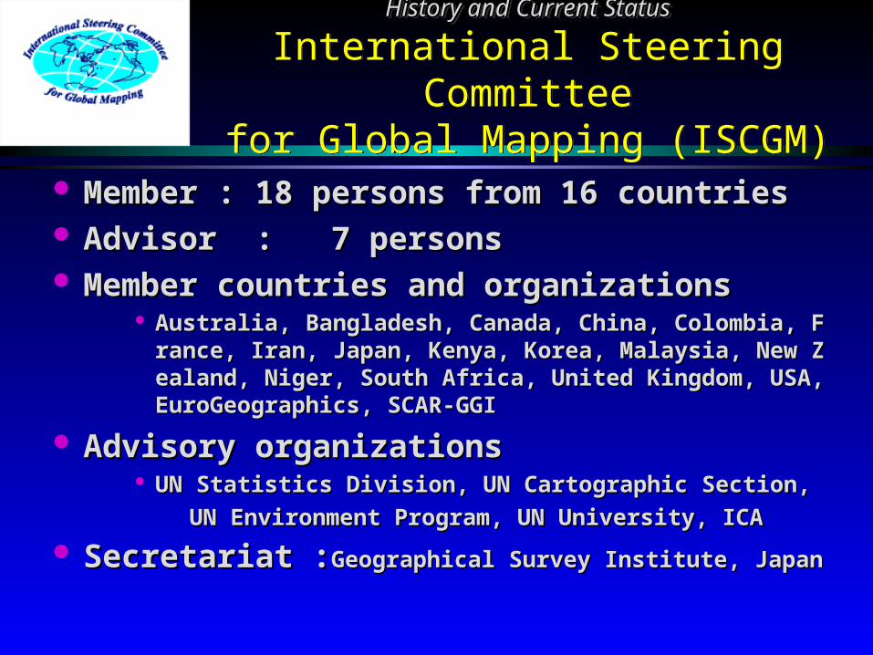
International Steering Committeefor Global Mapping (ISCGM)
History and Current StatusHistory and Current Status
International Steering Committeefor Global Mapping (ISCGM)
Member : 18 persons from 16 countriesMember : 18 persons from 16 countries Advisor : 7 personsAdvisor : 7 persons Member countries and organizationsMember countries and organizations
Australia, Bangladesh, Canada, China, Colombia, France, Iran, Australia, Bangladesh, Canada, China, Colombia, France, Iran, Japan, Kenya, Korea, Malaysia, New Zealand, Niger, South AfriJapan, Kenya, Korea, Malaysia, New Zealand, Niger, South Africa, United Kingdom, USA, EuroGeographics, SCAR-GGIca, United Kingdom, USA, EuroGeographics, SCAR-GGI
Advisory organizationsAdvisory organizations UN Statistics Division, UN Cartographic Section,UN Statistics Division, UN Cartographic Section, UN Environment Program, UN University, ICAUN Environment Program, UN University, ICA
Secretariat :Secretariat :Geographical Survey Institute, JapanGeographical Survey Institute, Japan

History and Current StatusHistory and Current Status
1996 --- Santa Barbara Seminar/Meeting1996 --- Santa Barbara Seminar/MeetingHistory and Current StatusHistory and Current Status
1996 --- Santa Barbara Seminar/Meeting1996 --- Santa Barbara Seminar/Meeting
The Interregional Seminar on Global Mapping fThe Interregional Seminar on Global Mapping for Implementation of Multinational Environmenor Implementation of Multinational Environmental Agreements tal Agreements was held in Nov. 1996 in Santwas held in Nov. 1996 in Santa Barbara, USAa Barbara, USA
22ndnd ISCGM Meeting ISCGM Meeting was held. was held. Santa Barbara Statement: Need for a Global SpatiaSanta Barbara Statement: Need for a Global Spatia
l Data Infrastructurel Data Infrastructure Working Groups established (Strategic Plan, UN SpWorking Groups established (Strategic Plan, UN Sp
ecial Session).ecial Session).
History and Current StatusHistory and Current Status
1997 --- UN Special Session1997 --- UN Special SessionHistory and Current StatusHistory and Current Status
1997 --- UN Special Session1997 --- UN Special Session
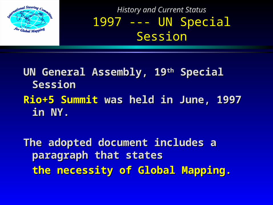
UN General Assembly, 19UN General Assembly, 19thth Special Special SessionSession
Rio+5 Summit Rio+5 Summit was held in June, 1997 was held in June, 1997 in NY.in NY.
The adopted document includes a The adopted document includes a paragraph that statesparagraph that states
the necessity of Global Mapping.the necessity of Global Mapping.

History and Current StatusHistory and Current Status
From “Program for the further implementation of AGENDA21”
History and Current StatusHistory and Current Status
From “Program for the further implementation of AGENDA21”
““A supportive environment needs to be establiA supportive environment needs to be established ... to facilitate public access to informatished ... to facilitate public access to information on global environmental issues ... using ... on on global environmental issues ... using ... such tools as geographic information systems such tools as geographic information systems and video transmission technology, including and video transmission technology, including global mappingglobal mapping. ...” (Paragraph 112 : Adopted . ...” (Paragraph 112 : Adopted document of the UN General Assembly, June document of the UN General Assembly, June 1997)1997)

History and Current StatusHistory and Current Status
1997 --- Gifu Forum/Meeting1997 --- Gifu Forum/MeetingHistory and Current StatusHistory and Current Status
1997 --- Gifu Forum/Meeting1997 --- Gifu Forum/Meeting
Global Mapping Forum ‘97 in Gifu Global Mapping Forum ‘97 in Gifu was hwas held in Nov. 1997 in Gifu, Japaneld in Nov. 1997 in Gifu, Japan
33rdrd ISCGM Meeting ISCGM Meeting was held. was held.Specifications Working Group established.Specifications Working Group established.Year 2000 for release of 1st versionYear 2000 for release of 1st version

History and Current StatusHistory and Current Status
1998 --- Sioux Falls Meeting1998 --- Sioux Falls MeetingHistory and Current StatusHistory and Current Status
1998 --- Sioux Falls Meeting1998 --- Sioux Falls Meeting
44thth ISCGM Meeting ISCGM Meeting was held in was held in June, 1998 in Sioux Falls, USA.June, 1998 in Sioux Falls, USA.Global Map is considered to be a Global Map is considered to be a
foundation data set for GSDI.foundation data set for GSDI.National mapping organizations are National mapping organizations are
to be invited to participate through to be invited to participate through the proper channels.the proper channels.
Data Policy Working Group Data Policy Working Group established.established.
History and Current StatusHistory and Current Status
1998 --- Canberra Meeting1998 --- Canberra MeetingHistory and Current StatusHistory and Current Status
1998 --- Canberra Meeting1998 --- Canberra Meeting
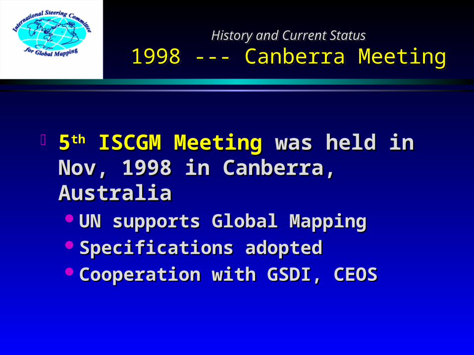
55thth ISCGM Meeting ISCGM Meeting was held in was held in Nov, 1998 in Canberra, Nov, 1998 in Canberra, AustraliaAustraliaUN supports Global MappingUN supports Global MappingSpecifications adoptedSpecifications adoptedCooperation with GSDI, CEOSCooperation with GSDI, CEOS

History and Current StatusHistory and Current Status
1998 --- Call for Participation1998 --- Call for ParticipationHistory and Current StatusHistory and Current Status
1998 --- Call for Participation1998 --- Call for Participation
November 1998, UN Sent each NMO a November 1998, UN Sent each NMO a Letter Inviting to Global Mapping Letter Inviting to Global Mapping ProjectProject
Remarkable Increase of ParticipationRemarkable Increase of Participation3/4 of Global Land are Covered by 3/4 of Global Land are Covered by
Participating CountriesParticipating Countries


History and Current StatusHistory and Current Status
1999 --- Cambridge Meeting1999 --- Cambridge MeetingHistory and Current StatusHistory and Current Status
1999 --- Cambridge Meeting1999 --- Cambridge Meeting
66thth ISCGM Meeting ISCGM Meeting was held in July, 1999 i was held in July, 1999 in Cambridge, UK.n Cambridge, UK.Understanding user needs essentialUnderstanding user needs essentialRelationships with other sectors of the geospatiaRelationships with other sectors of the geospatia
l community need to be established and maintail community need to be established and maintainedned
Private sector involvement neededPrivate sector involvement neededPromotional materials neededPromotional materials needed

History and Current StatusHistory and Current Status
2000 --- Cape Town Meeting2000 --- Cape Town MeetingHistory and Current StatusHistory and Current Status
2000 --- Cape Town Meeting2000 --- Cape Town Meeting
77thth ISCGM Meeting ISCGM Meeting was held on March, 200 was held on March, 2000 in Cape Town, South Africa0 in Cape Town, South AfricaPlanning begins on Version 2.0Planning begins on Version 2.0Data policy still under discussionData policy still under discussionPotential new layers/future additions:Potential new layers/future additions:
MODIS land coverMODIS land cover SRTM elevation dataSRTM elevation data Land cover derived from SPOT-4 Vegetation dataLand cover derived from SPOT-4 Vegetation data

History and Current StatusHistory and Current Status
2000 --- Hiroshima Forum2000 --- Hiroshima ForumHistory and Current StatusHistory and Current Status
2000 --- Hiroshima Forum2000 --- Hiroshima Forum
Global Mapping Forum 2000 in Global Mapping Forum 2000 in HiroshimaHiroshima was held in Nov., was held in Nov., 2000 in Hiroshima, Japan.2000 in Hiroshima, Japan.
Official website onlineOfficial website onlinewww.iscgm.orgwww.iscgm.org
Global Map Version 1.0 releasedGlobal Map Version 1.0 released
History and Current StatusHistory and Current Status
Global Map Version 1.0 ReleasedGlobal Map Version 1.0 ReleasedHistory and Current StatusHistory and Current Status
Global Map Version 1.0 ReleasedGlobal Map Version 1.0 Released
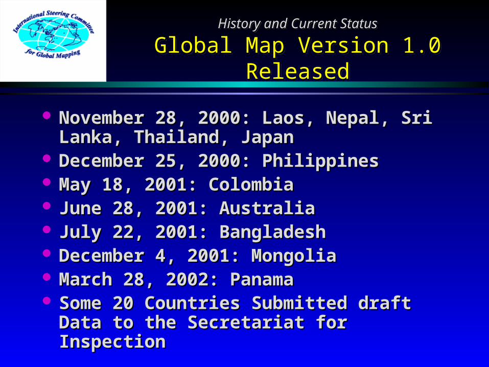
November 28, 2000: Laos, Nepal, Sri November 28, 2000: Laos, Nepal, Sri Lanka, Thailand, JapanLanka, Thailand, Japan
December 25, 2000: PhilippinesDecember 25, 2000: Philippines May 18, 2001: ColombiaMay 18, 2001: Colombia June 28, 2001: AustraliaJune 28, 2001: Australia July 22, 2001: BangladeshJuly 22, 2001: Bangladesh December 4, 2001: MongoliaDecember 4, 2001: Mongolia March 28, 2002: PanamaMarch 28, 2002: Panama Some 20 Countries Submitted draft Some 20 Countries Submitted draft
Data to the Secretariat for Data to the Secretariat for InspectionInspection
History and Current StatusHistory and Current Status
2001 --- UN CSD-92001 --- UN CSD-9History and Current StatusHistory and Current Status
2001 --- UN CSD-92001 --- UN CSD-9
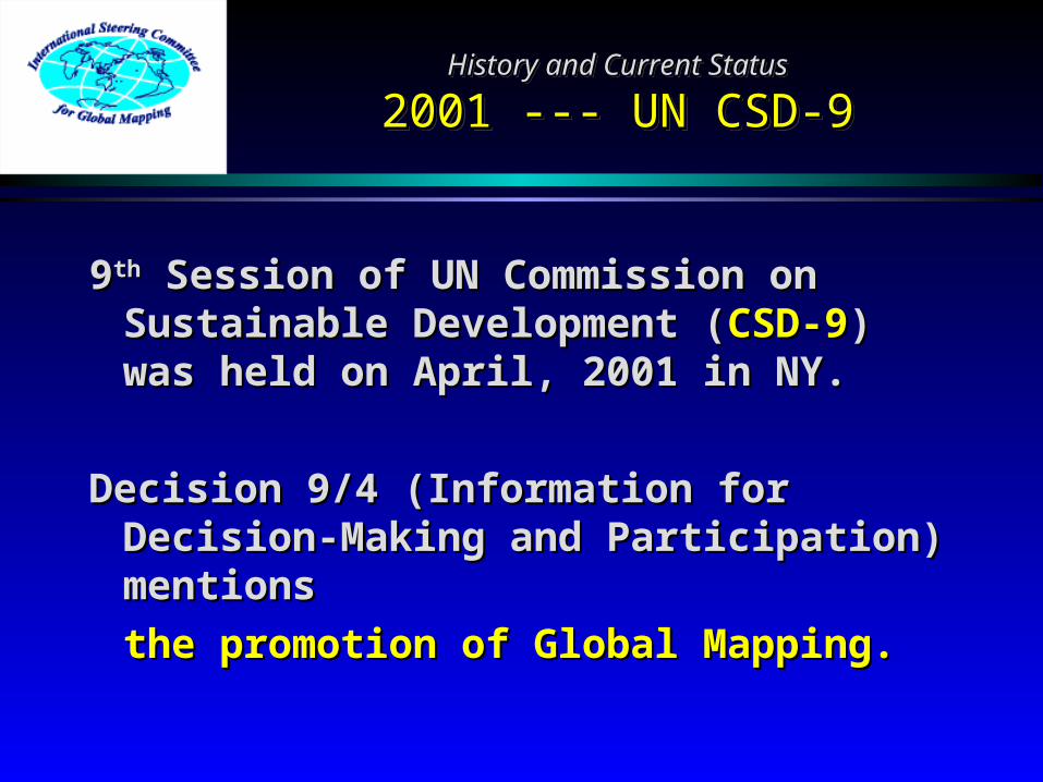
99thth Session of UN Commission on Session of UN Commission on Sustainable Development (Sustainable Development (CSD-9CSD-9)) was held on April, 2001 in NY.was held on April, 2001 in NY.
Decision 9/4 (Information for Decision 9/4 (Information for Decision-Making and Decision-Making and Participation) mentionsParticipation) mentions
the promotion of Global Mapping.the promotion of Global Mapping.
History and Current StatusHistory and Current Status
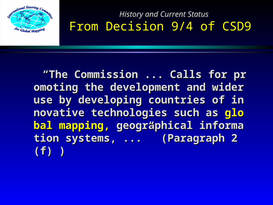
From Decision 9/4 of CSD9 History and Current StatusHistory and Current Status
From Decision 9/4 of CSD9
““The Commission ... Calls for promoting the deThe Commission ... Calls for promoting the development and wider use by developing countrvelopment and wider use by developing countries of innovative technologies such as ies of innovative technologies such as global global mapping,mapping, geographical information systems, geographical information systems, ...” (Paragraph 2 (f) ) ...” (Paragraph 2 (f) )

History and Current StatusHistory and Current Status
2001 --- Cartagena Meeting2001 --- Cartagena MeetingHistory and Current StatusHistory and Current Status
2001 --- Cartagena Meeting2001 --- Cartagena Meeting
88thth ISCGM Meeting ISCGM Meeting was held in May, 200 was held in May, 2001 in Cartagena, Colombia1 in Cartagena, ColombiaChair, Prof. John E. Estes, passed away in Chair, Prof. John E. Estes, passed away in
March.March.Mr. Jack Dangermond of ESRI forms ISCGMMr. Jack Dangermond of ESRI forms ISCGM
/GSDI grant program./GSDI grant program.Data policy to commercial use still under disData policy to commercial use still under dis
cussioncussion Increase in regional organizations (PCGIAP, Increase in regional organizations (PCGIAP,
PC-IDEA) PC-IDEA)

History and Current StatusHistory and Current Status
2002 --- WSSD PrepCom II2002 --- WSSD PrepCom IIHistory and Current StatusHistory and Current Status
2002 --- WSSD PrepCom II2002 --- WSSD PrepCom II
22ndnd Session of Preparatory Committee for t Session of Preparatory Committee for the World Summit on Sustainable Develohe World Summit on Sustainable Development (pment (WSSD PrepCom IIWSSD PrepCom II)) was held on Jwas held on January, 2002 in NY.anuary, 2002 in NY.
Chairman’s paper mentionsChairman’s paper mentionsthe promotion of Global Mapping.the promotion of Global Mapping.

History and Current StatusHistory and Current Status
From Chairman’s paper of WSSD PrepCom II
History and Current StatusHistory and Current Status
From Chairman’s paper of WSSD PrepCom II
““Promote the development and wider use of saPromote the development and wider use of satellite technology applications, including tellite technology applications, including global global mappingmapping and geographic information systems, and geographic information systems, through international cooperation, to provide vithrough international cooperation, to provide vital information on, for example, environmental tal information on, for example, environmental impacts, land use and land-use changes;” (Pimpacts, land use and land-use changes;” (Paragraph 28 (c) )aragraph 28 (c) )

History and Current StatusHistory and Current Status
2002 --- WSSD PrepCom III2002 --- WSSD PrepCom IIIHistory and Current StatusHistory and Current Status
2002 --- WSSD PrepCom III2002 --- WSSD PrepCom III
33rdrd Session of Preparatory Committee for t Session of Preparatory Committee for the World Summit on Sustainable Develohe World Summit on Sustainable Development (pment (WSSD PrepCom IIWSSD PrepCom II)) was held on was held on March/April, 2002 in NY.March/April, 2002 in NY.
Chairman’s paper mentionsChairman’s paper mentionsthe promotion of Global Mapping.the promotion of Global Mapping.
History and Current StatusHistory and Current Status
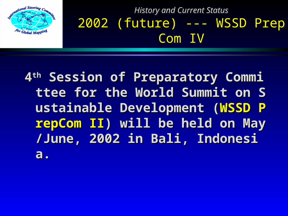
2002 (future) --- WSSD PrepCom IV2002 (future) --- WSSD PrepCom IVHistory and Current StatusHistory and Current Status
2002 (future) --- WSSD PrepCom IV2002 (future) --- WSSD PrepCom IV
44thth Session of Preparatory Committee for t Session of Preparatory Committee for the World Summit on Sustainable Develohe World Summit on Sustainable Development (pment (WSSD PrepCom IIWSSD PrepCom II)) will be held owill be held on May/June, 2002 in Bali, Indonesia.n May/June, 2002 in Bali, Indonesia.

History and Current StatusHistory and Current Status
2002 (future) --- WSSD2002 (future) --- WSSDHistory and Current StatusHistory and Current Status
2002 (future) --- WSSD2002 (future) --- WSSD
World Summit on Sustainable World Summit on Sustainable Development (Development (WSSDWSSD)) will be held on will be held on August/September, 2002 in August/September, 2002 in Johannesburg, South Africa.Johannesburg, South Africa.
Global Map is …Global Map is …
a significant contribution for the a significant contribution for the implementation of Agenda 21implementation of Agenda 21
under the worldwide collaborative efforts under the worldwide collaborative efforts by respective countries.by respective countries.

History and Current StatusHistory and Current Status
2002 (future) --- Budapest Meeting2002 (future) --- Budapest MeetingHistory and Current StatusHistory and Current Status
2002 (future) --- Budapest Meeting2002 (future) --- Budapest Meeting
99thth ISCGM Meeting ISCGM Meeting will be held on Septe will be held on September, 2002 in Budapest, Hungary.mber, 2002 in Budapest, Hungary.
New Chairperson to be selectedNew Chairperson to be selectedPhase 2 plans under discussionPhase 2 plans under discussion
Potential new layersPotential new layers PolicyPolicy

Application ExampleApplication Example
Purpose of the StudyApplication ExampleApplication Example
Purpose of the Study
To use the Global Map as a To use the Global Map as a means of comprehensive means of comprehensive assessment of assessment of impactsimpacts on on natural environment and natural environment and local economylocal economy caused by caused by large-scalelarge-scale international international infrastructureinfrastructure construction. construction.

Application ExampleApplication Example
Outline of ResearchApplication ExampleApplication Example
Outline of Research
The Global Map and related The Global Map and related data on the construction project data on the construction project are first input. Then, impacts are first input. Then, impacts on environments after the on environments after the construction are simulated by construction are simulated by applied models. Also indices applied models. Also indices for the assessment of the for the assessment of the simulation results are simulation results are proposed.proposed.

Application ExampleApplication Example
Case Study AreaApplication ExampleApplication Example
Case Study Area
Nam Kam watershed in the Mekong Basin, northeast ThailNam Kam watershed in the Mekong Basin, northeast Thailand, is adopted as a case study area because of the folloand, is adopted as a case study area because of the follo
wing reasons;wing reasons;
1.1. Some infrastructure has already been constructed Some infrastructure has already been constructed and post-construction impact assessment on envirand post-construction impact assessment on environment and socio-economy is available.onment and socio-economy is available.
2.2. Observation points for stream-flow data, which is Observation points for stream-flow data, which is necessary for validation of hydro-environmental mnecessary for validation of hydro-environmental model, are well maintained.odel, are well maintained.
3.3. Land use has been changed for the last 30 years.Land use has been changed for the last 30 years.

Outline of the Mekong BasinOutline of the Mekong Basin

Outline of Northeast ThailandOutline of Northeast Thailand
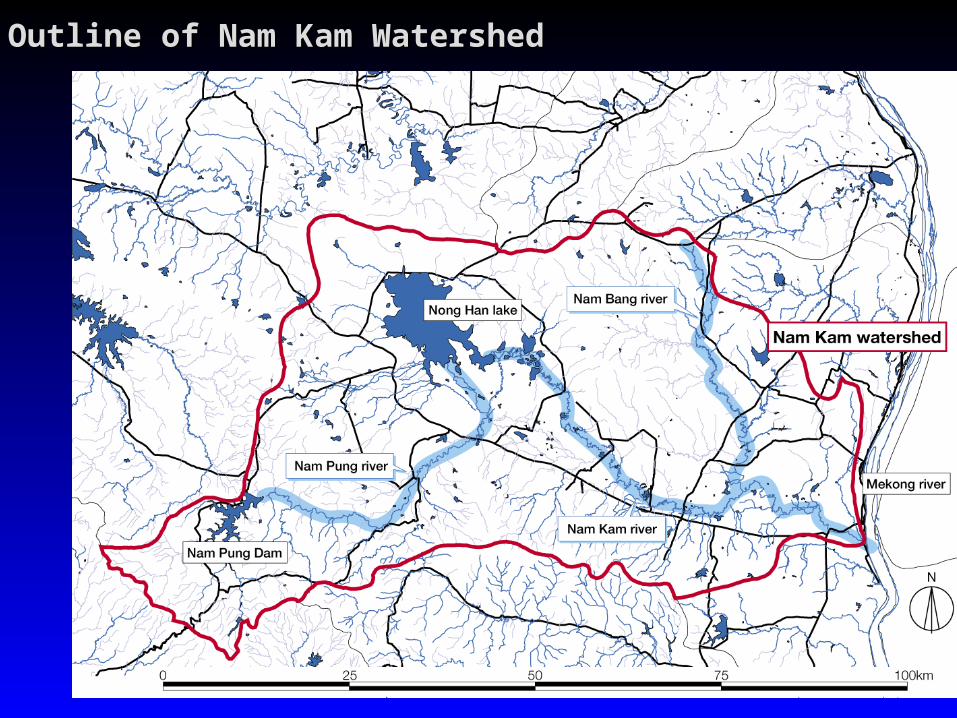
Outline of Nam Kam WatershedOutline of Nam Kam Watershed

Application ExampleApplication Example
Outline of Models and Assessment Method
Application ExampleApplication Example
Outline of Models and Assessment Method
3 models are adopted in this 3 models are adopted in this study.study.
1.1. Land use model for changes Land use model for changes in land usein land use
2.2. Hydro-environmental model Hydro-environmental model for water resource quantityfor water resource quantity
3.3. Soil-environmental model for Soil-environmental model for amount of soil runoffamount of soil runoff
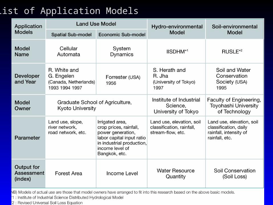
List of Application Models

Indices in the previous table are calculated to express the difference between environmental impacts and socio-economical effects based on the area characteristics of Nam Kam watershed.
Value of Each Scenario – Minimum Value
Maximum Value – Minimum ValueIndex Value =
In Nam Kam watershed, Nam Pung dam has already been in operation as a power dam since 1965. 3 scenarios shown in the table below have been examined to estimate the land use.

Application ExampleApplication Example
Results of ApplicationApplication ExampleApplication Example
Results of Application
The application results of land The application results of land use model, hydro-use model, hydro-environmental model and environmental model and socio-environmental model and socio-environmental model and also the assessment results of also the assessment results of 4 indices are shown.4 indices are shown.

Land Use interpreted by LANDSAT (1995)Land Use interpreted by LANDSAT (1995)

Area by Land Use, LANDSAT Data Reading and Estimation Area by Land Use, LANDSAT Data Reading and Estimation Results by the ModelResults by the Model
Land Use of 1995 by scenario 1
Land Use of 1995 by scenario 2 Land Use of 1995 by scenario 3

Monthly Evaporation ( for April ) Monthly Evaporation ( for August )
Results of Hydro-environmental ModelResults of Hydro-environmental Model

Average Monthly Saturation Degree of the Top Soil Layer ( for April)
Results of Hydro-environmental ModelResults of Hydro-environmental Model
Average Monthly Saturation Degree of the Top Soil Layer ( for August)
Results of Hydro-environmental ModelResults of Hydro-environmental Model
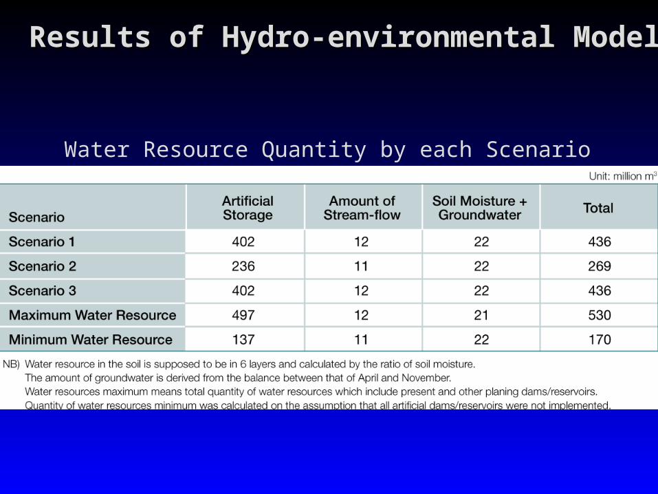
Water Resource Quantity by each Scenario

Results of Soil-environmental ModelResults of Soil-environmental Model
Calculation Results of Soil Erosion ( 1993 : ton/km2 )

Results of Soil-environmental ModelResults of Soil-environmental Model
Calculation Results of Soil Loss at Point S on Nam Kam River

Results of Comprehensive AssessmentResults of Comprehensive Assessment
Calculation Results of Comprehensive Assessment

Results of Comprehensive AssessmentResults of Comprehensive AssessmentCalculation Results of Comprehensive Assessment

Application ExampleApplication Example
ConclusionApplication ExampleApplication Example
Conclusion
In this study, a comprehensive method has been In this study, a comprehensive method has been adopted for the simultaneous evaluation of both adopted for the simultaneous evaluation of both environmental impacts and socio-economic effects.environmental impacts and socio-economic effects.
Combination of the Global Map data and other related Combination of the Global Map data and other related data enables the method for the comprehensive data enables the method for the comprehensive assessment, which will be an effective tool for future assessment, which will be an effective tool for future decision-making.decision-making.
Infrastructure construction can bring both Infrastructure construction can bring both environmental impacts and socio-economic effects, environmental impacts and socio-economic effects, which is the problem of watershed and basin which is the problem of watershed and basin developments of the whole world.developments of the whole world.
Basic Global Map data can be effectively applied for Basic Global Map data can be effectively applied for the assessment of water shed and basin development the assessment of water shed and basin development of the world and consequently contribute to the of the world and consequently contribute to the sustainable development of various areas.sustainable development of various areas.

Application ExampleApplication Example
Application CategoriesApplication ExampleApplication Example
Application Categories
1.1. AgricultureAgriculture2.2. Air QualityAir Quality3.3. Economic development Economic development
and conservationand conservation4.4. Emergency Emergency
managementmanagement5.5. FisheriesFisheries6.6. ForestryForestry7.7. GeologyGeology8.8. Information and Information and
intelligenceintelligence9.9. Land use and land coverLand use and land cover10.10. Mapping, charting and Mapping, charting and
geodesygeodesy
11.11. MarineMarine
12.12. Media, press and Media, press and educationeducation
13.13. Public healthPublic health
14.14. RangelandRangeland
15.15. Recreation and tourismRecreation and tourism
16.16. TransportationTransportation
17.17. Urban and regional Urban and regional planningplanning
18.18. Water qualityWater quality
19.19. Water resourcesWater resources
20.20. Weather and climateWeather and climate
Based on categories used in:
Brian C. Hadley, John E. Estes, and Joseph Scepan (2000). European and Asian Satellite Remote Sensing Applications: A Literature Review and Analysis. Santa Barbara, CA: Remote Sensing Research Unit, UCSB.
Thank you for your attention.Thank you for your attention.


