GIS Techniques for Screening High Conservation Value Areas · Protected (HL/HSAW) Conversion...
51
Gary Paoli, PhD [email protected] GIS Techniques for Screening High Conservation Value Areas The Case of Indonesia
-
Upload
hoangkhuong -
Category
Documents
-
view
215 -
download
0
Transcript of GIS Techniques for Screening High Conservation Value Areas · Protected (HL/HSAW) Conversion...
Gary Paoli, PhD [email protected]
GIS Techniques for Screening
High Conservation Value Areas
The Case of Indonesia

• Background to HCV
• Why Do Screening?
• Examples of HCV screening
• On the Horizon
Overview

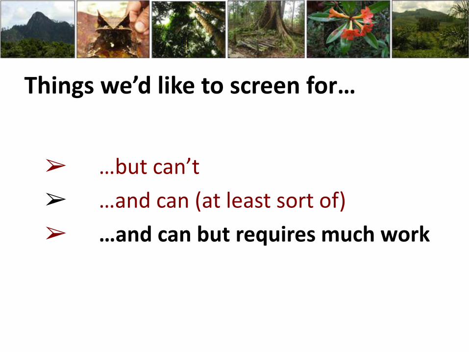
➢ …but can’t
➢ …and can (at least sort of)
➢ …and can but requires much work
Things we’d like to screen for…

Origins of the Concept
Forest Stewardship Council (1999)
Principle 9 of standard
for Certified Responsible Forestry
Draw special attention to areas with exceptional biological, social or cultural attributes

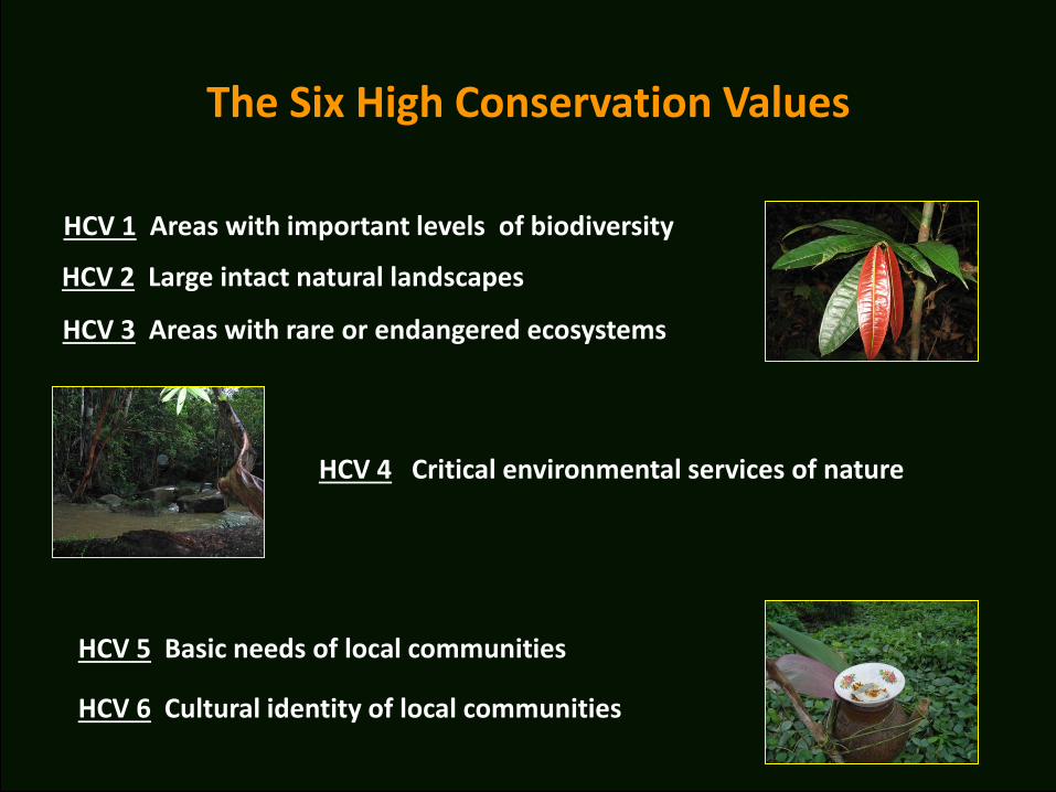
HCV 1 Areas with important levels of biodiversity
The Six High Conservation Values
HCV 5 Basic needs of local communities
HCV 6 Cultural identity of local communities
HCV 4 Critical environmental services of nature
HCV 2 Large intact natural landscapes
HCV 3 Areas with rare or endangered ecosystems
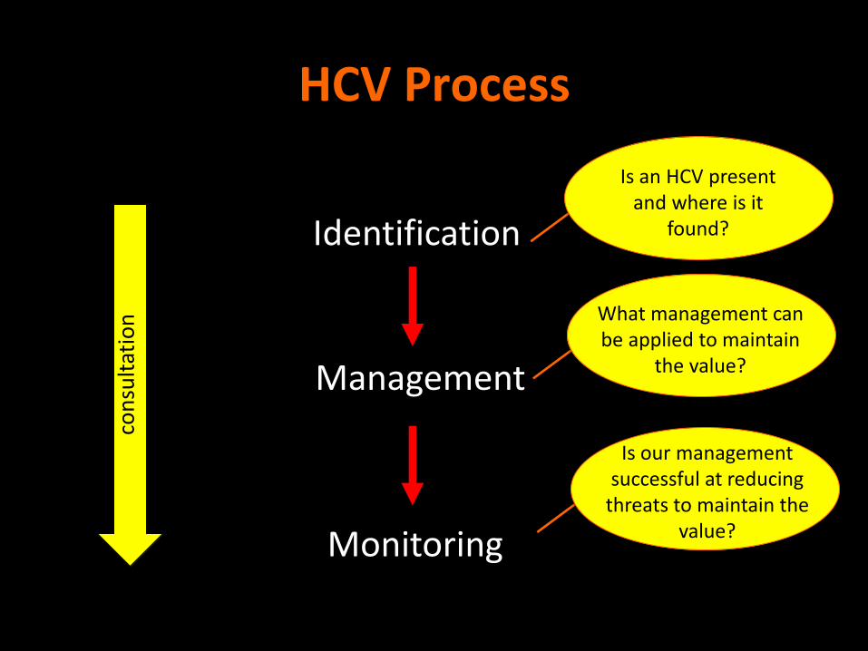
HCV Process
Identification
Management
Monitoring
con
sult
atio
n
Is an HCV present and where is it
found?
What management can be applied to maintain
the value?
Is our management successful at reducing
threats to maintain the value?
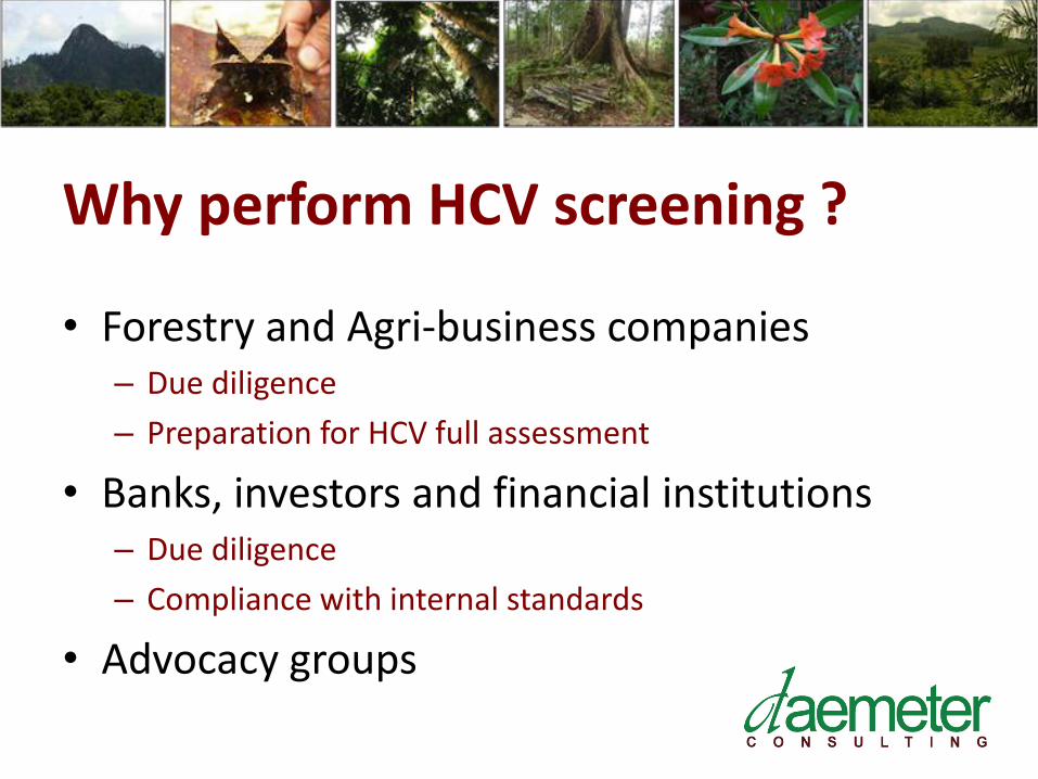
Why perform HCV screening ?
• Forestry and Agri-business companies – Due diligence
– Preparation for HCV full assessment
• Banks, investors and financial institutions – Due diligence
– Compliance with internal standards
• Advocacy groups

Where is HCV carried out ?
• Global in Scope
• Regional Centers of Activity
– Indonesia
– Malaysia
– West Africa
– South America (Brazil, Columbia)
• Growing in Europe and NA

➢ …but can’t
➢ …and can (at least sort of)
➢ …and can but requires much work
Things we’d like to screen for…

HCV 1 Areas with important levels of biodiversity
The Six High Conservation Values
HCV 5 Basic needs of local communities
HCV 6 Cultural identity of local communities
HCV 4 Critical environmental services of nature
HCV 2 Large intact natural landscapes
HCV 3 Areas with rare or endangered ecosystems

Kuburan Tok Bongkok di Riam Berasap
Describing Social Context Requires
Field Work
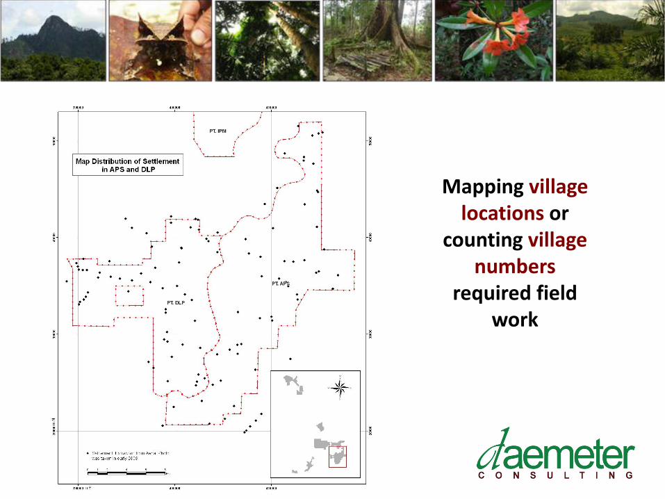
Mapping village locations or
counting village numbers
required field work

HCV 1 Areas with important levels of biodiversity
The Six High Conservation Values
HCV 5 Basic needs of local communities
HCV 6 Cultural identity of local communities
HCV 4 Critical environmental services of nature
HCV 2 Large intact natural landscapes
HCV 3 Areas with rare or endangered ecosystems

HCV 1 – Protected, Threatened or Endemic species

➢ …but can’t
➢ …and can (at least sort of)
➢ …and can but requires much work
Things we’d like to screen for…

Land cover - Presence of forest & natural ecosystems
- First approximation of biodiversity - Landscape context
Peat land Parks & Protected Areas Fires
HCV 1 Areas with important levels of biodiversity
The Six High Conservation Values
HCV 5 Basic needs of local communities
HCV 6 Cultural identity of local communities
HCV 4 Critical environmental services of nature
HCV 2 Large intact natural landscapes
HCV 3 Areas with rare or endangered ecosystems

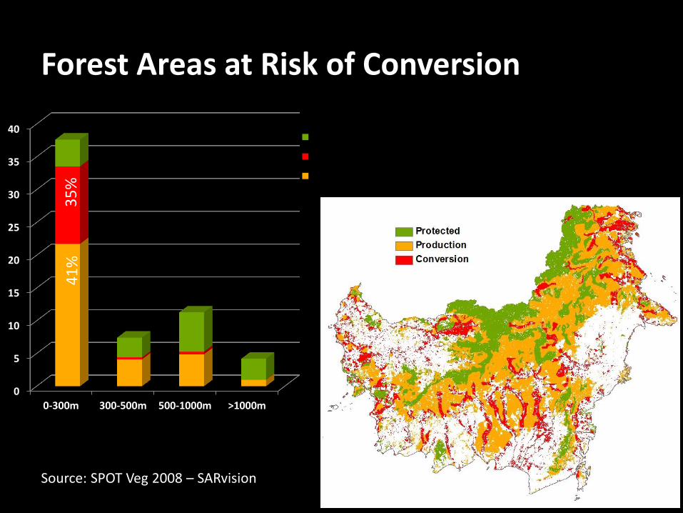
Land cover
0
5
10
15
20
25
30
35
40
0-300m 300-500m 500-1000m >1000m
Protected (HL/HSAW)
Conversion (HPK/APL)
Production (HP/HPT)
Forest Areas at Risk of Conversion
Source: SPOT Veg 2008 – SARvision
41
%
35
%
c. 55 million ha

Land cover – based on Landsat 7

Landscape Connectivity
– Beyond
the License Borders
High Risk for HCV

Landscape Connectivity
– Beyond
the License Borders
Even Higher Risk for HCV

Landscape Connectivity
– Beyond
the License Borders
Low Risk for HCV
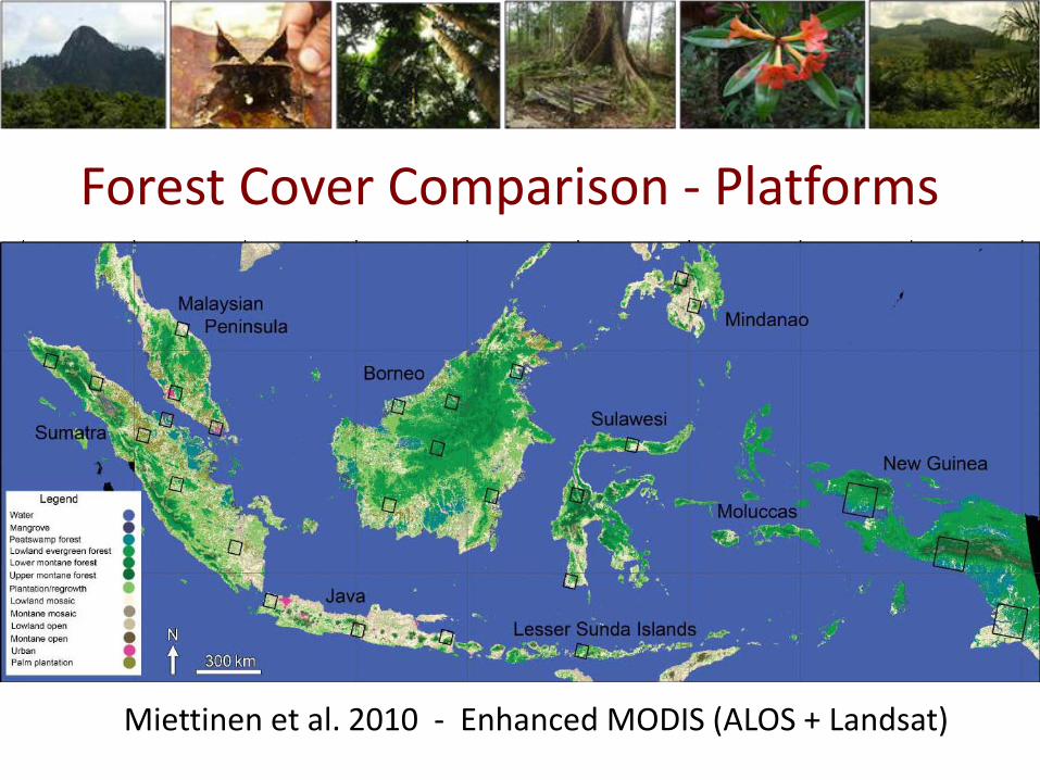
Miettinen et al. 2010 - Enhanced MODIS (ALOS + Landsat)
Forest Cover Comparison - Platforms

MODIS • Good spectral range • Strong signature for
natural mature forest. • Cloud free images
created from multiple images after cloud removal.
• Available 15-30d intervals, free & downloadable
• Resolution 250-1000m
Connectivity
Forest Cover Comparison - Platforms

Forest Cover Comparison - Platforms
MODIS
• Different algorithms will produce different results for ‘natural forest’.
Connectivity Lost

Landsat
• Good spectral range, can distinguish natural old growth forest from degraded forest or other types.
• High resolution 30m, but cloud free images hard to generate.
• Frequency not reliable
Forest Cover Comparison - Platforms
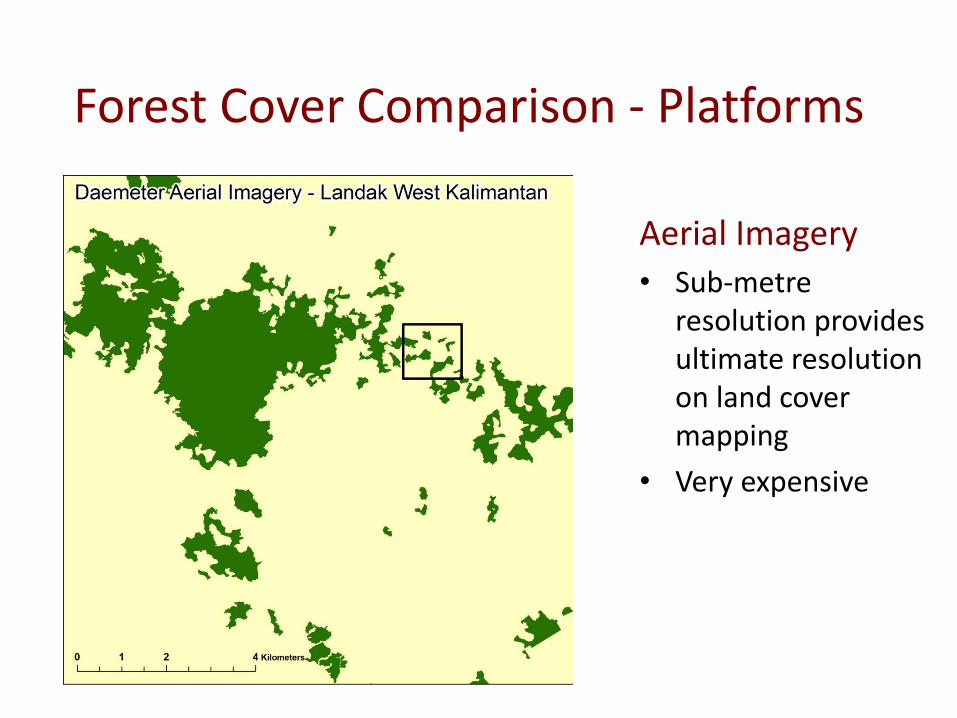
Aerial Imagery
• Sub-metre resolution provides ultimate resolution on land cover mapping
• Very expensive
Forest Cover Comparison - Platforms

Aerial Imagery
- Natural forest
Forest Cover Comparison - Platforms

• MODIS vs aerial
• Resolution 250m v <1m
• Different resolutions will provide different results where spatial pattern and connectivity are important.
Forest Cover Comparison - Platforms

Land cover - Presence of forest & natural ecosystems
- First approximation of biodiversity - Landscape context
Peat land Parks & Protected Areas Fires

Presence of Peat

Peat lands mapping
Wetland International RePPProT

Deep peat
Shallow peat
Deep peat
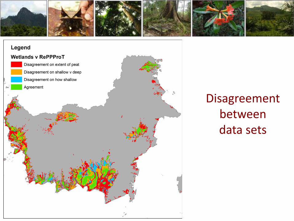
Disagreement between data sets

Parks & Protected Areas

Parks & Protected Areas
Boundary Version 1
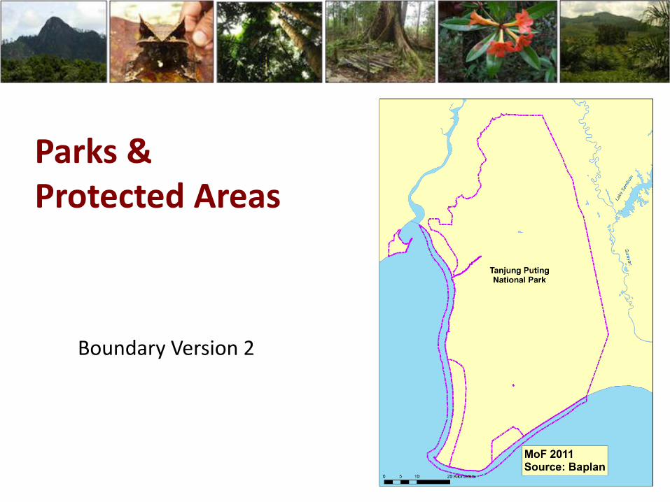
Parks & Protected Areas
Boundary Version 2

Parks & Protected Areas
Boundary Version 3

History of Fire
On-line Hotspot data
- ATSR
AVHRR
➢ …but can’t
➢ …and can (at least sort of)
➢ …and can but requires much work
Things we’d like to screen for…

Erosion Risk
Combining data on -Slope -Slope length -Soil texture -Rainfall

Rare or Endangered Ecosystems – HCV 3
Combining data on -Ecosystem extent -Past forest -Present forest -Future expected forest

Endangered ecosystem
1. Has declined by 50% compared to past extent
2. Will decline by 75% given current land use planning
Rare ecosystem
‘Original’ (past) extent covered <1%
NOTE: Analysis is contextualized
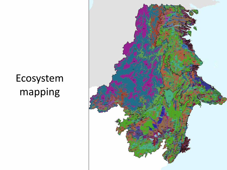
Ecosystem mapping

Past Forest Cover
c.1975
Daemeter

Present Forest Cover
2009
Daemeter
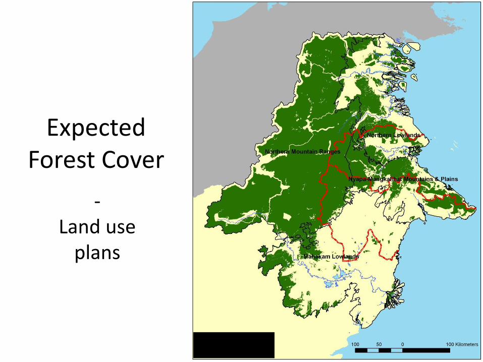
Expected Forest Cover
- Land use
plans
Daemeter

HCV 3
Rare or Endangered Ecosystems

Conclusion
GIS & RS are extremely important tools for HCV There are limitations & trade-offs Take full advantage of this power requires care – be cautious about need for ground survey, expert knowledge

Thank You
www.daemeter.org