
GIS IN TRANSPORTATION - faculty.kfupm.edu.sa€¦ · GIS-T Applications Cont. • Transportation...
24
In the name of Allah, the most Gracious, the most Merciful Introduction to GIS CRP 514 USING GIS IN TRANSPORTATION AND ITS APPLIICATIONS Dr. Baqer M. Al-Ramadan Guided by : prepared by : Mohammed Salem Banaimoon
Transcript of GIS IN TRANSPORTATION - faculty.kfupm.edu.sa€¦ · GIS-T Applications Cont. • Transportation...

In the name of Allah, the most Gracious, the most Merciful
Introduction to GIS
CRP 514
USING GIS IN TRANSPORTATION AND ITS
APPLIICATIONS
Dr. Baqer M. Al-Ramadan
Guided by :
prepared by :
Mohammed Salem Banaimoon

Outline
• Introduction
• Objectives
• GIS Models Used in Transportation
• GIS-T Data Representations
• GIS-T Analysis and Modeling
• GIS-T applications
• GIS and Transportation Case Studies
• Conclusions
Introduction
Geographic Information systems (GIS) represent a powerful new means to efficiently manage and integrate the numerous types of information necessary for the planning, design, construction, analysis, operation, maintenance, and administration of transportation systems and facilities.
Objectives
• To point out the need for Geographic Information Systems in
Transportation.
• To explore the applications of GIS in transportation.
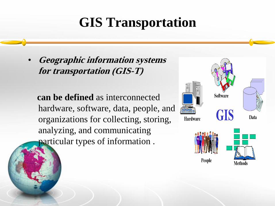
GIS Transportation
• Geographic information systems
for transportation (GIS-T)
can be defined as interconnected
hardware, software, data, people, and
organizations for collecting, storing,
analyzing, and communicating
particular types of information .

GIS Transportation Cont.
GIS-T applications are currently used broadly by
• transportation analysts and decision makers in different areas of
transportation planning and engineering.
• from infrastructure planning, design and management, traffic
safety analysis, and public transit planning and operations to
Intelligent Transportation Systems (ITS).

GIS Models Used in Transportation
• In general, three classes of GIS models are used in transportation,
which include:
Field models of the continuous variation of a phenomenon over
space (e.g., land elevation).
Discrete models, depending on which discrete entities (points,
lines or polygons) populate space (e.g., toll barriers, urbanized
areas).
Network models to represent topologically-connected linear
entities (e.g., roads, rail lines, or airlines) that are fixed in the
continuous reference surface.

Geographic Information Systems for
Transportation (GIS-T)
In general, topics related to GIS-T studies can
be grouped into three categories:
GIS-T Data Representations
GIS-T Analysis and Modeling
GIS-T applications
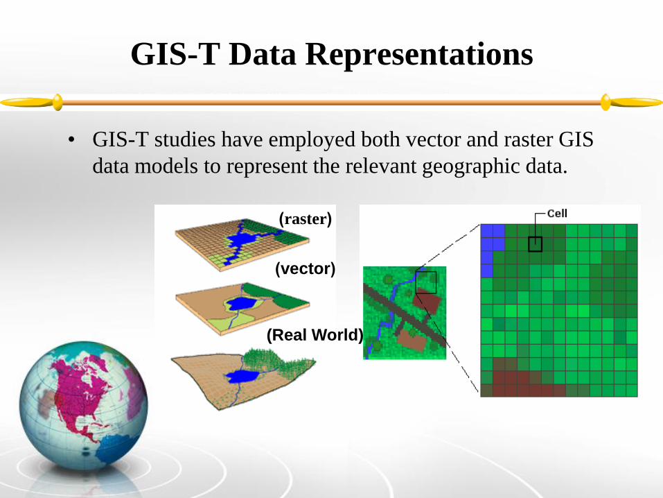
GIS-T Data Representations
• GIS-T studies have employed both vector and raster GIS
data models to represent the relevant geographic data.
(Real World)
(vector)
(raster )
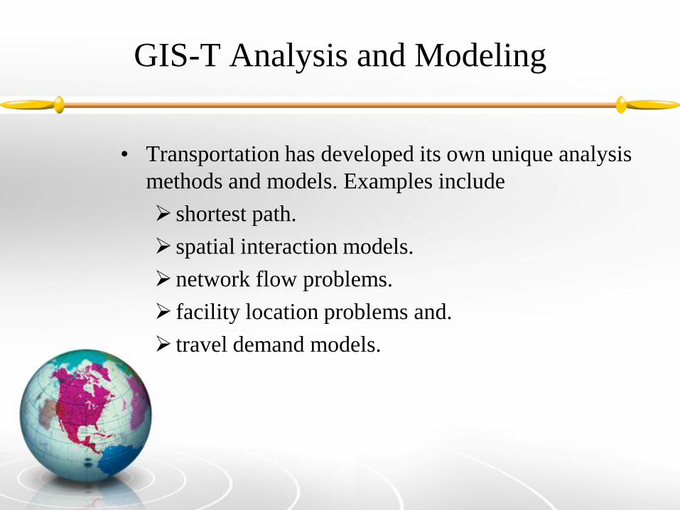
GIS-T Analysis and Modeling
• Transportation has developed its own unique analysis
methods and models. Examples include
shortest path.
spatial interaction models.
network flow problems.
facility location problems and.
travel demand models.

GIS-T Applications
• GIS-T applications covered much of the broad
scope of transportation, such as
infrastructure planning.
design and management.
transportation safety analysis.
travel demand analysis.
traffic monitoring and control.
public transit planning and operations, and
intelligent transportation systems (ITS).
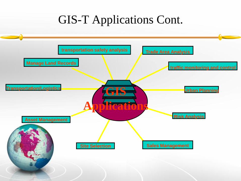
Trade Area Analysis
traffic monitoring and control
Urban Planning
Risk Analysis
Sales Management
transportation safety analysis
Manage Land Records
Transportation/Logistics
Asset Management
Site Selection
GIS
Applications
GIS-T Applications Cont.
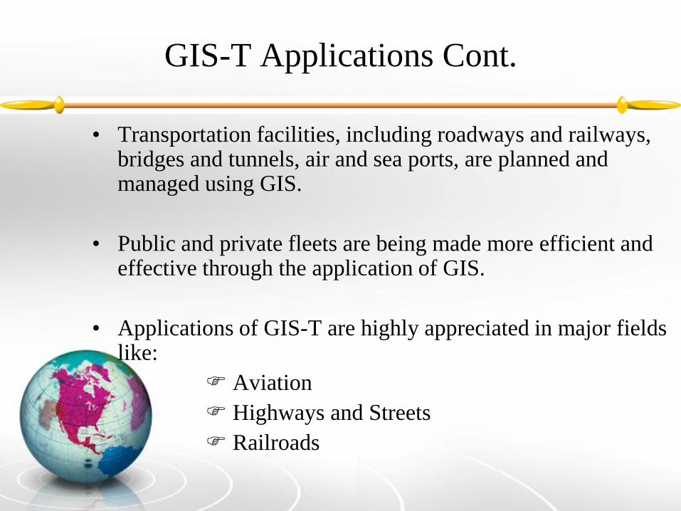
GIS-T Applications Cont.
• Transportation facilities, including roadways and railways, bridges and tunnels, air and sea ports, are planned and managed using GIS.
• Public and private fleets are being made more efficient and effective through the application of GIS.
• Applications of GIS-T are highly appreciated in major fields like:
Aviation
Highways and Streets
Railroads
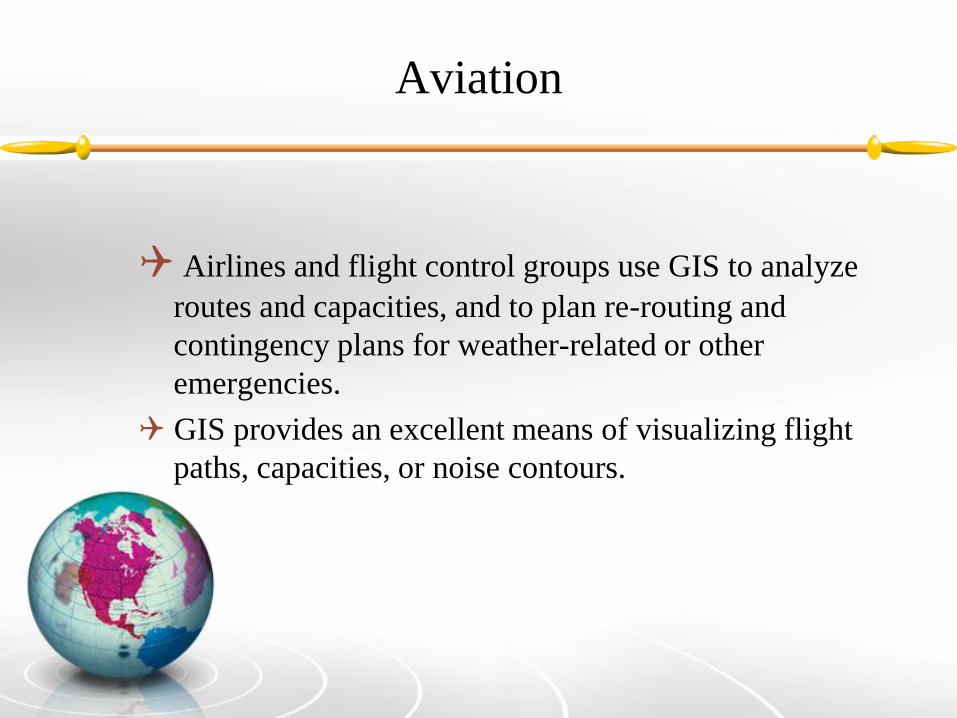
Aviation
Airlines and flight control groups use GIS to analyze
routes and capacities, and to plan re-routing and
contingency plans for weather-related or other
emergencies.
GIS provides an excellent means of visualizing flight
paths, capacities, or noise contours.
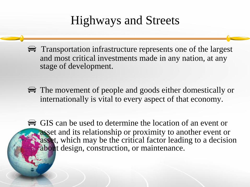
Highways and Streets
Transportation infrastructure represents one of the largest and most critical investments made in any nation, at any stage of development.
The movement of people and goods either domestically or internationally is vital to every aspect of that economy.
GIS can be used to determine the location of an event or asset and its relationship or proximity to another event or asset, which may be the critical factor leading to a decision about design, construction, or maintenance.

Railroads
Railways around the world find great utility in using GIS.
Major functions in which GIS has been successfully deployed
in railway organizations include:
Emergency response management .
Environmental and construction management.
Passenger information .
Capacity planning.
Site selection .
Risk management.

GIS and Transportation Case Studies
To find the best and optimum rout between A
and B because the existing rout lie on igneous
rocks and causes sliding.
The conditions for the design the new road
1. It should be faraway from mountains and vallies.
2. It should be faraway from igneous rocks regions.
3. It should be faraway from plants location and forest .
4. It should be construct near the existing rout to reduce the cost.

GIS and Transportation Case Studies
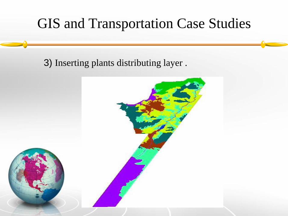
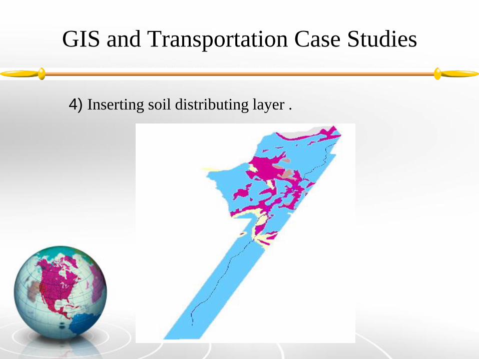
In GIS system should do the following :
1) Inserting elevations layer.
2) Inserting the existing rout layer .
GIS and Transportation Case Studies
3) Inserting plants distributing layer .
GIS and Transportation Case Studies
4) Inserting soil distributing layer .

GIS and Transportation Case Studies
Then the GIS system finds the best design to attain the
conditions of new road .
Case Study :To define the best route for the buses in The
Crestwood School District, Michigan.It has asked for a
revised bus route and schedule to run a newly developed
Summer Program.
GIS and Transportation Case Studies
The primary focus is to define the best route for the buses in the school district according to predefined conditions such as demographic data, administrative considerations, and optimal bus usage.
In this Case Study, ArcView's Network Analyst extension tool is used.
It dealt with the complexities of transportation data and the potential impacts on land area and how demographic information contained within the area affect the transportation infrastructure.
Conclusions
GIS-T platforms now represent a highly viable alternative for information processing in transportation agencies.
In the transportation industry geographic analysis is the key to making better decisions.
GIS technology serves three distinct transportation needs: infrastructure management, fleet and logistics management, and transit management.
Application of GIS to transportation has required the extension of basic functionality to include the linking of linearly referenced information to the network.

THANK YOU


