GIS a Tool for Transportation Infrastructure Planning in ... · PDF fileTS 6.4 GIS a Tool for...
14
TS 6 – Spatial Data Applications Stephen Yao Fiatornu TS 6.4 GIS a Tool for Transportation Infrastructure Planning in Ghana: A Case Study to the Department of Feeder Roads Promoting Land Administration and Good Governance 5 th FIG Regional Conference Accra, Ghana, March 8-11, 2006 1/14 GIS a Tool for Transportation Infrastructure Planning in Ghana A Case Study to the Department of Feeder Roads Stephen Yao FIATORNU, Ghana Key words: SUMMARY With the development of GIS technology, network transportation analysis within a GIS environment has become a common practice in many application areas. The key problems in transportation network system analysis are the deterioration problem and insufficient maintenance policies put in place due to lack of funds for infrastructure maintenance policies put in place due to lack of funds for infrastructure. This demand for information requires new approaches in which data related to transportation network should be identified, collected, stored, retrieved, managed, analyzed, communicated and presented for the decision support system of the organization. The adoption of newly emerging technologies such as Geographic Information System (GIS) can help to improved the decision making process in this area for better use of the available limited funds. The paper thus reviews the suitability of Geographical Information System (GIS) which was used as a pilot phase project in the Northern Region of Ghana to improve the decision making process in this area for better use of the available limited funds. The paper thus reviews the suitability of Geographical Information System (GIS) technology for managing the transport infrastructure in Ghana.
Transcript of GIS a Tool for Transportation Infrastructure Planning in ... · PDF fileTS 6.4 GIS a Tool for...
TS 6 – Spatial Data Applications Stephen Yao Fiatornu TS 6.4 GIS a Tool for Transportation Infrastructure Planning in Ghana: A Case Study to the Department of Feeder Roads Promoting Land Administration and Good Governance 5th FIG Regional Conference Accra, Ghana, March 8-11, 2006
1/14
GIS a Tool for Transportation Infrastructure Planning in Ghana A Case Study to the Department of Feeder Roads
Stephen Yao FIATORNU, Ghana
Key words: SUMMARY With the development of GIS technology, network transportation analysis within a GIS environment has become a common practice in many application areas. The key problems in transportation network system analysis are the deterioration problem and insufficient maintenance policies put in place due to lack of funds for infrastructure maintenance policies put in place due to lack of funds for infrastructure. This demand for information requires new approaches in which data related to transportation network should be identified, collected, stored, retrieved, managed, analyzed, communicated and presented for the decision support system of the organization. The adoption of newly emerging technologies such as Geographic Information System (GIS) can help to improved the decision making process in this area for better use of the available limited funds. The paper thus reviews the suitability of Geographical Information System (GIS) which was used as a pilot phase project in the Northern Region of Ghana to improve the decision making process in this area for better use of the available limited funds. The paper thus reviews the suitability of Geographical Information System (GIS) technology for managing the transport infrastructure in Ghana.
TS 6 – Spatial Data Applications Stephen Yao Fiatornu TS 6.4 GIS a Tool for Transportation Infrastructure Planning in Ghana: A Case Study to the Department of Feeder Roads Promoting Land Administration and Good Governance 5th FIG Regional Conference Accra, Ghana, March 8-11, 2006
2/14
GIS a Tool for Transportation Infrastructure Planning in Ghana A Case Study to the Department of Feeder Roads
Stephen Yao FIATORNU, Ghana
1. INTRODUCTION
Many development projects have serious dependence on transport network. Authentic information on the transport infrastructure is fundamental requirement for many decision making process; therefore information is required to be reliable, updated, relevant, easily accessible and affordable. Better information doesn’t guarantee better decision-making capability but its absence precludes it. This demand for information requires new approaches in which data related to transportation network should be identified, collected, stored, retrieved, managed, analyzed, communicated and presented. The road transport related data in particular involves activities like traffic counting, sign inventories, accident investigation, recording of construction and maintenance projects and funding, right of way surveys, bridge inventories, pavement condition surveys, geometry design inventories, and other data collection and maintenance activities.
These activities are mostly uncoordinated within the organizations and across the organizational boundaries. Because of lack of co-ordination or of narrow concept of data use and application, data collected for one purpose is rarely usable for others. If two users need the same data or very similar data, the data is often collected twice. However, if the data is integrated properly by using the appropriate referencing system concept it can be put to maximum use for transportation as well as for many other purposes. Considering the complexities in developing, updating and processing of the transport related data and the declining trend in cost of data management and storage facility there is and urgent need to adopt new concepts and technologies for designing and developing the information resource management of transport infrastructure in the country. Therefore, the development in the field of information technology such as GIS Expert System and Database Management Systems are especially relevant to the field to transportation engineering. 1.1 Initial Problems Faced without the Usage of GIS The database that existed before did not allow the user to manipulate, access, and query the database other than in a very limited way. The user is limited to textual queries only, the selection and viewing of crossing attribute data with respect to spatial and topological relationships is not possible. Over related data, such as land use, population, and the road network characteristics of the area in the crossings vicinity, cannot be accessed in the present database. The ability of GIS, along with the final presentation of results on a digital base map, will allow the user a better perception of the problem, enable better decisions, and allow a better understanding of what is to be achieved in a broader sense. The ability to define
TS 6 – Spatial Data Applications Stephen Yao Fiatornu TS 6.4 GIS a Tool for Transportation Infrastructure Planning in Ghana: A Case Study to the Department of Feeder Roads Promoting Land Administration and Good Governance 5th FIG Regional Conference Accra, Ghana, March 8-11, 2006
3/14
conditional queries, perform statistical analysis, create thematic maps, and provide charting by allowing for better understandability of the data. 2. GIS FOR TRANSPORTATION INFRASTRUCTURE PLANNING
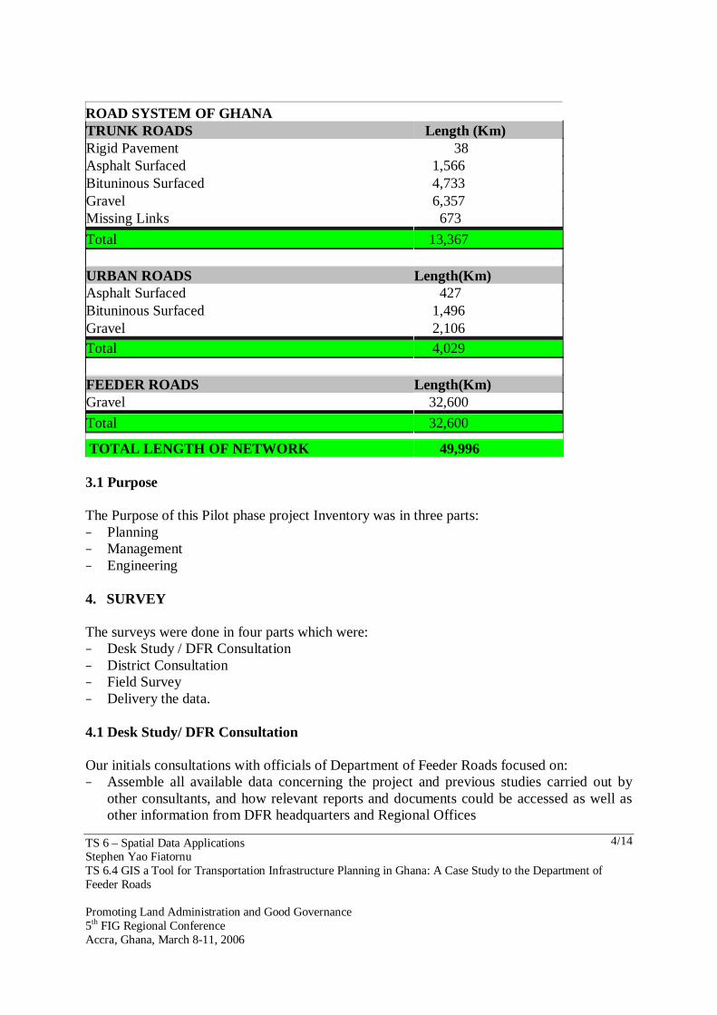
The main advantage of using GIS is its ability to access and analyze spatially distributed data with respect to its actual spatial location overlaid on a base map of the area of coverage that allows analysis not possible with the other database management systems. The main benefit of using the GIS is not merely the user-friendly visual access and display, but also the spatial analysis capability and the applicability to apply standard GIS functionalities such as thematic mapping, charting, network-level analysis, simultaneous access to several layers of data and the overlayment of same, as well as the ability to interface with external programs and software for decision support, data management, and user-specific functions. 3. A CASE STUDY IN RELATIONSHIP TO DEPT OF FEEDER ROADS − Road network in Ghana is more than 50,000km of road length − The planning and management of such a huge network in the country has been primarily
done at three levels − About 13,367km of Trunk Roads − About 4,029km of Urban Roads − And about 32,600km of Feeder Roads It really became a problem managing such roads, so a pilot phase project was put in place using GIS to see how effective this system would work for the decision making process of the Ministry. Many development projects have serious dependence on transport network. Authentic information on the transport infrastructure was fundamental requirement; therefore information required was to be reliable, updated, relevant, easily accessible and affordable for the decision making process of the Ministry.
TS 6 – Spatial Data Applications Stephen Yao Fiatornu TS 6.4 GIS a Tool for Transportation Infrastructure Planning in Ghana: A Case Study to the Department of Feeder Roads Promoting Land Administration and Good Governance 5th FIG Regional Conference Accra, Ghana, March 8-11, 2006
4/14
ROAD SYSTEM OF GHANA TRUNK ROADS Length (Km) Rigid Pavement 38 Asphalt Surfaced 1,566 Bituninous Surfaced 4,733 Gravel 6,357 Missing Links 673
Total 13,367 URBAN ROADS Length(Km) Asphalt Surfaced 427 Bituninous Surfaced 1,496 Gravel 2,106 Total 4,029 FEEDER ROADS Length(Km) Gravel 32,600
Total 32,600 TOTAL LENGTH OF NETWORK 49,996 3.1 Purpose The Purpose of this Pilot phase project Inventory was in three parts: − Planning − Management − Engineering 4. SURVEY The surveys were done in four parts which were: − Desk Study / DFR Consultation − District Consultation − Field Survey − Delivery the data. 4.1 Desk Study/ DFR Consultation Our initials consultations with officials of Department of Feeder Roads focused on: − Assemble all available data concerning the project and previous studies carried out by
other consultants, and how relevant reports and documents could be accessed as well as other information from DFR headquarters and Regional Offices
TS 6 – Spatial Data Applications Stephen Yao Fiatornu TS 6.4 GIS a Tool for Transportation Infrastructure Planning in Ghana: A Case Study to the Department of Feeder Roads Promoting Land Administration and Good Governance 5th FIG Regional Conference Accra, Ghana, March 8-11, 2006
5/14
− Maps prepared for the Department by Remote Sensing Unit of the University of Ghana, Legon. (CERSGIS Maps and other maps).
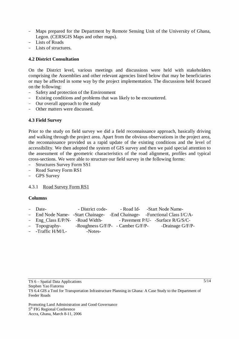
− Lists of Roads − Lists of structures. 4.2 District Consultation On the District level, various meetings and discussions were held with stakeholders comprising the Assemblies and other relevant agencies listed below that may be beneficiaries or may be affected in some way by the project implementation. The discussions held focused on the following: − Safety and protection of the Environment − Existing conditions and problems that was likely to be encountered. − Our overall approach to the study − Other matters were discussed. 4.3 Field Survey Prior to the study on field survey we did a field reconnaissance approach, basically driving and walking through the project area. Apart from the obvious observations in the project area, the reconnaissance provided us a rapid update of the existing conditions and the level of accessibility. We then adopted the system of GIS survey and then we paid special attention to the assessment of the geometric characteristics of the road alignment, profiles and typical cross-sections. We were able to structure our field survey in the following forms: − Structures Survey Form SS1 − Road Survey Form RS1 − GPS Survey 4.3.1 Road Survey Form RS1 Columns − Date- - District code- - Road Id- -Start Node Name- − End Node Name- -Start Chainage- -End Chainage- -Functional Class I/C/A- − Eng_Class E/P/N- -Road Width- - Pavement P/U- -Surface R/G/S/C- − Topography- -Roughness G/F/P- - Camber G/F/P- -Drainage G/F/P- − -Traffic H/M/L- -Notes-
TS 6 – Spatial Data Applications Stephen Yao Fiatornu TS 6.4 GIS a Tool for Transportation Infrastructure Planning in Ghana: A Case Study to the Department of Feeder Roads Promoting Land Administration and Good Governance 5th FIG Regional Conference Accra, Ghana, March 8-11, 2006
6/14
Fig 1: Copy of road Inventory form (RS1)
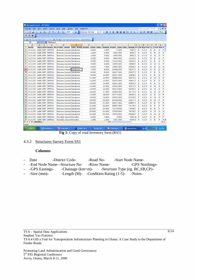
4.3.2 Structures Survey Form SS1
Columns − Date -District Code- -Road No- -Start Node Name- − -End Node Name- -Structure No- -River Name- -GPS Northings- − -GPS Eastings- -Chainage (km+m)- -Structure Type (eg. BC,SB,CP)- − -Size (mm)- -Length (M)- -Condition Rating (1-5)- -Notes-
TS 6 – Spatial Data Applications Stephen Yao Fiatornu TS 6.4 GIS a Tool for Transportation Infrastructure Planning in Ghana: A Case Study to the Department of Feeder Roads Promoting Land Administration and Good Governance 5th FIG Regional Conference Accra, Ghana, March 8-11, 2006
7/14
Fig 2: Copy of Structure Condition form (SS1) 4.4 Delivering the Data From the road inventory survey, a GIS database was established to document the existing conditions along the road which were in the following forms: − Structures list ( Form SS1) − Detailed roads list ( Form RS1) − Nodes table − Road Definition table − Shape file − GIS Map
TS 6 – Spatial Data Applications Stephen Yao Fiatornu TS 6.4 GIS a Tool for Transportation Infrastructure Planning in Ghana: A Case Study to the Department of Feeder Roads Promoting Land Administration and Good Governance 5th FIG Regional Conference Accra, Ghana, March 8-11, 2006
8/14
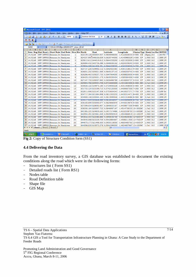
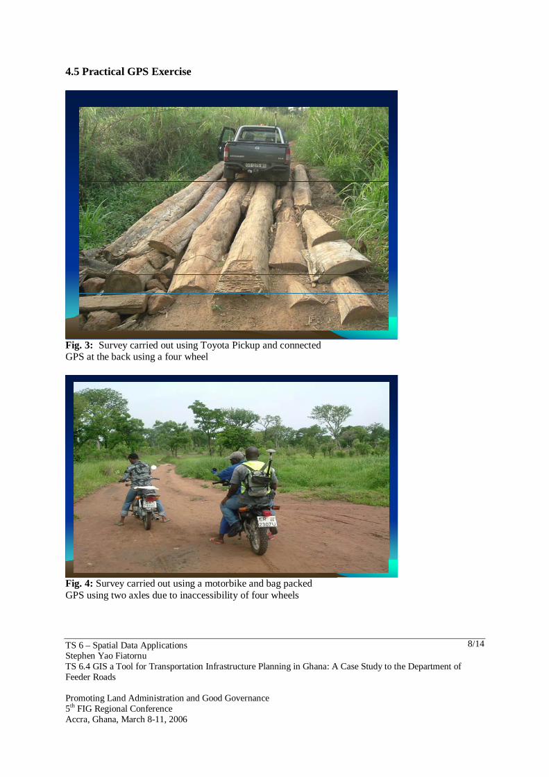
4.5 Practical GPS Exercise
Fig. 3: Survey carried out using Toyota Pickup and connected GPS at the back using a four wheel
Fig. 4: Survey carried out using a motorbike and bag packed GPS using two axles due to inaccessibility of four wheels
TS 6 – Spatial Data Applications Stephen Yao Fiatornu TS 6.4 GIS a Tool for Transportation Infrastructure Planning in Ghana: A Case Study to the Department of Feeder Roads Promoting Land Administration and Good Governance 5th FIG Regional Conference Accra, Ghana, March 8-11, 2006
9/14
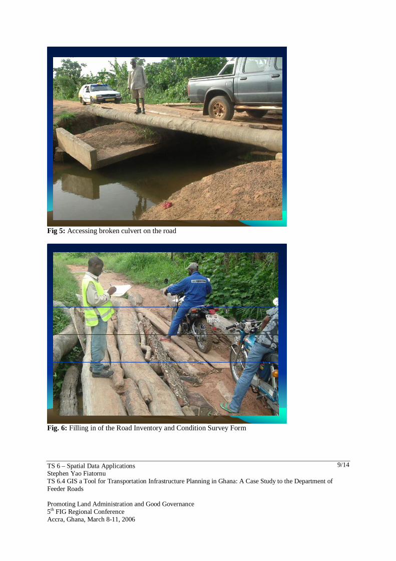
Fig 5: Accessing broken culvert on the road
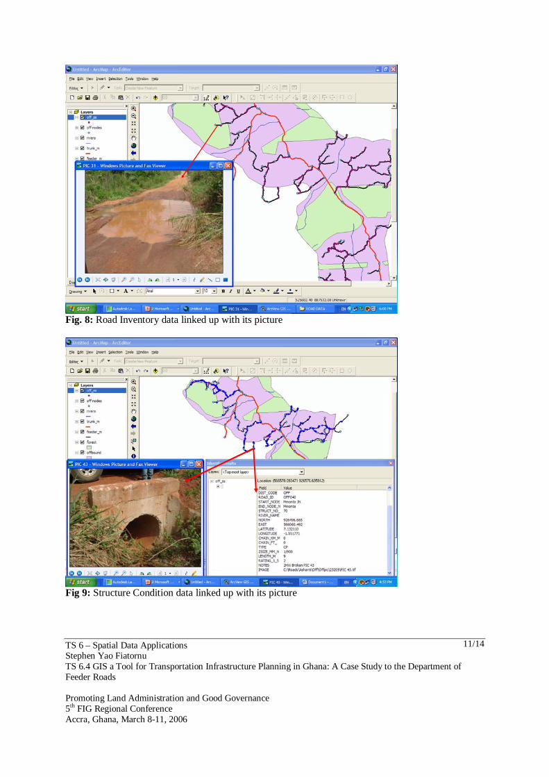
Fig. 6: Filling in of the Road Inventory and Condition Survey Form

TS 6 – Spatial Data Applications Stephen Yao Fiatornu TS 6.4 GIS a Tool for Transportation Infrastructure Planning in Ghana: A Case Study to the Department of Feeder Roads Promoting Land Administration and Good Governance 5th FIG Regional Conference Accra, Ghana, March 8-11, 2006
10/14
4.6 GIS Map For the purpose of identifying and classifying, the following functions were used: − Basic functions (editing, display, measurements) − Overlay. − Create Polylines to Polylines M. − Dynamic segmentation − Raster display and analysis − Surface modeling. − Links to other software. 4.7 Overlay
OverlayOverlay
Fig. 7: Overlay of various layers
TS 6 – Spatial Data Applications Stephen Yao Fiatornu TS 6.4 GIS a Tool for Transportation Infrastructure Planning in Ghana: A Case Study to the Department of Feeder Roads Promoting Land Administration and Good Governance 5th FIG Regional Conference Accra, Ghana, March 8-11, 2006
11/14
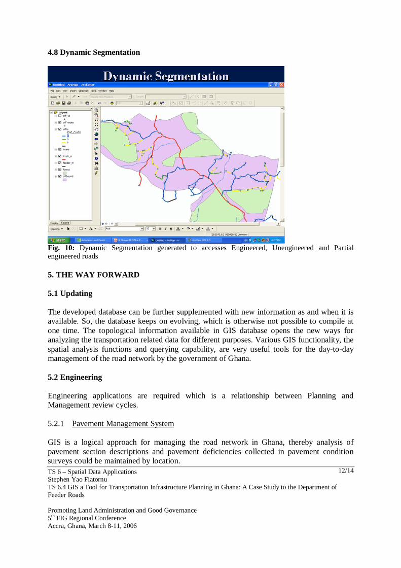
Fig. 8: Road Inventory data linked up with its picture
Fig 9: Structure Condition data linked up with its picture
TS 6 – Spatial Data Applications Stephen Yao Fiatornu TS 6.4 GIS a Tool for Transportation Infrastructure Planning in Ghana: A Case Study to the Department of Feeder Roads Promoting Land Administration and Good Governance 5th FIG Regional Conference Accra, Ghana, March 8-11, 2006
12/14
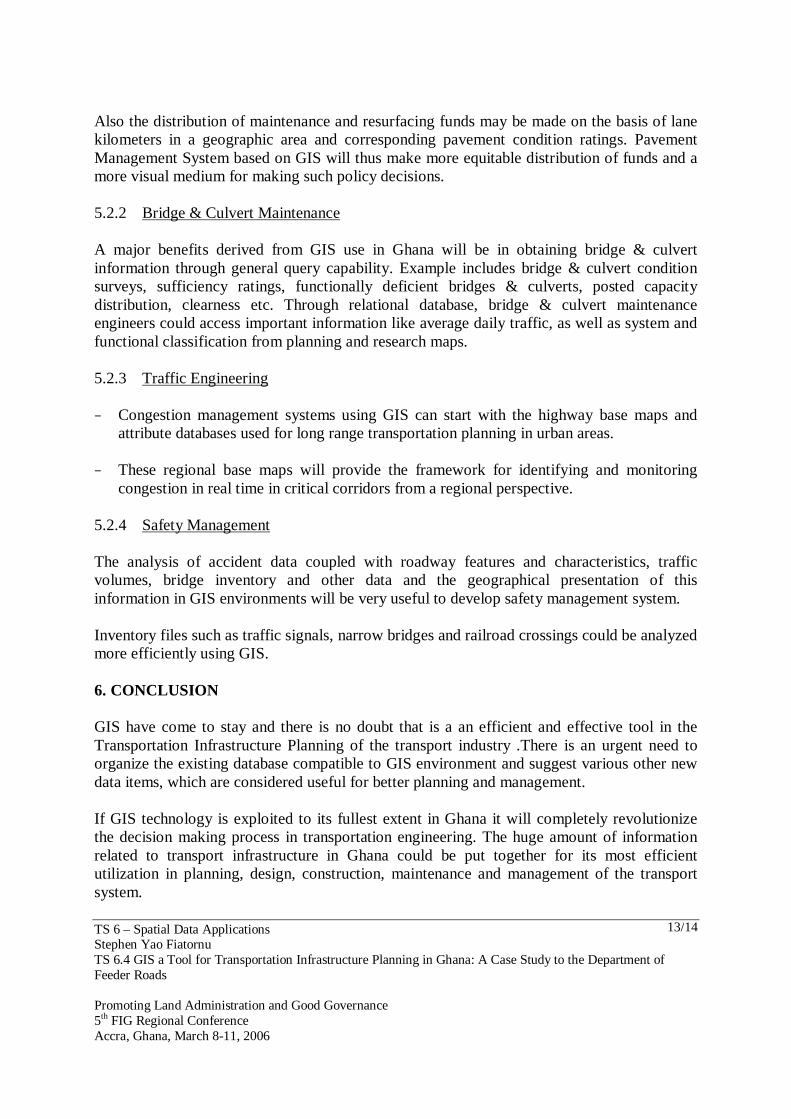
4.8 Dynamic Segmentation
Dynamic Segmentation Dynamic Segmentation
Fig. 10: Dynamic Segmentation generated to accesses Engineered, Unengineered and Partial engineered roads 5. THE WAY FORWARD 5.1 Updating The developed database can be further supplemented with new information as and when it is available. So, the database keeps on evolving, which is otherwise not possible to compile at one time. The topological information available in GIS database opens the new ways for analyzing the transportation related data for different purposes. Various GIS functionality, the spatial analysis functions and querying capability, are very useful tools for the day-to-day management of the road network by the government of Ghana. 5.2 Engineering Engineering applications are required which is a relationship between Planning and Management review cycles. 5.2.1 Pavement Management System GIS is a logical approach for managing the road network in Ghana, thereby analysis of pavement section descriptions and pavement deficiencies collected in pavement condition surveys could be maintained by location.
TS 6 – Spatial Data Applications Stephen Yao Fiatornu TS 6.4 GIS a Tool for Transportation Infrastructure Planning in Ghana: A Case Study to the Department of Feeder Roads Promoting Land Administration and Good Governance 5th FIG Regional Conference Accra, Ghana, March 8-11, 2006
13/14
Also the distribution of maintenance and resurfacing funds may be made on the basis of lane kilometers in a geographic area and corresponding pavement condition ratings. Pavement Management System based on GIS will thus make more equitable distribution of funds and a more visual medium for making such policy decisions. 5.2.2 Bridge & Culvert Maintenance A major benefits derived from GIS use in Ghana will be in obtaining bridge & culvert information through general query capability. Example includes bridge & culvert condition surveys, sufficiency ratings, functionally deficient bridges & culverts, posted capacity distribution, clearness etc. Through relational database, bridge & culvert maintenance engineers could access important information like average daily traffic, as well as system and functional classification from planning and research maps. 5.2.3 Traffic Engineering − Congestion management systems using GIS can start with the highway base maps and
attribute databases used for long range transportation planning in urban areas.
− These regional base maps will provide the framework for identifying and monitoring congestion in real time in critical corridors from a regional perspective.
5.2.4 Safety Management The analysis of accident data coupled with roadway features and characteristics, traffic volumes, bridge inventory and other data and the geographical presentation of this information in GIS environments will be very useful to develop safety management system. Inventory files such as traffic signals, narrow bridges and railroad crossings could be analyzed more efficiently using GIS. 6. CONCLUSION GIS have come to stay and there is no doubt that is a an efficient and effective tool in the Transportation Infrastructure Planning of the transport industry .There is an urgent need to organize the existing database compatible to GIS environment and suggest various other new data items, which are considered useful for better planning and management. If GIS technology is exploited to its fullest extent in Ghana it will completely revolutionize the decision making process in transportation engineering. The huge amount of information related to transport infrastructure in Ghana could be put together for its most efficient utilization in planning, design, construction, maintenance and management of the transport system.
TS 6 – Spatial Data Applications Stephen Yao Fiatornu TS 6.4 GIS a Tool for Transportation Infrastructure Planning in Ghana: A Case Study to the Department of Feeder Roads Promoting Land Administration and Good Governance 5th FIG Regional Conference Accra, Ghana, March 8-11, 2006
14/14
BIOGRAPHICAL NOTES
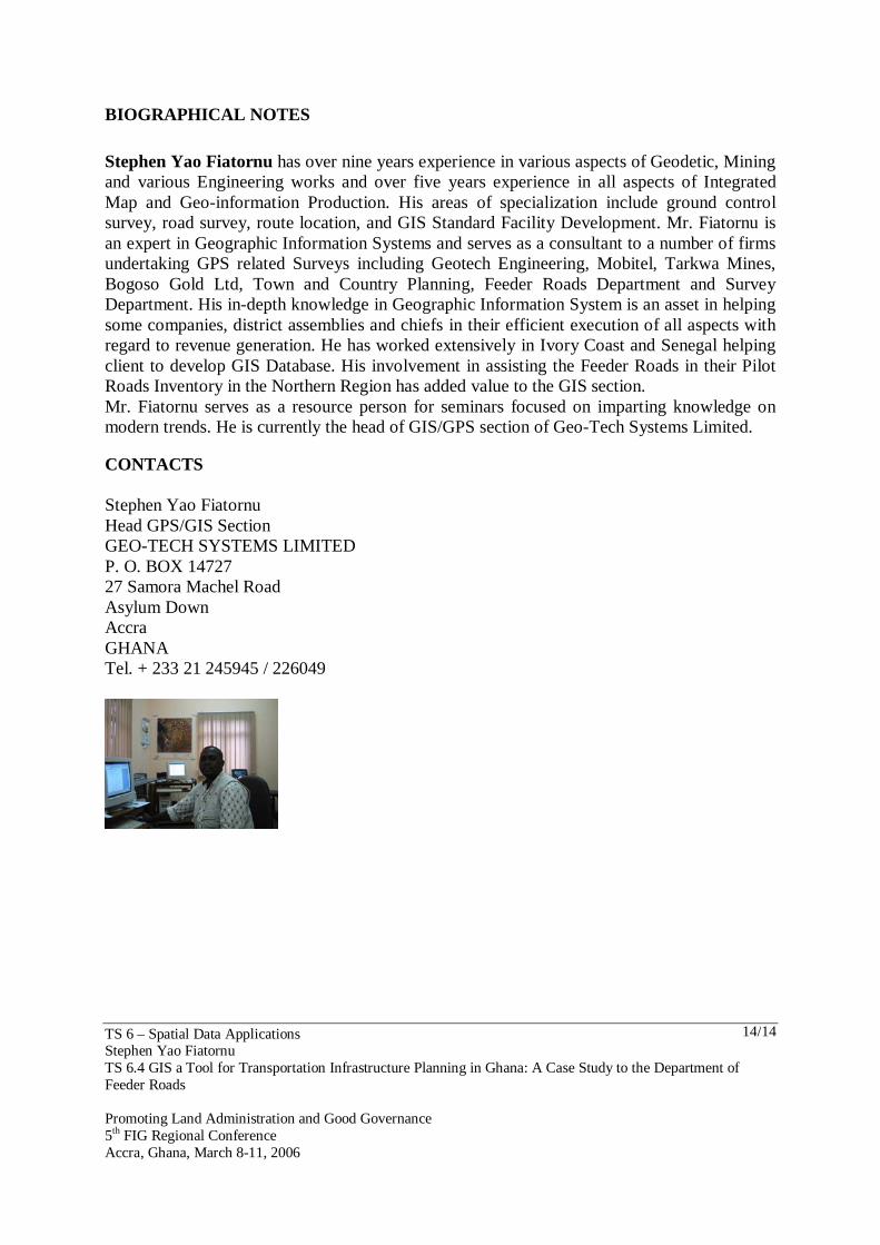
Stephen Yao Fiatornu has over nine years experience in various aspects of Geodetic, Mining and various Engineering works and over five years experience in all aspects of Integrated Map and Geo-information Production. His areas of specialization include ground control survey, road survey, route location, and GIS Standard Facility Development. Mr. Fiatornu is an expert in Geographic Information Systems and serves as a consultant to a number of firms undertaking GPS related Surveys including Geotech Engineering, Mobitel, Tarkwa Mines, Bogoso Gold Ltd, Town and Country Planning, Feeder Roads Department and Survey Department. His in-depth knowledge in Geographic Information System is an asset in helping some companies, district assemblies and chiefs in their efficient execution of all aspects with regard to revenue generation. He has worked extensively in Ivory Coast and Senegal helping client to develop GIS Database. His involvement in assisting the Feeder Roads in their Pilot Roads Inventory in the Northern Region has added value to the GIS section. Mr. Fiatornu serves as a resource person for seminars focused on imparting knowledge on modern trends. He is currently the head of GIS/GPS section of Geo-Tech Systems Limited. CONTACTS Stephen Yao Fiatornu Head GPS/GIS Section GEO-TECH SYSTEMS LIMITED P. O. BOX 14727 27 Samora Machel Road Asylum Down Accra GHANA Tel. + 233 21 245945 / 226049