GEOSTAT 4 Enterprise Architecture and other...
16
GEOSTAT 4 – Enterprise Architecture and other endeavours Rina Tammisto UN-EG ISGI Meeting October 8 2019, Manchester 1 29 October, 2019 Rina Tammisto
Transcript of GEOSTAT 4 Enterprise Architecture and other...
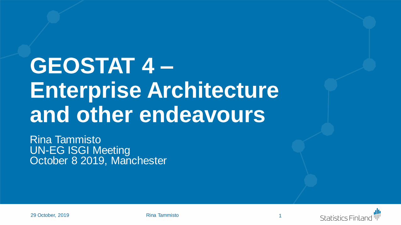
GEOSTAT 4 –Enterprise Architecture and other endeavoursRina TammistoUN-EG ISGI MeetingOctober 8 2019, Manchester
129 October, 2019 Rina Tammisto

Contents- Geospatial Reference Architecture of
Statistics Finland
- GEOSTAT 4
- Comparisons between the GSGF and the Finnish Geospatial Reference Architecture - for the GEOSTAT 4 project
- Personal interpretations ☺
2Rina Tammisto29 October, 2019

Geospatial Reference Architecture of Statistics Finland• Main goal was to understand and define what are geospatial
activities at Statistics Finland
• Method: Finnish Public Administration Recommendation (JHS) 179 v.2.0 Designing and Developing Enterprise Architecture (based on TOGAF v.9.1)
• Five perspectives: Architecture principles, Business architecture, Information architecture, Information systems architecture and Technology architecture
• STAT FI• Added also sixth perspective, the GSBPM
• Modelled current state, target state (emphasis on services needed) and made gap analysis, made a Road Map for the necessary actions
3Rina Tammisto29 October, 2019

The Geospatial Reference Architecture at STAT FI
EA at Statistics Finland:Statistics Finland’s
Information Architecture
(1-9/2017)
The Geospatial Management Group:
Geospatial Reference Architecture
(2-6/2018)
Implementation: Geospatial Data Repository &
Generic Services
(10/2018-6/2019)(A follow-up project
11/2019-5/2020)
4Rina Tammisto29 October, 2019

GEOSTAT 4 - 2/2020-4/2022• EU funded project, that will:
• Continue work done in the GEOSTAT 3 project
• Supplement and develop the GSGF Europe
• Link GSGF Europe to the ESS
• Create concrete examples
• Maintain and develop the EFGS web site
• Host 2020 and 2021 EFGS Conferences
• …
5Rina Tammisto29 October, 2019

Strategy Map - the Geospatial Reference Architecture of STAT FI
6Rina Tammisto29 October, 2019
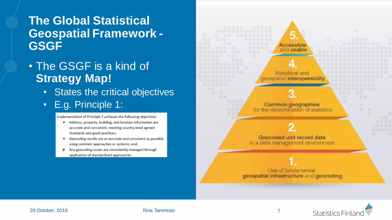
The Global Statistical Geospatial Framework -GSGF
• The GSGF is a kind of Strategy Map!
• States the critical objectives
• E.g. Principle 1:
7Rina Tammisto29 October, 2019
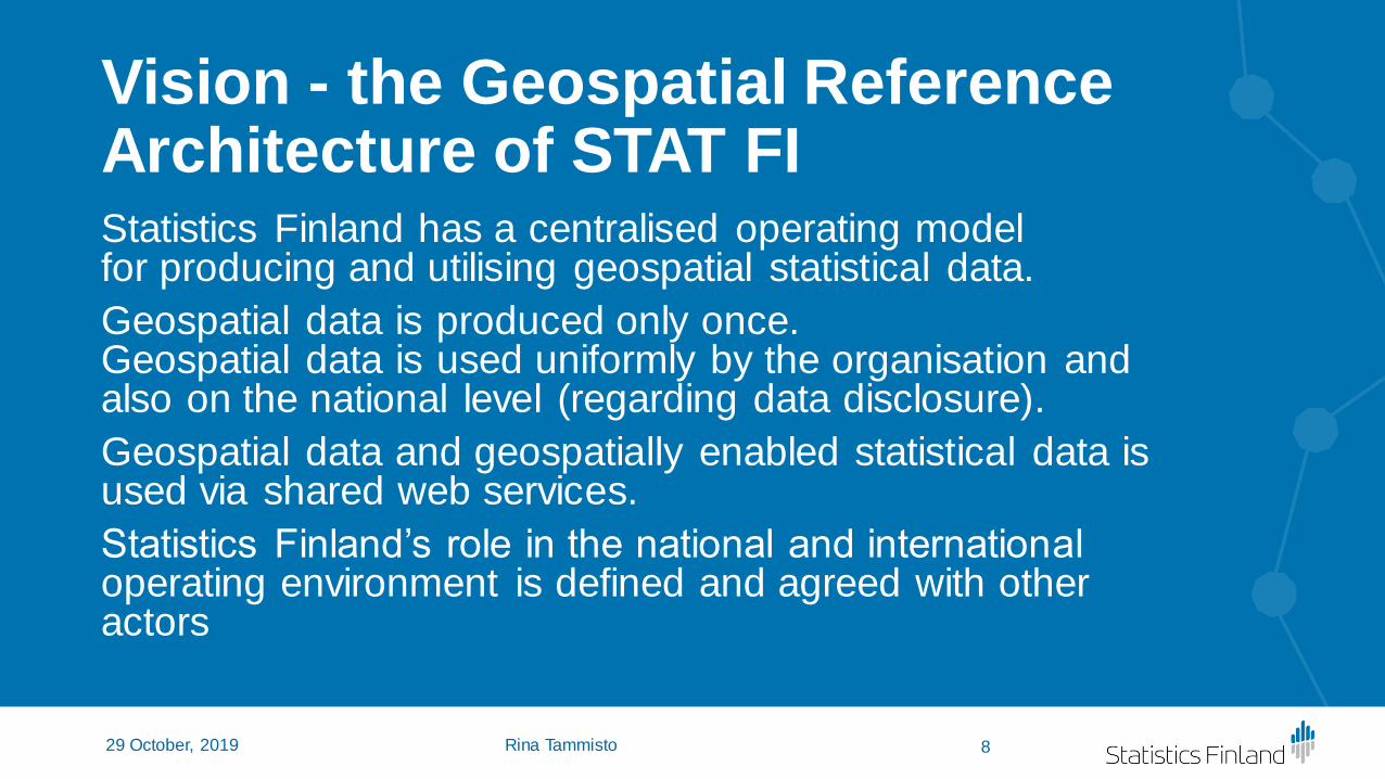
Vision - the Geospatial Reference Architecture of STAT FIStatistics Finland has a centralised operating model for producing and utilising geospatial statistical data.
Geospatial data is produced only once. Geospatial data is used uniformly by the organisation and also on the national level (regarding data disclosure).
Geospatial data and geospatially enabled statistical data is used via shared web services.
Statistics Finland’s role in the national and international operating environment is defined and agreed with other actors
8Rina Tammisto29 October, 2019

Vision, the GSGF
9Rina Tammisto29 October, 2019

Actors & Roles
• Geospatial related actors and their roles in-house
• In the operating environment other stakeholders and their roles
→ Everyone knows their role, responsibilities and relevance to each other
→Opportunity to share responsibilities
→GEOSTAT 4: A common model of statistical geospatial actors?
10Rina Tammisto29 October, 2019

Services
• Generic, shared web services
• Centralised use of geospatial information from geospatial data warehouse
• Geospatial information is utilised uniformly
• Cooperation with other geospatial information producers
→ GEOSTAT 4: Recognition of shared services?
11Rina Tammisto29 October, 2019
Process
CollectAnalyse
Disseminate

Processes
• Geospatial-related processes in context of organisational level processes
• General level processes • Geospatial Information System
processes• Supportive processes
• Sub-processes
→ GEOSTAT 4: Recognition of common statistical geospatial processes?
• Identifying processes that should be developed in associated organisations
12Rina Tammisto29 October, 2019

Interoperability cooperation with National Land Survey of Finland
Unofficial (but accepted and
supported)meetings
2019
Common Conceptual model (v1.0)
13Rina Tammisto29 October, 2019
Identification of interconnected processes and possible shared
servicesArchitecture is
a communtication tool

Statistics Finland -architecture
14
National Land Survey of Finland -architecture
Presentoija29 October, 2019
Services
Concepts
Information Models
Technologies
Information System Models
Interoperability – elements in the case Finland
Description of
Services
Information Models
Descriptions of Web
Services
Geospatial
Reference
Architecture
Catalogue of
Geospatial Services
Descriptions of Data
Repositories
VocabulariesNational Public Sector
RecommendationsReference
ArchitecturesStandards

Architectural Layer View and sharing
15Rina Tammisto29 October, 2019
IT Service
Process
Service
Actor
Linking
address dataGathering
address data
Integrate
address data
ID selection
ID selection
Addressstandardization
Address editing
Address storing
Area ID derivation
Area ID derivation
Coordinate conversion
NLS FISTAT FI
→ Recognition of generic shared services

Thank you!
16Rina Tammisto29 October, 2019
Tämä kuva, tekijä Tuntematon tekijä, käyttöoikeus: CC BY-SA