Geospatial Software for Fundraising Strategy Development · Geospatial Software for Fundraising...
30
Geospatial Software for Fundraising Strategy Development David Peterson Manager – Data & Analytics University of Minnesota Foundation [email protected] linkedin.com/in/david-peterson-366bb02a Lucy Tobin Prospect Researcher University of Minnesota Foundation [email protected] linkedin.com/in/lucy-tobin-599a2165
Transcript of Geospatial Software for Fundraising Strategy Development · Geospatial Software for Fundraising...

Geospatial Software for Fundraising Strategy Development
David PetersonManager – Data & AnalyticsUniversity of Minnesota [email protected]
linkedin.com/in/david-peterson-366bb02a
Lucy TobinProspect Researcher University of Minnesota [email protected]
linkedin.com/in/lucy-tobin-599a2165

Today’s Learning Objectives
• Participants will learn why geospatial thinking is of importance to non-profit fundraising
• Attendees will learn of the specific applications of geospatial technology for addressing research questions
• Attendees will learn the methods for translating the data and findings derived from the technology to key stakeholders
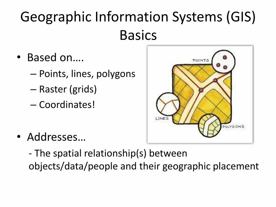
Geographic Information Systems (GIS) Basics
• Based on….
– Points, lines, polygons
– Raster (grids)
– Coordinates!
• Addresses…
- The spatial relationship(s) between objects/data/people and their geographic placement

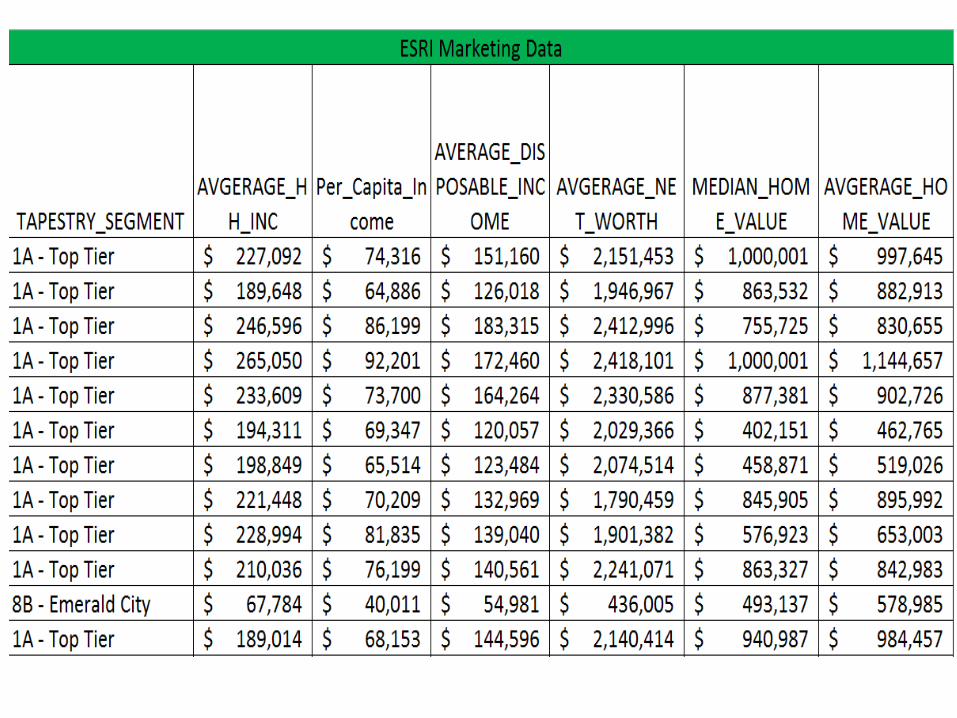
The 2016 Distressed Communities Index: An Analysis of Community Well-Being Across the United States. The Economic Innovation Group


What is the Questionwe hope to answer?
What will this information allow
us to do?

https://learn.arcgis.com/en/concepts/spatial-problem-solving-approach/

What do I need to answer the following question……?
• 1. Define the population
• 2. Latitude and Longitude data (x/y)
– List of addresses from your constituent database
– http://geocoding.geo.census.gov/geocoder/locations/addressbatch?form
• 3. County boundaries (shapefile)
– https://www.census.gov/geo/maps-data/data/cbf/cbf_counties.html


County File
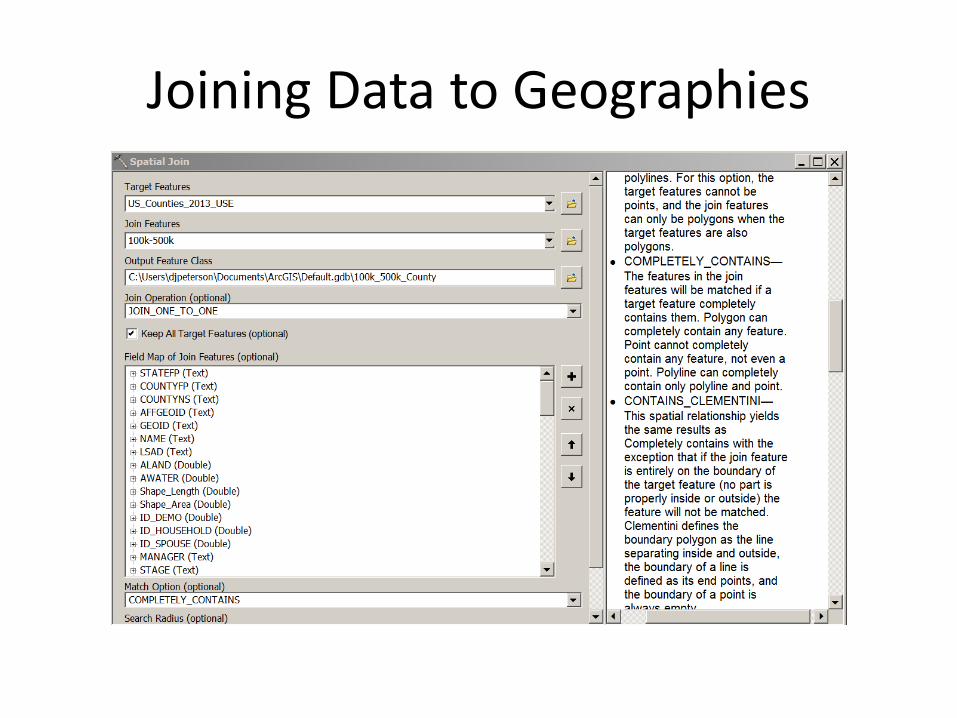
Joining Data to Geographies


What is the Question we hope to answer?
What will this information allow us to do?
What do I need to answer the question……?
Nothing extra….if we are using the same data


What is the Questionwe hope to answer?
What will this information allow
us to do?


Data Sources and Tools
• United States Census Bureau
– TIGER/Line: https://www.census.gov/geo/maps-data/data/tiger-line.html
– Census Geocoder: https://www.census.gov/geo/maps-data/data/geocoder.html
• NHGIS: https://www.nhgis.org/

Training
• Esri Training: http://www.esri.com/training/main
• University of Minnesota U-Spatial https://uspatial.umn.edu/training

Questions?