Geologic Map of the Wrangell-Saint Elias National Park and ... · Geologic Map of the...
15
Geologic Map of the Wrangell-Saint Elias National Park and Preserve, Alaska Compiled by Donald H. Richter, Cindi C. Preller, Keith A. Labay, and Nora B. Shew Pamphlet to accompany Scientific Investigations Map 2877 2006 U.S. Department of the Interior U.S. Geological Survey
Transcript of Geologic Map of the Wrangell-Saint Elias National Park and ... · Geologic Map of the...
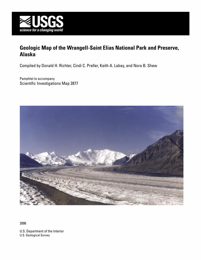
Geologic Map of the Wrangell-Saint Elias National Park and Preserve, Alaska
Compiled by Donald H. Richter, Cindi C. Preller, Keith A. Labay, and Nora B. Shew
Pamphlet to accompanyScientific Investigations Map 2877
2006
U.S. Department of the InteriorU.S. Geological Survey
�
GEOLOGIC NOTE
INTRODUCTION
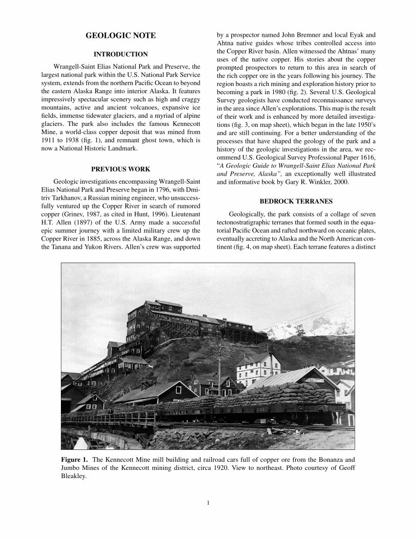
Wrangell-Saint Elias National Park and Preserve, the largest national park within the U.S. National Park Service system, extends from the northern Pacific Ocean to beyond the eastern Alaska Range into interior Alaska. It features impressively spectacular scenery such as high and craggy mountains, active and ancient volcanoes, expansive ice fields, immense tidewater glaciers, and a myriad of alpine glaciers. The park also includes the famous Kennecott Mine, a world-class copper deposit that was mined from �9�� to �938 (fig. �), and remnant ghost town, which is now a National Historic Landmark.
PREVIOUS WORK
Geologic investigations encompassing Wrangell-Saint Elias National Park and Preserve began in �796, with Dmi-triv Tarkhanov, a Russian mining engineer, who unsuccess-fully ventured up the Copper River in search of rumored copper (Grinev, �987, as cited in Hunt, �996). Lieutenant H.T. Allen (�897) of the U.S. Army made a successful epic summer journey with a limited military crew up the Copper River in �885, across the Alaska Range, and down the Tanana and Yukon Rivers. Allen’s crew was supported
by a prospector named John Bremner and local Eyak and Ahtna native guides whose tribes controlled access into the Copper River basin. Allen witnessed the Ahtnas’ many uses of the native copper. His stories about the copper prompted prospectors to return to this area in search of the rich copper ore in the years following his journey. The region boasts a rich mining and exploration history prior to becoming a park in �980 (fig. 2). Several U.S. Geological Survey geologists have conducted reconnaissance surveys in the area since Allen’s explorations. This map is the result of their work and is enhanced by more detailed investiga-tions (fig. 3, on map sheet), which began in the late �950’s and are still continuing. For a better understanding of the processes that have shaped the geology of the park and a history of the geologic investigations in the area, we rec-ommend U.S. Geological Survey Professional Paper �6�6, “A Geologic Guide to Wrangell-Saint Elias National Park and Preserve, Alaska”, an exceptionally well illustrated and informative book by Gary R. Winkler, 2000.
BEDROCK TERRANES
Geologically, the park consists of a collage of seven tectonostratigraphic terranes that formed south in the equa-torial Pacific Ocean and rafted northward on oceanic plates, eventually accreting to Alaska and the North American con-tinent (fig. 4, on map sheet). Each terrane features a distinct
Figure 1. The Kennecott Mine mill building and railroad cars full of copper ore from the Bonanza and Jumbo Mines of the Kennecott mining district, circa �920. View to northeast. Photo courtesy of Geoff Bleakley.

2
stratigraphy and is separated from neighboring terranes by major strike-slip or thrust faults.
The Windy terrane, exposed in the Alaskan interior north of the Denali Fault System and composed largely of Paleozoic metavolcanic and metasedimentary rocks, was the first to arrive; it accreted to the continent in Triassic and early Jurassic time (225–�80 Ma).
Next to arrive was the Wrangellia composite terrane (Peninsular, Wrangellia, and Alexander(?) terranes), pres-ently separated from the Windy terrane by the Denali Fault System, a series of strike-slip faults. During its journey north, the Wrangellia terrane merged with the Alexander(?) terrane before docking to the continent in early Cretaceous time (��0–85 Ma). The Nutzotin Mountains sequence of
Berg and others, �972, a thick marine flysch of Late Juras-sic and Early Cretaceous age, and the short-lived Cretaceous Chisana volcanic arc, formed in and along an oceanic trough next to the north edge of the Wrangellia composite terrane. As the composite terrane progressed north, the Nutzotin Mountain sequence eventually became the glue that attached Wrangellia to the continent.
The Alexander(?) terrane, located on the eastern edge of the park and extending into the neighboring Yukon Territory, Canada, stitched to the Wrangellia terrane by a Pennsylvanian monzonite-granite complex, is composed of early Paleozoic marble, schist, phyllite, and amphibolite.
Wrangellia, the principal terrane in the Wrangellia composite terrane, consists chiefly of a Pennsylvanian-
Figure 2. Generalized locations of mines, prospects, mineral occurrences, and exploration oil and gas wells in or near Wrangell-Saint Elias National Park and Preserve. Mining information provided by the U.S. Geological Survey’s Alaska Resource Data File (http://ardf.wr.usgs.gov/). Oil and gas data provided by the State of Alaska Division of Oil and Gas (http://www.dog.dnr.state.ak.us/oil/). Shaded relief image courtesy of the National Park Service.
Oil and gas well
Mineral occurrence
Prospect
Mine
Wrangell-Saint Elias National Park and Preserve boundary
Map boundaryEXPLANATION
60° 000'
62° 000'
144° 00' 141° 00'
15 30 45 MILES
Gulf of Alaska
0
3
Permian volcanic arc, probably built on oceanic crust, over-lain by a sequence of thick Triassic flood basalts, Triassic limestones, and Jurassic sedimentary rocks. It occupies the bulk of the region with magnificent volcanic edifices and broad glacial valleys.
The Peninsular terrane, buried by the deposits of an-cient glacial Lake Atna (Nichols, �989; Williams and Gal-loway, �986) and exposed only locally west of the park, consists chiefly of a Jurassic volcanic arc that overlies the Wrangellia terrane.
Located south of the Wrangellia composite terrane and separated by the Border Ranges Fault, the Southern Margin composite terrane’s spectacular mountains consist of two dis-tinct terranes: the Chugach and Prince William terranes.
The Chugach terrane’s towering peaks are composed largely of another, younger, marine flysch that formed in a deep oceanic trough, which arrived in the latest Cretaceous (about 67 Ma).
Following and separated by the Contact Fault System, the Chugach terrane was joined by the Prince William terrane (about 50 Ma), a Tertiary deep-sea fan and volca-nic rock assemblage, home to the ecologically sensitive Copper River Delta.
Finally, arriving about 26 Ma and still actively accret-ing to the continent, is the Yakutat terrane, a series of Juras-sic(?) and Cretaceous to late Tertiary sedimentary rocks that include minor amounts of oceanic volcanic rocks. The Yakutat terrane, host to some of the world’s largest gla-ciers (fig. 5, on map sheet), is separated from the northern terranes by the Chugach-Saint Elias Fault System and the Fairweather Fault.
QUATERNARY ACTIVITTY
The Wrangell volcanic field forms much of the higher elevations of the Wrangell and Saint Elias Mountains. Initial volcanism began about 26 million years ago near
the Alaska-Yukon border and progressed northwestward terminating at the spectacular Quaternary volcanoes of Mount Drum, Mount Wrangell, and Mount Sanford. The volcanic activity is related to the subduction of the Pacific Plate and coincided with the Yakutat terrane’s time of ar-rival. Subduction and associated volcanic activity largely ended about 200,000 years ago when much of the north movement of the Pacific Plate was then accommodated by right-lateral movement along the Denali Fault System, the Totschunda Fault System, and the Fairweather Fault; all strike-slip faults. As subduction mostly ceased, that part of Alaska south of the Denali-Totschunda Fault Systems, which includes most of Wrangell-Saint Elias National Park and Preserve, was largely coupled to the Pacific Plate. The latest activity to occur on the bounding faults was the shallow Magnitude 7.9 earthquake of November 3, 2002, whose epicenter was on the Denali Fault System northwest of the park. The ground rupture produced along the Denali and the Totschunda Fault Systems stretched into the park, as far southeast as the Nabesna River.
ACKNOWLEDGMENTS
Many of our colleagues have contributed to the com-pilation of this geologic map, for which we are grateful. E.M. MacKevett, Jr., George Plafker, H.R. Schmoll, G.R. Winkler, and L.A. Yehle all reviewed parts of the map; their efforts and comments contributed significantly to the map’s integrity. G.R. Winkler (bedrock) and H.R. Schmoll and L.A. Yehle (surficial deposits) reviewed the final prod-uct. Scott Starratt conducted the geologic names review. Carolyn Donlin edited the map. Rich Koch provided the digital cartography. Our most sincere appreciation extends to Logan Hovis, Suzanne McCarthy, D.S. Rosenkrans and the rest of the staff at Wrangell-Saint Elias National Park and Preserve, as well as many local residents of the Copper River basin, who helped in preparation of this map.
DESCRIPTION OF MAP UNITS
[Some unit exposures are too small to distinguish for identification. While labeled when possible, all are attributed within the digital database.]
SURFICIAL DEPOSITS
Alluvial deposits
Qa Alluvium (Holocene)—In active streambeds and lowest terraces along larger streams and active alluvial fans. Chiefly well sorted gravel and sand; minor silt and boulders
Qao Older alluvium (Holocene and Pleistocene)—In higher terraces along larger streams and in inactive alluvial fans. Predominantly of Pleistocene age, but may include localized Holocene deposits. Chiefly well sorted gravel and sand; minor silt and boulders

4
Mass wasting deposits
Qu Slope deposits, undifferentiated (Holocene and Pleistocene)—Colluvium consisting of talus and small landslides, also includes small glacial, rock glacier, and alluvial deposits. Sand, gravel, boulders, diamicton, and rubble
Qcb Bluff colluvium (Holocene)—Occurs along high steep bluffs of the Copper River and its principal tributaries. Locally includes small areas of the Copper River deposits (Qcr) and the drift of older glaciations (Qg). Unsorted silt, sand, gravel, and boulders
Ql Landslide deposits (Holocene and Pleistocene)—Slumps, earth-debris flows, block glides, and debris avalanches. Diamicton and rubble
Glacial and glaciolacustrine deposits
Qrg Rock glacier deposits (Holocene)—Well-defined lobate forms that may include glacier ice cores. Chiefly blocks of rubble
Qag Drift of Alaskan glaciation (Holocene)—Neoglacial deposits of end, lateral, and ground moraines, kames and outwash proximal to present glaciers; includes small rock glaciers. Diamicton, local gravel, and sand
Qg Drift of older glaciations (Pleistocene)—Wisconsin glaciation and older end, lateral, and ground moraines, local kames, kame-like deposits, and outwash. Also includes the glaciolacustrine deposits (Qcr) near complex interface with glacial Lake Atna in lower Chitina River valley. Chiefly diamicton, local gravel and sand
Qcr Copper River deposits (Pleistocene)—Interbedded glaciolacustrine, glacial, and alluvial deposits. Includes deposits of glacial Lake Atna (Nichols, �989; Williams and Galloway, �986); historically complex basin built from numerous lake stages in response to multiple glacial advances and retreats. Locally overlain by small fine-grained alluvium and pond deposits (Qfl). Interbedded with the Mount Wrangell valley-fill lavas (Qwwv) along west-ern margin of Mount Wrangell, especially in Chetaslina River valley area. Clay-pebble silt and diamicton, containing local to regionally distributed beds of gravel and sand
Other unconsolidated deposits
Qfl Fine-grained deposits (Holocene)—In ponds, swamps, lagoons, and along low-gradient streams. Chiefly silt, clay, fine sand, peat, and other organic material
Qms Mineral spring deposits (Holocene)—Deposited by warm, Na-HCO3-rich, CO2-charged, saline spring waters forming the Klawasi Group (Shrub, Upper Klawasi, and Lower Klawasi) mud volcanoes (Motyka and others, �989) located west of Mount Drum. Also includes one or more inactive deposits west of Capital Mountain; a methane-charged mineral spring found on Copper River’s east bank near Copper Center. Mud and clayey-silt
Qe Eolian deposits (Holocene)—Dunes on tops of river bluffs, windblown flats, and river bars. Includes informally named Bremner sand dunes, a large barchan field, located at confluence of Bremner and Copper Rivers. Fine-grained sand
Qb Beach and delta deposits (Holocene)—Wave-deposited, coarse-grained mate-rial and driftwood along seacoast; fine-grained sediment in mud flats of Copper River Delta; and marine uplift terraces. Successive spit-building episodes of progressive gradation are preserved in beach sequences along coastal lowland between Cape Yakataga and Bering Glacier. Boulders, gravel, sand, and silt

5
WRANGELL VOLCANIC FIELD
This Oligocene to Holocene regional province covers more than �0,000 km2 in the Wrangell and Saint Elias Mountains built by predominantly large non-explosive shield eruptive centers and summit calderas with a minor sedimentary base deposit. The Wrangell Lava collectively forms the entire volcanic field of effusive flows, tuffs, breccias, lahar deposits, dikes, and domes. The sedimentary nonmarine Frederika Formation was deposited prior to and during early stages of volcanism locally in southern Wrangell Mountains. Individual volcanic descriptions and ages (Richter and others, �990) can be found in U.S. Geological Survey Bulletin 2072, “Guide to the Volcanoes of the Western Wrangell Mountains, Alaska: Wrangell-St. Elias National Park and Preserve” (Richter and others, �995)
Individual volcanic eruptive centers
Mount Wrangell volcano (Holocene and Pleistocene, 0.65 Ma and younger)—Enormously bulky massive broad active shield; non-explosive, ice-filled caldera in summit area. Hundreds of voluminous andesitic lavas flowed for 650,000 years, concluding 25,000 years ago; one or two undated flows might be younger. As the only currently active volcano, present activ-ity is limited to frequent steam plume fumaroles and occasional summit caldera phreatic eruptions
Qwws Shield lavas—Chiefly andesitic flows
Qwwv Valley-fill lavas—Lavas filled deeply incised glacial valleys cutting into the thick shield lavas (Qwws). A few far-reaching flows interbedded with the Copper River deposits (Qcr); chiefly andesite
Mount Drum volcano (Pleistocene, 0.6–0.2 Ma)—Constructed during andesitic cone (or shield) building and rhyolite-dacite ring dome emplacement cycles. A late (0.25 Ma) cataclysmic eruption destroyed top and south sides
Qwd Lava flows—Andesite and dacite flows; dikes
Qwdr Domes—Dacite and rhyolite domes; associated flows and dikes
Mount Sanford volcano (Pleistocene, 0.9–0.5 Ma)—Height and extensive ice cover limit understanding of volcanic structure. Edifice, apparently sourced from three major vents, is an intermingled complex of lava flows and domes, predominantly andesite, including a particularly extensive rhyolite flow
Qws Lava flows—Chiefly andesite and dacite
Qwsr Rhyolite dome and flow—Thick far-ranging flow (0.6 Ma) probably sourced from northeast flank dome
Capital Mountain volcano (Pleistocene, 1.0 Ma)—Small andesitic shield and summit caldera intruded at center by an andesite plug, focal point of a spec-tacular radial basaltic andesitic dike swarm
Qwc Shield and intracaldera lavas—Chiefly andesite
Qwcr Central andesite plug and dike swarm; rhyolite laccolith and associ-ated dike—Plug represents final activity; dike originated from laccolith on shield’s southeast flank
Mount Jarvis volcanoes (Pleistocene, 1.7–1.0 Ma)—North-trending linear succession of centers including at least two summit calderas and eroded andesitic shields; satellite dacite domes and flows
Qwj Shield and intracaldera lavas—Extensive flat-lying andesitic flows
Qwjd Domes—Final stage deposition at chain’s north end; dacite
Tanada Peak volcano (Pleistocene and Pliocene, 1.8–0.9 Ma)—Large shield and remnant summit caldera, stripped by erosion, remaindered to thick, massive intracaldera lavas as serrated topographic highs
QTwt Shield and intracaldera lavas—Andesite flows and local agglutinates

6
Other volcanic deposits
Volcaniclastic deposits (Pleistocene)Qvd Volcanic debris flows—Chetaslina volcanic mass-flow deposit, probably
sourced from Mount Drum, exposed along Chetaslina and Copper Rivers; Sanford volcanic debris flow exposed along Sanford and Copper Rivers. Large blocks of lava and varied debris
Qpf Pyroclastic flows—The extensive informally named Nadina hot avalanche deposit from Mount Drum’s cataclysmic eruption and a smaller pyroclastic flow (0.3 Ma), possibly derived during an explosive episode from Mount Drum, deposited at Chetaslina River’s two forks. Abundant bombs, scoria, pumice, and ash; lesser andesite and dacite blocks
Qbc Cinder cones, flows, and tuffs (Pleistocene)—Olivine basalt and basaltic andesite
Older volcanic and sedimentary rocks (Pleistocene, Pliocene, or Miocene)—Boomerang (<�.0 Ma), Chetaslina (�.6–0.8 Ma), Skookum Creek (3.2–2.0 Ma), Mount Blackburn (4.3–3.2 Ma), and other Early Quaternary to Late Tertiary volcanic centers. Sedimentary rocks crop out at base of Wrangell Lava
QTw Lava flows and sedimentary rocks—Flat-lying andesite and dacite lava flows; a Tertiary tillite and the fossil-rich conglomeratic sandstone Frederika Formation
QTwi Flows of the Ice Fields Plateau—Massive dacite and high-silica andesite lavas capping Ice Fields Plateau east of Nabesna Glacier
QTwr Domes and intrusive rocks—Chiefly dacite and rhyolite Hypabyssal and plutonic rocks (Pleistocene, Pliocene, Miocene, or Oligocene)QTwd Dikes—Chiefly andesite and daciteTh Shallow plutons, small stocks, dikes, and sills—Andesite to dacite por-
phyry, diorite, and quartz diorite. K-Ar dates indicate ages that range from 7.0 to 3.0 Ma, younger than the plutons (Tp) located on north side of Wrangell Mountains. Probably related to Wrangell volcanism, porphyry rocks may be hypabyssal equivalents of the older Wrangell lavas (QTw) and the Chisana Formation (Kc)
Tg Granodiorite—Plutonic phase of the Wrangell Lava exposed mainly at Hawkins Glacier head, marginal to Mount Blackburn volcano caldera
Oldest volcanic rocks (Miocene or Oligocene)—Sonya Creek (23–20 Ma) and other, unmapped, older Tertiary volcanic centers (26–23 Ma)
Tw Lava flows and lahars—Basaltic andesite, andesite, and dacite lava flows; andesitic lahar deposits
Twr Rhyolite flow—Obsidian-bearing lava within Sonya Creek calderaTwd Domes—Dacite and rhyolite underlying the lava flows and lahar deposits
(Tw) of Sonya Creek volcano
WINDY TERRANE
Sedimentary rocks
}c Conglomerate and sandstone (Early Cretaceous(?) and Late Jurassic(?) or older)—Pebble to boulder conglomerate and coarse-grained sandstone. May reflect the Nutzotin Mountains sequence (KJs) of Berg and others (�972) northern shore facies; hornfels alteration along southern contact of the Snag pluton (Tsq)
Intrusive rocks
Tsq Snag pluton (Tertiary, 50 Ma)—Informally named body of leucocratic biotite quartz monzonite. K-Ar date indicates age of 50 Ma

7
Metamorphic rocks
Tc Metamorphic complex of Cottonwood Creek of Richter (1976) (Ter-tiary)—Banded granite and quartz diorite gneiss enclosed in schist and phyllite, most likely part of the Devonian metasedimentary (Dp) rocks. Greenschist to amphibolite metamorphism yields metamorphic age of 20–�7 Ma. Complex occurs within Denali Fault System between Nabesna and Chisana Rivers
Metamorphic rocks of the Carden Hills (Permian(?), Pennsylvanian, Missis-sippian, and Devonian(?))
|v Metavolcanic rocks—Slightly porphyritic meta-andesite and metabasalt; greenschist-facies metamorphism
|vc Metavolcaniclastic rocks—Chiefly meta-sandstone, metatuff, and quartzite; greenschist-facies metamorphism
Dp Metasedimentary rocks (Devonian)—Mainly phyllite, also includes calcareous mica-schist, quartzite, metaconglomerate, and thin marble lenses. Green-schist-facies metamorphism. Contains poorly preserved Devonian fossils
Ultramafic and associated rocks
}|u Alpine-type ultramafic rocks and gabbro (Cretaceous(?), Jurassic(?), Trias-sic, Permian, and Pennsylvanian(?))—Serpentinized peridotite and dunite, locally containing chromitite, leucocratic gabbro, and hornblende gabbro
WRANGELLIA COMPOSITE TERRANE
PENINSULAR TERRANE (West of Copper River)
Sedimentary, volcanic, and ultramafic rocks
Jnt Mafic and ultramafic rocks (Middle or Early Jurassic)—Gabbro, pyroxenite, peridotite and dunite. Includes the Nelchina River Gabbronorite, the Tonsina ultramafic, and a mafic sequence of Winkler and others (�980). K-Ar dates indicate ages of �88–�7� Ma
J^t Talkeetna Formation (Early Jurassic and Late Triassic(?))—Dominantly andesitic volcaniclastic rocks, products of Late Triassic and Early Jurassic oceanic volcanic arcs
WRANGELLIA TERRANE (Eastern Alaska Range and Northern Wrangell Mountains)
Metamorphic rocks
P*dm Diorite complex, metamorphic part (Permian(?) and Pennsylvanian)—Amphibolite-grade metamorphic rocks of mainly quartz-feldspar schist, biotite-hornblende gneiss, and syenite-monzonite gneiss. Jurassic K-Ar ages in probability reflect a metamorphic age. Together with associated late Paleo-zoic plutons (P*dp) construct part of the Skolai-Tetelna magmatic arc (P*t, P*s, and P*sc) and Pennsylvanian oceanic crust. Possibly correlative with the gabbro and orthogneiss (P*go) in southern Wrangell Mountains
Intrusive rocks
Tp Younger plutons (Tertiary)—Hornblende-feldspar and feldspar porphyry plutons; in part, related to Wrangell volcanism. K-Ar dates indicate ages of 39–�7 Ma
8
Kg Mid-Cretaceous plutons (Cretaceous)—Chiefly discordant plutons of granodi-orite and quartz monzonite; also include quartz diorite, diorite, syenodiorite, and trondhjemite phases. K-Ar dates indicate ages of ��7–�05 Ma. Locally abundant xenoliths
P*dp Diorite complex, plutonic part (Permian(?) and Pennsylvanian)—Horn-blende diorite grading into gneissic diorite. Together with associated meta-morphics (P*dm), almost certainly represents the Skolai-Tetelna magmatic arc’s (P*t, P*s, and P*sc) roots. Possibly correlative with the gabbro and orthogneiss (*go) in southern Wrangell Mountains
*a Ahtell pluton (Pennsylvanian)—Quartz monzonite and granodiorite discor-dant zoned pluton. Together with the monzonite-granite complex (*m) in Saint Elias Mountains make part of the Skolai-Tetelna magmatic arc’s (P*t, P*s, and Phsc) core. K-Ar data indicates an age of 285 Ma
Sedimentary and volcanic rocks
Kun Nonmarine sedimentary rocks (Late Cretaceous)—Conglomerate, sandstone, siltstone, and mudstone locally containing abundant plant fossils
Kc Chisana Formation (Early Cretaceous)—Thick volcanic arc assemblage of marine and subaerial volcanic and volcaniclastic rocks. Younger part con-sists of andesite and basaltic andesite flows, and volcaniclastic rocks; older part consists of volcaniclastic rocks and locally fossil rich marine argillite and graywacke
KJs Nutzotin Mountains sequence of Berg and others (1972) (Early Cretaceous and Late Jurassic)—Argillite-graywacke graded beds and minor con-glomerate, sandstone, and limestone; thick deep ocean trench fossil-poor marine flysch sequence bordering Wrangellia terrane
^l Triassic limestone (Late Triassic)—Locally fossil rich, thin-bedded limestone and interbedded argillite in partially starved marine basin; overlies shallow marine to intertidal fossil-poor cherty massive limestone
^n Nikolai Greenstone (Late and(or) Middle Triassic)—Widespread sequence of tholeiitic flood basalt flows, mainly subaerial and characteristically amygda-loidal; subordinate volcaniclastic interbeds and volcanic conglomerate basal sections. Metamorphosed to prehnite-pumpellyite facies although alteration rarely masks primary mineralogy and texture. Contains anomalously high amounts of copper
Mankomen Group (Early Permian and Pennsylvanian)—Marine sedi-mentary sequence consisting of the upper nonvolcanogenic Eagle Creek Formation (Pe and Pel) and the lower volcanogenic Slana Spur Formation (P*ss). Locally altered and metamorphosed. Correlates with the Skolai Group (P*s, Ph, Pl, and P*sc) in southern Wrangell Mountains
Pe Eagle Creek Formation (Early Permian)—Nonvolcanogenic argillite and siltstone deposited in a moderately deep quiet basin. Abundant fossils, cone-in-cone structures, and concretions. Intruded by locally abundant Triassic gabbroic inclusions (^n) and porphyry dikes and sills (Tp)
Pel Limestone of Eagle Creek Formation—Fossiliferous thin- to thick-bedded limestone
P*ss Slana Spur Formation (Early Permian and Pennsylvanian)—Fossil-rich volcanic sandstone, siltstone, conglomerate, and impure bioclastic lime-stone; shed off the Tetelna volcanic arc (P*t)
P*t Tetelna Volcanics (Early Permian and Pennsylvanian)—Subaerial and sub-marine basaltic to dacite lava, lahar flows, tuff deposits, and fine-grained volcaniclastic rocks. Extensive late Paleozoic magmatic arc vestiges form Wrangellia terrane’s basement in northern Wrangell Mountains and eastern
9
Alaska Range. Correlates to the Skolai Group’s (P*s) Station Creek For-mation (P*sc) in southern Wrangell Mountains
WRANGELLIA TERRANE (Southern Wrangell Mountains and Saint Elias Mountains)
Sedimentary and volcanic rocks
Ku Marine sedimentary rocks (Early and Late Cretaceous)—Sandstone and siltstone deposited at shallow to moderate depths; locally abundant marine fossils. Includes the MacColl Ridge, Chititu, Schulze, and Moonshine Creek Formations
Kl Shallow marine sedimentary rocks (Early Cretaceous)—Conglomerate, sandstone, siltstone, and clastic sandy limestone deposited under nearshore, high-energy, transgressive marine conditions; locally includes concretions and abundant fossils. Includes the Kennicott, Kuskulana Pass, and Berg Creek Formations
Js Sedimentary rocks (Late, Middle, or Early Jurassic)—Chiefly spiculite, graywacke, mudstone, and conglomerate deposited in a shallow-marine and nearshore littoral setting. Includes the fossil-rich Lubbe Creek, Nizina Mountain, and Root Glacier Formations
Jk Kotsina Conglomerate—Conglomerate and minor sandstone deposited under rapid local marine circumstances during orogenesis. Fossils absent
J^m McCarthy Formation (Early Jurassic and Late Triassic)—Spiculite, impure chert and limestone, and shale deposited in a starved marine basin environ-ment. Fossils locally abundant
^cn Chitistone and Nizina Limestones (Late Triassic)—Chiefly limestone and dolomite; minor chert and marble; locally fossil rich. The upper Chitis-tone and cherty Nizina, deposited in a shallow to moderately deep marine neritic environment, transition into an intertidal-supratidal setting with local sabkha facies full of algal-mat chips, stromatolites, and evaporate relics typical of the dolostone-rich lower Chitistone rocks
^n Nikolai Greenstone (Late and(or) Middle Triassic)—Widespread sequence of tholeiitic flood basalt flows, mainly subaerial and characteristically amygdaloidal, include subordinate volcaniclastic interbeds and volcanic conglomerate basal sections. Metamorphosed to prehnite-pumpellyite facies although alteration rarely masks primary mineralogy and texture. Contains anomalously high amounts of copper
P*s Skolai Group, undivided (Early Permian and Pennsylvanian)—Lower late Paleozoic magmatic arc and associated upper sedimentary rocks. Equivalent to the Mankomen Group (Pe, Pel, and P*ss) and the Tetelna Volcanics (P*t) in northern Wrangell Mountains and eastern Alaska Range
Ph Hasen Creek Formation (Early Permian)—Fossil-rich marine argillite, shale, and sandstone; nonvolcanic origin
Pl Limestone of Hasen Creek Formation—Fossil-rich, lenticular, marine limestone; partially equivalent to the Strelna metamorphic marble of Plafker and others (�989) (P*m)
P*sc Station Creek Formation (Early Permian and Pennsylvanian)—Magmatic arc consists of a younger volcaniclastic member and an older andesitic and basaltic lava flow member, both of submarine origin; locally metamor-phosed to greenschist-facies south of Chitina Fault
Intrusive rocks
Jc Chitina Valley batholith (Late Jurassic)—Compositionally diverse quartz monzodiorite, ranging from granite to diorite, generally foliated and locally
�0
gneissic particularly within plutons enclosed by the Strelna Metamorphics of Plafker and others (�989) (P*sm). K-Ar dates indicate plutonic ages of �57–�38 Ma, foliated phase ages are as young as �22 Ma; synchronous with Late Jurassic major regional orogeny perhaps related to subduction along Border Ranges Fault
*m Monzonite-granite complex (Pennsylvanian)—Large composite granite and quartz monzonite pluton containing lesser monzonite, syenite, and gabbro emplaced between Wrangellia and Alexander(?) terranes. K-Ar dates indicate ages of 297–295 Ma. Correlates with the Ahtell pluton (*a) in northern Wrangell Mountains to construct the Tetelna-Skolai magmatic arc’s (P*t, P*s, and P*sc) core
*go Gabbro and orthogneiss (Pennsylvanian)—Interlayered hornblende pyroxene gabbro and monzonitic gneiss; overlain by the Skolai Group (P*s, Ph, Pl, and P*sc) and their metamorphosed equivalent, the Strelna Metamorphics of Plafker and others (�989) (Phsm). Represents, in part, Pennsylvanian oceanic crust correlative with the diorite complex (P*dm and P*dp) in northern Wrangell Mountains and eastern Alaskan Range
Metamorphic rocks
P*sm Strelna Metamorphics of Plafker and others (1989) (Jurassic(?), Triassic(?), Permian, Early Pennsylvanian, and Late Mississippian(?))—Domi-nantly calcareous metasedimentary rocks, schist, phyllite, amphibolite, and marble; lesser quartzite, meta-andesite, and metabasalt in thin to thick thrust sheets containing local pods of the tectonically emplaced ultramafic rock and marble (P*m); overlying the gabbro and orthogneiss (*go). Includes the Jurassic Uranatina Metaplutonic Complex and the Dadina Schist of Carboniferous and possibly older(?) age exposed near Mount Drum. Metamorphic grade increases closer to the Chitina Valley batholith (Jc) and might represent metamorphosed roots of the Skolai–Tetelna mag-matic arc (P*t, P*s, and P*sc)
P*m Marble—Regionally metamorphosed with poorly preserved and locally placed Permian and Early Pennsylvanian fossils. Partially equivalent to the Permian limestone of the Hasen Creek Formation (Pl)
ALEXANDER(?) TERRANE (Saint Elias Mountains)
Metamorphic rocks
|k Kaskawulsh Group of Kindle (1953) (Pennsylvanian, Mississippian, Devo-nian(?), and older)—A metamorphosed marine sequence of marble, schist, and phyllite; minor meta-tuff, flows, breccia, and meta-conglomerate; probably oceanic crustal progression with carbonate reefs. Poorly preserved Ordovician, Devonian, and possible Mississippian and Pennsylvanian fossils present. Metamorphosed to upper greenschist-facies and locally intensely folded. Coextensive with widely occurring rocks within neighboring Yukon Territory, Canada; potentially representing westernmost known extent of Alexander(?) terrane
SOUTHERN MARGIN COMPOSITE TERRANE
CHUGACH TERRANE
Sedimentary, volcanic, and metamorphic rocks
Valdez Group (Late Cretaceous)—Mainly mudstone and graywacke turbidite beds, carbonaceous phyllite, minor mafic tuff and breccia in a thick regionally

��
extensive belt of accreted flyschoid deep marine rocks. Metamorphic grade increases southward from lower greenschist-facies to amphibolite-facies
Kv Greenschist-facies flysch—Flysch metamorphosed to lower greenschist-faciesKvv Metamorphosed basalt and tuff—Tholeiitic metabasalt and basaltic meta-
tuff, local pillow lava and pillow breccia, gabbroic dikes and sillsKvm Amphibolite-facies flysch—Flysch metamorphosed to amphibolite-facies
schistKvg Gneiss and schist—Gneiss, banded and migmatite. Includes the amphibolite-
facies schist of Mount Augusta of Plafker (written commun., 2000)
KJm Mélange units (mid-Cretaceous, Jurassic, and Late Triassic(?)—Tholeiitic pillowed basalt, chert, tuff, greywacke, argillite, and phyllite-greenstone deposited along a convergent plate margin as early as Late Triassic continu-ously into middle Cretaceous. Includes the McHugh Complex, a structur-ally complex and chaotic assemblage of oceanic rocks containing abundant slightly deformed radiolarian chert; and a mélange-like unit between the McHugh Complex and the Valdez Group (Kv)
Jlc Schist of Liberty Creek of Winkler and others (1981) (Jurassic(?))—Basalt flows, breccia, and tuff; regionally metamorphosed greenschist- and blue-schist-facies Middle Jurassic or older oceanic assemblage protolith
Intrusive rocks
Tgp Granitic plutons (Eocene, 50 Ma)—Granite, granodiorite, and diorite intruding Chugach and Prince William terranes; intermediate composition Eocene age dikes not shown on map
PRINCE WILLIAM TERRANE
Sedimentary and volcanic rocks
Orca Group (early Eocene and late Paleocene)—Weakly metamorphosed flysch and basalt thick submarine fan complex
Tos Turbidites—Mudstone to sandstone, locally fossil rich, submarine gravity flowsTov Basalt—Mainly tabular bodies of pillowed, massive, and columnar jointed
tholeiitic basalt lava flows; locally interbedded minor mudstone and siltstone
Intrusive rocks
Tgp Granitic plutons (Eocene, 50 Ma)—Granite, granodiorite, and diorite intruding Chugach and Prince William terranes; intermediate composition Eocene age dikes not shown on map
YAKUTAT TERRANE
Sedimentary, volcanic, and metamorphic rocks
QTy Yakataga Formation (Holocene(?), Pleistocene, Pliocene, and Miocene)—Mudstone, siltstone, sandstone, and diamictite in a diverse marine and glacio-marine clastic continental shelf deposit. Abundant mega- and micro-fauna
Tm Volcanic and hypabyssal rocks (Miocene and Oligocene)—Basalt to andesitic plugs, dikes, and flows
Tps Poul Creek Formation (early Miocene(?), Oligocene, and late Eocene(?))—Concretionary marine siltstone, claystone, sandstone, and conglomerate, minor basaltic tuff, and locally glauconitic. Includes part of the clastic Red-wood Formation and, as mapped, forms part of Robinson Mountains north of Cape Yakataga

�2
Tt Tokun Formation (Eocene)—Shallow marine concretionary siltstone and minor sandstone
Tk Kulthieth Formation (Eocene and early Paleocene(?))—Interbedded nonma-rine carbonaceous sandstone, siltstone, shale, and minor coal; sparse warm-water marine molluscan megafauna and locally abundant subtropical plant fossils. Includes small occurrences of the siltstone-rich Stillwater Formation east of Steller Glacier, the siltstone of Oily Lake of Plafker (�987), and the basalt of Hubbs Creek of Plafker and others (�987) found in Samovar Hills, a Malaspina Glacier nunatak
Kyn Schist of Nunatak Fiord (Cretaceous)—Complexly deformed interbed-ded mudstone and sandstone, minor volcaniclastic rocks and conglomerate; metamorphosed to greenschist- and epidote-amphibolite facies. Crops up between Boundary and Fairweather Fault Systems and intruded extensively by the Tertiary granitic plutons (Tgp) (Plafker, written commun., 2000)
Yakutat Group (Cretaceous and Jurassic(?))—Complexly deformed flysch and mélange locally recrystallized to greenschist
Kyf Flysch—Graywacke, siltstone, and argillite
Kym Mélange—Discrete blocks of greenstone, limestone, marble, graywacke, chert, conglomerate, and plutonic rocks, up to several kilometers in greatest dimension, in a sheared matrix of mudstone
Intrusive rocks
Td Rhyolite porphyry and granite (Pliocene(?) or Miocene(?))—Discordant hyp-abyssal plutons and dikes exposed between Mount Augusta and Mount Cook
REFERENCES
Allen, H.T., Lt., �897, A Military Reconnaissance of the Copper River Valley, �885, in United States Congress, 56, �st session, Senate Report no. �023, serial 3896, Committee on Military Affairs, �900, Compilation of Narratives of Exploration in Alaska: Washington D.C., Government Printing Office, p. 4��–488.
Berg, H.C., Jones, D.L., and Richter, D.H., �972, Gravina-Nutzotin belt—Tectonic significance of an Upper Mesozoic sedimentary and volcanic sequence in south-ern and southeastern Alaska: U.S. Geological Survey Professional Paper 800–D, p. D�–D24.
Fuis, Gary S., and Wald, Lisa W., comps., 2003, Rupture in south-central Alaska—The Denali fault earthquake of 2002: U.S. Geological Survey Fact Sheet 0�4–03, 7 p.
Grinev, �897, Zabytaya ekspeditsiya Dmitriya Tarkhanova na Mednuyu reku [The forgotten expedition of Dmitriv Tarkhanov to the Copper River]: Sovetskaia Etnogra-gia [Soviet Ethnography], v. 4, p. 88–�80. [English translation available in NPS Archives at 240 W. 5th Ave., Anchorage, AK 9950�, phone (907) 644–3480]
Hunt, William, �996, Mountain Wilderness: An Illustrated History of Wrangell-St. Elias National Park and Pre-serve: Virgina Beach, Va., Donning Co., p. 33–34.
Kindle, E.D., �953, Dezadeash map area, Yukon territory:
Geological Survey of Canada Memoir 268, 68 p.Lerbekmo, J.F., Westgate, J.A., Smith, D.G.W., and
Denton, G.H., �975, New data on the character and history of the White River volcanic eruption, Alaska, in Suggate, R.P., and Cresswell, M.M., eds., Quater-nary Studies: Wellington, Royal Society of New Zea-land, p. 203–209.
Lowe, P.C., Richter, D.H., Smith R.L., and Schmoll, H.R., �982, Geologic map of the Nabesna B–5 quadrangle, Alaska: U.S. Geological Survey Geologic Quadrangle Map GQ–�566, scale �:63,360.
MacKevett, E.M., Jr., �970a, Geologic map of the McCar-thy C–5 quadrangle, Alaska: U.S. Geological Survey Geologic Quadrangle Map GQ–899, scale �:63,360.
MacKevett, E.M., Jr., �970b, Geologic map of the McCar-thy C–4 quadrangle, Alaska: U.S. Geological Survey Geologic Quadrangle Map GQ–844, scale �:63,360.
MacKevett, E.M., Jr., �972, Geologic map of the McCarthy C–6 quadrangle, Alaska: U.S. Geological Survey Geo-logic Quadrangle Map GQ–979, scale �:63,360.
MacKevett, E.M., Jr., �973, Reconnaissance geologic map of the McCarthy A–5 quadrangle, Alaska: U.S. Geo-logical Survey Miscellaneous Field Studies Map MF–536, scale �:63,360.
MacKevett, E.M., Jr., �974, Geologic Map of the McCar-thy B–5 quadrangle, Alaska: U.S. Geological Survey Geologic Quadrangle Map GQ–��46, scale �:63,360.

�3
MacKevett, E.M., Jr., �978, Geologic map of the McCar-thy quadrangle, Alaska: U.S. Geological Survey Miscellaneous Investigations Series I–�032, scale �:250,000.
MacKevett, E.M., Jr., and Smith, J.G., �972a, Geologic map of the McCarthy B–6 quadrangle, Alaska: U.S. Geological Survey Geologic Quadrangle Map GQ–�035, scale �:63,360.
MacKevett, E.M., Jr., and Smith, J.G., �972b, Geologic map of the McCarthy B–4 quadrangle, Alaska: U.S. Geological Survey Geologic Quadrangle Map GQ–943, scale �:63,360.
MacKevett, E.M., Jr., Smith, J.G., Jones, D.L., and Win-kler, G.R., �978, Geologic map of the McCarthy C–8 quadrangle, Alaska: U.S. Geological Survey Geologic Quadrangle Map GQ–�4�8, scale �:63,360.
Miller, D.J., and MacColl, R.S., �964, Geologic map and sections of the northern part of the McCarthy A–4 quadrangle, Alaska: U.S. Geological Survey Miscel-laneous Geologic Investigations Map I–4�0, scale �:63,360.
Motyka, R.J., Poreda, R.J., and Jeffrey, W.A., �989, Geo-chemistry, isotopic composition, and origin of fluids emanating from mud volcanoes in the Copper River basin, Alaska: Geochemica et Cosmochimica Acta, v. 53, p. 29–4�.
Nichols, D.R., �989, Pleistocene glacial events, southeast-ern Copper River basin, Alaska, in Carter, L.D., Ham-ilton, T.D., and Galloway, J.P., eds., Late Cenozoic history of the interior basins of Alaska and the Yukon: U.S. Geological Survey Circular �026, p. 78–80.
Nichols, D.R., and Yehle, L.A., �969, Engineering geo-logic map of the southeastern Copper River basin, Alaska: U.S. Geological Survey Miscellaneous Geo-logic Investigations Map I–524, scale �:�25,000.
Plafker, George, �987, Regional geology and petroleum potential of the northern Gulf of Alaska continental margin, in Scholl, D.W., Grantz, Arthur, Vedder, J.G., eds., Geology and resource potential of the continental margin of western North America and adjacent ocean basins, Beaufort Sea to Baja California: Houston, Texas, Circum-Pacific Council for Energy and Mineral Resources, Earth Science Series, v. 6, p. 229–268.
Plafker, George, Nokleberg, W.J., and Lull, J.S., �989, Bed-rock geology and tectonic evolution of the Wrangellia, Peninsular, and Chugach terranes along the Trans-Alaska Crustal Transect in the Chugach Mountains and southern Copper River Basin, Alaska: Journal of Geophysical Research, v. 94, no. B4, p. 4255–4295.
Post, Austin, �988, in Porter, S.C., �989, Late Holocene fluctuations of the fiord glacier system in Icy Bay, Alaska: Arctic and Alpine Research, v. 2�, no. 4, �989, p. 364–379.
Richter, D.H., �97�a, Reconnaissance geologic map of the Nabesna B–4 quadrangle, Alaska: U.S. Geological
Survey Miscellaneous Geologic Investigations Map I–656, scale �:63,360.
Richter, D.H., �97�b, Reconnaissance geologic map of the Nabesna A–3 quadrangle, Alaska: U.S. Geological Survey Miscellaneous Geologic Investigations Map I–655, scale �:63,360.
Richter, D.H., �973, Reconnaissance geologic map of the Nabesna A–4 quadrangle, Alaska: U.S. Geological Survey Miscellaneous Geologic Investigations Map I–789, scale �:63,360.
Richter, D.H., �975, Reconnaissance geologic map of the Nabesna B–3 quadrangle, Alaska: U.S. Geological Survey Miscellaneous Geologic Investigations Map I–904, scale �:63,360.
Richter, D.H., �976, Geologic map of the Nabesna quad-rangle, Alaska: U.S. Geological Survey Miscellaneous Geologic Investigations Map I–932, scale �:250,000.
Richter, D.H., Duffield, W.A., Sawyer, D.A., Ratté, J.C., and Schmoll, H.R., �994, Geologic map of the Gul-kana A–� quadrangle, south-central Alaska: U.S. Geo-logical Survey Geologic Quadrangle Map GQ–�728, scale �:63,360.
Richter, D.H., and Jones, D.L., �973, Reconnaissance geo-logic map and cross- section of the Nabesna A–2 quad-rangle, Alaska: U.S. Geological Survey Miscellaneous Geologic Investigations Map I–749, scale �:63,360.
Richter, D.H., Matson, N.A., Jr., and Schmoll, H.R., �976, Geologic map of the Nabesna C–4 quadrangle, Alaska: U.S. Geological Survey Geologic Quadrangle Map GQ–�303, scale �:63,360.
Richter, D.H., Moll-Stalcup, E.J., Duffield, W.A., and Shew, Nora, �997, Geologic map of the Nabesna A–6 quadrangle, south-central Alaska: U.S. Geological Survey Open-File Report 97–475, scale �:63,360.
Richter, D.H., Preece, S.J., McGimsey, R.G., and Westgate, J.A., �995, Mount Churchill, Alaska; source of the late Holocene White River Ash: Canadian Journal of Earth Sciences, v. 32, no. 6, p. 74�–748.
Richter, D.H., Ratté, J.C., Leeman, W.P., and Menzies, Martin, 2000, Geologic map of the McCarthy D–� quadrangle, Alaska: U.S. Geological Survey Geologic Investigations Series I–2695, scale �:63,360.
Richter, D.H., Ratté, J.C., Schmoll, H.R., Leeman, W.P., Smith, J.G., and Yehle, L.A., �989, Geologic map of the Gulkana B–� quadrangle, south-central Alaska: U.S. Geological Survey Geologic Quadrangle Map GQ–�292, scale �:63,360.
Richter, D.H., Rosenkrans, D.S., and Steigerwald, M.J., �995, Guide to the volcanoes of the western Wrangell Moun-tains, Alaska: Wrangell-St. Elias National Park and Pre-serve: U.S. Geological Survey Bulletin 2072, p. 3�.
Richter, D.H., and Schmoll, H.R., �973, Geologic map of the Nabesna C–5 quadrangle, Alaska: U.S. Geologi-cal Survey Geologic Quadrangle Map GQ–�062, scale �:63,360.
�4
Richter, D.H., Schmoll, H.R., and Matson, N.A., Jr., �973, Reconnaissance geologic map of the Nabesna A–� quad-rangle, Alaska: U.S. Geological Survey Miscellaneous Geologic Investigations Map I–807, scale �:63,360.
Richter, D.H., and Smith, R.L., �976, Geologic map of the Nabesna A–5 quadrangle, Alaska: U.S. Geological Survey Geologic Quadrangle Map GQ–�292, scale �:63,360.
Richter, D.H., Smith, J.G., Lanphere, M.A., Dalrymple, G.B., Reed, B.L., and Shew, Nora, �990, Age and progression of volcanism, Wrangell volcanic field, Alaska: Bulletin of Volcanology, v. 53, no. �, p. 29–44.
Richter, D.H., Smith, J.G., Schmoll, H.R., and Smith, R.L., �993, Geologic map of the Nabesna B–6 quadrangle, Alaska: U.S. Geological Survey Geologic Quadrangle Map GQ–�688, scale �:63,360.
Richter, D.H., Smith, R.L., Yehle, L.A., and Miller, T.P., �979, Geologic map of the Gulkana A–2 quadrangle, Alaska: U.S. Geological Survey Geologic Quadrangle Map GQ–�520, scale �:63,360.
Trop, J.M., Ridgway, K.D., Manuszak, J.D., and Layer, P.W., 2002, Mesozoic sedimentary-basin develop-ment on the allochthonous Wrangellia composite ter-rane, Wrangell Mountains basin, Alaska: A long-term record of terrane migration and arc construction, Geo-logical Society of America Bulletin, v. ��4, no. 6, p. 693–7�7, scale �:63,360.
Williams, J.R., and Galloway, J.P., �986, Map of western Copper River basin, Alaska, showing lake sediments and shorelines, glacial moraines, and location of strati-graphic sections and radiocarbon-dated samples: Fair-banks, AK, Alaska Division of Geological and Geo-physical Survey, scale �:250,000.
Williams, J.R., and Johnson, K.M., �980, Map and description of Late Tertiary and Quaternary deposits, Valdez quadrangle, Alaska: U.S. Geological Survey Open-File Report 80–892–C, scale �:250,000.
Winkler, G.R., 2000, A geologic guide to Wrangell-Saint Elias National Park and Preserve, Alaska—a tec-tonic collage of northbound terranes: U.S. Geological Survey Professional Paper �6�6, p. �66.
Winkler, G.R., and MacKevett, E.M., Jr., �98�, Geologic map of the McCarthy C–7 quadrangle, Alaska: U.S. Geological Survey Geologic Quadrangle Map GQ–�533, scale �:63,360.
Winkler, G.R., Miller R.J., and Case J.E., �98�, Blocks and belts of blueschist in the northwestern Valdez quadrangle, Alaska: U.S. Geological Survey Circular 823–B, p. 72–74.
Winkler, G.R., and Plafker, George, �993, Geologic map of the Cordova and Middleton Island quadrangles, south-ern Alaska: U.S. Geological Survey Miscellaneous Investigations Series I–�984, scale �:250,000.
Winkler, G.R., Silberman, M.L., Grantz, Arthur, Miller, R.J. and MacKevett, E.M., Jr., �980, Geologic map and summary geochronology of the Valdez quadran-gle, southern Alaska: U.S. Geological Survey Open-File Report 80–892–A, scale �:250,000.
Yehle, L.A., �980, Preliminary surficial geologic map of Valdez C–� Quadrangle, Alaska: U.S. Geological Survey Miscellaneous Field Studies Map MF–��32, scale �:63,360.
Yehle, L.A., �98�, Preliminary surficial geologic map of Valdez B–� Quadrangle, Alaska: U.S. Geological Survey Miscellaneous Field Studies Map MF–�364, scale �:63,360.