GeoJot+ - GeoSpatial Experts LLC
23
GeoJot+ For pipeline data collection
Transcript of GeoJot+ - GeoSpatial Experts LLC

GeoJot+For pipeline data collection
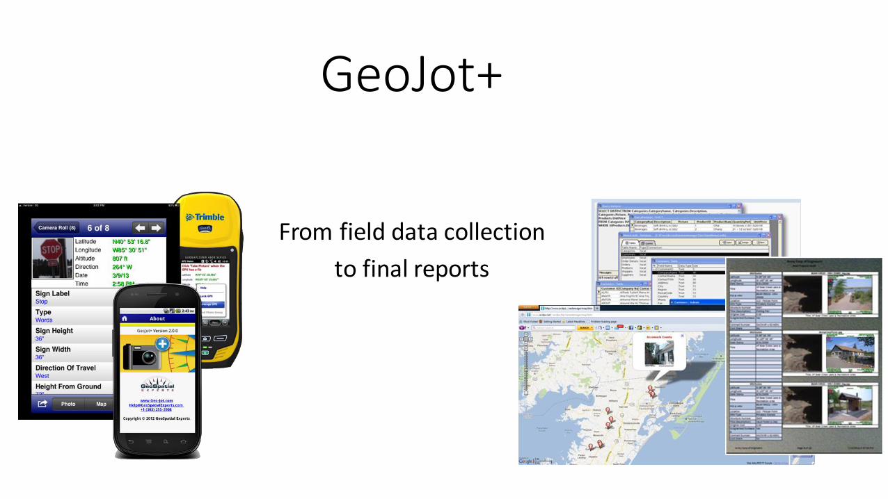
GeoJot+
From field data collection
to final reports

GeoJot+

GeoSpatial Experts….. The leader since 2001

Worldwide resellers
Applied Field Data Systems
Cansel - CanadaCedar Tree Technologies
Compass Tools
Electronic Data Solutions Frontier Precision
Geo Tactical Solutions
Laser Technology - AustraliaPrecision Laser & Instrument
SDGSeiler Instrument
Snapfile - UKToyo Computers - India
Western Data Systems
GeoJot+

Get the required compliance data during installation …… fast
• Great for contractors and employees
• Collect data points in 3 minutes versus 20 with manual method
• Eliminate manual data entry errors
• No more going back to sites to collect missing or bad data
• Keep inspectors onsite 3-5 more hours a week with cloud data transfer
• Save 6-10 hours per week processing data at headquarters
Pipeline data collection with GeoJot+
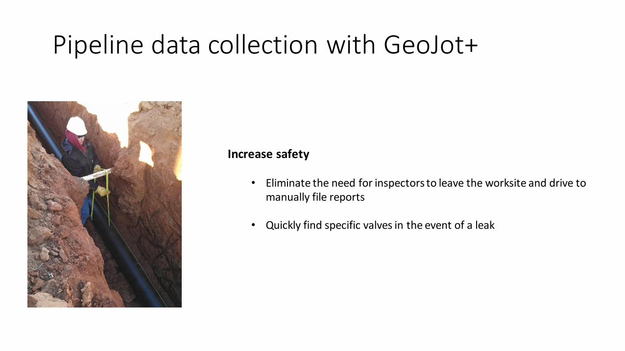
Pipeline data collection with GeoJot+
Increase safety
• Eliminate the need for inspectors to leave the worksite and drive to manually file reports
• Quickly find specific valves in the event of a leak

Pipeline data collection with GeoJot+
Simplify
• Train your inspectors in minutes – even remotely
• Reduce number of devices inspectors are bringing into the field
• Quickly transfer licenses between contractors, employees and devices
• Share information through reports, Google Earth maps, or ArcGIS layers
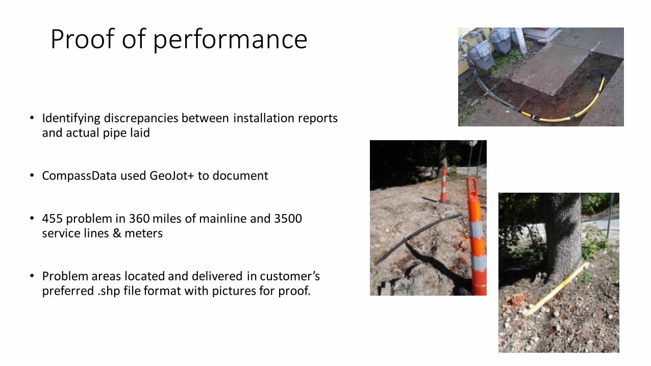
Proof of performance
• Identifying discrepancies between installation reports and actual pipe laid
• CompassData used GeoJot+ to document
• 455 problem in 360 miles of mainline and 3500 service lines & meters
• Problem areas located and delivered in customer’s preferred .shp file format with pictures for proof.

Right of way and vegetation management
• Document issues
• Verify improvements

Exploration
• Planning the logistics of seismic survey activities

Disaster Response
• Creating a photo inventory of assets before and after event

As-built data collection
GeoJot+
Attribute Attribute Value

And more…….
• Valve site inspections
• Asset audits
• Well head inspections
• Management of change
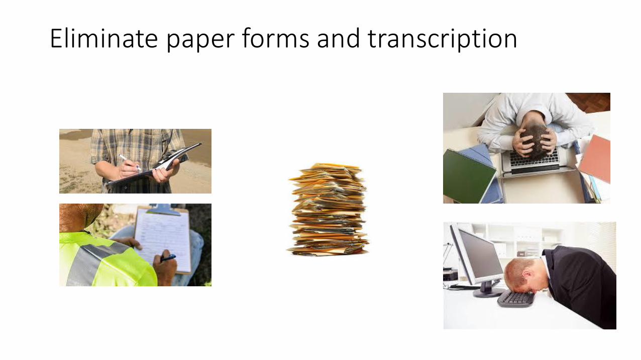
Eliminate paper forms and transcription

Embrace the future

Collect compliance data using:
• Android smartphones & tablets
• Apple iPhones & iPads
• Windows Mobile handheld GPS units
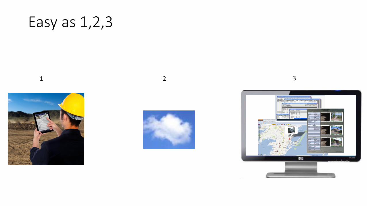
Easy as 1,2,3
1 2 3

Easy to train, use, manage
- Train inspectors to use GeoJot+ in minutes
- Quickly and accurately collect data
- Data collection intuitively tied to photos
- Transfer licenses between users on any device

Transfer data via the cloud
- Automatic
- Specify WiFi only to avoid data overages
- Data is put into a queue in remote areas
- Rename and organize photos automatically

GeoJot+ output for:
- Esri ArcGIS
- Google Earth
- Oracle
- SQL Server
- PODs
- MS Access
- Custom reports
- Web output

Next Steps?
• Short live demo
• Contact us to try it on a project (extended full feature trial, training)
• Private webinar to discuss needs and any customization of the system

Contact information
Tyler McGarrity
Technical Account Manager
Phone: 303.255.2908
Email: [email protected]
www.GeoSpatialExperts.com