Geohazards Evaluation of Mass Movements in Grand Canyon National Park, Arizona Kaytan Kelkar Deanna...
22
Geohazards Evaluation of Mass Movements in Grand Canyon National Park, Arizona Kaytan Kelkar Deanna Greco GRCA 2013
-
Upload
maryann-bishop -
Category
Documents
-
view
213 -
download
0
Transcript of Geohazards Evaluation of Mass Movements in Grand Canyon National Park, Arizona Kaytan Kelkar Deanna...
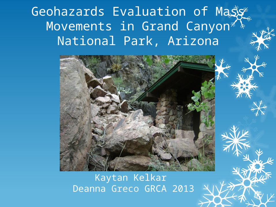
Geohazards Evaluation of Mass Movements in Grand Canyon National Park, Arizona
Kaytan Kelkar Deanna Greco GRCA 2013
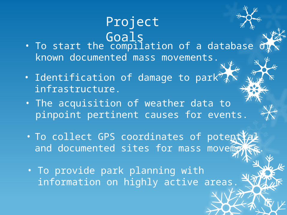
Project Goals
• To start the compilation of a database of known documented mass movements.
• Identification of damage to park infrastructure.
• To collect GPS coordinates of potential and documented sites for mass movements.
• The acquisition of weather data to pinpoint pertinent causes for events.
• To provide park planning with information on highly active areas.
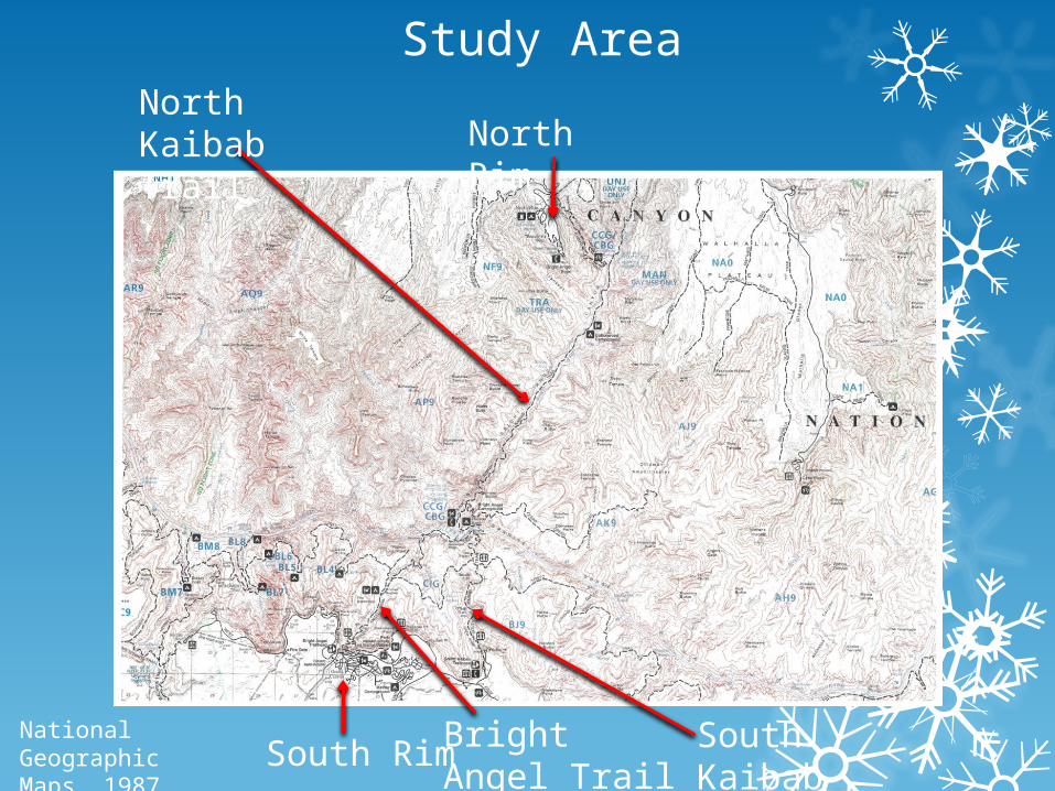
Study Area
South Rim Bright Angel Trail
South Kaibab Trail
North RimNorth Kaibab Trail
National Geographic Maps, 1987.
Grand Canyon National Park Facts
• Was granted national park status in 1919.
• Is situated on the Colorado Plateau in northwestern Arizona.
• Encompasses an area of 1.2 million acres.
• Is 1 mile deep and on average is 10 miles wide.
• Is home to highly diverse ecosystems.
• Can be experienced through various outdoor activities.
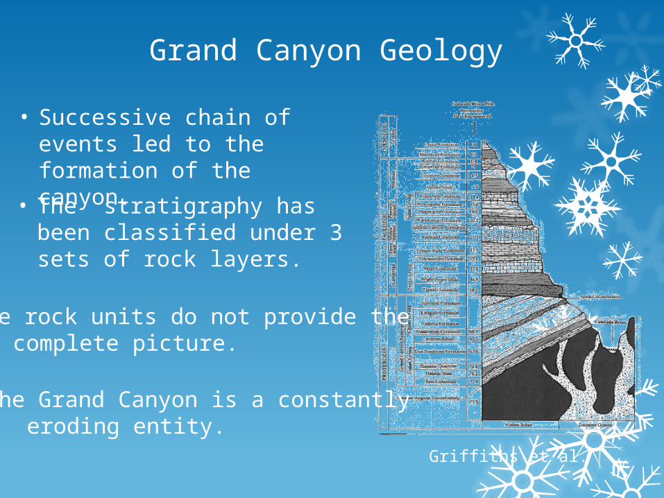
Grand Canyon Geology
• Successive chain of events led to the formation of the canyon.
• The stratigraphy has been classified under 3 sets of rock layers.
• The rock units do not provide the complete picture.
• The Grand Canyon is a constantly eroding entity.
Griffiths et al.
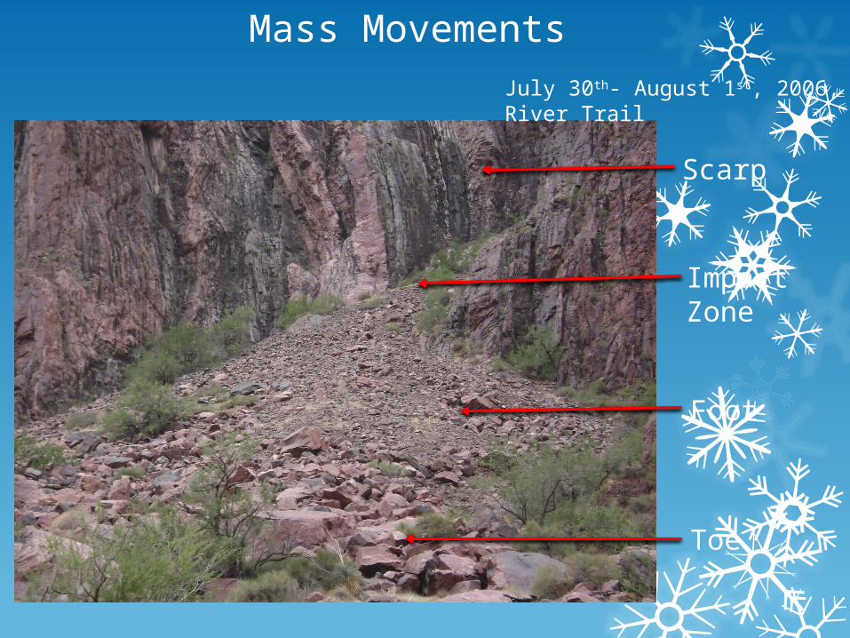
Mass Movements
July 30th- August 1st, 2006, River Trail
Scarp
Impact Zone
Foot
Toe
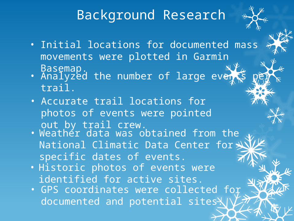
Background Research
• Initial locations for documented mass movements were plotted in Garmin Basemap.
• Weather data was obtained from the National Climatic Data Center for specific dates of events.
• Analyzed the number of large events per trail.
• Accurate trail locations for photos of events were pointed out by trail crew.
• GPS coordinates were collected for documented and potential sites.
• Historic photos of events were identified for active sites.
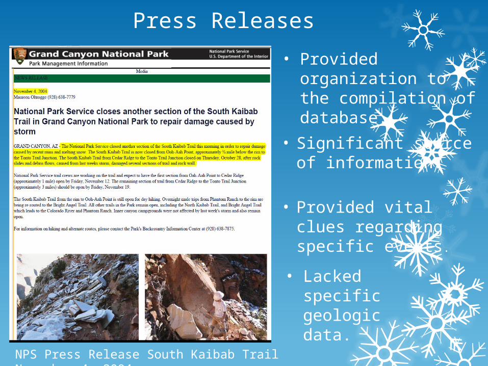
Press Releases
• Significant source of information.
• Provided vital clues regarding specific events.
• Provided organization to the compilation of database.
• Lacked specific geologic data.
NPS Press Release South Kaibab Trail November 4, 2004.
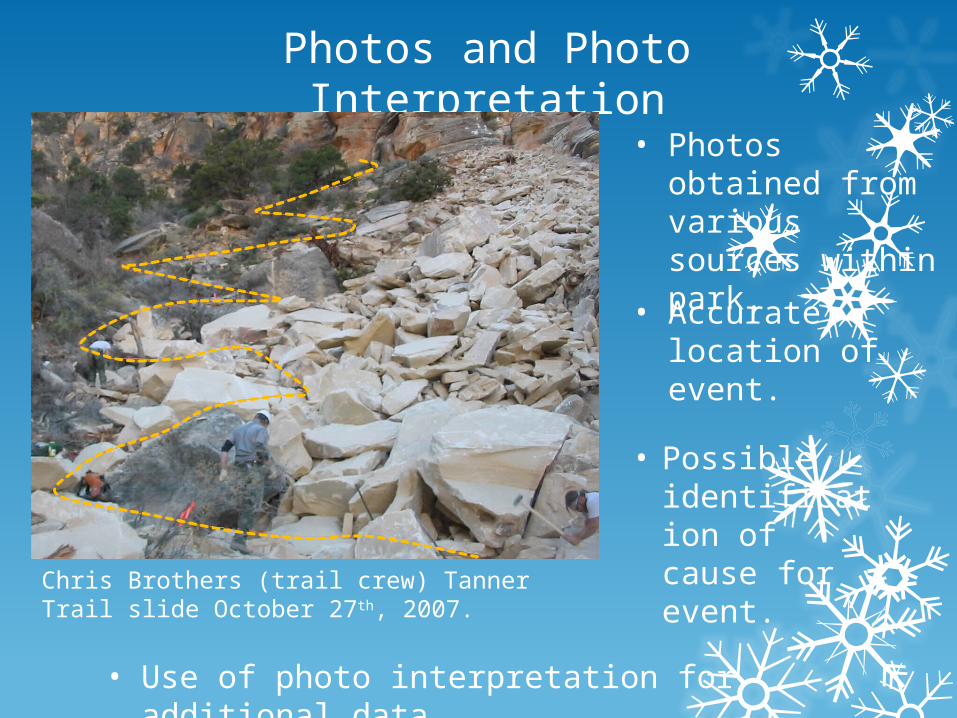
Photos and Photo Interpretation
• Photos obtained from various sources within park.
• Accurate location of event.
• Possible identification of cause for event.
• Use of photo interpretation for additional data.
Chris Brothers (trail crew) Tanner Trail slide October 27th, 2007.

Challenges
• Structuring gathered data from various sources to establish specific events.
• No set template or previous database to refer for the organization of the database.
• Vague verbal descriptions of events.
• Inadequate information from photographs.
• Inconsistencies in weather data.
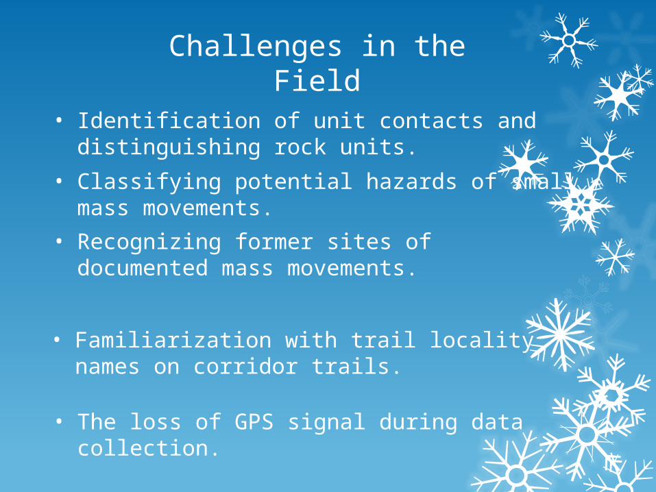
Challenges in the Field
• Identification of unit contacts and distinguishing rock units.
• Classifying potential hazards of small mass movements.
• Recognizing former sites of documented mass movements.
• The loss of GPS signal during data collection.
• Familiarization with trail locality names on corridor trails.
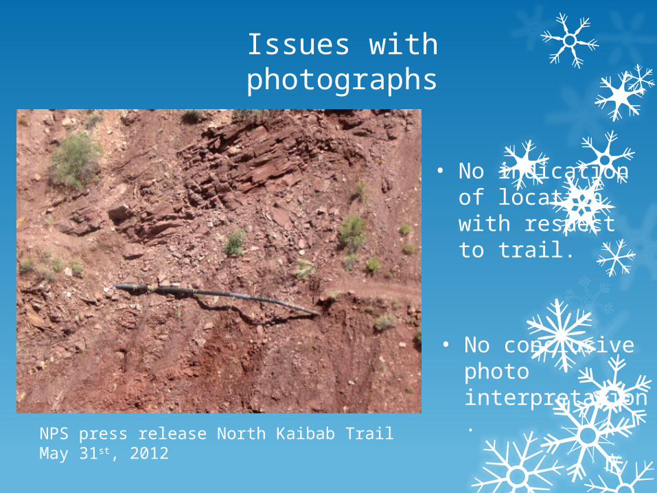
Issues with photographs
NPS press release North Kaibab Trail May 31st, 2012
• No indication of location with respect to trail.
• No conclusive photo interpretation.
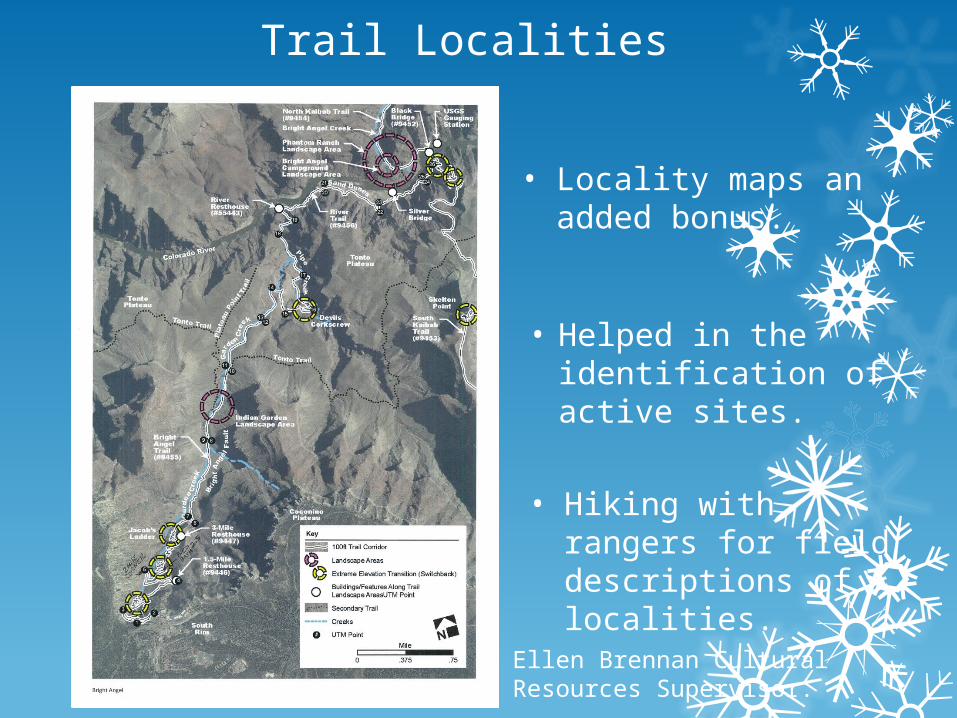
Trail Localities
• Locality maps an added bonus.
• Hiking with rangers for field descriptions of localities.
• Helped in the identification of active sites.
Ellen Brennan Cultural Resources Supervisor.
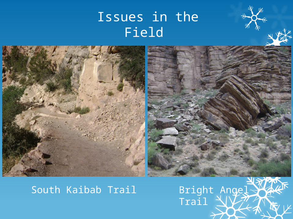
Issues in the Field
South Kaibab Trail Bright Angel Trail
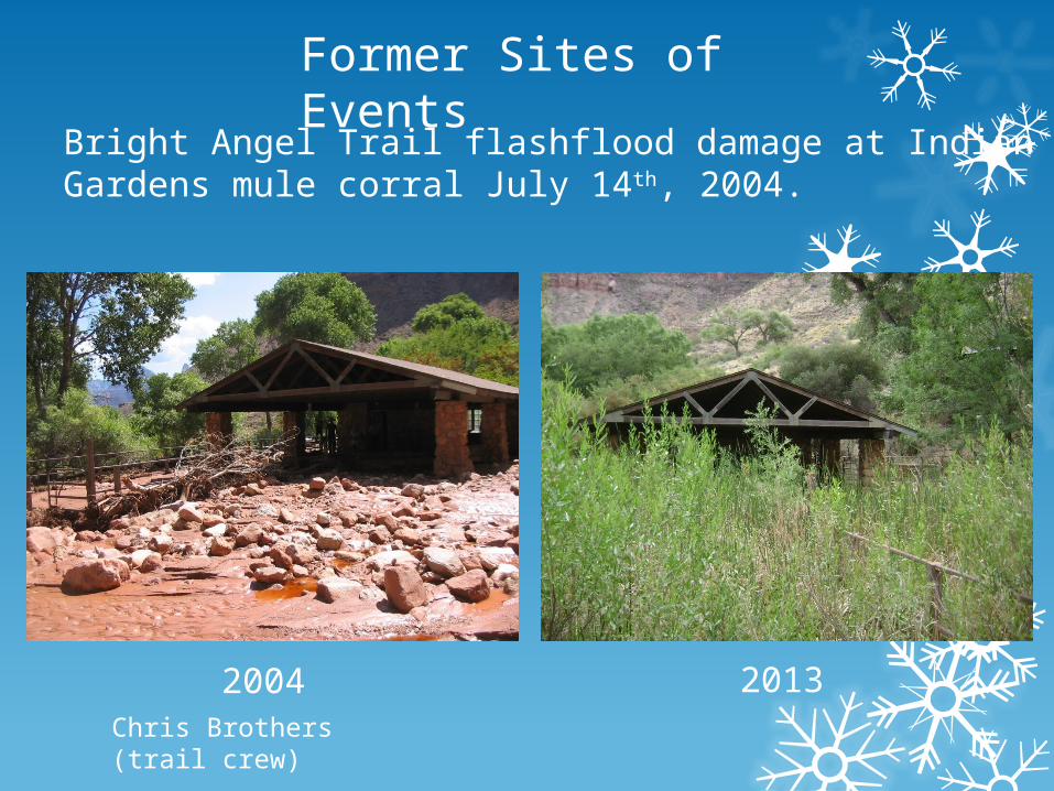
Former Sites of Events
Bright Angel Trail flashflood damage at Indian Gardens mule corral July 14th, 2004.
2004 2013Chris Brothers (trail crew)
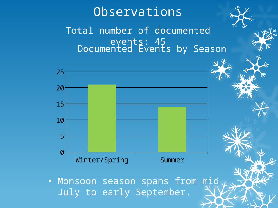
Observations
Total number of documented events: 45
Winter/Spring Summer0
5
10
15
20
25
Documented Events by Season
• Monsoon season spans from mid July to early September.
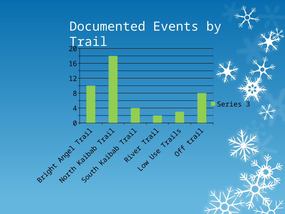
Documented Events by Trail
Bright Angel Trail
North Kaibab Trail
South Kaibab Trail
River Trail
Low Use
Trails
Off trail
0
2
4
6
8
10
12
14
16
18
20
Number of Events
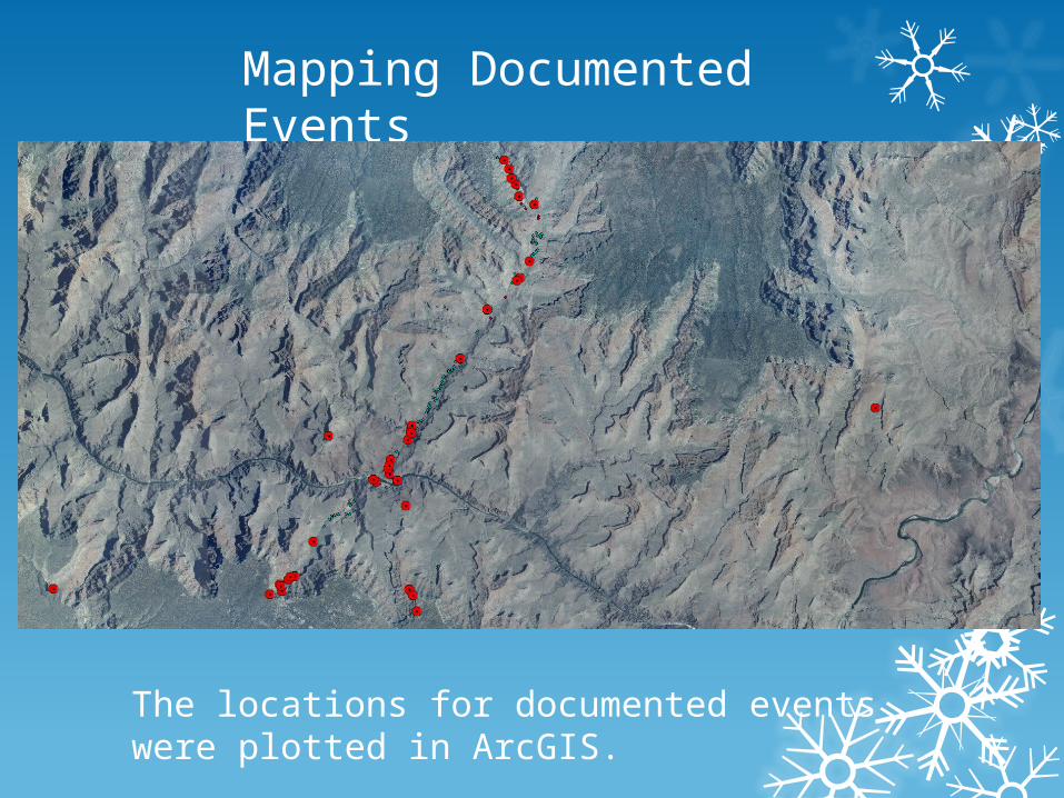
Mapping Documented Events
The locations for documented events were plotted in ArcGIS.
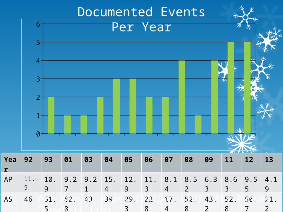
1992 1993 2001 2003 2004 2005 2006 2007 2008 2009 2011 2012 20130
1
2
3
4
5
6
Documented Events Per Year
Year 92 93 01 03 04 05 06 07 08 09 11 12 13
AP 11.5 10.9 9.27 9.21 15.4 12.9 11.3 8.14 8.52 6.33 8.63 9.55 4.19
AS 46 51.5 82.8 43 39 29.3 22.8 17.4 52.8 43.2 52.8 50.7 21.2
AP: Annual Precipitation (in), AS: Annual Snowfall (in)
Conclusion
• Unstable lithologic contacts are Coconino Sandstone-Hermit Shale and Redwall/Muav Limestone- Bright Angel Shale.
• Numerous unstable units responsible for propagating mass movements.
• Several active areas identified on corridor trails.
• Fluctuations in temperature preceding events were observed.
• Three very interesting finds.

Acknowledgments
• I am grateful to the Geological Society of America and the National Park Service for giving me this excellent opportunity.
• I would like to thank Deanna Greco for her support and expertise towards this project.
• I would like to thank Russell Rosenberg, Bil Vandergraff, Brian Gatlin, Chris Brothers and the Museum Collection at GRCA for their guidance.
• Oltrogge, Maureen. “National Park Service closes another section of the South Kaibab Trail in Grand Canyon National Park to repair damage caused by storm.” GRCA Park Management Information 4 November, 2004. NPS Press Release. nps.gov. 25 July 2013.
• Oltrogge, Maureen. “Third Pipeline Break in Grand Canyon Closes Section of North Kaibab Trail.” GRCA Park Management Information 31 May, 2012. NPS Press Release. nps.gov. 25 July 2013.
• Griffiths, Peter G., Robert H. Webb, and Theodore S. Melis. Initiation and frequency of debris flows in Grand Canyon, Arizona. No. USGS-OFR-96-491. DEPARTMENT OF THE INTERIOR WASHINGTON DC, 1996.
Works Cited
• Photos of the Tanner Trail slide and Indian Gardens flash flood damage were provided by Chris Brothers of trail crew.
• Trail locality maps were provided by Ellen Brennan of Cultural Resources.
• National Geographic Maps. Grand Canyon National Park Trails Illustrated. [ca. 1: 73,530]. Evergreen, CO: National Geographic Maps, 1987. Print.