Geography 241 – GIS I Dr. Patrick McHaffie Associate Professor Department of Geography Cook...
21
Geography 241 – GIS I Dr. Patrick McHaffie Associate Professor Department of Geography Cook County, % population < 5
-
date post
22-Dec-2015 -
Category
Documents
-
view
215 -
download
0
Transcript of Geography 241 – GIS I Dr. Patrick McHaffie Associate Professor Department of Geography Cook...

Geography 241 – GIS IDr. Patrick McHaffieAssociate ProfessorDepartment of Geography
Cook County, % population < 5

What is a GIS?
Geographic Information System - collection, organization, maintenance, analysis, and output of spatially-referenced information.
Two important components - What, and Where
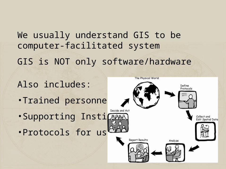
We usually understand GIS to be computer-facilitated system
GIS is NOT only software/hardware
Also includes:
•Trained personnel
•Supporting Institution
•Protocols for use
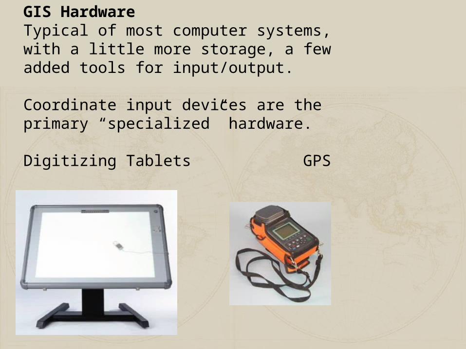
GIS HardwareTypical of most computer systems, with a little more storage, a few added tools for input/output.
Coordinate input devices are the primary “specialized” hardware.
Digitizing Tablets GPS receivers.

INPUT ANALYSISSTORAGE
OUTPUT
DigitizingGraphic editing,error correction: sliver removal, data sanitation, Tabular data entry and editing Data reductionText conversion
Graphic analysis capabilities -topology creation,reclassification, buffer, overlay, network, neighborhood functions, coordinate managementDatabase managerStatistical functions
Map compositionColor palette generationSymbol generation, editingGraphic overlayScreen queryGeographic query
GIS Software

What is in it for me?
Take a sheet of paper, put your name and major at the top. Then,
In a five minute free write, answer the question:
How can you imagine you might be using GIS and other Geotechnology in 5 years?

1.2 , 4 .75 .8 , 3 .68 .9 , 7 .2..
Real W or ldDat a M odel Dat a
S t r uct ur e
phenomena that exist
An abstraction, relevant phenomena and properties
computer representation
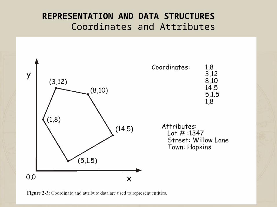
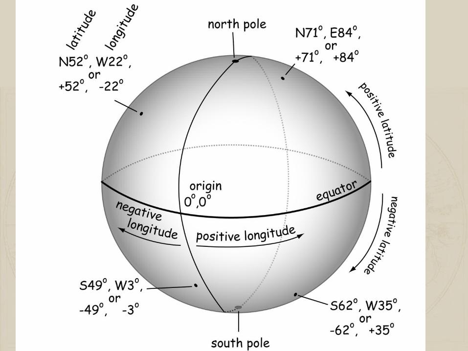
REPRESENTATION AND DATA STRUCTURES
Coordinates and Attributes
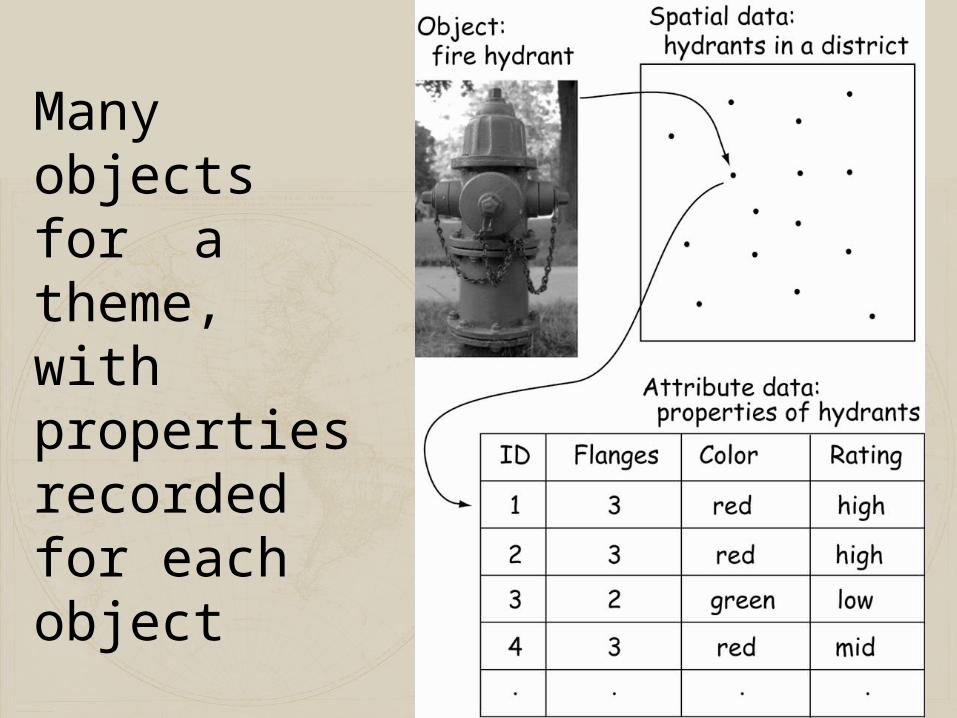
Many objects for a theme, with properties recorded for each object

REPRESENTATION AND DATA
STRUCTURES
•Most common data models define thematic layers
•Typically, layers, one layer for each distinct view of a theme

Cartesian Coordinates


Point s
L ineA r ea
Vect or Rast er
Point s
L ineA r ea
( x ,y )
X
Y
Common Data Models
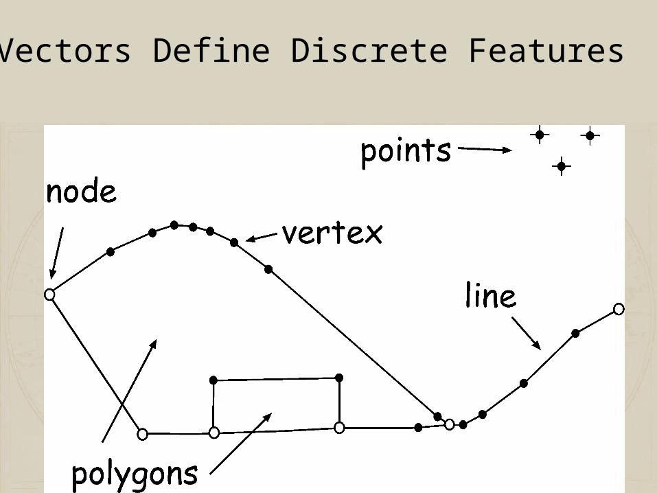
Vectors Define Discrete Features

PointsPoint ID X Y 1 32.7 45.6 2 76.3 19.5 3 22.7 15.8etc…..
1 2
3 4
Organization
Lines6
9
1
239
AB
C Line Begin End ID Point Point A 6 9 B 9 1 C 239 1etc…..
Polygons
13
22
41954
11
12
52
53
PolygonID Lines
A 11, 12, 52, 53, 54
B 52, 53, 9, 41, 22, 13
Three Types of Vector Features

Vector TopologyTopology – geometric properties that to not change with shape: Adjacency, connectivity, containment
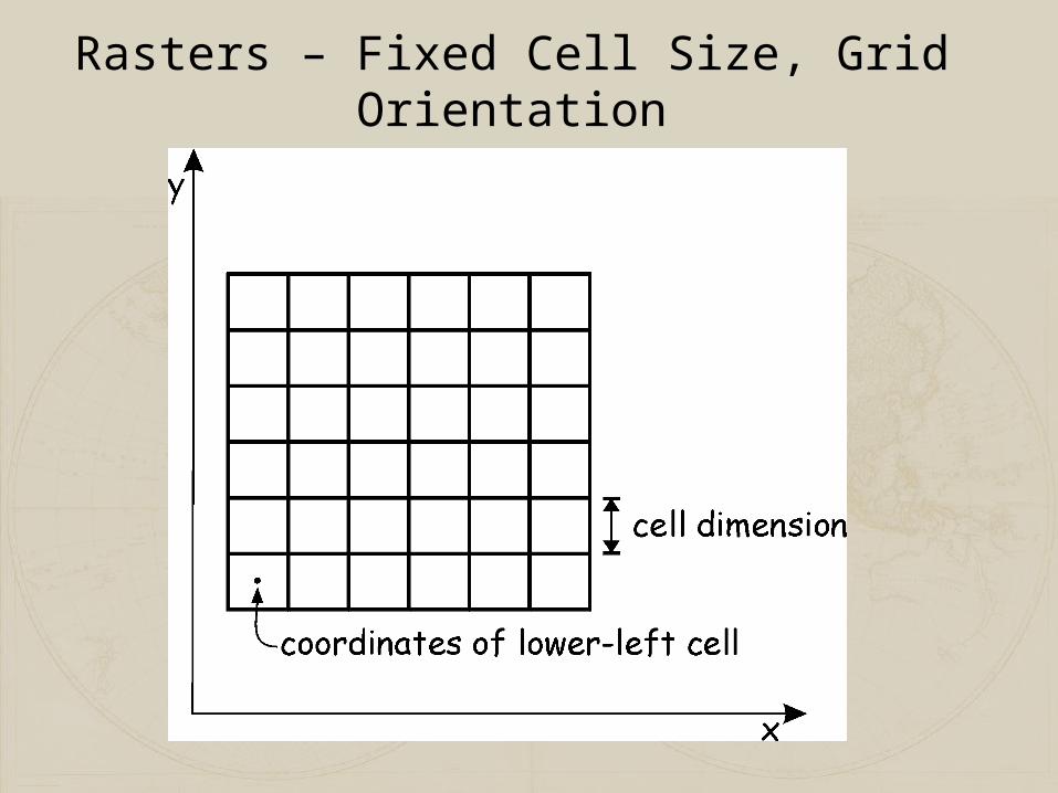
Rasters – Fixed Cell Size, Grid Orientation
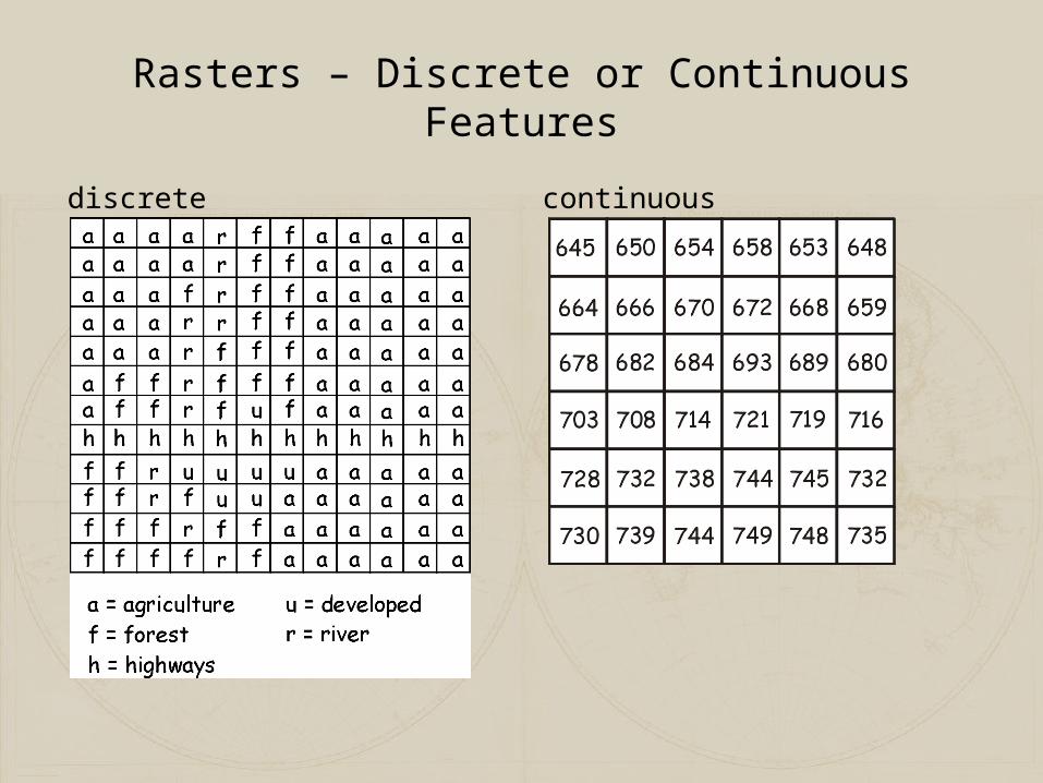
Rasters – Discrete or Continuous Features
discrete continuous

Raster – The Mixed Pixel Problem
Landcover map –Two classes, land or water
Cell A is straightforward
What category to assignFor B, C, or D?
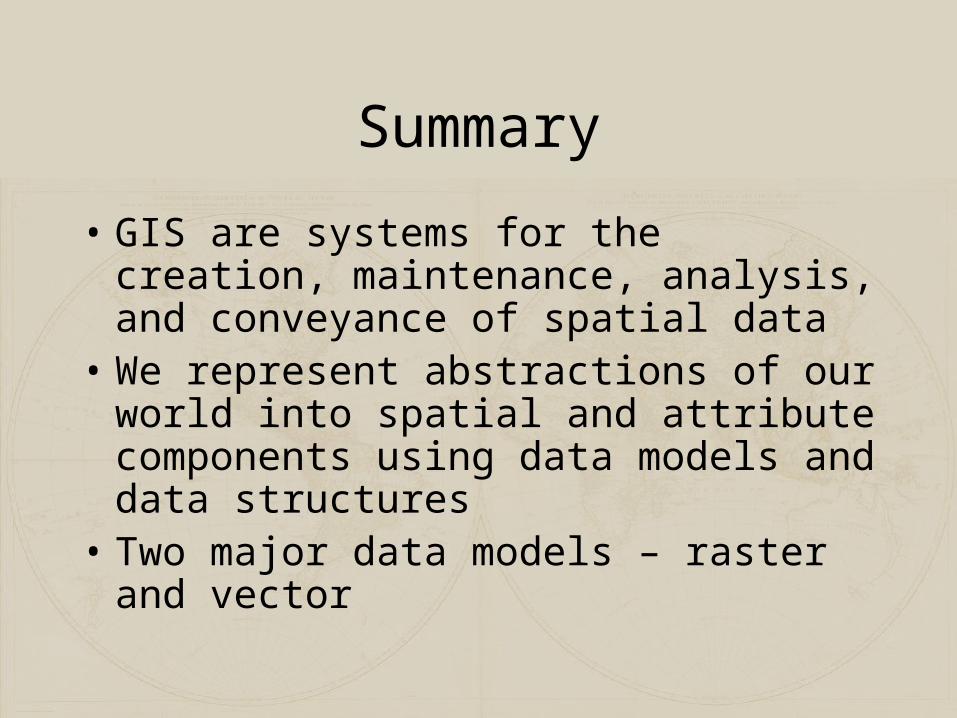
Summary
• GIS are systems for the creation, maintenance, analysis, and conveyance of spatial data
• We represent abstractions of our world into spatial and attribute components using data models and data structures
• Two major data models – raster and vector