GEOG 442 Day 9: Transportation/ Traffic Impacts Assessment.
26
GEOG 442 GEOG 442 Day 9 Day 9 : Transportation/ Traffic : Transportation/ Traffic Impacts Assessment Impacts Assessment
-
date post
19-Dec-2015 -
Category
Documents
-
view
217 -
download
0
Transcript of GEOG 442 Day 9: Transportation/ Traffic Impacts Assessment.

GEOG 442GEOG 442
Day 9Day 9: Transportation/ Traffic : Transportation/ Traffic Impacts AssessmentImpacts Assessment

2
Housekeeping ItemsHousekeeping Items
There may be some confusion about tool scheduling There may be some confusion about tool scheduling for the week of March 5.for the week of March 5.
Paper outlines are due on Thursday!Paper outlines are due on Thursday! The student union is having a protest rally tomorrow The student union is having a protest rally tomorrow
from 11:00 to 1 at the student union building over from 11:00 to 1 at the student union building over tuition and post-secondary funding issues.tuition and post-secondary funding issues.
WDCAG meeting tomorrow at 12:30 in Map Library.WDCAG meeting tomorrow at 12:30 in Map Library. There are two events concerning the award-winning There are two events concerning the award-winning
Ucluelet plan – one on campus and one downtown.Ucluelet plan – one on campus and one downtown. Anyone who wants to go, and report on, the Mark Anyone who wants to go, and report on, the Mark
Lakeman talk in Duncan on Sunday gets bonus marks.Lakeman talk in Duncan on Sunday gets bonus marks.
3
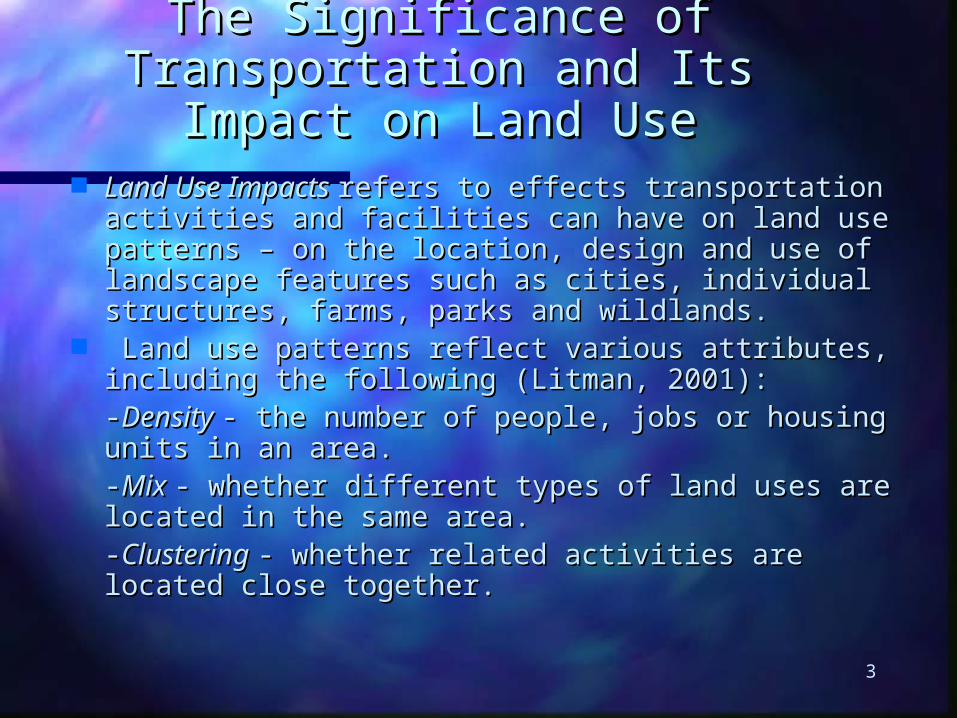
The Significance of Transportation The Significance of Transportation and Its Impact on Land Useand Its Impact on Land Use
Land Use Impacts Land Use Impacts refers to effects transportation activities refers to effects transportation activities and facilities can have on land use patterns – on the and facilities can have on land use patterns – on the location, design and use of landscape features such as location, design and use of landscape features such as cities, individual structures, farms, parks and wildlands.cities, individual structures, farms, parks and wildlands.
Land use patterns reflect various attributes, including the Land use patterns reflect various attributes, including the following (Litman, 2001):following (Litman, 2001):
--Density Density - the number of people, jobs or housing units in - the number of people, jobs or housing units in an area.an area.
--Mix Mix - whether different types of land uses are located in - whether different types of land uses are located in the same area.the same area.
--Clustering Clustering - whether related activities are located close - whether related activities are located close together.together.
4
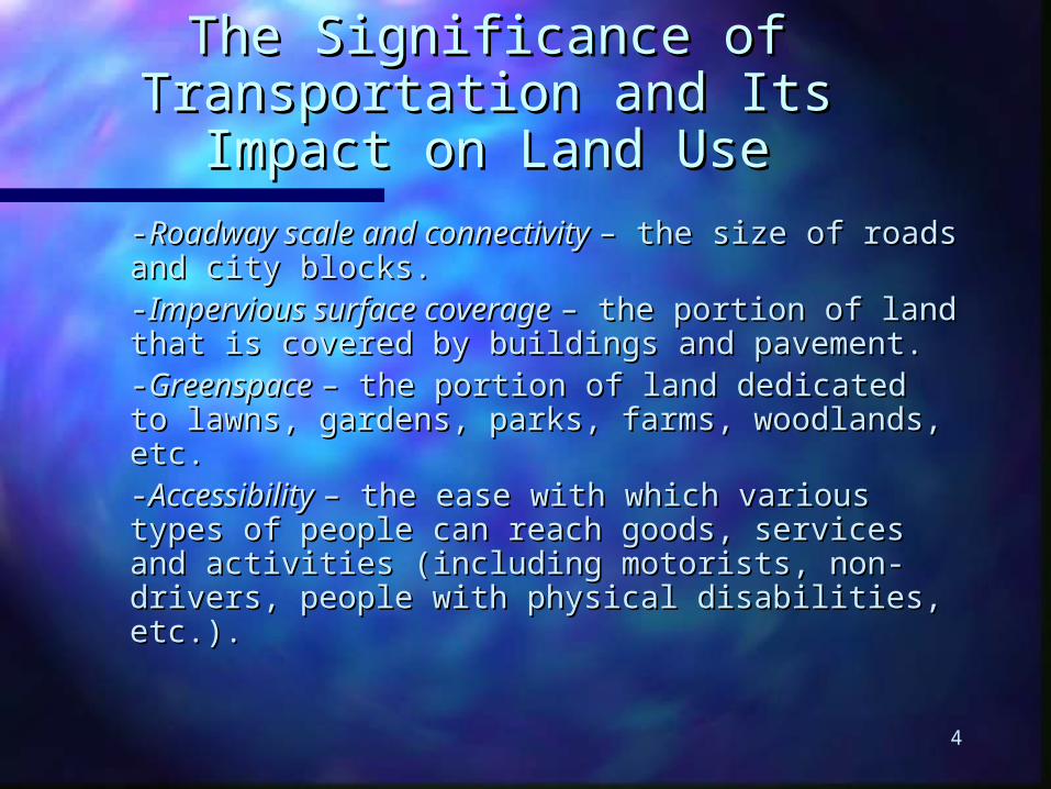
The Significance of Transportation The Significance of Transportation and Its Impact on Land Useand Its Impact on Land Use
--Roadway scale and connectivity Roadway scale and connectivity – the size of – the size of roads and city blocks.roads and city blocks.--Impervious surface coverage Impervious surface coverage – the portion of – the portion of land that is covered by buildings and pavement.land that is covered by buildings and pavement.
--Greenspace Greenspace – the portion of land dedicated to – the portion of land dedicated to lawns, gardens, parks, farms, woodlands, etc.lawns, gardens, parks, farms, woodlands, etc.
--Accessibility Accessibility – the ease with which various – the ease with which various types of people can reach goods, services and types of people can reach goods, services and activities (including motorists, non-drivers, activities (including motorists, non-drivers, people with physical disabilities, etc.).people with physical disabilities, etc.).
5
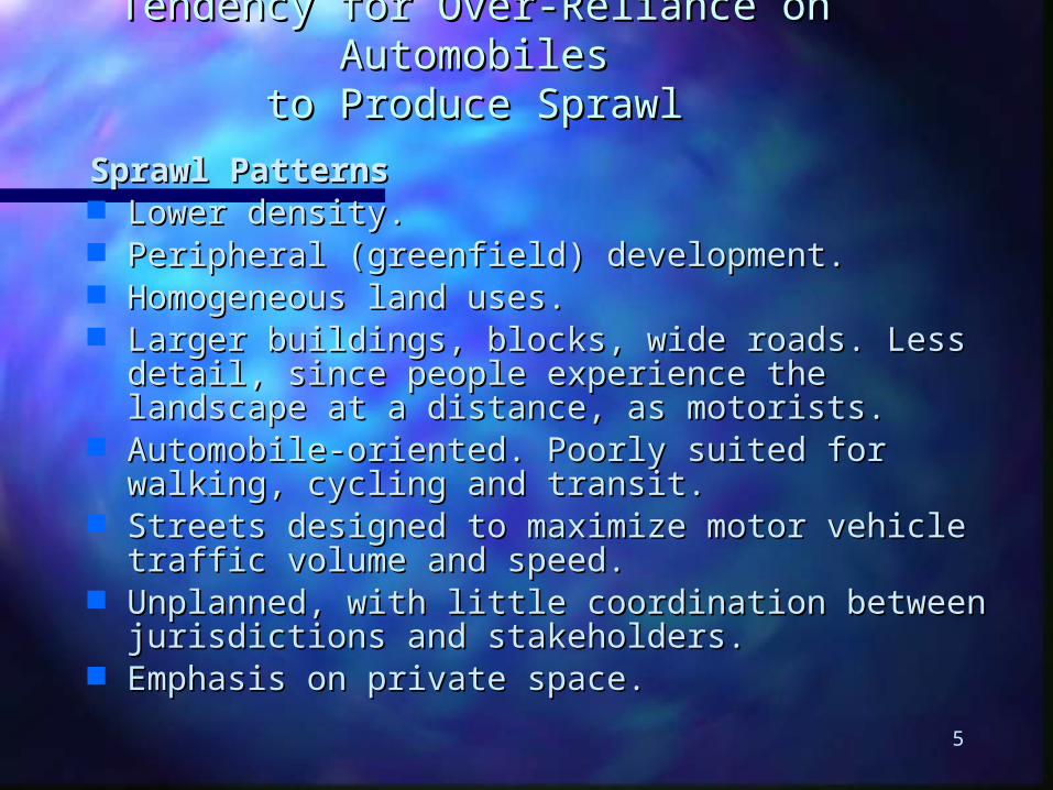
Tendency for Over-Reliance on AutomobilesTendency for Over-Reliance on Automobilesto Produce Sprawlto Produce Sprawl
Sprawl PatternsSprawl Patterns Lower density.Lower density. Peripheral (greenfield) development.Peripheral (greenfield) development. Homogeneous land uses.Homogeneous land uses. Larger buildings, blocks, wide roads. Less detail, since Larger buildings, blocks, wide roads. Less detail, since
people experience the landscape at a distance, as people experience the landscape at a distance, as motorists.motorists.
Automobile-oriented. Poorly suited for walking, cycling Automobile-oriented. Poorly suited for walking, cycling and transit.and transit.
Streets designed to maximize motor vehicle traffic volume Streets designed to maximize motor vehicle traffic volume and speed.and speed.
Unplanned, with little coordination between jurisdictions Unplanned, with little coordination between jurisdictions and stakeholders.and stakeholders.
Emphasis on private space.Emphasis on private space.
6
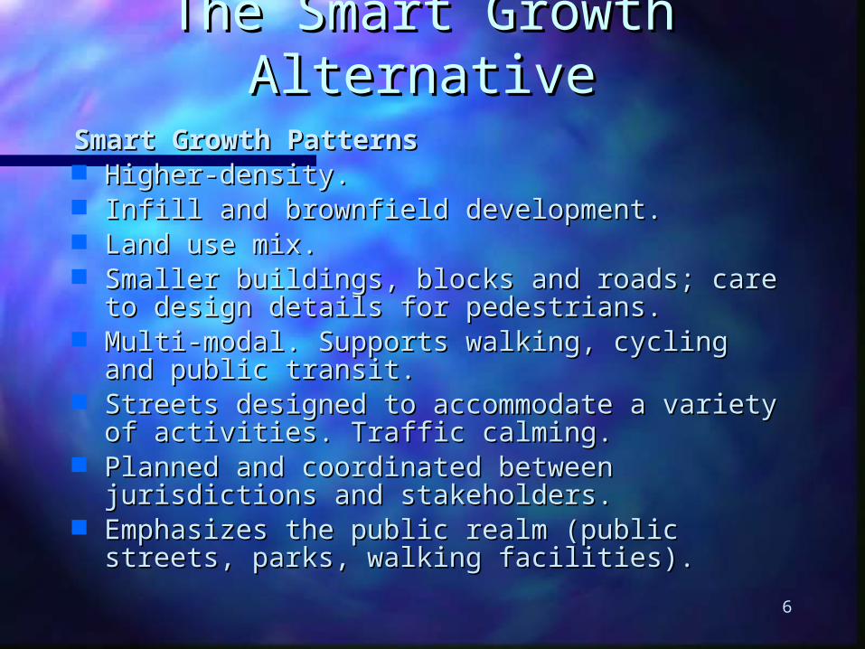
The Smart Growth AlternativeThe Smart Growth AlternativeSmart Growth PatternsSmart Growth Patterns Higher-density.Higher-density. Infill and brownfield development.Infill and brownfield development. Land use mix.Land use mix. Smaller buildings, blocks and roads; care to design Smaller buildings, blocks and roads; care to design
details for pedestrians.details for pedestrians. Multi-modal. Supports walking, cycling and public Multi-modal. Supports walking, cycling and public
transit.transit. Streets designed to accommodate a variety of Streets designed to accommodate a variety of
activities. Traffic calming.activities. Traffic calming. Planned and coordinated between jurisdictions and Planned and coordinated between jurisdictions and
stakeholders.stakeholders. Emphasizes the public realm (public streets, parks, Emphasizes the public realm (public streets, parks,
walking facilities).walking facilities).

7
What is Transportation?What is Transportation?
According to Leung (p. 140), “transportation… According to Leung (p. 140), “transportation… [is] a service which enables people, firms, and [is] a service which enables people, firms, and institutions to carry out activities in separate institutions to carry out activities in separate locations. The emphasis is on coordination of locations. The emphasis is on coordination of activity patterns, activity centres, and activity patterns, activity centres, and movement systems.”movement systems.”
Transportation planning deals with both land-Transportation planning deals with both land-based (pedestrians, bicycles, autos, taxis, based (pedestrians, bicycles, autos, taxis, buses and trains) and water-based systems buses and trains) and water-based systems (ferries and freighters, etc.).(ferries and freighters, etc.).

8
Land-Based TransportationLand-Based Transportation
The main purpose of land-based The main purpose of land-based transportation is to facilitate transportation is to facilitate accessaccess and and mobilitymobility. The key point is access. If land uses . The key point is access. If land uses are close together it provides access, and the are close together it provides access, and the need for mobility is reduced.need for mobility is reduced.
A key element in land-based transportation is A key element in land-based transportation is the road system; roads exist in a hierarchy: the road system; roads exist in a hierarchy: locallocal roads, roads, collectors collectors,, arterials arterials, and, and freeways freeways (also rural roads) [see description of their (also rural roads) [see description of their characteristics on pp. 70-71 of Leung].characteristics on pp. 70-71 of Leung].

9
Data Needed for Transportation AnalysisData Needed for Transportation Analysis
Traffic-relatedTraffic-related- As collected through vehicle - As collected through vehicle counts and observations (volumes, proportion counts and observations (volumes, proportion between through and local traffic, kinds of between through and local traffic, kinds of vehicles, congestion or bottlenecks, accident vehicles, congestion or bottlenecks, accident rates, dangerous intersections, and sensitive rates, dangerous intersections, and sensitive areas).areas).
Land UseLand Use- Types and volumes of traffic - Types and volumes of traffic generated by different land uses (see p. 72) generated by different land uses (see p. 72) based on vehicle counts entering and exiting a based on vehicle counts entering and exiting a site. site.
10
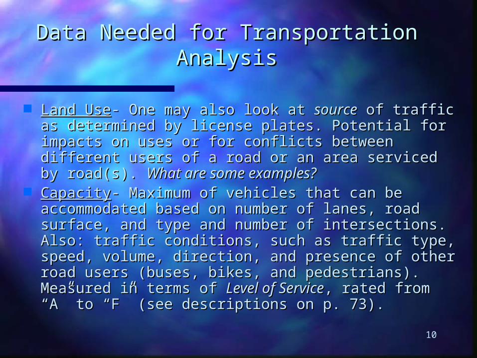
Data Needed for Transportation AnalysisData Needed for Transportation Analysis
Land UseLand Use- One may also look at - One may also look at sourcesource of traffic as of traffic as determined by license plates. Potential for impacts on determined by license plates. Potential for impacts on uses or for conflicts between different users of a road or uses or for conflicts between different users of a road or an area serviced by road(s). an area serviced by road(s). What are some examples?What are some examples?
CapacityCapacity- Maximum of vehicles that can be - Maximum of vehicles that can be accommodated based on number of lanes, road accommodated based on number of lanes, road surface, and type and number of intersections. Also: surface, and type and number of intersections. Also: traffic conditions, such as traffic type, speed, volume, traffic conditions, such as traffic type, speed, volume, direction, and presence of other road users (buses, direction, and presence of other road users (buses, bikes, and pedestrians). Measured in terms of bikes, and pedestrians). Measured in terms of Level of Level of ServiceService, rated from “A” to “F” (see descriptions on p. , rated from “A” to “F” (see descriptions on p. 73).73).
11
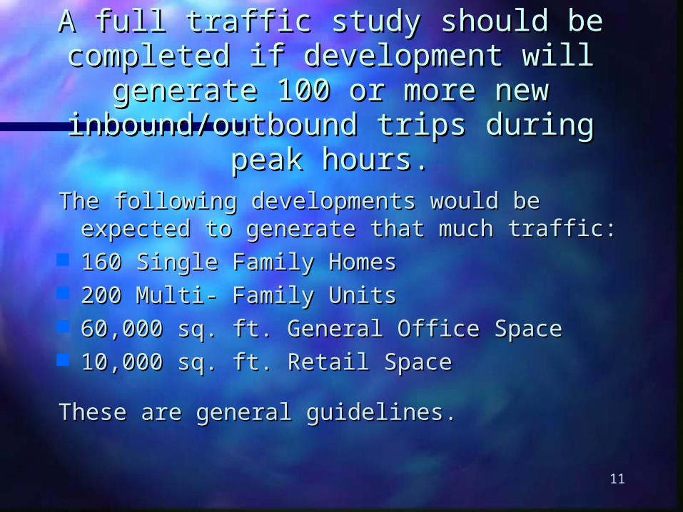
A full traffic study should be completed if A full traffic study should be completed if development will generate 100 or more new development will generate 100 or more new inbound/outbound trips during peak hours.inbound/outbound trips during peak hours.
The following developments would be expected The following developments would be expected to generate that much traffic:to generate that much traffic:
160 Single Family Homes160 Single Family Homes 200 Multi- Family Units200 Multi- Family Units 60,000 sq. ft. General Office Space60,000 sq. ft. General Office Space 10,000 sq. ft. Retail Space10,000 sq. ft. Retail Space
These are general guidelines.These are general guidelines.
12
Why Is This Traffic Level Significant?Why Is This Traffic Level Significant?
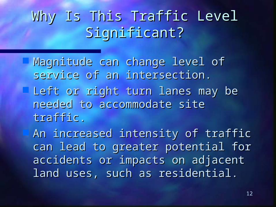
Magnitude can change level of service Magnitude can change level of service of an intersection.of an intersection.
Left or right turn lanes may be needed Left or right turn lanes may be needed to accommodate site traffic.to accommodate site traffic.
An increased intensity of traffic can lead An increased intensity of traffic can lead to greater potential for accidents or to greater potential for accidents or impacts on adjacent land uses, such as impacts on adjacent land uses, such as residential.residential.
13
When Should an Impact Study Be When Should an Impact Study Be Completed?Completed?
At the following stages of planning process At the following stages of planning process (depending on the scale of the development):(depending on the scale of the development):
Rezoning applicationsRezoning applications Subdivision applicationsSubdivision applications Building permit applicationsBuilding permit applications Formation of special planning areasFormation of special planning areas Amendments to the OCP/Neighborhood plansAmendments to the OCP/Neighborhood plans Permits for major driveways.Permits for major driveways.
14
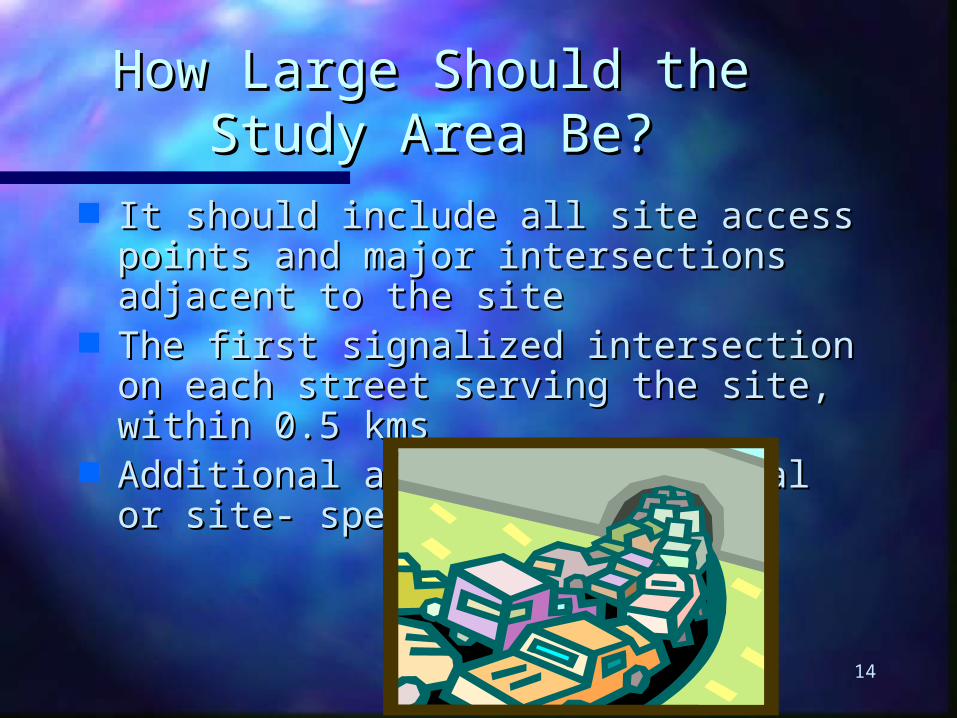
How Large Should the Study How Large Should the Study Area Be?Area Be?
It should include all site access points and It should include all site access points and major intersections adjacent to the sitemajor intersections adjacent to the site
The first signalized intersection on each The first signalized intersection on each street serving the site, within 0.5 kmsstreet serving the site, within 0.5 kms
Additional areas based on local or site- Additional areas based on local or site- specific issues.specific issues.
15
Traffic Impact Study Will Help Traffic Impact Study Will Help ToTo
Identify contribution a particular site makes Identify contribution a particular site makes to the traffic patternsto the traffic patterns
Provide a credible basis for estimating road Provide a credible basis for estimating road improvements required by a projectimprovements required by a project
Assess compatibility with local Assess compatibility with local transportation planstransportation plans
Provide guidance for short term/long term Provide guidance for short term/long term planning of site access.planning of site access.
16
ResourcesResources
City of Nanaimo: Traffic Access and City of Nanaimo: Traffic Access and Impact Study GuidelinesImpact Study Guidelines
Traffic Access and Impact Studies for Site Traffic Access and Impact Studies for Site Development, prepared by the Development, prepared by the Transportation Planners Task Force on Transportation Planners Task Force on Traffic Access/Impact StudiesTraffic Access/Impact Studies
17
Transit PlanningTransit Planning
Transit’s fortunes have risen and fallen with Transit’s fortunes have risen and fallen with the times, but in general it has been the the times, but in general it has been the Cinderella step-sister to the favoured Cinderella step-sister to the favoured daughter, the automobile.daughter, the automobile.
Transit is more commonly used for trips to Transit is more commonly used for trips to work (it is not always as convenient for work (it is not always as convenient for shopping), and its use is heaviest at peak shopping), and its use is heaviest at peak hours.hours.
Its use is lower on the weekends, and in the Its use is lower on the weekends, and in the summer.summer.
18
Transit PlanningTransit Planning
Trips are more common to the CBD Trips are more common to the CBD because of the disincentives of auto travel because of the disincentives of auto travel there.there.
Rail trips are the longest, followed by Rail trips are the longest, followed by subway, and bus. Trips to the CBD tend to subway, and bus. Trips to the CBD tend to take longer. All transit trips tend to take take longer. All transit trips tend to take longer than auto trips, and often involve longer than auto trips, and often involve getting on more than one vehicle, which is getting on more than one vehicle, which is a disincentive to its use.a disincentive to its use.
19
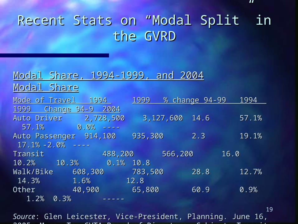
Recent Stats on “Modal Split” in the GVRDRecent Stats on “Modal Split” in the GVRD
Modal Share, 1994-1999, and 2004Modal Share, 1994-1999, and 2004 Modal ShareModal ShareMode of Travel 1994 Mode of Travel 1994 1999 % change 94-99 1994 1999 Change 94-9 20041999 % change 94-99 1994 1999 Change 94-9 2004Auto Driver 2,728,500 3,127,600 Auto Driver 2,728,500 3,127,600 14.614.6 57.1% 57.1% 57.1% 57.1% 0.0% 0.0% --------Auto Passenger 914,100 Auto Passenger 914,100 935,300 935,300 2.3 2.3 19.1% 19.1% 17.1% 17.1% -2.0%-2.0% --------Transit Transit 488,200 488,200 566,200 566,200 16.0 16.0 10.2% 10.2% 10.3% 10.3% 0.1% 0.1% 10.810.8Walk/Bike Walk/Bike 608,300 608,300 783,500 783,500 28.8 28.8 12.7% 12.7% 14.3% 14.3% 1.6% 12.81.6% 12.8OtherOther 40,900 40,900 65,800 65,800 60.9 60.9 0.9% 0.9% 1.2% 0.3% 1.2% 0.3% ----------
SourceSource: Glen Leicester, Vice-President, Planning. June 16, 2005. Memo, To: GVTA Board : Glen Leicester, Vice-President, Planning. June 16, 2005. Memo, To: GVTA Board of Directors. Subject: Transit Capacity Study. Burnaby: GVTA.of Directors. Subject: Transit Capacity Study. Burnaby: GVTA.

20
Recent Stats on “Modal Split” in the GVRDRecent Stats on “Modal Split” in the GVRD
In addition, 13.4% of all GVRD residents on In addition, 13.4% of all GVRD residents on average take transit at least once for a one-way average take transit at least once for a one-way trip each week. Dense mixed use areas like the trip each week. Dense mixed use areas like the West End and Downtown Vancouver have close West End and Downtown Vancouver have close to 50% of all trips to work occurring through to 50% of all trips to work occurring through walking, cycling or transit. Data on modal split is walking, cycling or transit. Data on modal split is collected by Statistics Canada through the collected by Statistics Canada through the Census. Other data can be generated through Census. Other data can be generated through trip diariestrip diaries..
21
Characteristics of Transit UsersCharacteristics of Transit Users
Use is usually inversely proportional to Use is usually inversely proportional to income with some exceptions (e.g. income with some exceptions (e.g. suburban commuter rail users)suburban commuter rail users)
Also inversely related to car ownership, Also inversely related to car ownership, though depends partly on people’s locationthough depends partly on people’s location
More likely to be used by minorities and More likely to be used by minorities and women, and sometimes seniorswomen, and sometimes seniors
Because of the central location of offices, Because of the central location of offices, sometimes more used by white collar than sometimes more used by white collar than blue collar workers.blue collar workers.

22
Attitudes of Transit UsersAttitudes of Transit Users
Desirable qualities for transitDesirable qualities for transit: easy access, : easy access, frequency, reliability, minimum number of transfers, frequency, reliability, minimum number of transfers, cost (hidden vs. out of pocket), availability of seating cost (hidden vs. out of pocket), availability of seating and climate control, security, etc.and climate control, security, etc.
These priorities vary depending on the class and These priorities vary depending on the class and individual.individual.
Transit agencies are faced with challenges, Transit agencies are faced with challenges, including “bread and butter” service vs. “luxury” including “bread and butter” service vs. “luxury” transit, and maintaining or establishing service in transit, and maintaining or establishing service in low-density suburbs. Also: establishing more low-density suburbs. Also: establishing more flexible services, such as mini-buses.flexible services, such as mini-buses.
23
Planning for PedestriansPlanning for Pedestrians
People tend to walk about 3 mph (or 4.8 kmh), People tend to walk about 3 mph (or 4.8 kmh), except in conditions of congestion or depending except in conditions of congestion or depending on purpose (e.g. window-shopping, strolling).on purpose (e.g. window-shopping, strolling).
Sidewalks optimally require two 3-foot “lanes,” Sidewalks optimally require two 3-foot “lanes,” each of which would have a capacity of about each of which would have a capacity of about 1000 persons per hour. Ideally people should 1000 persons per hour. Ideally people should have 15 feet (4.5 metres) clear space in front of have 15 feet (4.5 metres) clear space in front of them.them.
People will walk different distances for different People will walk different distances for different purposes, but a five-minute (1300 foot) radius is purposes, but a five-minute (1300 foot) radius is optimal.optimal.

24
Planning for CyclistsPlanning for Cyclists Different types of bike infrastructure: Different types of bike infrastructure: bikewaysbikeways, ,
bikeway networkbikeway network, , bike pathsbike paths, , bike lanesbike lanes, , bike-bike-pedestrian lanepedestrian lane,, bicycle trail bicycle trail,, bike route bike route [see pp. 76- [see pp. 76-77].77].
Other facilities can include: bike parking, bike Other facilities can include: bike parking, bike lockers, showers at destination points.lockers, showers at destination points.
Cyclists need a 5 foot (1.5 metres) wide space, 10 Cyclists need a 5 foot (1.5 metres) wide space, 10 feet for a two-way path.feet for a two-way path.
Depending on wind conditions and slope, velocity Depending on wind conditions and slope, velocity will range from 12 to 30 mph (20 to 50 kph).will range from 12 to 30 mph (20 to 50 kph).
Bikes can handle grades of 10%, 15% in the case Bikes can handle grades of 10%, 15% in the case of touring bikes.of touring bikes.
25
Characteristics of CyclistsCharacteristics of Cyclists
More than 75% are under 30, most of them 20 More than 75% are under 30, most of them 20 to 29. [This is much less so in Europe.]to 29. [This is much less so in Europe.]
Males outnumber women 3 to 1.Males outnumber women 3 to 1. Families with older children make more bike Families with older children make more bike
trips than those with small children.trips than those with small children. Children probably used to bike more when their Children probably used to bike more when their
parents were less concerned about safety parents were less concerned about safety issues.issues.
Most cycling trips take place in central city Most cycling trips take place in central city areas, though cycling enthusiasts exist in all areas, though cycling enthusiasts exist in all different environments. Typically, cycling trips different environments. Typically, cycling trips account for only 0.3 of all trips to work.account for only 0.3 of all trips to work.
26
ExerciseExercise
Currently, the vast majority of trips to Currently, the vast majority of trips to Malaspina occur through single-Malaspina occur through single-occupancy vehicle trips. Design a plan occupancy vehicle trips. Design a plan whereby this dependence on the whereby this dependence on the automobile could be reduced. Use more automobile could be reduced. Use more than one strategy, and consider than one strategy, and consider possible funding sources for the plan. possible funding sources for the plan. You can consider only one target group You can consider only one target group (e.g. students) or all commuters.(e.g. students) or all commuters.