Geodesign in Education: Introducing Geodesign in the Bachelor of … · 2016. 12. 20. · Programma...
16
Stefan van der Spek Associate Professor of Urban Design Director Geomatics for the Built Environment Geodesign in Education: Introducing Geodesign in the Bachelor of AUBS at TU Delft
Transcript of Geodesign in Education: Introducing Geodesign in the Bachelor of … · 2016. 12. 20. · Programma...
Stefan van der SpekAssociate Professor of Urban Design
Director Geomatics for the Built Environment
Geodesign in Education: Introducing Geodesign in the Bachelor of AUBS at TU Delft
Dr. Stefan van der Spek
Associate Professor of Urban Design
Director Geomatics for the Built Environment
Visiting Professor Northumbria University
/ Faculty of Architecture & Built Environment
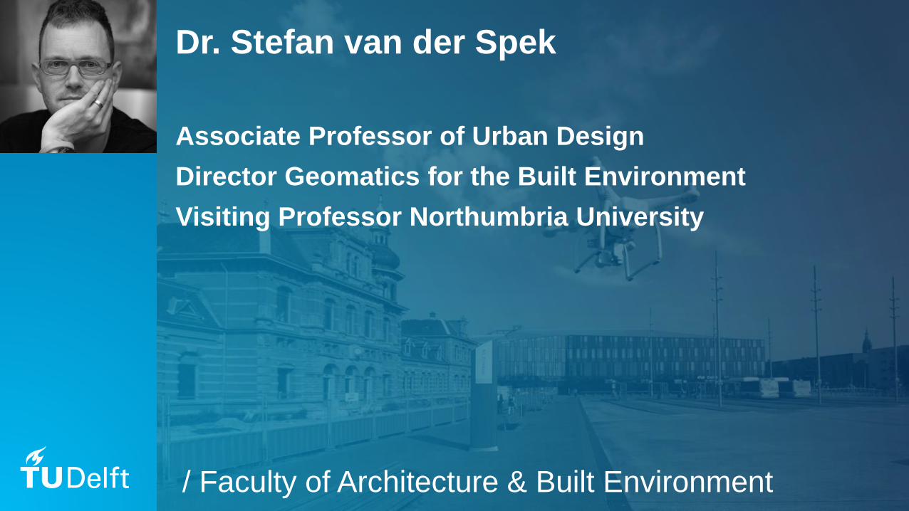
Location
Hoboken, Rotterdam
4
Why GIS
Gap between Design and GIS – GIS lacking
in (base) education of Architecture &
Urbanism
GIS, Geodata and informatics are essential
in tools delivering evidence-based, data-
driven and parametric design.
5
BSc AUBS
Architecture, Urbanism & Building Sciences
“In this degree programme you will be combining technology, theory and design, and your own creativity and spatial insight play a major role in this. Your education will be technical and scientific and you will learn how to analyse complex issues in a clear and structured way. You will work on a range of different design projects, either individually or in groups, and will learn about the way technology, culture and the living environment interact with each other”
6
Programma BSc AUBS
3 years, 6 semesters, 12 quarters
5 design projects
1. Home & Landscape
2. Design & Engineering
3. City & Public Space
4. Housing & (Living) Environment
5. Urban Planning & Strategy
7
BK3ON3 : City & Public Space
ON3 = design project quarter
2nd year, 1st urban design project
10 weeks
Urban project (plan area ±1x1km)
Design through the scales (region/city/area)
8
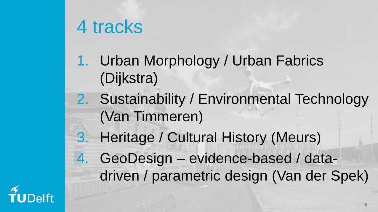
4 tracks
1. Urban Morphology / Urban Fabrics
(Dijkstra)
2. Sustainability / Environmental Technology
(Van Timmeren)
3. Heritage / Cultural History (Meurs)
4. GeoDesign – evidence-based / data-
driven / parametric design (Van der Spek)
9
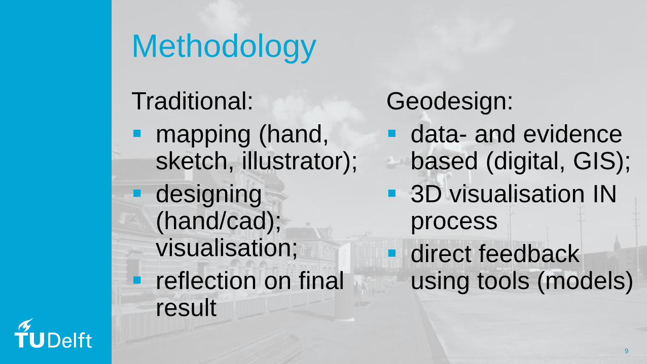
Methodology
Traditional:
mapping (hand, sketch, illustrator);
designing (hand/cad); visualisation;
reflection on final result
Geodesign:
data- and evidence based (digital, GIS);
3D visualisation IN process
direct feedback using tools (models)
10
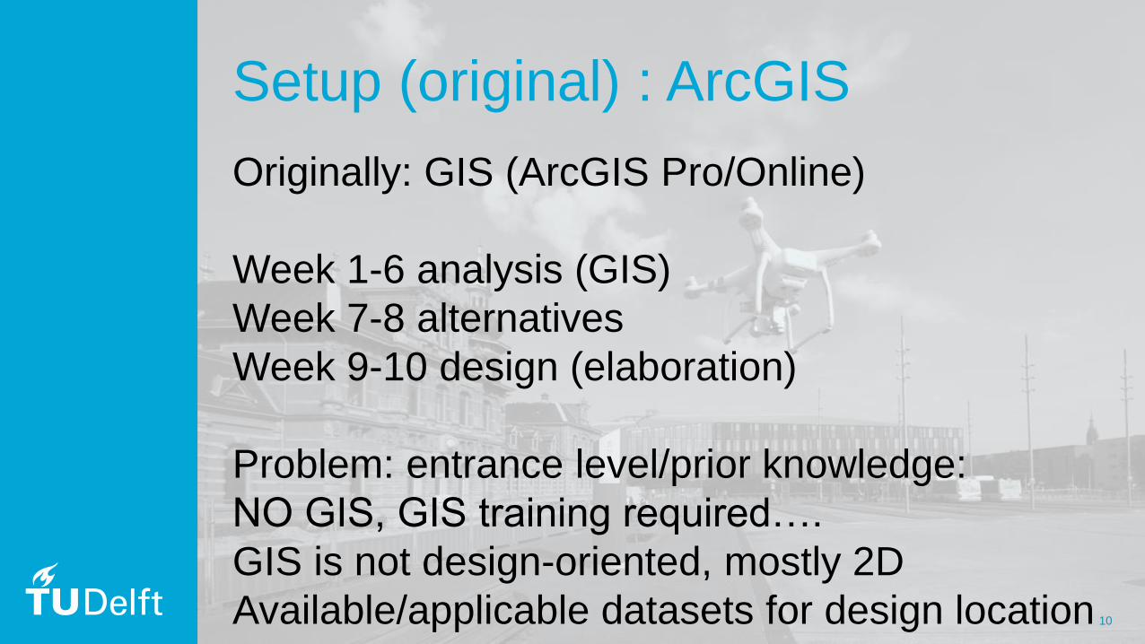
Setup (original) : ArcGIS
Originally: GIS (ArcGIS Pro/Online)
Week 1-6 analysis (GIS)
Week 7-8 alternatives
Week 9-10 design (elaboration)
Problem: entrance level/prior knowledge:
NO GIS, GIS training required….
GIS is not design-oriented, mostly 2D
Available/applicable datasets for design location
11
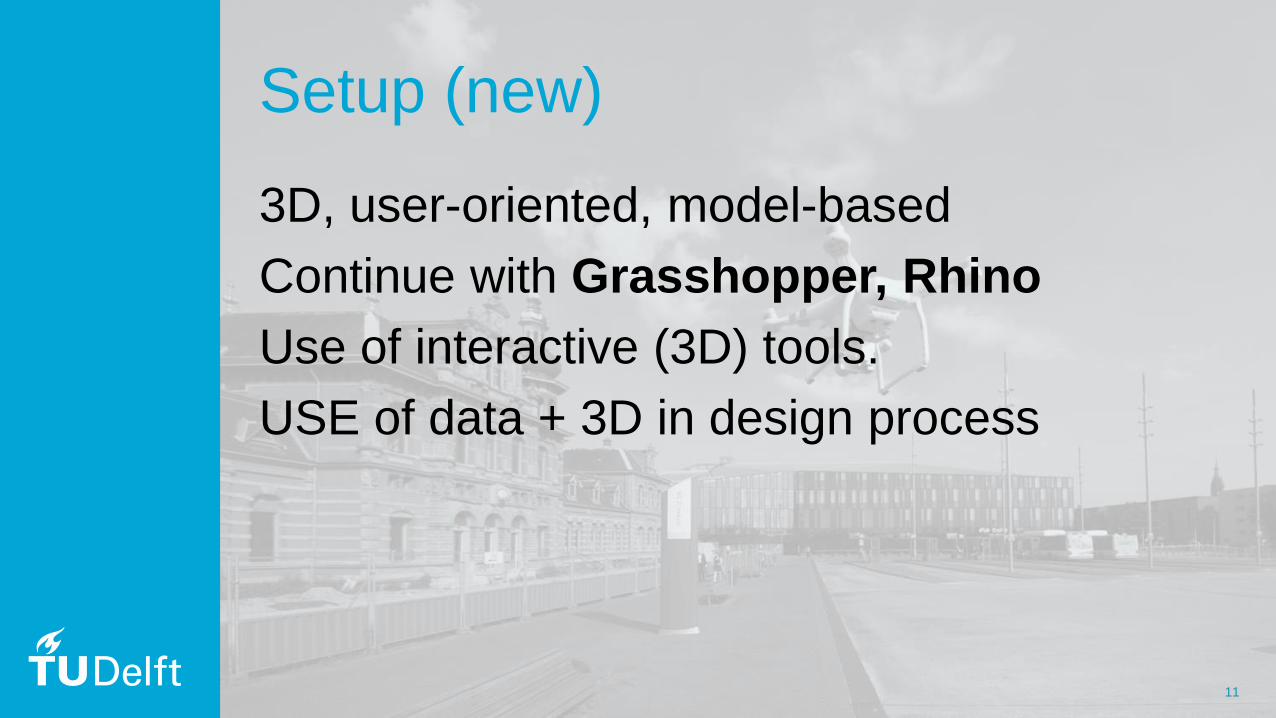
Setup (new)
3D, user-oriented, model-based
Continue with Grasshopper, Rhino
Use of interactive (3D) tools.
USE of data + 3D in design process
12
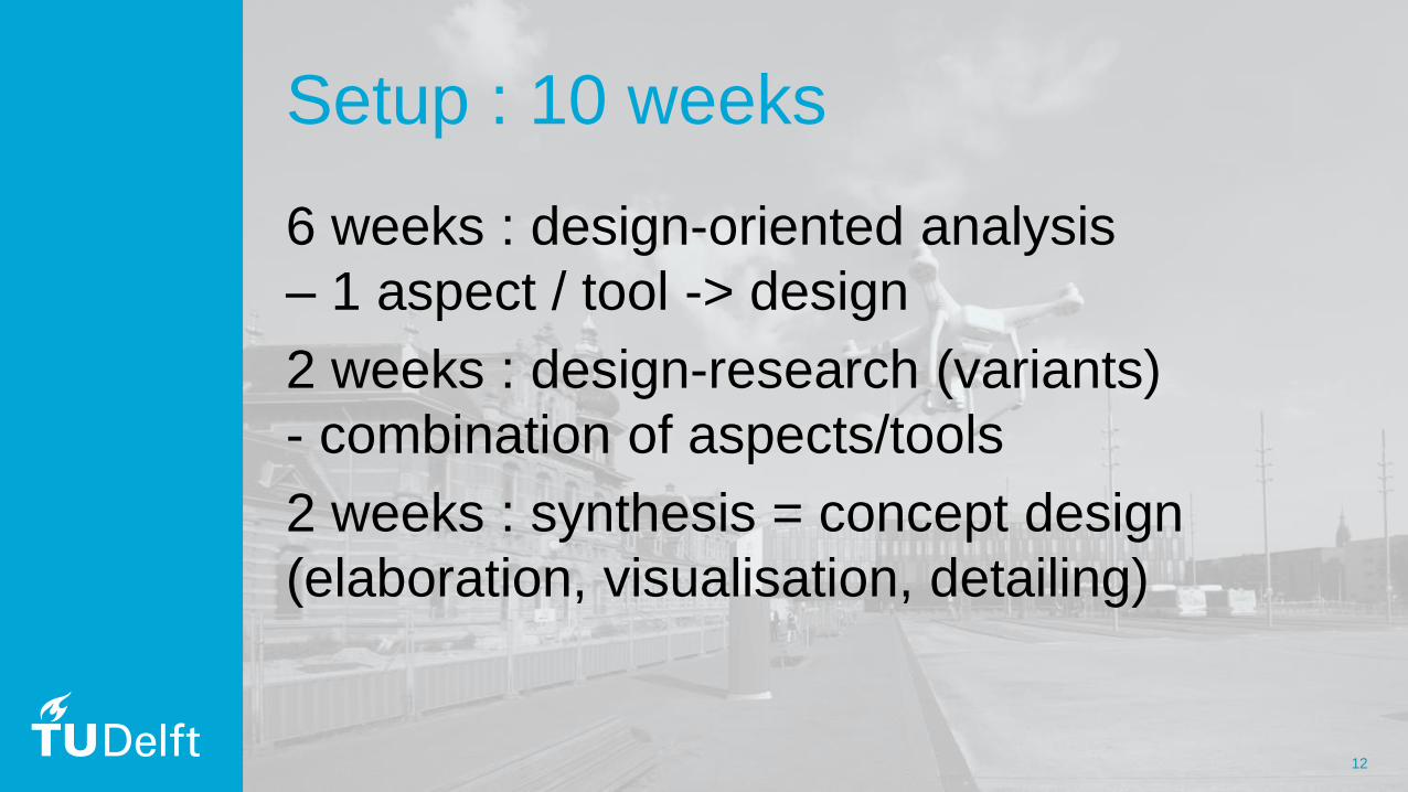
Setup : 10 weeks
6 weeks : design-oriented analysis
– 1 aspect / tool -> design
2 weeks : design-research (variants)
- combination of aspects/tools
2 weeks : synthesis = concept design
(elaboration, visualisation, detailing)
13
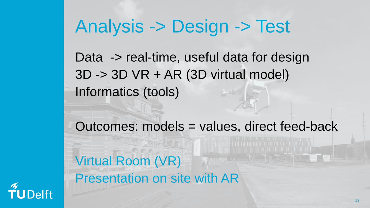
Analysis -> Design -> Test
Data -> real-time, useful data for design
3D -> 3D VR + AR (3D virtual model)
Informatics (tools)
Outcomes: models = values, direct feed-back
Virtual Room (VR)
Presentation on site with AR
14
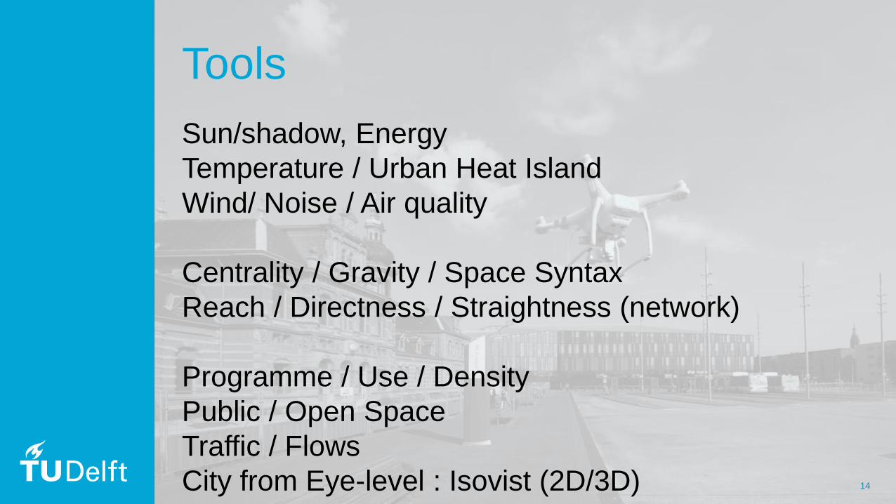
Tools
Sun/shadow, Energy
Temperature / Urban Heat Island
Wind/ Noise / Air quality
Centrality / Gravity / Space Syntax
Reach / Directness / Straightness (network)
Programme / Use / Density
Public / Open Space
Traffic / Flows
City from Eye-level : Isovist (2D/3D)
15
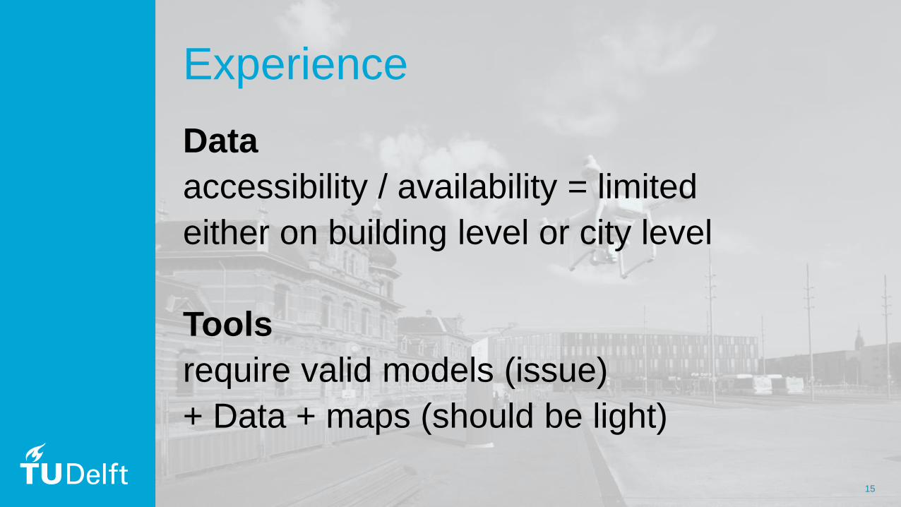
Experience
Data
accessibility / availability = limited
either on building level or city level
Tools
require valid models (issue)
+ Data + maps (should be light)
Sponsor Logos