
Geo-Spatial Mapping Initiative – Africa and Asia
17
Geo-Spatial Mapping Initiative
-
Upload
insight2impact-i2i -
Category
Economy & Finance
-
view
321 -
download
1
Transcript of Geo-Spatial Mapping Initiative – Africa and Asia
Geo-Spatial Mapping Initiative
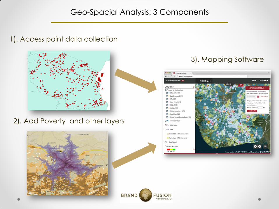
Geo-Spacial Analysis: 3 Components
1). Access point data collection
2). Add Poverty and other layers
3). Mapping Software
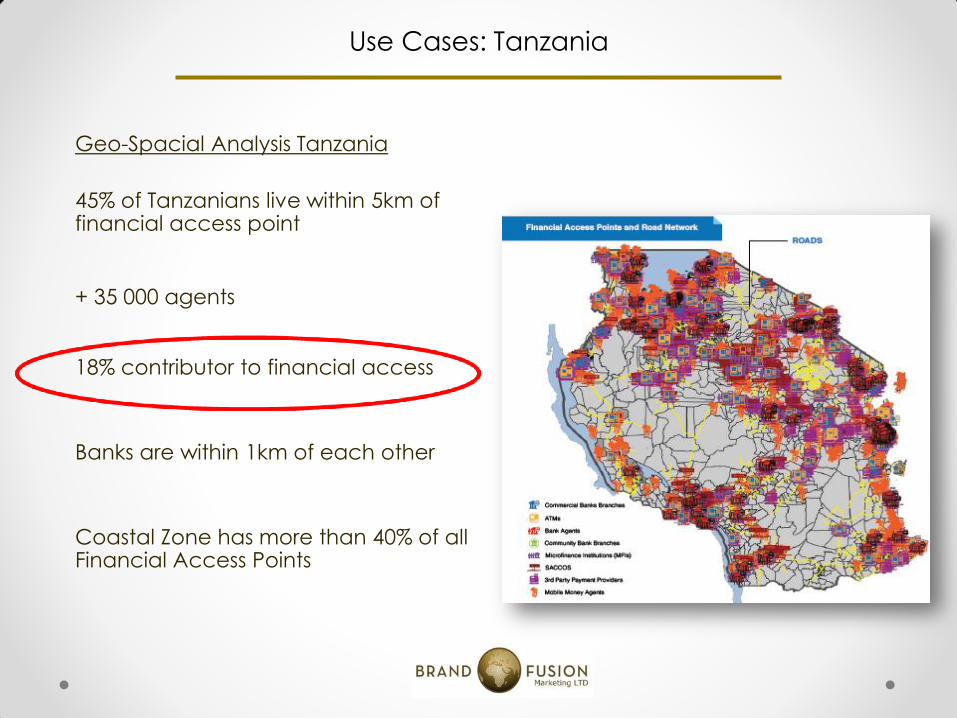
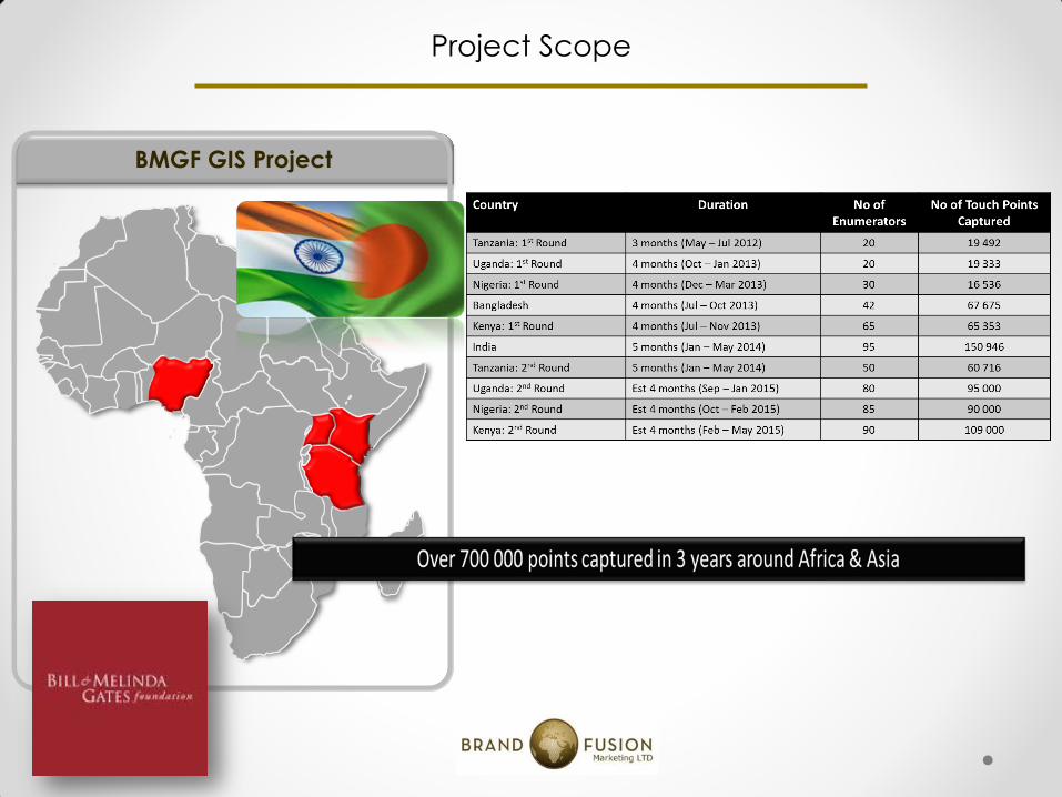
Use Cases: Tanzania
Geo-Spacial Analysis Tanzania
45% of Tanzanians live within 5km of financial access point
+ 35 000 agents
18% contributor to financial access
Banks are within 1km of each other
Coastal Zone has more than 40% of all Financial Access Points
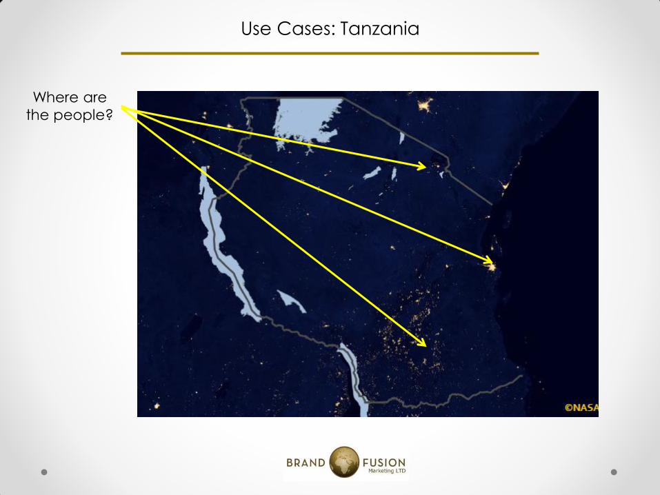
Use Cases: Tanzania
Where are
the people?
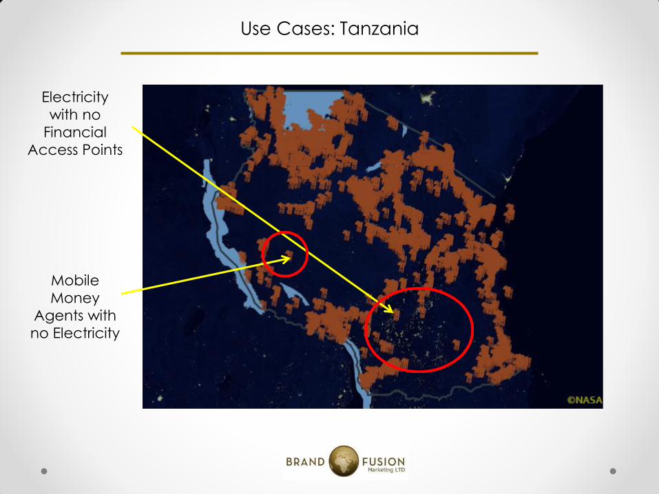
Use Cases: Tanzania
Electricity
with no
Financial
Access Points
Mobile
Money
Agents with
no Electricity
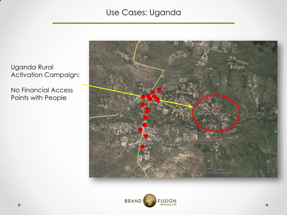
Use Cases: Uganda
Uganda Rural
Activation Campaign:
No Financial Access
Points with People
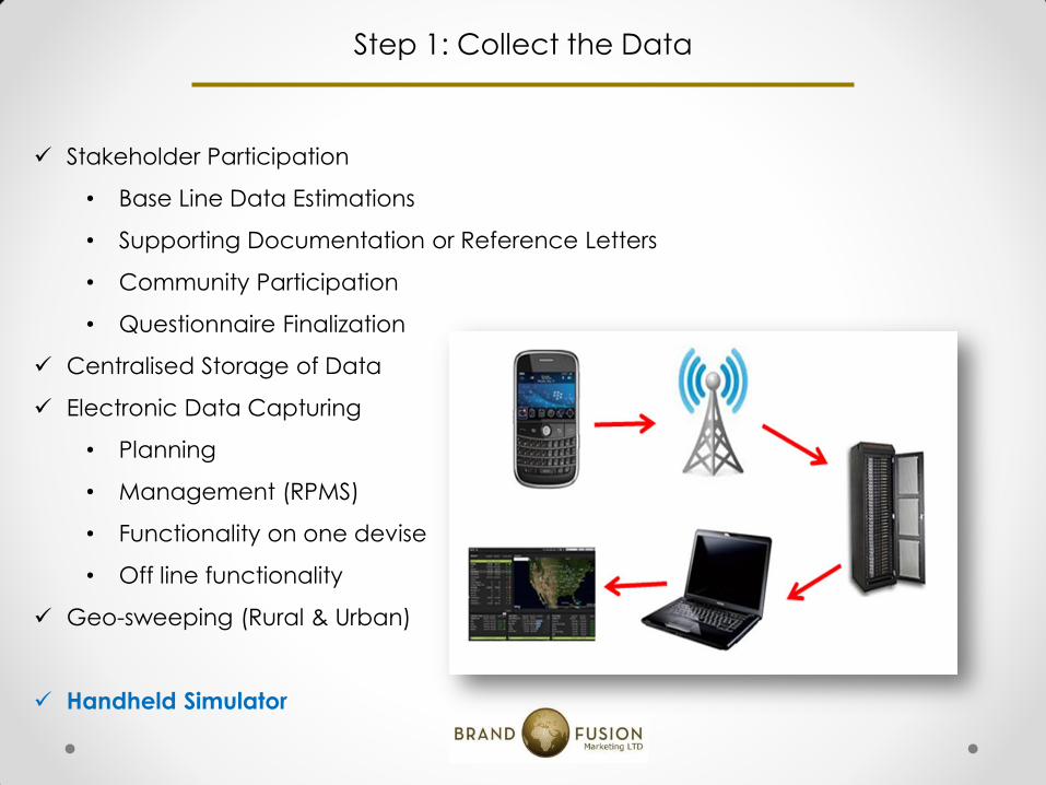
Stakeholder Participation
• Base Line Data Estimations
• Supporting Documentation or Reference Letters
• Community Participation
• Questionnaire Finalization
Centralised Storage of Data
Electronic Data Capturing
• Planning
• Management (RPMS)
• Functionality on one devise
• Off line functionality
Geo-sweeping (Rural & Urban)
Handheld Simulator
Step 1: Collect the Data
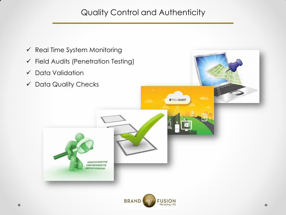
Quality Control and Authenticity
Real Time System Monitoring
Field Audits (Penetration Testing)
Data Validation
Data Quality Checks
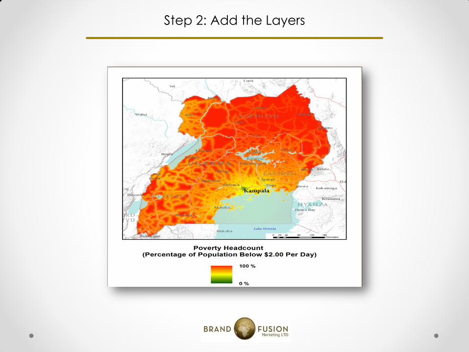
Step 2: Add the Layers
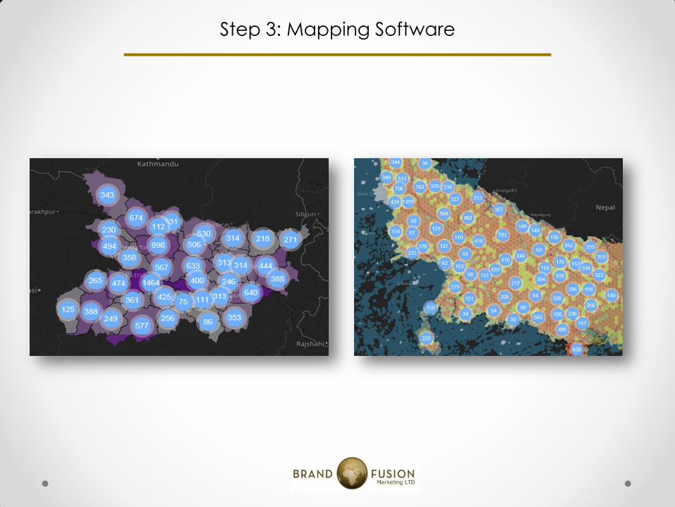
Step 3: Mapping Software
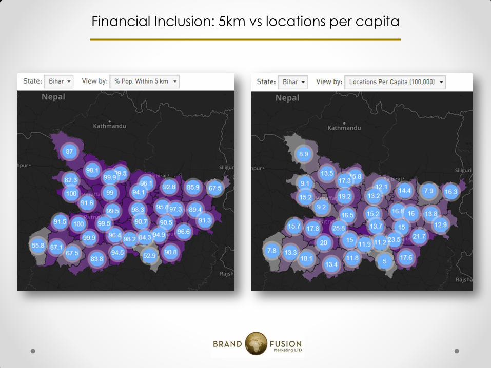
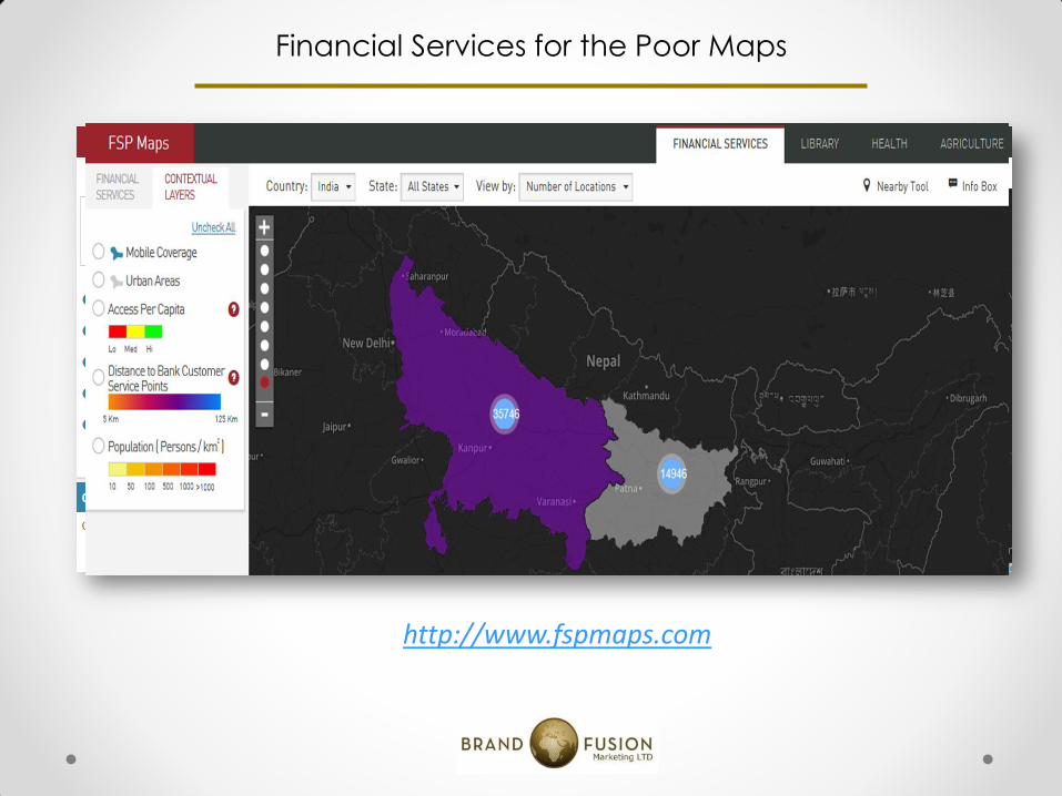
Financial Inclusion: 5km vs locations per capita
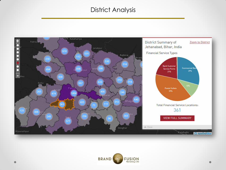
District Analysis
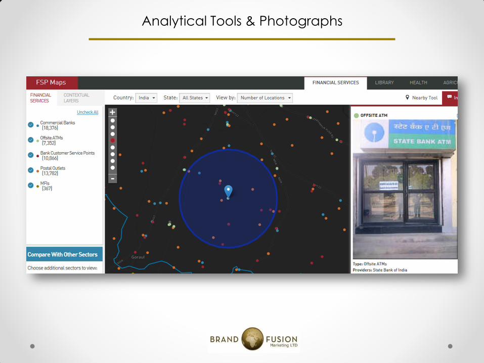
Analytical Tools & Photographs
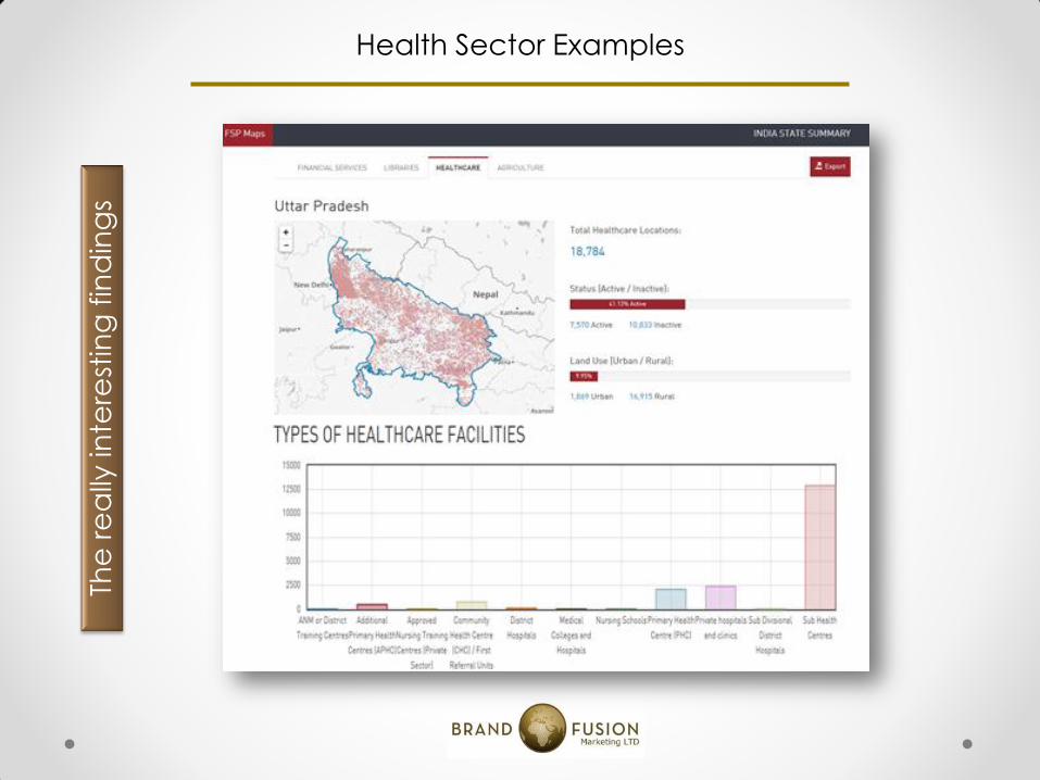
Health Sector Examples
The
re
ally
inte
rest
ing
fin
din
gs

Health Sector Examples (Cont…)