General Management Plan / Environmental Assessment Summary
84
National Park Service U.S. Department of the Interior Montezuma Castle – Tuzigoot National Monuments Arizona General Management Plan / Environmental Assessment Summary
Transcript of General Management Plan / Environmental Assessment Summary

National Park ServiceU.S. Department of the Interior
Montezuma Castle – Tuzigoot National MonumentsArizona
General Management Plan / Environmental Assessment Summary
National Park ServiceU.S. Department of the Interior
MONTEZUM
A CASTLE – TUZIGOOT NATIONAL MONUM
ENTS


February 2011
Dear Friends, Neighbors, and Partners of Montezuma Castle and Tuzigoot National Monuments,
The Monument staff and I are pleased to present to you the Montezuma Castle and Tuzigoot National Monuments General Management Plan Summary. This document is a condensed version, containing the key information of the larger General Management Plan/Environmental Assessment. The completion of the document depended on public participation and reflects valued input. Before selecting the preferred alternative, we considered all comments and suggestions.
The National Monument units in the Verde Valley — Montezuma Castle, Montezuma Well, and Tuzigoot — protect and interpret the legacy of the Sinagua culture, a native people who flourished in the area for centuries. The valley offered a home site with ample riparian resources and diversity in the biological transition of desert, grassland, and forest vegetation zones. The mission of the National Park Service requires us to manage these special places in a way that allows them to be enjoyed not just by those who are here today, but also by generations that follow.
We wish to extend our appreciation to those who worked with us during this long-term vision planning process. Together we developed a final plan that maintains a variety of interpretation and educational experiences while continuing to preserve and protect the nationally significant cultural resources in the riparian setting. Thank you for your ongoing interest, support, and participation in the future of Montezuma Castle, Montezuma Well, and Tuzigoot national monuments. We could not have done this without public interest.
Kathy M. Davis
Superintendent


C O N T E N T S
CHAPTER 1 — INTRODUCTION .................................................................................................... 5
Overview of Montezuma Castle and Tuzigoot National Monuments ................................ 7
Purpose and Need for the General Management Plan / Environmental Assessment ....10
Planning Issues and Opportunities ........................................................................................11
CHAPTER 2 — BACKGROUND ................................................................................................... 13
Foundation for Planning and Management .........................................................................15
Purpose .......................................................................................................................15Significance .................................................................................................................16Fundamental Resources and Values .......................................................................17Primary Interpretive Themes ...................................................................................19Special Mandates and Administrative Commitments ..........................................20Servicewide Mandates and Policies ........................................................................20
Guiding Management Principles and Strategies Management ...........................................22
Manage and Protect Cultural Resources ................................................................22Manage and Protect Natural Resources .................................................................24External Influences - Private and Public Partners, Owners of Adjacent Land, and Government Agencies ....................................30Ensure Sustainability by Employing User (Carrying) Capacity...........................30Provide Orientation, Interpretation, and Education ............................................31
CHAPTER 3 — THE PLAN AND ENVIRONMENTAL ASSESSMENT ................................................. 33
Management Zones .................................................................................................................35
Interpretive Historic ..................................................................................................36Park Operations .........................................................................................................36Resources and Research ...........................................................................................37Interaction and Discovery ........................................................................................37
Description of the Plan ...........................................................................................................40
Concept and General Management Strategies ......................................................40Conditions and Actions Common to All Three Sites ............................................40Boundary Adjustments, Land Purchases, And Easements ..................................41Cost Estimates ............................................................................................................41
Affected Environment and Implementation Impacts .........................................................42
Cultural Resources ....................................................................................................42Natural Resources .....................................................................................................44Visitor Use and Experience ......................................................................................46Socioeconomics .........................................................................................................46Monument Operations ............................................................................................46
Mitigation Measures ................................................................................................................47
General ........................................................................................................................47Natural Resources .....................................................................................................49Visitor Safety and Experiences ................................................................................52Hazardous Materials .................................................................................................52Scenic Resources .......................................................................................................52Socioeconomics .........................................................................................................52Sustainable Design and Aesthetics ..........................................................................52
User (Carrying) Capacity ........................................................................................................53
Park Operations Zone ...............................................................................................54Interpretive Historic Zone .......................................................................................54Interaction and Discovery Zone ..............................................................................55Resources and Research Zone .................................................................................56
Plan Implementation and Future Studies / Plans Needed ..................................................56
Conclusion ................................................................................................................................58
APPENDIXES AND INDEX ............................................................................................................ 59
Appendix A: Legal Mandates .................................................................................................61
Appendix B: Parcel Maps ........................................................................................................66
Index ..........................................................................................................................................69
Maps
Alternative B – Castle Site, Montezuma Castle National Monument ...............................66
Alternative B – Well Site, Montezuma Castle National Monument ..................................67
Alternative B – Tuzigoot National Monument .....................................................................68
Figures
1: Vicinity Map of Montezuma Castle National Monument, Montezuma Well Site, and Tuzigoot National Monument. ......................................................................................... 8
Tables
1: Montezuma Castle and Tuzigoot National Monuments Management Zones ........... 38-39
2: Cost Summary for Preferred Plan ...........................................................................................43

CHAPTER 1 — INTRODUCTION


7
OVERVIEW OF MONTEZUMA CASTLE AND TUZIGOOT NATIONAL MONUMENTS
M ontezuma Castle National Monument (including Montezuma Well) and Tuzigoot National Monument are National Park Service (NPS) units in central Arizona. The
monuments are within a 30-minute drive of each other and are managed collectively under a single administrative organization (see FIGURE 1 for a vicinity map).
Hundreds of species of
insects, arachnids and other
invertebrates find a home
in the unique ecosystems of
Montezuma Castle National
Monument. These include
harmless tarantulas as well
as highly venomous black
widow spiders and bark
scorpions. However, these
often misunderstoood desert
inhabitants pose little threat
to humans. The invertebrates
found at Montezuma Castle
and Montezuma Well reveal
extraordinary evolutionary
adaptations for survival in an
arid desert environment.
Montezuma Well
Bark scorpion
I N T R O D U C T I O N

CHAPTER 1 — INTRODUCTION
8
Figure 1. Vicinity Map of Montezuma Castle National Monument, Montezuma Well Site, and Tuzigoot National Monument.
Montezuma Castle National Monument was established in 1906 by presidential proclamation under the authority of the Antiquities Act (Presidential Proclamation No. 696, December 8, 1906, 34 Stat. 3265; see Appendix A). Since then, Congress passed legislation in 1937, 1959, 1978, and 2003 expanding the boundary of the monument to better protect the natural and cultural resources adjacent to the cliff dwellings. The legislation states it “is of the greatest ethnological value and scientific interest.” Today, Montezuma Castle National
Monument contains 1,004 acres within its boundary. This includes the 940-acre castle site and the 278-acre well site.
Montezuma Castle National Monument is approximately 3 miles east of I-17 exit 289. The monument preserves a prehistoric structure known as Montezuma Castle, which is a 20-room, five-story cliff dwelling built by the prehistoric Sinagua culture. It is one of the best-preserved cliff dwellings in North America. The National Monument has a visitor center, a bookstore, and a museum

MONTEZUMA CASTLE – TUZIGOOT NATIONAL MONUMENTS
9
Turquoise
that include exhibits and artifacts depicting the lifestyle, history, and culture of the Sinaguan, who built Montezuma Castle. The Castle itself is not open to the public, but a trail below the Castle offers many panoramic viewpoints. The monument also contains restrooms, a picnic area, and a parking facility for cars, buses, and recreational vehicles. An administrative building housing ranger operations and housing are south of the parking facility.
Montezuma Well, located approximately 4 miles east of I-17, exit 293, was added in 1943 as a 261-acre detached unit of Montezuma Castle National Monument through an act of Congress (October 19, 1943, 57 Stat. 572; see Appendix A). In 1959, 17 acres were authorized by an act of Congress (June 23, 1959, 73 Stat. 108; see Appendix A) “to facilitate the administration and protection” of the monument. Montezuma Well preserves an unusual example of a spring-fed, large, limestone sink and archeological sites representing the prehistoric Sinagua as well as Apache and Yavapai people. Montezuma Well contains a picnic area, restrooms, hiking trails, a visitor contact station, bulletin boards displaying visitor information, a small parking area, an administrative building and two ranger houses.
Tuzigoot National Monument was established by Presidential Proclamation No. 2344 on July 25, 1939 (see Appendix A). The boundary was expanded by an act of Congress in 1965 and again in 1978. Additional lands were conveyed through a land exchange in 2005.The establishing presidential proclamation states that “certain Government-owned lands (43 acres) in the state of Arizona have situated thereon historic and prehistoric structures and other objects of historic or scientific interest, and… it would be in the public interest to reserve such lands as a national monument to be known as Tuzigoot National Monument.” This 382-acre monument is approximately 20 miles northwest of I-17 exit 287 (Arizona Highway 260), near the town of Clarkdale, Arizona. Tuzigoot contains a visitor center and museum with a collection of Sinaguan artifacts, a nature trail, restrooms, an administrative building, a parking facility, and a 110 room prehistoric pueblo.
See Appendix B for maps of the national monuments.
CHAPTER 1 — INTRODUCTION
10
PURPOSE AND NEED FOR THE GENERAL MANAGEMENT PLAN / ENVIRONMENTAL ASSESSMENT
G eneral management plans are needed to meet the requirements of the National Parks and Recreation Act of 1978 and
NPS policy, which mandate development of a general management plan for each unit in the national park system. As the responsible agency, the National Park Service prepared the general management plan to establish and articulate a management philosophy and framework for long-term (15 to 20 years) decision-making and problem solving in units of the national park system. The general management plan provides comprehensive, integrated guidance for preserving cultural resources, perpetuating natural systems, providing opportunities for visitor enjoyment and understanding, and establishing the organizational mechanism to accomplish the plan. The General Management Plan for Montezuma Castle and Tuzigoot national monuments was needed because the last comprehensive planning effort for these national monuments was completed in 1975. Since this time, the population of the Verde Valley has increased substantially and continues to grow. This growth has resulted in changes in land use near the monuments. Visitation to the monuments also has increased over the past 30 years, although some declines have occurred within the past decade. Each of these changes has major implications for visitor expectations, how visitors access and use the monuments, facilities needed to support visitor uses, how resources are managed and protected, and how the National Park Service conducts its operations.
In the alternatives that are based on the monuments’ mission, purpose, and significance, the plan determines the areas to which resource protection and desired visitor use conditions are applied to achieve the management goals of the monuments. It also serves as the basis for later, more detailed implementation plans, which tier from the general management plan.
The environmental assessment was prepared in compliance with the National Environmental Policy Act to provide the decision-making framework that 1) analyzes a reasonable range of alternatives to meet objectives of the proposal, 2) evaluates potential issues and impacts to the monuments’ resources and values, and 3) identifies mitigation measures to lessen the degree or extent of these impacts. Resource topics were included because impacts that may be greater than minor include cultural resources, natural resources, visitor use and experience, socioeconomics, and monument operations. Other resource topics were dismissed because the plan would result in negligible or minor effects.
This document is a summary of the approved General Management Plan / Environmental Assessment. For more details, refer to the full, 324-page document by visiting http://parkplanning.nps.gov.
Hackberry

MONTEZUMA CASTLE – TUZIGOOT NATIONAL MONUMENTS
11
PLANNING ISSUES AND OPPORTUNITIES
A n issue is an opportunity, conflict, or problem regarding the use or management of public lands. The
general public, NPS staff, and other agencies and organizations helped identify issues and concerns during scoping (early information gathering) for the general management plan. The general management plan helps determine the best mix of resource protection and visitor use beyond what is prescribed by law and policy to preserve the monuments’ cultural and natural resources while encouraging visitors and employees to understand and appreciate their value. The following issues and opportunities were identified for Montezuma Castle and Tuzigoot national monuments:
• The plan needs to evaluate whether additional opportunities exist to expand the stories being told at the monuments to link the prehistoric cultures with contemporary people and whether to expand the areas available within the monuments for visitors to explore.
• The plan needs to evaluate how the visitors should interact with the resources of the monuments, including the variety and locations of monument resources that are accessible to visitors and the means of accessing resources.
• The plan needs to evaluate the character and level of development within the monuments and whether to expand existing facilities or construct additional facilities at the monuments to accommodate visitors and monument operations.
• Themonuments’existingheadquartersandmaintenancefacilitieswereoutsidethemonumentboundaries.TherearetwodistinctGeneralServicesAdministrationleasesontheheadquartersandmaintenancefacilities.Theplanneedstoexaminehowbesttoaccommodatethesemonumentmanagementfunctions.
• The monuments are a small portion of the Verde Valley. The National Park Service needs to work in partnerships with the other land management entities, local communities, tribes, and organizations within the Verde Valley on resource management and visitor use issues and opportunities.
• There are lands within the existing legislated boundaries that have not been acquired. Some of these contain significant resources that, if acquired, would protect additional resources associated with the monuments’ purpose. The plan needs to provide guidance for managing these lands if they are acquired. A boundary adjustment study, still under consideration, is beyond the scope of the general management plan.
Arizona Grape
CHAPTER 1 — INTRODUCTION
12
• The legislated boundary of Tuzigoot National Monument contains approximately 300 acres of mine tailings and other land disturbed by mining activities. The mine tailings do not contain resources related to the purpose and significance of the monument, are recontoured and revegetated but highly disturbed by mining activity, and are contaminated by hazardous substances. The plan needs to evaluate whether the monument boundary should be adjusted to eliminate these tailings areas, while retaining remaining suitable lands.
• Tavasci Marsh, acquired in 2006, is in a degraded condition and actions to restore the marsh are underway. The long-term objectives for restoration need to be supported within the management framework of the plan.
• Visitation at the monuments has generally increased since the 1940s, peaking at 1.2 million visitors in the mid-1990s. Although visitation has declined since the late 1990s, the population of the surrounding region is growing rapidly, and development of tourism in the area is expected to continue. The present visitor contact station at Montezuma Well is small, outdated, and limited in its ability to serve visitors. Expanded visitor contact would improve Montezuma Well’s ability to interpret early regional land use. Each unit is readily accessible from Camp Verde, Cottonwood, Clarkdale, Jerome, and Sedona.
• Currently, there is limited general orientation to all three sites, resulting in a lack of connectedness of the sites and their stories. If visitor interaction with monument resources increased, cultural and natural resources could experience additional effects. New wayside exhibits are being developed to better connect sites with interpretive information.
• The plan analyzes developing new onsite administrative and storage space because the current General Services Administration lease with the Yavapai Apache Nation for maintenance space was expiring. Construction of workspace and storage at the three sites would improve monument operations because it would be more efficient to provide workspace and store equipment within the units that use them most frequently rather than in one central area.
• The National Park Service could acquire private land holdings within the monument boundaries, including land owned by Freeport McMoRan Copper and Gold, Inc. (except for the mine tailings at Tuzigoot, which the monument does not wish to acquire), or work with Freeport McMoRan and other entities to protect the land for public use rather than development.
• The population of and land uses within the Verde Valley are changing. During the life of the general management plan, these changes could have an effect on visitation and resource conditions of the monuments.

CHAPTER 2 — BACKGROUND
In 1933, “Castle A,”
a 45-50 room, pueblo ruin
was excavated uncovering a
wealth of artifacts and greatly
enhancing our understanding
of the Sinagua people who
inhabited this riparian “oasis”
along Beaver Creek for over
400 years.


15
Purpose
P urpose statements reaffirm the reasons for which the monuments were set aside as units of the national park system and provide the foundation for management
and use of the monuments. The statements below are based on the monuments’ legislation and legislative history and on NPS policies.
The purposes of Montezuma Castle and Tuzigoot national monuments are as follows:
• PreserveandmanageprehistoricandhistoricstructuresandtheirrelatedresourceswithinMontezumaCastle,MontezumaWell,andTuzigoot
• Protectandmanageecologicalprocessesandconditionsrelatedtothemixofdesertandriparianhabitatstomaintainsustainableculturalandnaturallandscapes
• Promotestewardshipthrougheducationandinterpretationofcontinuingculturaladaptationstoadesertenvironment
FOUNDATION FOR PLANNING AND MANAGEME NT
Beaver Creek.
Desert tarantula
B A C K G R O U N D

CHAPTER 2 — BACKGROUND
16
Significance
Significance statements build on the monument’s purpose and clearly state why, within a national context, the monument’s resources and values are important enough to warrant the designation as a national park unit. These statements identify the resources and values central to managing the area and express the importance of the area to our natural and cultural heritage.
The primary significance of Montezuma Castle and Tuzigoot national monuments is summarized as follows:
• Montezuma Castle is one of the largest, most accessible, and best-preserved Sinaguan cliff dwelling in the Southwest.
• Tuzigoot is one of the largest known pueblos.
• The excavation, restoration, and development of Tuzigoot illustrate Depression-era (Civilian Works Administration, Works Project Administration, and Civilian Conservation Corps) pioneering archeological efforts in the Southwest and were instrumental in the preservation and accessibility of this and other national monuments.
• The monuments’ archeological collections constitute one of the largest artifact assemblages, including trade ware, of the Southern Sinagua culture of the Verde Valley.
• Montezuma Well is a unique, spring-fed, limestone sink connected to remnants of an extensive prehistoric irrigation system via a natural outlet.
• Because of its unique environment, Montezuma Well has substantial scientific value and contains species not found in any other waters in the world.
• The monuments represent a continuum of land use from pre-Columbian cultures through the present and have enormous learning potential about the relationship between humans and their environment.
• The natural and cultural resources within the monuments are significant to native tribes, as evidenced by oral histories, the archeological record, and continuing practices and beliefs. To this day, eight tribes maintain an association with the monuments.
• Montezuma Castle was among the first four national monuments created through the Antiquities Act of 1906, affording the first federal protection of archeological resources.
Processing a western diamondback rattlesnake outside the Montezuma Castle Visitor Center.
Amaranth
MONTEZUMA CASTLE – TUZIGOOT NATIONAL MONUMENTS
17
Fundamental Resources and Values
Fundamental resources and values are a monument’s attributes — its features, systems, processes, experiences, stories, scenes, sounds, smells, opportunities for visitor enjoyment, or others — that are critical to achieving the monument’s purpose and to maintaining its significance. Other important resources and values are additional monument attributes that are noteworthy but not related to the monument’s purpose and significance. Fundamental resources and values warrant primary consideration during planning and management or are important to monument management and planning.
The fundamental resources and values for the Montezuma Castle and Tuzigoot national monuments are grouped into the following three categories: cultural connectivity, structures and related resources and values, and natural features.
Cultural Connectivity. The cultural connectivity category lists the fundamental resources and values that support an understanding of the monuments’ role within larger geographic networks of exploration, settlement, resource development, and trade from prehistoric time to today. The fundamental resources and values in this category also support an understanding of continuing cultural adaptation to the desert environment.
• The vistas at the monuments that allow visitors to experience and understand the line-of-sight relationships among the prehistoric pueblos that were regularly spaced, approximately 1.8 miles apart, along the major drainages of the Verde Valley. The vistas make it possible to see pueblos (e.g., Sacred Mountain and Thoeny at Montezuma Well, the Salt Mine Pueblo at Montezuma Castle, and Bridgeport Pueblo, Tuzigoot Extension, and Hatalacva at Tuzigoot).
• The connection of structures within the monuments boundaries that reveal patterns in prehistoric land use and the related opportunity to contrast the similarities and differences in land use to human’s relationship with the environment from prehistoric to modern times.
• The resources and opportunities to understand the role of the Verde Valley as a major trading hub and an exporter of argillite, salt, and copper derivatives.
• The stories, oral histories, and resources revealing the role of the Verde River, Montezuma Well, Tavasci Marsh, Beaver Creek, and Wet Beaver Creek in prehistoric and historic trade, travel, exploration, and settlement of the area.
Olla at the Tuzigoot Museum.
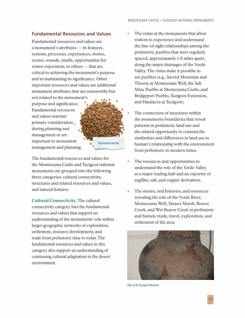
Buckwheat kernals

CHAPTER 2 — BACKGROUND
18
Structures and Related Resources and Values. The structures and related resources and values category lists the fundamental resources and values that support preservation and understanding of the prehistoric and historic structures and related resources and values of the monuments.
Montezuma Castle — The prehistoric Sinagua structures and related resources of the Castle, including four cliff dwellings and five rock shelters on the limestone face of the north bank of Beaver Creek, three agricultural sites evidenced by small stone structures in the floodplain of Beaver Creek, one or two room masonry structures, a bedrock mortar site southeast of the Castle in the inner channel of Beaver Creek, and two lithic scatter sites above the Castle and between the Castle’s access road and Highway 17.
The high degree of architectural integrity of the Castle cliff dwelling including the adobe-and-cobble masonry building construction, viga-and-latilla roof construction, and the three-sided alcove niche carved into the limestone cliffs sheltering the cliff dwelling.
Montezuma Well — The prehistoric Hohokam and Sinagua structures and related resources, including 22 rock shelters sites within the inside rim of Montezuma Well and the limestone cliffs overlooking arable land or prehistoric irrigation ditches, two pueblos sites on the south rim of Montezuma Well,
several one or two room masonry structures, agricultural features including well-preserved segments of a prehistoric irrigation canal system, artifact scatters, a burial ground, and a prehistoric cobble concentration at the edge of a cliff overlooking the irrigation canal.
Tuzigoot — The prehistoric Sinagua structures and archeological evidence used to understand the sociopolitical organization of this large cluster settlement, including Tuzigoot Pueblo on the crest of Tuzigoot Hill and the site of a two-to-five-room masonry structure on the eastern slope of Tuzigoot Hill.
Natural Features. The natural features category lists the following fundamental resources and values that support protection and understanding of the significant natural features and ecological processes of the monuments:
• The unique hydrology and geology of the monuments, including the spring-fed, large, limestone sink of Montezuma Well; the spring-fed Tavasci Marsh draining onto the fields below; the limestone formations of the monuments; Beaver Creek; Wet Beaver Creek; and the Verde River.
• Special species at Montezuma Well, including Kinosternon sonoriense (Sonoran mud turtle), Hyalella montezuma (amphipod), and Erpobdella montezuma (leech).
• The ecological processes and conditions related to the integration of dessert and riparian landscapes.
Montezuma Castle.

MONTEZUMA CASTLE – TUZIGOOT NATIONAL MONUMENTS
19
Other Important Resources and Values. The monuments also have the following noteworthy resources and values that are less than “fundamental,” but that remain important.
For cultural connectivity, one noteworthy resource and value is the partnerships with tribes, adjacent land owners, and local private and public agencies.
For structures and related resources and values, additional and important structures include the structures (museum and offices, storage tool house, pump house, and retaining wall) and pioneering archeological technologies developed at Tuzigoot by the Works Progress Administration and Civilian Conservation Corps. They also include structures and site features associated with 19th century homesteading activities, including the Back Cabin, the smokehouse structure, and irrigation ditch.
In addition, important natural features include the following:
• The Verde River, Beaver Creek, and Wet Beaver Creek that function as wildlife corridors and habitat for birds and mammals
• Mesquite bosques found at the Montezuma Well and Tuzigoot sites
• Night sky vistas at the Montezuma Well and Castle sites
• Open space for recreation at Montezuma Well
Primary Interpretive Themes
Primary interpretive themes are the key ideas through which the monuments’ resource values are conveyed to the public. They connect monuments’ resources and values to the purpose and significance, providing
the building blocks on which the interpretive program is based. The primary interpretive themes for Montezuma Castle and Tuzigoot national monuments are the following:
• Land use patterns and human settlement of the Verde Valley illustrate the continuum of occupation in the Southwest and demonstrate how contemporary cultures are linked to, and identify with, this place.
• Riparian areas of the Verde Valley support a diversity of plants and animals and serve an important role in scientific discovery and species survival as habitat is lost to development worldwide.
• Montezuma Castle and Tuzigoot national monuments serve as benchmarks of pioneering archeological efforts in the Southwest and demonstrate evolving scientific inquiry, methods, and interpretations that help us understand past human experiences and how they inform the present.
• The experiences of people in the Verde Valley demonstrate how, through migration, travel, and trade along natural corridors, cultures influence and affect one another.
• The preservation and interpretation of Montezuma Castle and Tuzigoot national monuments illustrate the NPS mission of protecting exemplary sites that contribute to our national identity while providing authentic places and experiences for people to connect to their heritage.

CHAPTER 2 — BACKGROUND
20
Special Mandates and Administrative Commitments
Special mandates and administrative commitments refer to monument-specific requirements. These formal agreements are often established concurrently with the creation of a unit of the national park system and include the following:
• TheBeaverCreekRoadcrossesthroughtheMontezumaWellsiteofMontezumaCastle.ThisroadisonfederallandbutispartiallymaintainedbyYavapaiCounty.TheNationalParkServiceandthecountyworkcollaborativelytoensurethatthisroadismaintainedforpublictransit.
• TheNationalParkServicehasapartnershipwithWesternNationalParksAssociationtomanagethesalesofinterpretation-relatedmerchandise,suchasbooks,attheMontezumaCastleandTuzigootvisitorcenters.ThispartnershipisgovernedbythelawsofthestateofArizonaandNPSpolicy.Thesaleofmerchandiseprovidesaservicetovisitorsandprovidesfundsformanagementofthemonuments.
Servicewide Mandates and Policies
Many management directives are specified in laws and policies guiding the National Park Service and, therefore, are not subject to alternative approaches. For example, there are laws about managing environmental quality (such as air quality, threatened and endangered species, and wetlands), laws governing the preservation of cultural resources (such as the National Historic Preservation Act), and laws about providing public services (such as barrier-free access). A general management plan is not needed to decide, for example, that
it is appropriate to protect endangered species, control exotic species, protect archeological sites, conserve artifacts, and provide access to people with impaired mobility.
The National Park Service Organic Act (16 United States Code, section 1) provides the fundamental management direction for all units of the national park service. In this act, the National Park Service is charged to:
Promote and regulate the use of the Federal areas known as national parks, monuments, and reservations…by such means and measure as conform to the fundamental purpose of said parks, monuments and reservations, which purpose is to conserve the scenery and the natural and historic objects and the wild life therein and to provide for the enjoyment of the same in such manner and by such means as will leave them unimpaired for the enjoyment of future generations.
The National Park System General Authorities Act (16 United States Code, section 1a-1 et seq.) affirms that while all national park system units “though distinct in character, are united through their inter-related purposes and resources into one national park system as cumulative expressions of a single national heritage.” The act makes it clear that the
Park staff deploying turtle traps at Montezuma Well.

MONTEZUMA CASTLE – TUZIGOOT NATIONAL MONUMENTS
21
Organic Act and other protective mandates apply equally to all units of the system. Further, it states that NPS management of park units “shall not be exercised in derogation of the values and purposes for which these various areas have been established.”
The Organic Act and the General Authorities Act prohibit any impairment of monument resources. Therefore, the general management plan includes determinations of whether the actions associated with the alternatives would result in impairment of the resources that collectively compose the monuments’ “scenery and the natural and historic objects and the wild life therein.”
Unless an activity is required by statute, the National Park Service cannot allow visitor uses in the monuments that would involve or result in any of the following, which are listed in section 8.2 of NPS Management Policies 2006:
• Be inconsistent with a park’s purposes or values
• Impede the attainment of a park’s desired conditions for natural and cultural resources as identified through the park’s planning process
• Create an unsafe or unhealthy environment for visitors or employees
• Diminish opportunities for current or future generations to enjoy, learn about, or be inspired by park resources or values
• Unreasonably interfere with » park programs or activities» anappropriateuse» theatmosphereofpeaceand
tranquility,orthenaturalsoundscapemaintainedinwildernessandnatural,historic,orcommemorativelocationswithinthepark
» NPS concessioner or contractor operations or services
The National Park Service has established policies for all units under its stewardship. These are identified and explained in the guidance manual, NPS Management Policies 2006. All of the alternatives considered in the general management plan, including the no-action alternative, incorporate and comply with the provisions of these mandates and policies.
Arizona black rattlesnake.
Cattails

CHAPTER 2 — BACKGROUND
22
GUIDING MANAGEMENT PRINCIPLES AND STRATEGIES MANAGEMENT
G uiding management principles and strategies shape the ways that monument staff manage the fundamental
resources and values, within the limitations imposed by servicewide and special mandates, to preserve the monuments’ significance, fulfill the monuments’ purpose, and achieve the monuments’ mission. These principles and strategies guide management under all three alternatives described in the general management plan document.
Some of these principles and strategies describe approaches that the monuments are currently taking; others are not currently being implemented but are consistent with NPS policy and are not controversial. As appropriate, the National Park Service would provide National Environmental Policy Act and National Historic Preservation Act compliance documentation for the implementation of actions under these principles and strategies and of actions taken under the selected alternative.
Manage and Protect Cultural Resources
The protection of cultural resources is essential for understanding the past, present, and future relationship of people with the area. Montezuma Castle and Tuzigoot national monuments are part of the NPS Vanishing Treasures Initiative, which provides emergency measures to protect structures in imminent danger, evaluates structures to determine treatment priority, and trains a younger workforce in the craft skills needed for archeological preservation.
The strategies enable the National Park Service to preserve unimpaired the monuments’ cultural resources while encouraging visitors and employees to understand and appreciate their value.
Western black widow

MONTEZUMA CASTLE – TUZIGOOT NATIONAL MONUMENTS
23
Archeological, Historic Structures, Cultural Landscapes, and Ethnographic Resources. The strategies for managing the archeological, historic structures, cultural landscapes, and ethnographic resources are as follows:
• Continue to survey and document or inventory cultural resources in accordance with the National Historic Preservation Act and other applicable regulations and policies.
• Gather field data regarding archeological resources to develop a more accurate predictive model of prehistoric site distribution and address related research questions.
• Continue to evaluate all identified resources to determine their eligibility for listing in the National Register of Historic Places.
• Use avoidance techniques and other measures to prevent impacts on known significant sites from visitors and project-related disturbances.
• Continue to support research and consultation to increase the understanding of all cultural resources.
• Consistent with Director’s Order 75A, continue to consult with and seek to improve working relations with federally recognized tribes and the state historic preservation officer on surveys, studies, excavations, and actions that potentially could affect cultural resources.
• Continue the preservation and stabilization of prehistoric and historic structures when necessary.
Museum and Archival Collections. The strategies for managing museum and archival collections are as follows:
• Continue to maintain a diverse museum collection according to NPS policies. While the collection will continue to contain primarily archeological artifacts and archival documents, managers should look for opportunities to expand holdings of ethnographic, historic biological, paleontological, and geological specimens.
• Continue to improve the conditions of artifact and specimen exhibits and storage according to NPS museum standards.
• Maintain and continue to expand opportunities for researchers to use the artifacts, specimens, and archival materials in the museum collection.
Relationships with Native Americans. The National Park Service recognizes that the monuments have long occupied a prominent position for Native Americans in the Verde Valley. NPS staff members will work to ensure that traditional Native American ties to the monuments are recognized and will strive to maintain positive, productive government-to-government relationships with tribes that are culturally associated with the monuments. The viewpoints and needs of tribes will continue to be respected, and issues that arise will be promptly addressed. Native American values will be considered in the management and operation of the monuments. To enhance its relationship with the tribes, the National Park Service will carry out the following strategies and actions:

CHAPTER 2 — BACKGROUND
24
• Consult regularly and maintain government-to-government relations with federally recognized tribes that have traditional ties to resources within the monuments to ensure productive, collaborative working relationships.
• Continue to identify and deepen the understanding of the significance of the monuments’ resources and landscapes to Native American people through cooperative research and sharing.
• Once they have been identified, protect and preserve the sites, resources, landscapes, and structures of significance to the federally recognized tribes as required under federal laws and Management Policies 2006.
• Encourage the participation of tribes in protecting the monuments’ natural and cultural resources of interest and concern to them.
• Involve tribes in the monuments’ interpretation program to promote accuracy of information about Native American cultural values and enhance public appreciation of those values.
• Support the continuation of traditional Native American activities in the monuments to the extent allowed by applicable laws and regulations.
• Continue to consult and collaborate with tribes concerning issues and proposed actions that might affect Native Americans.
Manage and Protect Natural Resources
The protection, study, and management of the monuments’ natural resources and processes are essential for achieving the monuments’ purposes and mission goals. The following principles and strategies will help the National Park Service retain the ecological integrity of Montezuma Castle and Tuzigoot national monuments, including natural resources and processes. These actions will help ensure that the monuments’ natural features are unimpaired; the areas continue to be dynamic, biologically diverse environments; and the monuments are recognized and valued as an outstanding example of resource stewardship, conservation, education, and public use.
Inventory and Monitoring. Knowing the condition of natural resources in a national park unit is fundamental to the National Park Service’s ability to protect and manage that unit. Montezuma Castle and Tuzigoot national monuments are confronted with increasingly complex and challenging issues, and the National Park Service needs scientifically credible data to make management decisions. Inventories involve compiling existing information and collecting new information. Inventories contribute to the accurate statement of the condition
of the monuments’ resources, especially the natural or unimpaired state.
Desert jackrabbit.

MONTEZUMA CASTLE – TUZIGOOT NATIONAL MONUMENTS
25
A long-term ecosystem monitoring program is necessary to enable managers to:
• Makebetterinformeddecisions
• Provideearlywarningofchangingconditionsintimetodevelopandimplementeffectivemitigatingmeasure
• Persuadeindividualsandotheragenciestomakedecisionsbenefitingthemonuments
• Satisfycertainlegalmandates
• Providereferencedataforrelativelypristinesitesforcomparisonwithareasoutsidethemonuments
• Evaluatetheeffectivenessofmanagementactionsandobtainmoreaccurateassessmentsofprogresstowardsmanagementgoals
Using monitoring information will increase confidence in managers’ decisions and improve their ability to manage natural resources.
Strategies for inventorying and monitoring include the following:
• Continue to develop inventories and long-term monitoring programs to address the status and health of the resources. Identify key indicators of resource or ecosystem conditions and monitor them over the long term to record changes in ecosystem health.
• Conduct inventories to identify vertebrate and invertebrate animal species, vascular and nonvascular plant species, and air, water, and geologic resources in the monuments.
• Continue to participate in the Sonoran Desert Inventory and Monitoring Network. Work with partners and collaborators to inventory resources and monitor vital components of the ecosystem. This will make it possible to better assess the condition of monuments’ resources and trends and to develop databases, data analyses, and retrieval tools so that the usefulness of natural resource information can be improved.
Redwinged blackbird at Tavasci Marsh.

CHAPTER 2 — BACKGROUND
26
Air Quality. Montezuma Castle and Tuzigoot national monuments are designated class II areas under the Clean Air Act. The National Park Service has a responsibility to protect air quality under both the 1916 Organic Act and the Clean Air Act. Accordingly, the National Park Service will seek to achieve the best possible air quality in the monuments to (1) preserve natural resources and systems; (2) preserve cultural resources; and (3) sustain visitor enjoyment, human health, and scenic vistas.
Vegetation, visibility, water quality, wildlife, historic and pre-historic structures and objects, cultural landscapes, and most other elements of the monuments’ environment are sensitive to air pollution. The National Park Service will actively promote and pursue measures to protect resource from the adverse impacts of air pollution.
The National Park Service will use the following strategies to address air quality in the monuments:
• Eliminate or reduce emissions associated with administrative and recreational use of the monuments.
• Continue to participate in regional air quality planning and research, and the implementation of air quality standards.
• Protect the monuments’ noteworthy night sky and scenic vistas as natural and cultural resources as an inspiration for visitor enjoyment.
Natural Sounds. Visitors have the opportunity in portions of the monuments to experience natural sounds, and the experience of reverence for cultural resources
and other experiential qualities of a cultural monument are sensitive to intrusions of human-caused noise. It is important to protect the natural soundscape for wildlife species as well. A natural, intact soundscape is important for animal communication, territory establishment, courtship and mating, nurturing young, and effective use of habitat. The sounds of modern society are generally confined to the developed areas in the monuments. Guiding principles and strategies will include protecting the monuments’ natural sounds as a contribution to visitor enjoyment and protecting natural sounds for the benefit of wildlife.
Fire Management. Prescribed and wildland fire will be used as a tool to meet resource management objectives. The following strategies will ensure that wildland fire will be used effectively to protect resources:
• Develop and maintain a current fire management plan for the monuments.
• Cooperate with adjacent communities, groups, state and federal agencies, and tribes to manage fire in the monuments and the region.
• Use fire as appropriate to maintain and restore native plant species and control nonnative plant species.
Geologic Features. Montezuma Castle and Tuzigoot national monuments contain unique landforms. The National Park Service will implement the following policies and strategies to ensure that the geologic features are not substantially degraded and the scenic views remain unimpaired:

MONTEZUMA CASTLE – TUZIGOOT NATIONAL MONUMENTS
27
• Inventory, map, and monitor geologic features to assess their condition.
• Allow natural geologic processes to proceed unimpeded. Intervention in natural geologic processes will be permitted only when directed by Congress, when necessary in emergencies that threaten human life and property, or when there is no other way to protect cultural resources or critical monument facilities.
• Develop interpretive and educational programs to educate visitors and the public about geology.
• Actively seek to understand and preserve soil resources and prevent to the extent possible its removal or contamination.
• Monitor high-impact visitor use areas and take actions to reduce impacts on geologic resources.
Paleontological Resources. Montezuma Castle and Tuzigoot national monuments contain paleontological resources. The following strategies will be implemented to better understand and protect these resources:
• Expand inventorying and monitoring to ensure that these nonrenewable resources are not lost.
• Manage and study paleontological resources in their geologic context, which provides information about the ancient environment.
• Partner with federal, state, and local agencies and with academic institutions to conduct paleontological research.
• Manage fossils collected in accordance with the monuments’ collection management plan.
Threatened or Endangered Species. The Endangered Species Act mandates that agencies, including the National Park Service, promote the conservation of all federally listed threatened or endangered species and their critical habitats within the monuments’ boundaries. Several special-status species, including those that are listed at the federal or state levels, are known to exist in and around the monuments and to use habitats in the monuments. The following actions will be taken to protect special-status species:
• Continue to work with the United States (U.S.) Fish and Wildlife Service (USFWS) and Arizona Game and Fish Department to ensure that the National Park Service’s actions help special status species to recover. If any state- or federally listed or proposed threatened or endangered species are found in areas that would be affected by construction, visitor use, or restoration activities proposed under any of the alternatives in this plan, the National Park Service will consult with the above agencies and will then try to avoid or mitigate any potential adverse impacts.
• Cooperate with the above agencies to inventory, monitor, protect, and perpetuate the natural distribution and abundance of all special-status species and their essential habitats in Montezuma Castle and Tuzigoot national monuments. These species and their habitats will be specifically considered in ongoing planning and management activities.

CHAPTER 2 — BACKGROUND
28
Vegetation. Whenever possible, natural processes will be relied on to maintain native plants and plant communities. Communities will include the diverse species, genetic variability, plant associations, and successional stages representing an ecologically functioning system. The following actions will be taken to manage the monuments’ vegetation:
• Inventory plant communities to determine the species present and monitor communities to identify changes in their condition. Continue to inventory rare plants.
• Continue efforts to control invasive plants in the monuments. Continue to work with other federal, state, and local agencies and with private landowners to prevent the spread of invasive plant species across monument boundaries.
• Restore extirpated native species where suitable habitat exists and restoration is compatible with social, political, and ecological conditions.
Wildlife and Fish. The following policies and strategies will ensure that native wildlife and fishes are protected:
• Determine the condition of native wildlife and fish through baseline inventories and use long-term monitoring to identify and evaluate changes.
• Perpetuate the native animal life as part of the natural ecosystem. Emphasize minimizing human impacts on native animals and minimizing human influence
on naturally occurring fluctuations of animal populations. Rely on ecological processes to control populations of native species to the greatest extent practical.
• Ensure the preservation of populations and habitats of migratory species, such as birds, that use the monuments. Cooperate with others to enhance the preservation of the populations and habitats of migratory species outside the monuments.
Prickly pear cactus.

MONTEZUMA CASTLE – TUZIGOOT NATIONAL MONUMENTS
29
• Develop educational programs to inform visitors and the general public about wildlife issues and concerns.
• Manage populations of invasive animal species whenever such species threaten monument resources or public health and when control is prudent and feasible.
• Restore extirpated native species where suitable habitat exists and restoration is compatible with social, political, and ecological conditions.
Ecosystem Management. To achieve desired future conditions for monument resources, a regional perspective must be considered, and it must be recognized that actions taken on lands outside the monuments directly and indirectly affect the monuments. Many of the threats to monument resources, such as invasive species and water pollution, come from outside the boundaries. Therefore, an ecosystem approach is required to understand and manage the monuments’ natural resources, and must be based on an understanding of the health and condition of the ecosystem.
Cooperation, coordination, and partnerships with agencies and neighbors are crucial to meet or maintain the desired future conditions for the monuments. This approach to ecosystem management may involve many parties and could include cooperative arrangements with federal and state agencies, tribes, or private landowners to address trans-boundary issues.
The following strategies will allow the National Park Service to lead in resource stewardship and the conservation of ecosystem values within and outside the monuments. They also will allow the National Park Service to maintain good relations with owners of adjacent property, surrounding communities, and private and public groups that affect and are affected by the monuments. The strategies involve active involvement of monument staff members to resolve external issues and ensure that the monuments’ values are not compromised:
• Continue to seek agreements with the U.S. Forest Service, Arizona State Parks, Arizona Game and Fish Department, Native American tribes, and other owners of adjacent property to protect and enhance the ecosystem.
• Work cooperatively to manage nonnative species in the region.
• Continue to partner with the research community to further the knowledge of ecosystem processes that affect the monuments.
• Continue to work with partners to protect species of concern and reintroduce extirpated native species when practical.

CHAPTER 2 — BACKGROUND
30
External Influences - Private and Public Partners, Owners of Adjacent Land, and Government Agencies
The National Park Service recognizes that Montezuma Castle and Tuzigoot national monuments are part of a greater area and that actions in the monuments affect the social, political, ecological, and historical condition of the surrounding environment and society. The management of the monuments influences local economies through tourism expenditures and the goods and services the National Park Service purchases to support operations. To ensure that the National Park Service continues to have good relations with area landowners and communities, and to ensure that the monuments are managed actively to resolve external issues and concerns, the following strategies will be implemented:
• Continue to establish partnerships with public and private organizations to achieve the purposes and missions of the monuments. Seek partnerships for resource protection, research, education, visitor enjoyment, visitor access, and management.
• Foster a spirit of cooperation with neighbors and encourage compatible uses of adjacent lands by keeping landowners, land managers, tribes, local governments, and the public informed about monument management activities. Consult periodically with landowners and communities that affect or potentially are affected by the monuments’ visitors and management actions.
• Work closely with local, state, and federal agencies and tribal governments. In particular, to meet mutual management needs, maintain a close working relationship with the federally recognized tribes, U.S. Forest Service, U.S. Fish and Wildlife Service, Arizona State Parks, Arizona Game and Fish Department, and owners of adjacent private land.
Ensure Sustainability by Employing User (Carrying) Capacity
General management plans must identify and implement commitments for user capacities for all areas of the monument. The National Park Service defines user capacity as the type and level of visitor use that can be accommodated while sustaining the quality of a monument’s resources and visitor opportunities consistent with the purposes of the monument. It is not necessarily a set of numbers or limits, but rather a process involving monitoring, evaluation, actions (managing visitor use), and adjustments to ensure monument values are protected.
The premise behind this process is that with any use of public lands comes some level of impact that must be accepted. Therefore, the National Park Service has the responsibility to decide what level of impact is acceptable and what actions are needed to keep impacts within acceptable limits. Instead of solely tracking and controlling user numbers, the monument staff manages the levels, types, behaviors, and patterns of visitor use and other public uses as needed to manage the condition of the resources and quality of the visitor experience. Monitoring user capacity helps test the effectiveness of management actions and provides a basis for informed adaptive management of public use.

MONTEZUMA CASTLE – TUZIGOOT NATIONAL MONUMENTS
31
The described desired conditions related to resource protection, visitor experiences, and general levels of development form the foundation for user capacity decisions. Specific indicators and standards will be monitored to confirm that the desired conditions are achieved or maintained. Actions that could be implemented if the standards are exceeded are included in either the general management plan or subsequent action plans. An indicator is used to track desired conditions to determine whether they are being met. A standard is basically the minimum acceptable desired condition. User capacity decision-making, which continues indefinitely, involves monitoring the indicators, determining whether standards are met, and taking management actions to minimize impacts when needed. At Montezuma Castle and Tuzigoot national monuments, managers initially will monitor facility-wide use levels and patterns. At the Castle, where crowded conditions that could affect sustainability occasionally occur, managers will apply more specific monitoring and focused management to achieve desired conditions. Adjustments in the type of monitoring at specific sites and throughout the monuments will be made as
needed. Additional information on ensuring sustainability is provided in the “User (Carrying) Capacity” section in chapter 3.
Provide Orientation, Interpretation, and Education
A variety of methods are used to orient visitors at Montezuma Castle and Tuzigoot national monuments, provide information about the monuments, and interpret the monuments’ resources. The National Park Service will continue to pursue strategies to ensure that information is available so that visitors can plan a rewarding visit to the monuments. Increasing outreach and educational programs will help connect diverse audiences to the monuments’ resources, build a local and national constituency, and gain public support for protecting the monuments’ resources. Continuing to provide interpretation opportunities will build emotional, intellectual, and recreational ties with the monuments and their cultural and natural heritage.
The strategies for managing orientation, interpretation, and education will be as follows:
• Continue to emphasize providing effective information, orientation, and interpretive services. Use appropriate techniques and technologies to increase the visibility of the National Park Service and its programs and to make people aware of issues facing Montezuma Castle and Tuzigoot national monuments.
• Ensure that interpretive and education programs include key resource issues, management priorities, public safety, and demonstrate standards for interpretive competencies identified and outlined by the NPS Interpretive Development Program.
Sacred datura, an evening blooming plant.

CHAPTER 2 — BACKGROUND
32
• Enhance cooperative efforts and partnerships with local communities, public and private agencies, organizations, stakeholders, and land managers in the region so that visitors can better learn about the abundance, variety, and availability of the region’s cultural, recreational, and interpretive opportunities. This will orient visitors about what to do and which attractions to see.
• Provide visitors with the tools and information they need for self-management and how to enjoy the monuments in a safe, low-impact manner.
• Strengthen partnerships with state parks, national parks, educational institutions, and other organizations to enrich interpretive and educational opportunities regionally and nationally.
• Ensure accessibility of opportunities for visitors to form their own intellectual and emotional connections to resource meaning for as many audiences as practical and possible by providing a variety of both personal and non-personal interpretive services.
A few desert animals are
primarily active during the day,
or “diurnal.” These include rock
squirrels, chipmunks, lizards,
snakes, hawks, and eagles. Many
animals have a temperature
range in which they are active,
so their active times of day
adjust to the season. Snakes and
lizards go into an active state
of torpor during the winter, are
active during the day during the
late spring and early fall, and
become crepuscular during the
heat of summer. Many insects
also alter their times of activity,
which in turn influences the
activity of insect eaters.
King snake.

CHAPTER 3 — THE PLAN AND ENVIRONMENTAL ASSESSMENT


35
MANAGEMENT ZONES
M ontezuma Castle and Tuzigoot national monuments are defined in the establishing legislation, the national monuments’ purpose and significance statements, and the servicewide mandates and
policies described earlier. Within these parameters, the National Park Service solicited input from the public, NPS staff, other government agencies, tribal officials, and other organizations regarding issues and desired conditions for the national monuments. Planning team members gathered information about existing visitor use and the condition of the national monuments’ facilities and resources. They considered which areas of the national monuments attract visitors, and which areas have sensitive resources. Using this information, the planning team developed four management zones and alternatives to reflect the range of ideas proposed by NPS staff and the public.
This chapter describes the management zones and the preferred plan for managing the national monuments for the next 15 to 20 years. Also it describes the affected environment and user carrying capacity.
Management zones define specific resource conditions and visitor experiences to be achieved and maintained in specified areas of the national monuments under each action alternative. Each zone includes the types of activities and facilities that are appropriate in that management zone. The management zones were developed as part of this planning effort and, therefore, are not applied or mapped for the no-action alternative.
In formulating the alternatives, the management zones were placed
Although Montezuma Castle
is small in size, many species
of animals live here. Birds,
mammals, lizards, and insects
are seen most frequently, though
seasons and weather play a
large role in determining what
animals are active.
Montezuma Castle.
T H E P L A N A N D E N V I R O N M E N T A L A S S E S S M E N T

CHAPTER 3 — THE PLAN AND ENVIRONMENTAL ASSESSMENT
36
in different locations or configurations on a map of the monuments according to the intent (concept) of each alternative. That is, the alternatives represent different ways to apply the management zones to the national monuments.
Interpretive Historic
In this management zone, formal, structured education and visitor services are emphasized with high use and resources in good condition.
Location examples include: existing facilities for visitor services (Montezuma Castle), existing roads and two parking lots at Well and picnic area (Montezuma Well), and existing visitor center and trails at pueblo (Tuzigoot).
Tuzigoot’s Tavasci Marsh and Black Hills.
Park Operations
In this management zone, park operations are emphasized with substantial levels of resource modification and little or no visitor use.
Location examples include: staff housing and sewage lagoons (Montezuma Castle), current housing and maintenance area east of Back cabin (Montezuma Well), and the current housing and maintenance area north of the pueblo (Tuzigoot). Work at the Experimental Kochia Plot to remove the invasive plant.
Source: Case Griffing, NPS.
Table 1 presents the management zones for Montezuma Castle and Tuzigoot national monuments. Resource conditions, visitor experiences, and appropriate activities and facilities are described for each management zone. Appendix B shows the locations of the management zones for the monuments.
MONTEZUMA CASTLE – TUZIGOOT NATIONAL MONUMENTS
37
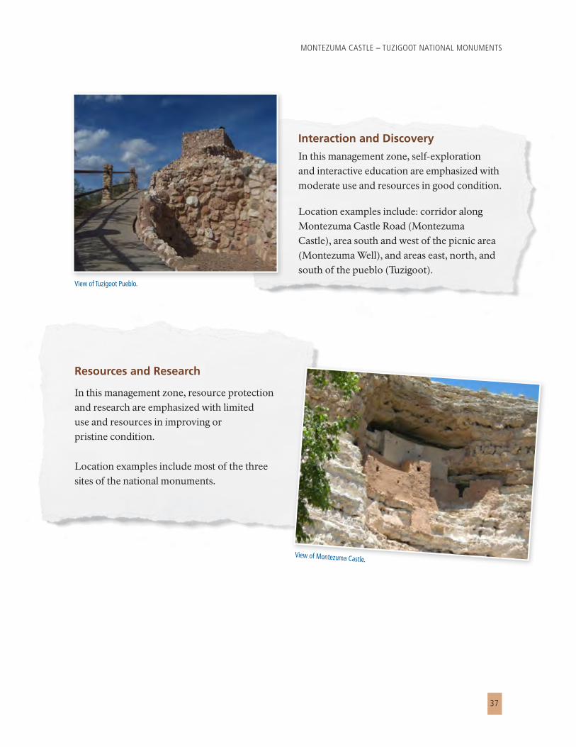
Resources and Research
In this management zone, resource protection and research are emphasized with limited use and resources in improving or pristine condition.
Location examples include most of the three sites of the national monuments.
View of Montezuma Castle.
Interaction and Discovery
In this management zone, self-exploration and interactive education are emphasized with moderate use and resources in good condition.
Location examples include: corridor along Montezuma Castle Road (Montezuma Castle), area south and west of the picnic area (Montezuma Well), and areas east, north, and south of the pueblo (Tuzigoot).
View of Tuzigoot Pueblo.

CHAPTER 3 — THE PLAN AND ENVIRONMENTAL ASSESSMENT
38
FeaturePark
OperationsInterpretive
HistoricInteraction
and DiscoveryResources
and Research
Zone concept Operations are emphasized with substantial levels of resource modification and little or no visitor use.
Formal, structured education and visitor services are emphasized with high use and resources in good condition.
Self-exploration and interactive education are emphasized with moderate use and resources in good condition.
Resource protection and research are emphasized with limited use and resources in improving or pristine condition.
Natural resource conditions
Natural resources may be modified for NPS operational needs.
Natural resources may be manipulated in small areas to minimize impacts relating to visitor use.
Natural resources may be manipulated to include features to tell the history of the area.
Management is limited to moving toward self-sustaining communities and ecological systems of native plants and animals.
Cultural resource condition
Properties eligible for or listed in the National Register of Historic Places or that fit the Archeological Resources Preservation Act definition of archeological resources are preserved. Additions or modifications are allowed only if they do not adversely affect resource integrity.
Stabilization and intensive preservation maintenance of all resource fabric associated with the National Register-eligible or – listed properties or that fit the Archeological Resources Preservation Act definition of archeological resources is a high management priority. Some modifications to cultural resources to support visitor activities may be appropriate.
Stabilization and intensive preservation maintenance of all resource fabric associated with National Register-eligible or – listed properties or that fit the Archeological Resources Preservation Act definition of archeological resources is a high management priority.
Archeological sites and other cultural resources that are eligible for or listed in the National Register or that fit the Archeological Resources Preservation Act definition of archeological resources are managed for their protection and research.
Hydrologic processes Natural hydrologic processes are likely to be disturbed to protect infrastructure, but mitigation is used to minimize off-site impacts.
Natural hydrologic processes and water features may be stabilized to control erosion and deposition to protect cultural sites and landscapes.
Natural hydrologic processes and water features are an important component of the historic scene and, to the extent practical, are managed to reflect period conditions.
Natural hydrologic processes are primarily undisturbed except for management needed to repair past damage or protect cultural resources.
Natural sights and sounds
Natural sights and sounds may be compromised by the presence of vehicles and high levels of human activity.
A moderate noise level often occurs, including noise from vehicles and voices. Human-related sights predominate. Natural conditions are less important to the visitor experience than in other zones.
Natural sounds and scenic quality are important to the visitor experience and/or protection of wildlife. Periodic, low-intensity noise comes from vehicles and human voices. Natural sights predominate.
Natural sounds and scenic quality are important. Natural sounds and sights predominate. Intrusions are rare, of low intensity, and mainly from outside the zone (such as vehicle noise).
Tolerance for impacts from human use
Area has a high tolerance for resource impacts.
Area has a moderate tolerance relating to development and visitor use.
Area has a low tolerance relating to development and visitor use.
Area has a very low tolerance to development and visitor use. Resource protection takes precedence.
Visitor experience Visitor access is restricted. Amenities and services are available to welcome and orient visitors to the monuments and to support day-use activities. Visitors have a formal, structured, educational experience. Most time spent in this zone is on a hardened, designated route with numerous interpretive message highlighting monument themes.
Visitors experience resources and education opportunities that represent time periods from the Sinaguan culture to the 1860s. Contact with cultural and natural resources provides opportunities for visitor learning, mostly through self-discovery and exploration. Some structured learning aids may be provided, such as trails, signs, and programs.
Access by visitors is highly regulated because of the sensitivity of resources. Guided walks may provide limited access and an in-depth learning opportunity.
Table 1: Montezuma Castle and Tuzigoot National Monuments Management Zones

MONTEZUMA CASTLE – TUZIGOOT NATIONAL MONUMENTS
39
FeaturePark
OperationsInterpretive
HistoricInteraction
and DiscoveryResources
and Research
Zone concept Operations are emphasized with substantial levels of resource modification and little or no visitor use.
Formal, structured education and visitor services are emphasized with high use and resources in good condition.
Self-exploration and interactive education are emphasized with moderate use and resources in good condition.
Resource protection and research are emphasized with limited use and resources in improving or pristine condition.
Natural resource conditions
Natural resources may be modified for NPS operational needs.
Natural resources may be manipulated in small areas to minimize impacts relating to visitor use.
Natural resources may be manipulated to include features to tell the history of the area.
Management is limited to moving toward self-sustaining communities and ecological systems of native plants and animals.
Cultural resource condition
Properties eligible for or listed in the National Register of Historic Places or that fit the Archeological Resources Preservation Act definition of archeological resources are preserved. Additions or modifications are allowed only if they do not adversely affect resource integrity.
Stabilization and intensive preservation maintenance of all resource fabric associated with the National Register-eligible or – listed properties or that fit the Archeological Resources Preservation Act definition of archeological resources is a high management priority. Some modifications to cultural resources to support visitor activities may be appropriate.
Stabilization and intensive preservation maintenance of all resource fabric associated with National Register-eligible or – listed properties or that fit the Archeological Resources Preservation Act definition of archeological resources is a high management priority.
Archeological sites and other cultural resources that are eligible for or listed in the National Register or that fit the Archeological Resources Preservation Act definition of archeological resources are managed for their protection and research.
Hydrologic processes Natural hydrologic processes are likely to be disturbed to protect infrastructure, but mitigation is used to minimize off-site impacts.
Natural hydrologic processes and water features may be stabilized to control erosion and deposition to protect cultural sites and landscapes.
Natural hydrologic processes and water features are an important component of the historic scene and, to the extent practical, are managed to reflect period conditions.
Natural hydrologic processes are primarily undisturbed except for management needed to repair past damage or protect cultural resources.
Natural sights and sounds
Natural sights and sounds may be compromised by the presence of vehicles and high levels of human activity.
A moderate noise level often occurs, including noise from vehicles and voices. Human-related sights predominate. Natural conditions are less important to the visitor experience than in other zones.
Natural sounds and scenic quality are important to the visitor experience and/or protection of wildlife. Periodic, low-intensity noise comes from vehicles and human voices. Natural sights predominate.
Natural sounds and scenic quality are important. Natural sounds and sights predominate. Intrusions are rare, of low intensity, and mainly from outside the zone (such as vehicle noise).
Tolerance for impacts from human use
Area has a high tolerance for resource impacts.
Area has a moderate tolerance relating to development and visitor use.
Area has a low tolerance relating to development and visitor use.
Area has a very low tolerance to development and visitor use. Resource protection takes precedence.
Visitor experience Visitor access is restricted. Amenities and services are available to welcome and orient visitors to the monuments and to support day-use activities. Visitors have a formal, structured, educational experience. Most time spent in this zone is on a hardened, designated route with numerous interpretive message highlighting monument themes.
Visitors experience resources and education opportunities that represent time periods from the Sinaguan culture to the 1860s. Contact with cultural and natural resources provides opportunities for visitor learning, mostly through self-discovery and exploration. Some structured learning aids may be provided, such as trails, signs, and programs.
Access by visitors is highly regulated because of the sensitivity of resources. Guided walks may provide limited access and an in-depth learning opportunity.
FeaturePark
OperationsInterpretive
HistoricInteraction
and DiscoveryResources
and Research
Interpretation, education, and orientation
These activities do not occur in this zone.
Formal, structured opportunities are greatest in this area and could include guided programs and contact with roving interpreters. Opportunities for all ages and abilities to learn about monument resources are a high priority. All monument themes are introduced.
Opportunities primarily are self-directed with signs and brochures. Cultural demonstrations linking prehistoric to contemporary cultures could occur. To the extent permissible under section 5.3.5.2.4 of Management Policies 2006, recreated land use scenes, such as prehistoric or historic farming, could be provided to illustrate the historic landscape.
Primarily, these areas would be interpreted indirectly in other areas of the monuments.
Use levels, density, and encounters
Visitor use does not occur in this zone.
High levels of activity predominate with a very high probability of encounters with other visitors and NPS staff. Group activities are handled effectively.
Moderate levels of activity occur in this zone with a moderate probability of encountering other visitors and NPS staff.
Except for a limited number of guided walks, this zone has very low levels of visitor use, low visitor density, and few encounters with others.
Appropriate activities Visitor use does not occur in this zone.
Activities include walking, natural and cultural resource observation, guided walks, picnicking, and photography. Special events could be allowed with a permit.
Activities include resource education, interpretive walks, natural and cultural resource observation, and sightseeing.
Activities include guided, interpretive hikes; photography; resource observation, and research.
Level of challenge, adventure, and time commitment
Visitor use does not occur in this zone.
This zone provides a low level of challenge and adventure. A short time commitment is needed to experience this zone.
This zone provides a moderate level of challenge and adventure, and requires a moderate time commitment.
A moderate to high time commitment is needed to access and experience this zone. Challenge and adventure are not appropriate users.
Types of facilities Monument administration facilities in this zone include headquarters, maintenance areas, housing, and other facilities necessary for the management of the monuments.
This zone includes visitor centers, fee stations, comfort stations, picnic areas, roads, parking lots, paved or hardened trails, benches, wayside exhibits, kiosks, and education facilities. Commercial visitor service and facilities could be based in this area. Regulatory and interpretive signs are common.
Facilities in this zone include interpretive signs and natural-surface trails that reflect historic conditions as much as possible. Other facilities, such as farm plots, represent periods of significance.
Improvements that facilitate interpretation and safety are small and blend with the environment.
This zone does not have any development for visitor use.
Visitor management Visitor activities do not occur in this zone.
Physical controls, such as fencing and barriers, and providing tools for visitor self-management, such as prohibiting climbing, restrict visitor access and accommodate high use while protect resources.
Providing tools for visitor self-management, such as prohibiting climbing, ensure resource protection while accommodating moderate use.
Regulatory controls on visitor access, such as allowing only guided trips or access for approved research, results in low use and ensure resource protection.
Threshold for triggering visitor management actions
Visitor activities do not occur in this zone.
Thresholds are low for safety issues, moderate for resource protection, and moderate for visitor experience.
Thresholds are moderate for safety issues, low for resource protection, and low for visitor experience.
Thresholds are moderate for safety issues, low for resource protection, and high for visitor experience.
Table 1: Montezuma Castle and Tuzigoot National Monuments Management Zones, Cont.

CHAPTER 3 — THE PLAN AND ENVIRONMENTAL ASSESSMENT
40
DESCRIPTION OF THE PLANConcept and General Management Strategies
T he main emphasis of the plan is to connect the three sites (Montezuma Castle, Montezuma
Well, and Tuzigoot) with improved regional orientation to the Verde Valley. Visitors would be introduced to all three sites and their related interpretive themes through coordinated messaging among the three sites. Visitors would travel to the sites to learn about the prehistoric and historic stories associated with human settlement of the Verde Valley.
• TheCastlewouldhighlightthearchitectureofthestructureandoffertheperspectiveoflifeinacliffdwelling.ThisalternativewouldprovidespectacularviewsfrombelowtheCastlealongBeaverCreek.
• MontezumaWellwouldhighlighttheprehistoricandhistoricfarmingactivitiesthatwerepossibleintheareabecauseofthepresenceofwater.
• TuzigootPueblowouldhighlighttheperspectiveofdailylifeinahilltoppueblo,providingdemonstrationsandprogramsassociatedwiththesocioeconomicactivitiesofthearea.
• PartnershipswouldbedevelopedandenhancedwithVerdeValleyorganizations,landowners,andgovernmentagenciestoensureawarenessofthesignificanceofthemonumentsandtheimportantrolethatregionalactivitiesandlandusescanplayintheprotectionofmonumentresources.
Managers would continue to follow the special mandates, administrative commitments, and servicewide mandates and policies that were described in “Foundation for Planning and Management” in chapter 2.
Conditions and Actions Common to All Three Sites
Features of the plan that would apply at Montezuma Castle, Montezuma Well, and Tuzigoot include the following.
• Resource management activities would be increased through expansion of the monuments’ resource stabilization program and active participation in the NPS inventory and monitoring program.
• Formal interpretive and education opportunities would be expanded.
• Orientation to the sites and other opportunities in the Verde Valley would be improved through partnerships that focus on coordinated wayfinding, marketing, increased information dissemination, and pre-trip planning services. Visitors would learn about prehistoric and historic human settlements in the Verde Valley and how each of the monument sites and other sites in the region provides opportunities to experience these stories first hand.
Copper

MONTEZUMA CASTLE – TUZIGOOT NATIONAL MONUMENTS
41
• At each site, interpretation through signs, programs, and cultural demonstrations would highlight the major themes.
• The National Park Service could acquire most of the privately owned lands within the legislated boundaries through trade or purchase from willing sellers, except for the mine tailings at Tuzigoot, which would be removed from the legislated boundary. The mine tailings do not contain resources related to the purpose and significance of the monument, and are highly disturbed by mining activity. The monument is particularly interested in acquiring the relatively intact acreage on the bench northwest of the ruins, which has archeological sites. Operational efficiency would be improved through the development of workspace and storage among the three sites to replace offsite workspace and storage lost with the expiration of the General Services Administration lease with the Yavapai Apache Nation for the current maintenance facility. (The administrative headquarters under a different General Services Administration lease from that of the maintenance facility would remain in Camp Verde.)
• Where possible, new facilities, such as trails, would be constructed in already disturbed areas or on existing pathways, social trails, or management use trails. Trails would be clearly marked and would avoid archeological sites. Disturbance to sensitive areas, such as archeological sites or habitat for threatened or endangered species, would also be avoided whenever possible or mitigated.
Boundary Adjustments, Land Purchases, And Easements
The boundary of Tuzigoot National Monument was expanded by Congress in 1978. However, until 2005, when it received 324 acres in a land exchange, the National Park Service did not own any of the land in the boundary expansion.
Because the mine tailings area does not contain resources related to the purpose and significance of the monument, and is highly disturbed by mining activity, it would be removed from Tuzigoot National Monument’s legislated boundary.
The National Park Service would look to acquiring the other land suitable within the monument boundary, including that owned by Freeport McMoRan Copper and Gold, Inc. (minus the tailings), or work cooperatively with Freeport McMoRan and other entities to protect the land for public use consistent with the general management plan zoning intent.
Cost Estimates
The cost figures presented are intended only to provide an estimate of the relative costs. The National Park Service and industry cost estimating guidelines were used to develop the costs (in 2008 dollars) to the extent possible, but the estimates should not be used for budgeting purposes. Specific costs will be determined in subsequent, more detailed planning and design exercises, and considering the design of facilities, identification of detailed resource protection needs, and changing visitor expectations. Actual costs to the National Park Service will vary depending

CHAPTER 3 — THE PLAN AND ENVIRONMENTAL ASSESSMENT
42
on if and when the actions are implemented, and on contributions by partners and volunteers. The implementation of the approved plan will depend on future NPS funding levels and servicewide priorities, and on partnership funds, time, and effort. The approval of a general management plan does
not guarantee that funding and staffing needed to implement the plan will be forthcoming. Full implementation of the plan could be many years in the future.
Table 2 presents the plan’s cost summary.
AFFECTED ENVIRONMENT AND IMPLEMENTATION IMPACTSCultural Resources
A rcheological. Montezuma Castle and Tuzigoot national monuments were established to preserve the important
and unique archeological resources present within the monuments. The installation of new facilities in areas of previous disturbance and following site-specific archeological surveys would result in very low levels of impacts on archeological resources. The actions of the preferred alternative will have no adverse effect on archeological resources and will contribute to beneficial cumulative
effects through expanded archeological site monitoring programs. Therefore, there will be no impairment of archeological resources.
Prehistoric and Historic Structures and Buildings. Montezuma Castle and Tuzigoot national monuments were established to preserve important prehistoric and historic structures. Potential impacts would be beneficial to the resource because of continued monitoring efforts and intensive preservation treatments and stabilization of the monuments’ principal prehistoric and historic structures. The actions of the preferred alternative will have no adverse effect on prehistoric and historic structures and buildings and will contribute a small increment to beneficial cumulative effects. Therefore, there will be no impairment of prehistoric and historic structures and buildings.
Mountain lion / Puma

MONTEZUMA CASTLE – TUZIGOOT NATIONAL MONUMENTS
43
Table 2: Cost Summary for Preferred Plan
Annual operating costs (ONPS)a $1,802,000
Additional staff b
1 GS9 ranger – community outreach 1 GS9 ranger – interpretation 2 WG7 maintenance mechanics 1 GS11 biologist
Currently planned costs (one-time costs)c $1,034,000
Montezuma Castle – Castle Unit
Expand parking lot (25 cars) $65,000
Expand parking lot (35 cars) $0
Construct park headquarters $0
Rehabilitate historic maintenance building $200,000
Designated trails $50,000
Relocate picnic area $0
Construct vehicle access/parking on plateau $0
Operations Facility $1,000,000
Montezuma Castle – Well Unit
Contruct visitor ramada $250,000
Construct visitor centerc 0
Designated trails $50,000
Construct modest work space and storage building $490,000
Tuzigoot
Designated trails $150,000
Construct marsh boardwalk (1000 feet) $270,000
Construct modest work space and storage building $490,000
Restore and rehabilitate Tavasci Marsh $953,000
Total Costsd $6,804,000
Total one-time costse $5,002,000
Facility costs $3,015,000
Non-facility costs $963,000
a. The base year for all estimates is 2007. Annual operating costs are the total costs per year for maintenance and operations associated with each alternative, including utilities, supplies, staff salaries and benefits, leasing, and other materials. Cost and staffing estimates assume that the alternative is fully implemented as described in the narrative.
b. The total number of full-time equivalents (FTE) is the number of person-years of staff required to maintain the assets of the monuments in good level, provide acceptable visitor services, protect resources, and generally support the monuments’ operations. The FTE number indicated ONPS-funded NPS staff only, not volunteer positions or positions funded by partners. FTE salaries and benefits are included in the annual operating costs.
c. The visitor center would be no more than 4,000 square feet. It would include parking, an upgraded access road, and development of a new water supply.
d. Total costs are the sum of facility costs, non-facility costs and annual operating cost.
e. Total one-time costs are sum of facility costs and non-facility costs.

CHAPTER 3 — THE PLAN AND ENVIRONMENTAL ASSESSMENT
44
Cultural Landscapes. The cultural landscapes, including the vistas between structures, have been identified as one of the fundamental resources of the monuments. There is some potential for impacts as a result of human activities and natural processes, such as vandalism and erosion. The National Park Service would continue efforts to reduce the impacts on cultural landscapes through law enforcement, public education, and implementation of the secretary’s standards. The actions of the preferred alternative will have no adverse effect on cultural landscapes and will contribute a small increment to beneficial cumulative effects. Therefore, there will be no impairment of cultural landscapes.
Ethnographic Resources and Traditional Cultural Properties. Montezuma Castle and Tuzigoot national monuments were established to preserve cultural and ethnographic resources and traditional cultural properties. Although no ethnographic resources or traditional cultural properties have been evaluated at the monuments, resources within the monuments are treated as eligible for consideration. Therefore, ongoing consultation with Native American tribes is expected to have a beneficial impact. The actions of the preferred alternative will have no adverse effect on traditional cultural properties or ethnographic resources, and will contribute to a beneficial cumulative effect. Therefore, there will be no impairment of ethnographic resources and traditional cultural properties.
Natural Resources
Floodplains. The unique hydrology and geology of the monuments was identified as a fundamental resource for the monuments because the hydrology was one of the reasons
for the settlement in the Verde Valley. Impacts to floodplains will be negligible due to a mix of beneficial and adverse effects from erosion control, and construction of a boardwalk at Tavasci Marsh that may include potential increased visitor use and access through trails. However, the relatively small areas impacted and the mitigation methods (including closure of trails to allow for recovery of the understory and appropriate design of the boardwalk) will also reduce the impacts to floodplains. Therefore, no impairment will occur.
Soils. Soil was not identified specifically as a fundamental resource, but the association of the soils to the unique geology of the monuments identifies it as an important resource for protection. Impacts to soils will be very slight and adverse due to trails construction and expansion of the visitor center, but the level of impact will be low due to the relatively small area impacted and the use of soil erosion control methods. The impacts will not rise beyond the negligible range. Therefore, no impairment of soils will occur.
Vegetation. Special plant communities are identified as an important resource because of the interpretive themes and the importance to understanding the role of the Verde River, Montezuma Well, Tavasci Marsh, Beaver Creek, and Wet Beaver Creek in prehistoric and historic trade, travel, exploration, and settlement. Impacts on vegetation will include minor, short-term, adverse impacts during construction efforts, but impacts will be mitigated through methods such as closure of trails to allow recovery of the understory, revegetation in certain areas, and control methods employed for nonnative species. Impacts to vegetation will be very low. Therefore, there will be no impairment of vegetation.

MONTEZUMA CASTLE – TUZIGOOT NATIONAL MONUMENTS
45
Wetlands. The hydrology of the area was identified as a fundamental resource for the monuments. The nature of the impacts to wetlands include marsh restoration to maintain existing hydrologic functions in Tavasci Marsh at Tuzigoot National Monument and a proposed boardwalk to provide education and interpretation of the marsh resource. The marsh restoration activities as well as trail construction will contribute a negligible adverse impact to wetlands, but the relatively slight impacts will be mitigated through trail closure to allow for vegetation to recover and the proper design of the boardwalk to limit impacts to a very small footprint that requires no removal of vegetation. The adverse impacts will be very slight. Therefore, there will be no impairment of wetlands.
Wildlife. The natural resources, including wildlife, were identified as part of the fundamental resources for the monuments. The nature of the impacts would be potential disturbance to the areas from the development and access of trails. Impacts to wildlife may rise to a level of minor, short-term, adverse impacts due to construction activities, but the impacts will be mitigated by timing construction to avoid nesting seasons, and in the long term the impacts from visitors will return to a very low level. Therefore, no impairment of wildlife will occur.
Threatened and Endangered Species. The natural resources, including wildlife, and threatened and endangered species were identified as part of the fundamental resources for the monuments. The nature of the impacts would be potential disturbance to the area from the development and access of trails. The impacts on threatened and endangered
species will primarily be minor and beneficial due to habitat restoration, with some negligible adverse impacts on habitat during construction that will be mitigated by timing construction activities to avoid impacts. The National Park Service made a determination and received concurrence from the USFWS that may affect but not likely to adversely affect all threatened, endangered, candidate species, and critical habitat. The impact will not exceed a negligible level during construction and habitat restoration effort. Therefore, no impairment will occur.
Bobcat.
Most desert animals are nocturnal, meaning they are active primarily
at night. This can be an adaptation to both predation and hot summer
daytime temperatures. Nocturnal animals include small desert rodents,
skunks, ringtails, foxes, bobcats, mountain lions, bats, and owls.

CHAPTER 3 — THE PLAN AND ENVIRONMENTAL ASSESSMENT
46
Visitor Use and Experience
Moderate to major, beneficial effects would result from the increased diversity in opportunities to view and learn about the monuments’ prime cultural resources. Connecting the three sites in the monuments via a central orientation facility in the Verde Valley would increase exposure of visitors to all three sites and provide a better understanding of each site’s unique role in settlement of the Verde Valley. Providing more trail opportunities and cultural programs would make visits to each site more exciting, interesting, and inviting for repeat visitation. Cumulative effects on visitor use and experience would be beneficial and moderate to major. In conclusion, the plan would contribute to moderate to major cumulative benefits.
Socioeconomics
The effects of the plan on socioeconomic conditions in the Verde Valley would be short-term, beneficial, and minor. Cumulative effects
would be short and long-term, minor, and beneficial, except that land use changes could result in long-term, minor to moderate, adverse impacts to groundwater resources connected to Montezuma Well.
Monument Operations
Implementation of the plan would result in long-term, minor to moderate, beneficial effects on monument operations because of increased and improved space for monument operations, and improved capability to manage visitors and resources. There would be long-term, minor, adverse impacts due the addition of facilities that would require increased operations and maintenance. In conclusion, the plan would contribute long-term, minor beneficial effects on monument operations, resulting in cumulative negligible to minor benefits for monument operations.
Montezuma Castle Visitor Center.

MONTEZUMA CASTLE – TUZIGOOT NATIONAL MONUMENTS
47
MITIGATION MEASURES
C ongress charged the National Park Service with managing the lands under its stewardship “…in such manner and
by such means as will leave them unimpaired for the enjoyment of future generations” (NPS Organic Act, 16 U.S. Code 1). As a result, NPS staff routinely evaluates and implements mitigation whenever conditions occur that could adversely affect the sustainability of national park system resources.
The following mitigation measures and best management practices will be applied to avoid or minimize potential impacts from implementation of the plan.
General
• Subject projects to site-specific planning and compliance, and make efforts to avoid adverse impacts through use of the Secretary of the Interior’s Standards for Archeology and Historic Preservation and by using screening and/or sensitive design that will be compatible with historic resources. If adverse impacts cannot be avoided, mitigate those impacts through a consultation process with all interested parties.
• Inventory all unsurveyed areas in the monuments for archeological, historical, and ethnographic resources and for cultural and ethnographic landscapes. Conduct archaeological surveys in unsurveyed areas where development will occur to determine the extent and significance of archeological resources.
• Document cultural and ethnographic landscapes in the monuments and identify treatments to ensure their preservation.
• Conduct additional background research, resource inventory, and National Register of Historic Places evaluation when information about the location and significance of cultural resources is lacking, including development of a multiple property historic context for National Register eligibility for archeological resources in the Verde Valley. Incorporate results of these efforts into site-specific planning and compliance documents.
• Should archeological resources be discovered during any construction, stop work in that location until the resources are properly recorded by the National Park Service and evaluated under the Archeological Resources Protection Act and the eligibility criteria of the National Register of Historic Places. Because stopping construction can be expensive, preconstruction resourse inventories and assessments will be conducted to minimize the probability of work stoppage. If, in consultation with the Arizona state historic preservation officer, the resources are determined eligible for listing, implement appropriate measures either to avoid further resource impacts or to mitigate the loss or disturbance of the resources.
• Avoid or mitigate impacts on ethnographic resources. Mitigation could include identification of and assistance in accessing alternative resource gathering areas, continuation of access to traditional use and spiritual areas, and screening new development from traditional use areas.
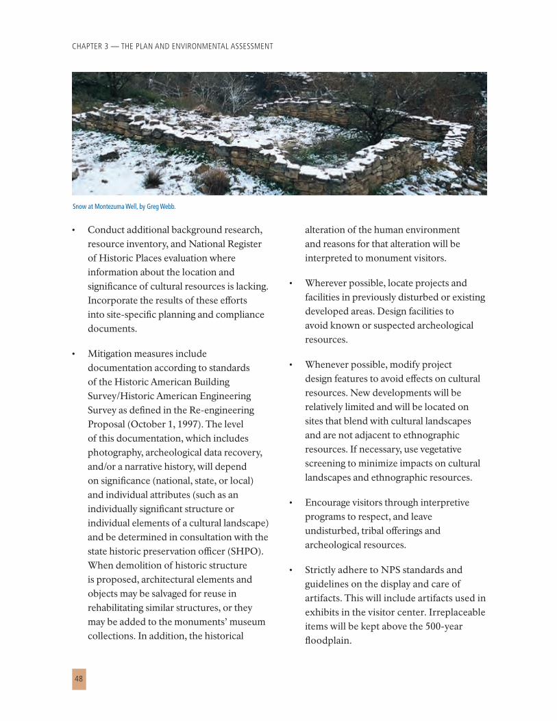
CHAPTER 3 — THE PLAN AND ENVIRONMENTAL ASSESSMENT
48
• Conduct additional background research, resource inventory, and National Register of Historic Places evaluation where information about the location and significance of cultural resources is lacking. Incorporate the results of these efforts into site-specific planning and compliance documents.
• Mitigation measures include documentation according to standards of the Historic American Building Survey/Historic American Engineering Survey as defined in the Re-engineering Proposal (October 1, 1997). The level of this documentation, which includes photography, archeological data recovery, and/or a narrative history, will depend on significance (national, state, or local) and individual attributes (such as an individually significant structure or individual elements of a cultural landscape) and be determined in consultation with the state historic preservation officer (SHPO). When demolition of historic structure is proposed, architectural elements and objects may be salvaged for reuse in rehabilitating similar structures, or they may be added to the monuments’ museum collections. In addition, the historical
alteration of the human environment and reasons for that alteration will be interpreted to monument visitors.
• Wherever possible, locate projects and facilities in previously disturbed or existing developed areas. Design facilities to avoid known or suspected archeological resources.
• Whenever possible, modify project design features to avoid effects on cultural resources. New developments will be relatively limited and will be located on sites that blend with cultural landscapes and are not adjacent to ethnographic resources. If necessary, use vegetative screening to minimize impacts on cultural landscapes and ethnographic resources.
• Encourage visitors through interpretive programs to respect, and leave undisturbed, tribal offerings and archeological resources.
• Strictly adhere to NPS standards and guidelines on the display and care of artifacts. This will include artifacts used in exhibits in the visitor center. Irreplaceable items will be kept above the 500-year floodplain.
Snow at Montezuma Well, by Greg Webb.

MONTEZUMA CASTLE – TUZIGOOT NATIONAL MONUMENTS
49
Natural Resources
Air Quality. Mitigation measures to minimize, avoid, and offset adverse effects on air quality could include implementation of a dust abatement program for any construction. Standard dust abatement measures could include the following elements:
• Water or otherwise stabilize soils
• Cover haul trucks
• Employ speed limits on unpaved roads
• Minimize vegetation clearing
• Revegetate after construction
Nonnative and Exotic Species. Implement a noxious weed abatement program. Standard measures could include the following elements:
• Ensure that construction-related equipment arrives on site free of mud and seed-bearing material
• Certify all seed and straw material as weed-free
• Identify areas of noxious weeds prior to construction
• Treat noxious weeds or noxious weed topsoil before construction by methods such as topsoil segregation, storage, or herbicide treatment
• Revegetate with appropriate native species
Natural Sounds. Standard noise abatement measures that will be implemented during construction to mitigate impacts to natural soundscapes could include the following elements:
• Scheduleworktominimizeimpactsonnearbynoise-sensitiveuses
• Usethebestavailablenoisecontroltechniqueswhereverfeasible
• Usehydraulicallyorelectricallypoweredimpacttoolswhenfeasible
• Locatestationarynoisesourcesasfarfromsensitiveusesaspossible
• Siteanddesignfacilitiestominimizeobjectionablenoise
Soils
Mitigation measures to minimize, avoid, and offset adverse effects on soils could include the following elements:
• Buildnewfacilitiesonsoilssuitablefordevelopment
• Minimizesoilerosionbylimitingthetimethatsoilisleftexposedandbyapplyingothererosioncontrolmeasuresinconstructionareas,suchaserosionmatting,siltfencing,andsedimentationbasins,toreduceerosion,surfacescouring,anddischargetowaterbodies
• Onceworkiscompleted,revegetateconstructionareaswithnativeplantsinatimelymanner

CHAPTER 3 — THE PLAN AND ENVIRONMENTAL ASSESSMENT
50
Rare, Threatened, and Endangered Species and Species of Concern. Mitigation actions will occur during normal monument operations as well as before, during, and after construction to minimize immediate and long-term impacts to rare, threatened, and endangered species. These actions will vary by specific project and area. Many of the measures listed below for vegetation and wildlife also will benefit rare, threatened and endangered species by helping to preserve habitat. Mitigation actions specific to rare, threatened, and endangered species will include the following:
• Conductsurveysforrare,threatened,andendangeredspeciesaswarranted.
• Designandsitefacilitiesandactionstoavoidadverseeffectsonrare,threatened,andendangeredspecies.Ifavoidanceisinfeasible,minimizeandcompensateforadverseeffectsonrare,threatened,andendangeredspeciesasappropriateandinconsultationwiththeappropriateresourceagencies.
• Developandimplementrestorationand/ormonitoringplansaswarranted.Plansshouldincludemethodsforimplementation,performancestandards,monitoringcriteria,andadaptivemanagementtechniques.
• Implementmeasurestoreduceadverseeffectsofnonnativeplantsandwildlifeonrare,threatened,andendangeredspecies.
• Managevisitoruseandaccessinrare,threatened,orendangeredspecies’habitatstoavoid,offset,andminimizepotentialadverseeffectsonthehabitatorspecies.Thiscouldincludetrailorareaclosures,temporaryorseasonalrestrictions,orreroutingofvisitoraccess.
Vegetation. Mitigation measures to minimize, avoid, and offset adverse effects on vegetation could include the following:
• Monitorareasusedbyvisitors,suchastrails,forsignsofnativevegetationdisturbance.Usepubliceducation,revegetationofdisturbedareaswithnativeplants,erosioncontrolmeasures,andbarrierstocontrolpotentialimpactsonplantsfromtrailerosionorthecreationofsocialtrails.
• Designateriveraccessandcrossingpoints,andusebarriersandclosurestopreventtramplingandlossofvegetationinotherriparianareas.
• Developrevegetationplansfordisturbedareas,includingconstructionsites,andrequiretheuseofnativespecies.Revegetationplansshouldspecifysuchfeaturesasseedandplantsources,seedandplantmixes,andsoilpreparation.Usesalvagedvegetationtotheextentpossible.
Southwestern willow flycatcher.

MONTEZUMA CASTLE – TUZIGOOT NATIONAL MONUMENTS
51
Water Resources. To prevent water pollution during construction, mitigation will include the following:
• Useerosioncontrolmeasures.
• Minimizedischargetowaterbodies.
• Regularlyinspectconstructionequipmentforleaksofpetroleumandotherchemicals.
• Duringongoingoperationofthemonuments,itmaybeappropriatetobuildrunofffiltrationandsedimentationsystemstominimizewaterpollutionfromlargerparkingareas.
Wildlife. Mitigation measures to minimize, offset, or avoid adverse effects on wildlife could include the following:
• Employtechniquestoreduceimpactsonwildlife,includingvisitoreducationprograms,restrictionsonvisitoractivities,andmonumentrangerpatrols.
• Implementanaturalresourceprotectionprogram.Standardmeasureswillincludeconstructionscheduling,biologicalmonitoring,erosionandsedimentcontrol,useoffencingorothermeanstoprotectsensitiveresourcesadjacenttoconstruction,removalofallfood-relateditemsorrubbish,topsoilsalvage,andrevegetation.Thiscouldincludespecificconstructionmonitoringbyresourcespecialistsaswellastreatmentandreportingprocedures.
Wetlands. To avoid adverse effects on wetlands, the National Park Service will do the following:
• Delineatewetlandsandapplyprotectionmeasuresduringconstruction.WetlandswillbedelineatedbyqualifiedNPSstafforcertifiedwetlandspecialistsandclearlymarkedbeforeconstructionwork.
• Designandinstallboardwalksforinterpretivepurposesandtominimizeimpactsonvegetationandwildlife.
• Performconstructionactivitiescautiouslytopreventdamagecausedbyequipment,erosion,andsiltation.
• Activelyworktoremovenonnativeplants/animalsandrestorenaturalwaterflows.
Barn owl.

CHAPTER 3 — THE PLAN AND ENVIRONMENTAL ASSESSMENT
52
Visitor Safety and Experiences
Visitor safety, use, and experience will be protected and enhanced with the following:
• Implementmeasurestoreduceadverseeffectsofconstructiononvisitorsafetyandexperience.
• Continueusingdirectionalsignsandeducationprogramstopromoteunderstandingamongvisitors.
• Implementadaptivevisitorusemanagement,asoutlinedintheusercapacitysectionintheenvironmentalassessment,whenresourceandvisitorexperienceconditionstrendtowardorviolateausercapacitystandard.
• Employmanagementstrategiessuchasvisitoreducation,sitemanagement,visitoruseregulations,rationingorreallocationofvisitoruse,andenforcement.
Hazardous Materials
Mitigation measures to minimize, offset, or avoid potential exposure to or adverse effects from hazardous materials will include the following:
• Implementaspillpreventionandpollutioncontrolprogramforhazardousmaterials.
• Employbestmanagementpracticesforhazardousmaterialsstorageandhandling,andforspillcontainment,cleanup,andreporting.
• Limitrefuelingandotheractivitiesinvolvinghazardousmaterialstouplandandornonsensitiveareas.
Scenic Resources
Mitigation measures are designed to minimize visual intrusion. These include the following:
• Whereappropriate,usefacilitiessuchasboardwalksandfencestoroutepeopleawayfromsensitivenaturalandculturalresourceswhilestillpermittingaccesstoimportantviewpoints.
• Design,site,andconstructfacilitiestoavoidorminimizeadverseeffectsonnaturalandculturalresourcesandvisualintrusionintothenaturalviewshedand/orlandscape.
• Providevegetativescreeningwhereappropriate.
Socioeconomics
During the future planning and implementation of the approved management plan for the monuments, the National Park Service will work with local communities and county governments to further identify potential impacts and mitigation measures that will best serve the interests and concerns of both the National Park Service and the local communities. Partnerships will be pursued to improve the quality and diversity of community amenities and services.
Sustainable Design and Aesthetics
Projects will avoid or minimize adverse impacts on natural and cultural resources. Development projects, such as buildings, utilities, roads, bridges, and trails, or reconstruction projects, such as road improvements, building rehabilitation, and utility upgrades, will be designed to work in harmony with the

MONTEZUMA CASTLE – TUZIGOOT NATIONAL MONUMENTS
53
surroundings, particularly in historic districts. Projects will reduce, minimize, or eliminate air and water nonpoint source pollution. Projects will be sustainable whenever practicable, by recycling and reusing materials, minimizing materials, minimizing energy consumption during the construction, and minimizing energy consumption during the construction, and minimize energy consumption throughout the lifespan of the project.
USER (CARRYING) CAPACITY
G eneral management plans for national park system units
must address user capacity management. The National Park Service defines user capacity as the type and level of use that can be accommodated while sustaining the quality of a park unit’s resources and visitor opportunities consistent with the purposes of the park unit. User capacity management involves establishing desired conditions, monitoring, evaluating, and taking actions (managing visitor use) to ensure that park unit values are protected. The premise is that with any use on public lands comes some level of impact that must be accepted; therefore it is the responsibility of the National Park Service to decide what level of impact is acceptable and what management actions are needed to keep impacts within acceptable limits. Instead of just tracking and controlling user numbers, NPS staff manage the levels, types, and patterns of visitor use and other public uses as needed to preserve the condition of the resources and quality of the visitor experience. The monitoring component of this process
helps NPS staff evaluate the effectiveness of management actions and provides a basis for informed management of public use.
This section includes potential indicators, standards, and potential management actions for each management zone that would be implemented as needed during the life of this plan. The recommended indicators and standards help translate the broader descriptions of desired conditions, which are qualitative in nature, into something measurable. The potential indicators were suggested for monitoring key aspects of
visitor experiences and resources at the monuments. As indicators
are identified in the future, standards that represent
the points where visitor experience and resource conditions become unacceptable in each zone would be defined based on
management goals.
Existing facilities generally provide good visitor opportunities, protect monument resources, and, based on projected trends, will continue to function well. However, high volumes of use in the peak season can cause crowding in the visitor center at Montezuma Castle and along the main trail to the Castle viewing area. If use increases, or the patterns or timing of use changes, crowding may get worse.
Because of the occasional problems of crowded conditions at the Castle, the indicator for “number of people per hour” is being developed for the general management plan. This indicator and standard will ensure that staff take appropriate action to disperse use throughout the monument or during the day or season to mitigate crowded conditions, as needed.
Bat

CHAPTER 3 — THE PLAN AND ENVIRONMENTAL ASSESSMENT
54
The monument staff is already monitoring bus arrivals. In the future it may be appropriate to actively disperse bus use throughout the day by requiring buses to arrive and depart at defined times and reduce use during the mid-day, peak hours. The increases in trail opportunities and educational programming in the action alternatives should improve visitor opportunities and may disperse use away from current high-use areas.
The monument staff will continue monitoring use levels and patterns. If these change significantly in any of the zones, the staff will initiate more systematic monitoring of user capacity indicators to ensure protection of desired conditions.
The potential indicators include, but are not limited to the topics of vandalism, looting, or theft of resources; crowding at attraction points; litter; user-created trails; human-caused noise; and introduction of invasive plants. Before new areas of the monuments in the interaction and discovery zone are opened to visitors, the staff will select key indicators to monitor like those proposed in the zone description. Since use patterns were not established in these areas, it is important for the monument staff to monitor conditions to ensure that new use in these areas does not have unexpected or unintended consequences.
The selection of any indicators and standards for monitoring or for implementation of any management actions that affect use would comply with the National Environmental Policy Act, the National Historic Preservation Act, and other laws, regulations, and policies as
needed. The National Park Service would also inform the public of progress and proposed revisions to indicators and standards through regular reporting on the user capacity program.
Park Operations Zone
No indicators are identified for user capacity because public use is not generally permitted in this zone.
Interpretive Historic Zone
This zone includes high levels of development and physical controls on visitor movement, which should substantially control visitor use impacts. Use levels and patterns would be continually monitored in this zone to identify trends based on data collected at the entrance gate, on traffic counters, and through regular observations by monument staff.
The indicator and standard for the number of people per hour for entry to Montezuma Castle would be implemented. The indicator, related monitoring, and management actions are below. Monument staff are developing the standard for this indicator.
Hairpin exhibit at the Tuzigoot Museum.

MONTEZUMA CASTLE – TUZIGOOT NATIONAL MONUMENTS
55
The indicator will be the number of people per hour entering the monument. Other indicators that may be considered in this zone for future monitoring at any of the popular sites in the monuments might include:
• Thenumberofpeopleatagiventimeatothermajorpointsofattraction,suchastheCastle’svisitorcenter,therimoverlooksatMontezumaWell,orinsideorontopoftheTuzigootPueblo
• Litteralongmainpathways
• Vegetationtramplinginhighuseareas,suchastheMontezumaWellpicnicarea
• Theconditionofarcheologicalresourcesclosetopublicuse,suchasthewallsoftheTuzigootPuebloorthewallsofthedwellingstructuresatMontezumaWell
Monument staff will periodically monitor the indicator using methods that may include traffic counters, cash-register receipts, and observations at select times throughout the day during both peak and off-peak season.
If monitoring indicates that the indicator is approaching the standard, future management actions could include any or all of the following:
• Implementvoluntaryredistributionofvisitorusethroughouttheday,week,orseason.Forexample,thiscouldincludevisitoreducationtoalertvisitorstolessbusytimesoftheday,week,orseasontoplantheirtrips;andtheuseofintelligenttransportationsystem(ITS)signsintownthatindicatethattheCastleisfulltoencouragevisitorstodelaytheirarrival.
• Requiremandatoryredistributionofvisitoruseduringpeaktimes.Underthisapproach,visitorreservationsmayberequiredtovisittheCastleduringpeakhoursofpeakdays,ortourbusoperatorsmayberequiredtomanagethearrivaloftheirvehiclestooff-peaktimes,days,ormonths.
• Restrictvisitoruse.Thiscouldincludeactionssuchastheclosureoftheparkinglotand/orlooptrailduringpeakhoursofpeak-seasondays.
Other potential management actions to address changes in conditions could include expanding education and orientation messages, restoring disturbed sites, redirecting use to less busy areas, regulating visitor use (for example, reducing parking capacity), and increasing physical controls on use, such as installing fencing or other barriers.
Interaction and Discovery Zone
This zone includes low levels of development and physical controls on visitor movement. Use levels and patterns will be monitored to identify trends in use through data collected as part of regular monument staff patrols. Other indicators that may be considered in this zone for future monitoring might include user-created trails, litter, human-caused noise, looting and vandalism of archeological sites near designated trails, and invasive plants. The range of potential management actions to address changes in conditions could include expanding education (particularly “leave no trace” messages); restoring disturbed sites; restricting use through actions such as a permit system, closure of areas, or guided only trips; and increasing enforcement patrols.

CHAPTER 3 — THE PLAN AND ENVIRONMENTAL ASSESSMENT
56
Resources and Research Zone
This zone would have low levels of use, all of which would be managed on guided tours, so no indicators of user capacity are proposed. However, monument staff would monitor for vandalism, looting, or theft of archeological resources.
PLAN IMPLEMENTATION AND FUTURE STUDIES / PLANS NEEDED
Implementation of the approved plan depends on future funding. The approval of the general management plan does not
indicate that the funding needed to implement all of its provisions will be immediately available. Full implementation of the approved plan could be many years in the future.
Other factors will also affect the implementation of the approved plan. After the general management plan for the monuments is completed and approved, other more detailed studies and plans would be needed to implement specific actions. As required, additional environmental compliance (National Environmental Policy Act, National Historic Preservation Act, and other relevant laws and policies), and public involvement would be conducted, as articulated in Director’s Order 75A: Civic Engagement and Public Involvement. Additional studies would include, but would not be limited to, the following:
• BoundaryadjustmentsatTuzigootNationalMonumenttoremovetheminetailings.
• Comprehensiveethnographicoverviewsandassessments(includingethnobotanicalstudies)atbothnationalmonuments.
• Historicresourcestudiesatbothnationalmonuments.
View from Montezuma Castle.

MONTEZUMA CASTLE – TUZIGOOT NATIONAL MONUMENTS
57
• Culturallandscapeinventoriesatbothmonumentstoidentifyspecificstrategiesanddetermineprioritiesforthemanagementandprotectionoftheseresources.
• Comprehensiveinterpretiveplanthatoutlinesspecificinterpretiveprogrammingandservicesatbothmonuments(completed).
• RestorationplanforTavasciMarshtooutlinestrategiesforreturningittoamorenaturallyfunctioningandstablecondition.
• Implementationplans,andsitespecificcompliance,ifnecessary,forspecificactionswithinthisgeneralmanagementplan,suchasincreasedparkingatMontezumaCastleandavisitorcontactstationatMontezumaWell.
• Site-specificcomplianceforproposedactionsthatcouldimpactfloodplainsorwetlandsortheirassociatedvaluesinallthreesitesofthemonument.CompliancecouldincludestatementsoffindingsforactionsnotexemptunderDirector’sOrder77-1:WetlandsManagementorDirector’sOrder77-2:FloodplainManagement.
• Tuzigootadministrativehistory(currentlyunderway).
• Boundarysurveysafterlandacquisitionsthenupgradeandpostboundaryfence.
• NativeplantsrestorationandinterpretativetrailsdevelopmentattheMontezumaWellunit.
• MontezumaWelldevelopmentplantoenhancevisitorfacilities.
Tavasci Marsh, NPS photo by Sharlot Hart.

CHAPTER 3 — THE PLAN AND ENVIRONMENTAL ASSESSMENT
58
CONCLUSION
B ased on the environmental analysis as documented in the environmental assessment, together with the
capability of the mitigation measures to avoid, reduce, or eliminate impacts, and with the due consideration for the nature of public comments, the results determine that the approved plan is not a major federal action significantly affecting the quality of the human environment. Negative environmental impacts that could occur are no more than minor to moderate in intensity. There are no significant impacts on public health, public safety, threatened or endangered species, sites or districts listed in or eligible for listing in the National Register of Historic Places, or other unique characteristics of the region. No highly uncertain or controversial impacts, unique or unknown risks, significant cumulative effects, or elements of precedence were identified. Implementation of the plan will not violate any federal, state, or local environmental protection law.
Based on the above information, it has been determined that an environmental impact statement is not required for this project and thus will not be prepared. The plan can be implemented as soon as practicable but not sooner than 30 days following the date of the approval of the General Management Plan.
Coyote.

APPENDIXES AND INDEX


MONTEZUMA CASTLE – TUZIGOOT NATIONAL MONUMENTS
61
APPENDIX A: LEGAL MANDATES
Praying mantis

APPENDIXES AND INDEX
62
Montezuma Castle

MONTEZUMA CASTLE – TUZIGOOT NATIONAL MONUMENTS
63
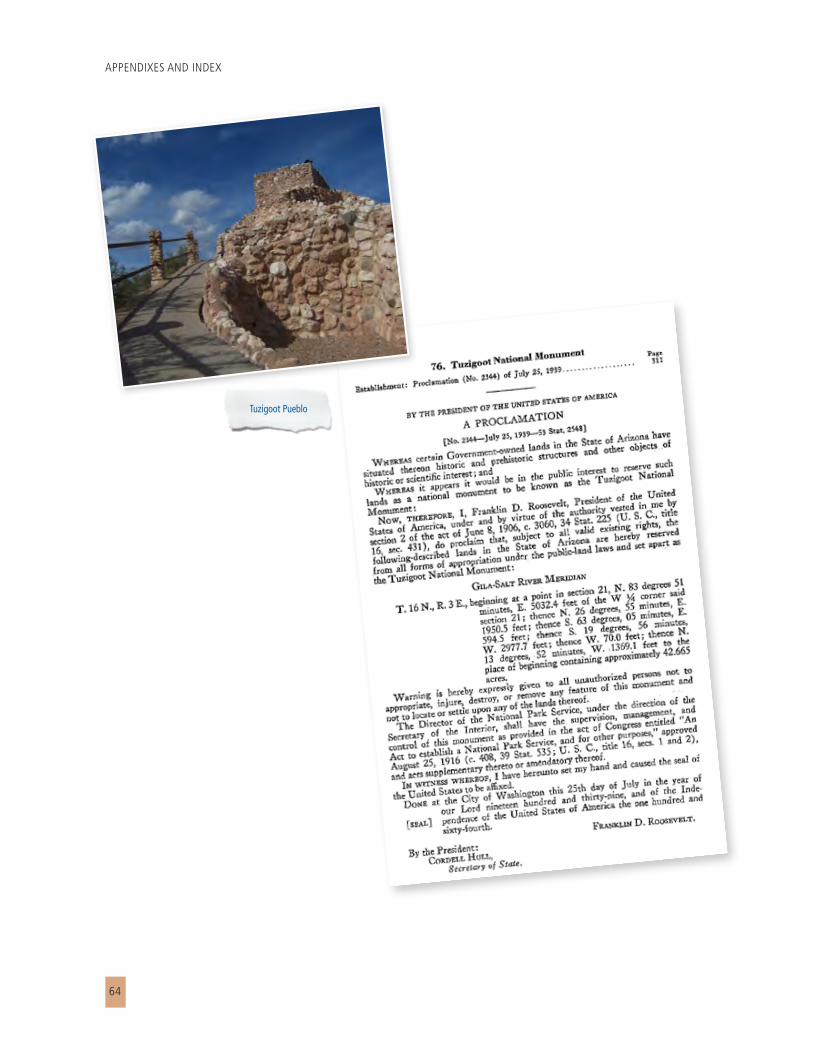
APPENDIXES AND INDEX
64
Tuzigoot Pueblo

MONTEZUMA CASTLE – TUZIGOOT NATIONAL MONUMENTS
65

APPENDIXES AND INDEX
66

MONTEZUMA CASTLE – TUZIGOOT NATIONAL MONUMENTS
67
APPENDIXES AND INDEX
68

MONTEZUMA CASTLE – TUZIGOOT NATIONAL MONUMENTS
69
Montezuma Well

APPENDIXES AND INDEX
70

MONTEZUMA CASTLE – TUZIGOOT NATIONAL MONUMENTS
71

APPENDIXES AND INDEX
72

MONTEZUMA CASTLE – TUZIGOOT NATIONAL MONUMENTS
73
Redwinged blackbird

APPENDIXES AND INDEX
74
APPENDIX B: PARCEL MAPS

MONTEZUMA CASTLE – TUZIGOOT NATIONAL MONUMENTS
75

APPENDIXES AND INDEX
76

MONTEZUMA CASTLE – TUZIGOOT NATIONAL MONUMENTS
77
INDEX
Aacademic institutions 27access 10, 18, 20, 30, 38, 39, 43, 44, 45, 47, 50, 52act of Congress 9administrative commitments 20, 40air pollution 26air quality 20, 26, 49Antiquities Act 8, 16archeological sites 20, 41, 55archival collections 23Arizona Game and Fish 27, 29, 30Arizona State Parks 29, 30artifacts 9, 13, 20, 23, 48
BBack cabin 19, 36Back ranch 9Beaver Creek 13, 15, 17, 18, 19, 20, 40, 44Beaver Creek Road 20best management practices 47, 52Bridgeport Pueblo 17
CCamp Verde 12, 41conservation 24, 27, 29cost 41, 42, 43cultural connectivity 17, 19cultural resources 1, 8, 10, 16, 20, 21, 22, 23, 24, 26, 27, 38, 46, 47, 48, 52
Eecosystem management 29ecosystem monitoring 25education 15, 24, 30, 31, 36, 37, 38, 39, 40, 44, 45, 50, 51, 52, 55education programs 31, 51, 52endangered species 20, 27, 41, 45, 50, 58Endangered Species Act 27environmental assessment 10, 52, 58erosion 38, 44, 49, 50, 51ethnographic, 23exotic species 20
Ffire management 26floodplain 18, 48Freeport McMoRan Copper and Gold, Inc 12, 41fundamental resources and values 17, 18
GGeneral Services Administration 11, 12, 41geological specimens 23

APPENDIXES AND INDEX
78
geologic features 26, 27
HHatalacva 17hiking 9historic biological 23Hohokam 9, 18
Iinterpretation 1, 15, 19, 20, 24, 31, 39, 41, 43, 45invasive plants 28, 54, 55invasive species 29inventories 25, 28, 47, 57
Mmanagement zones 35, 36mine tailings 12, 41, 56mitigation measures 10, 47, 52, 58monitoring 25, 27, 28, 30, 31, 40, 42, 50, 51, 53, 54, 55Montezuma Castle National Monument 4, 7, 8, 9Montezuma Well 1, 4, 7, 8, 9, 12, 15, 16, 17, 18, 19, 20, 36, 37, 40, 44, 46, 48, 55, 57, 67museum 8, 9, 17, 19, 23, 46, 48, 54
NNational Environmental Policy Act 10, 22, 54, 56National Historic Preservation Act 20, 22, 23, 54, 56National Parks and Recreation Act of 1978 10National Park Service Organic Act 20National Park System General Authorities Act 20National Register of Historic Places 23, 38, 47, 48, 58Native Americans 23, 24native plants 28, 38, 49, 50natural features 17, 18, 19, 24natural resources 10, 11, 12, 24, 25, 26, 29, 38, 45natural sounds 26nonrenewable resources 27NPS Management Policies 2006 21NPS Vanishing Treasures Initiative 22
Oorientation 12, 31, 39, 40, 46, 55
Ppaleontological 23, 27paleontological resources 27parking 9, 36, 39, 43, 51, 55, 57picnic area 9, 36, 37, 43, 55prescribed 11Presidential Proclamation No. 696 8Presidential Proclamation No. 2344 9primary interpretive themes 19private landowners 28, 29public use 12, 24, 30, 41, 53, 54, 55pueblo 13, 36, 37, 40

MONTEZUMA CASTLE – TUZIGOOT NATIONAL MONUMENTS
79
Rrecreation 19research 23, 24, 26, 27, 29, 30, 37, 38, 39, 47, 48resource stewardship 24, 29
SSacred Mountain 17Salt Mine Pueblo 17significance statements 35Sinaguan 9, 16, 38socioeconomic conditions 46soil 27, 44, 49, 50Sonoran Desert Inventory and Monitoring Network 25special mandates 22, 40special-status species 27structures and related resources and values 17, 18, 19
TTavasci Marsh 12, 17, 18, 25, 36, 43, 44, 45, 57Thoeny 17threatened and endangered species 20, 45, 50traffic 54, 55trails 9, 36, 38, 39, 41, 43, 44, 45, 50, 52, 54, 55, 57Tuzigoot Extension 17Tuzigoot Hill 18Tuzigoot National Monument 4, 7, 8, 9, 12, 37, 41, 45, 56, 68
Uuser capacity 30, 31, 52, 53, 54, 56U.S. Fish and Wildlife Service 27, 30, 45U.S. Forest Service 29, 30
Vvariability 28vegetation 1, 28, 44, 45, 49, 50, 51, 55vehicles 9, 38, 55Verde River 17, 18, 19, 44Verde Valley 1, 10, 11, 12, 16, 17, 19, 23, 40, 44, 46, 47viewshed 52visitor access 30, 39, 50visitor center 8, 9, 36, 43, 44, 48, 53, 55visitor contact station 9, 12, 57visitor enjoyment 10, 17, 26, 30
Wwater pollution 29, 51Western National Parks Association 20Wet Beaver Creek 17, 18, 19, 44wetlands 20, 45, 51, 57wildland fire 26wildlife 19, 26, 28, 29, 38, 45, 50, 51
YYavapai Apache Nation 12, 41Yavapai County 20


As the nation’s principal conservation agency, the Department of the Interior has responsibility
for most of our nationally owned public lands and natural resources. This includes fostering
sound use of our land and water resources; protecting our fish, wildlife, and biological diversity;
preserving the environmental and cultural values of our national parks and historic places; and
providing for the enjoyment of life through outdoor recreation. The department assesses our
energy and mineral resources and works to ensure that their development is in the best interests
of all our people by encouraging stewardship and citizen participation in their care. The
department also has a major responsibility for American Indian reservation communities and
for people who live in island territories under U.S. administration.
NPS MOCA 309/107725 • TUZI 309/107726; June 2011/Printed on recycled paper.

National Park ServiceU.S. Department of the Interior
Montezuma Castle – Tuzigoot National MonumentsArizona
General Management Plan / Environmental Assessment Summary
National Park ServiceU.S. Department of the Interior
MONTEZUM
A CASTLE – TUZIGOOT NATIONAL MONUM
ENTS