General Atmospheric Circulation
32
General Atmospheric Circulation
description
General Atmospheric Circulation. Take away Concepts and Ideas. Global circulation: The mean meridional (N-S) circulation Trade winds and westerlies The Jet Stream Earth ’ s climate zones Monsoonal climate Hurricanes. Where we left off on Monday …. - PowerPoint PPT Presentation
Transcript of General Atmospheric Circulation

General Atmospheric Circulation

Take away Concepts and Ideas
Global circulation:The mean meridional (N-S) circulation
Trade winds and westerlies
The Jet Stream
Earth’s climate zones
Monsoonal climate
Hurricanes
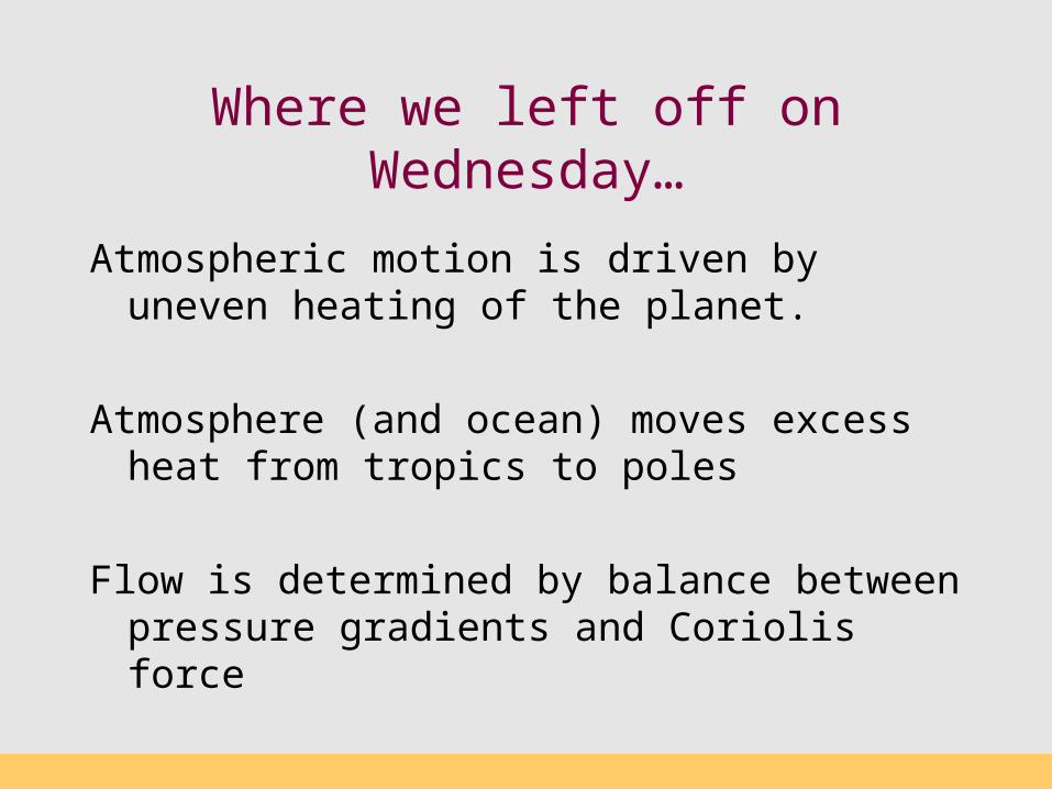
Where we left off on Wednesday…
Atmospheric motion is driven by uneven heating of the planet.
Atmosphere (and ocean) moves excess heat from tropics to poles
Flow is determined by balance between pressure gradients and Coriolis force
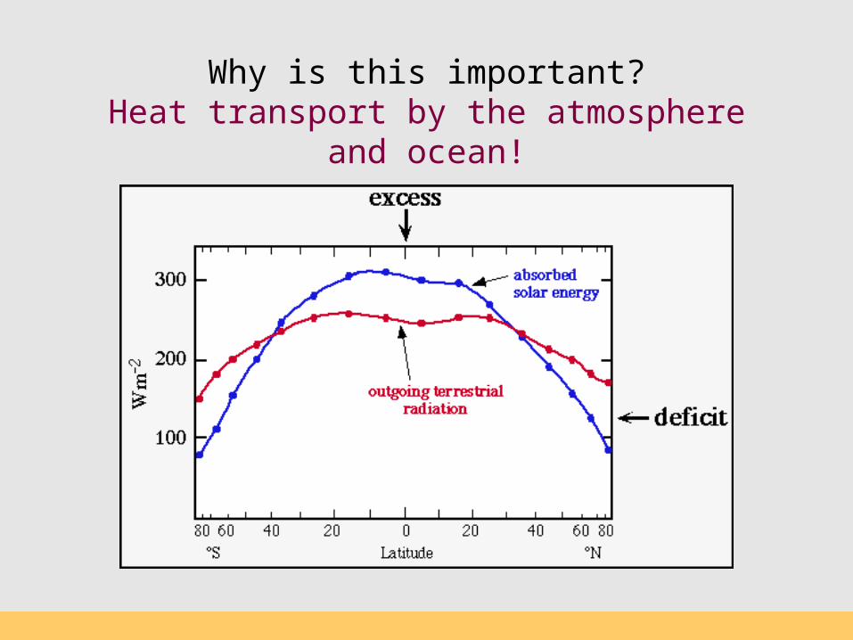
Why is this important?Heat transport by the atmosphere and ocean!

Pressure gradient force
F (east east) = - (Δp / Δ x) / ρF (north-south) = - (Δ p / Δ y) / ρ
High/low pressure?
High/low pressure?
High/low pressure?
x
y
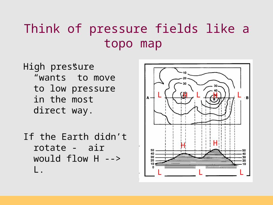
Think of pressure fields like a topo map
High pressure “wants” to move to low pressure in the most direct way.
If the Earth didn’t rotate - air would flow H --> L.
H
L
H L
LL
H
L H L
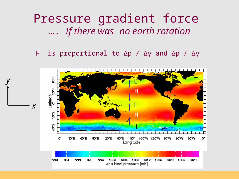
Pressure gradient force …. If there was no earth rotation
F is proportional to Δp / Δy and Δp / Δy
x
yH
H
L
L
L
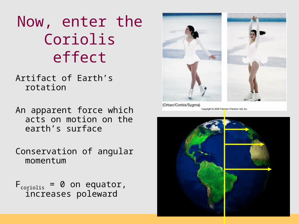
Now, enter the Coriolis effect
Artifact of Earth’s rotation
An apparent force which acts on motion on the earth’s surface
Conservation of angular momentum
Fcoriolis = 0 on equator, increases poleward
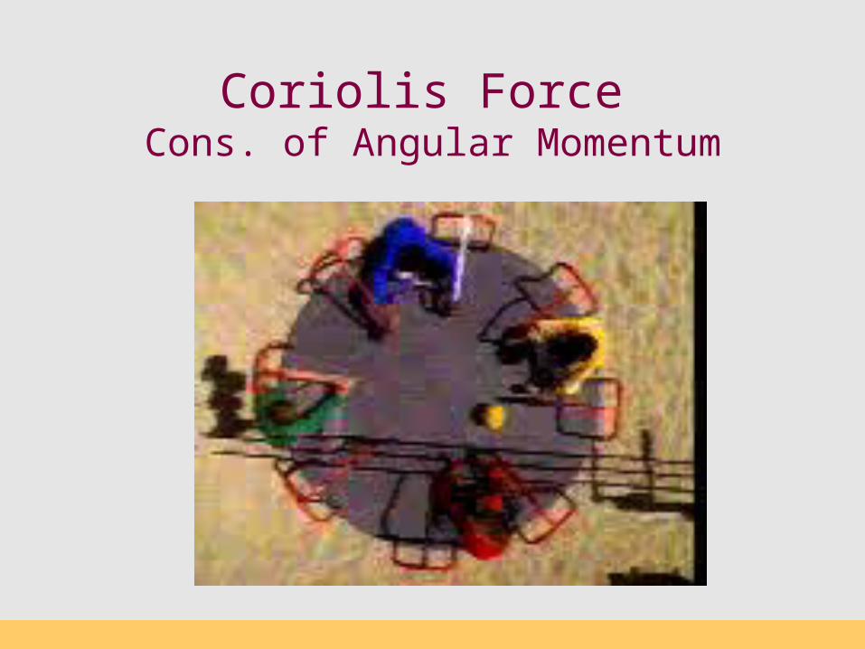
Coriolis Force Cons. of Angular Momentum
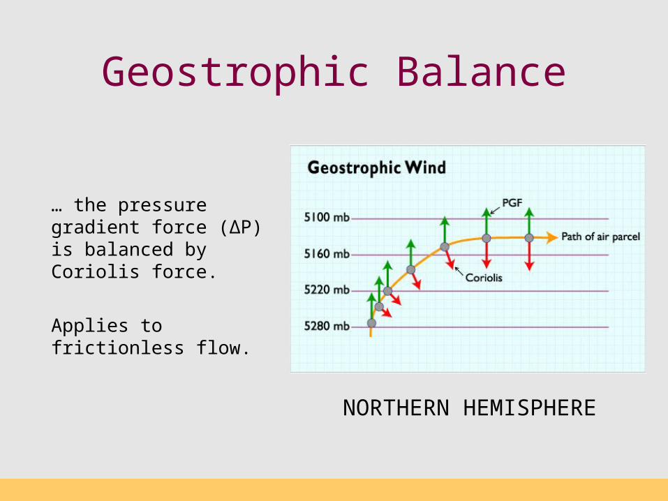
Geostrophic Balance
NORTHERN HEMISPHERE
… the pressure gradient force (∆P) is balanced by Coriolis force.
Applies to frictionless flow.

Pressure gradient force …. WITH earth rotation
Geostrophic Circulation
H
H
L
L
L
Interesting link…

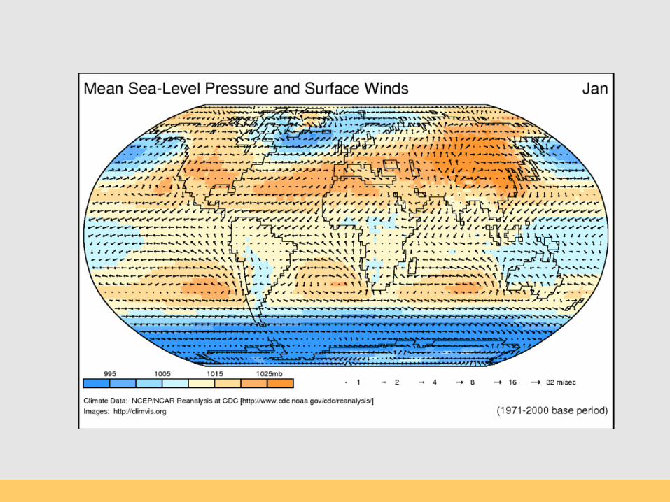
Surface Pressure
H
L
LH
http://weather.unisys.com/surface/sfc_con.php?image=pr&inv=0&t=cur&expanddiv=hide_bar
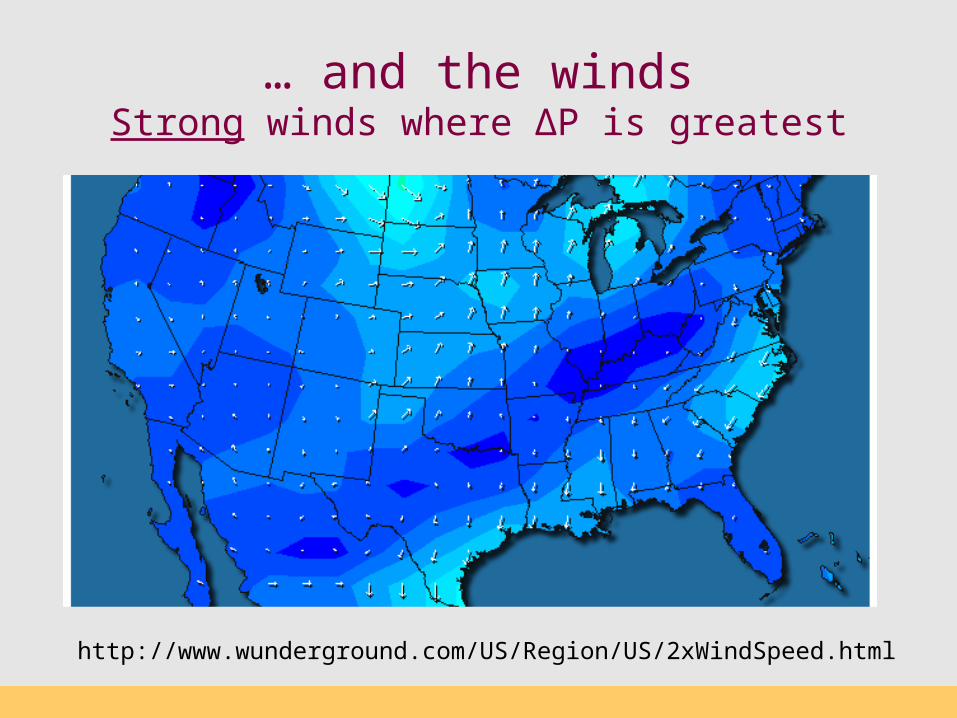
… and the windsStrong winds where ∆P is greatest
http://www.wunderground.com/US/Region/US/2xWindSpeed.html
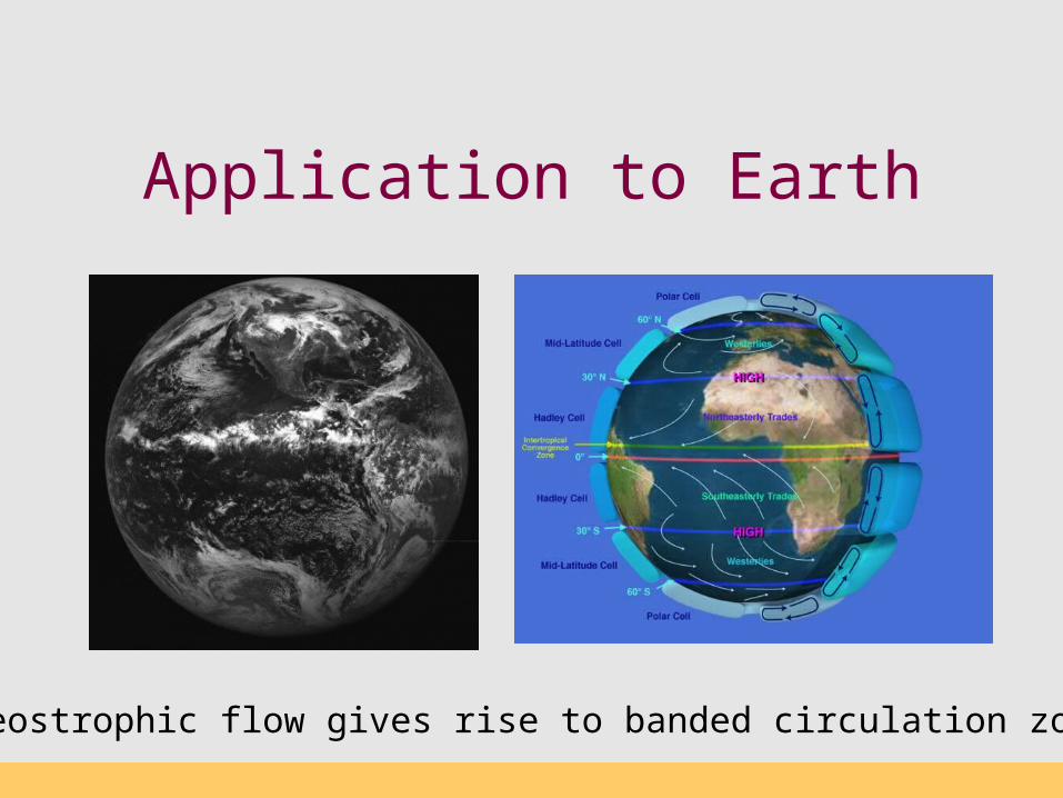
Application to Earth
Geostrophic flow gives rise to banded circulation zones

Trade Winds and the Intertropical Convergence Zone (ITCZ)
ITCZ

Hadley Cells Tropical-Subtropical
Tradewinds
Hadley Cells
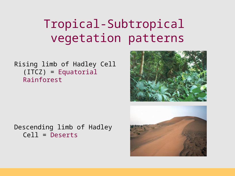
Tropical-Subtropical vegetation patterns
Rising limb of Hadley Cell (ITCZ) = Equatorial Rainforest
Descending limb of Hadley Cell = Deserts
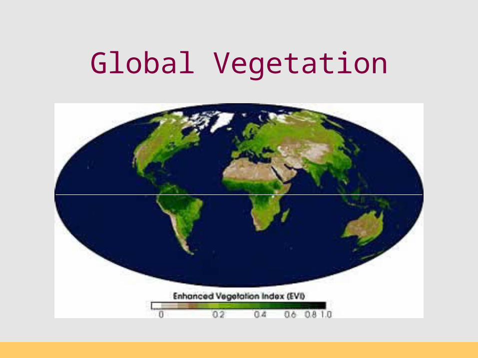
Global Vegetation
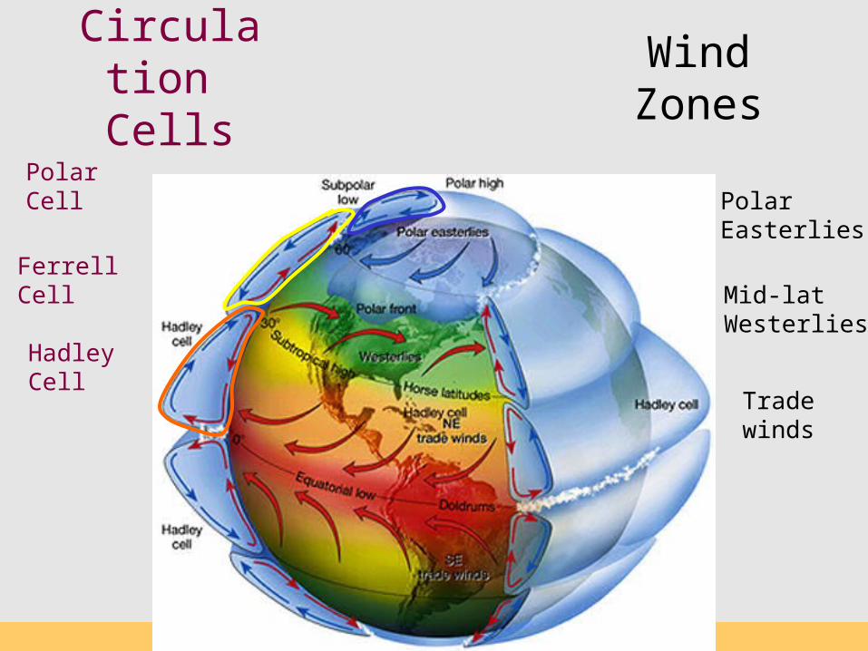
Circulation
Cells
Tradewinds
Hadley Cell
Mid-latWesterlies
Polar Easterlies
Ferrell Cell
Polar Cell
WindZones
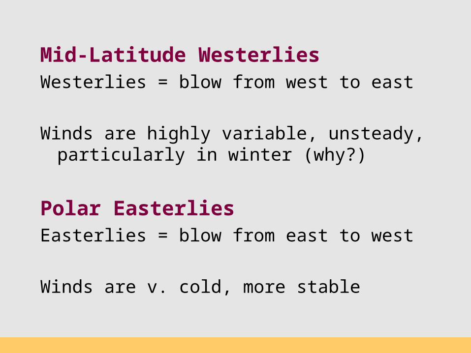
Mid-Latitude Westerlies
Westerlies = blow from west to east
Winds are highly variable, unsteady, particularly in winter (why?)
Polar EasterliesEasterlies = blow from east to west
Winds are v. cold, more stable
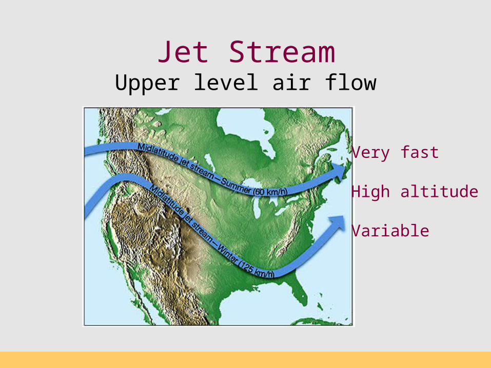
Jet StreamUpper level air flow
Very fast
High altitude
Variable
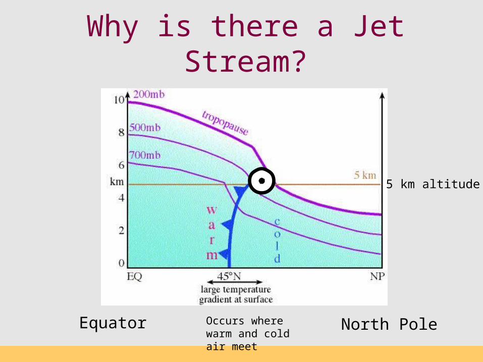
Why is there a Jet Stream?
Equator North PoleOccurs where warm and cold air meet
5 km altitude
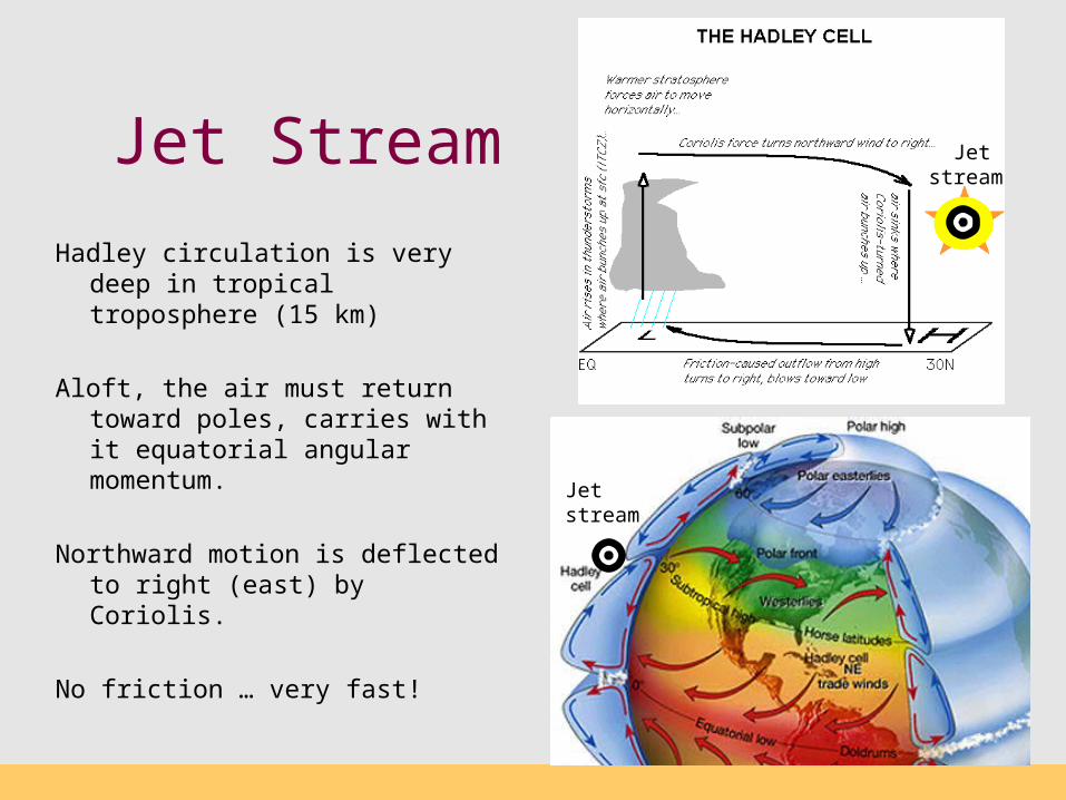
Jet Stream
Hadley circulation is very deep in tropical troposphere (15 km)
Aloft, the air must return toward poles, carries with it equatorial angular momentum.
Northward motion is deflected to right (east) by Coriolis.
No friction … very fast!
Jet stream
Jet stream
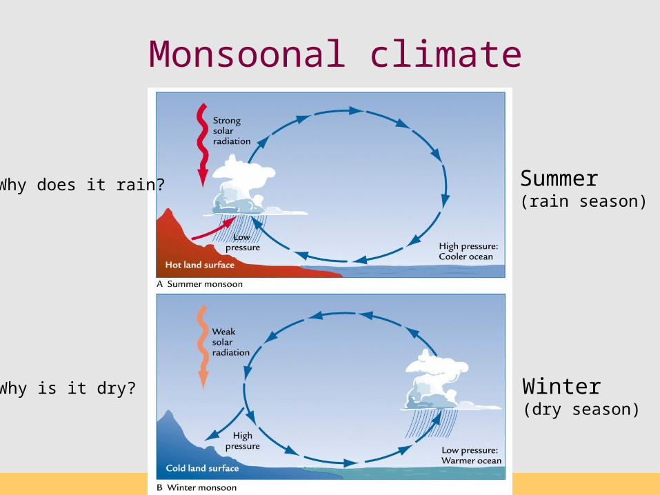
Monsoonal climate
Summer(rain season)
Winter(dry season)
Why does it rain?
Why is it dry?
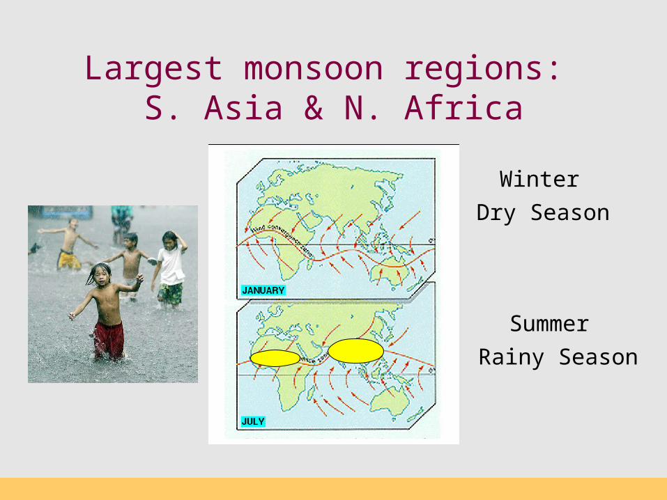
Largest monsoon regions: S. Asia & N. Africa
Rainy Season
Dry Season
Winter
Summer
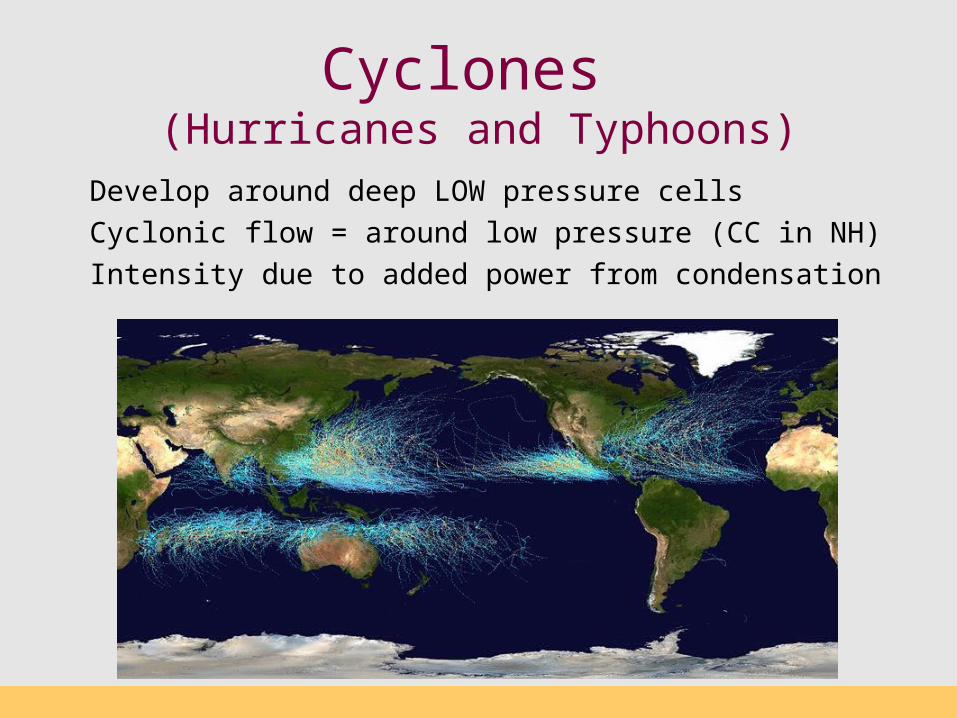
Cyclones (Hurricanes and Typhoons)
Develop around deep LOW pressure cells
Cyclonic flow = around low pressure (CC in NH)
Intensity due to added power from condensation
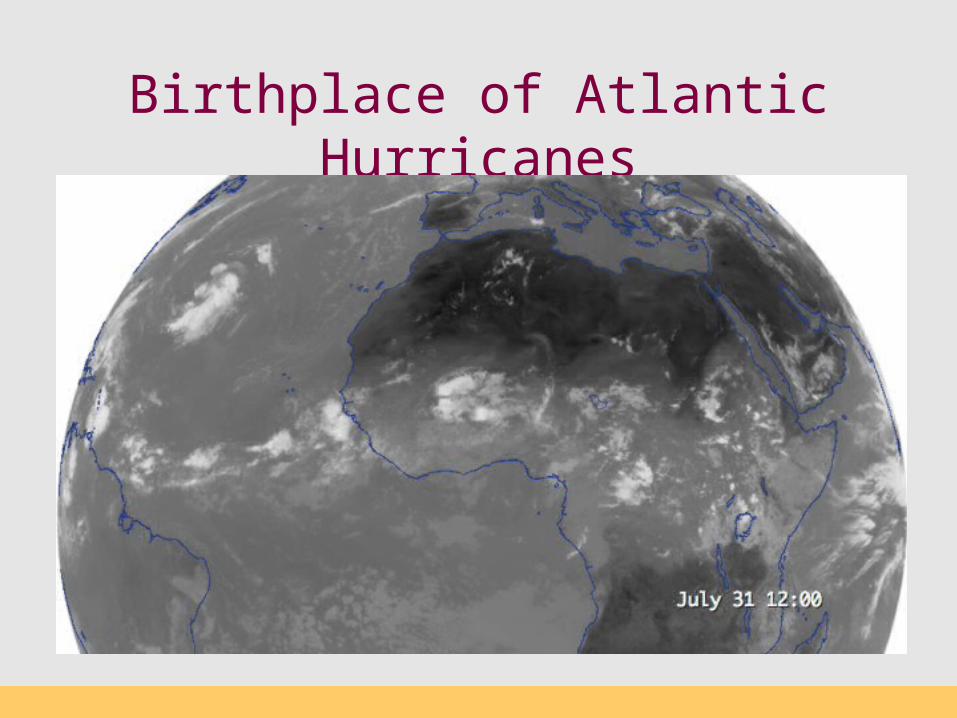
Birthplace of Atlantic Hurricanes
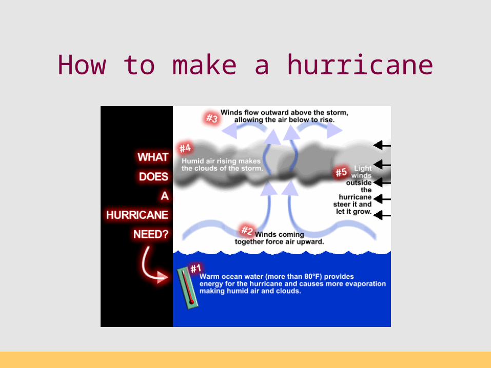
How to make a hurricane

Hurricane basics
- Forms over warm waters- Cyclonic flow around deep low- Alternating bands of convection/subsidence- Water condensation important energy source- Loses power over land
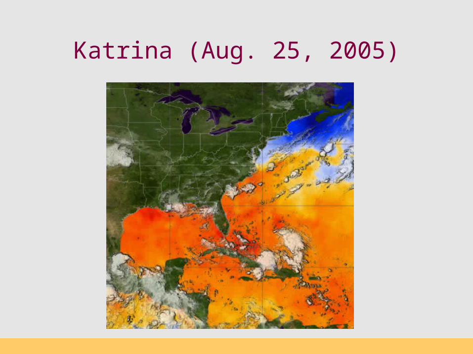
Katrina (Aug. 25, 2005)
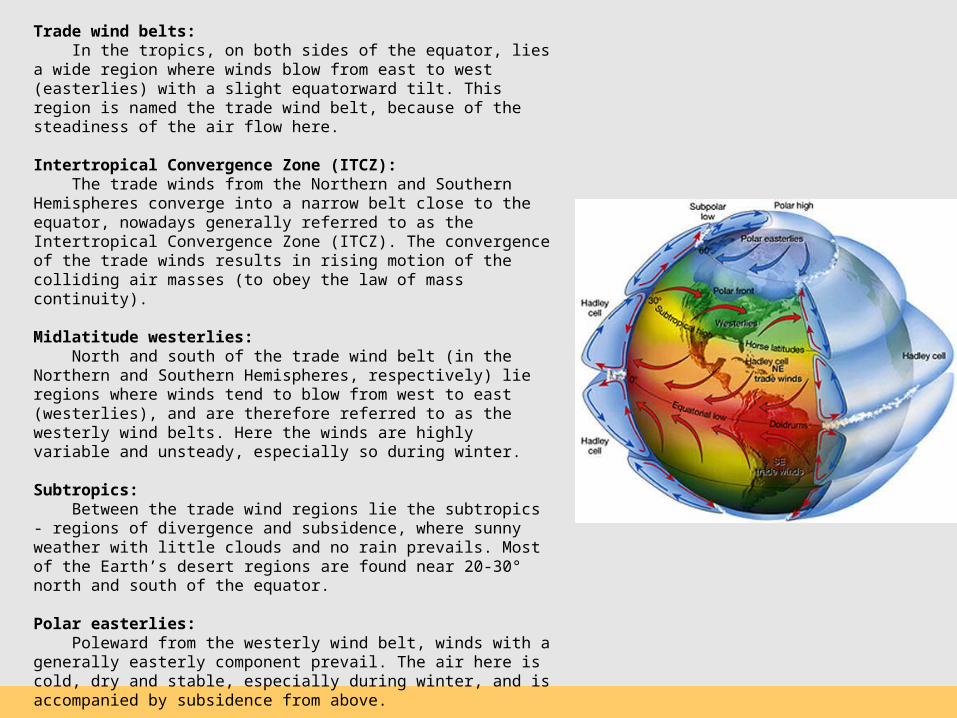
Trade wind belts: In the tropics, on both sides of the equator, lies a wide region where winds blow from east to west (easterlies) with a slight equatorward tilt. This region is named the trade wind belt, because of the steadiness of the air flow here.
Intertropical Convergence Zone (ITCZ): The trade winds from the Northern and Southern Hemispheres converge into a narrow belt close to the equator, nowadays generally referred to as the Intertropical Convergence Zone (ITCZ). The convergence of the trade winds results in rising motion of the colliding air masses (to obey the law of mass continuity).
Midlatitude westerlies: North and south of the trade wind belt (in the Northern and Southern Hemispheres, respectively) lie regions where winds tend to blow from west to east (westerlies), and are therefore referred to as the westerly wind belts. Here the winds are highly variable and unsteady, especially so during winter.
Subtropics: Between the trade wind regions lie the subtropics - regions of divergence and subsidence, where sunny weather with little clouds and no rain prevails. Most of the Earth’s desert regions are found near 20-30° north and south of the equator.
Polar easterlies: Poleward from the westerly wind belt, winds with a generally easterly component prevail. The air here is cold, dry and stable, especially during winter, and is accompanied by subsidence from above.
Polar front: The convergence zone between polar easterlies and midlatitude westerlies is referred to as the polar front. It separates between the cold (and dry) polar air, and the relatively warm (and more humid) midlatitude air. The polar front can be thought of as the average expression of the transient frontal systems that move along with midlatitude cyclones.