Gash Research Program - Spate Irrigation€¦ · Gash Research Program achievements, challenges,...
18
1 Gash Research Program achievements, challenges, and plans ahead Spate project annual meeting Kassala – 30 April 2012 Prof. Yasir A. Mohamed HRS-Sudan
Transcript of Gash Research Program - Spate Irrigation€¦ · Gash Research Program achievements, challenges,...

1
Gash Research Programachievements, challenges, and plans ahead
Spate project annual meetingKassala – 30 April 2012
Prof. Yasir A. Mohamed
HRS-Sudan

2
Content:
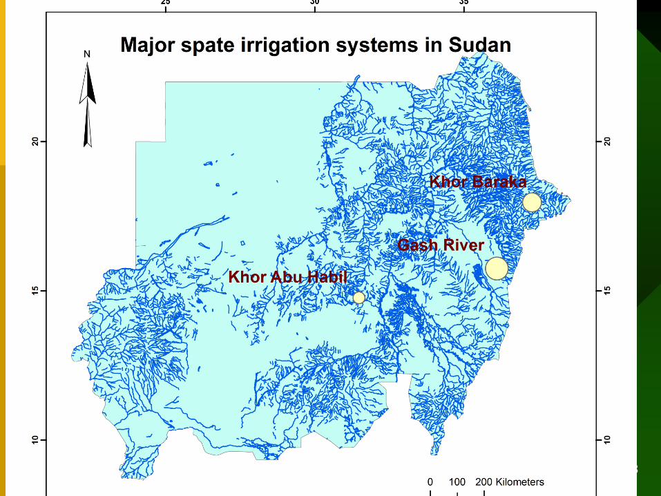
• Spate Irrigation Systems in Sudan
• Gash Agricultural Scheme
• Gash Research Program
• achievements, constraints, plans
3
• xx
– xxx
• xx
xx
4
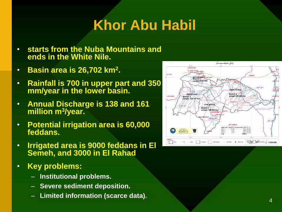
• starts from the Nuba Mountains and ends in the White Nile.
• Basin area is 26,702 km2.
• Rainfall is 700 in upper part and 350 mm/year in the lower basin.
• Annual Discharge is 138 and 161 million m3/year.
• Potential irrigation area is 60,000 feddans.
• Irrigated area is 9000 feddans in El Semeh, and 3000 in El Rahad
• Key problems:
– Institutional problems.
– Severe sediment deposition.
– Limited information (scarce data).
Khor Abu Habil

5
• K. Baraka starts from Eritrean with catchment area of 45,000 km².
• Annual flow is 250 to 900 million m3/year (estimate).
• The Delta Area 406,000 feddans, about 200,000 is arable. Peak used is 130,000 in early 1900’s. Now about 30,000 feddans.
• One of the oldest schemes, established in 1867.
• Key problems:
– Mesquite infestation
– Institutional problems
– Wind (Hababay and Atataib)
– Dynamic morphological changes
– Limited market access
Toker Delta

6
• Catchment is 21,000 km2. River length is 121 km from border to Gash Die.
• Transboundary catchment (Eretria, Ethiopia, Sudan).
• Average annual flow is 650 million m3/year.
• Key problems:
– Flashy floods, high sediment load
– Institutional and policy problems
– Mesquite infestation
– Low average productivity kg/ha, kg/m3
Gash Delta

7
• Highly variable flow:
– 200 to 1200 Mm3/year
– Very high velocity ~5 m/s (difficult to measure)
– Difficult to forecast
• Seasonal flow: from mid July to mid October.
• Measurements at 4 stations
• Mean annual rainfall at Kassala is 341mm, decreases northward.
Gash Water resources
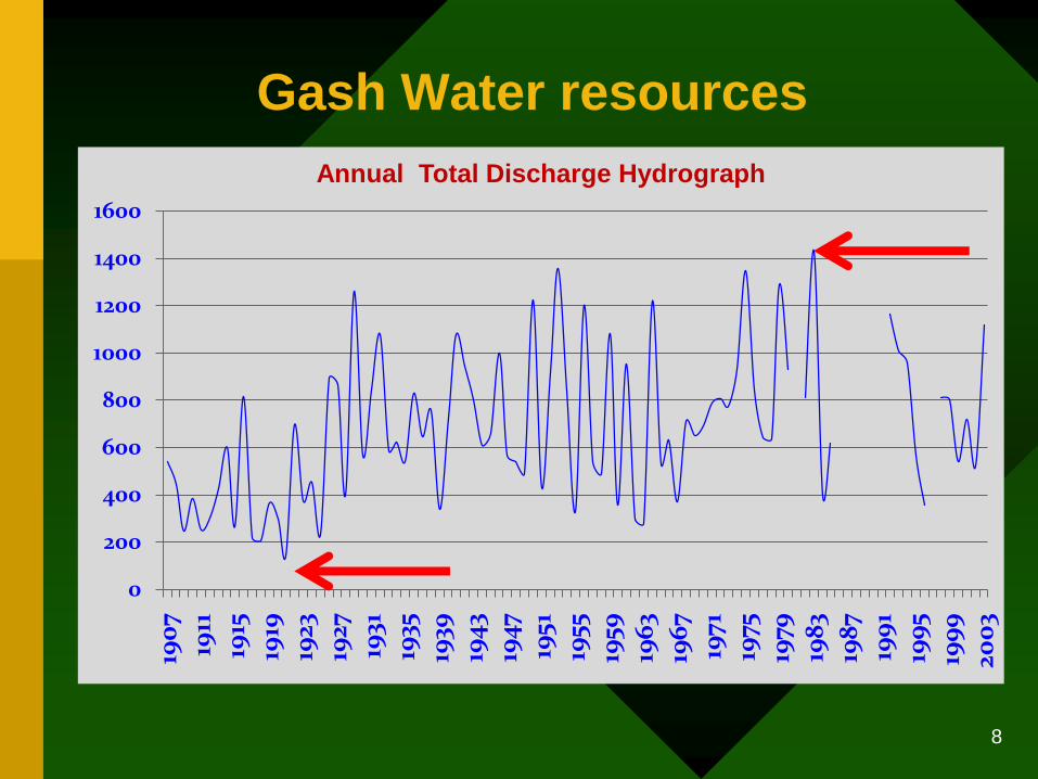
8
Gash Water resources
0
200
400
600
800
1000
1200
1400
1600
1907
1911
1915
1919
1923
1927
1931
1935
1939
1943
1947
1951
1955
1959
1963
1967
1971
1975
1979
1983
1987
1991
1995
1999
2003
Annual Total Discharge Hydrograph

9
• The arable land is 120,000,
annually irrigated area
75,000, and cropped is
56,000 feddans (average).
• The Gash land divided into
basins (4000 feddans) 25
squares (160 feddans)
16 plots (10 feddans)
• The GAS composed of 6
blocks, supplied by 7
canals
Gash land resources
(Source, Avelino, 2012)
10
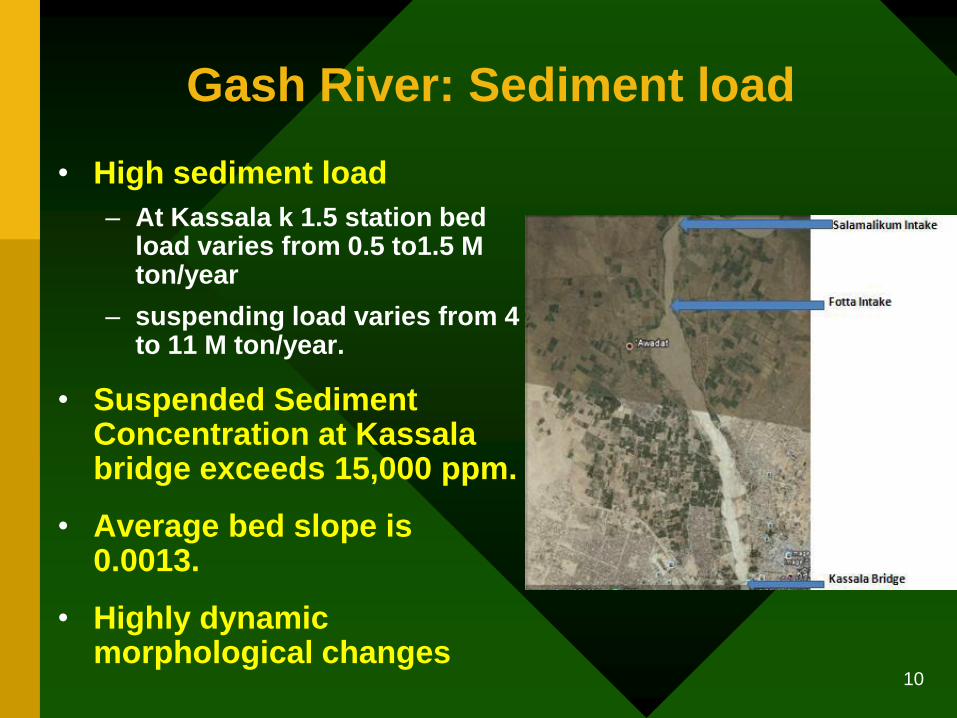
• High sediment load
– At Kassala k 1.5 station bed load varies from 0.5 to1.5 M ton/year
– suspending load varies from 4 to 11 M ton/year.
• Suspended Sediment Concentration at Kassala bridge exceeds 15,000 ppm.
• Average bed slope is 0.0013.
• Highly dynamic morphological changes
Gash River: Sediment load

11
• 2-days consultation workshop with stakeholders on:
potentials and constraints.
• More than 40 participants representing wide stakeholders (GOs, NGOs, researchers, farmers, Abu Habil, TDS, etc).
• More than 12 presentations (water resources, irrigation, agronomy, Mesquite, WUAs, etc.)
• Discussed problems and recommended research areas.
Gash Inception Workshop: 5-6 June 2011

12
• Sedimentation and river morphology.
• High flow variability.
• Irrigation water distribution.
• Mesquite.
• on farm water management.
• Declining groundwater table.
• Institutional and policy issues.
• Development based on limited (applied) research.
Potential problems in Gash
13
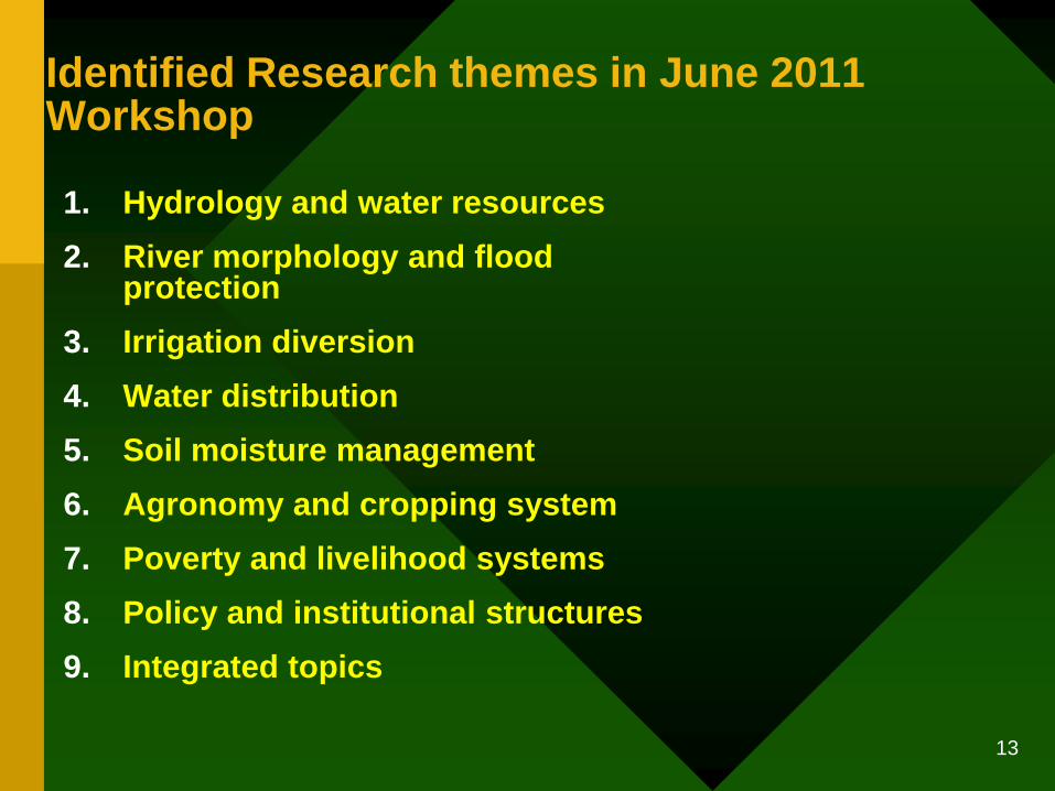
1. Hydrology and water resources
2. River morphology and flood protection
3. Irrigation diversion
4. Water distribution
5. Soil moisture management
6. Agronomy and cropping system
7. Poverty and livelihood systems
8. Policy and institutional structures
9. Integrated topics
Identified Research themes in June 2011 Workshop

14
1. Towards productive and profitable spate irrigated agriculture in Sudan
1. On-farm water management (Janero)
2. What is the optimal irrigation distribution network (Jonathan)
3. How to maximize irrigation diversions (Tewodros)
4. Sediment management (Tewodros)
2. Gash River training and protection work to mitigate flood damage
1. What is the optimal flood protection scenario
3. Institutional setups
1. WUA
2. O&M roles and responsibilities at different levels (Abeer)
4. Assess impact of Mesquite, and what are the solutions
1. Mapping
2. Effect on canal capacity
3. Impact on animal feed
4. How to remove/reduce the impact
5. Aquifer artificial (induced) recharge systems:
1. Determine types of aquifer in north Delta
2. Identification of recharge capacity in north Delta
3. What are the suitable recharge techniques in north Delta
Identified Research projects in June 2011 Workshop
Comp.
Research

15
• Research problems identified.
• 4 researches addressed by 4 international and 3 national researchers.
• New measurements conducted.
• Awareness on spate irrigation systems raised
• Capacity building cum problem solving proved to be effective.
Achievements of year 1:

16
• Address remaining research areas:
– River morphology, surface water –ground water, Mesquite, WUAs.
• Disseminate and encourage adoption of outputs from year 1.
• Continue capacity building efforts.
• Strengthen cooperation with national and international (relevant) organizations.
• Synergies with sister projects
• Search for additional resources
Plan for next two seasons:

17
Smart ICT for the Gash
1. A Flood Early Warning System for the Gash
River.
2. An Agricultural Water Management tool for
the Gash Agricultural Scheme
Sister Research project: Smart ICT for weather and water information and advice to smallholders