Fundamental Spatial Concepts - University of California ...good/275/uiucdec06.pdf · Fundamental...
51
Fundamental Spatial Concepts Fundamental Spatial Concepts Michael F. Goodchild University of California Santa Barbara
Transcript of Fundamental Spatial Concepts - University of California ...good/275/uiucdec06.pdf · Fundamental...

Fundamental Spatial ConceptsFundamental Spatial ConceptsMichael F. Goodchild
University of CaliforniaSanta Barbara

A conceptual frameworkA conceptual framework
Nomothetic science– knowledge that is true everywhere in space
and timeIdiographic science– the study of the unique– new planets– liquid lakes of Antarctica– descriptive, anectodal can be pejorative

the natural, social world
abstracted knowledge
nomothetic science
planning, decision making

A spatial turn in scienceA spatial turn in scienceAdding space to theory– the New Economic Geography
• space impeding flows of information, operation of markets
• transport costs– Spatial Ecology
• a heterogeneous resource base• space impeding interactions, breeding• metapopulations
Reasoning from spatial data– cross-sectional– new tools to overcome methodological problems– impacts in all social, environmental disciplines

Visualization and computingVisualization and computing
1960s Line printer maps and graphslate 1960s Pen plotters1970s Tektronix storage tubes1980s CGA1990s VGA, …2000s 32MB graphics cards in all PCs
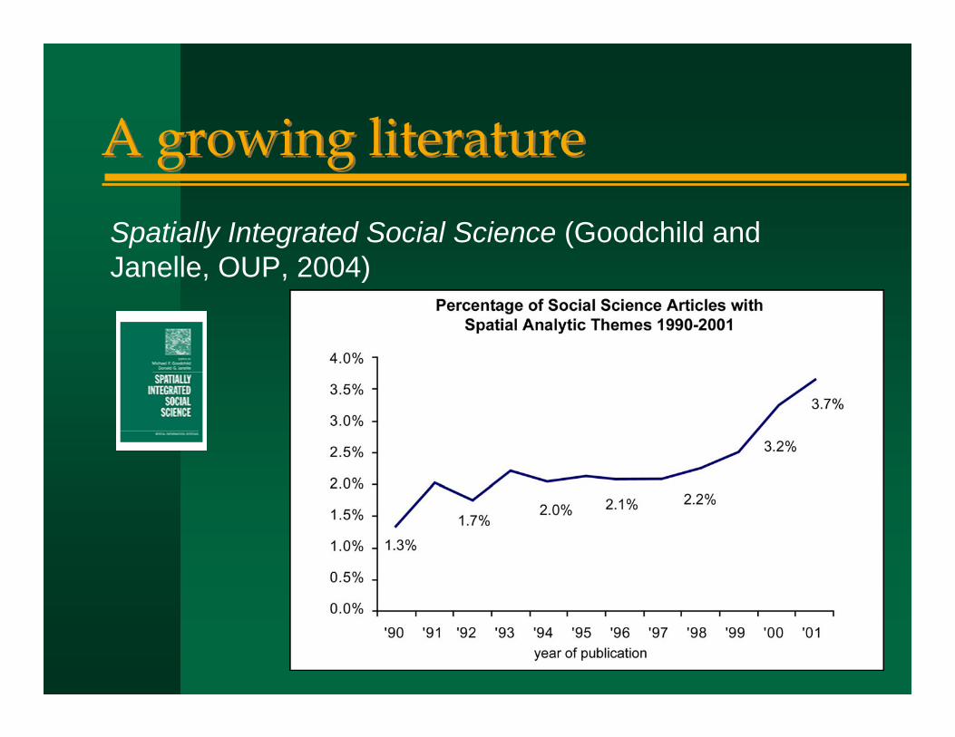
A growing literatureA growing literatureSpatially Integrated Social Science (Goodchild and Janelle, OUP, 2004)

The driversThe drivers
New technologies, new data– geographic information systems (GIS)– remote sensing– positioning (GPS)– delivery mechanisms
Place-based analysisApplications of science in policy, decision making


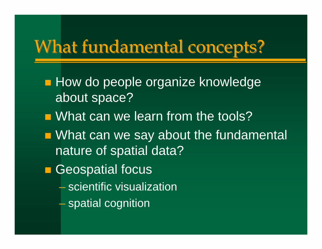
What fundamental concepts?What fundamental concepts?
How do people organize knowledge about space?What can we learn from the tools?What can we say about the fundamental nature of spatial data?Geospatial focus– scientific visualization– spatial cognition

Spatial thinkingSpatial thinking
Larger than GIS– compare GIScience
What every Google Earth user needs to knowOne of Gardner’s seven types of intelligence

1. Linguistic Children with this kind of intelligence enjoy writing, reading, telling stories or doing crossword puzzles.
2. Logical-Mathematical Children with lots of logical intelligence are interested in patterns, categories and relationships. They are drawn to arithmetic problems, strategy games and experiments.
3. Bodily-Kinesthetic These kids process knowledge through bodily sensations. They are often athletic, dancers or good at crafts such as sewing or woodworking.
4. Spatial These children think in images and pictures. They may be fascinated with mazes or jigsaw puzzles, or spend free time drawing, building with Lego or daydreaming.
5. Musical Musical children are always singing or drumming to themselves. They are usually quite aware of sounds others may miss. These kids are often discriminating listeners.
6. Interpersonal Children who are leaders among their peers, who are good at communicating and who seem to understand others' feelings and motives possess interpersonal intelligence.
7. Intrapersonal These children may be shy. They are very aware of their own feelings and are self-motivated.
http://www.professorlamp.com/ed/TAG/7_Intelligences.html

What is spatial thinking?What is spatial thinking?“Three aspects of spatial ability:
Spatial knowledge– symmetry, orientation, scale, distance
decay, etc.Spatial ways of thinking and acting– using diagramming or graphing,
recognizing patterns in data, change over space from change over time, etc.
Spatial capabilities– ability to use tools and technologies such
as spreadsheet, graphical, statistical, and GIS software to analyze spatial data”
http://www.nap.edu/catalog/11019.html
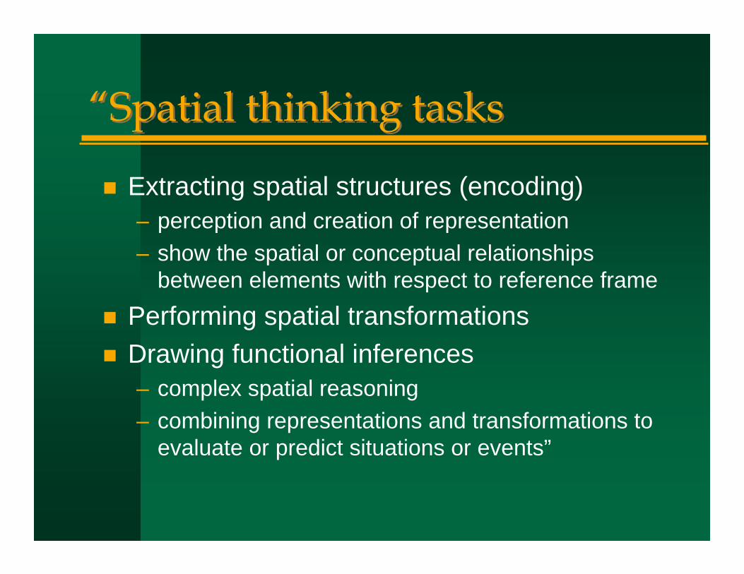
“Spatial thinking tasks“Spatial thinking tasks
Extracting spatial structures (encoding)– perception and creation of representation– show the spatial or conceptual relationships
between elements with respect to reference framePerforming spatial transformationsDrawing functional inferences– complex spatial reasoning– combining representations and transformations to
evaluate or predict situations or events”

“The spatially literate student“The spatially literate studentKnows where, when, how, and why to think spatiallyPractices spatial thinking with– broad and deep knowledge of spatial concepts and
representations– well-developed spatial capabilities for using supporting
tools and technologiesAdopts a critical stance to spatial thinking– can evaluate the quality of spatial data based on source,
likely accuracy, reliability– can use spatial data to construct, articulate, and defend
a line of reasoning in solving problems and answering questions”

Thinking about spaceThinking about space
Wayfinding skills– mental maps
Three levels of knowledge– landmark– route– survey
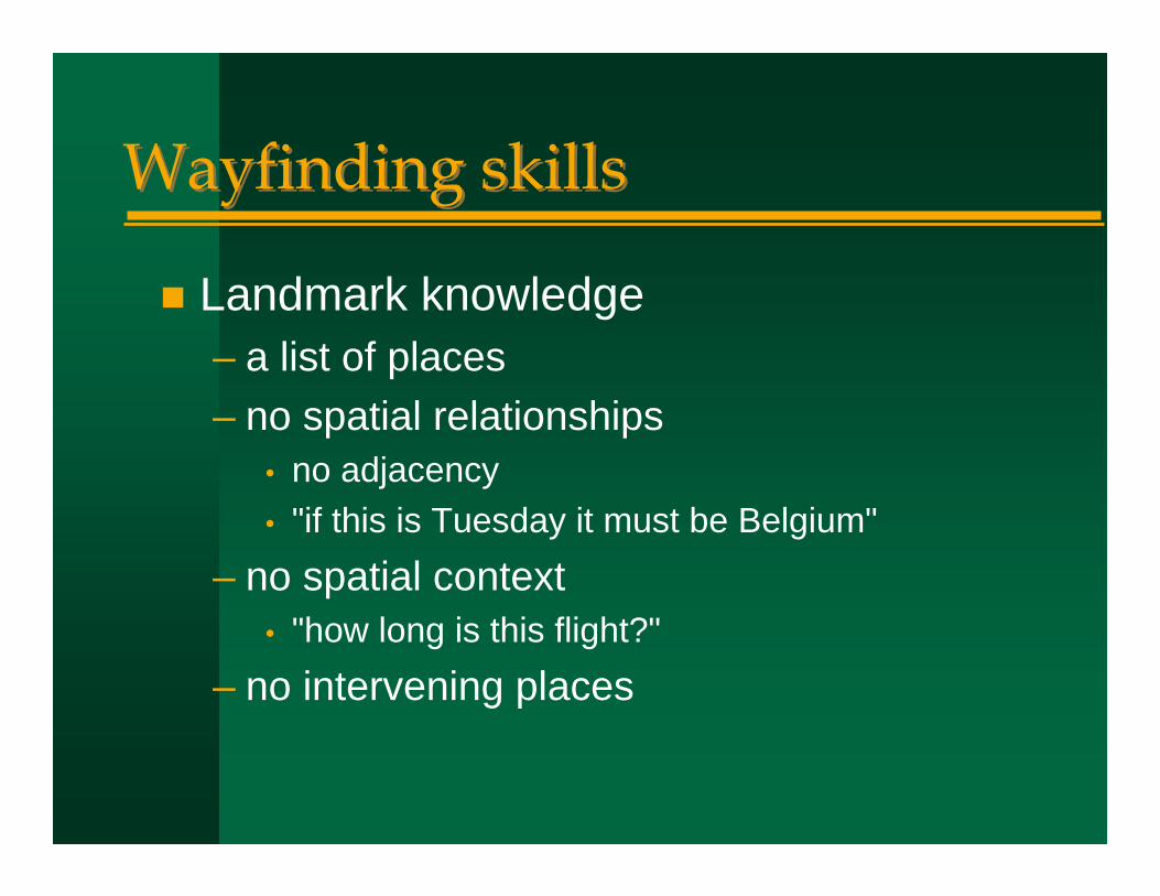
Wayfinding skillsWayfinding skills
Landmark knowledge– a list of places– no spatial relationships
• no adjacency• "if this is Tuesday it must be Belgium"
– no spatial context• "how long is this flight?"
– no intervening places

Tract12345678
Pop
2966500149834130322940863979
3786Location
x,yx,yx,yx,yx,yx,yx,yx,y
Shape
What value is location as an explanatory variable?

Route knowledgeRoute knowledge
Sequences of intervening places– no ability to short-cut– no directions, distances– context along the route– distorted context off the route


Survey knowledgeSurvey knowledge
Full two-dimensional representation– distances– orientations– shortcuts– context
• vertical and horizontal

Metric space
List of places
Attribute table
Linear network
Point, extended features and attributes
Adjacency matrix
W matrix of proximities
Non-metric spaces
Cartograms

http://www-personal.umich.edu/~mejn/election/
Michael Gastner, Cosma Shalizi, and Mark NewmanUniversity of Michigan

1. Location1. Location
Defining and measuring location– the impossibility of exact measurement
From infinitesimal point to extended areaPlace– how many places are there in the U.S.?– what is the most populous city in the world?
Location as contextLocation as common key


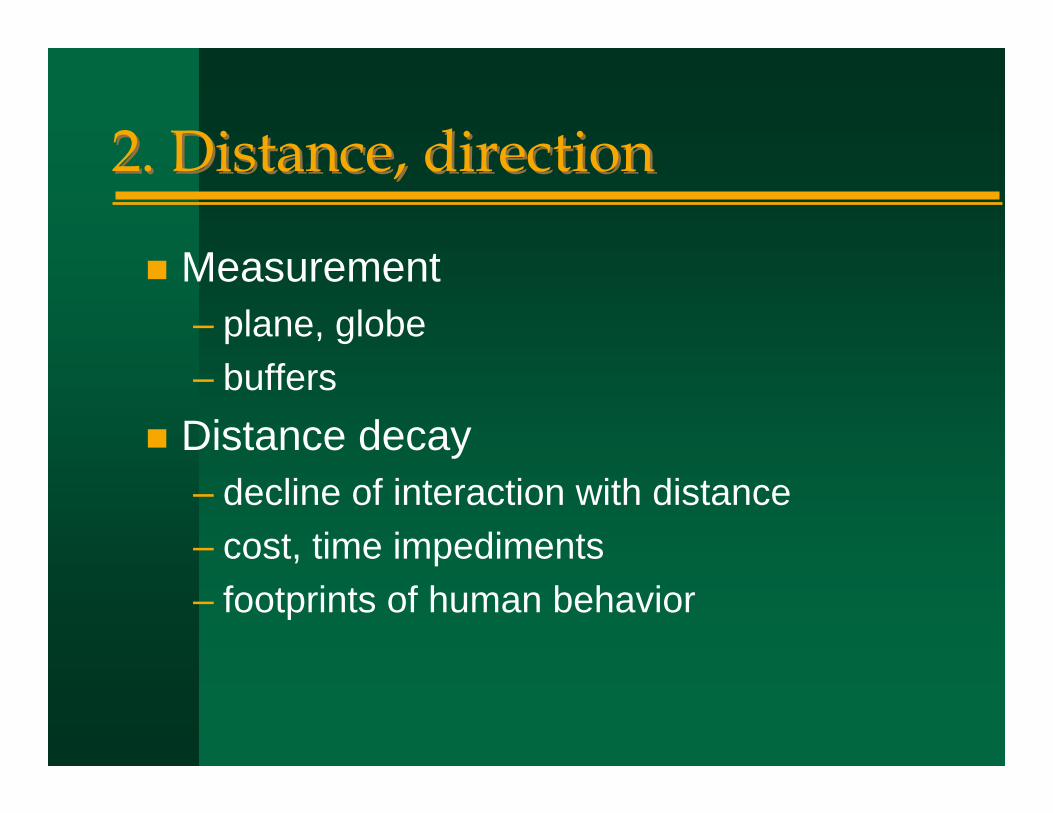
2. Distance, direction2. Distance, direction
Measurement– plane, globe– buffers
Distance decay– decline of interaction with distance– cost, time impediments– footprints of human behavior

The
Econ
o mis
t, M
a y 1
7 , 2
0 03
The
Econ
o mis
t, M
a y 3
, 200
3

!
Snow, J. (1949) Snow on Cholera.Oxford University Press.
from Lance Waller, Emory University
Johnson, S. (2006) The Ghost Map. Riverhead

3. Neighborhood/region/territory3. Neighborhood/region/territory
The context of individuals– action space
Homogeneous areasThe reporting zone containing the individualThe ecological fallacy– the modifiable areal unit problem
Competition for space– trade areas, bird territories– functional regions


4. Scale4. Scale
Level of detail– the inevitability of generalization
Extent– generalizability of results
Methods of upscaling, downscalingFractal concepts
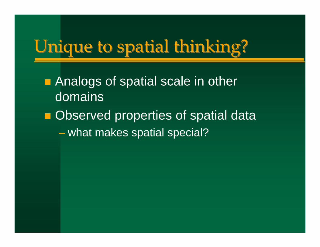
Unique to spatial thinking?Unique to spatial thinking?
Analogs of spatial scale in other domainsObserved properties of spatial data– what makes spatial special?

Tobler’s First LawTobler’s First Law
“All things are related, but nearby things are more related than distant things”– W.R. Tobler, 1970. A computer movie
simulating urban growth in the Detroit region. Economic Geography 46: 234-240
– implies process as much as form– “nearby things are more similar than
distant things”

ValidityValidity
“Nearby things are less similar than distant things”– negative spatial autocorrelation– possible at certain scales
• the checkerboard• retailing
– but negative a/c at one scale requires positive a/c at other scales
– smoothing processes dominate sharpening processes

FormalizationFormalization
Geostatistics– variogram, covariogram– measuring how similarity decreases with
distance– parameters vary by phenomenon
• does this make TFL less of a law?

UtilityUtility
Representation– GI is reducible to statements of the form
<x,z>– the atomic form of GI is unmanageable,
encountered only in point samples– all other GI data models assume TFL
Spatial interpolation– IDW and Kriging implement TFL

A second (first) lawA second (first) law
TFL describes a second-order effect– properties of places taken two at a time– a law of spatial dependence– is there a law of places taken one at a
time?Spatial heterogeneity– non-stationarity– uncontrolled variance

Practical implications of the second lawPractical implications of the second law
A state is not a sample of the nation– a country is not a sample of the world
Classification schemes will differ when devised by local jurisdictionsFigures of the Earth will differ when devised by local surveying agenciesGlobal standards will always compete with local standards

Implications for analysisImplications for analysis
Strong argument for place-based analysis, local statistics, geographically weighted regression– a middle ground in the
nomothetic/idiographic debate

ConclusionsConclusions
It is possible to enumerate the fundamental concepts of a spatial approach– four broadly defined concepts– 27 in recent publication– De Smith, Goodchild, and Longley (2006)
Geospatial Analysis– www.spatialanalysisonline.com

Conclusions (2)Conclusions (2)
This is more than GIS– an enveloping conceptual framework for
many new technologies– many drivers
One of a minimal set of intelligences– part of everyone’s education